Report of Thadmuthlong - C Village
District: West Jaintia Hills
Block: Laksein Block
Date: 25th January 2024
COMMUNITY LED LANDSCAPE MANAGEMENT PROJECT


COMMUNITY LED LANDSCAPE MANAGEMENT PROJECT (CLLMP)
The Government of Meghalaya with financial help from the World Bank is implementing the Meghalaya Community Led Landscape Management Project (MCLLMP). The project covers the entire state of Meghalaya, and implementation of community-led plans are rolled out in a phased manner throughout the state. The Meghalaya Basin Management Agency (MBMA) will facilitate community-led planning by providing support, technical inputs and funding.
The project is intended to strengthen community-led natural resources management in selected landscapes within the 7 districts of the state. This would be achieved through a variety of planning, capacity building, and on-the-ground interventions to promote the conservation, sustainable use of natural resources, social inclusion and community mobilization; building traditional knowledge and learning, mapping of natural resources management; strengthening the community institutions and creating linkage with financial institutions and community organizations.
The project interventions will include preparation of community led natural resource management plans. The CLLMP has the following three components:
Strengthening Knowledge and Capacity of Communities for Natural Resources Management
Community-Led Landscape Planning and Implementation
Project Management and Governance
The project objective is “to manage and conserve the natural resources, especially forests, soil and water sources, in a manner that supports the financial and physical well-being of communities in the State”
Thadmuthlong-C Village is in Laskein Block of West Jaintia Hills district in the state of Meghalaya. Agriculture is the main profession of this village and does not have any industrial development. The People of this area is very peaceful without taking much issues and problems to think about the external affairs. They are confined to what they have been doing and comfortable with their daily schedule.
According to the history the village was established on 1963 by Lt. Tal Tang with his wife Sati Rymbai. They settled here for free without paying a single penny. The state government named this village as Thadmuthlong -C. It seemed during those days, there were no schools and the community are mainly into farming and the crops cultivated by this village are rice, vegetables and few of the villagers owned a small shop.And later after many years, the village was extended to the large society and people came to start their family and the household has been extended with lots of population.
Thadmuthlong-C Village is in Laskein Block of West Jaintia Hills District, Meghalaya, India. It is about 23Km away from the Block Office and 14Km from district headquarter Jowai West Jaintia hills District, Meghalaya. The village is inhabited by the Pnar community with 342 households and a population of 1160.he gender ratio in the village is 518 males and 642 females. The land ownership of the village falls both under community and private individual owners respectively. The main institutions of the village are the Village Employment Council (VEC), 1 Self Help Group. As per the data collected, 14(HHs) used Charcoal 30 Qnty (kg/HH), 239(HHs) used wood 1000 Qnty and 19 (HHs) used LPG 10 Qnty (kg/HH) as their source of energy for domestic purposes.

The major occupations of the people in the village were farmers, daily wages earners, business, teacher, and government services.


LAND
Forest-18.03 Ha
Water Bodies- 5.82 Ha
Agri land-115.82Ha
Barren land-3.56 Ha
WATER BODIES
Springs- 10
Stream-3

Safe drinking Water
Health Care Facilities
Access to timber

Degraded Land
Water Shortage in Winter Session
Clearance of forest for expansion of settlement
Ground truthing and village level sensitization programme was held at Thadmuthlong-C Laksein Block on 3rd July 2019. There were around 21 members participated for the programme. The community decided to have a meeting with the entire village members and discuss about the project, formation of VNRMC, EC and Village facilitators.
1. Water bodies are facing threats due to storage of coal mine.
2. The cause of degradation is due to mining affected.
The list of indigenous tree species are – dieng chyrngan (Schima wallichi), dieng sning, deing kseh, (pinus kesiya), Dieng champa (magnolia champaca), dieng poma (toonaciliata), dieng soh chram.
The Valuable grasses of the village are- sla salah, sla syin.
Signing of Documents:
After few days of sensitization programme, on the 15th July 2019 the district DPMU and SPMU visited Thadmuthlong-C Village for signing of all the documents such as EOI, VGA and CGC.
Formation of VNRMC
The formation of VNRMC EC members and VCF were been done on the 15th July 2019 2019 wherein the community decided to select the representatives from VEC, SHG and other village functionaries.
Listed below are the members of the VNRMC:
Village Natural Resource Management Committee (VNRMC)
|
||||||||||||||||||||||||||||||||||||
|---|---|---|---|---|---|---|---|---|---|---|---|---|---|---|---|---|---|---|---|---|---|---|---|---|---|---|---|---|---|---|---|---|---|---|---|---|
Village Facilitators (VCF)
| Sl No | Name in Full | Gender M/F | Age(Yrs) | Education | Area of specialisation/ focus (forests, water, soil, accounts, environmental and social safeguards, knowledge management, GIS) | Trained under CLLMP (Yes/ No?) if yes, date training was received | Contact No and email address |
|---|---|---|---|---|---|---|---|
| 1 | Shri.Heimonmi Suchiang | M | 22 | HSSLC | Environment | No | 8119030364 |
| 2 | Shri. Wailad Tang | M | 29 | HSSLC | Social | No | 8787578187 |
| 3 | Smt.Wymkylla Suchiang | F | 25 | HSSLC | M&E | No | 7085568464 |
PRA exercise was conducted on the 3rd July 2019 at Thadmuthlong-C Village, Laskein Block, WJH
Plan Estimate
The plan estimate is done once field engineer along with the Environment Management pay a visit to the proposed sites for inspection. On approval, the plan estimate is being carried out further by the district field engineer.
| SL NO. | TYPE OF INTERVENTION/WORK | SITE NAME | GPS COORDINATES | AMOUNT from CLLMP | WORK STATUS | |
|---|---|---|---|---|---|---|
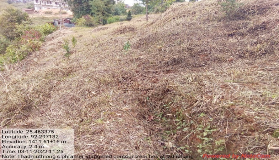
| 1 | CONTOUR TRENCHES | LAD RALIANG | 25.463375 | 92.297132 | 24,140 | IMPLEMENTED |
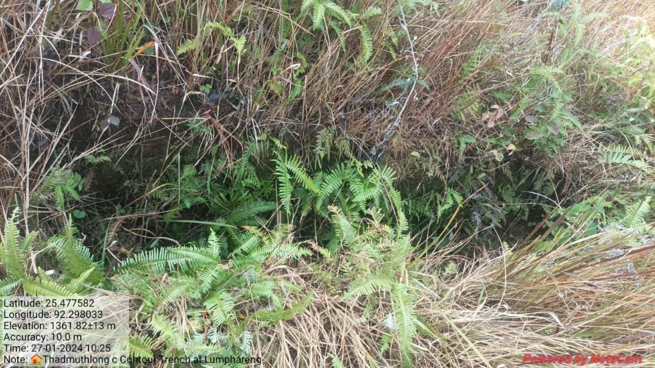
| 2 | CONTOUR TRENCHES | LUMPHARENG | 25.477373 | 92.297951 | 24,140 | IMPLEMENTED |
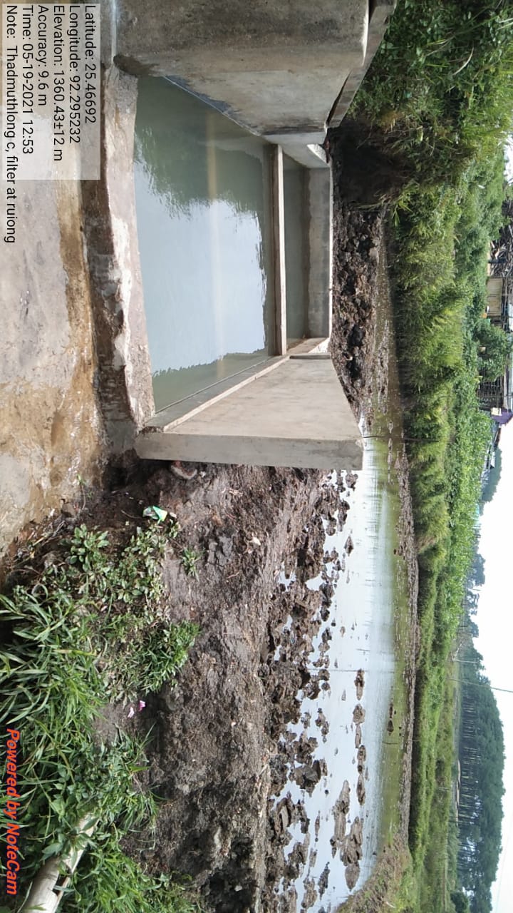
| 3 | FILTER | RUIONG | 25.466872 | 92.295264 | 64,560 | IMPLEMENTED |
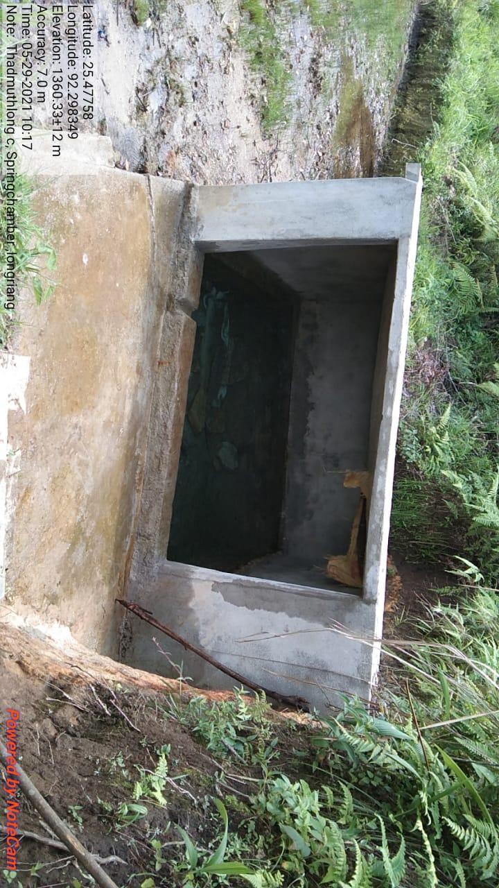
| 4 | SPRING CHAMBER | IONGRIANG | 25.47758 | 92.298349 | 96,665 | IMPLEMENTED |
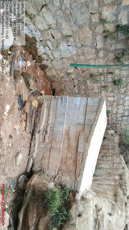
| 5 | SPRING CHAMBER | LAD RALIANG | 25.462612 | 92.297045 | 70,800 | IMPLEMENTED |
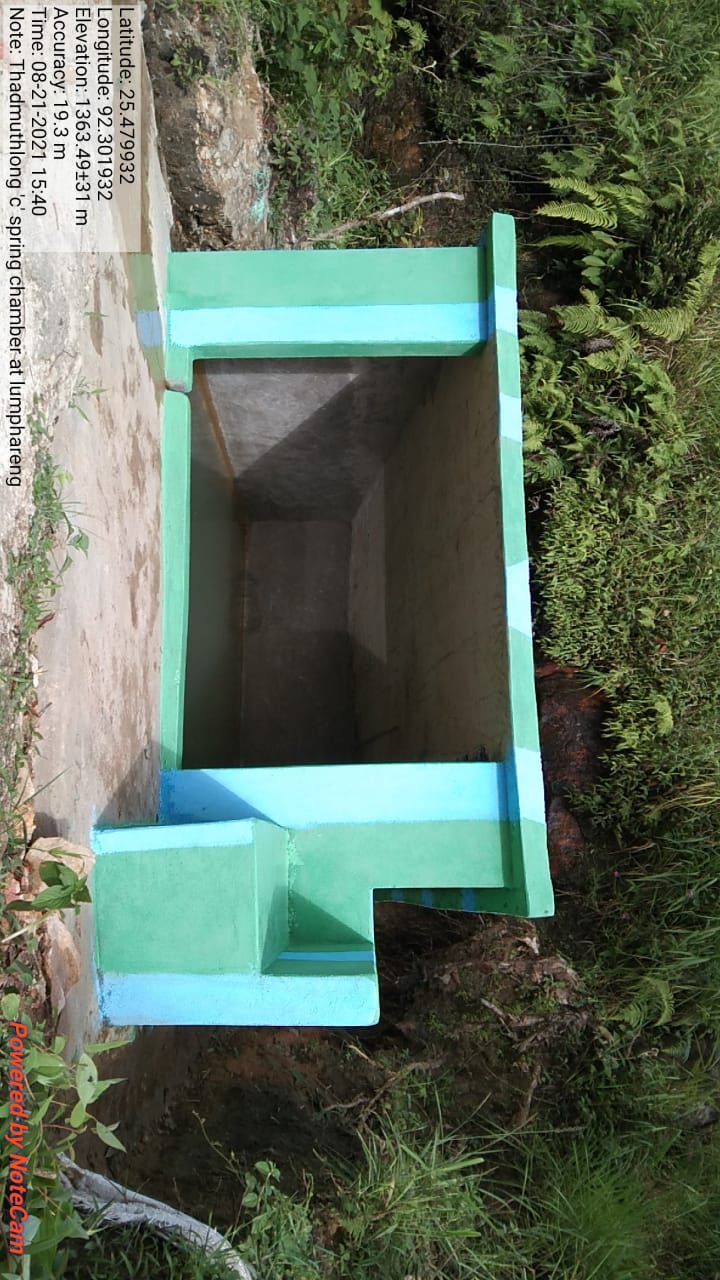
| 6 | SPRING CHAMBER | LUMPHARENG | 25.479972 | 92.301967 | 54,330 | IMPLEMENTED |
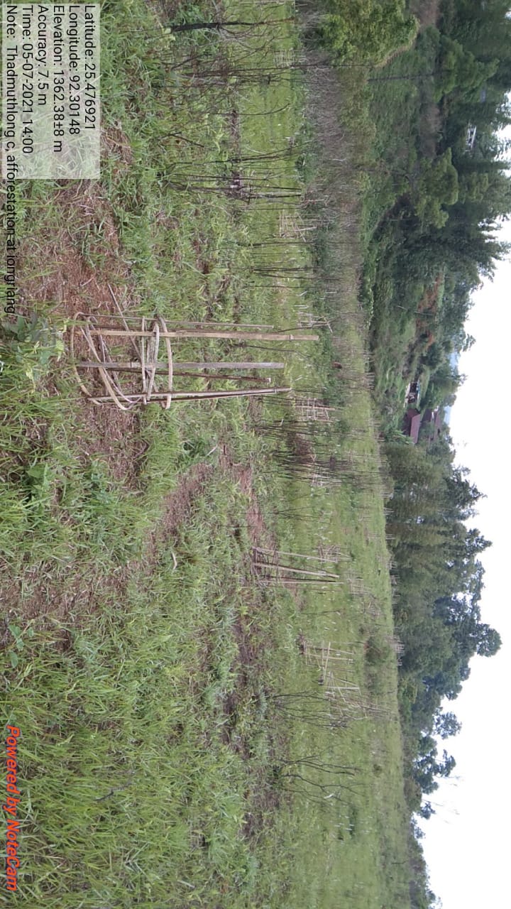
| 7 | AFFORESTATION | IONGRIANG | 25.476778 | 92.301313 | 1,66,170 | IMPLEMENTED |
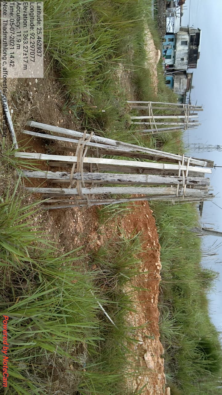
| 8 | AFFORESTATION | LAD RALIANG | 25.463168 | 92.297804 | 1,66,170 | IMPLEMENTED |
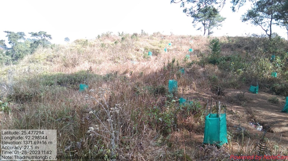
| 9 | AFFORESTATION | LUMPHARENG | 25.477177 | 92.298909 | 1,66,170 | IMPLEMENTED |
| 10 | LAND REHABILITATION ON MINE SPOIL AREA | UMPNEIN | 25.465543 | 92.30015 | 1,29,700 | IMPLEMENTED |
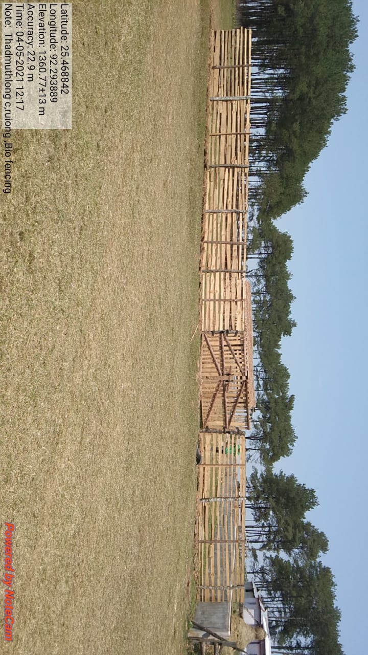
| 11 | BIO FENCING/RUIONG | RUIONG | 25.469112 | 92.293853 | 6,200 | IMPLEMENTED |
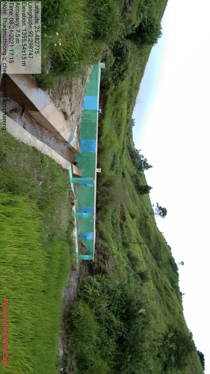
| 12 | CHECK DAM | LUMPHARENG | 25.482697 | 92.299757 | 3,17,060 | IMPLEMENTED |
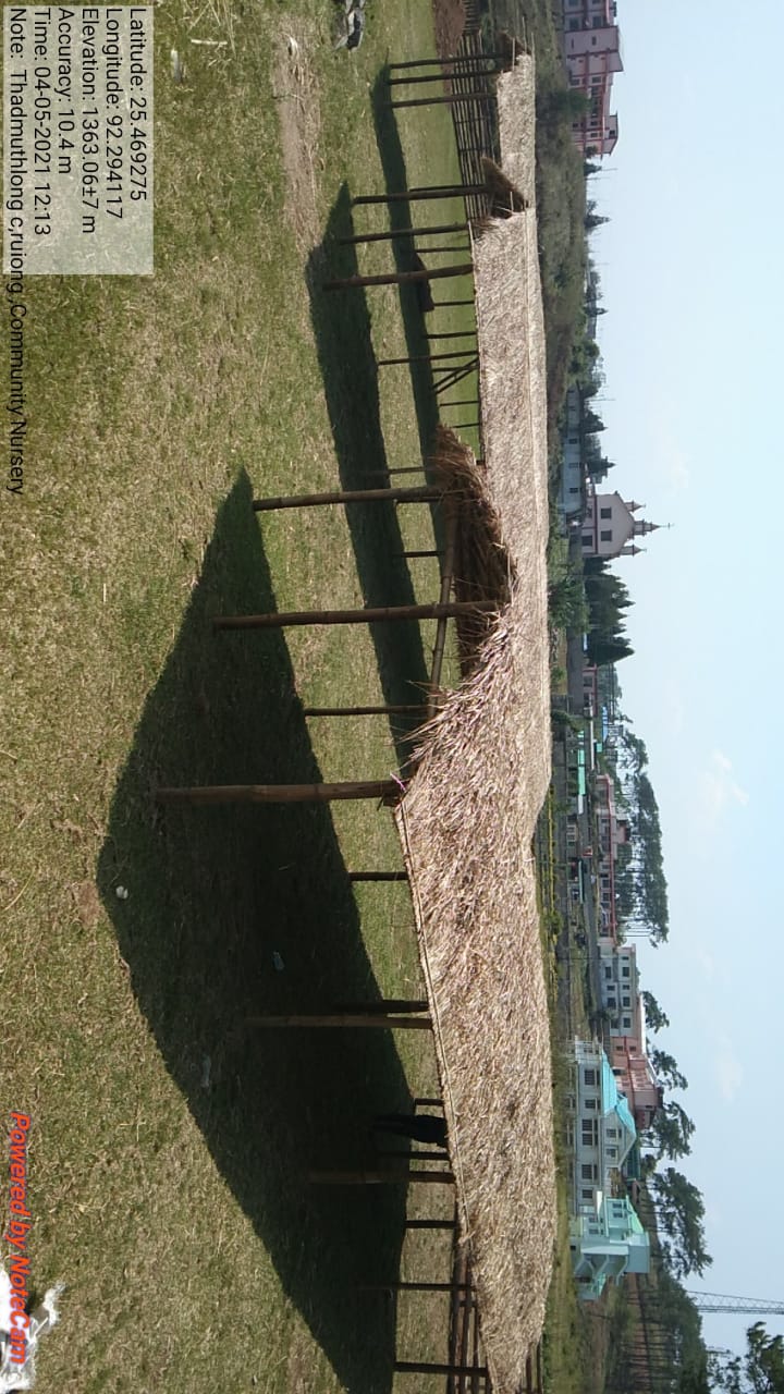
| 13 | COMMUNITY NURSERY | RUIONG | 25.469298 | 92.294001 | 1,06,505 | IMPLEMENTED |
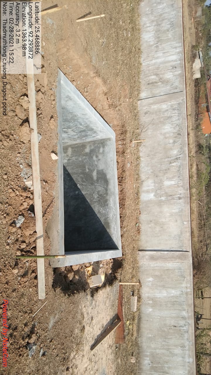
| 14 | DUG OUT POND | RUIONG | 25.468886 | 92.293872 | 21,040 | IMPLEMENTED |
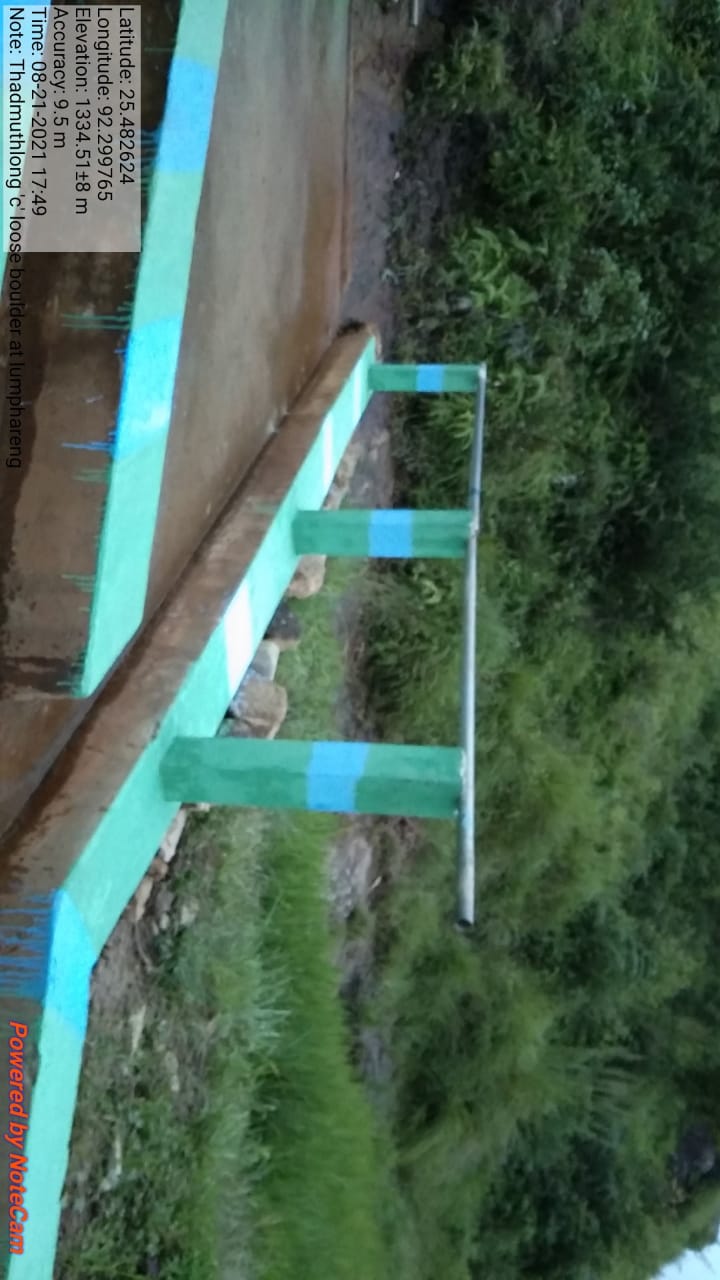
| 15 | LOOSE BOULDER | LUMPHARENG | 25.482624 | 92.299765 | 10,110 | IMPLEMENTED |
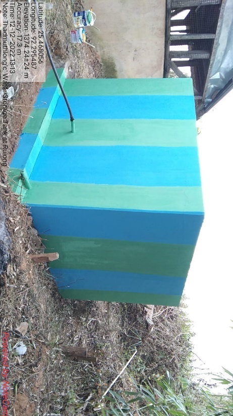
| 16 | WATER STORAGE TANK | RUIONG | 25.468178 | 92.295659 | 92,750 | IMPLEMENTED |
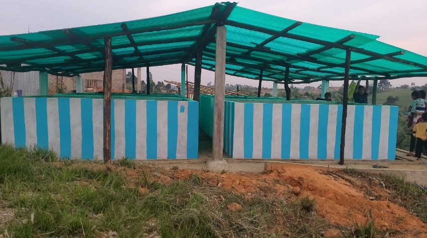
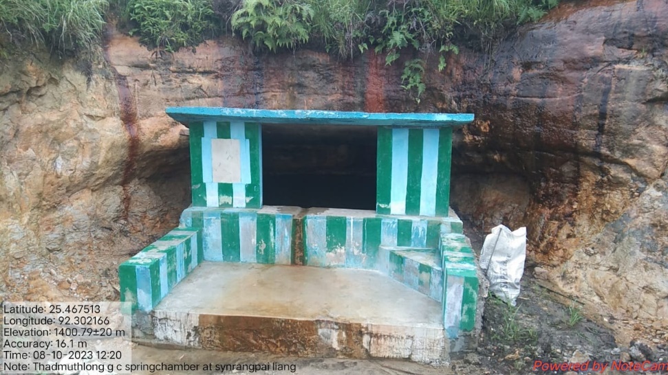
| 17 | VERMI COMPOSTING | SYNRANGPALIANG | 25.468186 | 92.302677 | 3,01,619 | IMPLEMENTED |
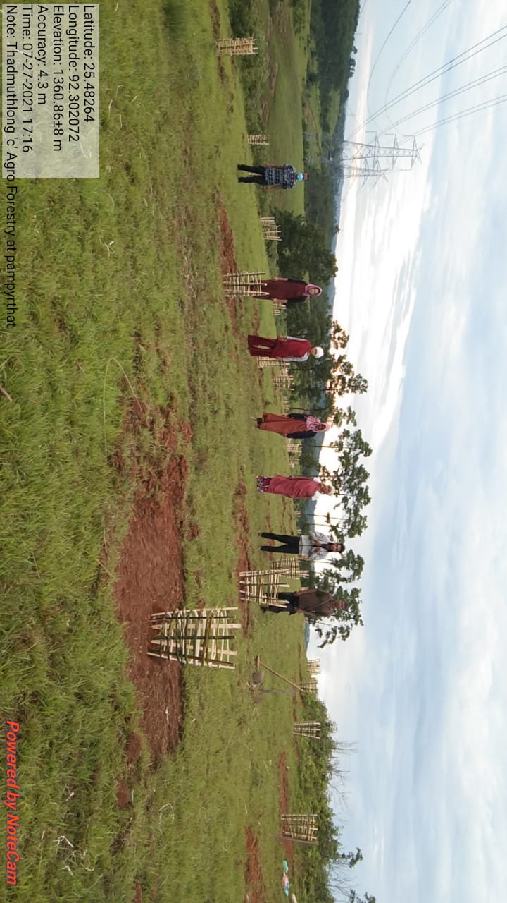
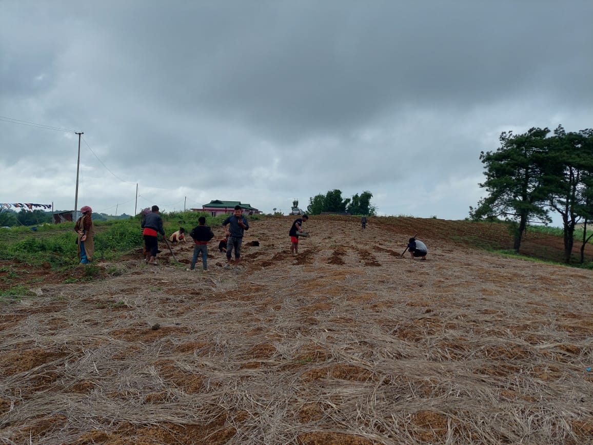
| 18 | AGRO-FORESTRY | PAMPYRTHAT | 25.482721 | 92.302088 | 1,09,650 | IMPLEMENTED |
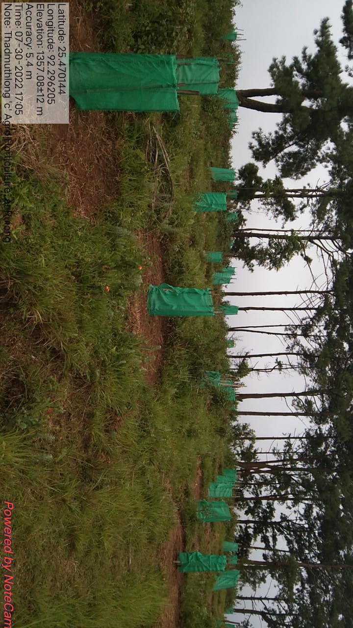
| 19 | AGRO-HORTICULTURE | RUIONG | 25.470144 | 92.296205 | 1,04,550 | IMPLEMENTED |
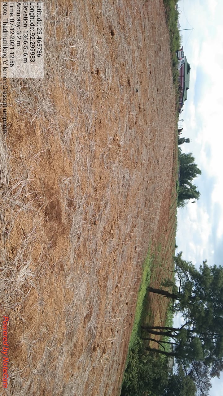
| 20 | PLANTATION OF LEMON GRASS | UMPNIEN | 25.465737 | 92.299968 | 25,725 | IMPLEMENTED |
| 21 | SPRING CHAMBER | UMPNIEN | 25.467468 | 92.302145 | 96,210 | IMPLEMENTED |
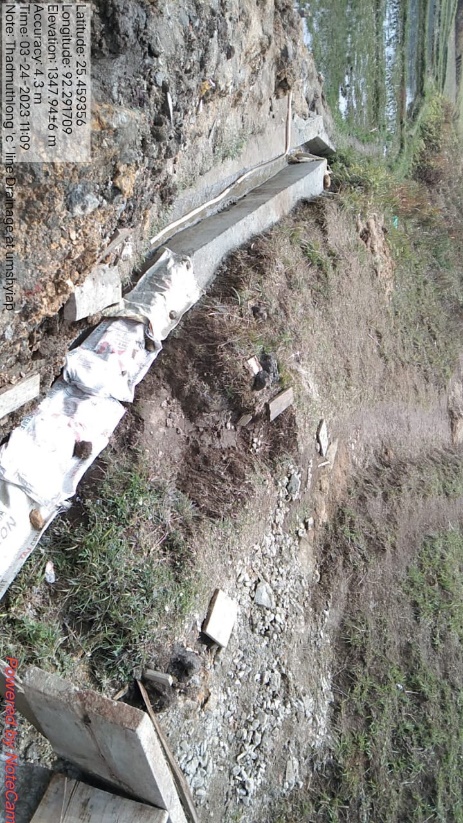
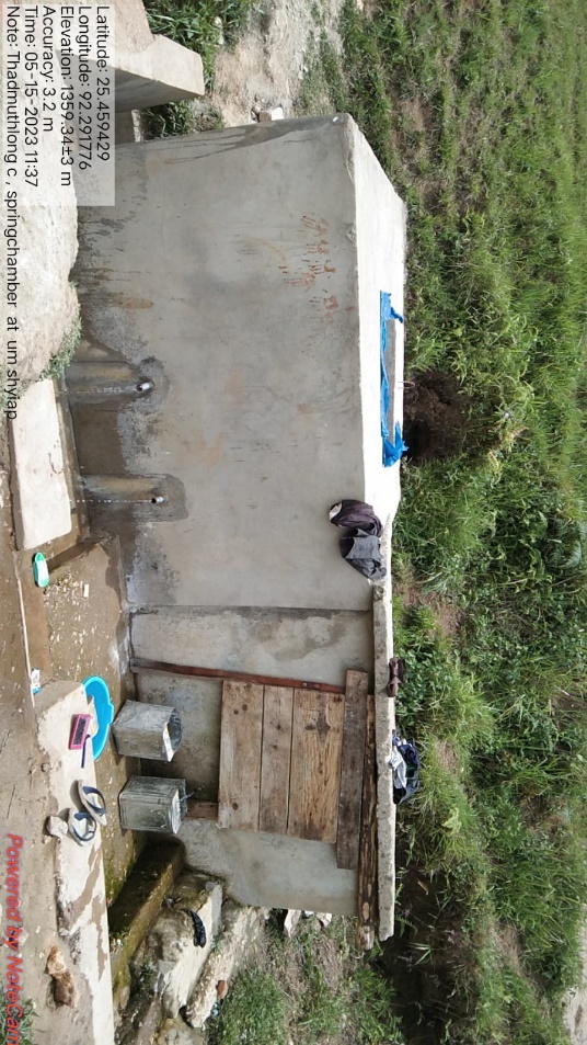
| 22 | LINE DRAINAGE | UMSHYIAP | 25.459354 | 92.291762 | 1,09,000 | IMPLEMENTED |
| 23 | RCC WATER TANK | UMSHYIAP | 25.459372 | 92.291758 | 2,40,000 | IMPLEMENTED |
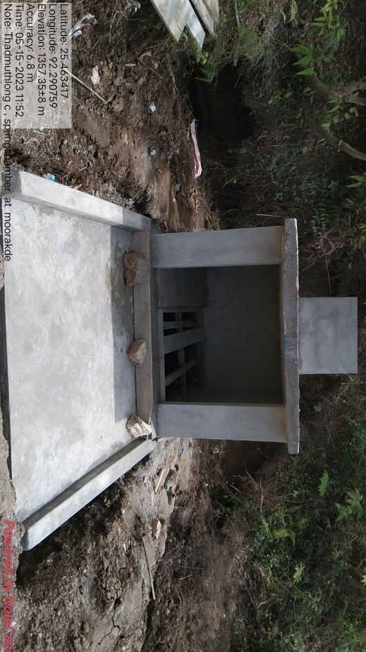
| 24 | SPRING CHAMBER | MOORAKDE | 25.463193 | 92.29069 | 1,50,000 | IMPLEMENTED |
FUND STATUS
| SL NO. | TYPE OF INTERVENTION/WORK | SITE NAME | GPS COORDINATES | AMOUNT from CLLMP | WORK STATUS | |
|---|---|---|---|---|---|---|
| 1 | CONTOUR TRENCHES | LAD RALIANG | 25.463375 | 92.297132 | 24,140 | IMPLEMENTED |
| SL NO. | TYPE OF INTERVENTION/WORK | SITE NAME | GPS COORDINATES | AMOUNT from CLLMP | WORK STATUS | |
|---|---|---|---|---|---|---|
| 2 | CONTOUR TRENCHES | LUMPHARENG | 25.477373 | 92.29795 | 24140 | IMPLEMENTED |
| SL NO. | TYPE OF INTERVENTION/WORK | SITE NAME | GPS COORDINATES | AMOUNT from CLLMP | WORK STATUS | |
|---|---|---|---|---|---|---|
| 3 | FILTER | RUIONG | 25.466872 | 92.295264 | 64,560 | IMPLEMENTED |
| SL NO. | TYPE OF INTERVENTION/WORK | SITE NAME | GPS COORDINATES | AMOUNT from CLLMP | WORK STATUS | |
|---|---|---|---|---|---|---|
| 4 | SPRING CHAMBER | IONGRIANG | 25.47758 | 92.298349 | 96,665 | IMPLEMENTED |
| SL NO. | TYPE OF INTERVENTION/WORK | SITE NAME | GPS COORDINATES | AMOUNT from CLLMP | WORK STATUS | |
|---|---|---|---|---|---|---|
| 5 | SPRING CHAMBER | LAD RALIANG | 25.462612 | 92.297045 | 70,800 | IMPLEMENTED |
| SL NO. | TYPE OF INTERVENTION/WORK | SITE NAME | GPS COORDINATES | AMOUNT from CLLMP | WORK STATUS | |
|---|---|---|---|---|---|---|
| 6 | SPRING CHAMBER | LUMPHARENG | 25.479972 | 92.301967 | 54,330 | IMPLEMENTED |
| SL NO. | TYPE OF INTERVENTION/WORK | SITE NAME | GPS COORDINATES | AMOUNT from CLLMP | WORK STATUS | |
|---|---|---|---|---|---|---|
| 7 | AFFORESTATION | IONGRIANG | 25.476778 | 92.301313 | 1,66,170 | IMPLEMENTED |
| SL NO. | TYPE OF INTERVENTION/WORK | SITE NAME | GPS COORDINATES | AMOUNT from CLLMP | WORK STATUS | |
|---|---|---|---|---|---|---|
| 8 | AFFORESTATION | LAD RALIANG | 25.463168 | 92.297804 | 1,66,170 | IMPLEMENTED |
| SL NO. | TYPE OF INTERVENTION/WORK | SITE NAME | GPS COORDINATES | AMOUNT from CLLMP | WORK STATUS | |
|---|---|---|---|---|---|---|
| 9 | AFFORESTATION | LUMPHARENG | 25.477177 | 92.298909 | 1,66,170 | IMPLEMENTED |
| SL NO. | TYPE OF INTERVENTION/WORK | SITE NAME | GPS COORDINATES | AMOUNT from CLLMP | WORK STATUS | |
|---|---|---|---|---|---|---|
| 10 | LAND REHABILITATION ON MINE SPOIL AREA | UMPNEIN | 25.465543 | 92.30015 | 1,29,700 | IMPLEMENTED |
| SL NO. | TYPE OF INTERVENTION/WORK | SITE NAME | GPS COORDINATES | AMOUNT from CLLMP | WORK STATUS | |
|---|---|---|---|---|---|---|
| 11 | BIO FENCING/RUIONG | RUIONG | 25.469112 | 92.29385 | 6,200 | IMPLEMENTED |
| SL NO. | TYPE OF INTERVENTION/WORK | SITE NAME | GPS COORDINATES | AMOUNT from CLLMP | WORK STATUS | |
|---|---|---|---|---|---|---|
| 12 | CHECK DAM | LUMPHARENG | 25.482697 | 92.29976 | 3,17,060 | IMPLEMENTED |
| SL NO. | TYPE OF INTERVENTION/WORK | SITE NAME | GPS COORDINATES | AMOUNT from CLLMP | WORK STATUS | |
|---|---|---|---|---|---|---|
| 13 | COMMUNITY NURSERY | RUIONG | 25.469298 | 92.294 | 1,06,505 | IMPLEMENTED |
| SL NO. | TYPE OF INTERVENTION/WORK | SITE NAME | GPS COORDINATES | AMOUNT from CLLMP | WORK STATUS | |
|---|---|---|---|---|---|---|
| 14 | DUG OUT POND | RUIONG | 25.468886 | 92.29387 | 21,040 | IMPLEMENTED |
| SL NO. | TYPE OF INTERVENTION/WORK | SITE NAME | GPS COORDINATES | AMOUNT from CLLMP | WORK STATUS | |
|---|---|---|---|---|---|---|
| 15 | LOOSE BOULDER | LUMPHARENG | 25.482624 | 92.29977 | 10,110 | IMPLEMENTED |
| SL NO. | TYPE OF INTERVENTION/WORK | SITE NAME | GPS COORDINATES | AMOUNT from CLLMP | WORK STATUS | |
|---|---|---|---|---|---|---|
| 16 | WATER STORAGE TANK | RUIONG | 25.468178 | 92.29566 | 92,750 | IMPLEMENTED |
| SL NO. | TYPE OF INTERVENTION/WORK | SITE NAME | GPS COORDINATES | AMOUNT from CLLMP | WORK STATUS | |
|---|---|---|---|---|---|---|
| 17 | VERMI COMPOSTING | SYNRANGPALIANG | 25.468186 | 92.30268 | 3,01,619 | IMPLEMENTED |
| SL NO. | TYPE OF INTERVENTION/WORK | SITE NAME | GPS COORDINATES | AMOUNT from CLLMP | WORK STATUS | |
|---|---|---|---|---|---|---|
| 18 | AGRO-FORESTRY | PAMPYRTHAT | 25.482721 | 92.30209 | 1,09,650 | IMPLEMENTED |
| SL NO. | TYPE OF INTERVENTION/WORK | SITE NAME | GPS COORDINATES | AMOUNT from CLLMP | WORK STATUS | |
|---|---|---|---|---|---|---|
| 19 | AGRO-HORTICULTURE | RUIONG | 25.470144 | 92.29621 | 1,04,550 | IMPLEMENTED |
| SL NO. | TYPE OF INTERVENTION/WORK | SITE NAME | GPS COORDINATES | AMOUNT from CLLMP | WORK STATUS | |
|---|---|---|---|---|---|---|
| 20 | PLANTATION OF LEMON GRASS | UMPNIEN | 25.465737 | 92.29997 | 25,725 | IMPLEMENTED |
| SL NO. | TYPE OF INTERVENTION/WORK | SITE NAME | GPS COORDINATES | AMOUNT from CLLMP | WORK STATUS | |
|---|---|---|---|---|---|---|
| 21 | SPRING CHAMBER | UMPNIEN | 25.467468 | 92.30215 | 96,210 | IMPLEMENTED |
| SL NO. | TYPE OF INTERVENTION/WORK | SITE NAME | GPS COORDINATES | AMOUNT from CLLMP | WORK STATUS | |
|---|---|---|---|---|---|---|
| 22 | LINE DRAINAGE | UMSHYIAP | 25.459354 | 92.29176 | 1,09,000 | IMPLEMENTED |
| SL NO. | TYPE OF INTERVENTION/WORK | SITE NAME | GPS COORDINATES | AMOUNT from CLLMP | WORK STATUS | |
|---|---|---|---|---|---|---|
| 23 | RCC WATER TANK | UMSHYIAP | 25.459372 | 92.29176 | 2,40,000 | IMPLEMENTED |
| SL NO. | TYPE OF INTERVENTION/WORK | SITE NAME | GPS COORDINATES | AMOUNT from CLLMP | WORK STATUS | |
|---|---|---|---|---|---|---|
| 24 | SPRING CHAMBER | MOORAKDE | 25.463193 | 92.29069 | 1,50,000 | IMPLEMENTED |