Community Led Landscape Management Project (CLLMP)
The Government of Meghalaya with financial help from the World Bank is implementing the Meghalaya Community Led Landscape Management Project (MCLLMP). The project will cover the entire state of Meghalaya and implementation of community led plans will be rolled out in phase manner throughout the state. The Meghalaya Basin Management Agency (MBMA) will facilitate community-led planning by providing support, technical inputs and funding.
Theprojectisintendedtostrengthencommunity-lednaturalresourcesmanagementinselected landscapes within the 7 districts of the state. This would be achieved through a variety of planning, capacity building, and on-the-ground interventions to promote the conservation, sustainable use of natural resources, social inclusion and community mobilisation; building traditional knowledge and learning, mapping of natural resources management; strengthening the community institutions and creating linkage with financial institutions and community organizations.
The project interventions include preparation of community led natural resource management plans. The CLLMP has the following three components:
Strengthening Knowledge and Capacity of Communities for Natural Resources Management
Community-Led Landscape Planning and Implementation
Project Management and Governance
The project objective is “to manage and conserve the natural resources, especially forests, soil and water sources, in a manner that supports the financial and physical well-being of communities in the State”
Introduction
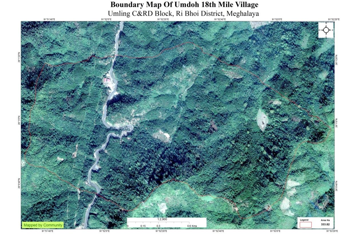
Umdoh 18 Mile Village falls under Umling
C&RD block of Ri-Bhoi district in the state of Meghalaya. The
village is at a distance of 12 Kms from Nongpoh, the district
headquarters of Ri Bhoi District and is at a total distance of 63
Kms from the state capital, Shillong. It falls under Raid
NongKhyllaw (Nongpoh Sordarship) with a total geographical area of
333.82 ha and a total population of 1091 villagers. 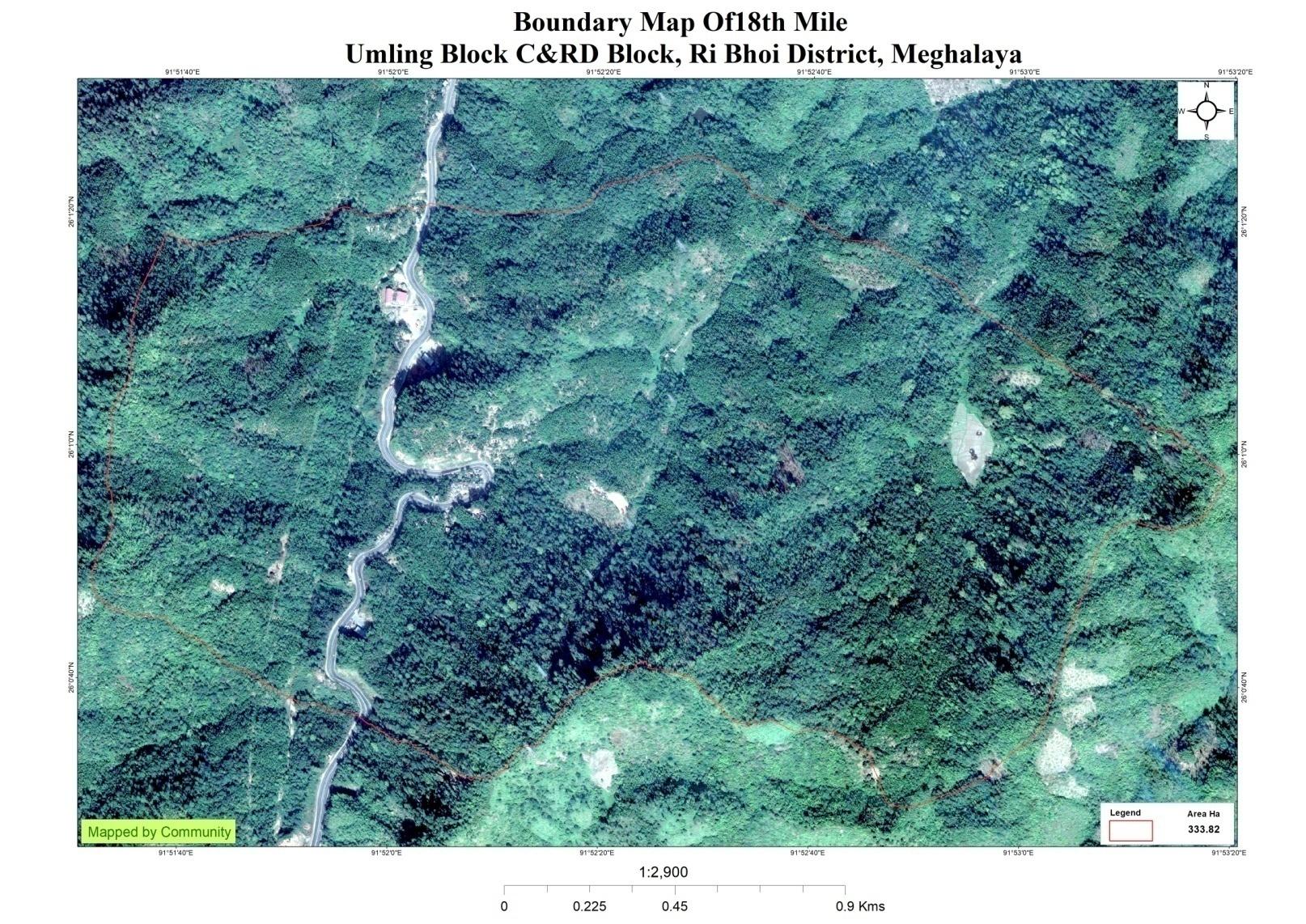
Village Profile: The village has been in existence since the year 1982. The predominant populations of Umdoh 18 Mile village are the khasis and the Wars. Agriculture is the main occupation of the people where they mainly take up traditional approaches of cultivation like Jhum or the shifting cultivation and Terrace cultivation. Traditional agriculture is often considered a step between the local hunt- and-gather practice. The People of Umdoh Village mainly cultivate areca nut (Areca catechu Linn) and betel leaf (Piper beetle Linn) being the main source of their revenue
SOCIAL PROFILE
Umdoh 18th Miles village is located in Umling C&RD Block of Ri-Bhoi district with 168 total numbers of households, and having a population of 953 people.
Umdoh 18 Mile Village falls under Umling C&RD block of Ri-Bhoi district in the state of Meghalaya. The village is at a distance of 12 Kms from Nongpoh, the district headquarters of Ri Bhoi District and is at a total distance of 63 Kms from the state capital, Shillong. It falls under Raid NongKhyllaw (Nongpoh Sirdarship) with a total geographical area of 333.82 ha and has a total population of 953 villagers.
Village Profile: The village has been in existence since the year 1982. The predominant populations of Umdoh 18 Mile village are the khasis and the Wars. Agriculture is the main occupation of the people where they mainly take up traditional approaches of cultivation like Jhum or the shifting cultivation and Terrace cultivation. Traditional agriculture is often considered a step between the local hunt- and-gather practice. The People of Umdoh Village mainly cultivate areca nut (Areca catechu Linn) and betel leaf (Piper beetle Linn) being the main source of their revenue
Population
As per Census 2011, Umdoh 18th Miles population is 707 and in 2020 the total population of Umdoh 18th Miles has been increased to 953. Out of this, 482 are males while the females count is 471. This village has 131 children in the age group of 0-4 years, among them 55 are boys and 76 are girls..
| Age Group | Male | Female | Total |
|---|---|---|---|
| 0-4 | 55 | 76 | 131 |
| 5-14 | 96 | 77 | 173 |
| 15-30 | 200 | 182 | 382 |
| 30-60 | 103 | 107 | 210 |
| Above 60 | 28 | 29 | 57 |
Card Holding Household:
The village has a total number of 130 Health cardholders, 134 Ration cardholders.
| Particulars | No. of HH |
|---|---|
| Total HH | 168 |
| Ration Card HH | 134 |
| Health Card HH | 130 |
Fuel Type:
| Fuel Type | Total HH |
|---|---|
| Charcoal | 0 |
| Biomass | 0 |
| Wood | 168 |
| LPG | 13 |
| Electric Heater | 140 |
| Kerosene | 0 |
OCCUPATION: The people of the village rely on agriculture and forest products for their livelihood. The main occupation of the villagers is farming followed by Teachers, vendors and Office workers.
Water: Insufficient availability of drinking water in the village during dry season, due to less discharge of water from the spring sources. The Village has been divided into Five hamlets; Lumsynteng, Lumshnong, Lumtangsang, Umdoh and Surok. Out of these five hamlets, one hamlet i.e Lumshnong is facing the most difficulty in access to drinking water as it is located in a hilly area.
School: There are two schools in the village, one Primary School and one Secondary School.
Ground Truthing
Dated: 13th of December 2018
The CLLMP team met with Mr. Donbok Kshair, headman of Umdoh 18 Mile village on the 13th of December 2018. He provided the team his full cooperation towards the project.
Case Findings:
1. There are a total of 189 HH out of which 118 fall under the BPL category.
2. Actively performing VEC
3. Mostly private lands however there is a 2000 sq ft of Private Land (Registered for com use).
4. Presence of Degraded Land
5. They have two sources of water supply (1 PHE and 1 Spring)
• There are five springs out of which only one has been developed.
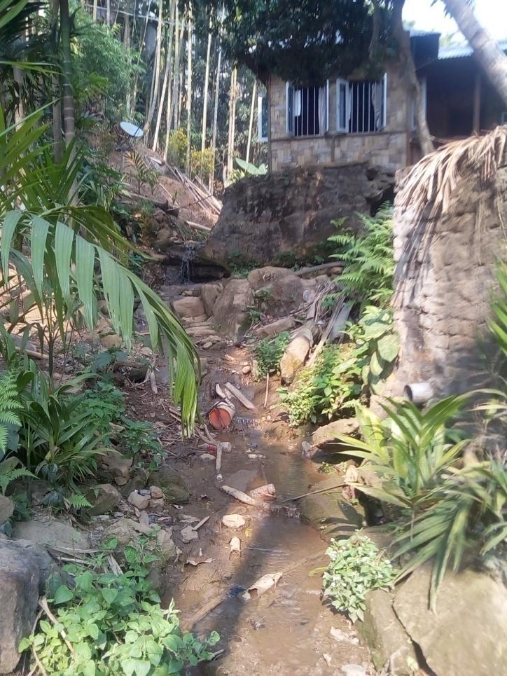
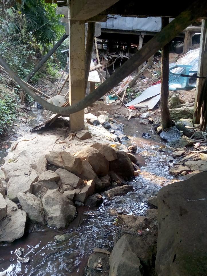
• PHE water has been sanctioned for only 90 houses but now there are 189 houses
• The village is facing a serious problem in regards to their drainage system. Most of the houses
are built on top of the small streams .The waste flows through these same streams which then
joins the “Um Doh” River.
Sensitization Programme
Dated: 3rd of January 2019
The District Project Manager and the Assistant Managers held a village Level sensitization Programme on the Community Led Landscape Management project on the 3rd of January 2019.The villagers actively participated in the program, voicing out their concerns and questions regarding the project making it a huge success.
The CLLMP officials gave a brief introduction on Meghalaya Basin Management Agency (MBMA) and elucidated about the various programmes and projects that MBMA is working on, they then gave a detailed introduction on the Community led Landscape Management Project (CLLMP) and the different aspects and procedures that the villagers and the CLLMP team should carry out during the course of the project and the importance of the involvement of the community for the CLLM-Project to be a success. They gave due importance to the environmental aspects of the project and enlightened them on the various benefits that the villagers could obtain from the project.
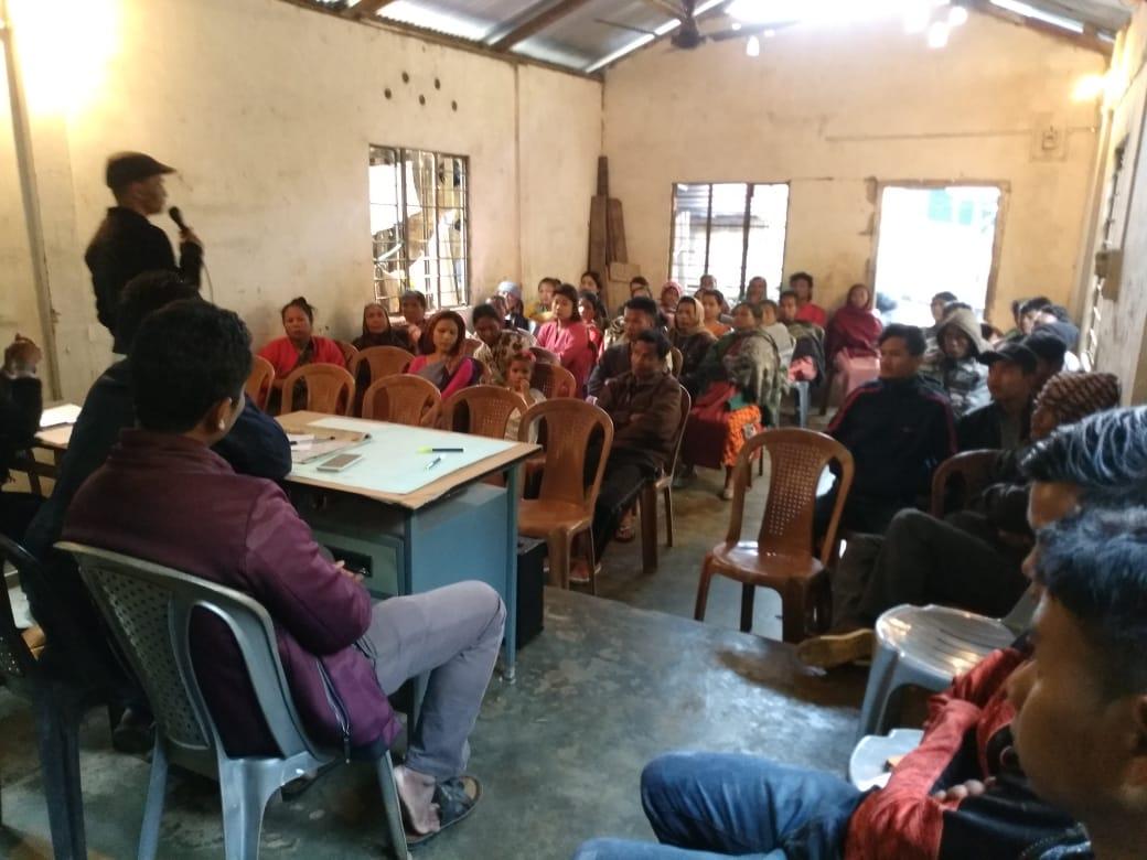
The Program was followed by an interactive session to answer the doubts and questions of the villagers.
2.2 Signing of Documents: After the interactive session, the village signed the Expression of Interest (EOI), the Village Grant Agreement (VGA) and the Citizen’s Green charter on the same day.
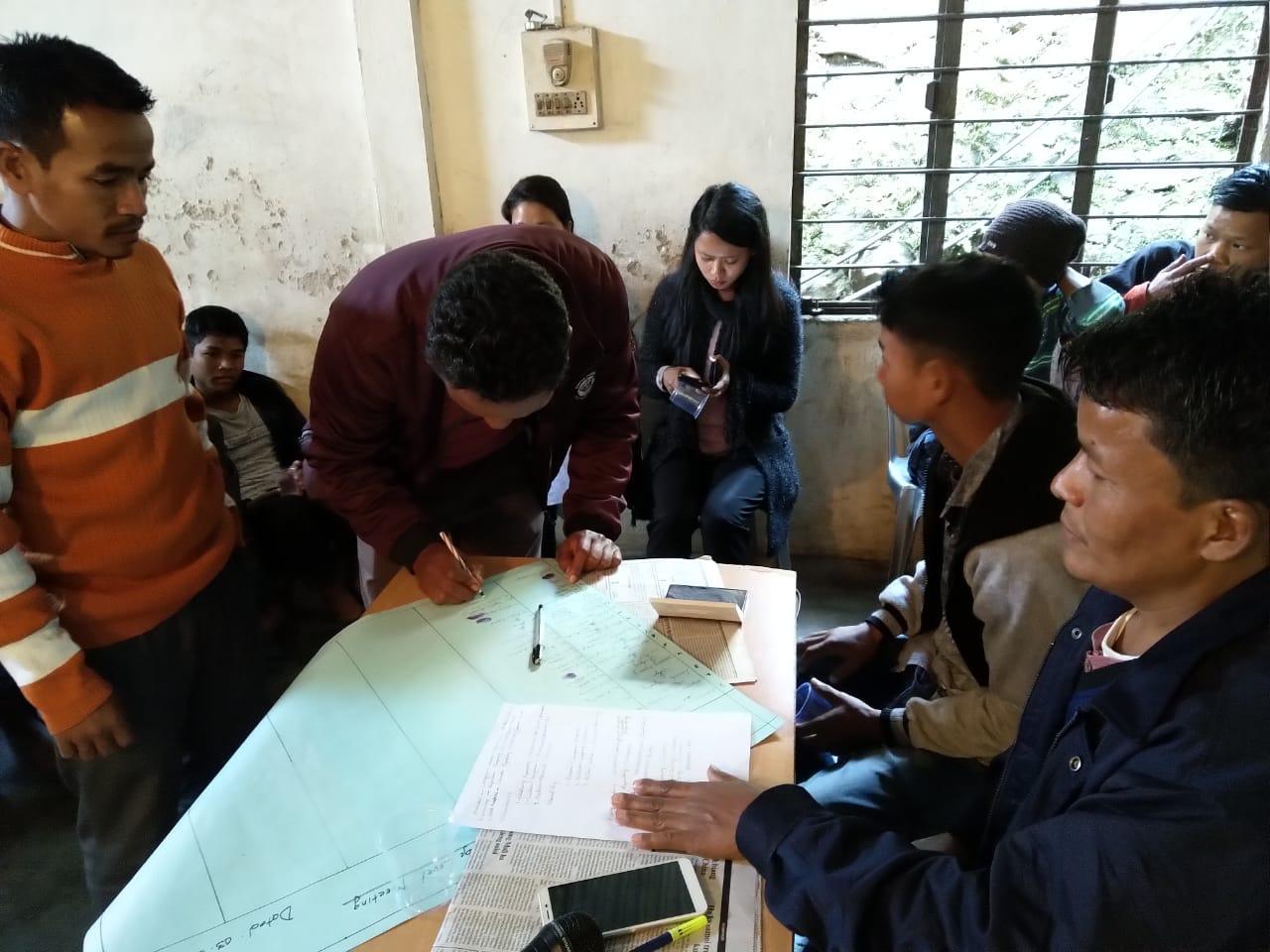
Signing of EOI,VGA, CGC at Umdoh 18 mile village
2.3 Formation of the VNRMC
The Formation of the Village Natural Resource Management Committee was done in a public meeting in the presence of the entire village and the CLLMP staffs. The community itself chose the President, the Secretary and the other executive members of the Committee.
Listed below are the members of the VNRMC:
| Sl.No. | Name | Gender (Male/Female) | Phone | Position | |
|---|---|---|---|---|---|
| 1 | Kyrshan Tansang | Male | 9862476368 | President | |
| 2 | Karishma Wahlang | Female | 9612117659 | Secretary | |
| 3 | Larisha Ryndong | Female | 7629965875 | Book keeper | |
| 4 | Riang Pohtam | Male | 9612972476 | Member | |
| 5 | Shanrishisha Ryndong | Female | 7629887963 | Member | |
| 6 | Longmin Mannar | Male | 9862997527 | Member | |
| 7 | Dreka Khongiong | Female | 9862476368 | Member | |
| 8 | Sikel Pohleng | Female | 8131945048 | Member | |
| 9 | Steward T.Sangma | Male | 8131027388 | Member | |
| 10 | Iwbih Suting | Female | 8131027388 | Member | |
| 11 | Parish Suting | Male | 7085923462 | Member | |
| 12 | Shaniah Pohswet | Male | 7085923462 | Member | |
| Village Community Facilitators | |||||
| Name | Gender | Age | Education | Contact Number | Role |
| Karishma Khongkai | Female | 28 | B.A | 9774530586 | Social Management & KM |
| Wadlang Ryndong | Male | 24 | B.com | 9862859493 | Environmental Management & GIS |
| Woolrhen Ryndong | Male | 24 | B.Sc | 8414082923 | Project Management M&E |
| List of Procurement members | |||||
| Name | Gender | Age | Education | Contact Number | |
| Stewart Sangma | Male | 35 | B.Com | 873098135 | |
| Bisoi Kshiar | Male | 29 | IX | 8131945041 | |
Risti Pohshen |
Female | 47 | NA | 8132902667 | |
3. Opening of a Bank Account.
The opening of the bank account was initiated after the village
signed the EOI (Expression of Interest), the VGA (Village Grant
Agreement) and the Green Charter. Mr. B Rumnong along with the
Accountant of the Ri Bhoi CLLMP team trained the Purchasing and
Procurement Committee of Ri Bhoi District including members of
Umdoh-18 Mile Village on matters relating to Accounts and
Bookkeeping on the 1st of July 2019.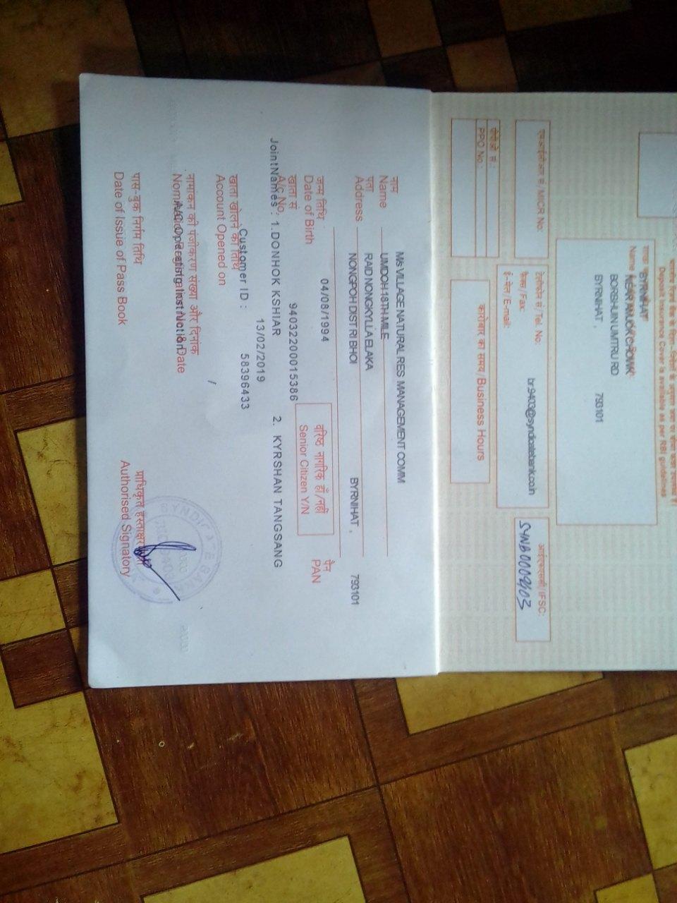
Training on Accounts and Book-Keeping
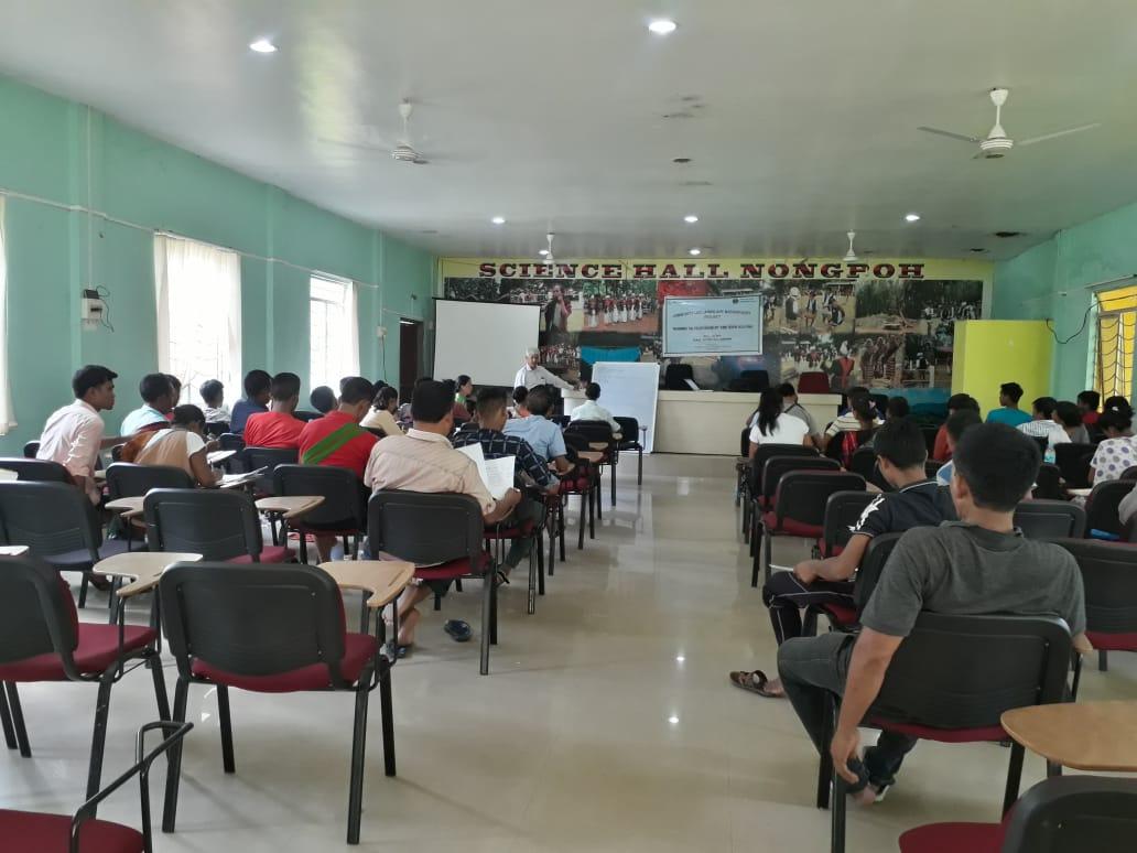
4. PRA Exercise
The PRA exercise aims to incorporate the knowledge and opinions
of the community in the planning and management of development
projects and programmes.PRA exercise at the Village took place on
the 8th of March 2019. There were a total of 55 villagers
who participated in this exercise 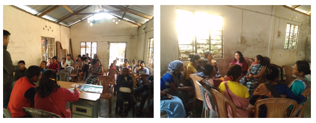
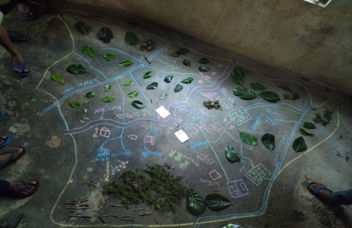
Resource Map drawn by the youths of Umdoh 18 Mile village.
Findings Based on the Resource Map of Umdoh 18th Mile
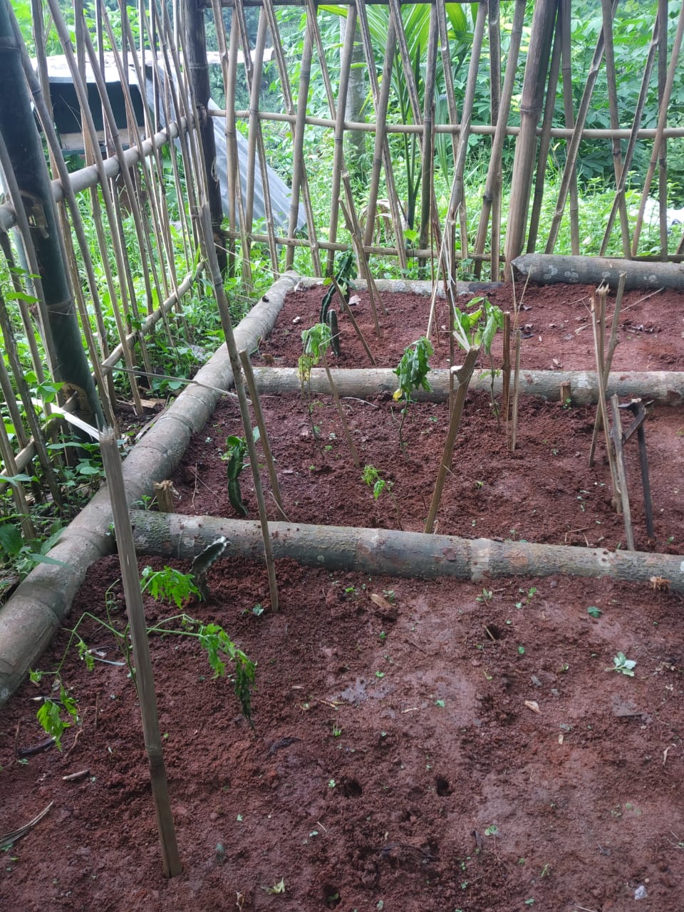
Main agriculture produce consists of betel nut, betel leaf ,paddy, broom and few more agricultural products.
There are 2 types of Forest in the village of which one is of the community while the rest are of private ownership
4 springs are present in the village
Wah Umdam is the main river that flows throughout the boundary of the village
Connectivity : The village is connected to the rest of the district via NH7 which is the Guwahati-Shillong road.
6. Habitation is not restricted to one place but scattered to various parts of the village.
7. 6 nos of churches present in the village
8. There are 2 Schools in the village; one of which is under the SSA while the otheris a Government School
Baseline Date Survey for Environment and Social Template
During the PRA exercise, the EE of Social and Environmental
Management and the community members were divided into groups to
fill the Social and Environmental Templates. Discussions and
consultations with social groups existing in the village were held
to gather basic village information regarding households,
demographic information, major crops and enterprises taken in the
village, trends of production and productivity of major crops in the
village and demographic distribution of village population.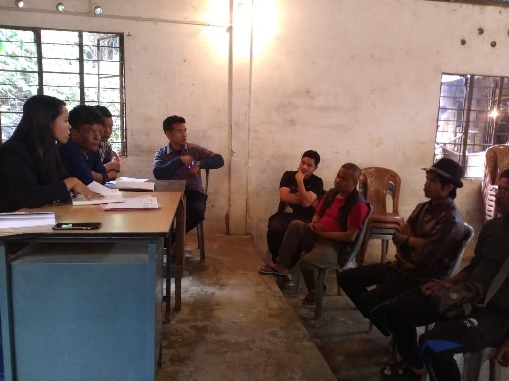
Focussed Group Discussion on Problem Analysis
Do people have sufficient access to supply of fodder, fuel wood, leaf litter?
Yes, people in the village still have sufficient access to supply of fodder, fuel wood, and leaf litter. They get it from community forest and from their own private lands/forest.
Has access to timber improved or reduced over the years? How is access for household use and commercial use managed?
Access to Timber has reduced over the years. People in the village have to purchase it when needed.
Are the water bodies facing any threats?
Yes, three springs (Umblai, Umdoh,umtynsang) are facing threats; due to Solid waste, Domestic waste and deforestation.
Yes, three streams (Wah khyndai Khatphra mer, Wah shnong, Wah umdoh) are facing threats; due to solid waste and domestic waste.
Do all people in the village have access to drinking water? What are the challenges?
No. Insufficient availability of drinking water during dry season, due to less discharge of water from the spring sources.
The Village is divided into Five hamlets; Lumsynteng, Lumshnong, Lumtangsang, Umdoh and Surok. Out of these five hamlets, one hamlet i.e Lumshnong is facing the most difficulty in access to drinking water as it is located in a hilly area.
Are there degraded areas in the village (open/ degraded forests, mining affected, high soil erosion etc.)?
Minor degradation in cultivated land
What has caused this degradation? Are there practices causing threats to availability and access to natural resources?
Fertility of the soil declines over the year.
Excessive practice of mono cropping system (Arecanut)
What have been the changes in agricultural practices?
No Changes.
Are there any challenges in farming?
The main challenge in farming has been the loss of soil fertility.
How would you consider the health situation in your village?
The nearest PHC is at a distance of 2Km which is easily accessible for the villagers.
Five years ago, diseases such as Malaria and Diarrhoea were common in the village. However, at present situations have improved wherein the previous diseases are less prevalent, besides mild fever.
How is the situation of cleanliness, sanitation, access to toilets and waste management?
The village traditional committee organises the cleaning drive four times in a year.
Sufficient toilets are available in every household.
Who are the most vulnerable in the village? What can be done to improve their lives?
BPL Families. Inclusion of BPL family members during project implementation
What are the livelihood aspirations of the youth? Are there any avenues available?
None, except daily wages
Do any committees/ institutions/ rules exist to manage and monitor natural resources in the village?
The VNRMC under the CLLMP will manage the natural resources in the village.
What are some of the major issues of conflict in the village?
Social dispute due to alcohol abuse.
Have any of the above issues been discussed in village meetings?
Yes the village Dorbar have discussed the issues and are doing their best to address these problems.
How do people resolve disagreements and conflicts?
All disagreements and conflicts are addressed by the traditional institution of village’s governance called the Village Dorbar.
Seasonal Calendar
The CLLMP team also mapped the seasonal calendar of Umdoh 18th Mile Village to help identify heavy workload periods, periods of relative ease, credit crunch, diseases, food security, wage availability etc. This will prove helpful in project planning and project timeline framing.
| SEASONAL CALENDAR | |||||||||||||
|---|---|---|---|---|---|---|---|---|---|---|---|---|---|
| Sl No. | CRITERIA | JAN | FEB | MAR | APRL | MAY | JUNE | JULY | AUG | SEP | OCT | NOV | DEC |
| 1 | Water Scarcity | 2 | 2 | 1 | 1 | 1 | 3 | 3 | 4 | ||||
| 2 | Prone to sickness | 1 | 2 | ||||||||||
| 3 | Out flux | 1 | 2 | 3 | |||||||||
| 4 | Rainfall | 2 | 1 | 1 | 1 | 2 | 3 | ||||||
| 5 | Free – Less work | 1 | 2 | 3 | |||||||||
| 6 | Betel leaves Cultivation | 1 | 1 | 2 | |||||||||
| 7 | Betel leaves Plucking | 1 | 2 | 2 | 2 | 3 | 3 | 3 | |||||
| 8 | Betel nut cultivation | 1 | 1 | ||||||||||
| 9 | Betel nut harvesting | 1 | 2 | 3 | 2 | 3 | |||||||
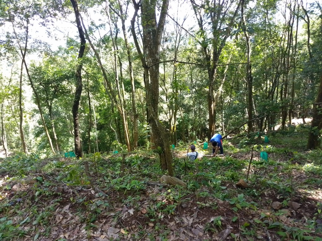
| 10 | Tree Plantation | 1 | 1 | ||||||||||
| 11 | Vegetable (crop cultivation) | 1 | 1 | ||||||||||
| 12 | Vegetable (crop harvesting) | 1 | 2 | 3 | |||||||||
| 13 | Festive Season | 1 | 3 | 2 | |||||||||
| 14 | Forest fire | 1 | |||||||||||
| 15 | Collection of Fuel wood | 1 | 2 | 2 | 3 | ||||||||
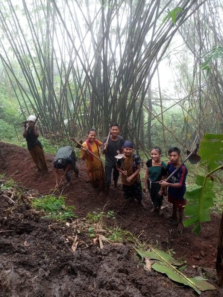
5.CNRMP
The CNRM-Plan was prepared at a village level meeting was held in the community Hall of the village on the 4th of February 2019 with the help of the VNRMC members and the community as a whole. A total of 15 men and women from the village were present to voice their problems an opinion before the plan was formulated.
The village wanted to concentrate on the drainage aspect of the CNRM-plan, however since the expense is very high we can only do so as per maximum permissible amount under the project.
As per the findings at the ground truthing phase, an immediate intervention is required with regards to the drainage system of the village as it is a serious case of contamination of drinking water sources to other villages relying on the “Umdoh River”.
Submission of CNRMP by the VNRMC
The Final Community Natural Resource Management Plan
|
Name of Proposed Interventions | Site |
|
Nos of HHs expected to Benefit | ||
|---|---|---|---|---|---|---|
|
|
|
||||
| 1 |
|
DONG Umdong |
|
|
|
168 |
| 2 |
|
LumJingtep |
|
|
|
168 |
| 3 |
|
Community footpath and staircase |
|
|
|
|
| 4 |
|
Fragile hill slopes and Spring catchment sites |
|
|
|
|
| 5 |
|
KYNTOIT LUMRYNDON |
|
|
|
168 |
| 6 |
|
Near Community hall |
|
|
||
| 7 |
|
LUMRENDONG |
|
|
|
168 |
| 8 |
|
|||||
| 9 |
|
Umblai and Umdoh |
|
|
|
168 |
| 10 |
|
LUMSHNONG |
|
|
34 | 168 |
| 11 |
|
LUMRYNDONG |
|
|
34 | 168 |
| 12 |
|
19 mile |
|
189 | ||
| 13 |
|
LumDynteng |
|
70 | ||
| 14 |
|
LumDynteng |
|
20 | ||
| 15 |
|
Dong Surok |
|
45 | ||
| 16 |
|
|||||
| 17 |
|
Lumjingtep |
|
189 | ||
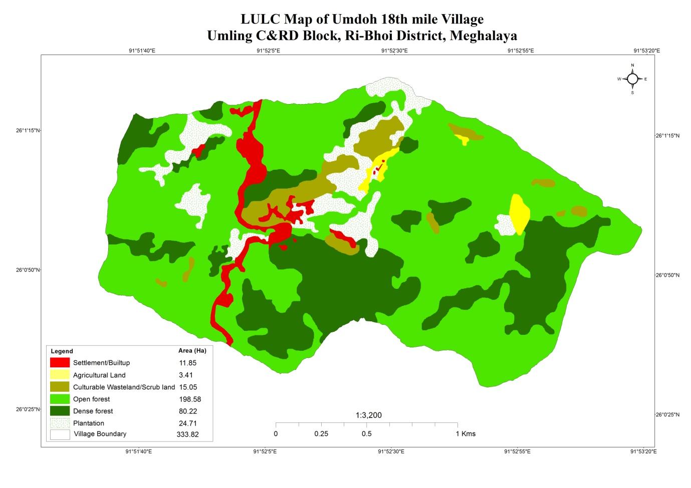
GIS Activities – UMDOH 18TH MILE
| Sl.No | Parameters | Village Information |
|---|---|---|
| 1. | GPS Coordinates | |
| i | Latitude | 26.016201°N |
| ii | Longitude | 91.869723°E |
| iii | Elevation Reading (MSL) | 188 M |
| 2. | Village Geographical Area(Ha) | 333.82 Ha |
| i | Total Forest Area ( including community, Clan, Pvt Forest) | 278.8 Ha |
| ii | Total Area of Water Bodies | - |
| iii | Total Area under Agri- Horticulture | 3.41 Ha |
| iv | Total Degraded land area (Ha) | 15.05 Ha |
| 3 | Average Annual Rainfall | 1000-1200 |
| 4 | Soil Type | Loamy soil |
6. Project Implementation
| 1. | Type Of Intervention | Site Name | GPS Co-ordinates | Amount Sanctioned | Work Status | |
|---|---|---|---|---|---|---|
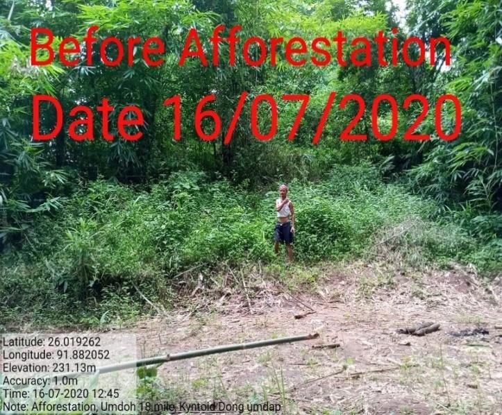
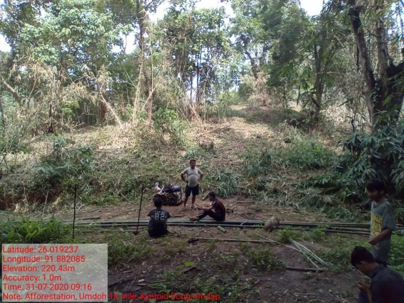
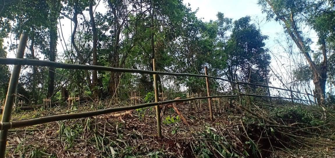
| Afforesation | Dong umdap | 25.0192N | 92.8820E | ₹ 46,810.00 | Completed | |
| 2. | Type Of Intervention | Site Name | GPS Co-ordinates | Amount Sanctioned | Work Status | |
|---|---|---|---|---|---|---|
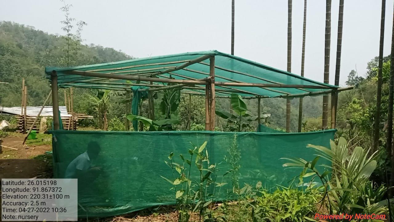
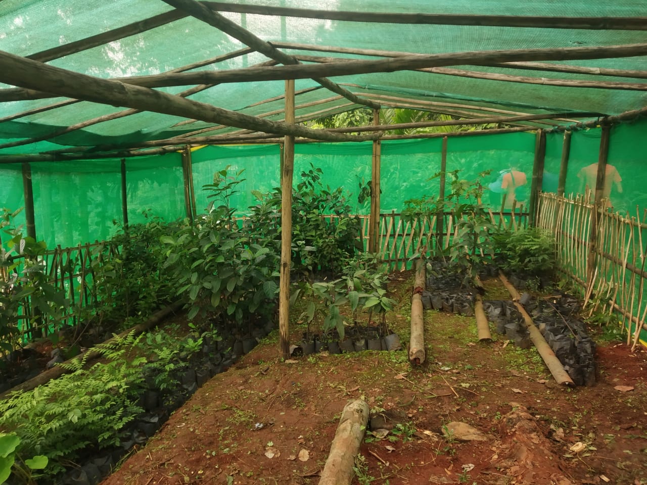
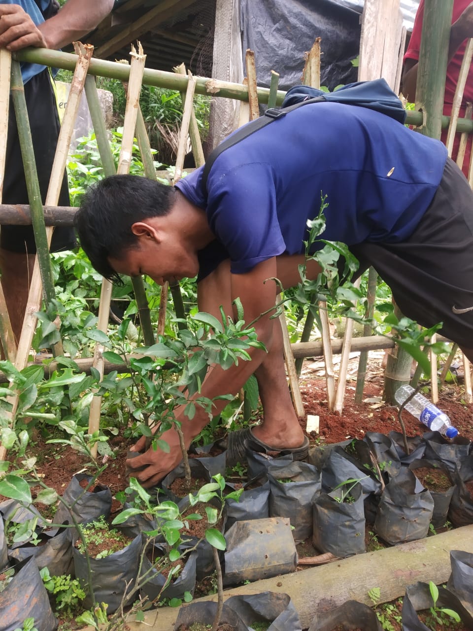
| Nursery | Lumryndong | 25.01598 N | 91.867323 E | ₹ 1,19,300 | Completed | |
| 3. | Type Of Intervention | Site Name | GPS Co-ordinates | Amount Sanctioned | Work Status | |
|---|---|---|---|---|---|---|
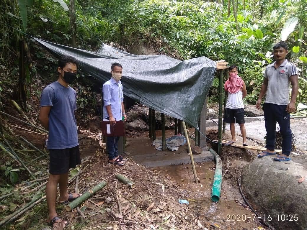
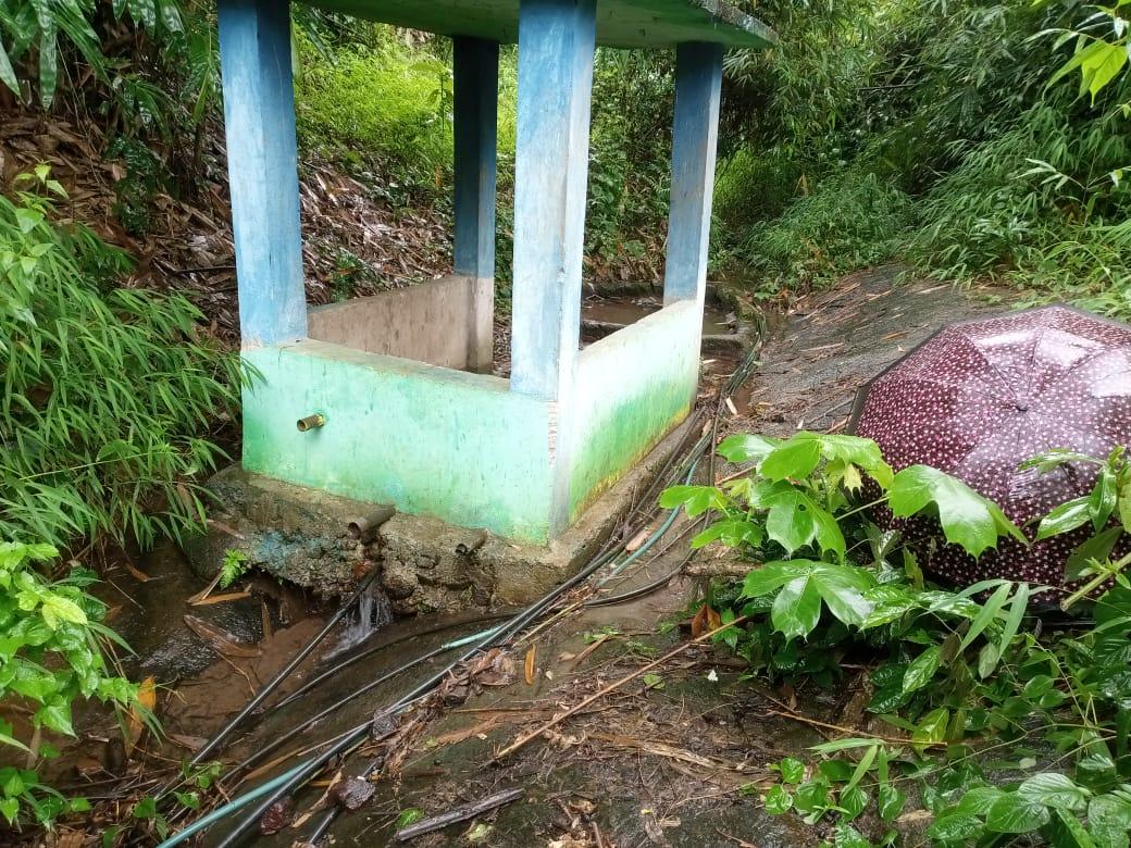
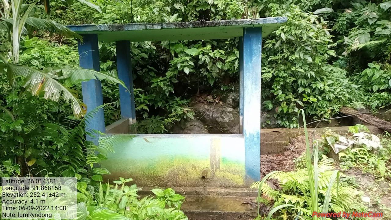
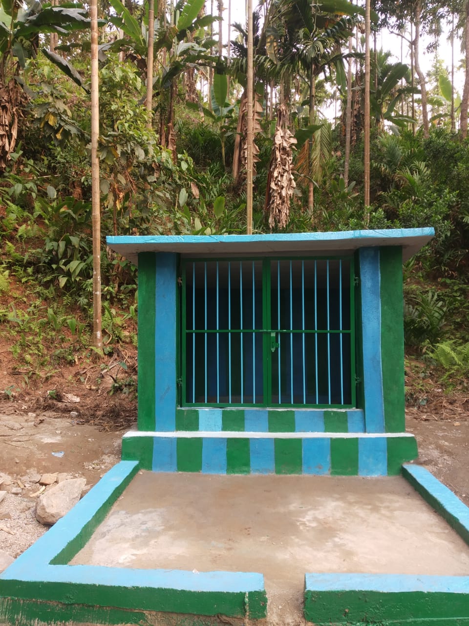
| Spring Chamber | LumRyndong | 25.0160 N | 91.8738 E | ₹1,48,818.00 | Completed | |
| 4. | Type Of Intervention | Site Name | GPS Co-ordinates | Amount Sanctioned | Work Status | |
|---|---|---|---|---|---|---|
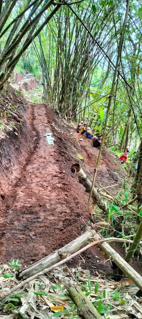
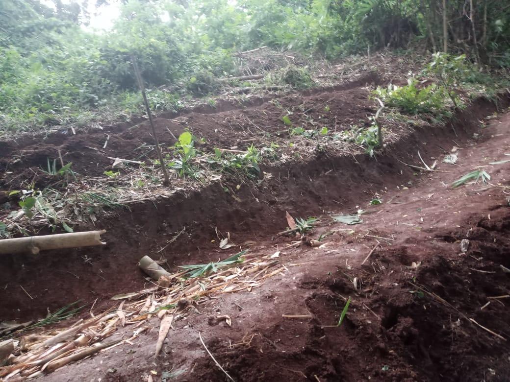
| Bench Terracing | Lum Dynteng | 26.011157 N | 91.871446 E | ₹ 4,50,000.00 | Completed | |
| 5. | Type Of Intervention | Site Name | GPS Co-ordinates | Amount Sanctioned | Work Status | |
|---|---|---|---|---|---|---|
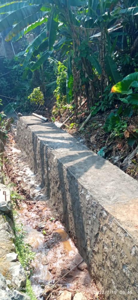
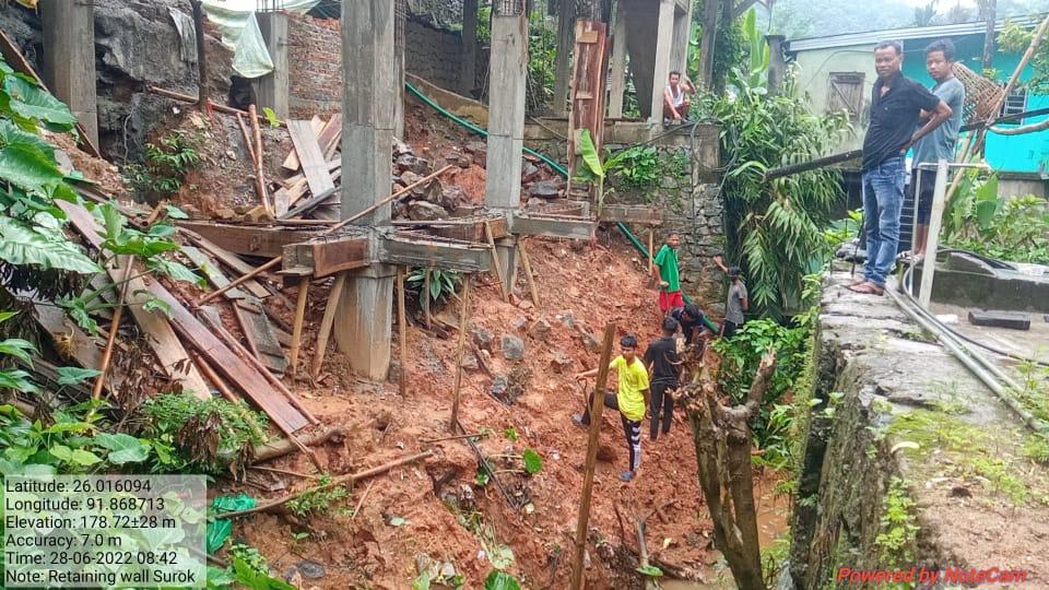
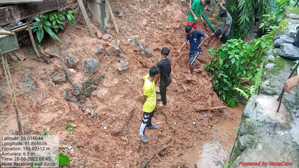
| Retaining wall | Dong Surok | 26.016028 N | 91.868647 E | ₹ 4,44,010.00 | Completed | |
| 6. | Type Of Intervention | Site Name | Amount Sanctioned | Work Status |
|---|---|---|---|---|
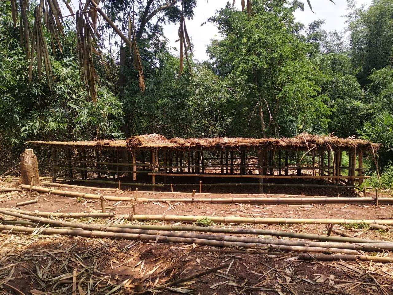
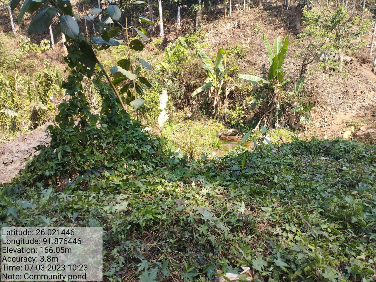
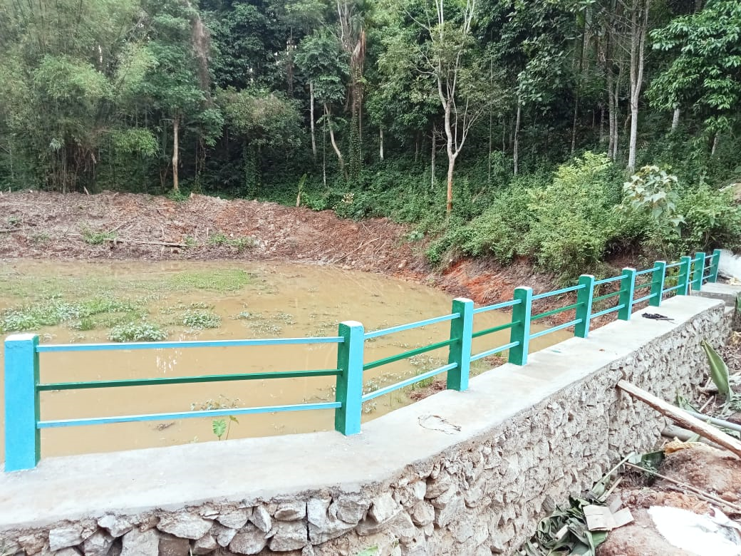
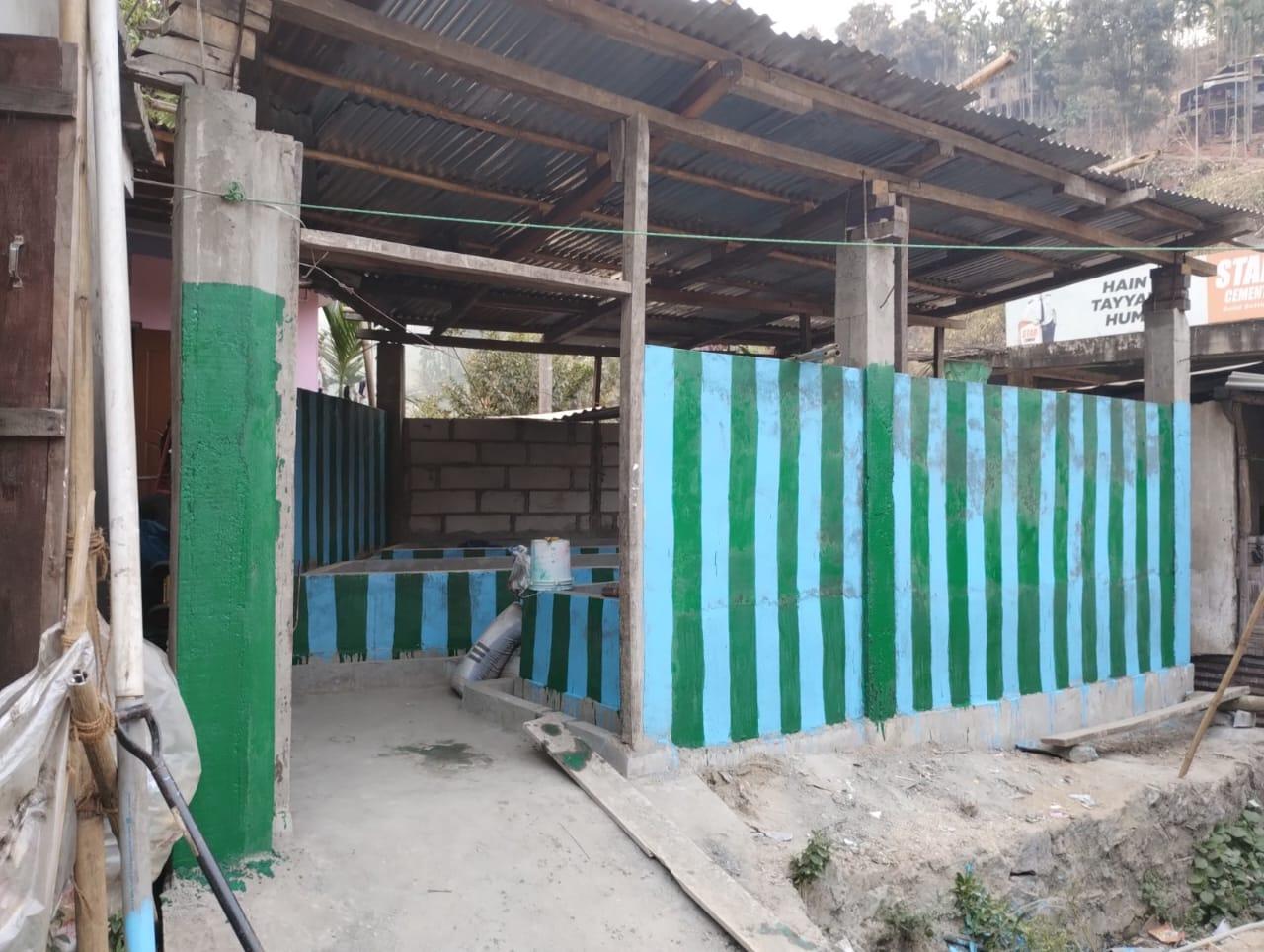
| Community Pond | Umdoh Shnong Garo | ₹3,93,282 | Completed |
| 7. | Type Of Intervention | Site Name | GPS Co-ordinates | Amount Sanctioned | Work Status | |
|---|---|---|---|---|---|---|
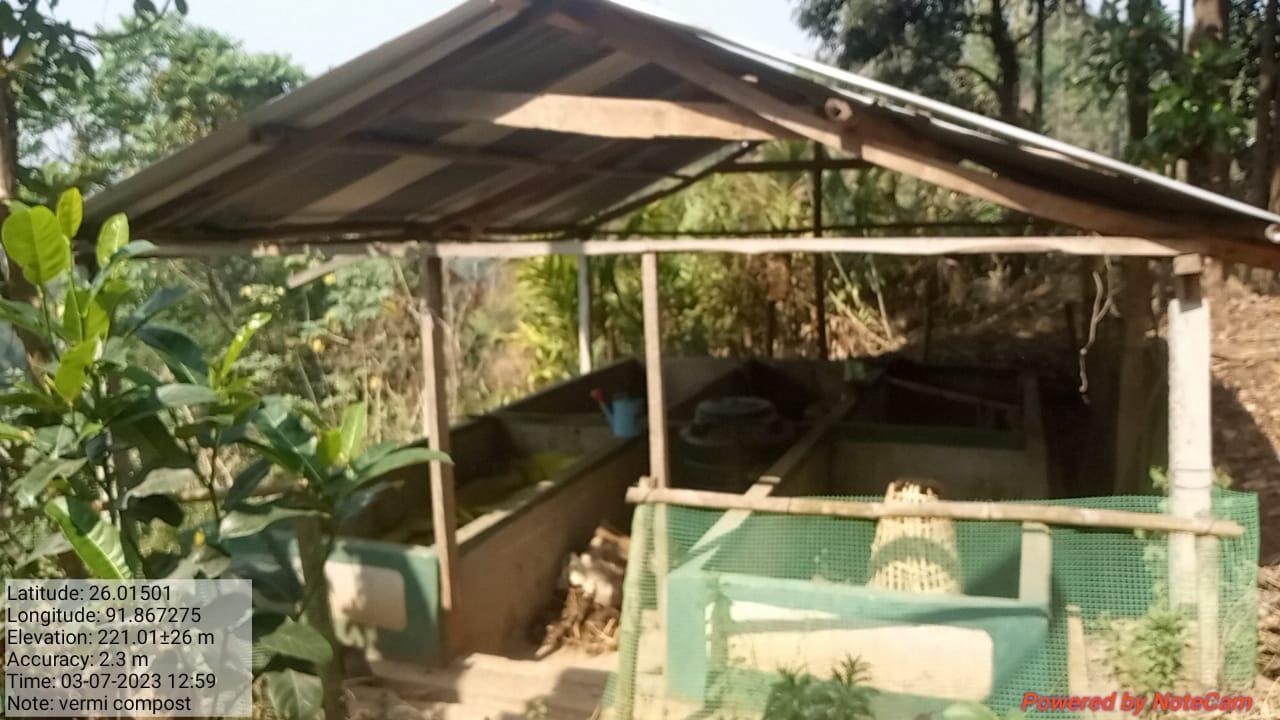
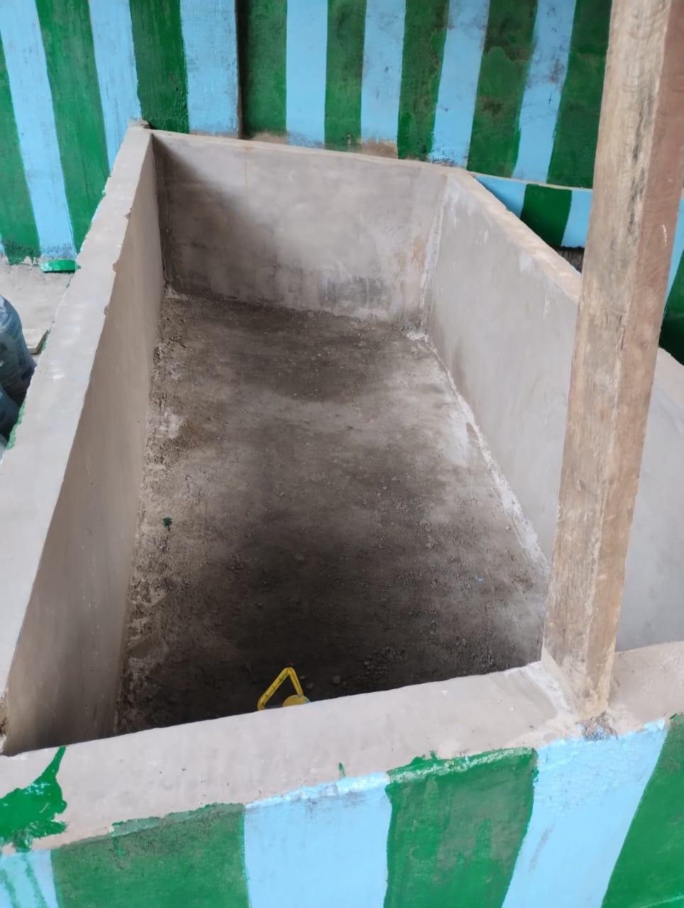
| Vermi Compost | Kyntoit LumRyndon | 26.01501 N | 91.867275 E | ₹2,22,000.00 | Completed | |
| 8. | Type Of Intervention | Site Name | GPS Co-ordinates | Amount Sanctioned | Work Status | |
|---|---|---|---|---|---|---|
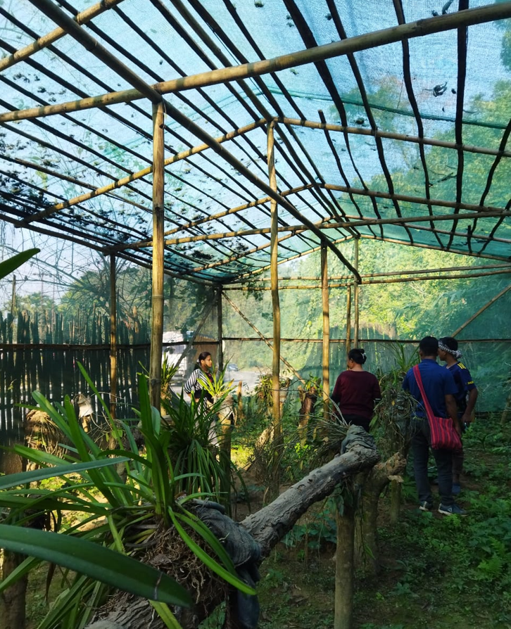
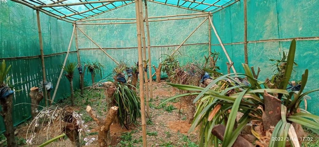
| Poly house for Orchids | Dong 19 Mer | 26.014197 N | 91.8665 | ₹1,03,200.00 | Completed | |
| 9. | Type Of Intervention | Site Name | GPS Co-ordinates | Amount Sanctioned | Work Status | |
|---|---|---|---|---|---|---|
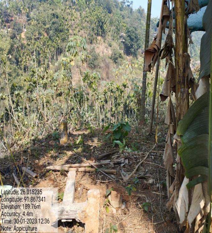
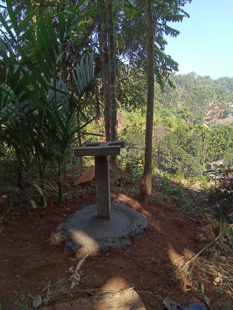
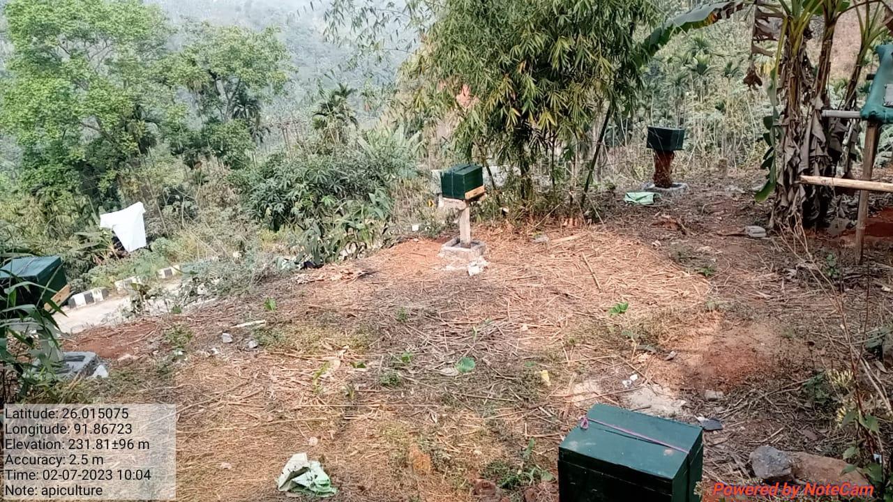
| Apiculture | LumDynteng | 26.01575 N | 91.86723 E | ₹ 1,12,0 00.00 | Completed | |
| 10. | Type Of Intervention | Site Name | GPS Co-ordinates | Amount Sanctioned | Work Status | |
|---|---|---|---|---|---|---|
| Contour Trench | LumDynteng | 26.01575 N | 91.86723 E | ₹38,862.00 | Completed | |
| 10. | Type Of Intervention | Site Name | GPS Co-ordinates | Amount Sanctioned | Work Status | |
|---|---|---|---|---|---|---|
| Spring chamber 2 | Lum Rymdong | 26.013539 | 91.868179 | ₹1,28,086. | Completed | |
| Intervention | Site Name | Amount | Status |
|---|---|---|---|
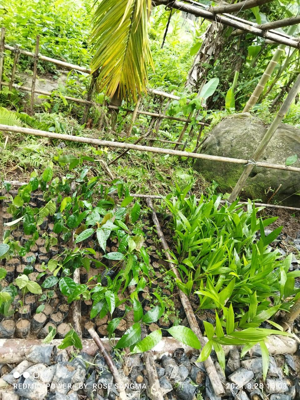
FMP Activities 1.Fire Control Line 2.Assisted natural regeneration in open forest 3.Community Forest Boundary Survey 4.In-situ & Ex-situ conservation of rare and endangered plants 5.Nursery for Food Forestry (Sapling for the Available Nursery) |
All under Community Land | 69700 79432 5000 7000 11000 |
All Completed |
| Intervention | Site Name | Amount | Work Status |
|---|---|---|---|
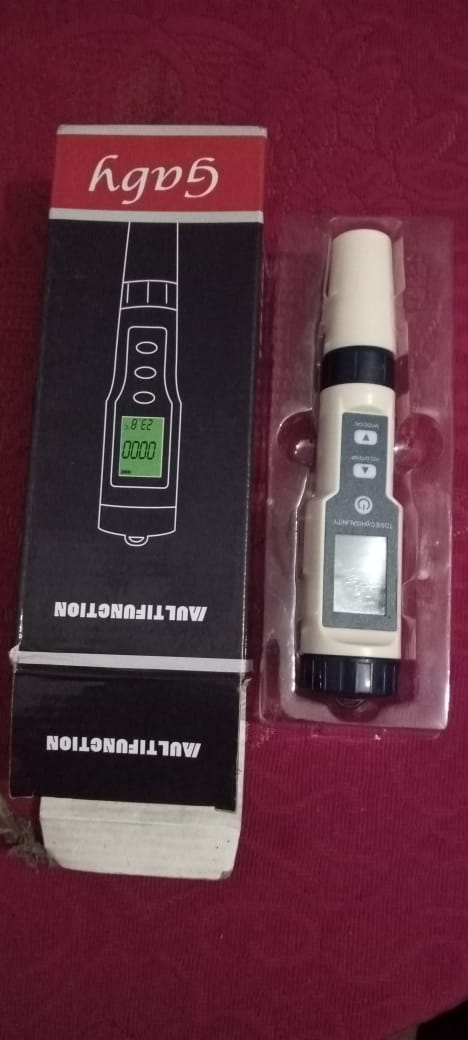
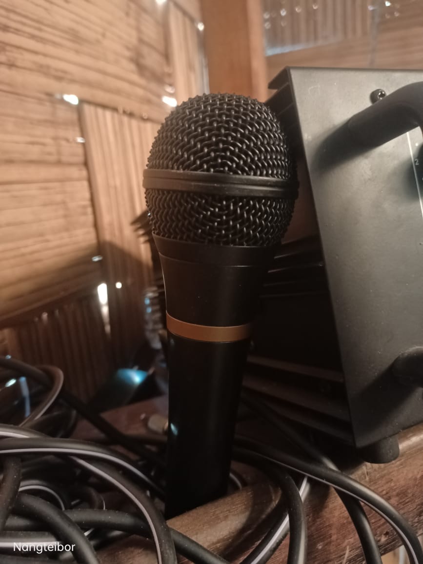
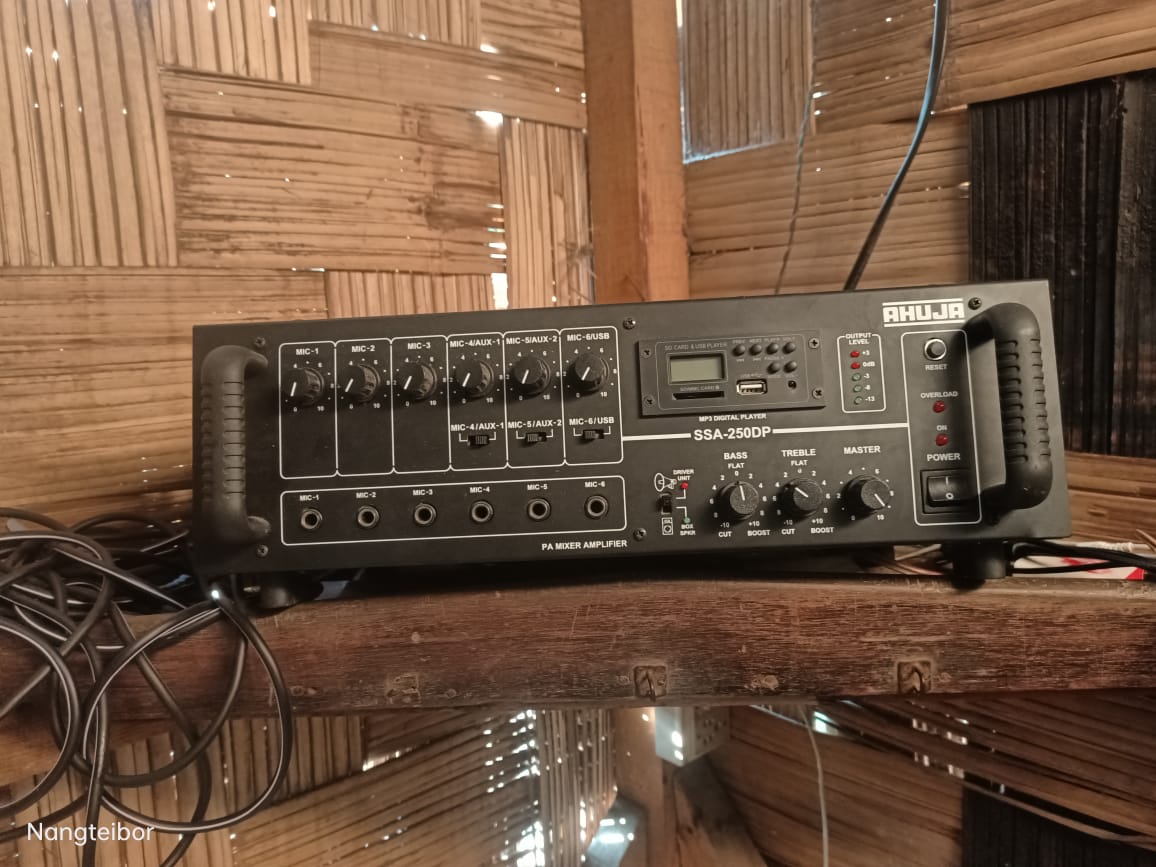
Excess fund activities PA System Water Tester |
community land | 80,000 70,000 10,000 |
Completed |
| Intervention | Site Name | Amount | Work Status |
|---|---|---|---|
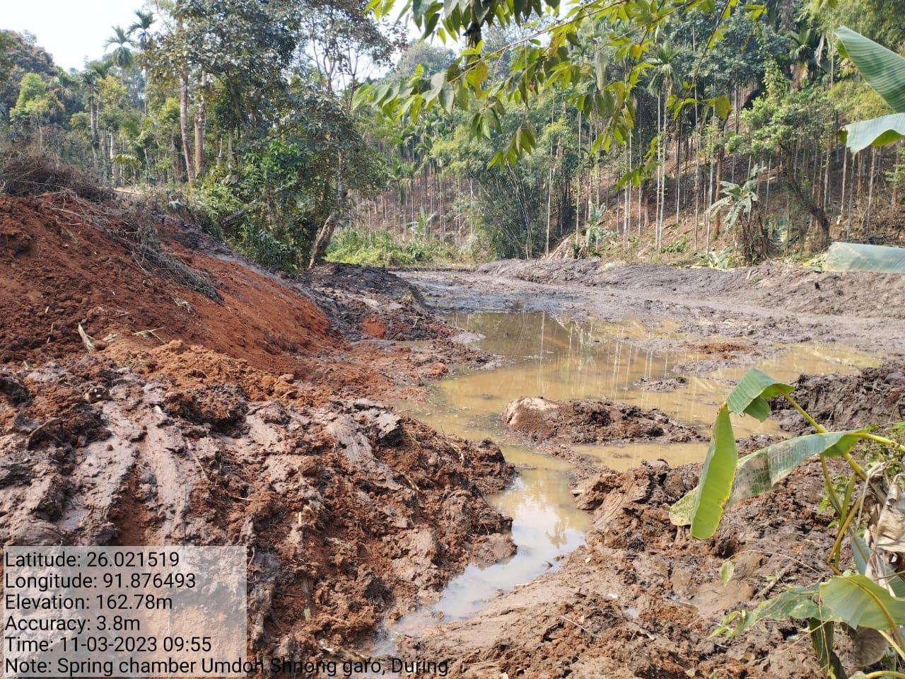
| Spring Chamber 3 | Umdoh Shnong Garo | 76717 | Completed |
TESTIMONIALS
President- Kyrshan Tangsang 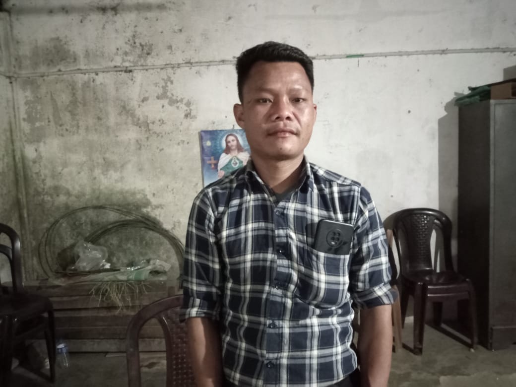
Firstly I would like to thank God for this project as through it we have witnessed a tremendous change in the village. I can't deny the fact that through this we have received so many implementations where all these serve the best interest of the people in our village. I would also like to take this opportunity to thank the staff as it's through their constant guidance and leadership that we were able to reap the harvest of the work that was carried under CLLMP. I firmly believe that this project is one that will be remembered for a lifetime for all the good works and successful implementation that it has brought in this village.
Secretary - Karishma Khongkai 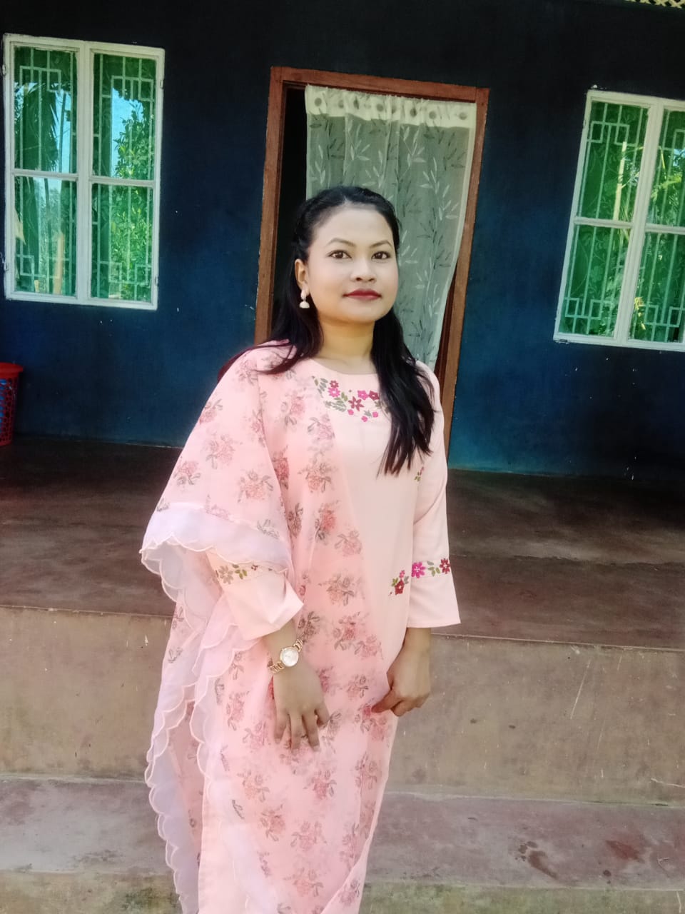
If we talk of the benefits that the project is endowed with, then
it's enormous. The project covers a wide stretch of benefits ranging
from how to protect the environment to how to work on safeguarding
it by working in harmony with nature without exploiting the
resources it has in store for us. Not leaving aside the numerous
training, it has provided for us so that we can carry the work in
good vigour and spirit. Being the secretary comes with a lot of
responsibility, but the project had made it easy for me to work as
in every step of it I was guided, supervised and taught the various
lessons on how to conduct meetings, put records and make sure all
the work is carried under the proper guidance of the project. 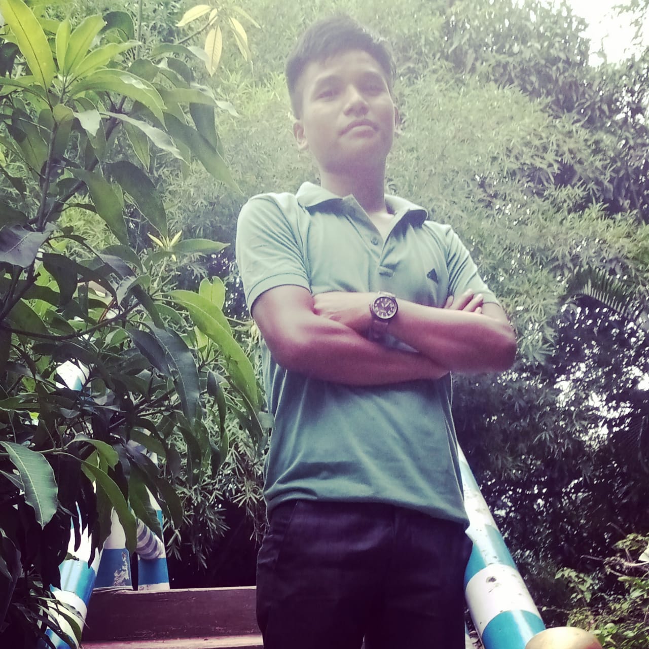
VCF- EM : Woorhen Ryndong
To be a VCF under this project is something that's really beneficial. The reason is because the role that we have is at the grassroot level, so this requires a thorough understanding of the work that's required on field, various ways and measures to work to uplift and strengthen various NRM activities, also to be responsible people on how to communicate with people at the village showing them the importance of NRM. All this is fruitful at the end as before we go to the field we are properly trained and supervised, not forgetting the continuous training and support we received throughout the process. On sight learning is one more benefit we have gained as we're taken to various places, get to learn their best practices and in this way we get to inculcate these healthy practices in the village. In all these works, the means of livelihood is also provided as everyone gets their share for the services they have rendered under the project.
VCF- M&E Wadlang Ryndong 
The reason as to why I took this role is the urge that is within me and also the capacity that others see in me to work as a facilitator for the village under the project. Through this project I have learned so many important lessons that I did not get to know while I was in school. I have been able to lend a hand in the overall working of the project in the village and also to be an instrument of change to make other people know about NRM and how to work under it for a sustainable environment.
