Report on:
Patharkhmah VILLAGE under jirang C&RD Block
District: Ri-Bhoi
17TH JAN,2024
COMMUNITY LED LANDSCAPE MANAGEMENT PROJECT


The Government of Meghalaya with financial help from the World Bank is implementing the Meghalaya Community Led Landscape Management Project (MCLLMP). The project will cover the entire state of Meghalaya and implementation of community-led plans will be rolled out in a phase manner throughout the state. The Meghalaya Basin Management Agency (MBMA) will facilitate community-led planning by providing support, technical inputs, and funding.
The project is intended to strengthen community-led natural resources management in selected landscapes within the 11 districts of the state. This would be achieved through a variety of planning, capacity building, and on-the-ground interventions. It is also intended to promote the conservation and sustainable use of natural resources, social inclusion and community mobilization; building traditional knowledge and learning, mapping of natural resources management; strengthening the community institutions, and creating linkage with financial institutions and community organizations.
The project interventions include the preparation of community-led natural resource management plans. The CLLMP has the following three components:
Strengthening the Knowledge and Capacity of Communities for Natural Resources Management
Community-Led Landscape Planning and Implementation
Project Management and Governance
The project objective is “to manage and conserve the natural resources, especially forests, soil and water sources, in a manner that supports the financial and physical well-being of communities in the State”
The CLLM-Programme’s main focus is on increasing the capacities of communities and traditional institutions (TI) by adopting a landscape approach to manage their natural resources such as soil, springs and other water sources, forests and bio-diversity, etc…
The project will be planned and implemented in about 400 villages across the state.
CLLMP has a strong focus on institution-building at the village-level, by ensuring systematic capacity-building on technical and social skill-sets.
The project will also extend such training to communities beyond the targeted villages and support the efforts made by the communities to access funding from various rural and natural resources initiatives and schemes.
The program will also invest in improving the process and outcome delivery by developing and adhering to effective systems and procedures, supported by the appropriate technology.
It benefits the community (It helps in developing skills and capacity relating to technical and managerial areas like NRM and Conflict resolution.)
It benefits the traditional institutions (village councils, traditional leaders, community-based organizations, SHGs, etc...) in the form of knowledge sharing, promotion of innovative approaches, access to technology, technical managerial and financial support.
It is estimated that the project will impact around 1 lakh partners (of which 50% are women) who depend on land, forest, agro forestry.
Through the project, 55000 Ha of targeted area will be ensured with availability of water, biological resources, and soil productivity, which will in turn benefit around 400 villages and the outcomes delivery can be summarized as follows:
The Project is executed by the MBMA specifically in accordance with the technical inputs, safeguards management and Community NRM plan preparation; in collaboration with other partners, particularly, SIRD (for training and capacity building), Department of Soil and Water Conservation, Water Resource Department, Forest Department.
2018-2023 (5 years)
Introduction
Patharkhmah Village falls under Jirang C&RD
block of Ri-Bhoi district in the state of Meghalaya. The village is
at a distance of 67 Kms from Nongpoh, which is the district
headquarters of Ri Bhoi District and is at a total distance of 119
Kms from the state capital, Shillong. It falls under the charge of
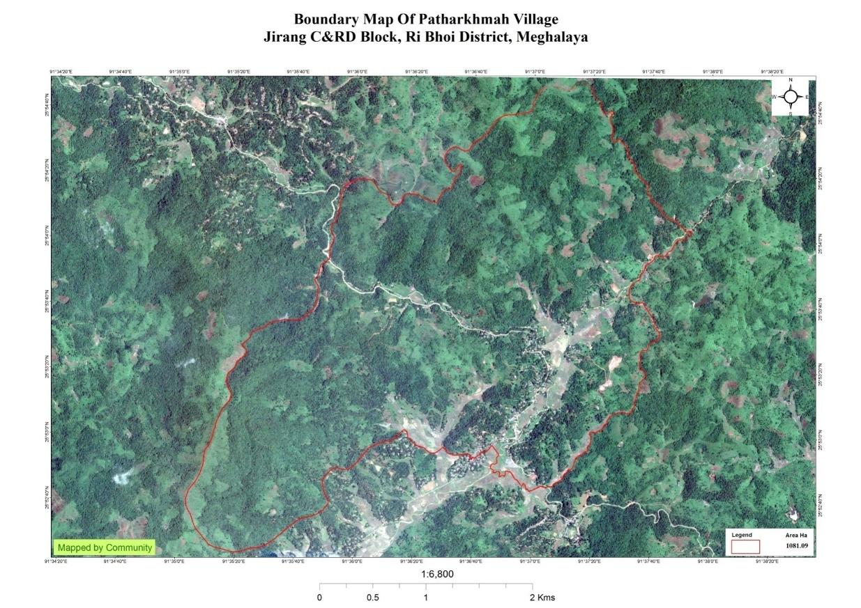
the HimaNongkhlaw, with a total geographical area of 1081.09 ha and
a total population of 1320 villagers. 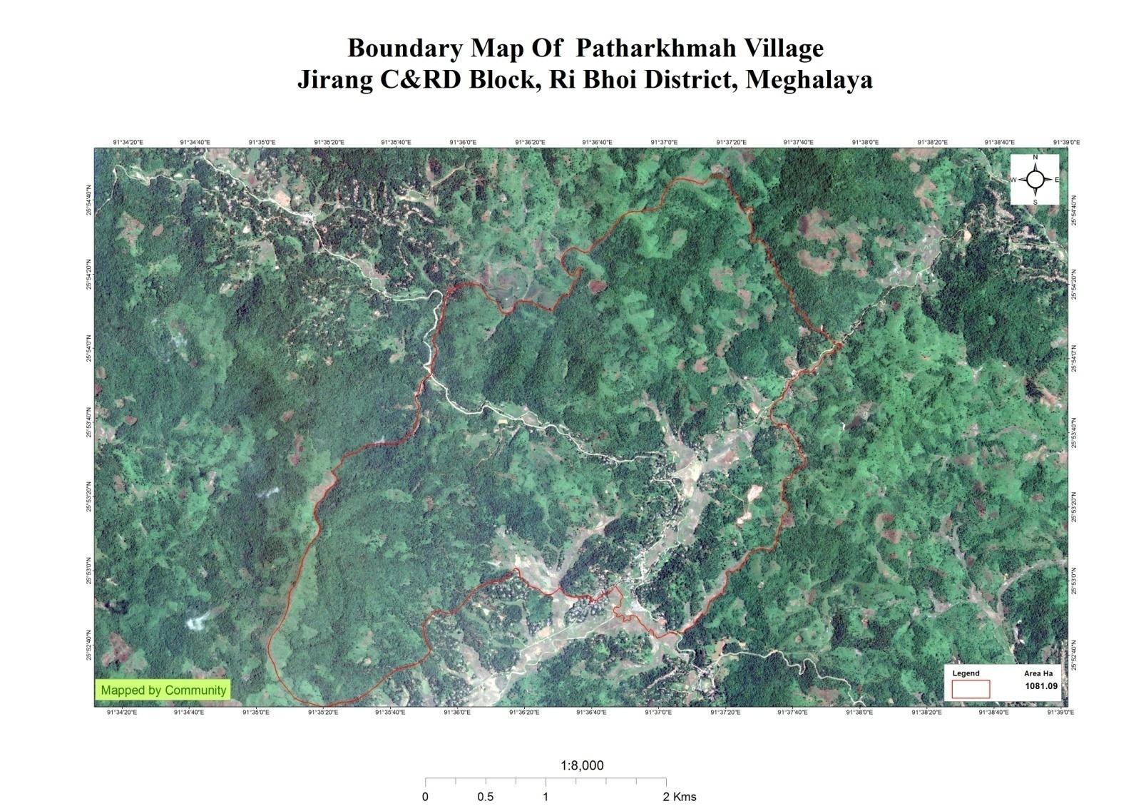
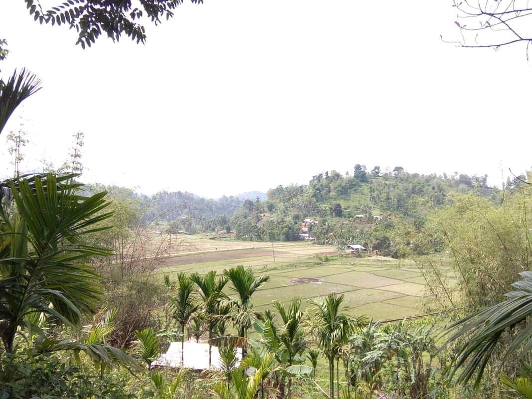
Brief History : Patharkhmah village is located on top of a hill under Hima Nongkhlaw at Jirang C&RD Block of Ri-Bhoi district, Meghalaya. It is around 67 KM from the district headquarters at Nongpoh. It is surrounded by Umrit village, Umkynsier village, New Jirang village and other villages.
The village was formed in the year 1953 under the leadership of headman (Sordar) Shri. (L) Rishmon Syngkli and there were about 80 households.The PWD road from Dispur to Shillong is a backbone to the economy of Patharkhmah village. Through it they are able to indulge in trade and commerce. Patharkhmah is now one of the centre villages and it has many department offices in it like, the CHC, Police Outpost, A.H. & Veterinary, Agriculture and Sericulture, PWD office, PHE office, SBI bank, MRB Bank, Government Higher Secondary School, B.C.Dolloi College, Khrum Sohram SSA L.P School and two Anganwadi Centres. It also has one of the biggest markets in the entire Western Ri-Bhoi known as the Umsaw Market. About 90% of the villagers of Patharkhmah are either farmers or daily wage labourers.
Social Profile
The total number of households is 320 and has a population of 1485 people. Most of the people are engaged in Agriculture allied activities, Masons, Local vendors and where some few others are also enrolled in government services.
Village Accessibility: In order to reach Patharkhmah village, one can venture through the Umling P.W.D. road, Mairang to Nongkhlaw road and even from Assam to Jirang road. Patharkhmah has got a subdivision that lies 6 km from the Block Headquarter and lies 70 KM far away from District Headquarter. Forthose who want to venture into the Patharkhmah village,the village is situated near the Road side and it is also the centre of western Ri Bhoi, which makes it convenient to locate and access the village and there are footpaths constructed by the MGNREGA scheme that leads and take you inside the village.

Population
Patharkhmah population is 1485. Out of this, 776 are males while the female count is 709. This village has 93 children in the age group of 0-4 years. Among them 51 are boys and 42 are girls.
| Age Group | Male | Female | Total |
| 0-4 | 51 | 42 | 93 |
| 5-14 | 172 | 163 | 335 |
| 15-30 | 285 | 280 | 565 |
| 30-60 | 221 | 200 | 421 |
| Above 60 | 47 | 24 | 71 |
BPL/APL Household:
The village has a total number of 274 Health cardholders, 320 Ration cardholders in which 260 belong to BPL and 60 belong to APL. The major occupation of the people is farming, while some of them are Teachers, Mason and Govt. servants.
| Total HH | 320 |
|---|---|
| BPL | 260 |
| APL | 60 |
Card Holding Household:
| Particulars | No. of HH |
|---|---|
| Total HH | 320 |
| Ration Card HH | 320 |
| Health Card HH | 274 |
Fuel Type
| Fuel Type | Total HH |
|---|---|
| Charcoal | 10 |
| Biomass | NIL |
| Wood | 250 |
| LPG | 160 |
| Electric Heater | 150 |
| Kerosene | 10 |
:
OCCUPATION: The people of the village rely on agriculture and forest, Business, Teachers ,Mason and Government jobs for their everyday livelihood and economic status.
Drinking Water:There is sufficient drinking water and they can access drinking water easily through PHE water Pipeline and Tap water platform in every hamlet.
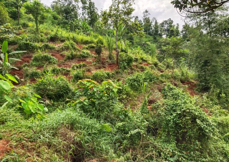
Deforestation: Deforestation had caused the river Umshait to decrease in discharge and increase flooding during heavy rain.
Jhum cultivation: Theymainly take up traditional approaches of cultivation like, Jhum or the shifting cultivation
WATER BODIES LAND:1081.09Ha 
Springs – 7 FOREST:707.03Ha
Stream – 5 CULTURABLE LAND: 665.87 Ha
River – 1
Pond – 16
CLLMP ACTIVITIES
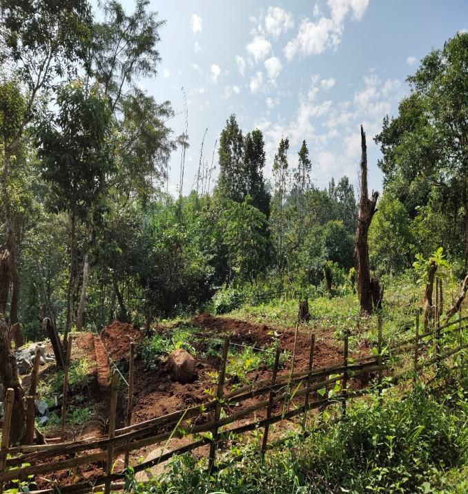
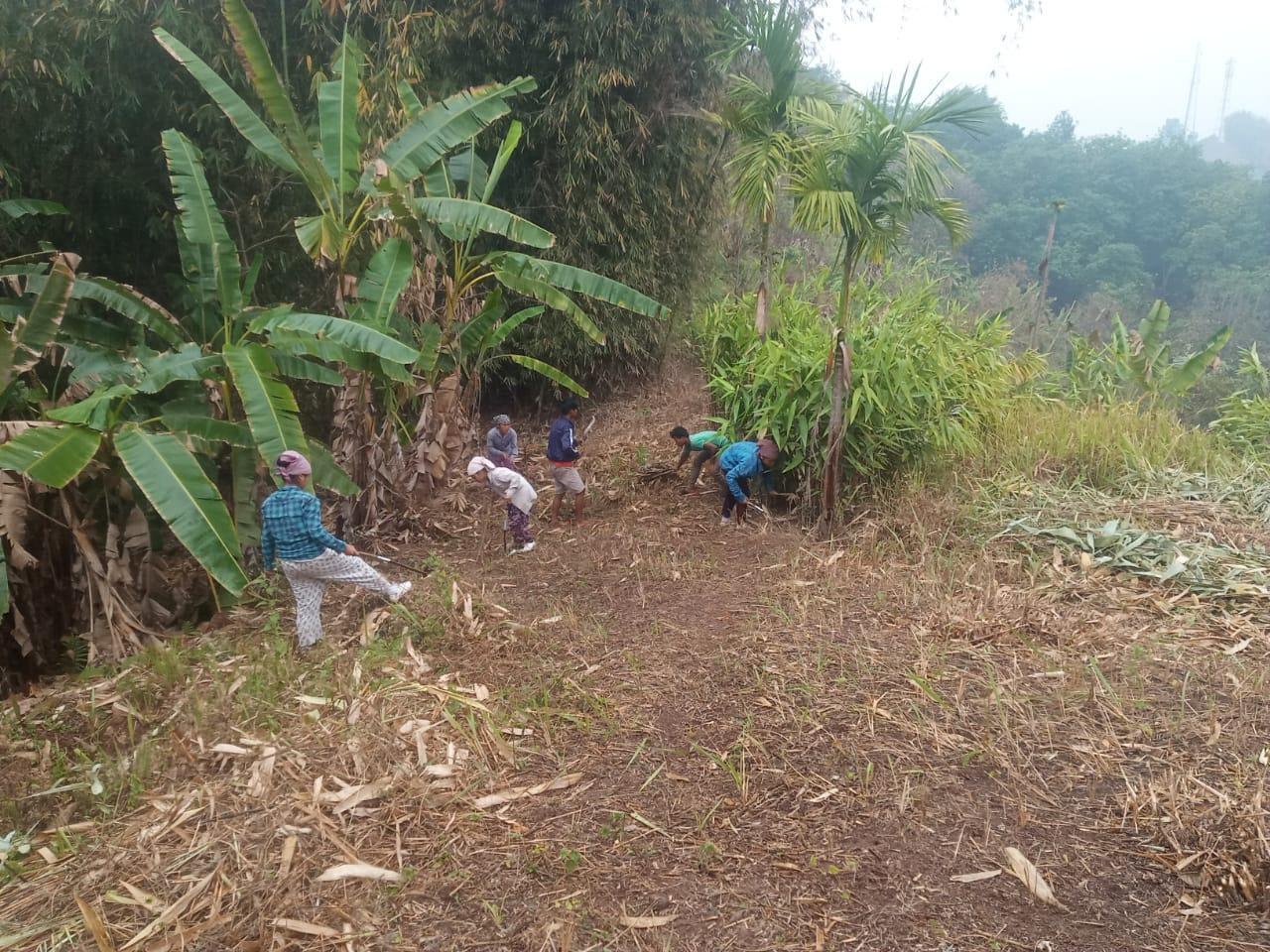
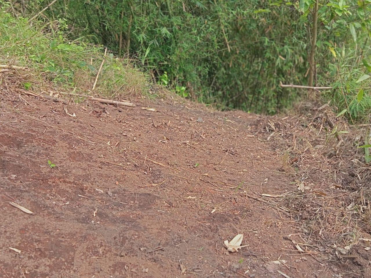
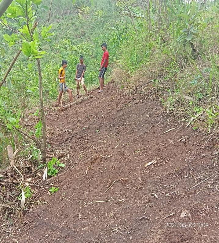
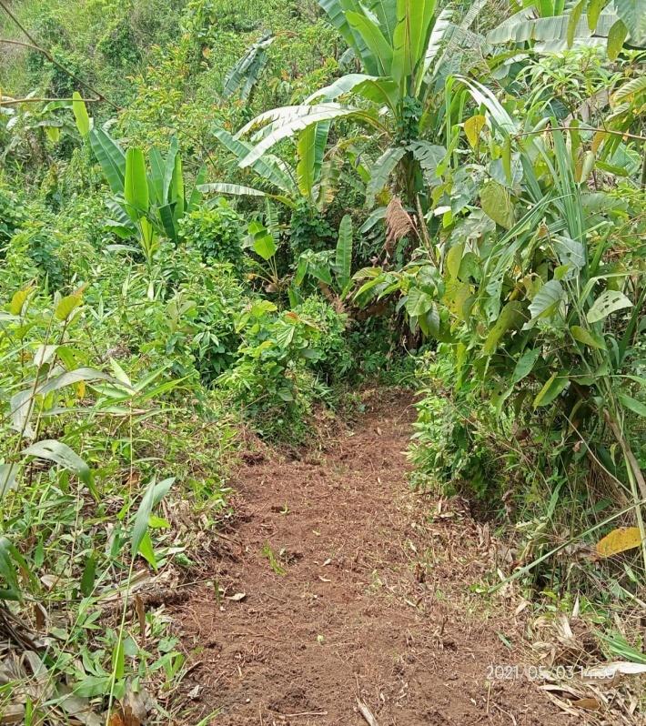
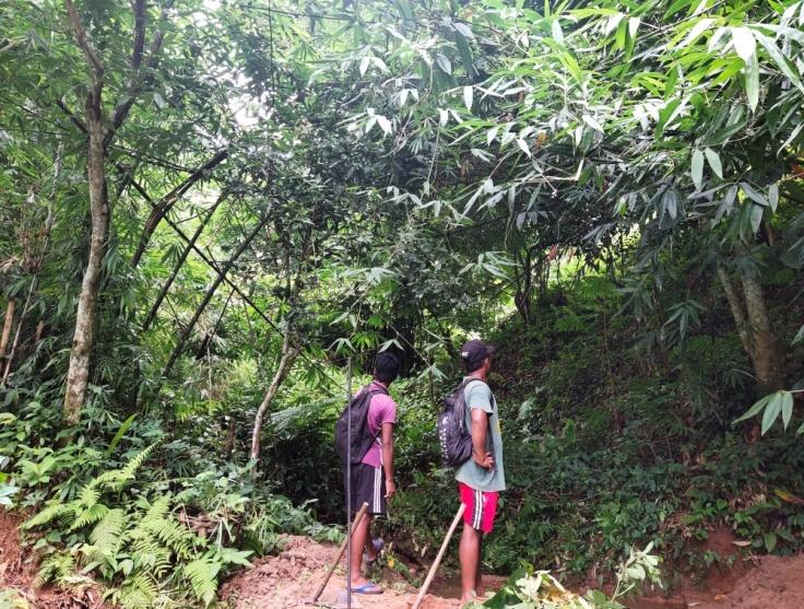
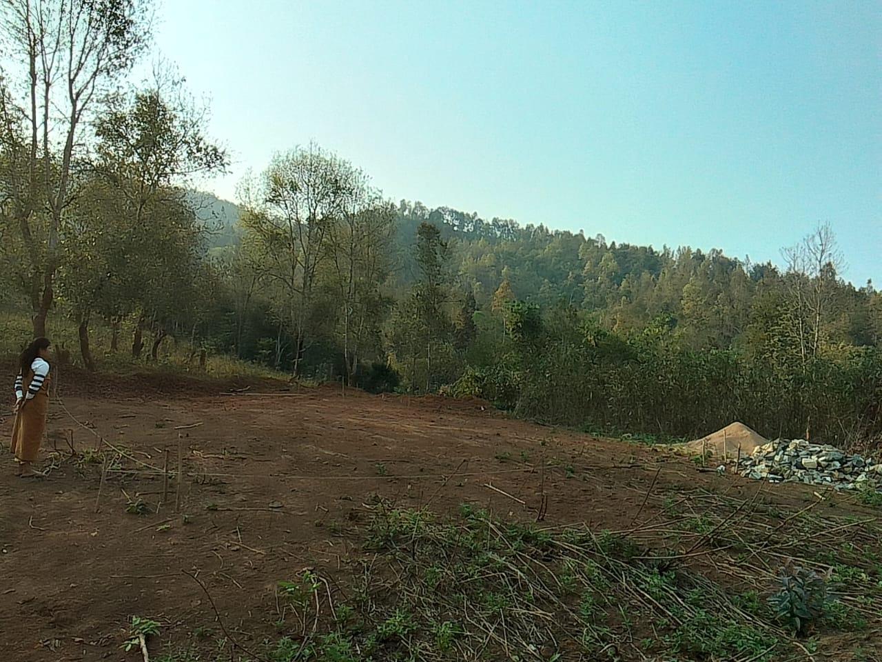
Ground Truthing Dated: 4th of July 2019
The CLLMP team met with Mr. M.Kharmalki, headman of Patharkhmah village on the 4th of July 2019. He provided the team with important information regarding the current scenario of the landscape and the natural resource management under his chairmanship.
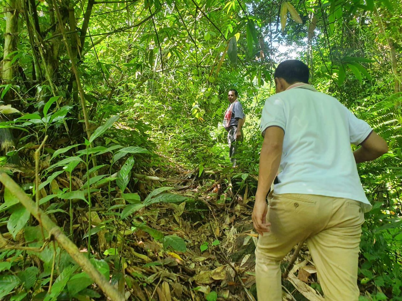
Figure 1: Ground -Truthing / field verification
Case Findings:
There are a total of 320 Households out of which 260 HH falls under the BPL category
Actively performing VEC
Around 18 acres of farmland have been left un-irrigated due to water problems
They have one rivers
Presence of waste lands and degraded lands
Around 40 acres of cleared forests in the past years
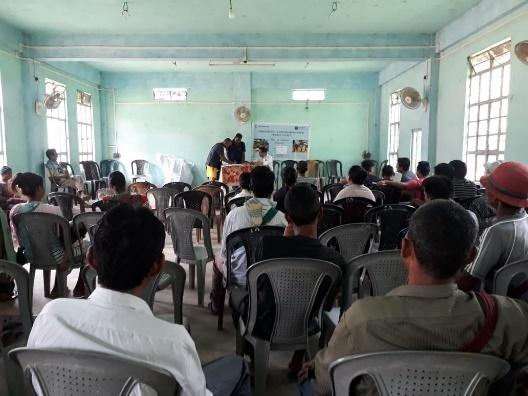
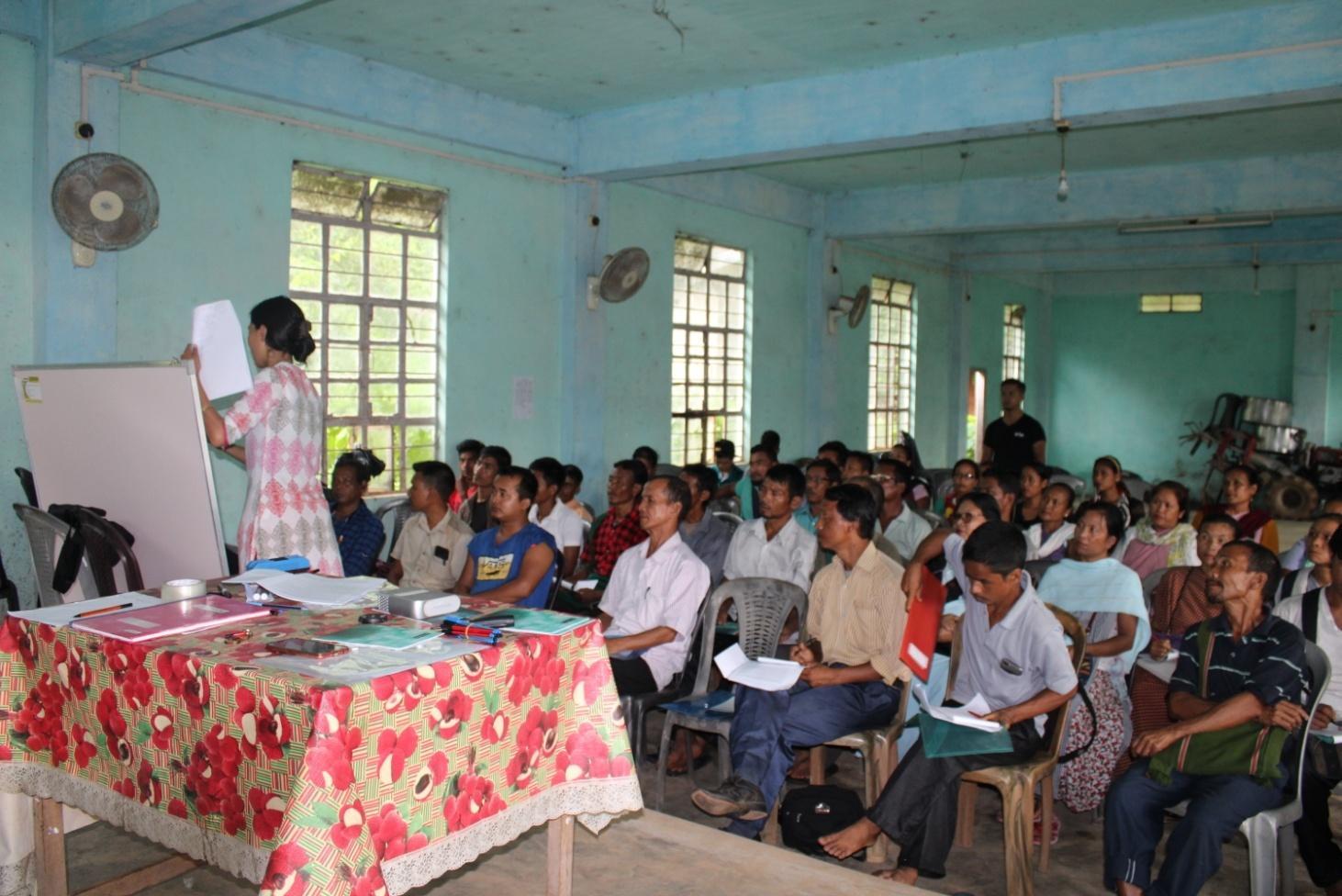
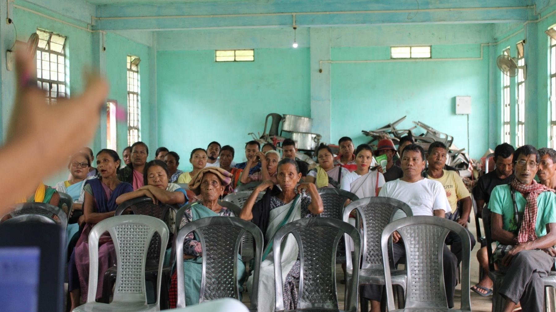
2. Sensitization Programme Dated: 22.07.2019
The District Project Manager and the Assistant Managers held a village Level sensitization Programme on the Community Led Landscape Management project on the 22nd of July 2019.The villagers actively participated in the program, voicing out their concerns and questions regarding the project, making it a huge success.
The CLLMP officials gave a brief introduction on Meghalaya Basin Management Agency (MBMA) and elucidated on the various programs and projects that MBMA is working on, they then gave a detailed introduction on the Community-led Landscape Management Project (CLLMP) and the different aspects and procedures that the villagers and the CLLMP team should carry out during the course of the project and the importance of the involvement of the community for the CLLM-Project to be a success. They gave due importance to the environmental aspects of the project and enlightened them on the various benefits that the villagers could obtain from the project.
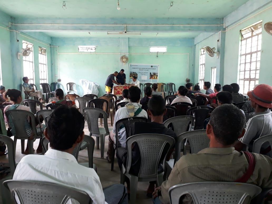
Figure 2: Sensitization Program
The Program was followed by an interactive session to answer the doubts and questions of the villagers.
2.1 Signing of Documents:
After the interactive session, the village signed the Expression of Interest (EOI), the Village Grant Agreement (VGA) and the Citizen’s Green charter on the same day.
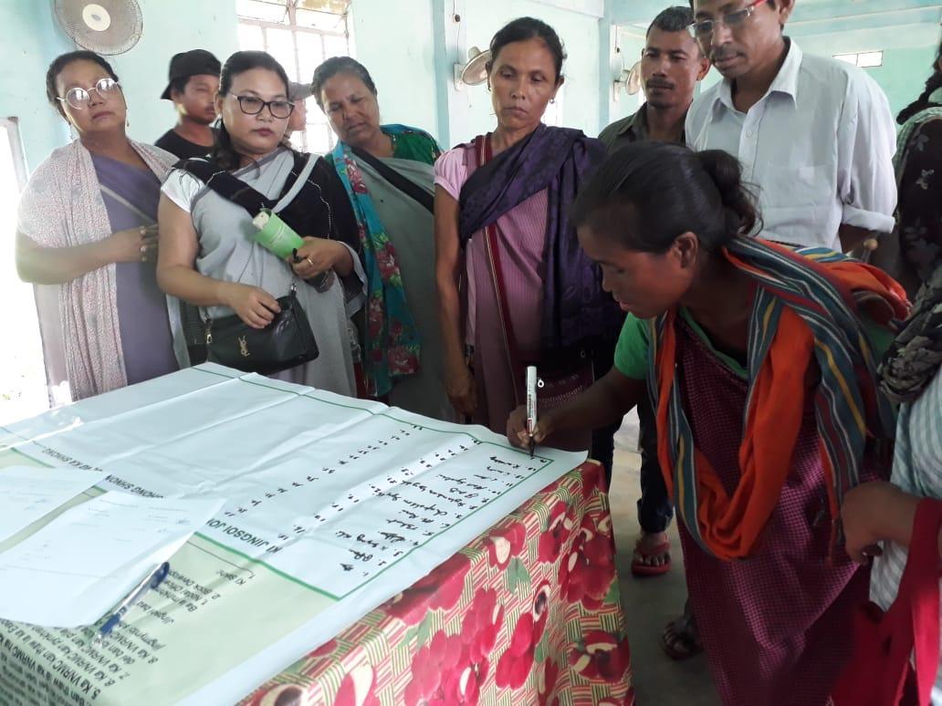
Figure 3 : Signing of Documents
2.2 Formation of the VNRMC
The Formation of the Village Natural Resource Management Committee was done in a public meeting in the presence of the entire village and the CLLMP staffs. The community itself chose the President, the Secretary and the other executive members of the Committee.
Listed below are the members of the VNRMC:
|
|||||||||
|
Name in Full | Designation | Gender M/F | Age (Yrs) | Education | Occupation | Community | Religion | Contact No and email address |
|
Najim kharkamni | Chairman | M | 50 | X | Self employed | Khasi | Christian | 8132098061 |
|
Iadalin Thangkiew | Secretary | F | 42 | X | Self employed | Khasi | Christian | 9365606257 |
|
Teiborlang Mawion | Bookkeeper | M | 35 | XII | Self employed | Khasi | Christian | 9365130117 |
|
Ieidsimai Wahlang | Member | F | 50 | XII | Self employed | Khasi | Christian | 985653190 |
|
Bihstina Makri | Member | F | 55 | X | Self employed |
Khasi | Christian | 8259042207 |
|
Peter Lyngdoh | Member | M | 38 | XII | Self employed |
Khasi | Christian | |
|
Audio Doloi | Member | M | 50 | XII | Teacher | Khasi | Christian | |
| 8 | Rebimola Wahlang | Member | F | 40 | X | Self employed | Khasi | Christian | 6909164180 |
| 9 | Kynmawlang Kharsyntiew | Member | F | 25 | X | Self employed | Khasi | Christian | 8731079064 |
| List of Procurement members | |||||
| Sl. No | Name | Gender | Age | Education | Contact Number |
| 1 | Pynskhemborlang Thangkiew | M | 22 | IX | 8787697385 |
| 2 | Betterson Ripnar | M | 25 | X | 7005498201 |
| 3 | Graceful Syngkli | F | 20 | XII | 7629015365 |
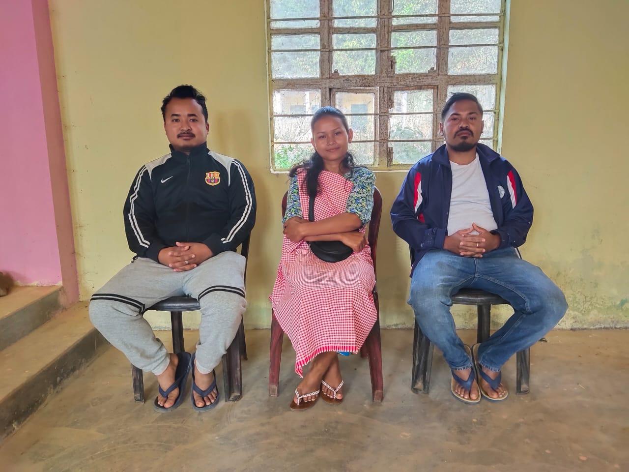
| Village Community Facilitators | ||||||
| Sl.No. | Name | Gender | Age | Education | Contact Number | Role |
| 1 | Tailancy Lyngdoh | F | 23 | XII | 6009782967 | KM and SM VCF |
| 2 | Shiningstar Syngkli | M | 24 | XII | 7630084419 | Evnt & GIS VCF |
| 3 | Alfred Doloi | M | 25 | B.Com | 8014274458 | M&E and PM VCF |
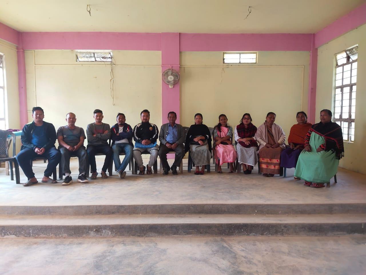
Figure : The Village Natural Resource Management Committee (VNRMC) of Patharkhmah Village
VNRMC Members
 Village
Community Facilitators
Village
Community Facilitators
Figure : The Village Community Facilitators (VCF)
Opening of Bank Account Dated: 12.02.2019
The opening of the bank account was initiated after the village signed the EOI (Expression of Interest), the VGA (Village Grant Agreement) and the Green Charter. The Accountant of the Ri Bhoi CLLMP team trained the Purchasing and Procurement Committee of Jirang Block including members from Patharkhmah Village on matters relating to Accounts and Bookkeeping on the 16th of September 2019.
The Accounts Team of CLLM Project Ri Bhoi District trained the Book-keeper, the Purchasing
and Procurement Committee of PatharkhmahVillage, on the 10th November, 2020.
Topics Covered:
Principles of Community Procurement
Benefits of Community Procurement
Important aspects undertaken by Community Procurement.
Procurement Process/Steps
Function of Purchase Committee
Important Procurement records to be maintained
Financial limits and methods
Maintaining Books of Accounts to the Book Keeper.
4. Participatory Rural Appraisal Exercise Dated: 1.02.2019
The PRA exercise aims to incorporate the knowledge and opinions of the community in the planning and management of development projects and programmes. PRA exercise at Patharkhmah Village took place on the 28th of August 2019.
Commencement of PRA.
Introduction: Participatory Rural Appraisal (PRA) is the process of involving local people in the analysis and interpretation of their own situation of a given rural area. The local people i.e. the participants take a leadership role in collecting, analysing, interpreting and presenting information and in this process impart knowledge and development insight to the specialists and extension agents
For management of natural resources, participatory Rural Appraisal is conducted to establish rapport with the village community as well as to identify and define problems for prioritization in the village itself. It is a way of learning from and with community members to investigate their need assessment, analyse and evaluate constraints and opportunities and find out priorities in the area of agriculture, small scale rural enterprises and any other social and economic development programs addressed to village development, based on the principle of listening and learning
Objectives of PRA exercise at Patharkhmah Village:
The Participatory Rural Appraisal (PRA) exercise at Patharkhmah was conducted with following objectives:
To identify the natural, human and economic resources of a village.
To identify the village problems and prioritize them with the help of the community members.
To prepare the Community natural Resource Management Plan of the village.
Activity 1: Village Boundary Mapping and Drawing of Resource Map
The first Step is to map the Village boundary of the Village.The second step is to involve the local community in preparation of village resource map as perceived by the community members to solicit their participation. Infrastructure, services and other village resources such as agricultural lands, wells, wastelands, cattle population etc. were mapped. Local people prepared the Resource Map by drawing it on a chart paper without much interference from outsiders.
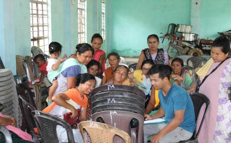
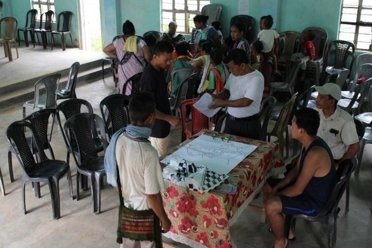
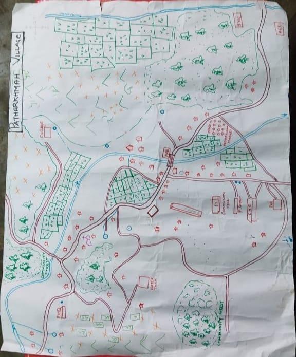
Figure 9 : Village Boundary Mapping
Resource Map analysis:
Main agriculture produce is Paddy, broom grass and Betel Nuts.
There are 3 types of Forest ownership: Community, Private and Protected Forest.
3 community forest
Private forest spread around the village
3 Protected Forest
One river Wah Umshait flows through the village paddy field.
Presence of Barren land
Presence of Community Hall
Presence of Football playground.
Presence of Integrated Child Development Services (ICDS)
Fifteen dugout ponds for fisheries.
Three tubes well.
School: There are 5 Schools. One Higher Secondary, One Secondary, One U.P and one L.P schools in the village.
There are only two churches.
Habitation is not confined to one place but spread all over the village.
Activity 2: Baseline Data Survey for Environment and Social Template
During the PRA Exercise, theCLLMP officials had a discussion with the community members to gather basic village information regarding the number of households, demographic information, major crops and enterprises taken in the village, trends of production and productivity of major crops in the village and demographic distribution of village population.
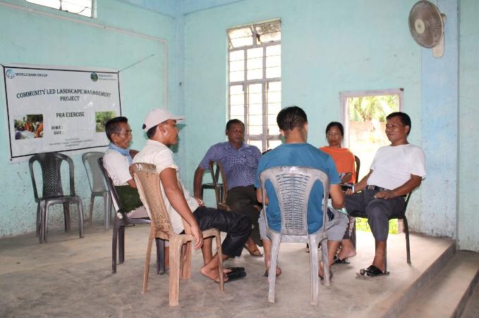
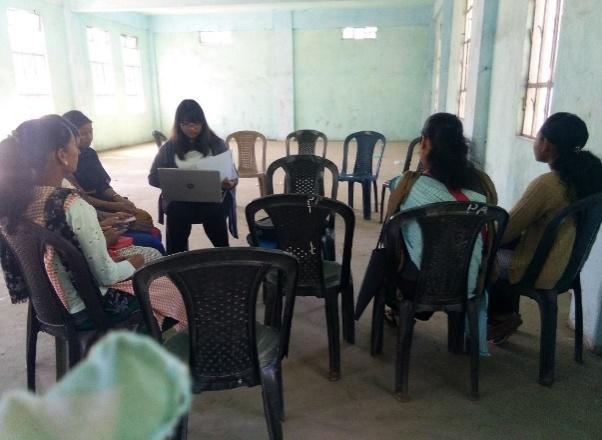
Figure 6 : Filling the CNRMP template
Information related to land use categories such as forest, cultivable land, water bodies ,etc and problems and challenges related to NRM were discussed.
Activity 3: Focussed Group Discussion on Problem Analysis
Do people have sufficient access to supply of fodder, fuel wood, leaf litter?
The villagers expressed that they have sufficient access when it comes to supply of fodder and leaf litter and they have not faced any issues till now, but they do not have sufficient access to supply of fuel wood as they have to either purchase fuel wood or get it from far off forests.
Has access to timber improved or reduced over the years? How is access for household use and commercial use managed?
Yes, access to Timber does not have any issues because there is an improvement in people’s livelihood and economy status, so, maximum number of houses are of Assam type, only few are still using timber for household construction and some uses timber for commercial purposes to increase their economic status
Are the Water bodies facing any threats?
Water bodies are not facing any particular threats except in the rainy seasons when the water becomes contaminated due to flash floods and over flooding.
Do all the people in the village have access to drinking water? What are the challenges?
Yes, the people in the village have access to drinking water through P.H.E pipeline and there is availability of tap water in each hamlet. The challenge that the villagers face is during dry seasons where the volume of water is limited and becomes difficult to access.
Are there degraded areas in the village (open/degraded forests, mining affected, high soil erosion etc…)?
None
What has caused this degradation? Are there practices causing threats to availability and access to natural resources?
The majority of the villagers are still practicing Jhum Cultivation and this leads to the degradation of the land and also destruction of the forests which in turn can lead to soil erosion.
What have been the changes in agricultural practices?
The villagers have started using advanced Agriculture Tools in place of traditional tools used in the ancient techniques of farming.
How would you consider the health situation in your village?
The health situation at Patharkhmah has improved over the years because it is the centre of all the villages in western Ri Bhoi. As the CHC is also located in Patharkhmah village, it enables the villagers to have easier access to facilities when there is any health issues in the village
How is the situation of cleanliness, sanitation, access to toilets and waste management?
Cleanliness, sanitation and waste management is well maintained by the village members, women’s group and youth group in the village. Since the Swachh Bharat Mission has come into force the village council has taken the initiative to improve the cleanliness in the village and all the villagers now have access to toilets.
Who are the most vulnerable group in the village? What can be done to improve their lives?
BPL families and single parent families are the most vulnerable groups in the village. Inclusion of such families during implementation of the project would help improve their lives.
What are the livelihood aspirations of the youth? Are there any avenues available?
The majority of the people in the village turn to farming and job cards under MGNREGA for employment and they also engage in some business and self-employment to earn and to improve their livelihood.
Do any committees /institutes/rules exist to manage and monitor natural resources in the village?
The VNRMC under the CLLMP manage the Natural resources in the village. Prior to the CLLMP the village form the forest management committee to look after and preservation of the forest
What are some of the major issues or conflicts in the village?
None
Have any of the above issues been discussed in village meetings?
If there are any issues or conflicts within the village the Durbar village executive committee will solve the issues and address the Problems.
How do people resolve disagreements and conflicts?
All disagreements and conflicts are addressed by the traditional institution of villages’ governance called the village Durbar.
Activity 4: Seasonal Calendar
The EE Social Management also mapped the seasonal calendar of Patharkhmah Village to help identify heavy workload periods, periods of relative ease, credit crunch, diseases,
food security, wage availability , festive season etc. This will prove helpful in project planning and project timeline framing.
| SEASONAL CALENDAR | ||||||||||||||
| S.l No. | CRITERIA | JAN | FEB | MAR | APRL | MAY | JUNE | JULY | AUG | SEP | OCT | NOV | DEC | |
| 1 | Water Scarcity | 2 | 1 | 1 | 1 | 3 | 3 | 3 | 2 | |||||
| 2 | Prone to sickness | 3 | 1 | 1 | 1 | 1 | 2 | 2 | 3 | |||||
| 3 | Seeking job outside | 1 | 1 | 2 | 3 | 3 | 3 | 1 | ||||||
| 4 | Rain Fall | 3 | 2 | 1 | 1 | 1 | 2 | 3 | ||||||
| 5 | Free – Less work | 1 | 2 | 3 | 3 | 3 | 1 | |||||||
| 6 | Paddy Cultivation | 1 | 1 | 2 | ||||||||||
| 7 | Paddy harvesting | 2 | 1 | 1 | ||||||||||
| 8 | Ginger cultivation | 1 | 1 | 1 | ||||||||||
| 9 | Ginger harvesting | 1 | 2 | 1 | ||||||||||
| 10 | Tree Plantation | 1 | 1 | |||||||||||
| 11 | Vegetable (crop cultivation) | 1 | 1 | 2 | 1 | |||||||||
| 12 | Vegetable (crop harvesting) | 1 | 1 | |||||||||||
| 13 | Festive Season | 1 | 1 | |||||||||||
| 14 | Forest fire | 1 | 1 | 2 | ||||||||||
| 15 | Collection of Fuel wood | 1 | 2 | 2 | 1 | |||||||||
| LESS | 3 |
| MODERATE | 2 |
| MAXIMUM | 1 |
5. Submission of the CNRMP
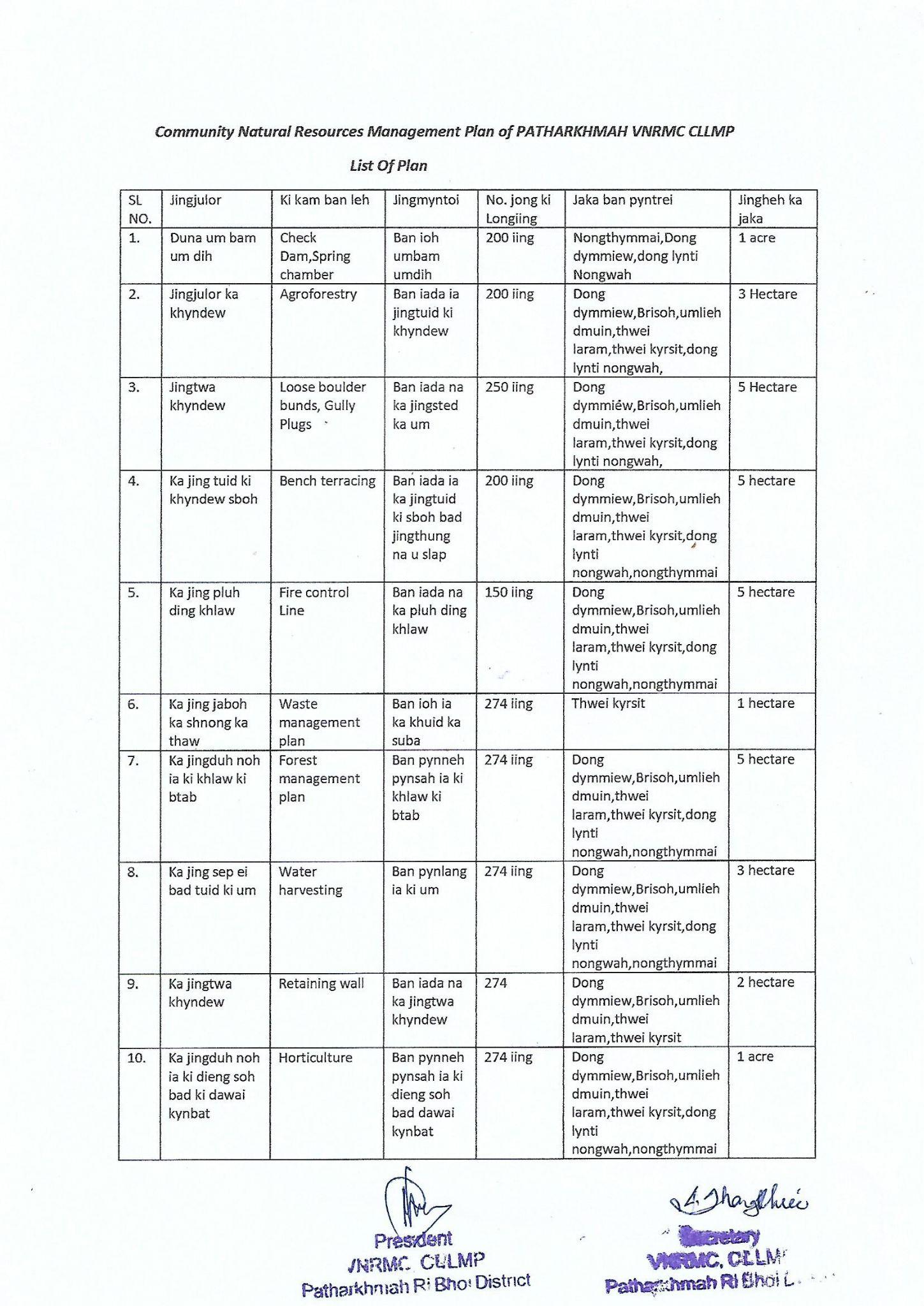
5.1The Final Community Natural Resource Management Plan
|
Name of Proposed Interventions | Site |
|
Nos of HHs expected to Benefit | Priority (High/ Medium/ Low) | ||
|
|
|
|||||
| 1 |
|
UmliehDumuin |
|
|
|
|
|
| Dong Dymmiew |
|
|
|
|
|||
| 2 |
|
Nongthymmai Them |
|
|
|
|
|
| 3 |
|
NongthymmaiLum, Nongthymmai Them &UmliehDumuin |
|
|
|
|
|
| 4 |
|
Dong Dymmiew |
|
|
|
|
|
| UmliehDumuin |
|
|
|
|
|||
| 5 |
|
Nongthymmai Them |
|
|
|
|
|
| 6 |
|
Dong Dymmiew (2 nos) |
|
|
|
|
|
| Dong Umshyniar |
|
|
|
|
|||
| Thweilaram |
|
|
|
|
|||
| Brisoh |
|
|
|
|
|||
| LyntiNongwah |
|
|
|
|
|||
| NongthymmaiLum |
|
|
|
|
|||
| 7 |
|
ThweiLaram |
|
|
|
|
|
| 8 |
|
Umpalangem, , |
|
|
|
|
|
| Ummaram, |
|
|
|
|
|||
| Kathol Donga |
|
|
|
|
|||
| Rajaganat |
|
|
|
|
|||
| UmlihDumuin |
|
|
|
|
|||
| 9 |
|
LyntiNongwah 1 |
|
|
|
|
|
| LyntiNongwah 2 |
|
|
|
|
|||
| UmRiaje |
|
|
|
|
|||
| 10 |
|
Dongpdeng |
|
|
|
|
|
| 11 |
|
7 Sites |
|
|
|
|
|
| 12 |
|
LyntiNongwah |
|
|
|
|
|
| 13 |
|
NongthymmaiLum |
|
|
|
|
|
| 14 |
|
Data to be filled |
|
|
|
|
|
| 1 |
|
UmliehDumuin |
|
|
|
|
|
| Dong Dymmiew |
|
|
|
|
|||
6. GIS Activities
| Sl. No. | Parameters | Village Information |
| 1 | GPS Coordinates: | |
| i | Latitude | 25.883306N |
| ii | Longitude | 91.61344E |
| iii | Elevation Reading (MSL) | 337M |
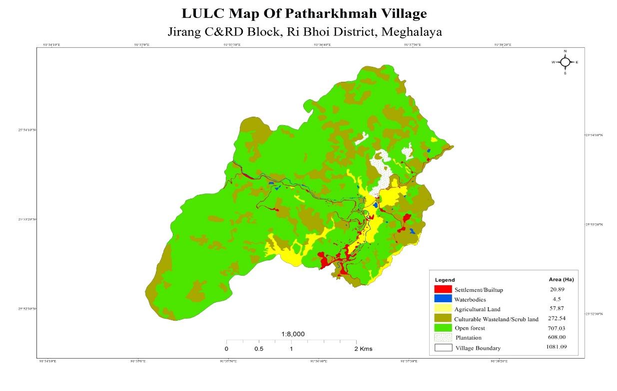
| 2 | Village Geographical Area (Ha) | Total:1081.09Ha 10.081sq.Km |
| i | Total Forest Area (including community, Clan, Pvt Forest) | 707.03Ha |
| ii | Total Area of Water Bodies | 4.5Ha |
| iii | Total Area under Agri-Horticulture | 665.87 Ha |
| iv | Total Degraded land area (Ha) | 272.54 Ha |
| 3 | Average Annual Rainfall | 1000-1500mm |
| 4 | Soil Type | Loamy soil |
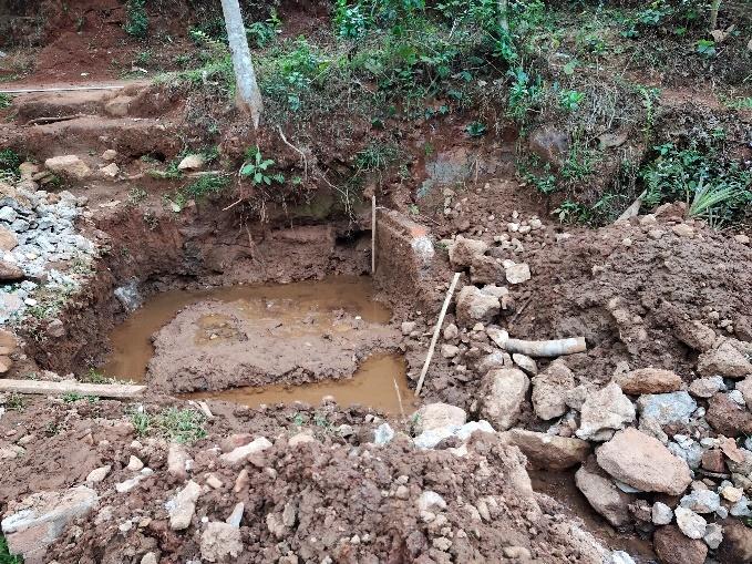
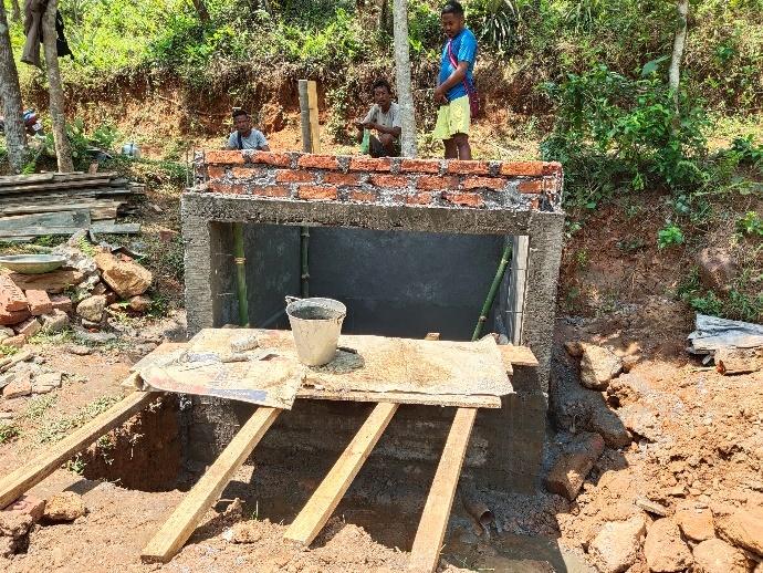
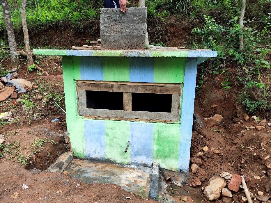
7. Project Implementation
| 1. | Type Of Intervention | Site Name | GPS Co-ordinates | Amount Sanctioned | Work Status | |
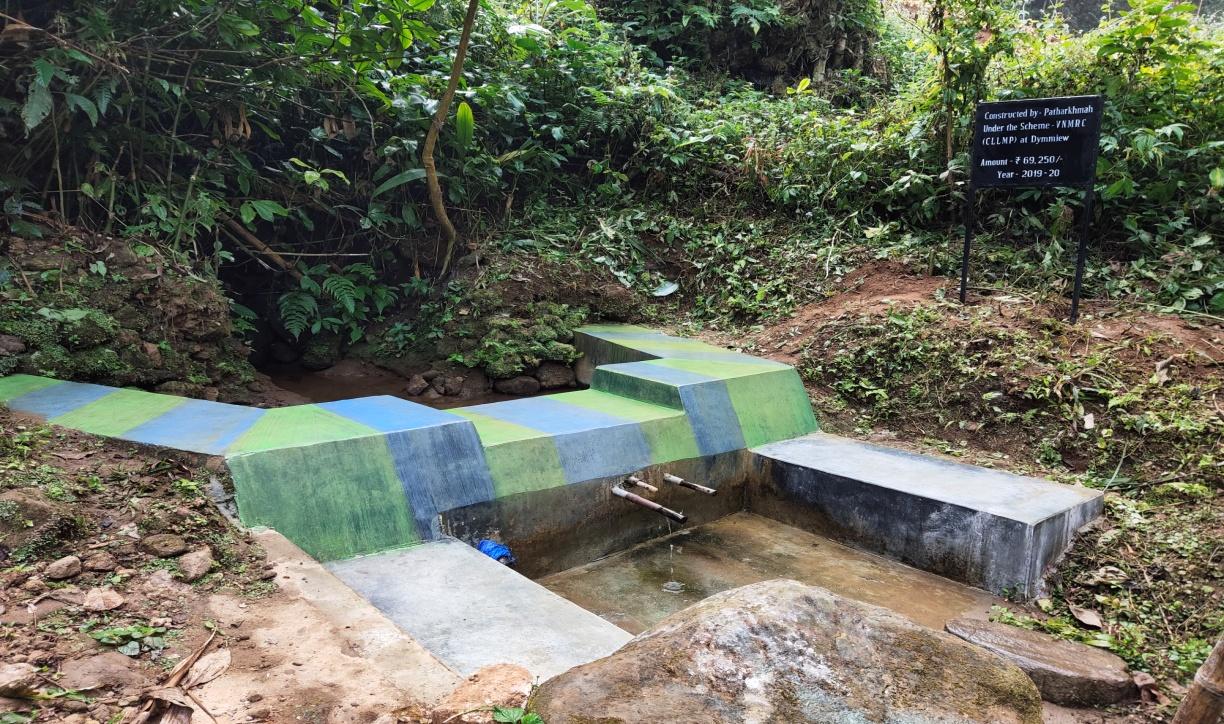
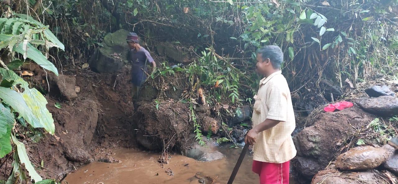
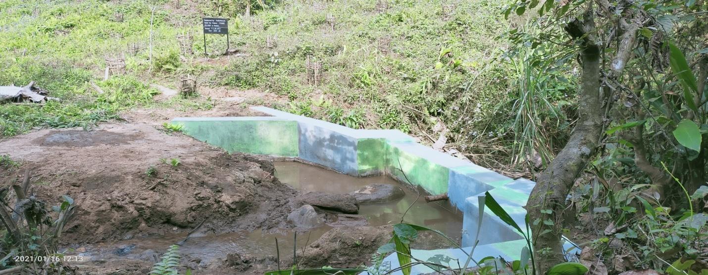
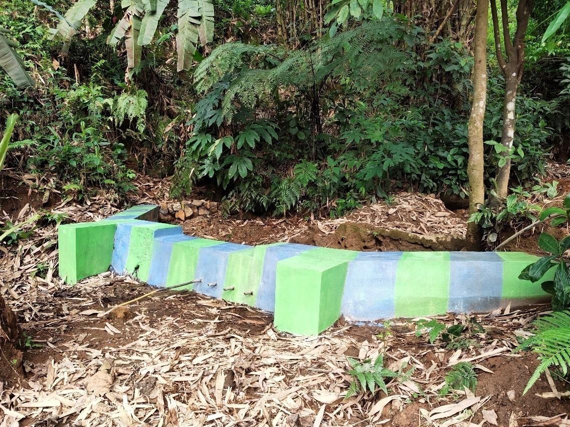
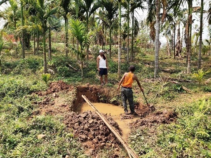
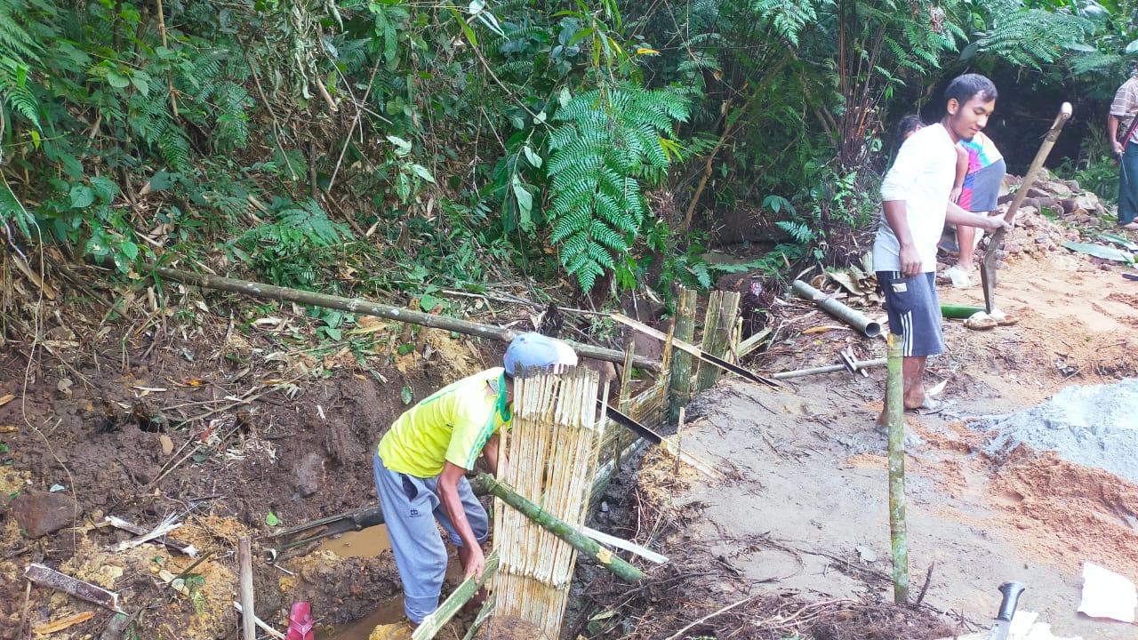
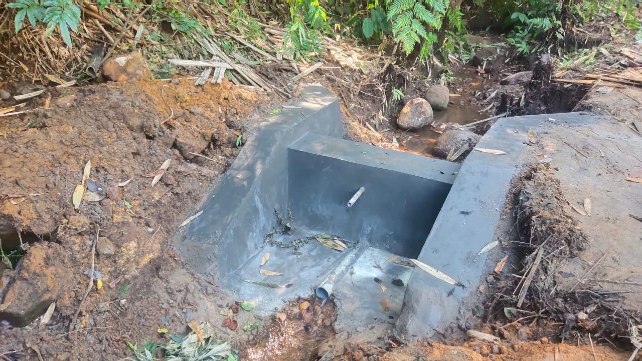
| Check Dam | Dong thwei laram | 25.891694°"N | 91.613194°"E | ₹ 69,250.00 | Completed | |
| 2. | Type Of Intervention | Site Name | GPS Co-ordinates | Amount Sanctioned | Work Status | |
| Check Dam | Umlieh | 25°69'11.05"N | 92°0'62.37"E | ₹ 2,38,470.00 | Completed | |


| 3. | Type Of Intervention | Site Name | GPS Co-ordinates | Amount Sanctioned | Work Status |
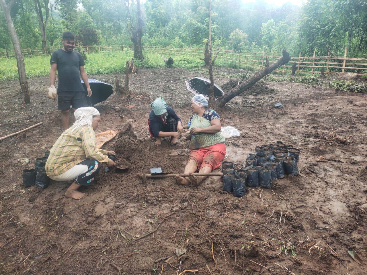
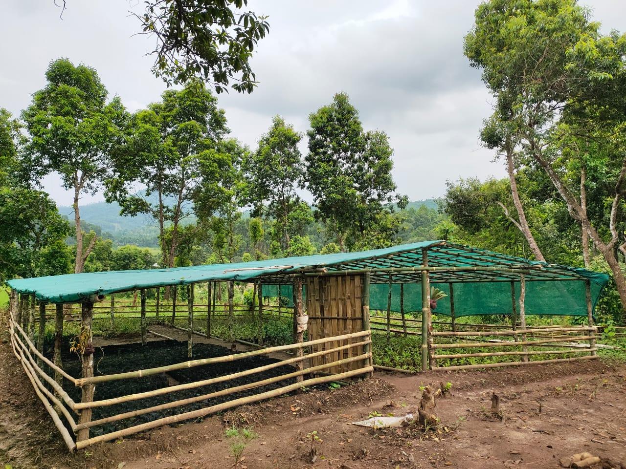
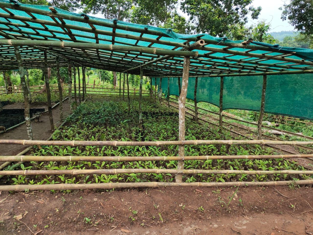
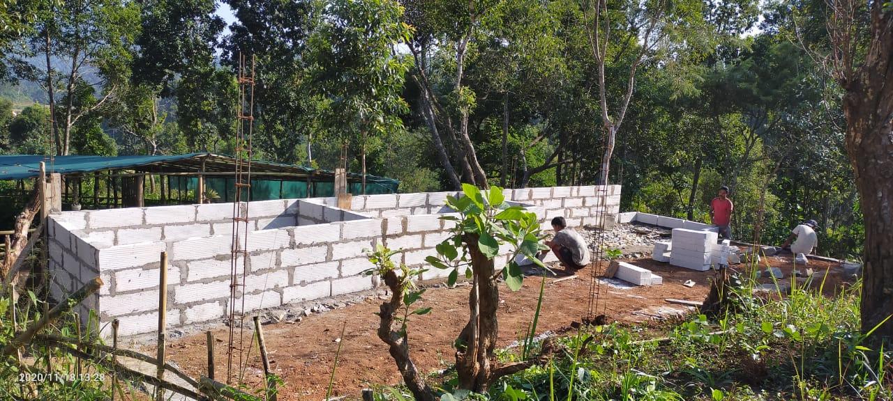
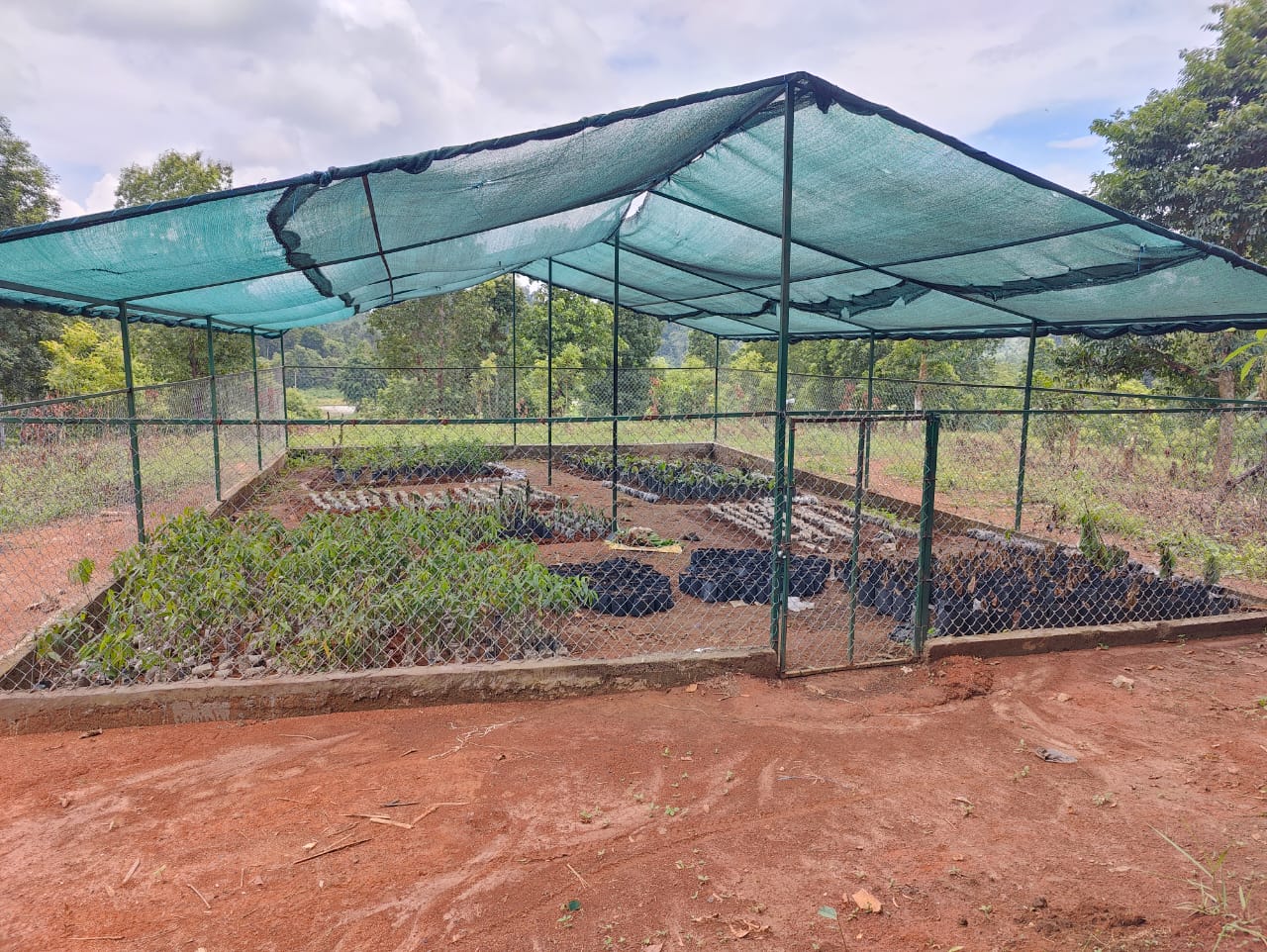
| Nursery | Nongthymmai | 25.884984, 91.602373 | ₹ 1,19,300.00 | Completed |
| 4. | Type Of Intervention | Site Name | GPS Co-ordinates | Amount Sanctioned | Work Status |
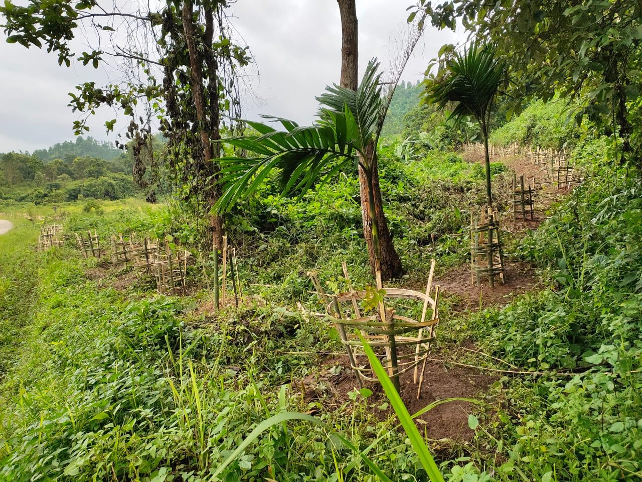
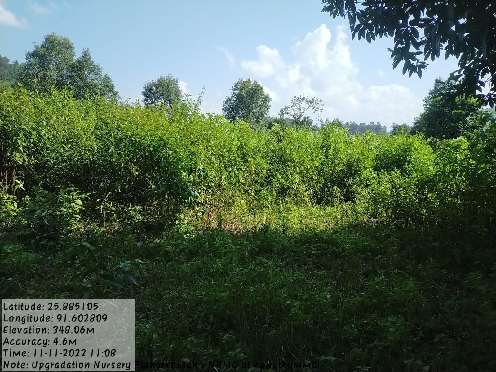
| Afforestation | Nongthymmai Them | 25.884733, 91.602566 | ₹ 5,64,720.00 | Completed |
| 5. | Type Of Intervention | Site Name | GPS Co-ordinates | Amount Sanctioned | Work Status |
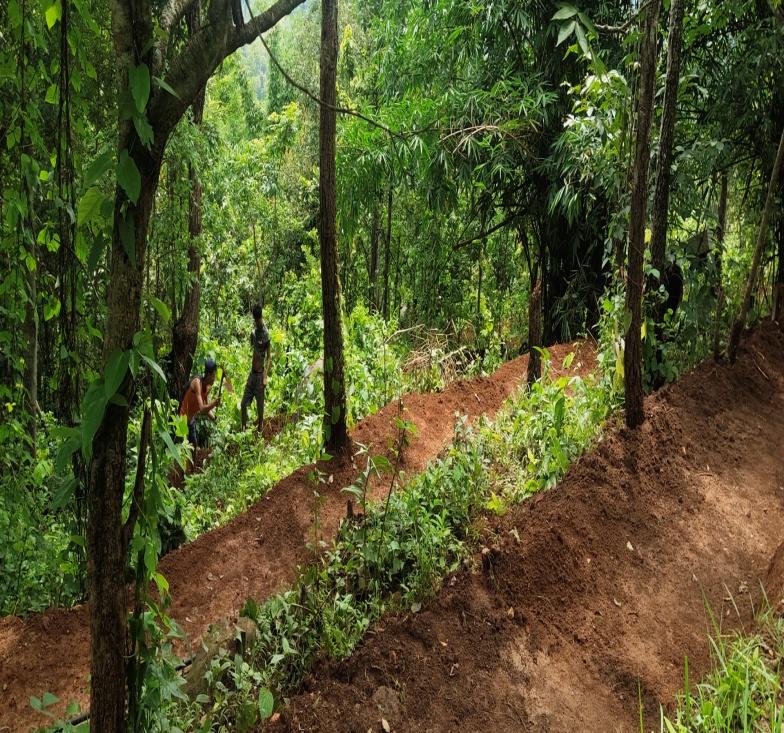
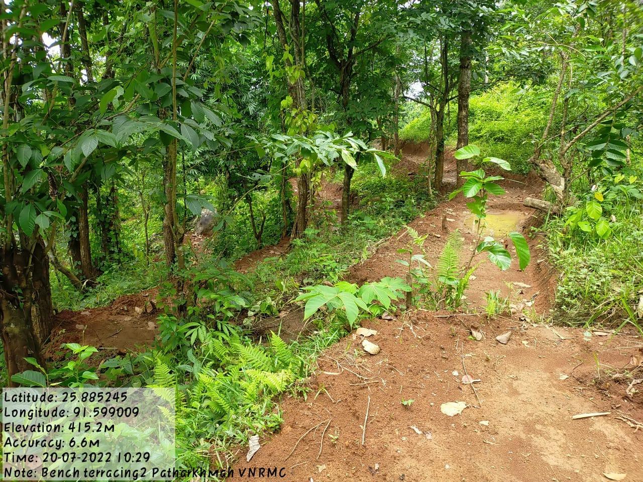
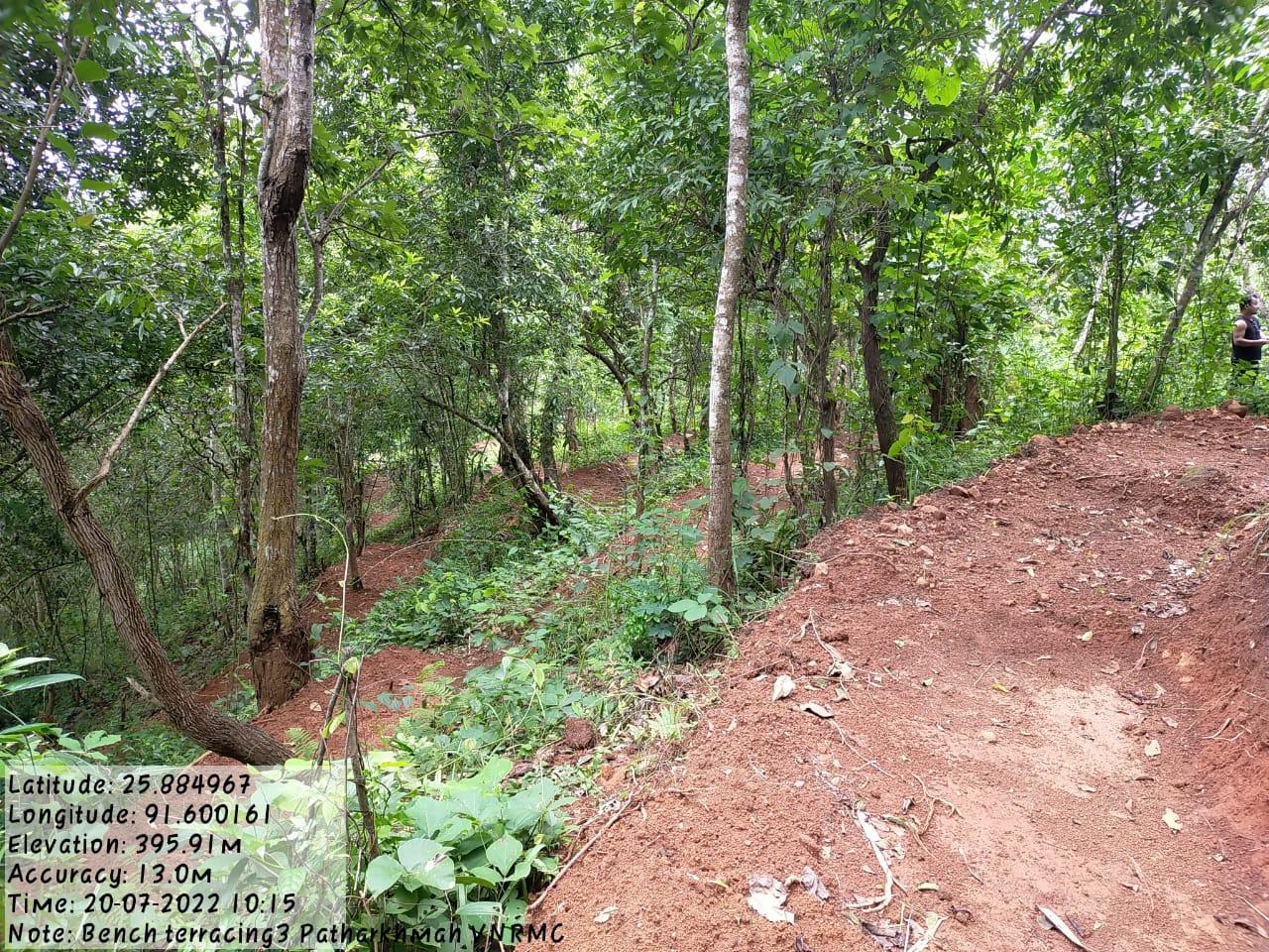
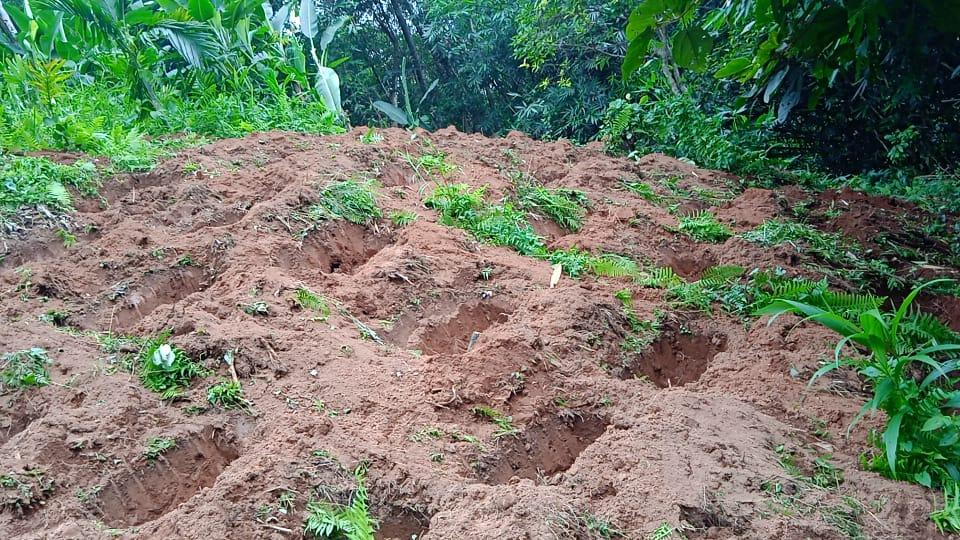
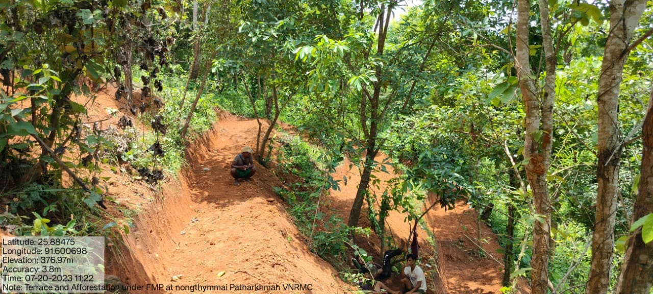
| Bench Terracing1,2,3&4 | Umlieh Dymmuin Nongthymmai Lum Dong Dymmiew |
25.898592, 91.622658 25.885048, 91.599127 25.884967, 91.600161 25.883988, 91.617234 |
₹ 72,900.00 ₹ 2,20,458 ₹ 2,00,000 |
Completed |

| 6. | Type Of Intervention | Site Name | GPS Co-ordinates | Amount Sanctioned | Work Status |
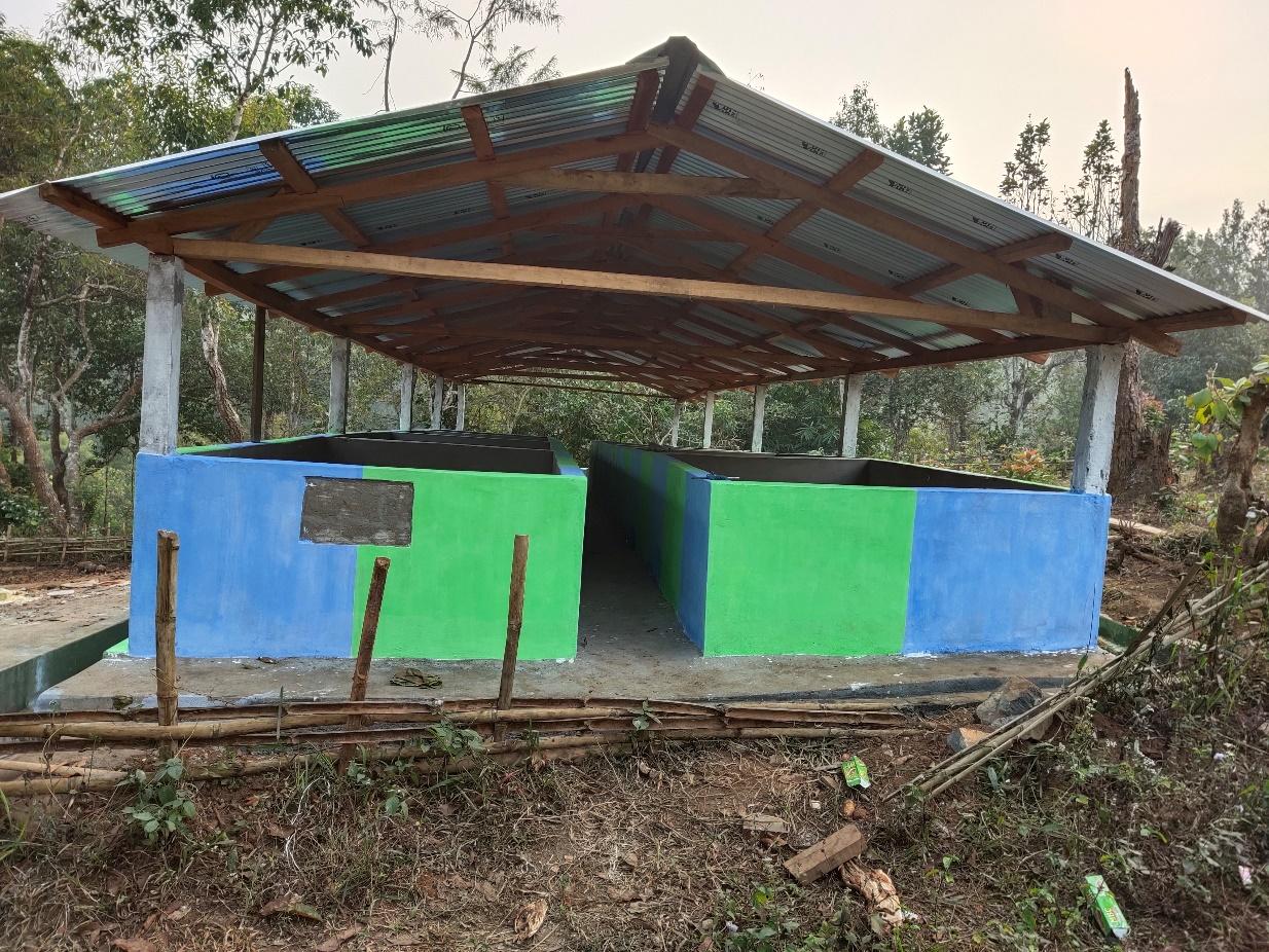
| Vermicompost | Nongthymmai Them | 25.88511, 91.602364 | ₹ 3,32,460.00 | Completed |
| 7. | Type Of Intervention | Site Name | GPS Co-ordinates | Amount Sanctioned | Work Status |
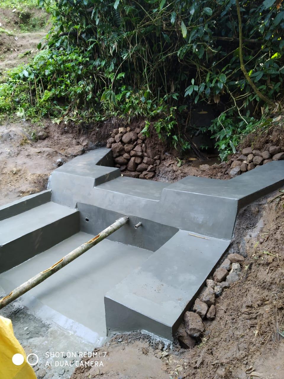
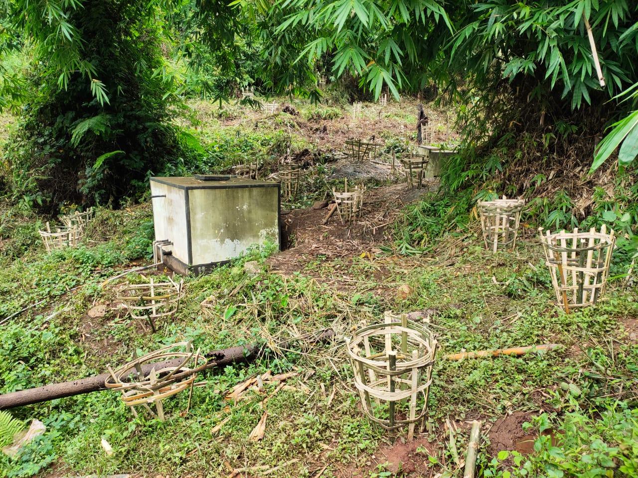
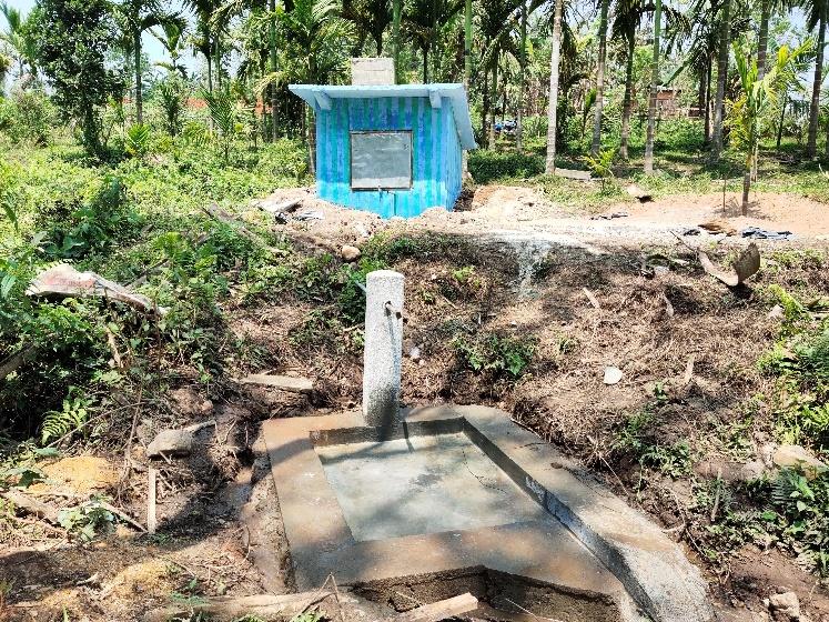
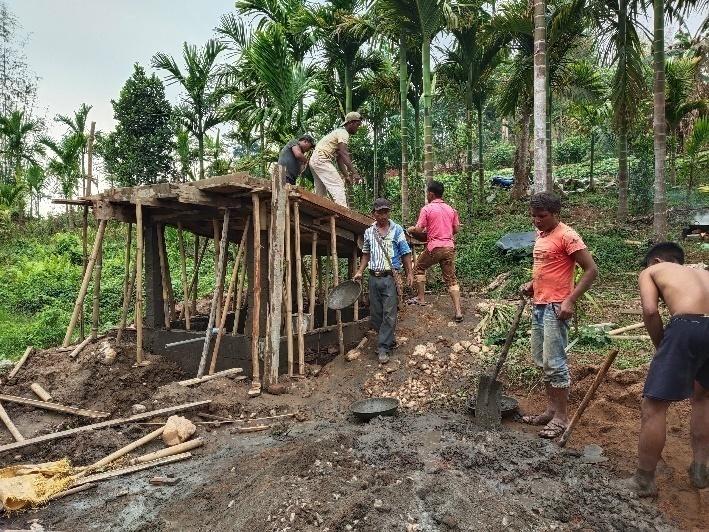
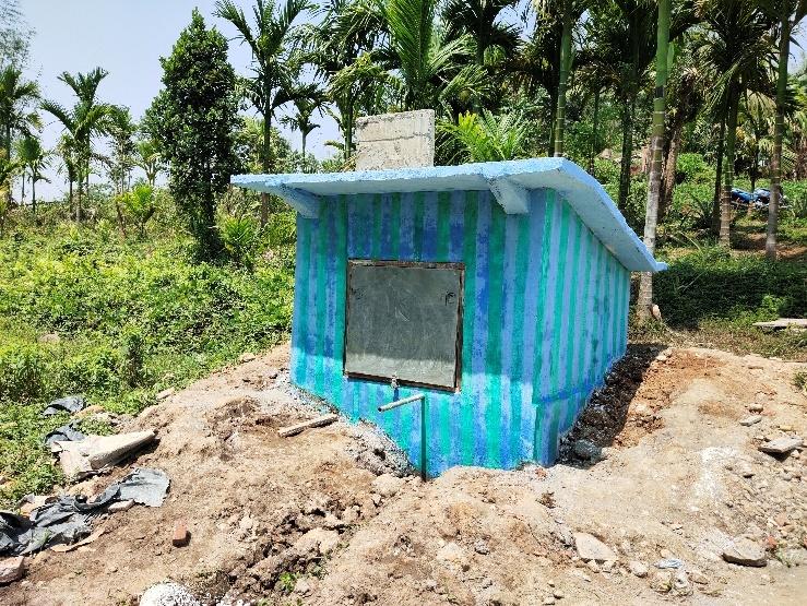
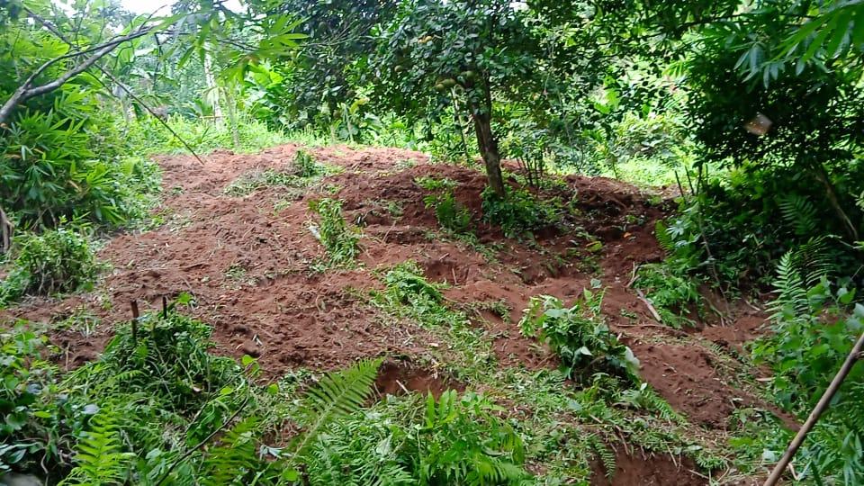
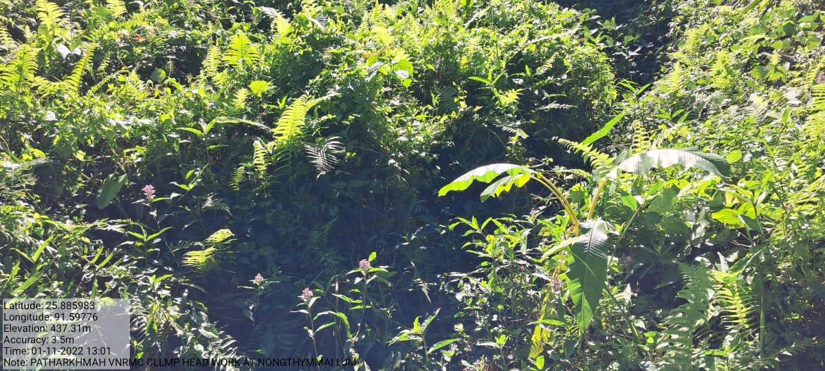
| Head Work | Dong dymmiew | 25.882995, 91.616701 | ₹ 92,200.00 | Completed |
| 8. | Type Of Intervention | Site Name | GPS Co-ordinates | Amount Sanctioned | Work Status |
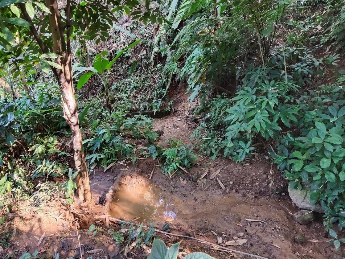
| Spring Chamber 1 | Dong Lynti Nongwah 1 | 25.89517, 91.6249676 | ₹ 81,170.00 | Completed |
| 9. | Type Of Intervention | Site Name | GPS Co-ordinates | Amount Sanctioned | Work Status |
| Spring Chamber 2 | Dong Lynti Nongwah 2 | 25.89349, 91.527882 | ₹ 79,630.00 | Completed |
| 10 | Type Of Intervention | Site Name | GPS Co-ordinates | Amount Sanctioned | Work Status |
| Forest Fire Line Control 1,2&3 | Umlieh Dumuin1&2 Thwei kyrsit |
25.902274, 91.624821 25.90215, 91.624764 25.89174, 91.60827 |
80,110 | Completed |
| 11 | Type Of Intervention | Site Name | GPS Co-ordinates | Amount Sanctioned | Work Status |
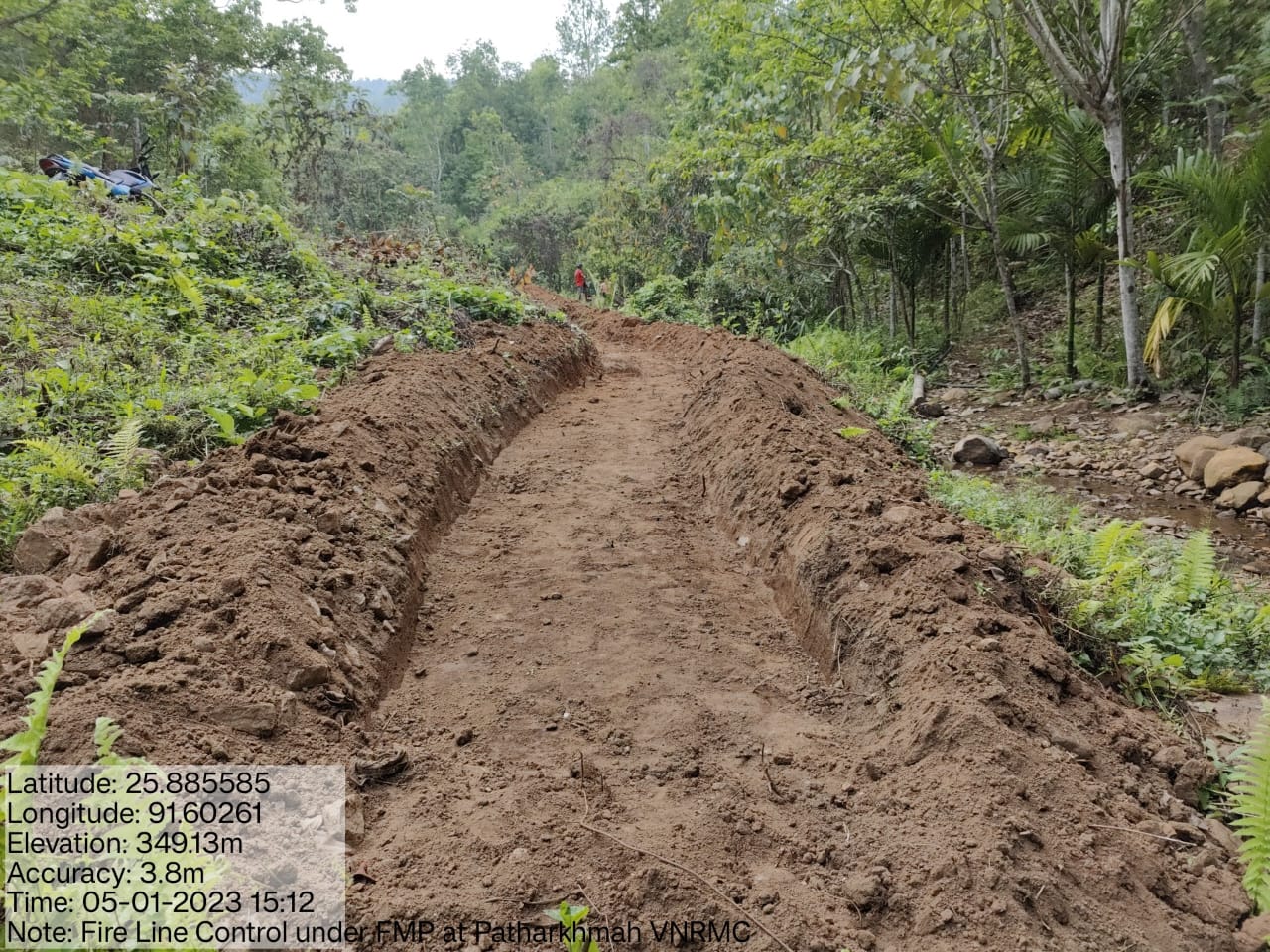
| Contour Trenches 6 Sites | Thwei Laram1, Thwei Laram 2 , brisoh | 25.891602, 91.613398, 25.892428, 91.610291, 25.890376, 91.622629 |
99,395 | Completed |
| 12 | Type Of Intervention | Site Name | GPS Co-ordinates | Amount Sanctioned | Work Status |
| Headwork 2 | Nongthymmai Lum | 25.885656, 91.597633 | 1,04,937 | Completed |
| 13 | Type Of Intervention | Site Name | GPS Co-ordinates | Amount Sanctioned | Work Status |
| Upgradation of Nursery | Nongthymmai them | 25.884984, 91.602373 | 3,00,000 | Completed |
| Intervention Name | Site Name | Amount | Completed |
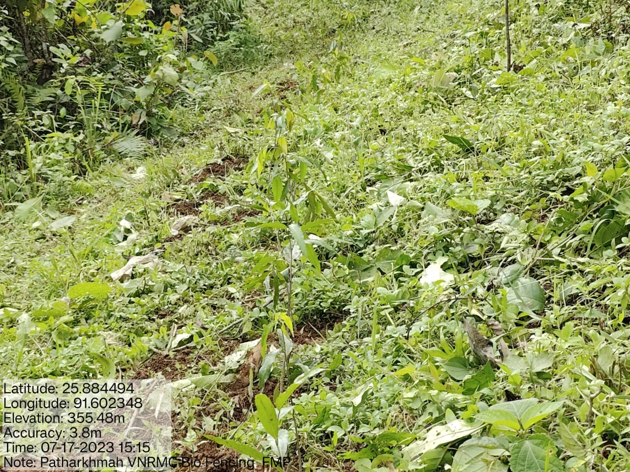
1.Fire Control Line Cum Bio Fencing 2.Assisted Natural Regeneration in Open Forests (Bench Terrace and Afforestation) 3.Assisted Natural Regeneration in Open Forests (Bio-Fencing) 4.Community Forest Boundary Survey 5.Enrichment planting in forest blanks (Afforestation) 6.In-situ & Ex-situ conservation of rare and endangered plants 7.Nursery for Food Forestry (Sapling for the Available Nursery) |
All under community land | 176758 150000 132812 8000 197241 18000 11000 |
All Completed |
| Intervention Name | Site Name | Amount | Completed |
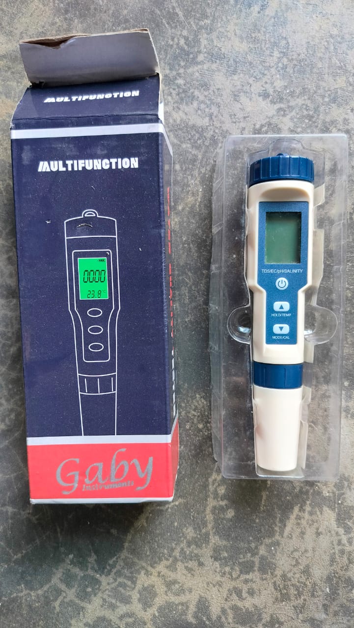
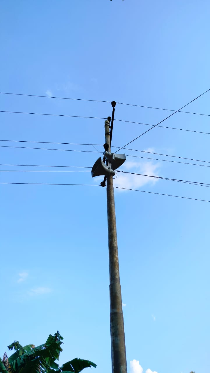
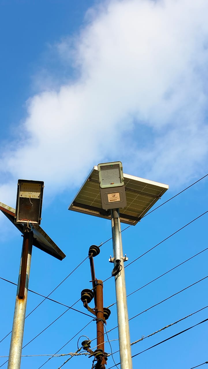
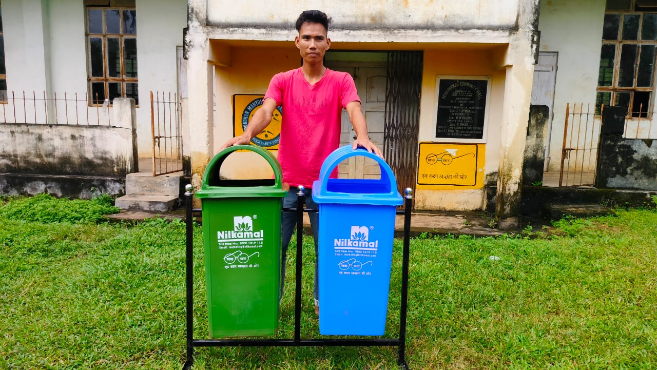
Excess Fund activities PA System Water Tester Solar Light Dustbin |
All under community land | 1,20,00 | All Completed |
TESTIMONIALS 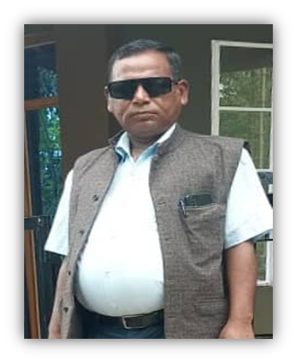
President – Najim Kharmalki
Throughout its intervention in the village, the project has been instrumental in providing job opportunities for farmers, promoting afforestation and tree planting, preserving water sources, and educating the community about environmental conservation. This initiative has not only brought tangible benefits like contour trenches, afforestation, spring chamber, and nursery facilities but has also empowered the villagers with knowledge and skills to protect the environment.
The efforts of the VCF (Village Community Facilitator) members and the community's willingness to work together as a team have played a crucial role in the success of the project. It's heartening to see that the project has been able to address some of the environmental challenges and foster positive changes in the village.
Overall, "CLLMP" is a commendable initiative that has brought
about positive change in the village's socio-economic and
environmental aspects. With continued dedication and collaboration,
it has the potential to inspire even greater transformations in the
community and beyond.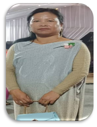
Secretary- Iadalin Thangkhiew
As a secretary, I’m grateful for the role and position that this project has given. The experience that I had while working with the project at the village level is one that I will cherish for a lifetime. The project has catered to the basic needs of the villagers especially in relation to water. Being the secretary I get to attend all of its meetings and share my thoughts and concerns regarding various activities. This project is the epitome of rural development and through its work it has been a blessing to the entire community.
VCF M&E- Alfred Doloi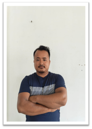
As a youth, I was very delighted when I was given the opportunity to work as a VCF at the village under this project. The increasing environmental degradation in the area due to the cutting down of trees is of great concern and this highlights the importance of ongoing education and awareness campaigns to emphasize the value of nature and the long-term consequences of unsustainable practices. As a VCF I get to educate the community about the importance of environmental protection and the project has made it sure that its implementation takes care of this huge environmental concern and serves the interest of the community sustainably.
By empowering the youth, women, and the entire community to understand the significance of preserving and maintaining the environment, the project can continue to make a lasting impact.
VCF EM - Shiningstar Syngkli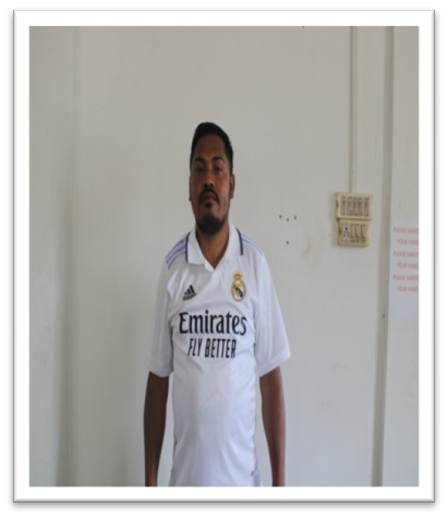
It has been 5 years since I took this part as a VCF in environment management and the reason I took this role is the growing environmental degradation that has a huge impact on the environment that has compelled me to come forward and do my best towards strengthening it. There was a lack of knowledge about the importance of Mother Nature in our village. The cutting down of trees by the villagers without thinking that they might face difficulties in the future has added more to the already existing problem. But ever since CLLMP came it has helped us the VCFs to understand about the importance of NRM and we as facilitators have been able to share those in return to the community. The project makes our work much easier through its various training, learning practices and exposure visits. Now instead of cutting down trees the villagers are now working on how to plant more trees and take care of it. By empowering the youth, women, and the entire community to understand the significance of preserving and maintaining the environment, the project continues to make a lasting impact.
Social management - Emika
As a Village Community Facilitator of Social & Knowledge Management I was delighted to take this part. This project brought teamwork in the community and through it; it has taught us how to preserve the environment by planting more trees, making our very own manure to use in agricultural practices and not leaving the other works that have had a huge impact on the lives of the villagers. As a VCF I get to educate the villagers about the project and its initiative by visiting the overall households of the village, not leaving aside the training and exchange of learning practices that the project has provided with.
As a VCF I believe that it’s essential to continue promoting teamwork, knowledge sharing, and effective social management to ensure the project's sustainability and the village's environmental well-being. Encouraging the community to take ownership and preserve the work done through the project will be crucial for a brighter and greener future.