
The Government of Meghalaya with financial help from the World Bank is implementing the Meghalaya Community Led Landscape Management Project (MCLLMP). The project will cover the entire state of Meghalaya and implementation of community led plans will be rolled out in phase manner throughout the state. The Meghalaya Basin Management Agency (MBMA) will facilitate community-led planning by providing support, technical inputs and funding.
The project intends to strengthen community-led natural resources management in selected landscapes within the 12 districts of the state. This would be achieved through a variety of planning, capacity building, and on-the-ground interventions to promote the conservation, sustainable use of natural resources, social inclusion and community mobilization; building traditional knowledge and learning, mapping of natural resources management; strengthening the community institutions and creating linkage with financial institutions and community organizations.
The project interventions include preparation of community led natural resource management plans. The CLLMP has the following three components:
Strengthening Knowledge and Capacity of Communities for NaturalResources Management
Community-Led Landscape Planning andImplementation
Project Management andGovernance
The project objective is “to manage and conserve the natural resources, especially forests, soil and water sources, in a manner that supports the financial and physical well-being of communities in the State”
Ground truthing: CLLMP villages are selected based on a survey conducted by NESAC. In 2012, they conducted a watershed-based vulnerability analysis of all 35 watersheds and 179 sub-watersheds of Meghalaya. Based on vegetation index, slope and soil brightness index, it accordingly classified landscapes as (i) most critical (very high priority), (ii) moderately critical (high priority), and (iii) low priority areas.
Since the NESAC classification is over 5 years old, it is likely that the number of villages under the different categories may have increased over the years. Therefore, ground-truthing of classified villages will be undertaken by MBMA before intervention under the Project.
Sensitisation: The CNRM plan preparation at the village-level will be preceded by community sensitisation and mobilisation based on participatory processes. The formation of the Village NRM Committee (VNRMC), selection of its executive committee and opening of its operational bank account will follow this initial step.
PRA exercise: Participatory rural appraisal (PRA) is an approach used to incorporate the knowledge and opinions of rural people in the planning and management of development projects and programmes. These exercises were undertaken to gain a better understanding of household resources and farming systems and to support participatory planning processes.
Community Natural Resource Management Plan (CNRMP): The Plan will be prepared by the community and build on the baseline information collected to arrive at potential interventions and initiatives to achieve their vision for improvements of their natural resources in their village.
Project Implementation: MBMA has established a state-level project management unit (SPMU) and will use existing GoM structures at the District and Block levels (to act as DPMU and BPMU) and the traditional tribal institutions (Dorbars, Nokma, Doloi) at the village level for implementing the project. Since CLLMP is a community-led project, it is vital that every village community member receives complete information on the project so as to enable them to take the appropriate collective decisions in a collective manner.
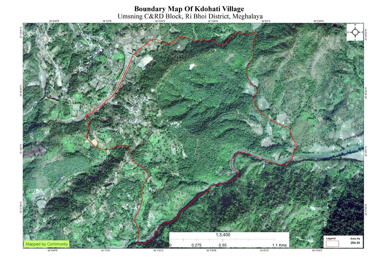
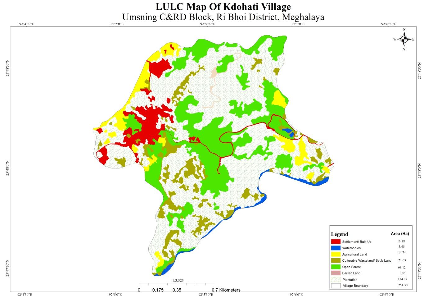
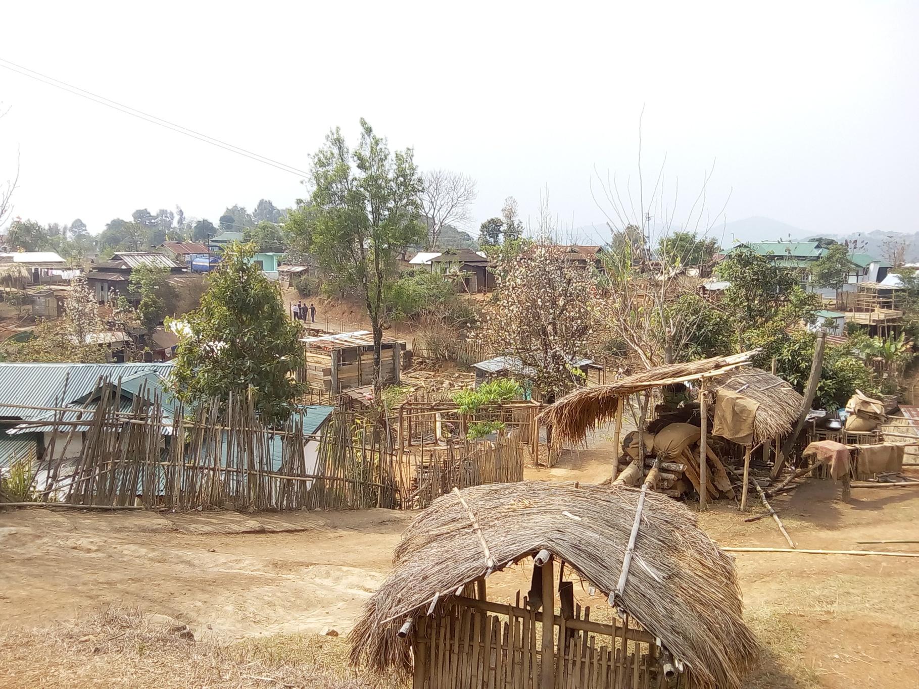
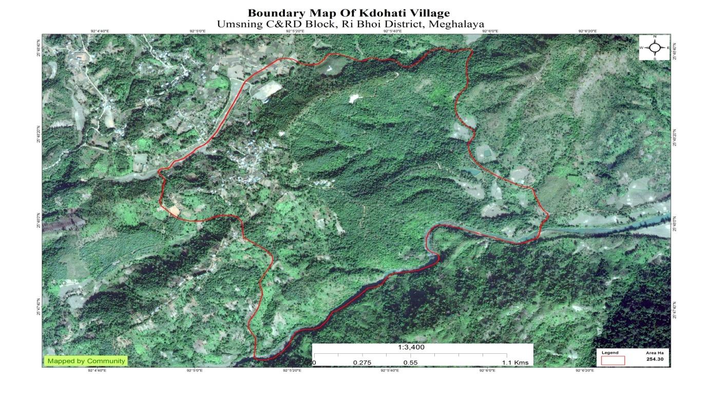
Kdoh Hati Village is situated in Ri-Bhoi District under Umsning C& RD Block at a distance of 107 Kms from Shillong, the capital of Meghalaya. It falls under the Raid Nongtham Khyriem Syiemship with a total geographical area of 254.30 hectare and a total population of 643 villagers.
Agriculture is the main occupation of the people where they mainly take up traditional approaches of cultivation like Jhumor the shifting cultivation and Terrace cultivation. Traditional agriculture is often considered a step between the local hunt- and-gather practice.
The people of KdohHati mainly cultivate Broom Grass (Thysanolaena) and Ginger (Zingiber officinale) being the main source of their revenue. Apart from these two they also grow Paddy (Oryzasativa ), Corn (Zea mays), Potatoes (Solanum Tuberosum), Yam (Dioscorea Alata) and Oranges (Citrus X sinensis) .
The village was founded in 1968 and has been in existence for almost 51 years.
The village has a very proud history.
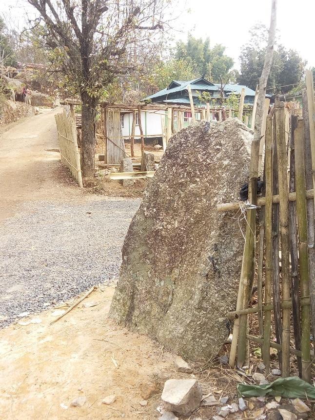
As per our conversation with Mr. Ynda Lawai, the Headman of Kdoh Hati, the name of the village itself is a reminder of the village’s rich history. Legend has it that right in the centre of the village, where the three stones stand, is where the Syiem (Chief) of Khyrim would tie his elephants while on his expeditions.
The Syiem of Khyrim ruled a rich and prosperous hima (chieftainship) and so it was required of him to make frequent visits to check on the territories of his vast domain. He would go on these expeditions with his
elephants, who soon gained a reputation of their own, and it is at “Kdoh Hati” that he would tie them to the three stones to let them rest, giving the land the name that it is known by till today–Kdoh Hati, meaning “where the elephants are tied”.
It is also said that there was a severe epidemic in the land causing most of the inhabitants to flee from KdohHati. Men, women and children, none were spared till there was only one family left, Mrs. So Muktieh and her husband Lansaring. With time the “Maram”, the “Mushai”, the “War” and others came to inhabit the village, making it the perfect example of “Unity in diversity” or as we say “Khynriam u Pnar u Bhoi uWar”
Social Profile
Kdoh Hati Village is located in Umsning C&RD Block of Ri-Bhoi District in Meghalaya, India. It is situated 32Km away from sub-district Headquarter Umsning and 52Km away from district headquarter Nongpoh. Kdoh Hati has 132 total numbers of households and has a population of 630 people.
Population
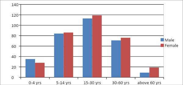
As per Census 2011, Kdoh Hati population is 530 and in 2020 the total population of Kdoh Hati has been increase to 630. Out of this, 312 are males while the females count is 328. This village has 61 children in the age group of 0-4 years. Among them 35 are boys and 28 are girls.
| Age Group | Male | Female | Total |
|---|---|---|---|
| 0-4 | 35 | 28 | 61 |
| 5-14 | 84 | 86 | 170 |
| 15-30 | 113 | 119 | 232 |
| 30-60 | 71 | 76 | 147 |
| Above 60 | 9 | 19 | 28 |
BPL/APL Household:
| Particulars |
|
|---|---|
| BPL HH | 89 |
| APL HH | 20 |
Card Holding Household:
| Particulars | No. of HH |
|---|---|
| Total HH | 132 |
| Ration Card HH | 109 |
| PHH | 77 |
| AAY | 12 |
| NON- NSFA | 20 |
| Health Card HH | 105 |
Fuel Type:
| Fuel Type | Total HH |
|---|---|
| Charcoal | 0 |
| Biomass | 0 |
| Wood | 132 |
| LPG | 40 |
| Electric Heater | 4 |
| Kerosene | 0 |
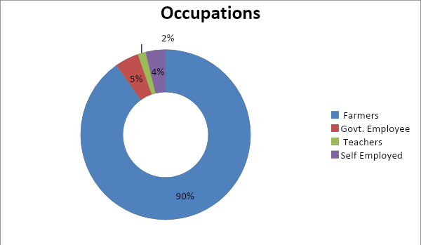
OCCUPATION: The people of the village rely on agriculture and forest products for their livelihood. The main occupation of the villagers is farming followed by Govt. Employee, Self-employed and Teachers.
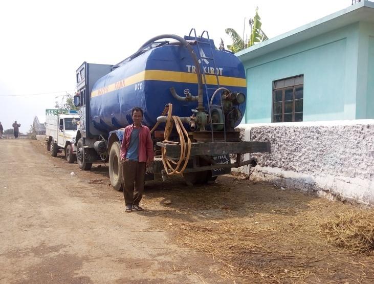
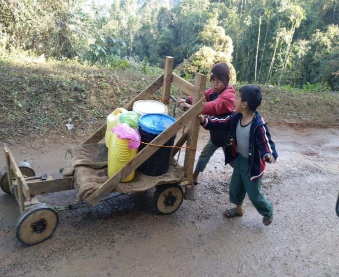
Drinking Water: There is a water scarcity in the village due to less discharge of water from the spring sources. People in the village have to procure water at Rs 650 for 1500 liters, especially during the dry season.
Road: The road is in dilapidated condition and commuting is difficult.
Jhum cultivation: mainly take up traditional approaches of cultivation like Jhum or the shifting cultivation.
Water Bodies:
Springs -4
Streams -6
River-1
Land
Forest-345.99Ha
Cultivable land- 63.02 Ha
CLLMP Activities at Kdoh Hati Village
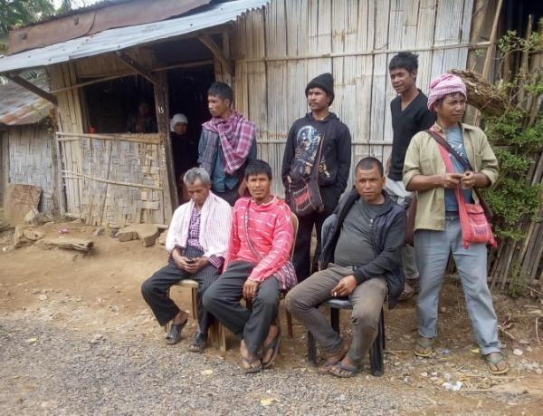
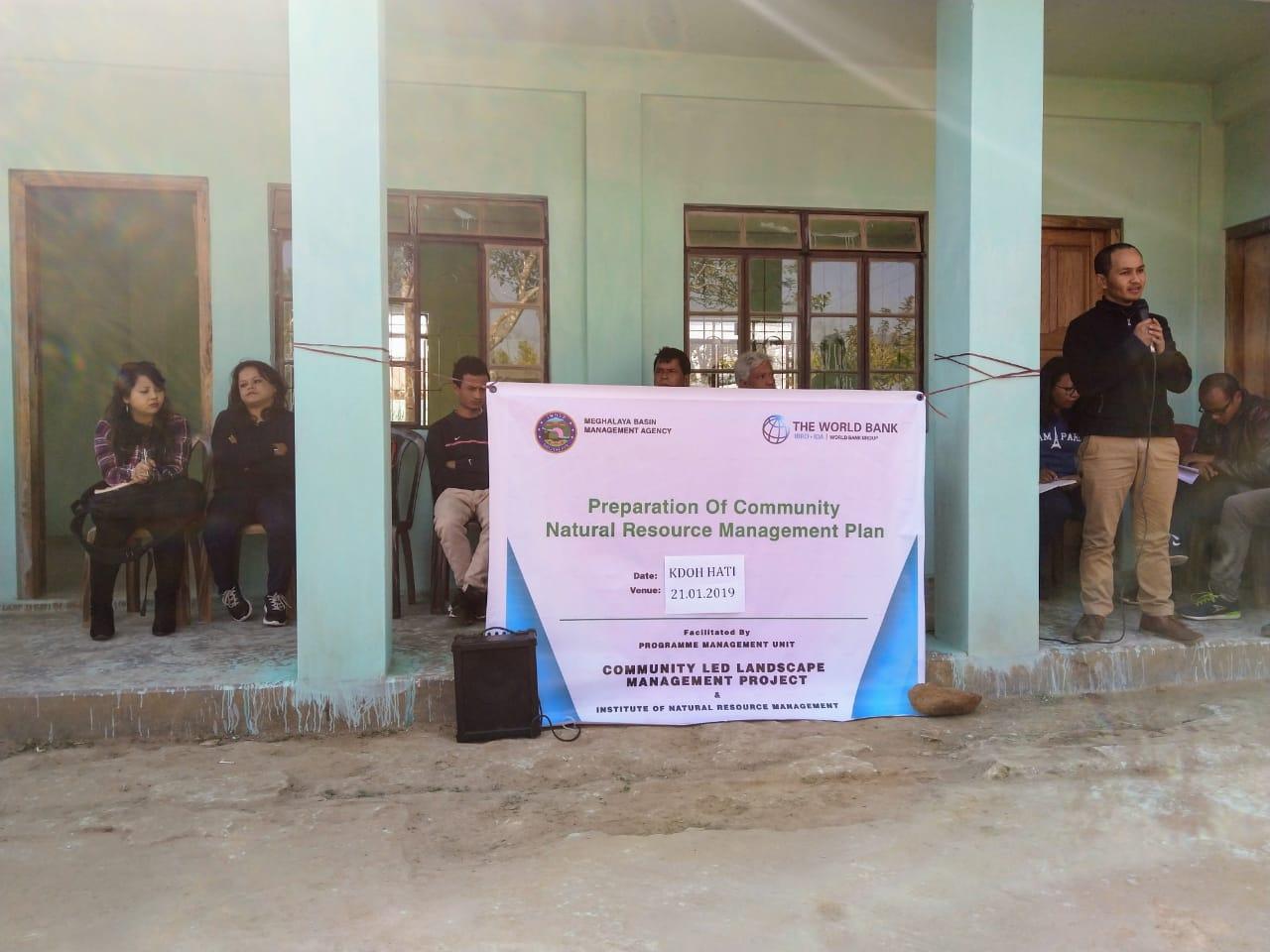
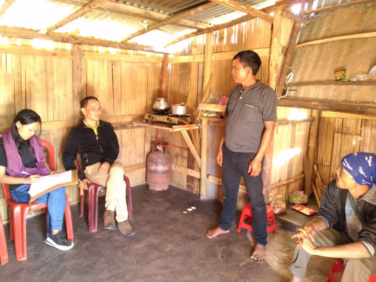
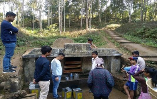
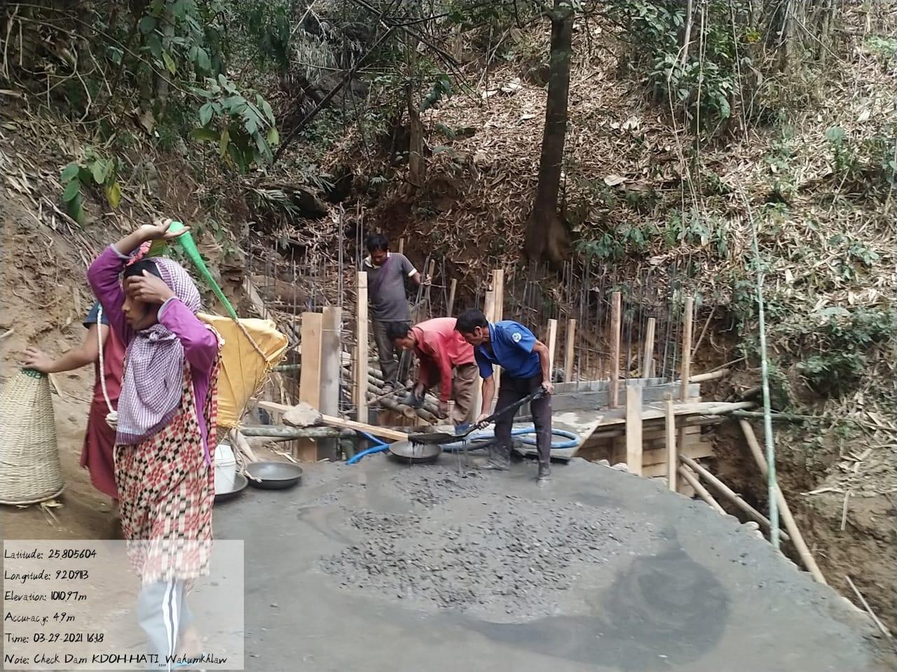
The Headman of KdohHati Village, Mr Ynda Lawai met with the CLLMP Team on the 6th of December 2018 to discuss the issues faced by the villagers in regards to their water supply and their natural Resource management.
Case findings:
1. The village is facing a lot of difficulties in terms of drinking water. They currently have two source of drinking water supply-
The first source is at the bottom of the hill on which the village is situated. They use this source during the summer as it dries up during the winter
The second source is the “Wah Umkhlaw” which is in their community forest. It takes approximately 2 hours for the villagers to fetch water as it is a long way down hill as well.
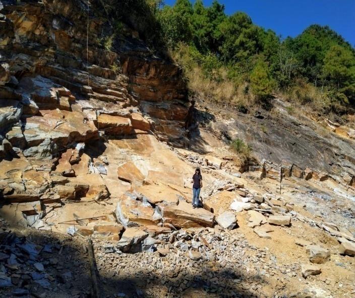
Stone mining is prevalent.’
No PHE water supply. The Village spent almost 1.5 lks on drinking water in the recent “Synod” Convention.
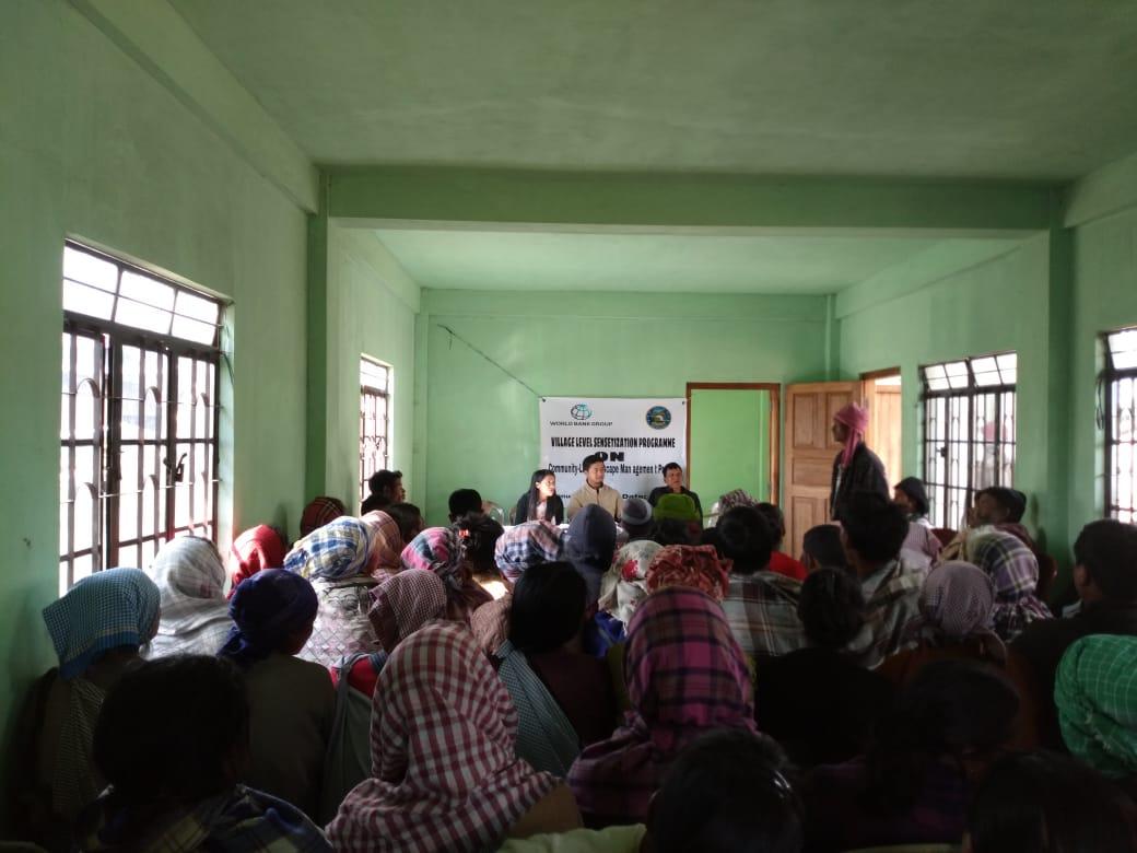
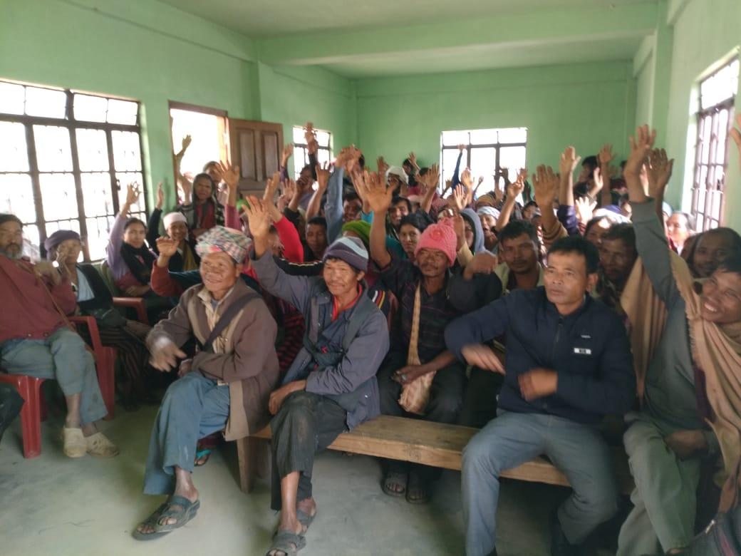
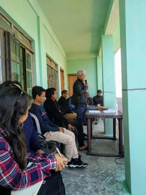
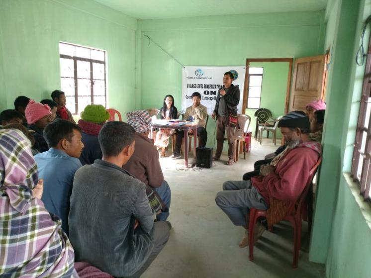
The District Project Manager along with the Assistant Managers held a Village Level Sensitization Programme on the Community Led Landscape Management project on the 4th of January 2019. A total of 112 villagers actively participated in the program, voicing out their concerns and questions regarding the project making it a huge success.
Awareness on the Community-led landscape ManagementProject
Laying importance on the involvement of the community in making the plan and the project a success
An interactive session was also held to answer the doubts of
the community where some of the key questions raised by the
villagers were: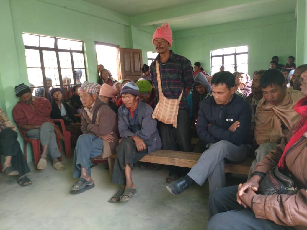
Will the village facilitators be responsible for the expenses if they undergo training?
Who will be funding the project?
What is the “World Bank” and will they have to repay the bank?
The DPM and the Assistant Managers were able to answer all of their questions and it was only after the interactive session that the villagers wanted to sign the Expression of Interest and the Green Charter and raised their hands in unison expressing their enthusiasm to be a part of the CLLM Project.
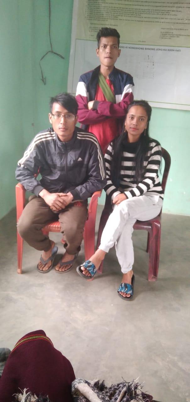
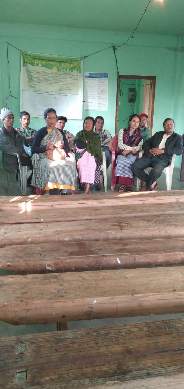
Formation of VNRMC was done on the 4th of January 2019 in a public meeting in the presence of the entire village. and the CLLMP staffs. The community itself chose the President, the Secretary and the other executive members of the Committee.
Some of the village youth facilitators were chosen however most of them volunteered. Listed below are the members of the VNRMC
| Sl No | Name in Full | Gender M/F | Age (in Yrs) | Education | Designation | Occupation | Community | Contact No and email address |
|---|---|---|---|---|---|---|---|---|
| 1 | OndaLawai | Male | 50 | III | President | Farmer | Khasi | 9862214629 |
| 2 | Bansuklang Nongrum | Female | 36 | BA | Secretary | Farmer | Khasi | 7630084232 |
| 3 | Rechestar Khriam | Male | 22 | X | Book keeper | Farmer | Khasi | 8730806755 |
| 4 | Brelet Nongrum |
Male | 50 | II | Member | Farmer | Khasi | NA |
| 5 | Hamles Lyngdoh | Male | 35 | VII | Member | Farmer | Khasi | 9366525664 |
| 6 | Salanki Nongrum | Male | 35 | VI | Member | Farmer | Khasi | 8787593525 |
| 7 | Roselily Khapiah |
Female | 38 | IX | Member | ASHA | Khasi | 8974833724 |
| 8 | NgiamlinBina | Female | 38 | IX | Member | Farmer | Khasi | 8119900443 |
| 9 | Mebalin Suting |
Female | 36 | VI | Member | Farmer | Khasi | NA |
| Village Community Facilitators | ||||||
|---|---|---|---|---|---|---|
| Sl.No. | Name | Gender | Age | Education | Contact Number | Role |
| 1 |
|
F | 23 | X | 6009158259 | KM and SM VCF |
| 2 | Rahbok Skhem Marboh | M | 25 | VIII | 8787335973 | Evnt & GIS VCF |
| 3 | Aibanpyniar Kharlukhi | M | 27 | XII | 6909126975 | M&E and PM VCF |
|
|||||
|---|---|---|---|---|---|
| Sl. No | Name | Gender | Age | Education | Contact Number |
| 1 | Blaskhem Marboh | Female | 50 | X | NA |
| 2 | John Kharlukhi | Male | 38 | V | 7630084232 |
| 3 | Shanbok Masynting | Male | 28 | X | 7628868371 |
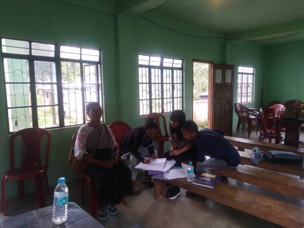
Opening of a Bank Account.
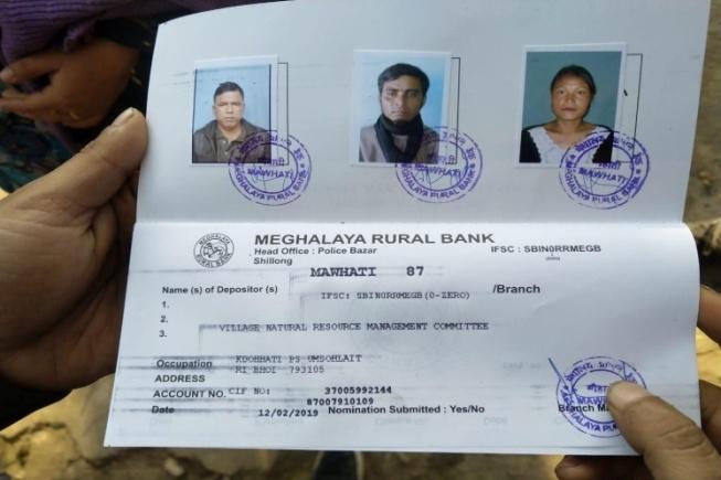
The opening of the bank account was done after the signing of the EOI (Expression of Interest), the VGA (Village Grant Agreement) and the signing of the Green Charter at the respective villages. A Meeting was also held with all members of the VNRMC of Kdoh Hati Village where the accountant of the CLLMP team had briefed them before opening the bank account. A meeting was held for all the VNRMC members of Kdoh Hati Village to brief and assist them before opening the VRNMC bank account. The bank account was opened on 12th February,2019
. Training provided to members of the Purchasing Committee
Topics Covered:
Principles of Community Procurement
Benefits of Community Procurement
Important aspects undertaken by Community Procurement.
Procurement Process/Steps
Function of Purchase Committee
Important Procurement records to be maintained
Financial limits and methods
Maintaining Books of Accounts to the Book Keeper.
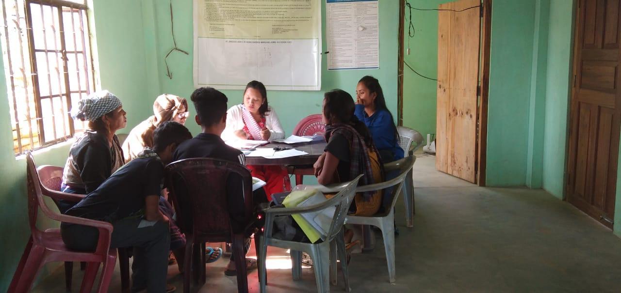
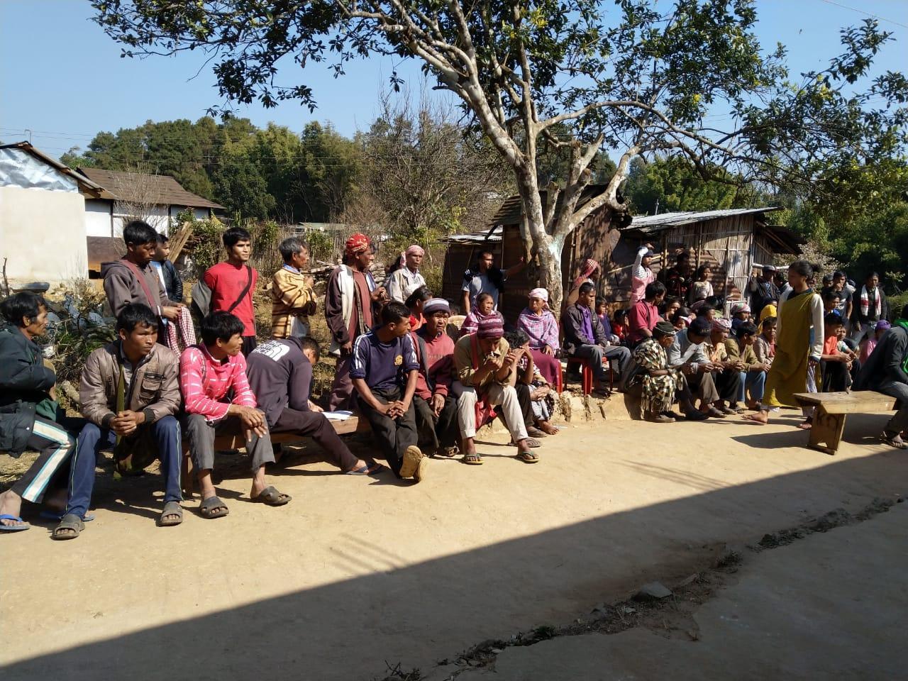
4. Participatory Rural Appraisal Exercise Dated: 21.01.2019
The PRA exercise aims to incorporate the knowledge and opinions of the community in the planning and management of development projects and programmes.
PRA exercise at Kdoh Hati started on the 21st of January 2019. There were a total of 112 villagers who took part in this exercise and we also had 16 CLLMP staffs that helped organize the program including Mr B Rumnong, who is the Deputy Project Director of the CLLM- Project.
The initial stage of Participatory Rural Appraisal (PRA) exercise at Pahamkroh Village commenced with a meeting cum orientation program on CLLMP. While conducting the meeting, the community members were made aware of the various PRA exercises to be conducted for the development of Community Natural Resource Management Plan (CNRMP) of the village, the community members’ contribution in the exercise and the objectives to be achieved. The key informants (the VNRMC and the VCFs) helped facilitate maximum participation.
Commencement of PRA.
Introduction: Participatory Rural Appraisal (PRA) is the process of involving local people in the analysis and interpretation of their own situation of a given rural area. The local people i.e. the participants take a leadership role in collecting, analyzing, interpreting and presenting information and in this process impart knowledge and development insight to the specialists and extension agents
For management of natural resources, participatory Rural Appraisal is conducted to establish rapport with the village community as well as to identify and define problems for prioritization in the village itself. It is a way of learning from and with community members to investigate their need assessment, analyze and evaluate constraints and opportunities and find out priorities in the area of agriculture, small scale rural enterprises and any other social and economic development programs addressed to village development. Based on the principle of listening and learning,
Objectives of PRA exercise at Kdoh Hati Village:
The Participatory Rural Appraisal (PRA) exercise at Kdoh Hati was conducted with following objectives:
To identify the natural, human and economic resources of a village.
To identify the village problems and prioritize them with the help of the community members.
To prepare the Community natural Resource Management Plan of the village.
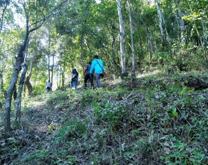
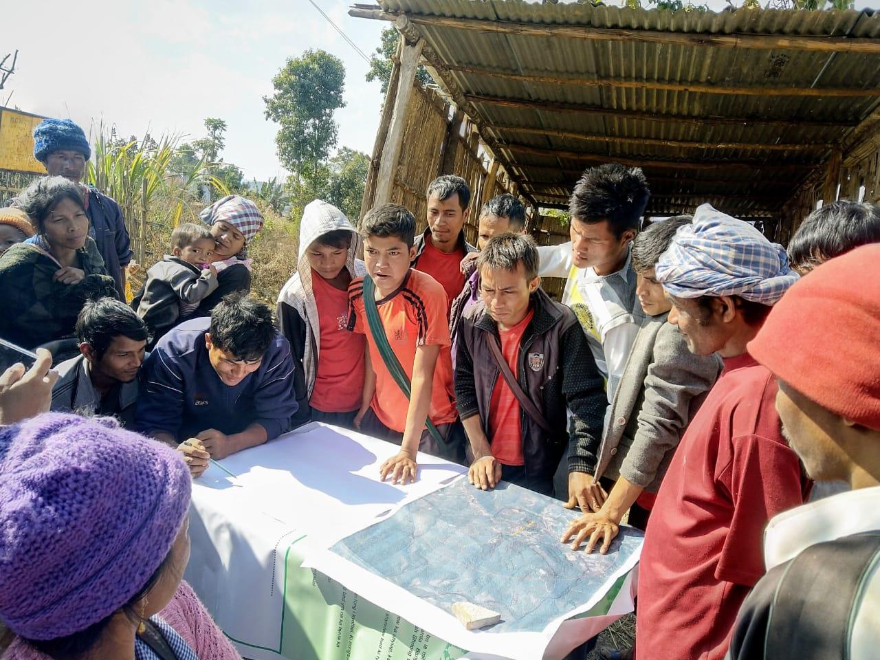
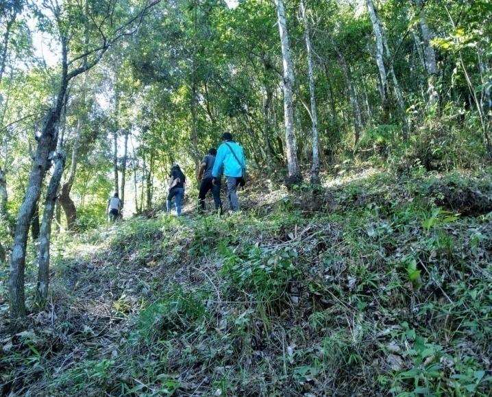
Activity 1: Village Boundary Mapping
The GIS personnel along with Village Community Facilitators mapped the village boundary of Kdoh Hati Village.
Activity 2: Drawing the Resource Map
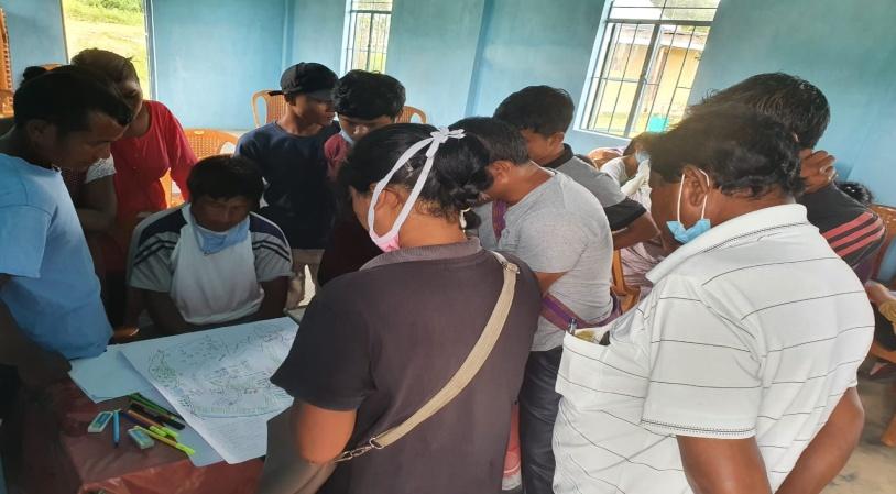
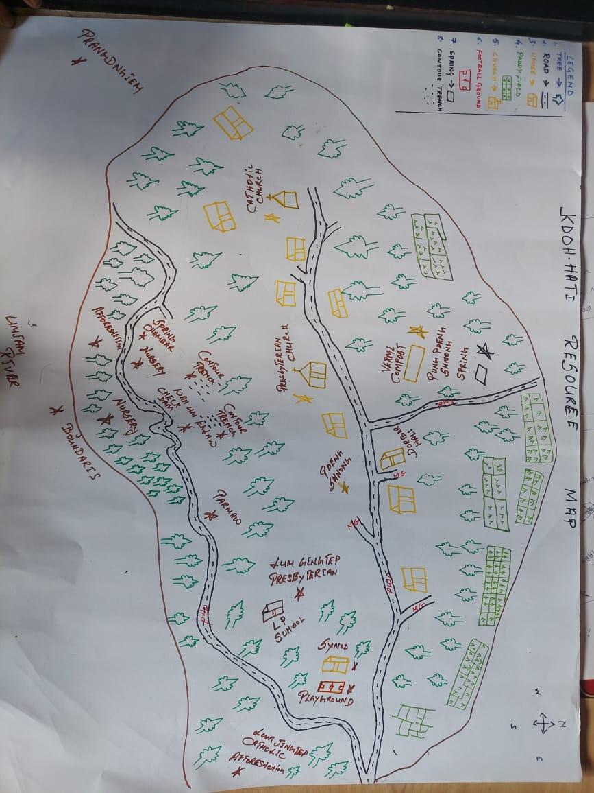
The second step is to involve the local community in preparation of a village resource map as perceived by the community members to solicit their participation. Infrastructure, services and other village resources such as agricultural lands, wells, wastelands, cattle population etc. were mapped. Local people prepared the Resource Map by drawing it on a chart paper without much interference from outsiders.
This activity achieved the following purposes:
Rapport building and won the confidence of the villagers.
Analyzed the spatial information, particularly studied problems and opportunities of villagers.
Got an impression about the village setting, physical layout, location of various houses and institutions.
Findings Based on the Resource Map of Kdoh Hati Village:
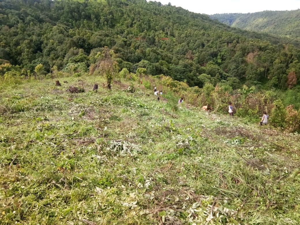
Main agriculture produce is Paddy and Ginger
There are 2 types of Forest ownership: Community, Private Owned.
1 community forest
5 private forest
Six (6) springs are present in the village with two already developed but needs more work.
One main river is present and one stream flows through the village.
Presence of Barren land
School: There are three Schools in the village, two Primary Schools and one Secondary School.
There are 3 Churches.
Connectivity : Umsning- Jaggy road connecting the village with the other village of the district
Habitation is not confined to one place but spread all over the village.
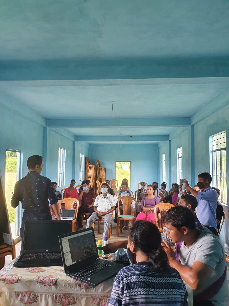
Activity 3: Baseline Data Survey to fill the Environment and Social Template
Date: 22.10.2020
During the PRA exercise, the CLLMP officials and the community members were divided into groups to fill the Social and Environmental Templates. Discussions and consultations with social groups existing in the village were held to gather basic village information regarding households, demographic information, major crops and enterprises taken in the village, trends of production and productivity of major crops in the village and demographic distribution of village population.
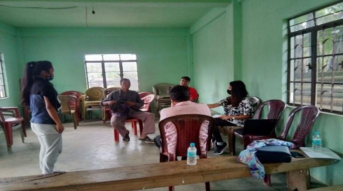
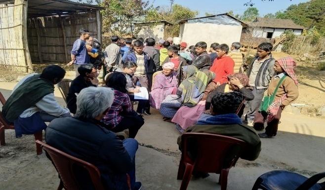
Figure : Group Discussions on Conflicts and Challenges
22.10.2020 (Continuation of PRA)
Activity 5: PROBLEM ANALYSIS
Do people have sufficient access to supply of fodder, fuel wood, leaf litter?
No. People from the village get fuel wood only from the private forest, which is not enough. They have to purchase from the outside.
Has access to timber improved or reduced over the years? How is access for household use and commercial use managed?
Access to Timber has reduced over the years. They have to purchase from outside when needed.
Are the water bodies facing any threats?
Yes. Two springs (Wah khrummure and Wah umkhlaw) are facing threats due to solid waste and domestic waste water pollution.
Do all people in the village have access to drinking water? What are the challenges?
No. There is a water scarcity in the village due to less discharge of water from the spring sources.
People in the village have to procure water at Rs 650 for 1500 liters, especially during the dry season.
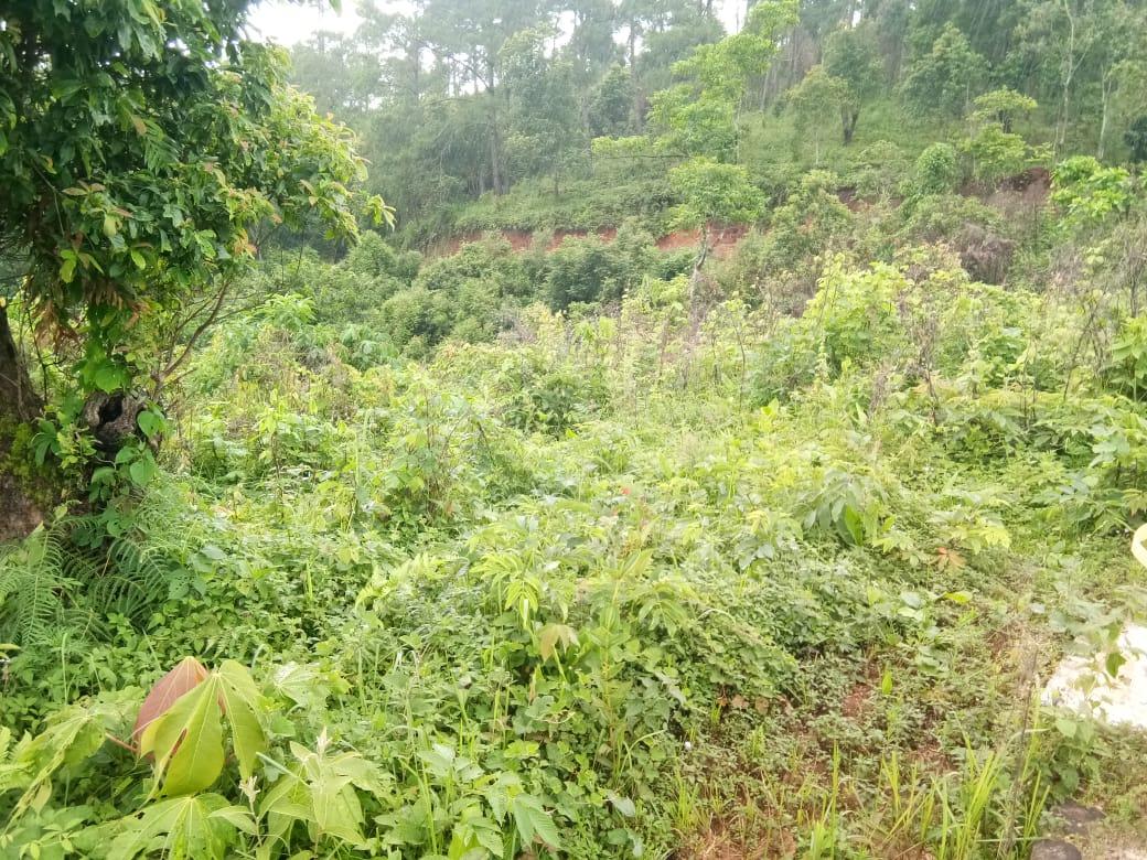
Are there degraded areas in the village (open/ degraded forests, mining affected, high soil erosion etc.)?
Yes. There are degraded areas in cultivated land.
What has caused this degradation? Are there practices causing threats to availability and access to natural resources?
Yes. Excessive practicing of Jhum Cultivation, using of Pesticide and Weedicide.
What have been the changes in agricultural practices?
Excessive use of Pesticide and Weedicide.
Are there any challenges in farming?
The main challenge in farming has been the loss of soil fertility. Moreover the use of chemical Fertilizers has further damaged the soil.
How would you consider the health situation in your village?
The nearest CHC is at 3Km away, which is easily accessible for the community in the village.
Looking back a decade ago, there was a drastic change when it came to the health situation in a village, during the past; diseases such as Malaria and Dysentery are common. However, at present situations have improved wherein the previous diseases are less prevalent, besides mild fever or cold.
There is an organization in the Village which they called it a ‘Maa Meeting’ this organization emphasizes the well-being of pregnant women and adolescence health.
How is the situation of cleanliness, sanitation, access to toilets and waste management?
When it comes to cleanliness, the youth community organizes a cleaning drive once a week. While the SHG also has a responsibility in organizing a cleaning drive in their own hamlets according to their own group.
Sufficient toilets are available in every household but the construction is poor.
Who are the most vulnerable in the village? What can be done to improve their lives?
Single parent family. Inclusion of Single parent family members during project implementation
What are the livelihood aspirations of the youth? Are there any avenues available?
The majority of the population turn to farming and Job-Cards under MGNREGA for employment.
None.
Do any committees/ institutions/ rules exist to manage and monitor natural resources in the village?
The VNRMC under the CLLMP is managing and monitoring the natural resources in the village. Prior to the CLLMP, the Village Traditional Dorbar and SHG are managing and monitoring the natural resources in the village.
What are some of the major issues of conflict in the village?
Social Conflict due to Alcohol abuse.
Have any of the above issues been discussed in village meetings?
Yes the village Dorbar have discussed the issues and are doing their best to address these problems.
How do people resolve disagreements and conflicts?
All disagreements and conflicts are addressed by the traditional institution of village governance called the Village Dorbar.
22.10.2020 (Continuation of PRA)
Activity 6: Seasonality Calendar
The CLLMP team also mapped the seasonal calendar of Kdoh Hati Village to help identify heavy workload periods, periods of relative ease, credit crunch, diseases, food security, wage availability etc. This will prove helpful in project planning and project timeline framing.
Figure: Preparation of Seasonality calendar
Participants:
Shri. Onda Lawai- VNRMC President
Shmt. Ibalatei Kshiar- Village Community Facilitator
Smt. Blaskhem Marboh - Community Member
Shri. Jesparlin Marboh- VNRMC Member
Shri Hamles Lyngdoh - Community Member
| SEASONALITY CALENDAR | |||||||||||||
|---|---|---|---|---|---|---|---|---|---|---|---|---|---|
| Sl No. | CRITERIA | JAN | FEB | MAR | APRL | MAY | JUNE | JULY | AUG | SEP | OCT | NOV | DEC |
| 1 | Water Scarcity | 2 | 2 | 1 | 1 | 1 | 3 | 3 | |||||
| 2 | Prone to sickness | 1 | 1 | ||||||||||
| 3 | Seeking job outside | 1 | |||||||||||
| 4 | Rain Fall | 1 | 1 | 2 | 3 | ||||||||
| 5 | Free – Less work | 1 | |||||||||||
| 6 | Paddy Cultivation | 3 | 1 | 1 | 3 | ||||||||
| 7 | Paddy harvesting | 3 | 1 | 1 | |||||||||
| 8 | Ginger Cultivation | 3 | 1 | 2 | |||||||||
| 9 | Ginger Harvesting | 2 | 1 | 3 | |||||||||
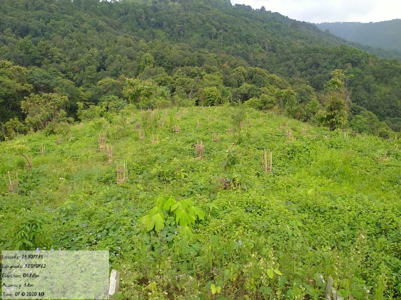
| 10 | Tree Plantation | 1 | 1 | ||||||||||
| 11 | Vegetable (crop cultivation) | 1 | 2 | 1 | 2 | 1 | |||||||
| 12 | Vegetable (crop harvesting) | 2 | 1 | 1 | 2 | 3 | 3 | 1 | |||||
| 13 | Festive Season | 1 | 2 | 3 | |||||||||
| 14 | Forest fire | 1 | 1 | ||||||||||
| 15 | Collection of Fuel wood | 1 | 1 | ||||||||||
| MAXIMUM | 1 |
|---|---|
| MODERATE | 2 |
| LESS | 3 |
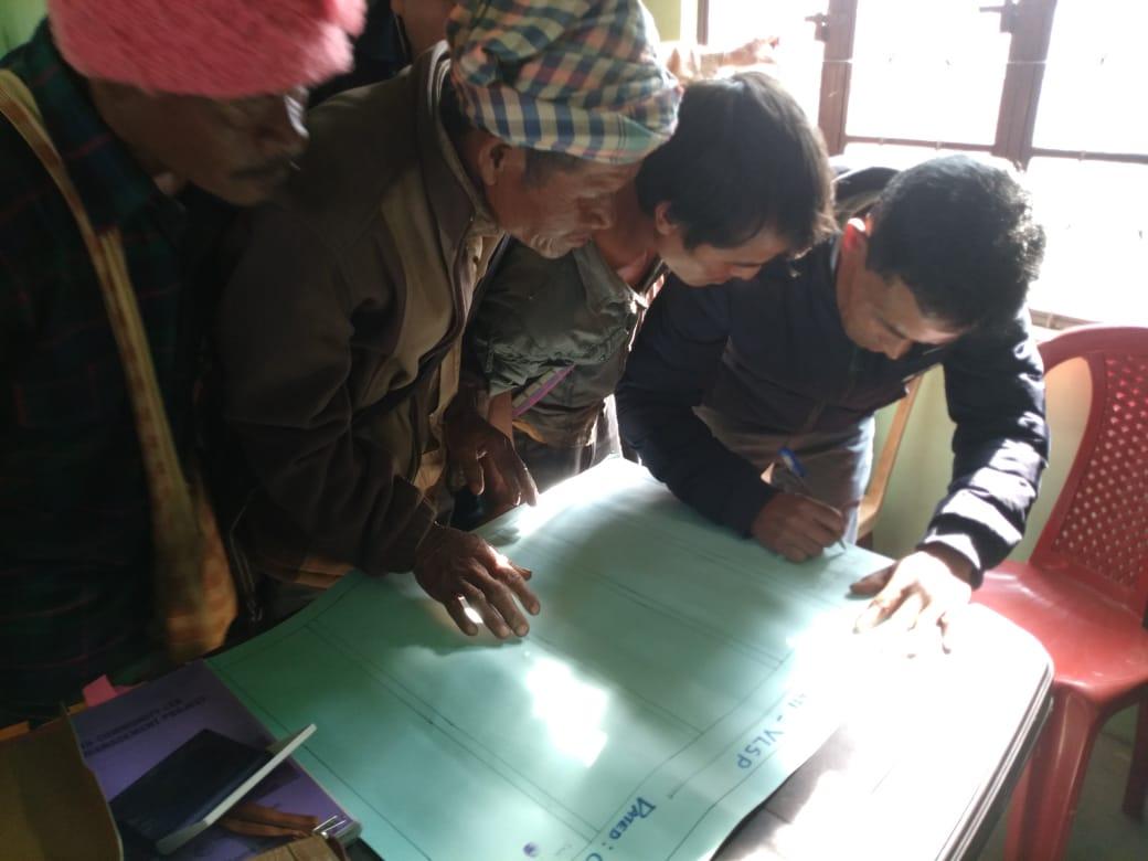
5.Development of the Community Natural Resource Management Plan (CNRMP)
The Community Natural Resource Management Plan was prepared at a village level meeting held on the 27th of March 2019. A total of 55 men and women from the village members of the Village Natural Resource Management Committee (VNRMC) were present to voice their problems and opinion while preparing the Community Natural Resource Management Plan.
10.1 Highlights of CNRMP: The community have expressed their need for proper water supply in the village, as they have to spend almost 45 minutes to go and fetch water and another 45 minutes coming back causing much trouble to the villagers.
The initial plan was to use a hydraulic pump to bring the water from the source to the village.
However, after inspection an expert from Meghalaya Institute of Natural
Resources (MINR) pointed out that the discharge from the source was too less for this technology to work.
The villagers were adamant that if we were to use an electric pump, it would be a waste of time and effort. So the CLLMP team have decided to first treat this water source giving it the required discharge for the hydraulic pump to work. This will be the first priority in the Community Natural Resource Management Plan (CNRMP)
The Assistant Manager made an inspection to the proposed intervention sites of the CNRMP along with Mr Kitkupar Lawriniang who is the Technical Assistant under Umsning B
|
Name of Proposed Interventions | Site |
|
Nos of HHs expected to Benefit | ||
|---|---|---|---|---|---|---|
|
|
|
||||
| 1 |
|
WAH UMKHLAW | COMMUNITY |
|
|
|
| 2 |
|
WAH UMKHLAW | COMMUNITY | 8 | 124 |
|
| 3 |
|
WAH TONGUM SHNONG | COMMUNITY | 8 | 124 |
|
| 4 |
|
|
COMMUNITY | 8 | 124 |
|
| 5 |
|
|
|
8 | 124 |
|
| 6 | HEADWORK FOR MINI HYDEL PROJECT | WAHUM KHLAW | COMMUNITY |
|
124 |
|
| 7 |
|
NEAR MADAN FOOTBALL | COMMUNITY |
|
|
|
| 10 |
|
Lum jintep presbyterian | Mission | 135 | ||
| 11. |
|
|
COMMUNITY( BOTH) |
|
|
|
| 17 |
|
WAH UMKHLAW | COMMUNITY | 8 | 124 |
|
| 18 |
|
WAH UMKHLAW | COMMUNITY | 8 | 124 |
|
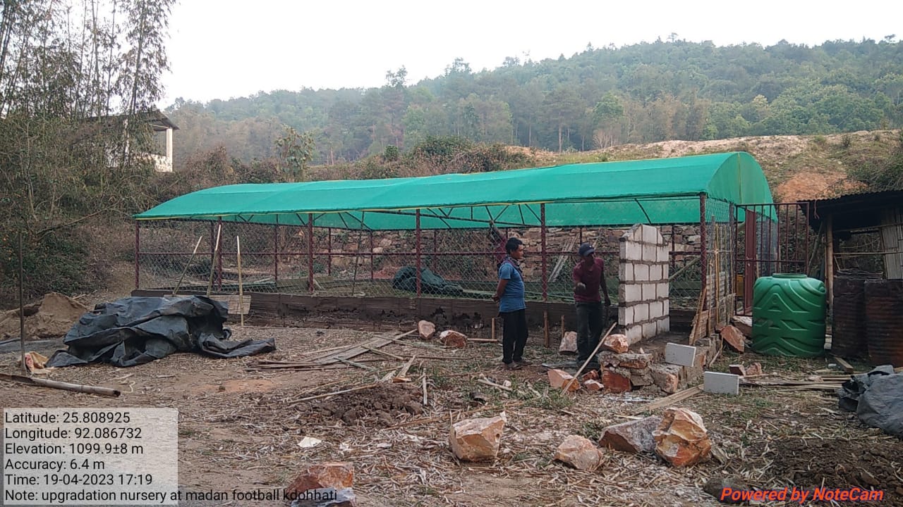
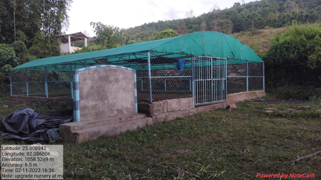
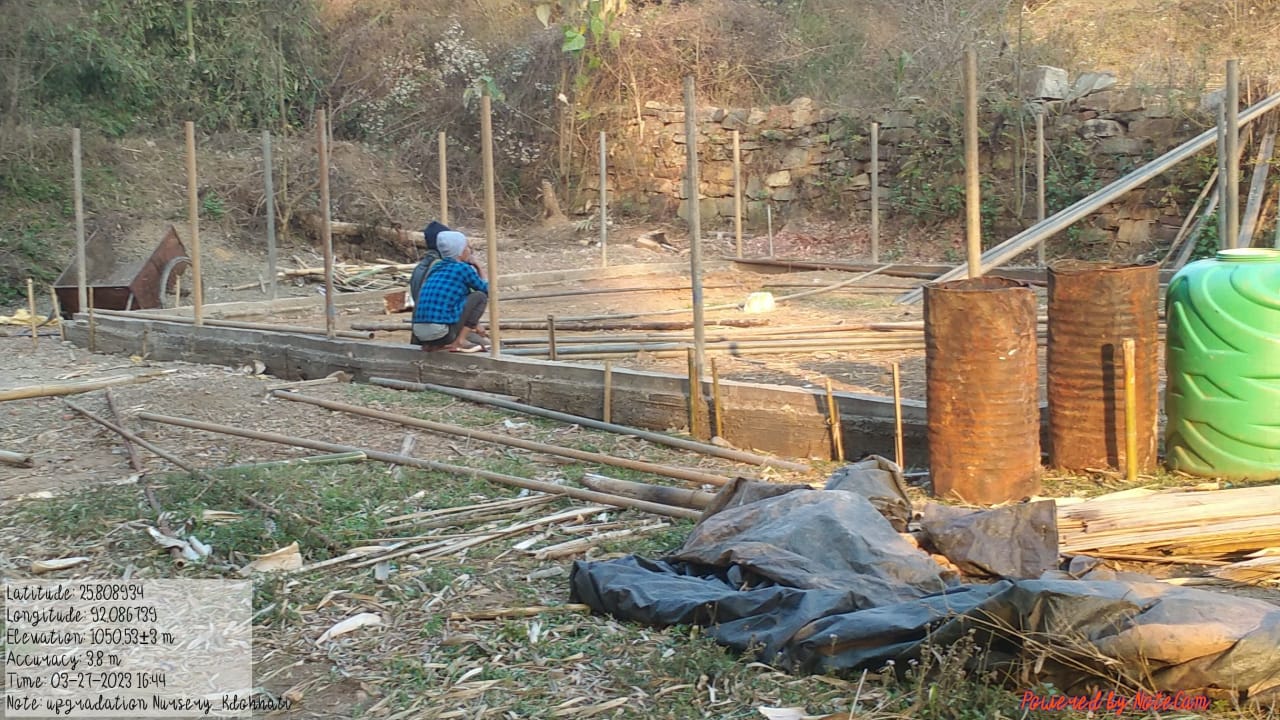
| 19 | Upgradation of Nursery | WAH UMKHLAW | COMMUNITY |
|
||
| 20 |
|
1.WAH UMLANG | 1.Community | 132 | ||
GIS Activities – KDOHATI
| Sl.No | Parameters | Village Information |
|---|---|---|
| 1. | GPS Coordinates | |
| i | Latitude | 25.808698°N |
| ii | Longitude | 92.087665°E |
| iii | Elevation Reading (MSL) | 1075 m |
| 2. | Village Geographical Area(Ha) | 254.30Ha |
| i | Total Forest Area ( including community, Clan, Pvt Forest) | 63.32 Ha |
| ii | Total Area of Water Bodies | 3.46 Ha |
| iii | Total Area under Agri- Horticulture | 14.74 Ha |
| iv | Total Degraded land area (Ha) | 21.63 Ha |
| 3 | Average Annual Rainfall | 1000-1200 |
| 4 | Soil Type | Loamy soil |

PROJECT IMPLEMENTATION
| Intervention | Site Name | Amount Sanctioned | Date of Completion | Status |
|---|---|---|---|---|
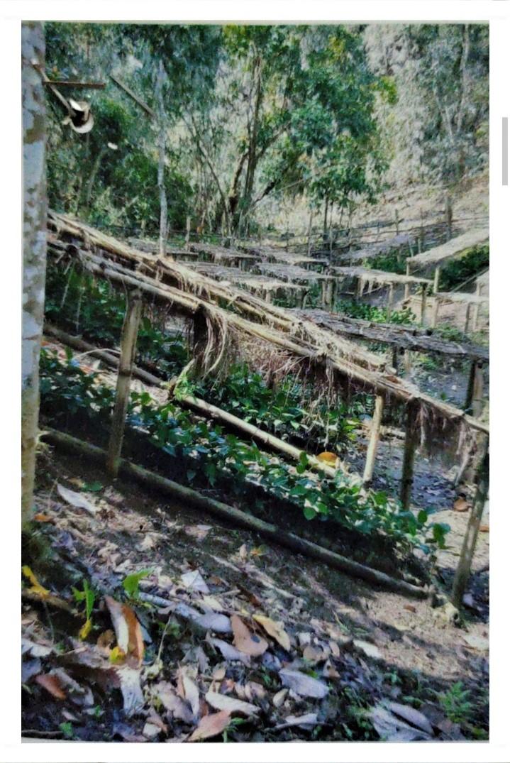
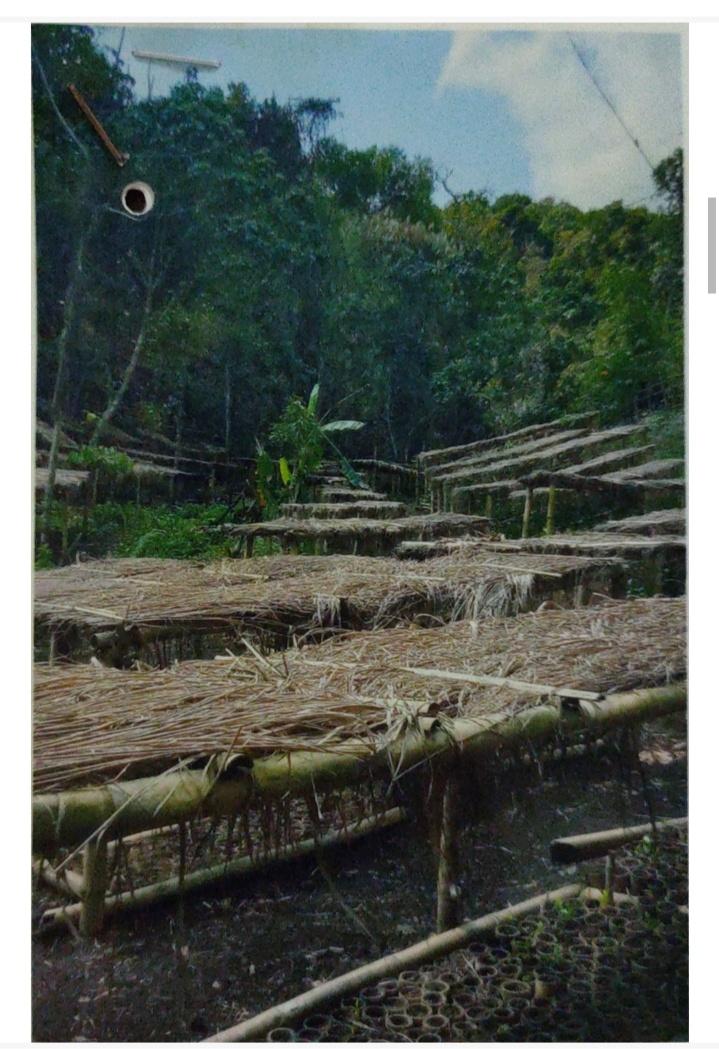
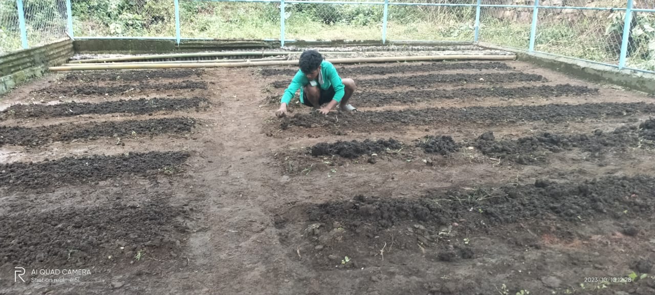
| Nursery | Wah Umkhlaw | 2,38,600.00 | 31.10.2019 | Completed |
| Name of the Intervention | Site Name | Total Amount | Date of Completion | Work Status |
|---|---|---|---|---|
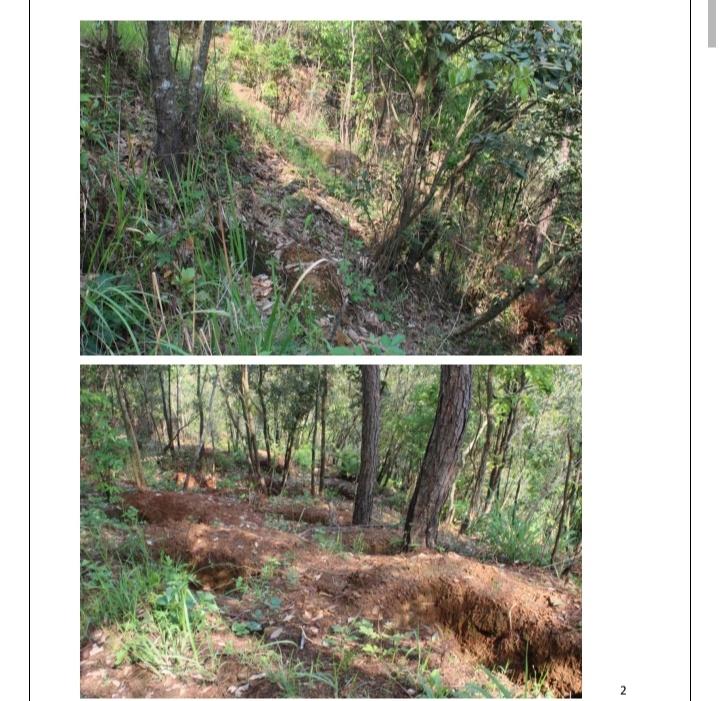
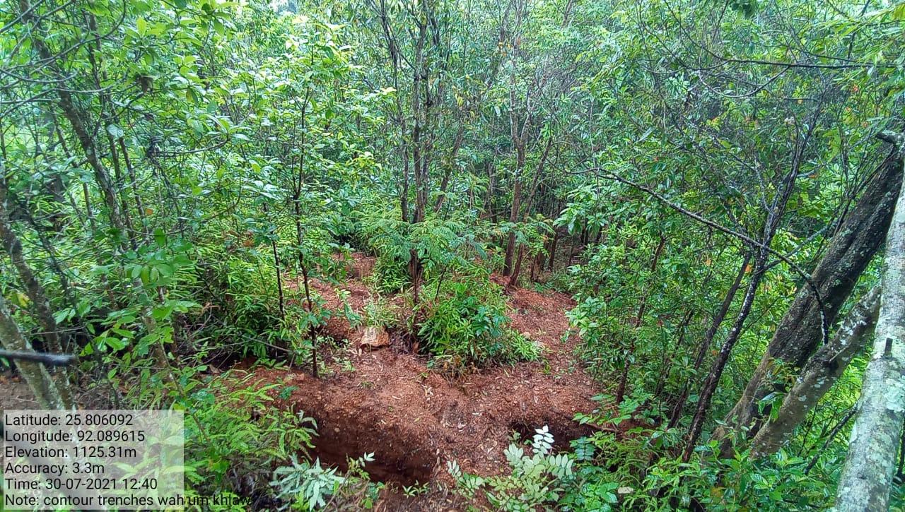
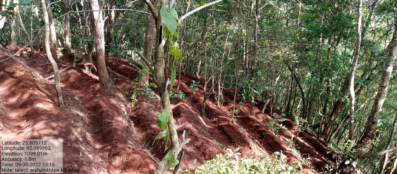
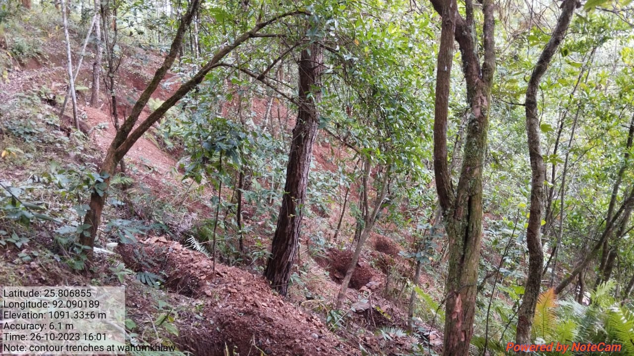
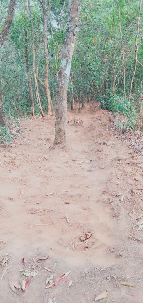
| Contour trenches | Wahumkhlaw | 23,168 | 14.10.19 | Completed |
| Name of the Intervention | Site Name | Total Amount | Date of Completion | Work Status |
|---|---|---|---|---|
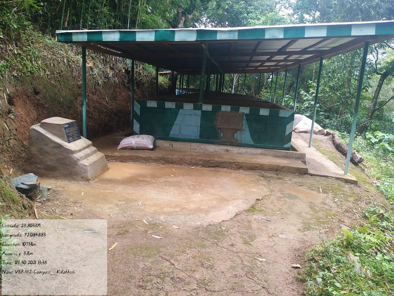
| Vermicomposting Unit - 10 Units | Wah tong um shnong | 3,36500.00 | 31.07.20 | Completed |
| Name of the Intervention | Site Name | Total Amount | Date of Completion | Work Status |
|---|---|---|---|---|
| Afforestation | Lumjingtep, near Wah Khlaw | 3,76,480.00 | 31st .07.20 | Completed |
| Name of the Intervention | Location | Total Amount | Date of Completion | Work Status |
|---|---|---|---|---|
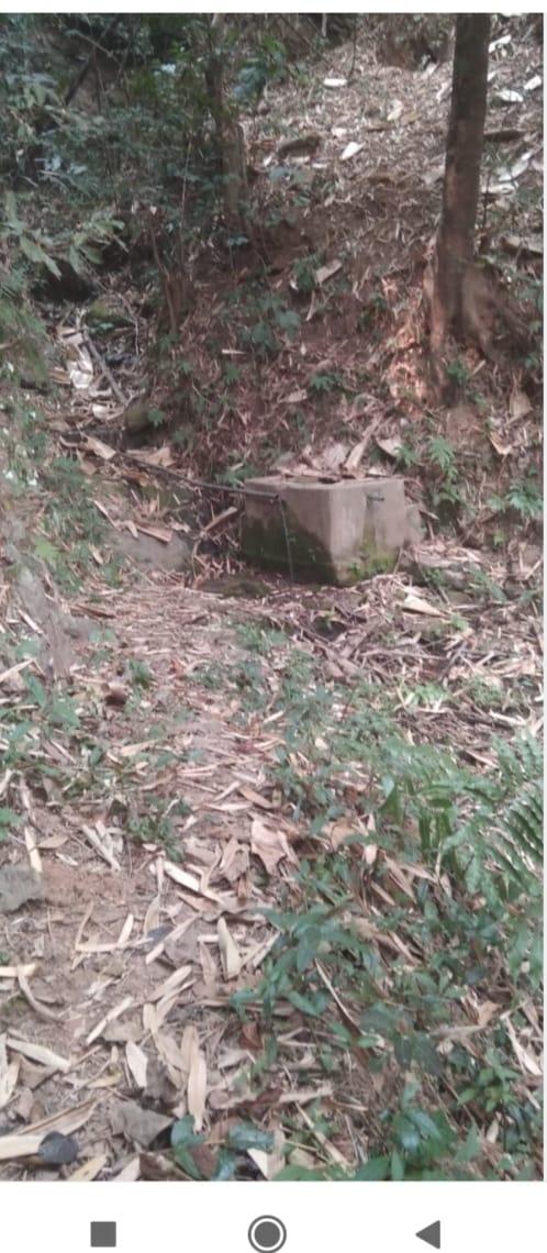
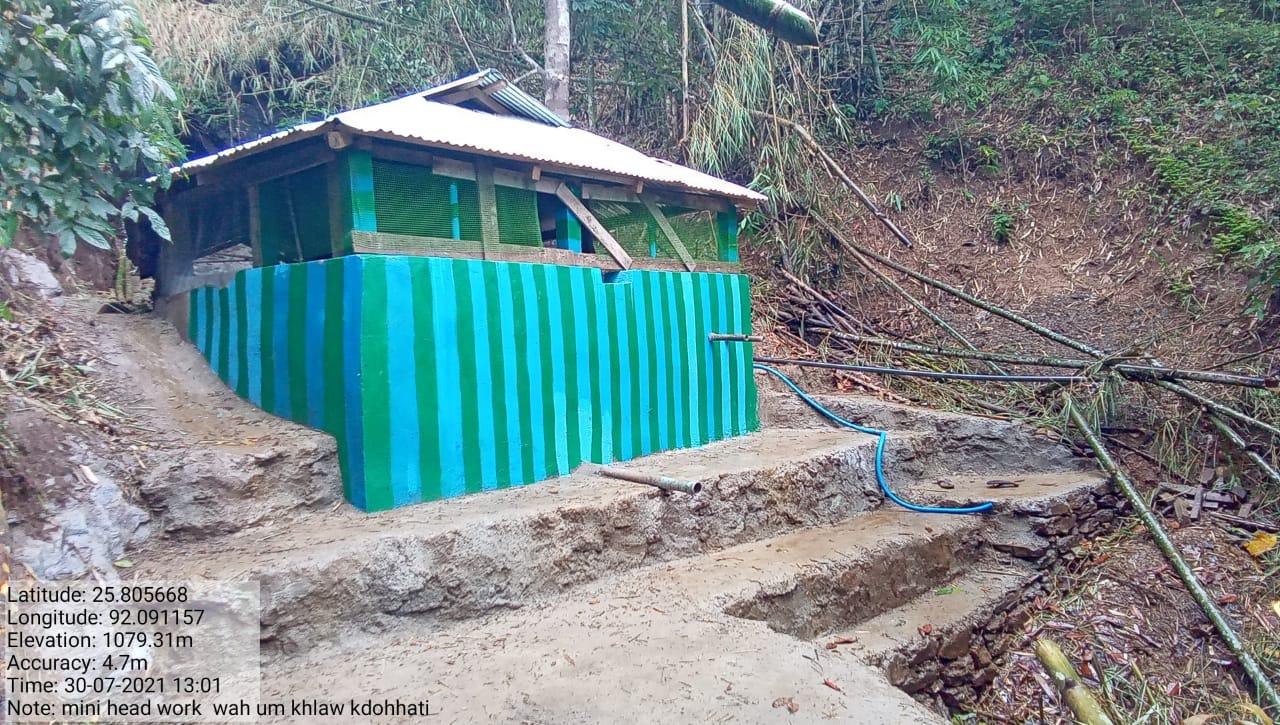
| Headwork/ Mini Hydel Project | Wah Umkhlaw | 7,79,200.00 | 14.08.21 | Completed |
| Name of the Intervention | Site Name | Total Amount | Date of Completion | Work Status |
|---|---|---|---|---|
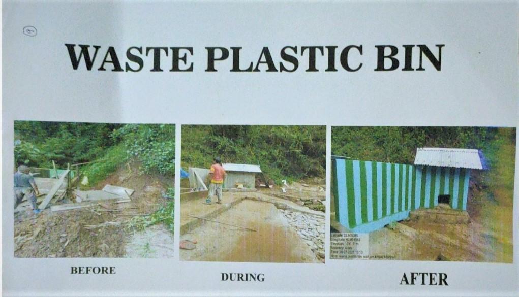
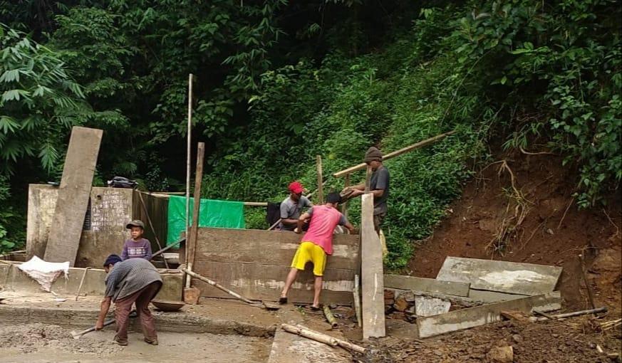
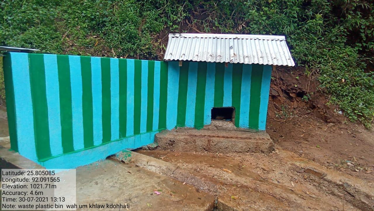
| Waste Plastic Bin | Wah UmKhlaw | 42,800.00 | 14th.08.21 | Completed |
| Name of the Intervention | Site Name | Total Amount | Date of Completion | Work Status |
|---|---|---|---|---|
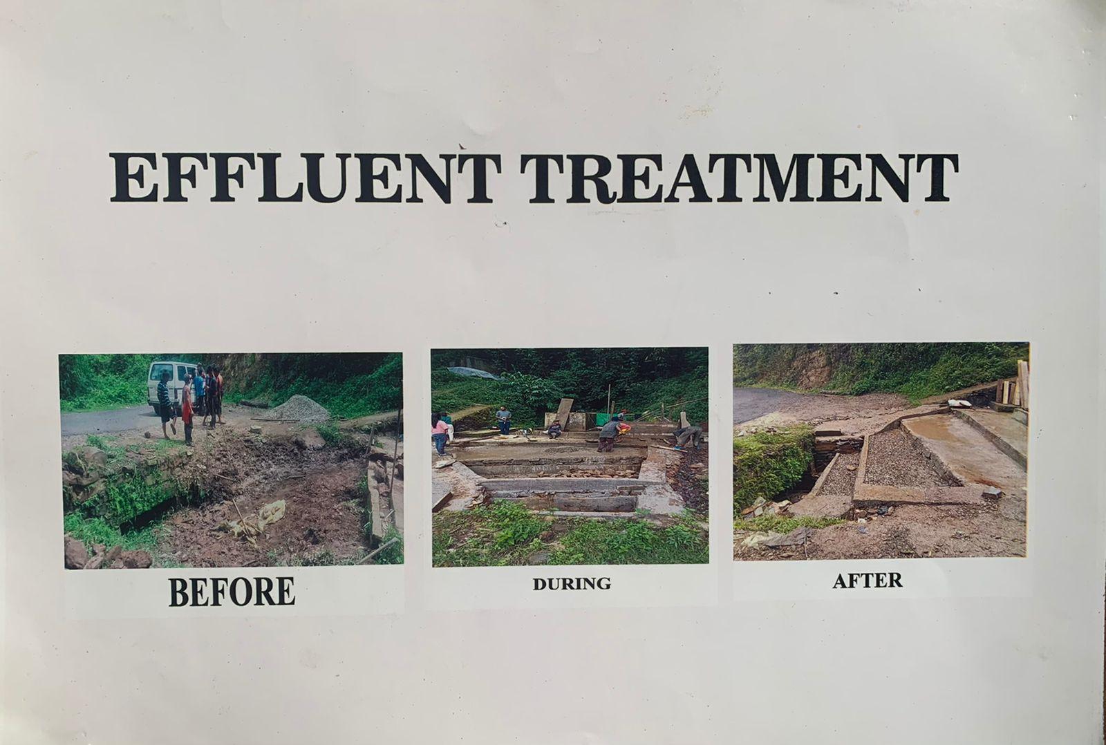
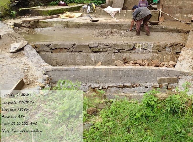
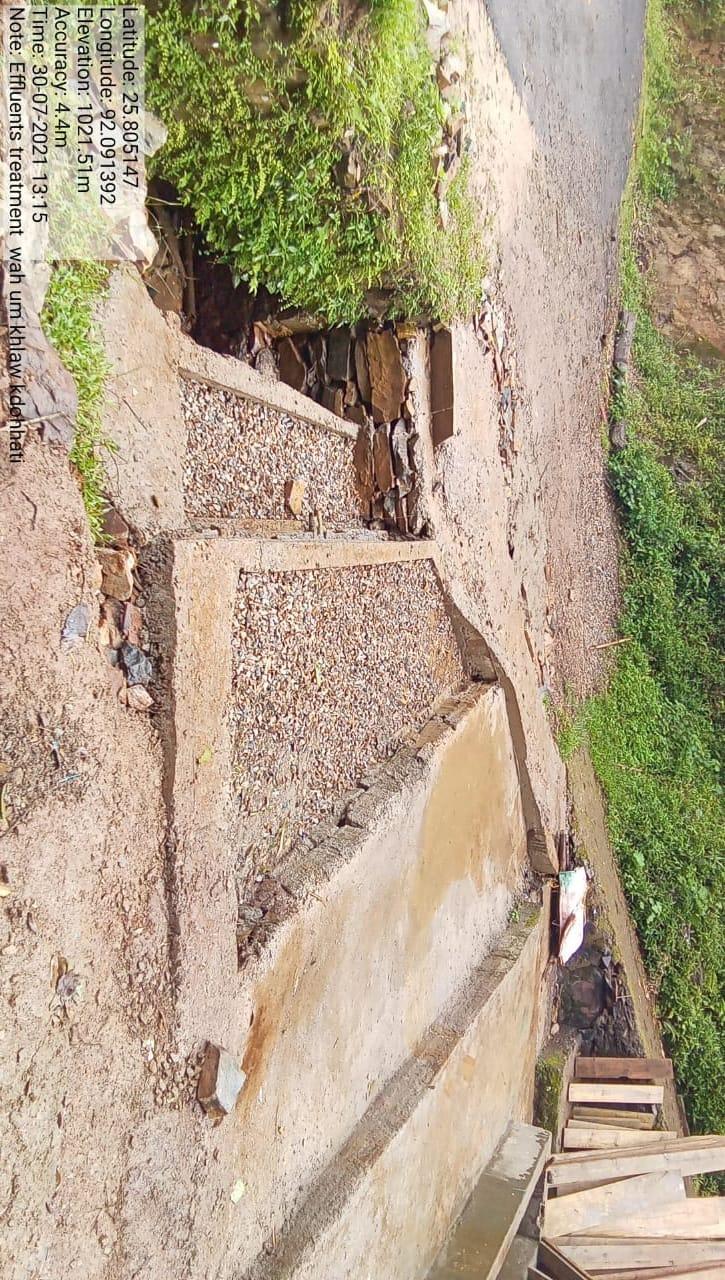
| Effluent Treatment | Wah Um Khlaw | 66,252.00 | 17.08.21 | Completed |
| Name of the Intervention | Site Name | Total Amount | Date of completion | Work status |
|---|---|---|---|---|
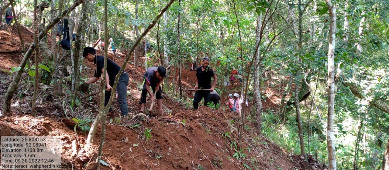
| Bench Terracing | Near Village cemetry | 60,000.00 | 28.02.22 | Completed |
| Name of the Intervention | Site Name | Total Amount | Date of Completion | Work Status |
|---|---|---|---|---|
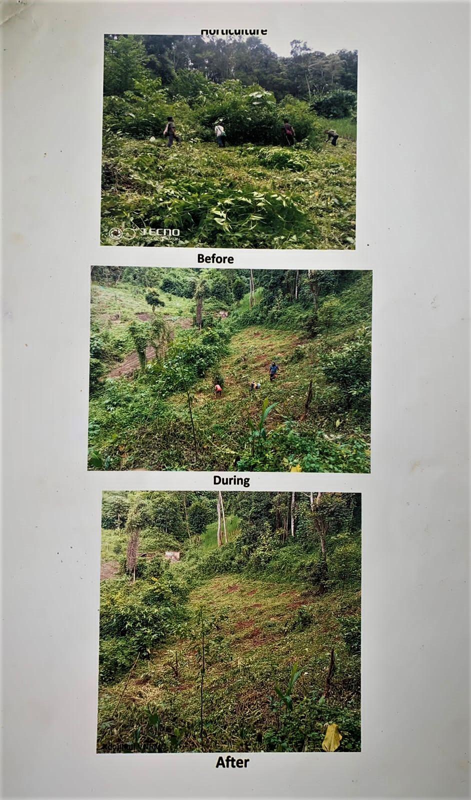
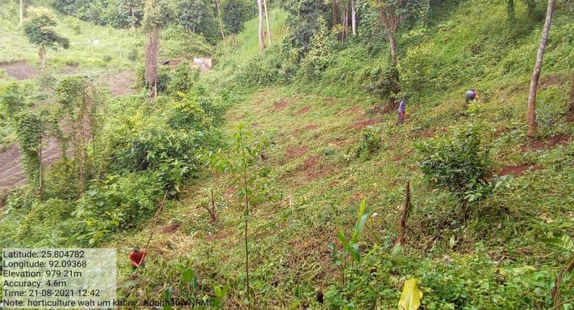
| Horticulture | Wah umkhlaw | 97,467.00 | 23.08.21 | Completed |
| Name of the Intervention | Site Name | Total Amount | Date of Completion | Work Status |
|---|---|---|---|---|
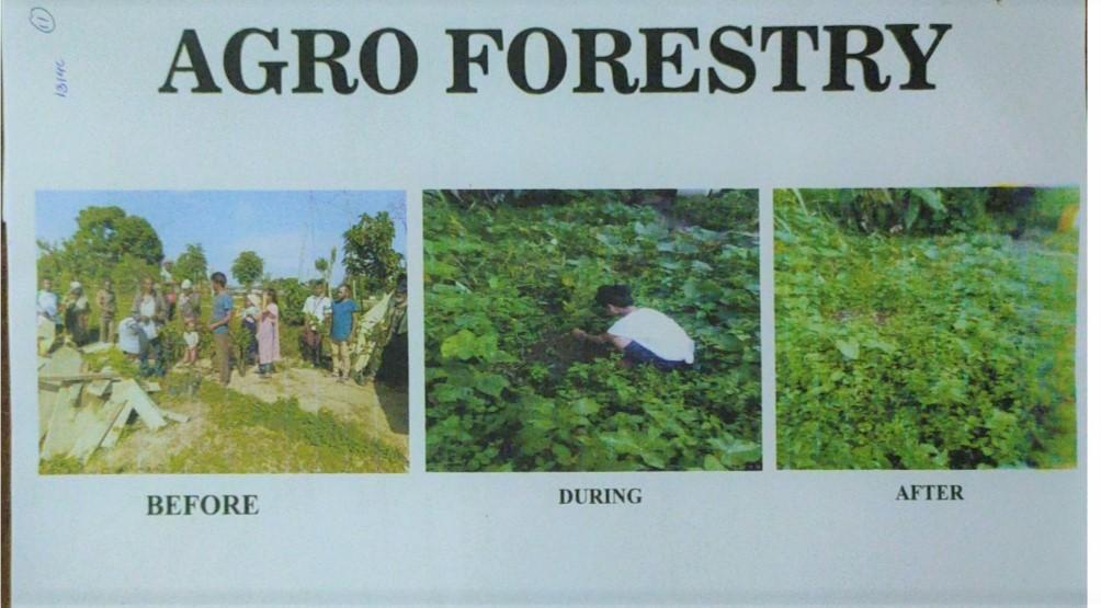
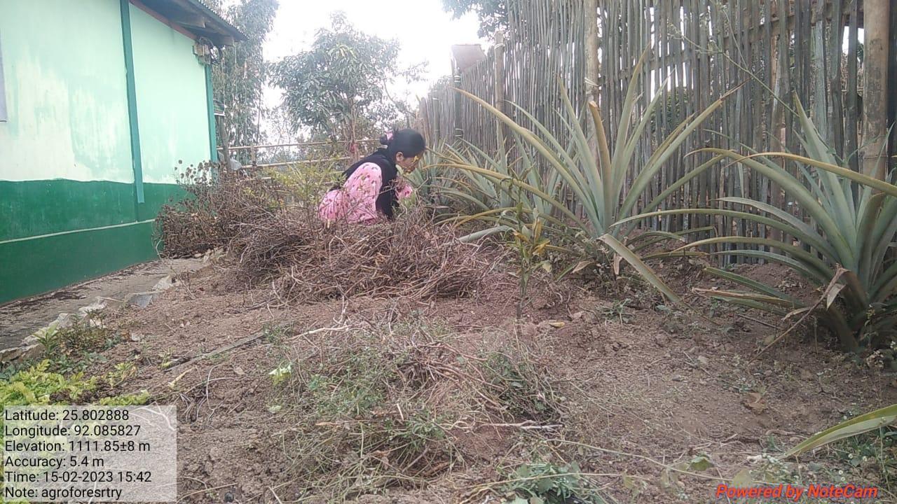
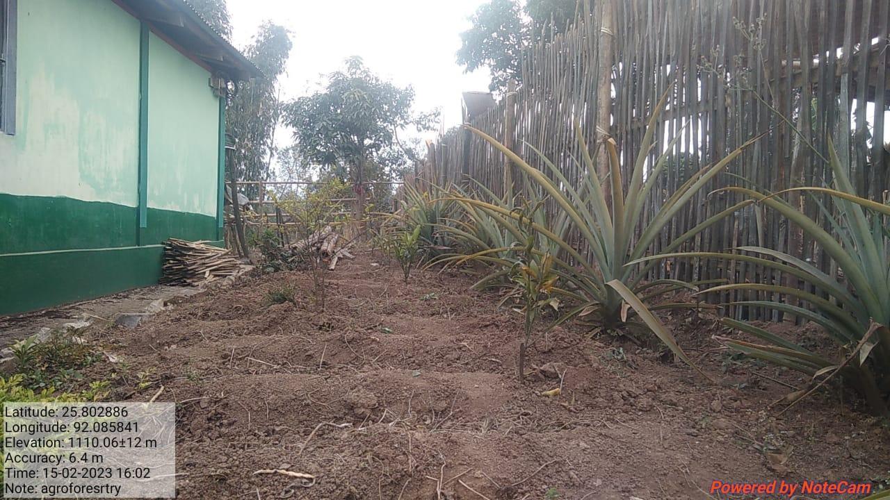
| Agro-forestry | Village Forest and House hold | 80,536.00 | 24.08.21 | Completed |
| Name of the Intervention | Site Name | Total Amount | Date of Completion | Work Status |
|---|---|---|---|---|
| Bench Terracing 2 | Wah Umkhlaw | 2,00,000 | 01.10.22 | Completed |
| Name of the Intervention | Site Name | Total Amount | Work Status |
|---|---|---|---|
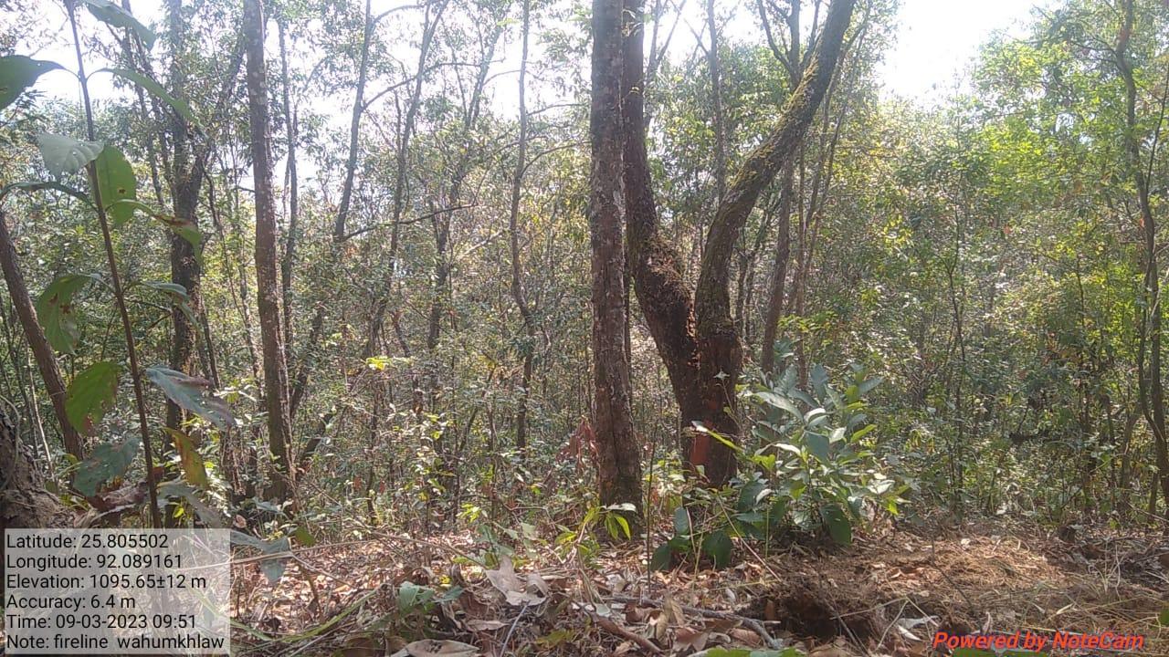
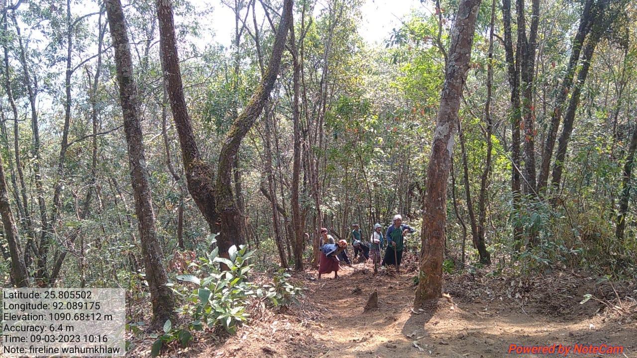
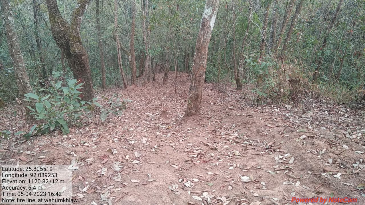
Fire Line control |
Khlaw shnong | 80,000 | Completed |
| Name of the Intervention | Site Name | Total Amount | Work Status |
|---|---|---|---|
| Upgradation of Nursery | Wah Um Khlaw | 3,00,000 | completed |
| Intervention | Site Name | Amount | Work Status |
|---|---|---|---|
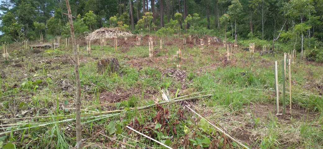
FMP Activities 1.Fire Control Line 2. .Assisted natural regeneration in open forests (Contour trench ) 3.Community Forest Boundary Survey 4.Enrichment Planting in forests blanks 5.Nursery for Food Forestry (Sapling for the Existing Nursery 6. In situ & Ex situ conservation of rare and endangered species |
Community Land | 67,985 | Completed |
| Intervention | Site Name | Amount | Work Status |
|---|---|---|---|
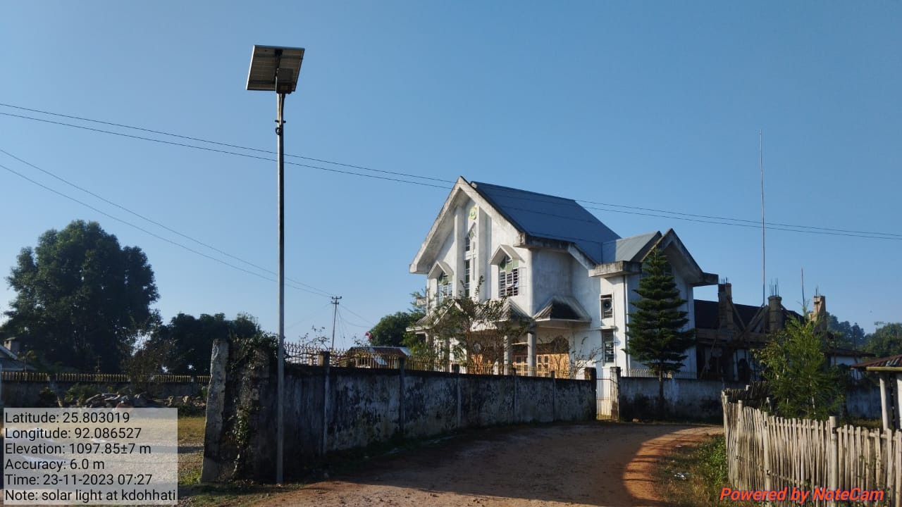
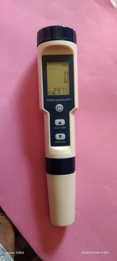
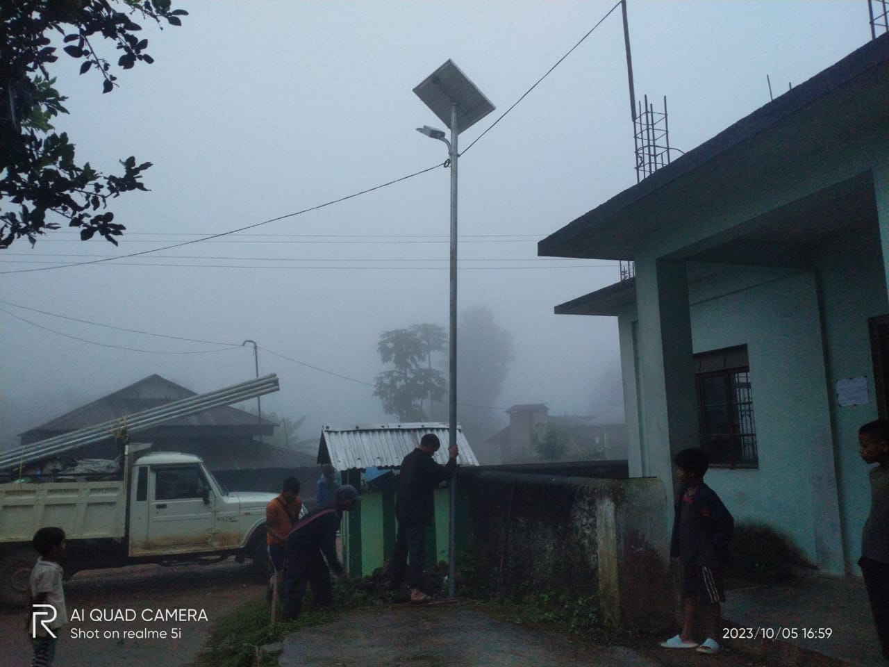
Excess fund activities Fire line control Water Tester Solar light |
community land | 140000 80,000 10000 50000 |
Completed |
TESTIMONIALS
PRESIDENT -Onda Lawai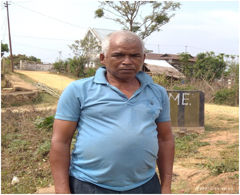
It's wonderful to see the positive impact that the project has had on the environment and the community and the project has brought about several meaningful benefits:
Environmental Awareness and Education: The project has raised awareness among villagers about the importance of respecting and caring for the environment. This education likely includes teaching about sustainable practices, ecosystem health, and the consequences of environmental degradation.
Community Engagement and Continuous Involvement: The project has fostered a sense of responsibility and stewardship among community members. They've learned how to take care of their surroundings and work together to protect their environment for present and future generations.
Environmental Protection: The project has provided practical knowledge on preserving water sources and preventing soil erosion. These are crucial aspects of maintaining a healthy ecosystem and ensuring the sustainability of natural resources.
Hope and Inspiration: The positive impact of the project has likely instilled hope within the community. Witnessing the tangible improvements resulting from their efforts can inspire them to continue working towards a better environment and a better quality of life.
Economic Benefits: Depending on the nature of the project, there could be economic benefits as well. For example, if the project involves sustainable agriculture or resource management, it might enhance the community's livelihoods.
Long-Term Sustainability: By instilling values of environmental responsibility and teaching practical skills, the project is likely contributing to the long-term sustainability of the community's environment and resources.
Sense of Pride: The project's success has created a sense of pride among community members, knowing that they have played a role in positive change and improvements in their surroundings.
Projects that successfully combine environmental conservation and
community development can have a profound and lasting impact. It's
heartening to witness that this project has brought about positive
change, fostering a deeper connection between the community and
their environment. This type of collaboration and shared
responsibility is crucial for addressing environmental challenges on
a broader scale.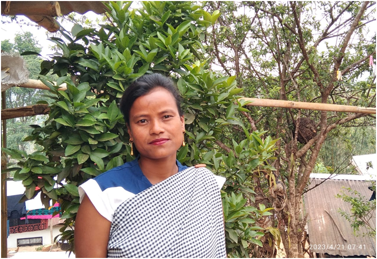
SECRETARY -Bansuklang Nongrum
It's truly inspiring to see the deep and multifaceted impact that the project has had on both the environment and the community. My role as the project secretary has allowed me to be a vital bridge between the project's goals and the community's understanding. To break down some of the key points that is under this:
Education and Awareness: The project has not only provided practical knowledge but has also fostered a sense of responsibility and respect towards the environment. This education likely extends to understanding the significance of preserving water sources, which is crucial for the community's well-being.
Leadership and Empowerment: Being chosen as the secretary has empowered me with knowledge and information. By organizing and participating in training sessions, I have become a key communicator; sharing valuable insights with the community and helping them comprehend the importance of the project's goals.
Strengthening Relationships: My involvement in the project has enhanced my relationship with the villagers. Through sharing information and engaging in collaborative efforts, I've likely built trust and a stronger sense of community among the people.
Multi-Dimensional Learning: It's clear that the project has been more than just about environmental protection. It's been a holistic learning experience, encompassing various aspects of sustainable living, ecosystem preservation, and community engagement.
Positive Chain Reaction: The fact that project members came to teach the community shows that the project has created a cycle of knowledge sharing. As the community learns and applies their newfound understanding, they can also become advocates and educators for others.
Personal Fulfillment: My enthusiasm for the project and role as secretary shine through. It's apparent that this opportunity has brought personal fulfillment and a sense of purpose, which can be incredibly rewarding.
Shared Vision: The project has likely united the community with a shared vision and common goals. This unity can lead to more effective and sustainable environmental initiatives.
To conclude, it's remarkable how a well-designed project can have such far-reaching positive effects, from individual empowerment to community cohesion and environmental stewardship. This project highlights the significance of grassroots efforts in creating meaningful change. By continuing to nurture these learning and relationships, the community can build a legacy of responsible environmental management for generations to come
VCF –SM & KM :Ibalateishisha Kshiar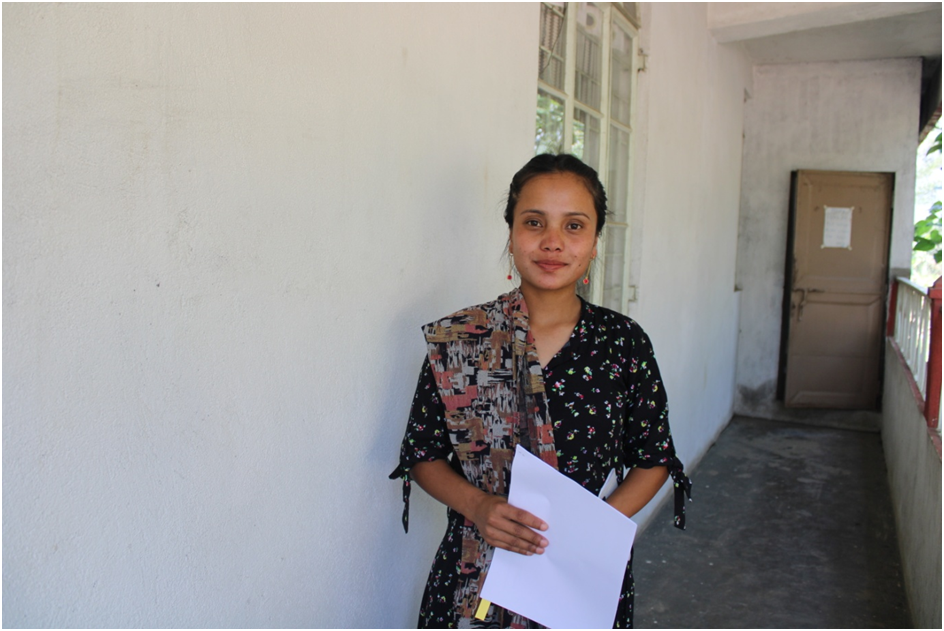
I’m happy to see that my dedication and proactive involvement in the project as a Village Community Facilitator (VCF) has been successful. The role has clearly been instrumental in driving positive change within the village. Let's delve deeper into the key aspects that I want to be highlighted:
Community Empowerment: By taking the role of a VCF, it showcases our commitment to the betterment of the village. By making the villagers understand the project and encouraging their active participation, the project is empowering them to take ownership of their environment and community.
Education and Awareness: The project's benefits extend to educating villagers about responsible practices. Teaching them not to litter, to keep the village clean, and to refrain from throwing plastic and bottles indiscriminately helps instill a sense of responsibility for their surroundings.
Environmental Conservation: Our efforts to teach the community about preserving the environment for future generations are crucial. Encouraging practices like vermicomposting for organic fertilizer production and planting various types of vegetation showcases a commitment to sustainability and the health of the ecosystem.
Landscape Improvement: Planting trees, flowers, ginger, and vegetables contributes to improving the aesthetics of the village while also providing practical benefits like cleaner air, local produce, and potential economic gains.
Behavioral Change: Our work highlights the importance of behavioral change within the community. By instilling new habits and practices, the VCFs are contributing to a shift in mindset that prioritizes the environment and sustainable living.
Community Collaboration: Our role likely involves fostering collaboration among community members. This teamwork can create a stronger sense of unity and shared purpose, further reinforcing positive outcomes.
Holistic Approach: The wide range of activities were involved in, from education to practical implementations like vermicomposting and gardening, shows a holistic approach to community development and environmental preservation.
Legacy Building: The values and practices we're promoting will likely have a lasting impact on the village. Future generations can inherit a cleaner, more sustainable environment because of our efforts.
Our work as a VCF demonstrates how individuals can truly make a difference by taking initiative and leading by example. The combination of education, practical actions, and community engagement can create a positive ripple effect that extends far beyond our immediate efforts. It's clear that we're contributing to a brighter future for the village and its residents.