REPORT ON: KREM MYRSIANG VILLAGE
DISTICT: EAST JAINTIA HILLS
18th AUGUST 2020
COMMUNITY LED LANDSCAPE MANAGEMENT PROJECT

MEGHALAYA BASIN MANAGEMENT AGENCY

COMMUNITY LED LANDSCAPE MANAGEMENT PROJECT (CLLMP)
The Government of Meghalaya with financial help from the World Bank is implementing the Meghalaya Community Led Landscape Management Project (MCLLMP). The project will cover the manner throughout the state. The Meghalaya Basin Management Agency (MBMA) will facilitate community-led planning by providing support, technical inputs and funding.
The project is intended to strengthen Community Led Natural Resources Management in selected landscapes within the 7 districts of the state. This would be achieved through a variety of planning, capacity building, and on-the-ground interventions to promote the conservation, sustainable use of natural resources, social inclusion and community mobilisation; building traditional knowledge and learning, mapping of natural resources management; strengthening the community institutions and creating linkage with financial institutions and community organisations.
The project interventions will include preparation of community led natural resource management plans. The CLLMP has the following three components:
1. Strengthening Knowledge and Capacity of Communities for Natural Resources Management
2. Community-Led Landscape Planning and Implementation
3. Project Management and Governance
The project objective is “to manage and conserve the natural resources especially forests, soil and water sources, in a manner that supports the financial and physical well-being of communities in the State”
The CLLM-Programme focuses on increasing the capacities of communities and traditional institutions (TI) by adopting a landscape approach to manage their natural resources such as soil, springs and other water sources, forests and bio-diversity, etc.
The project will be planned and implemented in about 400 villages across the state.
CLLMP has a strong focus on institution-building at the village-level, by ensuring systematic capacity-building on technical and social skill-sets.
The project will also extend such training to communities beyond the targeted villages and support efforts made by them to access funding from various rural and natural resources initiatives and schemes.
The programme will also invest in improving the process and outcome delivery, by developing and adhering to effective systems and procedures, supported by the appropriate technology.
Benefits for community (Skills and Capacity relating to technical and managerial areas like NRM and Conflict resolution
Benefits to traditional institutions (village councils, traditional leaders, community-based organizations, SHGs etc) through Knowledge sharing, promotion of innovative approach, access to technology, technical managerial and financial support.
It is estimated that the project will impact around 1 lakh partners (of which 50% are women) who depend on land, forest, agro forestry.
Through the project, 55000 Ha of targeted area will be ensured with availability of water, biological resources and soil productivity, which will in turn benefit around 400 villages and the outcomes delivery can be summarized as follows.
The Project will be executed by the MBMA in collaboration with other partners particularly, SIRD (for training and capacity building), Department of Soil and Water Conservation, Water Resource Department, Forest Department, specifically with respect to technical inputs, safeguards management and Community NRM plan preparation
2018-2023 (5 years)
Introduction and History………………………………………………………………………..05
Physical & Social profile.………………………………………………………………………..06
Population………………………………………………………………………………………………06
Card Holding household………………………………………………………………………….06
Fuel Type………………………………………………………………………………………………..07
Occupation……………………………………………………………………………………………..07
Key Constraints……………………………………………………………………………………….07
Environment Challenge…………………………………………………………………………..07
Land Use Land Cover Pattern………………………………………………………………….08
The different maps of the village…………………………………………………………….09
CLLMP Activities
1. Ground Truthing………………………………………………………………………………….10
2. Sensitization on CLLMP………………………………………………………………..……..11
2.1 Signing of EOI, VGA and Green Charter…………………………………12
2.2 Formation of VNRMC…………………………………………………………...12
2.3 Bookkeeper…………………………………………………………..................13
2.3 Village Community Facilitators……………………………………………..13
2.4 Purchase Committee…………………………………………………………….14
3. Opening of Bank Account and training on Accounting…………………………14
4. PRA Exercise and Preparation of CNRMP
4.1 Drawing of Resource and Social Map…………………………………….15-16
4.2 Re-orientation session on preparation of CNRM plan……………17-18
4.3 Preparation CNRMP………………………………………………………………19-25
4.4 Site inspection of Proposed Intervention Sites……………………..26-44
4.5 Review of the progress & in-situ course
in the Preparation of CNRMP………………………………………………..45-46
4.6 Presentation of CNRMP to the VNRMC…………………………………47-49
5. Implementation of Activities …………………………………….………………………..50-54
6. Fund Status………………………………………………………………………………………….55
7. Annexure………………………………………………………………................................56
INTRODUCTION
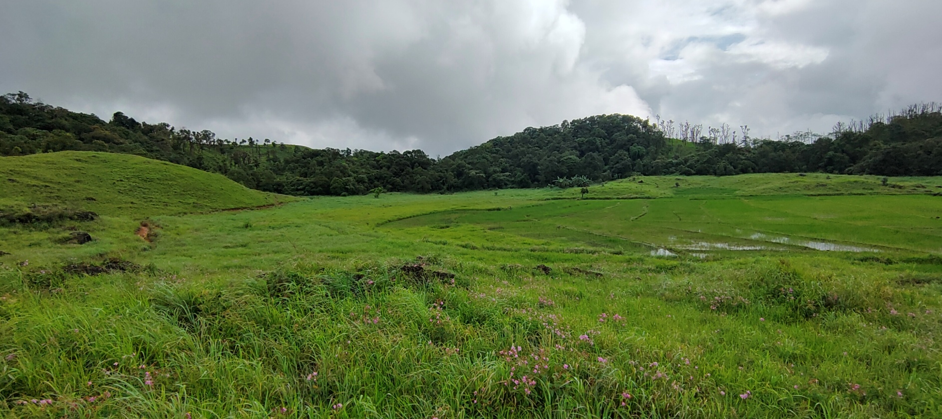
Krem Myrsiang Village falls under Saipung C&RD block of East Jaintia Hills district in the state of Meghalaya. The village is at a distance of 24 Kms from Khliehriat, the district headquarters of East Jaintia Hills District and is at a total distance of 79 Kms from the state capital, Shillong. It falls under the “Elaka Sutnga” with a total geographical area of 596.23 ha and a total population of 574 villagers.
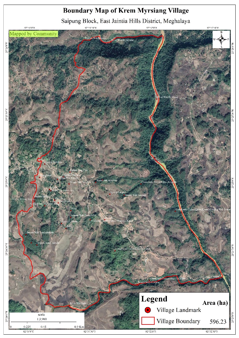
GPS coordinates: Latitude: 25.415767 °N Longitude: 92.519458 °E
Elevation Reading (MSL): 983m
History of Kremmyrsiang Village.
Village Profile:
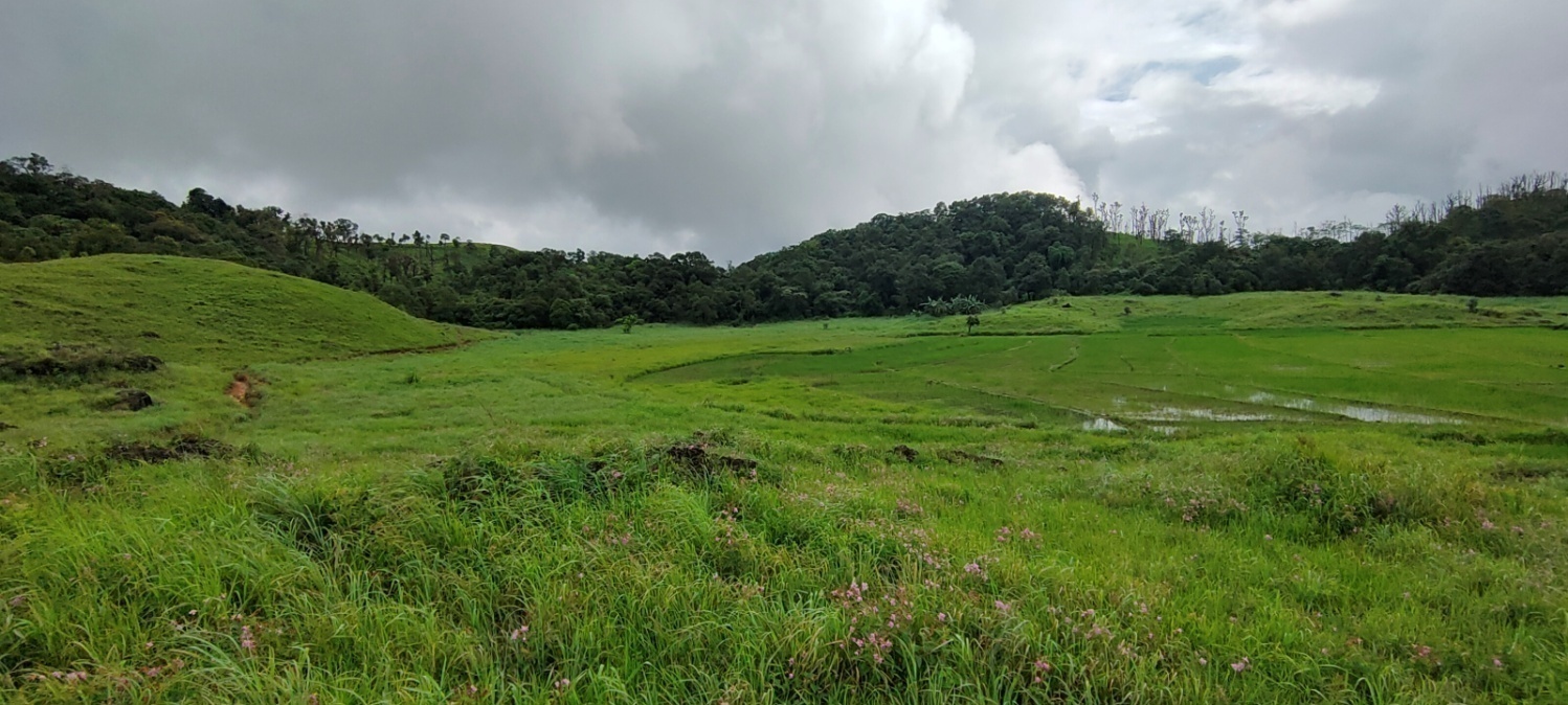
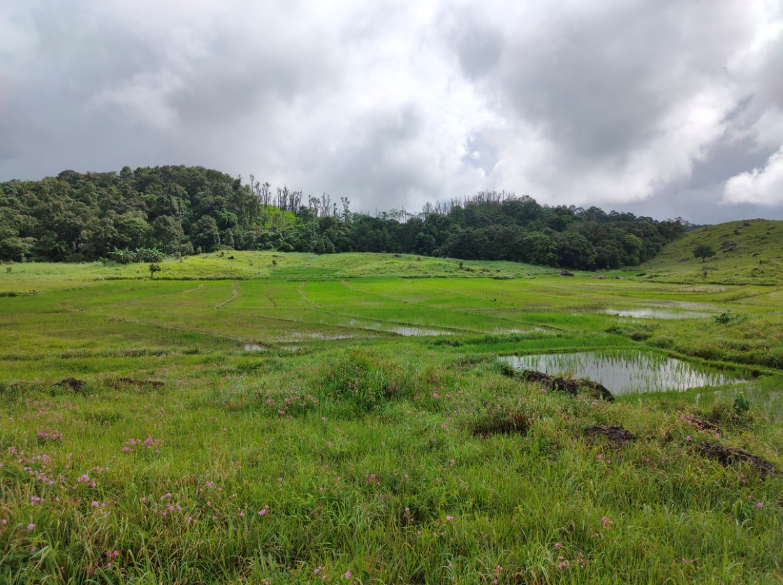
The village has a total area of 17.97 sq. km as per the village boundary given by the community. The area mostly falls under vegetation cover as categories open and dense forest. Its main source of drinking water is from PHE tap water which has the source from Wah Rymbah. There are also numerous fishery ponds which belong to individual owners. There are community culturable wasteland such as Pdak Pdak, Puriang, Shnongrim, Lum Iap Syiar and Lum Roman which can be used for many interventions. Agriculture is the main occupation of Pynurkba village where they mainly take up traditional approaches of cultivation like jhum or shifting cultivation. The farmers mostly cultivate paddy and vegetables. There are two schools inside the village, out of which one is a Lower Primary School and the other is a Primary School. The health dispensary and Bank is 17 km away and the Post office is 23 km away from the village.
 Population
As per data collected during the PRA exercise, Krem Myrsiang’s total population is 574. Out of this, 291 are males while the females count is 283.
| Age Group | Male | Female | Total |
|---|---|---|---|
| 0-4 | 25 | 45 | 70 |
| 5-14 | 85 | 90 | 175 |
| 15-30 | 102 | 80 | 182 |
| 30-60 | 67 | 59 | 126 |
| Above 60 | 12 | 9 | 21 |
Occupation:
The large portion of the population is mostly farmers and daily wage earners.
Irrigation Water: There is shortage of water starting from the month of March till Mid-April and some farmers need to carry drinking water in containers to water their vegetables in their kitchen gardens which are located almost 1km away from the village.
Drinking Water: Most of the springs which are located in the village tend to dry up from December to April and the people then have to rely on springs which are located further away from the village.
Access to LPG: The people need to travel to Rymbai village (which is 17kms away) just to get a refilled cylinder.
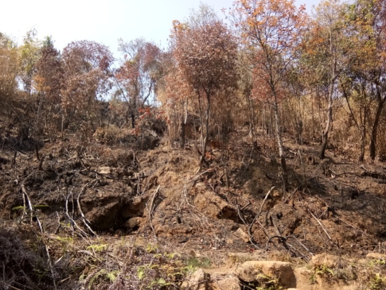
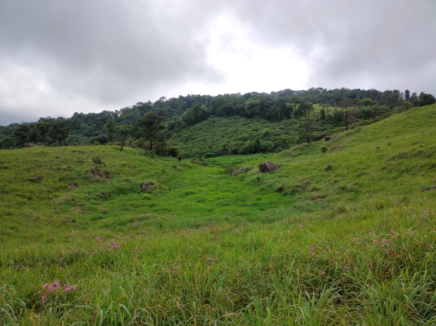
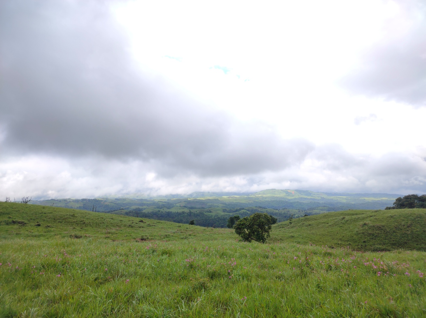
Soil erosion is very common as most of the landscapes are highly degraded due to deforestation, overgrazing etc.
Crop infestation due to pest is one of the major challenges the farmers of Pynurkba have faced these past few years.
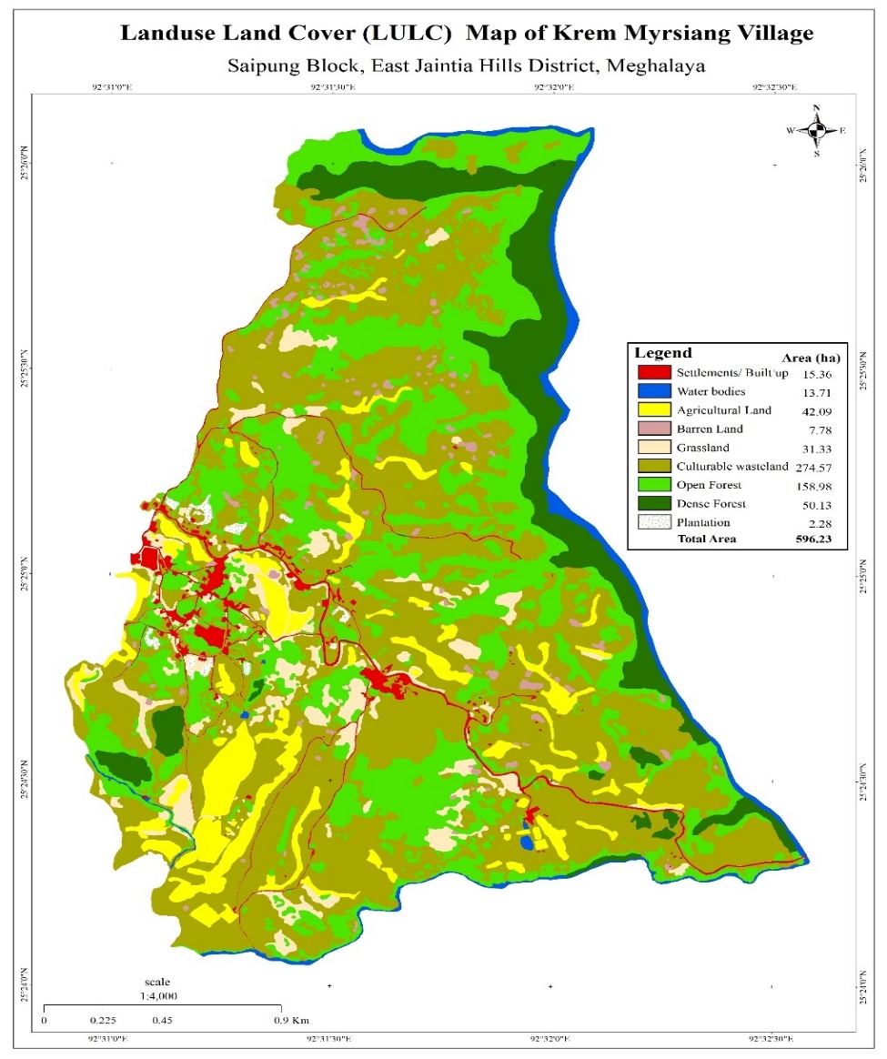
The LULC map has been categories into 8 categories which are under the following
| Landuse/ Landcover | Area in Hectare |
|---|---|
| Settlements/ Built Ups | 15.36 |
| Water Bodies | 13.71 |
| Agricultural Land | 42.09 |
| Barren Land | 7.78 |
| Grassland | 31.33 |
| Culturable Wasteland | 274.57 |
| Open Forest | 158.98 |
| Dense Forest | 50.13 |
GROUND TRUTHING
Dated: 2nd August 2019
As Krem Myrsiang village falls under the NESAC list, the DPMU team met with the local headman to gather information about the village and conducted site verification. This village was also suggested by the Deputy Commissioner of East Jaintia Hills District and BDO of Khliehriat Block.
Case Findings: -
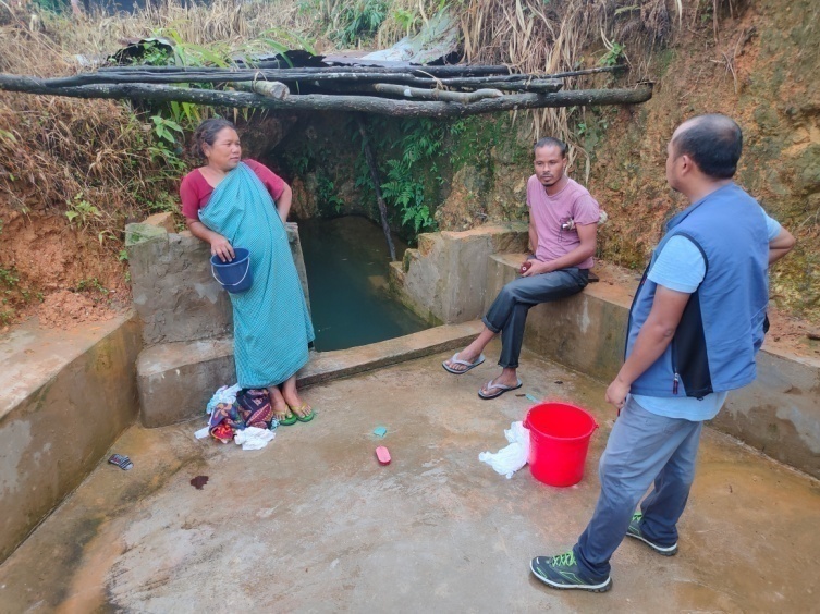
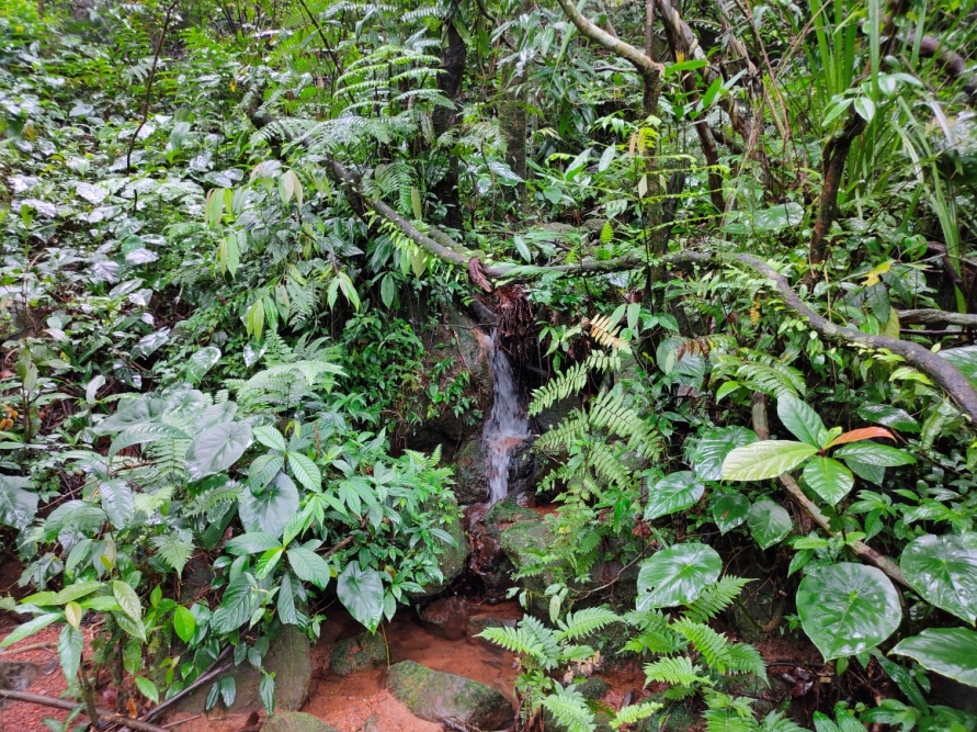
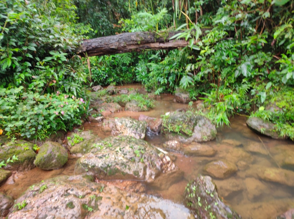
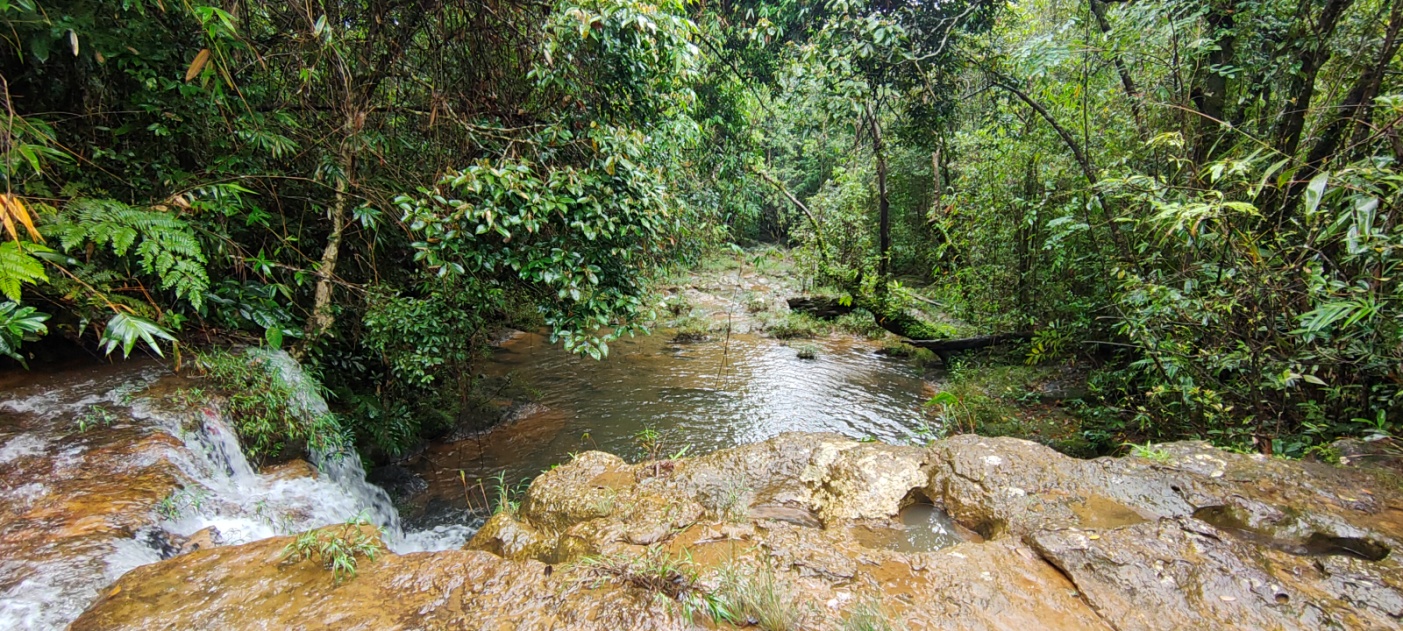
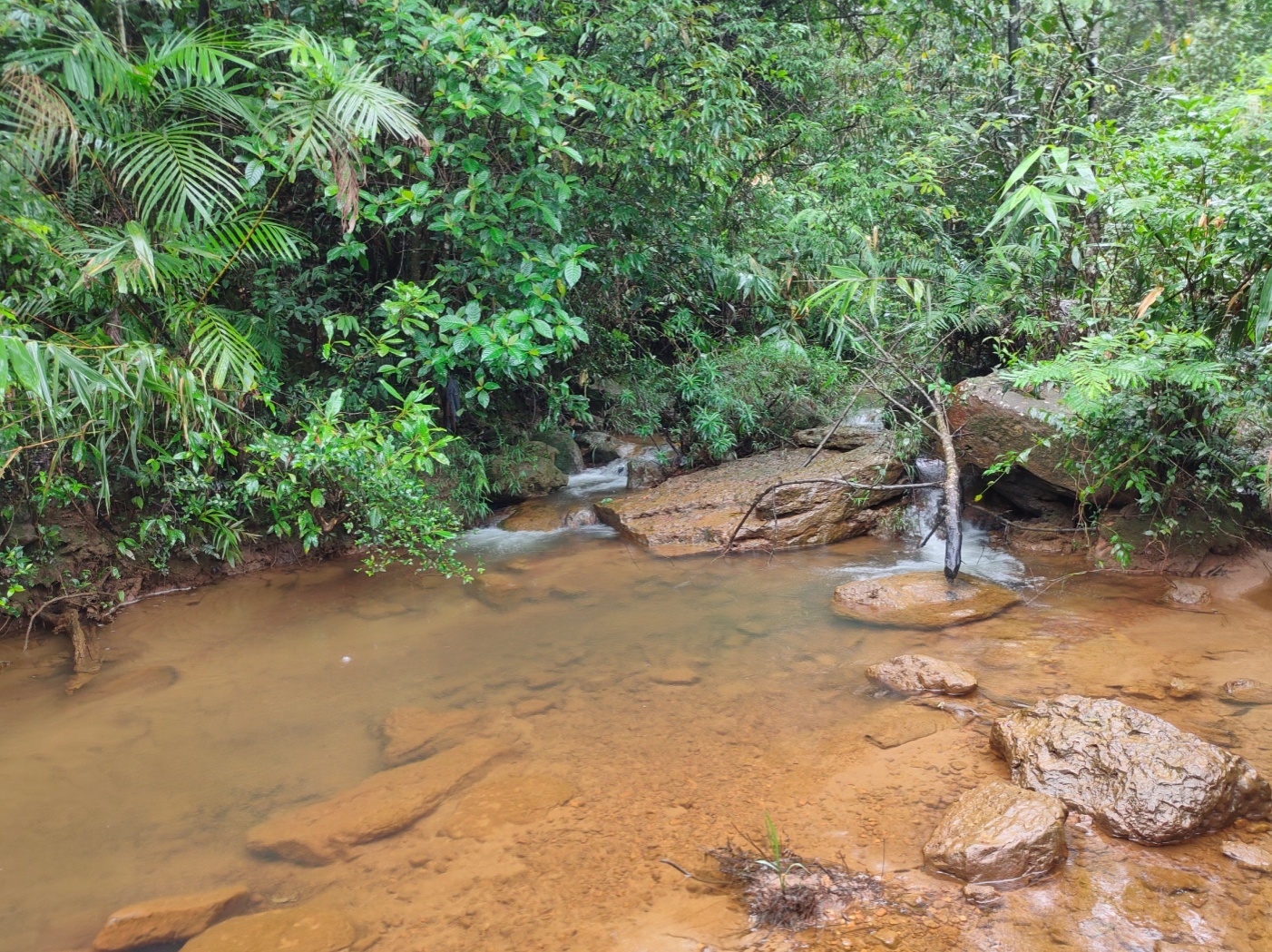
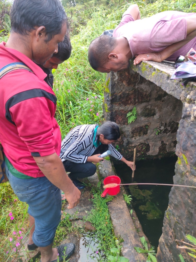
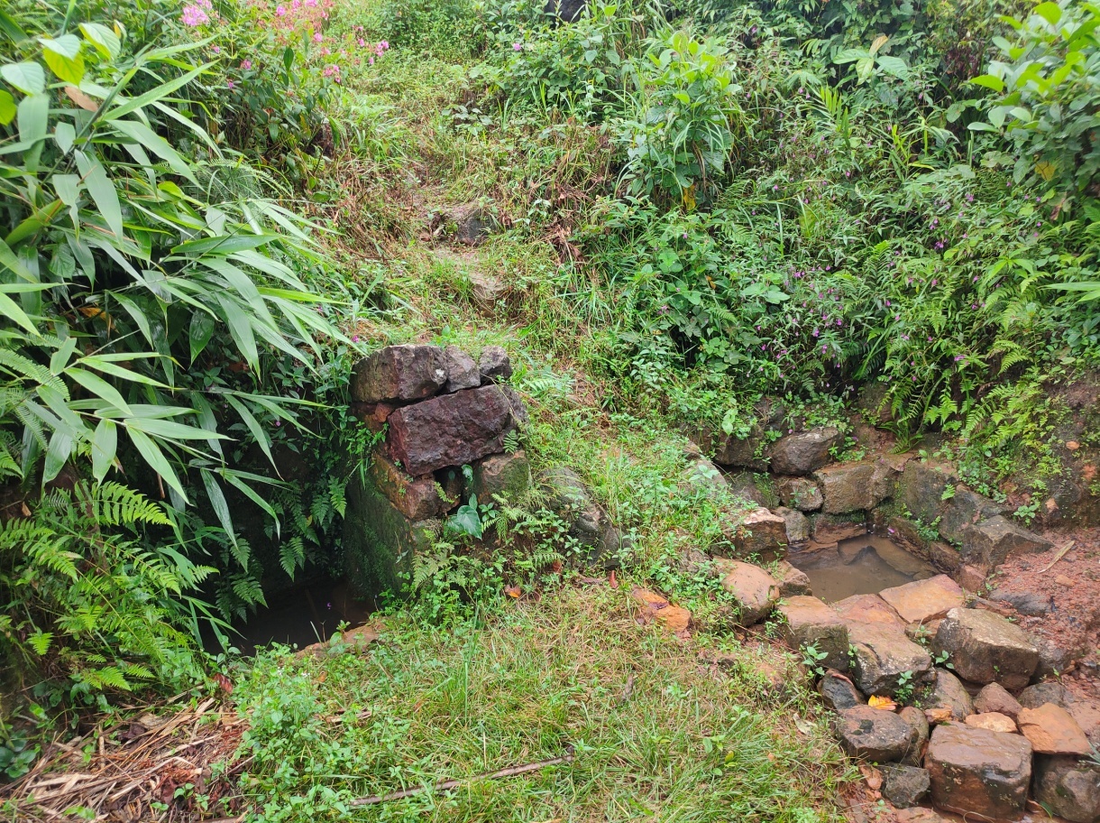
1. There are 4 springs which the whole community highly depend on and these springs tend to dry up during the winter season. So during this dry period, the people depend on other privately owned springs for drinking water and streams which are located far away from the village for washing clothes.
2. Shifting cultivation is the main agricultural practice and this has resulted to soil becoming highly infertile and loose.
3. There is one particular stream, Um Walieh, which has been polluted due to domestic waste.
4. Huge areas of paddy fields are left un-irrigated as the source of water is either unavailable or further away from the fields.
5. The productivity of the land is decreasing with each passing year.
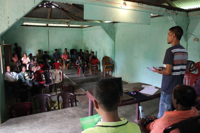
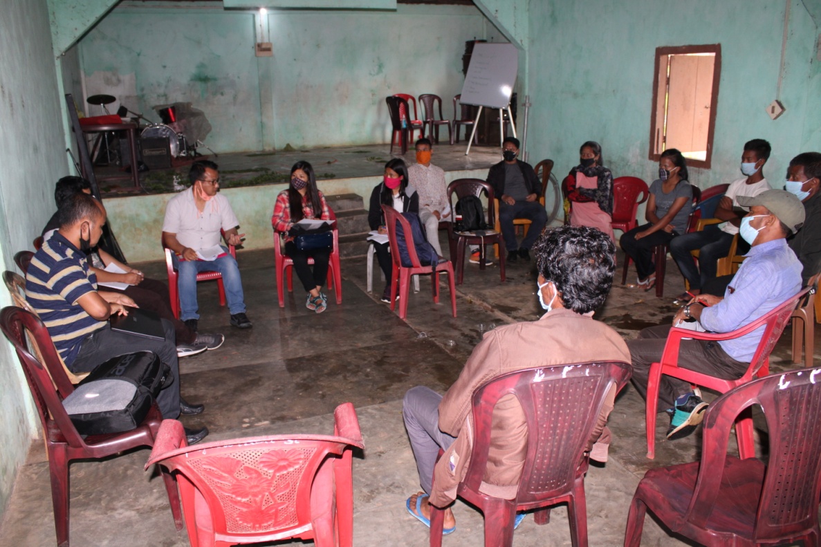
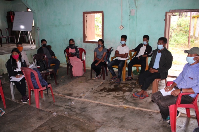
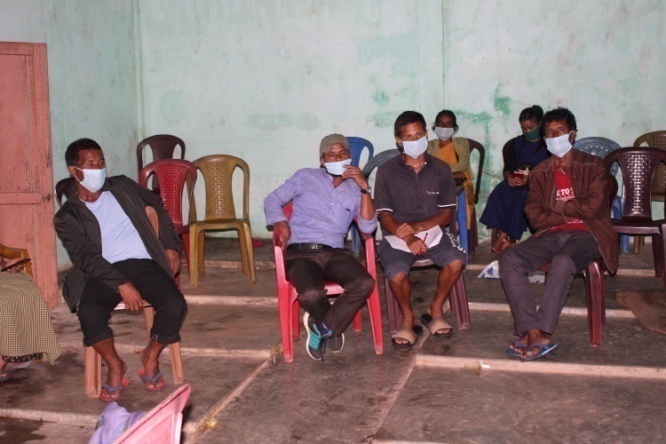
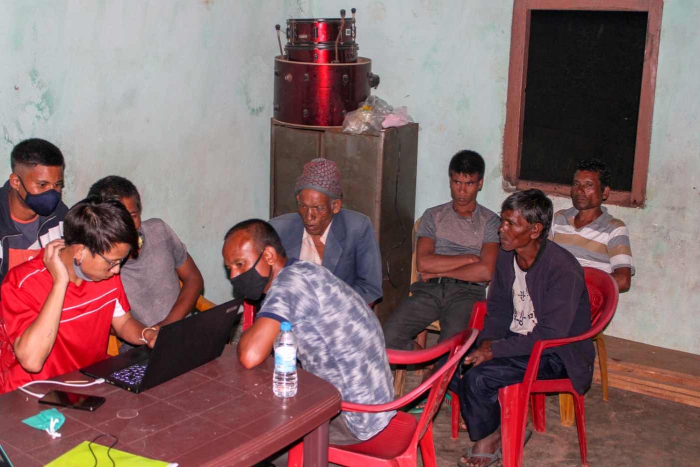
SENSITIZATION PROGRAMME
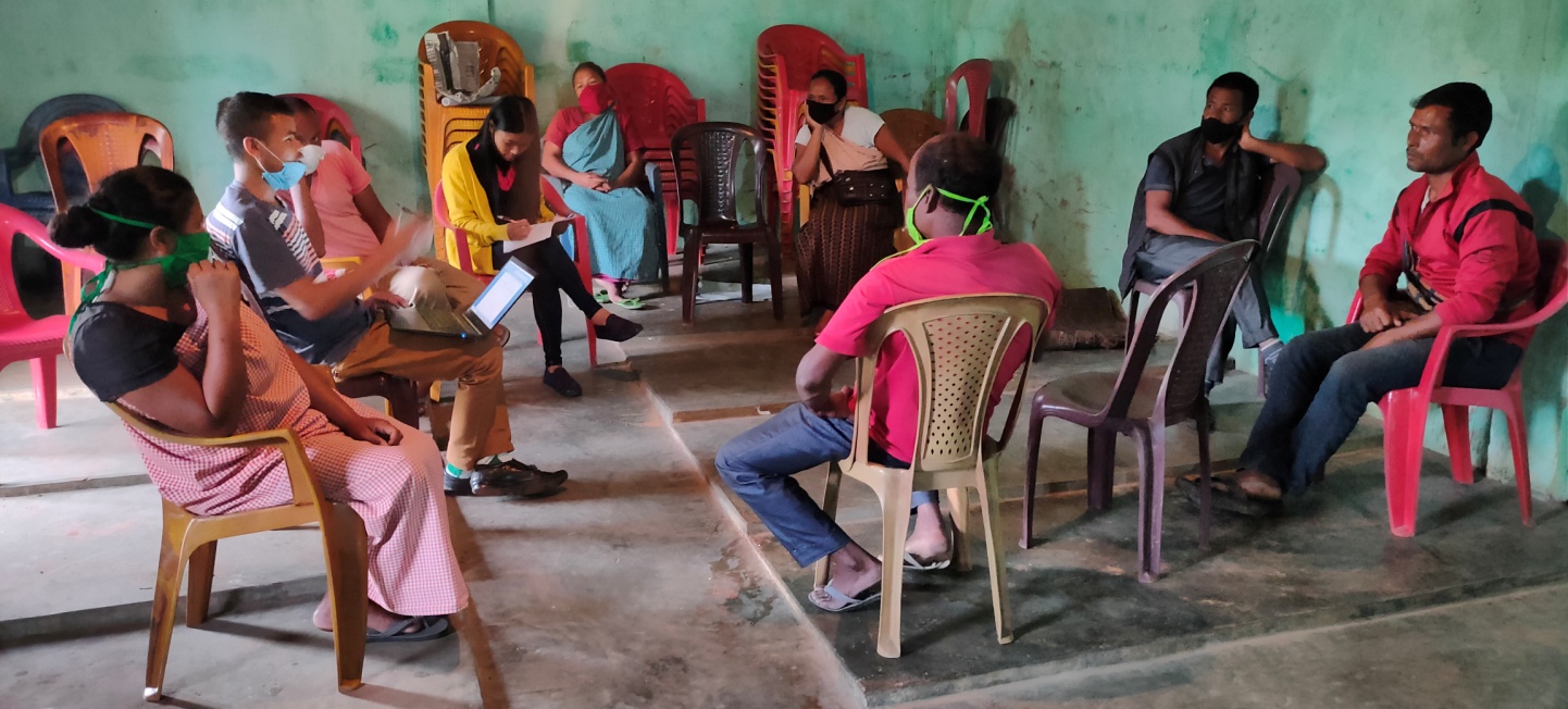
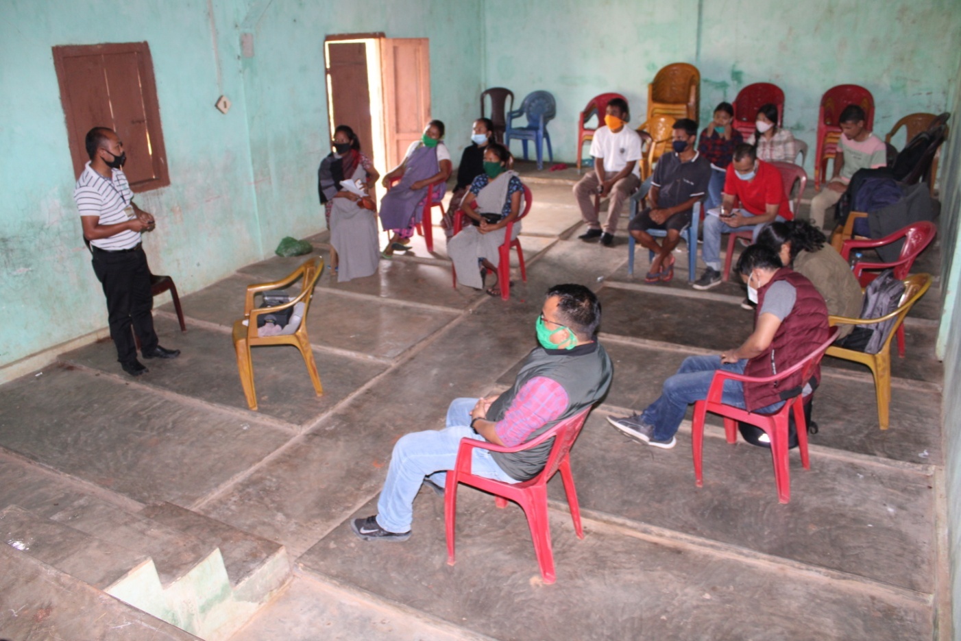
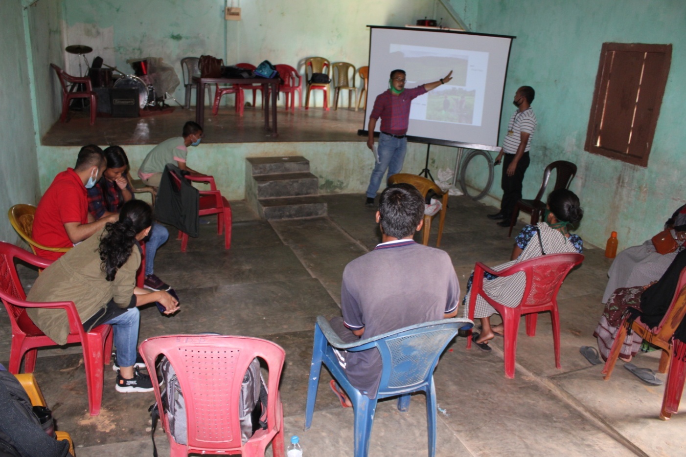
The sensitization programme at Pynurkba Village took place on the 2nd August 2019 at the Community Hall of Pynurkba Village. The Secretary of Pynurkba village, Mr. Hamlet Pdang presided over the programme. A total of 33 particpants attended the sensitization program.
 The
Assistant Manager (Social Management) gave a detailed introduction
to the Community led Landscape Management Project (CLLMP) and the
different procedures that the villagers and the CLLMP team should
carry out during the course of the project and the importance of the
involvement of the community for the CLLM-Project to be a
success.
The
Assistant Manager (Social Management) gave a detailed introduction
to the Community led Landscape Management Project (CLLMP) and the
different procedures that the villagers and the CLLMP team should
carry out during the course of the project and the importance of the
involvement of the community for the CLLM-Project to be a
success.
The Assistant Manager (Monitoring & Evaluation) gave a brief introduction on Meghalaya Basin Management Agency (MBMA) and elucidated about the various programmes and projects that MBMA is working on, but mainly focused on the Community Led Landscape Management Project (CLLMP). He also spoke about the different aspects and procedures of the project and gave due importance on the environmental aspects of the project.
The Assistant Manager (Social Management) spoke on the social aspects of the Community Led Landscape Management Project by giving numerous examples. He also enlightened the various benefits that the villagers could obtain from the project.
The Program was followed by an interactive session to answer the doubts and questions of the villagers.
Can this project be implemented on individual land?
Ans: Yes, but there should be an agreement signed between the land owner and the VNRMC before
implementing any NRM related activity.
Does this project only concentrate on conservation?
Ans: No, there are different NRM activities which can be implemented but this project mainly focuses
on capacity building and training the community people
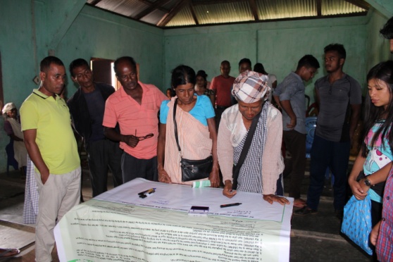 Signing
of Documents: After the sensitization programme, all the
participants signed the Citizens Green charter banner. The EOI, VGA
and Citizens Green Charter documents were signed on 8th
August 2019 during a public meeting (Dorbar shnong) in the presence
of the entire village
Signing
of Documents: After the sensitization programme, all the
participants signed the Citizens Green charter banner. The EOI, VGA
and Citizens Green Charter documents were signed on 8th
August 2019 during a public meeting (Dorbar shnong) in the presence
of the entire village
Formation of the VNRMC
The Formation of the Village Natural Resource Management Committee was done in a public meeting (Dorbar Shnong) in the presence of the entire village on 17th August 2019. The community itself chose the Chairman, the Secretary and the other executive members of the Committee.
|
||||||||
|---|---|---|---|---|---|---|---|---|
| Sl No | Name in Full | Gender M/F | Age [Yrs] | Designation | Education | Occupation | Community | Contact Number |
| 1 | Vincent Dkhar | M | 40 | M.A | Chairman | Farmer | Pnar | 8787368027 |
| 2 | Readiness Syrti | F | 40 | B.A | Secretary | Farmer | Pnar | 8787483609 |
| 3 | Dising Pakem | M | 36 | Member | Farmer | Pnar | - | |
| 4 | Poly C Syrti | M | 44 | SSLC | Member | Farmer | Pnar | - |
| 5 | Lestar Lamurong | M | 36 | - | Member | Farmer | Pnar | - |
| 6 | Phili Sutnga | F | 60 | VII | Member | Farmer | Pnar | - |
| 7 | Iusibia Nongtdu | F | 39 | - | Member | Farmer | Pnar | - |
| 8 | Chalestina Nongtdu | F | 33 | III | Member | Farmer | Pnar | - |
| 9 | Iohlamkmen Syrti | F | 24 | HSSLC | Member | Farmer | Pnar | 8413071040 |
| Bookkeeper | ||||||||||
|---|---|---|---|---|---|---|---|---|---|---|
| Sl.No. | Name | Gender | Contact Number | |||||||
| 1 | ||||||||||
| Village Community Facilitators | ||||||||||
| Sl.No. | Name | Gender | Age | Education | Contact Number | Role | ||||
| 1 | Skhembor Nongtdu | M | 27 | VIII | 8787767940 | M&E | ||||
| 2 | Smt. Monrila Nongtdu | M | 27 | IX |
9612352105 |
NRM & GIS | ||||
| 3 | Iohlamkmen Syrti | F | 24 | HSSLC | 8413071040 | Social | ||||
| Purchase Committee | |||
|---|---|---|---|
| Sl.No. | Name | Gender | Contact Number |
| 1 | |||
| 2 | |||
| 3 | |||
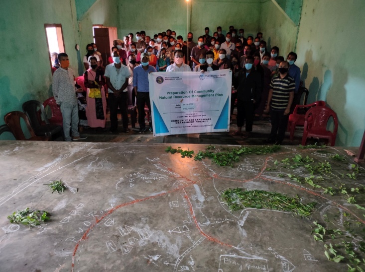
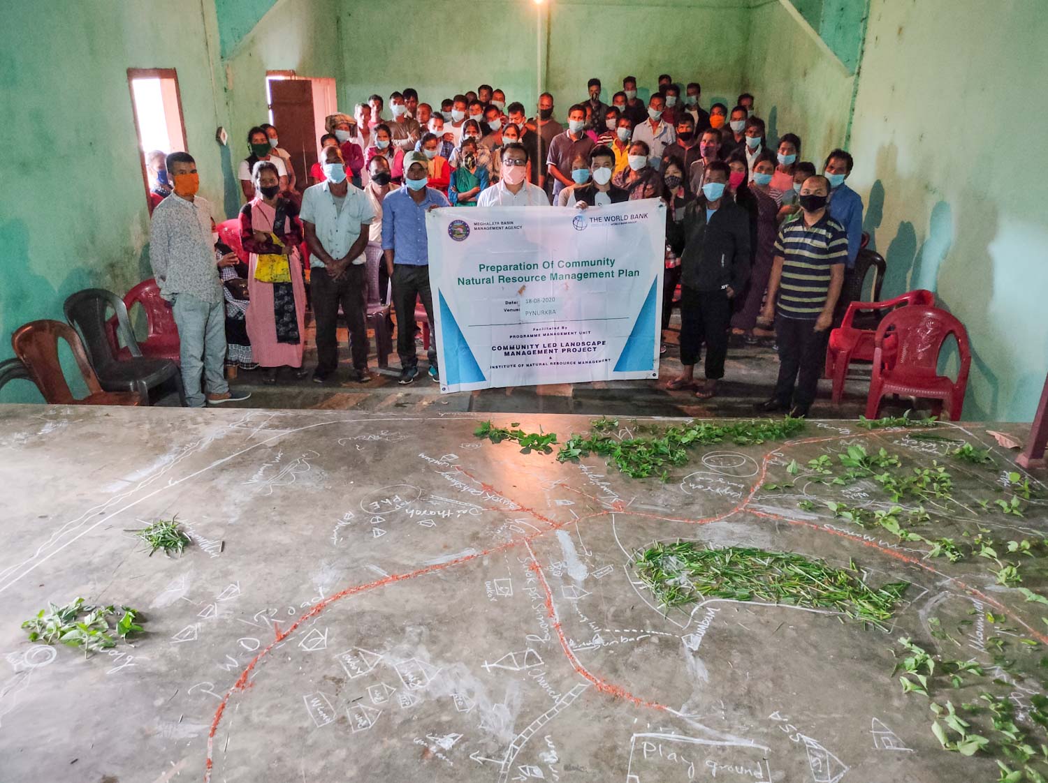
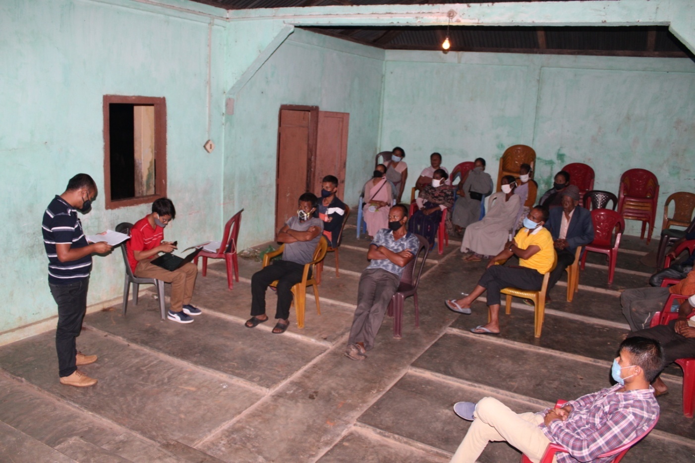
4. PRA EXERCISE & PREPARATION OF CNRMP
18th – 25th AUGUST 2020
Dated – 18th August 2020
Venue: Pynurkba Community Hall
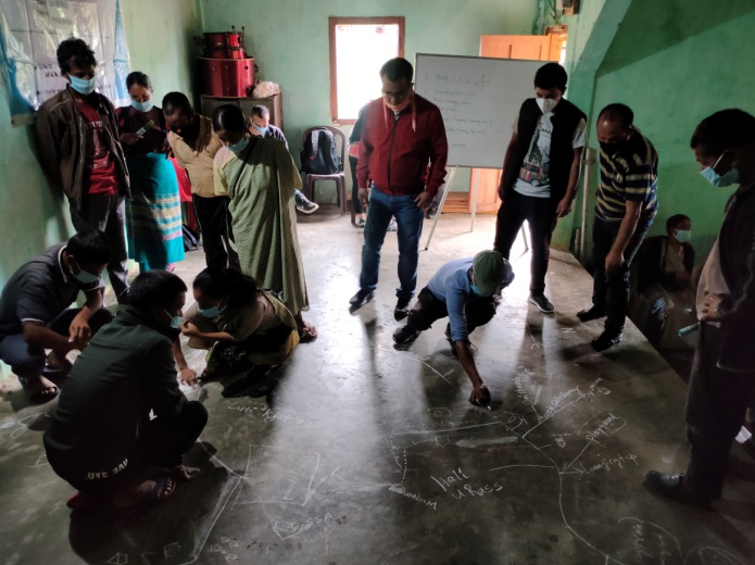
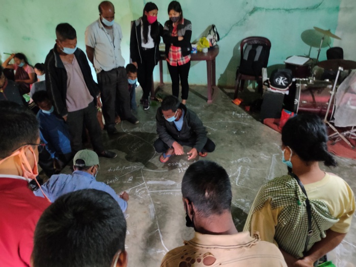
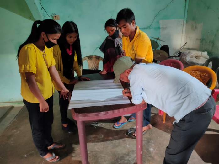
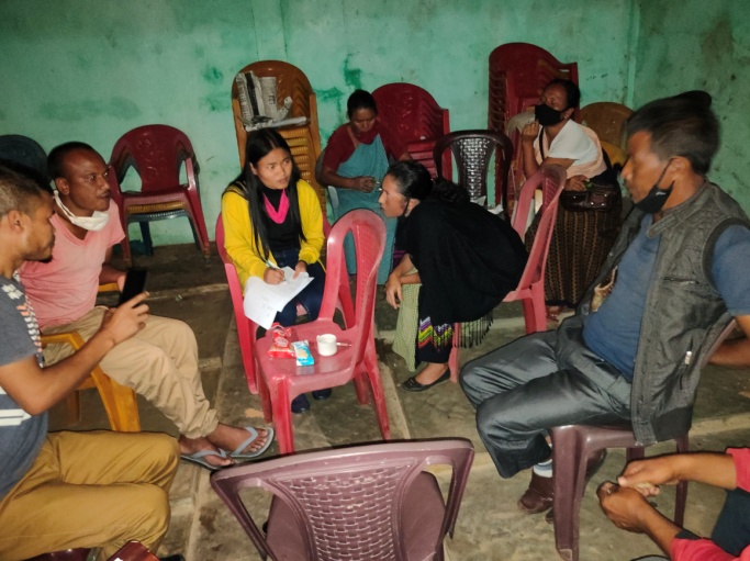
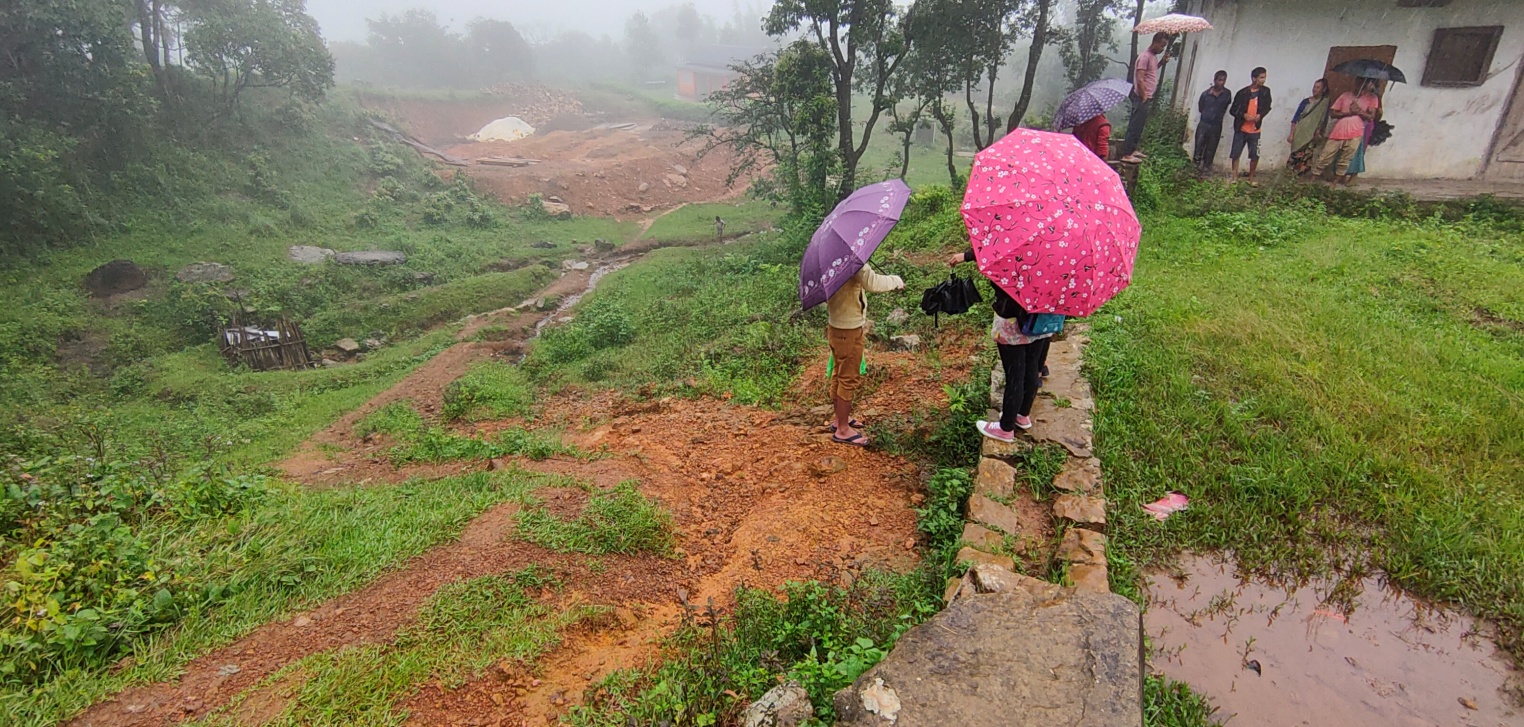
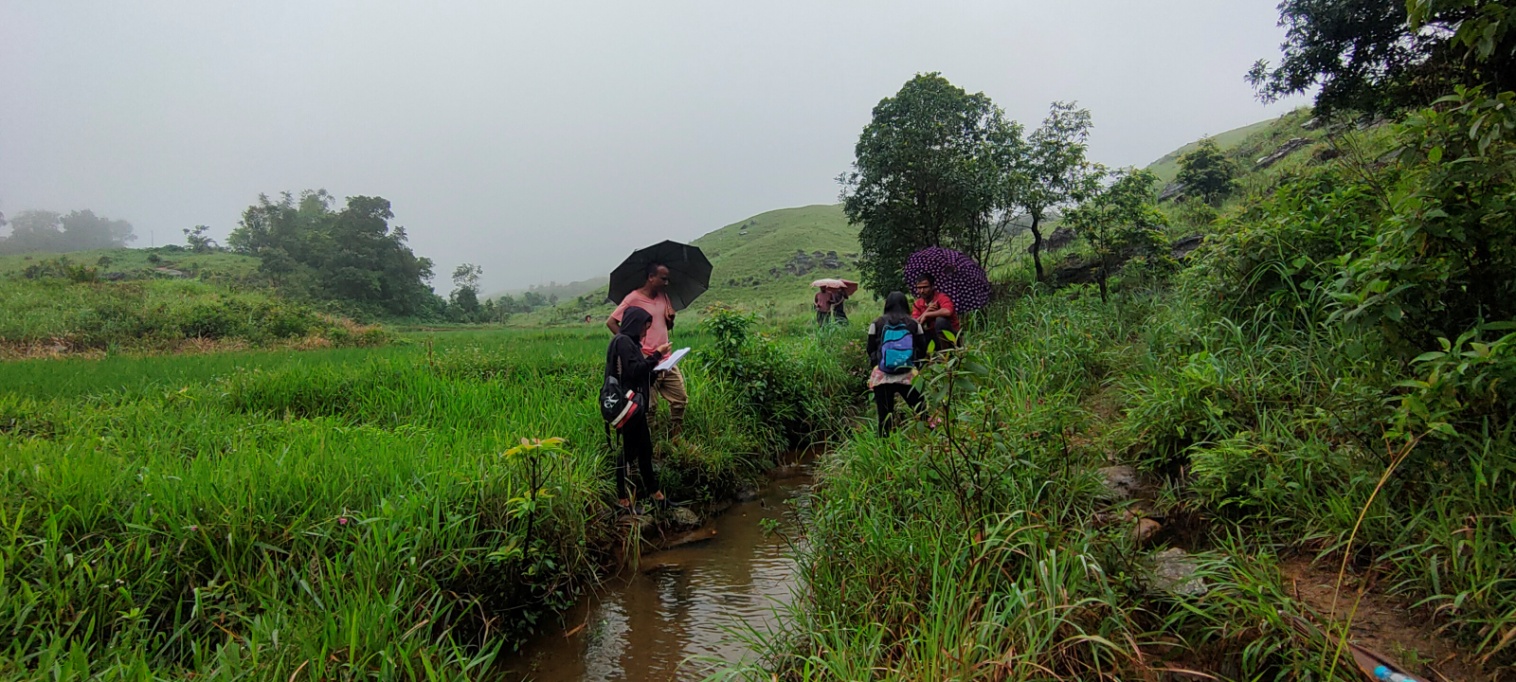
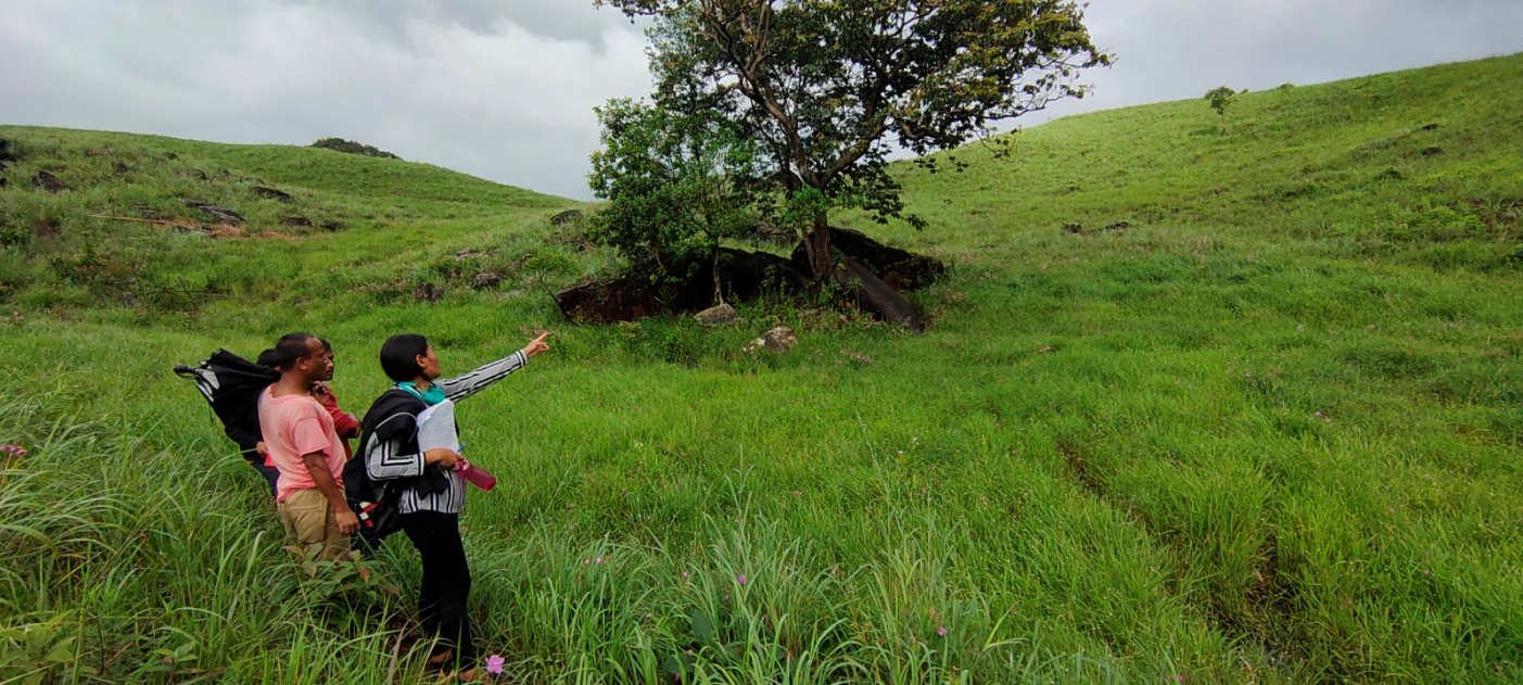
The PRA exercise aims to incorporate the knowledge and opinions of the community in the planning and management of development projects and programmes. There were a total of 65 participants taking part in this exercise who contributed their time and knowledge to this project.
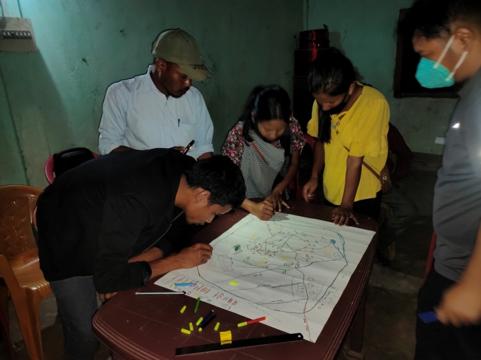
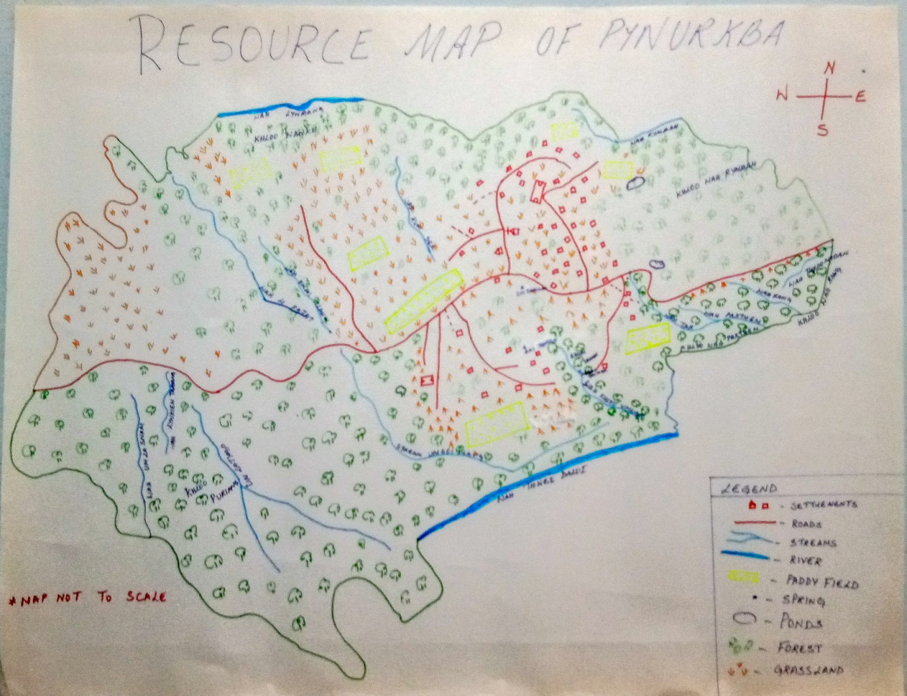
i) Drawing of the Resource and Social Map Duration: 2hrs 45 mins
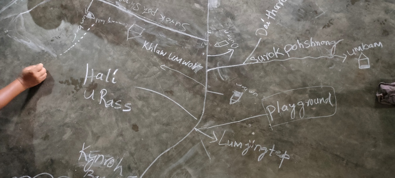
Shri. Philip Rymbai, Smt. Monday Pdang, Smt. Taimon Pdang, Shri. Rass Rymbai, Shri Peterson Dkhar participated in drawing the resource and social map of Pynurkba village. They started by drawing the roads, the village boundary, then the landmarks, the community forest, the rivers/streams and lastly the springs. With time, the map design got better and better as more participants got involved and shared their inputs. The DPMU and SPMU team made the participants understand that by drawing the resource map, they would have greater knowledge on the location and distribution of their available resources.
ii. Re-orientation session on preparation of CNRM plan
The purpose of this session is to revisit the CNRM plan and to identify all the key areas in the plan that needs improvement and reworked. The topics of discussions are as follows:
The major issue with old plan was that it was very limited and the DPD advised the VNRMC members to work with DPMU team in order to prepare a new plan that exceeds more than 10 years.
The plan should not be focussed only on water conservation but also on other interventions such as Land productivity enhancement, Agro-forestry activities, Community nurseries and Capacity building.
All the plans should relate with one another.
There is a huge area of cultivable wasteland (587.26 ha) that can be reclaimed and by practicing Agro-forestry can benefit and improve the livelihoods of the farmers.
It is important to know the area of the intervention site before implementing any activity.
Before any afforestation activity, it it important to first identify the nature of the soil in order for the VNRMC to have a better idea on the types of tree species which can survive in their village. If the proposed afforestation site is far away from the village, the DPD suggested in identifying tree species which cattle and goats don’t like to feed on.
Proper management of the available forest is needed to avoid any over exploitation such as unnecessary felling of trees for firewood.
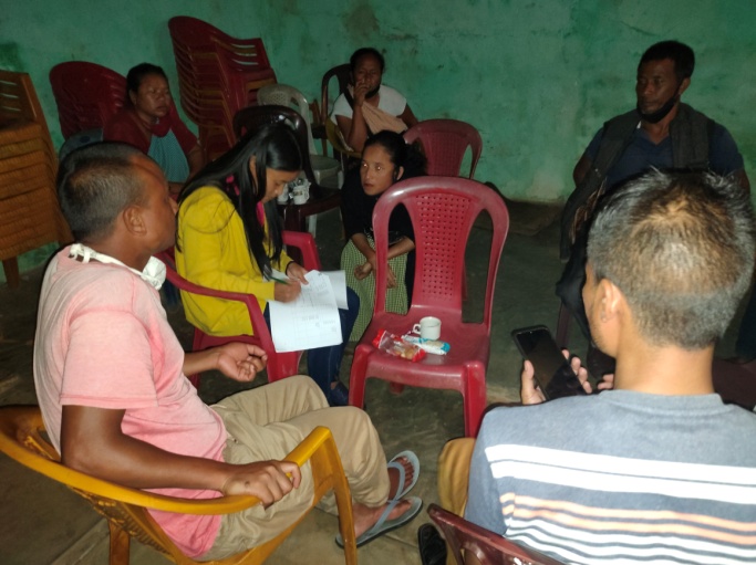
Preparation of CNRMP in Pynurkba Village
Dated – 21th August 2020
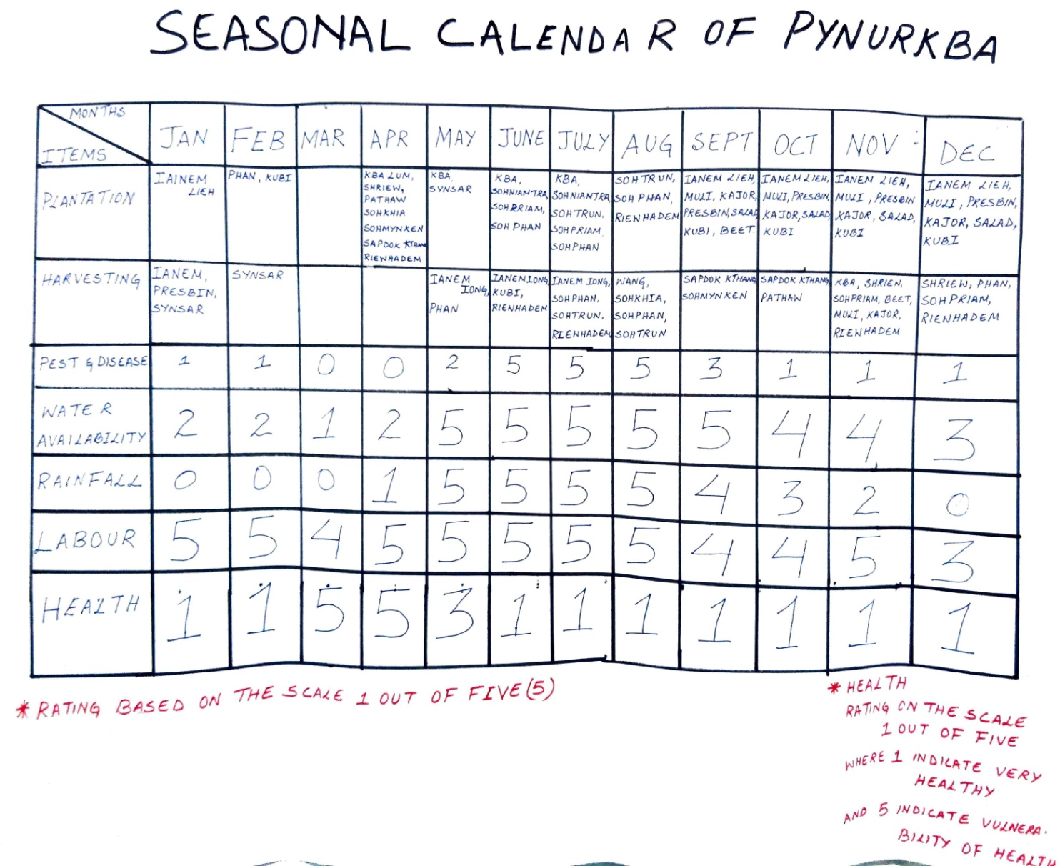
Group 1 – Preparation of Seasonal Calendar

Findings as per the Seasonal Calendar:
| January – June | July - December | |
|---|---|---|
| Plantation | Mustard greens, Potato, Cabbage, Paddy, Cassava, Cucumber, Chilli, Bitter tomato, Yam, Corn, Broom, Orange, Jackfruit, Passion fruit | Paddy, Orange, Passion fruit, Jackfruit, Corn, Mustard greens, Radish, Carrot, French bean, Salad, Cabbage, Beetroot, |
| Harvesting | Mustard greens, French bean, Broom, Potato, Cabbage, Corn | Mustard green, Jackfruit, Pineapple, Colocasia, Orange Corn, Cucumber, Bitter tomato, Chilli, Pumpkin, Cassava, Passion fruit, Beetroot, Radish, Yam, Carrot, Potato |
Pest infestation is at large during the month of June – August.
Water availability improves after the month of May and starts decreasing after November.
There is adequate amount of rainfall during the monsoon but little to no rainfall from November till April.
People tend to fall sick during the month of March – May.
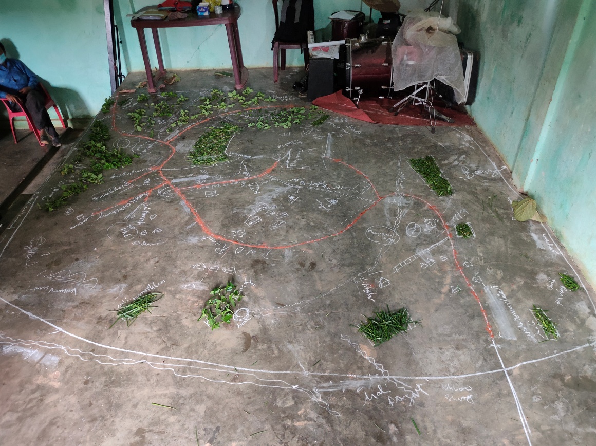
Group 2 – Drawing of the resource & social map on chart
paper
Group 3 – Problem Analysis
Findings:
At present, there are no constraints to access of fodder, fuel wood and fodder but the participants’ belief that with time and with increase in population they will eventually start decreasing.
Some of the water bodies are polluted due to domestic waste, siltation and also turn up dry during the winter season.
According to Kong Taimon Pdang, there is always a shortage of drinking water starting from the month of November till April and then the community has to depend on water bodies which are 2 to 3 km away from the village.
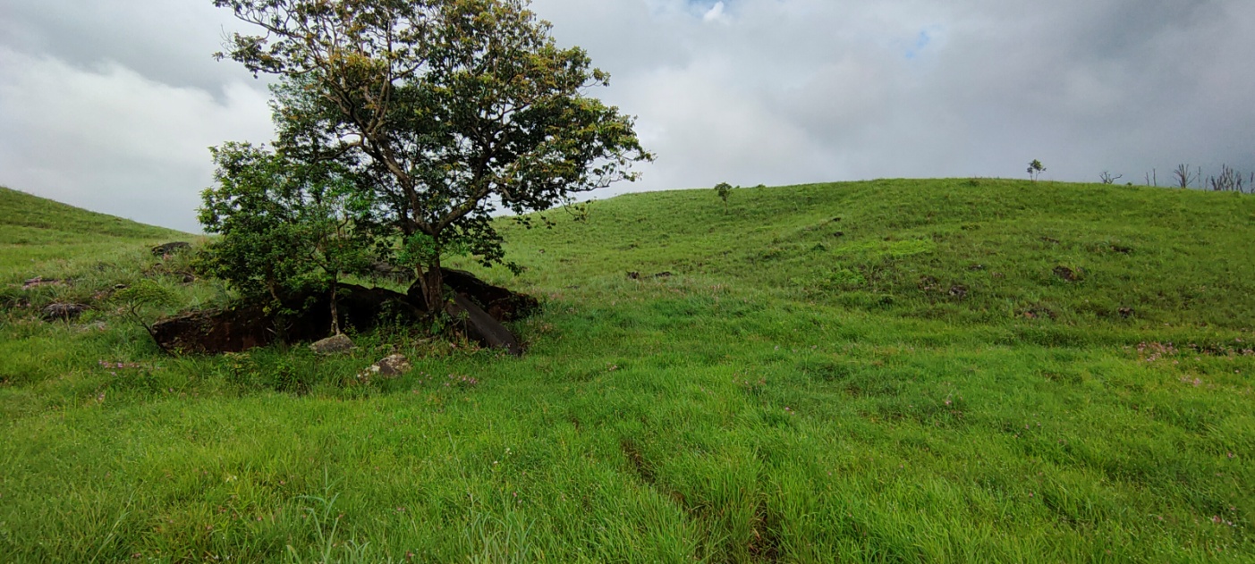
As seen on the map below, a large portion of the land is highly degraded and therefore soil erosion and open/degraded forest is common. Shifting cultivation, growth in population, open grazing etc. are some of the causes to this degradation.
To cope with the increase in population, the people had to adapt from the traditional agricultural practices to a modern approach by using machines, fertilizers, pesticides etc.
Due to water scarcity, most of the land is left uncultivated and then they are prone to soil erosion. Climate change has deeply affected farmers as most of their crops would get damaged by heavy rainfall and pest proliferation.
There are no proper drains for domestic effluents and the runoff ends up polluting some water bodies.
Most of the conflicts and disagreements are resolved during the village dorba
Group 4 – Identification of Intervention Sites
Findings based on the discussions:
According to Shri. Ebormiki Dkhar, the VNRMC should first prioritise in constructing a retaining wall to prevent soil erosion in SSA Lower primary school.
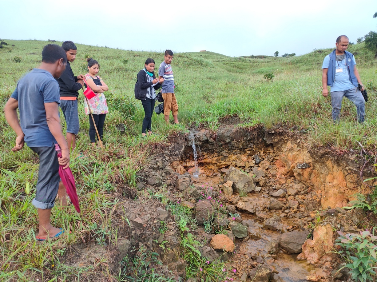
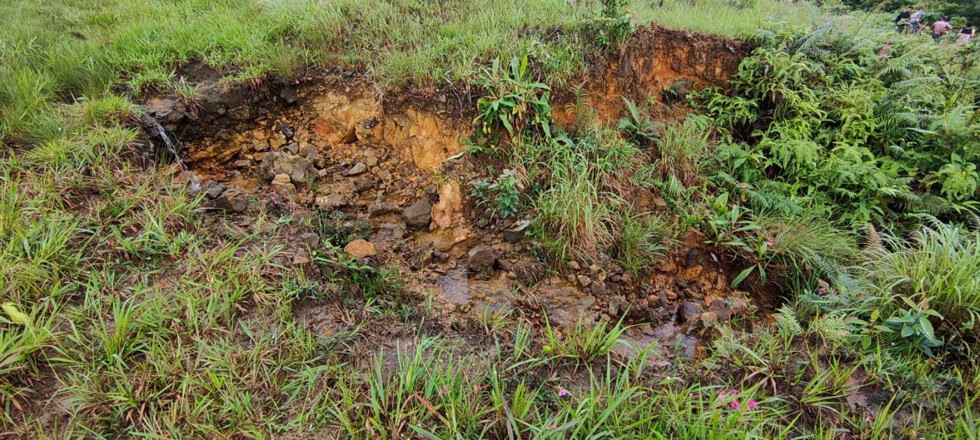
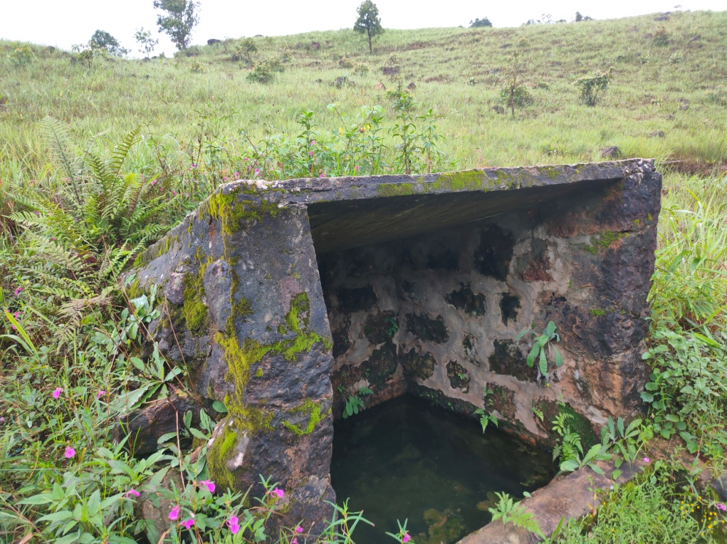
The participants all agreed on the construction of a spring chamber in Khlieh Umwar which is a community spring.
Shri. Hamlet Pdang suggested on construction of a spring chamber in Daitharoh and also a loose boulder around the spring to prevent any soil erosion.
Shri Rass Rymbai and Shri. Philip Pdang suggested on building a check dam in Khlieh Umwar which is one of the streams the local community highly depend on.
The participants suggested Mooprah as the best site for Agro-forestry, Loose boulder check dam and Jalkund for rain water harvesting
As there is a community forest and agricultural land in Puriang (a site), Smt. Taimon Pdang and Shri. Philip Rymbai suggested a need of a dug out pond, a community nursery and a composting area.
Larshah site was also suggested for horticulture practice.
Group 5 – Vision Map
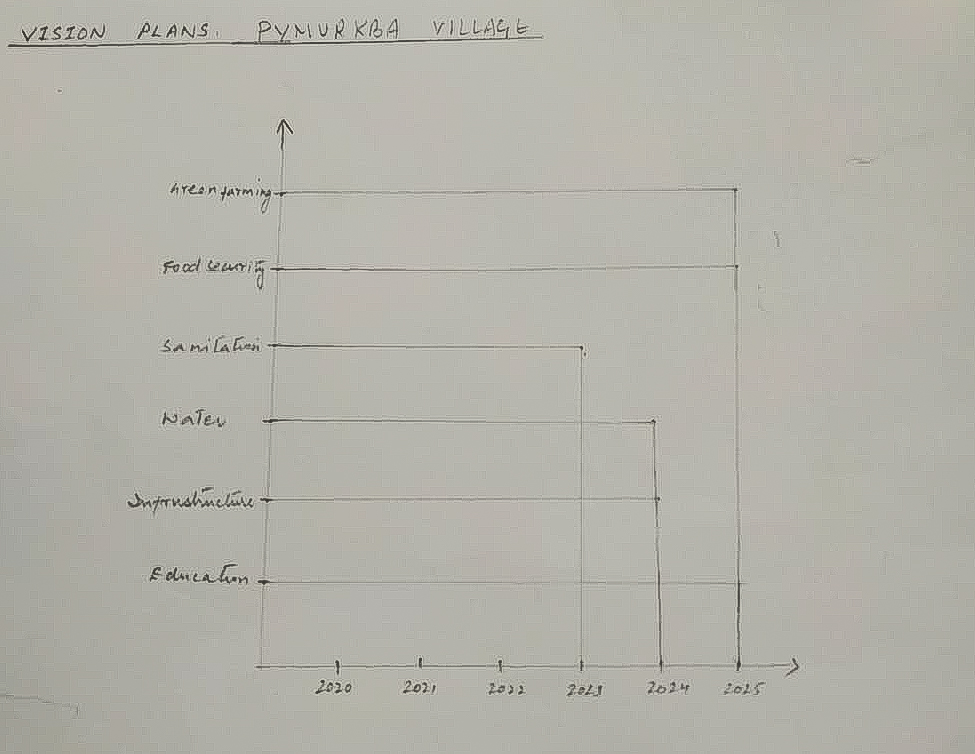
Vision Plan of Pynurkba village
Green/Organic farming: The people of Pynurkba village who are mostly farmers’ wants to practiced organic farming by the year 2025 since they could see the affected to soil infertility and agricultural products produce low quality as before if they use the fertilizers.
Food Security: They want to access to a sufficient quantity and good quality of affordable & nutritious food by the year 2025 which includes the people from BPL category.
Sanitation: They want to gain access to clean water household wise, proper waste management and transform the village as one of the cleanest in Meghalaya by the year 2023.
Water: To have adequate amount water in the village all throughout the year by 2024.
Infrastructure: To have a basic infrastructure and facilities available by 2024 for the community like Higher Secondary School building, PHC, CHC, Community Service centre, good metalled roads, etc.
Education: They want that all the people in the village should be able to read and write and the children and youth in the village should have an advanced education by the year 2024.
Group 5 – Vision Map
| Sl. no. | Desire/Needs | How to avail | Responsible in assisting | Target/Goals |
|---|---|---|---|---|
| Organic farming |
|
|
5 years | |
| Food security |
|
|
5 years | |
Sanitation
|
|
|
3 years | |
| Availability of irrigation and drinking water all throughout the year |
|
|
4 years | |
Infrastructure
|
|
|
4 years | |
Education
|
|
|
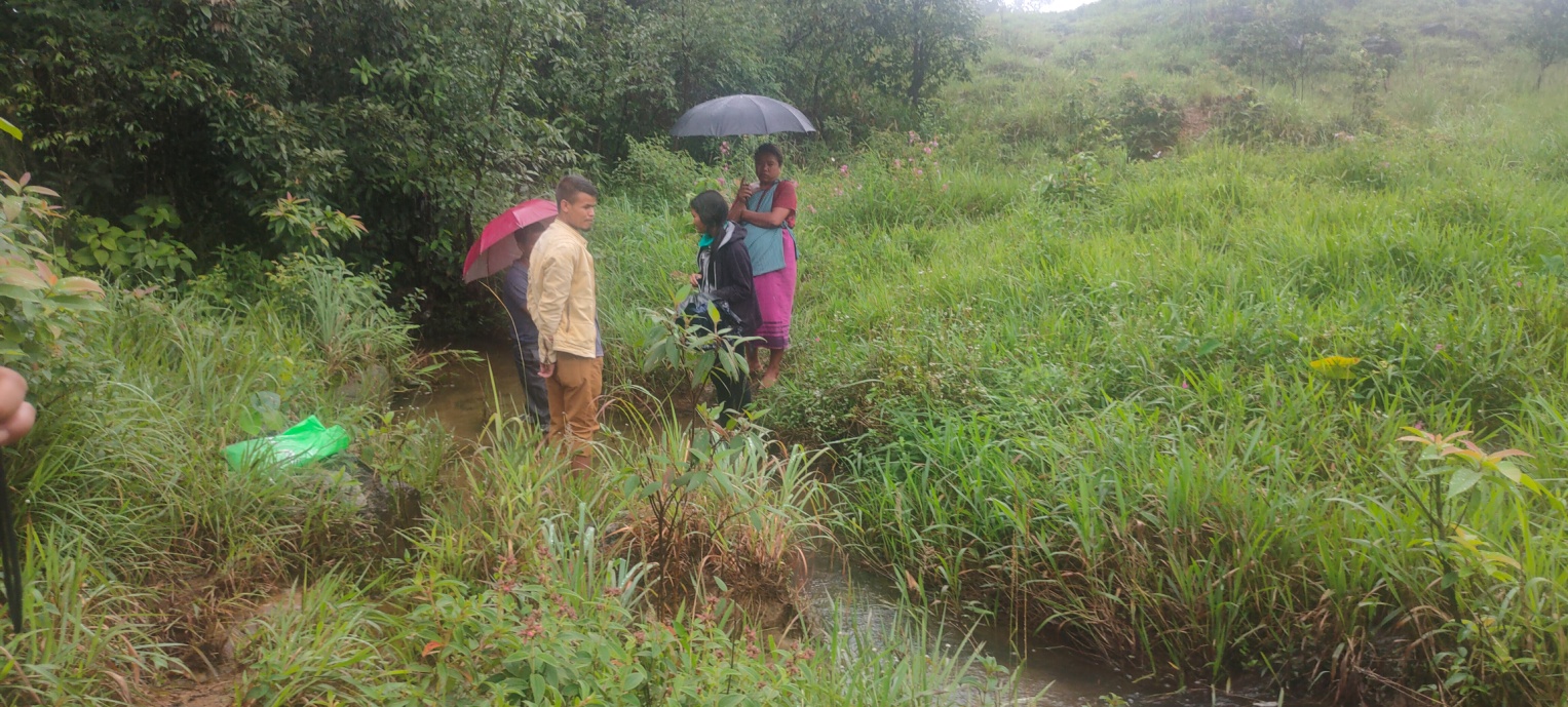
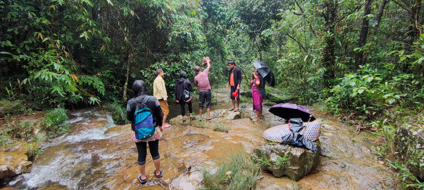
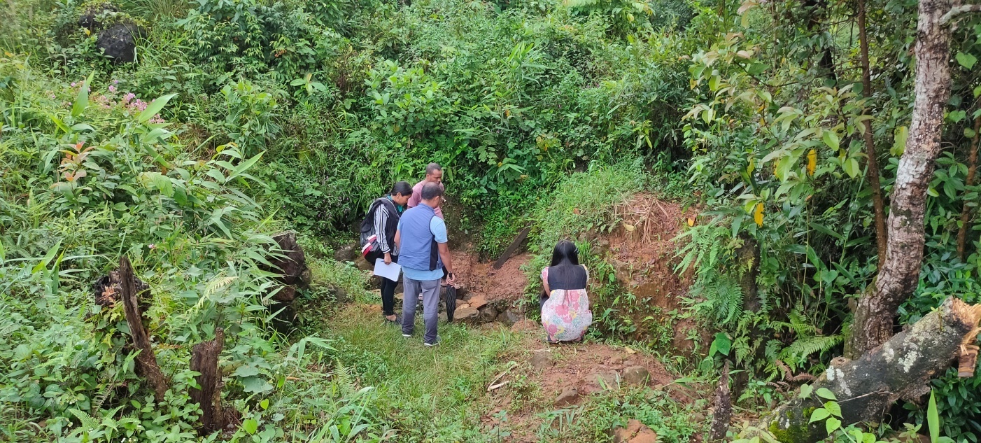
Site inspection of Proposed Intervention sites
Dated: 22nd August 2020
1.
| Name of Site | GPS Coordinates | Reason for selection | Proposed Intervention |
|---|---|---|---|
| SSA Lower Primary School | 25.25031°N 92.28918°E |
Due to heavy rainfall the school ground wall has been affected by soil erosion. Loose boulder wall will prevent landslide occurrence. | Loose Boulder wall |
| Name of Site | GPS Coordinates | Reason for selection | Proposed Intervention |
|---|---|---|---|
| Khloo Um War (Spring) | 25.25227°N 92.29230°E |
A communal spring which is perennial and give adequate amount of drinking water to people during dry season |
Spring Chamber |
| Khloo Um War(Stream) | 25.24998°N 92.29195°E |
One of the streams which the people highly depend on during the winter season | Check dam |
3.
| Name of Site | GPS Coordinates | Reason for selection | Proposed Intervention |
|---|---|---|---|
| Wah Hali | 25.25178°N 92.29134°E |
A stream which the people depend for irrigating their fields | Gabion Wall |
4.
| Name of Site | GPS Coordinates | Reason for selection | Proposed Intervention |
|---|---|---|---|
| Wah Tar | 25.25220°N 92.29457°E |
One of the streams which the people highly depend on during the winter season | Check dam |
5.
| Name of Site | GPS Coordinates | Reason for selection | Proposed Intervention |
|---|---|---|---|
| Puriang | 25.23963°N 92.27866°E |
One of the agricultural sites. Dug out pond will provide water and with the use of bamboo drip irrigation it can irrigate the agricultural fields | Jalkund and Dug out pond |
6.
| Name of Site | GPS Coordinates | Reason for selection | Proposed Intervention |
|---|---|---|---|
| Pdak Pdak | 25.23359°N 92.28592°E |
A catchment area and also a culturable wasteland which people want to cultivate these lands | Water reservoir |
7.
| Name of Site | GPS Coordinates | Reason for selection | Proposed Intervention |
|---|---|---|---|
| Shnongrim | 25.23343°N 92.28667°E |
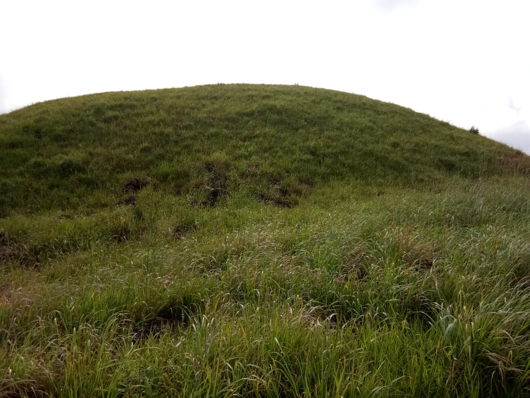
Cultivable wasteland | Afforestation |
8.
| Name of Site | GPS Coordinates | Reason for selection | Proposed Intervention |
|---|---|---|---|
| Um Latyap | 25.233173°N 92.287506°N |
A catchment area near an agricultural land | Dugout pond and recharge pits |
9.
| Name of Site | GPS Coordinates | Reason for selection | Proposed Intervention |
|---|---|---|---|
| Li Pajat | 25.25155°N 92.28039°N |
A stream which the local community depend on for irrigation |
Check dam |
10.
| Name of Site | GPS Coordinates | Reason for selection | Proposed Intervention |
|---|---|---|---|
| Hali Pom Thlun | 25.25422°N 92.28581°N |
Agricultural land affected by gully erosion |
Gully plugs |
11.
| Name of Site | GPS Coordinates | Reason for selection | Proposed Intervention |
|---|---|---|---|
| Khlieh Um Thalong | 25.25415°N 92.28605°N |
A communal spring | Contour Trenches and Afforestation to improve discharge |
12.
| Name of Site | GPS Coordinates | Reason for selection | Proposed Intervention |
|---|---|---|---|
| Daitharoh | 25.25343°N 92.28715°N |
A communal spring | Spring Chamber |
13.
| Name of Site | GPS Coordinates | Reason for selection | Proposed Intervention |
|---|---|---|---|
| Mooprah | 25.25917°N 92.29910°N |
A cultivable wasteland | Agroforestry |
NRM breakdown of the proposed activities
| SL.NO | Problems they are facing | NAME OF PROPOSED INTERVENTION | NAME OF THE SITE | IMPACT | BENEFITED HH |
|---|---|---|---|---|---|
| 1 | Soil Erosion near paddy field | Gullys plug Side channel Loose boulder |
Pamthlun Umlasnam Hali pajat |
|
84 |
| 2 | Culturable wasteland | Afforestation Contour trenches |
Shnongrim Lumkumser |
|
84 |
| 3 | Not enough water for domestic and irrigation purposes | Check dam | Khliehumwar Wahlipajat Madan larshah |
|
84 |
| 4 | Not enough water for irrigation purposes | Water reservoir(earthern dam) | Pdak pdak |
|
84 |
| 5 | Spring chmaber | Daitharoh Umthalong khlooumwar |
|
50 | |
| 6 | Jalkund Dugout pond |
Puriang Umlatyab umwahlieh |
|
84 | |
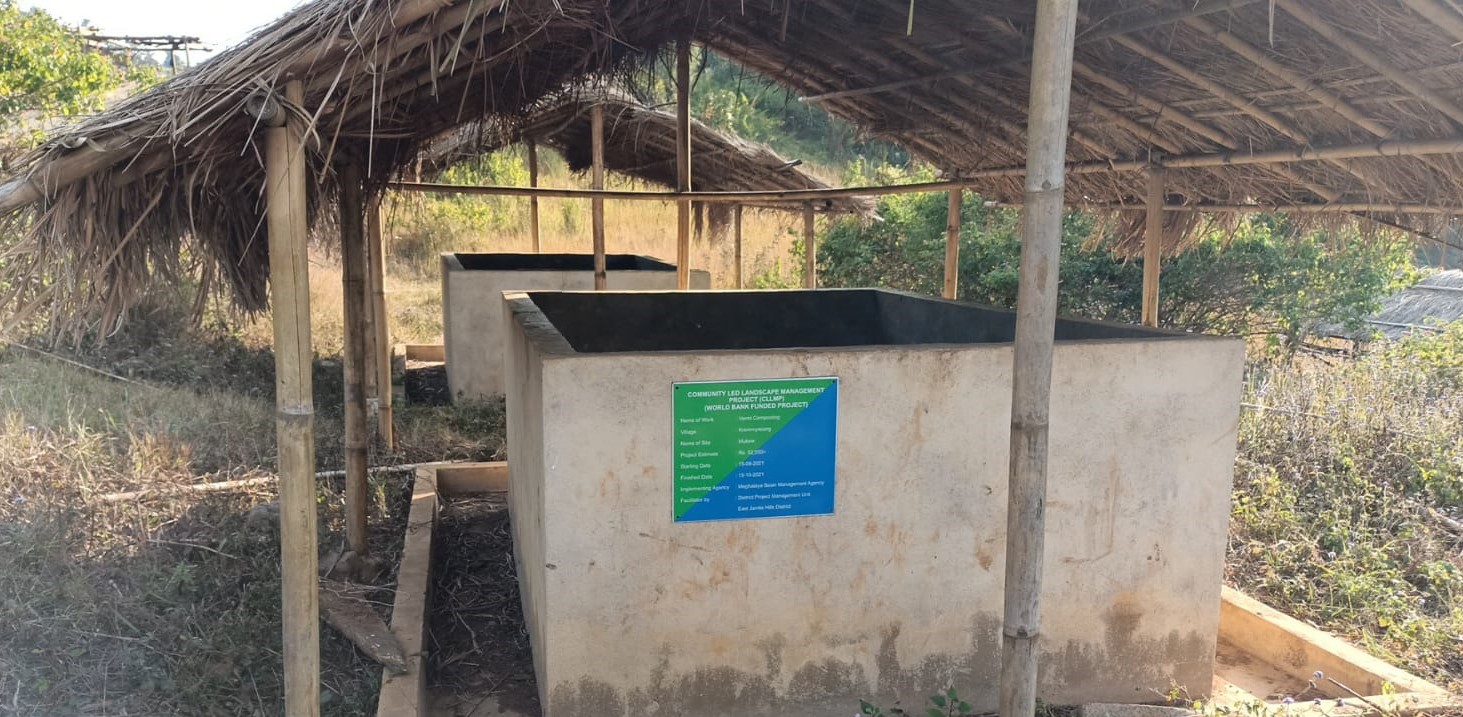
| 7 | Poor nutrient of the soil | Composting/ vermicomposting | Madanlaeshah |
|
84 |
| 8 | Community nursery | Madan larshah |
|
84 | |
| 9 | Agroforestry | Mooprah |
|
84 | |
| 10 | Contour trenches | umthalong |
|
45 |
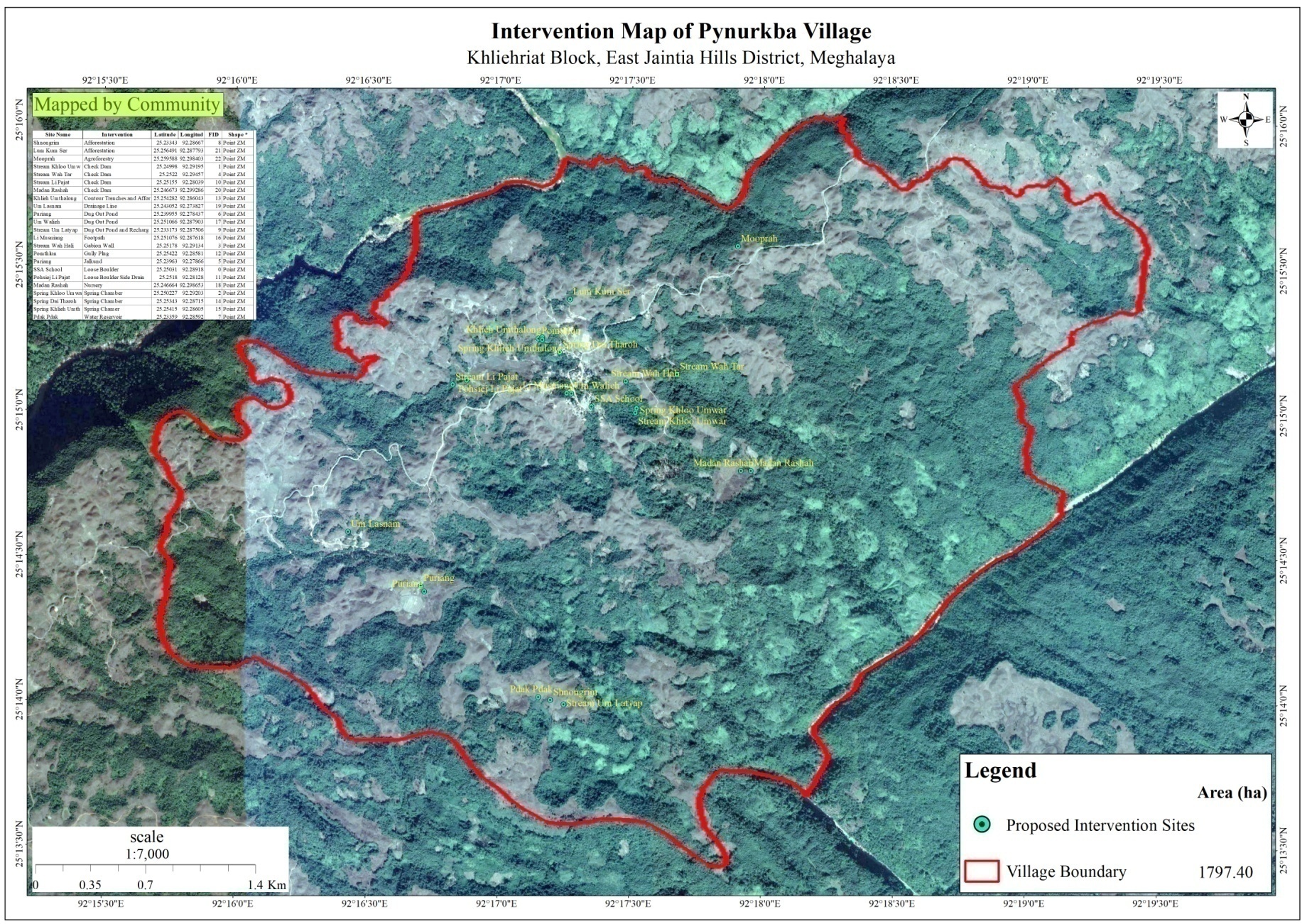
This map shows all the location of the proposed Intervention in Pynurkba Village
Review of the progress and in-situ course in the Preparation of CNRMP
Dated: 24th August 2020
The Asst. Manager Knowledge Management prepared a presentation based on the activities completed and this was presented by the ADPM. The DPD and GM gave their inputs and remarks which are as follows:
According to the GM Knowledge Management there is a lack of information under Problem Analysis with women/vulnerable groups.
The DPD NRM suggested the VNRMC and DPMU team to identify sites where earthen dams can be built as the materials required are available in the village and also the design is relatively simple.
He also advised the VNRMC to work with the DPMU team to identity the local tree species and their usage.
In Puriang, a proposed intervention site, the DPD advised to treat the landscape following the ridge to valley approach.
For any afforestation site which is located far away from the village, he suggested of planting only those tree species which cattle and goats do not like to feed upon.
Presentation of CNRMP to the VNRMC
Dated: 25th August 2020
i. Documenting the History of Pynurkba village
With the help of Shri. Dren Pdang, a senior resident of the village, the Asst. Manager Knowledge Management was able to document the timeline of the village on the social and development aspects.
ii. Problem Analysis with the Women/Vulnerable Group
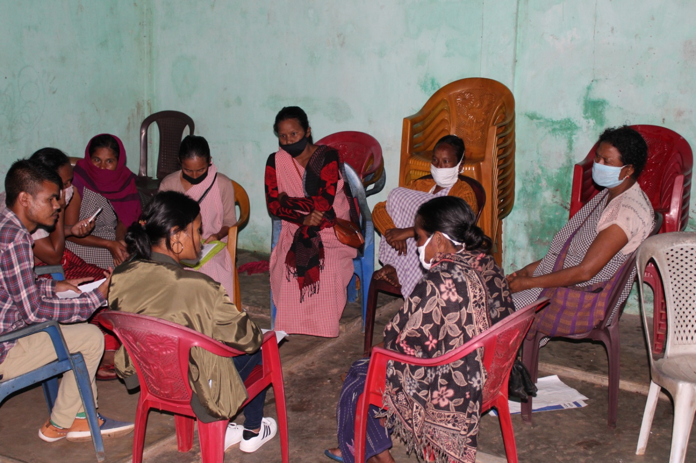
Findings:
The community women are involved in decision making but there also some instances where only men are involved.
Part of the Dorbar: The participant agreed that at present the village women have come forward to take part in meetings and also be members of the local governing body (dorbar shnong committee).
Water problems: the problems related to water have always been highlighted but the women feel that they are the ones who are most vulnerable especially during the winter season as they have to walk a long distance just to fetch water which is stressful and time consuming.
Sanitation: The participants feel that the village needs to do more to improve as there is no proper drainage system for domestic effluents. These effluents end up contaminating water bodies such as springs and streams which can cause severe health problems.
When asked about the different interventions proposed they all agreed that solving the water crisis of the village should be the number one priority and doing that will help improve all livelihood activities.
Presentation of CNRMP to the VNRMC
On 25th August 2020, the ADPM and the entire DPMU team thanked all the members of the VNRMC and VCF’s who had work with the team from the first day in order to help bring changes to help the entire community. The ADPM presented the CNRM plan to the VNRMC members and VCF’s as to conclude the entire week’s program. They were briefed once again on all the activities that were completed, the different types of interventions which were proposed along with their benefits and the roles and responsibilities of each VCF.
IMPLEMENTATION OF ACTIVITES
| 1. | Type Of Intervention | Site Name | GPS Co-ordinates | Amount Sanctioned | Work Status | Benefitted area | |
|---|---|---|---|---|---|---|---|
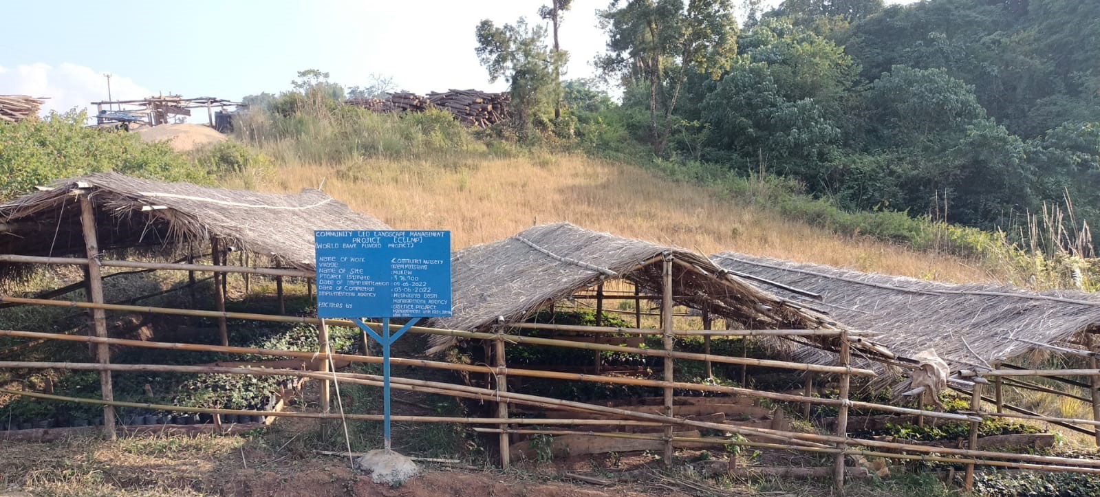
| Vermi composting | Mukew | 25.41350°N | 92.526103°E | ₹ 52550 | Completed | 27.2 ha | |
| 2. | Type Of Intervention | Site Name | GPS Co-ordinates | Amount Sanctioned | Work Status | Benefitted area | |
|---|---|---|---|---|---|---|---|
| Community nursery | Mukew | 25.41336°N | 92.52614°E | ₹ 76700 | Completed | 19.5 ha | |
3. |
Type Of Intervention | Site Name | GPS Co-ordinates | Amount Sanctioned | Work Status | Benefitted area | |
|---|---|---|---|---|---|---|---|
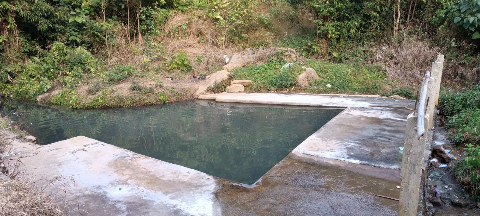
| Check Dam | Thangmasi | 25.41313°N | 92.52247°E | ₹ 184900 | Completed | 19.5 ha | |
| 4. | Type Of Intervention | Site Name | GPS Co-ordinates | Amount Sanctioned | Work Status | Benefitted area | |
|---|---|---|---|---|---|---|---|
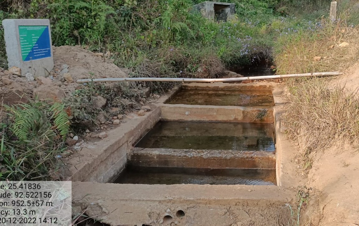
| Filter | Rimpala | 25.41801°N | 92.52225°E | ₹ 92420 | Completed | 19.5 ha | |
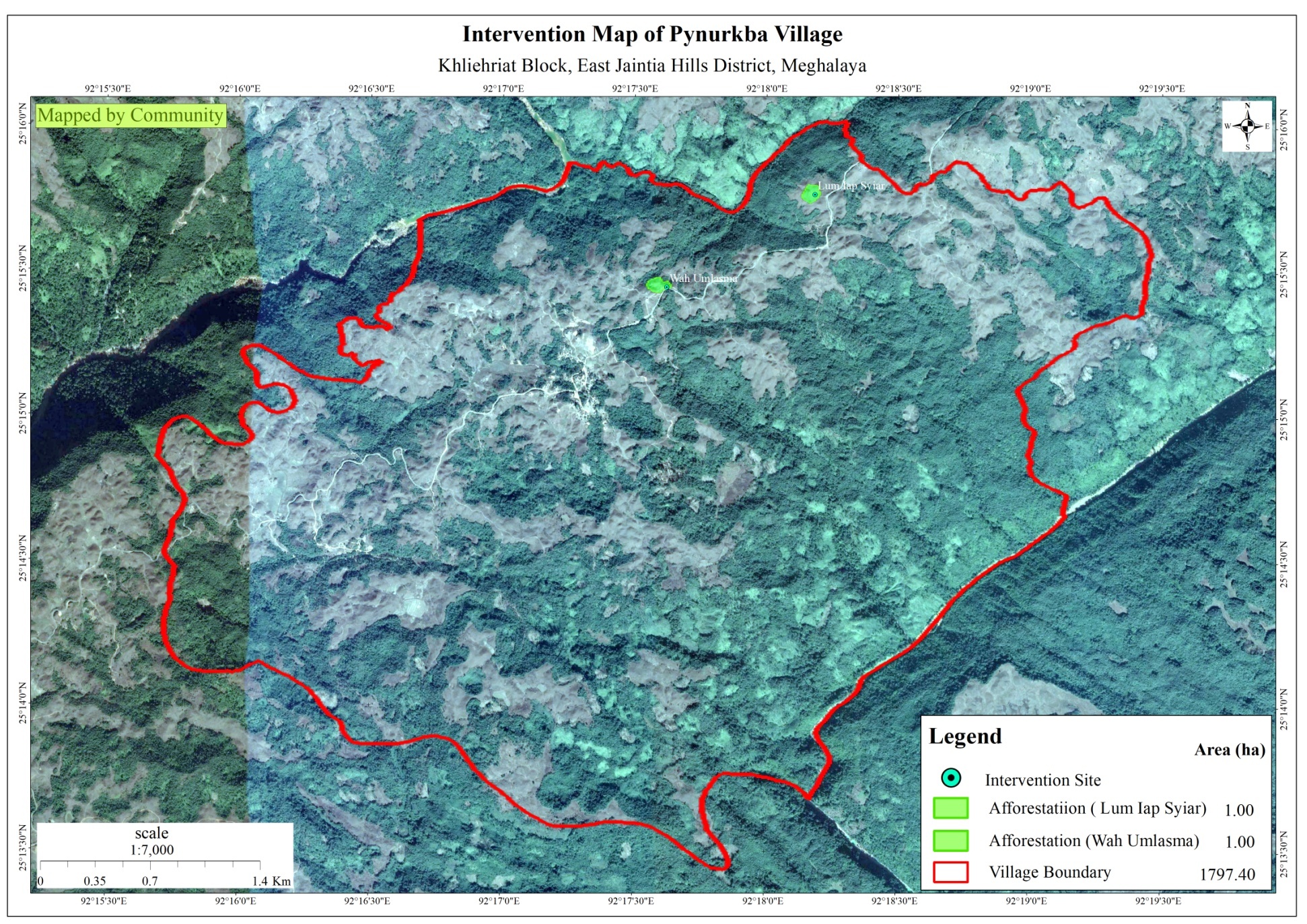
This map shows t he location and area of the both the afforestaion sites which have been implemented in Pynurkba village.
FUND STATUS
| Name of Village | Fund available at the VNRMC | Total No. of Work Order Issued | Total amount Issued under CLLMP (Per Activity) | Total Amount Spent | Unspent Funds |
|---|---|---|---|---|---|
| Pynurkba Village | Rs. 8,30,000/- | 2 | Afforestation ₹ 1,66,170.00 |
₹ 3,32,340.00 | ₹ 4,97,660.00 |
Afforestation ₹ 1,66,170.00 |