 Village Profile
on
Village Profile
on
Ksehkohmoit Village under Mairang C&RD
Block
District: Eastern West Khasi Hills District
1st November, 2021.
COMMUNITY LED LANDSCAPE MANAGEMENT
PROJECT
(CLLMP)


The Government of Meghalaya with financial help from the World Bank is implementing the Meghalaya Community Led Landscape Management Project (MCLLMP). The project will cover the entire state of Meghalaya and implementation of community led plans will be rolled out in phase manner throughout the state. The Meghalaya Basin Management Agency (MBMA) will facilitate community-led planning by providing support, technical inputs and funding.
Theprojectisintendedtostrengthencommunity-lednaturalresourcesmanagementin selected landscapes within the 11 districts of the state. This would be achieved through a variety of planning, capacity building, and on-the-ground interventions to promote the conservation, sustainable use of natural resources, social inclusion and community mobilisation; building traditional knowledge and learning, mapping of natural resources management; strengthening the community institutions and creating linkage with financial institutions and community organizations.
The project interventions will include preparation of community led natural resource management plans. The CLLMP has the following three components:
Strengthening Knowledge and Capacity of Communities for NaturalResources Management
Community-Led Landscape Planning and Implementation
Project Management and Governance
Objective:
 The project objective is
“to manage and conserve the natural resources, especially
forests, soil and water sources, in a manner that supports the
financial and physical well-being of communities in the
State.”
The project objective is
“to manage and conserve the natural resources, especially
forests, soil and water sources, in a manner that supports the
financial and physical well-being of communities in the
State.”
The CLLM-Programme focuses on increasing the capacities of communities and traditional institutions (TI) by adopting a landscape approach to manage their natural resources such as soil, springs and other water sources, forests, and bio-diversity, etc.
The project will be planned and implemented in about 400 villages across the state.
CLLMP has a strong focus on institution-building at the village-level, by ensuring systematic capacity-building on technical and social skill-sets.
The project will also extend such training to communities beyond the targeted villages and support efforts made by them to access funding from various rural and natural resources initiatives and schemes.
The programme will also invest in improving the process and outcome delivery, by developing and adhering to effective systems and procedures, supported by the appropriate technology.
Benefits for community (Skills and Capacity relating to technical and managerial areas like NRM and Conflict resolution
Benefits to traditional institutions (village councils, traditional leaders, community-based organizations, SHGs etc) through Knowledge sharing, promotion of innovative approach, access to technology, technical managerial and financial support.
It is estimated that the project will impact around 1 lakh partners (of which 50% are women) who depend on land, forest, agro forestry.
Through the project, 55000 Ha of targeted area will be ensured with availability of water, biological resources, and soil productivity, which will in turn benefit around 400 villages and the outcomes delivery can be summarized as follows.
IMPLEMENTATION AGENCY:
The Project will be executed by the MBMA in collaboration with other partners particularly, SIRD (for training and capacity building), Department of Soil and Water Conservation, Water Resource Department, Forest Department, specifically with respect to technical inputs, safeguards management and Community NRM plan preparation
PROJECT PERIOD:
2018-2023 (5 years)
| Sl. No. | Topics | Page No. |
|---|---|---|
| I. | Introduction & History | 5-6 |
| II. | Social Profile | 7 |
|
8-15 | |
| III. | CLLMP Activities | 16 |
|
17-29 |
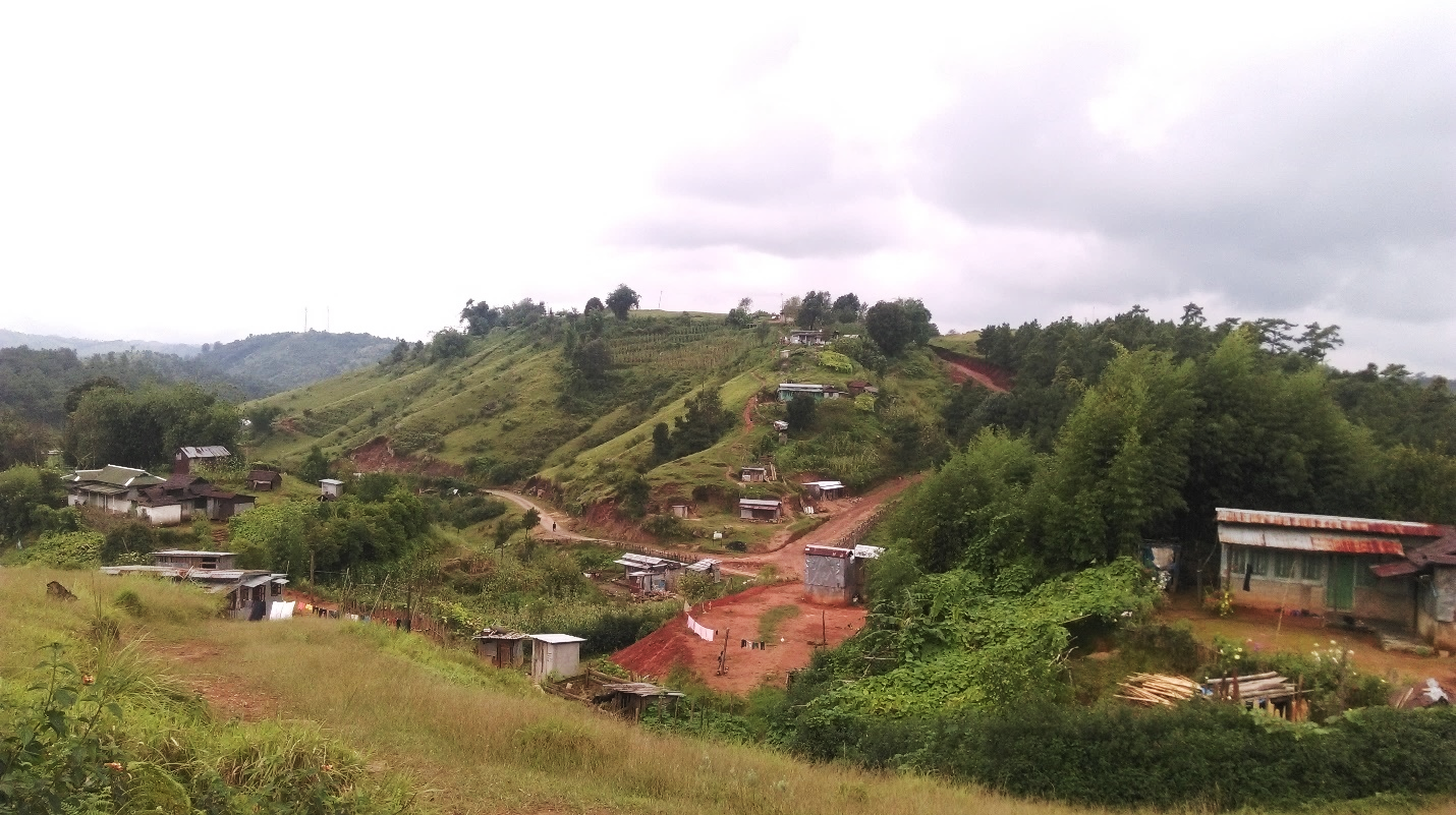
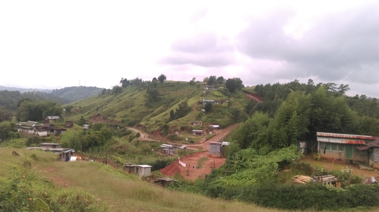
Ksehkohmoit Village is situated in Eastern West Khasi Hills District under Mairang C&RD Block. It is 9kms away from Mairang, the district headquarters and 47kms away from Nongstoin, West Khasi Hills District.
As per Census 2021, Ksehkohmoit population is 762, with total household of 140. It falls under the Hima Khadsawphra.
 BRIEF
HISTORY:
BRIEF
HISTORY:Fig.1. Lanscape of Ksehkohmoit.
Divided from Nongdom Village, Ksehkohmoit was formed during the year 1986. Shyrwang village falls under Ksehkohmoit village until the year 1988 where it was divided into its own village. The first headman or Sordar was Shri. Hawon Sun from1986-1999.
The boundary of Ksehkohmoit village encompasses Langtor from the east and Kynshi and Shyrwang from the west. The predominant population of Ksehkohmoit are the Khasi and it had a population of 977 people in the year 1986. Mostly the people take paddy (khawsaw) and potato as their main food in their day-to-day life due to which paddy and potato are the main crop cultivated in the area. The inhabitants follows and belief in their traditional belief system or Niam Tynrai.
Animal husbandry and Agriculture are the main occupation in the village where they mainly take up traditional approaches of cultivation like Jhum or shifting cultivation.
The people of Ksehkohmoit Village mainly cultivate paddy (Oryza Sativa) and potato being the main source of their revenue.
Ksehkohmoit has a rich diverse forest which includes species like sohphie (Myrica Esculenta) and sohphoh Khasi (Docynia indica) being the dominant species and many more. Majority of the land in Ksehkohmoit falls under private land.
Ksehkohmoit Village has a total number of 140 households and a population of 762. Agriculture and its allied activities are highly practised. Some are also enrolled in government and teaching jobs and few inhabitants are engaged in local business.
Village Accessibility:
Ksehkohmoit village is situated in Eastern West Khasi Hills District. In order to reach Ksehkohmoit, one must venture through the highway and take a left turn after reaching Bynther. One must pass through Langtor to reach Ksehkohmoit.
1. Population: As per 2021 census, Ksehkohmoit population was 762 and a total household of 140. Out of this, 409 werw males while the females count was 353. This village has 140 children in the age group of 0-4 years. Among them 69 were boys and 71 were girls.
| Age Group | Male | Female | Total |
|---|---|---|---|
| 0-4 | 69 | 71 | 140 |
| 5-14 | 139 | 103 | 242 |
| 15-30 | 107 | 116 | 223 |
| 30-60 | 79 | 60 | 139 |
| Above 60 | 15 | 3 | 18 |
Fuel Type:
| Fuel Type | Total HH |
|---|---|
| Charcoal | 0 |
| Biomass | 0 |
| Wood | 130 |
| LPG | 10 |
| Electric Heater | 0 |
| Kerosene | 0 |
3. Occupation: The people of the village rely on agriculture and forest products for their livelihood. The main occupation of the villagers is farming followed by teachers, self-employed, and drivers.
Drinking Water: There is sufficient amount of drinking water in the village.
Jhum cultivation: Mainly take up traditional approaches of cultivation like Jhum or the shifting cultivation.
| Water Bodies | No. |
|---|---|
| Springs | 20 |
| Streams | 8 |
| River | 3 |
| Land | No. |
|---|---|
| Forest | 345.99 Ha |
| Cultivable land | 63.02 Ha |
1. Ground Truthing:
The DPMU-CLLMP team conducted the ground truthing of the village of Ksehkohmoit on 20th July,2019.
The team assessed the village on the same day. There was availability of degraded land which were mostly fallow and barren. There were also some eroded areas. The village mostly depended on springs for drinking water and streams for other domestic uses. The soil type in the village is sandy loamy and reddish brown.
Case Findings:
There was a total of 140 households.
Actively performing VEC.
Most of the land falls under Private land.
Few patches of degraded land left unused.
Forest on hill slopes was prone to forest fires. Loss of Natural Vegetation.
Abundance of small streams.
Paddy fields on upland areas were without proper irrigation.
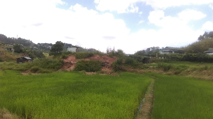
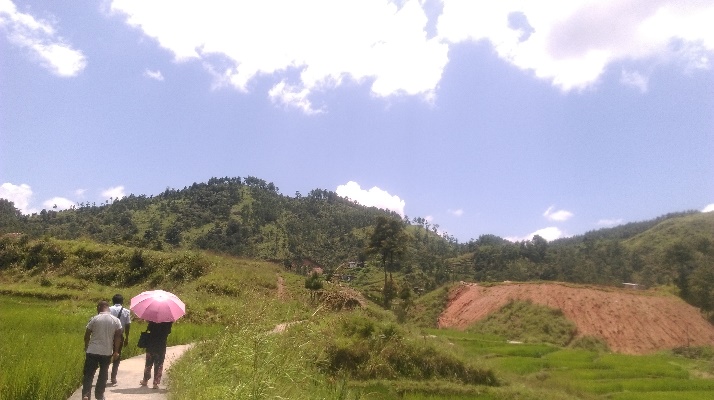
Fig.2 & 3. Ground Truthing.
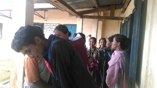
2. Sensitization Programme:
A sensitization programme on CLLMP was conducted in the village on the 22nd July, 2019. The DPMU team gave a detailed presentation on CLLMP as well as the guidelines related to the Project.
Highlights of the meeting:
Awareness about Community–Landscape Management project
Laying importance on the involvement of the community in making the CNRM plan and its success
A brief awareness on cleanliness was conducted based on our findings during the ground truthing phase
An interactive session was held to answer the doubts of the villagers regarding the project.
2.1. Signing Of EOI, VGA and Green Charter:
Ksehkohmoit Village signed the Expression of Interest (EOI), the Village Grant Agreement (VGA) and the Green Charter on 23rd July, 2019, after a uniform agreement by the entire community that the Community-Led landscape Management Project (CLLMP) be implemented at Ksehkohmoit Village.
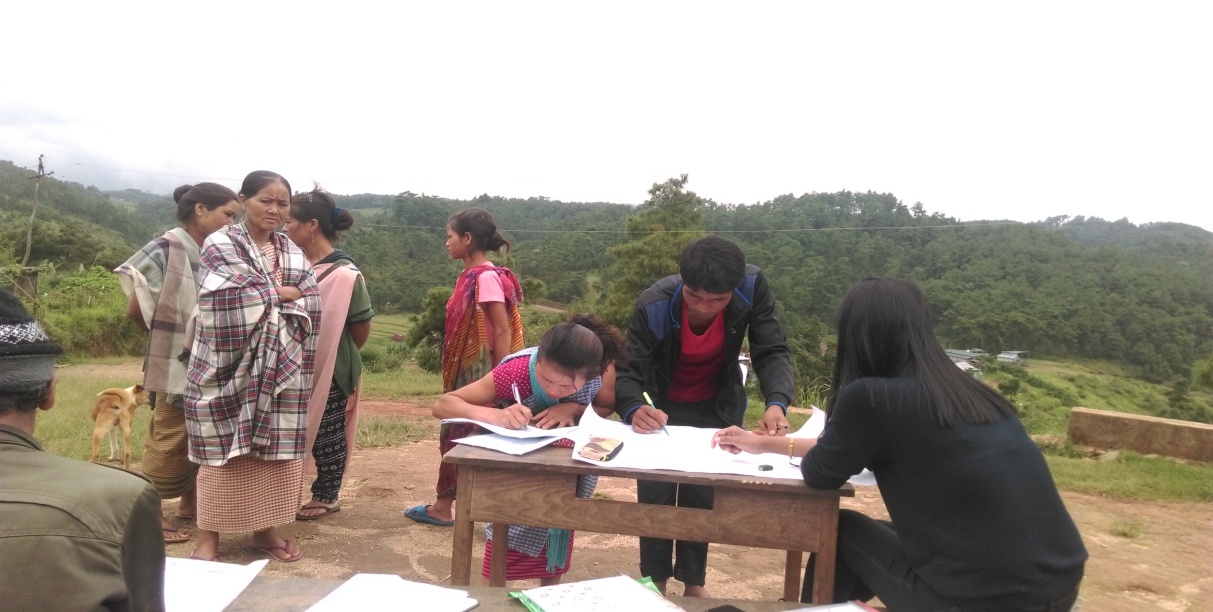
Fig. 4. Signing Of EOI, VGA and Green Charter.
2.2. Formation of the Village Natural Resource Management Committee
Formation of the Village Natural Resource Management Committee was done on the 4th June, 2019, in a public meeting in the presence of the entire village and the CLLMP staffs. The community chose the President, the Secretary, and other executive members of the Committee.
Listed below are the members of the Ksehkohmoit VNRMC:
|
|||||||||
|---|---|---|---|---|---|---|---|---|---|
| Sl. No. | Name in Full | Designation | Gender M/F | Age (Yrs) | Education | Occupation | Community | Religion | Contact No. |
| 1. | Shri.Styeful Jana | President | Male | 36 | IX | Farmer | Khasi | Christian | 9615850447 |
| 2. | Smt.KisnaliL. Kynshi | Secretary | Male | 27 | BA | Teacher | Khasi | Christian | 6009227171 |
| 3. | Shri. Wesling L. Lyngkhoi | Finance Secretary | Male | 38 | BA | Farmer | Khasi | Christian | 8974942697 |
| 4. | Shri. Bras L. Lyngkhoi | Member | Male | 41 | IV | Farmer | Khasi | Christian | 8787392941 |
| 5. | Shri.Extor Marbaniang |
Member | Male | 56 | II | Farmer | Khasi | Christian | NA |
| 6. | Shri.Hamion Sunn |
Member | Male | 77 | III | Farmer | Khasi | Christian | 8794976931 |
| 7. | Smt.Happy dalin L.Kynshi | Member | Female | 30 | BA | Farmer | Khasi | Christian | 9615850447 |
| 8. | Smt.Mesiia L. Kynshi | Member | Female | 54 | II | Farmer | Khasi | Christian | 8575705443 |
| 9. | Smt.Phillis Basaringaid |
Member | Female | 39 | IV | Farmer | Khasi | Christian | 8575912070 |
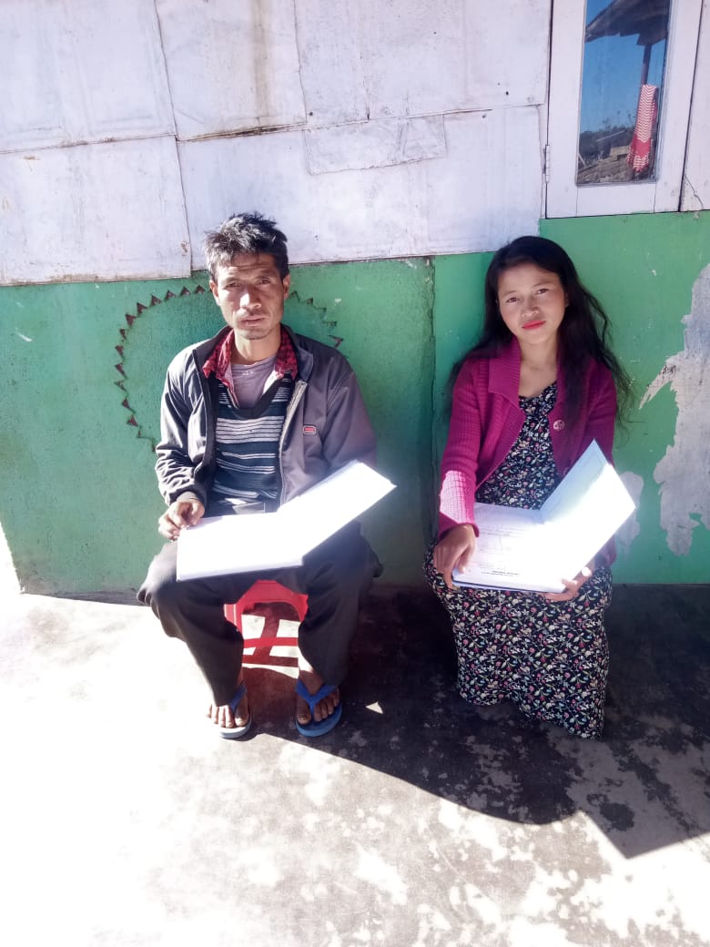
Fig. 5. President and Secretary.
| Village Community Facilitators | ||||||
|---|---|---|---|---|---|---|
| Sl.No. | Name | Gender | Age | Education | Contact Number | Role |
| 1. | Youbanda K. Kylliang | F | 22 | VIII | 6009020702 | VCF KM & SM |
| 2. | Pherbak Raliang | M | 28 | IX | 8415888251 | VCF Evt & GIS |
| 3. | Kordor L. Kynshi | M | 21 | IX | 8787542825 | VCF M&E & PM |
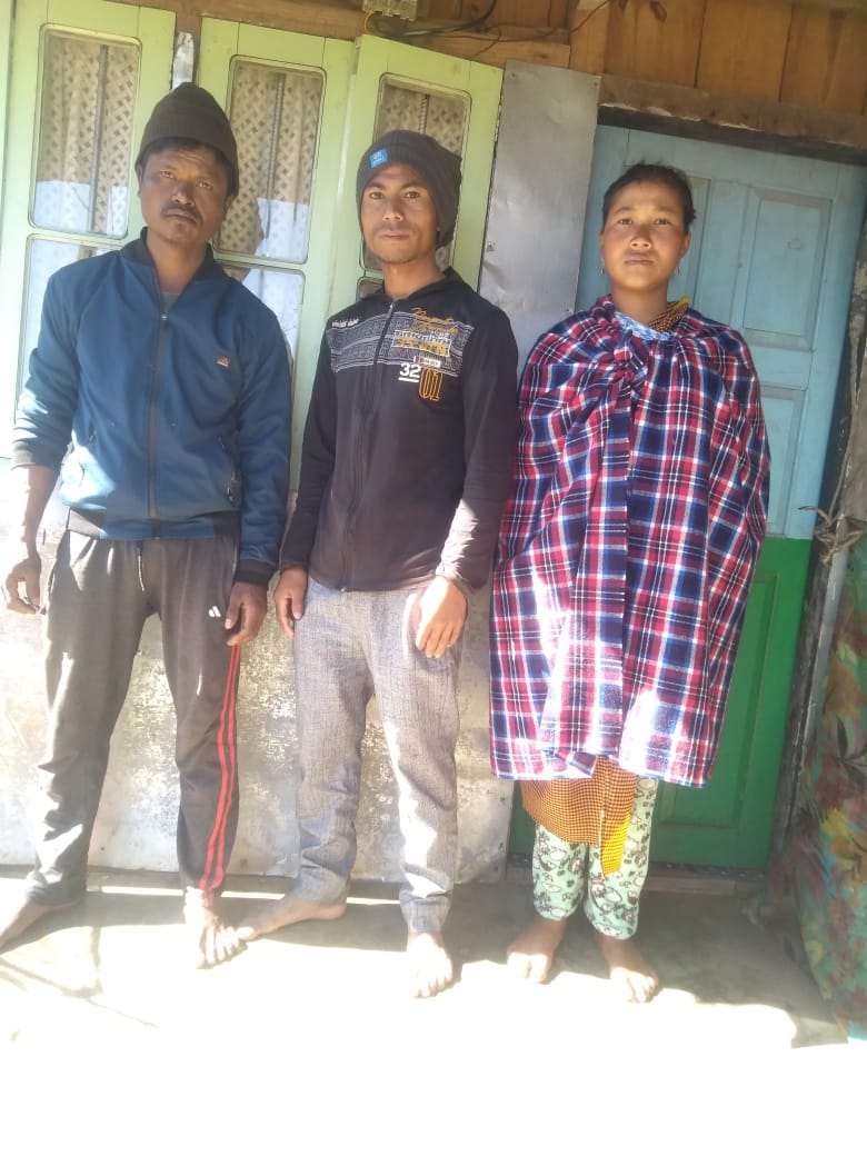
Fig. 6. Village Community Facilitators.
| Sl.No | Name | Gender | Age | Education | Contact Number |
|---|---|---|---|---|---|
| 1. | Sparlus Kharsyntiew | M | 30 | Bsc. | 84575234467 |
| 2. | Fighter Diengdoh | M | 43 | VII | 9862323456 |
| 3. | JunishaL.Kynshi | F | 27 | IX | 8775482136 |
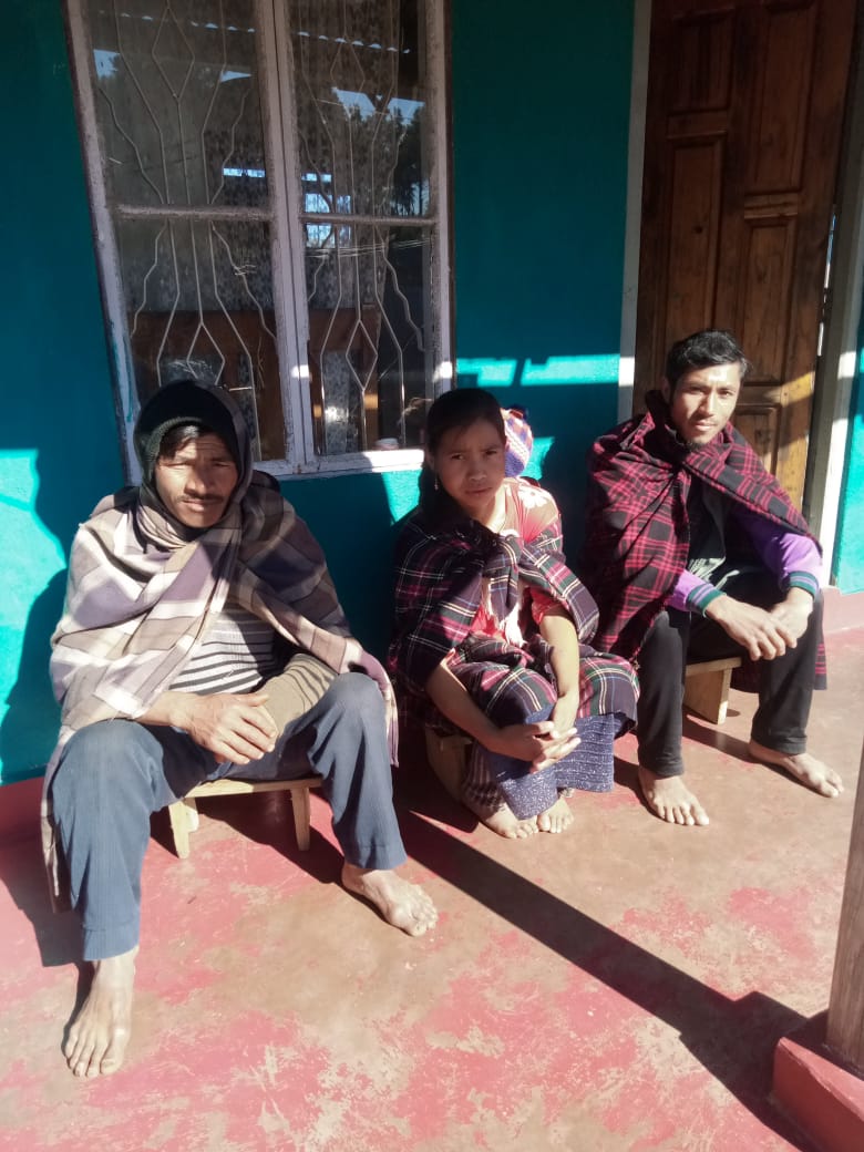
Fig. 7. Procurement Committee Members.
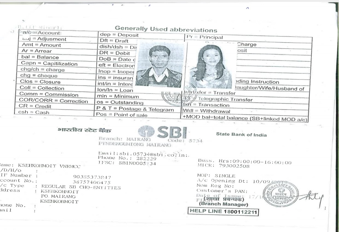
3.Opening of Bank Account:
The opening of the bank account was done after the signing of the EOI (Expression of Interest), the VGA (Village Grant Agreement) and the signing of the Green Charter at the respective villages.
A meeting was held for all the VNRMC members of Pahamkroh to brief and assist them before opening the VRNMC bank account. The bank account was opened on 10/09/2019.
4. Participatory Rural Appraisal Exercise:
The PRA exercise aims to incorporate the knowledge and opinions of the community in the planning and management of development projects and programmes. The PRA exercise at Pungsaniang Village took place on the 22nd July, 2019, were the villagers, men and women included, took part in the exercise.
The initial stage of Participatory Rural Appraisal (PRA) exercise at Pungsaniang Village commenced with a meeting cum orientation program on CLLMP. While conducting the meeting, the community members were made aware of the various PRA exercises to be conducted for the development of Community Natural Resource Management Plan (CNRMP) of the village, the community members’ contribution in the exercise and the objectives to be achieved. The key informants being the VNRMC and the VCFs helped facilitate maximum participation.
Commencement of PRA:
Introduction:
Participatory Rural Appraisal (PRA) is the process of involving local people in the analysis and interpretation of their own situation of a given rural area. The local people i.e., the participants take a leadership role in collecting, analysing, interpreting, and presenting information and in this process impart knowledge and development insight to the specialists and extension agents
For management of natural resources, participatory Rural Appraisal is conducted to establish rapport with the village community as well as to identify and define problems for prioritization in the village itself. It is a way of learning from and with community members to investigate their need assessment, analyse and evaluate constraints and opportunities and find out priorities in the area of agriculture, small scale rural enterprises and any other social and economic development programs addressed to village development based on the principle of listening and learning.
Objectives of PRA exercise at Ksehkohmoit Village:
The Participatory Rural Appraisal (PRA) exercise at Ksehkohmoit was conducted with following objectives:
To identify the natural, human, and economic resources of village.
To identify the village problems and prioritize them with the help of the community members.
To prepare the Community natural Resource Management Plan of the village.
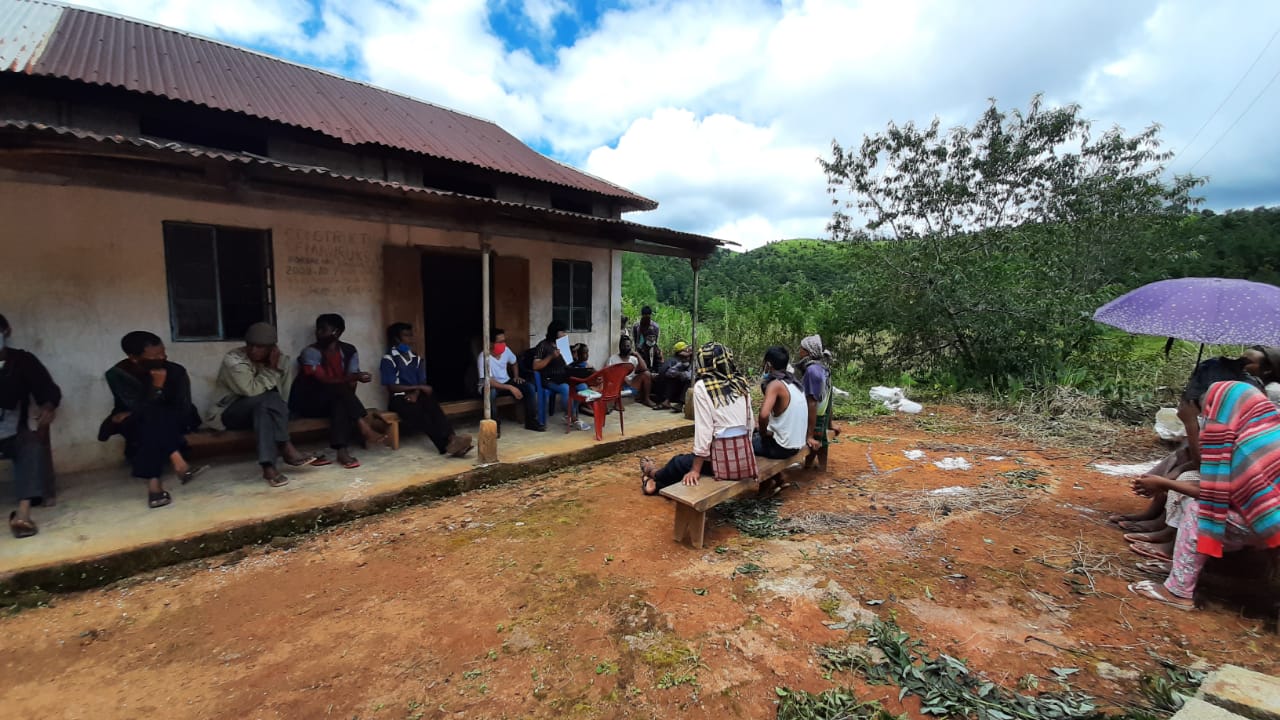
Fig. 8. Participatory Rural Appraisal Exercise.
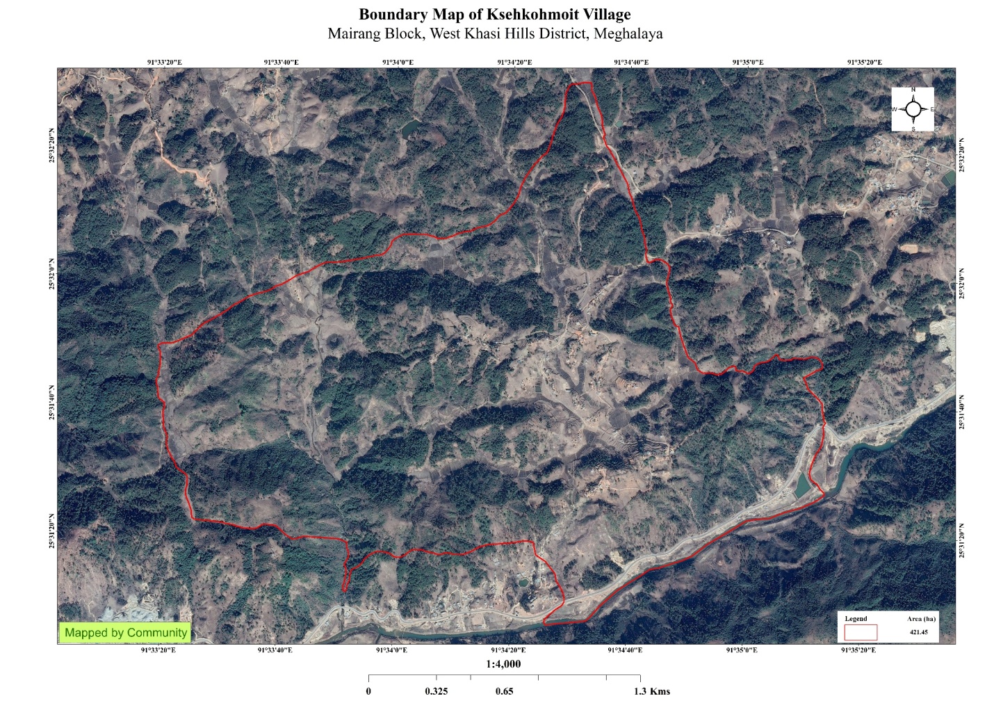
Activity 1: Village Boundary Mapping and drawing the Resource Map:
This activity achieved the following purposes:
Rapport building and won the confidence of the villagers.
Analysed the spatial information, particularly studied problems, and opportunities of villagers.
Got an impression about the village setting, physical layout, location of various houses and institutions.
Findings Based on the Resource Map of Ksehkohmoit Village:
1Main agriculture produce is rice, potato, and maize.
The type of forest found in the village are mainly private lands.
Three rivers- Wahkynshi, Umshyrwang and Umshwer are present and flow through the village paddy field.
Presence of Barren land.
Presence of Community Hall.
Presence of Football playground.
Presence of Integrated Child Development Services (ICDS).
Presence of dug out ponds for fisheries.
Habitation is not confined to one place but spread all over the village.
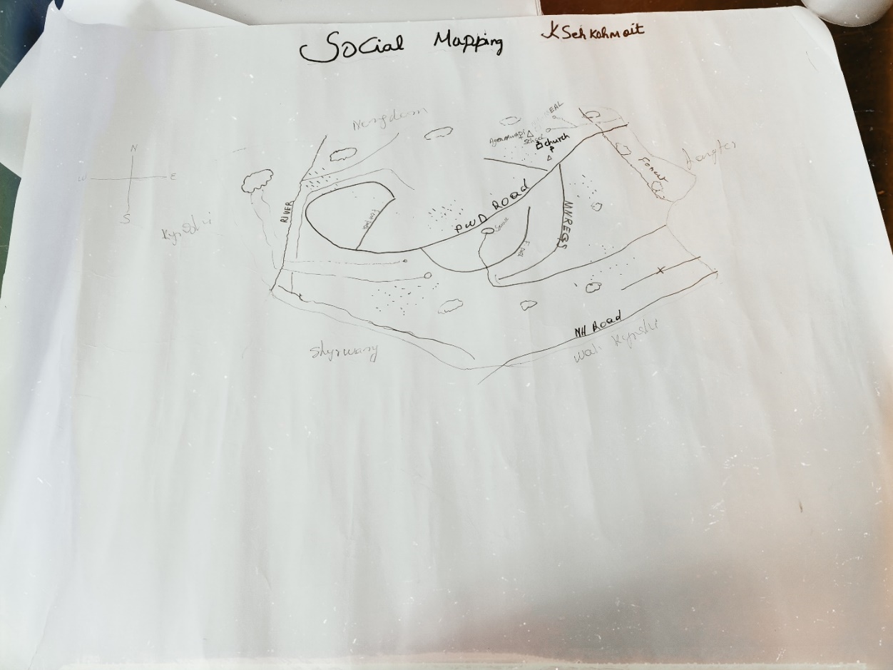
Fig. 9. Resource Map of Ksehkohmoit.
Activity 2: Baseline Data Survey to fill the Environment and Social Template:
During the PRA exercise, the External Expert of Social & Environment Management held group discussions with different groups to gather basic village information regarding number of households, demographic information, major crops, and enterprises taken in the village, trends of production and productivity of major crops in the village and demographic distribution of village population. Information related to land use category such as forest, cultivable land, water bodies, etc., and problems and challenges related to NRM were discussed.
Activity 3: Focussed Group Discussion on Problem Analysis
Do people have sufficient access to supply of fodder, fuel wood, leaf litter?
No, the people in the village do not have sufficient access to supply of fodder, fuel wood, leaf litter. They get it from the community forest and from their own private lands/forest.
Has access to timber improved or reduced over the years? How is access for household use and commercial use managed?
Access to Timber has reduced over the years. People in the village get it only from private land which is not enough. They must purchase it when needed.
Are the water bodies facing any threats?
Yes, the water bodies are facing threats due to burning of trees for charcoal and deforestation.
Do all people in the village have access to drinking water? What are the challenges?
Yes, there is sufficient availability of drinking water.
They face water scarcity during winter only.
Are there degraded areas in the village (open/ degraded forests, mining affected, high soil erosion etc.)?
There are some minor degradations in cultivated land.
What has caused this degradation? Are there practices causing threats to availability and access to natural resources?
Fertility of the soil decline over the year.
Excessive practice of Jhum Cultivation.
Deforestation.
What have been the changes in agricultural practices?
Since urea was introduced, there has been a decrease in productivity.
Are there any challenges in farming?
The main challenge in farming is lack of water availability, use of chemical fertilizer and pests.
How would you consider the health situation in your village?
Good.
How is the situation of cleanliness, sanitation, access to toilets and waste management?
Improved. All houses have toilets and waste management has been improved.
Who are the most vulnerable in the village? What can be done to improve their lives?
Poor people.
What are the livelihood aspirations of the youth? Are there any avenues available?
None, except daily wages
Do any committees/ institutions/ rules exist to manage and monitor natural resources in the village?
The VNRMC under the CLLMP is the main committee that is now in place to manage the natural resources in the village; Village Dorbar.
What are some of the major issues of conflict in the village?
Nothing related to NRM.
Have any of the above issues been discussed in village meetings?
Yes.
How do people resolve disagreements and conflicts?
All disagreements and conflicts are addressed by the traditional institution of village called the Village Dorbar.
Activity 4: Seasonality Calendar
The CLLMP team also mapped the seasonal calendar of PahamkrohVillage to help identify heavy workload periods, periods of relative ease, credit crunch, diseases, food security, wage availability etc. This will prove helpful in project planning and project timeline framing.
Participants:
Shri. Styeful Jana- Headman of Ksehkohmoit Village and President of VNRMC.
Shri.Wesling L. Lyngkhoi- Finance Secretary of the VNRMC
Shri.Extor Marbaniang- Member of the VNRMC
Shri.Hamion Sunn- Member of the VNRMC
| SEASONAL CALENDAR | ||||||||||||||
|---|---|---|---|---|---|---|---|---|---|---|---|---|---|---|
| Sl. No. | CRITERIA | Jan | Feb | Mar | Apr | May | Jun | Jul | Aug | Sep | Oct | Nov | Dec | |
| 1 | Water Scarcity | 3 | 2 | 1 | 1 | 1 | ||||||||
| 2 | Prone to sickness | 2 | 2 | 2 | ||||||||||
| 3 | Seeking job outside | |||||||||||||
| 4 | Rain Fall | 1 | 1 | 2 | 2 | 2 | 3 | |||||||
| 5 | Free – Less work | 1 | 2 | 3 | ||||||||||
| 6 | Paddy Cultivation | 2 | 1 | 1 | ||||||||||
| 7 | Paddy Harvesting | 1 | 1 | |||||||||||
| 11 | Vegetable (crop Cultivation) | 2 | 1 | 1 | 2 | 2 | 2 | 2 | ||||||
| 12 | Vegetable (crop Harvesting) | 1 | 1 | 1 | 2 | 2 | 2 | 2 | ||||||
| 13 | Festive Season | 1 | 2 | 1 | ||||||||||
| 14 | Forest Fire | 1 | 2 | 2 | ||||||||||
| 15 | Collection of Fuel wood | 2 | 2 | 1 | ||||||||||
| Maximum | 1 |
|---|---|
| Moderate | 2 |
| Less | 3 |
5. Submission of the CNRMP:
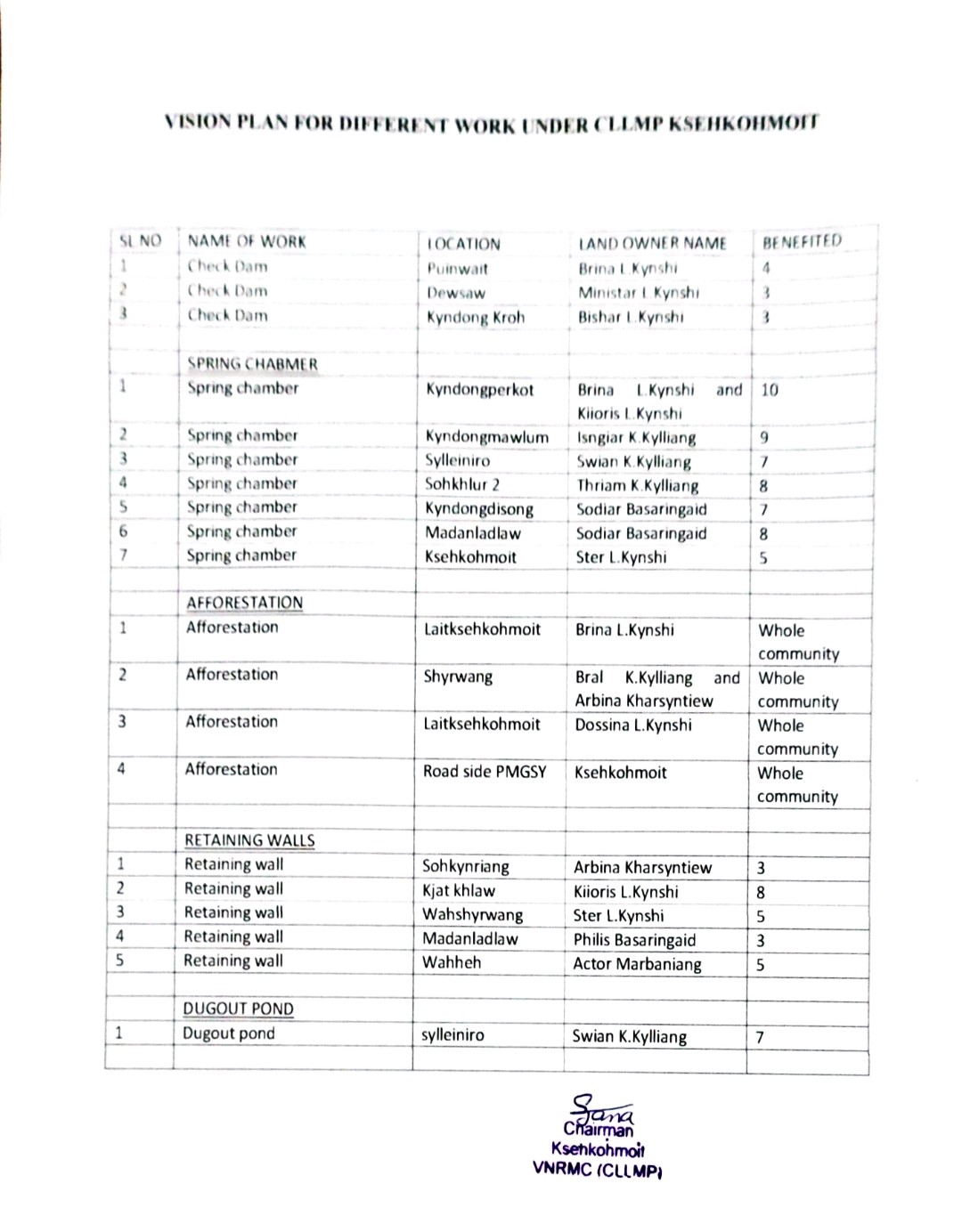
5.1.Final Community Natural Resource Management Plan
| Sl. No. | Name of Proposed Interventions | Site | Land ownership | Nos of HHs expected to Benefit | Priority (High/ Medium/ Low) | ||
|---|---|---|---|---|---|---|---|
| BPL | APL | TOTAL | |||||
| 1. | Check Dam | Puinwait | Private | 4 | 4 | High | |
| 2. | Dewsaw | Private | 3 | 3 | High | ||
| 3. | KyndongKroh | Private | 3 | 3 | High | ||
| 4. | Spring Chamber | Kyndongperkot | Private | 10 | 10 | High | |
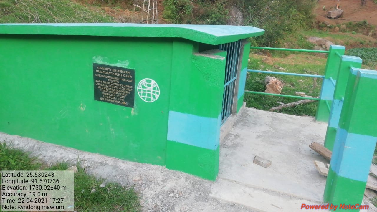
| 5. | Kyndongmawlum | Private | 9 | 9 | High | ||
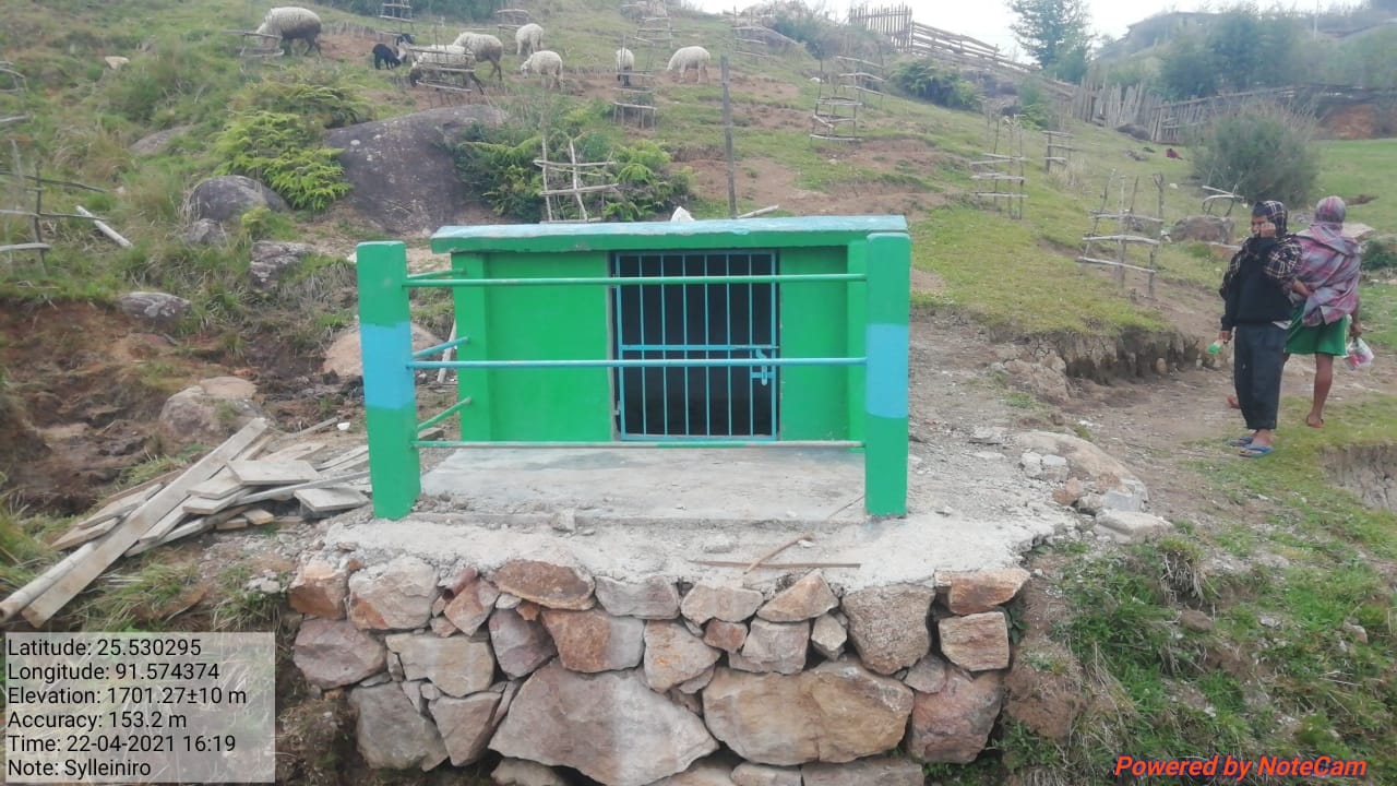
| 6. | Sylleiniro | Private | 7 | 7 | High | ||
| 7. | Sohkhlur 2 | Private | 8 | 8 | High | ||
| 8. | Kyndongdisong | Private | 7 | 7 | High | ||
| 9. | Madanladlaw | Private | 8 | 8 | High | ||
| 10. | Ksehkohmoit | Private | 5 | 5 | High | ||
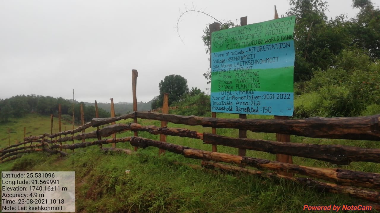
| 11. | Afforestation | Laitksehkohmoit | Private | High | |||
| 12. | Shyrwang | Private | High | ||||
| 13. | Laitksehkohmoit | Private | High | ||||
| 14. | Roadside PMGSY | Private | High | ||||
| 15. | Retaining Wall | Sohkynriang | Private | 3 | High | ||
| 16. | KjatKhlaw | Private | 8 | 8 | High | ||
| 17. | Wahshyrwang | Private | 5 | 5 | High | ||
| 18. | Madanladlaw | Private | 3 | 3 | High | ||
| 19. | Retaining Wall | Wahheh | Private | 5 | 5 | High | |
| 20. | Dugout pond | Sylleiniro | Private | 7 | 7 | High | |
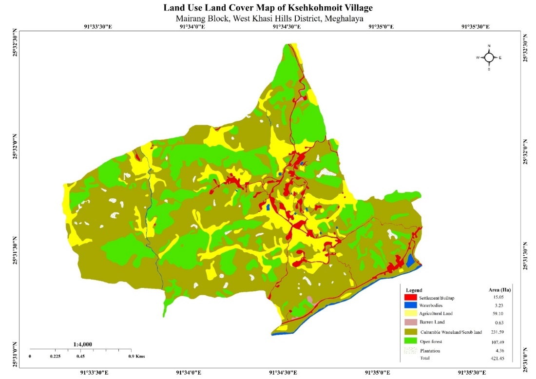
6. GIS Activities:
| Sl. No. | Parameters | Village Information |
|---|---|---|
| 1 | GPS Coordinates: | |
| i | Latitude | 25.529818o |
| ii | Longitude | 91.576476o |
| iii | Elevation Reading (MSL) | 170m |
| 2 | Village Geographical Area (Ha) | Total:421.45ha 4.2145sq km |
| i | Total Forest Area (including community, Clan, Pvt Forest) | 107.49ha |
| ii | Total Area of Water Bodies | 3.23 ha |
| iii | Total Area under Agri-Horticulture |
4.36 |
| iv | Total Degraded land area (Ha) | 2.29 |
| 3 | Average Annual Rainfall | 1200-3000m |
| 4 | Soil Type | Sandy loamy soil and reddish brown |
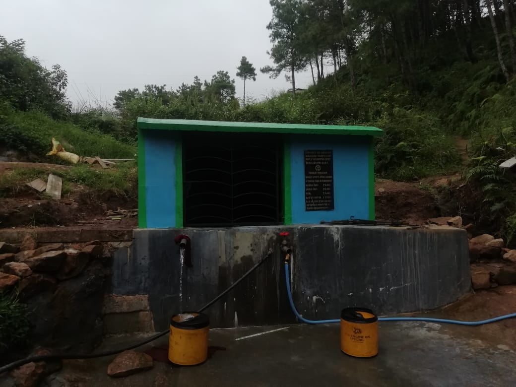
7. Project Implementation:
| 1. | Type Of Intervention | Site Name | GPS Co-ordinates | Amount Sanctioned | Work Status | |
|---|---|---|---|---|---|---|
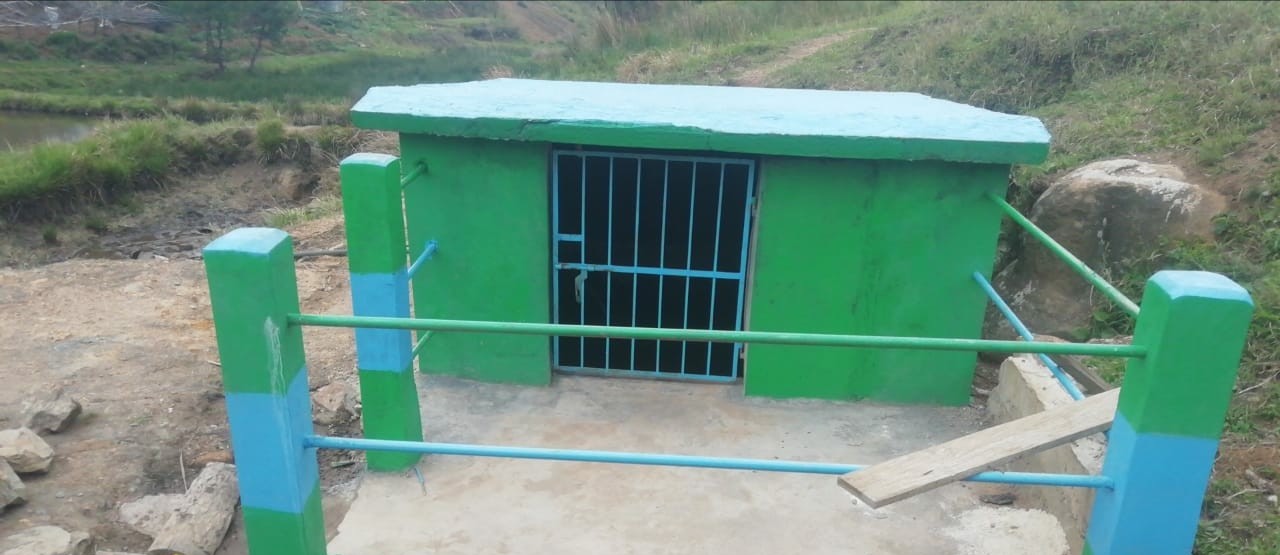
| Spring Chamber and Treatment of Catchment Area | Kyndong Sohkhlur II |
25.530344° | 91.570733° | 64,930 | Completed | |
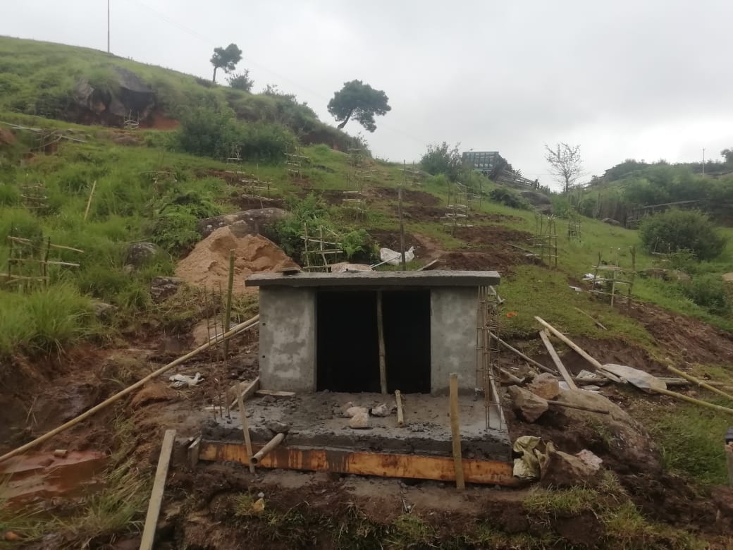
| 2. | Type Of Intervention | Site Name | GPS Co-ordinates | Amount Sanctioned | Work Status | |
|---|---|---|---|---|---|---|
| Spring Chamber | Kyndongmawlum | 25.53013 | 91.57068 | 65,800 | Completed | |
| 3. | Type of Intervention | Site Name | GPS Co-ordinates | Amount Sanctioned | Work Status | |
|---|---|---|---|---|---|---|
| Spring Chamber and Treatment of Catchment Area | Kyndongperkot | 25.530312° | 91.574407° | 65,800 | Completed | |
| 4. | Type Of Intervention | Site Name | GPS Co-ordinates | Amount Sanctioned | Work Status | |
|---|---|---|---|---|---|---|
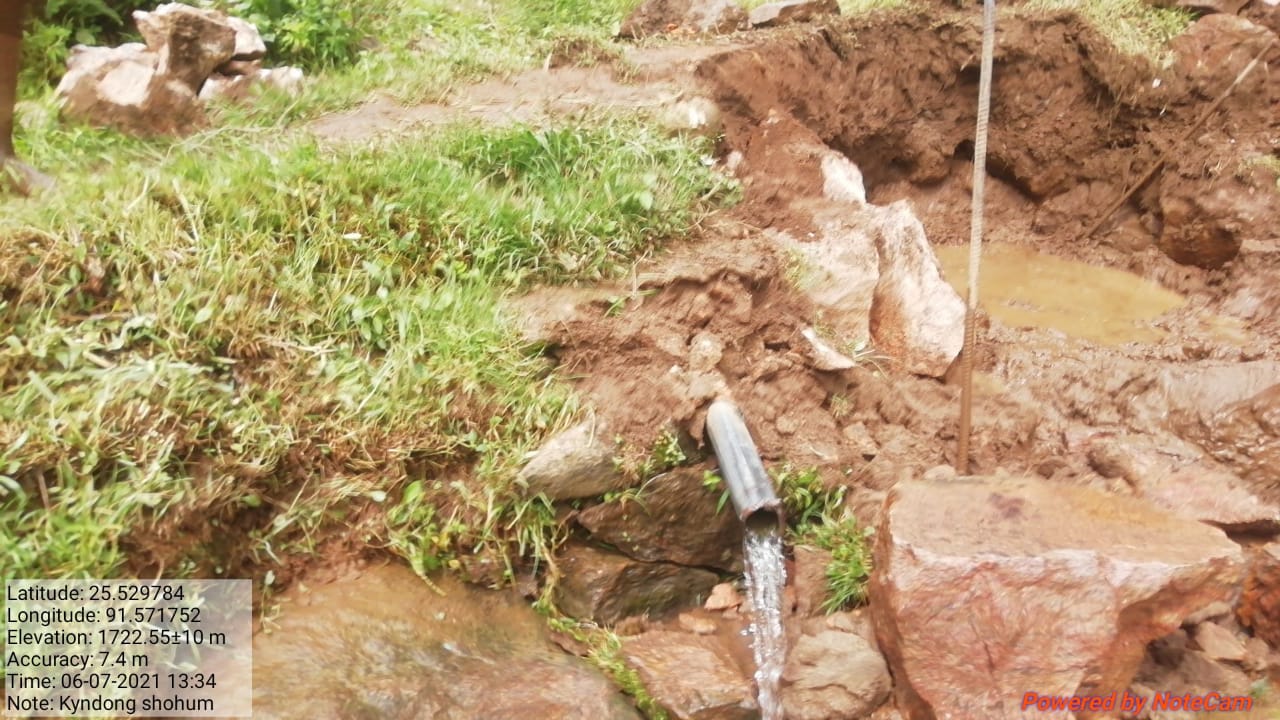
| Spring Chamber | Kyndongshawum | 25.52968306 | 91.57177917 | 76,650 | Completed | |
| 5. | Type of intervention | Site Name | GPS Co-ordinates | Amount Sanctioned | Work Status | |
|---|---|---|---|---|---|---|
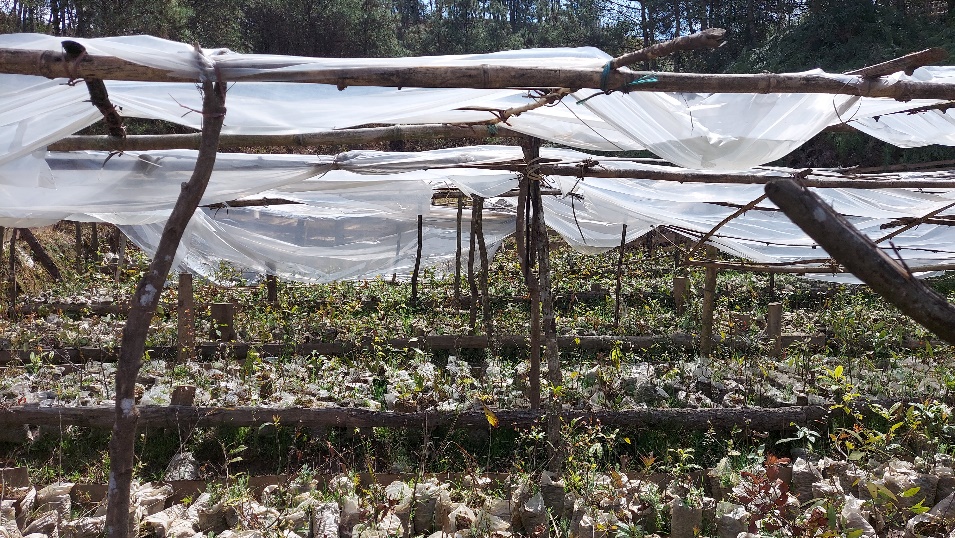
| Nursery | Ksehkohmoit | 25.531831 | 91.576488 | 1,48,640 | Completed | |
| 6. | Type Of Intervention | Site Name | GPS Co-ordinates | Amount Sanctioned | Work Status | |
|---|---|---|---|---|---|---|
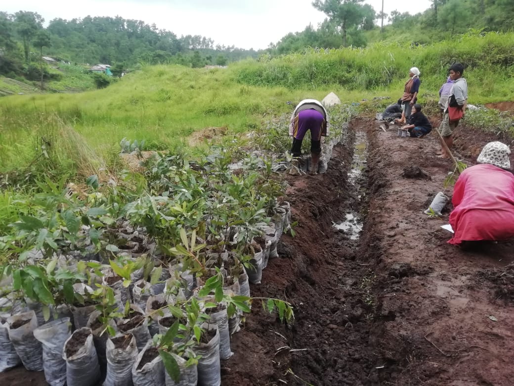
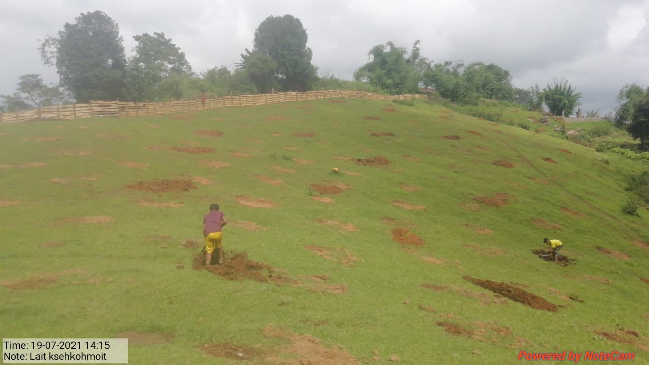
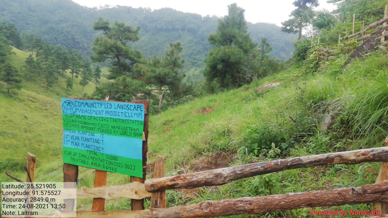
| Afforestation along with Staggered Trenches | Laitram | 25.52190591 | 91.575527 | 51,000 | Completed | |
| 7. | Type Of Intervention | Site Name | GPS Co-ordinates | Amount Sanctioned | Work Status | |
|---|---|---|---|---|---|---|
| Afforestation with Staggered Trenches | Laitksehkohmoit | 25.531429° | 91.569587° | 1,54,000 | Completed | |
| 8. | Type Of Intervention | Site Name | GPS Co-ordinates | Amount Sanctioned | Work Status | |
|---|---|---|---|---|---|---|
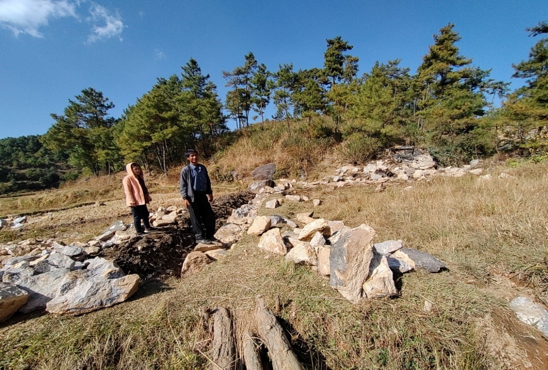
| Water Conservation Pond | Kyndonngkroh | 25.533984° | 91.574903° | 4,34,700 | Not yet completed | |
8. FUND STATUS:
| Fund Released to VNRMC (Project Implementations) | Total No. Of Work Order issued | Total amount issued under CLLMP (Per Activity) | Total Amount Spent | Start Date | End Date |
|---|---|---|---|---|---|
| ₹20,30,484 | 16 | Spring Chamber with TCA (Spring Chamber) |
61,259 | 03-Jul-20 | 16-Apr-21 |
| Spring Chamber with TCA (Afforestation) |
3,500 | 03-Jul-20 | 16-Apr-21 | ||
| Spring Chamber with TCA (Spring Chamber) | 62,521 | 04-Jul-20 | 16-Apr-21 | ||
| Spring Chamber with TCA (Afforestation) |
3,500 | 04-Jul-20 | 16-Apr-21 | ||
| Spring Chamber with TCA (Spring Chamber) | 60,373 | 03-Jul-20 | 16-Apr-21 | ||
| Spring Chamber with TCA (Afforestation) |
3,500 | 03-Jul-20 | 16-Apr-21 | ||
| Nursery | 99,288 | 03-Jul-20 | 22-Apr-21 | ||
| Spring Chamber | 76,352 | 05-Jul-21 | 28-Aug-21 | ||
| Afforestation with Staggered trenches (Afforestation) | 31,048 | 09-Jul-21 | 24-Aug-21 | ||
| Afforestation with Staggered trenches (Trenches) | 2,534 | 09-Jul-21 | 24-Aug-21 | ||
| Afforestation with Staggered trenches (Afforestation) | 1,05,128 | 08-Jul-21 | 23-Aug-21 | ||
| Afforestation with Staggered trenches (Trenches) | 9,216 | 08-Jul-21 | 23-Aug-21 | ||
| Water Conservation Pond | 4,39,147 | 13-Dec-21 | 30-Apr-22 | ||
| Erosion Control Retaining Wall | 4,71,312 | 15-Feb-22 | 30-Apr-22 | ||
| Water Conservation Pond | 5,55,096 | 15-Feb-22 | 30-Apr-22 | ||
| Spring Chamber | 46,710 | 29-Aug-22 | 17-Nov-22 | ||
| TOTAL AMOUNT SPENT | ₹20,30,484 | ||||