
COMMUNITY LED LANDSCAPE MANAGEMENT PROJECT
Report of Mustem Village
District: West Jaintia Hills
Block: Thadlaskein Block
Date: 25th January 2024
COMMUNITY LED LANDSCAPE MANAGEMENT PROJECT
COMMUNITY LED LANDSCAPE MANAGEMENT PROJECT (CLLMP)
The Government of Meghalaya with financial help from the World Bank is implementing the Meghalaya Community Led Landscape Management Project (MCLLMP). The project covers the entire state of Meghalaya, and implementation of community-led plans are rolled out in a phased manner throughout the state. The Meghalaya Basin Management Agency (MBMA) will facilitate community-led planning by providing support, technical inputs and funding.
The project is intended to strengthen community-led natural resources management in selected landscapes within the 7 districts of the state. This would be achieved through a variety of planning, capacity building, and on-the-ground interventions to promote the conservation, sustainable use of natural resources, social inclusion and community mobilization; building traditional knowledge and learning, mapping of natural resources management; strengthening the community institutions and creating linkage with financial institutions and community organizations.
The project interventions will include preparation of community led natural resource management plans. The CLLMP has the following three components:
Strengthening Knowledge and Capacity of Communities for Natural Resources Management
Community-Led Landscape Planning and Implementation
Project Management and Governance
The project objective is “to manage and conserve the natural resources, especially forests, soil and water sources, in a manner that supports the financial and physical well-being of communities in the State”
Mustem Village is located in West Jaintia Hills District in the state of Meghalaya. Agriculture is the main profession of this village and does not have any industrial development. The people of this village are very peaceful without taking much issues and problems to think about the external affairs. They are confined to what they have been doing and comfortable with their daily schedules.
According to the history of this village, people from chyrmang village used Mustem for harvesting crops only. People lived on a farm for the whole week and go home only on a market day. After years and years, its so happened that the Christian Missionary came to this village (Mustem) to praise their Gospel and as days goes by, people heard about their preaching and they committed themselves to convert into Christian religion and due to this reason, they were expelled from Chyrmang village. The missionaries from foreign country named the village as Mustem through which there was a yellow rock ‘’Moo stem’’ lying in the center of the village and which still exist till today. Since the time the missionaries established the village, there have been school in Mustem. People who fall sick has to go to Jowai since there was no hospital in the village. Church was built in the year 1889.
The community are mainly into farming as they work on paddy cultivation, plantation of vegetables etc. And later after many years, the village was extended to the large society and people came to start their family and the household has been extended with lots of population.
Mustem Village is located in Thadlaskein subdivision of Jaintia Hills District in Meghalaya, India. It is situated 21km away from sub-district headquarter Thadlaskein (tehsildar office) and 13km away from district headquarter, Jowai. The village is inhabited by the Pnar community with 462 households and a population of 3126 people. The gender ratio in the village is 1272 males and 1854 females. As per the data collected, 462 HHs uses fire wood for meeting the fuel needs with an average consumption of 9000 kg per household per annum. The village does have sites of tourist interest Wah sajri, Wah Monhadem, Wah Umbluh, Lum lyntur with an average of 1000 numbers of visitors per year. The main institution of the village are the Village Council and 27 Self Help Group (SHGs). There is no Water and Sanitation Committee. Government water supply is available. The village has 6 primary schools.


LAND
Forest- 643.2Ha
Water Bodies- 36.17 Ha
Agri-horti-238.98 Ha
Degraded Land-1258.51 Ha
H
WATER BODIES
Springs- 9
Stream-7

Access of land for cultivation

Degraded Land
Deforestation
Ground truthing and village level sensitization programme was held at Mustem Village under Thadlaskein Block on 26 July 2019. There were many members participated for the programme. The community decided to have a meeting with the entire village members and discuss about the project, formation of VNRMC, EC and Village facilitators.
1. Fuel wood and fodder is not sufficient.
2. Timber are reduced over the year.
3. There is poor construction and mismanagement of water bodies in the village.
4. Degraded land especially in the plantation field.
5. Soil are infertile.
6. No waste management and public toilets are unavailable.
7. The cause of degradation are due to heavy rainfall.
8. The village elders are the most vulnerable in terms of economic security.
9. Any conflict is being handled by the village council.
The list of indigenous tree species are – Sohiong (Prunus nepalensis), Sohlyngi (Elaeognus spp), Sohbliat (Morus spp), Kseh chyrngan (Schima wallichi), Diengsning, saphai (Myrica esculanta), Dienglin (Betula alnoides), Satew,Sohbrab, kseh um, soh rimet, sohslongnar, sapriam(Psidium guajava), sohplum (Prunus domestica), Sohdieng, Dieng symblang, syndoh (Exbucklandia populnea), chken.
NTPs in Forest including medicinal shrubs/trees etc- Sapriam (Psidium guajava), Phlangsma, sla salah soo and many other medicinal plants.
Commercially valued tree- Diengsning, Dieng chyrngan (Schima wallichii), diengkseh, dienglin (Betula alnoides).
Fodder Species/Valuable grasses in forests- Shkenkhian, tyrpait,symblang,kdait, sla syllah, kba and locally grown crops and grasses.
Any vulnerable endangered species in Forest (Fauna & Fauna)- E. fauna – khlienglieh,fox,rabbit,deer,kyrbai,V.flora-pitcher plant (Nepenthes Khasiana).
Invasive plant species- Chken, syndoh(Exbucklandia populnea), diengsning, kseh um, sohslongnar.
Signing of Documents:
After few days of sensitization programme, on the 30 August 2019,the district DPMU and SPMU visited Mustem Village for signing of all the documents such as EOI, VGA and CGC.
Formation of VNRMC
The formation of VNRMC, EC members and VCF were been done on the 16 of August 2019, wherein the community decided to select the representatives from VEC, SHG and other village functionaries.
Listed below are the members of the VNRMC:
| Village Natural Resource Management Committee (VNRMC) | ||||||||
|---|---|---|---|---|---|---|---|---|
| Sl No | Name in Full | Gender M/F | Age (in Yrs) | Education | Designation | Occupation | Community | Contact No and email address |
| 1 | Mr Iahmideibha Ladia | M | 29 | XII Passed | Graduate | Labour | Pnar | 8837274143 |
| 2 | Mr. Barister Bang | M | 29 | 8th Passed | Graduate | Others | Pnar | 9366286404 |
| 3 | Smt.Ksohbha Shylla | F | 39 | Graduate | SSLC | Labour | Pnar | 9366223584 |
Village Facilitators (VCF)
| Sl No | Name in Full | Gender M/F | Age (Yrs) |
Education | Area of specialisation/ focus (forests, water, soil, accounts, environmental and social safeguards, knowledge management, GIS) | Trained under CLLMP (Yes/ No?) if Yes, date training was received | Contact No and email address |
|---|---|---|---|---|---|---|---|
| 1 | Mr. Safefull Nongpluh | M | 40 | XII Passed | Monitoring | No | 9366454917 |
| 2 | Mr Trechanmi Bang | M | 29 | Graduate | Environment | No | 9383297156 |
| 3 | Smt Bidalin Talang | F | 54 | 8th Passed | Social | No | 6009828303 |
PRA exercise was conducted on the 26.07.2019 at Mustem Village, Thadlaskein Block,WJH.
Plan Estimate:
The plan estimate is done once field engineer along with the Environment Management pay a visit to the proposed sites for inspection. On approval, the plan estimate is being carried out further by the district field engineer.
| SL NO. | TYPE OF INTERVENTION/WORK | SITE NAME | GPS COORDINATES | AMOUNT | WORK STATUS | |
|---|---|---|---|---|---|---|
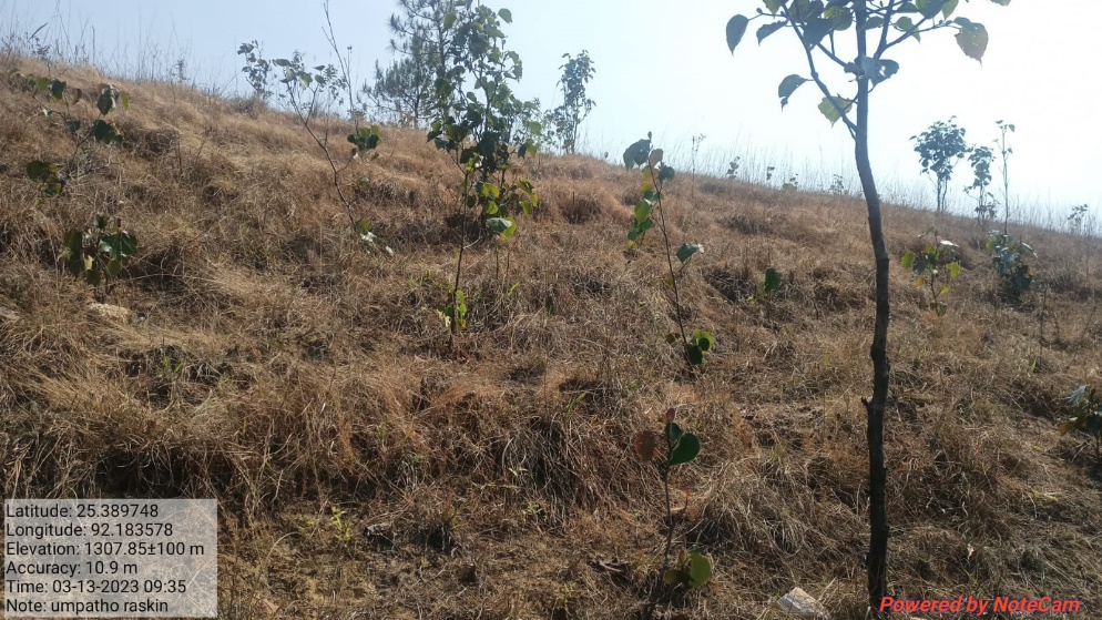
| 1 | AFFORESTATION | UMPATHO | 25.394438 | 92.18 | 1,66,170 | IMPLEMENTED |
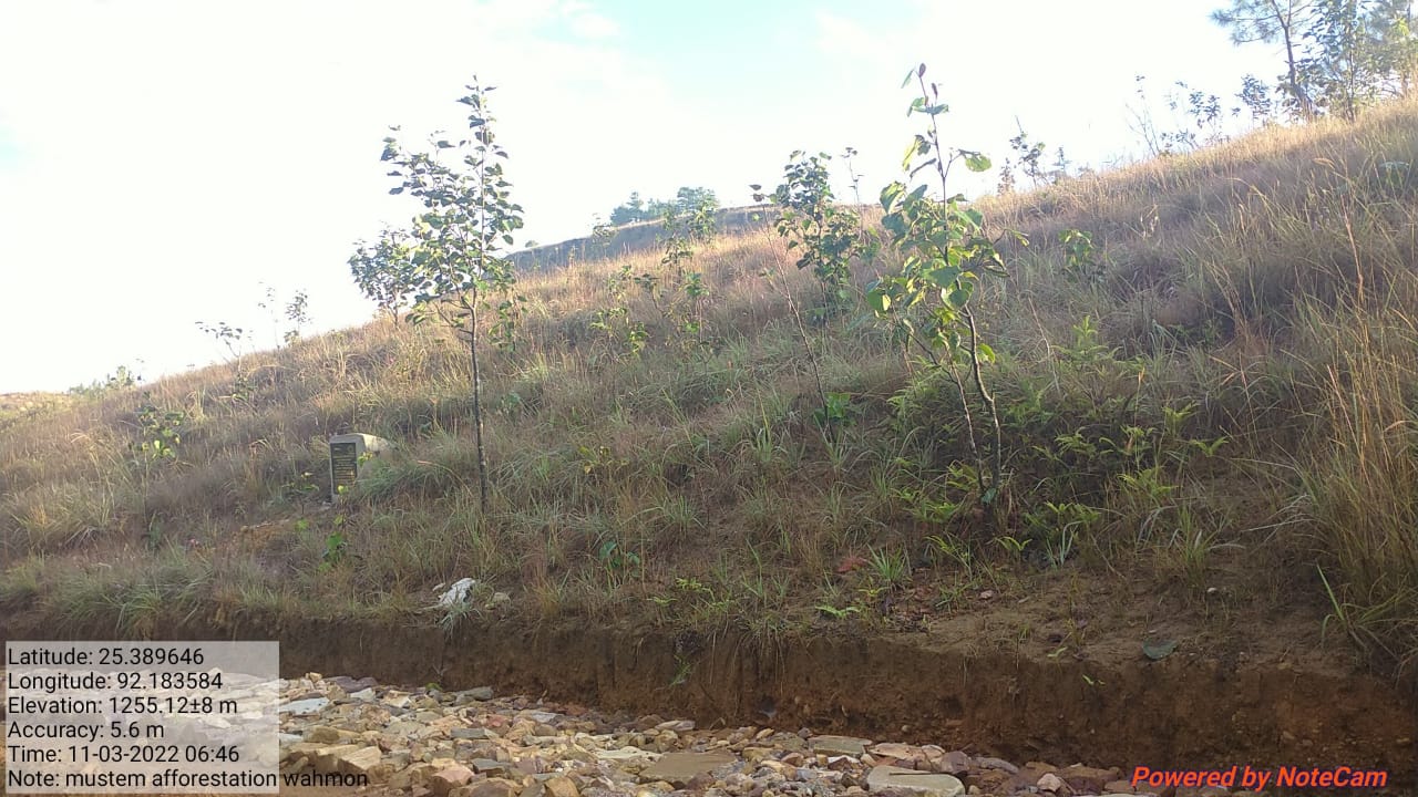
| 2 | AFFORESTATION | WAHMON | 25.389646 | 92.18358 | 1,66,170 | IMPLEMENTED |
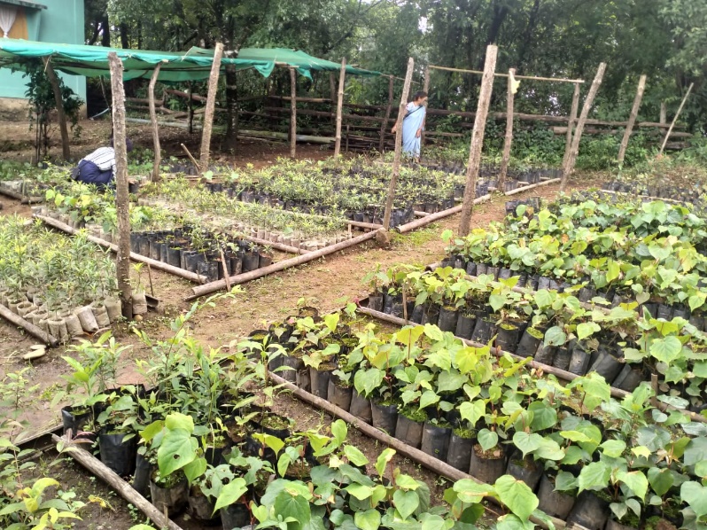
| 3 | COMMUNITY NURSERY | MUSTEM (Near Playfield) | 25.401792 | 92.18527 | 1,13,957 | IMPLEMENTED |
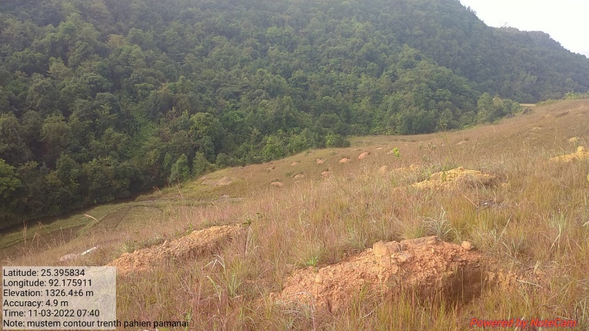
| 4 | CONTOUR TRENCHES | PAHIEM PAMMANAI | 25.395834 | 92.17591 | 44,300 | IMPLEMENTED |
| 5 | AGRO-FORESTRY | MYNTIAR WAH MUSTEM | 25.398481 | 92.1895 | 1,09,650 | IMPLEMENTED |
| 6 | AGRO-HORTICULTURE | PSYIAH SYNIONG | 25.399291 | 92.18742 | 1,04,550 | IMPLEMENTED |
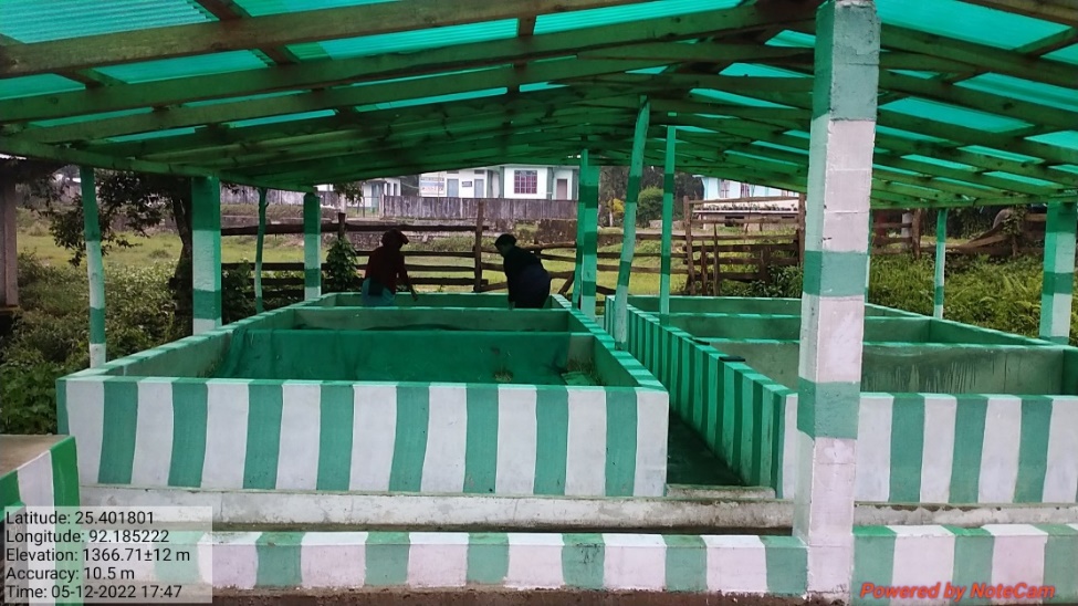
| 7 | VERMI COMPOSTING | SYNRANG KTIEH | 25.401792 | 92.18527 | 3,01,619 | IMPLEMENTED |
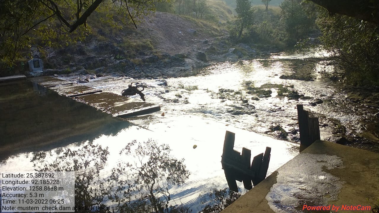
| 8 | CHECK DAM/KHLIEH KSHAID SARJRE | KHLIEH KSHAID SARJRE | 25.387892 | 92.18573 | 3,92,580 | IMPLEMENTED |
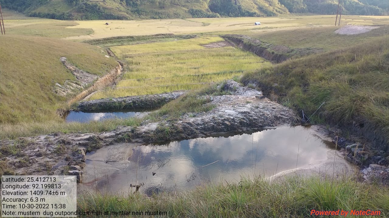
| 9 | DUG OUT POND CUM FISH & AGRI CULTIVATION | MYNTIAR NIEN MUSTEM | 25.412713 | 92.19981 | 2,27,660 | IMPLEMENTED |
| 10 | FENCING FOR PITCHER PLANT GARDEN | KSHAID SAJRI | 25.387248 | 92.18641 | 2,24,100 | IMPLEMENTED |
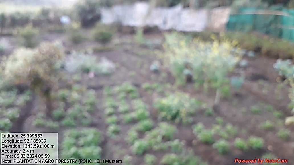
| 11 | PLANTATION OF AGRO-FORESTRY | POHCHIEH | 25.399599 | 92.18724 | 26,140 | IMPLEMENTED |
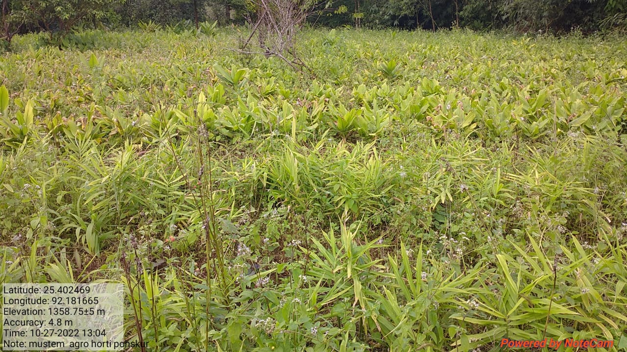
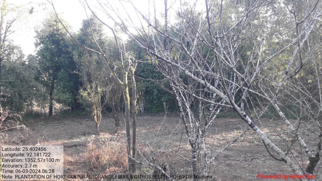
| 12 | PLANTATION OF HORTICULTURE (ORANGE FRUIT/CITRUS FRUIT) | POHSKUR | 25.402469 | 92.18167 | 63,500 | IMPLEMENTED |
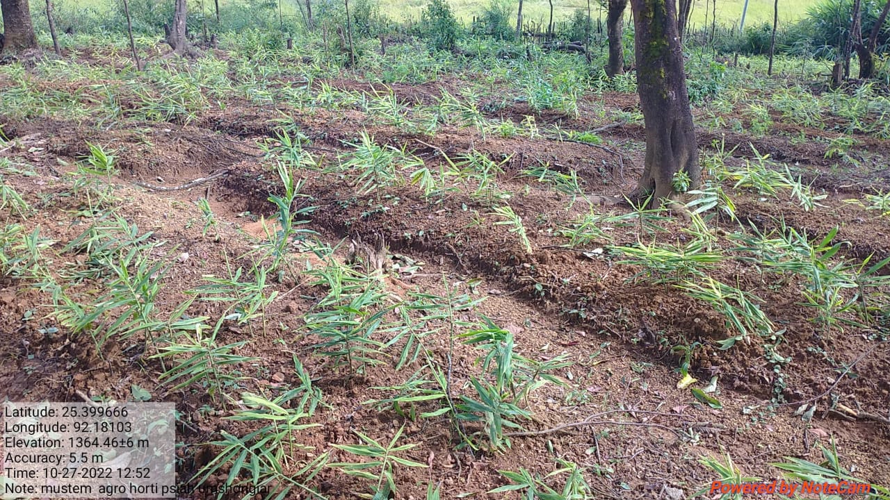
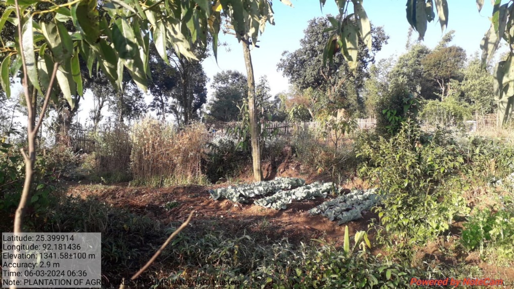
| 13 | PLANTATION OF AGRO-FORESTRY | UMCHANGIAR | 25.399666 | 92.18103 | 31,900 | IMPLEMENTED |
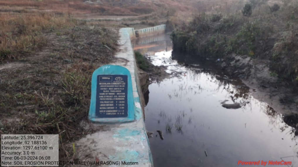
| 14 | SOIL EROSION PROTECTION WALL | WAH RASONG | 25.396708 | 92.18699 | 1,80,688 | IMPLEMENTED |
4. FUND STATUS
| SL NO. | TYPE OF INTERVENTION/WORK | SITE NAME | GPS COORDINATES | AMOUNT | WORK STATUS | |
|---|---|---|---|---|---|---|
| 1 | AFFORESTATION | UMPATHO | 25.394438 | 92.18 | 1,66,170 | IMPLEMENTED |
| SL NO. | TYPE OF INTERVENTION/WORK | SITE NAME | GPS COORDINATES | AMOUNT | WORK STATUS | |
|---|---|---|---|---|---|---|
| 2 | AFFORESTATION | WAHMON | 25.389646 | 92.18358 | 1,66,170 | IMPLEMENTED |
| SL NO. | TYPE OF INTERVENTION/WORK | SITE NAME | GPS COORDINATES | AMOUNT | WORK STATUS | |
|---|---|---|---|---|---|---|
| 3 | COMMUNITY NURSERY | MUSTEM (Near Playfield) | 25.401792 | 92.18527 | 1,13,957 | IMPLEMENTED |
| SL NO. | TYPE OF INTERVENTION/WORK | SITE NAME | GPS COORDINATES | AMOUNT | WORK STATUS | |
|---|---|---|---|---|---|---|
| 4 | CONTOUR TRENCHES | PAHIEM PAMMANAI | 25.395834 | 92.17591 | 44,300 | IMPLEMENTED |
| SL NO. | TYPE OF INTERVENTION/WORK | SITE NAME | GPS COORDINATES | AMOUNT | WORK STATUS | |
|---|---|---|---|---|---|---|
| 5 | AGRO-FORESTRY | MYNTIAR WAH MUSTEM | 25.398481 | 92.1895 | 1,09,650 | IMPLEMENTED |
| SL NO. | TYPE OF INTERVENTION/WORK | SITE NAME | GPS COORDINATES | AMOUNT | WORK STATUS | |
|---|---|---|---|---|---|---|
| 6 | AGRO-HORTICULTURE | PSYIAH SYNIONG | 25.399291 | 92.18742 | 1,04,550 | IMPLEMENTED |
| SL NO. | TYPE OF INTERVENTION/WORK | SITE NAME | GPS COORDINATES | AMOUNT | WORK STATUS | |
|---|---|---|---|---|---|---|
| 7 | VERMI COMPOSTING | SYNRANG KTIEH | 25.401792 | 92.18527 | 3,01,619 | IMPLEMENTED |
| SL NO. | TYPE OF INTERVENTION/WORK | SITE NAME | GPS COORDINATES | AMOUNT | WORK STATUS | |
|---|---|---|---|---|---|---|
| 8 | CHECK DAM | KHLIEH KSHAID SARJRE | 25.387892 | 92.18573 | 3,92,580 | IMPLEMENTED |
| SL NO. | TYPE OF INTERVENTION/WORK | SITE NAME | GPS COORDINATES | AMOUNT | WORK STATUS | |
|---|---|---|---|---|---|---|
| 9 | DUG OUT POND CUM FISH & AGRI CULTIVATION | MYNTIAR NIEN | 25.412713 | 92.19981 | 2,27,660 | IMPLEMENTED |
| SL NO. | TYPE OF INTERVENTION/WORK | SITE NAME | GPS COORDINATES | AMOUNT | WORK STATUS | |
|---|---|---|---|---|---|---|
| 10 | FENCING FOR PITCHER PLANT GARDEN | KSHAID SAJRI | 25.387248 | 92.18641 | 2,24,100 | IMPLEMENTED |
| SL NO. | TYPE OF INTERVENTION/WORK | SITE NAME | GPS COORDINATES | AMOUNT | WORK STATUS | |
|---|---|---|---|---|---|---|
| 11 | PLANTATION OF AGRO-FORESTRY | POHCHIEH | 25.399599 | 92.18724 | 26,140 | IMPLEMENTED |
| SL NO. | TYPE OF INTERVENTION/WORK | SITE NAME | GPS COORDINATES | AMOUNT | WORK STATUS | |
|---|---|---|---|---|---|---|
| 12 | PLANTATION OF HORTICULTURE (ORANGE FRUIT/CITRUS FRUIT) | POHSKUR | 25.402469 | 92.18167 | 63,500 | IMPLEMENTED |
| SL NO. | TYPE OF INTERVENTION/WORK | SITE NAME | GPS COORDINATES | AMOUNT | WORK STATUS | |
|---|---|---|---|---|---|---|
| 13 | PLANTATION OF AGRO-FORESTRY | UMCHANGIAR | 25.399666 | 92.18103 | 31,900 | IMPLEMENTED |
| SL NO. | TYPE OF INTERVENTION/WORK | SITE NAME | GPS COORDINATES | AMOUNT | WORK STATUS | |
|---|---|---|---|---|---|---|
| 14 | SOIL EROSION PROTECTION WALL | WAH RASONG | 25.396708 | 92.18699 | 1,80,688 | IMPLEMENTED |