Village Profile on
Markasa Village under Mawthadraishan C&RD
Block
District: Eastern West Khasi Hills District
29th November, 2021.
COMMUNITY LED LANDSCAPE MANAGEMENT PROJECT
(CLLMP)


The Government of Meghalaya with financial help from the World Bank is implementing the Meghalaya Community Led Landscape Management Project (MCLLMP). The project will cover the entire state of Meghalaya and implementation of community led plans will be rolled out in phase manner throughout the state. The Meghalaya Basin Management Agency (MBMA) will facilitate community-led planning by providing support, technical inputs and funding.
The project is intended to strengthen community-led natural resources management in selected landscapes within the 11 districts of the state. This would be achieved through a variety of planning, capacity building, and on-the-ground interventions to promote the conservation, sustainable use of natural resources, social inclusion and community mobilisation; building traditional knowledge and learning, mapping of natural resources management; strengthening the community institutions and creating linkage with financial institutions and community organizations.
The project interventions will include preparation of community led natural resource management plans. The CLLMP has the following three components:
Strengthening Knowledge and Capacity of Communities for Natural Resources Management.
Community-Led Landscape Planning and Implementation.
Project Management and Governance.
Objective:
 The project objective
is “to manage and conserve the natural resources, especially
forests, soil and water sources, in a manner that supports the
financial and physical well-being of communities in the
State”
The project objective
is “to manage and conserve the natural resources, especially
forests, soil and water sources, in a manner that supports the
financial and physical well-being of communities in the
State”
The CLLM-Programme focuses on increasing the capacities of communities and traditional institutions (TI) by adopting a landscape approach to manage their natural resources such as soil, springs and other water sources, forests, and bio-diversity, etc.
The project will be planned and implemented in about 400 villages across the state.
CLLMP has a strong focus on institution-building at the village-level, by ensuring systematic capacity-building on technical and social skill-sets.
The project will also extend such training to communities beyond the targeted villages and support efforts made by them to access funding from various rural and natural resources initiatives and schemes.
The Programme will also invest in improving the process and outcome delivery, by developing and adhering to effective systems and procedures, supported by the appropriate technology.
Benefits for community (Skills and Capacity relating to technical and managerial areas like NRM and Conflict resolution
Benefits to traditional institutions (village councils, traditional leaders, community-based organizations, SHGs etc) through Knowledge sharing, promotion of innovative approach, access to technology, technical managerial and financial support.
It is estimated that the project will impact around 1 lakh partners (of which 50% are women) who depend on land, forest, agro forestry.
Through the project, 55000 Ha of targeted area will be ensured with availability of water, biological resources, and soil productivity, which will in turn benefit around 400 villages and the outcomes delivery can be summarized as follows.
The Project will be executed by the MBMA in collaboration with other partners particularly, SIRD (for training and capacity building), Department of Soil and Water Conservation, Water Resource Department, Forest Department, specifically with respect to technical inputs, safeguards management and Community NRM plan preparation.
2018-2023 (5 years).
Contents
| SL. No. | Title | Page No. |
|---|
Introduction and History................................................................................... 5-6
Social Profile ..................................................................................................... 7-10
1. Population.........................................................................................................7
2. Card holding household....................................................................................8
3. Occupation........................................................................................................9
4. Key constraints.................................................................................................10
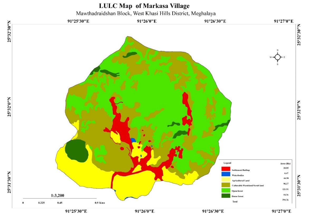
5. Land use land cover pattern.............................................................................10
6. Environment challenge.....................................................................................10
CLLMP Activities...............................................................................................11-14
Ground-Truthing..................................................................................................11
Sensitization on CLLMP......................................................................................11
Signing of EOI, VGA, and Green Charter.................................11
Formation of VNRMC................................................................11
Village Community Facilitators..................................................12
Purchase commitee...................................................................13
Opening of Bank Account and training on accounting.........................................15
PRA Exercise......................................................................................................
Village boundary Mapping and Resource Mapping...................16
Basic survey for CNRMP Template...........................................1
Focussed Group Discussion.....................................................17
Seasonal Calender..............................................................................................19
Submission of CNRMP by the VNRMC...............................................................19
The final CNRMP Plan..............................................................20
GIS Activities......................................................................................................21
Project implementation........................................................................................22-25
8) Fund Status.................................................................................................... 26-27
I.INTRODUCTION
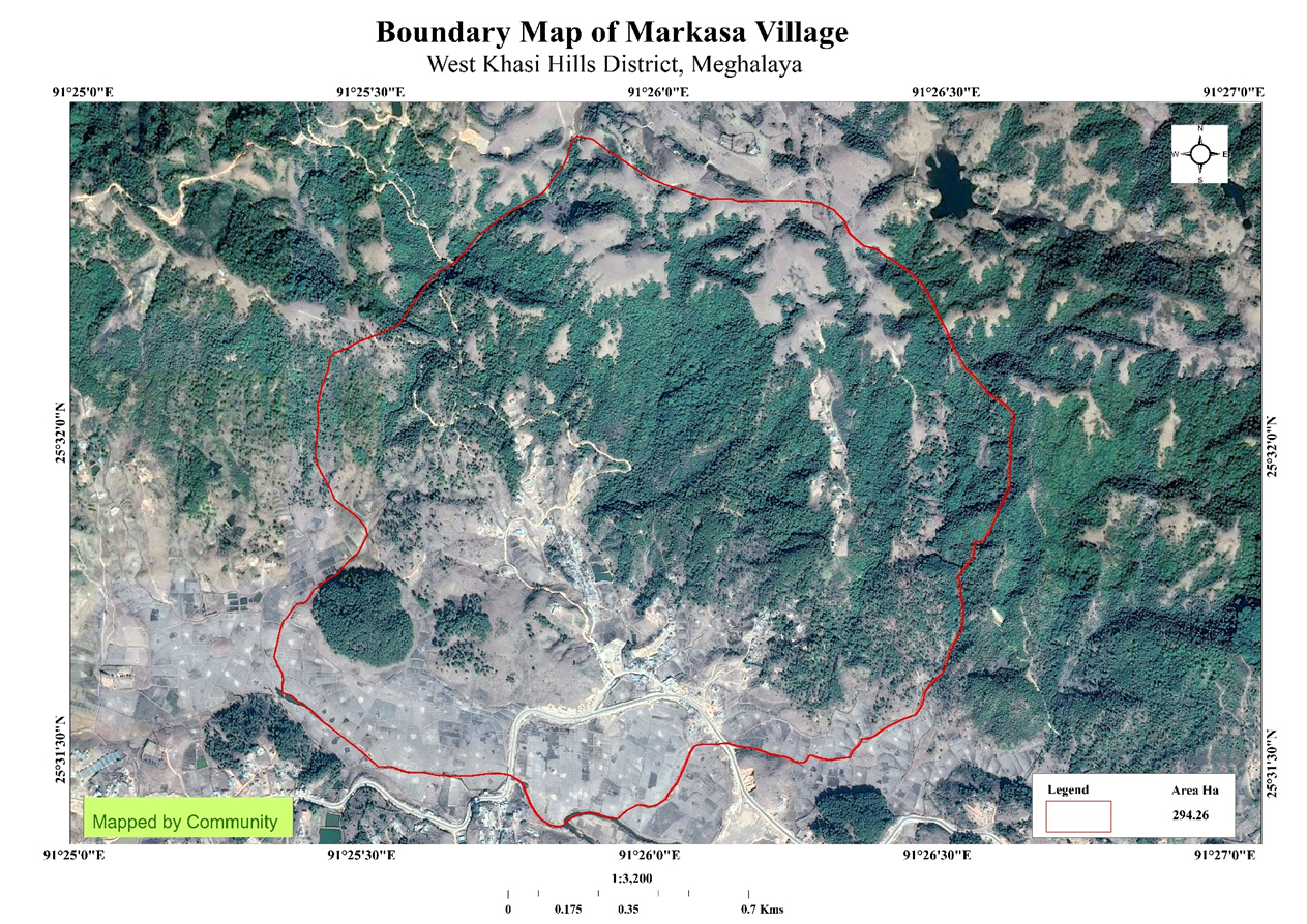
Markasa Village falls under Mawthadraishan Block of Eastern West Khasi Hills in the State of Meghalaya. Markasa village lies at a distance of 21 Kms away from Nongstoin which is the District Headquarter of West Khasi Hills and about 72 Kms away from Shillong which is the capital of Meghalaya. It falls under Hima Myriaw Syiemship with a total geographical area of 294.26Ha and a population of 795 from 120 households.
Its Boundaries:
North: Mawphanlur Myriaw syiemship.
East: Mawroh Mawiang syiemship.
South: Nongkasen Myriaw Syiemship.
West: Mawkohnoh Myriaw Syiemship.
Brief History:
Markasa village is located in Eastern West Khasi Hills District and is part of Myriaw Syiemship. It is one of the oldest villages in Khasi Jaintia Hills. From olden days, there were many people living in the village. This is seen through the different areas where people started constructing their houses. There were also areas and estates which proved that cultivation and farming was done back from the olden days.
By its name, Markasa was inhabited by hunters from Nongriat and Nginlong village. The villagers sat down with them and narrated stories about the abundance in produce and meat. They professed that their fields are rich with fruits and crops in which food for them was plentiful. Then the hunters accorded to barter their produce and food and made the place as the centre of trade. This place where they met came to be known as Markasa for it was here that they shared food with one another.
As time went on, the town inevitably fell into near abandonment, with the disbandment of the earlier settlers. It was revived by the few that remained. The elders and the villagers decided to established a school in the village which resulted in the revival of the near derelict village.
II.Social Profile
Markasa Village is located at Mawthadraishan Block of Eastern West Khasi Hills District in Meghalaya, which has a total number of populations of 795 people. It is located in rural area of Eastern West Khasi Hills and is also one of the villages of Mawthadraishan Block. Majority of the people residing within the Village are Farmers, Local Businesses and some of them as teachers.
Literacy: As per the census of 2011, the literacy rate of Markasa Village is 83.6% where the male literacy rate was 80.41% and the female literacy rate was 86.78%. There are four schools in Markasa Village i.e., three Primary Schools and one Secondary School.
In Markasa Village, the Dorbar serves as the Governance in the village which look after the administration, safety of villagers as well as overall governance. Apart from the village Dorbar, there is also the Markasa VEC, VNRMC which looks after the implementation of CLLMP, Seng Kynthei (Women wing) and Seng Samla (Youth Wing) aiming for the good and growth of the village, Markasa Sport Club and Self-Help Group (SHG).
 1.Population:
As per census 2011, Markasa Village has a total population of 639
villagers and in 2023 the total population of Markasa Village has
increased to 795. Out of this, 409 are males and 386 are females.
The different categories of aged group are given below:
1.Population:
As per census 2011, Markasa Village has a total population of 639
villagers and in 2023 the total population of Markasa Village has
increased to 795. Out of this, 409 are males and 386 are females.
The different categories of aged group are given below:
| Demographic | Male | Female | Total |
|---|---|---|---|
| 0-4 | 29 | 36 | 65 |
| 5-14 | 105 | 95 | 200 |
| 15-30 | 172 | 137 | 309 |
| 30-60 | 86 | 97 | 183 |
| Above 60 | 17 | 21 | 38 |
BPL/APL Household:
| Particulars | No of Households |
|---|---|
| BPL HH | |
| APL HH |
2.Card Holding Household:
| Particulars | No of Households |
|---|---|
| Total HH | 120 |
| Ration card HH |
Fuel Type:
| Fuel Type | Total No of Household |
|---|---|
| Charcoal | 13 |
| Wood | 87 |
| LPG | 20 |
| Kerosene | 0 |
| Electricity | 0 |
 3.Occupation:
In Markasa, the main occupation of the people within the Village are mostly Farmers, Local Businesses, and some of them are teachers.
4.KEY CONSTRAINTS:
Drinking Water
Water for irrigation
Access to Fuel wood
Land for cultivation
5.LAND:
Community forest- 132.27 Ha
Cultivable land- 44.5 Ha
 6.ENVIRONMENTAL CHALLENGE:
Drinking Water,Forest Fire, Degraded land
Water Bodies
Spring-3, Stream- 3, River-1
III. CLLMP Activities
1.Ground Truthing:
The DPMU-CLLMP met with Shri. Thandar Warjri, Headman of Markasa village and other village representatives on the 27th July, 2019 for field assessment. Shri. Thandar Warjri provided the team with important information regarding the current scenario of the landscape and the natural resource management under his headmanship.
Case finding:
There are a total number of 120 households out of which 66HH fall under the BPL category.
Actively performing VEC.
Forest on hills slopes is prone to forest fires. Loss of natural vegetation.
Lack of water resources.
Few patches of degraded land left unused.
2. Sensitization Programme:
The District Project Manager and the Assistant Manager held a village level sensitization programme on the Community Led Landscape Management Project on the 22nd August, 2019. Villagers who participated in the programme, voicing out their concerns and questions regarding the project making it a huge success.
2.1. Signing of EOI, VGA and Green Charter:
Markasa Village signed the Expression of Interest (EOI), the Village Grant Agreement (VGA) and the Green Charter after a uniform agreement by the enitre community that the Community-Led Landscape Management Project (CLLMP) be implemented at MarkasaVillage.
2.2. Formation of the VNRMC:
The Formation of the Village Natural Resource Management Committee was done on the 22 August 2019, in a public meeting in the presence of the entire village and the CLLMP staffs. The community chose the President, the Secretary, and the other executive members of the Committee.
| Village Natural Resource Management Committee (VNRMC) | ||||||||
|---|---|---|---|---|---|---|---|---|
| Sl No | Name in Full | Gender M/F | Age (in Yrs) | Education | Designation | Occupation | Community | Contact No |
| 1 | Shri.Thandar warjri | Male | 50 | 9th passed | President | Business | Khasi | 8974005524 |
| 2 | Smt.Lanosha Marwein | Female | 35 | B.A passed | Secretary | Business | Khasi | 6009675580 |
| 3 | Shri.Shining Marwein | Male | 33 | 9th Passed | Finance secretary | Labourer | Khasi | 8837226384 |
| 4 | Smt.Fultis Lyngkhoi | Female | 28 | B.A passed | Member | Business | Khasi | 9366016557 |
| 5 | Shri.Shanbor roy Marwein | Male | 45 | 9th passed | Member | Labourer | Khasi | 8787718529 |
| 6 | Shri.Donbok Marwein | Male | 25 | 12th passed | Member | Labourer | Khasi | |
| 7 | Shri.Shaining Mawtyllup | Male | 23 | 12th passed | Member | Farmer | Khasi | 8787372672 |
| 8 | Shri.Richard Myrthong | Male | 32 | 10th passed | Member | Labourer | Khasi | 8787822928 |
| 9 | Shri Mooningstar Iawphniaw | Male | 28 | 9th passed | Member | Labourer | Khasi | 8837073089 |
Listed below are the members of the VNRMC:
2.3.Village Community Facilitators:
| Sl No | Name | Gender | Age | Education | Contact No | Role |
|---|---|---|---|---|---|---|
| 1 | Richard Myrthong | Male | 32 | X | 8787822928 | Environment |
| 2 | Shaining Mawtyllup | Male | 23 | XII | 8787372672 | Document |
| 3 | Paulstar Thabah | Male | 21 | XII | 9366098706 | Social |
2.4. Procurement Members:
| Sl.No | Name | Gender | Age | Education | Contact Number |
|---|---|---|---|---|---|
| 1 | Fultis Lyngkhoi | F | 29 | BA | 9366016557 |
| 2 | Shanborroy Marwein | M | 52 | VIII | 8837448362 |
| 3 | Fouscrous Iawphniaw | M | 37 | X | 98635722034 |
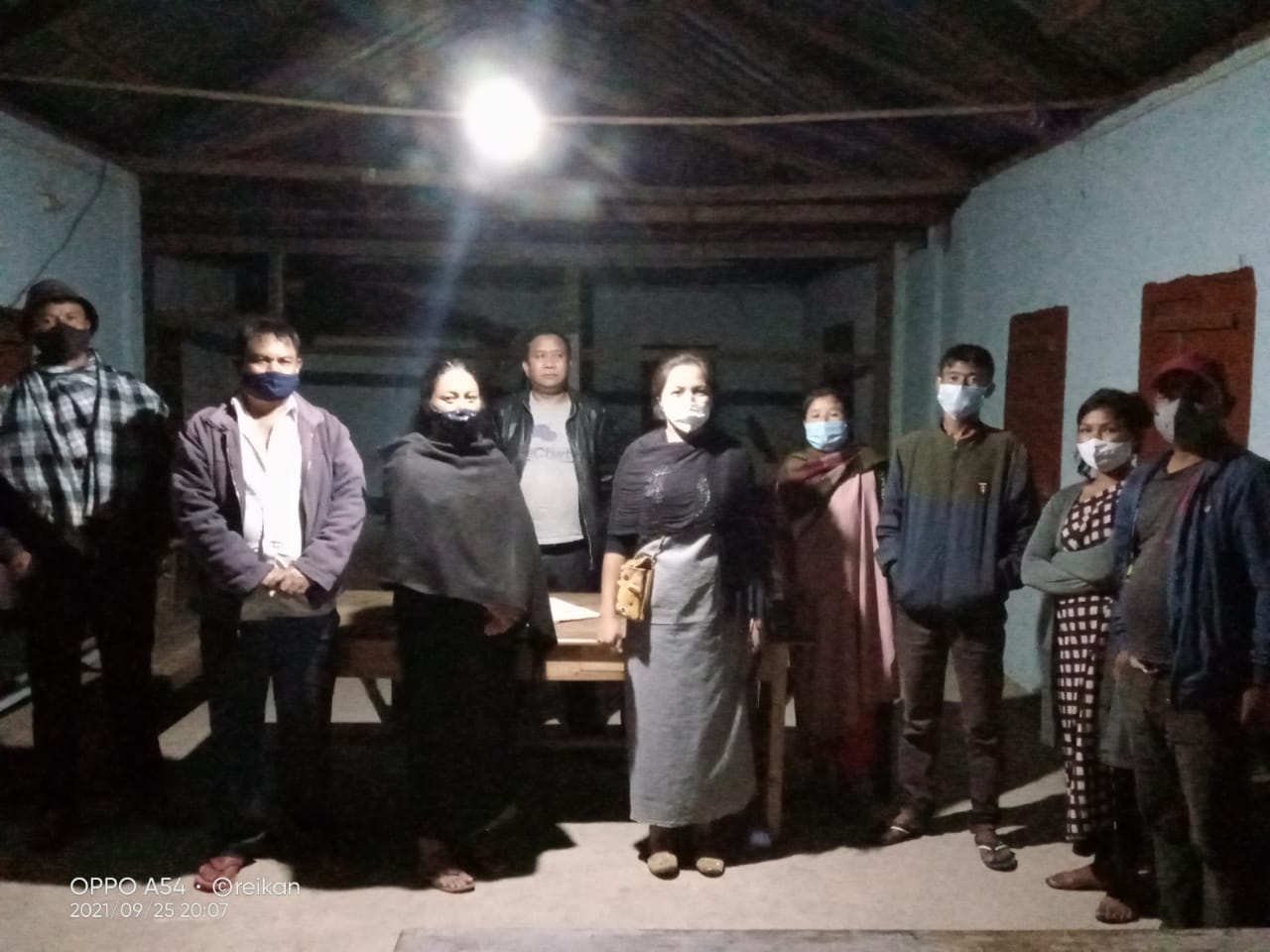
Fig.1 VNRMC Members
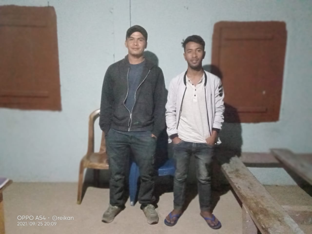
Fig.2.Village Community Facilitators (VCF)
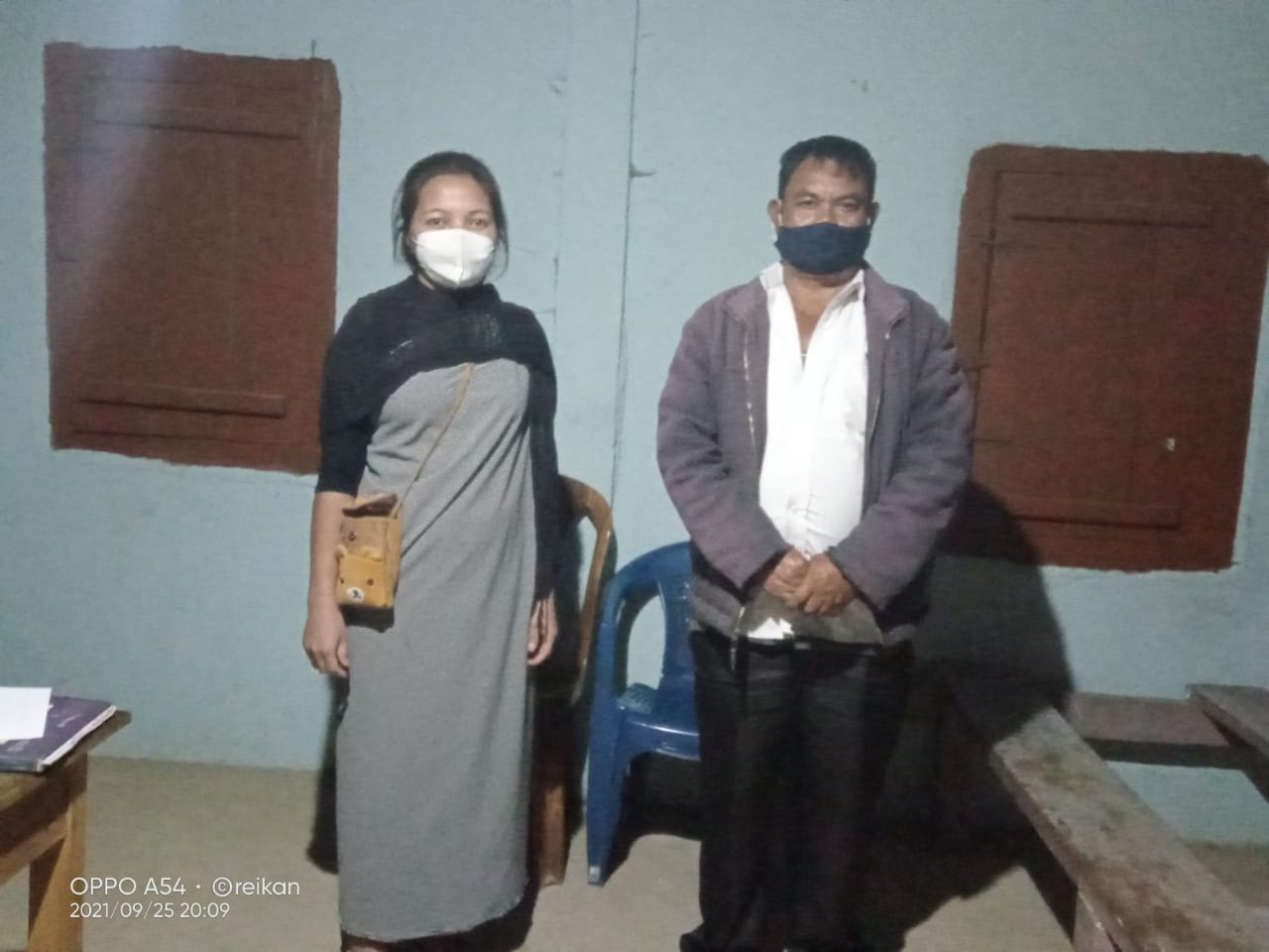
Fig.3. Procurement Members
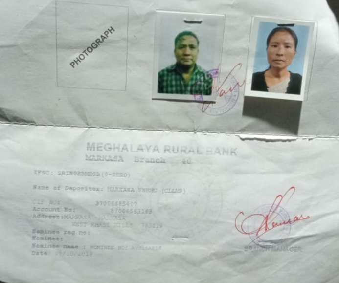
3.Opening of Bank Account:
The opening of the bank account in Markasa village was done after the signing of the EOI (Expression of Interest), the VGA (Village Grant Agreement) and the signing of the Green Charter at the respective villages. A meeting was held for all the VNRMC members of Markasa to brief and assist them before opening the VRNMC bank account. The bank account was opened on 05th October 2019.
4.Participatory Rural Appraisal Exercise:
The PRA exercise aims to incorporate the knowledge and opinions of the community in the planning and management of development projects and programmes. The PRA exercise at Markasa village took place on 20th September, 2019, where a total of 30 villagers, men and women included, who took part in the exercise.
The initial stage of Participatory Rural Appraisal (PRA) exercise at Markasa village commenced with a meeting cum orientation program on CLLMP. While conducting the meeting, the community members were made aware of the various PRA exercises to be conducted for the development of Community Natural Resource Management Plan (CNRMP) of the village, the community members’ contribution in the exercise and the objectives to be achieved. The key informants (the VNRMC and the VCFs) helped facilitate maximum participation.
Commencement of PRA:
Introduction: Participatory Rural Appraisal (PRA) is the process of involving local people in the analysis and interpretation of their own situation of a given rural area. The local people i.e., the participants take a leadership role in collecting, analysing, interpreting, and presenting information and in this process impart knowledge and development insight to the specialists and extension agents.
For management of natural resources, participatory Rural Appraisal is conducted to establish rapport with the village community as well as to identify and define problems for prioritization in the village itself. It is a way of learning from and with community members to investigate their need assessment, analyse and evaluate constraints and opportunities and find out priorities in the area of agriculture, small scale rural enterprises and any other social and economic development programs addressed to village development. Based on the principle of listening and learning.
Objectives of PRA exercise in Markasa village:
The Participatory Rural Appraisal (PRA) exercise in Markasa was conducted with following objectives:
To identify the natural, human and economic resources of village.
To identify the village problems and prioritize them with the help of the community members.
To prepare the Community natural Resource Management Plan of the village.
4.1: Village Boundary Mapping and Resource Mapping:
The GIS in collaboration with the Village Community Facilitators mapped the village boundary of Markasa Village.
The second step is to involve the local community in preparation of village resource map as perceived by the community members to solicit their participation. Infrastructure, services and other village resources such as agricultural lands, wells, Forest, wastelands, cattle population etc. were mapped. Local people prepared the Resource Map by drawing it on a chart paper as well as on the ground without much interference of outsiders.
This activity achieved the following purposes:
Rapport building and won the confidence of the villagers.
Analyzed the spatial information, particularly studied problems and opportunities of villagers.
Got an impression about the village setting, physical layout, location of various houses and institution.
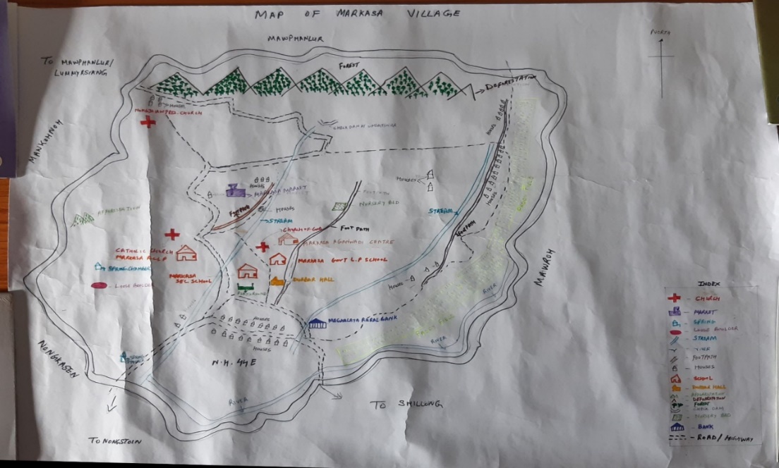
Findings Based on the Resource Map of Markasa Village:
Main agriculture produce is Cayote, Paddy.
There is only one Private Forest in the village.
3. There is only one river (Umsohlang River) that passed through the village.
4. Presence of Community Hall.
5. Presence of Football playground.
6. Presence of Integrated Child Development Services (ICDS).
7. Three springs Chamber.
8. School: There are three Schools. Two Primary School and one Secondary School in the village.
9. There are 3 churches in the village viz. Presbyterian, Church of God and Catholic.
4.2: Basic Survey for CNRMP Template:
During the PRA exercise, the External Expert of Social & Environment Management held group discussions with different groups to gather basic village information regarding number of households, demographic information, major crops and enterprises taken in the village, trends of production and productivity of major crops in the village and demographic distribution of village population.
Information related to land use category such as forest, cultivable land, water bodies, etc., and problems and challenges related to NRM were discussed.
4.3: Focussed Group Discussions:
A: Do people have sufficient access to supply of fodder, fuel wood, leaf litter?
Limited
B: Has access to timber improved or reduced over the years? How is access for household use and commercial use managed?
Reduced, from another village
C: Are the water bodies facing any threats?
Yes
D: Do all people in the village have access to drinking water? What are the challenges?
Yes (summer), winter is difficult; less rainfall; very less spring water.
E: Are there degraded areas in the village (open/ degraded forests, mining affected, high soil erosion etc.)?
Yes
.
F: What has caused this degradation? Are there practices causing threats to availability and access to natural resources?
Deforested of forest land, unfertile land, forest fire. Yes, shifting.
G: What have been the changes in agricultural practices?
Use of chemical fertilizers, most of the farmers stick with the traditional practices of farming
H: Are there any challenges in farming?
lack of water resources, use of chemical fertilizers which lead to land degradation
I: How would you consider the health situation in your village?
Good
J: How is the situation of cleanliness, sanitation, access to toilets and waste management?
improved. All houses have toilets and waste management has been improved but not upto the mark
K: Who are the most vulnerable in the village? What can be done to improve their lives?
Poor people and the Widows.
L: What are the livelihood aspirations of the youth? Are there any avenues available?
Employment generation
M: Do any committees/ institutions/ rules exist to manage and monitor natural resources in the village?
the Executive Committee of the village Dorbar
N: What are some of the major issues of conflict in the village?
No
O: Have any of the above issues been discussed in village meetings?
Yes
P: How do people resolve disagreements and conflicts?
Dorbar Shnong
4.4: Seasonality Calendar:
The CLLMP team also mapped the seasonal calendar of Markasa village to help identify heavy workload periods, periods of relative ease, credit crunch, diseases, food security, wage availability etc. This will prove helpful in project planning and project timeline framing.
Participants:
Richard Myrthong.
Shaining Mawtyllup.
Paulstar Thabah.
Lanosha Marwein.
| SlNo | Criteria | Jan | Feb | March | April | May | June | July | August | Sep | Oct | Nov | Dec |
|---|---|---|---|---|---|---|---|---|---|---|---|---|---|
| 1 | Water Scarcity | 5 | 8 | ||||||||||
| 2 | Prone to sickness | 4 | 3 | ||||||||||
| 3 | Rain Fall | 1 | 1 | 1 | 1 | ||||||||
| 4 | Free-Less work | 1 | 1 | ||||||||||
| 5 | Paddy Cultivation | 1 | 1 | ||||||||||
| 6 | Paddy harvesting | 1 | 1 | ||||||||||
| 7 | Tree Plantation | 1 | 1 | ||||||||||
| 8 | Vegetable (crop cultivation) | 1 | 1 | 1 | 1 | ||||||||
| 9 | Vegetable (crop harvesting | 1 | 1 | ||||||||||
| 10 | Festive Season | 1 | |||||||||||
| 11 | Forest fire | 1 | 1 |
5. Submission of the CNRMP:
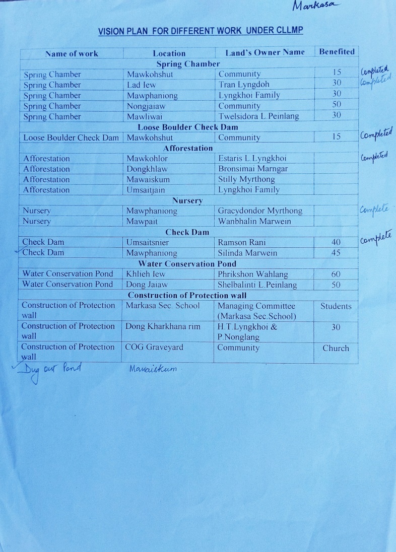
5.1 Final CNRMP Plan:
| SL.No | Name of work | Site | Land ownership | Benefited | Priority (High/Medium/Low) |
|---|---|---|---|---|---|
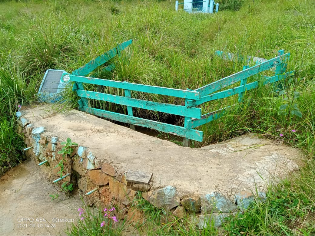
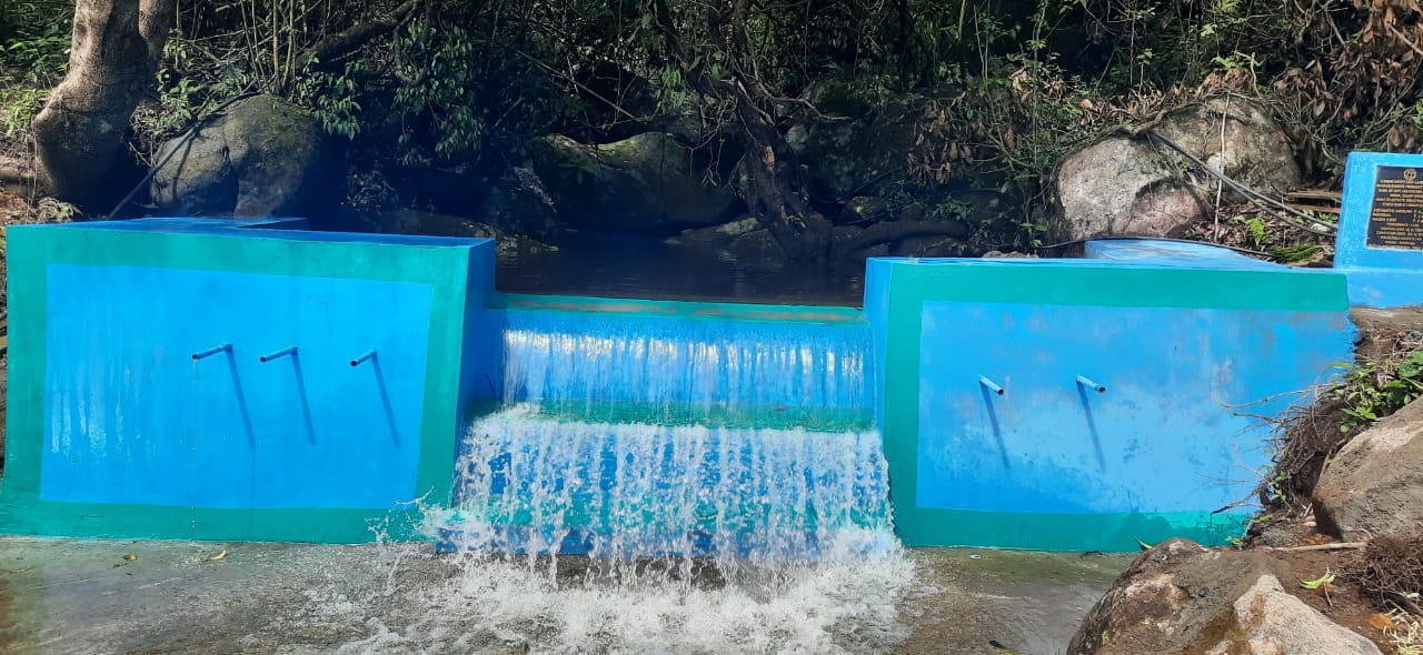
| 1 | Spring Chamber | Mawkohshut | Community | 15 | High |
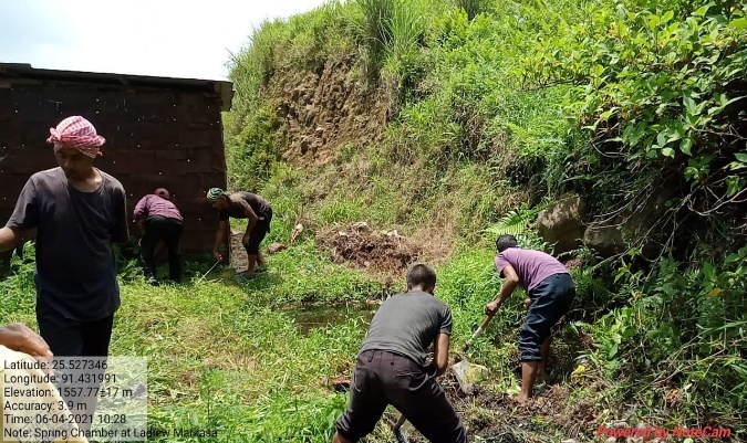
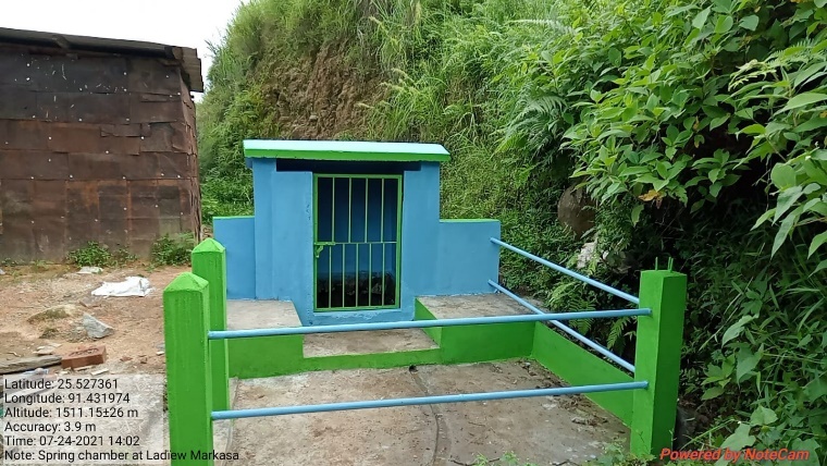
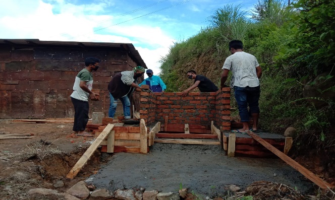
| 2 | Spring Chamber | Lad iew | Private | 30 | High |
| 3 | Spring Chamber | Mawphaniong | Private | 30 | High |
| 4 | Spring Chamber | Nongjaiaw | Community | 50 | High |
| 5 | Spring Chamber | Mawliwai | Private | 30 | High |
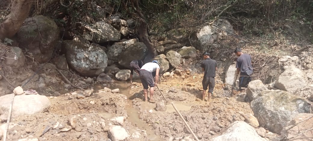
| 6 | Loose Boulder Checkdam | Mawkohshut | Community | 15 | High |
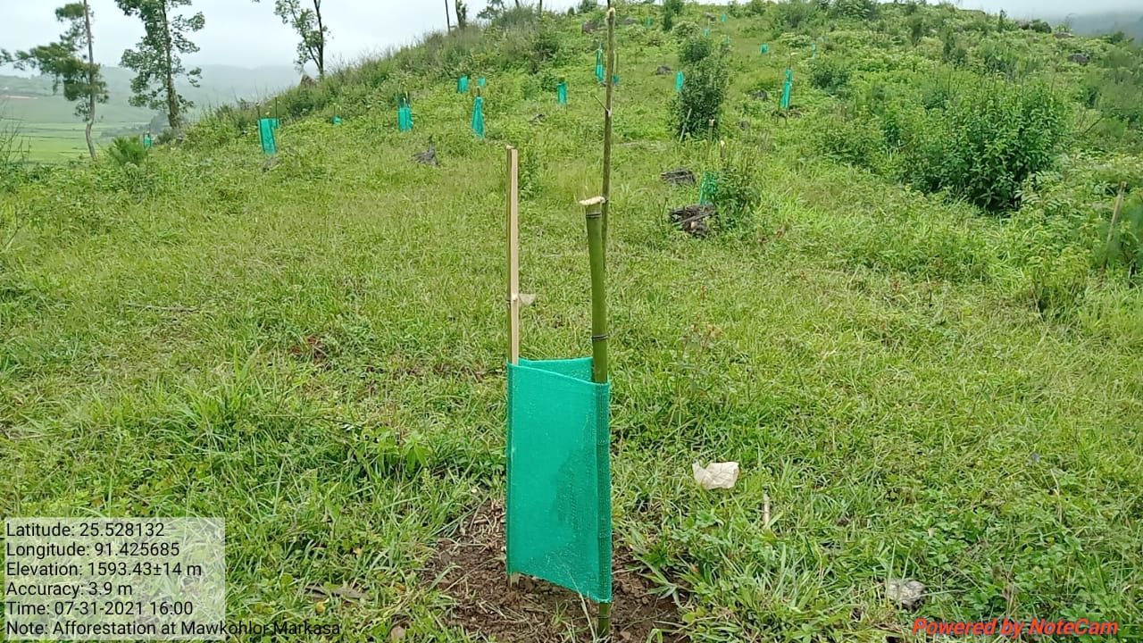
| 7 | Afforestation | Mawkohlor | Private | High | |
| 8 | Afforestation | Dong Khlaw | Private | High | |
| 9 | Afforestation | Mawaiskum | Private | High | |
| 10 | Afforestation | Umsaitjain | Private | High | |
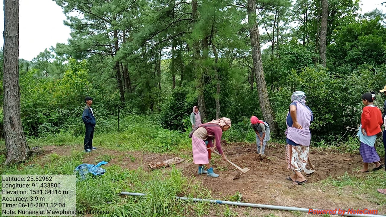
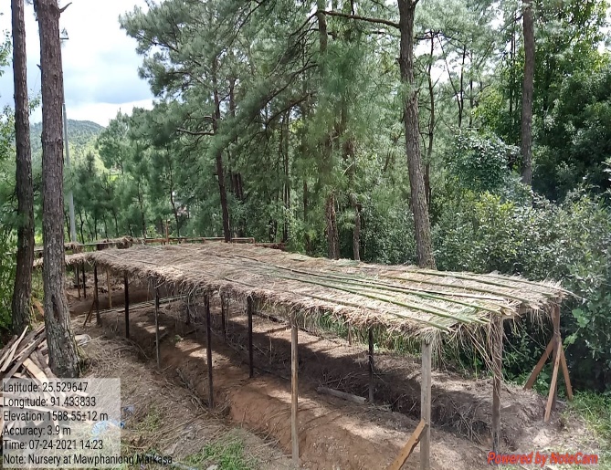
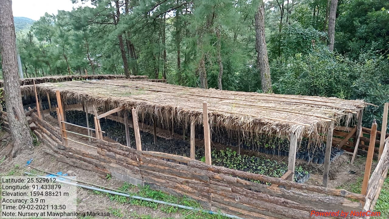
| 11 | Nursery | Mawphaniong | Private | High | |
| 12 | Nursery | Mawpait | Private | High | |
| 13 | Check Dam | Umsaitsnier | Private | 40 | High |
| 14 | Check Dam | Mawphaniong | Private | 45 | High |
| 15 | Water Conservation Pond | Khlieh Iew | Private | 60 | High |
| 16 | Water Conservation Pond | Dong Jaiaw | Private | 50 | High |
| 17 | Construction of Protection wall | Markasa Sec.School | Private | High | |
| 18 | Construction of Protection wall | Dong Karkhana Rim | Private | 30 | High |
| 19 | Construction of Protection wall | C.O.G Graveyard | Community | High |
6. GIS Activities:
| Sl. No. | Parameters | Village Information |
|---|---|---|
| 1 | GPS Coordinates: | |
| i | Latitude | 25.527631N |
| ii | Longitude | 91.433319E |
| iii | Elevation Reading (MSL) | 1515m |
| 2 | Village Geographical Area (Ha) | Total:294.26Ha 2. 9426sq.Km |
| i | Total Forest Area (including community, Clan, Pvt Forest) | 131.55Ha |
| ii | Total Area of Water Bodies | 0.47Ha |
| iii | Total Area under Agri-Horticulture | No Agriculture_Horticulture area |
| iv | Total Degraded land area (Ha) | 5.31 |
| 3 | Average Annual Rainfall | 1200-3000mm |
| 4 | Soil Type | Fine Loamy Soil |
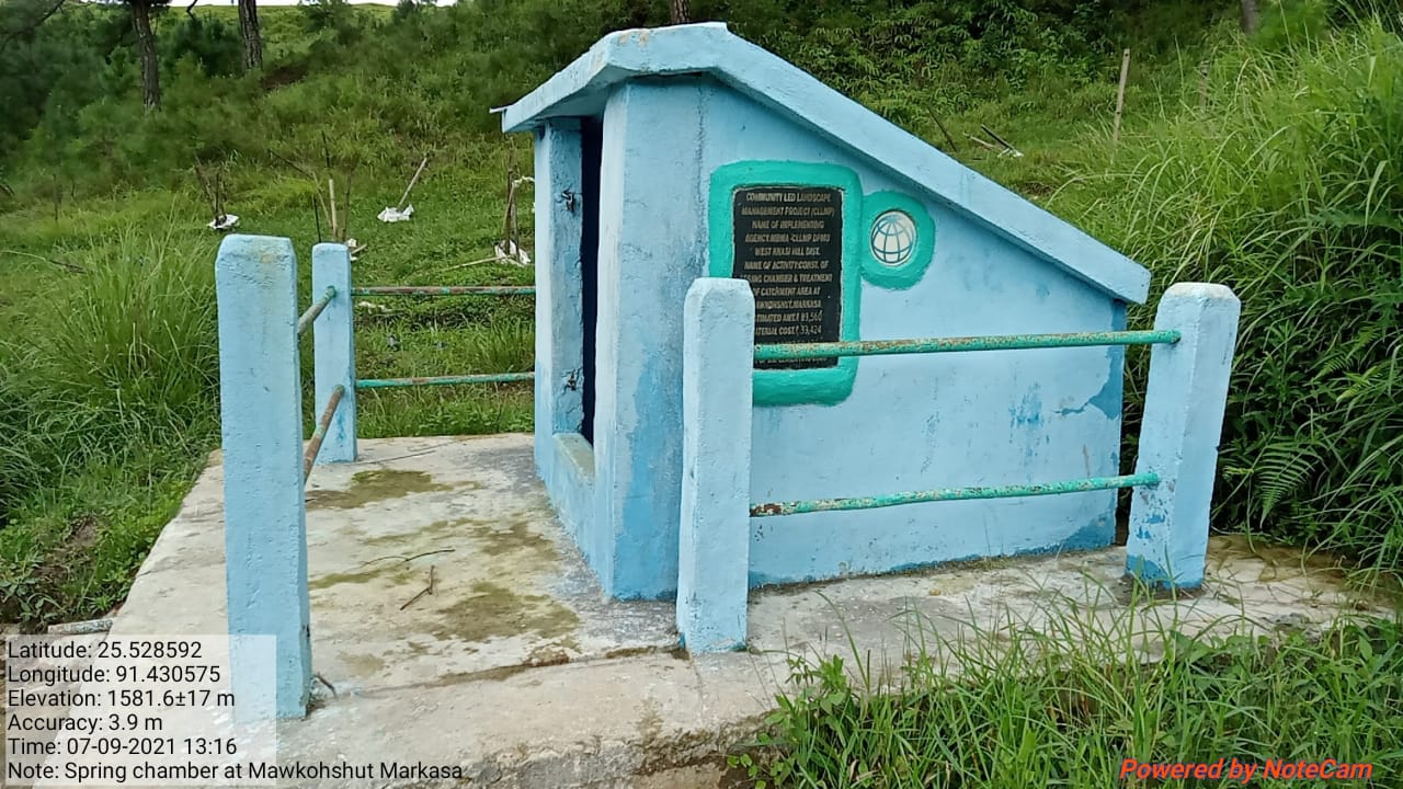
7.Project Implementation:
| 1. | Type Of Intervention | Site Name | GPS Co-ordinates | Amount Sanctioned | Work Status | |
|---|---|---|---|---|---|---|
| Spring Chamber | Mawkohshut | 25.526802 | 91.431956 | 83,560 | Completed | |
| 2. | Types Of Intervention | Site Name | GPS Co-ordinates | Amount Sanctioned | Work Status | |
|---|---|---|---|---|---|---|
| Loose Boulder Check Dam | Mawkohshut | 25.528663 | 91.430713 | 21,800 | Completed | |
| 3. | Types Of Intervention | Site Name | GPS Co-ordinates | Amount Sanctioned | Work Status | |
|---|---|---|---|---|---|---|
| Check Dam | Umsaitsnier | 25.53261333 | 91.43308833 | 4,17,670 | Completed | |

| 4. | Types Of Intervention | Site Name | GPS Co-ordinates | Amount Sanctioned | Work Status | |
|---|---|---|---|---|---|---|
| Afforestation | Mawkohlor | 25.52886639 | 91.42557333 | 1,73,250 | Completed | |
| 5. | Types Of Intervention | Site Name | GPS Co-ordinates | Amount Sanctioned | Work Status | |
|---|---|---|---|---|---|---|
| Spring Chamber | Lad iew | 25.52734 | 91.431833 | 85,600 | Completed | |
| 6. | Types Of Intervention | Site Name | GPS Co-ordinates | Amount Sanctioned | Work Status | |
|---|---|---|---|---|---|---|
| Community Nursery | Mawphaniong | 25.529519 | 91.434177 | 1,53,500 | Completed | |
8.Fund Status:
| Fund Released to VNRMC (Project Implementation) | Total No. of Work Order Issued | Total amount Issued under CLLMP (Per Activity) | Total Amount Spent | Start Date | End Date |
|---|---|---|---|---|---|
| ₹21,55,000/- | 6 | Spring Chamber with TCA | 78,888 | 06-Jul-20 | 14-Aug-20 |
| Spring Chamber with TCA | 4,672 | 06-Jul-20 | 14-Aug-20 | ||
| Loose Boulder Check Dam | 21,800 | 06-Jul-20 | 28-Jul-20 | ||
| Check Dam | 4,17,666 | 08-Mar-21 | 24-Apr-21 | ||
| Check Dam | 1,90,500 | 06-Dec-21 | 28-Jan-22 | ||
| Spring Chamber | 85,600 | 04-Jun-21 | 23-Jul-21 | ||
| Afforestation | 1,58,250 | 16-Jul-20 | 20-Aug-20 | ||
| Community Nursery | 1,22,581 | 15-Jun-21 | 28-Aug-21 | ||
| Dug Out Pond | 1,13,820 | 31-Jan-22 | 24-Mar-22 | ||
| Erosion Control Retaining Wall | 4,37,700 | 24-May-22 | 06-Aug-22 | ||
| Spring Chamber | 85,500 | 29-Apr-22 | 23-Jul-22 | ||
| Establishment of Agro-Horticulture With Staggered Trenches (Agro- Horticulture) | 1,46,743 | 05-Jul-22 | 20-Jul-22 | ||
| Establishment of Agro-Horticulture With Staggered Trenches (Trenches) | 9,216 | 05-Jul-22 | 20-Jul-22 | ||
| Erosion Control Retaining Wall | 3,83,000 | 17-Feb-23 | 28-Mar-23 | ||
| Construction of 6 units Vermi Compost | 2,18,300 | 14-Feb-23 | 20-Mar-23 | ||
| TOTAL AMOUNT SPENT | 24,74,236/- | ||||