The Government of Meghalaya with financial help from the World Bank is implementing the Meghalaya Community Led Landscape Management Project (MCLLMP). The project will cover the entire state of Meghalaya and implementation of community led plans will be rolled out in phase manner throughout the state. The Meghalaya Basin Management Agency (MBMA) will facilitate community-led planning by providing support, technical inputs and funding.
The project is intended to strengthen community-led natural resources management in selected landscapes within the 11 districts of the state. This would be achieved through a variety of planning, capacity building, and on-the-ground interventions to promote the conservation, sustainable use of natural resources, social inclusion and community mobilisation; building traditional knowledge and learning, mapping of natural resources management; strengthening the community institutions and creating linkage with financial institutions and community organizations.
The project interventions include preparation of community led natural resource management plans. The CLLMP has the following three components:
Strengthening Knowledge and Capacity of Communities for NaturalResources Management
Community-Led Landscape Planning and Implementation
Project Management and Governance
The project objective is “to manage and conserve the natural resources, especially forests, soil and water sources, in a manner that supports the financial and physical well-being of communities in the State”
The CLLM-Programme focuses on increasing the capacities of communities and traditional institutions (TI) by adopting a landscape approach to manage their natural resources such as soil, springs and other water sources, forests and bio-diversity, etc.
The project will be planned and implemented in about 400 villages across the state.
CLLMP has a strong focus on institution-building at the village-level, by ensuring systematic capacity-building on technical and social skill-sets.
The project will also extend such training to communities beyond the targeted villages and support efforts made by them to access funding from various rural and natural resources initiatives and schemes.
The programme will also invest in improving the process and outcome delivery, by developing and adhering to effective systems and procedures, supported by the appropriate technology.
Benefits for community (Skills and Capacity relating to technical and managerial areas like NRM and Conflict resolution
Benefits to traditional institutions (village councils, traditional leaders, community-based organizations, SHGs etc) through Knowledge sharing, promotion of innovative approach, access to technology, technical managerial and financial support.
It is estimated that the project will impact around 1 lakh partners (of which 50% are women) who depend on land, forest, agroforestry.
Through the project, 55000 Ha of targeted area will be ensured with availability of water, biological resources and soil productivity, which will in turn benefit around 400 villages and the outcomes delivery can be summarized as follows.
The Project is executed by the MBMA in collaboration with other partners particularly, SIRD (for training and capacity building), Department of Soil and Water Conservation, Water Resource Department, Forest Department, specifically with respect to technical inputs, safeguards management and Community NRM plan preparation
2018-2023 (5 years)
Introduction
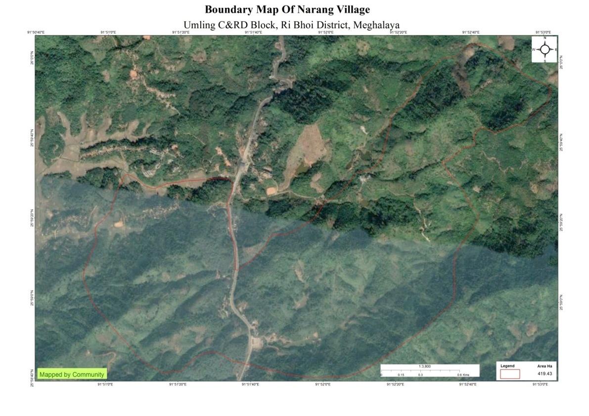
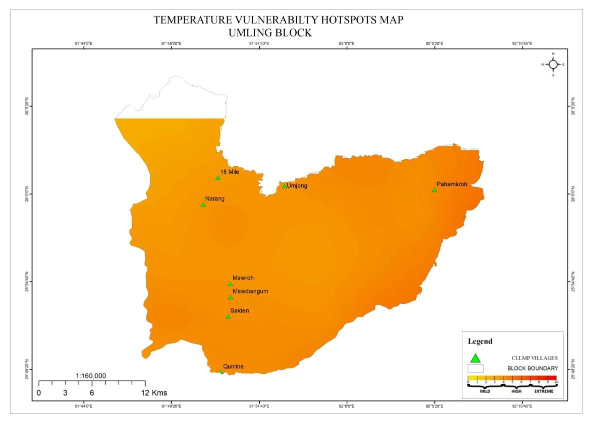
Narang Village falls under Umling C&RD block
of Ri-Bhoi district in the state of Meghalaya. The village is at a
distance of 3 Kms from Umling C&RD Block, 14 Kms from Nongpoh,
the district headquarters of Ri Bhoi District and is at a total
distance of 66 Kms from the state capital, Shillong. It falls under
Raid-Nongkhrah with a total geographical area of
419.43 ha and a total population of 622 villagers.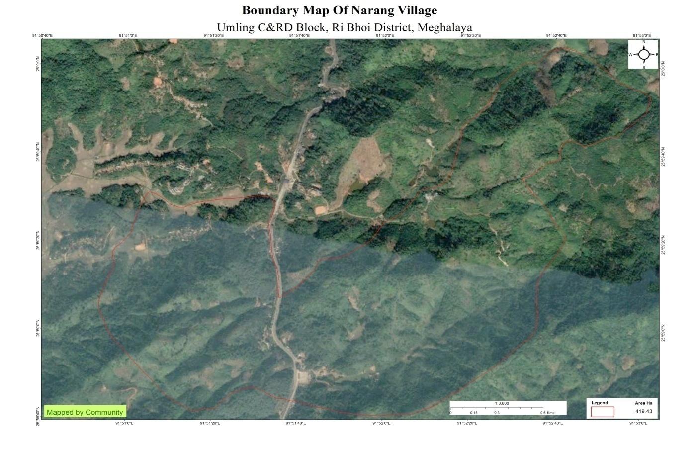
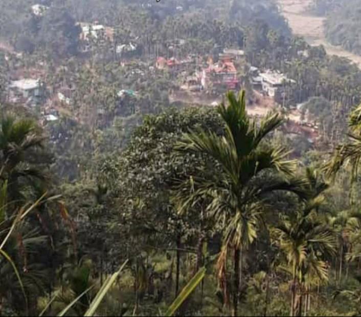
Under the Nongkhrah Raid, Nongpoh Sirdarship (Elaka),Narang is one of the older villages in the region. This village is known as Narang because in this area there are two rocks that are known as Maw NarangShynrang and Maw NarangKynthei. The Maw NarangShynrang is located in a place known as KlirNiangbari and the Maw NarangKynthei is located in a place known as PynnohIrLebik. These rocks as per folklore are said to be husband and wife and believed to be the land and river deities of this region where people in the past use to perform rituals and give offerings to them for a good harvest and for the prosperity of the villagers.
Forty years ago Narang village was still one village along with Pahammawlein village (20th Mile) and they were under the same Headman. The last headman to overlook both the villages as one was (L) So Lapang who was from Narang. After the two villages were separated Narang (L) JroNongrum was the first headman of Narang village and when he passed away (L) DretSyiem was appointed as the Headman and he held the office for fifteen years and he was succeeded by (L) DretJynthem who held the office for eighteen years and the current Headman is Shri PanjewellKhongmalai.
 The
village has a Government L.P school, an Anganwadi Centre, Narang
Sub-Centre (Health) (which has been shifted to Niangbarithem because
the village did not have a proper place for it but the name still
remains the same.) The village also has a football ground, a village
pond, various drinking water sources, two forests and cemeteries.
Most of the villagers are farmers who own farming lands and work
hard on these lands. The main produce of cultivation are rice,
banana, betel nut, betel leaves, pineapple, yam, Papaya, ginger,
turmeric, chillies and some even practice rubber plantation.
The
village has a Government L.P school, an Anganwadi Centre, Narang
Sub-Centre (Health) (which has been shifted to Niangbarithem because
the village did not have a proper place for it but the name still
remains the same.) The village also has a football ground, a village
pond, various drinking water sources, two forests and cemeteries.
Most of the villagers are farmers who own farming lands and work
hard on these lands. The main produce of cultivation are rice,
banana, betel nut, betel leaves, pineapple, yam, Papaya, ginger,
turmeric, chillies and some even practice rubber plantation.
Social Profile
The total number of households is 110 and has a population of 622 people. Agriculture and its allied activities are highly in vogue, where some few others are also enrolled in government and teaching jobs and some few inhabitants are engaged in local businesses.
Village Accessibility: In order to reach Narang Village one must go through National highway from Nongpoh to Guwahati which is located 14 Km away from Nongpoh.
Literacy: As per the 2011 census, the literacy rate of Narang village was 80.10%. In Narang Male literacy stands at 77.78% while female literacy rate is 82.63%. The village has only one School (Government L.P School)
The village further has a Durbar, an Executive Committee, Sub-committees like Village Employment Council (VEC), Village Natural Resource Management Council (VNRMC), Village Water and Sanitation Committee (VWSC) and a School Managing Committee. In the village there are also Women association, Youth association and eight Self Help Groups (SHGs) which consists only of women and is recognised by the office of the Block Development Officer. The village has its own rules and regulations which are enforced and looked after by the Village Durbar, it also has a Treasurer and auditors who look after the finances of the village.
Population 
As per Census 2011, Narang population is 530 and in 2020 the total population of Narang has been increased to 630. Out of this, 312 are males while the females count is 328. This village has 61 children in the age group of 0-4 years. Among them 35 are boys and 28 are girls.
| Age Group | Male | Female | Total |
|---|---|---|---|
| 0-4 | 38 | 23 | 61 |
| 5-14 | 68 | 101 | 169 |
| 15-30 | 98 | 118 | 216 |
| 30-60 | 75 | 85 | 160 |
| Above 60 | 11 | 05 | 16 |
BPL/APL Household:
| Particulars | No. of HH |
|---|---|
| BPL HH | 85 |
| APL HH | 25 |
Card Holding Household:
| Particulars | No. of HH |
|---|---|
| Total HH | 110 |
| Ration Card HH | 110 |
| Health Card HH | 100 |
Fuel Type:
| Fuel Type | Total HH |
|---|---|
| Charcoal | 0 |
| Biomass | 0 |
| Wood | 110 |
| LPG | 38 |
| Electric Heater | 20 |
| Kerosene | 0 |
OCCUPATION: The people of the village rely on
agriculture and forest products for their livelihood. The main
occupation of the villagers is farming followed by Teachers,
Mason/Carpenter and Army.
CLLMP ACTIVITIES
Ground Truthing
Dated: 6th of November 2018
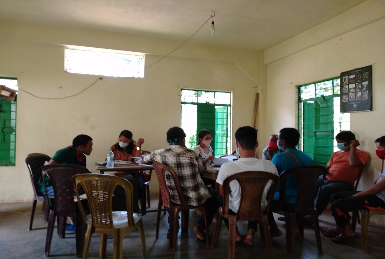
The CLLMP team met with Mr. Panjewel Khongmalai, headman of Narang village on the 19th of June 2019. He provided the team with important information regarding the current scenario of the landscape and the natural resource management under his chairmanship.
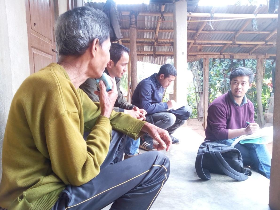
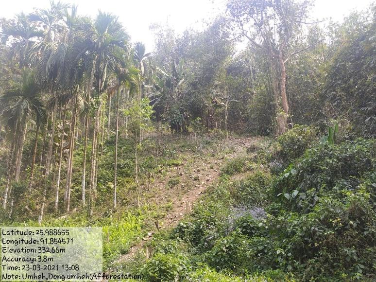
Figure 1 : Ground-truthing at Narang Village.
Case Findings & Selection parameters: -
1. There are a total of 110 HH out of which 85 fall under the BPL category.
2. Actively performing VEC
3. Mostly private lands however there is a community forest
4. Presence of Degraded Land
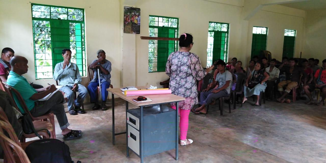
Sensitization Programme
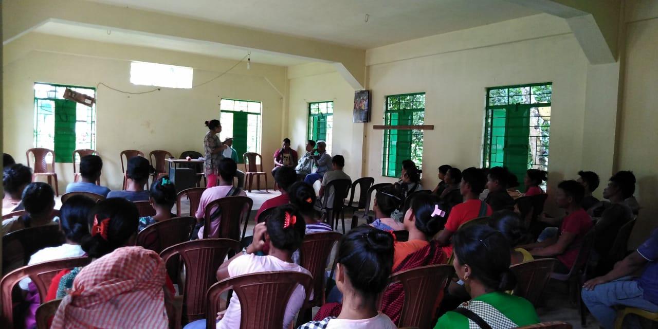
Dated: 20th of June 2019
The District Project Manager and the Assistant Managers held a village Level sensitization Programme on the Community Led Landscape Management project on the 4th of June 2019. The Sensitization program was chaired by the headman of Narang Village Mr P. Khongmalai. The meeting saw in attendance almost up to 57 men and women.
The villagers actively participated in the program, voicing out their concerns and questions regarding the project making it a huge success.
The CLLMP officials gave a brief introduction on Meghalaya Basin
Management Agency (MBMA) and elucidated about the various programmes
and projects that MBMA is working on, they then gave a detailed
introduction on the Community led Landscape Management Project
(CLLMP) and the different aspects and procedures that the villagers
and the CLLMP team should carry out during the course of the project
and the importance of the involvement of the community for the
CLLM-Project to be a success. They gave due importance to the
environmental aspects of the project and enlightened them on the
various benefits that the villagers could obtain from the
project.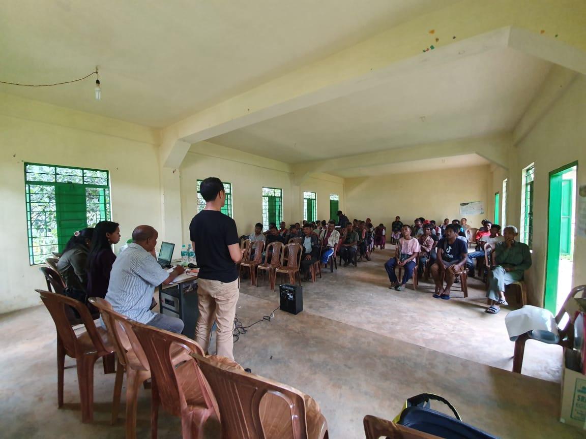
The Program was followed by an interactive session to answer the doubts and questions of the villagers.
.
2.2 Signing of Documents: After the
interactive session, the village signed the Expression of Interest
(EOI), the Village Grant Agreement (VGA) and the Citizen’s Green
charter on the same day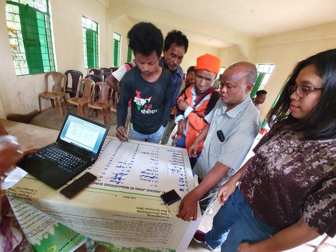
2.3 Formation of the VNRMC
The Formation of the Village Natural Resource Management Committee was done in a public meeting in the presence of the entire village and the CLLMP staffs. The community itself chose the President, the Secretary and the other executive members of the Committee.
Listed below are the members of the VNRMC:
|
|||||||||
|---|---|---|---|---|---|---|---|---|---|
|
Name in Full | Designation | Gender M/F | Age (Yrs) | Education | Occupation | Community | Religion and Denomination | Contact No and email address |
|
Panjewel Khongmalai | President | M | 46 | BA | Teacher | Khasi | Christian | 7308493518 |
|
Randani Nongrum | Secretary | F | 45 | VIII | Farmer | Khasi | Christian | 6909211924 |
|
Petrus Shadap | Book keeper | M | 26 | XII | Student | Khasi | Christian | 8259826587 |
|
Julia Syngkli | Member | F | 30 | V | ASHA | Khasi | Christian | 7085451782 |
|
Mary Magdalene Marboh | Member | F | 45 | VIII | Farmer | Khasi | Christian | 9862866877 |
|
Prisca Syngkli | Member | F | 29 | V | Farmer | Khasi | Christian | 6009679268 |
|
Banshan Namsaw | Member | M | 33 | XII | Farmer | Khasi | Christian | 8257885464 |
|
Shel Jynthem | Member | M | 37 | V | Farmer | Khasi | Christian | 8732859479 |
|
Bir Jynthem | Member | M | 38 | IV | Farmer | Khasi | Christian | 9774486322 |
| Village Community Facilitators | ||||||
|---|---|---|---|---|---|---|
| Sl.No. | Name | Gender | Age | Education | Contact Number | Role |
| 1 | Teilang Jynthem | M | 20 | X | 9774069346 | Environmental & GIS |
| 2 | Winky Syngkli | M | 24 | X | 8794859011 | Project Management M&E |
| 3 | Rupalin Jynthem | F | 20 | XII | 8794323795 | Social Management &KMS |
| List of Procurement members | ||||
|---|---|---|---|---|
| Name | Gender | Age | Education | Contact Number |
| Jowel Syngkli | Male | 34 | VII | 8413068796 |
| Magdalin Marboh | Female | 47 | IX | 9862866877 |
| Shal Jynthem | Male | 37 | V | 8732859479 |
Figure: The Village VNRMC EC Members
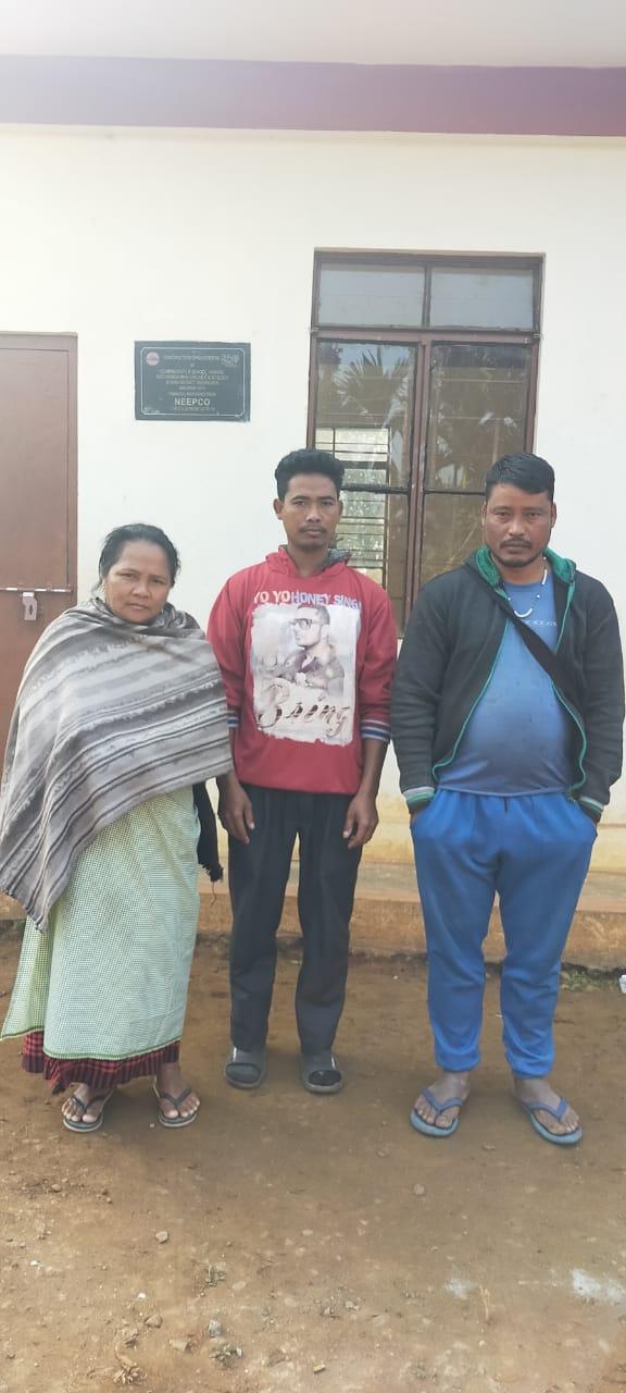
Figure: The Procurement Committee
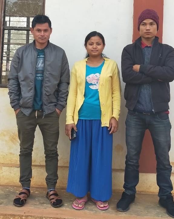
Figure: The Village Community Facilitators
3. Opening of Bank Account.
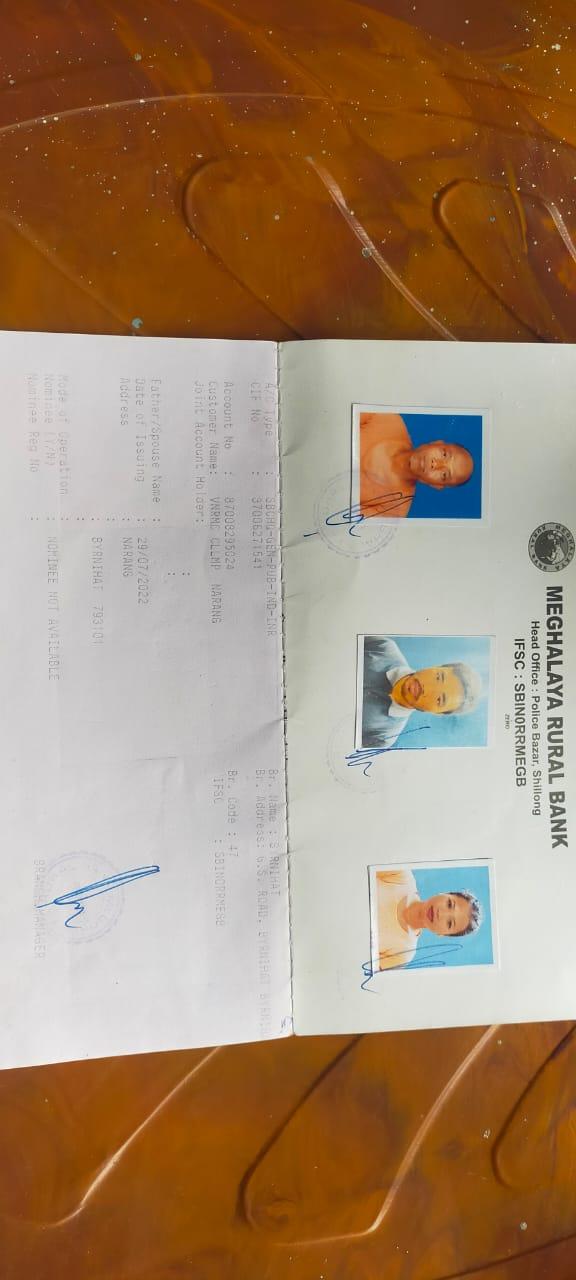
The opening of the bank account was initiated after the village signed the EOI (Expression of Interest), the VGA (Village Grant Agreement) and the Green Charter. The Accountant of the Ri Bhoi CLLMP team trained the Purchasing and Procurement Committee of Narang Village on matters relating to Accounts and Bookkeeping on the 5th of December 2019
The Accountant of CLLMP Team Ri Bhoi District trained the Purchasing and Procurement Committee of Narang Village and several discussions were made regarding the following topics :
Topics Covered:
Principles of Community Procurement
Benefits of Community Procurement
Important aspects undertaken by Community Procurement.
Procurement Process/Steps
Function of Purchase Committee
Important Procurement records to be maintained
Financial limits and methods
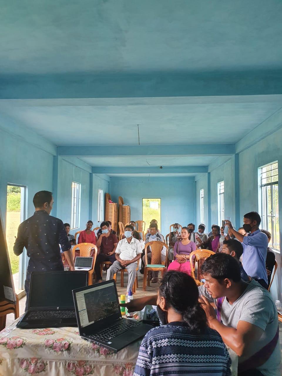
4. Participatory Rural Appraisal Exercise
The PRA exercise aims to incorporate the knowledge and opinions of the community in the planning and management of development projects and programmes.PRA exercise at Narang Village took place on the 7th of November 2019. There were a total of 51 villagers who participated in this exercise
The initial stage of Participatory Rural Appraisal (PRA) exercise at Narang Village, commenced with a meeting cum orientation program on CLLMP. While conducting the meeting, the community members were made aware of the various PRA exercises to be conducted for the development of the Community Natural Resource Management Plan (CNRMP) of the village, the community members’ contribution in the exercise and the objectives to be achieved. The key informants (the VNRMC and the VCFs) helped facilitate maximum participation. The dates and time for conducting the various Participatory Rural Appraisal (PRA) exercise were fixed in consultation with the community members and all were requested to participate in the exercise. The schedule and time was announced at the end of the meeting.
Participants on the 07.11.2019:
CLLMP Officials: Shri V. Buhphang (DPM) and the DPMU CLLMP Team
Community members: Shri. Panjewel Khongmalai(Chairman), Smt.Randani Nongrum (Secreatry) Shri. Petrus Shadap(Book-Keeper) Smt. Julia Syngkli , Smt. Mary Magdalene Marboh, Shri. Banshan Namsaw Shri. Shel Jynthem, Shri. Bir Jynthem, Smt. Prisca Syngkli (VNRMC Members), Shri. Teilang Jynthem, Shri.Winky Syngkli, Smt. Rupalin Jynthem (VCF) and other community members
Commencement of PRA.
Introduction: Participatory Rural Appraisal (PRA) is the process of involving local people in the analysis and interpretation of their own situation of a given rural area. The local people i.e. the participants take a leadership role in collecting, analyzing, interpreting and presenting information and in this process impart knowledge and development insight to the specialists and extension agents
For management of natural resources, participatory Rural Appraisal is conducted to establish rapport with the village community as well as to identify and define problems for prioritization in the village itself. It is a way of learning from and with community members to investigate their need assessment, analyze and evaluate constraints and opportunities and find out priorities in the area of agriculture, small scale rural enterprises and any other social and economic development programs addressed to village development. Based on the principle of listening and learning,
Objectives of PRA exercise at Narang Village:
The Participatory Rural Appraisal (PRA) exercise at Narang was conducted with following objectives:
To identify the natural, human and economic resources of village.
To identify the village problems and prioritize them with the help of the community members.
To prepare the Community natural Resource Management Plan of the village.
Activity 1: Village Boundary Mapping:
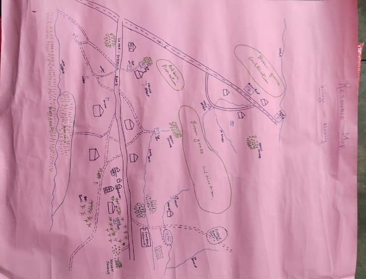
Activity 2: Drawing the Resource Map
The second step is to involve the local community in preparation of a village resource map as perceived by the community members to solicit their participation. Infrastructure, services and other village resources such as agricultural lands, wells, wastelands, cattle population etc. were mapped. Local people prepared the Resource Map by drawing it on a chart paper without much interference from outsiders.
This activity achieved the following purposes:
Rapport building and winning the confidence of the villagers.
Analyzed the spatial information, particularly studied problems and opportunities of villagers.
Got an impression about the village setting, physical layout, location of various houses and institutions.
Findings Based on the Resource Map of Nar-ang:
Main agricultural produce is Paddy, banana, broom and Arecanut.
There are 2 types of Forest ownership: Community and Clan Owned.
3 community forest
2 clan forest
Twelve (12) springs are present in the village.
Six streams flow through the village paddy field.
Two water tanks are available and checkdams+ washing platform and water reservoir are available.
Three dugout lakes for fisheries and a water reservoir.
School: there is only one School (Government L.P School)
Church: two Churches are present in the village
Present of Rubber plantation
Habitation is confined to three places
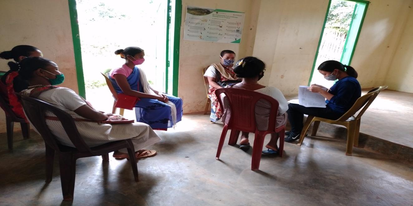
Activity 3: Baseline Data Survey to fill the Social Template
Date: 01.09.2020
During the PRA exercise, the EE (Social & Environmental Management) and the community members were divided into groups to fill the Social Templates. Discussions and consultations with social groups existing in the village were held to gather basic village information regarding households, demographic information, major crops and enterprises taken in the village, trends of production and productivity of major crops in the village and demographic distribution of village population.
01.09.2020 (Continuation of PRA)
Activity 5: PROBLEM ANALYSIS
Do people have sufficient access to supply of fodder, fuel wood, leaf litter?
No. Less availability of fuel wood in the village, they can get only from private forest which is not enough. They have to purchase from outside.
Has access to timber improved or reduced over the years? How is access for household use and commercial use managed?
Access to Timber has reduced over the years. People in the village can get it only from private land, which is not enough. They have to purchase it when needed.
Are the water bodies facing any threats?
Yes, one spring (Irsyrnei) is facing threats; due to Solid waste and Domestic waste.
Yes, two streams (Dongbah and Dongskhi) are facing threats; due to solid waste and domestic waste.
Do all people in the village have access to drinking water? What are the challenges?
No. Insufficient availability of drinking water during dry season due to lack of water reservoirs and no pipelines system connecting from water source to houses.
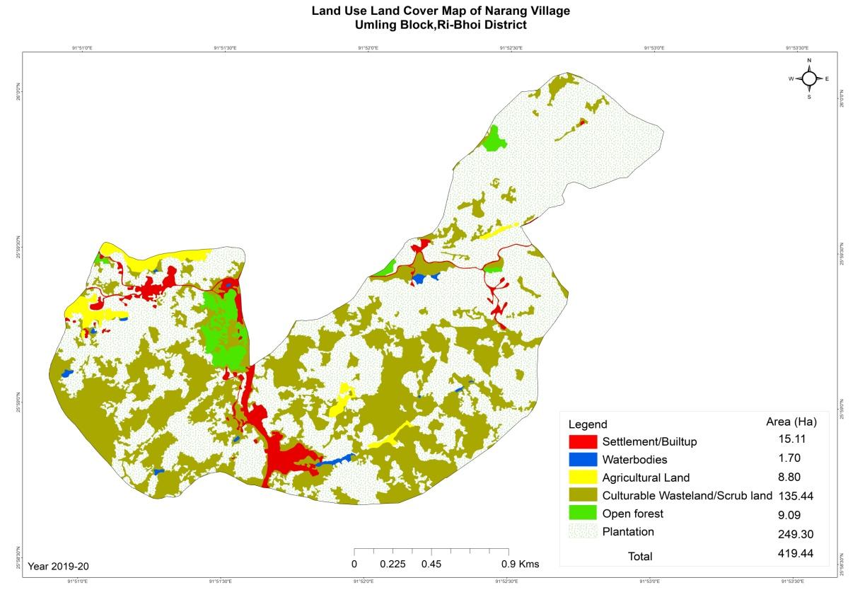
Are there degraded areas in the village (open/ degraded forests, mining affected, high soil erosion etc.)?
Minor degradation in cultivated land
What has caused this degradation? Are there practices causing threats to availability and access to natural resources?
Fertility of the soil declines over the year.
Excessive practice of mono cropping system (Arecanut)
What have been the changes in agricultural practices?
No Changes.
Are there any challenges in farming?
The main challenge in farming has been the loss of soil fertility.
Another challenge in farming is Natural Disaster and wild animals like Wild Boars and Porcupines regularly come and destroy the crops.
How would you consider the health situation in your village?
The nearest CHC is at a distance of 3Km which is easily accessible for the villagers.
In the past the rate of infections from communicable diseases was much higher, eg; Tuberculosis, Malaria and dysentery. At the present time there is a lesser rate of infections from communicable diseases, but there is a higher rate of lifestyle diseases such as Diabetes and Hypertension.
How is the situation of cleanliness, sanitation, access to toilets and waste management?
The women's wing committee organises the cleaning drive once a week.
Sufficient toilets are available in every household but the constructions are poor.
Who are the most vulnerable in the village? What can be done to improve their lives?
BPL Families. Inclusion of BPL family members during project implementation
What are the livelihood aspirations of the youth? Are there any avenues available?
None, except daily wages
Do any committees/ institutions/ rules exist to manage and monitor natural resources in the village?
The VNRMC under the CLLMP manage the natural resources in the village.
What are some of the major issues of conflict in the village?
Social dispute due to alcohol abuse.
Have any of the above issues been discussed in village meetings?
Yes the village Dorbar have discussed the issues and are doing their best to address these problems.
How do people resolve disagreements and conflicts?
All disagreements and conflicts are addressed by the traditional institution of village’s governance called the Village Dorbar.
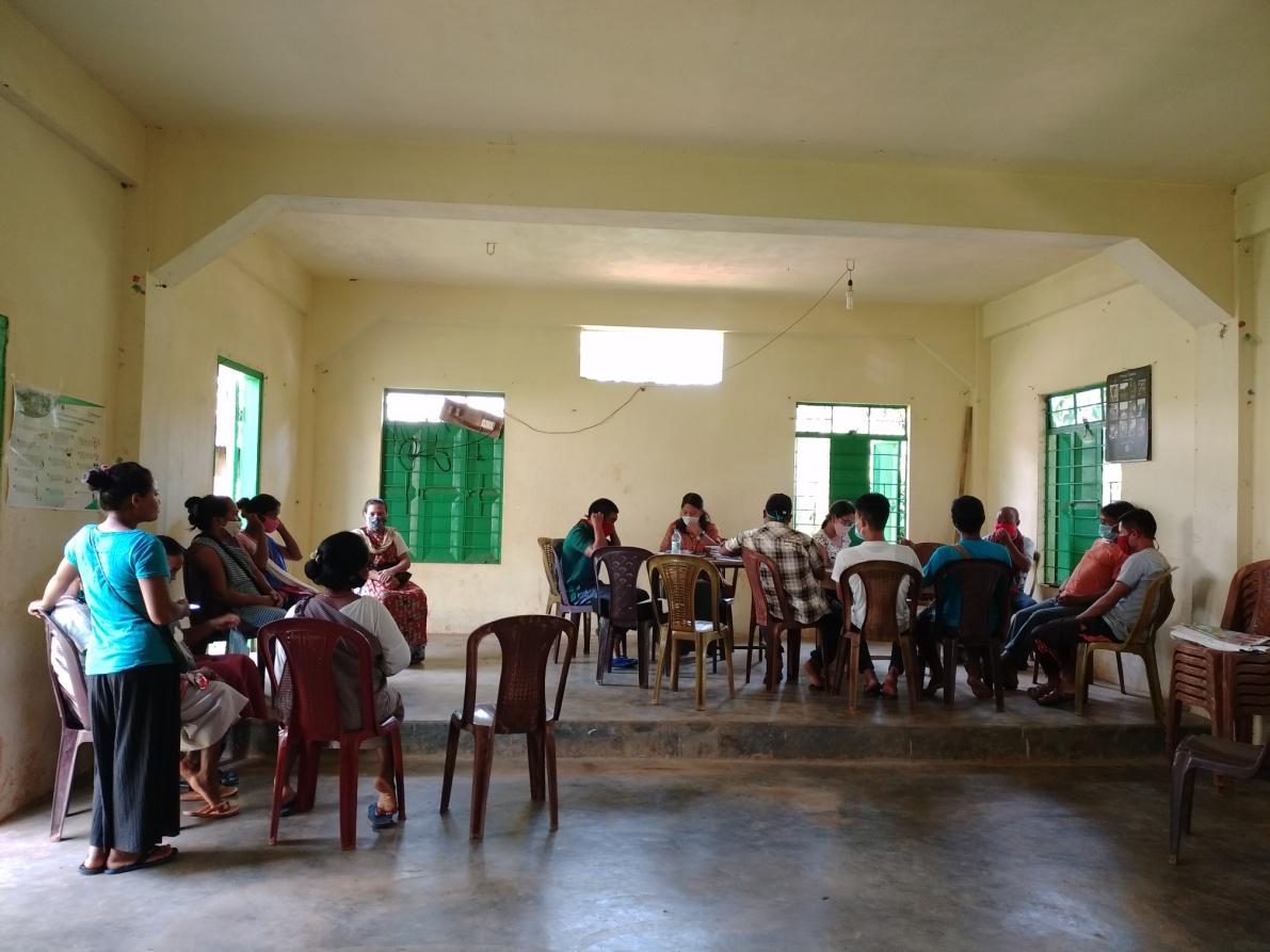
Figure: Group Discussion on Conflict and Challenges
01.09.2020 (Continuation of PRA)
Activity 6: Seasonality Calendar
The CLLMP team also mapped the seasonal calendar of Narang Village to help identify heavy workload periods, periods of relative ease, credit crunch, diseases, food security, wage availability etc. This will prove helpful in project planning and project timeline framing.
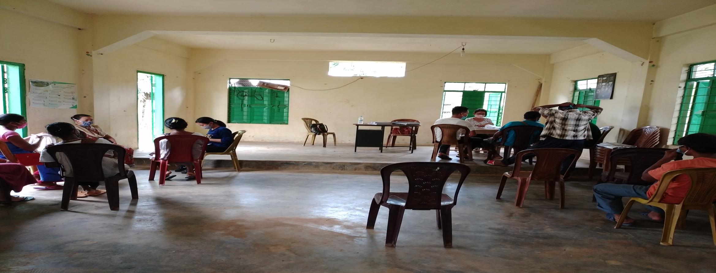
Figure: Preparation of Seasonality Calendar
Participants:
Smt. Aiom Syngkli –Community ASHA
Smt. Rupalin Jynthem - Village Community Facilitator
Shmt. Julia Syngkli VNRMC Member
Smt. Prisca Syngkli - VNRMC Member
Smt. Randani Nonglum – VNRMC Member
Smt. Magdalin Marboh - Community Member
Smt. Christila Suting - Community Member
| SEASONALITY CALENDAR | |||||||||||||
|---|---|---|---|---|---|---|---|---|---|---|---|---|---|
| Sl No. | CRITERIA | JAN | FEB | MAR | APRL | MAY | JUNE | JULY | AUG | SEP | OCT | NOV | DEC |
| 1 | Water Scarcity | 3 | 2 | 1 | 1 | 1 | 3 | ||||||
| 2 | Prone to sickness | 2 | 3 | 1 | 1 | ||||||||
| 3 | Seeking job outside | 1 | 3 | 3 | |||||||||
| 4 | Rain Fall | 3 | 1 | 1 | 1 | 2 | 2 | ||||||
| 5 | Free – Less work | 1 | 2 | 2 | 1 | ||||||||
| 6 | Paddy Cultivation | 1 | 1 | ||||||||||
| 7 | Paddy harvesting | 1 | 2 | ||||||||||
| 8 | Betle Nut Tree Plantation | 1 | 2 | 3 | |||||||||
| 9 | Beetle Nut Harvesting | 1 | 1 | 2 | 3 | ||||||||
| 10 | Tree Plantation | 1 | 1 | ||||||||||
| 11 | Vegetable (crop cultivation) | 1 | 3 | 2 | 1 | ||||||||
| 12 | Vegetable (crop harvesting) | 1 | 1 | 2 | 2 | 3 | |||||||
| 13 | Festive Season | 1 | 3 | 2 | |||||||||
| 14 | Forest fire | 1 | 1 | ||||||||||
| 15 | Collection of Fuel wood | 1 | 1 | 2 | 3 | ||||||||
| MAXIMUM | 1 |
|---|---|
| MODERATE | 2 |
| LESS | 3 |
List of CNRMP proposed by the VNRMC
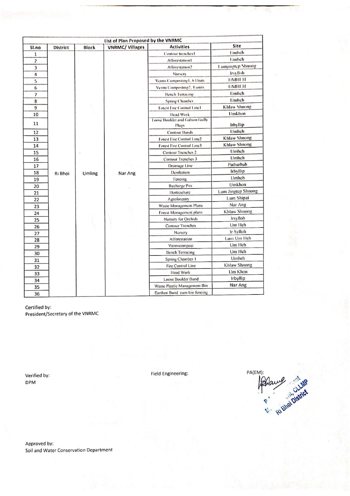
The Finalized Community Natural Resource Management Plan of Narang Village.
|
Name of Proposed Interventions | Site |
|
Nos of HHs expected to Benefit | ||
|---|---|---|---|---|---|---|
|
|
|
||||
| 1 |
|
Iersynrei |
|
|
|
|
| 2 |
|
Umheh |
|
|
|
|
| 3 |
|
Irbyllip |
|
|
|
|
| 4 |
|
Iersynrei |
|
|
|
|
| 5 |
|
Umheh |
|
|
|
|
| 6 |
|
Umheh |
|
|
|
|
| 7 |
|
Umheh |
|
|
|
|
| 8 |
|
Thoinitri |
|
|
|
|
| 9 |
|
LumnengUmheh |
|
|
|
|
| 10 |
|
Umheh |
|
|
|
|
| 11 |
|
|||||
| 12 |
|
UmShnong | Community | 15 | 0 | 15 |
| 13 |
|
|||||
| 14 |
|
|||||
| 15 |
|
|||||
| 16 |
|
|||||
| 17 |
|
Umheh |
|
|
|
|
| 18 |
|
1.lumjintep Shnong 2.umheh 3.22mer |
|
|
|
|
| 19 |
|
Umkhon |
|
|
||
| 20 |
|
|||||
| 21 |
|
|||||
| 22 |
|
Umheh |
|
|
||
| 23 |
|
Community Hall | ||||
| 24 |
|
|
||||
6. GIS Activities
| Sl. No. | Parameters | Village Information |
|---|---|---|
| 1 | GPS Coordinates: | |
| i | Latitude | 25.989309N |
| ii | Longitude | 91.853897E |
| iii | Elevation Reading (MSL) | 327m |
| 2 | Village Geographical Area (Ha) | Total: 419.43Ha 4.193 sq.Km |
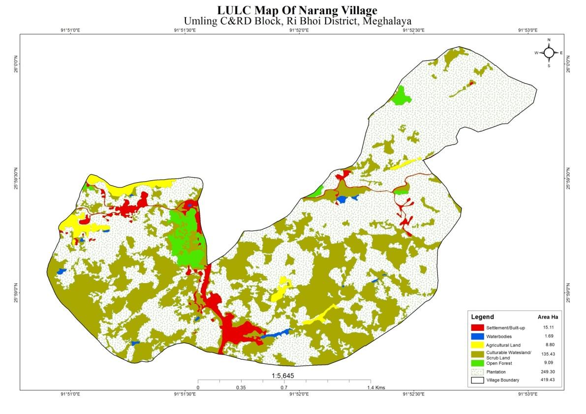
| i | Total Forest Area (including community, Clan, Pvt Forest) | 9.09 Ha |
| ii | Total Area of Water Bodies | 1.69Ha |
| iii | Total Area under Agri-Horticulture | 258.1Ha |
| iv | Total Degraded land area (Ha) | 3Ha |
| 3 | Average Annual Rainfall | 1000-1500mm |
| 4 | Soil Type | laterite |
PROJECT IMPLEMENTATION
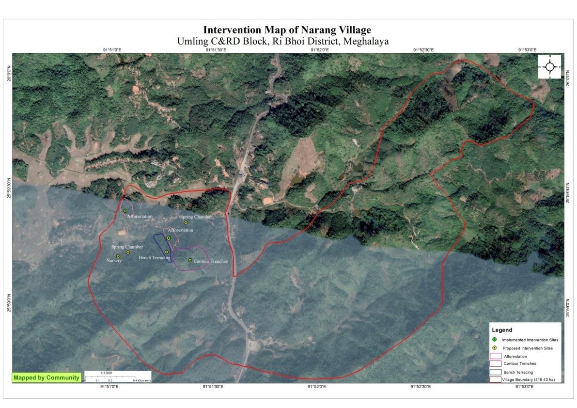
| Intervention | Site Name | Total Amount | Work Status |
|---|---|---|---|
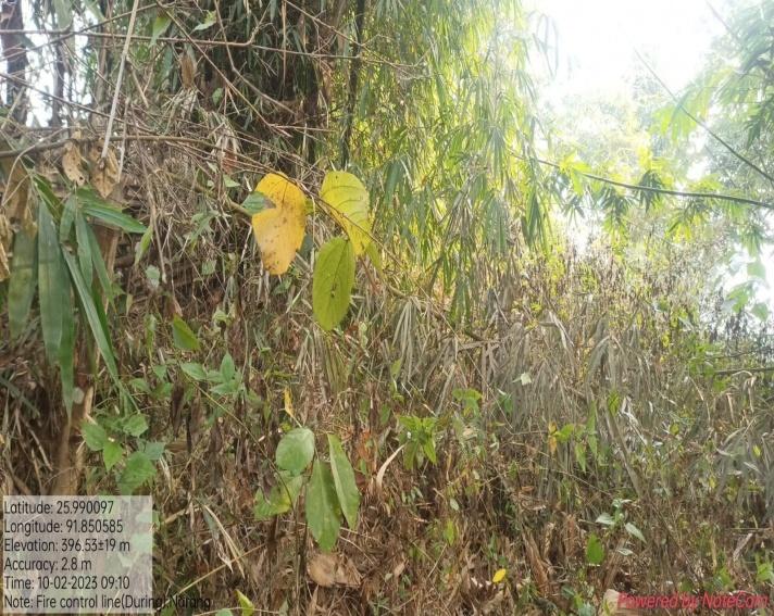
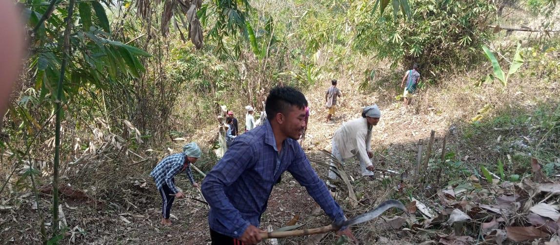
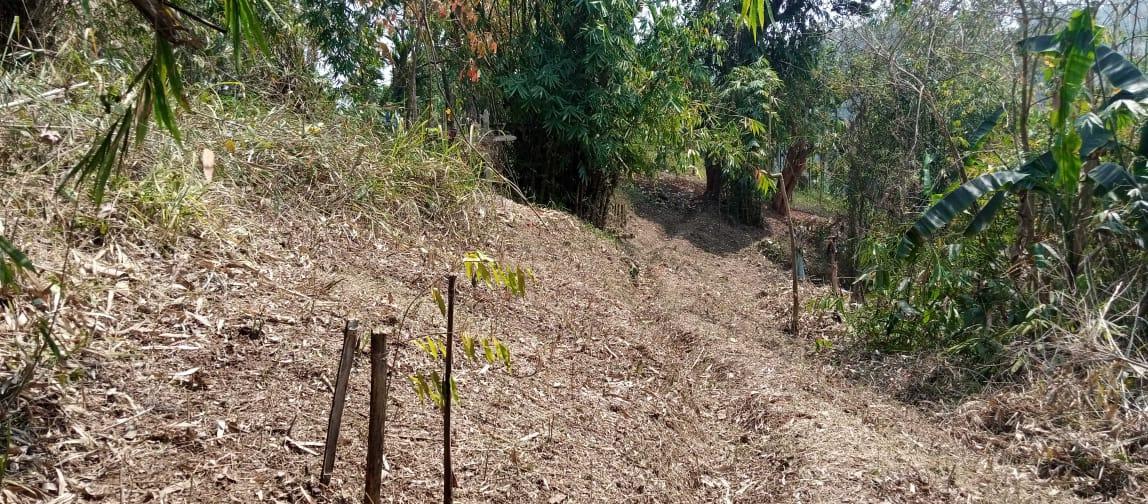
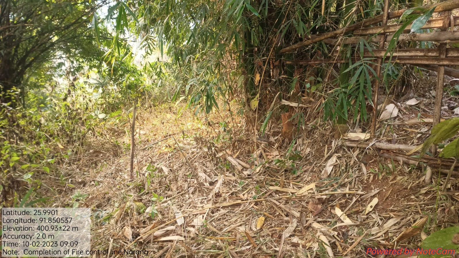
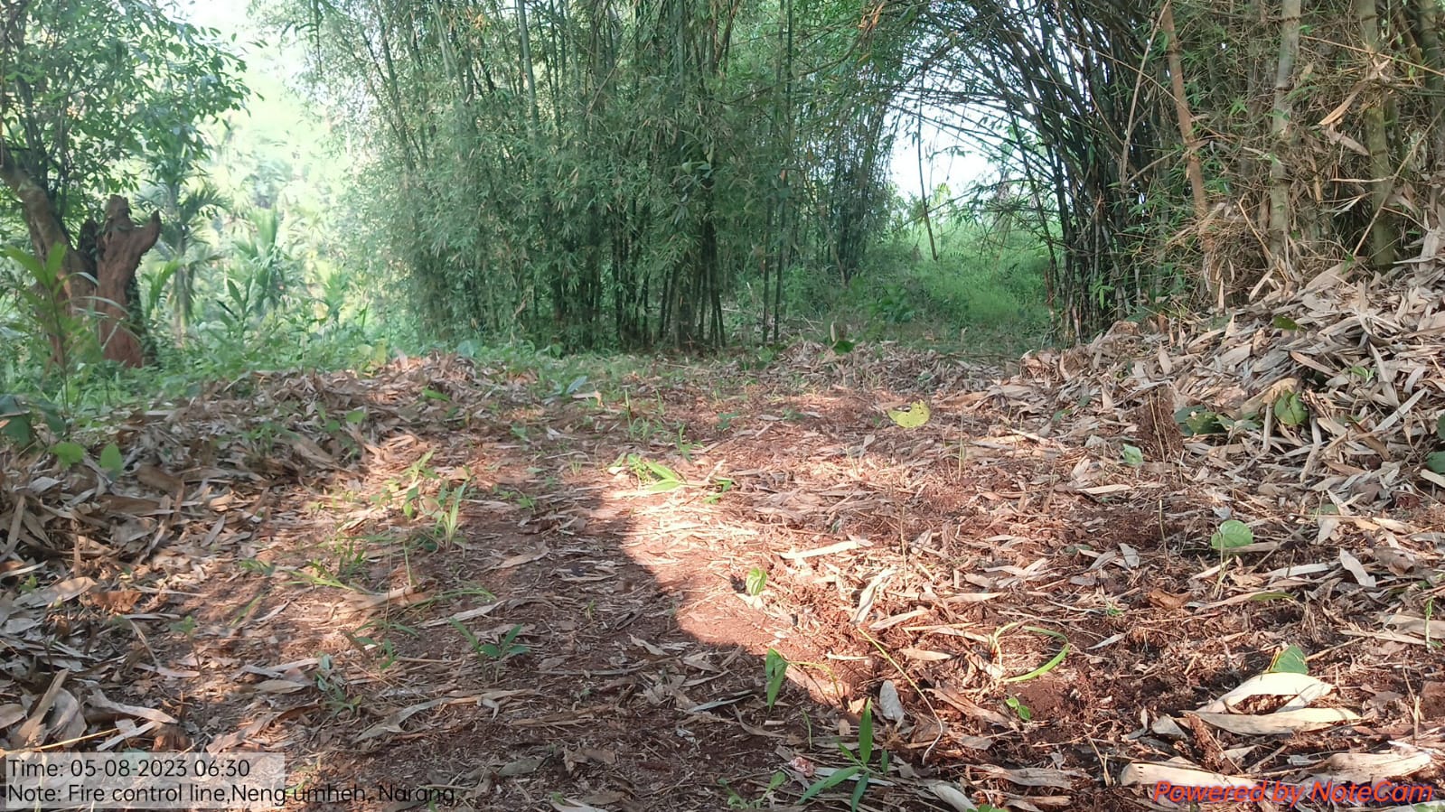
| Fire Control Line | Lumjingtep Shnong | 63,261 | Completed |
| Intervention | Site Name | Total Amount | Work Status |
|---|---|---|---|
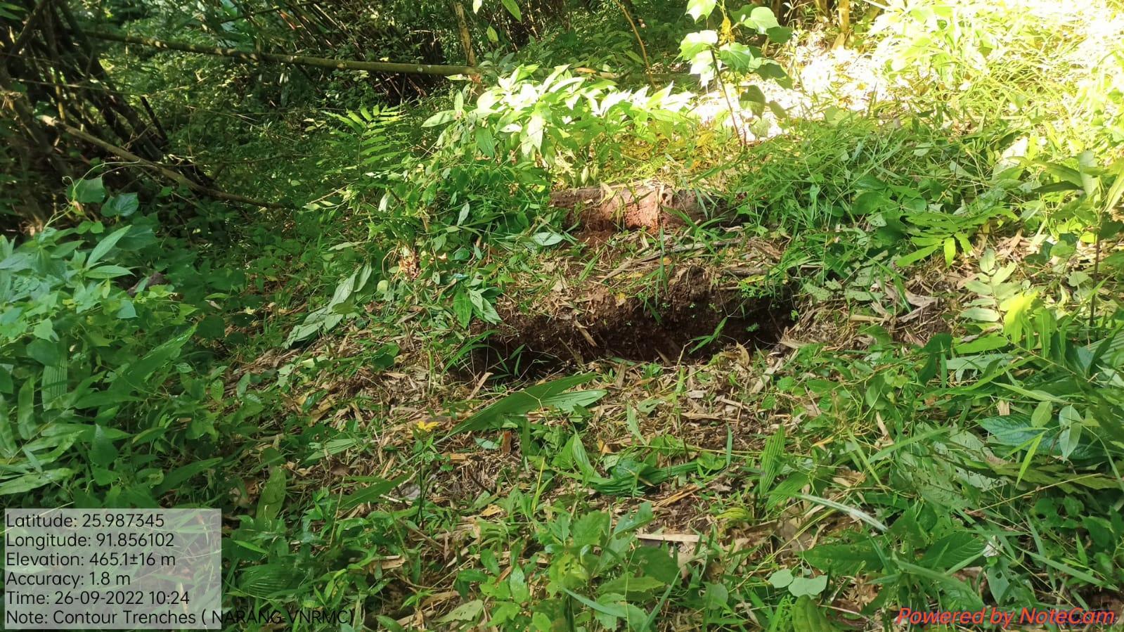
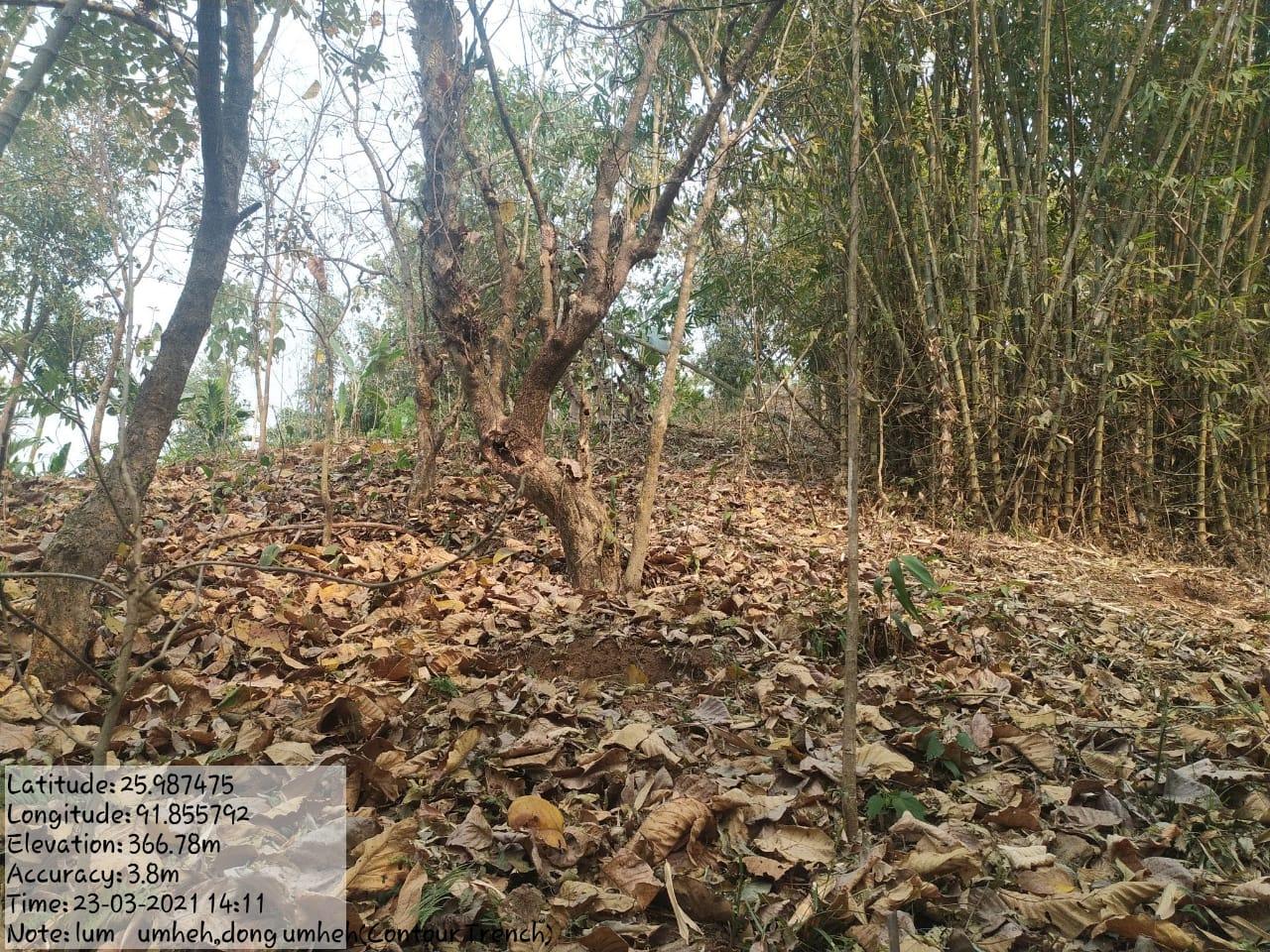
| Contour Trenches | Umheh | 66,320 | Completed |
| Intervention | Site Name | Total Amount | Work Status |
|---|---|---|---|
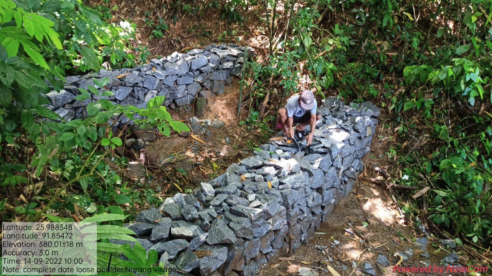
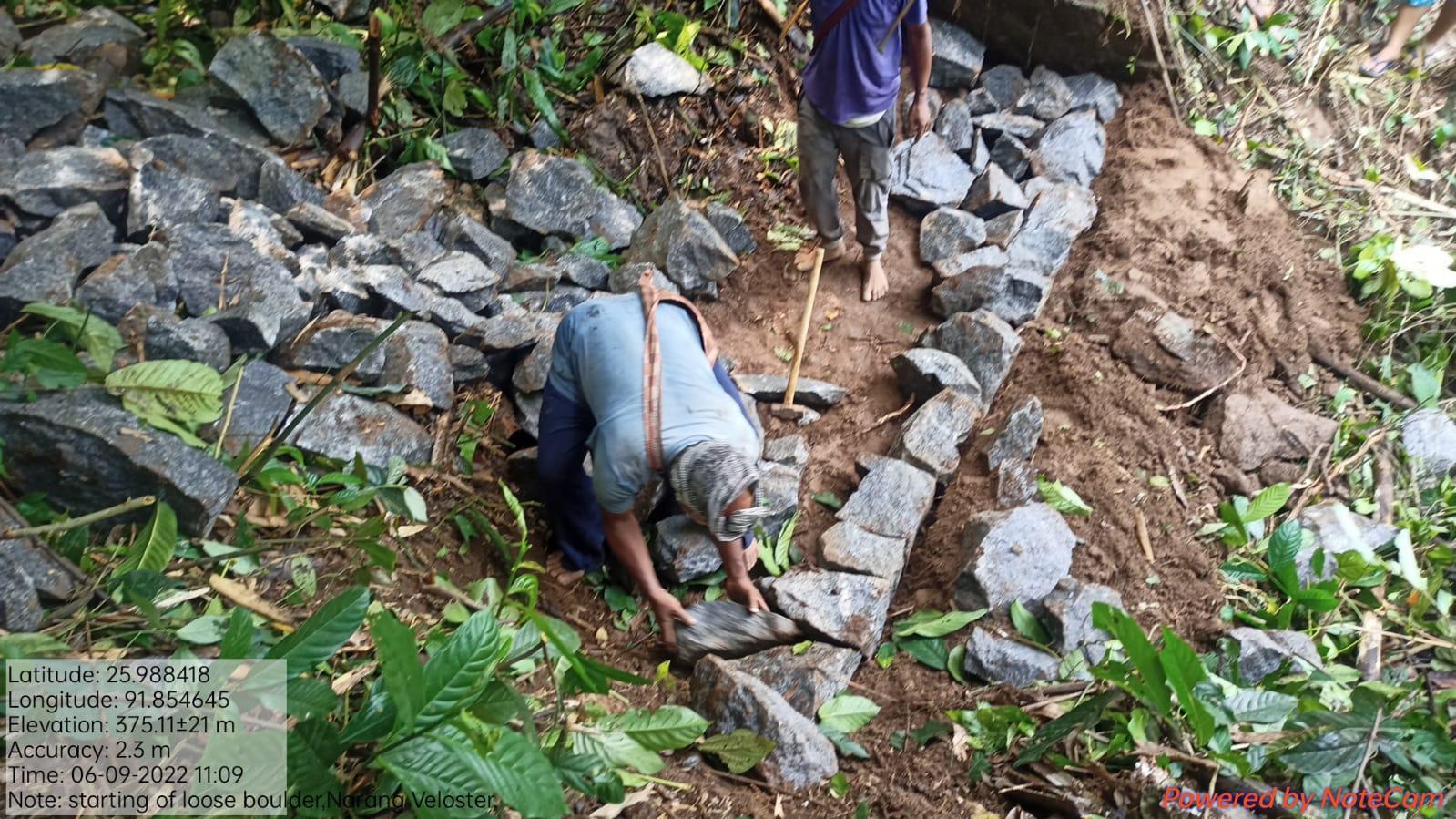
| Loose Boulder Bund | Umheh | 1,77,559 | Completed |
| Intervention | Site Name | Total Amount | Work Status |
|---|---|---|---|
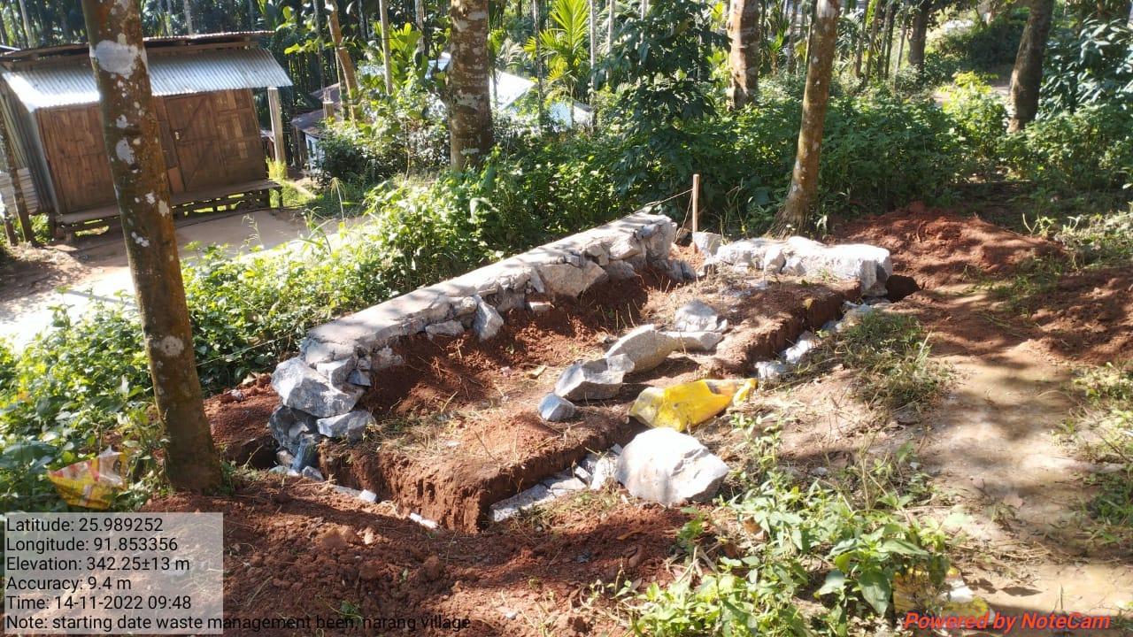
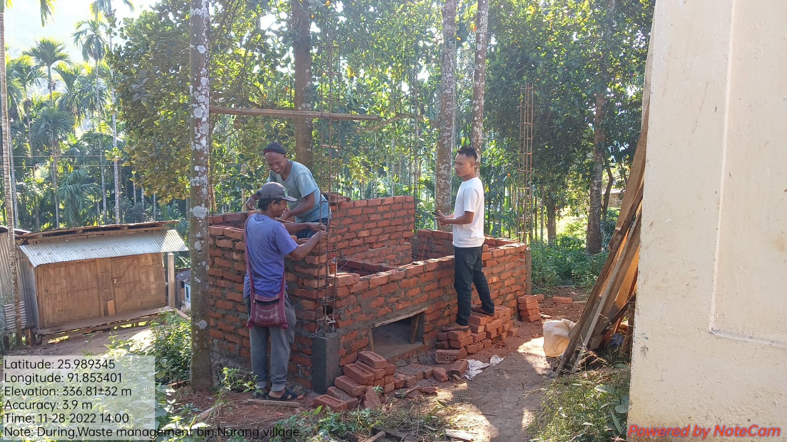
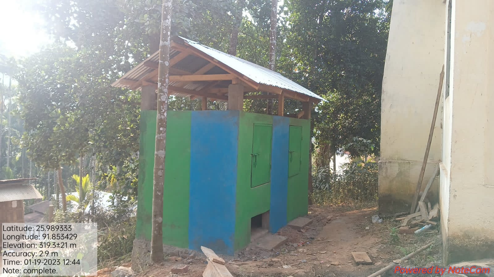
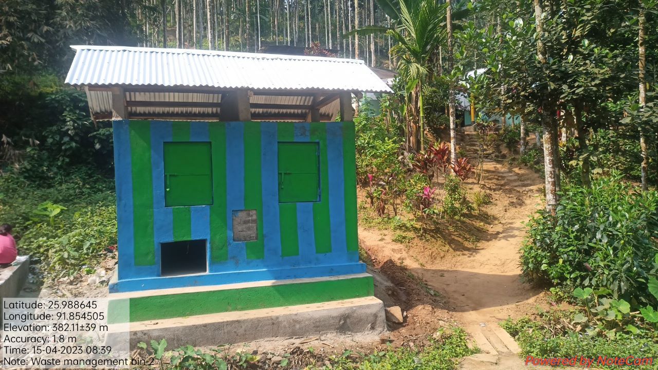
| Waste Management Bin | Near Community Hall | 93,000 | Completed |
| Intervention | Site Name | Total Amount | Work Status |
|---|---|---|---|
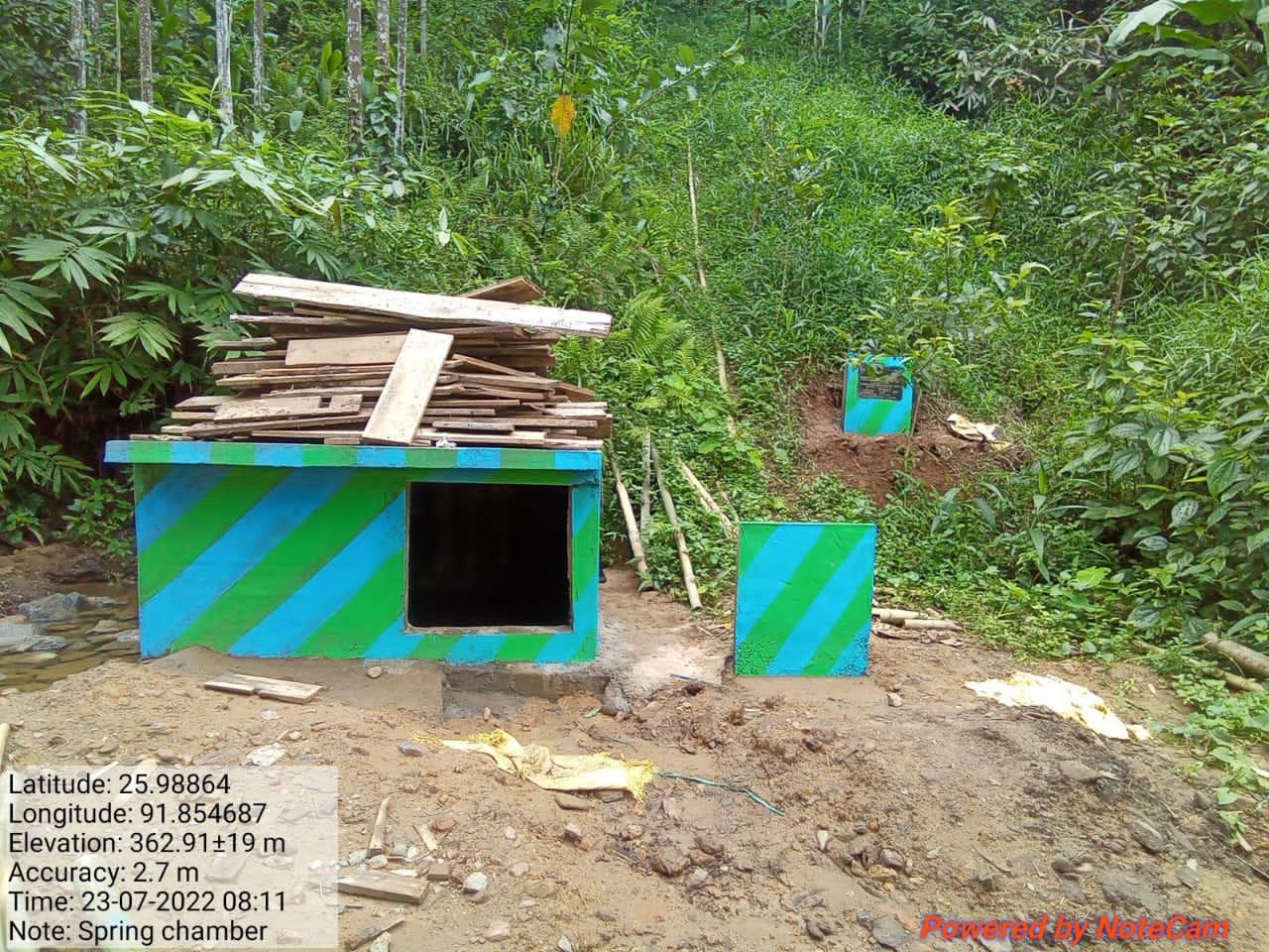
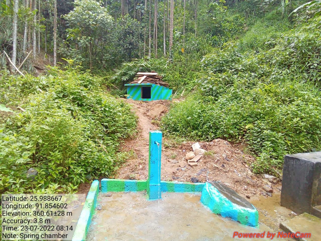
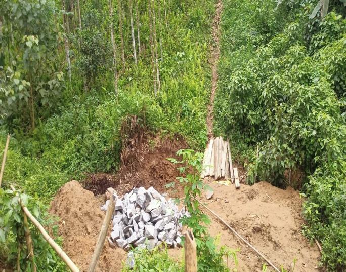
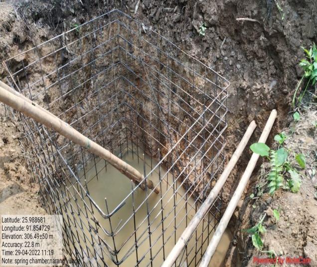
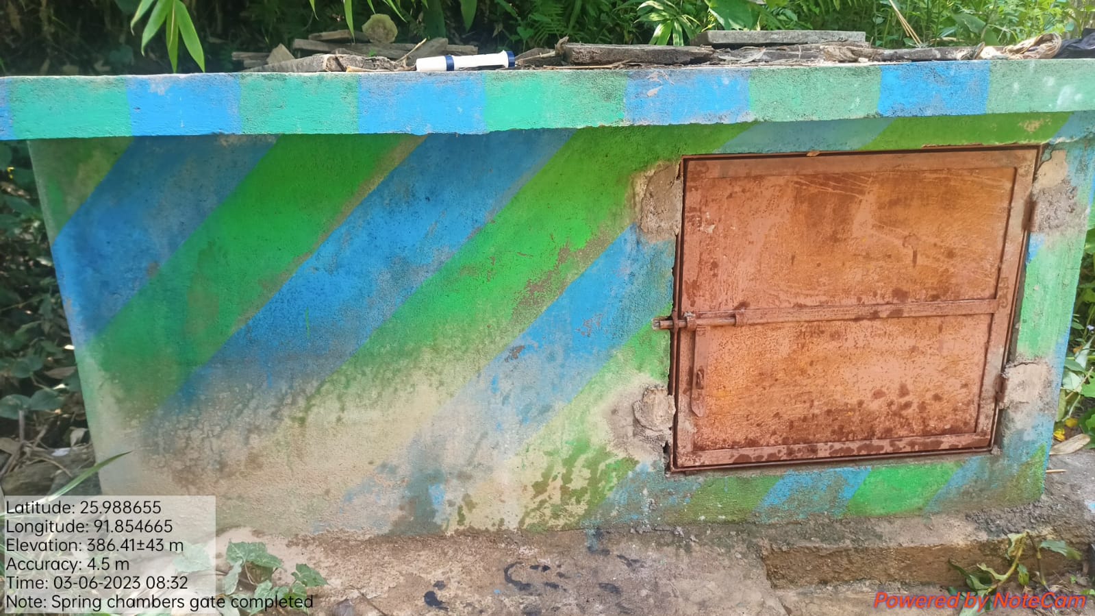
| Spring Chamber | Umheh | 65,000 | Completed |
| Intervention | Site Name | Total Amount | Work Status |
|---|---|---|---|
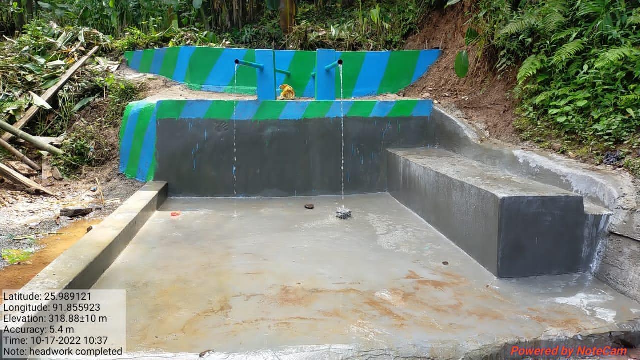
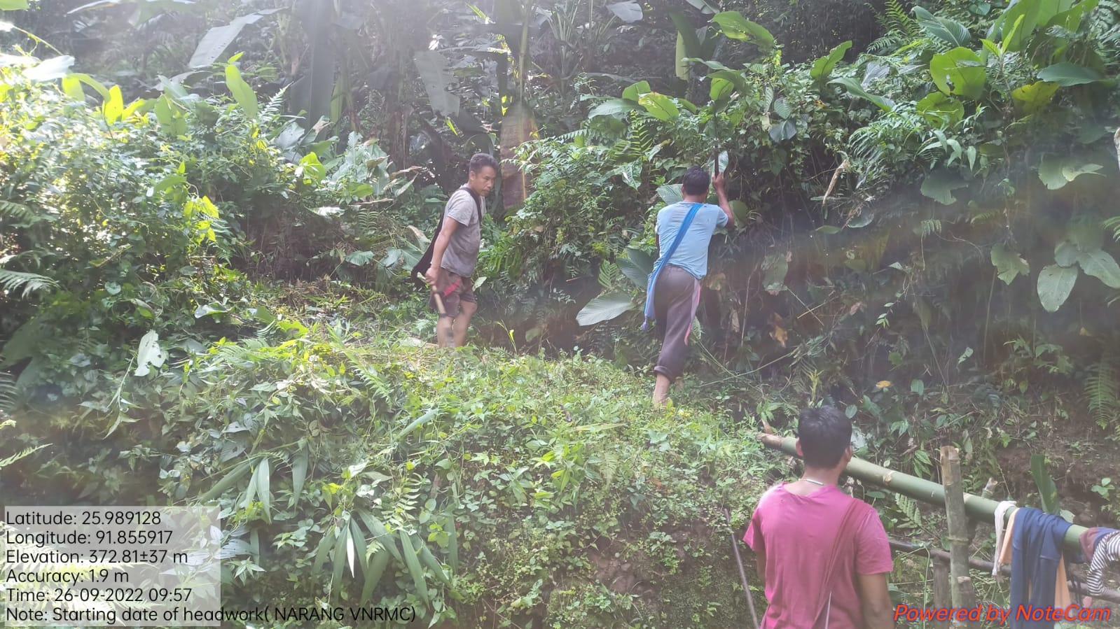
| Headwork | Umkhon | 1,80,000 | Completed |
| Intervention | Site Name | Total Amount | Work Status |
|---|---|---|---|
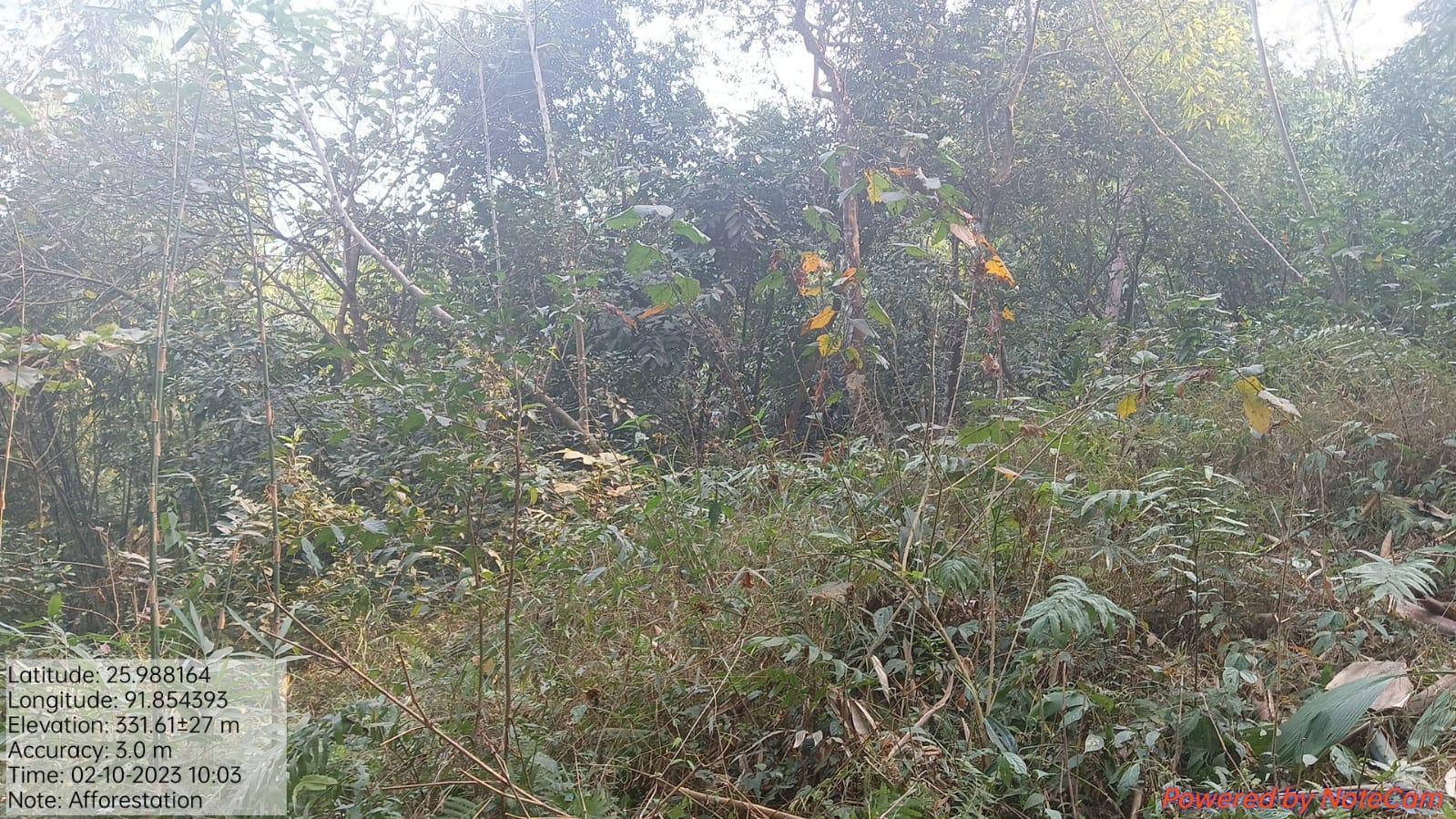
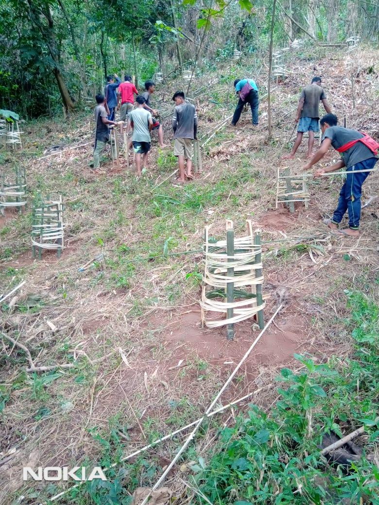
| Afforestation | Lumjingtep Shnong | 4,35,900 | Completed |
| Intervention | Site Name | Total Amount | Work Status |
|---|---|---|---|
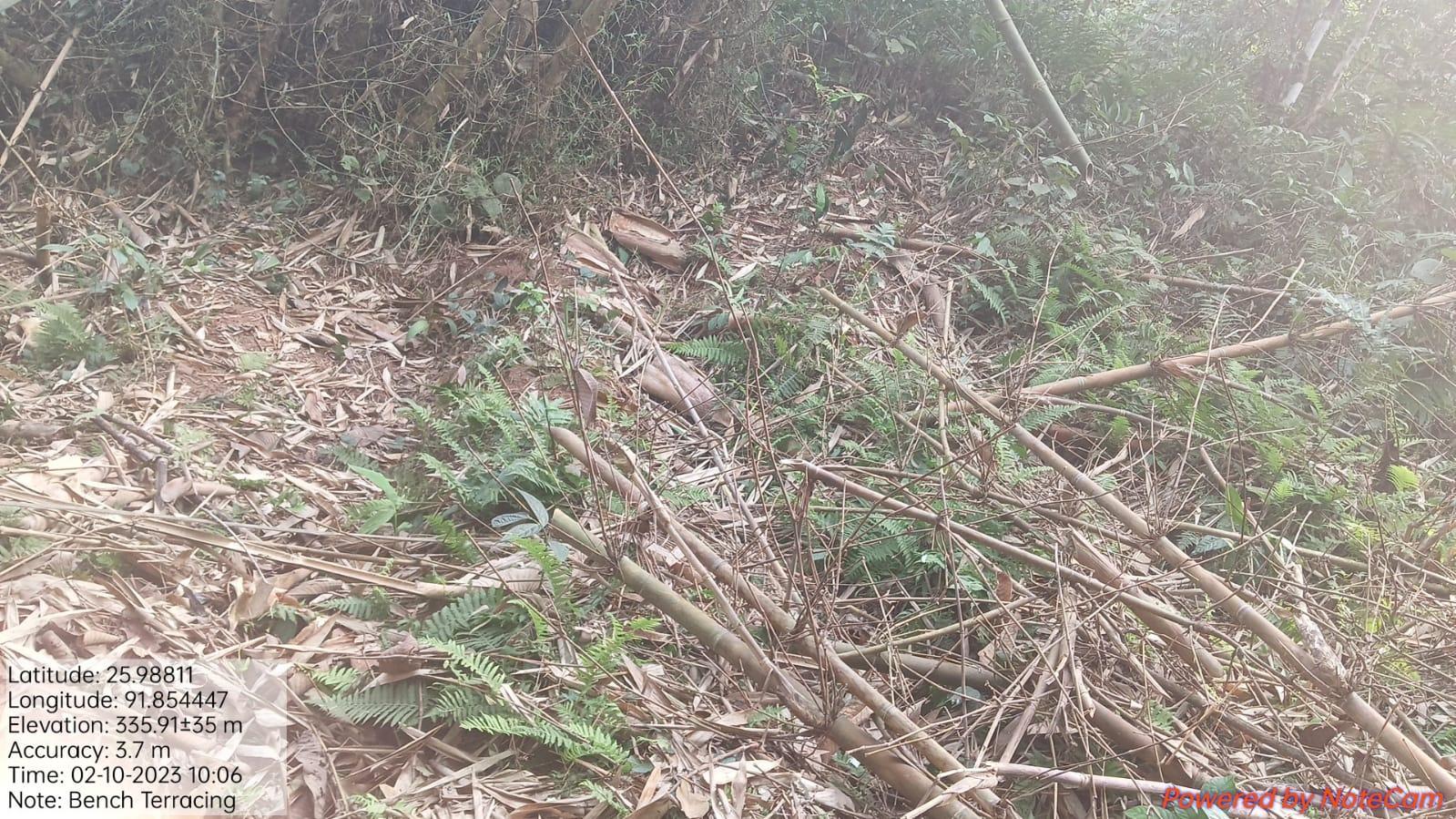
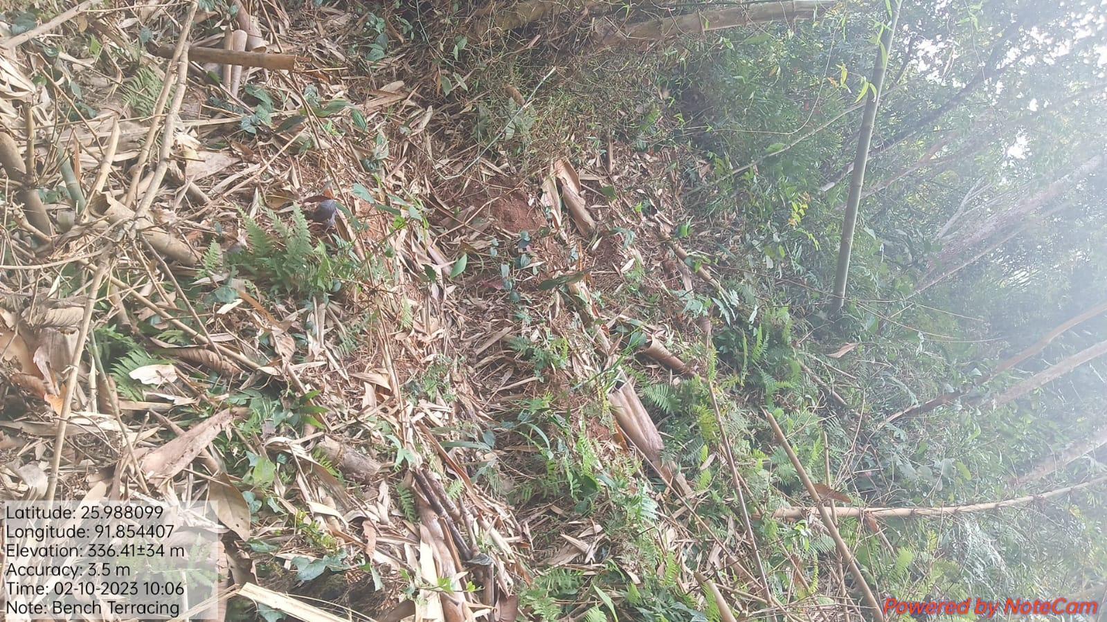
| Bench Terracing | Umheh | 1,55,000 | Completed |
| Intervention | Site Name | Total Amount | Work Status |
|---|---|---|---|
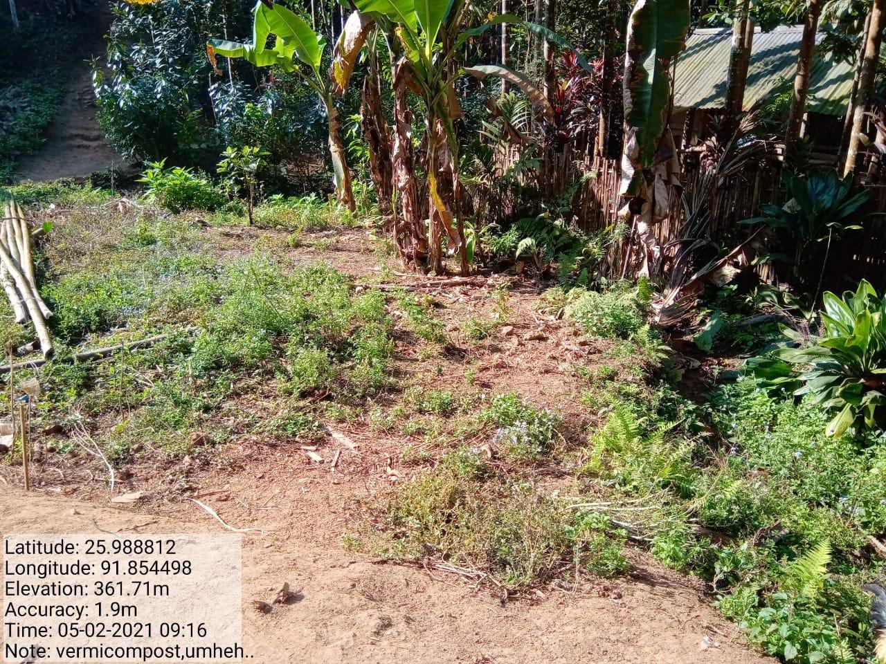
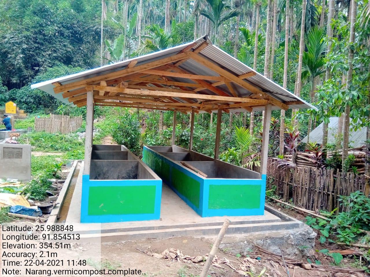
| Vermi Compost | Irysylloh | 3,32,640 | Completed |
| Intervention | Site Name | Total Amount | Work Status |
|---|---|---|---|
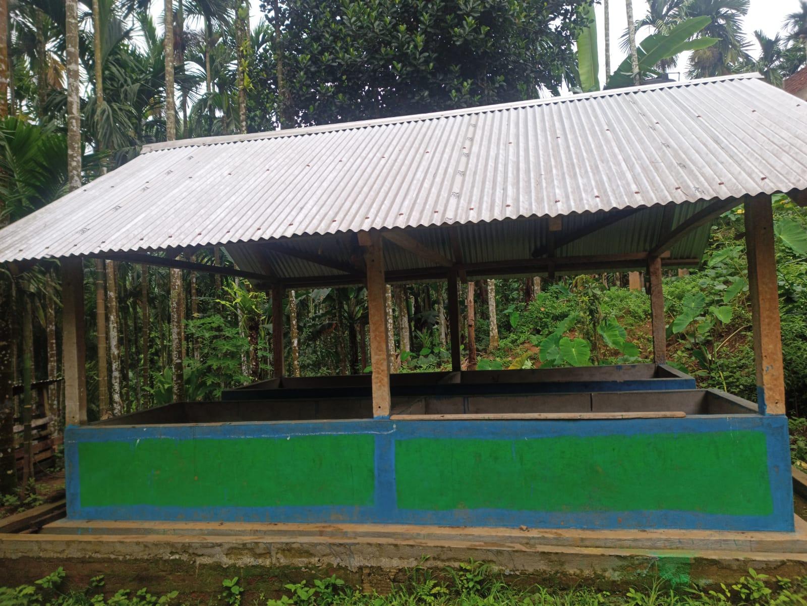
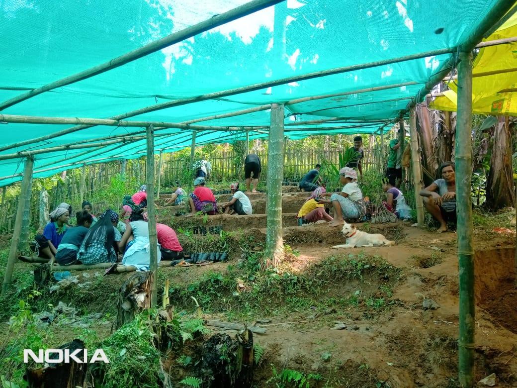
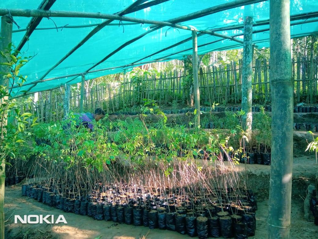
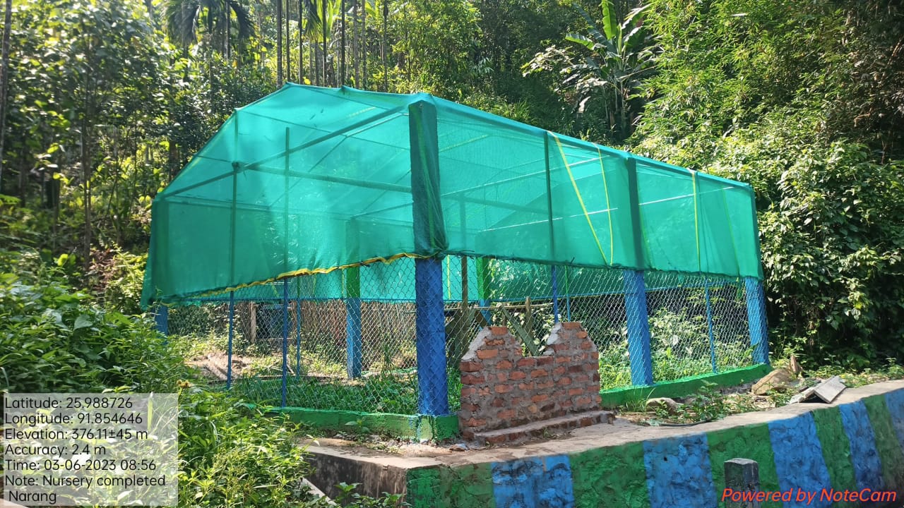
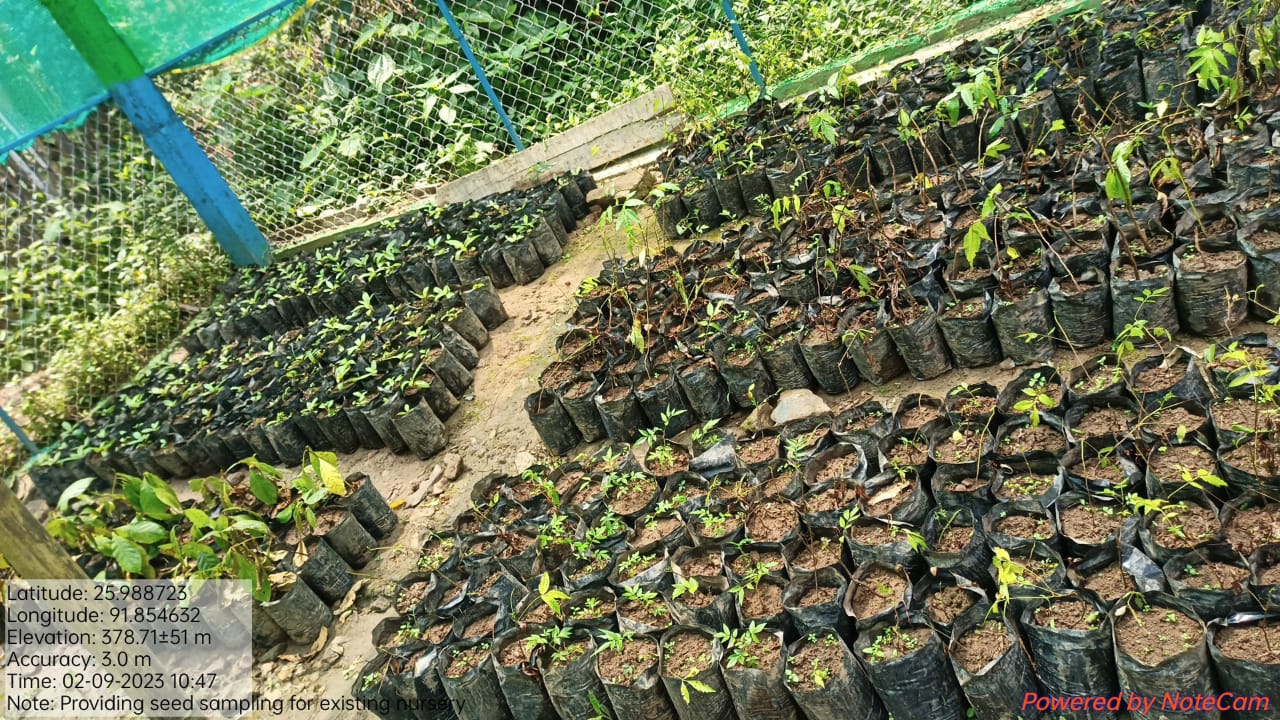
| Nursery | Irsylloh | 1,19,300 | Completed |
| Intervention | Site Name | Total Amount | Work Status |
|---|---|---|---|
| Waste Management Bin | Um heh | 1,11,649 | Completed |
| Intervention | Site Name | Total Amount | Work Status |
|---|---|---|---|
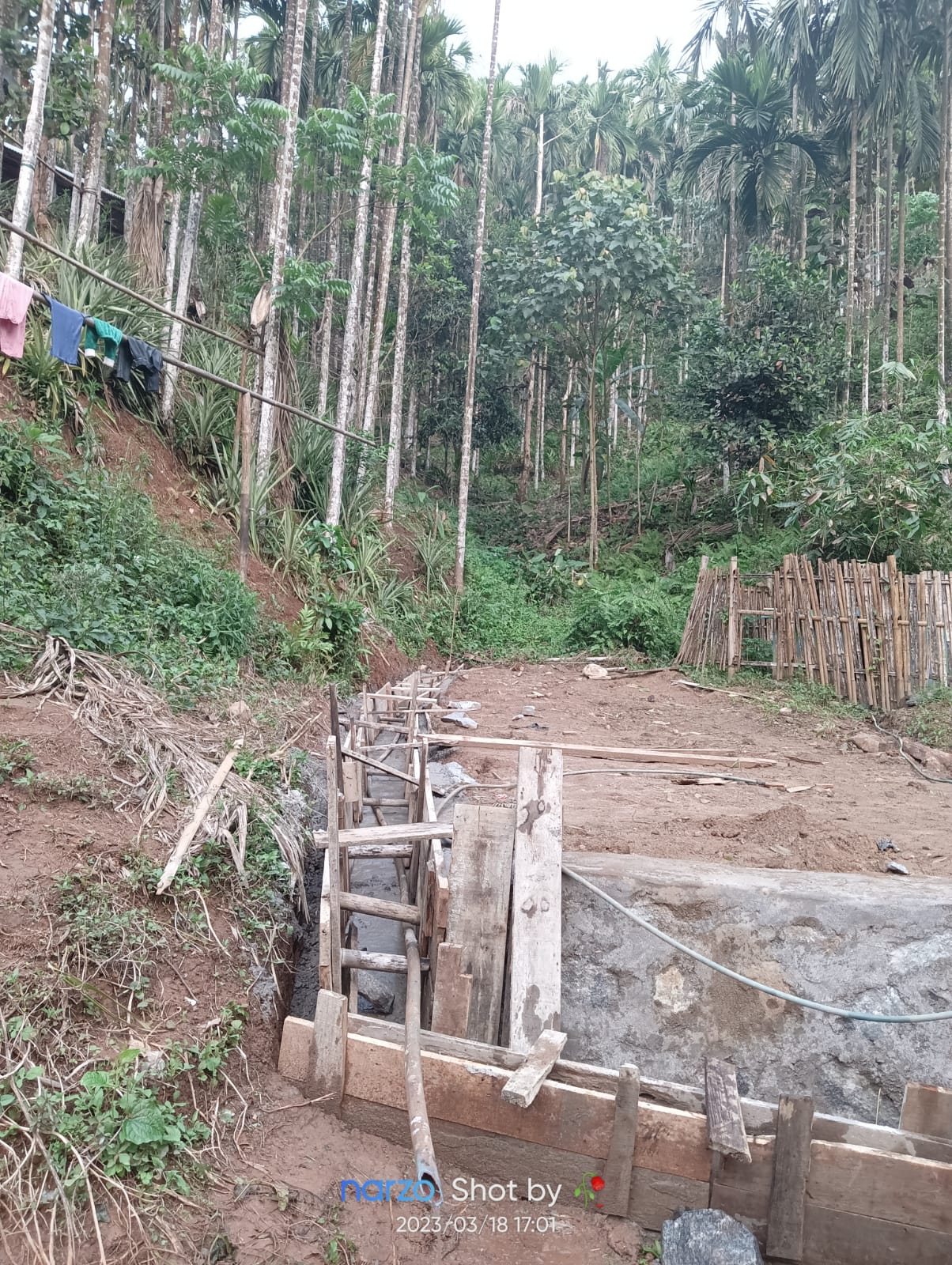
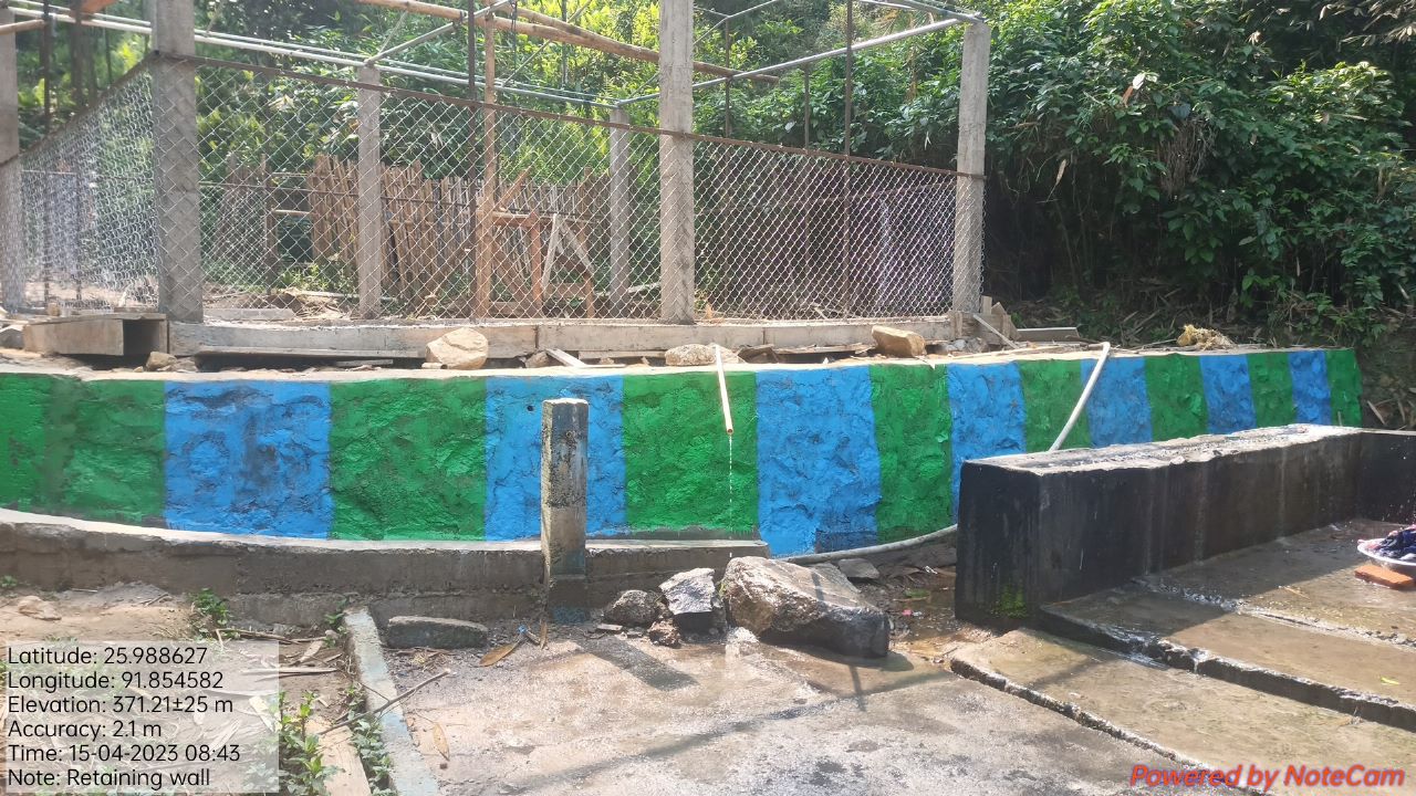
| Retaining wall | Um heh | 2,87,925 | Completed |
| Intervention | Site Name | Total Amount | Work Status |
|---|---|---|---|
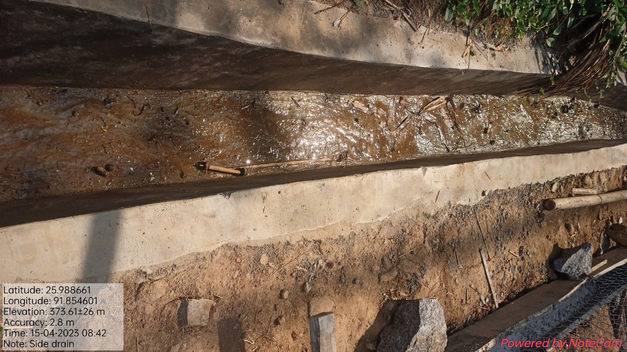
| CC Side Drain | Um heh | 35,426 | Completed |
| Intervention | Site Name | Amount | Work Status |
|---|---|---|---|
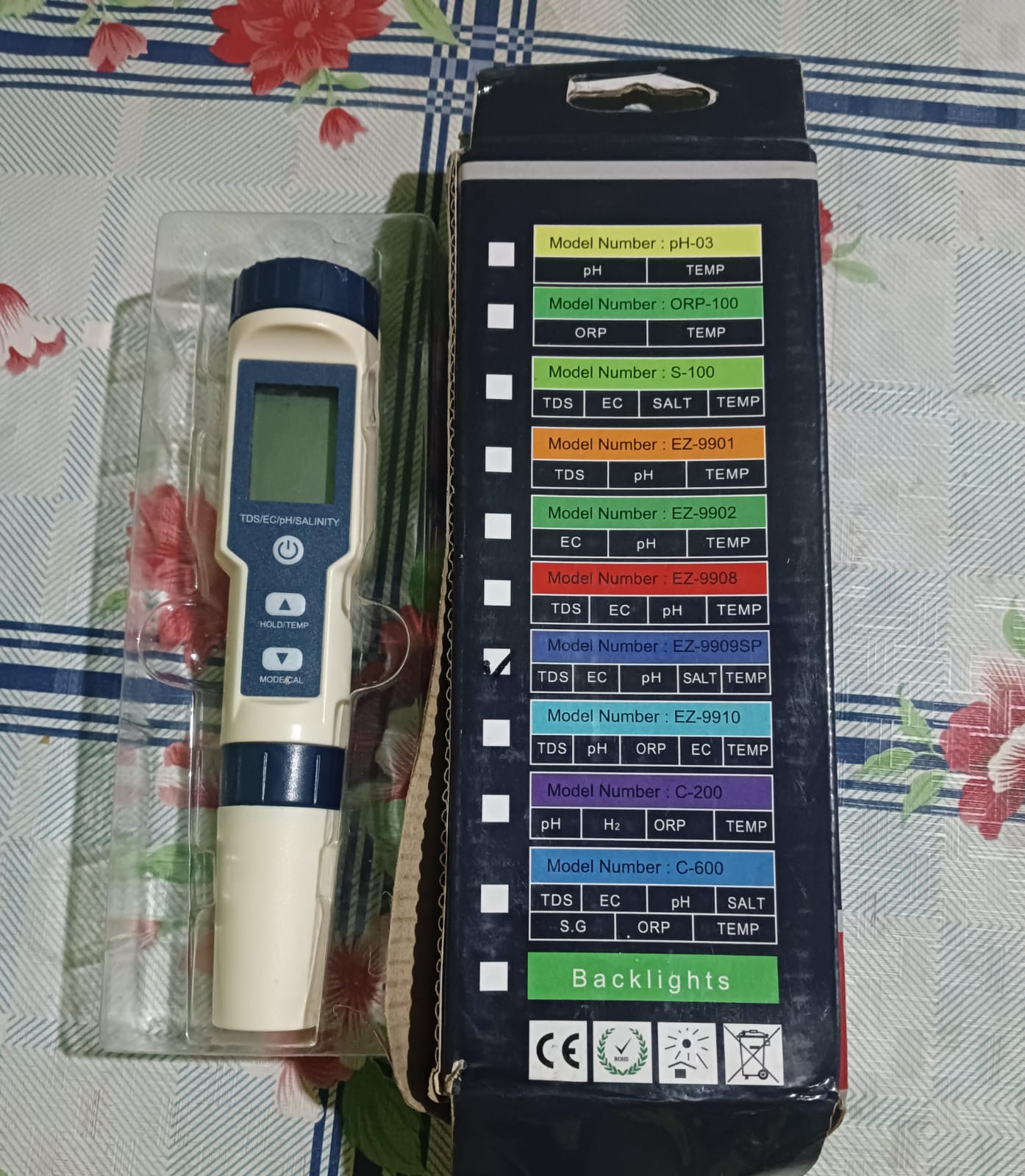
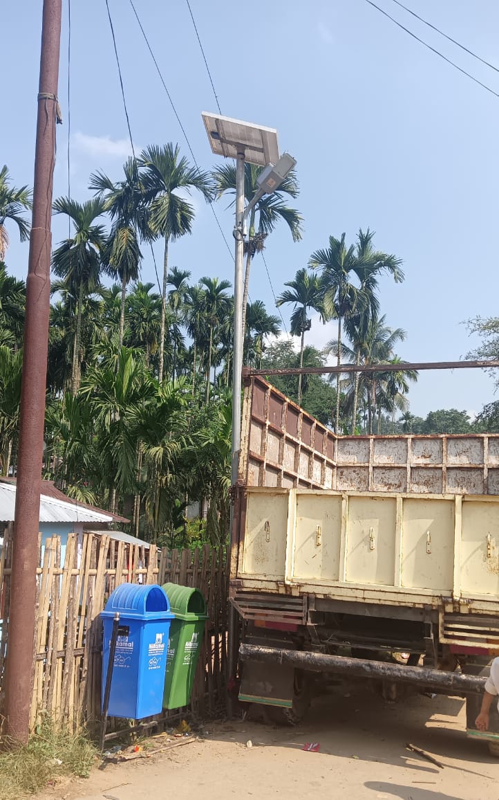
Excess fund activities Upgaration of Community Nursery Water Tester Solar light Dustbin Gates for Spring Chamber |
community land | 2,02,778 147347 10000 25000 15000 3500 |
Completed |
| Intervention | Site Name | Amount | Work Status |
|---|---|---|---|
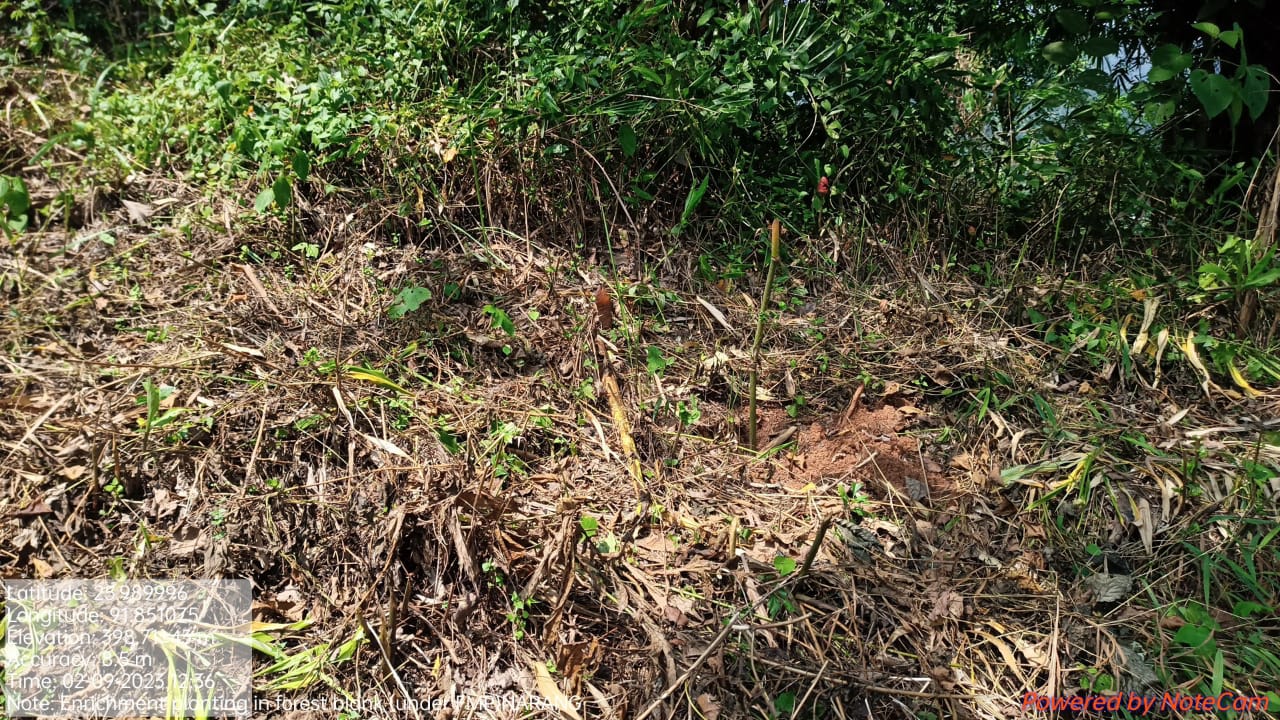
FMP Activities 1.Fire Control Line 2.Assisted natural regeneration in open forests (Contour Bund Cum Afforestation) 3.Community Forest Boundary Survey 4.Enrichment Planting in forests blanks 5.Nursery for Food Forestry (Sapling for the Existing Nursery 6. In situ & Ex situ conservation of rare and endangered species |
Community Land | 46,079 | Completed |
TESTIMONIALS
President - Rosting Shanglong 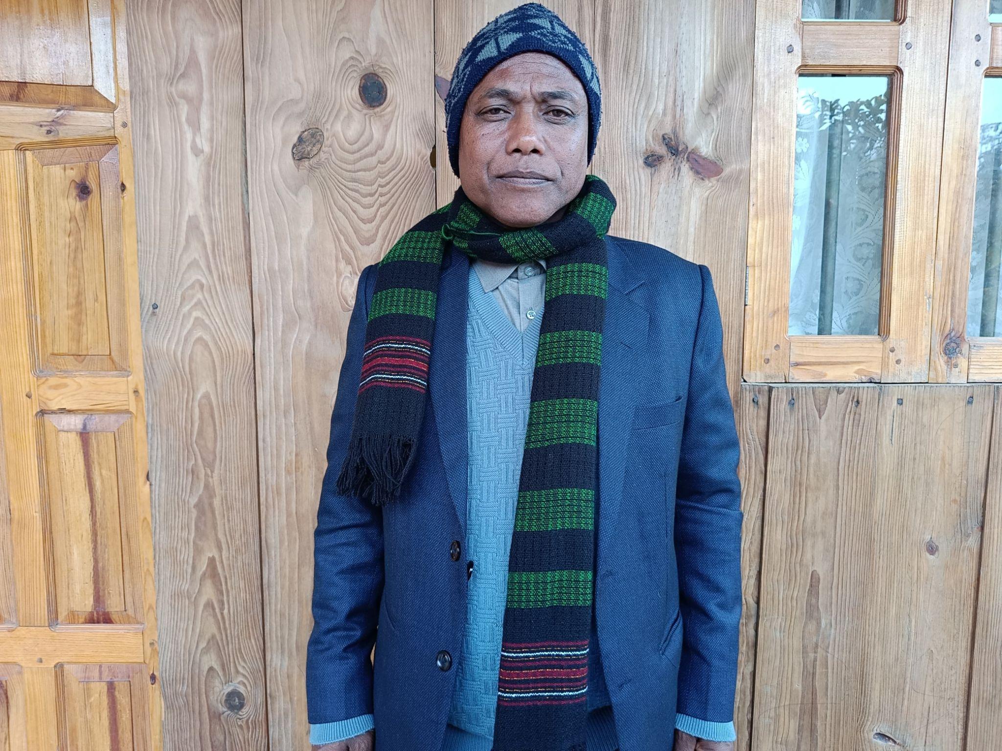
Throughout its intervention in the village, the project has been instrumental in providing job opportunities for farmers, promoting afforestation and tree planting, preserving water sources, and educating the community about environmental conservation. This initiative has not only brought tangible benefits like contour trenches, afforestation, spring chamber, and nursery facilities but has also empowered the villagers with knowledge and skills to protect the environment.
The efforts of the VCF (Village Community Facilitator) members and the community's willingness to work together as a team have played a crucial role in the success of the project. It's heartening to see that the project has been able to address some of the environmental challenges and foster positive changes in the village.
Overall, "CLLMP" is a commendable initiative that has brought about positive change in the village's socio-economic and environmental aspects. With continued dedication and collaboration, it has the potential to inspire even greater transformations in the community and beyond.
Secretary- Wanmery Jynthem 
As a secretary, I’m grateful for the role and position that this project has given. The experience that I had while working with the project at the village level is one that I will cherish for a lifetime. The project has catered to the basic needs of the villagers especially in relation to water. Being the secretary I get to attend all of its meetings and share my thoughts and concerns regarding various activities. This project is the epitome of rural development and through its work it has been a blessing to the entire community.
VCF M&E : Rosila Shanglong 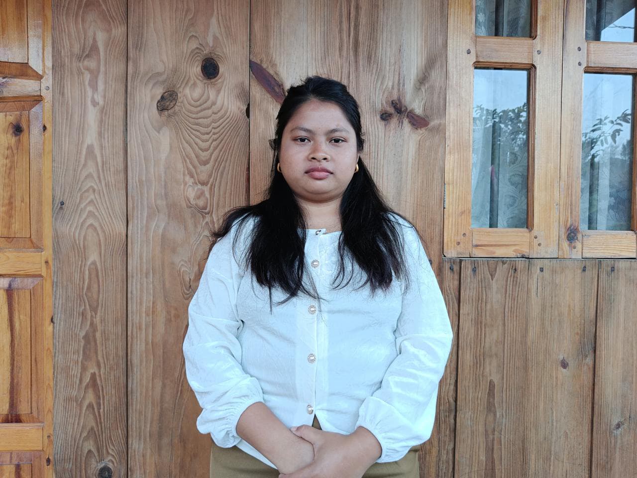
As a youth, I was very delighted when I was given the opportunity to work as a VCF at the village under this project. The increasing environmental degradation in the area due to the cutting down of trees is of great concern and this highlights the importance of ongoing education and awareness campaigns to emphasize the value of nature and the long-term consequences of unsustainable practices. As a VCF I get to educate the community about the importance of environmental protection and the project has made sure that its implementation takes care of this huge environmental concern and serves the interest of the community sustainably.
By empowering the youth, women, and the entire community to understand the significance of preserving and maintaining the environment, the project can continue to make a lasting impact.
VCF Social management - Rupalin Jynthem 
As a Village Community Facilitator of Social & Knowledge Management I was delighted to take this part. This project brought teamwork in the community and through it; it has taught us how to preserve the environment by planting more trees, making our very own manure to use in agricultural practices and not leaving the other works that have had a huge impact on the lives of the villagers. As a VCF I get to educate the villagers about the project and its initiative by visiting the overall households of the village, not leaving aside the training and exchange of learning practices that the project has provided with.
As a VCF I believe that it’s essential to continue promoting teamwork, knowledge sharing, and effective social management to ensure the project's sustainability and the village's environmental well-being. Encouraging the community to take ownership and preserve the work done through the project will be crucial for a brighter and greener future.