COMMUNITY LED LANDSCAPE MANAGEMENT PROJECT
(CLLMP)
The Government of Meghalaya with financial help from the World Bank is implementing the Meghalaya Community Led Landscape Management Project (MCLLMP). The project covers the entire state of Meghalaya and implementation of community-led plans are rolled out in a phased manner throughout the state. The Meghalaya Basin Management Agency (MBMA) will facilitate community-led planning by providing support, technical inputs and funding.
The project is intended to strengthen community-led natural resources management in selected landscapes within the 7 districts of the state. This would be achieved through a variety of planning, capacity building, and on-the-ground interventions to promote the conservation, sustainable use of natural resources, social inclusion and community mobilization; building traditional knowledge and learning, mapping of natural resources management; strengthening the community institutions and creating linkage with financial institutions and community organizations.
The project interventions will include preparation of community led natural resource management plans. The CLLMP has the following three components:
Strengthening Knowledge and Capacity of Communities for Natural Resources Management
Community-Led Landscape Planning and Implementation
Project Management and Governance
The project objective is “to manage and conserve the natural resources, especially forests, soil and water sources, in a manner that supports the financial and physical well-being of communities in the State”
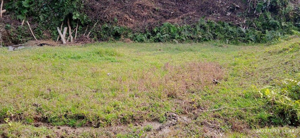
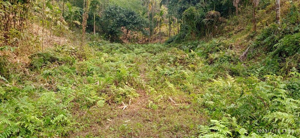
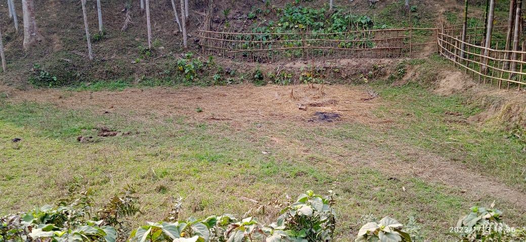
Chandapara Village is located in West Garo Hills district in Meghalaya. Agriculture is the main profession of this village and does not have any industrial development. The People of this area is very peaceful without taking much issues and problems to think about the external affairs. They are confined to what they have been doing and comfortable with. Even though the village has very little known to the development sectors and does not take any concern over reviving, rejuvenating as well as protecting the environment. So being one of the most degraded villages falling under Dalu block, Chandapara still have a chance to work towards conserving and protecting the natural resources of the village .
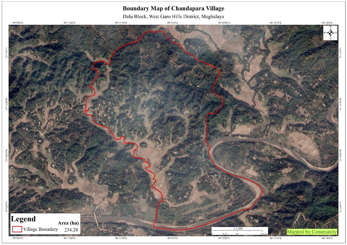
Chandapara has a total population of 656 with 124 Households with a geographical area of 234.28 Ha 2.3428 sq.Km. The community inhabitants in the village are Garos and the land is owned by the Aking Nokma. According to the sources, Chandapara came into existence /established in the year 1910, with very less population and comprising of only Garo community. The village currently has about 335 male and 321 female with very less access to the health cards.
Chandapara is situated 7 km away from sub-district headquarter Dalu and 52km away from district headquarter Tura. The public transport facilities to and fro from village is quite less however it is easily access to any kind of Public transportation an hours to travel. Infact, most of the community travel by their own vehicle such as bikes and cars.
When it comes to use of fuel like LPG, very less households are still unable to use gas and prefer using woods for cooking purposes. Around The village has less institution for education, safe drinking water supply, hospitals and especially electricity which is one of the main concern of this village. Whereas, as per one of the Village facilitators said, roads are good enough comparatively to previous years.
Dimapara is the nearest market to the village which is about 1 km away. Whereas, Barengapara market is about 4 km away from the village. Further when asked about produce vegetables, it seemed only few vegetables like brinjal,pumpkin are being produce which are being sold in weekly markets.
When asked about the village literacy, it seemed the community have minimum in education qualification and mostly into hand to mouth kind of a lifestyle. Most of the community concentrate on areaca nut and Cashew nut plantation to earn their income.
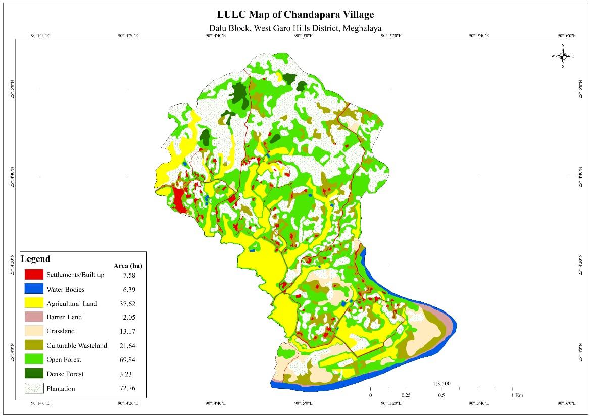

Agriculture is the major occupation of people in the village where they cultivate mostly horticulture crops and some agricultural crops. Areca nut is mostly grown in this area and other horticultural crops like Cashew nut, black pepper, rubber. Around 112 HH are said to be farmers, 8 HH with the occupation of teacher, 2 HH nurse with another 2 HH working in the police departments.

Ground truthing and sensitization programme were undertaken onthe
11th December, 2018 by the district team of West Garo Hills.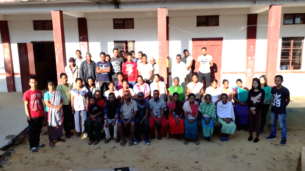
During the programme the community were sensitized about the project and activities that can be undertaken in the project.
There was also a small discussion about formation of VNRMC, Village facilitators, opening of bank accounts and the project goals. There were around 43 participants attended the programme comprising of village elders headmen, VEC secretary, including women groups, youths CLLMP along with District Assistant Managers – Environment Management , Social Management and M&E.
low productivity of produce
Whereas medicinal herbs available are Lantanacamara, Tulsi etc.
Signing of Documents:
After the sensitization, the community signed documents such as EOI, VGAand Green charter. Then the selection of candidates for the Village Natural Resource Management Committee Executive members and Village community facilitators where done on the same day 15th January, 2021.
1.2 Formation of the VNRMC
On the 15th January, 2021, the Formation of the Village Natural Resource Management Committee was done. Listed below are the members of the EC and VCF:
|
||||||||
|---|---|---|---|---|---|---|---|---|
| Sl No | Name in Full | Gender M/F | Age (in Yrs) | Education | Designation | Occupation | Community | Contact No and email address |
| 1 | Lekson Sangma | M | 48 | HSLC | VNRMC Chairman | Farmer | Garo | 8837317220 |
| 2 | Sunemia Sangma | F | 30 | HSLC | VNRMC Sec | Shopkeeper | Garo | 8118926826 |
| 3 | JoymothyMarak | M | 43 | E.C Member | Garo | - | ||
| 4 | Pilsing Momin | M | E.C Member | Farmer | Garo | - | ||
| 5 | Aprilson Sangma | M | 46 | HSLC | E.C Member | Primary master | Garo | - |
| 6 | Prement Sangma | M | 43 | Claass 8 | E.C Member | - | Garo | - |
| 7 | Rohilber Sangma | M | E.C Member | Garo | - | |||
| 8 | Bonseng Sangma | M | E.C Member | Garo | - | |||
| 9 | Mesalene Sangma | F | 32 | Class 7 | E.C Member | Shopkeeper | Garo | - |
Village Community Facilitator (VCF)
| Sl No | Name in Full | Gender M/F | Age (Yrs) |
Education | Area of specialisation/ focus (forests, water, soil, accounts, environmental and social safeguards, knowledge management, GIS) | Trained under CLLMP (Yes/ No?) if Yes, date training was received | Contact No and email address |
|---|---|---|---|---|---|---|---|
| 1 | Senggrik N Marak | M |
|
|
|
|
|
| 2 | Jawin Sangma | M |
|
|
|
|
70050551398 |
| 3 | Senggrik N Marak | M |
|
|
|
|
|
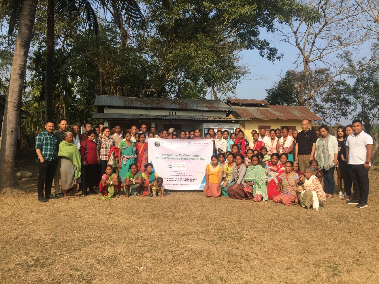
On the 1st March 2019, the District team of West Garo Hills
conducted PRA and CNRM plan at chandapara Village, Dalu Block,
WGH.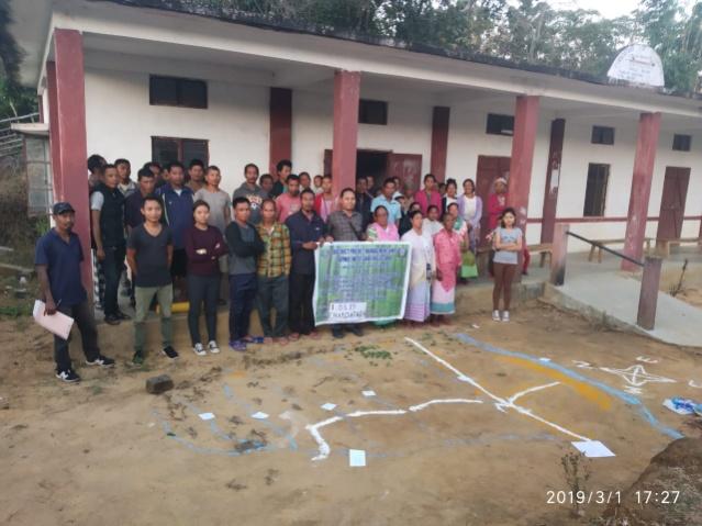
The community was being informed that CNRM plan preparation is mainly to understand the natural resources of the village, requirement of plans and activities propose by the community.
During the CNRM plan preparation the social and resource map was also being done and the community were being asked to navigate and locate their villages’resources.
The exercise were participated by the villageheadmen, VNRMCs and Village facilitators along with the women participations from SHGs.
PROJECT IMPLEMENTATION
| SL NO | Type Of Intervention | Site Name | Amount Sanctioned as per Estimate | Work Status |
|---|---|---|---|---|
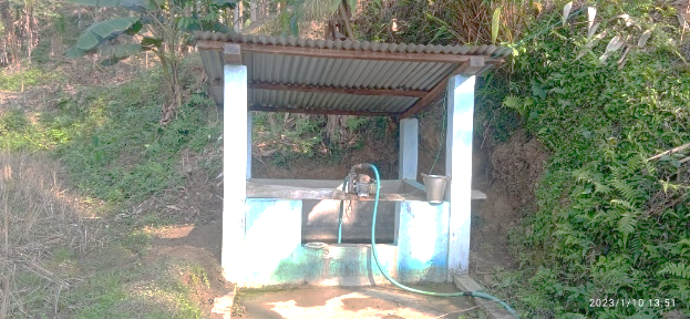
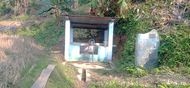
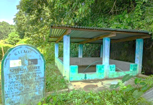
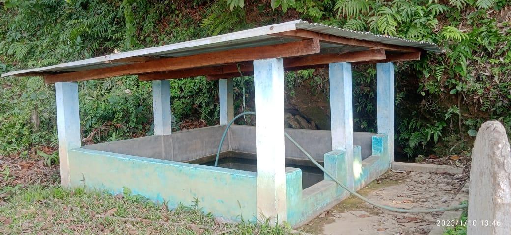
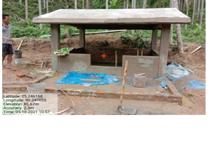
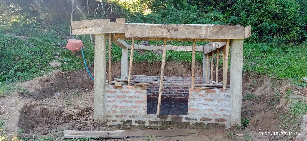
| 1. | Spring Chamber | Jongsin Gittim | Rs. 85,300.00 | Completed |
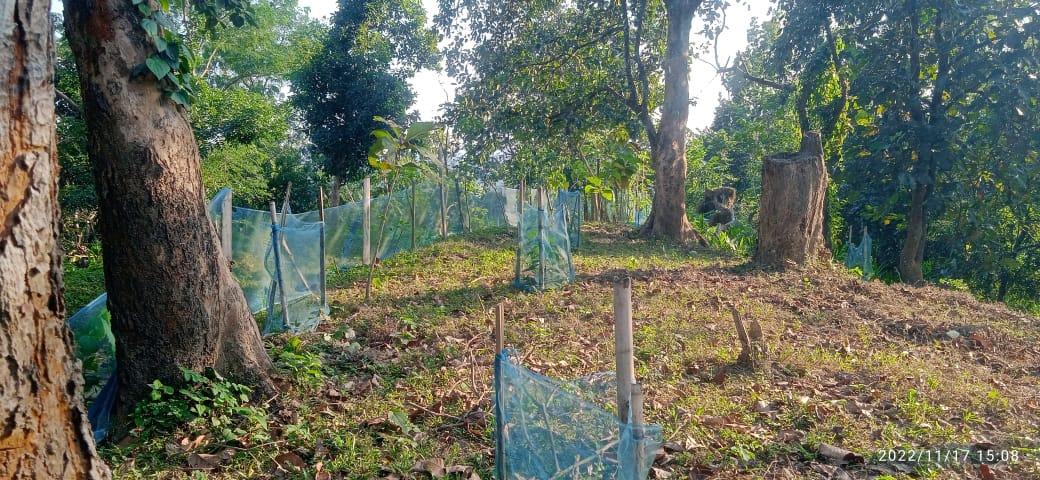
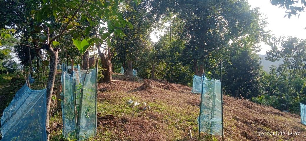
| 2. | Community Nursery | Adu Gittim | Rs.1,48,000.00 | Completed |
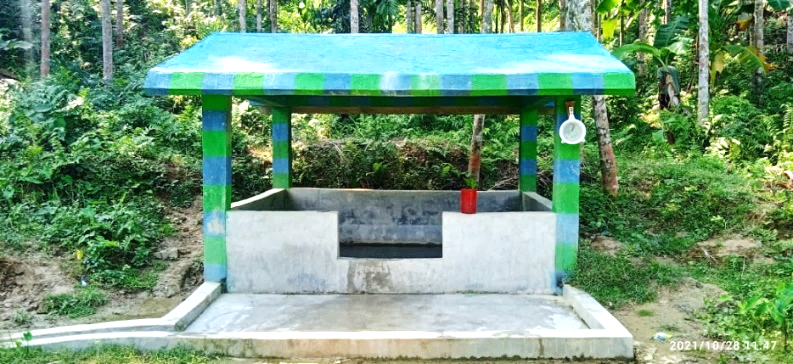
| 3. | Spring Chamber | Sombalin Chiga | Rs. 1,17,860.00 | Completed |
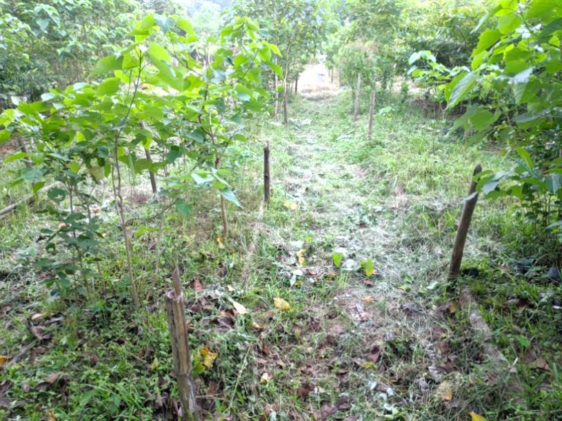
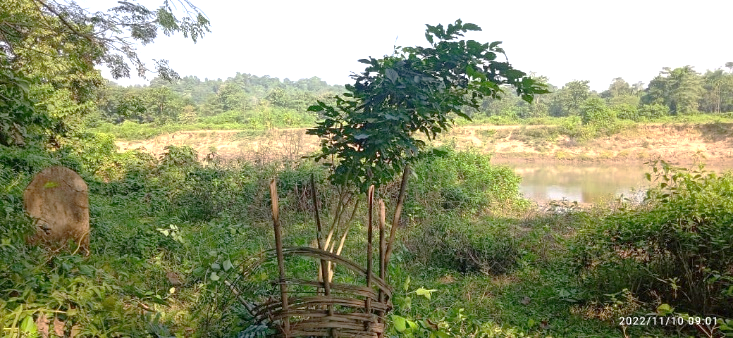
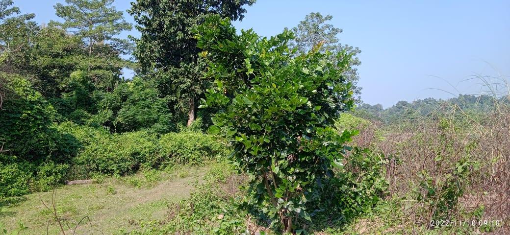
| 4. | Plantation | Boghai Riverside | Rs.2,34,000.00 | Completed |
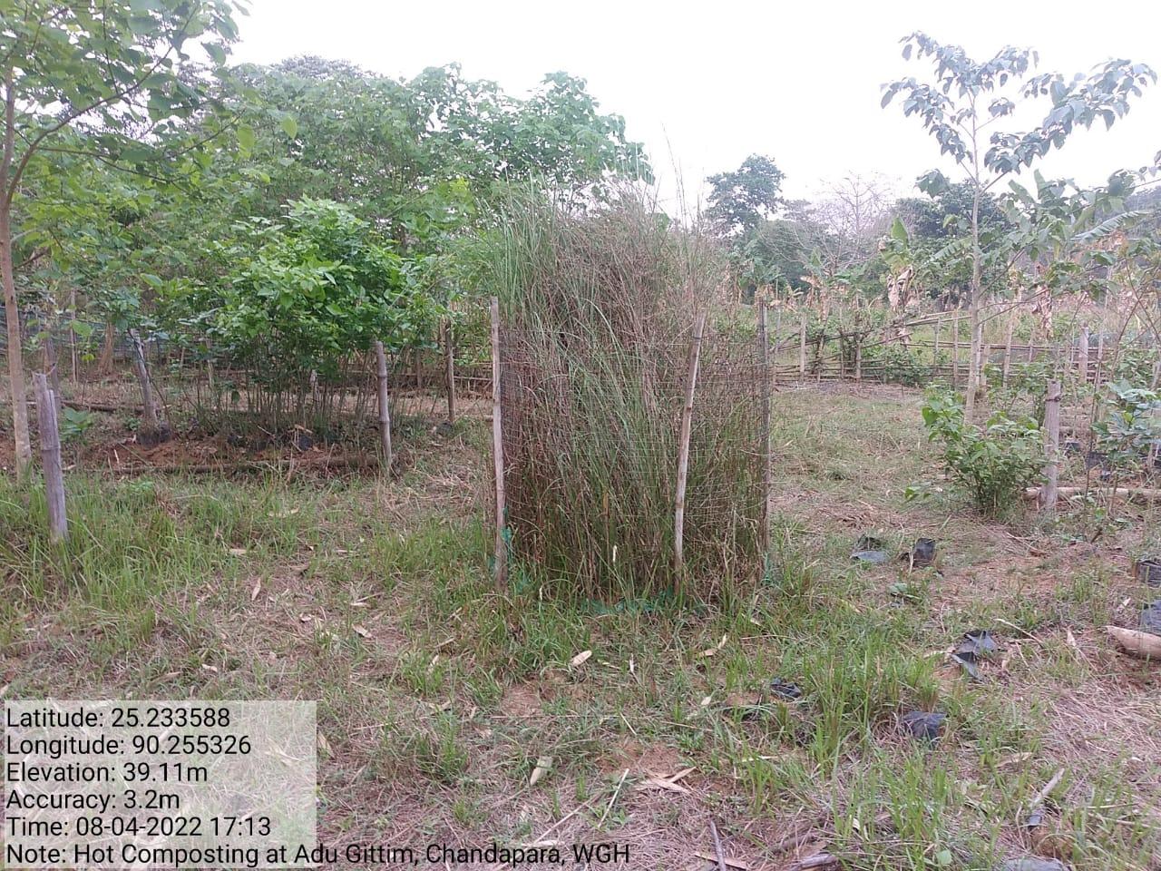
| 5. | Hot Composting (18 Days Composting) | Adu Gittim, near Nursery | Rs.33,000.00 | Completed |
| 6. | Spring Chamber | Sengme Chimik | Rs.1,56,000.00 | Completed |
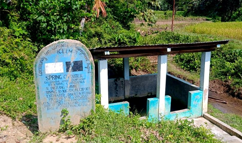
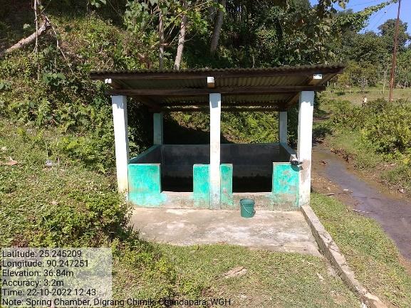
| 7. | Spring Chamber | Digrang Chimik | Rs.1,17,860.00 | Completed |
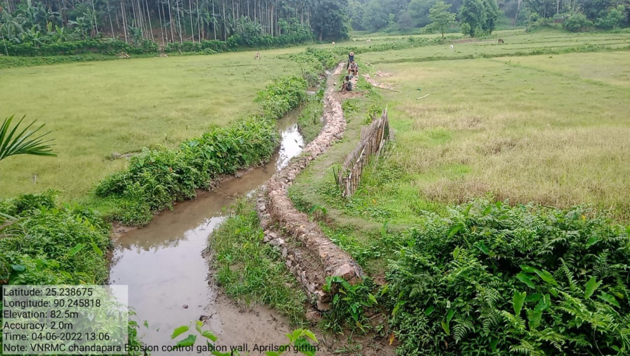
| 8. | Erosion Control gabion Wall | Aprilson Gittim | Rs.4,54,000.00 | Completed |
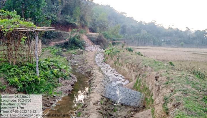
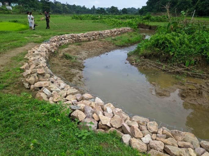
| 9. | Erosion Control gabion Wall | Bikash Gittim | Rs.3,19,980.00 | Completed |
| 10. | Agroforestry | Selbin Gittim | Rs.52,000 | Completed |
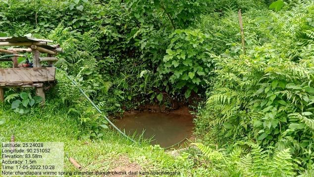
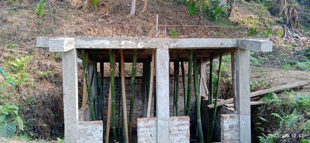
| 11. | Spring Chamber | Panjak Chimik | Rs.2,40,000.00 | On-going |
| 12. | Spring Chamber with Trenches | Sengnak Chimik | Rs.1,97,000.00 | On-going |
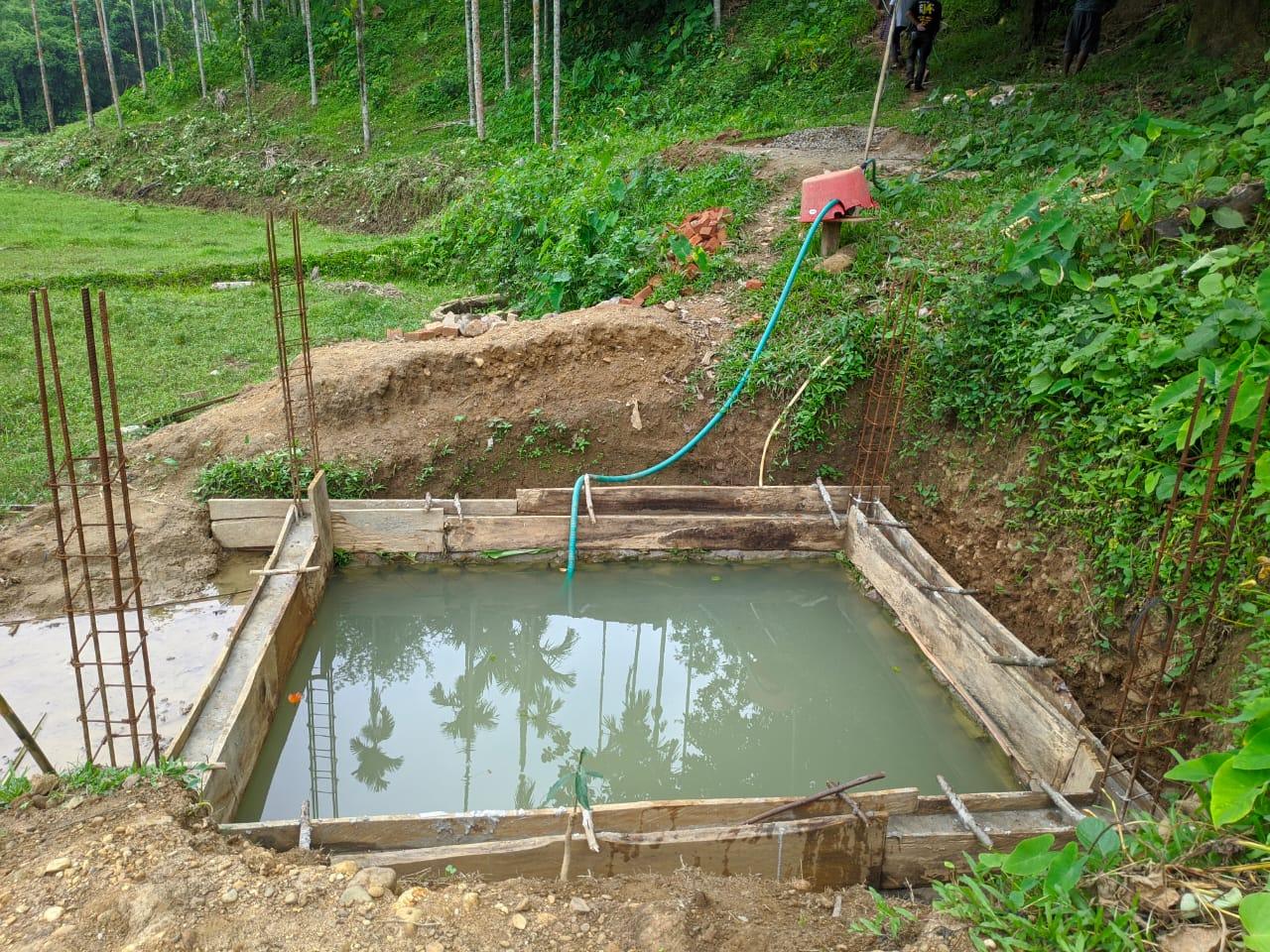
| 13. | Dug out pond (Additional) | Kamingstone Gittim | Rs.125,000 | On-going |
| 14. | Dug out pond (Additional) | Ronithson Gittim | Rs. 125,000 | On-going |
| 15. | Dug out pond (Additional) | Robin Gittim | Rs. 125,000 | On-going |
| 16. | Dug out pond (Additional) | Tenang Gittim | Rs. 125,000 | On-going |
4. Fund Status
| 1. 1 | Type of Intervention | Site Name | GPS Coordinates | Amount | Work Status |
|---|---|---|---|---|---|
| Spring Chamber | Jongsin Gittim | Elevation 36m N 25.24274 E090.24826 |
Rs. 85,300 | Completed |
| 2. 1 | Type of Intervention | Site Name | GPS Coordinates | Amount | Work Status |
|---|---|---|---|---|---|
| Community Nursery | Adu Gittim | Elevation 35m N 25.23342 E 090.25547 |
Rs. 1,48,000 | Completed |
| 3. 1 | Type of Intervention | Site Name | GPS Coordinates | Amount | Work Status |
|---|---|---|---|---|---|
| Spring Chamber | Sombalin Chiga | Elevation 27m N 25.23887 E 090.24924 |
Rs. 1,17,860 | Completed |
| 4. 1 | Type of Intervention | Site Name | GPS Coordinates | Amount | Work Status |
|---|---|---|---|---|---|
| Plantation | Boghai Riverside | Elevation 36m N 25.234865 E 90.258844 |
Rs. 2,34,000 | Completed |
| 5. 1 | Type of Intervention | Site Name | GPS Coordinates | Amount | Work Status |
|---|---|---|---|---|---|
| Hot Composting (18 Days Composting) | Adu Gittim, near Nursery | Elevation 35m N 25.23342 E 090.25547 |
Rs. 33,000 | Completed |
| 6. 1 | Type of Intervention | Site Name | GPS Coordinates | Amount | Work Status |
|---|---|---|---|---|---|
| Spring Chamber | Sengme Chimik | Elevation 35m N 25.24621 E 90.24708 |
Rs. 1,56,000 | Completed |
| 7. 1 | Type of Intervention | Site Name | GPS Coordinates | Amount | Work Status |
|---|---|---|---|---|---|
| Spring Chamber | Digrang Chimik | Elevation 33m N 25.24525 E 090.24720 |
Rs. 1,17,860 | Completed |
| 8. 1 | Type of Intervention | Site Name | GPS Coordinates | Amount | Work Status |
|---|---|---|---|---|---|
| Erosion Control gabion Wall | Aprilson Gittim | Elevation 78m N 25.23878 E 90.24582 |
Rs. 4,54,000 | Completed |
| 9. 1 | Type of Intervention | Site Name | GPS Coordinates | Amount | Work Status |
|---|---|---|---|---|---|
| Erosion Control gabion Wall | Bikash Gittim | Elevation 82m N 25.23848 E 90.24706 |
Rs. 3,19,980 | Completed |
| 10. 1 | Type of Intervention | Site Name | GPS Coordinates | Amount | Work Status |
|---|---|---|---|---|---|
| Agroforestry | Selbin Gittim | Elevation 69m N 25.24620 E 90.24625 |
Rs. 52,000 | Completed |
| 11. 1 | Type of Intervention | Site Name | GPS Coordinates | Amount | Work Status |
|---|---|---|---|---|---|
| Spring Chamber | Panjak Chimik | Elevation 35m N 25.24025 E 90.25114 |
Rs. 2,40,000 | On-going |
| 12. 1 | Type of Intervention | Site Name | GPS Coordinates | Amount | Work Status |
|---|---|---|---|---|---|
| Spring Chamber with Trenches | Sengnak Chimik | Elevation 34m N 25.24129 E 90.24497 |
Rs. 1,97,000 | On-going |
| 13. 1 | Type of Intervention | Site Name | GPS Coordinates | Amount | Work Status |
|---|---|---|---|---|---|
| Dug out pond (Additional) | Kamingstone Gittim | Elevation 58m N 25.24071 E 90.24844 |
Rs.125,000 | On-going |
| 14. 1 | Type of Intervention | Site Name | GPS Coordinates | Amount | Work Status |
|---|---|---|---|---|---|
| Dug out pond (Additional) | Ronithson Gittim | Elevation 43m N 25.24499 E 90.24499 |
Rs. 125,000 | On-going |
| 15. 1 | Type of Intervention | Site Name | GPS Coordinates | Amount | Work Status |
|---|---|---|---|---|---|
| Dug out pond (Additional) | Robin Gittim | Elevation 38m N 25.24515 E 90.2439 |
Rs. 125,000 | On-going |
| 16. 1 | Type of Intervention | Site Name | GPS Coordinates | Amount | Work Status |
|---|---|---|---|---|---|
| Dug out pond (Additional) | Tenang Gittim | Elevation 32m N 25.24293 E 90.2485 |
Rs. 125,000 | On-going |