

COMMUNITY LED LANDSCAPE MANAGEMENT PROJECT (CLLMP)
The Government of Meghalaya with financial help from the World Bank is implementing the Meghalaya Community Led Landscape Management Project (MCLLMP). The project covers the entire state of Meghalaya and implementation of community-led plans are rolled out in a phased manner throughout the state. The Meghalaya Basin Management Agency (MBMA) will facilitate community-led planning by providing support, technical inputs and funding.
The project is intended to strengthen community-led natural resources management in selected landscapes within the 7 districts of the state. This would be achieved through a variety of planning, capacity building, and on-the-ground interventions to promote the conservation, sustainable use of natural resources, social inclusion and community mobilization; building traditional knowledge and learning, mapping of natural resources management; strengthening the community institutions and creating linkage with financial institutions and community organizations.
The project interventions will include preparation of community led natural resource management plans. The CLLMP has the following three components:
Strengthening Knowledge and Capacity of Communities for Natural Resources Management
Community-Led Landscape Planning and Implementation
Project Management and Governance
The project objective is “to manage and conserve the natural resources, especially forests, soil and water sources, in a manner that supports the financial and physical well-being of communities in the State”
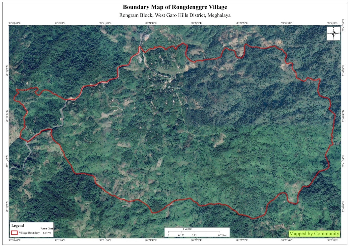
Rongdenggre Village is situated under the Rongram C&RD block of West Garo Hills district of Meghalaya. The village is about 22 km from the Rongram Block office and 35 km from the district Headquarter, Tura. The village is under the traditional land owner of A’king Nokma. The total population and the demographic of both male and female of the village is about 570 with 103 number of households.
The village can be reach through transportation such as buses and winger, with a very limited access to its time to ply. However, these days, many of the community travel to and fro in their private vehicles as well as in their motor bikes.
The Village is about 22 Km away from Rongram Block and 35 km away from district headquarter Tura. The public transport facilities to and from village is in public bus, winger and private vehicle. In respect to the Social Mobilization, it wasn’t that difficult to handle the community of this village as they are active and hardworking. Despite of very less facilities available, the community are very keen towards achieving the aims and objectives of CLLMP.
When it comes to use of fuel /LPG /biomass/gas most of the households are using Wood sand very less access to LPG. The community has few facilities such as education, safe drinking water supply, road and access to medical facilities. The village is under Head of village (Nokma).
In regards to social profile, Rongdenggre village has total no of 103 households with the total population of 570. Out of which 282 are male and 288 are female.
The following is the demographic break up information acquired by the CLLMP team of WGH district.

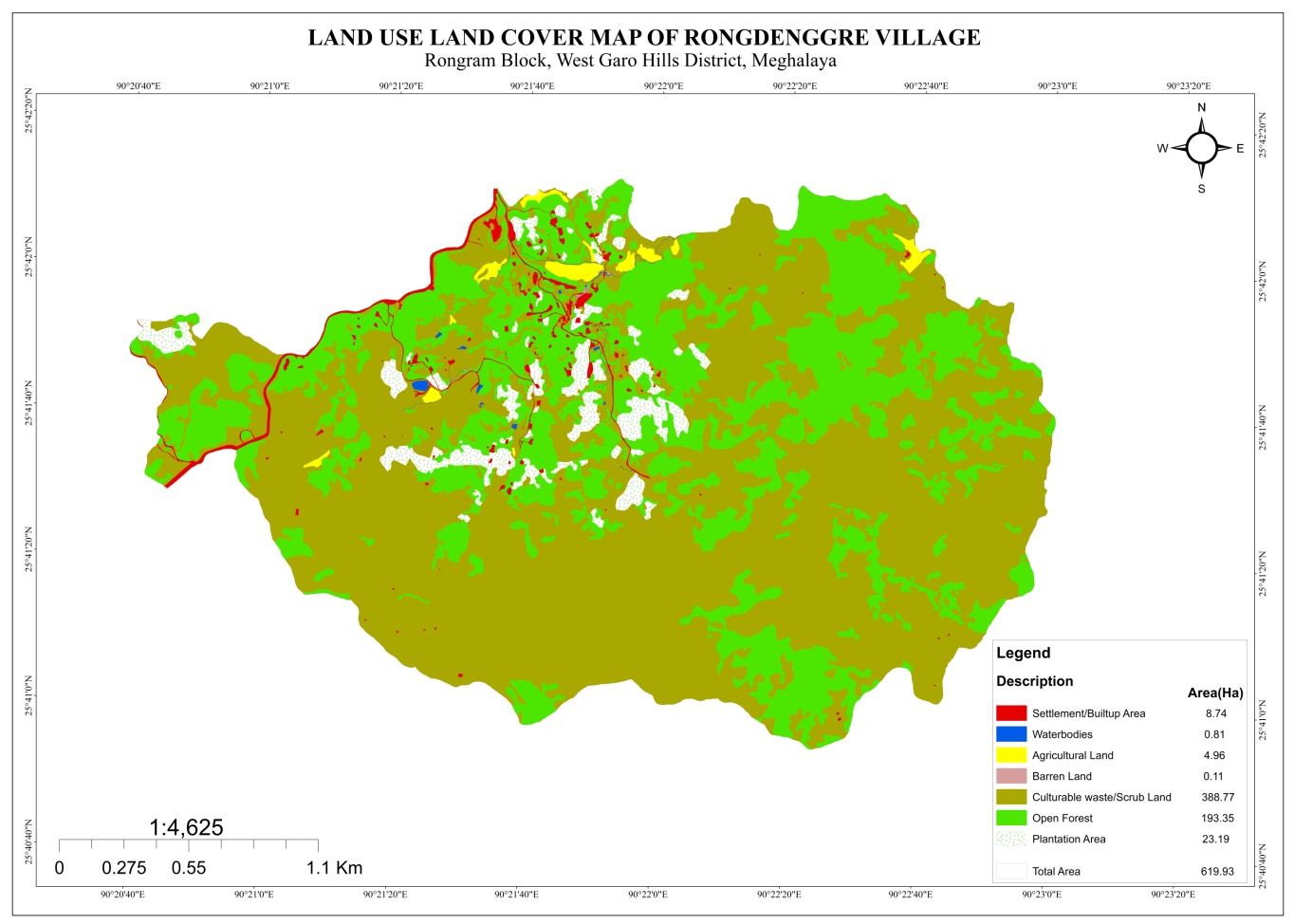
Rongdenggre village are still into farming which includes agriculture and multi cropping. Unlike any other village’s Areca nut is always one of the most grown cash crops followed by black pepper, banana, pineapple etc. People came to observe and realize that the hill is gradually losing its soil fertility and water retention properties. There are 102 HH farmers, and 1 HH are Police Service.
On the 21st Jan 2019, Assistant District Project Manager (ADPM) and Assistant Manager, Social Management of District Project Management Unit (DPMU), West Garo Hills visited Rongdenggre village for Sensitization cum Ground Truthing.
The village has 570 HH with 103 populations.
The village has Community Forest
Low soil fertility
No proper drinking water facilities. The village water sources are springs and streams. It has 12 streams and 4 springs.
No irrigation facilities for farming
The village has few medicinal herbs and endangered species in forest.
The village has many local tree species such as: - Gambare, Boldak, Kimbal, Bolsil, Jenggil, Te.bil, Prap, Te.wek, Chagro, Bolpu, Mandal, Bolchu, Me..gong, Achri, Agatchi, Do.kime, Chamisi, Aminsep, Sisoo, Bollong, Ambari, Arimu Chagro, Gimbil, Bolbret, Bolchim, Agatchi,
The village Forest has medicinal shrubs/trees such as Tematchi, mandal, Memang narang, mandal, Bamboo.
Commercially valued Trees/ Shrubs/Plants in forests available in the village forest are – Gambar, Bolbret, Dalbergia Sisoo, Schimawallichii (Boldak),
Fodder Species/ Valuable grasses in forests-Samsok, Samchigang, Dilbak, Ampang, Samchek, Sambanggre, Me.ga, Nengchong, Dalak, Sarat, Samsillong (Meghalaya budu), Wakmebudu. Bamboo grass is available in the village
The endangered species in Forest (fauna & flora) such as Duabanga grandiflora (Bolchim), Shorea robusta (Bolsal), Chambu, Sisoo, Gambari, Soksimarang, Attapol (Annona reticulta (custard apple) etc
The District team of West Garo Hills conducted PRA and CNRM plan at Rongdenggre Village on the 21st Jan 2019. Rongram Block, WGH.
The exercises were conducted by the district team Social, Environment, M&E. The Team informed the community that PRA exercise is to understand and locate the natural resources of the village and plan the activities according to their need. The community had an exercise to plan and draw resource and social map on the same day.
In the exercise of CNRM plan preparation, the community were asked to prioritized the plan /activities and submit the plan to DPMU for 5 years. The exercises were done in the presence of village headmen, VNRMCs and Village facilitators. There were around 34 participants for the programme.
1.0 Signing of Documents:
As an acceptance and agreement to the project, every member of the village households had to sign green charter on 19th Jan, 2019 and submitted the Village agreement and Expression of Interest to DPMU.
Formation of the VNRMC
On 21st Jan, 2019 after the ground survey and sensitization programme, the village signed the EOI, VGA and Green charter as a sign of accepting the project. Whereas in regards, to the selection of Village Natural Resource Management Committee (VNRMC) members the Village Executive Committee (VEC) along with entire community carried out the process of selecting 15 chosen members such as 9 Executive members, 3 Purchase committee and 3 Village Community Facilitator.
Listed below are the members of the VNRMC:
| Sl No | Name in Full | Gender M/F | Age (in Yrs) | Education | Designation | Occupation | Community | Contact No and email address |
|---|---|---|---|---|---|---|---|---|
| 1 | Silseng DSangma | M | 35 | Class 10 | VNRMC Chairman | Farmer | Garo | 6000153896 |
| 2 | Jimmy D shira | F | 45 | Class12 | VNRMC Sec | Aganwadi | Garo | 6009301852 |
| 3 | Henry M Sangma | M | Member | Farmer | Garo | 6009622764 | ||
| 4 | Chingsengbirth Marak | M | Member | Farmer | Garo | 9863510641 | ||
| 5 | Tengkal TSangma | M | 26 | Class 10 | Member | Farmer | Garo | 9089331683 |
| 6 | Deepstar Sangma | M | Member | Garo | 6009718835 | |||
| 7 | Senmira Sangma | F | 28 | Class 6 | Member | Farmer | Garo | 6009804174 |
| 8 | Joyson B Marak | F | 43 | primary | Member | Farmer | Garo | 8794895115 |
| 9 | Kresilla Sangma | F | 33 | Class 8 | Member | Farmer | Garo | 9366003385 |
| Sl No | Name in Full | Gender M/F | Age (Yrs) |
Education | Area of specialisation/ focus (forests, water, soil, accounts, environmental and social safeguards, knowledge management, GIS) | Trained under CLLMP (Yes/ No?) if Yes, date training was received | Contact No and email address |
|---|---|---|---|---|---|---|---|
| 1 | Silbard B Marak | M | Class | SM@KM | |||
| 2 | Silnachi D Sangma | F | 17 | Class X | NRM&GIS | yes |
7640054313 |
| 3 | Nenerak Marak | M | 19 | Class XII | M&E | yes | 6909235036 |
Plan Estimate:
The DPMU of WGH made an inspection to the proposed intervention sites soon after the CNRM plan preparation.
|
Implemented Activities | Name of Site | Work Status |
|---|---|---|---|
| 1. |
|
Wage |
|
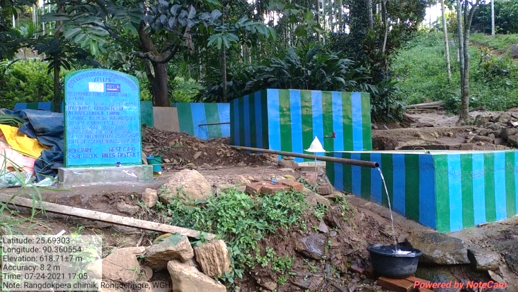
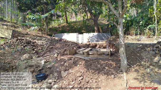
| 2. | Spring Chamber with storage Tank | Rangdokpea Chimik | Completed |
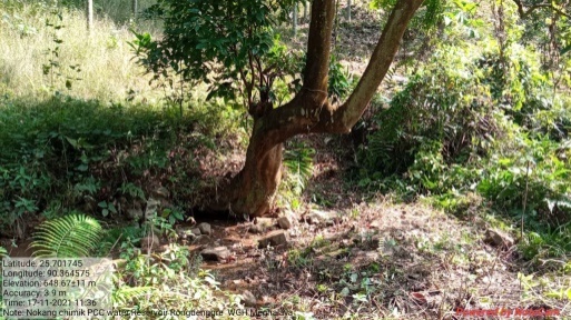
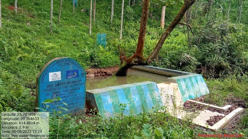
| 3. | PCC Water Reservoir | Nokang Chimik | Completed |
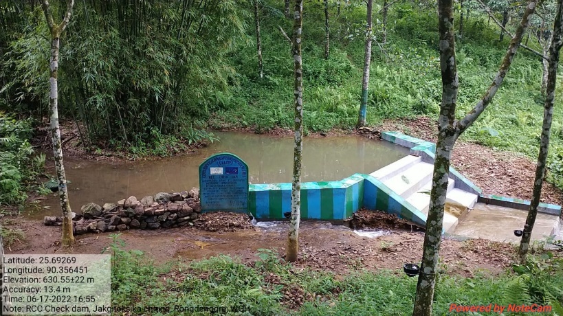
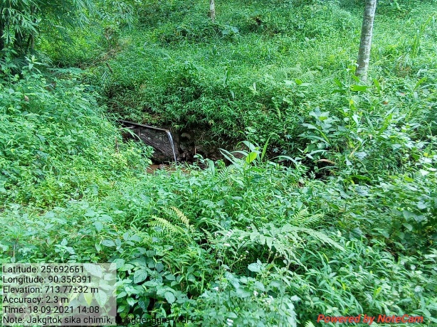
| 4. | RCC Check Dam | Jakgitoksika Chiring | Completed |
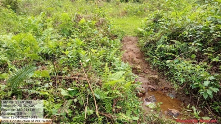
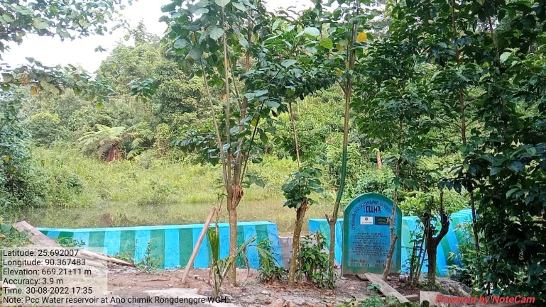
| 5. | PCC Water Reservoir | Ano Chibisik | Completed |
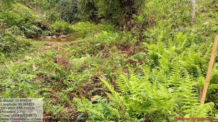
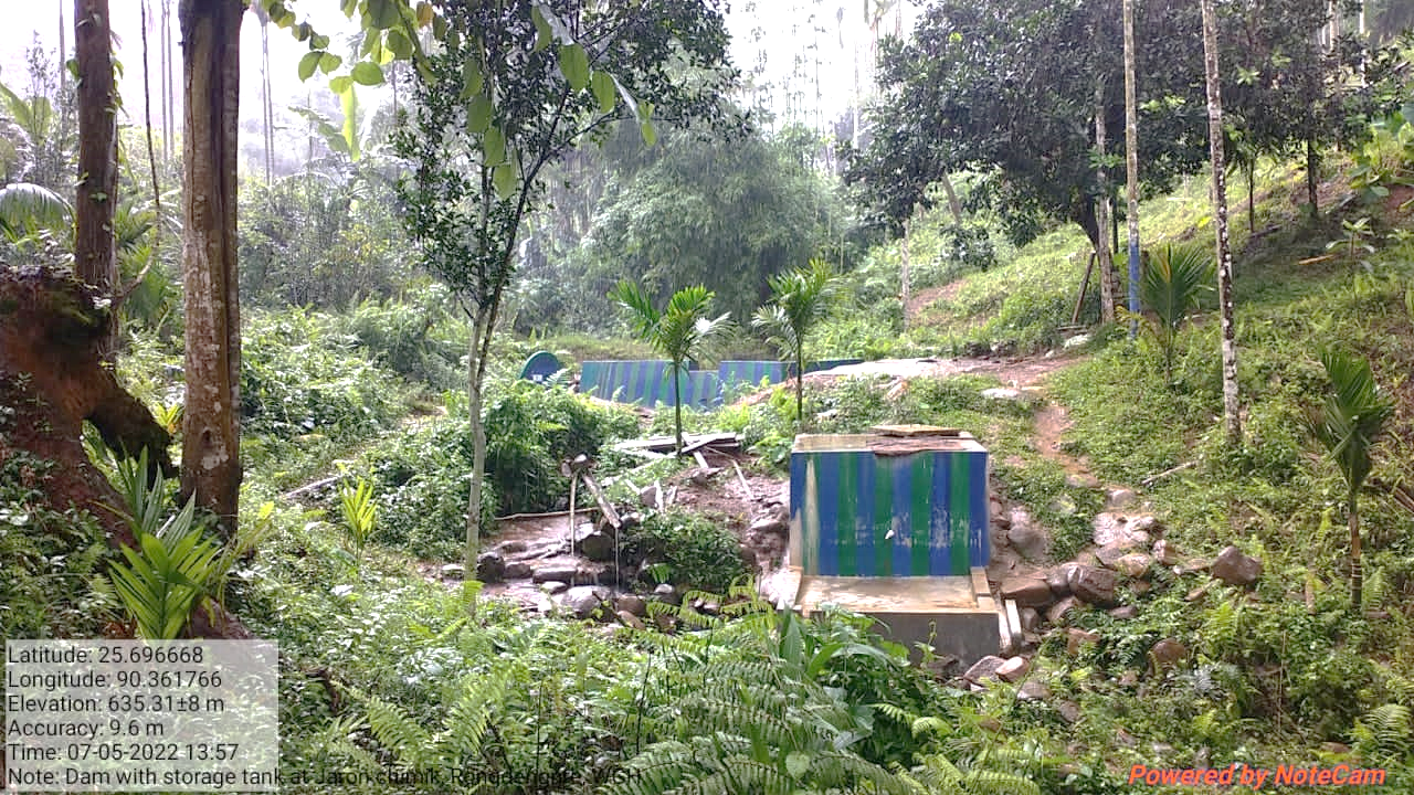
| 6. | Dam with Storage Tank | Jaron Chimik | Completed |
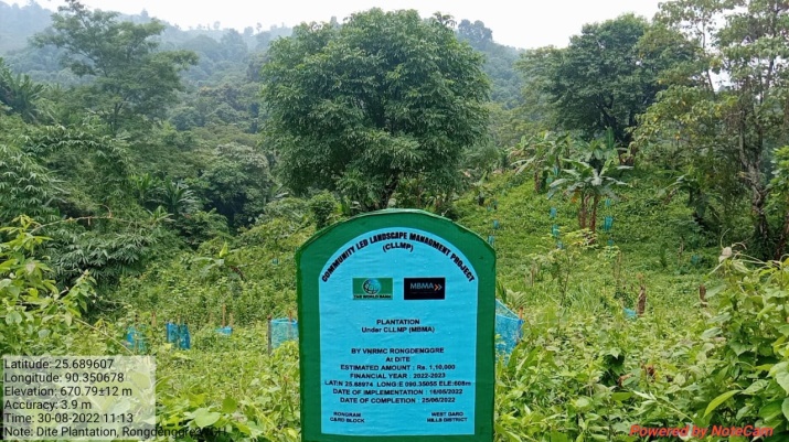
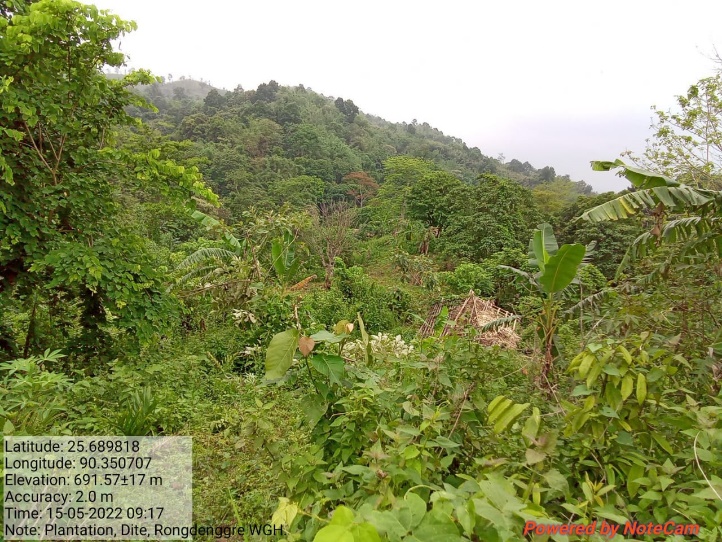
| 7. | Plantation | Dite | Completed |
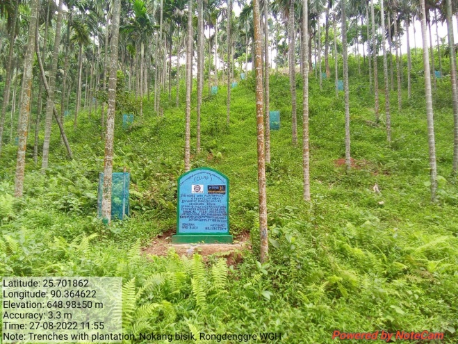
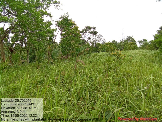
| 8. | Trenches with Plantation | Nokang bisik | Completed |
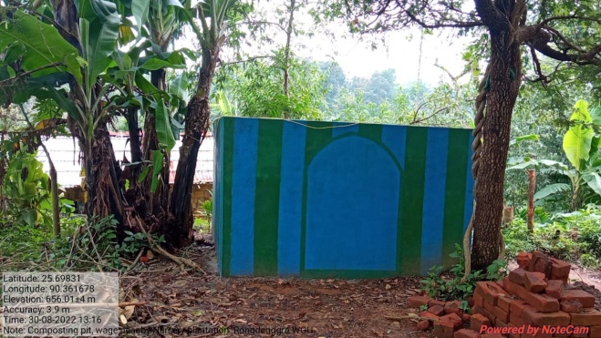
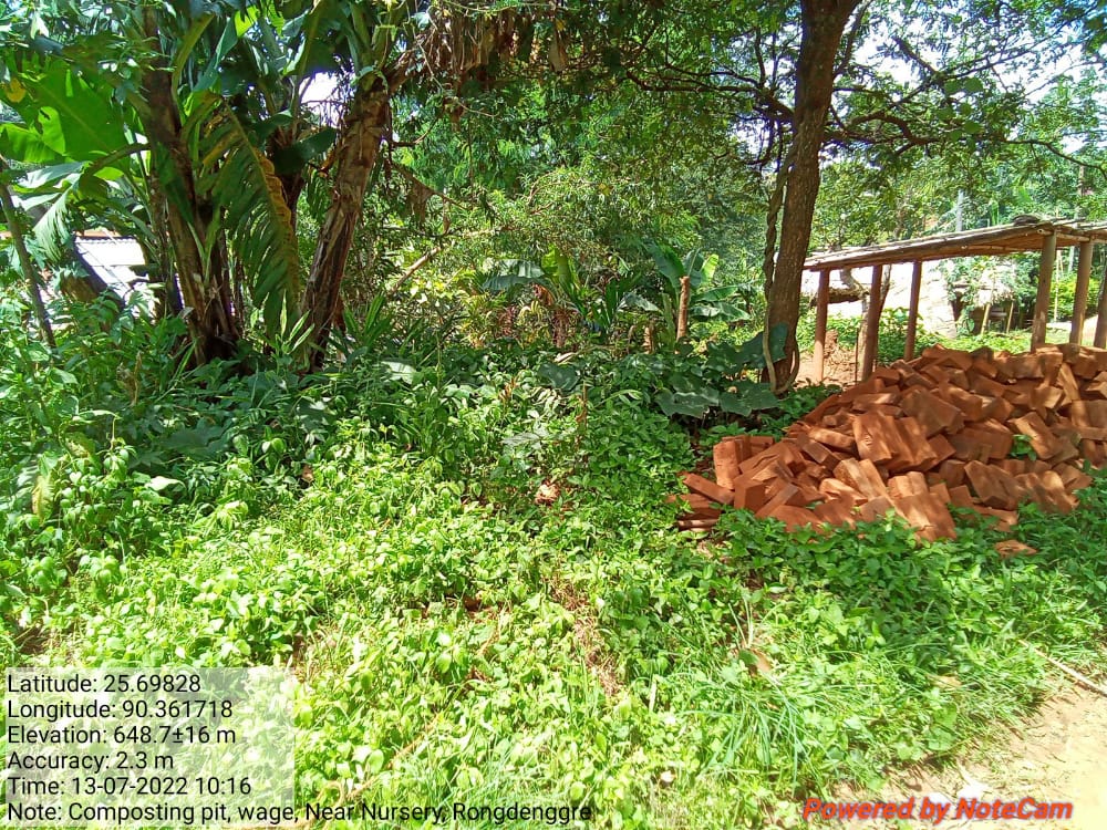
| 9. | Composting Pit | Wage,near Nursery | Completed |
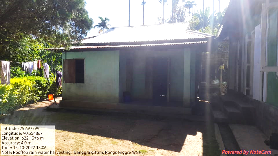
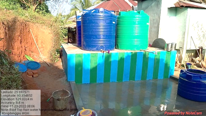
| 10. | Roof Top Rain Water Harvesting (Additional) | Danggra Gittim | Completed |
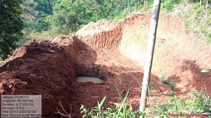
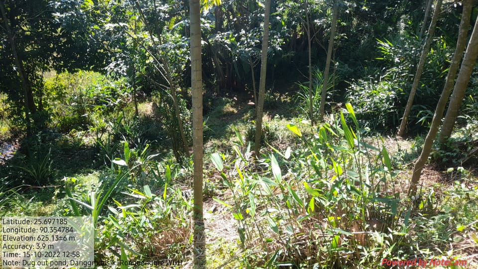
| 11. | Dug out Pond (Additional) | Danggra Bisik | On-going |
4. Fund Status
| 1 | Type Of Intervention | Site Name | GPS Co-ordinates | Amount | Work Status |
|---|---|---|---|---|---|
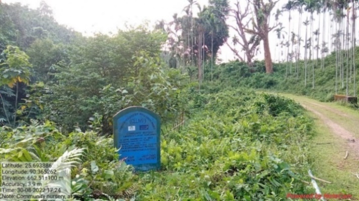
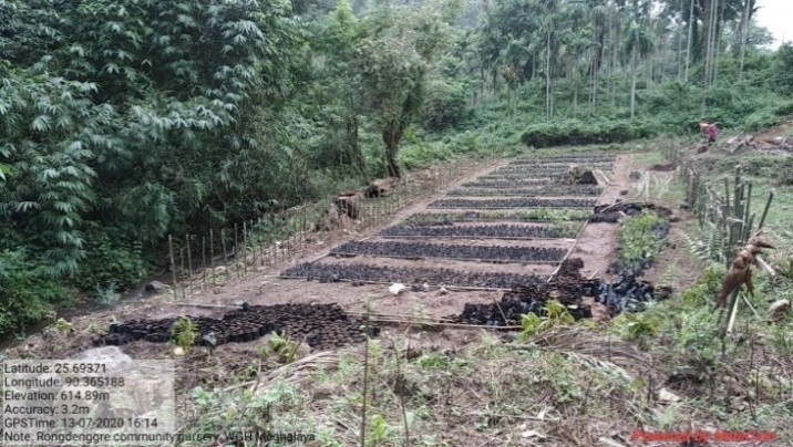
| Community Nursery | Wage | Elevation: 602m N25.69376° E090.36521° | Rs.79,000 | Completed |
| 2 | Type Of Intervention | Site Name | GPS Co-ordinates | Amount | Work Status |
|---|---|---|---|---|---|
| Spring Chamber with Storage tank | Rangdokpea Chimik | Elevation:622m N 25.69302 E 090.36060 |
Rs.3,22,000 | Completed |
| 3 | Type Of Intervention | Site Name | GPS Co-ordinates | Amount | Work Status |
|---|---|---|---|---|---|
| RCC check Dam | Jakgitoksika Chiring | Elevation 647m N 25.69272° E 090.35642° | Rs.2,98,000 | Completed |
 Before After
| 4 | Type Of Intervention | Site Name | GPS Co-ordinates | Amount | Work Status |
|---|---|---|---|---|---|
| PCC Water Reservoir | Nokang Chimik | Elevation 588m N 25.70185° E 090.36473° | Rs.3,23,000 | Completed |
Before After
| 5 | Type Of Intervention | Site Name | GPS Co-ordinates | Amount | Work Status |
|---|---|---|---|---|---|
| PCC Water Reservoir | Ano Chibisik | Elevation 613m N 25.69198 E 090.36753 | Rs.4,99,000 | Completed |
Before After
| 6 | Type Of Intervention | Site Name | GPS Co-ordinates | Amount | Work Status |
|---|---|---|---|---|---|
| Dam with Storage Tank | Jaron Chimik | Elevation 626m N 25.69667 E 090.36178 | Rs. 3,94,000 | Completed |
Before After
| 7 | Type Of Intervention | Site Name | GPS Co-ordinates | Amount | Work Status |
|---|---|---|---|---|---|
| Plantation | Dite | Elevation 608m N 25.68974 E 090.35055 | Rs. 1,10,000 | Completed |
Before After
| 8 | Type Of Intervention | Site Name | GPS Co-ordinates | Amount | Work Status |
|---|---|---|---|---|---|
| Trenches with Plantation | Nokang Bisik | Elevation 600m N 25.70194 E 90.36474 | Rs.58,000 | Completed |
Before After
| 9 | Type Of Intervention | Site Name | GPS Co-ordinates | Amount | Work Status |
|---|---|---|---|---|---|
| Composting Pit | Wage, near nursery | Elevation 602m N 25.69376° E 090.36521° |
Rs. 72,000.00 | Completed |
 Before After
| 10 | Type Of Intervention | Site Name | GPS Co-ordinates | Amount | Work Status |
|---|---|---|---|---|---|
| Roof Top Rain Water Harvesting (Additional) | Danggra Gittim | Elevation 631m N 25.69772 E 90.35464 | Rs.300,000 | Completed |
Before After
| 11 | Type Of Intervention | Site Name | GPS Co-ordinates | Amount | Work Status |
|---|---|---|---|---|---|
| Dugout pond (Additional) | Danggra Bisik | Elevation 611m N 25.69703 E 90.35478 | Rs.200,000 | On-going |
 Before After