
COMMUNITY LED LANDSCAPE MANAGEMENT PROJECT (CLLMP)
The Government of Meghalaya with financial help from the World Bank is implementing the Meghalaya Community Led Landscape Management Project (MCLLMP). The project covers the entire state of Meghalaya, and implementation of community-led plans are rolled out in a phased manner throughout the state. The Meghalaya Basin Management Agency (MBMA) will facilitate community-led planning by providing support, technical inputs and funding.
The project is intended to strengthen community-led natural resources management in selected landscapes within the 7 districts of the state. This would be achieved through a variety of planning, capacity building, and on-the-ground interventions to promote the conservation, sustainable use of natural resources, social inclusion and community mobilization; building traditional knowledge and learning, mapping of natural resources management; strengthening the community institutions and creating linkage with financial institutions and community organizations.
The project interventions will include preparation of community led natural resource management plans. The CLLMP has the following three components:
Strengthening Knowledge and Capacity of Communities for Natural Resources Management
Community-Led Landscape Planning and Implementation
Project Management and Governance
The project objective is “to manage and conserve the natural resources, especially forests, soil and water sources, in a manner that supports the financial and physical well-being of communities in the State”
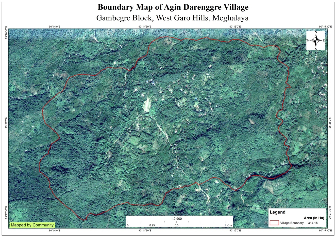
Agin Darenggre Village is situated under the Gambegre C&RD block of West Garo Hills district of Meghalaya. The village is about 15 km from the Gambegre Block office and 11km from the district Headquarter, Tura. The village is under the traditional land owner of A’king Nokma. The total population and the demographic of both male and female of the village is about 463 with 85 number of household. As per the information from the community, there were around 5 to 10 number of tourists visited the Village especially Rongbilbang tourist spot.
 Thevillage
can be reach through transportation such as buses and maxi cabs,
with a very limited access to its time to ply. However these days,
many of the community travel to and fro in their private vehicles as
well as in their motor bikes.
Thevillage
can be reach through transportation such as buses and maxi cabs,
with a very limited access to its time to ply. However these days,
many of the community travel to and fro in their private vehicles as
well as in their motor bikes.
The Village is about 15Km away from Gambegre Block and 11 km away from district headquarter Tura. The public transport facilities to and from village is in Auto rikshaw transport, and private vehicle.In respect to the Social Mobilization, it wasn’t that difficult to handle the community of this village as they are active and hardworking. Despite of very less facilities available, the community are very keen towards achieving the aims and objectives of CLLMP.
When it comes to use of fuel /LPG /biomass/gas most of the households are using firewood and very less access to LPG.The community has few facilities such as education, safe drinking water supply, road and access to medical facilities. The village is under Head of village (Nokma).
The demographic of Agin Darenggre village has a total no of 85 households with the total population of 463, Out of which are 236 male and 227are female.
The following is the demographic break up information acquired by the CLLMP Social Management Personnel of WGH district.

 AgindarengreVillage
is one of the villages which is nearest to the Tura town area.
Agindarengre village are still into farming which includes
agriculture and multi cropping. Unlike any other village’sArecanut
is always one of the most grown cash crops followed by black pepper,
banana, pineapple etc. People came to observe and realize that the
hill is gradually losing its soil fertility and water retention
properties. There are 69 HH farmers, 4 HH Temporary employee and 12
HH are Gov’t Service.
AgindarengreVillage
is one of the villages which is nearest to the Tura town area.
Agindarengre village are still into farming which includes
agriculture and multi cropping. Unlike any other village’sArecanut
is always one of the most grown cash crops followed by black pepper,
banana, pineapple etc. People came to observe and realize that the
hill is gradually losing its soil fertility and water retention
properties. There are 69 HH farmers, 4 HH Temporary employee and 12
HH are Gov’t Service.

 GROUND
TRUTHING AND SENSITIZATION PROGRAMME
GROUND
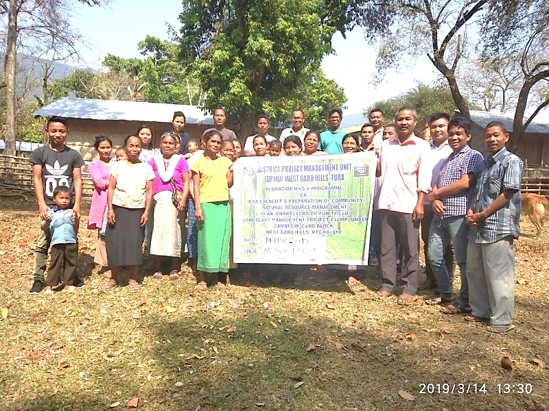
TRUTHING AND SENSITIZATION PROGRAMMEOn the 14th March 2019 ,Assistant District Project Manager (ADPM ) and Assistant Manager Social Management of District Project Management Unit (DPMU), West Garo Hills visited Agin Darenggre village for Sensitization cum Ground Truthing .
The village has 85 HH with 463 population .
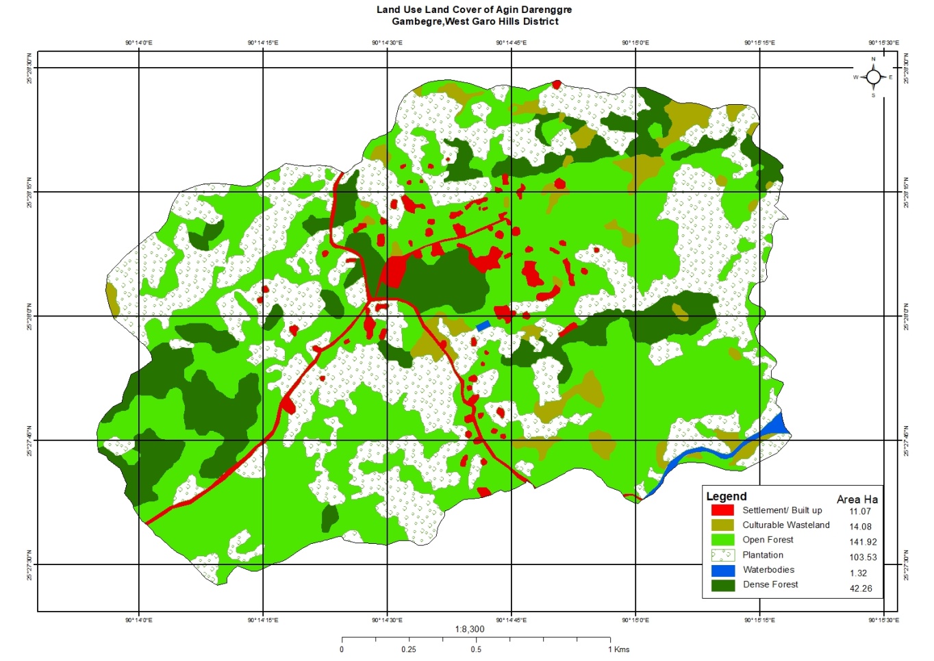
The village has Community forest
No degarded land . However low soil fertility
No proper drinking water facilities . The village water sources is springs and streams . It has 7 streams and 3 springs .
PHE tank which is benefitted for 7 HHs.
No irrigation facilities for farming
The community own water catchment area has about of 0.03 ha
Thevillage has few medicinal herbs and endangered species in forest .
The village has many local tree species such as :-
Bombax ceiba (Bolchu), Bolbok, Shorea robusta (Bolsal), Bolchupret, Gimbil, Soksinareng, Agatchi, Mangifera indica (Mango), Artocarpus heterophyllus (Jackfruit), Citrus maxima (Jambura), Berry (Angkil), Phyllantus emblica (Ambari), Sokchon, Ajari,Bauhnia variegata(Me.gong), Golmotra, Sisu, Gmelina arborea (Gambari), Chidare, Bandikari, Tamarindus indica (Tamarind), Dongbing, Ambiletong, Makanchi, Chigambe, Arimme, Boldubak, Boldukaki, Bolpret, Bolbit, Chambu, Bolpu, Prap, Tewek, Oroxylum indicum (Kereng), Chram,Chagru.
The village Forest has medicinal shrubs/trees such as Memang Narang(Citrus indica)
Commercially valued Trees/ Shrubs/Plants in forests avaiable in the village forest are -Angkil, Tamarindus indica (Tamarind), Phyllantus emblica (Ambari), Mangifera indica (Mango).
Bamboo grass is available in the village
The endangered species in Forest (fauna & flora) such as Duabanga grandiflora (Bolchim), Shorea robusta (Bolsal), Chambu, Sisoo, Gambari, Soksimarang, Attapol (Annona reticulta (custard apple) etc
The village has 7 streams and 3 springs
Health situation in the villages is good
Youth club is active in the village who manages Conservation of aquatic life in rivers, streams etc, System for Disposal of solid waste,Cleanliness of village - roads, footpaths.
The District team of West Garo Hills conducted PRA and CNRM plan at Agindarengre Village on the 12th May 2019, Gambegre Block, WGH.
The exercise were conducted by the district team of West Garo Hills. The team informed the community that PRA exercise is to understand and locate the natural resources of the village and plan the activities according to their need. The community had an exercise to plan and draw resource and social map on the same day.
In the exercise ofCNRM plan preparation, the community were asked to prioritized the plan /activities and submit the plan to DPMU for 5 years. The exercises were done in the presence of villageheadmen, VNRMCs and Village facilitators. There were around 34 participants for the programme.
Signing of Documents:
As an acceptance and agreement, community of Agin Darenggre agreed to sign green charter on 12th May, 2019 and submitted the Village agreement and Expression of Interest to DPMU of West Garo Hills.
Formation of the VNRMC
On 12th May, 2019 after the ground survey and sensitization programme, the village signed the EOI, VGA and Green charter as a sign of accepting the project. Whereas in regards, to the selection of Village Natural Resource Management Committee(VNRMC) members the Village Executive Committee (VEC) along with entire community carried out the process of selecting 15 chosen members such as 9 Executive members, 3 Purchase committee and 3 Village Community Facilitator .
Listed below are the members of the VNRMC:
| Sl No | Name in Full | Gender M/F | Age (in Yrs) | Education | Designation | Occupation | Community | Contact No and email address |
|---|---|---|---|---|---|---|---|---|
| 1 | PrebirthCh Marak | M | 32 | Class 12 | President | Farmer | Garo | 9366893173 |
| 2 | Florence S Sangma | F | 32 | Class 12 | Secretary | Farmer | Garo | |
| 3 | Xavier P Marak | M | 25 | Class 10 | EC Member | Farmer | Garo | - |
| 4 | Dilceng DSangma | M | 40 | Class 8 | EC Member | Farmer | Garo | - |
| 5 | Jullit D MArak | M | 46 | Class 10 | EC Member | Farmer | Garo | - |
| 6 | Mejin N Marak | M | 68 | Class 7 | Secretary | Housewife | Garo | - |
| 7 | Kalnish S Sangma | F | 54 | Class 6 | EC Member Nokma |
Farmer | Garo | - |
| 8 | Trassbill S Sangma | F | 38 | Class 10 | EC Member | Housewife | Garo | - |
| 9 | Malina S Sangma | F | 56 | Class 5 | EC Member | Farmer | Garo |
Village Community Facilitators (VCF)
| Sl No | Name in Full | Gender M/F | Age (Yrs) |
Education | Area of specialisation/ focus (forests, water, soil, accounts, environmental and social safeguards, knowledge management, GIS) | Trained under CLLMP (Yes/ No?) if Yes, date training was received | Contact No and email address |
|---|---|---|---|---|---|---|---|
| 1 |
|
|
|
|
|
|
|
| 4 |
|
|
|
|
|
|
|
| 7 |
|
|
|
Plan Estimate:
The DPMU of WGH made an inspection to the proposed intervention sites soon after the CNRM plan preparation gets over along.
|
Implemented Activities | Name of Site | Status |
|---|---|---|---|
| 1. |
|
Rongbilbang |
|
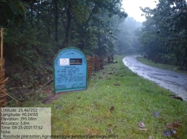
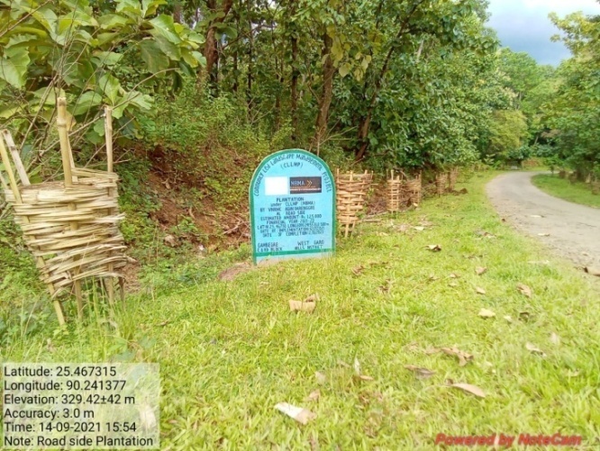
| 2. | Plantation | Roadside | Completed |
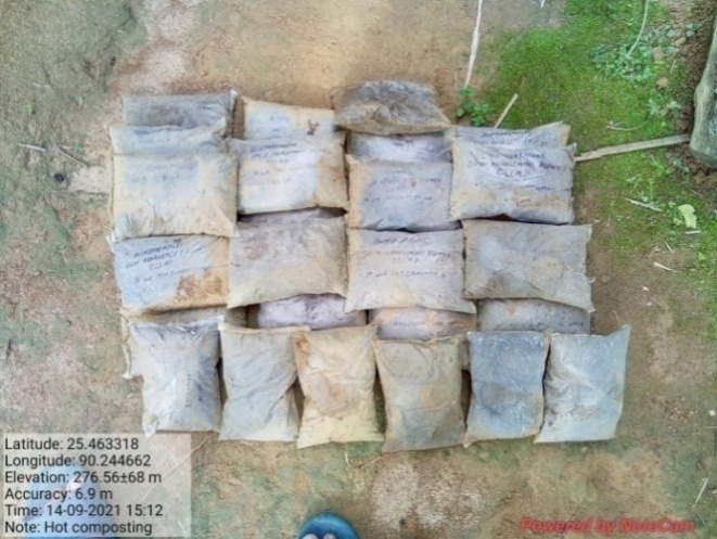
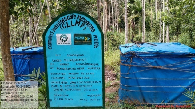
| 3. | 18 Days Hot Composting | Land Productivity Enhancement | Completed |
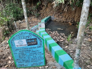
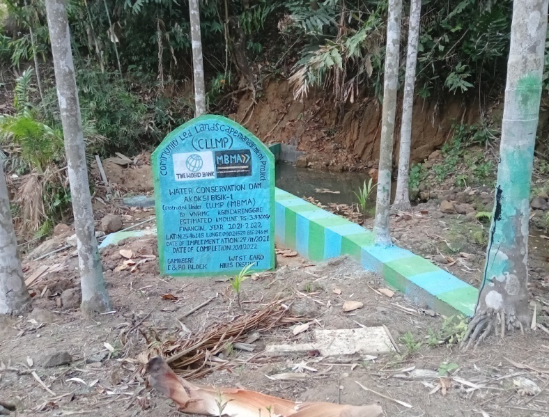
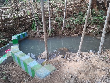
| 4. | Water Conservation Dam | Akoksi Bisik-1 | Completed |
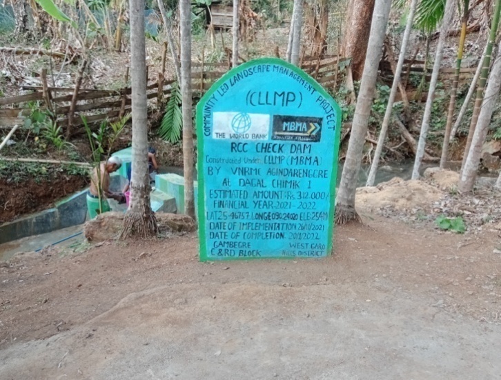
| 5. | RCC Check Dam | Dagal Chimik-1 | Completed |
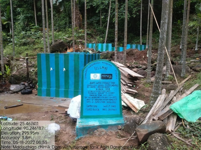
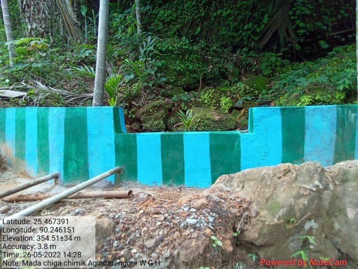
| 6. | Dam with storage tank | Mada chiga | Completed |
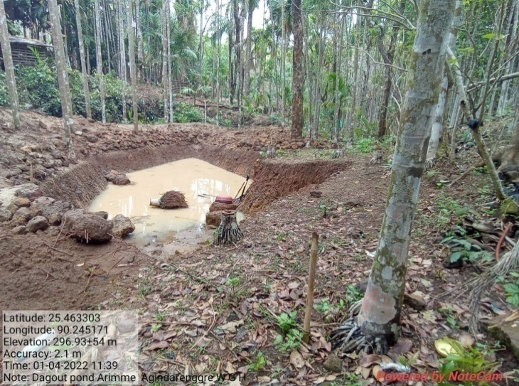
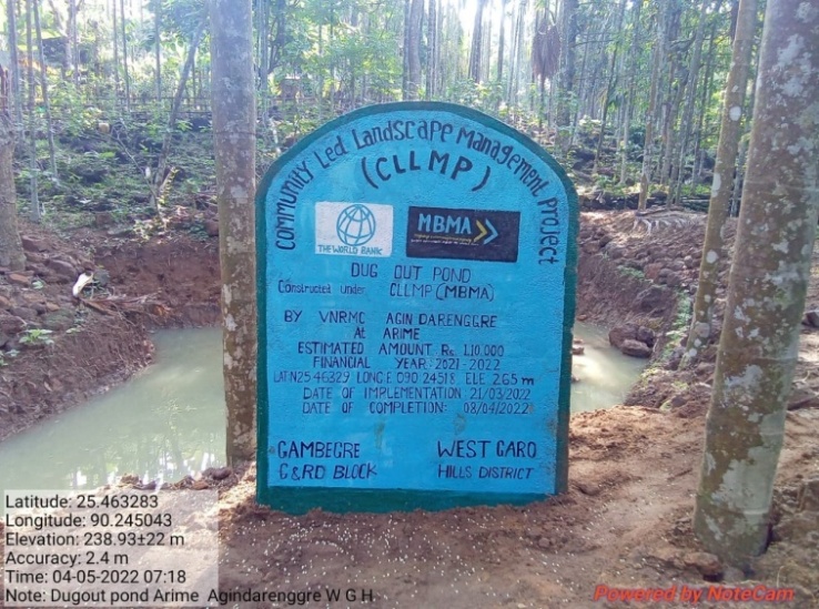
| 7. | Dug Out Pond | Arime | Completed |
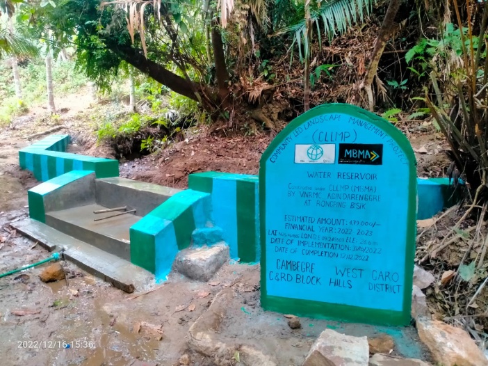
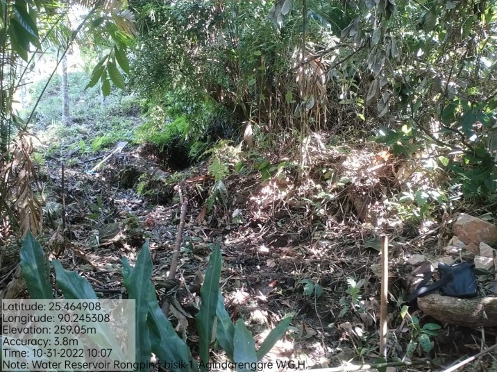
| 8. | Water Reservoir | Rongping Bisik | Completed |
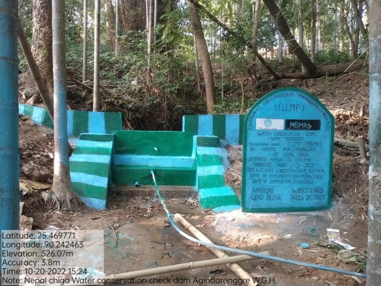
| 9. | Water conservation with trenches | Nepal Chiga | Completed |
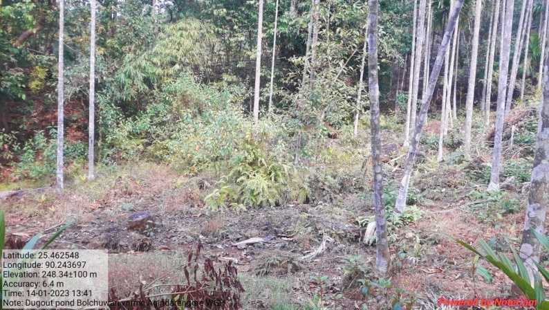
| 10. | Dugout pond (Additional) | Bolchu Wari | |
| 11. | Dugout pond (Additional) | Rongping Chibol |
4. Fund Status
| 1. | Type Of Intervention | Site Name | GPS Co-ordinates | Amount | Work Status |
|---|---|---|---|---|---|
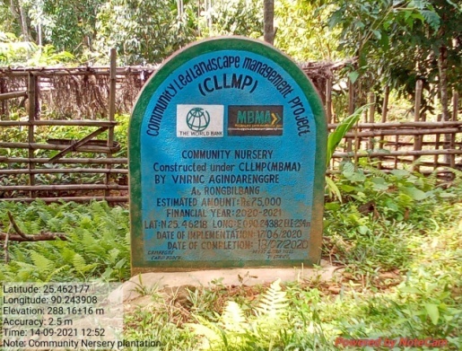
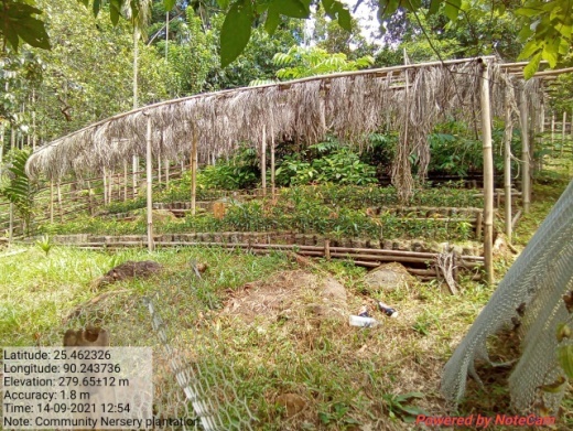
| Community Nursery | Rongbilbang | Elevation: 234m N2546217 E 090.24382 |
Rs175,000,00 | Completed |
| 2. | Type Of Intervention | Site Name | GPS Co-ordinates | Amount | Work Status |
|---|---|---|---|---|---|
| Plantation | Roadside | Elevation: 300m N25.417298° E090.241349° | Rs 25,000,00 | Completed |
| 3 | Type Of Intervention | Site Name | GPS Co-ordinates | Amount | Work Status |
|---|---|---|---|---|---|
| 18 Days Hot Composting | Land Productivity Enhancement | Elevation: 234m N25.46217 E090.24382 | Rs 33,00,00 | Completed |
| 4 | Type Of Intervention | Site Name | GPS Co-ordinates | Amount | Work Status |
|---|---|---|---|---|---|
| Water Conservation Dam | Akoksi Bisik-1 | Elevation 246m N 25.46148 E 90.24529 | Rs 393000 | Completed |
| 5 | Type Of Intervention | Site Name | GPS Co-ordinates | Amount | Work Status |
|---|---|---|---|---|---|
| RCC Check Dam | Dagal Chimik-1 | Elevation 254m N 25.46757 E 90.24020 | Rs 312000 | Completed |
| 6 | Type Of Intervention | Site Name | GPS Co-ordinates | Amount | Work Status |
|---|---|---|---|---|---|
| Dam with Storage Tank | Mada Chiga | N 25.46740 E 90.24609 |
Rs3,22,000 | Completed |
| 7 | Type Of Intervention | Site Name | GPS Co-ordinates | Amount | Work Status |
|---|---|---|---|---|---|
| Dug Out Pond | Arime | N 25.463285 E 90.245177 |
11,0000 | Completed |
| 8 | Type Of Intervention | Site Name | GPS Co-ordinates | Amount | Work Status |
|---|---|---|---|---|---|
| Water Reservoir | Rongping Bisik | N 25.46652° E 090.24787° |
Rs 479000 | Completed |
| 9 | Type Of Intervention | Site Name | GPS Co-ordinates | Amount | Work Status |
|---|---|---|---|---|---|
| Water Conservation Dam with trenches | Nepal Chiga | N 25.46982° E 90.24241° |
Rs 306000 | Completed |
| 10 | Type Of Intervention | Site Name | GPS Co-ordinates | Amount | Work Status |
|---|---|---|---|---|---|
Dugout pond (Additional) |
Bolchu wari | N 25.46247 E 90.24376 |
Rs250,000 |
| 11 | Type Of Intervention | Site Name | GPS Co-ordinates | Amount | Work Status |
|---|---|---|---|---|---|
Dugout pond (Additional) |
Rongping Chibol | N 25.46509 E 90.24376 |
Rs250,000 |