
COMMUNITY LED LANDSCAPE MANAGEMENT PROJECT (CLLMP)
The Government of Meghalaya with financial help from the World Bank is implementing the Meghalaya Community Led Landscape Management Project (MCLLMP). The project covers the entire state of Meghalaya and implementation of community-led plans are rolled out in a phased manner throughout the state. The Meghalaya Basin Management Agency (MBMA) will facilitate community-led planning by providing support, technical inputs and funding.
The project is intended to strengthen community-led natural resources management in selected landscapes within the 7 districts of the state. This would be achieved through a variety of planning, capacity building, and on-the-ground interventions to promote the conservation, sustainable use of natural resources, social inclusion and community mobilization; building traditional knowledge and learning, mapping of natural resources management; strengthening the community institutions and creating linkage with financial institutions and community organizations.
The project interventions will include preparation of community led natural resource management plans. The CLLMP has the following three components:
Strengthening Knowledge and Capacity of Communities for Natural Resources Management
Community-Led Landscape Planning and Implementation
Project Management and Governance
The project objective is “to manage and conserve the natural resources, especially forests, soil and water sources, in a manner that supports the financial and physical well-being of communities in the State”
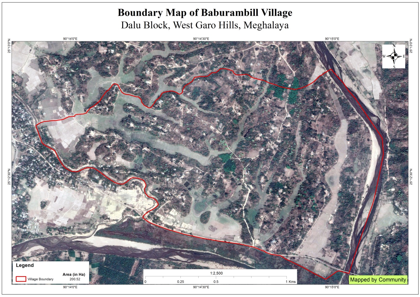
Baburambil village is situated under the Dalu C&RD block of West Garo Hills district of Meghalaya. The village is about 5 km from the Dalu Block and 52km from the district Headquarter, Tura. The village is under the traditional land owner of A’king Nokma. The total population and the demographic of both male and female of the village is about 482 with 86number of household. The village Latitude is 25.208879°North and Longitude 90.247161°East.
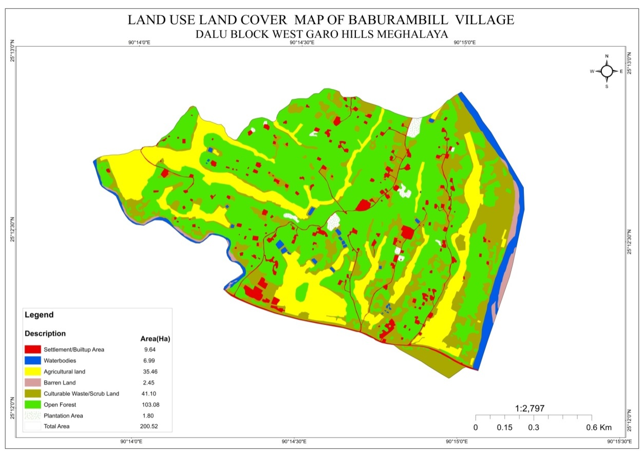
The total geographical area of the village is around 200.52 Ha with 2.0052sq.Km.
The Village is about 5Km away from Dalu Block and 52 km away from district headquarter Tura. The public transport facilities to and from village is in sumo, bus and private vehicle .In respect to the Social Mobilization, it wasn’t that difficult to handle the community of this village as they are active and hardworking. Despite of very less facilities available, the community are very keen towards achieving the aims and objectives of CLLMP.
Fuel /LPG /biomass/gas most of the households are using Wood sand very less access to LPG. The community has few facilities such as education, safe drinking water supply, road and access to medical facilities. The village is under Head of village (Nokma). About 110 households still uses woods for cooking whereas about 50 households use LPG.
Baburambil village has total no of 160 households with the total population of 730. Out of which are 380 males and 350are females.
The following is the demographic break up information acquired by the CLLMP team of WGH district.

The main occupation of the Baburambil village is farming which includes agriculture, multi cropping and cattle-rearing. Areca nut is always one of the most grown cash crops followed by cashew nut, banana, black pepper etc.
There are 135 HH Farmer, 16 HH are Business and 9 HH are Service.

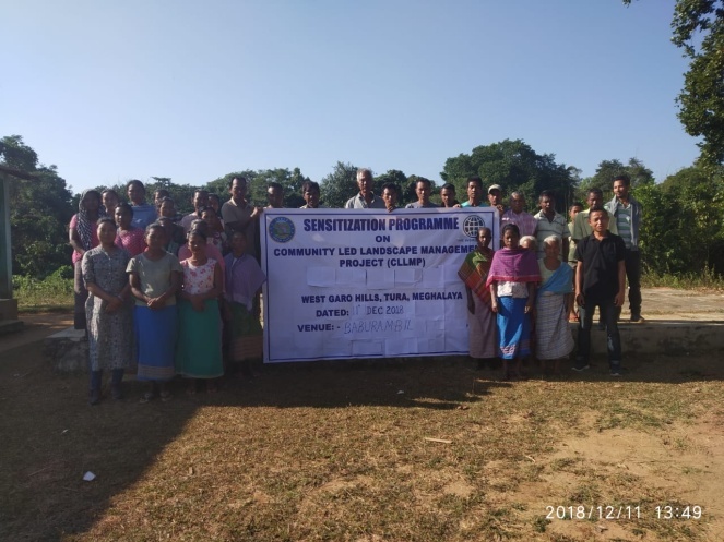 GROUND
TRUTHING AND SENSITIZATION PROGRAMME
GROUND
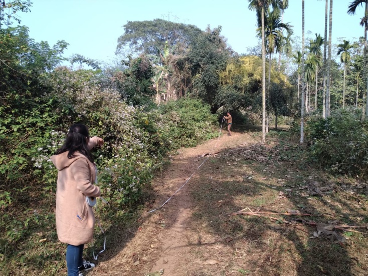
TRUTHING AND SENSITIZATION PROGRAMMEWest Garo Hills district team Environment and Social Management and M&E visited Baburambil village, under Dalu block on the 11th Dec, 2018.
The visit was for Ground truthing and sensitization programme for the community. There were around 32 participants attended the sensitization programmes comprising of Nokma, VEC secretary and other community members.
The village has 160 HH with 730 total populations.
The village water sources are springs and streams. It has 2 streams and 3 springs.
The village has indigenous tree species such as:-Bauhinia variegate (Megong), bolchubret, Artocarpusheterophyllus(tebrong), Mangiferaindica (tegatchu), katbet, Ficus sp.(Prap), chirori, Bombyxceiba (bolchu), doldak, agru, giga, pakram, bolsal, tendile, chambura, gambari, masanchi, chidai,j alai, bognagas, chagro, bolsil, kasi, chigambal.
The village Forest has medicinal shrubs/trees such asMasanchi, Gomperam, Bogasalgro, Kering, Angkil, Che.eng, Chambura, Tegachu, Samsueng, Shrubs-Dutduleng, Ruattik, Sambattal, Gaiabeen, Pasim.
Commercially valued Trees/ Shrubs/Plants in forests available in the village forest are Segun, Bolsal, Rongi, Tebrong, Tegatchu, Gambari, Chram.
Water scarcity during winter season.
High soil erosion.
Irrigation problem due to scarcity of water.
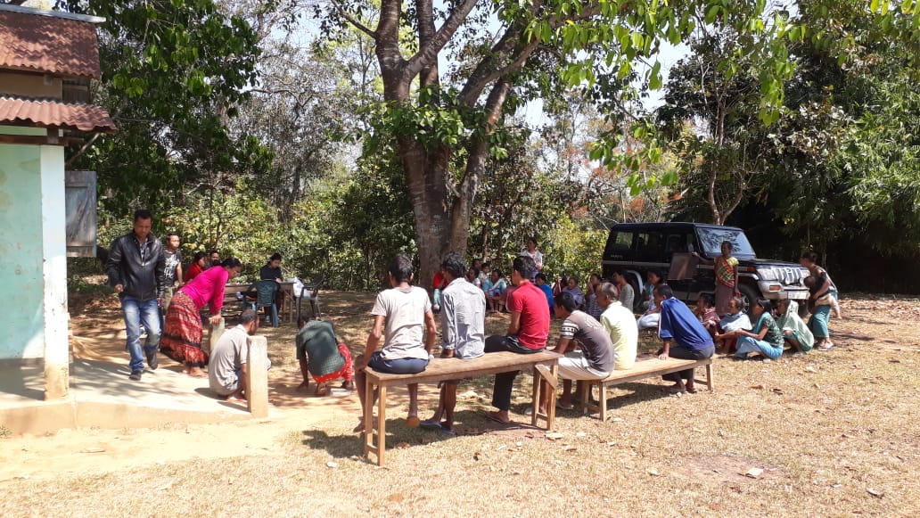 The
District team of West Garo Hills conducted PRA and CNRM plan on
1st March 2019 at Baburambil Village Dalu Block, WGH.
The
District team of West Garo Hills conducted PRA and CNRM plan on
1st March 2019 at Baburambil Village Dalu Block, WGH.
The exercises were conducted by the district team Environment, Social Management and M&E. The Team informed the community that PRA exercise is to understand and locate the natural resources of the village and plan the activities according to their need. The community had an exercise to plan and draw resource and social map on the same day.
In the exercise of CNRM plan preparation, the community were asked to prioritized the plan /activities and submit the plan to DPMU for 5 years. The exercises were done in the presence of village headmen, VNRMCs and Village facilitators.
And on the 7th January 2019, the district team had a second visit to the village for signing of green charter and attend other formalities such as VGA, EOI etc. There were around 8 participants attended the meeting.
Signing of Documents:
As an acceptance and agreement to the project, every member of the village households had to sign green charter on 7th January 2019and submitted the Village agreement and Expression of Interest to DPMU.
Formation of the VNRMC
On 7th January 2019, after the ground survey and sensitization programme, the village signed the EOI, VGA and Green charter as a sign of accepting the project. Whereas in regards, to the selection of Village Natural Resource Management Committee (VNRMC) members the Village Executive Committee (VEC) along with entire community carried out the process of selecting 15 chosen members such as 9 Executive members, 3 Purchase committee and 3 Village Community Facilitator.
Listed below are the members of the VNRMC:
| Sl No | Name in Full | Gender M/F | Age (in Yrs) | Education | Designation | Occupation | Community | Contact No and email address |
|---|---|---|---|---|---|---|---|---|
| 1 | PelwinSangma | F | 36 | Class 4 | Member | Farmer | Garo | 9362188703 |
| 2 | Kitish Marak | M | 65 | Class 11 | Member | Farmer | Garo | - |
| 3 | ProkashCh Marak | M | 42 | Class 3 | Member | Farmer | Garo | - |
| 4 | Pingston S Sangma | M | 26 | Class 10 | Chairman | VEC Sec | Garo | 7085106800 |
| 5 | Chengre T Sangma | F | 25 | Class 8 | Secretary | Farmer | Garo | 6009021360 |
| 6 | Promila Marak | F | 42 | Class 4 | Member | Farmer | Garo | - |
| 7 | Obola T Sangma | F | 40 | Class 4 | Member | Farmer | Garo | 8837340876 |
| 8 | BancheraSangma | F | 27 | Class 10 | Book keeper | Farmer | Garo | 8132037674 |
| SelliaSangma | F | 70 | Class 4 | Member | Farmer | Garo | 8416082027 | |
| 9 |
Village Community Facilitators (VCF)
| Sl No | Name in Full | Gender M/F | Age (Yrs) |
Education | Area of specialisation/ focus (forests, water, soil, accounts, environmental and social safeguards, knowledge management, GIS) | Trained under CLLMP (Yes/ No?) if Yes, date training was received | Contact No and email address |
|---|---|---|---|---|---|---|---|
| 1 | Gatwin Marak | M | 25 | Claass 8 | SM&KM | yes | 8131823662 |
| 2 | Rikrak S Sangma | M | 23 | Class 10 | NRM&GIS | Yes | 8413860670 |
| 3 | Noni RimchiSangma | F | 19 | Class 10 | M&E | Yes | - |
Plan Estimate:
The DPMU team of WGH made an inspection to the proposed intervention sites soon after the CNRM plan preparation.
|
Implemented Activities | Name of Site | Work Status |
|---|---|---|---|
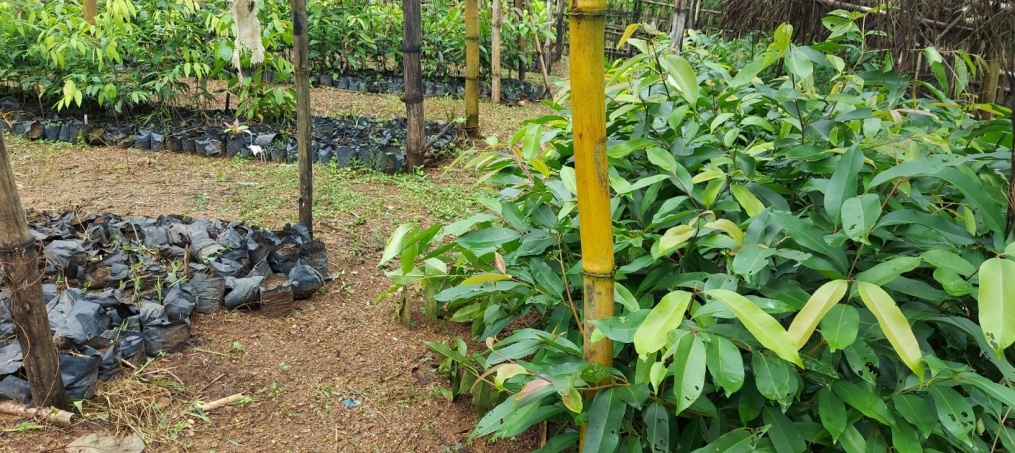
| 1. | Community Nursery | Farmer’s Club | Completed |
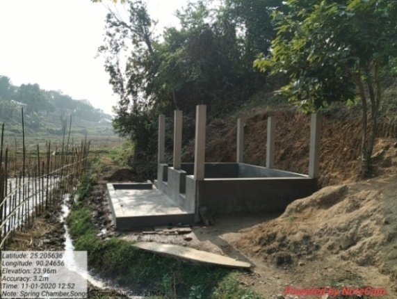
| 2. | Spring Chamber | Songgitcham | Completed |
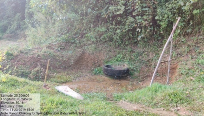
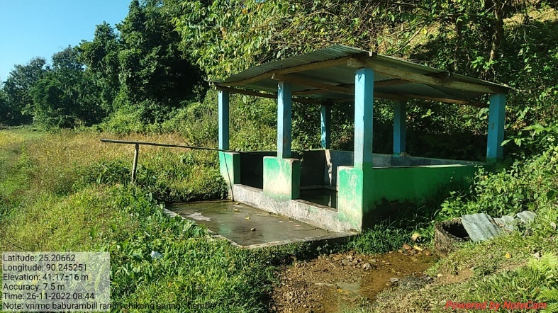
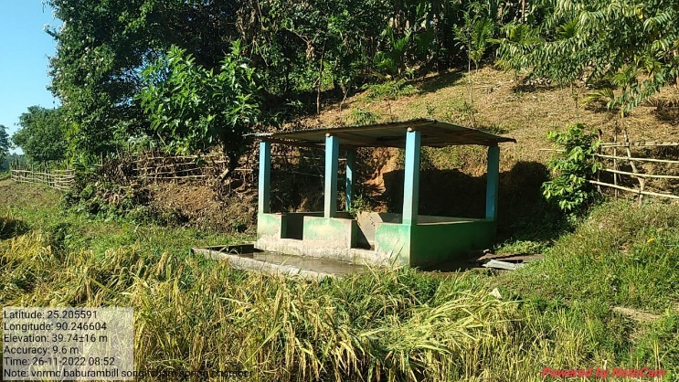
| 3. | Spring Chamber | Rangri Chikong | Completed |
| 4. | 18 Days Composting (Hot Composting) | Farmer’s Club, near nursery | Completed |
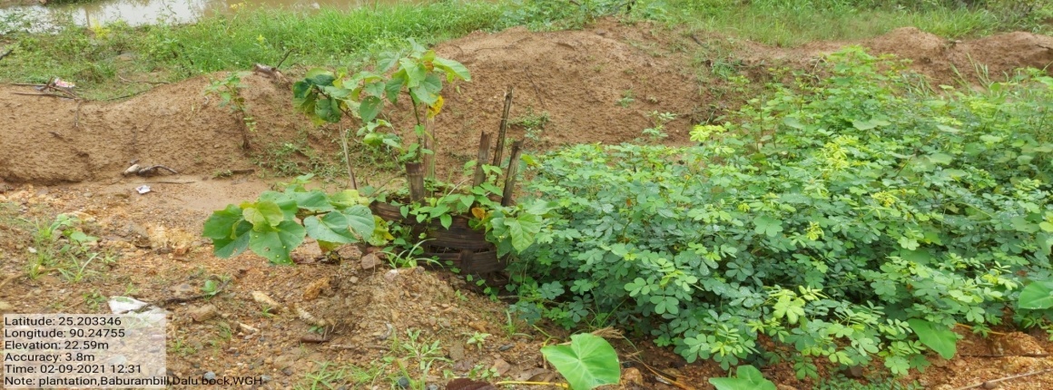
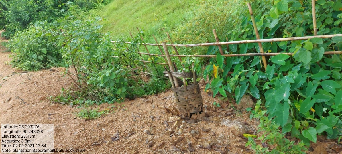
| 5. | Plantation | Roadside | Completed |
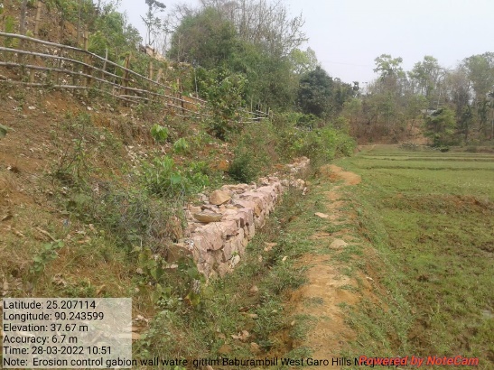
| 6. | Gabion Wall | Watre Gittim | Completed |
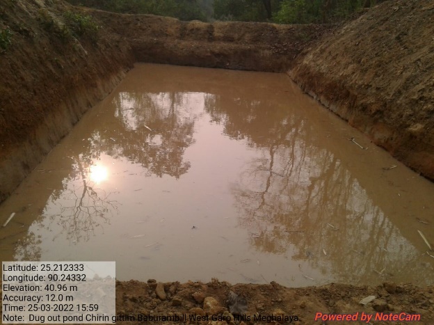
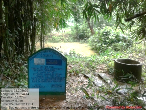
| 7. | Dug out pond | Chiringgittim | Completed |
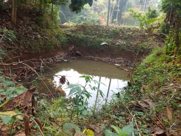
| 8. | Dug Out Pond | Obila Gittim | Completed |
| 9. | Dug Out Pond | A. du Gittim | Completed |
| 10. | Dug out pond | Watre Gittim | Completed |
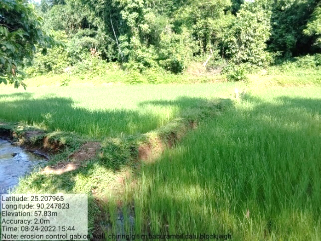
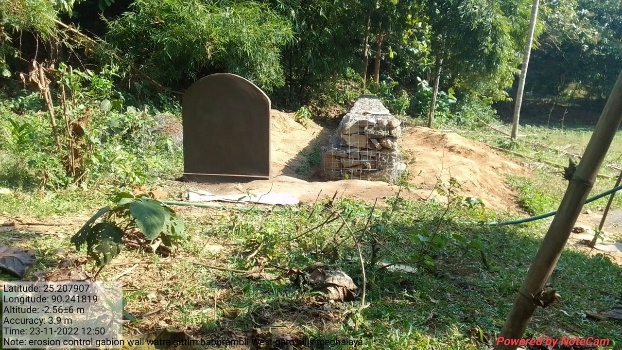
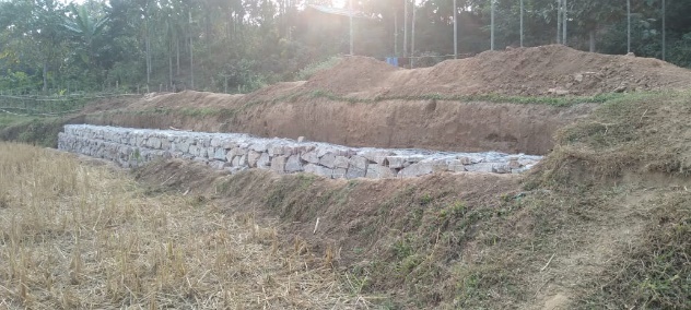
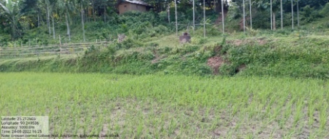
| 11. | Erosion Control Gabion Wall | A. du Gittim | On-going |
| 12. | Trenches with Plantation | Songgitcham Chikong | Completed |
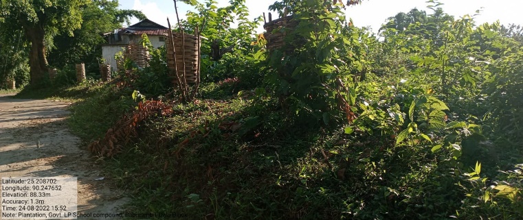
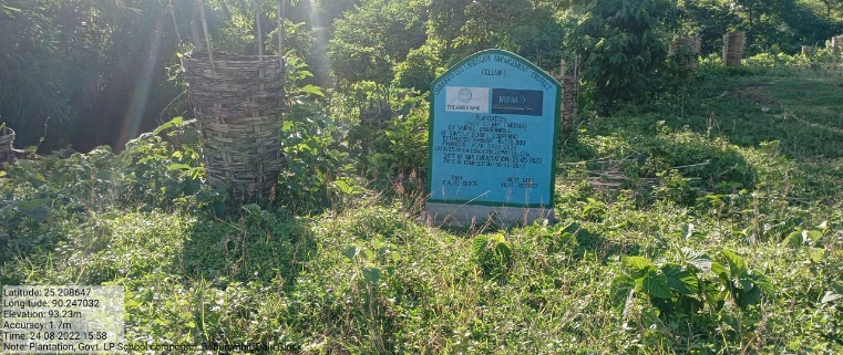
| 13. | Plantation | Govt. LP School Compound | Completed |
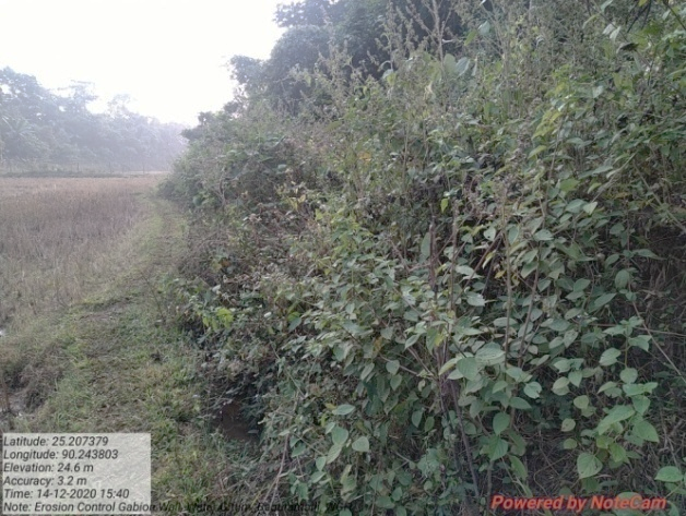
| 14. | Erosion Control Gabion Wall | Watre Gittim | Ongoing |
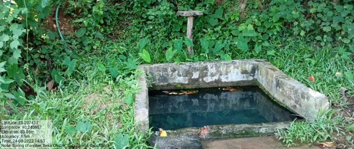
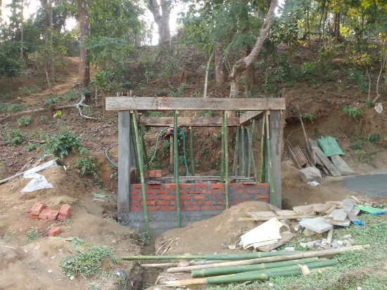
| 15. | Spring Chamber | Reka Chimik | On-going |
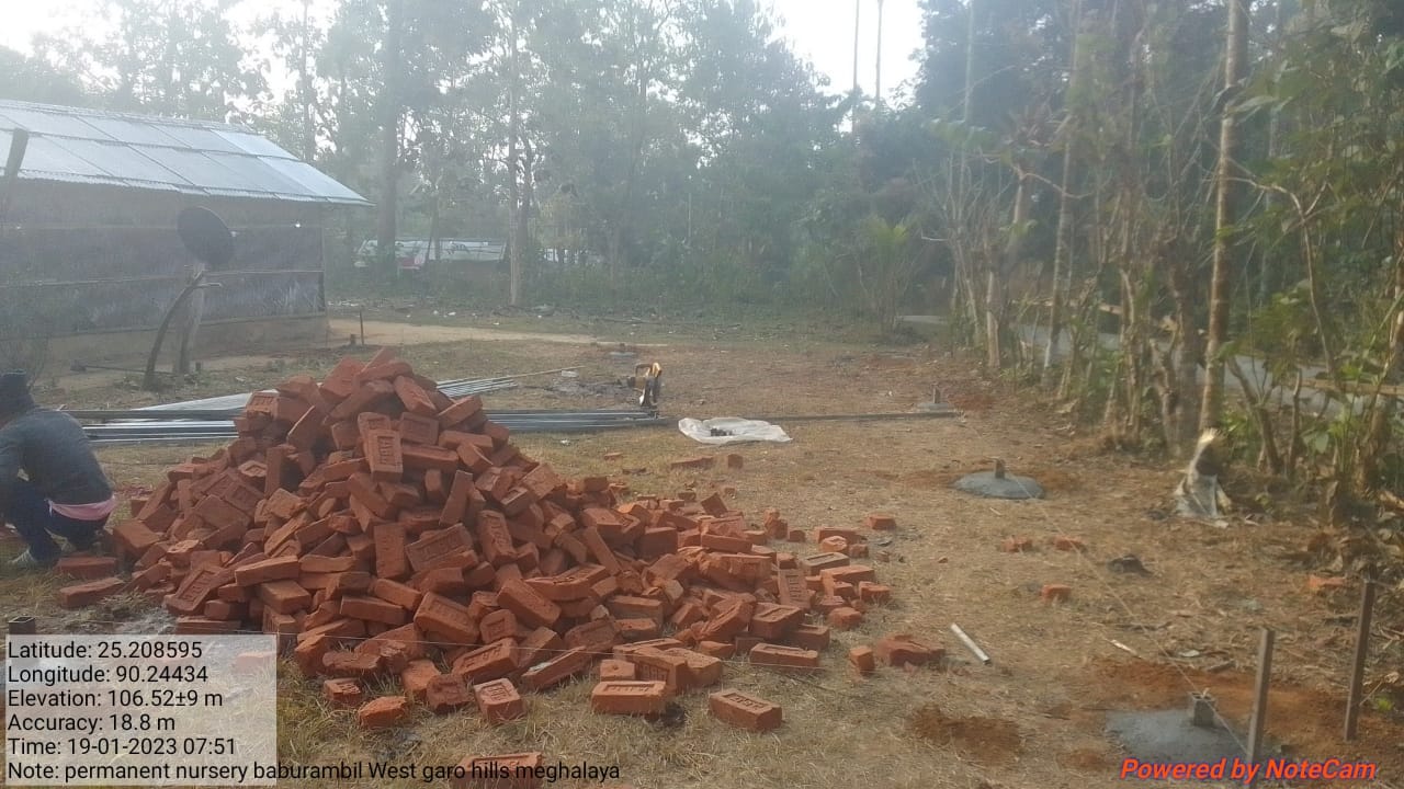
| 16. | Permanent Community Nursery (Balance fund) | Chiring Gittim | On-going |
| 17. | Erosion Control Gabion Wall | Chiring Gittim |
4. Fund Status
| 1. | Type Of Intervention | Site Name | GPS Co-ordinates | Amount | Work Status |
|---|---|---|---|---|---|
| Community Nursery | Farmer’s Club | Elevation 24m N 25.20360 E 090.24668 | Rs. 90,000 | Completed |
| 2. | Type Of Intervention | Site Name | GPS Co-ordinates | Amount | Work Status |
|---|---|---|---|---|---|
| Spring Chamber | Songgitcham | Elevation 30m N 25.20562 E 090.24650 | Rs. 1,17,860 | Completed |
| 3. | Type Of Intervention | Site Name | GPS Co-ordinates | Amount | Work Status |
|---|---|---|---|---|---|
| Spring Chamber | Rangri Chikong | Elevation 24m N 25.20660 E 090.24523 | Rs. 1,17,860 | Completed |
Before After
| 4. | Type Of Intervention | Site Name | GPS Co-ordinates | Amount | Work Status |
|---|---|---|---|---|---|
| 18 Days Composting (Hot Composting) | Farmer’s Club, near nursery | Elevation 24m N 25.20360 E 090.24668 | Rs. 33,000 | Completed |
| 5. | Type Of Intervention | Site Name | GPS Co-ordinates | Amount | Work Status |
|---|---|---|---|---|---|
| Plantation | Roadside | Elevation 30m N 25.20337 E 90.24751 | Rs. 91,000 | Completed |
| 6. | Type Of Intervention | Site Name | GPS Co-ordinates | Amount | Work Status |
|---|---|---|---|---|---|
| Gabion Wall | Watre Gittim | Elevation 29m N 25.20703 E 090.24173 | Rs. 1,92,000 | Completed |
| 7. | Type Of Intervention | Site Name | GPS Co-ordinates | Amount | Work Status |
|---|---|---|---|---|---|
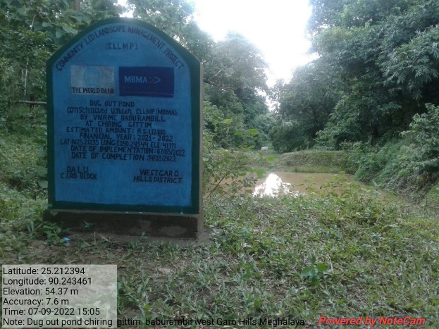
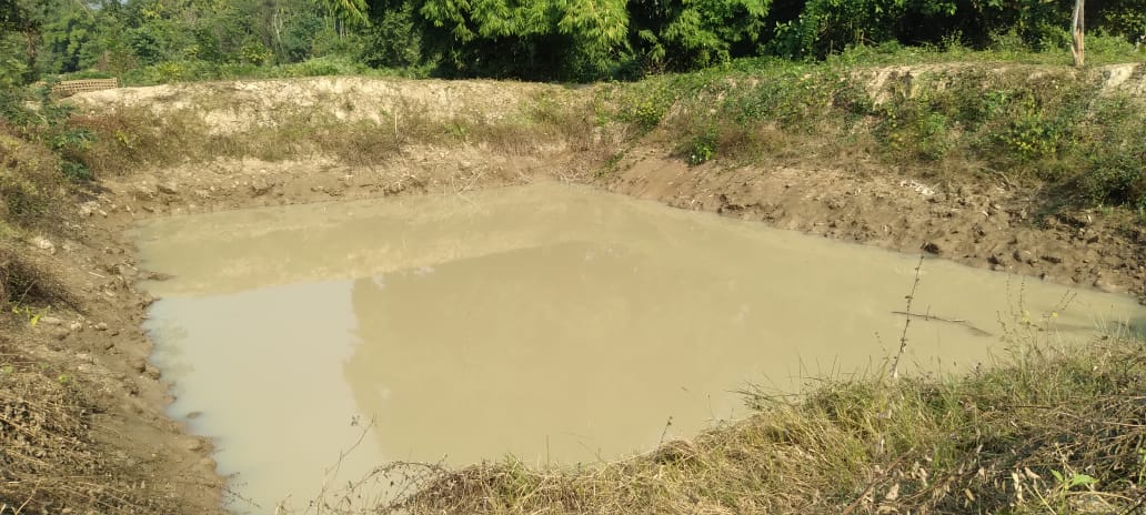
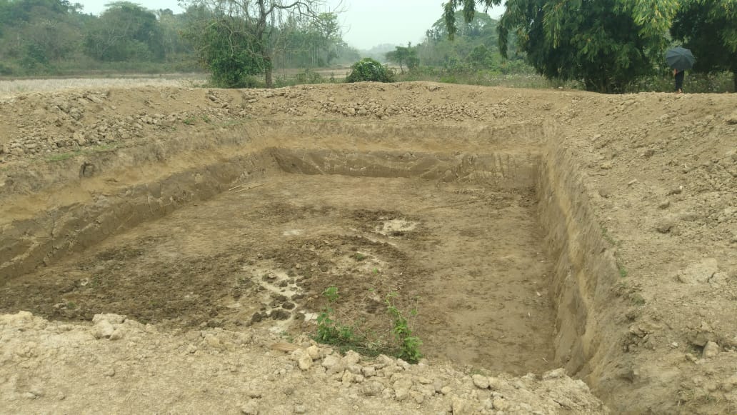
| Dug out pond | Chiring Gittim | Elevation 41m N 25.21235 E 090.24344 | Rs. 1,12,000 | Completed |
| 8. | Type Of Intervention | Site Name | GPS Co-ordinates | Amount | Work Status |
|---|---|---|---|---|---|
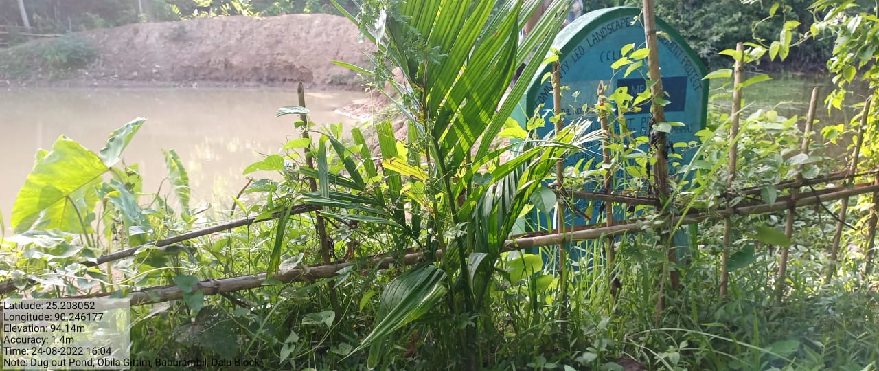
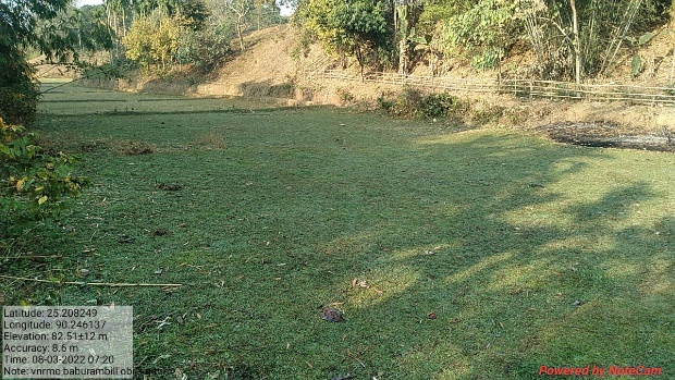
| Dug out pond | Obila Gittim | Elevation 33m N 25.20811 E 090.24872 | Rs. 1,20,130 | Completed |
Before After
| 9. | Type Of Intervention | Site Name | GPS Co-ordinates | Amount | Work Status |
|---|---|---|---|---|---|
| Dug out pond | A. du Gittim | Elevation 23m N 25.20519 E 090.24967 | Rs. 1,16,000 | Completed |
| 10. | Type Of Intervention | Site Name | GPS Co-ordinates | Amount | Work Status |
|---|---|---|---|---|---|
| Dug out pond | Watre Gittim | Elevation 24m N 25.20855 E 090.24391 | Rs. 1,20,000 | Completed |
| 11. | Type Of Intervention | Site Name | GPS Co-ordinates | Amount | Work Status |
|---|---|---|---|---|---|
| Erosion Control Gabion Wall | A. du Gittim | Elevation 24m N 25.20793 E 090.24789 | Rs. 3,22,000 | On-going |
| 12. | Type Of Intervention | Site Name | GPS Co-ordinates | Amount | Work Status |
|---|---|---|---|---|---|
| Trenches with Plantation | Songgitcham Chikong | Elevation 30m N 25.20562 E 090.24650 | Rs. 51,000 | Completed |
Before After
| 13. | Type Of Intervention | Site Name | GPS Co-ordinates | Amount | Work Status |
|---|---|---|---|---|---|
| Plantation | Govt. LP School Compound | Elevation 37m N 25.20864 E 090.24741 | Rs.1,10,000 | Completed |
| 14. | Type Of Intervention | Site Name | GPS Co-ordinates | Amount | Work Status |
|---|---|---|---|---|---|
| Erosion Control Gabion Wall | Watre Gittim | Elevation 23m N 25.20719 E 090.24368 | Rs. 1,92,000 | Ongoing |
Before After
| 15. | Type Of Intervention | Site Name | GPS Co-ordinates | Amount | Work Status |
|---|---|---|---|---|---|
| Spring Chamber | Reka Chimik | Elevation 33m N 25.20743 E 090.24084 | Rs. 2,15,000 | On-going |
Before After
| 16. | Type Of Intervention | Site Name | GPS Co-ordinates | Amount | Work Status |
|---|---|---|---|---|---|
| Permanent Community Nursery (Balance fund) | Chiring Gittim | Elevation 39.68m N 25.208722 E 90.244513 | Rs.3,00,000 | Ongoing |
| 17. | Type Of Intervention | Site Name | GPS Co-ordinates | Amount | Work Status |
|---|---|---|---|---|---|
| Erosion Control Gabion Wall | Chiring Gittim | Elevation 32m N 25.21368 E 090.24818 | Rs. 1,55,150 |