
COMMUNITY LED LANDSCAPE MANAGEMENT PROJECT (CLLMP)
The Government of Meghalaya with financial help from the World Bank is implementing the Meghalaya Community Led Landscape Management Project (MCLLMP). The project covers the entire state of Meghalaya and implementation of community-led plans are rolled out in a phased manner throughout the state. The Meghalaya Basin Management Agency (MBMA) will facilitate community-led planning by providing support, technical inputs and funding.
The project is intended to strengthen community-led natural resources management in selected landscapes within the 7 districts of the state. This would be achieved through a variety of planning, capacity building, and on-the-ground interventions to promote the conservation, sustainable use of natural resources, social inclusion and community mobilization; building traditional knowledge and learning, mapping of natural resources management; strengthening the community institutions and creating linkage with financial institutions and community organizations.
The project interventions will include preparation of community led natural resource management plans. The CLLMP has the following three components:
Strengthening Knowledge and Capacity of Communities for Natural Resources Management
Community-Led Landscape Planning and Implementation
Project Management and Governance
The project objective is “to manage and conserve the natural resources, especially forests, soil and water sources, in a manner that supports the financial and physical well-being of communities in the State”
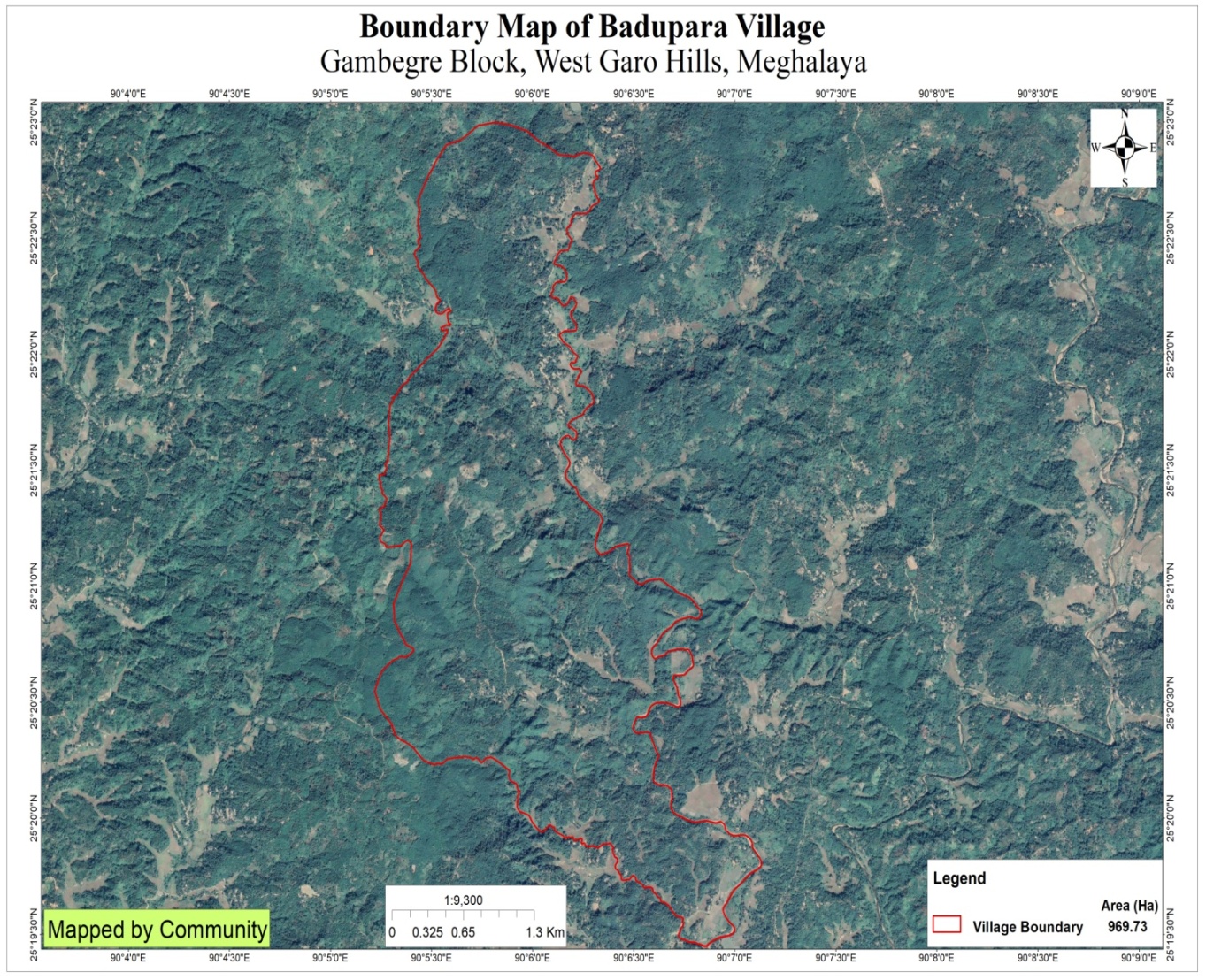
Badupara village is situated under the Gambegre C&RD block of West Garo Hills district of Meghalaya. The village is about 12 km from the Gambegre Block and 37 km from the district Headquarter, Tura. The village is under the traditional land owner of A’king Nokma. The total population and the demographic of both male and female of the village is about 407 with 77 number of households. The village Latitude is 25.37497"North and Longitude 090.10158"East. The community is surrounded by Areca nut and Pineapple plantation. The total geographical area of the village is around 969.73 Ha with 9.6973 sq.Km.
The Village is about 12 Km away from Gambegre Block and 37 km away from district headquarter Tura. The public transport facilities to and from village is Autorikshaw, and private vehicle. In respect to the Social Mobilization; it wasn’t that difficult to handle the community of this village as they are active and hardworking. Despite of very less facilities available, the community are very keen towards achieving the aims and objectives of CLLMP.
When it comes to use of fuel /LPG /biomass/gas most of the households are using Wood sand very less access to LPG. The community has few facilities such as education, safe drinking water supply, road and access to medical facilities. The village is under Head of village (Nokma). Whereas 75 HH used wood and 2 HH used LPG and electricity 31HH in the community. The total population of the, Badupara village has total no of 77 households with the total population of 407. Out of which are 209 males and 198 are females.
The following is the demographic break up information acquired by the CLLMP team of WGH district.

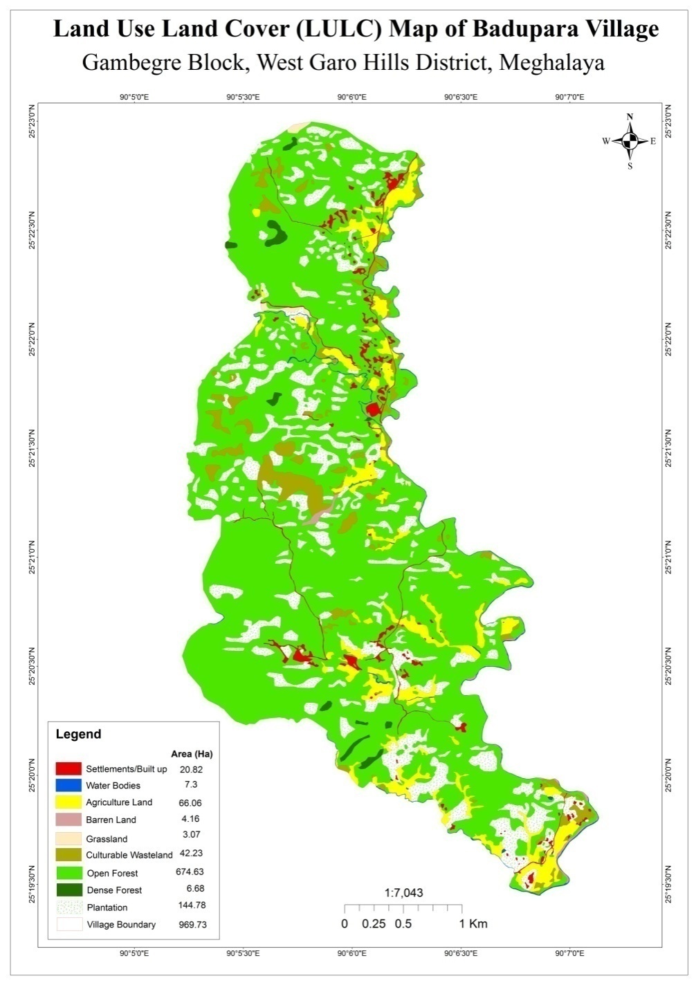
The village is far from the Tura town and is under developing village. Badupara village are still into farming which includes agriculture and multi cropping. Unlike any other village’s Areca nut is always one of the most grown cash crops followed by pineapple plantation. People came to observe and realize that the hill is gradually losing its soil fertility and water retention properties. The occupations of the community are farmers 75 and 2 Govt service.
 GROUND TRUTHING AND SENSITIZATION PROGRAMME
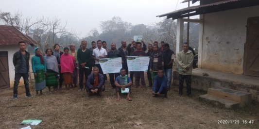
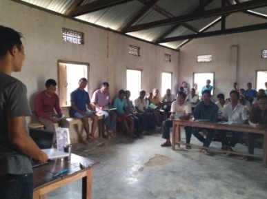
DPMU team of West Garo Hills visited Badupara village for Sensitization cum Ground Truthing on 29th January, 2020
The village has 77 HH with 407 total populations.
The village water sources are springs and streams. It has 9 streams and 11springs and 0 River.
The village has many local tree species such as Tewek, Prap, kilwe, Bolbret, ambari, Bolchu, Gambare, chram, bolal, Bolchim, kudom, Boldak, Wakinte, boldureng, Bolsrem, Suri, Agru, Wakgru, Bolbok, Bolong, Bolsal, Gimbil, Bolsil, Bolpu, Me.gong, Chusitim, Achri, Bandikari, Bolbil, Ajari, Chidao, chigambal, Rangi, Kasi, Sanaru, Makanchi, Bolajak, bolnasin, Dongtreng, Jengjil, Bolgasalgro, Kiring, Tebrong, Chambu, Mao, Tegatchu
The village Forest has medicinal shrubs/trees such as Bolnasin, Jengjil, Makanchi, Bolgasalgro, Kiring
Commercially valued Trees/ Shrubs/Plants in forests available in the village forest are Snaru, Rangi, Gambari, Kasi, Bolsal, Kilwe, Makanchi, Bolsreng.
Any vulnerable/ endangered species in Forest (fauna & flora) ar Kilwe, Tebrong
 The
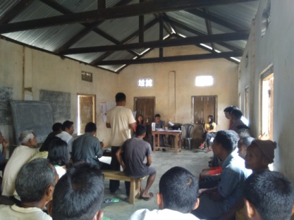
District team of West Garo Hills conducted PRA and CNRM plan at
Badupara Village Gambegre Block, WGH on 05th March,
2020.
The
District team of West Garo Hills conducted PRA and CNRM plan at
Badupara Village Gambegre Block, WGH on 05th March,
2020.
The exercises were conducted by the district team of West Garo Hills. The Team informed the community that PRA exercise is to understand and locate the natural resources of the village and plan the activities according to their need. The community had an exercise to plan and draw resource and social map on the same day.
In the exercise of CNRM plan preparation, the community were asked to prioritized the plan /activities and submit the plan to DPMU for 5 years. The exercises were done in the presence of village headmen, VNRMCs and Village facilitators.
 2.1
Signing of Documents:
2.1
Signing of Documents:
As an acceptance and agreement to the project, every member of the village households had to sign green charter on 05th March, 2020 and submitted the Village agreement and Expression of Interest to DPMU.
2.2 Formation of the VNRMC
On, 05th March, 2020 after the ground survey and sensitization programme, the village signed the EOI, VGA and Green charter as a sign of accepting the project. Whereas in regards, to the selection of Village Natural Resource Management Committee(VNRMC) members the Village Executive Committee (VEC) along with entire community carried out the process of selecting 15 chosen members such as 9 Executive members, 3 Purchase committee and 3 Village Community Facilitator.
Listed below are the members of the VNRMC:
| Sl No | Name in Full | Gender M/F | Age (in Yrs) | Education | Designation | Occupation | Community | Contact No and email address |
|---|---|---|---|---|---|---|---|---|
| 1 | Hardina D Sangma | F | 31 | Class-10 | President | Farmer | Garo | 9366544704 |
| 2 | Benithson D Marak | M | 35 | Class-12 | Secretary | Farmer | Garo | 9366876909 |
| 3 | Jimne Ch Marak | M | 35 | Class-12 | Book-Keeper | Farmer | Garo | 9863220027 |
| 4 | Lickson M Momin | M | 27 | Class-10 | Member | Farmer | Garo | 6009285210 |
| 5 | Ethnalson M Marak | M | 62 | Class-8 | Member | Farmer | Garo | 6009951970 |
| 6 | Kiljan M Marak | M | 78 | Class-7 | Member | Farmer | Garo | __ |
| 7 | Prisbina D Sangma | F | 35 | Class-10 | Member | Farmer | Garo | |
| 8 | Tuen D Sangma | F | 30 | Class-8 | Member | Farmer | Garo | 6009794741 |
| Ringgi M Marak | F | 32 | Class-10 | Member | Farmer | Garo | 6002089597 | |
| 9 |
Village Community Facilitators (VCF)
| Sl No | Name in Full | Gender M/F | Age (Yrs) |
Education | Area of specialisation/ focus (forests, water, soil, accounts, environmental and social safeguards, knowledge management, GIS) | Trained under CLLMP (Yes/ No?) if Yes, date training was received | Contact No and email address |
|---|---|---|---|---|---|---|---|
| 1 | Nindro Marak | M | 23 | Class-12 | NRM&GIS | Yes | 7005948943 |
| 2 | Salseng Sangma | M | 28 | Class-9 | SM/KM | Yes | 6009209193 |
| 3 | Morning Ch Momin | M | 25 | Class-9 | M&E | Yes | 6009181185 |
Plan Estimate:
The DPMU team of WGH made an inspection to the proposed intervention sites soon after the CNRM plan preparation gets over along with the district of West Garo Hills.
|
Implemented Activities | Name of Site | Status |
|---|---|---|---|
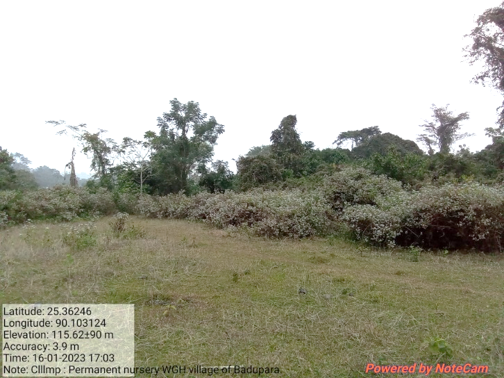
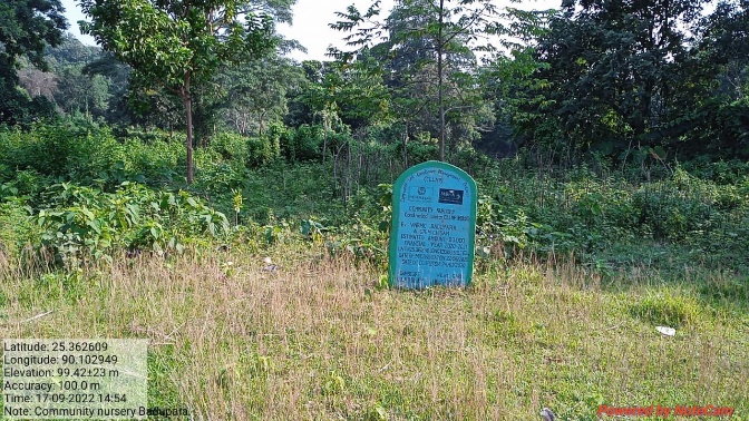
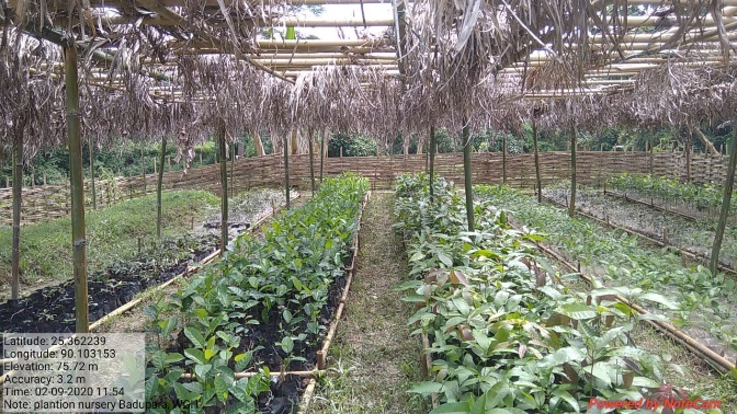
| 1. | Community Nursery | Grim Chisam | Completed |
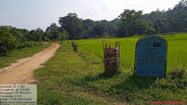
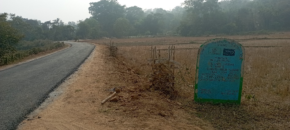
| 2. | Plantation | Roadside | Completed |
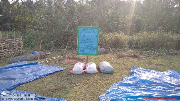
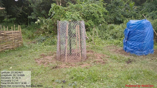
| 3. | 18 Days Composting (Hot Composting) | Grim Chisam, near Nursery | Completed |
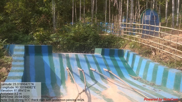
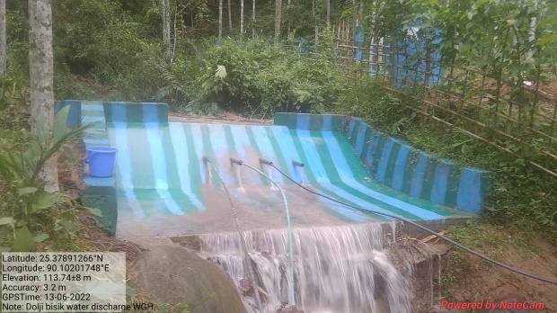
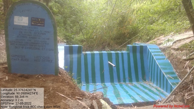
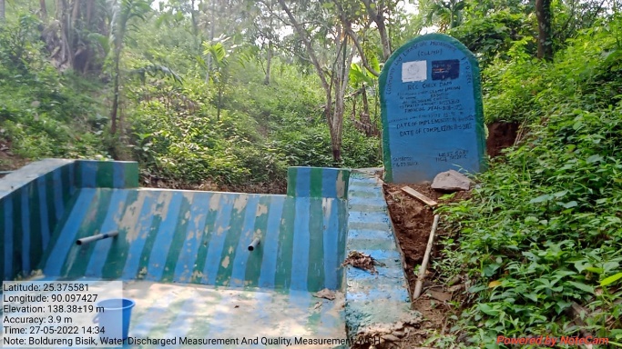
| 4. | RCC Check Dam with Protection Fencing | Dolji Bisik | Completed |
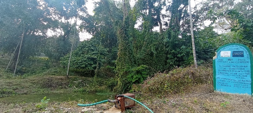
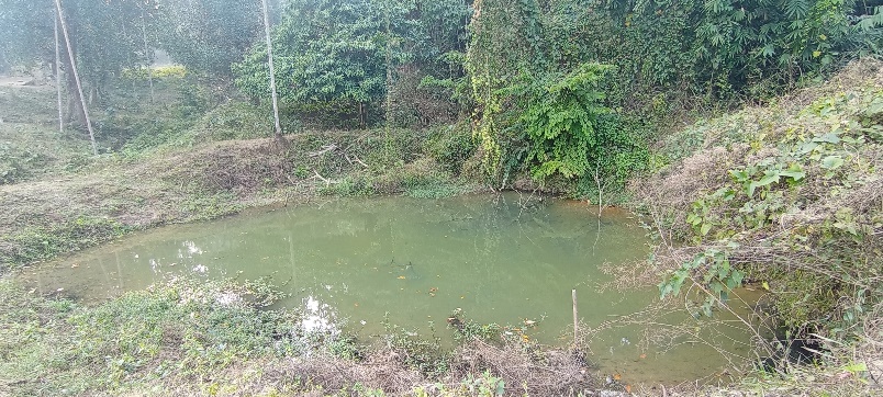
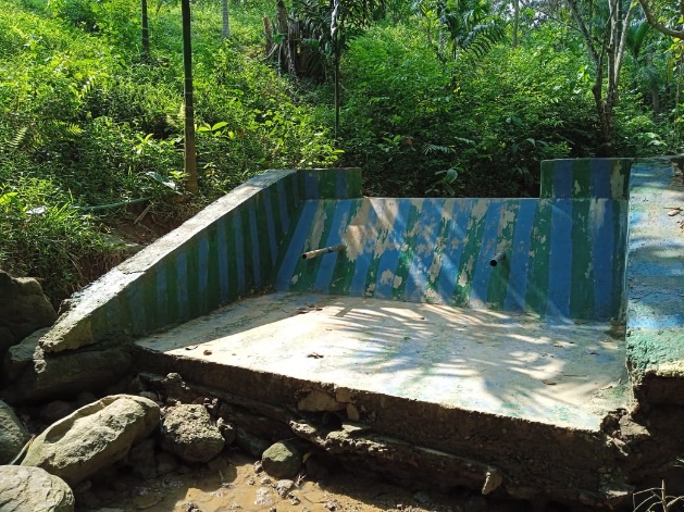
| 5. | Dug Out Pond | Songitcham | Completed |
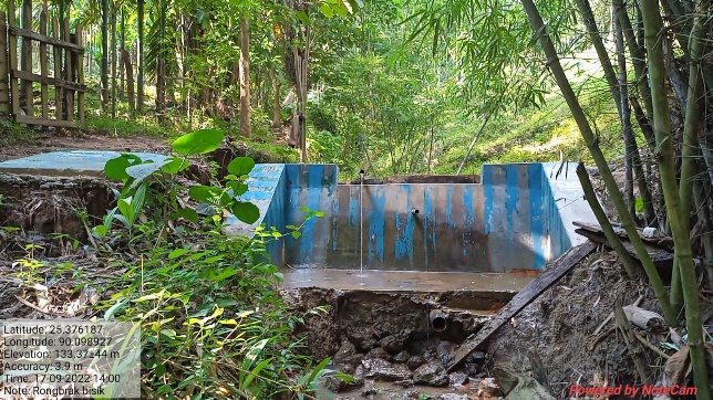
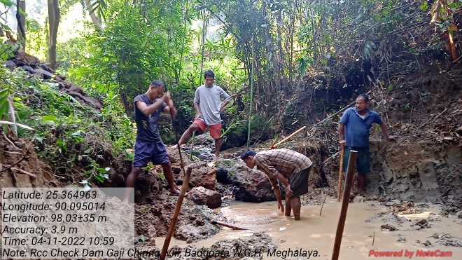
| 6. | RCC Check Dam | Rongbrak Chiring | Completed |
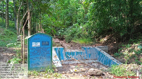
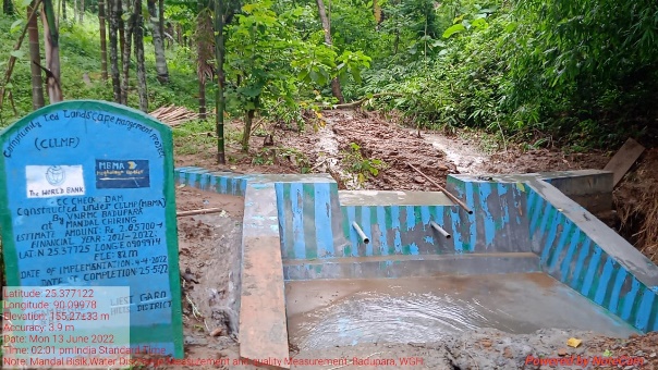
| 7. | CC Check Dam | Mandal Chiring | Completed |
| 8. | RCC Check Dam | Boldoreng Chiring | Completed |
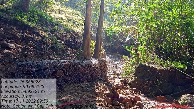
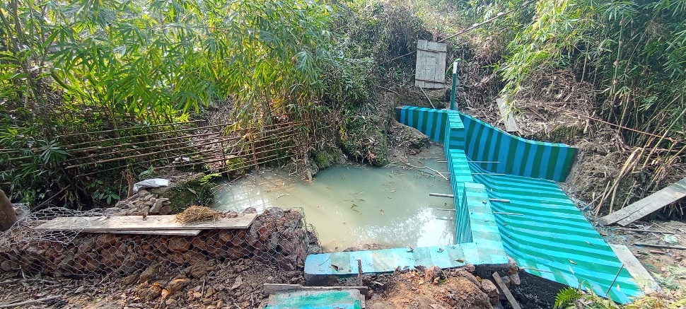
| 9. | Erosion Control Gabion Wall | Gaji Chiring | Completed |
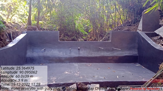
| 10. | Water Reservoir with Gully Plug | Gaji Chiring | Completed |
| 11. | Permanent Community Nursery (Balance fund) | Grim Chisam | On-going |
 4. Fund
Status
4. Fund
Status
| 1 | Type Of Intervention | Site Name | GPS Co-ordinates | Amount | Work Status |
|---|---|---|---|---|---|
| Community Nursery | Grim Chisam | Elevation 62m N 25.36238 E 090.10315 | Rs.90,000 | Completed |
| 2 | Type Of Intervention | Site Name | GPS Co-ordinates | Amount | Work Status |
|---|---|---|---|---|---|
| Plantation | Roadside | Elevation 58m N 25.37468 E 090.10198 | Rs.1,86,000 | Completed |
| 3 | Type Of Intervention | Site Name | GPS Co-ordinates | Amount | Work Status |
|---|---|---|---|---|---|
| 18 Days Composting (Hot Composting) | Grim Chisam, near Nursery | Elevation 62m N 25.36238 E 090.10315 | Rs.33,000 | Completed |
| 4 | Type Of Intervention | Site Name | GPS Co-ordinates | Amount | Work Status |
|---|---|---|---|---|---|
| RCC Check Dam with Protection fencing | Dolji Bisik | Elevation 86m N 25.37896 E 090.10191 | Rs. 3,33,000 | Completed |
| 5 | Type of Intervention | Site Name | GPS Coordinates | Amount | Work Status |
|---|---|---|---|---|---|
| Dug out pond | Songitcham | Elevation 69m N 25.36763 E 090.10088 | Rs.70,000 | Completed |
| 6 | Type Of Intervention | Site Name | GPS Co-ordinates | Amount | Work Status |
|---|---|---|---|---|---|
| RCC Check Dam | Rongbrak Chiring | Elevation 91m N 25.37637 E 090.09897 | Rs.2,42,000 | Completed |
| 7 | Type Of Intervention | Site Name | GPS Co-ordinates | Amount | Work Status |
|---|---|---|---|---|---|
| CC Check Dam | Mandal Chiring | Elevation 82m N 25.37725 E 090.09974 | Rs.2,05,700 | Completed |
| 8 | Type of Intervention | Site Name | GPS Coordinates | Amount | Work Status |
|---|---|---|---|---|---|
| RCC Check Dam | Boldoreng Chiring | Elevation 95m N 25.37552 E 090.09738 | Rs.2,39,800 | Completed |
| 9 | Type of Intervention | Site Name | GPS Coordinates | Amount | Work Status |
|---|---|---|---|---|---|
| Erosion Control Gabion Wall | Gaji Chiring | Elevation 67m N 25.36467 E 090.09511 | Rs.2,63,500 | Completed |
| 10 | Type of Intervention | Site Name | GPS Coordinates | Amount | Work Status |
|---|---|---|---|---|---|
| Water Reservoir with Gully Plug | Gaji Chiring | Elevation 65m N 25.36486 E 090.09509 | Rs.4,92,000 | Completed |
| 11 | Type of Intervention | Site Name | GPS Coordinates | Amount | Work Status |
|---|---|---|---|---|---|
Permanent Community Nursery (Balance fund) |
Grim Chisam | Elevation 62m N 25.36238 E 90.10315 | Rs.300,000 |