

COMMUNITY LED LANDSCAPE MANAGEMENT PROJECT (CLLMP)
The Government of Meghalaya with financial help from the World Bank is implementing the Meghalaya Community Led Landscape Management Project (MCLLMP). The project covers the entire state of Meghalaya, and implementation of community-led plans are rolled out in a phased manner throughout the state. The Meghalaya Basin Management Agency (MBMA) will facilitate community-led planning by providing support, technical inputs and funding.
The project is intended to strengthen community-led natural resources management in selected landscapes within the 11 districts of the state. This would be achieved through a variety of planning, capacity building, and on-the-ground interventions to promote the conservation, sustainable use of natural resources, social inclusion and community mobilization; building traditional knowledge and learning, mapping of natural resources management; strengthening the community institutions and creating linkage with financial institutions and community organizations.
The project interventions will include preparation of community led natural resource management plans. The CLLMP has the following three components:
Strengthening Knowledge and Capacity of Communities for Natural Resources Management
Community-Led Landscape Planning and Implementation
Project Management and Governance
The project objective is “to manage and conserve the natural resources, especially forests, soil and water sources, in a manner that supports the financial and physical well-being of communities in the State”
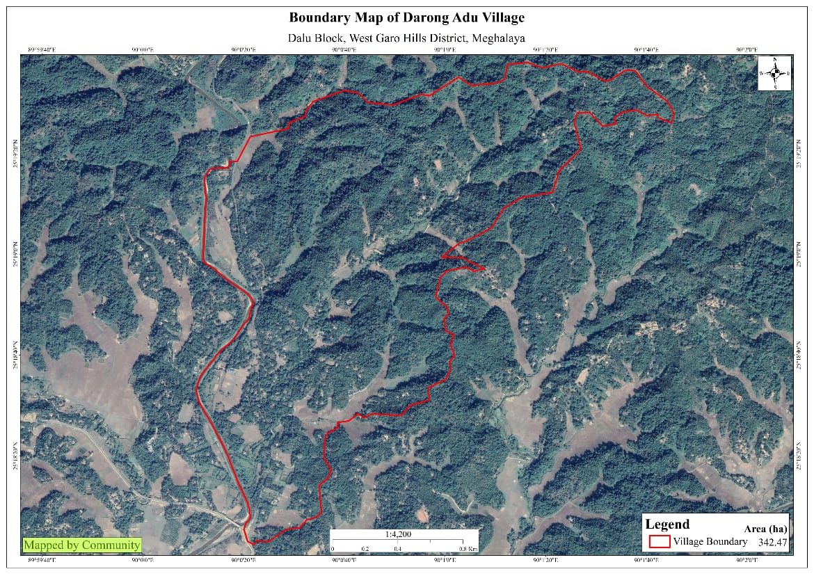
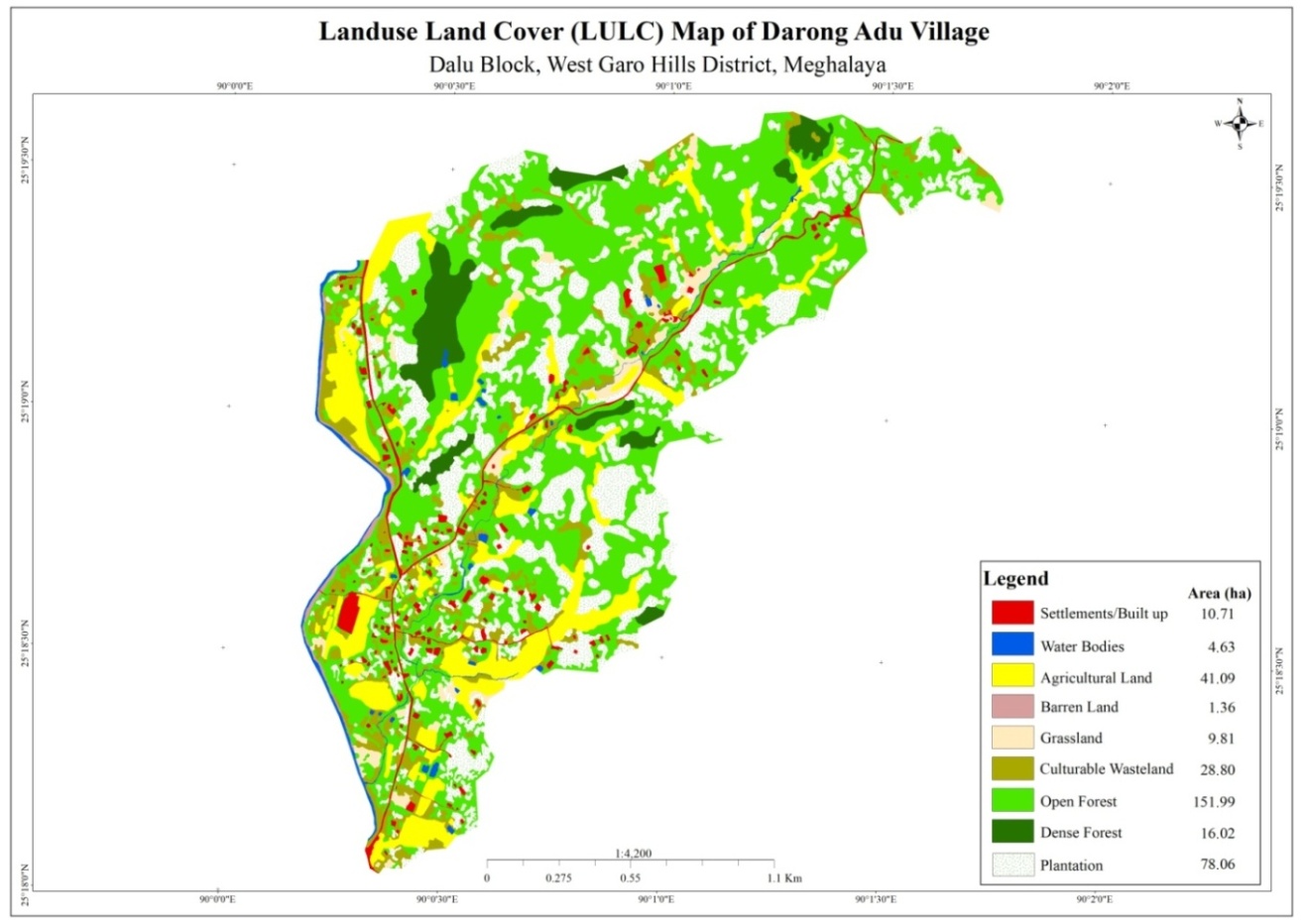
Darong Adu is situated in the plain area with the total population of about 1058 with 131 Households. As per the record, the village was established in the year 1890 having Garo community. The total geographical area of the village is around 342.47 Ha with 3.4247sq.Km
The village is located 24 km away from the block office and 52 km from the district headquarter Office. The village is towards the outskirts of Tura town area where plying to and fro from the village is quite time consuming. The transportation facilities of the village are bus and sumo. Also there are people who prefer to travel by their private vehicles.
The Village is about 24 Km away from Dalu Block and 52 km away from district headquarter Tura. The public transport facilities to and from village is in public transport, maxi cab and private vehicle. In respect to the Social Mobilization, it wasn’t that difficult to handle the community of this village as they are active and hardworking. Despite of very less facilities available, the community are very keen towards achieving the aims and objectives of CLLMP.
Fuel /LPG /biomass/gas most of the households are using Woods and very less access to LPG. The community has few facilities such as education, safe drinking water supply, road and access to medical facilities. The village is under Head of village (Nokma). Whereas 146 HH are uses woods and 98 HH are uses LPG in the community.
Darong Adu village has total no of 131 households with the total population of 1058. Out of which 521 are male and 537 are female.
The following is the demographic break up information acquired by the CLLMP team of WGH district.

The community of Darong Adu are into farming that includes agriculture and multi cropping. Arecanut is one of the most grown cash crops followed by black pepper, banana, pineapple etc. Till date, there are 23 HH are farmers, 51 HH are Labourer, 29 HH are Business and 28 HH into government service.
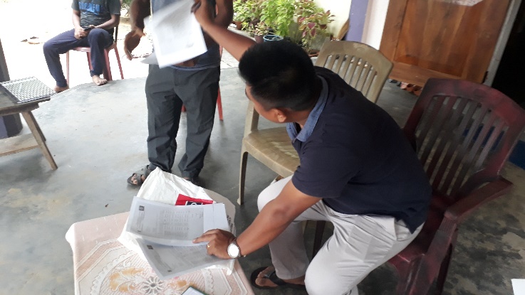
GROUND TRUTHING AND SENSITIZATION PROGRAMME
 Ground
truthing and sensitization programme was held on 28th Dec 2018. The
district team, M&E and Environment Management visited the
village.
Ground
truthing and sensitization programme was held on 28th Dec 2018. The
district team, M&E and Environment Management visited the
village.
During the programme the community were sensitized on the objectives of the project and its activities under the project. During the same day, there was a discussion causes related to the degradation of land and the sources of water supply in the village.
Also there was a brief explanation on the formation of VNRMC, Village facilitators, opening of bank accounts and the preparation of plans and interventions. There were around 28 participants attended the programme including village elders, headmen, VEC secretary.
CASE FINDINGS / CHALLENGES
PRA EXERCISE AND CNRM PLAN PREPARATION
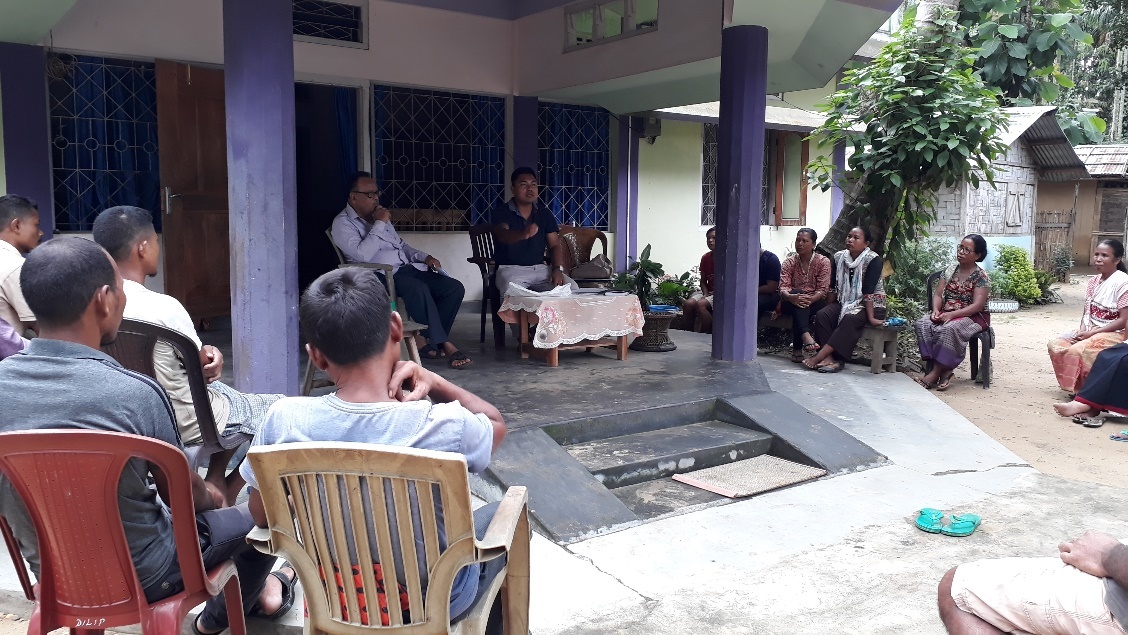 The
District team of West Garo Hills conducted PRA and CNRM plan at
Darong Adu Village on the 28th Feb 2019, Dalu Block, and WGH.
The
District team of West Garo Hills conducted PRA and CNRM plan at
Darong Adu Village on the 28th Feb 2019, Dalu Block, and WGH.
The exercises were conducted by the district team Social, Environment, M&E. The Team informed the community that PRA exercise is to understand and locate the natural resources of the village and plan the activities according to their need. The community had an exercise to plan and draw resource and social map on the same day.
In the exercise of CNRM plan preparation, the community were asked to prioritized the plan /activities and submit the plan to DPMU for 5 years. The exercises were done in the presence of village headmen, VNRMCs and Village facilitators. There were around 43 participants for the programme.
SIGNING OF DOCUMENTS
As an acceptance and agreement to the project, every member of the village households had to sign green charter on 15th Jan, 2019 and submitted the Village agreement and Expression of Interest to DPMU.
FORMATION OF THE VNRMC
On 17th Jan, 2019 after the ground survey and sensitization programme, the village signed the EOI, VGA and Green charter as a sign of accepting the project. Whereas in regards, to the selection of Village Natural Resource Management Committee(VNRMC) members the Village Executive Committee (VEC) along with entire community carried out the process of selecting 15 chosen members such as 9 Executive members, 3 Purchase committee and 3 Village Community Facilitator .
LISTED BELOW ARE THE MEMBERS OF THE VNRMC
| Sl No | Name in Full | Gender M/F | Age (in Yrs) | Education | Designation | Occupation | Community | Contact No and email address |
|---|---|---|---|---|---|---|---|---|
| 1 | Kremison Shira | Male | Class 9 | EC Member | EC Member | Secretary | Garo | |
| 2 | Bichard Sangma | Male | Class 4 | EC Member | EC Member | Farmer | Garo | |
| 3 | Bright Marak | Male | Class 9 | EC Member | EC Member | Farmer | Garo | |
| 4 | Jeckman Marak | Male | Class 9 | EC Member | EC Member | Farmer | Garo | |
| 5 | Salseng Arengh | Male | Class 9 | Chairman | Chairman | Farmer | Garo | 9366877756 |
| 6 | Mrenalin Arengh | Female | Class 9 | Secretary | Secretary | Housewife | Garo | 8974489653 |
| 7 | Silme Shira | Female | Class9 | EC Member | EC Member | Farmer | Garo | 8787396289 |
| 8 | Perina Sangma | Female | Class 9 | EC Member | EC Member | Housewife | Garo | |
| 9 | Maiabi Marak | Female | Class 9 | EC Member | EC Member | Farmer | Garo |
VILLAGE COMMUNITY FACILITATORS (VCF)
| Sl No | Name in Full | Gender M/F | Age (Yrs) |
Education | Area of specialisation/ focus (forests, water, soil, accounts, environmental and social safeguards, knowledge management, GIS) | Trained under CLLMP (Yes/ No?) if Yes, date training was received | Contact No and email address |
|---|---|---|---|---|---|---|---|
| 1 |
|
|
|
|
M&E |
|
8787824492 |
| 2 |
|
|
|
|
|
yes |
|
|
|
|
|
|
NRM & GIS |
|
|
PLAN ESTIMATE
The DPMU of WGH made an inspection to the proposed intervention sites soon after the CNRM plan preparation gets over.
PROJECT IMPLEMENTATION
|
Implemented Activities | Name of Site | Status |
|---|---|---|---|
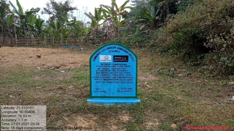
| 1. | 18 Days Hot Composting | Roadside near nursery |
|
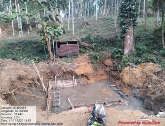
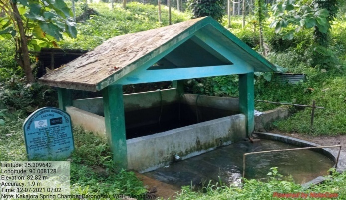
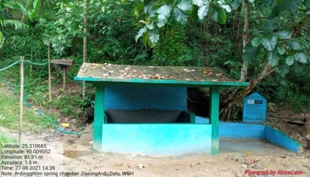
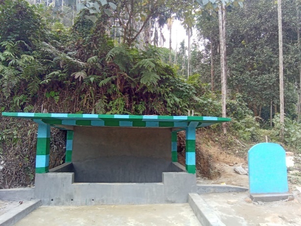
| 2. | Spring Chamber | Kakajora | Completed |
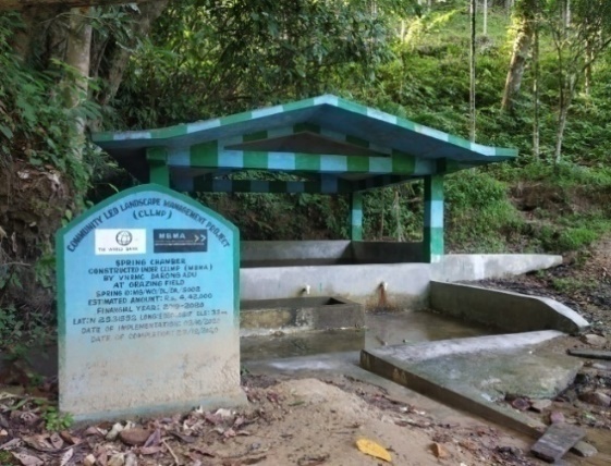
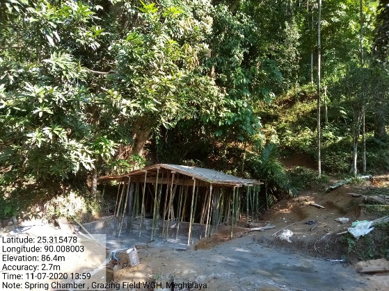
| 3. | Spring Chamber | Grazing Field | Completed |
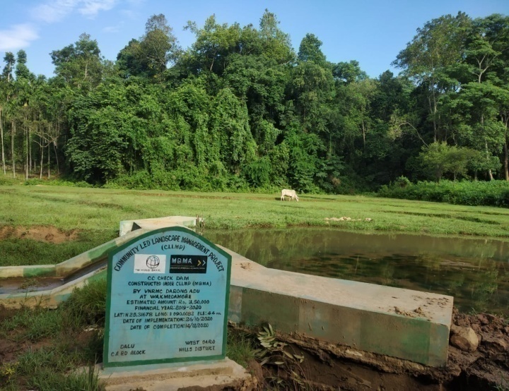
| 4. | CC Check Dam | Wakmedamgre | Completed |
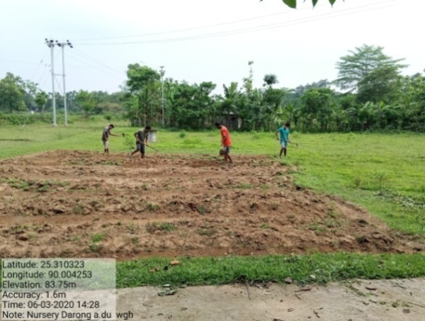
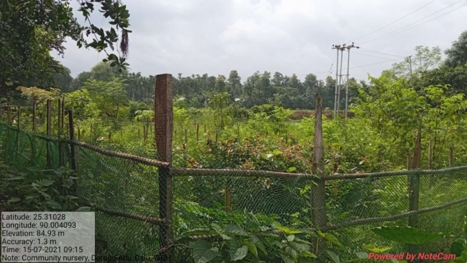
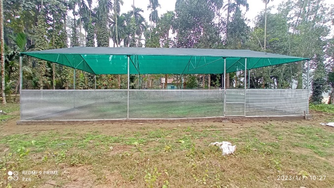
| 5. | Community Nursery | Roadside | Completed |
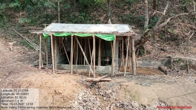
| 6. | Spring Chamber | Ading Gittim | Completed |
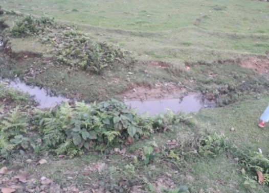
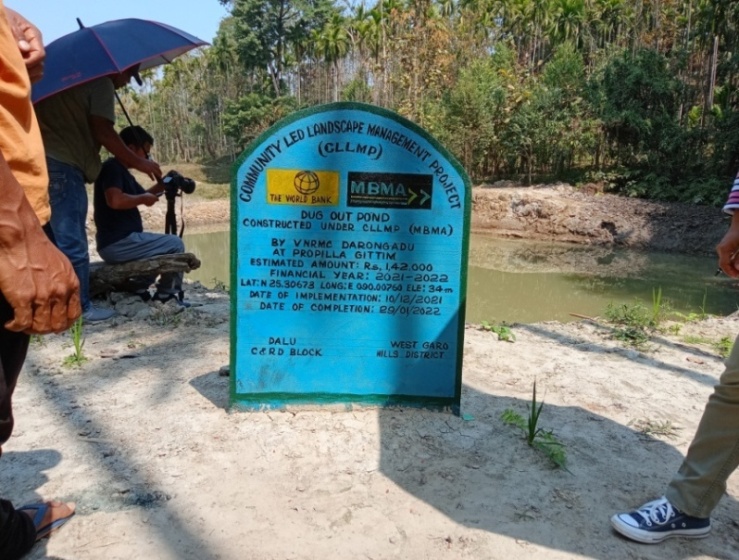
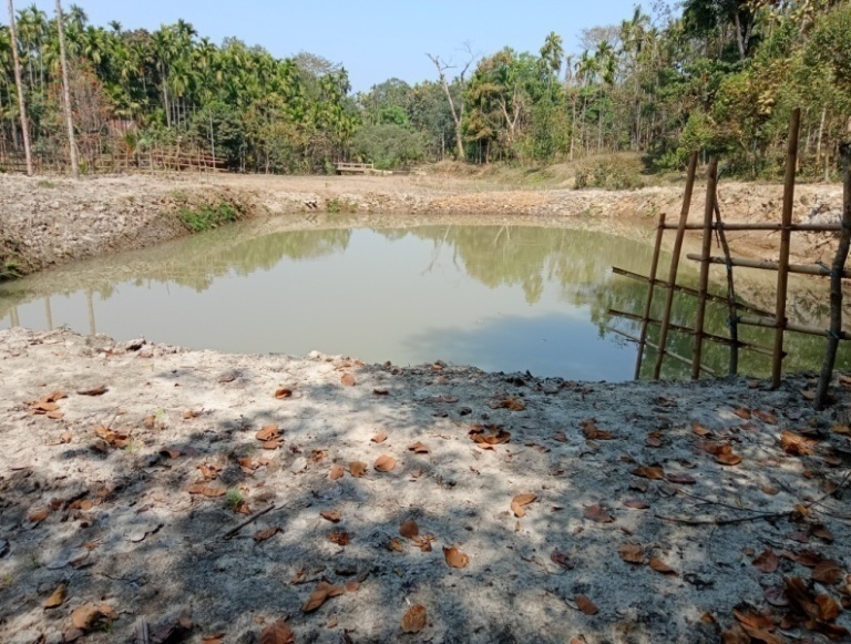
| 7. | Dug Out Pond | Propilla Gittim | Completed |
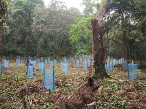
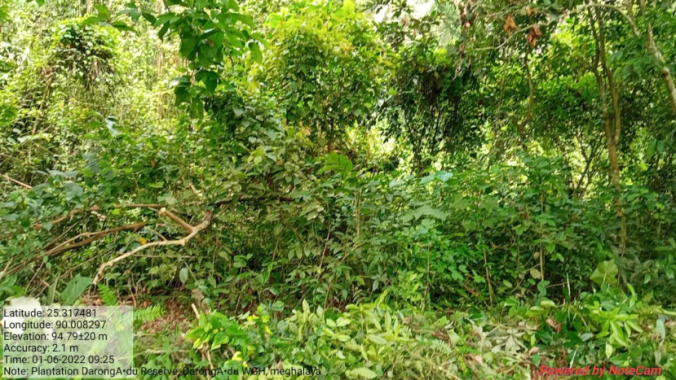
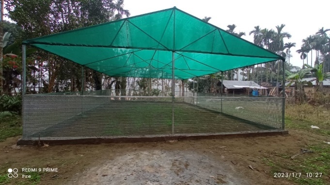
| 8. | Plantation | Darong Adu Reserve | Completed |
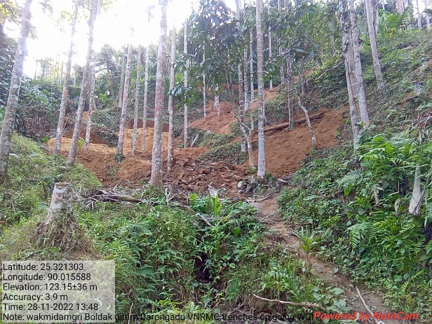
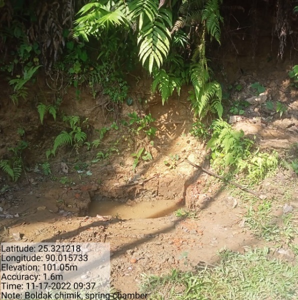
| 9. | Trenches (Additional) | Boldak Chimik | Completed |
| 10. | Spring Chamber (Additional) | Boldak Chimik | Completed |
| 11. | Permanent Community Nursery (Balance fund) | Grazing Field | Ongoing |
FUND STATUS
| 1 | Type Of Intervention | Site Name | GPS Co-ordinates | Amount | Work Status |
|---|---|---|---|---|---|
| 18 Days Hot Composting | Roadside near nursery | Elevation 36m N 25.30963 E 090.00805 | Rs.33,000 | Completed |
| 2 | Type Of Intervention | Site Name | GPS Co-ordinates | Amount | Work Status |
|---|---|---|---|---|---|
| Spring Chamber | Kakajora | Elevation 36m N 25.30963 E 090.00805 | Rs.4,42,000 | Completed |
| 3 | Type Of Intervention | Site Name | GPS Co-ordinates | Amount | Work Status |
|---|---|---|---|---|---|
| Spring Chamber | Grazing Field | Elevation 33m N 25.31552E 090.00817 | Rs.4,42,000 | Completed |
| 4 | Type Of Intervention | Site Name | GPS Co-ordinates | Amount | Work Status |
|---|---|---|---|---|---|
| CC Check Dam | Wakmedamgre | Elevation 44m N 25.31678 E 090.00882 | Rs.3,50,000 | Completed |
| 5 | Type Of Intervention | Site Name | GPS Co-ordinates | Amount | Work Status |
|---|---|---|---|---|---|
| Community Nursery | Roadside | Elevation 77m N 25.31017 E 090.00454 | Rs.1,23,000 | Completed |
| 6 | Type Of Intervention | Site Name | GPS Co-ordinates | Amount | Work Status |
|---|---|---|---|---|---|
| Spring Chamber | Ading Gittim | Elevation 51m N 25.31076 E 90.00907 | Rs.4,42,000 | Completed |
| 7 | Type Of Intervention | Site Name | GPS Co-ordinates | Amount | Work Status |
|---|---|---|---|---|---|
| Dug Out Pond | Propilla Gittim | Elevation 34m N 25.30673 E 090.00760 | Rs.1,42,000 | Completed |
| 8 | Type Of Intervention | Site Name | GPS Co-ordinates | Amount | Work Status |
|---|---|---|---|---|---|
| Plantation | Darong Adu Reserve | Elevation 41m N 25.31732E 090.00900 | Rs. 1,81,000 | Completed |
After
| 9 | Type Of Intervention | Site Name | GPS Co-ordinates | Amount | Work Status |
|---|---|---|---|---|---|
| Trenches (Additional) | Boldak Chimik | Elevation 84m N 25.32112 E 90.01534 | Rs. 36,000 | Completed |
| 10 | Type Of Intervention | Site Name | GPS Co-ordinates | Amount | Work Status |
|---|---|---|---|---|---|
| Spring Chamber (Additional) | Boldak Chimik | Elevation 64m N 25.32120 E 90.01568 | Rs.464,000 | Completed |
| 11 | Type Of Intervention | Site Name | GPS Co-ordinates | Amount | Work Status |
|---|---|---|---|---|---|
| Permanent Community Nursery (Balance fund) | Grazing Field | Elevation 42m N 25.3184E 9 0.00384 | Rs.300,000 | On-going |
TESTIMONY FROM THE FIELD
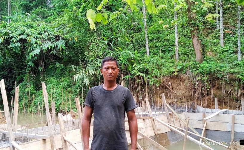 Shri.
Salseng Arengh from Darong Adu VNRMC Chairman stated in his
testimony, He said that because of this project implemented in his
community they are getting benefits for drinking, irrigation, and
domestic and for various purposes. Kakajora spring chamber is
highest benefitted for them in utilizing of water for community.
During like gathering, funeral or wedding services communities face
difficulties while utilizing the water but as of now they get water
easily for used.
Shri.
Salseng Arengh from Darong Adu VNRMC Chairman stated in his
testimony, He said that because of this project implemented in his
community they are getting benefits for drinking, irrigation, and
domestic and for various purposes. Kakajora spring chamber is
highest benefitted for them in utilizing of water for community.
During like gathering, funeral or wedding services communities face
difficulties while utilizing the water but as of now they get water
easily for used.
On behalf of community VNRMC Chairman thankful for the CLLM project (Community Led Landscape Management Project) for implementing and solving the problems of communities.
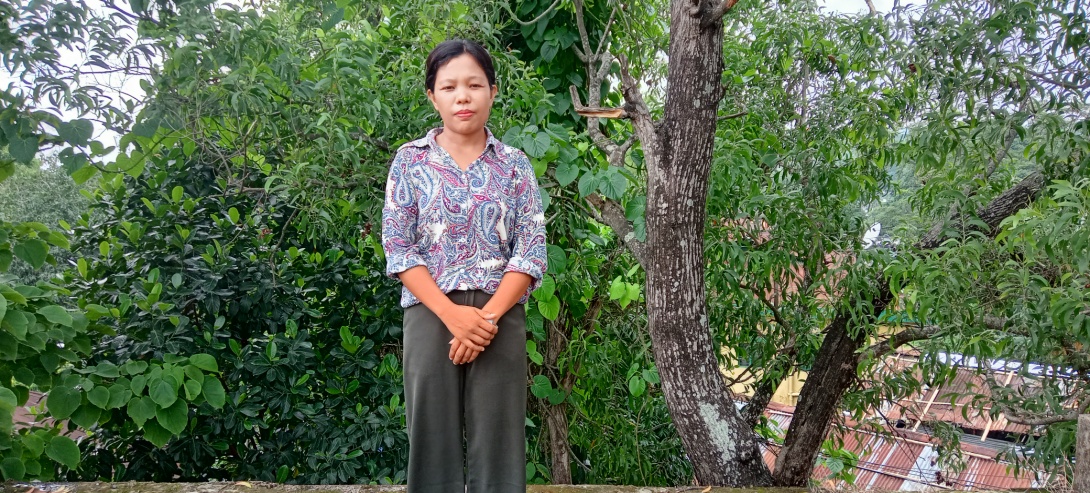 Miss
Preditha D Shiras SM/KM VCF from Darong Adu village she worked as
VCF for 5 years in CLLM Project. She gratefully said that as a VCF
(Village Community Facilitator) she got lots of knowledge from
project when she went for excursion to Tezpur Assam Green Hub their
she get training of how to take pictures or in what types of angle
we should take pictures and many more. Besides working as VCF we get
chance in different project to work and also she gets chance to work
in PES. She also said that as a VCF she request community to attend
the meeting and participate in various programmes.
Miss
Preditha D Shiras SM/KM VCF from Darong Adu village she worked as
VCF for 5 years in CLLM Project. She gratefully said that as a VCF
(Village Community Facilitator) she got lots of knowledge from
project when she went for excursion to Tezpur Assam Green Hub their
she get training of how to take pictures or in what types of angle
we should take pictures and many more. Besides working as VCF we get
chance in different project to work and also she gets chance to work
in PES. She also said that as a VCF she request community to attend
the meeting and participate in various programmes.