
COMMUNITY LED LANDSCAPE MANAGEMENT PROJECT (CLLMP)
The Government of Meghalaya with financial help from the World Bank is implementing the Meghalaya Community Led Landscape Management Project (MCLLMP). The project covers the entire state of Meghalaya and implementation of community-led plans are rolled out in a phased manner throughout the state. The Meghalaya Basin Management Agency (MBMA) will facilitate community-led planning by providing support, technical inputs and funding.
The project is intended to strengthen community-led natural resources management in selected landscapes within the 7 districts of the state. This would be achieved through a variety of planning, capacity building, and on-the-ground interventions to promote the conservation, sustainable use of natural resources, social inclusion and community mobilization; building traditional knowledge and learning, mapping of natural resources management; strengthening the community institutions and creating linkage with financial institutions and community organizations.
The project interventions will include preparation of community led natural resource management plans. The CLLMP has the following three components:
Strengthening Knowledge and Capacity of Communities for Natural Resources Management
Community-Led Landscape Planning and Implementation
Project Management and Governance
The project objective is “to manage and conserve the natural resources, especially forests, soil and water sources, in a manner that supports the financial and physical well-being of communities in the State”
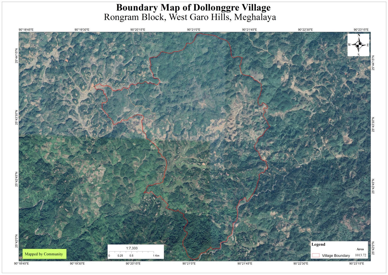
Dollonggre village is situated under the Rongram C&RD block of West Garo Hills district of Meghalaya. The village is about 20 km from the Rongram Block and 30km from the district Headquarter, Tura. The village is under the traditional land owner of A’king Nokma. The total population and the demographic of both male and female of the village is about 482 with 86number of household. The village Latitude is 25.71656°North and Longitude 090.35627°East.
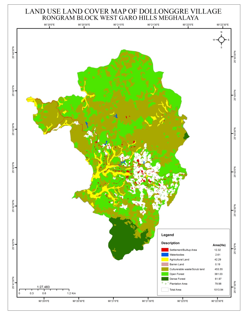
The total geographical area of the village is around 1013.94Ha with 1.01394sq.Km.
The Village is about 20 km away from Rongram Block and 30 km away from district headquarters Tura. The public transport facilities to and from village is in Bus and private vehicle. Despite of very less facilities available, the community are very keen towards achieving the aims and objectives of CLLMP.
Fuel /LPG /biomass/gas, most of the households are using Woods and very less access to LPG. The community has few facilities such as education, transportation and road. The village is under Head of village (Nokma). About 141 households still uses woods for cooking whereas about 30 households use LPG.
Dollonggre village has total no of 171 households with the total population of 940. Out of which are 449 male and 491 are females.
The following is the demographic break up information acquired by the CLLMP team of WGH district.

The main occupation practiced over there in Dollonggre village is farming which includes agriculture and multi cropping. Areca nut is always one of the most grown cash crops followed by pineapple, banana, black pepper etc. There are 128 HH Farmer, 35 are HH Labour and 8 HH are Service.
DPMU team of West Garo Hills visited Dollonggre village for Sensitization cum Ground Truthing on 5th September 2019.
The village has 171 HH with 940 total populations.
The village has community forest.
The village water sources are springs and streams. It has 5 streams and 9 springs.
The village has indigenous tree species such as :-Duabangagrandi flora (Bolchim), Father tree (Bolkasin), Bolchu , Jackfruit, Mango, Bolbret, Siso, Gamar
The village Forest has medicinal shrubs/trees such Meghalaya budu, Mebitchi, Donggam
Commercially valued Trees/ Shrubs/Plants in forests available in the village forest are Bolbret, Siso, Gamar, Bolchu, Jackfruit, Mango
The village has Fodder Species/Valuable Grasses available in the forest such as Vetiver grass, Pangsil, Broom grass, Wakme, Samskal, Chongira, Arurak, Mekridonok, Matchaduri, Pasim, Karika, Gominjak.
The springs which are present in village needs rejuvenate.
Land Degradation
Scarcity of drinking water
The District team of West Garo Hills conducted PRA and CNRM plan on 10th January 2019at Dollonggre Village Rongram Block, WGH.
The exercises were conducted by the district team Environment. The Team informed the community that PRA exercise is to understand and locate the natural resources of the village and plan the activities according to their need. The community had an exercise to plan and draw resource and social map on the same day.
In the exercise of CNRM plan preparation, the community were asked to prioritized the plan /activities and submit the plan to DPMU for 5 years. The exercises were done in the presence of village headmen, VNRMCs and Village facilitators.
Signing of Documents:
As an acceptance and agreement to the project, every member of the village households had to sign green charter on10th January 2019and submitted the Village agreement and Expression of Interest to DPMU.
Formation of the VNRMC
On 10th January 2019, after the ground survey and sensitization programme, the village signed the EOI, VGA and Green charter as a sign of accepting the project. Whereas in regards, to the selection of Village Natural Resource Management Committee (VNRMC) members the Village Executive Committee (VEC) along with entire community carried out the process of selecting 15 chosen members such as 9 Executive members, 3 Purchase committee and 3 Village Community Facilitator.
Listed below are the members of the VNRMC:
| Sl No | Name in Full | Gender M/F | Age (in Yrs) | Education | Designation | Occupation | Community | Contact No and email address |
|---|---|---|---|---|---|---|---|---|
| 1 | Rakseng Sangma | M | 28 | Class X | Chairman | Farmer | Garo | 6009373522 |
| 2 | Ganchi T Sangma | F | 21 | 9th passsed | Secretary | Farmer | Garo | 9863500566 |
| 3 | Nomilla Sangma | F | 20 | 9th passed | Member | Farmer | Garo | 6009920986 |
| 4 | George Marak | M | 27 | 9th passed | Member | Farmer | Garo | 8837311630 |
| 5 | Chiram A Sangma | M | 32 | 9th passed | Member | farmer | garo | 6009133482 |
| 6 | Lakme Marak | F | 28 | 10th passed | Member | farmer | garo | 6009858077 |
| 7 | Jebing Marak | M | 45 | primary | Member | farmer | garo | 6009397219 |
| 8 | Mina A Sangma | F | 35 | primary | Member | farmer | garo | 6002444390 |
| Onsilla A Sangma | F | 26 | primary | Member | farmer | garo | 7005746579 | |
| 9 |
Village Community Facilitators (VCF)
| Sl No | Name in Full | Gender M/F | Age (Yrs) |
Education | Area of specialisation/ focus (forests, water, soil, accounts, environmental and social safeguards, knowledge management, GIS) | Trained under CLLMP (Yes/ No?) if Yes, date training was received | Contact No and email address |
|---|---|---|---|---|---|---|---|
| 1 | SM/KM | ||||||
| 2 | Sengran A Sangma | M | 29 | 9th passed | M&E | Yes | 7005255879 |
| 3 | Edward D Sangma | M | 26 | NRM | 6009741887 |
Plan Estimate:
The DPMU team of WGH made an inspection to the proposed intervention sites soon after the CNRM plan preparation.
|
Implemented Activities | Name of Site | Work Status |
|---|---|---|---|
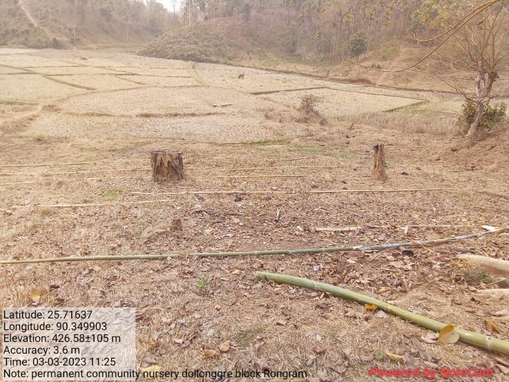
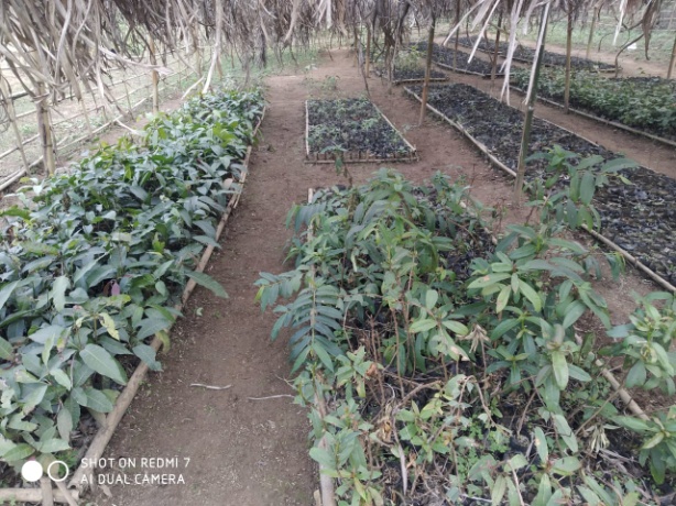
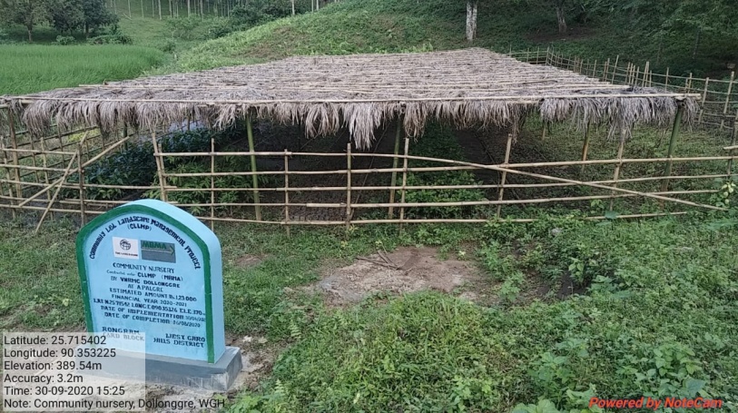
| 1. | Community Nursery | Apalgre | Completed |
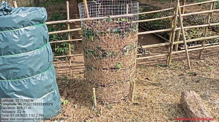
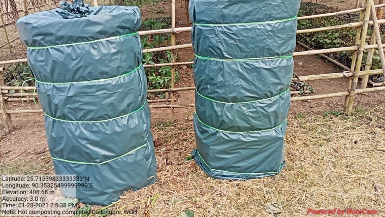
| 2. | 18 Days Hot Composting Unit | Apalgre, near nursery | Completed |
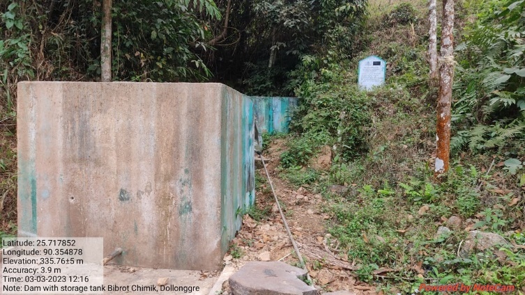
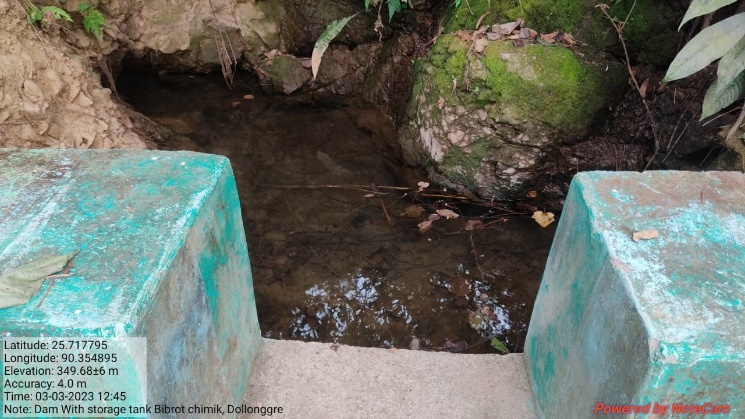
| 3 | Dam with Storage Tank | Bibrot Chimik | Completed |
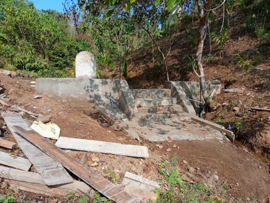
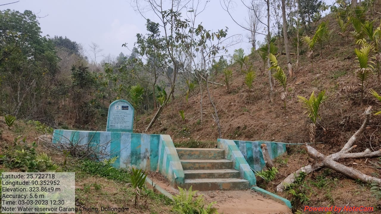
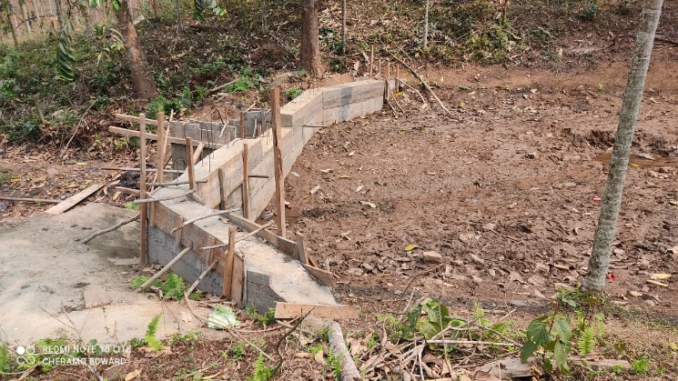
| 4 | RCC Check Dam | Garang Chiring | Completed |
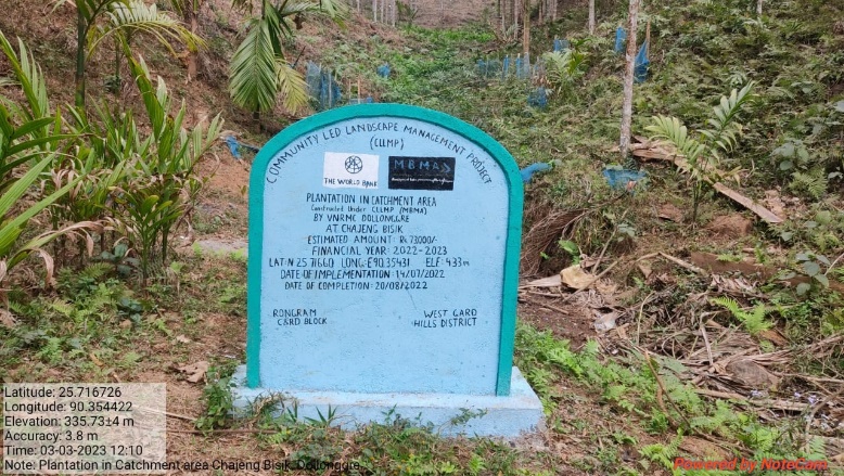
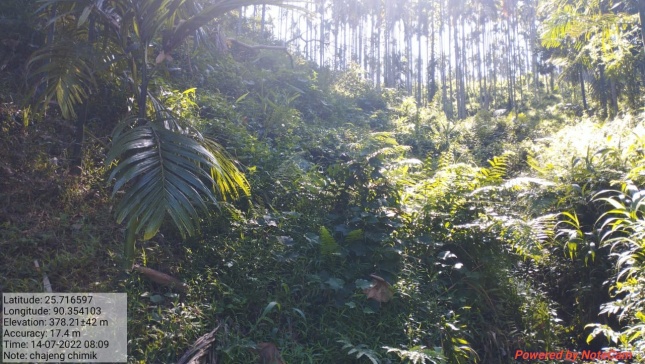
| 5 | Plantation | Chajeng Bisik | Completed |
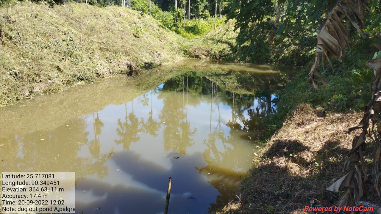
| 6 | Dug out pond | Apalgre | Completed |
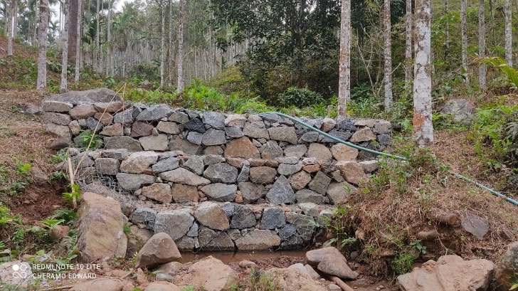
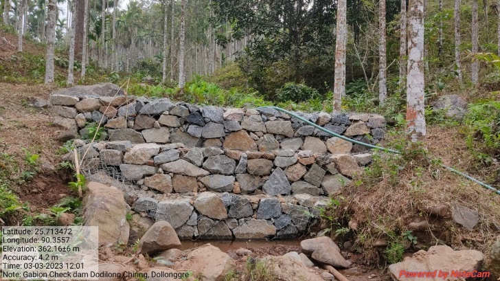
| 7 | Gabion Check Dam | Dodilong Chiring | Ongoing |
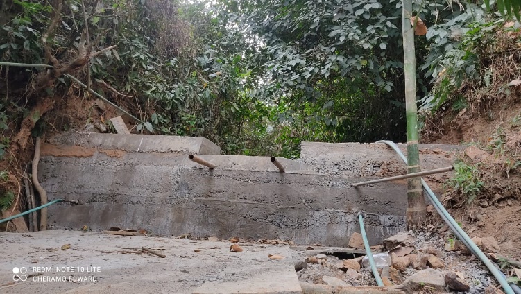
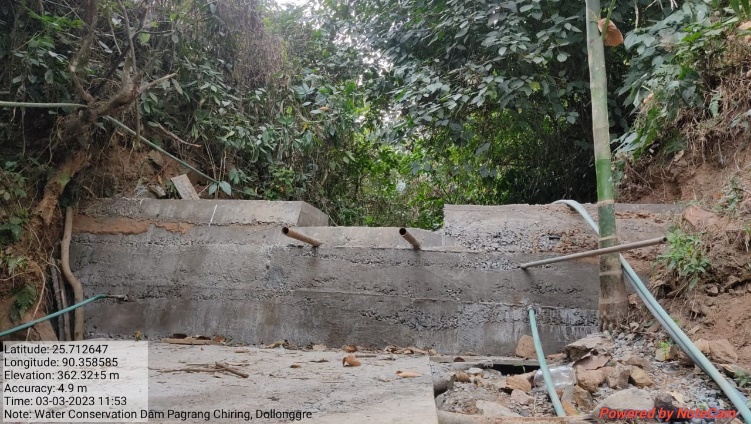
| 8 | Water Conservation Dam | Pagrang Chiring | Ongoing |
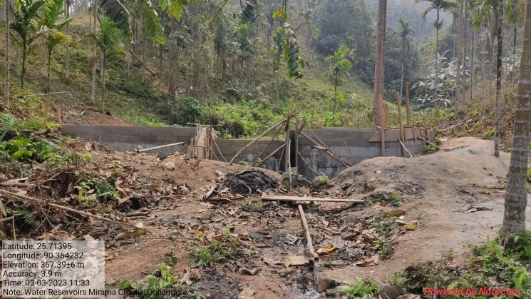
| 9 | Water Reservoir | Mirama Chiring | Ongoing |
| 10 | Permanent Community Nursery (Balance fund) | Apalgre |
4. Fund Status
| 1 | Type Of Intervention | Site Name | GPS Co-ordinates | Amount | Work Status |
|---|---|---|---|---|---|
| Community Nursery | Apalgre | Elevation: 370m N25.71542 E090.35326 | Rs. 1,23,000 | Completed |
| 2 | Type Of Intervention | Site Name | GPS Co-ordinates | Amount | Work Status |
|---|---|---|---|---|---|
| 18 Days Hot Composting Unit | Apalgre, near nursery | Elevation: 370m N25.71542 E090.35326 | Rs.33,000 | Completed |
| 3 | Type Of Intervention | Site Name | GPS Co-ordinates | Amount | Work Status |
|---|---|---|---|---|---|
| Dam with Storage Tank | Bibrot Chimik | Elevation 372m N 25.71772 E 090.35464 | Rs. 3,20,000 | Completed |
| 4 | Type Of Intervention | Site Name | GPS Co-ordinates | Amount | Work Status |
|---|---|---|---|---|---|
| RCC Water Reservoir | Garang Chiring | Elevation 356m N 25.72258 E 090.35278 | Rs.3,63,000 | Completed |
Before After
| 5 | Type Of Intervention | Site Name | GPS Co-ordinates | Amount | Work Status |
|---|---|---|---|---|---|
| Plantation | Chajeng Bisik | Elevation 433m N 25.71660 E 90.35431 | Rs. 73,000 | Completed |
Before After
| 6 | Type Of Intervention | Site Name | GPS Co-ordinates | Amount | Work Status |
|---|---|---|---|---|---|
| Dug out pond | Apalgre | Elevation 352m N 25.71700 E 090.34938 | Rs. 1,10,000 | Completed |
| 7 | Type Of Intervention | Site Name | GPS Co-ordinates | Amount | Work Status |
|---|---|---|---|---|---|
| Gabion Check Dam | Dodilong Chiring | Elevation 398m N 25.71332 E 090.35549 | Rs. 1,50,000 | Completed |
| 8 | Type Of Intervention | Site Name | GPS Co-ordinates | Amount | Work Status |
|---|---|---|---|---|---|
| Water Conservation Dam | Pagrang Chiring | Elevation 426m N 25.71264 E 090.35828 | Rs. 3,00,000 | Completed |
| 9 | Type Of Intervention | Site Name | GPS Co-ordinates | Amount | Work Status |
|---|---|---|---|---|---|
| Water Reservoir | Mirama Chiring | Elevation 407m N 25.71388 E 090.36409 | Rs. 3,63,000 | Completed |
| 10 | Type Of Intervention | Site Name | GPS Co-ordinates | Amount | Work Status |
|---|---|---|---|---|---|
| Permanent Community Nursery (Balance fund) | Apalgre | Elevation | Rs.3,00,000 | Completed |