
COMMUNITY LED LANDSCAPE MANAGEMENT PROJECT (CLLMP)
The Government of Meghalaya with financial help from the World Bank is implementing the Meghalaya Community Led Landscape Management Project (MCLLMP). The project covers the entire state of Meghalaya and implementation of community-led plans are rolled out in a phased manner throughout the state. The Meghalaya Basin Management Agency (MBMA) will facilitate community-led planning by providing support, technical inputs and funding.
The project is intended to strengthen community-led natural resources management in selected landscapes within the 7 districts of the state. This would be achieved through a variety of planning, capacity building, and on-the-ground interventions to promote the conservation, sustainable use of natural resources, social inclusion and community mobilization; building traditional knowledge and learning, mapping of natural resources management; strengthening the community institutions and creating linkage with financial institutions and community organizations.
The project interventions will include preparation of community led natural resource management plans. The CLLMP has the following three components:
Strengthening Knowledge and Capacity of Communities for NaturalResources Management
Community-Led Landscape Planning and Implementation
Project Management and Governance
The project objective is “to manage and conserve the natural resources, especially forests, soil and water sources, in a manner that supports the financial and physical well-being of communities in the State”
Gambegre Village is situated in West Garo Hills district in the state of Meghalaya. Agriculture is the main profession of this village and does not have any industrial development however they are very keen towards development. The village is not so far away from Tura town area and has about only 18 km.
Gambegre Village is situated under West Garo Hills district of Meghalaya. The village is under Nokma (Head of Village) who guided the village in a direction towards happiness and prosperity. With the coming of the CLLMP in the village, the Gambegre VNRMC was formed and awareness on CLMP was given. The community understood full well on the importance of NRM activities and the importance to save their precious hill from gradually degrading.
The village is selected under the NESAC list and found to be degraded. However, this village stand out to be one of the most and successful village under the community Led Landscape Management Project (CLLMP), MBMA. The village was initiated with ground truthing, Sensitization and awareness program on the Project Objective by the District Project Management Unit (DPMU) of West Garo Hills.
According to the Village history, Gambegre is situated with the total population of 550 only. It has with 85 Households. As per the information received from the elderly people, Gambegre came into existence /established in the year 1872, with very less population and comprising of only Garo community. The villages currently have about 267 male and 283 female. Around 78 HH has ration cards whereas there is no one who has an access to health cards so far
Gambegre Village is about 0.3Km away from Gambegre block and 18 km away from district headquarter Tura. With less population and comprising of only Garo community. The village is under Nokma (Head of Village) who guided the village in a direction towards happiness and prosperity. With the coming of the CLLMP in the village, the Gambegre VNRMC was formed and awareness on CLMP was given. The community understood full well on the importance of NRM activities and the importance to save their precious hill from gradually degrading. The community travelled 1 Km to the weekly market from their settling area. The public transport facilities to and from village is by public transport, mini cab and private vehicle.
Agriculture is the main profession of this village and does not have any industrial development where they mainly take up traditional approaches of cultivation like Jhum or the shifting cultivation and terrace cultivation. The People of this area is very peaceful without taking much issues and problems to think about the external affairs. Even though the villages have very little known to the development sectors and does not take any concern over reviving, rejuvenating as well as protecting the environment. . Major challenges of the village is safe drinking water supply, the only source of drinking water is natural streams, ring well etc or walk ½ Km from the settling area.
In regards to demographic status, Gambegre village has total no of 85 household with the total population of 550.Out of which 267 are male and 283 are female.
The following is the demographic break up information acquired by the CLLMP team of WGH district


Gambegre Village is still lot to catch up even though it is one of the villages nearest to the Tura town area. Around 81 Households are still into farming which includes agriculture and multi cropping, 3 HH are Teachers and 1 HH are in Fishery. Unlike any other villages Arecanut is always one of the most grown cash crops followed by Cashewnut, Banana, black pepper etc. Around 81 HH are still using the woods for cooking whereas 4 household have an access to LPG.


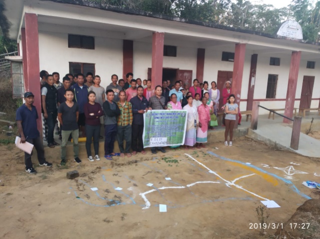
Gambegre Village was initiated under Community Led Landscape Management Project in the year 2019. The District Project Management Unit visited the village for Sensitization programme and Ground truthing were undertaken on the 11th January, 2019 by the district team of West Garo Hills. On explaining on the project goals and its objective, the team also explained on various activities that can be taken up under the project.
There was also a small discussion on the formation of VNRMC, Village facilitators, opening of bank accounts and the preparation of plans and interventions.
There were around 35 participants attended the programme comprising of village elders, headmen, VEC secretary, including women groups, youths CLLMP Assistant Managers - Environment, Social and M&E. On the same day, the community accepted the project and signed green charter as a part of an agreement. There are few findings and observations collected during the visits are as follow:-
1. There is no safe drinking water supply. The sources of drinking water are streams, wells and irregular PHE pipe.
 The CNRM plan preparation and pra
exercise was held on the 4th February, 2019, the District team of
West Garo Hills conducted PRA and CNRM plan at Gambegre Village,
Gambegre Block, West Garo Hills.
The CNRM plan preparation and pra
exercise was held on the 4th February, 2019, the District team of
West Garo Hills conducted PRA and CNRM plan at Gambegre Village,
Gambegre Block, West Garo Hills.Listed below are the members of the VNRMC:
| Sl No | Name in Full | Gender M/F | Age (in Yrs) | Education | Designation | Occupation | Community | Contact No and email address |
|---|---|---|---|---|---|---|---|---|
| 1 | Silchira Ch Marak | F | 29 | Class 10 | Chairman | Farmer | Garo | 7628835159 |
| 2 | Tenang A Sangma | M | 35 | Class 10 | secretary | Farmer | Garo | 7629807645 |
| 3 | Sahen Ch Marak | M | 47 | Class 10 | Book kepper | Teacher | Garo | 9862588789- |
| 4 | Kairash M Sangma | M | 36 | Class 10 | EC Member | Farmer | Garo | 9366942890 |
| 5 | Jangson D Sangma | M | 59 | Class 10 | EC Member | Farmer | Garo | 9378108411 |
| 6 | Rosemerina Ch Sangma | F | 59 | primary | Secretary | Farmer | Garo | 6909240603 |
| 7 | Pronitha Ch Marak | F | 26 | Class 9 | EC Member | Farmer | Garo | 7628854859 |
| 8 | Dimen Sangma | M | 40 | Primary | EC Member | Farmer | Garo | 9862045862 |
| Pilitha Ch Sangma | F | 37 | Class 4 | EC Member | Farmer | Garo | 9378173305 |
Village Community Facilitators (VCF)
| Sl No | Name in Full | Gender M/F | Age (Yrs) |
Education | Area of specialisation/ focus (forests, water, soil, accounts, environmental and social safeguards, knowledge management, GIS) | Trained under CLLMP (Yes/ No?) if Yes, date training was received | Contact No and email address |
|---|---|---|---|---|---|---|---|
| 1 |
|
|
|
|
|
|
|
| 2 |
|
|
|
|
|
yes |
|
| 3 |
|
|
|
|
|
yes |
|
Plan Estimate:
The DPMU of WGH made an inspection to the proposed intervention sites soon after the CNRM plan preparation.
|
Implemented Activities | Name of Site | Work Status |
|---|---|---|---|
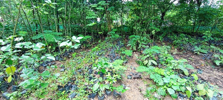
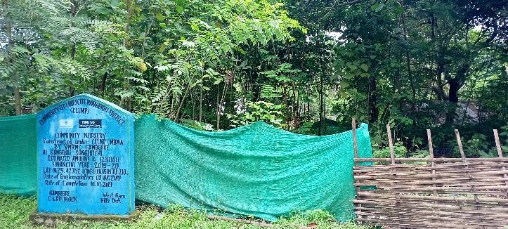
| 1. | Community Nursery | Gambegre Songjatchi | Completed |
| 2. | Water Conservation Dam | Matchok Chiring | Completed |
| 3. | Spring Chamber | Rami Chiga | Completed |
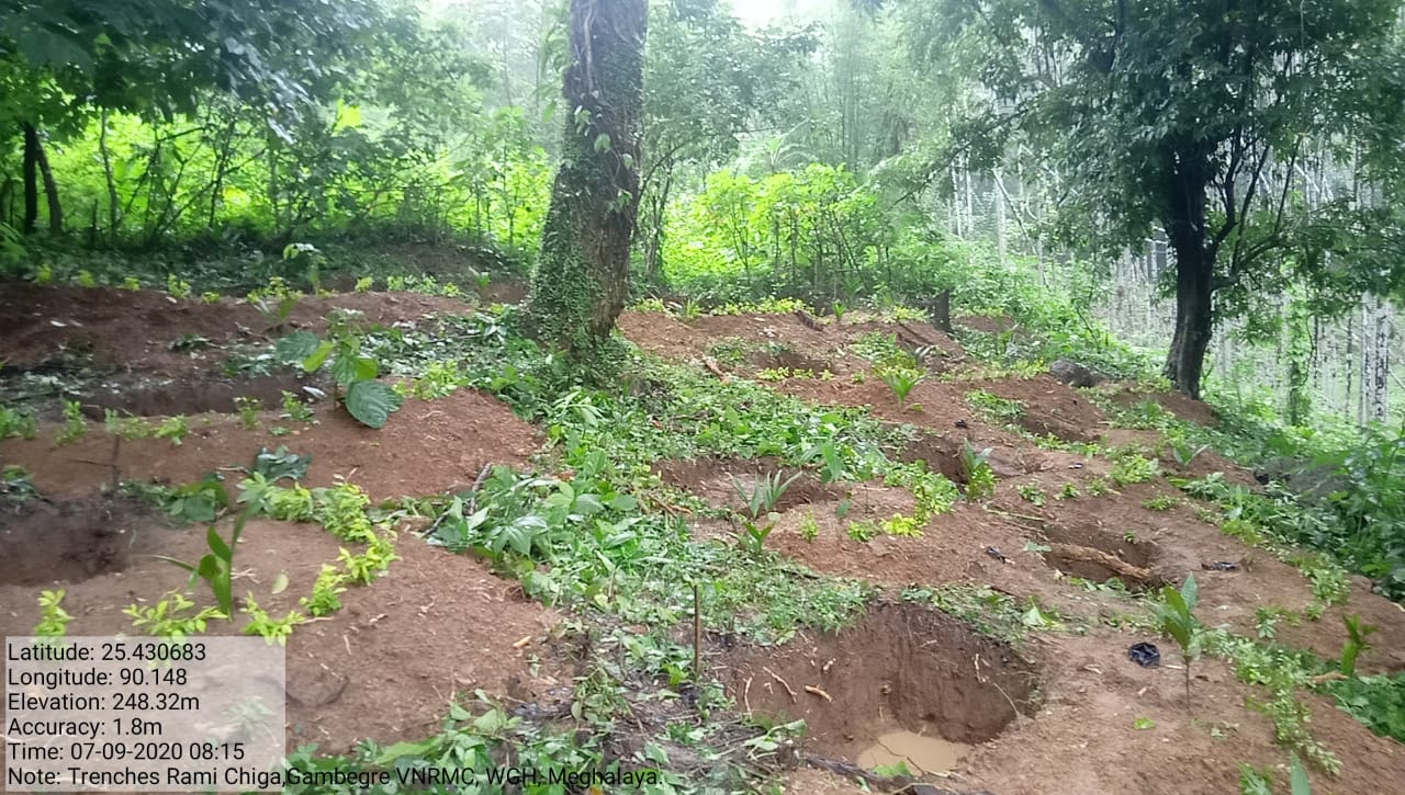
| 4. | Trenches | Rami Chiga | Completed |
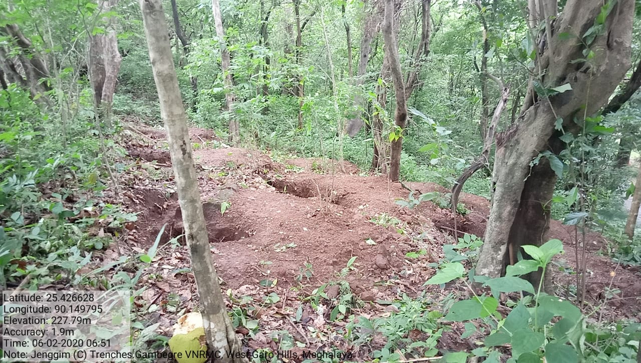
| 5. | Trenches | Jenggim C | Completed |
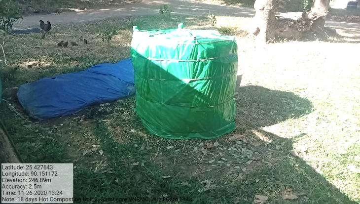
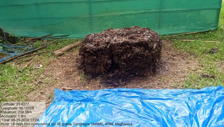
| 6. | 18 Days Composting (Hot Composting | Gambegre Songjatchi, near Nursery | Completed |
| 7. | Dug out pit | Jenggim Bisik | Completed |
| 8. | Dug out pit | Jenggim Bipek | Completed |
| 9. | Spring chamber | Rongrim Bisik | Completed |
| 10. | Dug out pond | Dalu Bipek | Completed |
| 11. | RCC Check Dam | Chigitchak Chiring | Completed |
| 12. | Plantation | Songgitcham Reserve | Completed |
| 13. | Dug out Pit | Rangsan Amu Chakram | Completed |
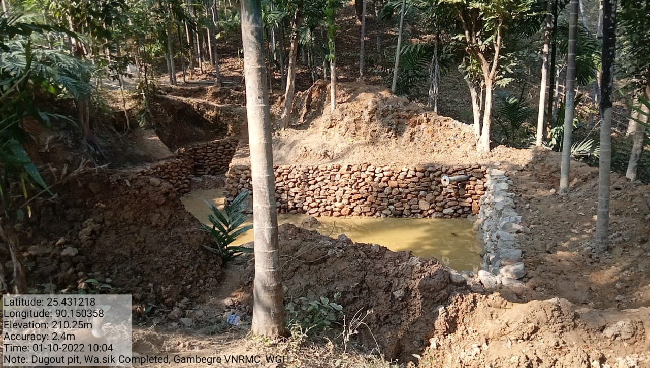
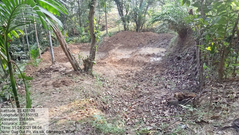
| 14. | Dug out Pit | Wa.sik | Completed |
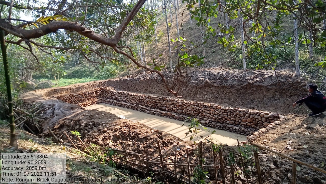
| 15. | Dug out Pit | Rongrim Bipek | Completed |
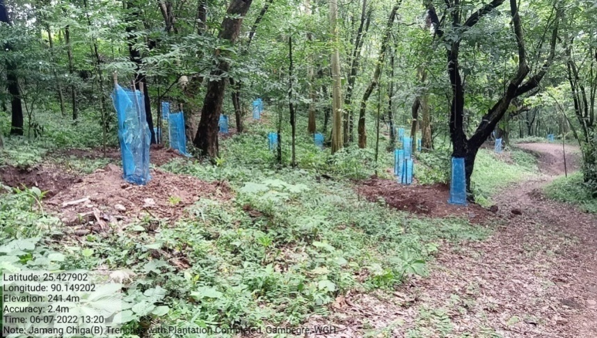
| 16. | Trenches with Plantation | Jamang Chiga-B | Completed |
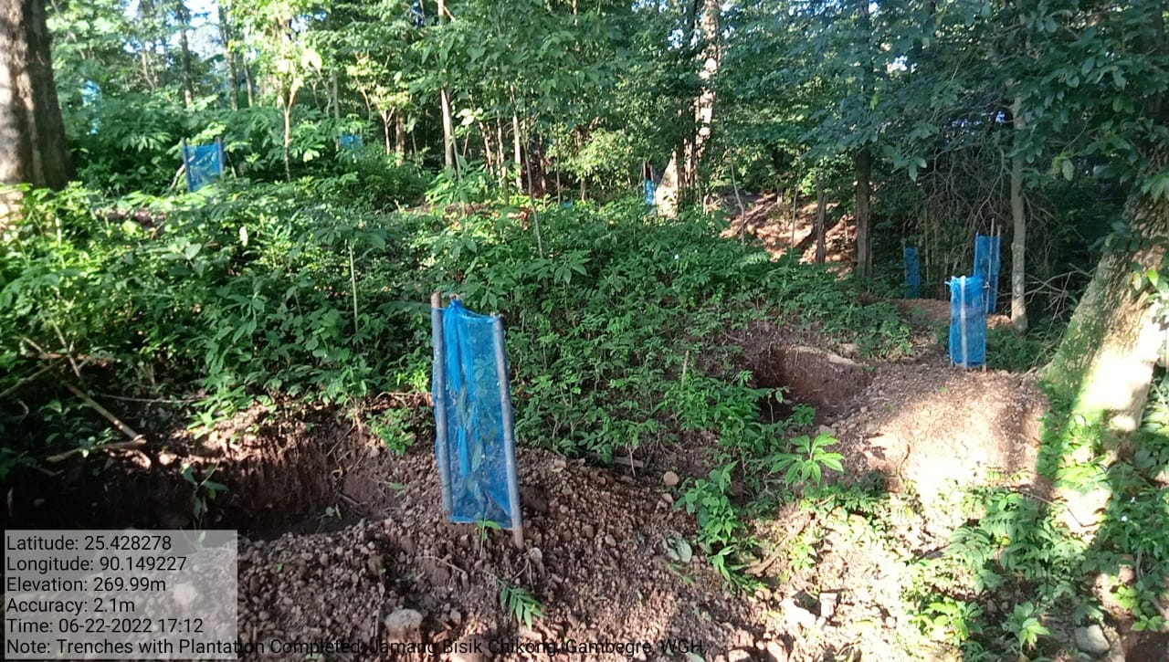
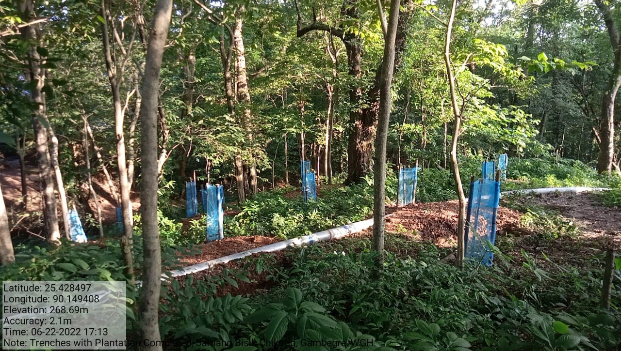
| 17. | Trenches with Plantation | Jamang Chikong | Completed |
| 18. | Roof top rain water harvesting (Additional) | Multi facility building | Completed |
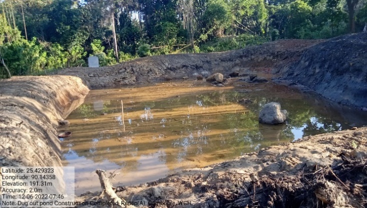
| 19. | Dugout pond (Additional) | Redep (A) | Completed |
| 20. | Dugout pond (Additional) | Redep (B) | Completed |
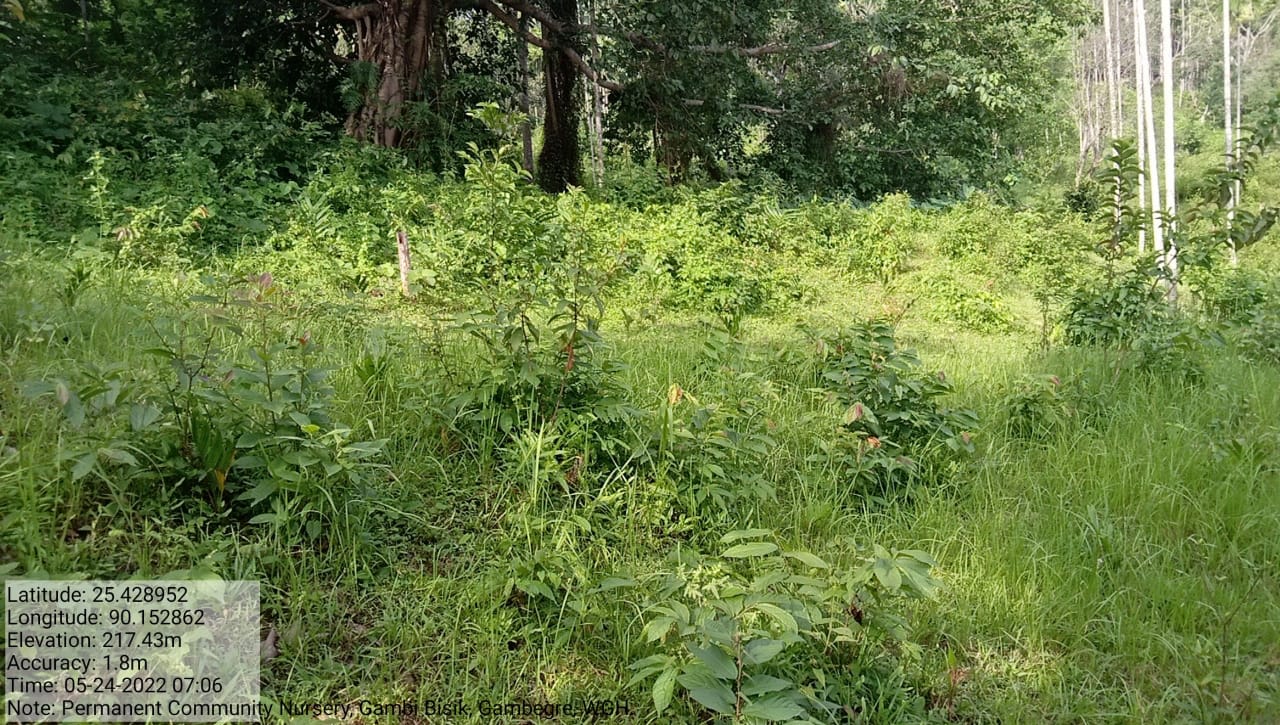
| 21. | Permanent Community Nursery (Balance fund) | Gambi Bisik | Ongoing |
4. Fund Status
| 1 | Type Of Intervention | Site Name | GPS Co-ordinates | Amount | Work Status |
|---|---|---|---|---|---|
| Community Nursery | Gambegre Songjatchi | Elevation 210m N 25.42762 E 090.15119 |
Rs.1,23,000 | Completed |
| 2 | Type Of Intervention | Site Name | GPS Co-ordinates | Amount | Work Status |
|---|---|---|---|---|---|
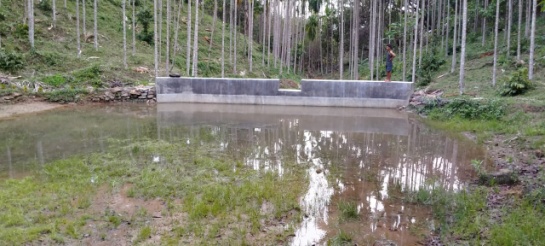
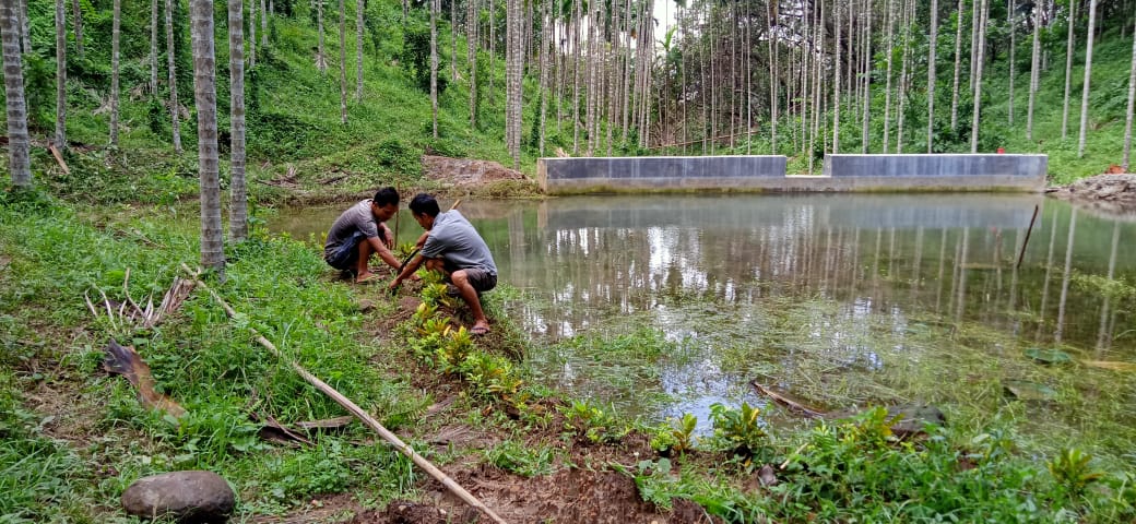
| Water Conservation Dam | Matchok Chiring | Elevation 167m N 25.42239° E 090.15245° |
Rs.4,36,000 | Completed |
| 3 | Type Of Intervention | Site Name | GPS Co-ordinates | Amount | Work Status |
|---|---|---|---|---|---|
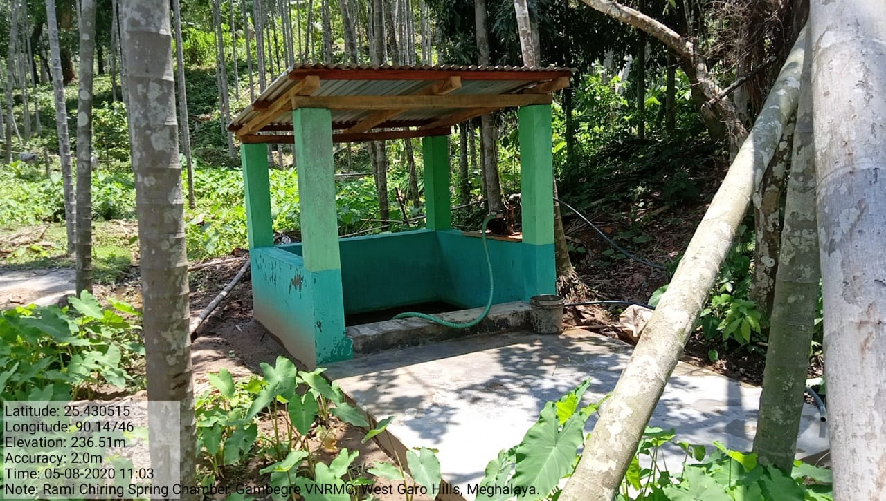
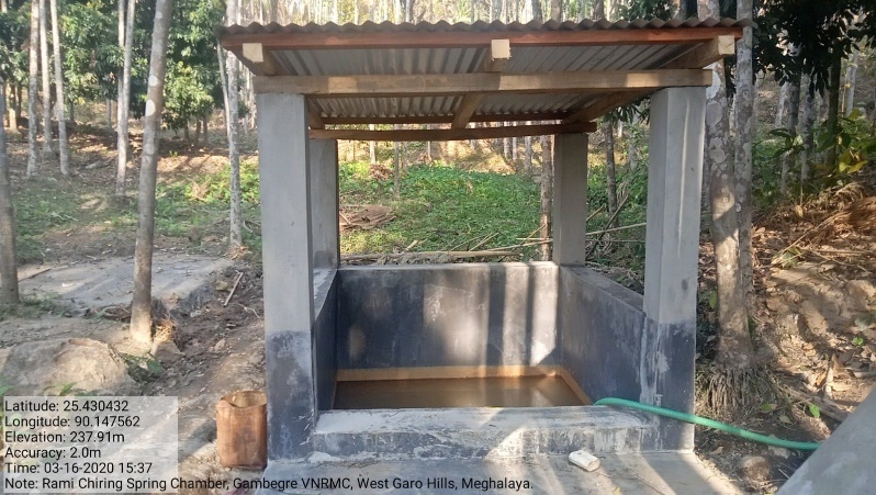
| Spring Chamber | Rami Chiga | Elevation 237m N 25.43057 E 90.14766 |
Rs.1,02,900 | Completed |
Before After
| 4 | Type Of Intervention | Site Name | GPS Co-ordinates | Amount | Work Status |
|---|---|---|---|---|---|
| Trenches | Rami Chiga | Elevation 240m N 25.43057 E 090.14766 | Rs.9,900 | Completed |
| 5 | Type Of Intervention | Site Name | GPS Co-ordinates | Amount | Work Status |
|---|---|---|---|---|---|
| Trenches | Jenggim C | Elevation 190m N 25.42662 E 090.14977 | Rs.10,200 | Completed |
| 6 | Type Of Intervention | Site Name | GPS Co-ordinates | Amount | Work Status |
|---|---|---|---|---|---|
| 18 Days Composting (Hot Composting | Gambegre Songjatchi, near Nursery | Elevation 210m N 25.42762 E 090.15119 |
Rs.33,000 | Completed |
| 7 | Type Of Intervention | Site Name | GPS Co-ordinates | Amount | Work Status |
|---|---|---|---|---|---|
| Dug out pit | Jenggim Bisik | Elevation 187m N 25.42638° E 090.15045° |
Rs. 1,09,000 | Completed |
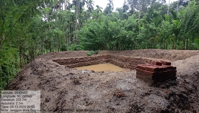
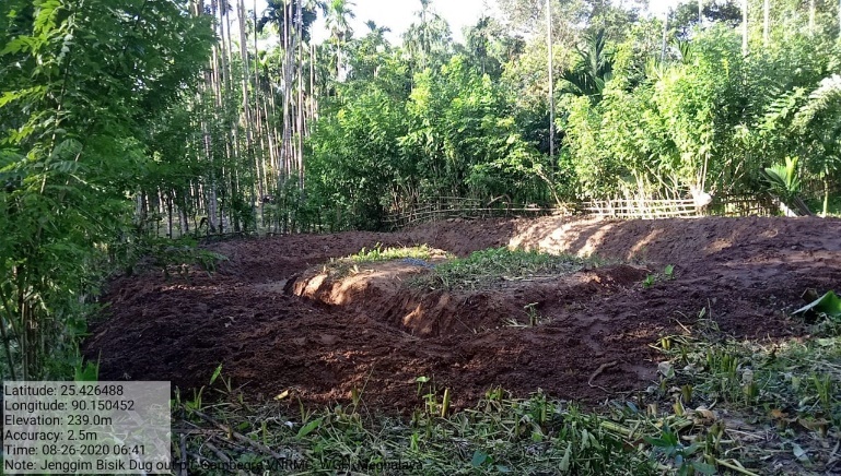
Before After
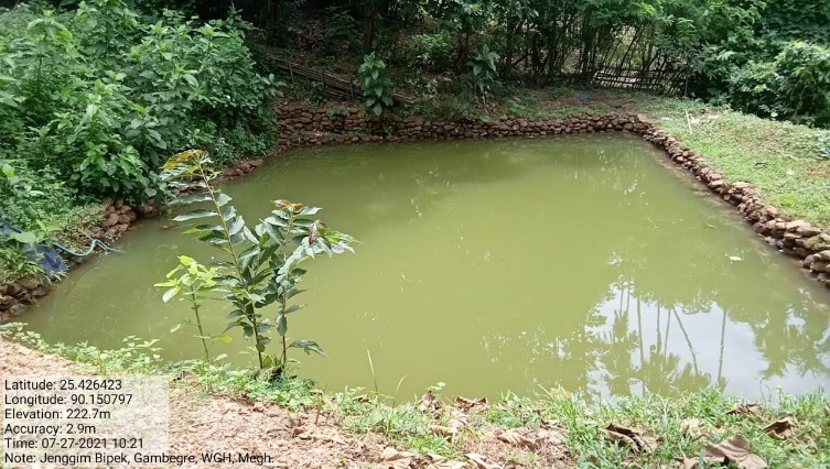
| 8 | Type Of Intervention | Site Name | GPS Co-ordinates | Amount | Work Status |
|---|---|---|---|---|---|
| Dug out pit | Jenggim Bipek | Elevation 88m N 25.42640° E 090.15092° |
Rs.1,16,000 | Completed |
| 9 | Type Of Intervention | Site Name | GPS Co-ordinates | Amount | Work Status |
|---|---|---|---|---|---|
| Spring cha mber | Rongrim Bisik | Elevation 70m N 25.42859° E 090.15440° |
Rs.1,70,500 | Completed |
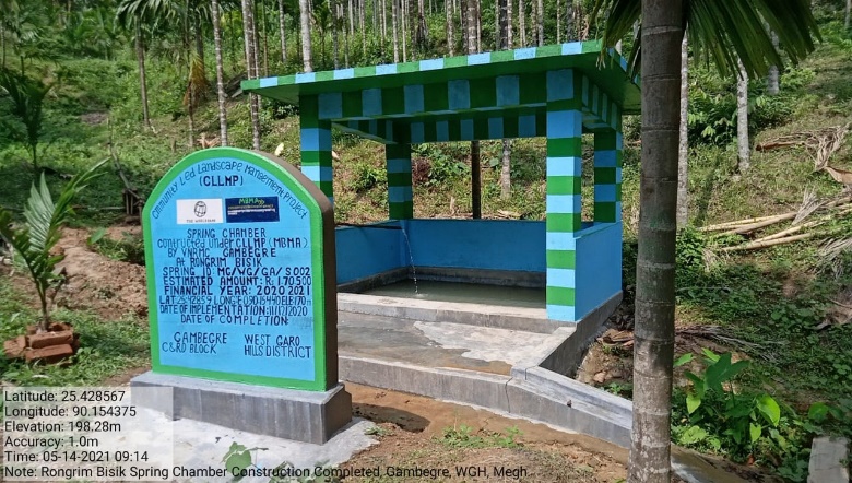
 Before After
| 10 | Type Of Intervention | Site Name | GPS Co-ordinates | Amount | Work Status |
|---|---|---|---|---|---|
| Dug out pond | Dalu Bipek | Elevation 64m N 25.43818° E 090.15297° |
Rs.1,15,000 | Completed |
 Before After
| 11 | Type Of Intervention | Site Name | GPS Co-ordinates | Amount | Work Status |
|---|---|---|---|---|---|
| RCC Check Dam | Chigitchak Chiring | Elevation 65m N 25.43873° E 090.14988° |
Rs.3,39,000 | Completed |
| 12 | Type Of Intervention | Site Name | GPS Co-ordinates | Amount | Work Status |
|---|---|---|---|---|---|
| Plantation | Songgitcham Reserve | Elevation 226m N 25.43357 E 090.15116 |
Rs.1,25,000 | Completed |
| 13 | Type Of Intervention | Site Name | GPS Co-ordinates | Amount | Work Status |
|---|---|---|---|---|---|
| Dug out Pit | Rangsan Amu Chakram | Elevation 177m N 25.42500 E 090.14845 |
Rs.1,15,000 | Completed |
Before After
| 14 | Type Of Intervention | Site Name | GPS Co-ordinates | Amount | Work Status |
|---|---|---|---|---|---|
| Dug out Pit | Wa.sik | Elevation 184m N 25.43114 E 090.15020 |
Rs.1,34,000 | Completed |
 Before After
| 15 | Type Of Intervention | Site Name | GPS Co-ordinates | Amount | Work Status |
|---|---|---|---|---|---|
| Dug out Pit | Rongrim Bipek | Elevation 153m N 25.43034 E 090.15542 | Rs.1,44,000 | Completed |
| 16 | Type Of Intervention | Site Name | GPS Co-ordinates | Amount | Work Status |
|---|---|---|---|---|---|
| Trenches with Plantation | Jamang Chiga-B | Elevation 198m N 25.42764° E 090.14848° |
Rs.41,500 | Completed |
| 17 | Type Of Intervention | Site Name | GPS Co-ordinates | Amount | Work Status |
|---|---|---|---|---|---|
| Trenches with Plantation | Jamang Chikong | Elevation 214m N 25.42814° E 090.14937° |
Rs.31,000 | Completed |
| 18 | Type Of Intervention | Site Name | GPS Co-ordinates | Amount | Work Status |
|---|---|---|---|---|---|
| Roof top rain water harvesting (Additional) | Multi facility building | Elevation 206m N 25.42779 E 90.15166 | Rs. 1,80,000 | Completed |
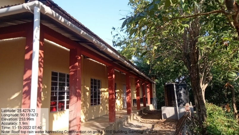
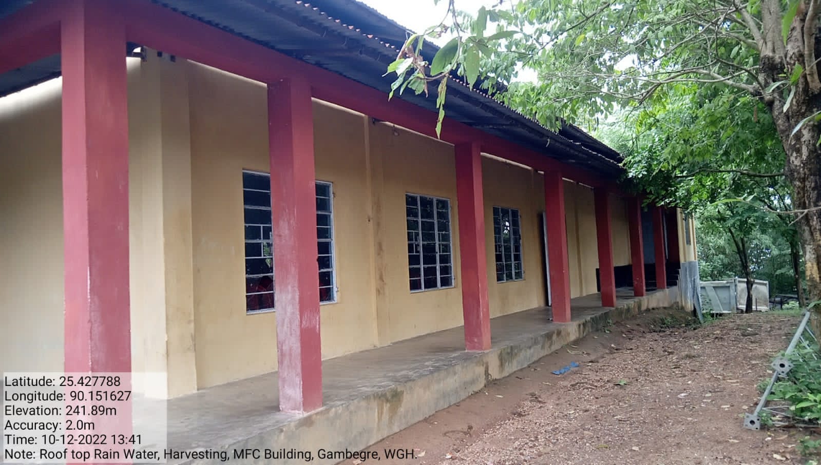 Before After
| 19 | Type Of Intervention | Site Name | GPS Co-ordinates | Amount | Work Status |
|---|---|---|---|---|---|
| Dugout pond (Additional) | Redep (A) | Elevation 151m N 25.42943 E 90.14381 | Rs. 1,60,000 | Completed |
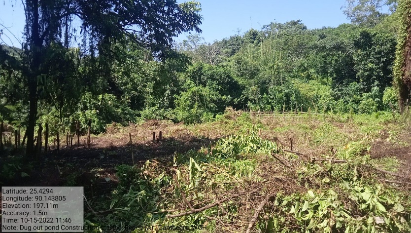 Before After
| 20 | Type Of Intervention | Site Name | GPS Co-ordinates | Amount | Work Status |
|---|---|---|---|---|---|
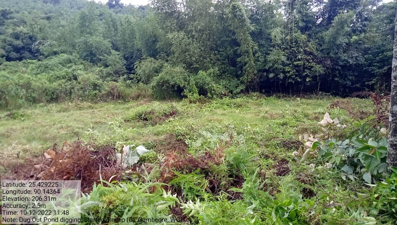
| Dugout pond (Additional) | Redep (B) | Elevation 150m N 25.42927 E 90.14361 | Rs. 1,60,000 | Completed |
Before After 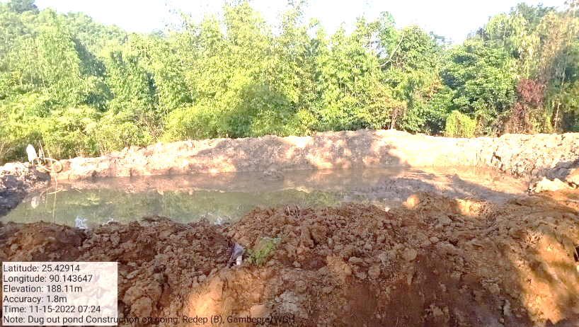
| 21 | Type Of Intervention | Site Name | GPS Co-ordinates | Amount | Work Status |
|---|---|---|---|---|---|
| Permanent Community Nursery (Balance fund) | Gambi Bisik | Elevation 217m N 25.42895 90.15286 | Rs.3,00,000 | Ongoing |