
COMMUNITY LED LANDSCAPE MANAGEMENT PROJECT (CLLMP)
The Government of Meghalaya with financial help from the World Bank is implementing the Meghalaya Community Led Landscape Management Project (MCLLMP). The project covers the entire state of Meghalaya and implementation of community-led plans are rolled out in a phased manner throughout the state. The Meghalaya Basin Management Agency (MBMA) will facilitate community-led planning by providing support, technical inputs and funding.
The project is intended to strengthen community-led natural resources management in selected landscapes within the 7 districts of the state. This would be achieved through a variety of planning, capacity building, and on-the-ground interventions to promote the conservation, sustainable use of natural resources, social inclusion and community mobilization; building traditional knowledge and learning, mapping of natural resources management; strengthening the community institutions and creating linkage with financial institutions and community organizations.
The project interventions will include preparation of community led natural resource management plans. The CLLMP has the following three components:
Strengthening Knowledge and Capacity of Communities for Natural Resources Management
Community-Led Landscape Planning and Implementation
Project Management and Governance
The project objective is “to manage and conserve the natural resources, especially forests, soil and water sources, in a manner that supports the financial and physical well-being of communities in the State”
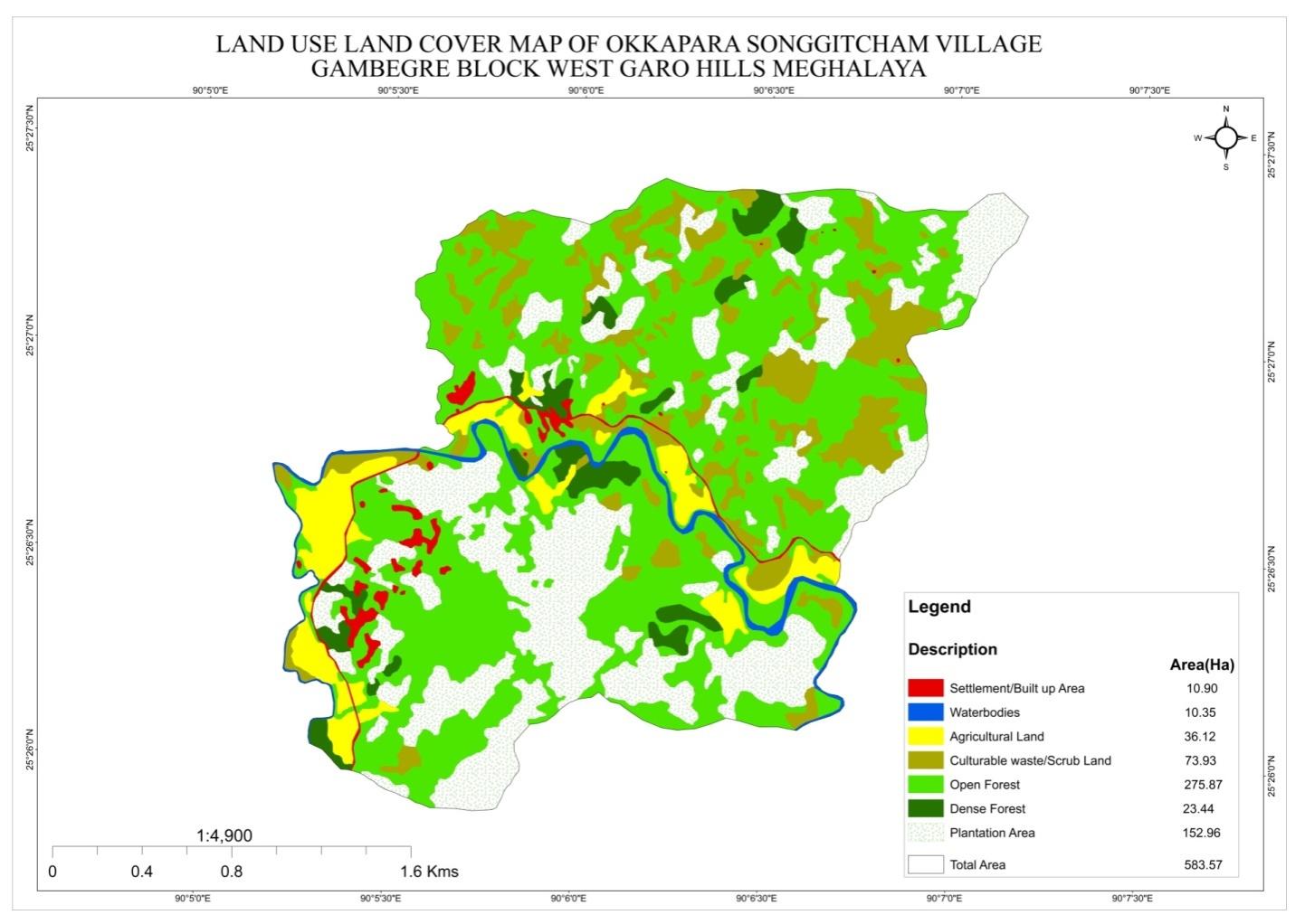
Okkapara Songgitcham Village is situated under the Gambegre C&RD block of West Garo Hills district of Meghalaya. The village is about 7 km from the Gambegre Block office and 20 km from the district Headquarter, Tura. The village is under the traditional land owner of A’king Nokma. The total population and the demographic of both male and female of the village is about 457 with 71 number of households.
The village can be reach through transportation Bus, public vehicle and private cars, with a very limited access to its time to ply. However, these days, many of the community travel to and fro in their private vehicles as well as in their motor bikes.
The Village is about 7Km away from Gambegre Block and 20km away from district headquarter Tura. The public transport facilities to and from village is in Autorikshaw transport, and private vehicle. In respect to the Social Mobilization, it wasn’t that difficult to handle the community of this village as they are active and hardworking. Despite of very less facilities available, community is very keen towards achieving the aims and objectives of CLLMP.
In regards to fuel /LPG /biomass/gas most of the households are using wood and very less access to LPG. The community has few facilities such as education, safe drinking water supply, road and access to medical facilities. The village is under Head of village (Nokma). About 64 households still uses woods for cooking whereas about 7 households use LPG.
Whereas on checking social profile, Okkapara Songgitcham village has total no of 71 households with the total population of 457.Out of which are 241 male and are 216 female. The following is the demographic break up information acquired by the CLLMP team of WGH district.

Okkapara Songgitcham Village is still yet to work towards
development and has lot of Arecanut plantation is including cash
crops followed by black pepper, banana, pineapple, Paddy field etc.
People came to observe and realize that the hill is gradually losing
its soil fertility and water retention properties. There are 64 HH
farmers, and 6 HH are Service and 1 HH entrepreneur.
DPMU team of West Garo Hills visited Okkapara Songgitcham village for Sensitization cum Ground Truthing on 4th Feb, 2020.
The village has 71 HH with 457 population .
Shortage of water March- April and during rainy season ,their water not good for drinking
The village has Community forest
Low soil fertility
No proper drinking water facilities .The village water sources is streams. It has 3 streams and 9 springs and 2 rivers.
No irrigation facilities for farming
The community own water catchment area has about of 0.03 ha
The village has few medicinal herbs and endangered species in forest .
The village has many local tree species such as :-
NATURAL RESOURCES
Boldak, bolbret, Gambare, Sakap, Bolchubret, Tegatchu, tebrong, Belati, Tewek, Chram, Changsim, Golmatra, Ajari, Kilwe, Bolsal, Letchu, Cheeng, Bolchiring, Prap, Gondu, Chambu,Siso, Chaku, Kiring, aritak, Arjun, Gasampe, Dengadoti, Chambu
Chaku, Aritak,Arjun,Cheeng, Tegatchu, Tebrong,Bakwebudu, Terikgalwangbudu,Gasampe, Tepatang, Dengadoti, Chambu are medicinal shrubs/trees etc
Chambu, Bolbret, Bolsal, Gambare, Siso, Boldak, Kilwe are Commercially valued Trees/ Shrubs/Plants available in the forests
Matchaduri, Pangpangsi, ampang are Valuable grasses available in the forests.
The District team of West Garo Hills conducted PRA and CNRM plan at Okkapara Songgitcham Village on the 17th June 2020. Gambegre Block, WGH.
The exercises were conducted by the district team of West Garo Hills. The Team informed the community that PRA exercise is to understand and locate the natural resources of the village and plan the activities according to their need. The community had an exercise to plan and draw resource and social map on the same day.
In the exercise of CNRM plan preparation, the community were asked to prioritized the plan /activities and submit the plan to DPMU for 5 years. The exercises were done in the presence of village headmen, VNRMCs and Village facilitators. There were around 34 participants for the programme.
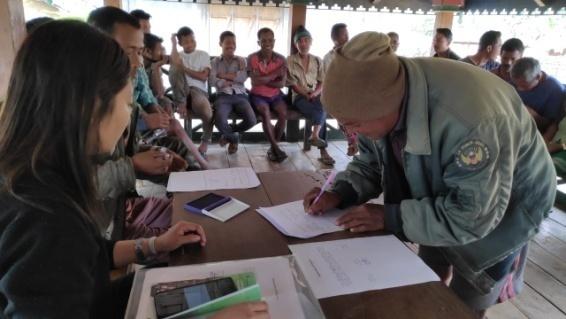
2.0 Signing of Documents:
As an acceptance and agreement to the project, every member of the village households had to sign green charter on 6th March, 2020 and submitted the Village agreement and Expression of Interest to DPMU.
Formation of the VNRMC
On 6th March, 2020 after the ground survey and sensitization
programme, the village signed the EOI, VGA and Green charter as a
sign of accepting the project. Whereas in regards, to the selection
of Village Natural Resource Management Committee (VNRMC) members the
Village Executive Committee (VEC) along with entire community
carried out the process of selecting 15 chosen members such as 9
Executive members, 3 Purchase committee and 3 Village Community
Facilitator.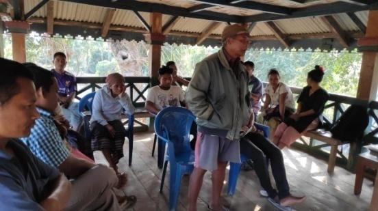
Listed below are the members of the VNRMC:
| Sl No | Name in Full | Gender M/F | Age (in Yrs) | Education | Designation | Occupation | Community | Contact No and email address | |
|---|---|---|---|---|---|---|---|---|---|
| 1 | Markin Ch Marak | M | 51 | Class 3 | President | Farmer | Garo | 9366130385 | |
| 2 | Grenalitha Ch Marak | F | 41 | Class 10 | Secretary | Farmer | Garo | 6002237946 | |
| 3 | Robaline M Sangma | F | 37 | Class 10 | Member | Farmer | Garo | 7005933474 | |
| 4 | Ellingstone Ch Marak | F | M | 33 | Class 12 | Member | Garo | 7005933474 | |
| 5 | Bandilla S Sangma | M | 32 | Class 12 | Member | Garo | 6009079954 | __ | |
| 6 | Pastina S Sangma | F | 24 | Class 10 | Member | Farmer | Garo | 9366453993 | |
| 7 | Rakjilla S Sangma | F | 34 | Class 6 | Member | Farmer | Garo | ||
| 8 | Silsrang Marak | M | 23 | Class 10 | Member | Farmer | Garo | ||
| 9 | Baygerd D Sangma | M | 26 | Class 12 | Book keeper | Farmer | Garo | 6003235537 |
2.3 Village Community Facilitators (VCF)
| Sl No | Name in Full | Gender M/F | Age (Yrs) |
Education | Area of specialisation/ focus (forests, water, soil, accounts, environmental and social safeguards, knowledge management, GIS) | Trained under CLLMP (Yes/ No?) if Yes, date training was received | Contact No and email address |
|---|---|---|---|---|---|---|---|
| 1 | Fhillin S Sangma | M | 29 | Class 10 | M&E | Yes | 9366050522 |
| 2 | Wesber Sangma | M | 27 | Class 10 | NRM&GIS | Yes | 6002780307 |
| 3 | Santinna Ch Marak | F | 22 | Class 12 | SM&KM | Yes | 9366415414 |
Plan Estimate:
The DPMU of WGH made an inspection to the proposed intervention sites soon after the CNRM plan preparation.
|
Implemented Activities | Name of Site | Work Status |
|---|---|---|---|
| 1. |
|
Ringdi Chisam |
|
| 2 | Plantation | Dam Reserve (Du. katchua A.bri) | Completed |
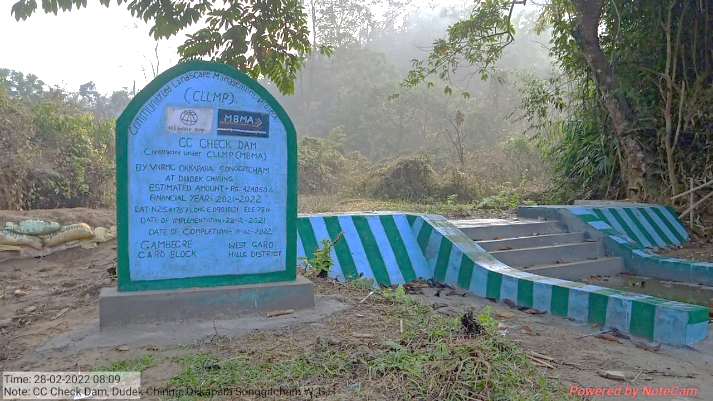
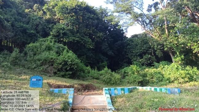
| 3 | CC Check Dam with CC Canal | Mengong Chiring | Completed |
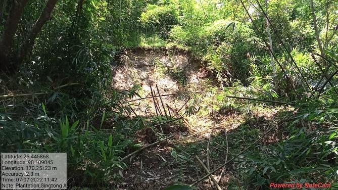
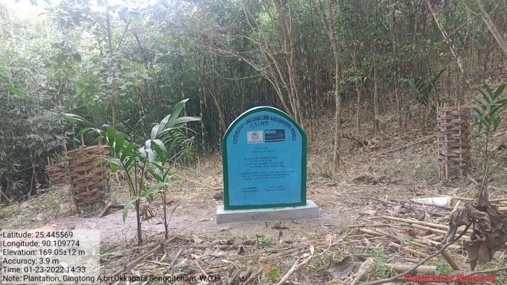
| 4 | Plantation | Gingtong A.bri | Completed |
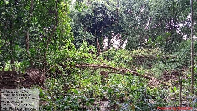
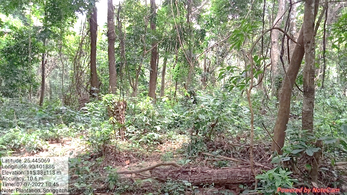
| 5 | Plantation | Songgitcham Reserve1 | Completed |
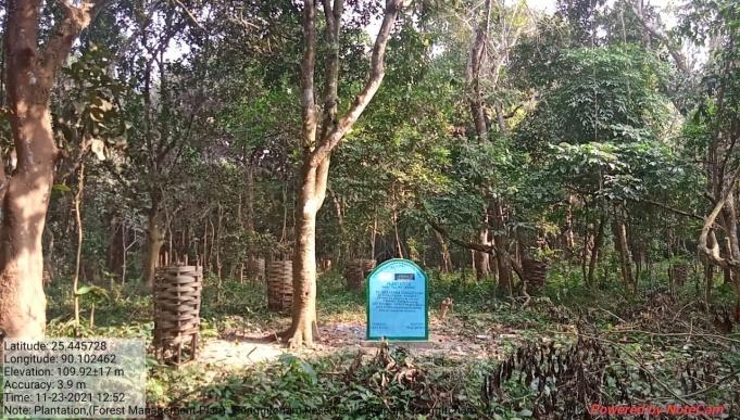
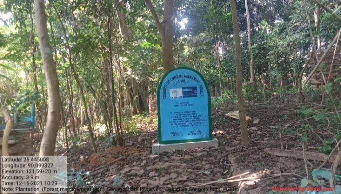
| 6 | Plantation | Songgitcham Reserve-2 | Completed |
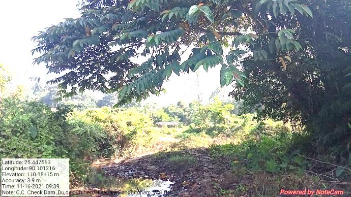
| 7 | CC Check Dam | Dudek Chiring | Completed |
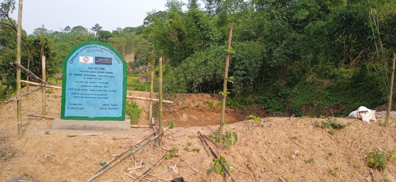
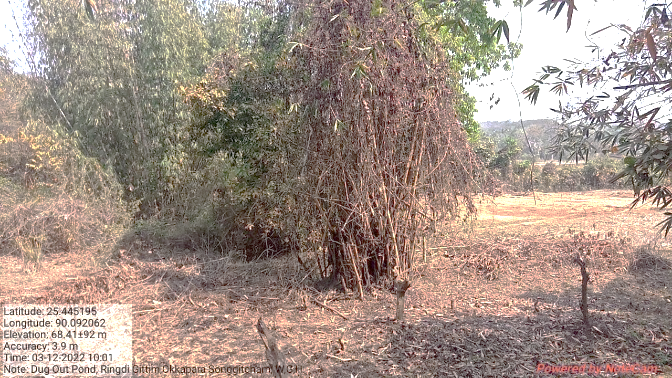
| 8 | Dug out pond | Ringdi Gittim | Completed |
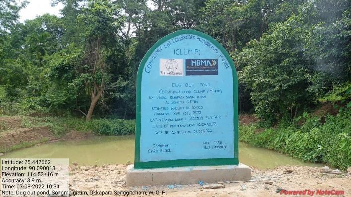
| 9 | Dug out pond | Songma Gittim | Completed |
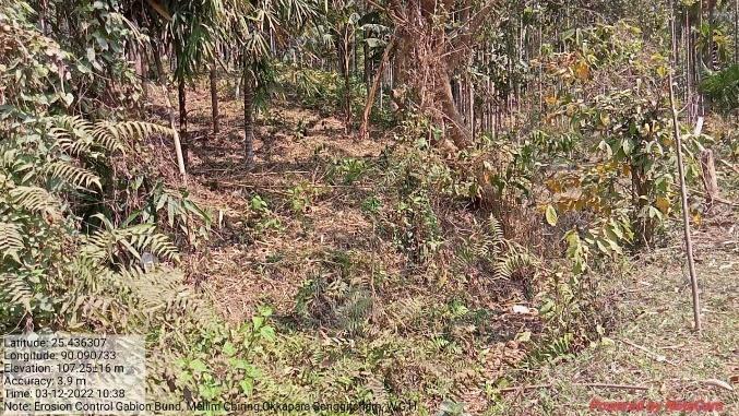
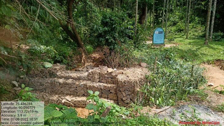
| 10 | Erosion Control Gabion Bund | Mellim Chiring | Completed |
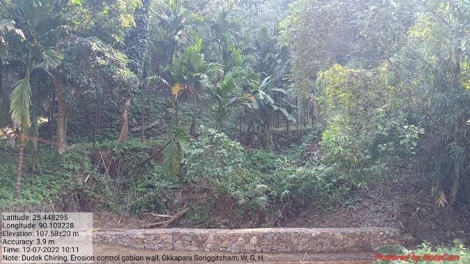
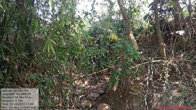
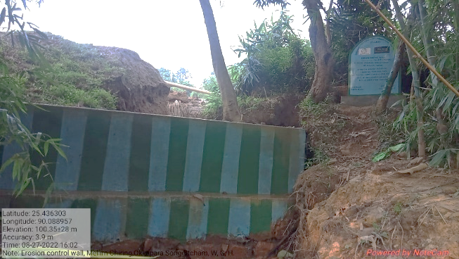
| 11 | Erosion Control Wall | Mellim Chiring | Completed |
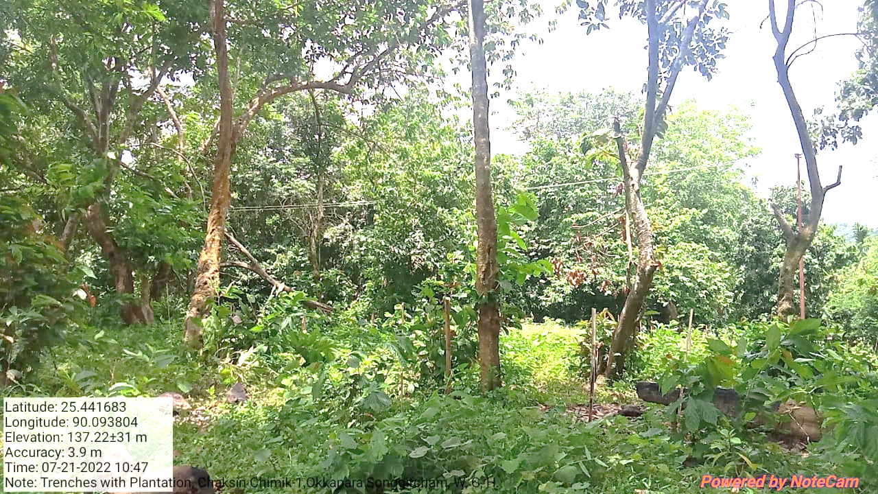
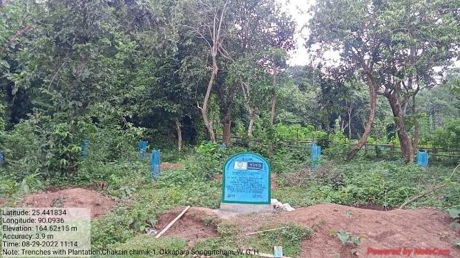
| 12 | Trenches with Plantation | Chaksin chimik-1 | Completed |
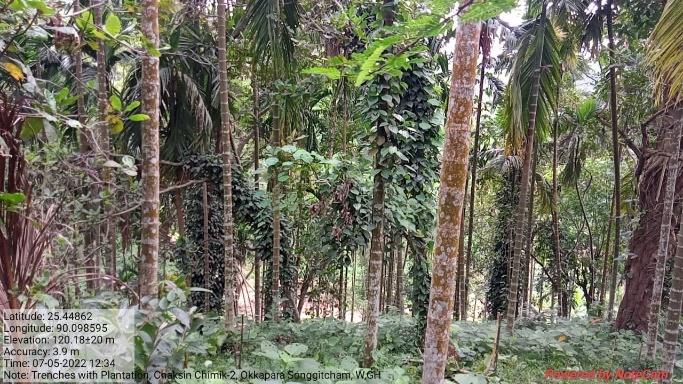
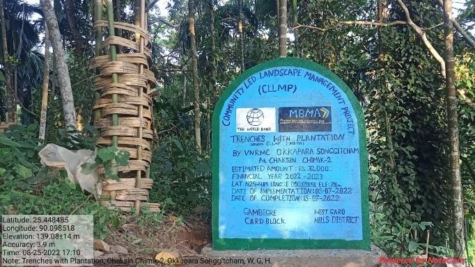
| 13 | Trenches with Plantation | Chaksin chimik-2 | Completed |
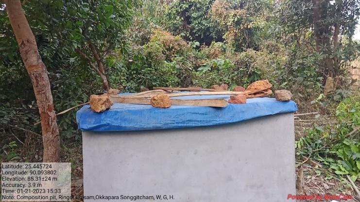
| 14 | Composting pit | Ringdi Chisam | On-going |
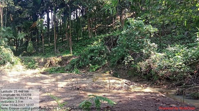
| 15 | Erosion Control Gabion Wall (Additional) | Tegatchu Chiring | On-going |
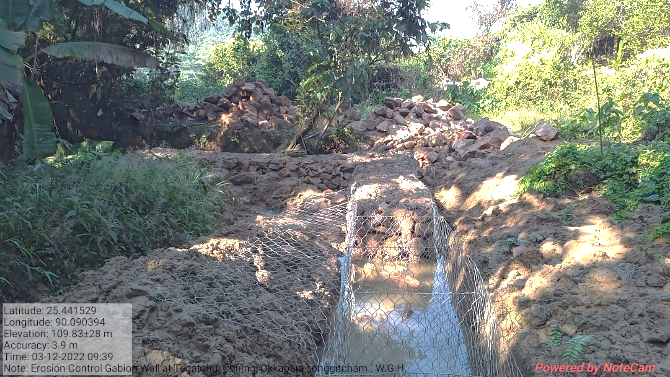
| 16 | Erosion Control Gabion Wall (Additional) | Dudek Chiring | On-going |
4. Fund Status
| 1 | Type Of Intervention | Site Name | GPS Co-ordinates | Amount | Work Status |
|---|---|---|---|---|---|
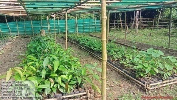
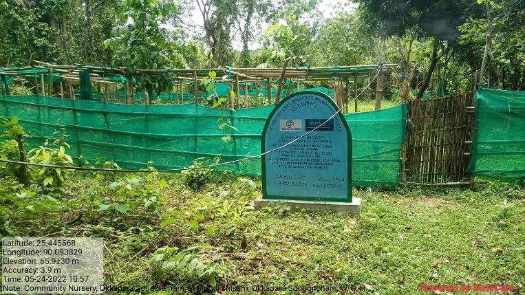
| Community Nursery | Ringdi Chisam | Elevation 63m N 25.44567 E 090.09383 | Rs.1,39,000 | Completed |
| 2 | Type Of Intervention | Site Name | GPS Co-ordinates | Amount | Work Status |
|---|---|---|---|---|---|
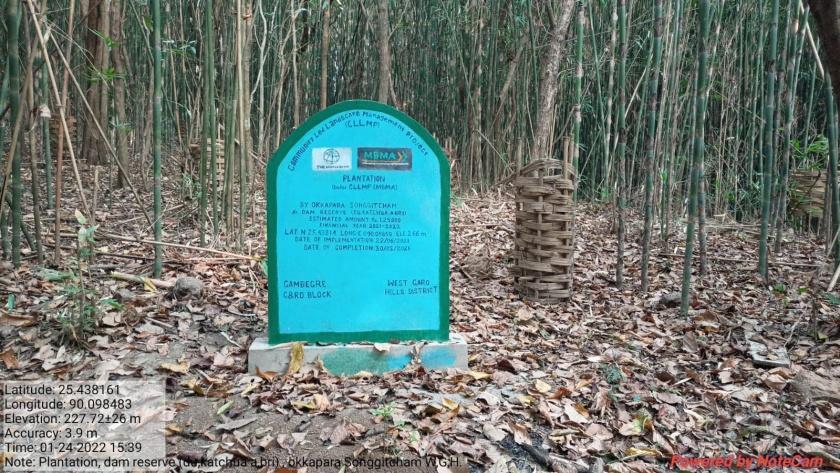
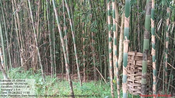
| Plantation | Dam Reserve (Du. katchua A.bri) | Elevation 266m N 25.43814 E 090.09850 | Rs.1,25,000 | Completed |
| 3 | Type Of Intervention | Site Name | GPS Co-ordinates | Amount | Work Status |
|---|---|---|---|---|---|
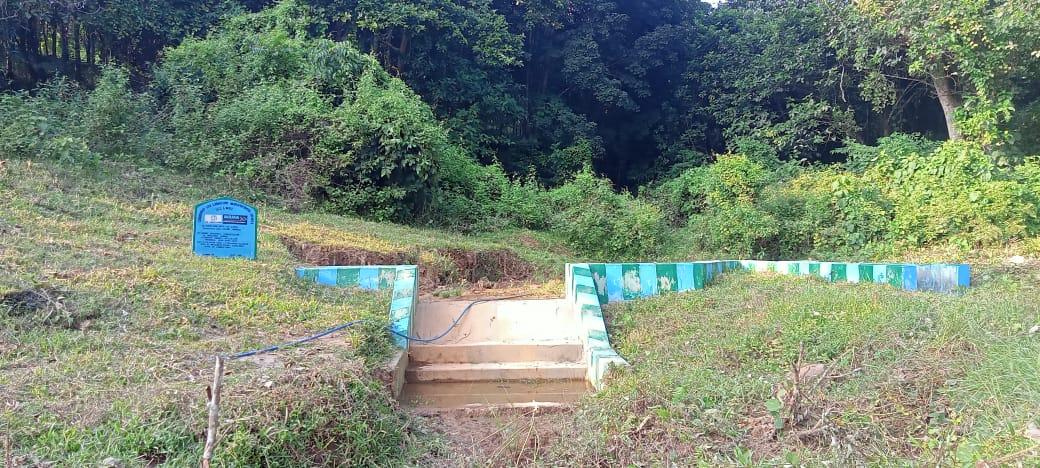
| CC Check Dam with CC Canal | Mengong Chiring | Elevation 80m N 25.44876 E 090.09765 | Rs.2,32,650 | Completed |
| 4 | Type Of Intervention | Site Name | GPS Co-ordinates | Amount | Work Status |
|---|---|---|---|---|---|
| Plantation | Gingtong A.bri | Elevation 161m N 25.44581 E 090.10965 | Rs.1,25,000 | Completed |
Before After
| 5 | Type Of Intervention | Site Name | GPS Co-ordinates | Amount | Work Status |
|---|---|---|---|---|---|
| Plantation | Songgitcham Reserve1 | Elevation 108m N 25.44570 E 090.10266 | Rs.1,25,000 | Completed |
| 6 | Type Of Intervention | Site Name | GPS Co-ordinates | Amount | Work Status |
|---|---|---|---|---|---|
| Plantation | Songgitcham Reserve-2 | Elevation 121m N 25.44489 E 090.09932 | RS.1,25,000 | Completed |
| 7 | Type Of Intervention | Site Name | GPS Co-ordinates | Amount | Work Status |
|---|---|---|---|---|---|
| CC Check Dam | Dudek Chiring | Elevation 78m N 25.44757 E 090.10121 | Rs.4,24,050 | Completed |
Before After
| 8 | Type Of Intervention | Site Name | GPS Co-ordinates | Amount | Work Status |
|---|---|---|---|---|---|
| Dug out pond | Ringdi Gittim | Elevation 45m N 25.44540 E 090.09227 | Rs.90,000 | Completed |
Before After
| 9 | Type Of Intervention | Site Name | GPS Co-ordinates | Amount | Work Status |
|---|---|---|---|---|---|
| Dug out pond | Songma Gittim | Elevation 49m N 25.44263 E 090.09019 | Rs.90,000 | Completed |
Before After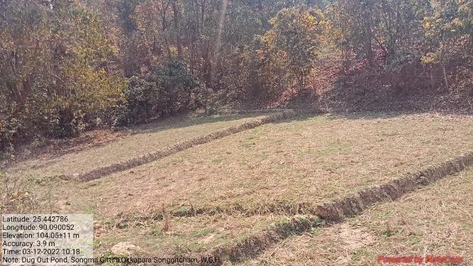
| 10 | Type Of Intervention | Site Name | GPS Co-ordinates | Amount | Work Status |
|---|---|---|---|---|---|
| Erosion Control Gabion Bund | Mellim Chiring | Elevation 73m N 25.43640 E 090.09083 | Rs.2,09,300 | Completed |
Before After
| 11 | Type Of Intervention | Site Name | GPS Co-ordinates | Amount | Work Status |
|---|---|---|---|---|---|
| Erosion Control Wall | Mellim Chiring | Elevation 55m N 25.43641 E 090.08901 |
Rs.3,60,000 | Completed |
Before After
| 12 | Type Of Intervention | Site Name | GPS Co-ordinates | Amount | Work Status |
|---|---|---|---|---|---|
| Trenches with Plantation | Chaksin chimik-1 | Elevation 113m N 25.44154 E 090.09341 | Rs.29,000 | Completed |
Before After
| 13 | Type Of Intervention | Site Name | GPS Co-ordinates | Amount | Work Status |
|---|---|---|---|---|---|
| Trenches with Plantation | Chaksin chimik-2 | Elevation 88m N 25.44859 E 090.09858 |
Rs.32,000 | Completed |
Before After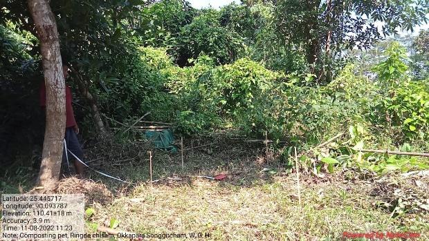
| 14 | Type Of Intervention | Site Name | GPS Co-ordinates | Amount | Work Status |
|---|---|---|---|---|---|
| Composting pit | Ringdi Chisam | Elevation 108m N 25.44565 E 090.09409 | Rs.49,000 | On-going |
Before After
| 15 | Type Of Intervention | Site Name | GPS Co-ordinates | Amount | Work Status |
|---|---|---|---|---|---|
| Erosion Control Gabion Wall (Additional) | Tegatchu Chiring | Elevation 76M N25.44156 E 90.09028 | Rs.230,000 | On-going |
Before After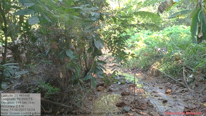
| 16 | Type Of Intervention | Site Name | GPS Co-ordinates | Amount | Work Status |
|---|---|---|---|---|---|
| Erosion Control Gabion Wall (Additional) | Dudek Chiring | Elevation 54m N 25.44830 E 90.10329 | Rs.270,000 | On-going |
Before After