
COMMUNITY LED LANDSCAPE MANAGEMENT PROJECT (CLLMP)
The Government of Meghalaya with financial help from the World Bank is implementing the Meghalaya Community Led Landscape Management Project (MCLLMP). The project covers the entire state of Meghalaya and implementation of community-led plans are rolled out in a phased manner throughout the state. The Meghalaya Basin Management Agency (MBMA) will facilitate community-led planning by providing support, technical inputs and funding.
The project is intended to strengthen community-led natural resources management in selected landscapes within the 7 districts of the state. This would be achieved through a variety of planning, capacity building, and on-the-ground interventions to promote the conservation, sustainable use of natural resources, social inclusion and community mobilization; building traditional knowledge and learning, mapping of natural resources management; strengthening the community institutions and creating linkage with financial institutions and community organizations.
The project interventions will include preparation of community led natural resource management plans. The CLLMP has the following three components:
Strengthening Knowledge and Capacity of Communities for NaturalResources Management
Community-Led Landscape Planning and Implementation
Project Management and Governance
The project objective is “to manage and conserve the natural resources, especially forests, soil and water sources, in a manner that supports the financial and physical well-being of communities in the State”
Rimrangpara is one of the villages that falls under Dalu Block in West Garo Hills district of Meghalaya. The village is under A’ king Nokma and is surrounded by Gambegre Block towards North, Gasuapara Block towards East, Tura Block towards North, Ziizika Block towards west. It is located 27 KM from Block office Dalu, around 35 kilometres from Tura and approx.360 Kilometres from State capital Shillong.
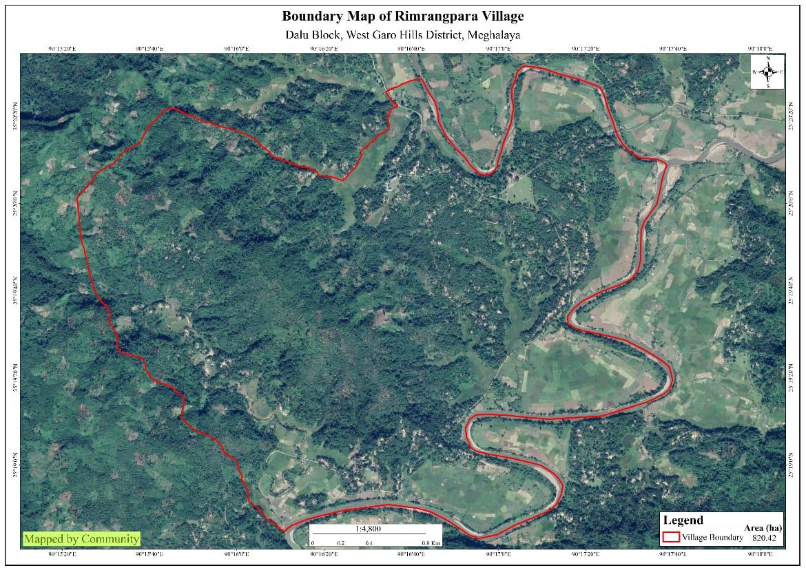
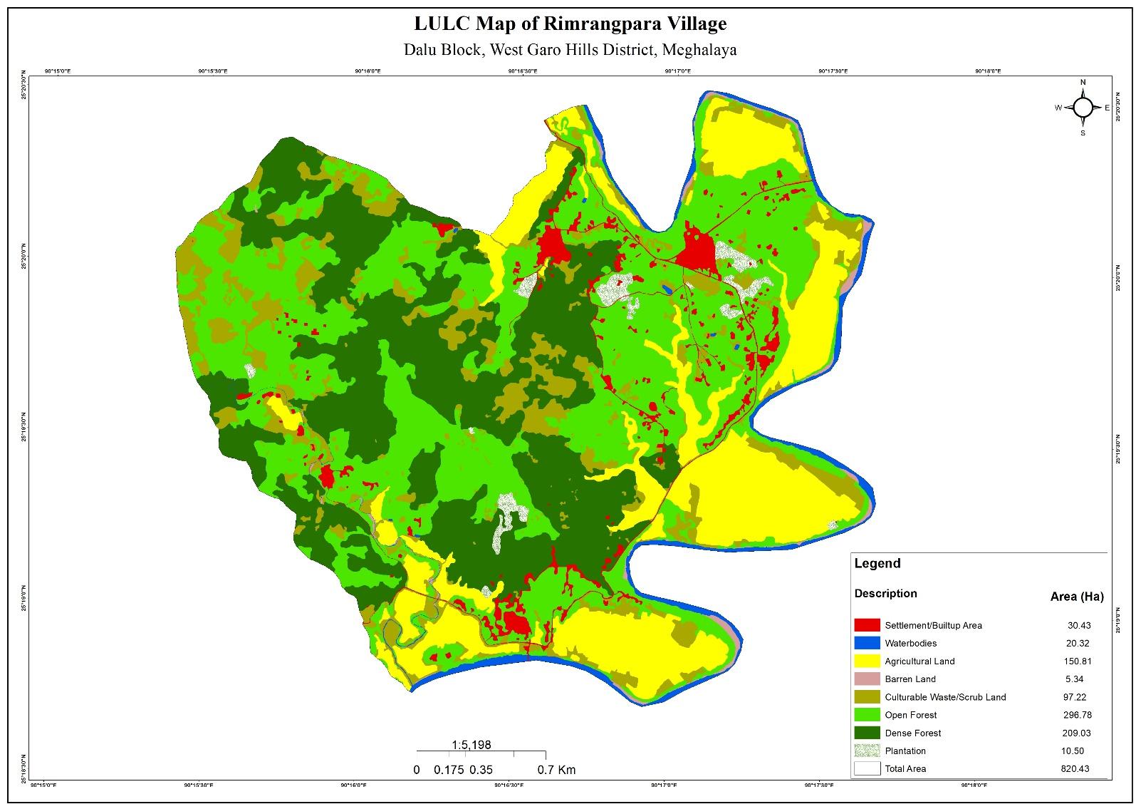
Tura is the nearest town and kerapara is the nearest local market for the community to buy their weekly/monthly ration. Rimrangpara being one of the biggest villages in area wise with 820.42 ha and it’s degraded with no forest cover as seen in the map below.
Rimrangpara village is the land of Aking Nokma, established in the year 1835. The community inhabiting the village from 1835 till now are Garos with the total population of 518 that is of 90 households. The village is situated 27 km away from the block Headquarter and 35 km from district headquarter Office but there are good number of public transport such as bus and winger plying from village to the block offices and to and fro from Tura to Dalu. There are also people who prefer to travel by their private vehicles as well.
When it comes to use of fuel /LPG /biomass/gas most of the households are using Woods and very less access to LPG. The community has few facilities such as education, safe drinking water supply, road and access to medical facilities. The village is under Head of village (Nokma).
In regards to social profile, Rimrangpara village has total no of 90 households with the total population of 518. Out of which are 251males and 267 are females.
The following is the demographic break up information acquired by the CLLMP team of


The community of Rimrangpara village are into farming and cultivation of cash crops. There are around 43.4 ha that is used for agriculture and horticulture purpose. Even though there are many farmers, there are people who are working as primary school teachers and into police force as well.


On the 5th Dec 2018, the district team visited the village for
Ground truthing and sensitization programme. During the programme
the community were sensitized on the objectives of the project and
its activities under the project. During the same day, there was a
discussion causes related to the degradation of land and the sources
of water supply in the village. 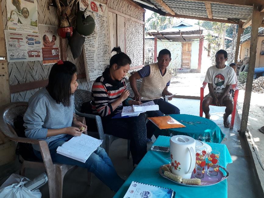
Also there was a brief explanation on the formation of VNRMC, Village facilitators, opening of bank accounts and the preparation of plans and interventions.
There were around 30 participants attended the programme comprising of village elders, headmen, VEC secretary, including women groups, youths CLLMP Assistant Managers - Environment, Social and M&E.
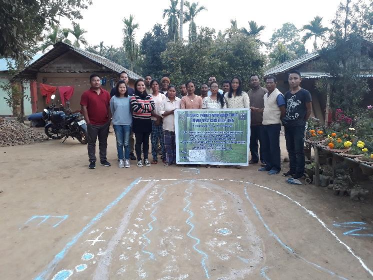 On
the 31st January, 2019, the District team of West Garo
Hills conducted PRA and CNRM plan at Rimrangpara Village, Dalu
Block, WGH.
On
the 31st January, 2019, the District team of West Garo
Hills conducted PRA and CNRM plan at Rimrangpara Village, Dalu
Block, WGH.
During the exercise the community was being informed that PRA exercise is mainly to understand and locate the natural resources of the village and degraded land to identify and work on the activities. The community had an exercise to draw resource and the social map on the same.
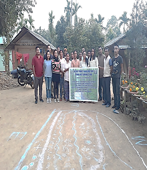 Whereas,
during the CNRM plan preparation the community were told to plan the
activities for 5 long years and submit the plan it to the DPMU
prioritizing the list. In the exercise, village headmen, VNRMCs and
Village facilitators joined to complete the task. There were around
30 people participated for the exercise.
Whereas,
during the CNRM plan preparation the community were told to plan the
activities for 5 long years and submit the plan it to the DPMU
prioritizing the list. In the exercise, village headmen, VNRMCs and
Village facilitators joined to complete the task. There were around
30 people participated for the exercise.
They have reserve forest
Low soil fertility. Most of them plants are cantus , Cashewnut and rubber plantation
Habitation of abandon forest – It was a sacred grove however they do not maintain
Signing of Documents
Formation of the VNRMC
On the same day i.e. 5th January, 2019, the community had a meeting to select VNRMC members, Executive members, Village facilitators and purchase committee who are the representatives from VEC, SHG and other village functionaries in front of the DPMU staffs.
Listed below are the members of the VNRMC:
| Sl No | Name in Full | Gender M/F | Age (in Yrs) | Education | Designation | Occupation | Community | Contact No and email address |
|---|---|---|---|---|---|---|---|---|
| 1 | Rajen D Marak | M | 42 | HSSLC | Chairman | Farmer | Garo | 8787833426 |
| 2 | Edhin Ch Momin | F | 24 | Class 10 | Secretary | Farmer | Garo | 8414844085 |
| 3 | Christberth D Sangma | M | 27 | Class 10 | Member | Farmer | Garo | - |
| 4 | Baliston D Sangma | M | 36 | Class 7 | Member | Farmer | Garo | - |
| 5 | Metalson D Marak | M | 38 | Class 10 | Member | Farmer | Garo | 9366374348 |
| 6 | Awith D Marak | M | 33 | Class 6 | Member | Farmer | Garo | 9366940538 |
| 7 | Munira D Marak | F | 27 | Class 10 | Member | Farmer | Garo | 9366817574 |
| 8 | Singmera D Marak | F | 21 | Class 9 | Member | Farmer | Garo | 6300978240 |
| Chingkera D Marak | F | 22 | Class 10 | Member | Farmer | Garo | - |
Village Community Facilitators (VCF)
| Sl No | Name in Full | Gender M/F | Age (Yrs) |
Education | Area of specialisation/ focus (forests, water, soil, accounts, environmental and social safeguards, knowledge management, GIS) | Trained under CLLMP (Yes/ No?) if Yes, date training was received | Contact No and email address |
|---|---|---|---|---|---|---|---|
| 1 |
|
|
|
|
|
|
|
| 2 |
|
|
|
|
|
yes |
|
| 3 | Naitina Ch Momin |
|
|
|
|
yes | 8837042403 |
Plan Estimate:
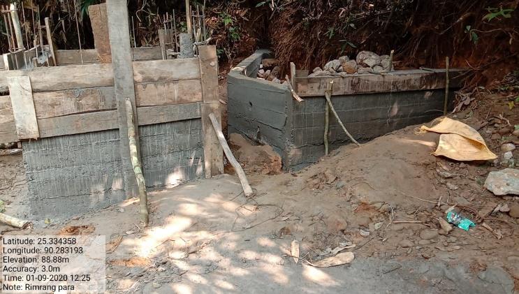
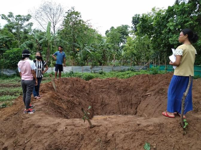
The DPMU of WGH made an inspection to the proposed intervention sites soon after the CNRM plan preparation.
|
Implemented Activities | Name of Site | Work Status |
|---|---|---|---|
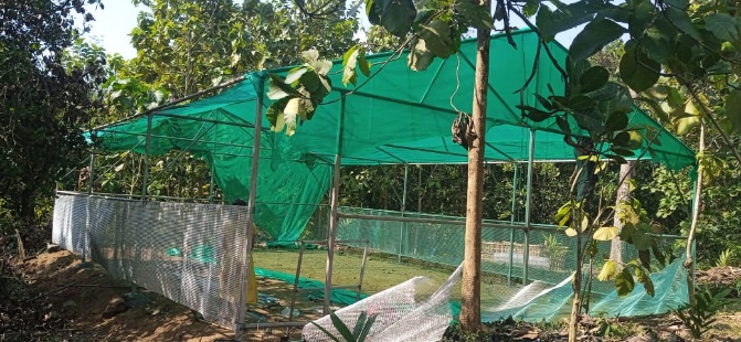
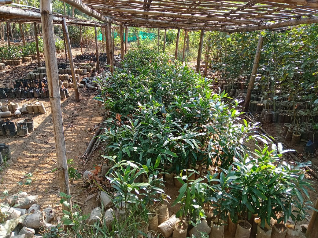
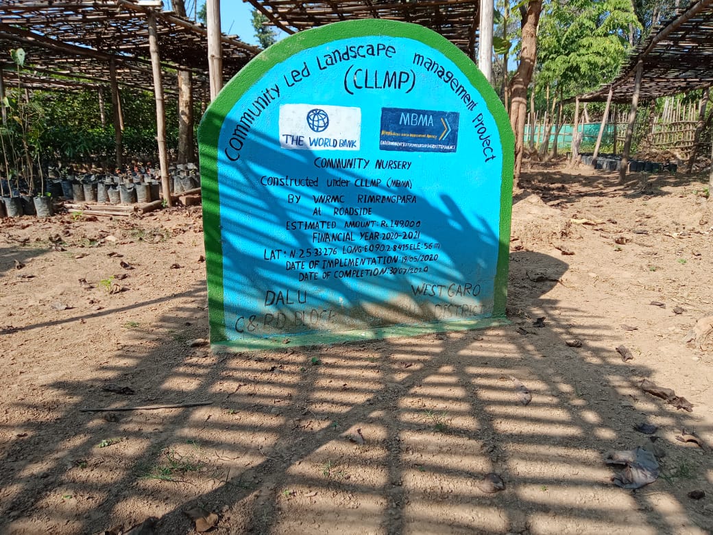
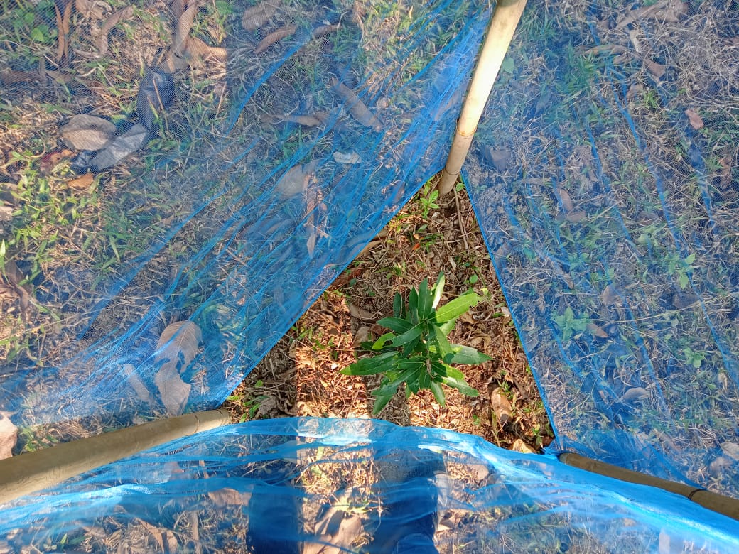
| 1. | Community Nursery | Roadside | Completed |
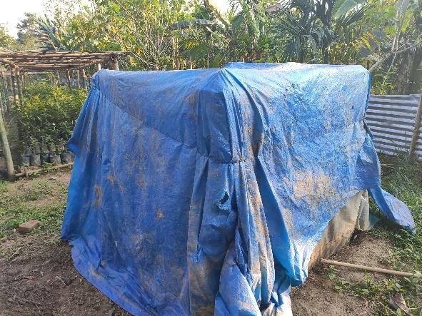
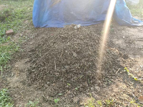
| 2. | 18 Days Composting | Roadside Near Nursery | Completed |
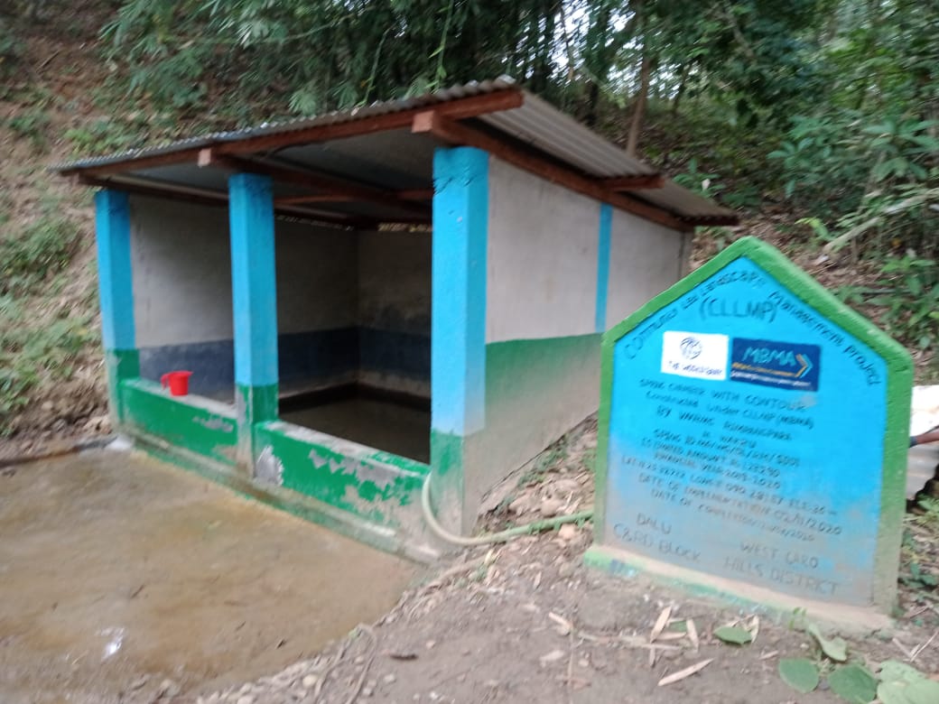
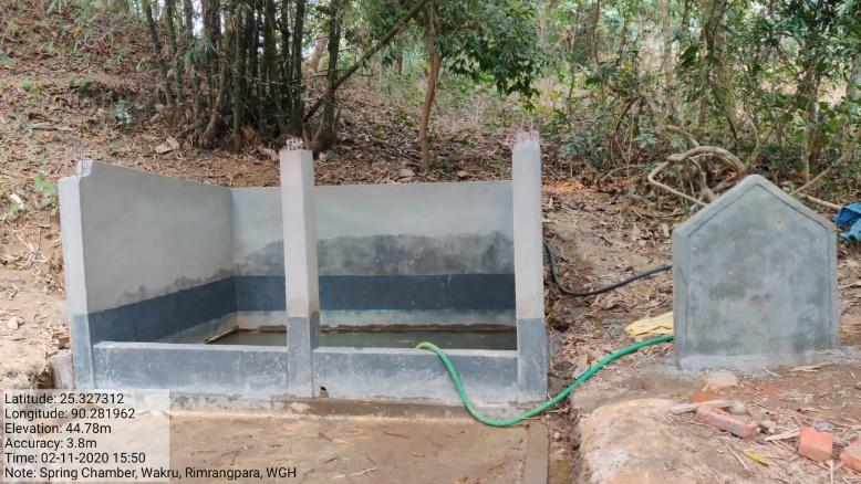
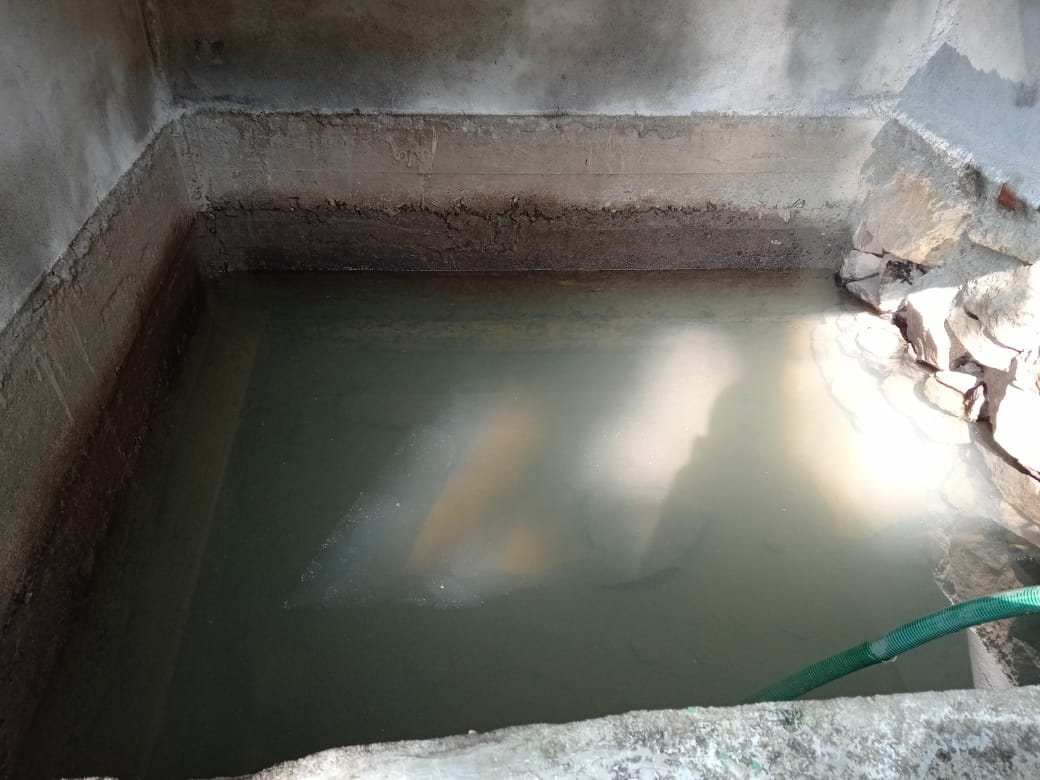
| 3. | Spring Chamber with Contour | Wakru | Completed |
| 4. | Spring Chamber with Storage Tank | Matia | Completed |
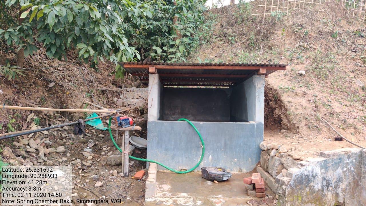
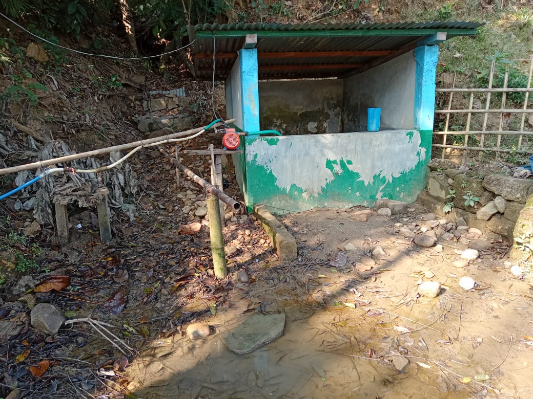
| 5. | Spring Chamber with Gully plug and recharge contour | Bakla | Completed |
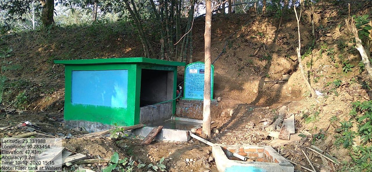
| 6. | Spring Chamber with Filter Tank | Walseng Gittim | Completed |
| 7. | Jalkund | Roadside near Nursery | Completed |
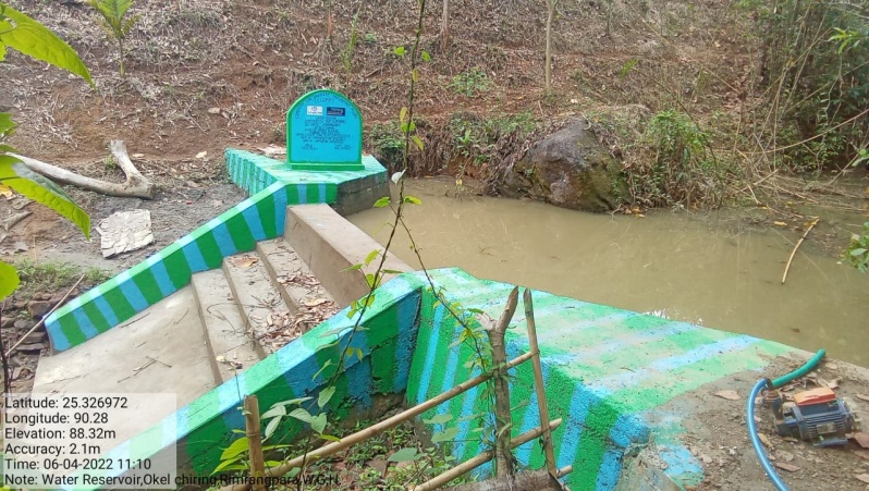
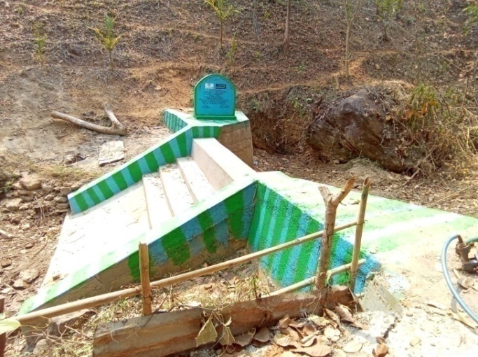
| 8. | Water Reservoir | Okel Chiring | Completed |
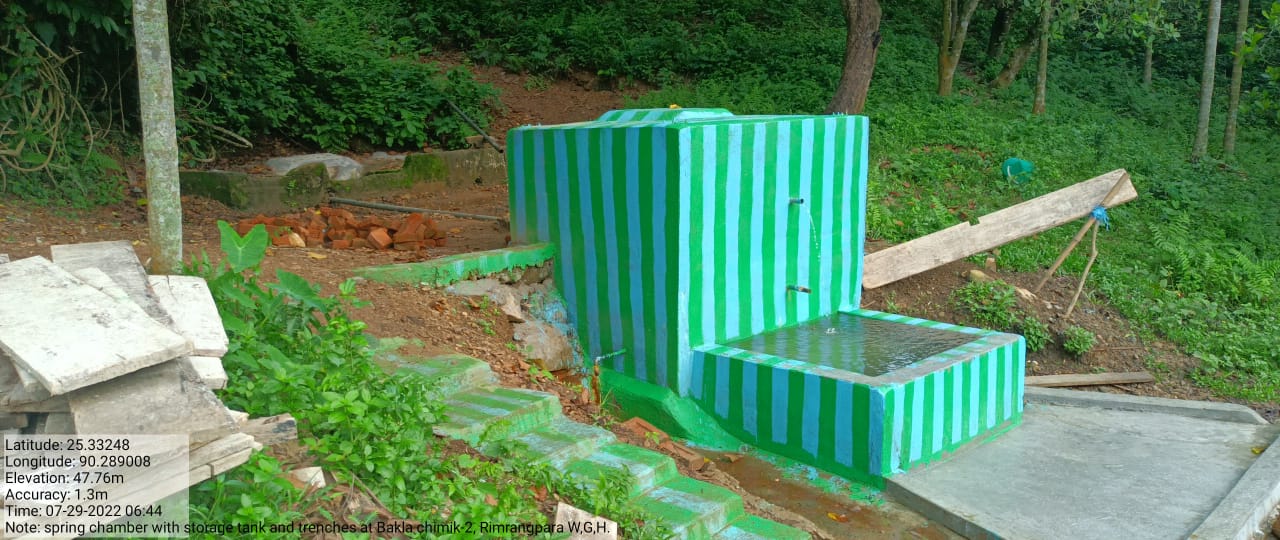
| 9. | Spring chamber with storage tank and trenches | Bakla-2 | Completed |
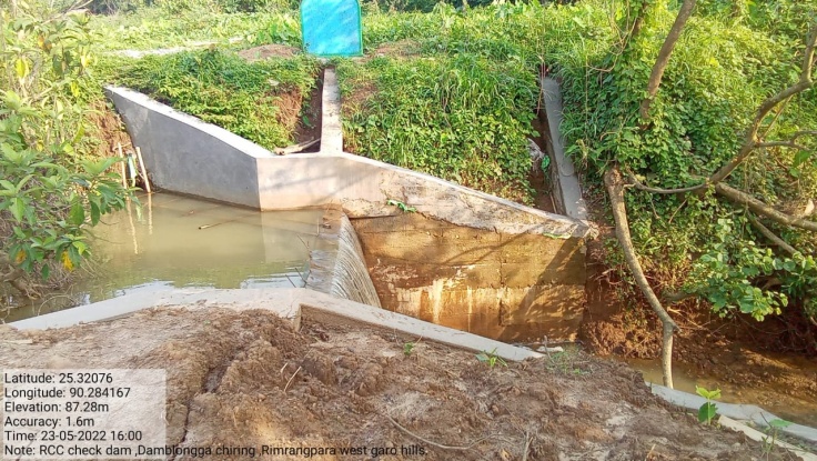
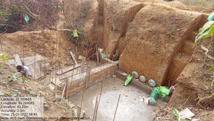
| 10. | RCC Check Dam | Dambilonga Chiring | Completed |
| 11. | Plantation | Dagi Lake | Completed |
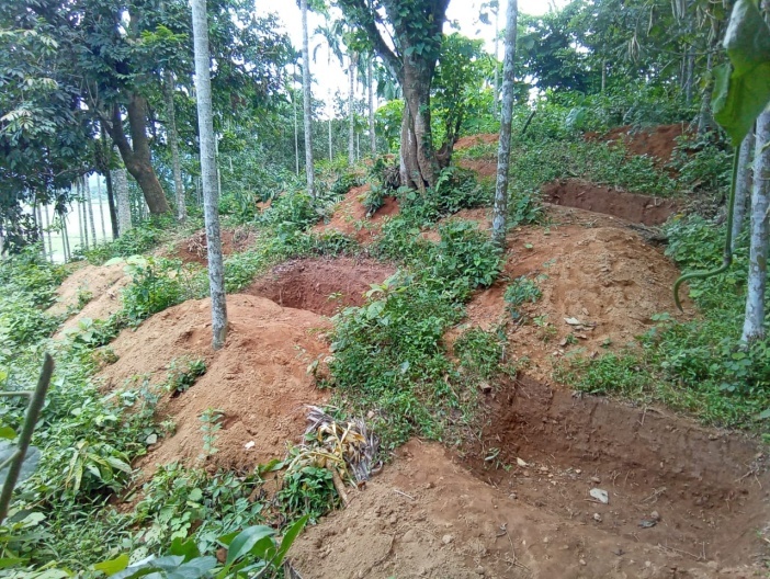
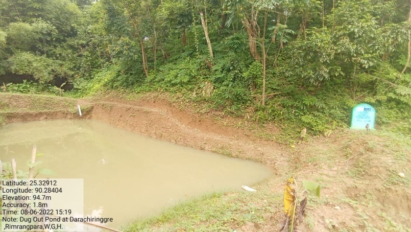
| 12. | Dug out Pond | Darachiringgre | Completed |
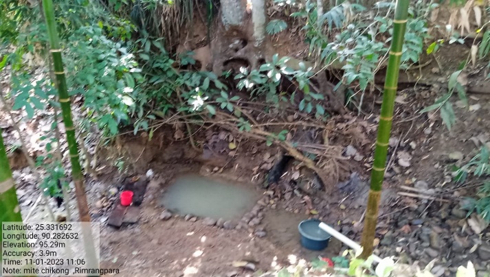
| 13. | Spring Chamber (Additional) | Mite Chikong | |
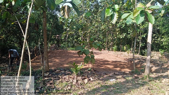
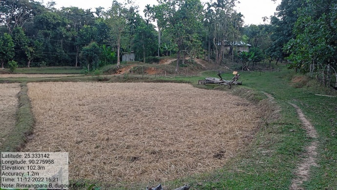
| 14. | Dug out pond (Additional) | Rimrangpara B | On-going |
| 15. | Permanent Community Nursery(Balance fund) | Rajen Compound | Completed |
4. Fund Status
| 1 | Type Of Intervention | Site Name | GPS Co-ordinates | Amount | Work Status |
|---|---|---|---|---|---|
| Community Nursery | Roadside | Elevation 56m N 25.33276 E 090.28415 |
Rs.1,49,000 | Completed |
| 2 | Type Of Intervention | Site Name | GPS Co-ordinates | Amount | Work Status |
|---|---|---|---|---|---|
| 18 Days Composting | Roadside Near Nursery | Elevation 56m N 25.33276 E 090.28415 |
Rs.33,000 | Completed |
| 3 | Type Of Intervention | Site Name | GPS Co-ordinates | Amount | Work Status |
|---|---|---|---|---|---|
| Spring Chamber with Contour | Wakru | Elevation 36m N 25.32733° E 090.28187° |
Rs.1,23,290 | Completed |
| 4 | Type Of Intervention | Site Name | GPS Co-ordinates | Amount | Work Status |
|---|---|---|---|---|---|
| Spring Chamber with Storage Tank | Matia | Elevation 52m N 25.33440° E 090.28326° |
Rs1,18,300 | Completed |
| 5 | Type Of Intervention | Site Name | GPS Co-ordinates | Amount | Work Status |
|---|---|---|---|---|---|
| Spring Chamber with Gully plug and recharge contour | Bakla | Elevation 43m N 25.33167 E 090.28895 |
Rs.1,16,460 | Completed |
| 6 | Type Of Intervention | Site Name | GPS Co-ordinates | Amount | Work Status |
|---|---|---|---|---|---|
| Spring Chamber with Filter Tank | Walseng Gittim | Elevation 46m N 25.33206 E 090.28339 | Rs1,97,500 | Completed |
| 7 | Type Of Intervention | Site Name | GPS Co-ordinates | Amount | Work Status |
|---|---|---|---|---|---|
| Jalkund | Roadside near Nursery | Elevation 56m N 25.33276 E 090.28415 | Rs.28,000 | Completed |
| 8 | Type Of Intervention | Site Name | GPS Co-ordinates | Amount | Work Status |
|---|---|---|---|---|---|
| Water Reservoir | Okel Chiring | Elevation 40m N 25.32697 E 090.27998 |
Rs.4,15,000 | Completed |
| 9 | Type Of Intervention | Site Name | GPS Co-ordinates | Amount | Work Status |
|---|---|---|---|---|---|
| Spring chamber with storage tank and trenches | Bakla-2 | Elevation 49m N 25.33259 E 090.28893 |
Rs.2,42,000 | Completed |
| 10 | Type Of Intervention | Site Name | GPS Co-ordinates | Amount | Work Status |
|---|---|---|---|---|---|
| RCC Check Dam | Dambilongga Chiring | Elevation 33m N 25.32079 E 090.28424 | Rs.4,92,000 | Completed |
| 11 | Type Of Intervention | Site Name | GPS Co-ordinates | Amount | Work Status |
|---|---|---|---|---|---|
| Plantation | Dagi Lake | Elevation 99m N 25.33347 E 090.28327 |
Rs.1,25,000 | Completed |
| 12 | Type Of Intervention | Site Name | GPS Co-ordinates | Amount | Work Status |
|---|---|---|---|---|---|
| Dug out Pond | Darachiringgre | Elevation 91m N 25.32916 E 90.28396 | Rs.1,15,450 | Completed |
| 13 | Type Of Intervention | Site Name | GPS Co-ordinates | Amount | Work Status |
|---|---|---|---|---|---|
| Spring Chamber (Additional) | Mite Chikong | Elevation 44m N 25.33165 E 90.28270 | Rs.350,000 | On-going |
| 14 | Type Of Intervention | Site Name | GPS Co-ordinates | Amount | Work Status |
|---|---|---|---|---|---|
| Dug out pond (Additional) | Rimrangpara B | Elevation 80m N 25.33291 E 90.27622 | Rs.150,000 | On-going |
| 15 | Type Of Intervention | Site Name | GPS Co-ordinates | Amount | Work Status |
|---|---|---|---|---|---|
| Permanent Community Nursery (Balance fund) | Rajen Compound | Elevation 92m N 25.32909 E 90.28681 | Rs.300,000 | Completed |