
COMMUNITY LED LANDSCAPE MANAGEMENT PROJECT (CLLMP)
The Government of Meghalaya with financial help from the World Bank is implementing the Meghalaya Community Led Landscape Management Project (MCLLMP). The project covers the entire state of Meghalaya and implementation of community-led plans are rolled out in a phased manner throughout the state. The Meghalaya Basin Management Agency (MBMA) will facilitate community-led planning by providing support, technical inputs and funding.
The project is intended to strengthen community-led natural resources management in selected landscapes within the 7 districts of the state. This would be achieved through a variety of planning, capacity building, and on-the-ground interventions to promote the conservation, sustainable use of natural resources, social inclusion and community mobilization; building traditional knowledge and learning, mapping of natural resources management; strengthening the community institutions and creating linkage with financial institutions and community organizations.
The project interventions will include preparation of community led natural resource management plans. The CLLMP has the following three components:
Strengthening Knowledge and Capacity of Communities for Natural Resources Management
Community-Led Landscape Planning and Implementation
Project Management and Governance
The project objective is “to manage and conserve the natural resources, especially forests, soil and water sources, in a manner that supports the financial and physical well-being of communities in the State”
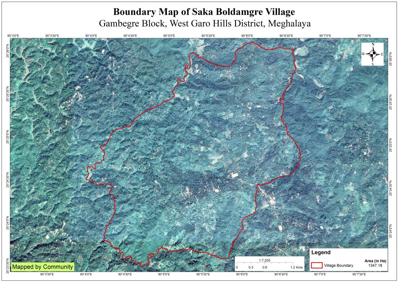
Saka Boldamgre village is situated under the Gambegre C&RD block of West Garo Hills district of Meghalaya. The village is about 8 km from the Gambegre Block and 36 km from the district Headquarter, Tura. The village is under the traditional land owner of A’king Nokma. The total population and the demographic of both male and female of the village is about 417 with 129 number of household. Total geographical area of the village is around 1347.18ha 13.4718 Sq. Km.
The village can be reach through transportation buses with a very limited access to its time to ply. However these days, many of the community travel to and fro on public bus, pick-up and sumo and also in their private vehicles as well as in their motor bikes.
The Village is about 8Km away from Gambegre Block and 36km away from district headquarter Tura. The public transport facilities to and from village is in Auto rickshaw public transport, and private vehicle. In respect to the Social Mobilization, it wasn’t that difficult to handle the community of this village as they are active and hardworking. Despite of very less facilities available, the community are very keen towards achieving the aims and objectives of CLLMP.
When it comes to use of fuel /LPG /biomass/gas most of the households are using Woods and very less access to LPG. The community has few facilities such as education, safe drinking water supply, road and access to medical facilities. The village is under Head of village (Nokma).
In regards to social profile, Saka Boldamgre village has total no of 129 households with the total population of 417. Out of which are 208 males and 209 are females.
The following is the demographic break up information acquired by the CLLMP team of WGH district.

Saka Boldamgre village are still into farming which includes agriculture and multi cropping. Unlike any other village’s Areca nut is always one of the most grown cash crops followed by black pepper, banana, lemon etc.
There are 114 HH farmers, 10 HH Business, 4 HH Teacher and 1 HH Gov’t Service.
Ground truthing Survey was held on the 30th January 2020 by the district team, as well as sensitization programme was held on the same day.
The village has 129 HH with 417 total populations.
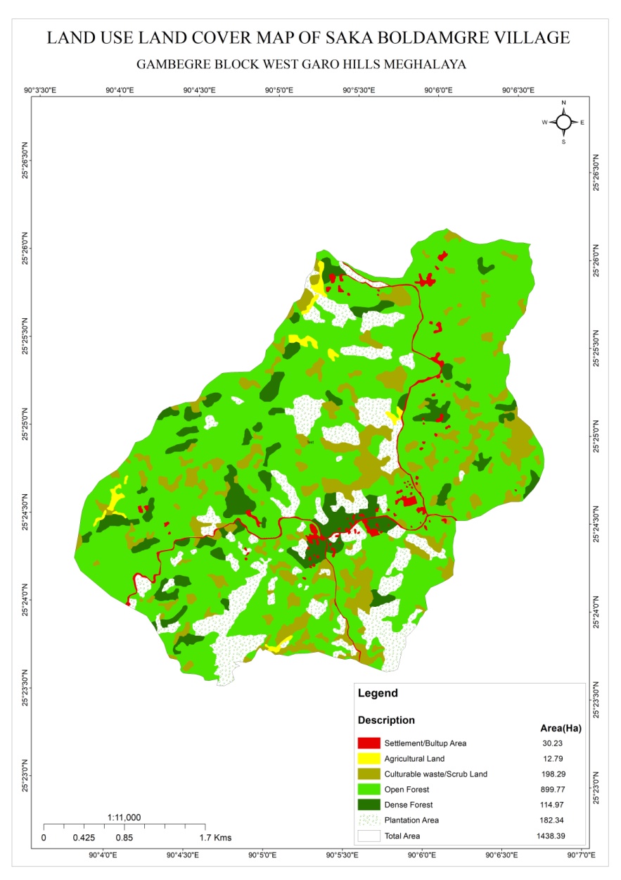
The village has Community forest
The village water sources are springs and streams. It has 10 streams and 8 spring
The village has many indigenous tree species such as :- Kilwe, Siso, bolchu, Boldak, gambare, Bolsal, Golmatra, Chambu, Ajari, Dimbri, Bolnasin, Jengil, Bolgasagru, chram, Boldubak, Namiaga, Boltajong, Gimbil, Dokime, Lapseng, Prap, Changsim, Bolchim, Godom, Agatchi, Guerangsang, Tewek, Aminsep, Kantap, Ambiletong, wakinte, Agru, jiga, tebrong, Tegatchu, Achiri, Neemgas, Rangket, Bolsil, Makanchi, Mandal, Chidao, Chamisi, Bolbret.
Commercially valued Trees/ Shrubs/Plants in forests available in the village forest are – Kilwe, Siso, Gambare, Chidao, Chamisi, Bolbret, Bolsal
Shortage of drinking water during winter season
Lack of proper facilities for irrigation
Decline in soil fertility.
The District team of West Garo Hills conducted PRA and CNRM plan on 3rd June 2020 at Saka Boldamgre Village Gambegre Block, WGH.
The exercises were conducted by the district team. The Team informed the community that PRA exercise is to understand and locate the natural resources of the village and plan the activities according to their need. The community had an exercise to plan and draw resource and social map on the same day.
In the exercise of CNRM plan preparation, the community were asked to prioritized the plan /activities and submit the plan to DPMU for 5 years. The exercises were done in the presence of village headmen, VNRMCs and Village facilitators.
Signing of Documents:
As an acceptance and agreement to the project, every member of the village households had to sign green charter on 3rd June 2020 and submitted the Village agreement and Expression of Interest to DPMU. Resigning of the all the documents were done on 5th August 2020
Formation of the VNRMC
On 3rd June 2020, after the ground survey and sensitization programme, the village signed the EOI, VGA and Green charter as a sign of accepting the project. Resigning of the all the documents were done on 5th August 2020. Whereas in regards, to the selection of Village Natural Resource Management Committee(VNRMC) members the Village Executive Committee (VEC) along with entire community carried out the process of selecting 15 chosen members such as 9 Executive members, 3 Purchase committee and 3 Village Community Facilitator.
Listed below are the members of the VNRMC:
| Sl No | Name in Full | Gender M/F | Age (in Yrs) | Education | Designation | Occupation | Community | Contact No and email address |
|---|---|---|---|---|---|---|---|---|
| 1 | Kristha R Marak | F | 36 | VIII | President | ASHA | garo | 9366955704 |
| 2 | Charmingstar Ch Momin | M | 34 | X | Secretary | Business | garo | 9366993294 |
| 3 | Arkilla S Sangma | F | Member | garo | 9863859123 | |||
| 4 | Neljing M Marak | M | 34 | X | Member | VEC Secretary | garo | 6009185474 |
| 5 | Sujen A Sangma | M | 30 | VIII | Member | Farmer | garo | 7005847369 |
| 6 | Tonilla S Sangma | F | 30 | X | Member | Anganwadi | garo | 6009305723 |
| 7 | OngmiS Sangma | F | 34 | VIII | Member | Anganwadi | garo | 6009305529 |
| 8 | Wetjilla S Sangma | F | 40 | VIII | Member | Farmer | garo | 6003446369 |
| Holik D Sangma | M | 40 | VI | Member | Labour | garo | 9366909015 | |
| 9 |
Village Community Facilitators (VCF)
| Sl No | Name in Full | Gender M/F | Age (Yrs) |
Education | Area of specialisation/ focus (forests, water, soil, accounts, environmental and social safeguards, knowledge management, GIS) | Trained under CLLMP (Yes/ No?) if Yes, date training was received | Contact No and email address |
|---|---|---|---|---|---|---|---|
| 1 | Waichilla S Sangma | F | 21 | 9th passed | NRM & GIS | Yes | 6009280475 |
| 2 | Fifteentdro Sangma | M | 20 | 9th passed | SM &KM | Yes | 7005931042 |
| 3 | Manchino Momin | F | 23 | 9th passed | M&E | Yes | 7005498038 |
|
Implemented Activities | Name of Site | Work Status |
|---|---|---|---|
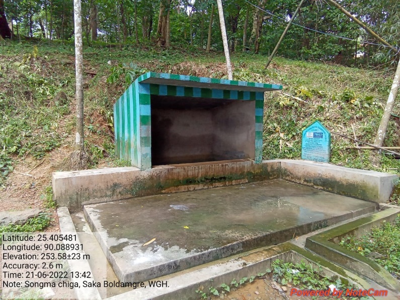
| 1. | Spring Chamber | Songma Chiga | Completed |
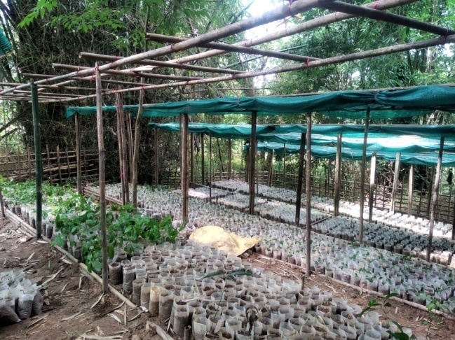
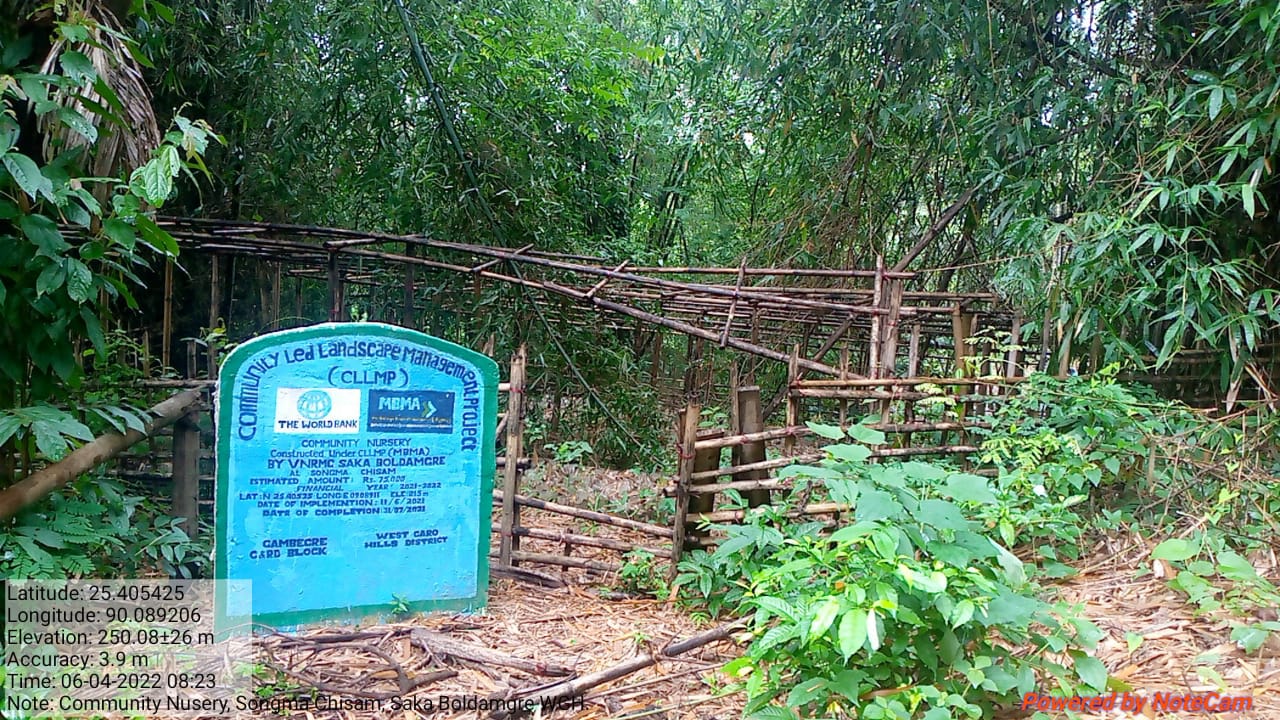
| 2. | Community Nursery | Songma Chisam | Completed |
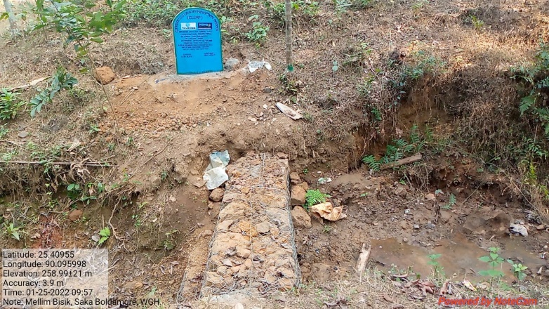
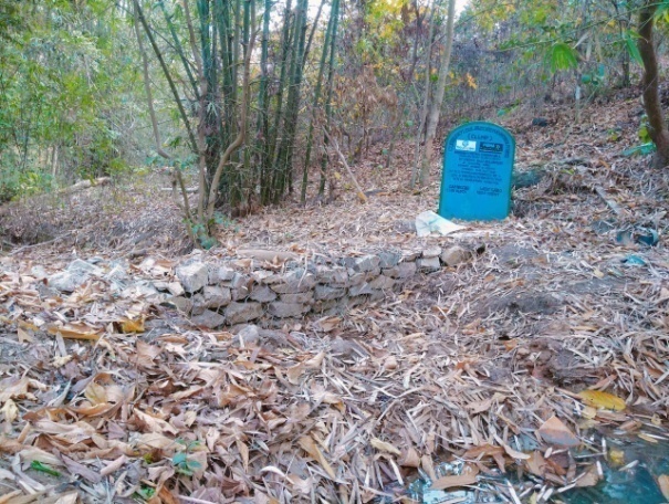
| 3. | Erosion Control Gabion Wall | Mellim Bisik | Completed |
| 4. | Erosion Control Gabion Wall | Songgital Chiga | Completed |
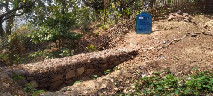
| 5. | Erosion Control Gabion Wall | Banguri Bisik | Completed |
| 6. | Composting Pit | SSA School Compound | Completed |
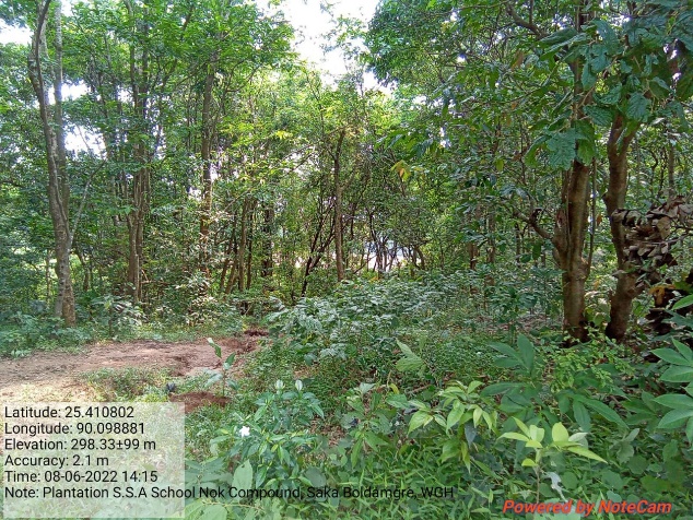
| 7. | Plantation | SSA School Compound | Completed |
| 8. | Water conservation dam with Trenches and Plantation | Jembra Bisik | Completed |
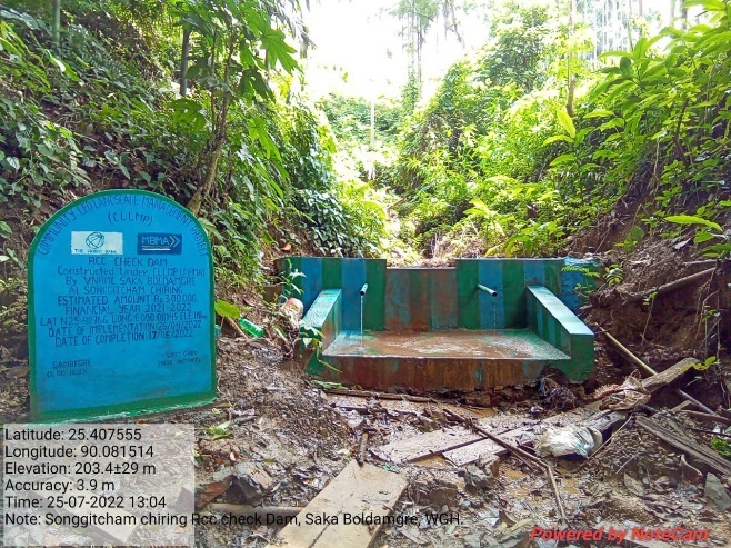
| 9. | RCC Check Dam | Songgitcham Chiring | Completed |
| 10. | Spring Chamber | Dobok Auata Chimik | Completed |
| 11. | Water Reservoir with Protection Fencing | Jembra Songgital | Completed |
| 12. | Plantation | Songma Chiga | Completed |
| 13. | Erosion Control Check Dam (Additional) | Walkam Chiring | Completed |
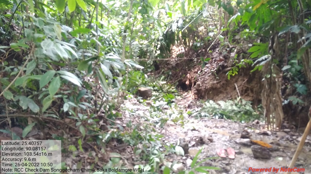
| 14. | Trenches (Additional) | Songgitcham Chiring | Completed |
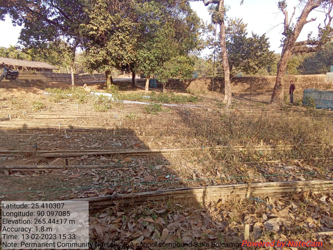
| 15. | Permanent Community Nursery (Balance fund) | SSA School Compound | Ongoing |
4. Fund Status
| 1 | Type Of Intervention | Site Name | GPS Co-ordinates | Amount | Work Status |
|---|---|---|---|---|---|
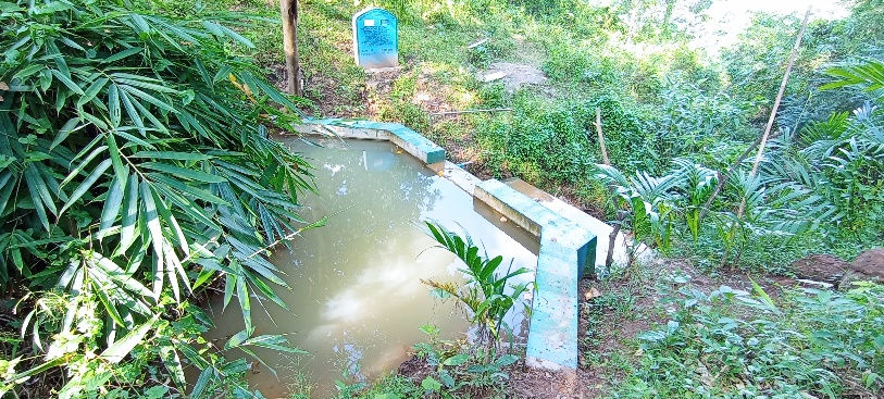
| Spring Chamber | Songma Chiga | Elevation: 215m N25.40552° E090.08894° | Rs.1,48,000 | Completed |
| 2 | Type Of Intervention | Site Name | GPS Co-ordinates | Amount | Work Status |
|---|---|---|---|---|---|
| Community Nursery | Songma Chisam | Elevation 215m N 25.40535 E 090.08911 | Rs. 75,000 | Completed |
| 3 | Type Of Intervention | Site Name | GPS Co-ordinates | Amount | Work Status |
|---|---|---|---|---|---|
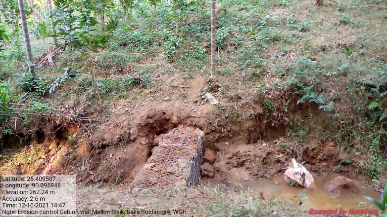
| Erosion Control Gabion Wall | Mellim Bisik | Elevation 212m N 25.40952 E 090.09607 | Rs. 1,10,000 | Completed |
| 4 | Type Of Intervention | Site Name | GPS Co-ordinates | Amount | Work Status |
|---|---|---|---|---|---|
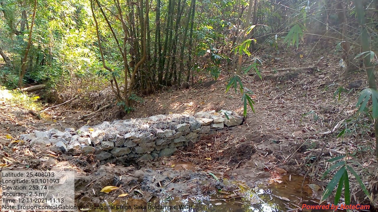
| Erosion Control Gabion Wall | Songgital Chiga | Elevation 216m N 25.40804 E 090.10110 | Rs. 1,25,000 | Completed |
| 5 | Type Of Intervention | Site Name | GPS Co-ordinates | Amount | Work Status |
|---|---|---|---|---|---|
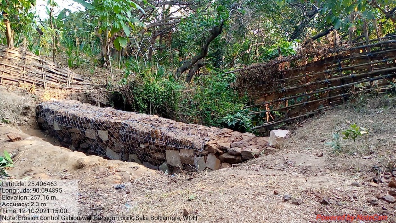
| Erosion Control Gabion Wall | Banguri Bisik | Elevation 224m N 25.40641 E 090.09491 | Rs. 1,30,000 | Completed |
| 6 | Type Of Intervention | Site Name | GPS Co-ordinates | Amount | Work Status |
|---|---|---|---|---|---|
| Composting Pit | SSA School Compound | Elevation 231m N 25.40983 E 090.09671 | Rs. 72,000 | Completed |
Before After
| 7 | Type Of Intervention | Site Name | GPS Co-ordinates | Amount | Work Status |
|---|---|---|---|---|---|
| Plantation | SSA School Compound | Elevation 252m N 25.41092 E 090.09875 | Rs. 70,000 | Completed |
 Before After
| 8 | Type Of Intervention | Site Name | GPS Co-ordinates | Amount | Work Status |
|---|---|---|---|---|---|
| Water conservation dam with Trenches and Plantation | Jembra Bisik | Elevation 227m N 25.41306 E 090.09849 | Rs. 3,60,000 | Completed |
| 9 | Type Of Intervention | Site Name | GPS Co-ordinates | Amount | Work Status |
|---|---|---|---|---|---|
| RCC Check Dam | Songgitcham Chiring | Elevation 118m N 25.40766 E 090.08145 | Rs. 3,00,000 | Completed |
 Before After
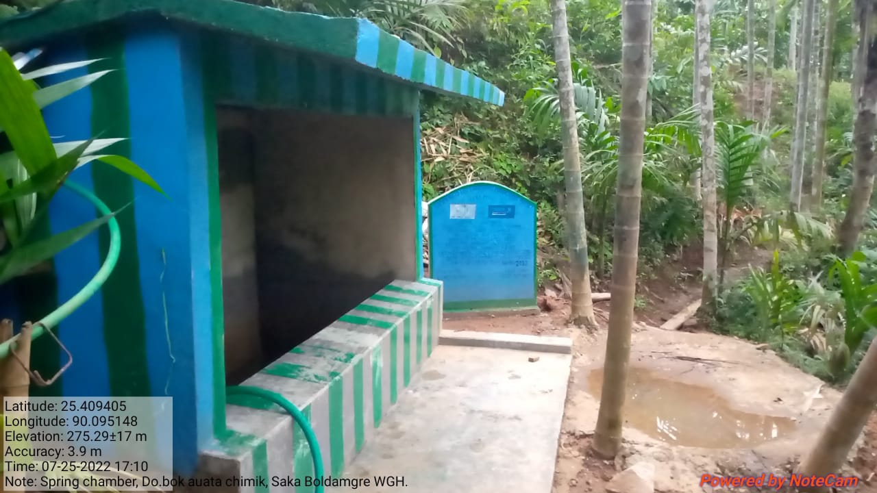
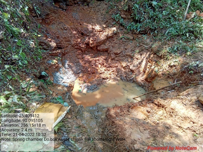
| 10 | Type Of Intervention | Site Name | GPS Co-ordinates | Amount | Work Status |
|---|---|---|---|---|---|
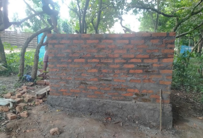
| Spring Chamber | Dobok Auata Chimik | Elevation 230m N 25.40936 E 090.09512 | Rs. 2,16,000 | Completed |
Before After
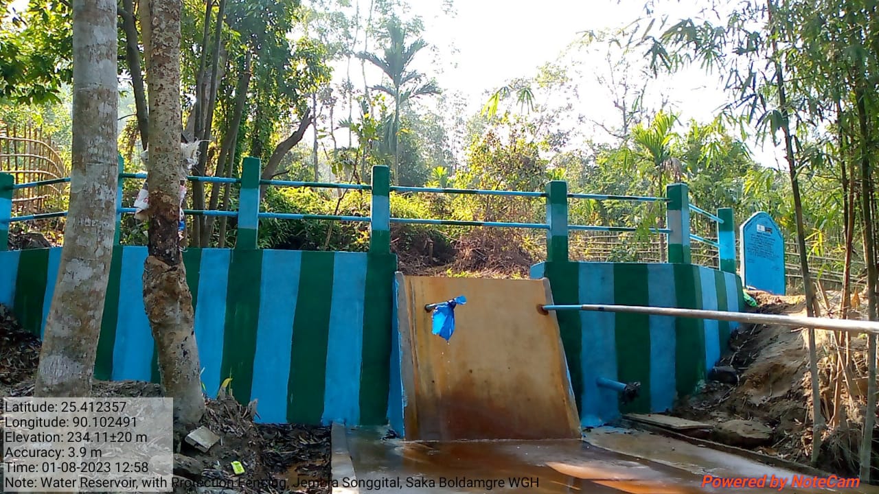
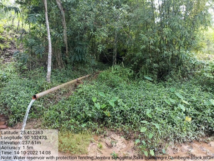
| 11 | Type Of Intervention | Site Name | GPS Co-ordinates | Amount | Work Status |
|---|---|---|---|---|---|
| Water Reservoir with Protection Fencing | Jembra Songgital | Elevation 178m N 25.41224 E 090.10245 | Rs. 4,99,000 | Completed |
 Before After
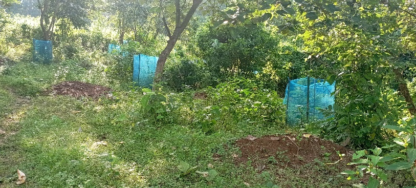
| 12 | Type Of Intervention | Site Name | GPS Co-ordinates | Amount | Work Status |
|---|---|---|---|---|---|
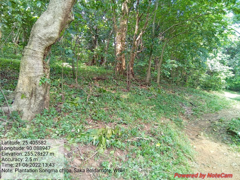
| Plantation | Songma Chiga | Elevation 218m N 25.40563 E 090.08927 | Rs. 50,000 | Completed |

Before After
| 13 | Type Of Intervention | Site Name | GPS Co-ordinates | Amount | Work Status |
|---|---|---|---|---|---|
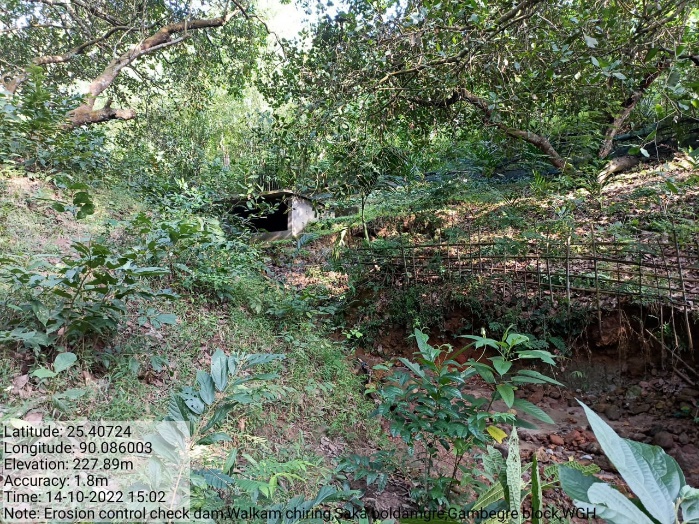
| Erosion Control Check Dam (Additional) | Walkam Chiring | Elevation 169m N 25.40725 E 90.08602 | Rs. 4,60,000 | Completed |

 Before After
| 14 | Type Of Intervention | Site Name | GPS Co-ordinates | Amount | Work Status |
|---|---|---|---|---|---|
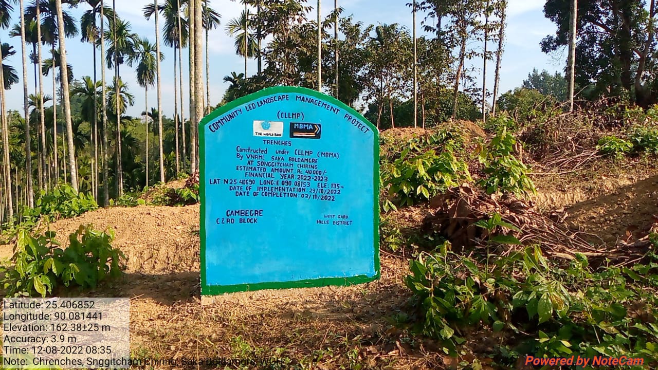
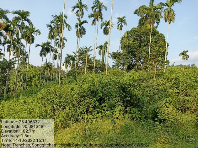
| Trenches (Additional) | Songgitcham Chiring | Elevation 135m N 25.4069 E 90.08153 | Rs. 40,000 | Completed |
Before After
| 15 | Type Of Intervention | Site Name | GPS Co-ordinates | Amount | Work Status |
|---|---|---|---|---|---|
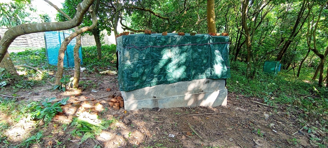
| Permanent Community Nursery (Balance fund) | SSA School Compound | Elevation 277m N 25.40999 E 90.09727 | Rs. 3,00,000 | Ongoing started on 13th Feb 2023 |