Report on
pyndenmawramhah Village under MAWKYRWAT c&rd block
District: SOUTH WEST KHASI HILLS
COMMUNITY LED LANDSCAPE MANAGEMENT PROJECT


The Government of Meghalaya with the financial help from the World Bank has been implementing the Meghalaya Community Led Landscape Management Project (MCLLMP). The project covers the entire state of Meghalaya and implementation of community led plans have been rolled out in phase manner throughout the state. The Meghalaya Basin Management Agency (MBMA) had facilitated the community-led planning by providing support, technical inputs and funding.
The project had strengthened community-led natural resources management in selected landscapes within the 12 districts of the state. This has been achieved through a variety of planning, capacity building, and on-the-ground interventions to promote the conservation, sustainable use of natural resources, social inclusion and community mobilisation; building traditional knowledge and learning, mapping of natural resources management; strengthening the community institutions and creating linkage with financial institutions and community organizations.
The project interventions include the preparation of community led natural resource management plans. The CLLMP has the following three components:
Strengthening Knowledge and Capacity of Communities for Natural Resources Management
Community-Led Landscape Planning and Implementation
Project Management and Governance
The project objective is “to manage and conserve the natural resources, especially forests, soil and water sources, in a manner that supports the financial and physical well-being of communities in the State”
SCOPE:
The CLLM-Programme focuses on increasing the capacities of communities and traditional institutions (TI) by adopting a landscape approach to manage their natural resources such as soil, springs and other water sources, forests and bio-diversity, etc.
The project has been planned and implemented in about 400 villages across the state.
CLLMP has a strong focus on institution-building at the village-level, by ensuring systematic capacity-building on technical and social skill-sets.
The project has also extended such trainings to communities beyond the targeted villages and support efforts made by them to access funding from various rural and natural resources initiatives and schemes.
The programme has also invested in improving the process and outcome delivery, by developing and adhering to effective systems and procedures, supported by the appropriate technology.
BENEFITS:
Benefits for community (Skills and Capacity relating to technical and managerial areas like NRM and Conflict resolution
Benefits to traditional institutions (village councils, traditional leaders, community-based organizations, SHGs etc) through Knowledge sharing, promotion of innovative approach, access to technology, technical managerial and financial support.
It has been estimated that the project has impacted around 1 lakh partners (of which 50% are women) who depend on land, forest, agro forestry.
Through the project, 55000 Ha of targeted area has been ensured with availability of water, biological resources and soil productivity, which has in turn benefitted around 400 villages and the outcomes delivery can be summarized as follows.
IMPLEMENTATION AGENCY:
The Project has been executed by the MBMA in collaboration with other partners particularly, SIRD (for training and capacity building), Department of Soil and Water Conservation, Water Resource Department, Forest Department, specifically with respect to technical inputs, safeguards management and Community NRM plan preparation.
PROJECT PERIOD:
2018-2023 (5 years)
TABLE OF CONTENTS:
Introduction and History………………………………………………..4-5
Social Profile ………………………………………………………….6
Village Accesibility…………………………………….. 6
Literacy rate……………………………………………. 6
Population……………………………………………... 6
Occupation…………………………………………….. 7
Village organisation……………………………………. 8
Fuel Type………………………………………………8
Drinking Water………………………………………...8
Cultivatible Land………………………………………8
Forest Cover…………………………………………….8
Forest Species……………………………………………9
Water Bodies…………………………………………….9
Areas affected…………………………………………..9
III. CLLMP Activities
Ground-Truthing………………………………………………… 9
Sensitization on CLLMP…………………………………………10
Signing of EOI, VGA and Green Charter……………………….10
Formation of VNRMC…………………………………………...11
Village Community Facilitators…………………………………..12
Purchase Committee …………………………………………… ..13
IV. Opening of Bank Account …………………………….………………..13
V. PRA Exercise……………………………………………………………14
Basic Survey for CNRMP template……………………………….15
Focussed Group Discussions……………………………………16-17
Village Boundary Mapping and Resource Mapping………………17
VI. GIS Activities…………………………………………………………….18-19
VII. The Proposal list of intervention…………………………………………20-21
VIII. Project Implementation ………………………………………… ……..22-27
IX. Fund Status ………………………………………………………………..28
X. Ground Testimonials ………………………………………………………...
INTRODUCTION:
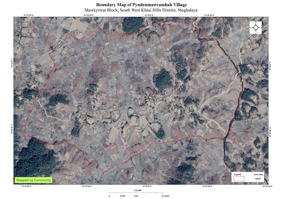
Pyndenmawramhah village is situated in South West Khasi Hills District under the Mawkyrwat C&RD Block. The village is about 27 Km away from the District Headquarters i.e., Mawkyrwat and about 25 Km away from the Block Headquarters. It has a total geographical area of 190.68Ha and falls under the Hima Maharam Syiemship. Pyndenmawramhah village has a total population of 695 comprising of 339 males and 356 females. All the residents of Pyndenmawramhah village belonged to the Khasi Scheduled Tribe. The average rainfall of the village is 1200mm and the type of soil is mainly loamy soil.
BRIEF HISTORY ABOUT THE VILLAGE:
Pyndenmawramhah was once a locality under the village of Nonglynkien which was then named as Pyndennonglynkien since the year 1946-1947. Some of the first residents in this area were Kong Timai Shangpliang, Bah Tron Marwein, Kong Herimai Shangplainag bah Kisonsing Lyngdoh and ka Samai Myrthong. The first headsman of Pyndennonglynkien now Pyndenmawramhah was Worin Wanniang (1990-2002) followed by Ijro Lyngkhoi (2002-2011) then Terian K Dewsaw (2011).
In the year 2011-2012, along with the Maharam Kingdom Khranlin Sohshang and Ferdinand Lyngkhoi was made the new headman and secretary (2012-2013). Together they have worked to bring about an absolute community and renamed it Pyndenmawramhah and since then (2014-2015) is seen to be mentioned and recognized in Government IDs such as Voter's ID, Job card, IFAD among others.
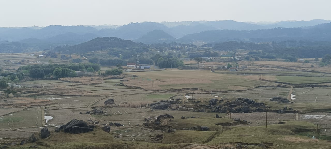
Fig: Pyndenmawramhah village.
VILLAGE SOCIAL PROFILE:
Pyndenmawramhah village has a total number of 96 households, having a total population of 695 villagers. People in this village mainly depend on agriculture and its allied activities for their livelihood. They are mainly farmers and daily wage labourers while others are teachers or are engaged with government services.
Village Acessibility:
In order to reach this village, one must venture with local taxis or sumos from the district headquarter via the Mawkyrwat- Nongstoin road towards Mawthawpdah and take a right turn to reach Laitlawsnai and Pyndenmawramhah.
Literacy Rate:
Pyndenmawramhah as it is a newly formed village, there are only 2 Primary Schools that caters to the children within the village.
Population:
Out of the recent survey, the total population lies at 695 villagers where 339 are male and the female count is 356.This village has 189 children belonging to the group 0-4years and 45 people are above the age of 60. About 186 total number of people belong to the age group of 15-30 years, thus this indicates that the majority of the population of Pyndenmawramhah village comprise of the young and healthy people.
| Age Group | Male | Female | Total |
|---|---|---|---|
| 0-4years | 89 | 100 | 189 |
| 5-14years | 83 | 99 | 182 |
| 15-30years | 98 | 88 | 186 |
| 30-60years | 44 | 49 | 93 |
| Above 60years | 25 | 20 | 45 |
| Total | 339 | 356 | 695 |
Occupations:
The people of Pyndenmawramhah village rely mainly on agriculture and forest produce for their livelihood. Out of 96 households within the village, 80 households are farmers, 3 household are labourers, while 8 household are teachers and 5 households are in government services.
Fig: Chart shows the number of Household engaged in different occupations.
Organisation within the Village:
There are 11 Self Help Groups (SHGs) under NRLM in Pyndenmawramhah village under one Village Organisation. There are also 12 VEC & traditional institutions such as SSS (Seng samla Shnong) within this village.
Fuel Type:
The people of this village use wood as a fuel. All 96 households depend on wood gathered from the forest for their daily requirement.
| Type of Fuel | Total No of HH | Qty (Kgs/HH) | Total |
|---|---|---|---|
| Wood | 96 | 6000kg | 576000kg |
Drinking Water:
The people of Pyndenmawramhah have access to drinking water mainly from the springs within the village. Government water supply lines are also available in this village. But over the years there has been a scarcity of water supply in this village due to less water discharge from the springs source and due to the increase in human population and their daily requirements. There are 3 springs within the village which are perennial that people use for drinking viz. Mawpon, Pamiarwat, Dompdeng.
Cultivable Land Cover:
The total agricultural area of this village is 78.88ha. The type of soil in Pyndenmawramhah village is Loamy soil. People practise bun cultivation and shifting cultivation in their own private lands. The main crops grown in this village are Paddy, Maize, Potato, Ginger,Turmeric, Sweet Potato, Mustard, Beans, Squash, pumpkin and Yam. They also plant Bayberry, Crab apple, Mulberry, Passion Fruit, and Peach.
Forest Cover:
The total forest cover under Pyndenmawramhah village is 7.26ha. The forest cover is on private land and the quality of the forest is low. People uses the forest products mainly for fuelwood and for other purposes. Some of the forest that falls on the private land within the village are Wahtynnai, Mawwatkhar-1, Mawwatkhar-2, Phot Nongrim, Sohshang and Kseh Ryndia.
Forest Species:
Some of the indigenous tree species found in this village are Diengngan, Diengkseh bilat, Diengloin, Diengsning, Diengblei, Diengsohiongkrem. This village also has a variety of bamboo species in the village like the Siej Naga as the locals call it. There are some plant species used by the people of the community for medicinal purposes like Diengsohlang, mint, Jatira, Jale and Jamyrdoh. The forest is home to many vulnerable fauna like wild birds, wild fox, squirrel, wild chiken Risai, and rabbits.
Water Bodies:
Total area of water bodies in Pyndenmawramhah is 1.726ha. There are about 3 springs within the village which have been mentioned above which people use mainly for drinking purpose. Umnanglang is the only stream within the village and Wahkynja is the only river which the people mainly use for washing, irrigation and fisheries.
Areas Affected:
Approximately about 14.47ha of forest land have been degraded over the years due to soil erosion, forest fires, excessive felling of trees which have led to the loss of productivity of the land and the loss of the saplings and other natural resources About 7.1ha of cultivable land have been affected by the excessive use of fertilizers and 6.14ha of land have been degraded over the years owing to human settlement and culturable wastelands.
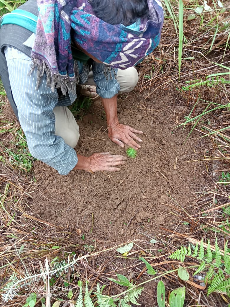
CLLMP ACTIVITIES:
Ground Truthing: The CLLMP officials met with Mr.Khranling Sohshang, headman of Pyndenmawramhah village, Mr.Ferdinand Lyngkhoi the village Secretary and other village representatives for field assessment. Mr.Sohshang, provided the CLLMP Team with important information regarding the current scenario of the landscape and the natural resource management under his headmanship.
Case Findings:
Most of the household falls under the BPL category.
They have an actively performing VEC in the village.
The land within the village falls under the Hima Maharam Syiemship.
The source of water supply in the village is from two sources: private and public.
There are patches of degraded land that has been left unused.
There is a loss of Natural Vegetation in the area.
Sensitization Programme:
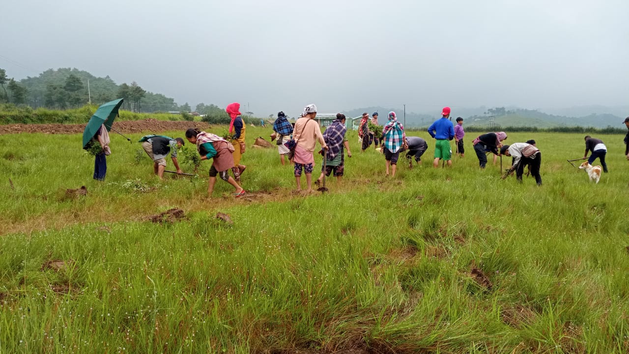
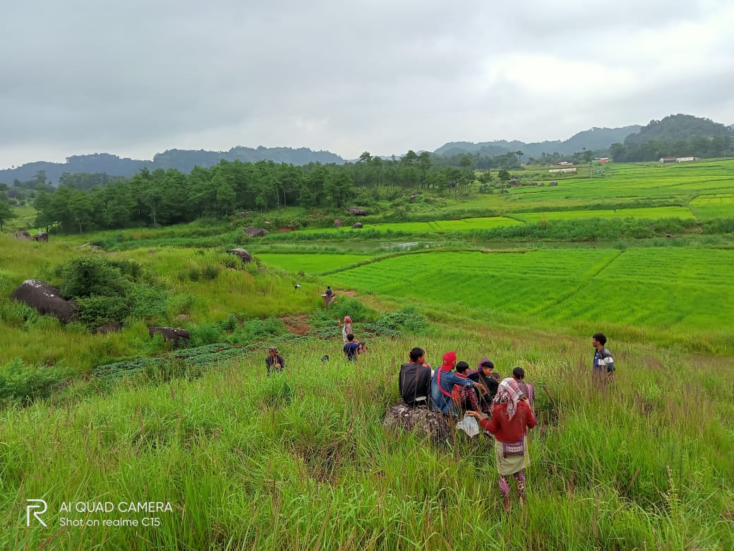
The District Project Manager Mr. J. Wanniang along with the staff held a village Level Sensitization Programme on the Community Led Landscape Management Project (CLLMP) on the 24th October 2020.The villagers actively participated in the program, voicing out their concerns and questions regarding the project making it a huge success.
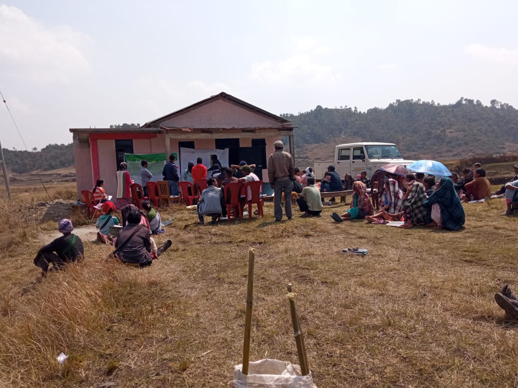
Fig: Villagers attending the Programme.
Highlights of the meeting:
1.Awareness about the Community Led Landscape Management Project (CLLMP).
2. Laying the importance on the involvement of the community in making the CNRM plan and its success.
3. A brief awareness on cleanliness was conducted based on our finding during the ground truthing phase.
4. An interactive session was held to answer doubts of the villagers regarding the project.
Signing of EOI, VGA and Green Charter:
On 24th October 2020, Pyndenmawramhah village signed the EOI (Expression of Interest), VGA (Village Grant Agreement) and the Green Charter after there was a uniform agreement by the people of the entire Community that the Community Led Landscape Management Project (CLLMP) be implemented at Pyndenmawramhah village.
Formation of the VNRMC:
The formation of the Village Natural Resources Management Committee was done in a public meeting on the 24th October 2020 in the presence of the entire village and the CLLMP Staff. The people of the community chose the President, The Secretary, the Purchase Committee members and the other Executive members to formed the Pyndenmawramhah VNRMC. There are 9 Executive members, 3 Village community Facilitator and 3 Purchase Committee members.
List below are the members of the VNRMC:
| Village Natural Resource Management Committee (9members committee constituted from Village Council, SHG group, Women’s group, youth, VEC) | ||||||||
|---|---|---|---|---|---|---|---|---|
| Sl No. | Name | Designation | Gender (M/F) |
Age in years | Qualification | Occupation | Community | Phone No. |
| 1. | Edilbert Lyngkhoi | President | M | 32 | XII | Teacher | Khasi | 9366137411 |
| 2. | Jecy Shangpliang | Secretary | F | 27 | X | Farmer | Khasi | Na |
| 3. | Bikarlas Lyngdoh | F. Secretary | M | 41 | VI | Farmer | Khasi | 8787405015 |
| 4. | Balari K.Jahrin | Member | F | 27 | VIII | Farmer | Khasi | 6009300367 |
| 5. | Lidaris Pariong | Member | F | 39 | IX | Farmer | Khasi | 9366726565 |
| 6. | Smendar Lyngdoh | Member | M | 45 | V | Farmer | Khasi | 8787544058 |
| 7. | Kromenstar Pariong | Member | M | 34 | IV | Farmer | Khasi | 9366950583 |
| 8. | Bantina Pariong | Member | F | 38 | VII | Farmer | Khasi | 9366616766 |
| 9. | Rogina Lyngkhoi | Member | F | 44 | IX | Farmer | Khasi | NA |
| Traditional Village Institutional Functionaries (Village Dorbar/Nokma/Doloi Council) | ||||||||
|---|---|---|---|---|---|---|---|---|
| Sl No. | Name | Designation | Gender (M/F) |
Age in years | Qualification | Occupation | Community | Phone No. |
| 1. | Khranling Sohshang | Myntri | M | 51 | VI | Farmer | Khasi | 7005663584 |
| 2. | Ferdinand Lyngdoh | Secretary | M | 46 | IX | Farmer | Khasi | 8787678852 |
| 3. | Bikarles Lyngdoh | Member | M | 41 | VI | Farmer | Khasi | 8787405015 |
| 4. | Akro Lyngkhoi | Member | M | 65 | III | Farmer | Khasi | 9383361939 |
| 5. | Orensing Lyngkhoi | Member | M | 54 | X | Teacher | Khasi | NA |
| 6. | Smendar Lyngdoh | Member | M | 45 | V | Farmer | Khasi | 8787544058 |
| 7. | Dromsius Sangriang | Member | M | 33 | V | Farmer | Khasi | 6009674254 |
| 8. | Regius Nonglang | Member | M | 45 | IX | Farmer | Khasi | NA |
| 9. | Woles Shangpliang | Member | M | 45 | V | Farmer | Khasi | NA |
| 10 | Kyrshan Lyngkhoi | Member | M | 40 | XII | Farmer | Khasi | NA |
| 11 | Jerian K.Dewsaw | Member | M | 50 | V | Farmer | Khasi | NA |
| 12 | Leral Marwein | Member | M | 33 | III | Farmer | Khasi | NA |
| 13 | Sephrin Lyngdoh | Member | M | 45 | VI | Farmer | Khasi | NA |
| 14 | Oren Lyngkhoi | Member | M | 50 | X | Farmer | Khasi | NA |
| 15 | Edilbert Lyngkhoi | Member | M | 33 | BA | Farmer | Khasi | NA |
| 16 | Jency Shangpliang | Member | F | 32 | XII | Farmer | Khasi | NA |
| 17 | Darilin Pariong | Member | F | 36 | XII | Farmer | Khasi | NA |
| 18 | Youskhemlin Lyngdoh | Member | F | 30 | BA | Farmer | Khasi | NA |
| 19 | Elbira Shangpliang | Member | F | 31 | X | Farmer | Khasi | NA |
| Village Community Facilitators (VCF) | ||||||
|---|---|---|---|---|---|---|
| Sl no. | Name | Age | Gender | Qualifiaction | Contact Number | Role |
| 1. | Timely Pariong | 26 | F | BA | 986344916 | Social and KM |
| 2. | Youskhemlin Lyngdoh | 34 | F | BA | 8837461806 | Evt and GIS |
| 3. | Kyrshanlang Lyngkhoi | 27 | M | XII | 6009787248 | Monitoring & Evaluation |
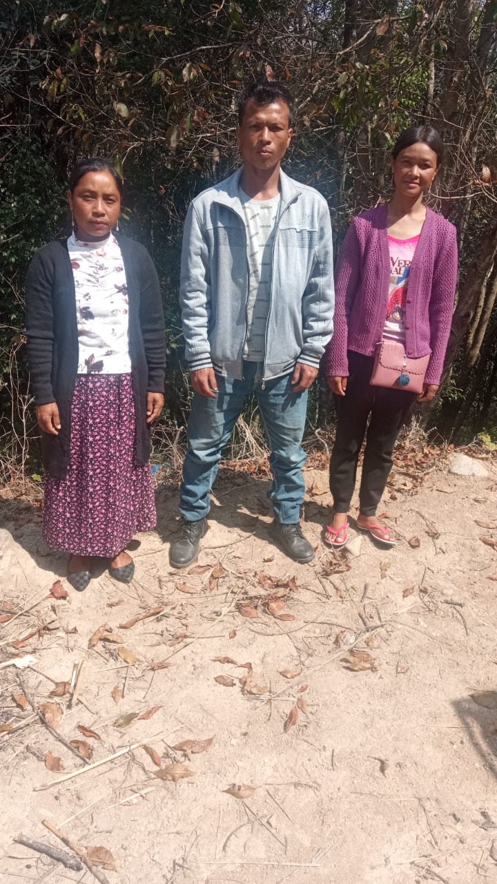
Fig: VCF’s of Pyndenmawramhah.
| Procurement Members | |||||
|---|---|---|---|---|---|
| Sl no. | Name | Age | Gender | Qualification | Contact Number |
| 1. | Lidaris Pariong | 41 | M | Farmer | IX |
| 2. | Radius Nonglang | 50 | F | Labourer | VII |
| 3. | Candida Shangpliang | 43 | F | Teacher | IX |
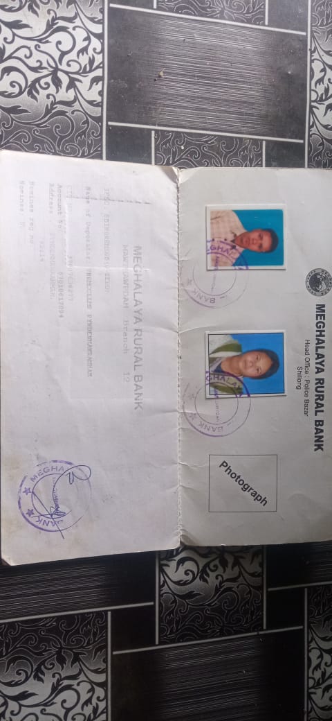
Opening of Bank Account:
The opening of the bank account was done after the signing of the EOI (Expression of Interest), the VGA (Village Grant Agreement) and the signing of the Green Charter. The Accountant of CLLMP South West Khasi Hills trained the Purchasing and Procurement Committee of Pyndenmawramhah village on matters relating to Accounts and Book Keeping and on the:
Principles of Community Procurement
Benefits of Community Procurement
Important aspects undertaken by Community Procurement.
Procurement Process/Steps
Function of Purchase Committee
Important Procurement records to be maintained
Financial limits and methods
 Maintaining of Books of
Accounts to the Book Keeper.
Maintaining of Books of
Accounts to the Book Keeper.
Fig:Bank details of the VNRMC.
Participatory Rural Appraisal Exercise:
The PRA exercise aims to incorporate the knowledge and opinions of the community in the planning and management of development projects and programmes.
The PRA exercise took place on the 24th October 2020 and both men and women attended the program.
The District Project Manager gave the introduction and spoke about the different activities that the participants had to take part in the programme.
The Program Associate, Environment Management, Social Management spoke about the different CNRM plans and the different types of intervention. A group of participants interacted and helped in the collection of data based on the environmental and social template. With the help of this group, different sites of interventions were identified, analysed and evaluated in order to prioritized the areas that needed the natural resources management.
Findings based on the information gathered from the participants during the PRA/CNRMP exercise:
1. The main agricultural produce is Paddy, Maize and Potato.
2. Most of the household depend on firewood as a source of fuel.
3. Drinking water is limited over a period of 3-4 months during the winter season.
4. There are only Private Forest.
5. The springs which are present in the village needs rejuvenation.
6. Training on Land productivity, Spring shed management and Community nursery is necessary for the village community.
Baseline Data Survey to fill the Environment and Social Template:
During the PRA Exercise the External Expert of Social & Environment Management held a group discussion with the different groups to gather basic village information regarding number of households, demographic information, major crops and enterprises taken in the village, trends of production and productivity of major crops in the village and demographic distribution of village population.
Information related to land use category such as forest, cultivable land, water bodies, etc and the problems and challenges related to NRM were discussed.
Focussed Group Discussion on Problem Analysis:
Do people have sufficient access to supply of fodder, fuel wood, leaf litter?
No,the people in the village does not have sufficient access to supply of fodder, fuel wood, leaf litter. They either get it from their own private lands/forest or from the neighbouring villages.
Has access to timber improved or reduced over the years? How is access for household use and commercial use managed?
People have to purchase it from neighbouring village when needed.
Are the water bodies facing any threats?
So far, the water bodies within the village have faced some minor threats.
Do all people in the village have access to drinking water? What are the challenges?
Yes, there is sufficient drinking water in the village except during the winter season due to less discharge of water from the spring source.
Are there degraded areas in the village (open/ degraded forests, mining affected, high soil erosion etc.)?
There are some minor degradations in cultivated land.
What has caused this degradation? Are there practices causing threats to availability and access to natural resources?
Fertility of the soil has decline over the year.
The practices that cause threat to the availability of these resources are:
Excessive practice of Jhum Cultivation and the forest land is mostly pine forest.
What have been the changes in agricultural practices?
Previously their method of farming is Shifting Cultivation, but over the years with much awareness people have now practiced crop rotation.
Are there any challenges in farming?
The main challenges faced by the people of the village is that over the years they have seen a decline in the soil productivity due to soil erosion and the use of excessive fertilisers.
How would you consider the health situation in your village?
The nearest health care is at Mawthawpdah PHC with a distance of 10Km away and the community as a whole can commute to the health centre easily.
How is the situation of cleanliness, sanitation, access to toilets and waste management?
The SHG members is responsible for organizing the cleaning drive once in a month.
Sufficient toilets are available in every household but most of the constructions are poor. Waste Management is poor because people are not really aware of how to properly disposed off waste.
Who are the most vulnerable in the village? What can be done to improve their lives?
BPL Fmilies. Inclusion of BPL family members during project implementation
What are the livelihood aspirations of the youth? Are there any avenues available?
None, except daily wages labourers.
Do any committees/ institutions/ rules exist to manage and monitor natural resources in the village?
The VNRMC under the CLLMP is the main committee that is now in place to manage the natural resources in the village.
What are some of the major issues of conflict in the village?
Nothing related to NRM.
Have any of the above issues been discussed in village meetings?
NA
How do people resolve disagreements and conflicts?
All disagreements and conflicts are addressed by the traditional institution of village called the Village Dorbar.
Village Boundary Mapping and Recourse Mapping:
The GIS personnel along with the Village Community Facilitators mapped the village boundary of Pyndenmawramhah village.
The village resource map is prepared by the people of the community. In this resource map, the local people prepare it by drawing it on chart paper. Recourses such as agricultural lands, wells, wastelands, cattle population, playgrounds, ICDS, churches, community halls, etc were mapped.
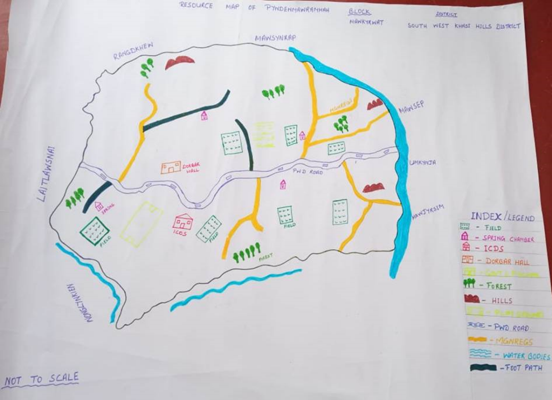
Fig:Resource map of Pyndenmawramhah village
GIS Activities:
| Sl. No. | Parameters | Village Information |
|---|---|---|
| 1 | GPS Coordinates: | |
| i | Latitude | 25.428901 |
| ii | Longitude | 91.433233 |
| iii | Elevation Reading (MSL) | 1525M |
| 2 | Village Geographical Area (Ha) | 190.68HA |
| i | Total Forest Area (including community, Clan, Pvt Forest) | 7.26HA |
| ii | Total Area of Water Bodies | 1.72HA |
| iii | Total Area under Agri-Horticulture | 78.88 HA |
| iv | Total Degraded land area (Ha) | 27.71 HA |
| 3 | Average Annual Rainfall | 1200MM |
| 4 | Soil Type | Loamy soil |
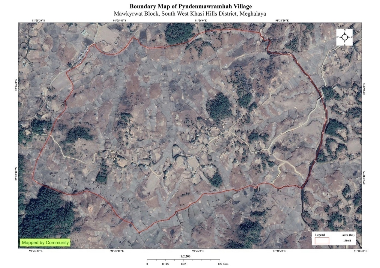
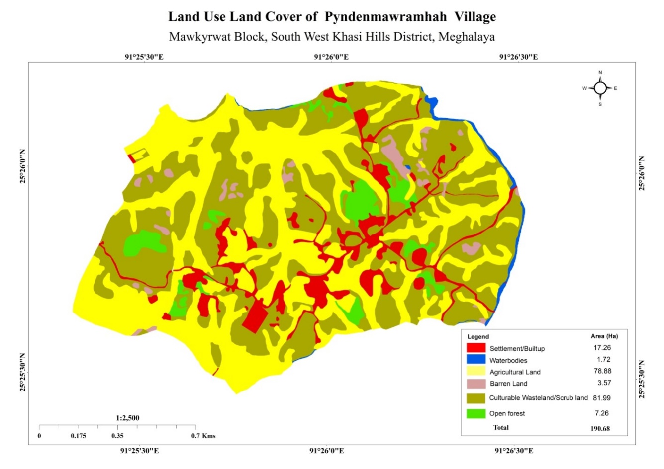
Fig: Boundary Map and LULC Map.
The Proposed list of Interventions:
|
Name of Proposed Interventions | Site |
|
Nos of HHs expected to Benefit | Priority (High/ Medium/ Low) |
|---|---|---|---|---|---|
| 1. | Spring chamber | Mawpon |
|
|
|
| 2. | Spring chamber | Domdewsaw |
|
|
High |
| 3. | Spring chamber | Pamiarwat |
|
|
High |
| 4. | Spring chamber | Umdoh |
|
|
High |
| 5. |
|
Nongrim |
|
|
High |
| 6. |
|
Mawtynnai |
|
|
High |
| 7. | Spring chamber | Nongrim |
|
|
High |
| 8. | Jalkund | Domdewsaw |
|
|
High |
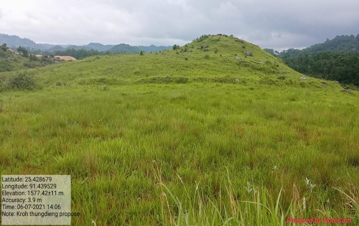
| 9. | Jalkund | Kroh |
|
|
High |
| 10. | Jalkund | Diiang |
|
|
High |
| 11. | Forest plantation | Mawsdep |
|
|
High |
| 12. | Forest plantation | Pamiarwat |
|
|
High |
| 13. | Forest plantation | Mawpon |
|
|
High |
| 14. | Forest plantation | Kroh |
|
|
High |
| 15. | Forest plantation | Nongrim |
|
|
High |
| 16. | Forest plantation | Rymmang |
|
|
High |
| 17. | Forest plantation | Domdewsaw |
|
|
High |
| 18. | Forest plantation | Rymmang |
|
|
High |
| 19. | Forest plantation | Rymmang |
|
|
High |
| 20. | Forest plantation | Mawpon |
|
|
High |
| 21. | Forest plantation | Nongrim |
|
|
High |
| 22. | Forest plantation | Umlonghung |
|
|
High |
| 23. | Forest plantation | Rymmang |
|
|
High |
| 24. | Forest plantation | Nongrim |
|
|
High |
| 25. | Trenches | Diiang |
|
|
High |
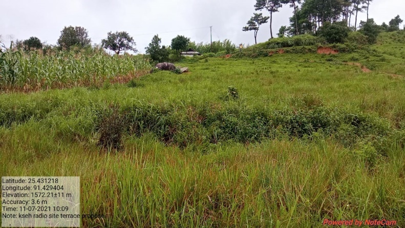
| 26. | Bench terracing | Kseh Radio |
|
|
High |
| 27. | Trenches | Umlonghung |
|
|
High |
| 28. | Bench terracing | Domdewsaw |
|
|
High |
| 29. | Composting | Pyndenmawramhah |
|
|
High |
| 30. | Trenches | Umdoh |
|
|
High |
| 31. | Trenches | Krem Shaijir |
|
|
High |
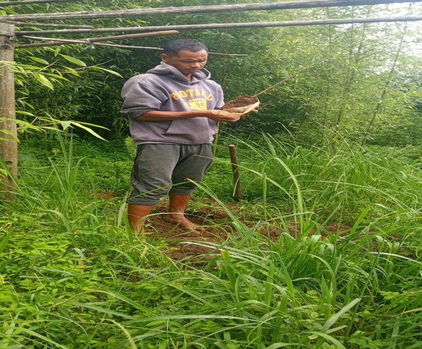
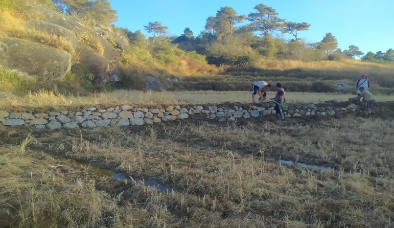
PROJECT IMPLEMENTATION:
| 1. | Type Of Intervention | Site Name | GPS Co-ordinates | Amount Sanctioned | Work Status | |
|---|---|---|---|---|---|---|
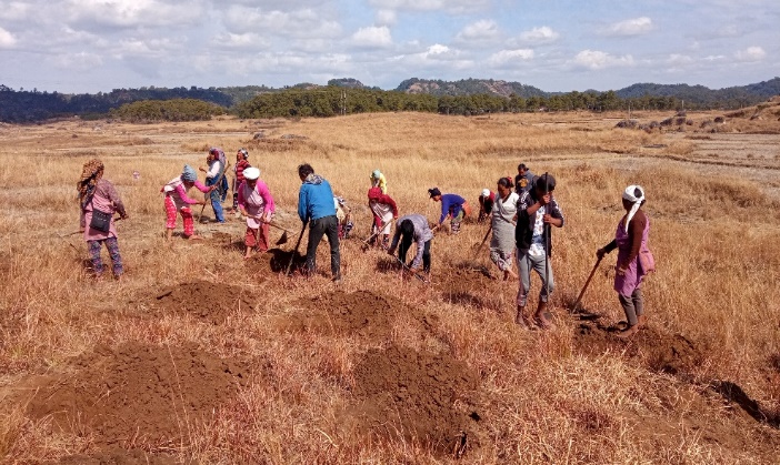
| Afforestation at Umdoh | Umdoh | 25.432102 | 91.429669 | Rs.8,175 | Completed | |
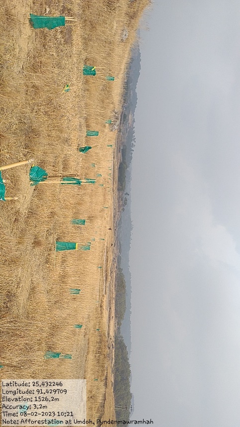
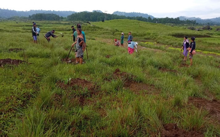
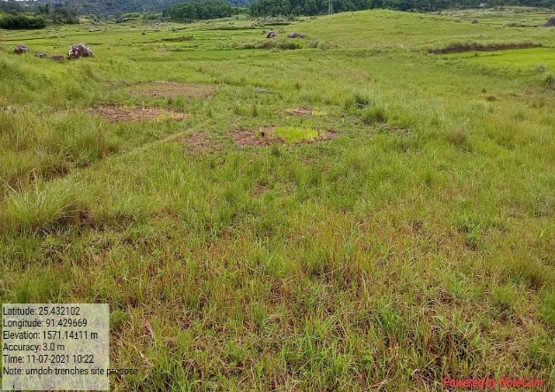
Fig: Afforestation at Umdoh.
| 2. | Type Of Intervention | Site Name | GPS Co-ordinates | Amount Sanctioned | Work Status | |
|---|---|---|---|---|---|---|
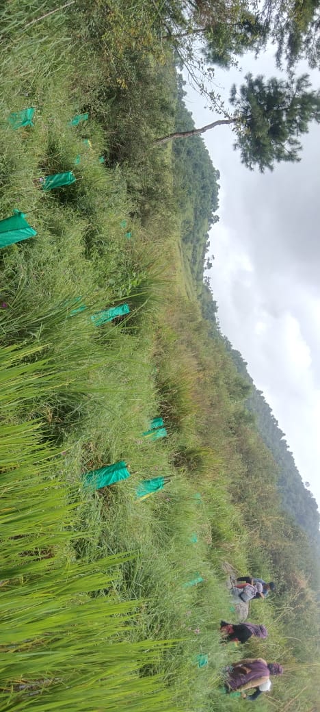
| Afforestation at Krem Shaijir | Krem Shaijir | 25.427378 | 91.433977 | Rs.8,175 | Completed | |
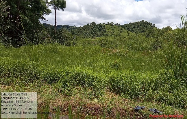
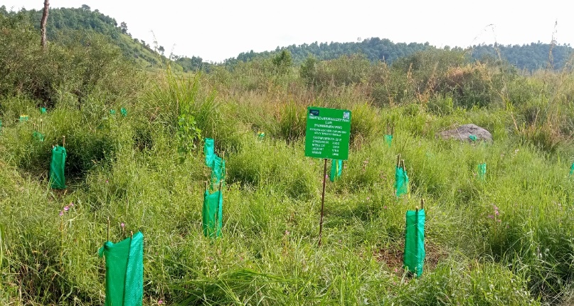
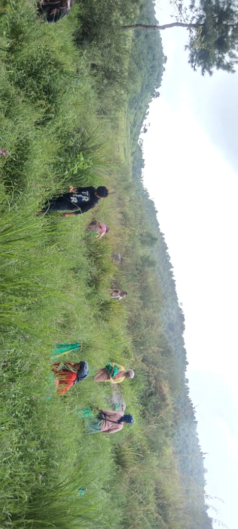
Fig: Afforestation at Krem Shaijir.
| 3. | Type Of Intervention | Site Name | GPS Co-ordinates | Amount Sanctioned | Work Status | |
|---|---|---|---|---|---|---|
| Afforestation at Mawpon | Mawpon | 25.427637 | 91.432464 | Rs.96,150 | Completed | |
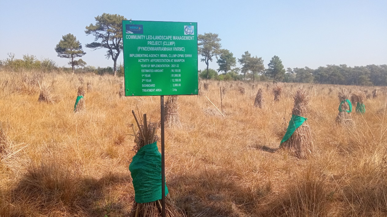
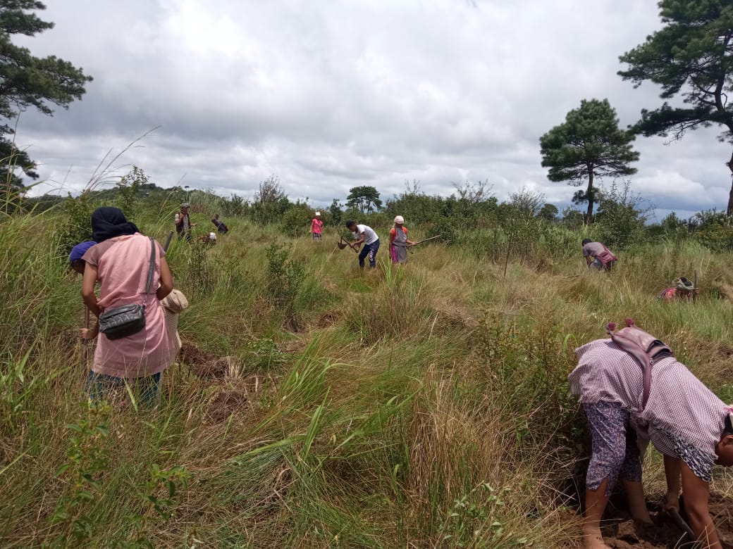
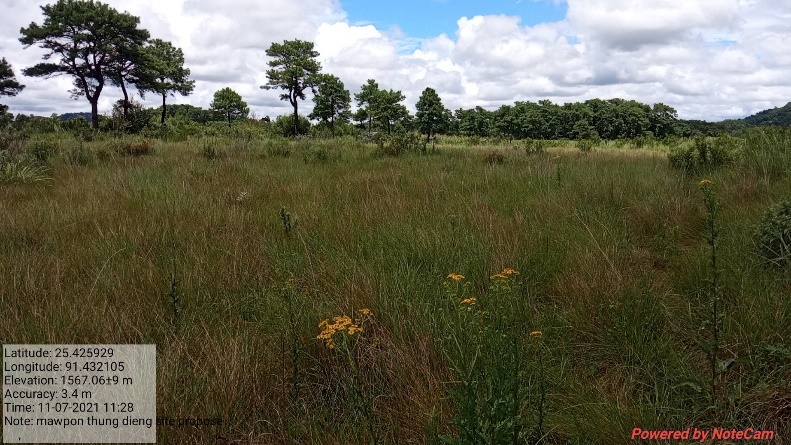
Fig: Afforestation at Mawpon.

| 4. | Type Of Intervention | Site Name | GPS Co-ordinates | Amount Sanctioned | Work Status | |
|---|---|---|---|---|---|---|
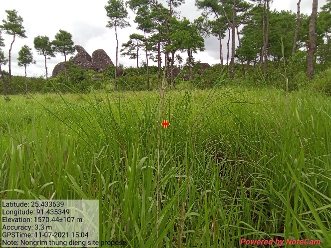
| Afforestation at Nongrim | Nongrim | 25.433149 | 91.435869 | Rs.2,51,400 | Completed | |

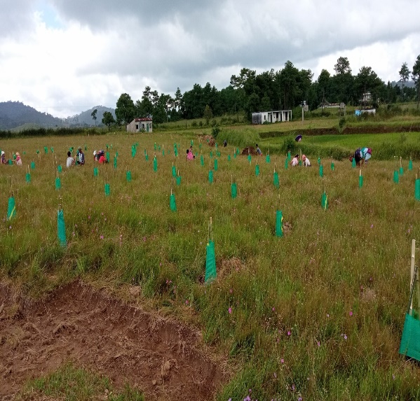
Fig: Afforestation at Nongrim.
| 5. | Type Of Intervention | Site Name | GPS Co-ordinates | Amount Sanctioned | Work Status | |
|---|---|---|---|---|---|---|
| Afforestation at Diiang | Diiang | 25.435482 | 91.433274 | Rs.49,575 | Completed | |
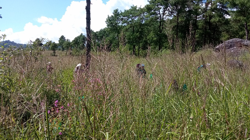
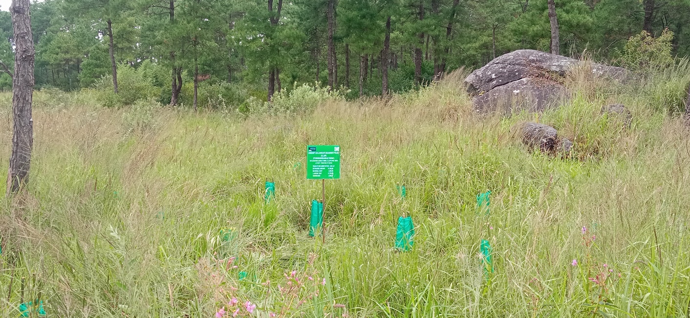
Fig: Afforestation at Diiang.
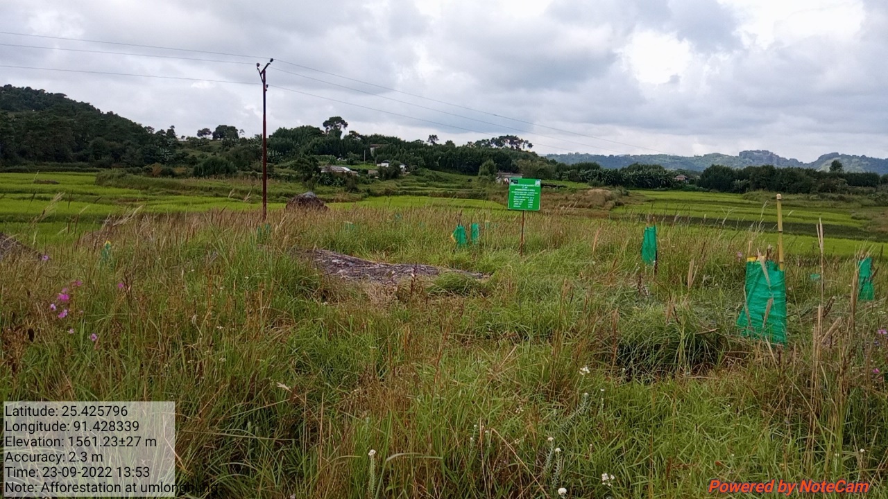
| 6. | Type Of Intervention | Site Name | GPS Co-ordinates | Amount Sanctioned | Work Status | |
|---|---|---|---|---|---|---|
| Afforestation at Ksehradio | Ksehradio | 25.430484 | 91.428078 | Rs.34,050 | Completed | |
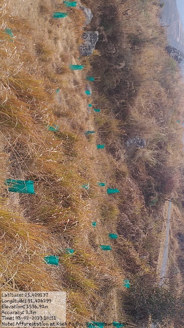
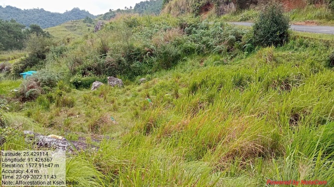

Fig: Afforestation at Ksehradio.
| 7. | Type Of Intervention | Site Name | GPS Co-ordinates | Amount Sanctioned | Work Status | |
|---|---|---|---|---|---|---|
| Afforestation at Mawsdep | Mawsdep | 25.426853 | 91.429252 | Rs.34,050 | Completed | |
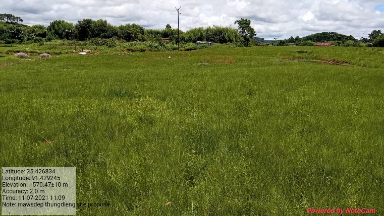
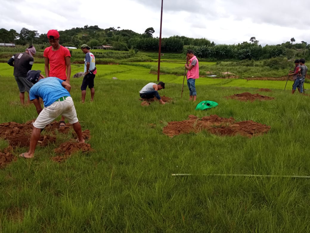
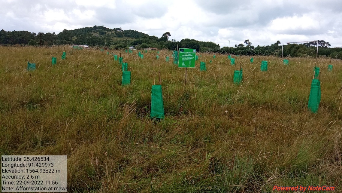
Fig: Afforestation at Mawsdep.
| 8. | Type Of Intervention | Site Name | GPS Co-ordinates | Amount Sanctioned | Work Status | |
|---|---|---|---|---|---|---|
| Afforestation at Pamiarwat | Pamiarwat | 25.428144 | 91.437683 | Rs.34,050 | Completed | |
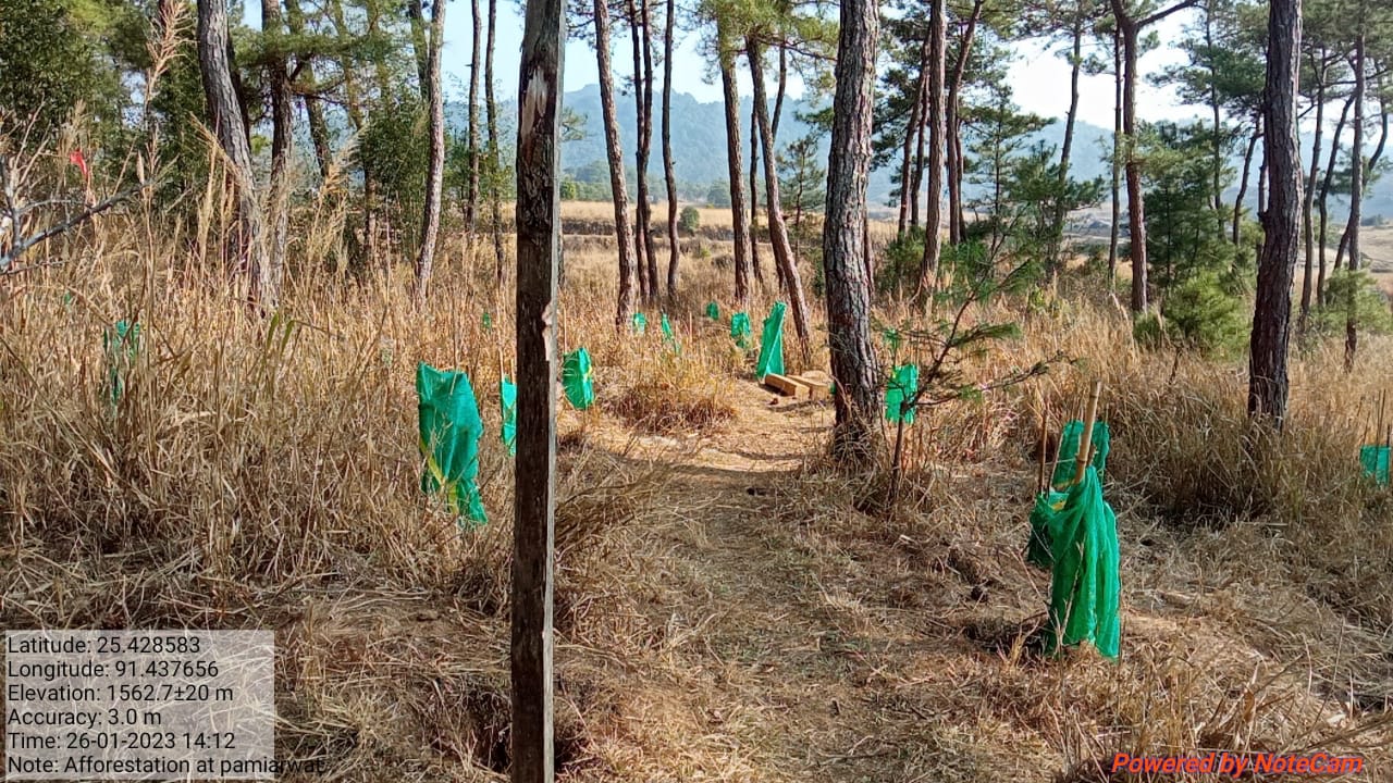
Fig: Afforestation at Pamiarwat.
| 9. | Type Of Intervention | Site Name | GPS Co-ordinates | Amount Sanctioned | Work Status | |
|---|---|---|---|---|---|---|
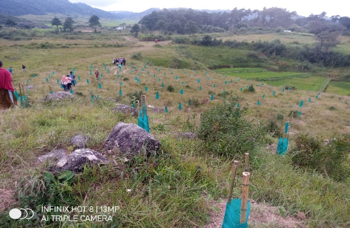
| Afforestation at Kroh | Kroh | 25.428679 | 91.439529 | Rs.65,100 | Completed | |
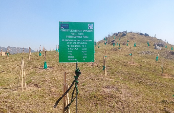
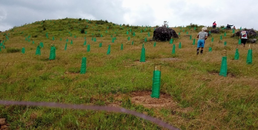
Fig: Afforestation at Kroh.
| 10. | Type Of Intervention | Site Name | GPS Co-ordinates | Amount Sanctioned | Work Status | |
|---|---|---|---|---|---|---|
| Afforestation at Rymmang | Rymmang | 25.431627 | 91.440883 | Rs.1,27,200 | Completed | |
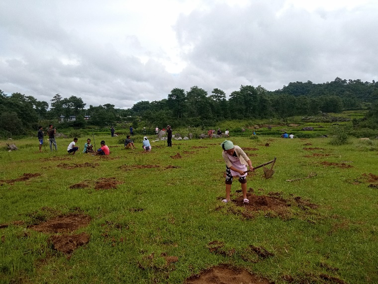
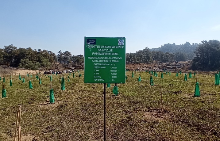
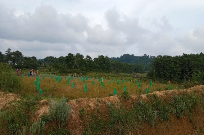
Fig: Afforestation at Rymmang.
| 11 | Type Of Intervention | Site Name | GPS Co-ordinates | Amount Sanctioned | Work Status | |
|---|---|---|---|---|---|---|
| Afforestation at Domdewsaw | Domdewsaw | 25.434217 | 91.438932 | Rs.49,575 | Completed | |
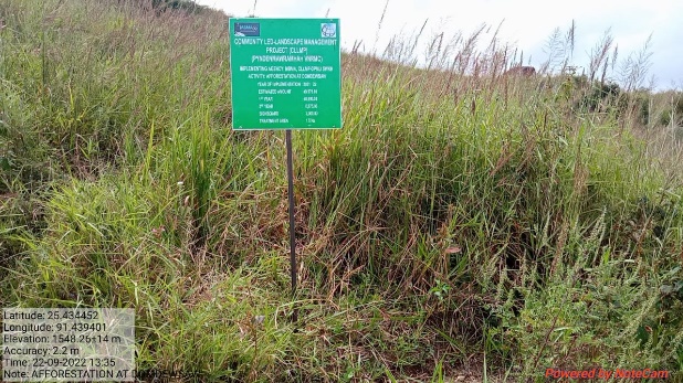
Fig: Afforestation at Domdewsaw.
| 12. | Type Of Intervention | Site Name | GPS Co-ordinates | Amount Sanctioned | Work Status | |
|---|---|---|---|---|---|---|
| Afforestation at Umlonghung | Umlonghung | 25.426853 | 91.429258 | Rs.65,100 | Completed | |
Fig: Afforestation at Umlonghung.
| 13. | Type Of Intervention | Site Name | GPS Co-ordinates | Amount Sanctioned | Work Status | |
|---|---|---|---|---|---|---|
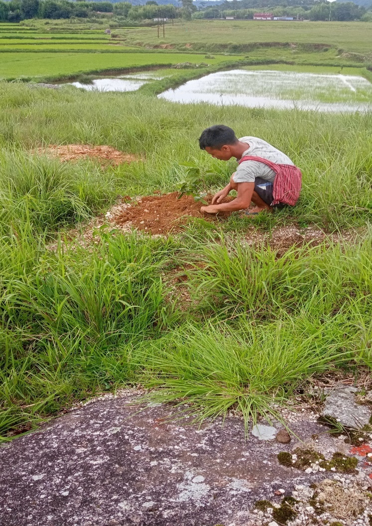
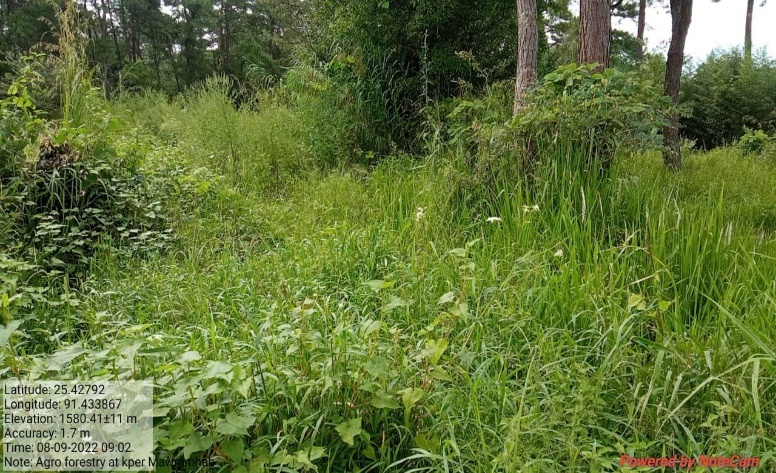
| Agro-forestry | Pyndenmawramhah-1 | 25.42792 | 91.433867 | Rs.54,300 | Completed | |
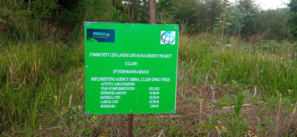
Fig: Agro-Forestry at Pyndenmawramhah-1.
| 14. | Type Of Intervention | Site Name | GPS Co-ordinates | Amount Sanctioned | Work Status | |
|---|---|---|---|---|---|---|
| Agro-horticulture | Pyndenmawramhah | 25.428056 | 91.433787 | Rs.1,56,900 | Completed | |
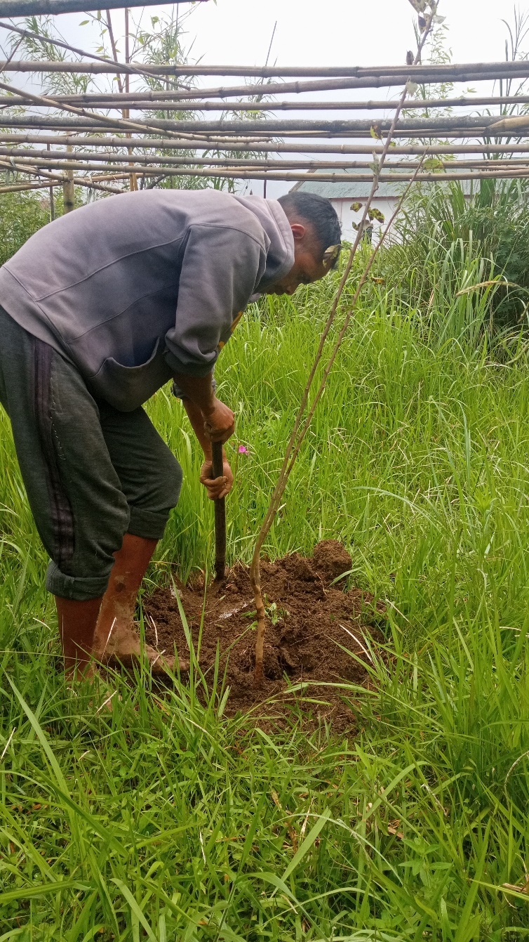
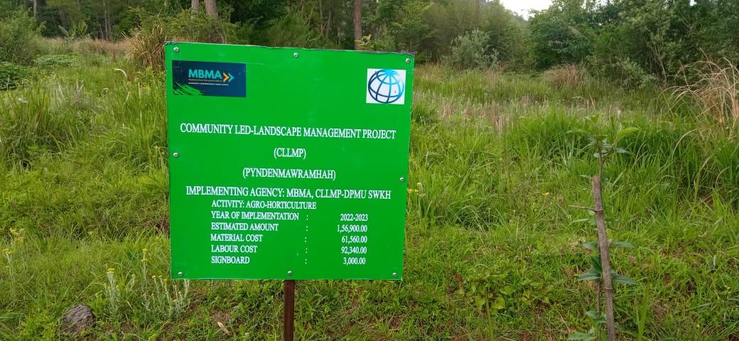
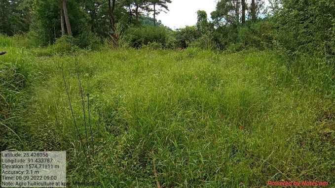
Fig: Agro-Horticulture at Pyndenmawramhah.

| 15. | Type Of Intervention | Site Name | GPS Co-ordinates | Amount Sanctioned | Work Status | |
|---|---|---|---|---|---|---|
| Community Nursery | Dimplot (Mawtynnai) | 25.431418 | 91.437053 | Rs.1,64,830 | Completed | |
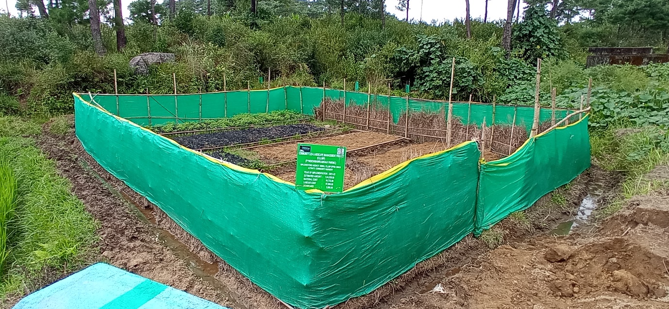
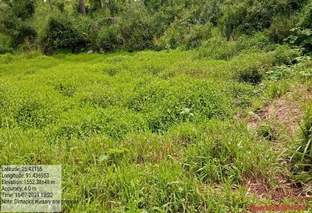
Fig: Community Nursery at Dimplot (Mawtynnai).
| 16. | Type Of Intervention | Site Name | GPS Co-ordinates | Amount Sanctioned | Work Status | |
|---|---|---|---|---|---|---|
| Trenches at Umlonghung | Umlonghung | 25.426853 | 91.429258 | Rs.24,300 | Completed | |
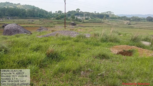
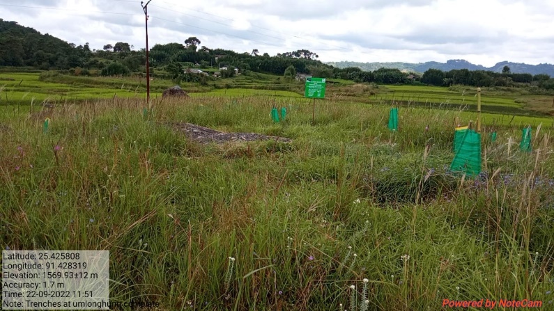
Fig: Trenches at Umlonghung.
| 17. | Type Of Intervention | Site Name | GPS Co-ordinates | Amount Sanctioned | Work Status | |
|---|---|---|---|---|---|---|
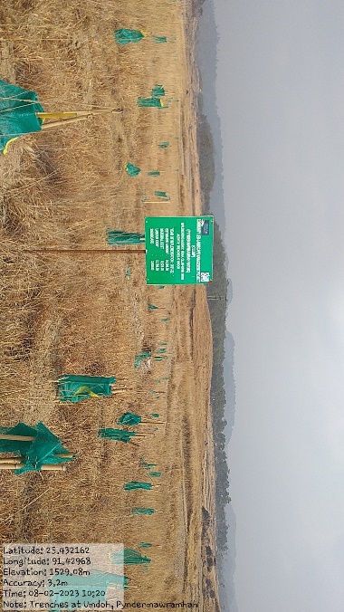
| Trenches at Umdoh | Umdoh | 25.432102 | 91.429669 | Rs.24,300 | Completed | |
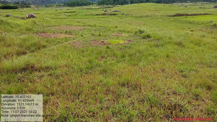
Fig: Trenches at Umdoh.
| 18. | Type Of Intervention | Site Name | GPS Co-ordinates | Amount Sanctioned | Work Status | |
|---|---|---|---|---|---|---|
| Trenches at Krem Shajir | Krem Shajir | 25.427378 | 91.433977 | Rs.24,300 | Completed | |
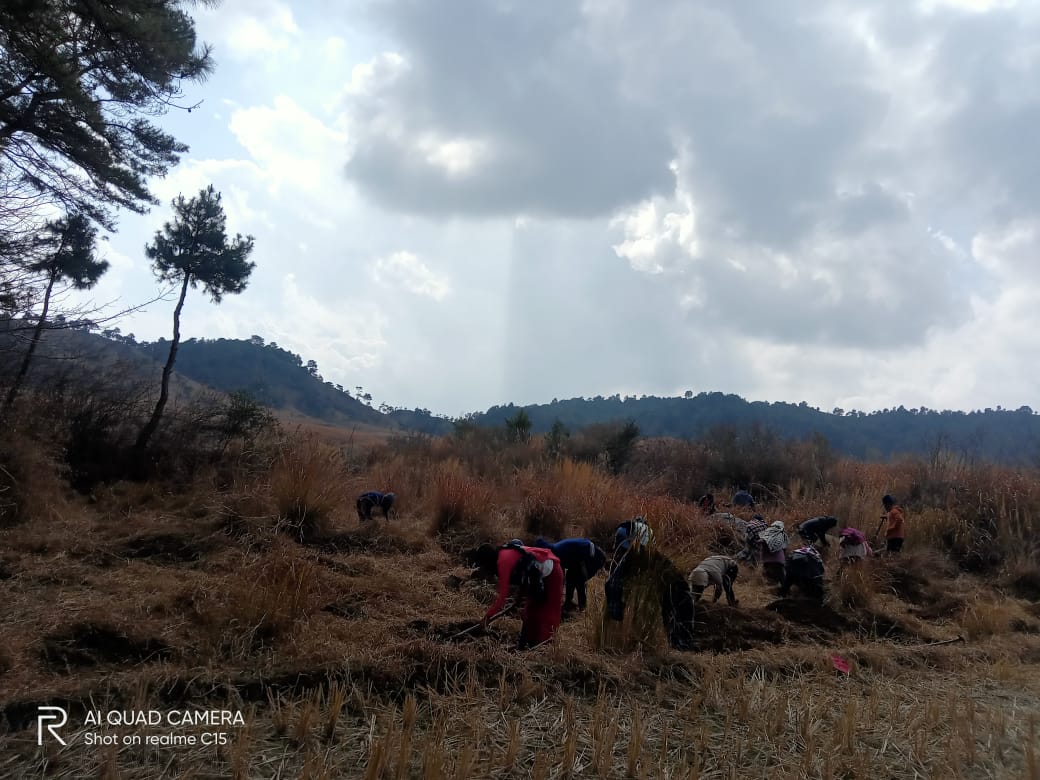
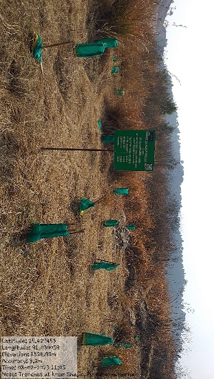
Fig: Trenches at Krem Shajir
| 19. | Type Of Intervention | Site Name | GPS Co-ordinates | Amount Sanctioned | Work Status | |
|---|---|---|---|---|---|---|
| Trenches at Diiang | Diiang | 25.435482 | 91.433274 | Rs.24,300 | Completed | |
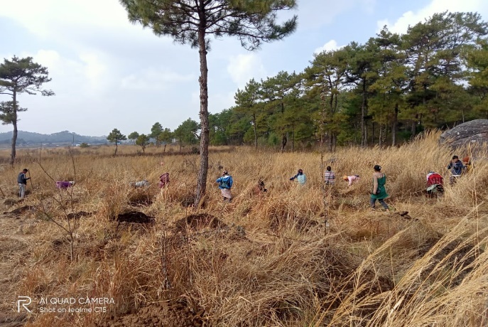
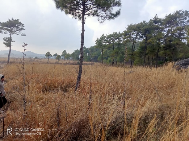

Fig: Trenches at Diiang.
| 20. | Type Of Intervention | Site Name | GPS Co-ordinates | Amount Sanctioned | Work Status | |
|---|---|---|---|---|---|---|
| Dug Out Pond at Umdoh | Umdoh | 25.429521 | 91.432033 | Rs.1,65,780 | Completed | |

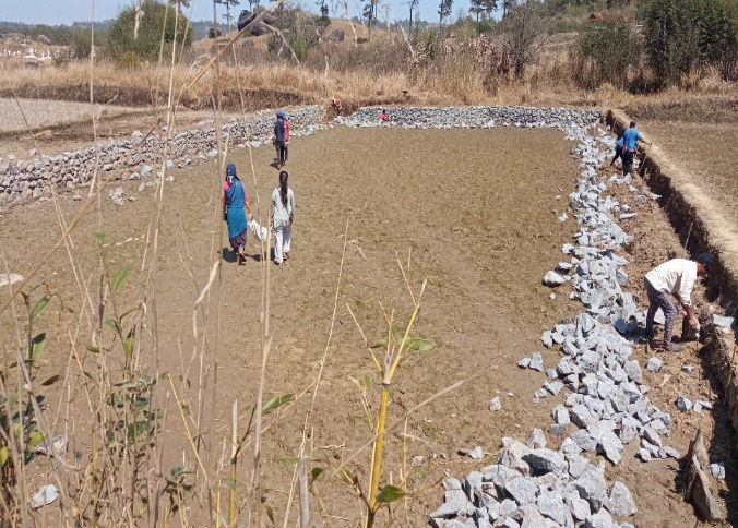
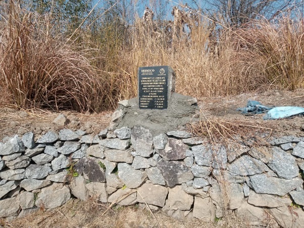
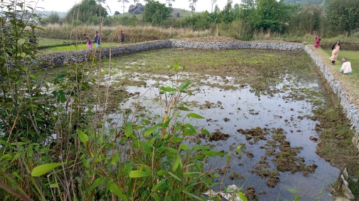
Fig: Dug out pond at Umdoh.
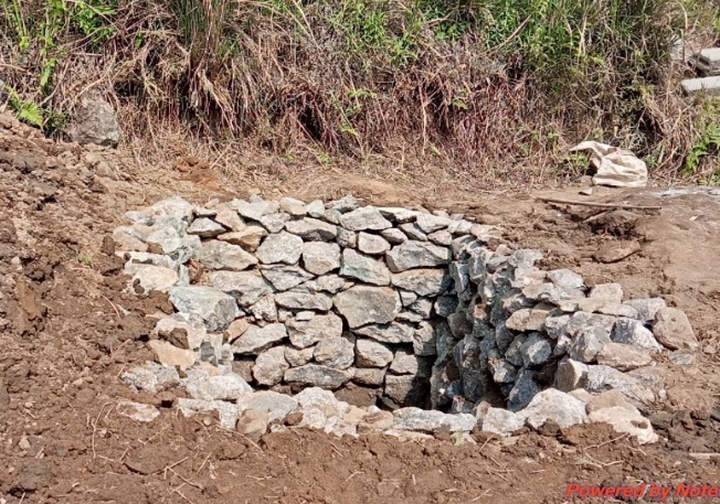
| 21. | Type Of Intervention | Site Name | GPS Co-ordinates | Amount Sanctioned | Work Status | |
|---|---|---|---|---|---|---|
| Spring Chamber at Mawpon | Mawpon | 25.426047 | 91. 431897 | Rs.55,150 | Completed | |
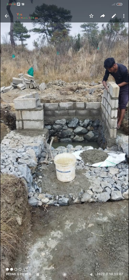
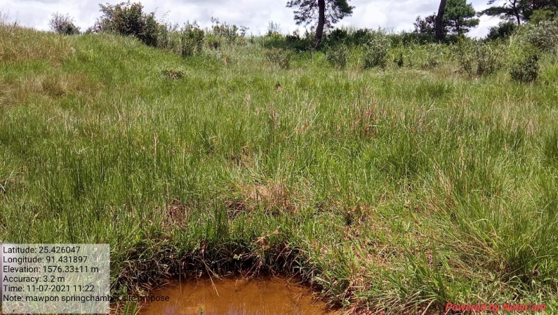
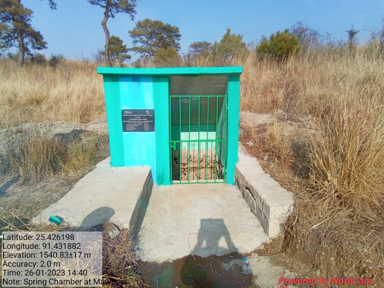
Fig: Spring Chamber at Mawpon.
| 22. | Type Of Intervention | Site Name | GPS Co-ordinates | Amount Sanctioned | Work Status | |
|---|---|---|---|---|---|---|
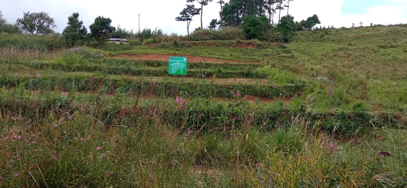
| Bench Terracing at Domdewsaw | Domdewsaw | 25.434217 | 91.438923 | Rs.72,610 | Completed | |
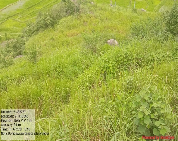
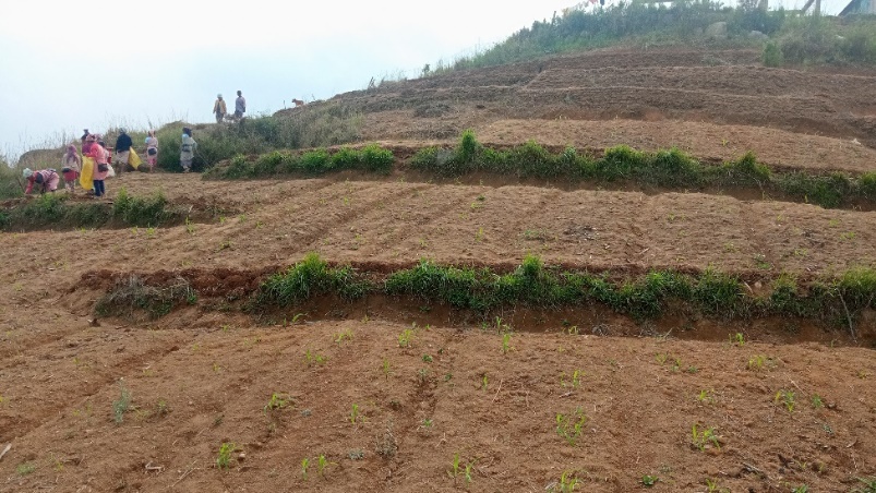
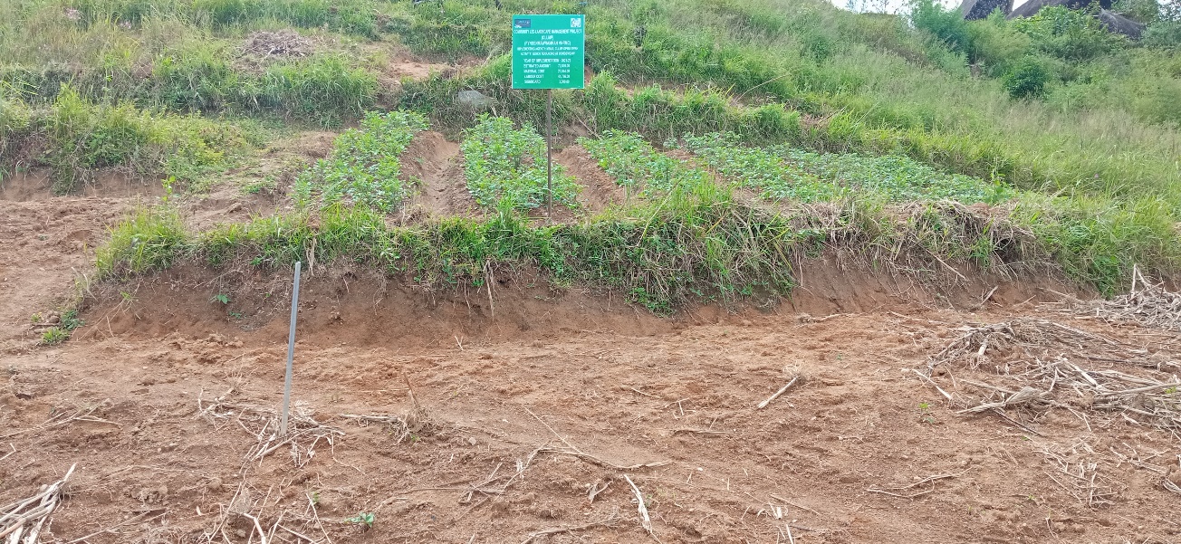
Fig: Bench Terracing at Domdewsaw.
| 23. | Type Of Intervention | Site Name | GPS Co-ordinates | Amount Sanctioned | Work Status | |
|---|---|---|---|---|---|---|
| Bench Terracing at Kseh Radio | Kseh Radio | 25.431218 | 91.429404 | Rs.1,42,220 | Completed | |
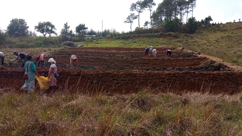
Fig: Bench Terracing at Kseh Radio.
| 24. | Type Of Intervention | Site Name | GPS Co-ordinates | Amount Sanctioned | Work Status | |
|---|---|---|---|---|---|---|
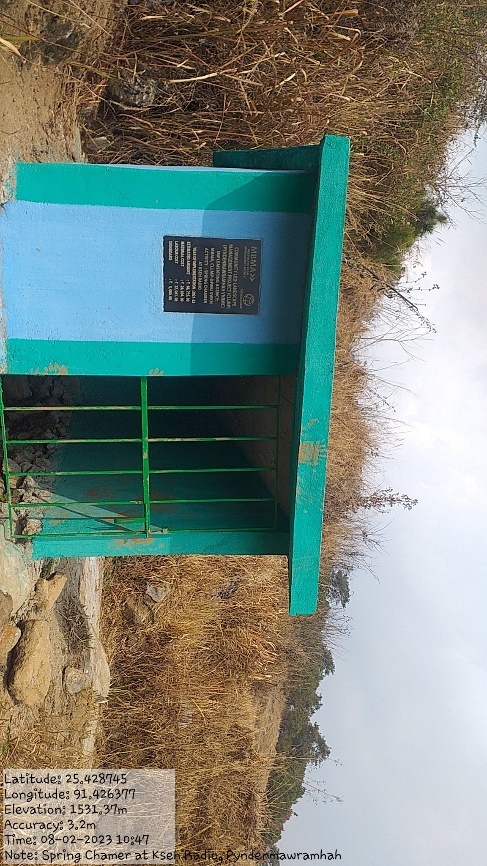
| Spring Chamber at Kseh Radio | Kseh Radio | 25.428742 | 91.426403 | Rs.66,735 | Completed | |
Fig: Spring Chamber at KsehRadio.
| 25. | Type Of Intervention | Site Name | GPS Co-ordinates | Amount Sanctioned | Work Status | |
|---|---|---|---|---|---|---|
| Spring Chamber at Dimaplot | Dimaplot | 25.431418 | 91.437053 | Rs.66,735 | Completed | |
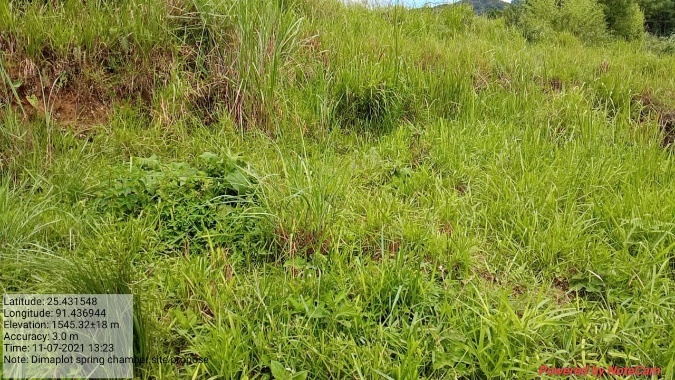
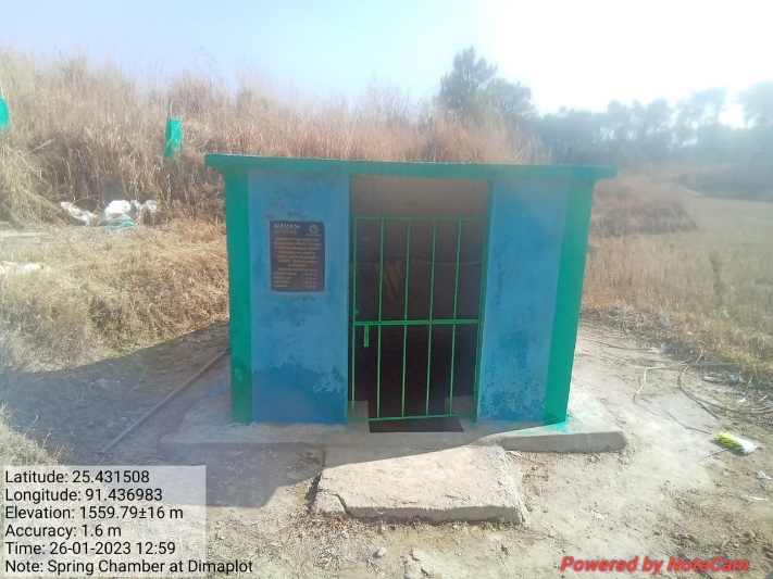
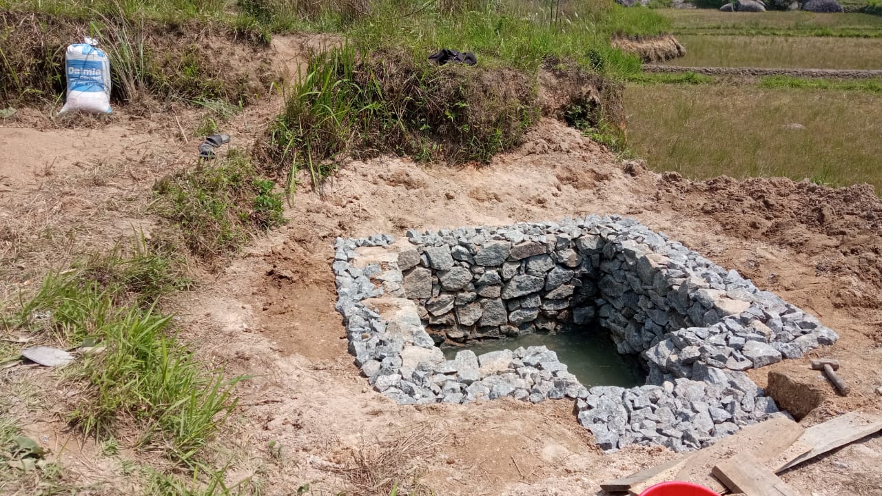
Fig: Spring Chamber at Dimaplot.
| 26. | Type Of Intervention | Site Name | GPS Co-ordinates | Amount Sanctioned | Work Status | |
|---|---|---|---|---|---|---|
| Dug out Pond at Nongrim 1 | Nongrim 1 | 25.434268 | 91.435527 | Rs.79,490 | Completed | |
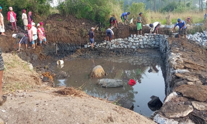
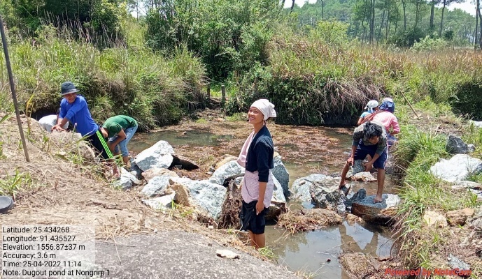
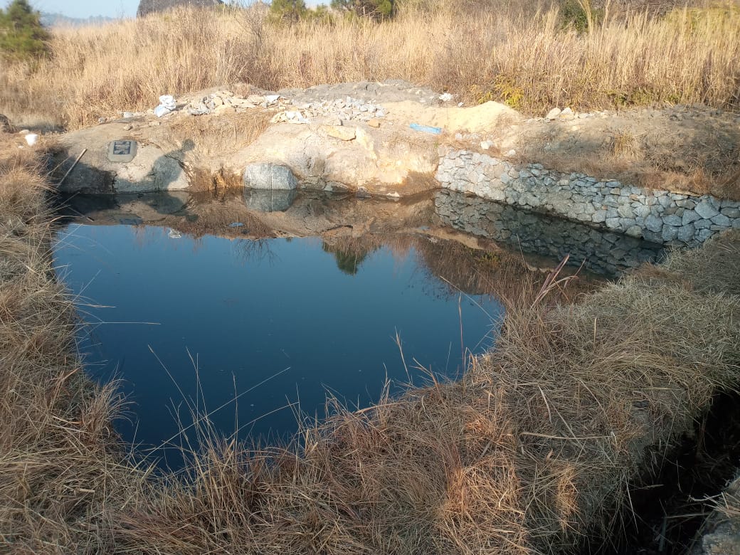
Fig: Dug out Pond at Nongrim 1.
| 27. | Type Of Intervention | Site Name | GPS Co-ordinates | Amount Sanctioned | Work Status | |
|---|---|---|---|---|---|---|
| Dugout pond Nongrim 2 | Nongrim 2 | 25.433116 | 91.437053 | Rs.2,10,450 | Completed | |
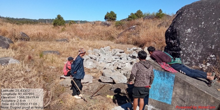
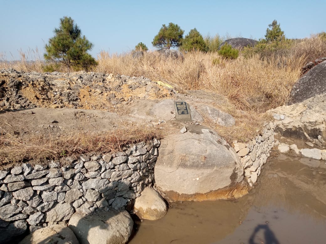
Fig: Dugout Pond Nongrim 2.
Project Implementation of the Additional 5 Lakhs:

| 28. | Type Of Intervention | Site Name | GPS Co-ordinates | Amount Sanctioned | Work Status | |
|---|---|---|---|---|---|---|
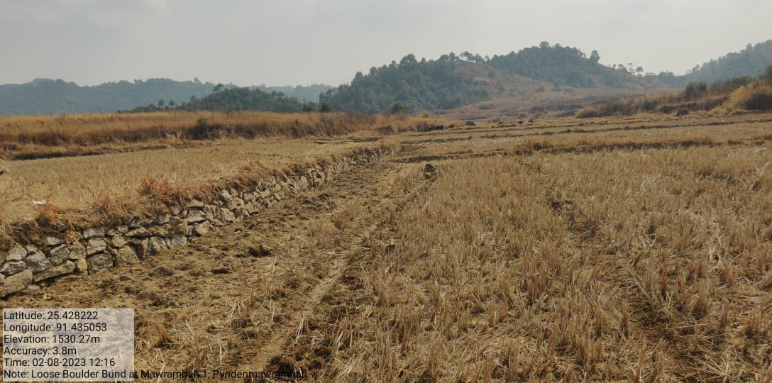
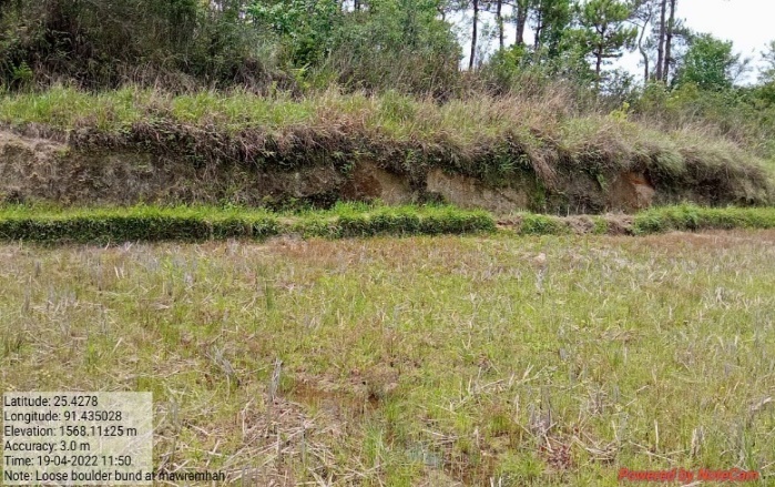
| Loose Boulder Bund at Mawramhah 1 | Mawramhah 1 | 25.4278 | 91.435028 | Rs.97,370 | Completed | |
Fig: Loose Boulder Bund at Mawramhah 1.
| 29. | Type Of Intervention | Site Name | GPS Co-ordinates | Amount Sanctioned | Work Status | |
|---|---|---|---|---|---|---|
| Loose Boulder Bund at Umlonghung | Umlonghung | 25.427106 | 91.427486 | Rs.61,950 | Completed | |
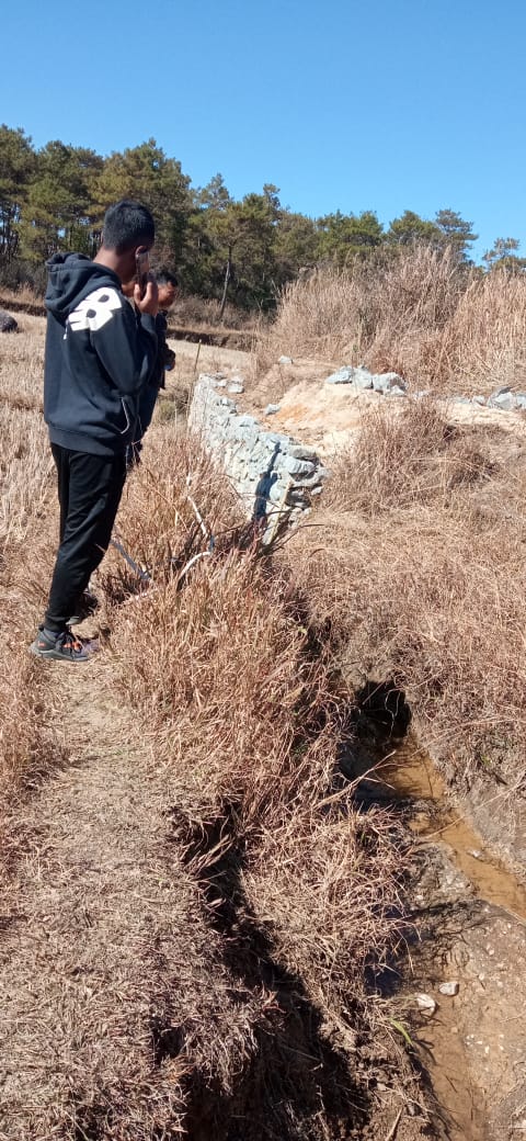
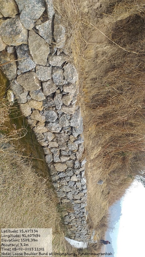
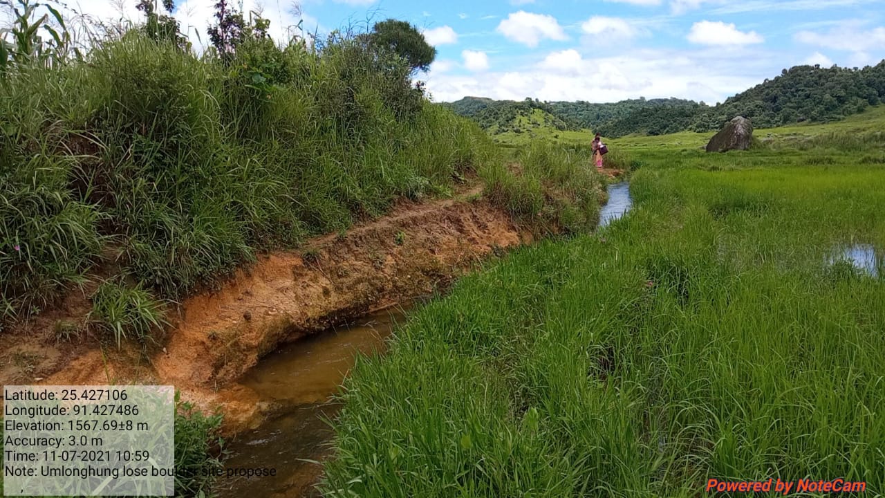
Fig:Loose Boulder Bund at Umlonghung.
| 30. | Type Of Intervention | Site Name | GPS Co-ordinates | Amount Sanctioned | Work Status | |
|---|---|---|---|---|---|---|
| Loose Boulder Bund at Mawramhah 2 | Mawramhah 2 | 25.427746 | 91.4349 | Rs.53,310 | Completed | |
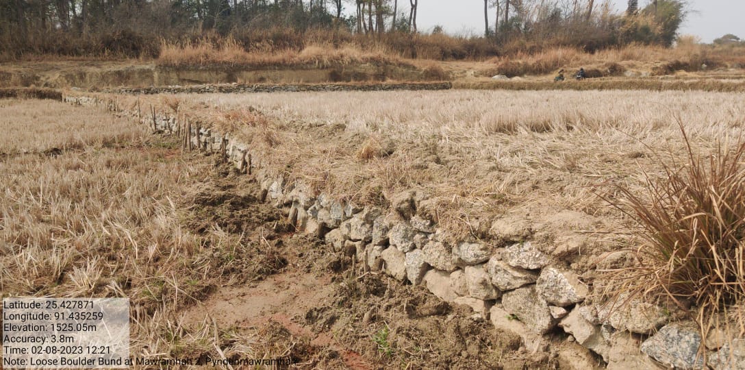
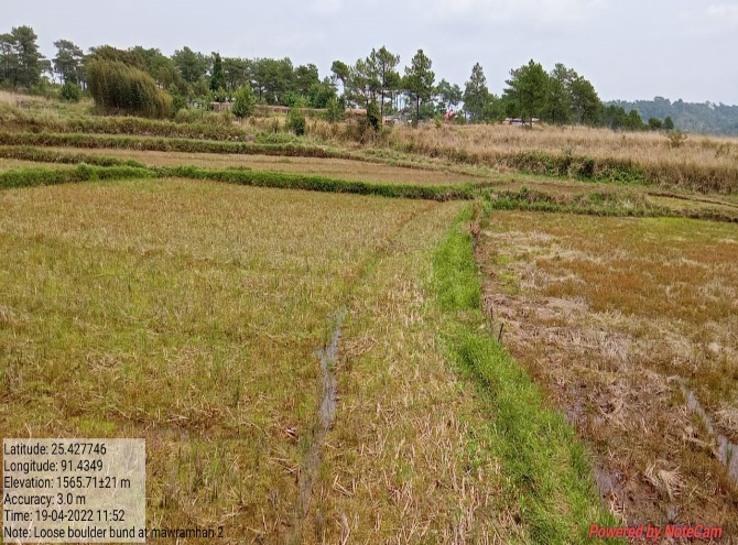
Fig: Loose Boulder Bund at Mawramhah 2.
| 31. | Type Of Intervention | Site Name | GPS Co-ordinates | Amount Sanctioned | Work Status | |
|---|---|---|---|---|---|---|
| Loose Boulder Bund at Krem Shajir | Krem Shajir | 25.427642 | 91.433568 | Rs.56,250 | Completed | |
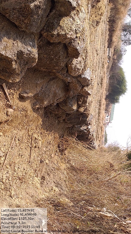
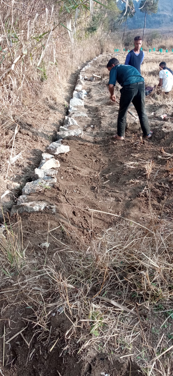
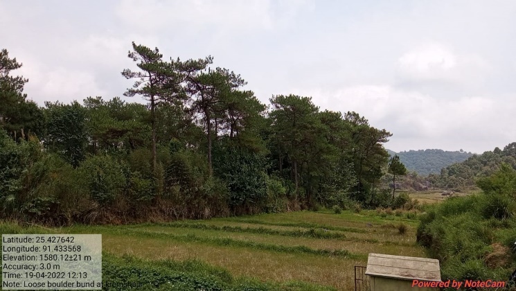
Fig: Loose Boulder Bund at Krem Shajir.
| 32. | Type Of Intervention | Site Name | GPS Co-ordinates | Amount Sanctioned | Work Status | |
|---|---|---|---|---|---|---|
| Loose Boulder Bund at Umkynja | Umkynja | 25.436242 | 91.437159 | Rs. 27,440 | Completed | |
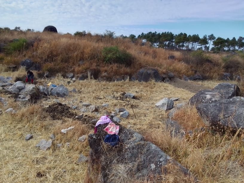
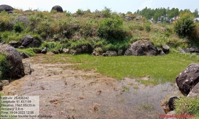
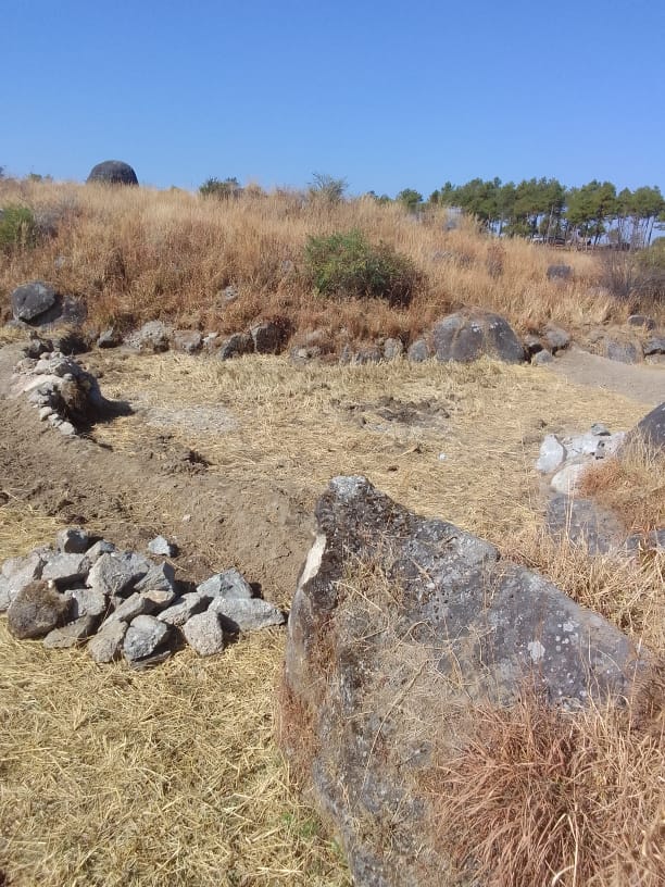
Fig: Loose Boulder Bund at Umkynja.
| 33. | Type Of Intervention | Site Name | GPS Co-ordinates | Amount Sanctioned | Work Status | |
|---|---|---|---|---|---|---|
| Loose Boulder Bund at Phot. | Phot | 25.426304 | 91.433174 | Rs.1,73,680 | Completed | |
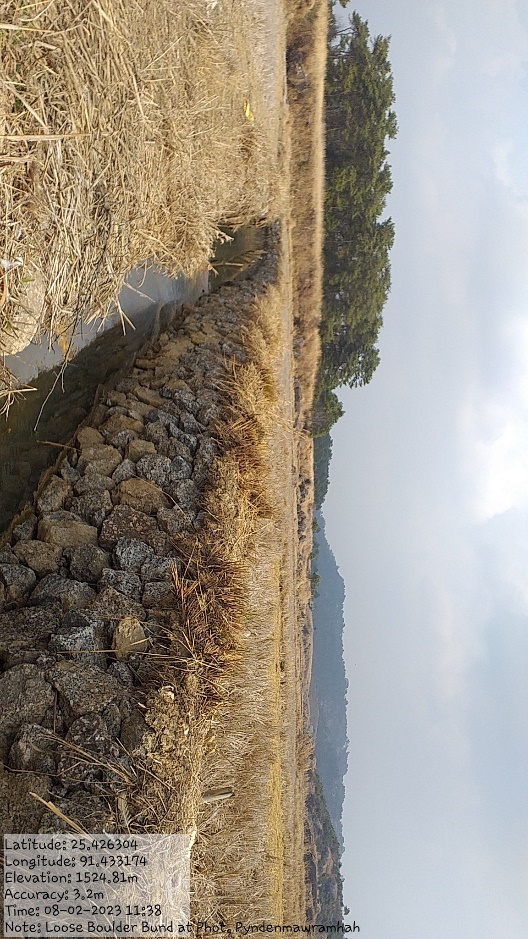
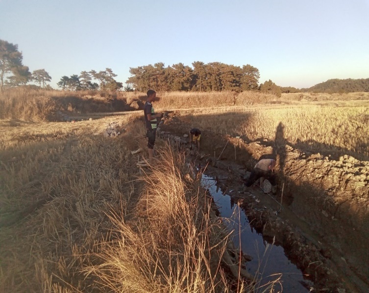
Fig: Loose Boulder Bund at Phot.
| 34. | Type Of Intervention | Site Name | GPS Co-ordinates | Amount Sanctioned | Work Status | |
|---|---|---|---|---|---|---|
Loose Boulder Bund at Mawwatkhar |
Maw Wat Khar | 25.431449 | 91.427524 | Rs. 15,000 | Completed | |


Fig: Loose Boulder Bund at Mawwatkhar.
| 35. | Type Of Intervention | Site Name | GPS Co-ordinates | Amount Sanctioned | Work Status | |
|---|---|---|---|---|---|---|
| Loose Boulder Bund at Umdoh | Umdoh | 25.429481 | 91.432219 | Rs. 15,000 | Completed | |
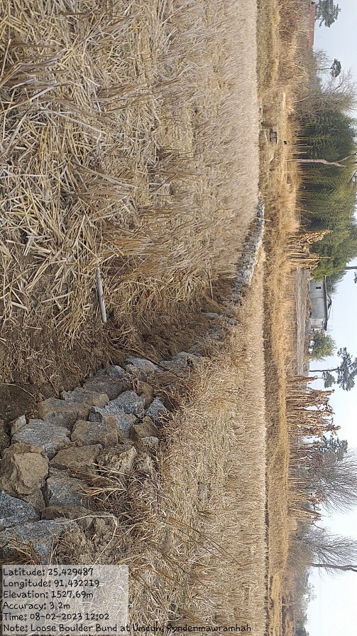
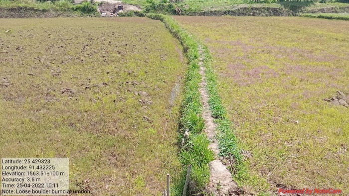
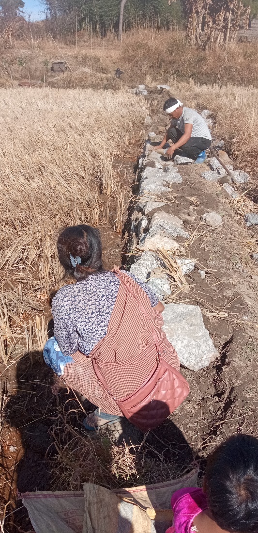
Fig: Loose Boulder Bund at Umdoh.
11.FUND STATUS:
The fund sanctioned for both the Rs.21,55,000 and the additional Rs.5,00,000 are listed in the table below:
Fund Released to VNRMC (Project Implementation)- Rs.26,55,000 Total No. of Work Order Issued- 35 |
|||||
| Activity Name | Amount Sanction | Amount Spent | Work Order Issued Date | Start Date | End Date |
| Afforestation at Umdoh | Rs.8,175 | Rs. 8,175 | 30th Jun 2021 | 22nd Jun 2022 | 24th Jun 2022 |
| Afforestation at Krem Shaijir | Rs.8,175 | Rs.8,175 | 30th Jun 2021 | 28th Jun 2022 | 30th Jun 2022 |
| Afforestation at Mawpon | Rs.96,150 | Rs. 96,150 | 30th Jun 2021 | 16th July 2021 | 19th Aug 2022 |
| Afforestation at Nongrim | Rs.2,51,400 | Rs.2,51,400 | 30th Jun 2021 | 13th Aug 2021 | 26th Aug 2022 |
| Afforestation at Diiang | Rs.49,575 | Rs.49,575 | 30th Jun 2021 | 1st July 2022 | 22nd July 2022 |
| Afforestation at Kseh Radio | Rs.34,050 | Rs.34,050 | 30th Jun 2021 | 4th July 2022 | 15th July 2022 |
| Afforestation at Mawsdep | Rs.34,050 | Rs.34,050 | 30th Jun 2021 | 16th July 2021 | 25th Aug 2022 |
| Afforestation at Pamiarwat | Rs.34,050 | Rs.34,050 | 30th Jun 2021 | 17th Jun 2022 | 30th Jun 2022 |
| Afforestation at Kroh | Rs.65,100 | Rs.65,100 | 30th Jun 2021 | 2nd Aug 2021 | 31st Aug 2022 |
| Afforestation at Rymmang | Rs.1,27,200 | Rs.1,27,200 | 30th Jun 2021 | 10th Aug 2021 | 27th Aug 2022 |
| Afforestation at Domdewsaw | Rs.49,575 | Rs.49,575 | 30th Jun 2021 | 23rd Aug 2021 | 27th Aug 2022 |
| Afforestation at Umlonghung | Rs.65,100 | Rs.65,100 | 30th Jun 2021 | 4th July 2022 | 30th July 2022 |
| Agro-forestry | Rs.54,300 | Rs.54,300 | 30th Jun 2021 | 2nd June 2022 | 10th Jan 2023 |
| Agro-horticulture | Rs.1,56,900 | Rs.1,56,900 | 30th Jun 2021 | 2nd June 2022 | 7th Jan 2023 |
| Community Nursery | Rs.1,64,830 | Rs.1,64,830 | 30th Jun 2021 | 8th Mar 2022 | 28th Mar 2023 |
| Trenches at Umlonghung | Rs.24,300 | Rs.24,300 | 30th Jun 2021 | 17th Jan 2022 | 27th Jan 2022 |
| Trenches at Umdoh | Rs.24,300 | Rs.24,300 | 30th Jun 2021 | 17th Jan 2022 | 29th Jan 2022 |
| Trenches at Krem Shajir | Rs.24,300 | Rs.24,300 | 30th Jun 2021 | 17th Jan 2022 | 27th Jan 2022 |
| Trenches at Diiang | Rs.24,300 | Rs.24,300 | 30th Jun 2021 | 17th Jan 2022 | 27th Jan 2022 |
| Dug Out Pond at Umdoh | Rs.1,65,780 | Rs.1,65,780 | 14th Dec 2021 | 1st Feb 2022 | 9th Jan 2023 |
| Spring Chamber at Mawpon | Rs.55,150 | Rs.55,150 | 14th Dec 2021 | 1st Mar 2022 | 12th Jan 2023 |
| Bench Terracing at Domdewsaw | Rs.72,610 | Rs.72,610 | 25th Feb 2022 | 1st April 2022 | 29th April 2022 |
| Bench Terracing at Kseh Radio | Rs.1,42,220 | Rs.1,42,220 | 25th Feb 2022 | 1st April 2022 | 14th Jan 2023 |
| Spring Chamber at Kseh Radio | Rs.66,735 | Rs.66,735 | 10th Mar 2022 | 2nd May 2022 | 16th Jan 2023 |
| Spring Chamber at Dimaplot | Rs.66,735 | Rs.66,735 | 10th Mar 2022 | 3rd May 2022 | 11th Jan 2023 |
| Dug out Pond at Nongrim 1 | Rs.79,490 | Rs.79,490 | 10th Mar 2022 | 2nd Nov 2022 | 22nd Nov 2022 |
| Dugout pond Nongrim 2 | Rs.2,10,450 | Rs.2,10,450 | 31st Mar 2022 | 1st Dec 2022 | 30th Dec 2022 |
| Loose Boulder Bund at Mawramhah 1 | Rs.97,370 | Rs.97,370 | 6th May 2022 | 8th Nov 2022 | 29th Dec 2022 |
| Loose Boulder Bund at Umlonghung | Rs.61,950 | Rs.61,950 | 6th May 2022 | 2nd Nov 2022 | 12th Dec 2022 |
| Loose Boulder Bund at Mawramhah 2 | Rs.53,310 | Rs.53,310 | 6th May 2022 | 1st Dec 2022 | 30th Dec 2022 |
| Loose Boulder Bund at Krem Shajir | Rs.56,250 | Rs.56,250 | 6th May 2022 | 1st Dec 2022 | 7th Jan 2023 |
| Loose Boulder Bund at Umkynja | Rs.27,440 | Rs.27,440 | 6th May 2022 | 10th Nov 2022 | 30th Nov 2022 |
| Loose Boulder Bund at Phot | Rs.1,73,680 | Rs.1,73,680 | 6th May 2022 | 9th Nov 2022 | 22nd Dec 2022 |
| Loose Boulder Bund at Maw Wat Khar | Rs.15,000 | Rs.15,000 | 6th May 2022 | 10th Nov 2022 | 7th Jan 2023 |
| Loose Boulder Bund at Umdoh | Rs.15,000 | Rs.15,000 | 6th May 2022 | 10th Nov 2022 | 30th Nov 2022 |
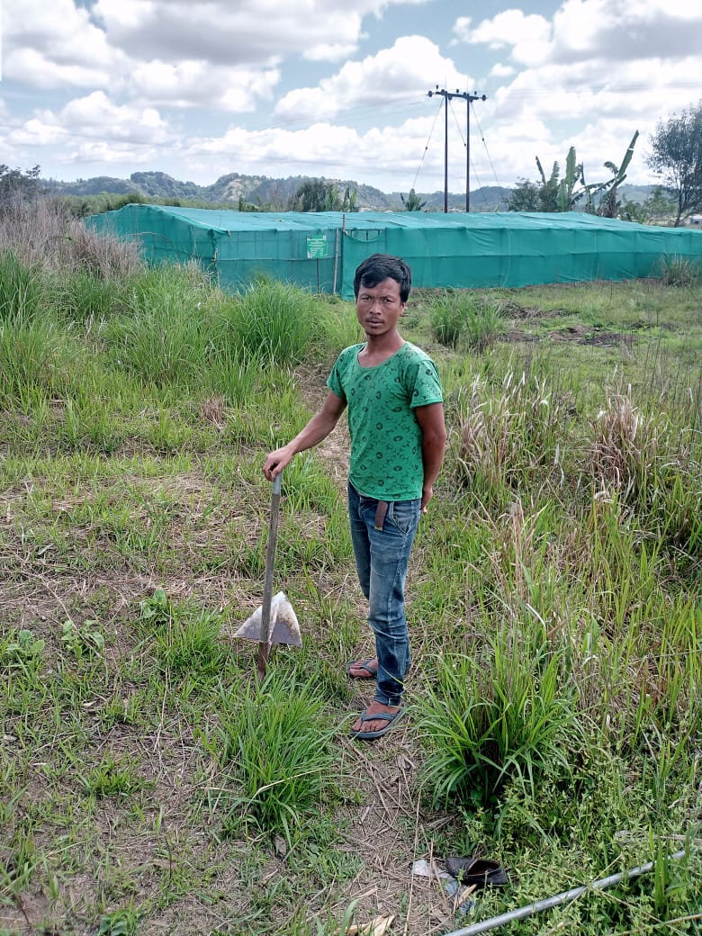
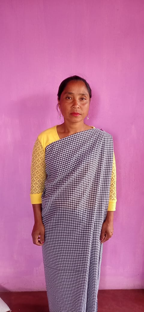
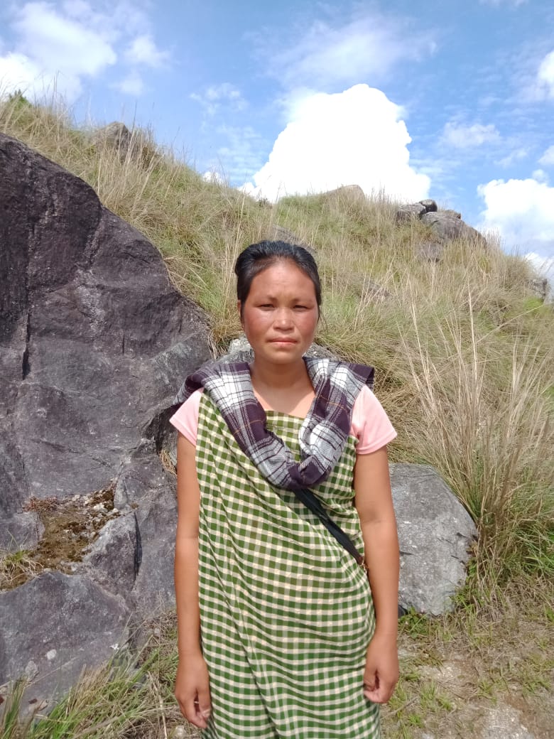
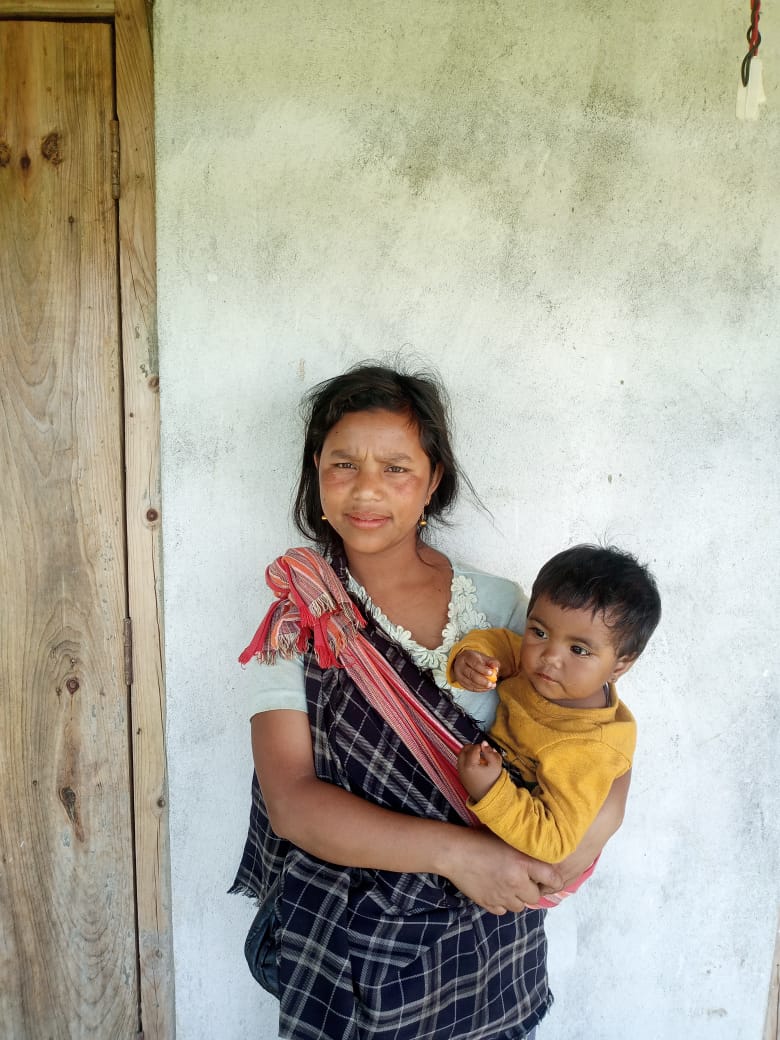
IX. GROUND TESTIMONIALS:
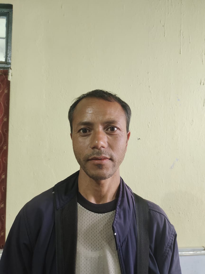
Mr.Edilbert Lyngkhoi
President, Pyndenmawramhah VNRMC
I would first like to express my gratitude towards the coming of the Community-Led Landscape Management Project in our village. With the funding from the World Bank, we have seen much changes within our villages in matters relating to the implementation of the various activities aiming at conservation of our surroundings. All activities and intervention received from the office have been benefitted by every resident of our village.
Mr.Kyrshan Lyngkhoi
VCF M&E
According to Mr. Kyrshan Lyngkhoi, the training received from the Project and the guidance from the DPMU team have been very helpful to him. It is a privileged to work as a VCF and to represent my village. CLLMP have given me the opportunity to learn and explore and as I get to play my part in contributing for the betterment of my surroundings, I will carry the knowledge received for the years to come.
Mrs.Youskhemlin Lyngdoh
VCF Environment
My experience with this office has been profiting not only to me personally as I have received quite a few numbers of trainings, but as a VCF I have also noticed that the implementation of this Project within our village has interventions that have benefitted the resident of our village equally, be it the Spring Chamber, Boulder Bunds or Afforestation or other interventions that cater to conserving the environment. The objective of this Project has taught us to be responsible and sensitive towards our surrounding and to never take for granted our Forest, Land and Waters which are readily available to us. We are grateful to the CLLMP team for its support through all the years.
Mr. Jency Shangpliang
Secretary Pyndenmawramhah VNRMC
As a secretary, I have now gained experience to
organise and preside a public meeting within my village and this is
only possible as I learned and practised along the way during my
time with CLLMP.
Mrs.Balarihun Kharjahrin
EC Member
I am grateful that through this project, I get additional income to support my family as the wages are given equally to me as a woman and to the men in our VNRMC especially in the works related to afforestation.
-------------------------------------*******************--------------------------------------