UNDER MAWKYRWAT C&RD BLOCK
DISTRICT: SOUTH WEST KHASI HILLS
COMMUNITY-LED LANDSCAPE MANAGEMENT PROJECT


The Government of Meghalaya with the financial help from the World Bank has been implementing the Meghalaya Community Led Landscape Management Project (MCLLMP). The project covers the entire state of Meghalaya and implementation of community led plans have been rolled out in phase manner throughout the state. The Meghalaya Basin Management Agency (MBMA) had facilitated the community-led planning by providing support, technical inputs and funding.
The project had strengthened community-led natural resources management in selected landscapes within the 12 districts of the state. This has been achieved through a variety of planning, capacity building, and on-the-ground interventions to promote the conservation, sustainable use of natural resources, social inclusion and community mobilisation; building traditional knowledge and learning, mapping of natural resources management; strengthening the community institutions and creating linkage with financial institutions and community organizations.
The project interventions include the preparation of community led natural resource management plans. The CLLMP has the following three components:
Strengthening Knowledge and Capacity of Communities for Natural Resources Management
Community-Led Landscape Planning and Implementation
Project Management and Governance
The project objective is “to manage and conserve the natural resources, especially forests, soil and water sources, in a manner that supports the financial and physical well-being of communities in the State”
SCOPE:
The CLLM-Programme focuses on increasing the capacities of communities and traditional institutions (TI) by adopting a landscape approach to manage their natural resources such as soil, springs and other water sources, forests and bio-diversity, etc.
The project has been planned and implemented in about 400 villages across the state.
CLLMP has a strong focus on institution-building at the village-level, by ensuring systematic capacity-building on technical and social skill-sets.
The project has also extended such trainings to communities beyond the targeted villages and support efforts made by them to access funding from various rural and natural resources initiatives and schemes.
The programme has also invested in improving the process and outcome delivery, by developing and adhering to effective systems and procedures, supported by the appropriate technology.
BENEFITS:
Benefits for community (Skills and Capacity relating to technical and managerial areas like NRM and Conflict resolution
Benefits to traditional institutions (village councils, traditional leaders, community-based organizations, SHGs etc) through Knowledge sharing, promotion of innovative approach, access to technology, technical managerial and financial support.
It has been estimated that the project has impacted around 1 lakh partners (of which 50% are women) who depend on land, forest, agro forestry.
Through the project, 55000 Ha of targeted area has been ensured with availability of water, biological resources and soil productivity, which has in turn benefitted around 400 villages and the outcomes delivery can be summarized as follows.
IMPLEMENTATION AGENCY:
The Project has been executed by the MBMA in collaboration with other partners particularly, SIRD (for training and capacity building), Department of Soil and Water Conservation, Water Resource Department, Forest Department, specifically with respect to technical inputs, safeguards management and Community NRM plan preparation.
PROJECT PERIOD:
2018-2023 (5 years)
TABLE OF CONTENTS:
Introduction and History ----------------------------------------------------------- 4-6
Social Profile ----------------------------------------------------------------------- 7
Village Accesibility ---------------------------------------- 7
Literacy rate ------------------------------------------------- 7
Population --------------------------------------------------- 7
iv. Occupation -------------------------------------------------- 8
v. Village organisation --------------------------------------- 9
vi. Fuel Type ---------------------------------------------------- 9
vii. Drinking Water---------------------------------------------- 9
viii Cultivatable Land ------------------------------------------- 9
ix. Forest Cover ------------------------------------------------- 9
x. Forest Species ----------------------------------------------- 10
xi Water Bodies ------------------------------------------------ 10
xii. Areas affected ----------------------------------------------- 10
III. CLLMP Activities
Ground-Truthing ----------------------------------------------------------- 11
Sensitization on CLLMP -------------------------------------------------- 12
2.1. Signing of EOI, VGA and Green Charter ------------------- 12
2.2. Formation of VNRMC ----------------------------------------- 12-13
2.3. Village Community Facilitators -------------------------------13
2.4. Purchase Committee -------------------------------------------- 14-15
3. Opening of Bank Account _------------------------------------------------16
4. PRA Exercise ----------------------------------------------------------------17
4.1. Village Boundary Mapping and Resource Mapping --------18
4.2. Basic Survey for CNRMP template----------------------------19
4.3. Focussed Group Discussion ----------------------------------- 20-21
5. Submission of CNRMP Plan ----------------------------------------------- 22
5.1. The final CNRMP Plan------------------------------------------ 23
6. GIS Activities --------------------------------------------------------------- 24-25
7. Project Implementation ---------------------------------------------------- 26-48
8. Fund Status ------------------------------------------------------------------ 49
9. Ground Testimonials-------------------------------------------------------- 50-53
INTRODUCTION:
Pyndensakwang village is situated in South West Khasi Hills District under the Mawkyrwat C&RD Block. The village is about 3 Km away from the District Headquarters i.e., Mawkyrwat and about 5 Km away from the Block Headquarters. It has a total geographical area of 201.27Ha and falls under the Hima Maharam Syiemship. Pyndensakwang village has a total population of 832 comprising of 408 males and 424 females. All the residents of Pyndensakwang village belonged to the Khasi Scheduled Tribe. The average rainfall of Pyndensakwang village is 1200mm and the type of soil is mainly loamy soil.
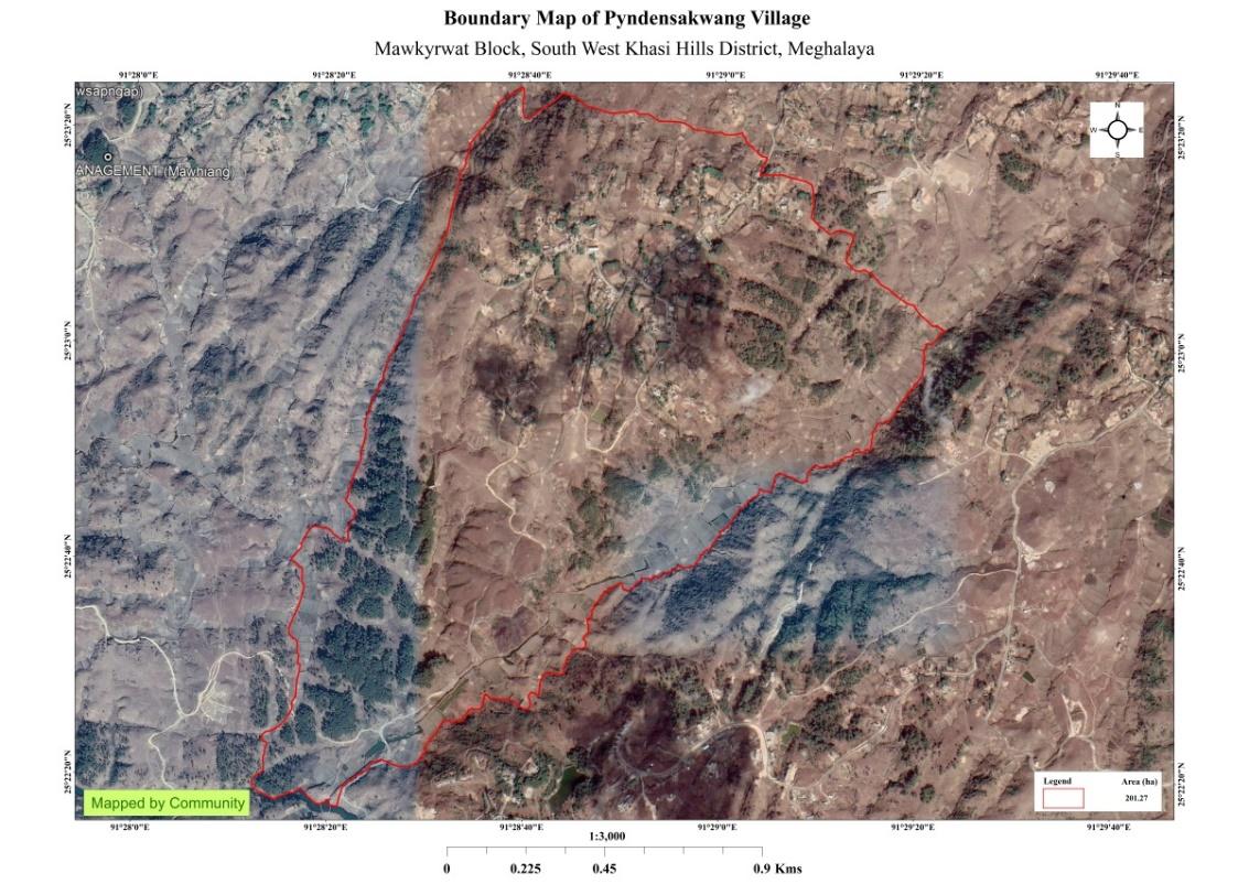
Fig: Pyndensakwang village Boundary Map.
Brief History:
The name Pyndensakwang is a maram word that literally translates to “Pynden” meaning “plain area” and “Sakwang” as its origin is from Sakwang village. Pyndensakwang is a village that has been recognised by the Maharam kingship and other high powers of the ruling party. It is a village that is 100 years old and is situated in a plain area. The villagers are mostly farmers and a few are working in the government and business sector. The villagers have ownership over the land. It has its own area of ruling that has been recognised by the Syiem (king) of Maharam in accordance with the laws of ruling within the kingdom.
According to stories passed down by the elders, a huge earthquake shook the khasi-Jaintia hills in the year 1897 and a few people from this village settled in a new area. In the year 1898 or 1899, there were about 8 household that settled here and these were: Ken Ramsiej, Iar Ramsiej, Sin Ramsiej, Lew Ramsiej, Merry Ramsiej, Jyllun Ramsiej, Mai Wartde, and Tieh Kharjahrin who were in the care of Pyndensakwang village. Few years later, there were about 15-16 household and now the number of households have increase. The village Ministers that serve as the ruling head since the village’s inception were Bin Ramsiej, Shrip Ramsiej, Sawer Wartde, Jlensi KharShandi and Arnes Lyngdoh who is still the village minister to this day.
The people of Pyndensakwang village does not have their own land and they settled over the land that was owned by the Lyngkhei clan and the Nongsiej clan that were from Rangmaw and Mawten village and the settlers have to pay tax on their crops to the land owners. In the year 1964 there were around 40 household and under the leadership of the elders of the village they bought the land. After this they divided among 45 household and to 3 of the original land owners who refused to sell at that time. To this day this land that was divided is looked after and cared by the descendants of the 48 households. The different clans that lived in this village were the Ramsiej, Kharjahrin, Wartde, Nongsiej, Sohphoh, Iawphniaw, Lyngdoh, Syiemlieh, Kharbani. The village is led by the village minister and the village dorbar. They also have other branch of committees within the village dorbar that ensures a smooth functioning of village as a whole.
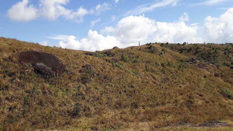
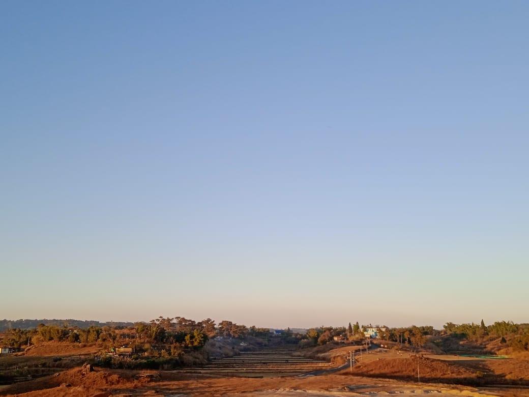
Fig: Pyndensakwang village.
VILLAGE SOCIAL PROFILE:
Pyndensakwang village has a total number of 150 households, having a total population of 832 villagers. People in this village mainly depend on agriculture and its allied activities for their livelihood. There are teachers, businessmen and some others are engaged with government services.
Village Acessibility:
In order to reach Pyndensakwang village one must travel by road with local taxis via Mawkyrwat -Shillong Road and on reaching the District Court one must turn left to reach Pyndensakwang village.
Literacy Rate:
As per 2011 Census, Pyndensakwang has a higher literacy rate compared to the State average. Pyndensakwang literacy rate was 98.31% while the State average stands at 74.4%. The male literacy rate was higher at 98.71% than that of the female literacy rate which stands at 97.93%. In Pyndensakwang, there are a total number of 7 schools out of which 5 are Primary Schools and 2 Secondary Schools.
Population:
As per 2011 Census, the total population of Pyndensakwang village is 612 people and this has seen an increased over the years and now stands at 832 as of the recent survey. Out of this, 408 are male and the female count is 404. About 268 total number of people belong to the age group of 15-30 years, thus this indicates that the majority of the population of Pyndensakwang village comprise of the young and healthy people.
| Age Group | Male | Female | Total |
|---|---|---|---|
| 0-4years | 67 | 66 | 133 |
| 5-14years | 87 | 88 | 175 |
| 15-30years | 137 | 131 | 268 |
| 30-60years | 97 | 100 | 197 |
| Above 60years | 20 | 19 | 59 |
| Total | 408 | 404 | 832 |
Occupation:
The people of Pyndensakwang village rely mainly on agriculture and forest produce for their livelihood. Out of 150 households within the village, 80 households are farmers, 23 household are labourers, while 23 household are teachers and 14 households are in government service and 10 households are engaged in business activities.
Organisation within the Village:
There are 9 Self Help Groups (SHGs) under NRLM in Pyndensakwang village under one Village Organisation. Presence of a committee relating to Water and Sanitation within the village. There are also 8 VEC & traditional institutions within Pyndensakwang village.
Fuel Type:
The people of Pyndensakwang village mainly uses wood as a fuel. About 150 households depend on wood gathered from the forest for their daily requirement.
| Type of Fuel | Total No of HH | Qty (Kgs/HH) | Total |
|---|---|---|---|
| Wood | 144 | 6000kg 2Stacks per year |
864000kg |
| LPG | 6 | 6400kg 8cylinder per year |
38400kg |
Drinking Water:
The people of Pyndensakwang have access to drinking water mainly from the springs within the village. Government water supply lines are also available in this village. But over the years there has been a scarcity of water supply in this village due to less water discharge from the springs source and due to the increase in human population and their daily requirements. There are 7 springs within the village which are perennial that people use for drinking viz. Siejkongplian, Mawshoi, Mawkynrum, Dommawkhan, Pungkadah, Photbah, Compound School.
Cultivable Land Cover:
The total agricultural area of Pyndensakwang village is 60.81ha. The type of soil in Pyndensakwang village is Loamy soil. People practise bun cultivation in their own private lands. The main crops of Pyndensakwang village are Paddy, Maize, Potato, Yam, Sweet Potato, Mustard, Beans, Pumkin & Chayote. They also plant Bayberry, Crab apple, Mulberry, Passion Fruit, Black berry and Peach in their own garden.
Forest Cover:
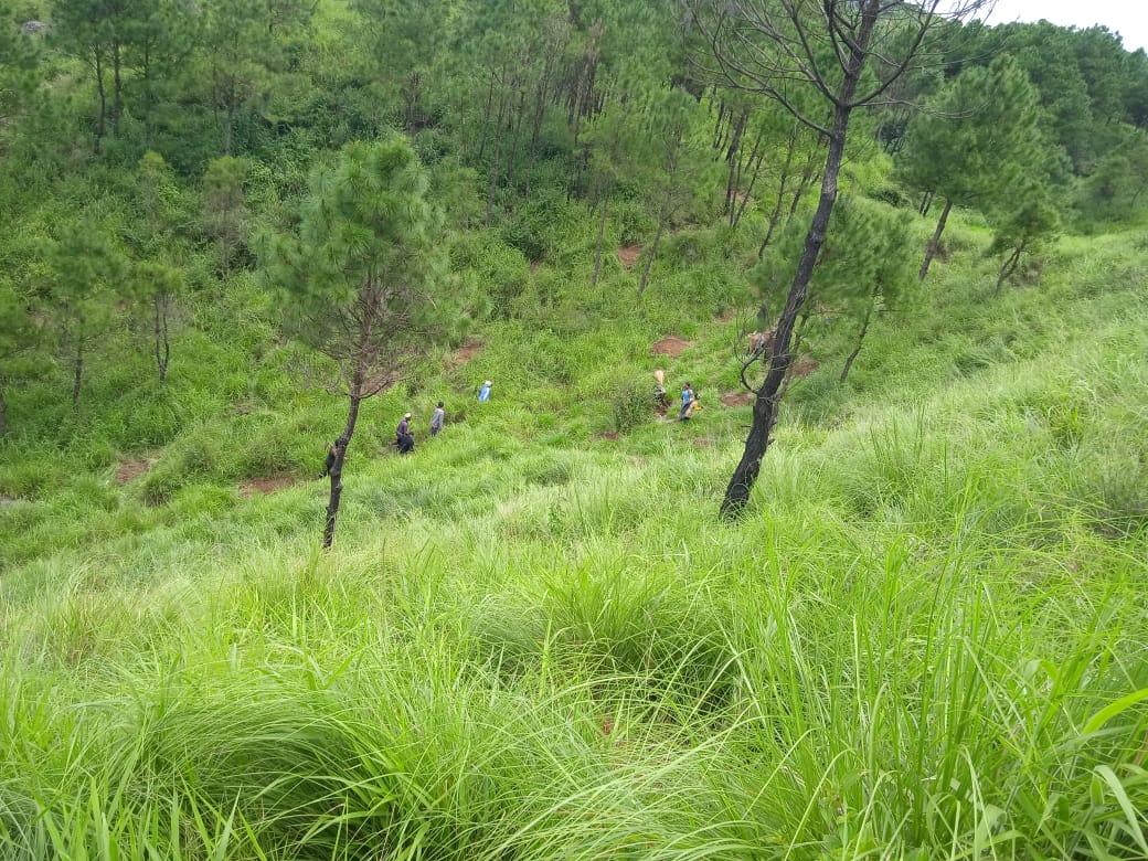
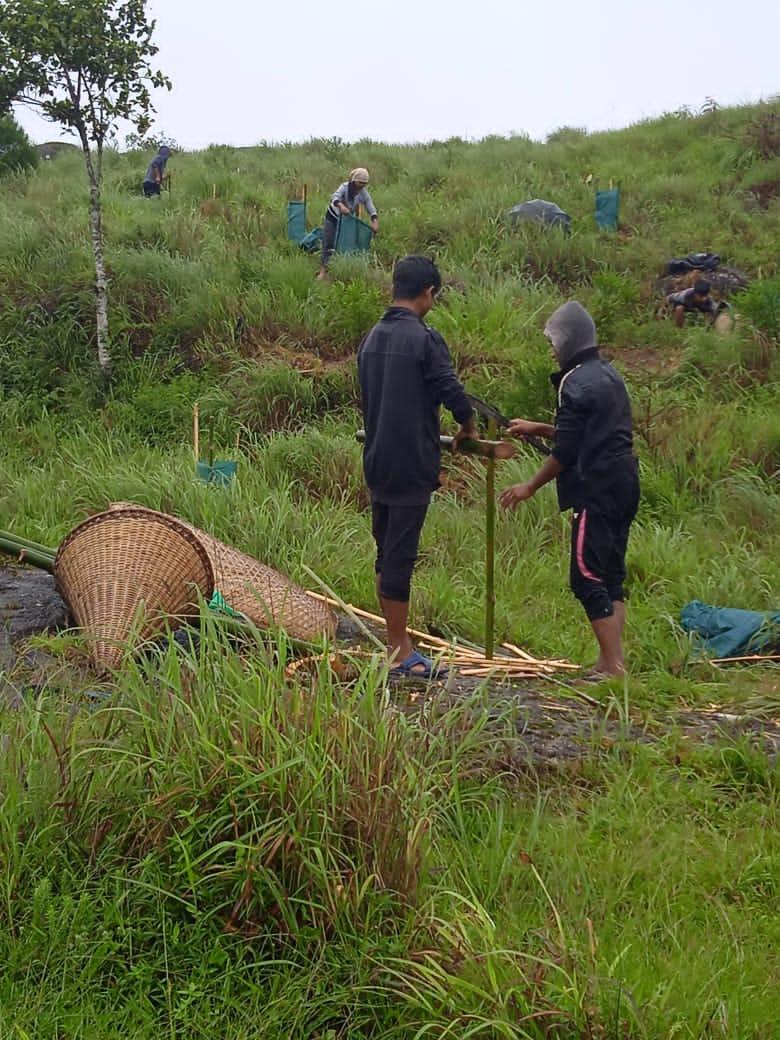
The total forest cover under Pyndensakwang village is 37.66ha. Most of the forest cover are on community land and on private land and the quality of the forest is open. People uses the forest products mainly for fuelwood, timber, as medicines, aromatic plants and for other purposes. There are Community Forest at Jakar, & Ranab Umdoh while the forest that falls on the private land within the village are Khangnar, Synrei utung, Dahlwa, Mawsymoit and Perbah.
Forest Species:
Some of the indigenous tree species found in this village are Dieng Kseh, Dieng Alda, Dieng Ngan, Dieng Ksehbilat, Dieng loin, Dieng doh, Diengshit, Dieng Sohphie, Diengtanglung. There are some plant species used by the people of the community for medicinal purposes like Dieng sohphie, Dieng sohot, Diengbyrkham, Jatira, Jale and Jamyrdoh. Raibitia, Sohbyrthid, Jarain, Tyrkhang are some of the main invasive plant species found here. The forest is home to many vulnerable fauna-like wild birds, clouded leopard, and rabbits.
Water Bodies:
Total area of water bodies in Pyndensakwang is 1.76ha. There are about 7 springs within the village which people use mainly for drinking purpose. Some the streams within the village are Umdoh, Mawshoi, Siejiewhei and Khangnar which are all perennial and are mainly use for washing, irrigation and fisheries.
Areas Affected:
Approximately about 25.66ha of forest land have been degraded over the years due to soil erosion, forest fires, excessive felling of trees which have led to the loss of productivity of the land and the loss of the saplings and other natural resources. About 3.41ha of cultivable land have been affected by the excessive use of fertilizers and 5.89 of land have been degraded over the years owing to human settlement and culturable wastelands.
CLLMP ACTIVITIES:
Ground Truthing:
The CLLMP officials met with Mr.Arnes Lyngdoh, headman of
Pyndensakwang village, Mr. Donborlang Nongsiej the village Secretary
and other village representatives for field assessment. Mr.Lyngdoh,
provided the CLLMP Team with important information regarding the
current scenario of the landscape and the natural resource
management under his headmanship. 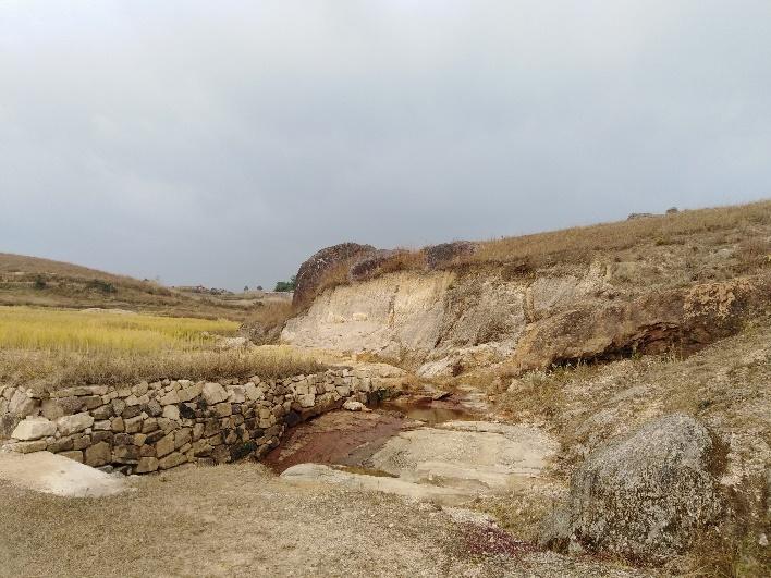
Fig: Ground truthing Survey at Pyndensakwang.
Case Findings:
Most of the household falls under the BPL category.
They have an actively performing VEC in the village.
The land within the village falls under the Hima Maharam Syiemship.
The source of water supply in the village is from two sources: private and public.
There are a few patches of degraded land that has been left unused.
There is a loss of Natural Vegetation in the area.
There is a small stream within the village.
Forest on hill slopes is prone to forest fires.
Some of the paddy fields in the area are without proper irrigation.
Sensitization Programme:
The District Project Manager Mr. J. Wanniang along with the staff held a village Level Sensitization Programme on the Community Led Landscape Management Project (CLLMP) on the 29th June 2019.The villagers actively participated in the program, voicing out their concerns and questions regarding the project making it a huge success.
Highlights of the meeting:
1. Awareness about the Community Led Landscape Management Project (CLLMP).
2. Laying the importance on the involvement of the community in making the CNRM plan and its success.
3. A brief awareness on cleanliness was conducted based on our finding during the ground truthing phase.
4. An interactive session was held to answer doubts of the villagers regarding the project.
2.1: Signing of EOI, VGA and Green Charter:
On 29th June 2019, Pyndensakwang village signed the EOI (Expression of Interest), VGA (Village Grant Agreement) and the Green Charter after there was a uniform agreement by the people of the entire Community that the Community Led Landscape Management Project (CLLMP) be implemented at Pyndensakwang village.
2.2: Formation of the VNRMC:
The formation of the Village Natural Resources Management Committee was done in a public meeting on the 29th June 2019 in the presence of the entire village and the CLLMP Staff. The people of the community chose the President, The Secretary, the Purchase Committee members and the other Executive members to formed the Pyndensakwang VNRMC. There are 9 Executive members, 3 Village Community Facilitator and 3 Purchase Committee members.
List below are the members of the VNRMC:
| Village Natural Resource Management Committee (9members committee constituted from Village Council, SHG group, Women’s group, youth, VEC) | |||||||||
|---|---|---|---|---|---|---|---|---|---|
| Sl No | Name | Designation | Gender (M/F) |
Age (in yrs) | Qualification | Occupation | Community | Phone No. | |
| 1. | Donborlang Nongsiej | President | M | 38 | XII | Teacher | Khasi | 8837441656 | |
| 2. | Beautiful Ramsiej | Secretary | F | 30 | XII | Business | Khasi | 9366591657 | |
| 3. | Paulningstar Ramsiej | F.Secretary | M | 26 | BA | Govt. Servant | Khasi | 7005872950 | |
| 4. | Bhin Wartde | Member | M | 58 | XII | Teacher | Khasi | 8131830860 | |
| 5. | Arnes Lyngdoh | Member | M | 50 | X | Govt. Servant | Khasi | 8837247802 | |
| 6. | Lovender Mashra | Member | M | 35 | X | Business | Khasi | 9366069960 | |
| 7. | KyntiMerry Ramsiej | Member | F | 30 | XII | Teacher | Khasi | 9366507559 | |
| 8. | Stemly K. Jahrin | Member | F | 50 | X | Teacher | Khasi | 9378179893 | |
| 9. | Happylanda Ramsiej | Member | F | 40 | BA | Helper | Khasi | NA | |
2.3: Village Community Facilitators.
| Sl no. | Name | Gender | Age | Qualification | Contact Number | Role |
|---|---|---|---|---|---|---|
| 1. | Donborlang Nongiej | Male | 38 | XII | 8837441656 | Social & KM |
| 2. | Beautiful Ramsiej | Female | 30 | XII | 9366591657 | Environment & GIS |
| 3. | Plosborlin K.Jahrin | Male | 28 | XII | 7085329500 | Document and M&E |
2.4. Procurement Members
| Sl no. | Name | Age | Gender | Qualification | Contact Number |
|---|---|---|---|---|---|
| 1. | Restarding Sohphoh | 33 | Male | B. A | 6009890210 |
| 2. | Sobar K Wanniang | 58 | Male | III | 9402153135 |
| 3. | Kolbingland Syiemlieh | 36 | Male | VII | 8256970124 |
| 4. | Dresfullian Ramsiej | 48 | Female | IX | 7005087716 |
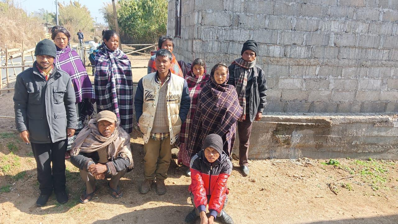
Fig: VNRMC members.
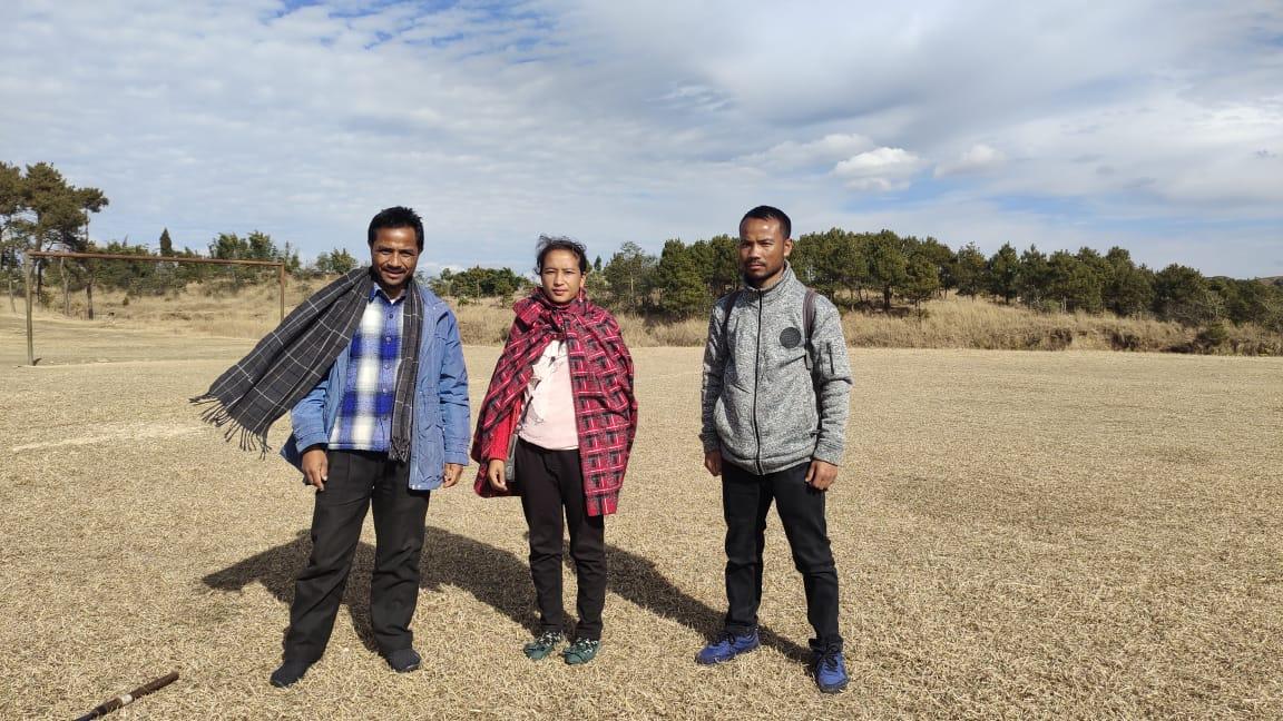
Fig: Village Community Facilitators.
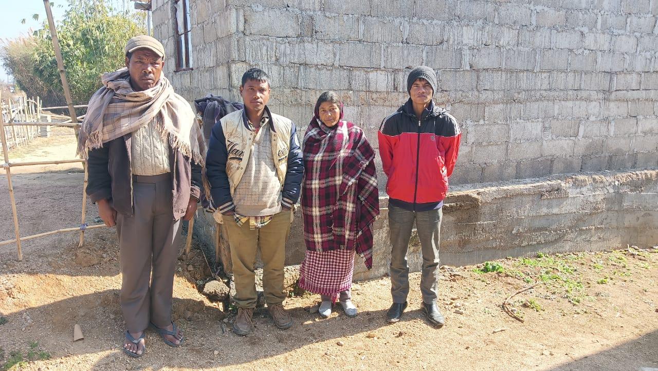
Fig: Procurement Members.
Opening of Bank Account:
The opening of the bank account was done after the signing of the EOI (Expression of Interest), the VGA (Village Grant Agreement) and the signing of the Green Charter. The Accountant of CLLMP South West Khasi Hills trained the Purchasing and Procurement Committee of Pyndensakwang village on matters relating to Accounts and Book Keeping and on the:
Principles of Community Procurement
Benefits of Community Procurement
Important aspects undertaken by Community Procurement.
Procurement Process/Steps
Function of Purchase Committee
Important Procurement records to be maintained
Financial limits and methods
Maintaining of Books of Accounts to the Book Keeper.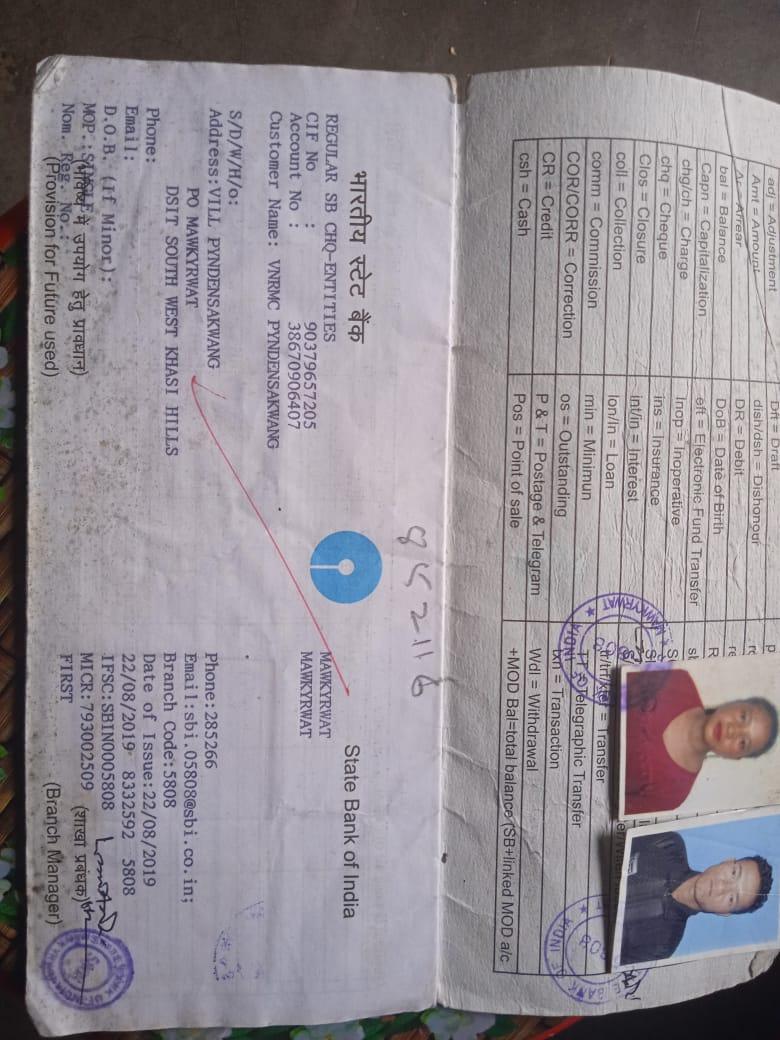
Fig: Bank details of Pyndensakwang VNRMC
.
Participatory Rural Appraisal Exercise:
The PRA exercise aims to incorporate the knowledge and opinions of the community in the planning and management of development projects and programmes. The PRA exercise at Pyndensakwang village took place on the 29th June 2019 where there were a total of 50 villagers, men and women included who took part in this exercise.
The initial stage of Participatory Rural Appraisal (PRA) exercise at Pyndensakwang village commenced with a meeting cum orientation program on CLLMP. While conducting the meeting, the community members were made aware of the various PRA exercises to be conducted for the development of Community Natural Resource Management Plan (CNRMP) of the village, the community members’ contribution in the exercise and the objectives to be achieved. The key informants (the VNRMC and the VCFs) helped facilitate maximum participation.
Commencement of PRA.
Introduction: Participatory Rural Appraisal (PRA) is the process of involving local people in the analysis and interpretation of their own situation of a given rural area. The local people i.e. the participants take a leadership role in collecting, analysing, interpreting and presenting information and in this process impart knowledge and development insight to the specialists and extension agents.
For management of natural resources, participatory Rural Appraisal is conducted to establish rapport with the village community as well as to identify and define problems for prioritization in the village itself. It is a way of learning from and with community members to investigate their need assessment, analyse and evaluate constraints and opportunities and find out priorities in the area of agriculture, small scale rural enterprises and any other social and economic development programs addressed to village development. Based on the principle of listening and learning.
Objectives of PRA exercise in Pyndensakwang village:
The Participatory Rural Appraisal (PRA) exercise in Pyndensakwang was conducted with following objectives:
To identify the natural, human and economic resources of the village.
To identify the village problems and prioritized them with the help of the community members.
To prepare the community natural resources management plan of the village.
4.1: Village Boundary Mapping and Resource Mapping:
The GIS personnel along with the Village Community Facilitators mapped the village boundary of Pyndensakwang Village.
The second step is to involve the local community in preparation of village resource map as perceived by the community members to solicit their participation. Infrastructure, services, and other village resources such as agricultural lands, wells, Forest, wastelands, cattle population etc. were mapped. Local people prepared the Resource Map by drawing it on a chart paper as well as on the ground without much interference of outsiders.
This activity achieved the following purposes:
Rapport building and won the confidence of the villagers.
Analysed the spatial information, particularly studied problems and opportunities of villagers.
Got an impression about the village setting, physical layout, location of various houses and institution.
Findings Based on the Resource Map of Pyndensakwang Village:
1. The main agricultural produce is Paddy, Maize and Potato.
2. There are two types of forest ownership: Community and Private.
3. There are two Community Forest.
4. Presence of Football playground.
5. There are seven Schools. Five Primary Schools and two Secondary School in the village.
6. There are 2 churches in the village viz. Presbyterian, Church of God.
7. Presence of Integrated Child Development Services (ICDS) through Anganwadi Centre (AWC).
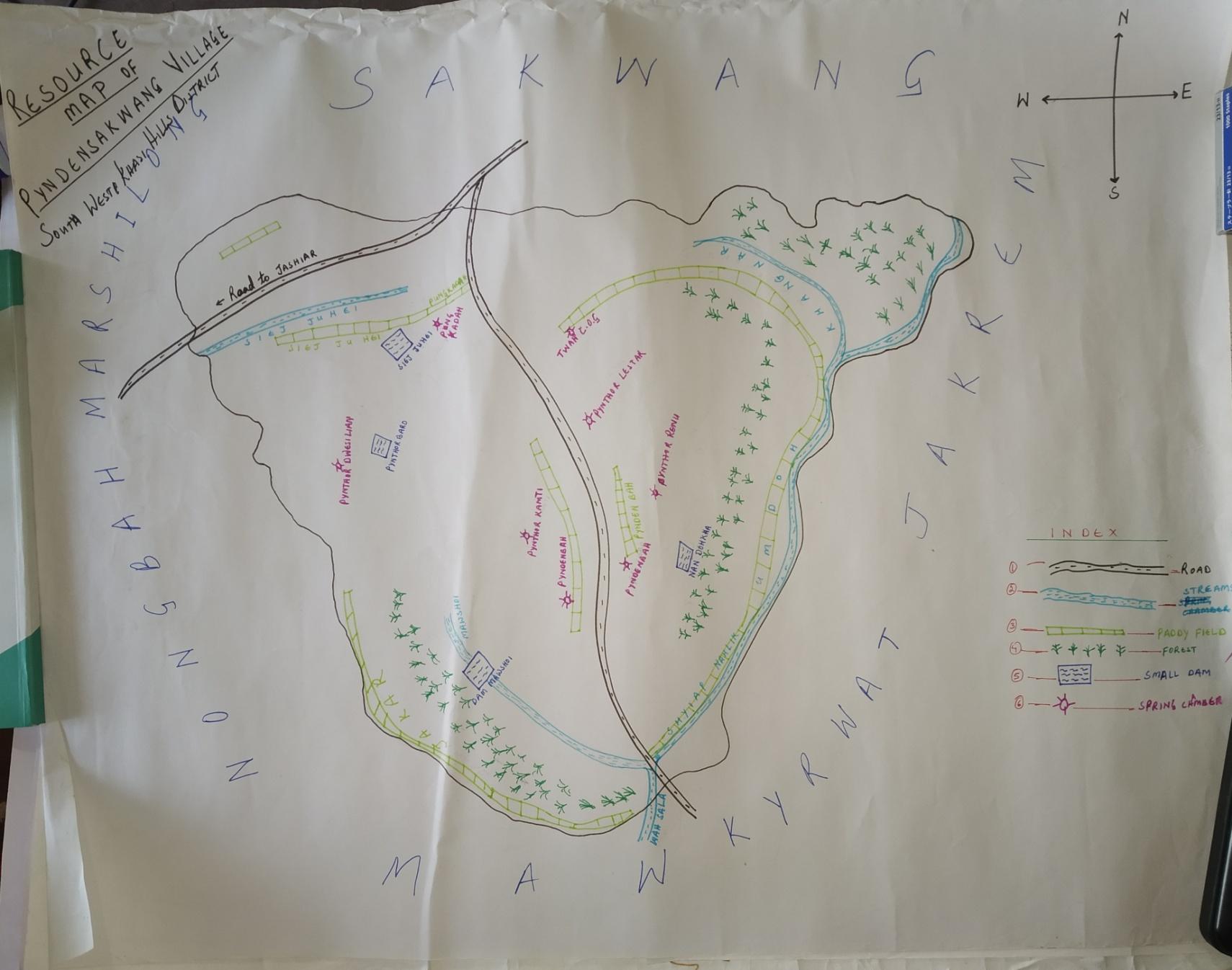
Fig:Resource map of Pyndensakwang drawn by the Community members.
4.2: Basic Survey for CNRMP Template:
During the PRA Exercise the External Expert of Social & Environment Management held a group discussion with the different groups to gather basic village information regarding number of households, demographic information, major crops and enterprises taken in the village, trends of production and productivity of major crops in the village and demographic distribution of village population.
Information related to land use category such as forest, cultivable land, water bodies, etc and the problems and challenges related to NRM were discussed.
4.3: Focussed Group Discussion:
1. Do people have sufficient access to supply of fodder, fuel wood, leaf litter?
Yes, people in the village have sufficient access to supply of fodder, fuel wood, leaf litter. They get it from the community forest and from their own private lands/forest.
2. Has access to timber improved or reduced over the years? How is access for household use and commercial use managed?
Yes, access to timber has reduced over the years. People have to purchase it from neighbouring village when needed.
3. Are the water bodies facing any threats?
So far, the water bodies within the village are faced with some minor threats.
4. Do all people in the village have access to drinking water? What are the challenges?
Yes, there is sufficient drinking water in the village, except during the winter season (February to March) due to less discharge of water from the spring source.
5. Are there degraded areas in the village (open/ degraded forests, mining affected, high soil erosion etc.)?
There are some minor degradations in cultivated land.
6. What has caused this degradation? Are there practices causing threats to availability and access to natural resources?
Fertility of the soil has decline over the year.
The practices that cause threat to the availability of these resources are:
Forest fires that take place occasionally.
7. What have been the changes in agricultural practices?
Over the years with much awareness people have practiced crop rotation.
8.Are there any challenges in farming?
The main challenges faced by the people of Pyndensakwang village is that over the years they have seen a decline in the soil productivity due to soil erosion.
9. How would you consider the health situation in your village?
The nearest health care is in the district headquarter with a distance of 3Km away and is easily accessible for the community as a whole to commute to the health centre.
10.How is the situation of cleanliness, sanitation, access to toilets and waste management?
The SHG members is responsible for organizing the cleaning drive. Sufficient toilets are available in every household but most of the constructions are poor. Some households have access to toilets from SBM (Swash Bharat Mission) scheme. The presence of VWSC in the village has also improve sanitation and cleanliness.
11.Who are the most vulnerable in the village? What can be done to improve their lives?
BPL Families. Inclusion of BPL family members during project implementation
12. What are the livelihood aspirations of the youth? Are there any avenues available?
None, except daily wages labourers.
13. Do any committees/ institutions/ rules exist to manage and monitor natural resources in the village?
The VNRMC under the CLLMP is the main committee that is now in place to manage the natural resources in the village.
14.What are some of the major issues of conflict in the village?
Nothing related to NRM.
15.Have any of the above issues been discussed in village meetings?
NA
16. How do people resolve disagreements and conflicts?
All disagreements and conflicts are addressed by the traditional institution of village called the Village Dorbar.
5. Submission of the CNRMP: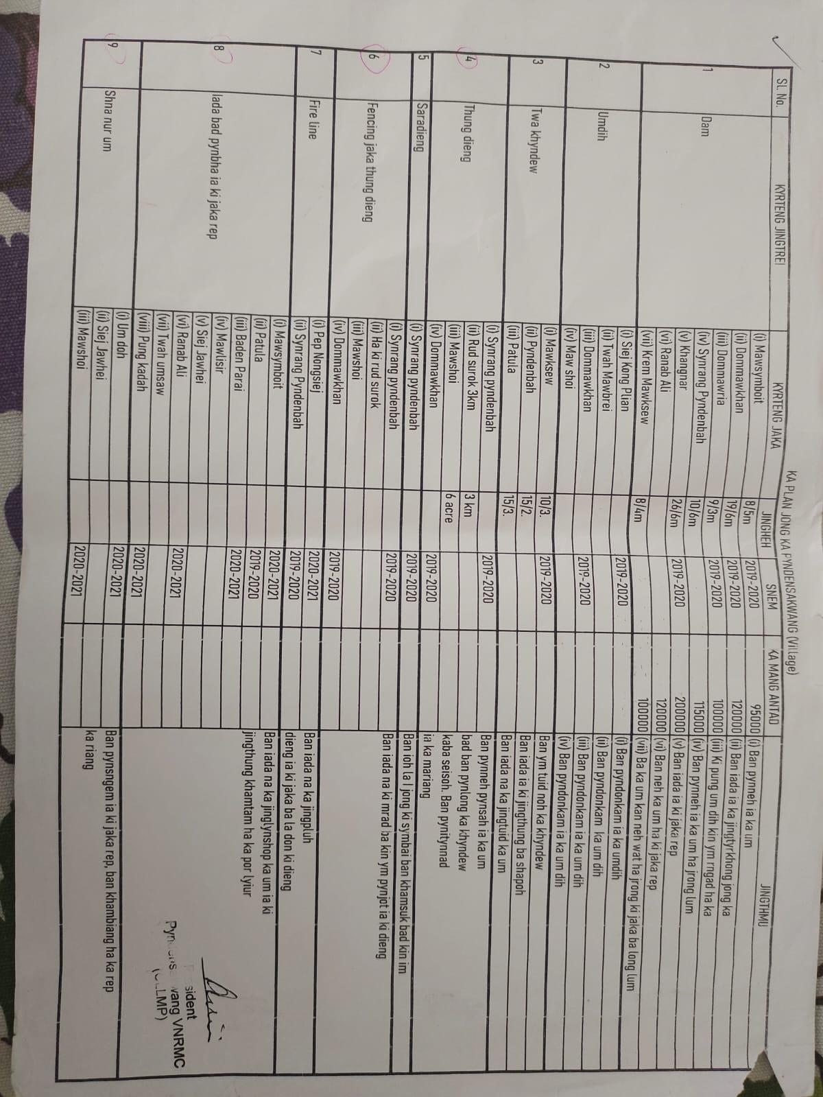
SL. No |
Name of work | Site | Land ownership | Benefited | Priority (High/Medium/Low) |
|---|---|---|---|---|---|
| 1 | Erosion control wall | Mawksew | Community | 18 HH | High |
| 2 | Spring Chamber and Catchment area | Siej Kong Plian | Private | 10 HH | High |
| 3 | Afforestation | Synrang Pyndennah | Community | 150 HH | High |
| 4 | Community nursery | Synrang Pyndennah | Community | 150 HH | High |
| 5 | Spring Chamber and Catchment area | Mawshoi | Private | 8 HH | High |
| 6 | Check dam | Ranab ali | Private | 12 HH | High |
| 7 | Fireline | Kpepnongsiej | Community | 5 HH | High |
| 8 | Afforestation | Khangnar | Private | 20 HH | High |
| 9 | Afforestation | Dom Myllung | Private | 25 HH | High |
| 10 | Treatment of catchment area | Mawshoi | Private | 8 HH | High |
| 11 | Improvement of degraded forest | Dom Makhan | Private | 24 HH | High |
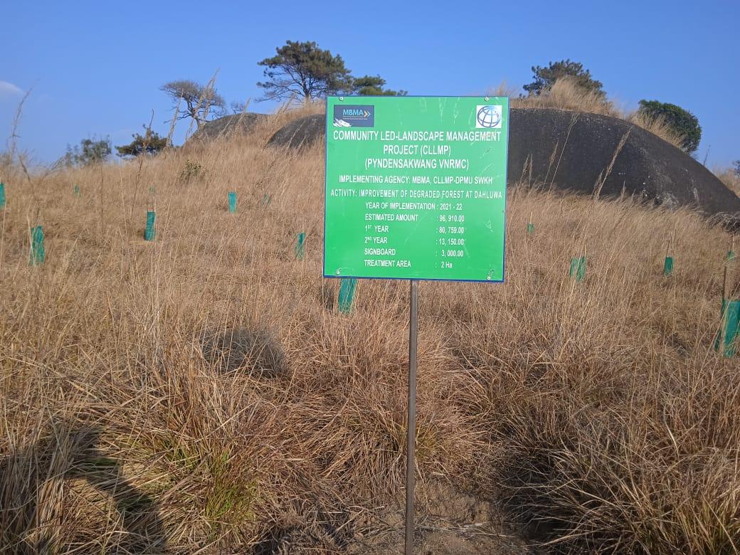
| 12 | Improvement of degraded forest | Dahluwa | Private | 25 HH | High |
| 13 | Improvement of degraded forest | Shait Shait nah | Private | 15 HH | High |
| 14 | Improvement of degraded forest | Maw Symboit | Private | 35 HH | High |
| 15 | Afforestation | Kper Nongsiej | Community | 150 HH | High |
| 16 | Dug out pond | Synrangpyndenbah | Community | 12 HH | High |
| 17 | CC checkdam, gully plug | Dom Mawkhan | Community | 15 HH | High |
| 18 | Spring chamber | Compound school | Private | 15 HH | High |
| 19 | Filter-Soaked pit | Dom Mawkhan | Community | 1 HH | High |
| 20 | Treatment of catchment area | Dom Mawkhan | Community | 15 HH | High |
5.1 Final CNRMP Plan:
6.GIS Activities:
| Sl. No. | Parameters | Village Information |
|---|---|---|
| 1 | GPS Coordinates: | |
| i | Latitude | 25.38548 |
| ii | Longitude | 91.481575 |
| iii | Elevation Reading (MSL) | 1572 |
| 2 | Village Geographical Area (Ha) | 201.27 Ha |
| i | Total Forest Area (including community, Clan, Pvt Forest) | 37.66 Ha |
| ii | Total Area of Water Bodies | 1.76 |
| iii | Total Area under Agri-Horticulture | 60.81 (agricultural only) |
| iv | Total Degraded land area (Ha) | 34.69Ha |
| 3 | Average Annual Rainfall | 12000mm |
| 4 | Soil Type | Loam soil |
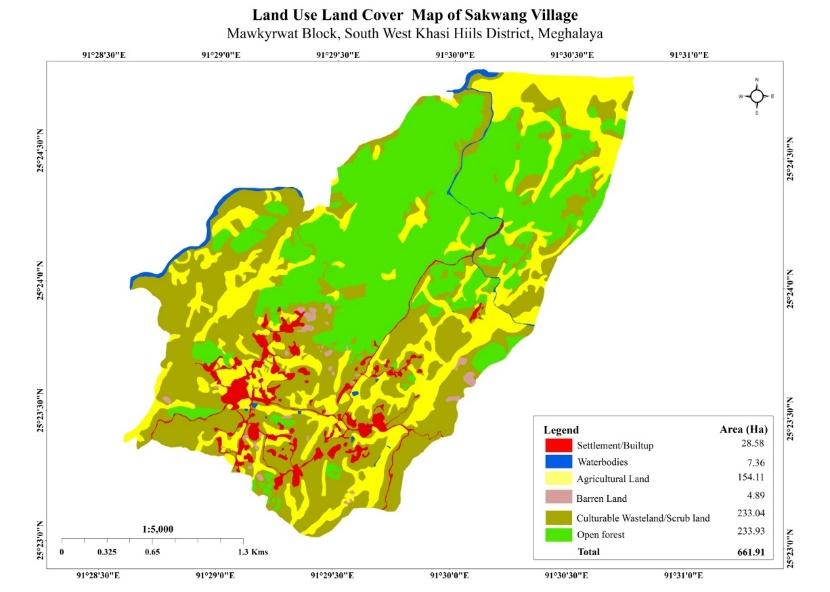
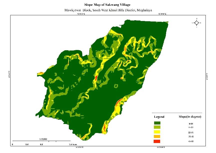
Fig: Boundary Map, Slope Map and LULC Map.
7.Project Implementation:
| 1. | Type Of Intervention | Site Name | GPS Co-ordinates | Amount Sanctioned | Work Status | |
|---|---|---|---|---|---|---|
| Construction of Erosion control wall at Mawksew | Mawksew | 25.379742 | 91.475942 | Rs. 87,530 | Completed | |
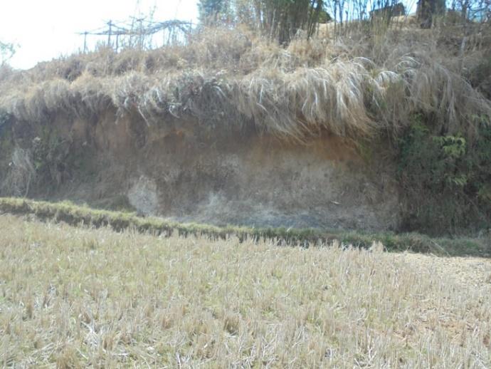
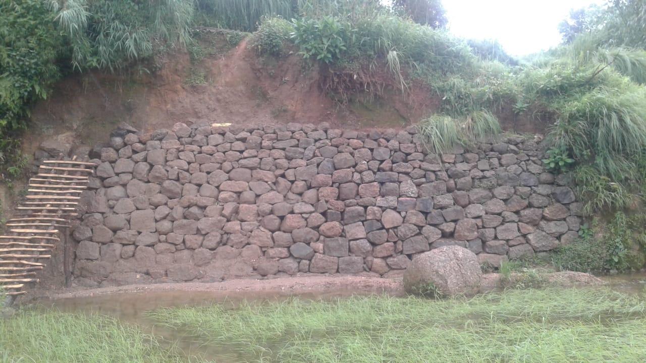
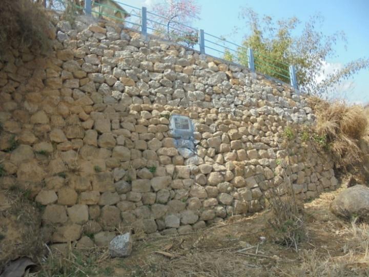
Fig: Erosion Control Wall at Mawksew.
| 2. | Type Of Intervention | Site Name | GPS Co-ordinates | Amount Sanctioned | Work Status | |
|---|---|---|---|---|---|---|
| Spring Chamber and treatment of catchment area at Siej Kong Plian | Siej Kong Plian | 25.386463° | 91.478696° | Rs.91,070 | Completed | |
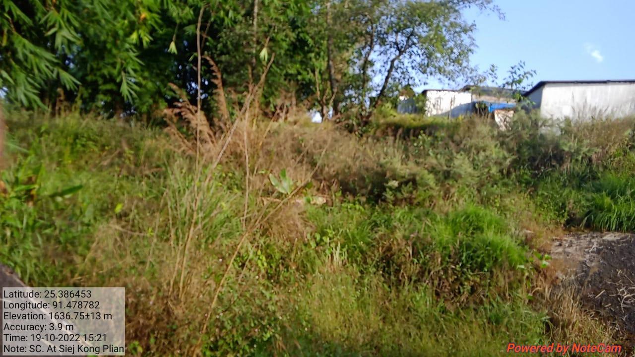
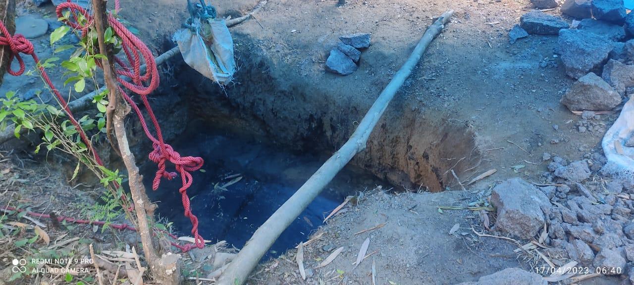
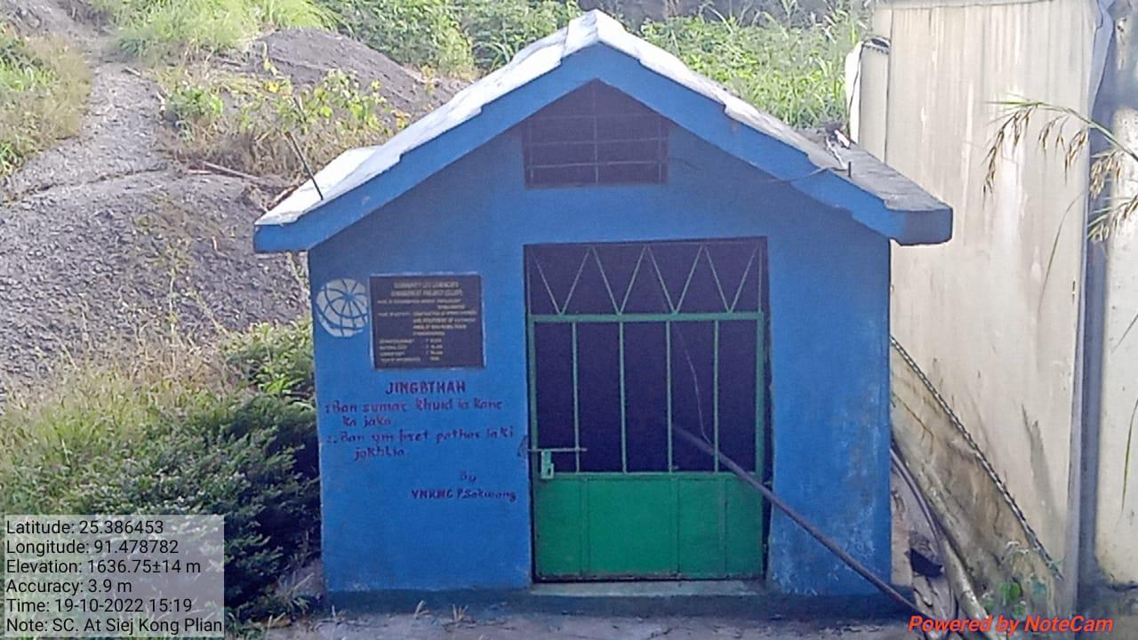
Fig: Spring Chamber at Siej Kong Plian
| 3. | Type Of Intervention | Site Name | GPS Co-ordinates | Amount Sanctioned | Work Status | |
|---|---|---|---|---|---|---|
| Afforestation at Synrangpyndenbah | Synrangpyndenbah | 25.379945 | 91.476312 | Rs.1,16,500 | Completed | |
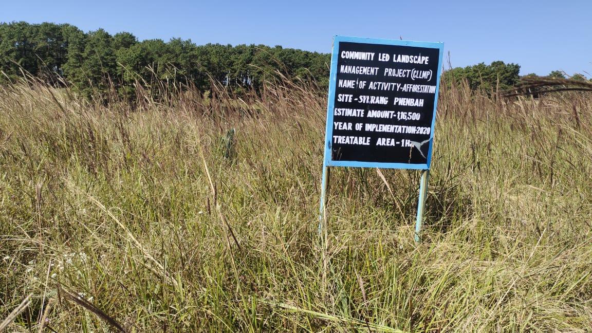
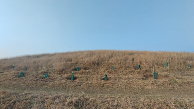
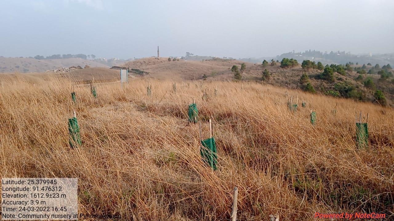
Fig: Afforestation at Synrang Pyndenbah
| 4. | Type Of Intervention | Site Name | GPS Co-ordinates | Amount Sanctioned | Work Status | |
|---|---|---|---|---|---|---|
| Community Nursery at Synrang Pyndennah | Synrang Pyndennah | 25.37985 | 91.476081 | Rs.2,97,280 | Completed | |
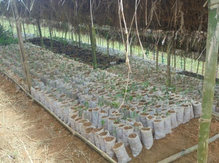
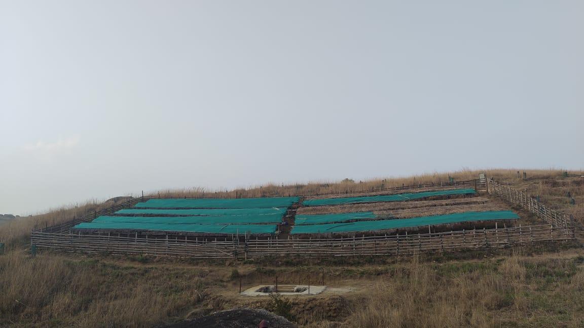
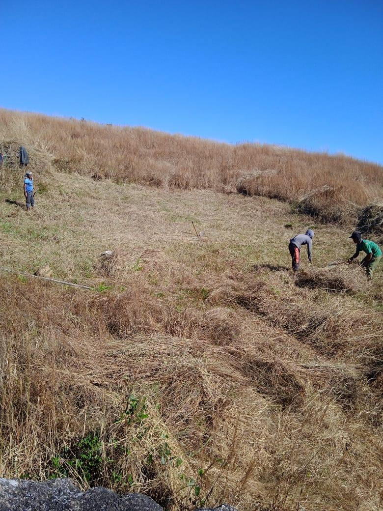
Fig: Community Nursery at Synrang Pyndennah.
| 5. | Type Of Intervention | Site Name | GPS Co-ordinates | Amount Sanctioned | Work Status | |
|---|---|---|---|---|---|---|
| Spring Chamber & Catchment area | Mawshoi | 25.383523 | 91.47603 | Rs.56,850 | Completed | |
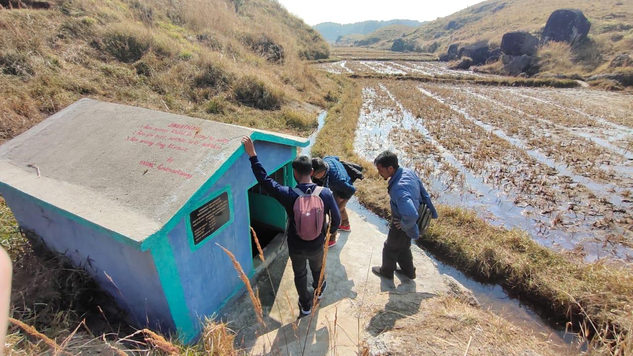
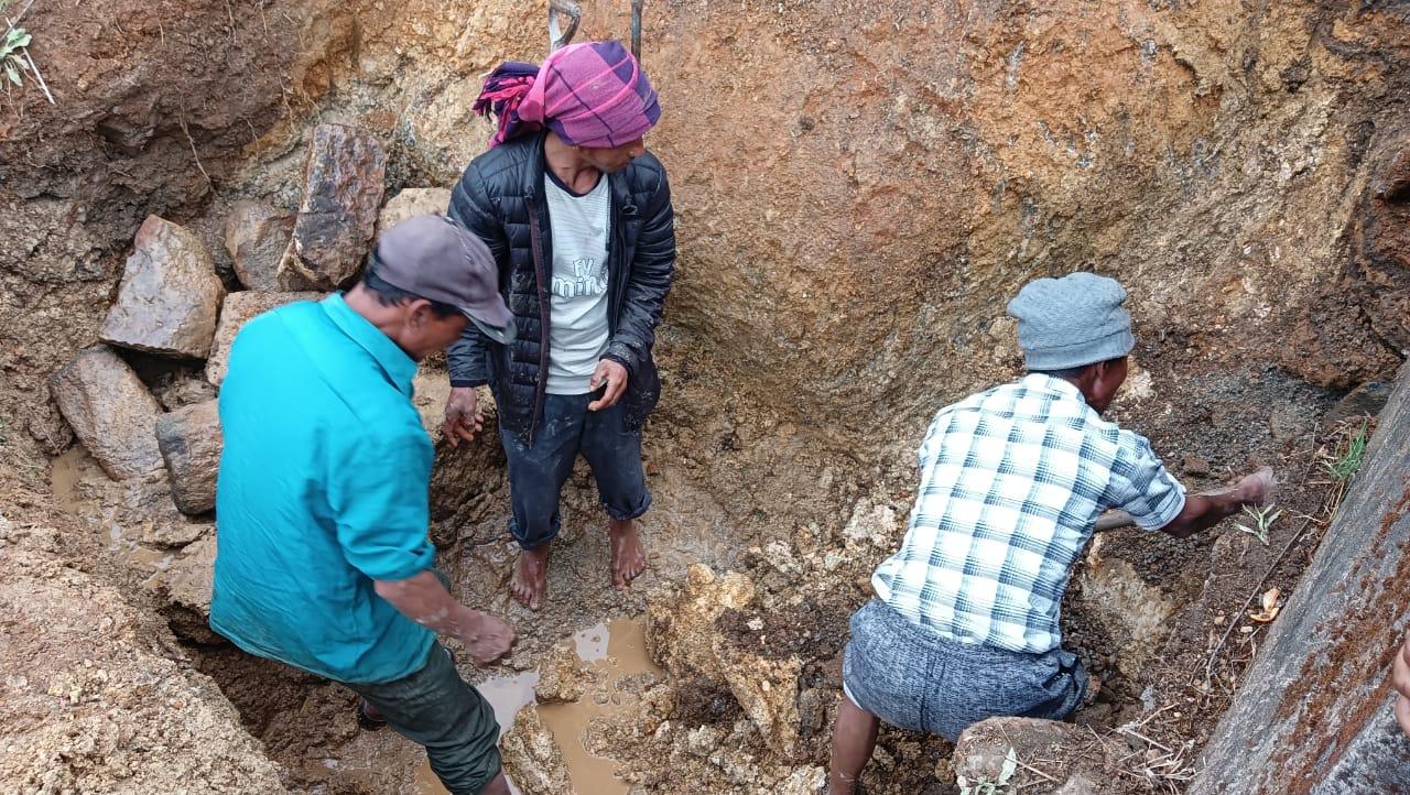
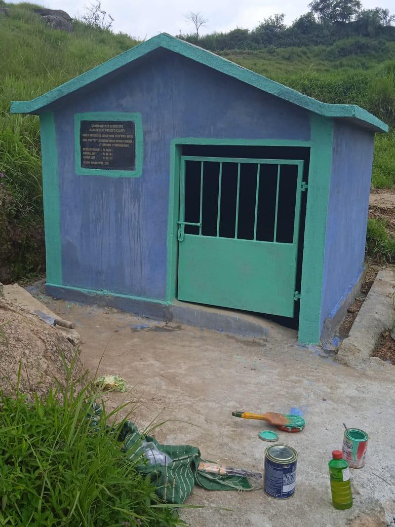
Fig: Spring Chamber at Mawshoi.
| 6. | Type Of Intervention | Site Name | GPS Co-ordinates | Amount Sanctioned | Work Status | |
|---|---|---|---|---|---|---|
| Check Dam at Ranab ali | Ranab ali | 25.378633 | 91.475733 | Rs.4,16,900 | Completed | |
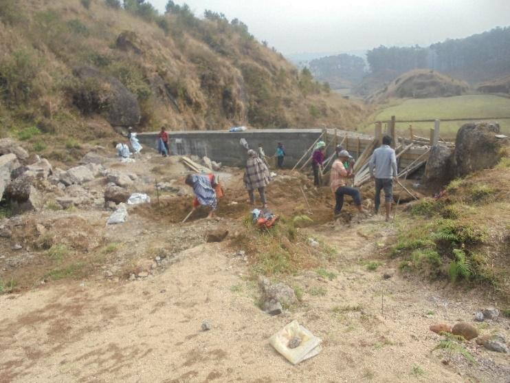
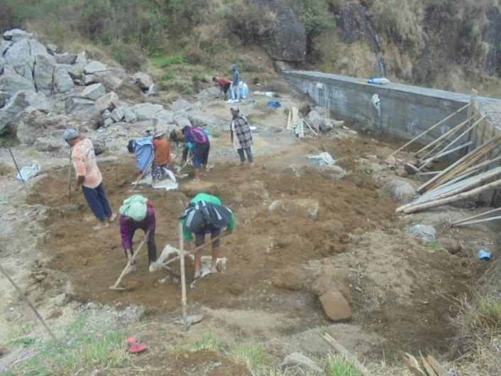
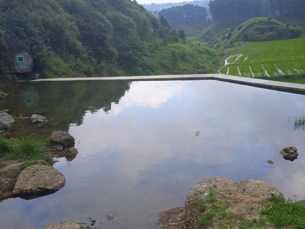
Fig: Checkdam at Ranab Ali.
| 7 | Type Of Intervention | Site Name | GPS Co-ordinates | Amount Sanctioned | Work Status | |
|---|---|---|---|---|---|---|
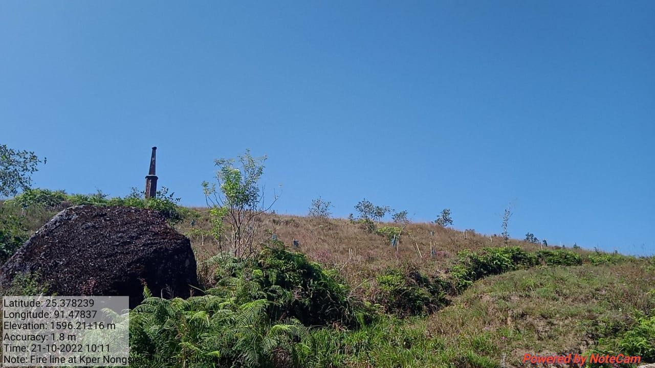
| Fireline at Kpep Nongsiej | Kpep Nongsiej | 25.378239 | 91.47837 | Rs.11,900 | Completed | |
Fig: Fireline at Kpep Nongsiej.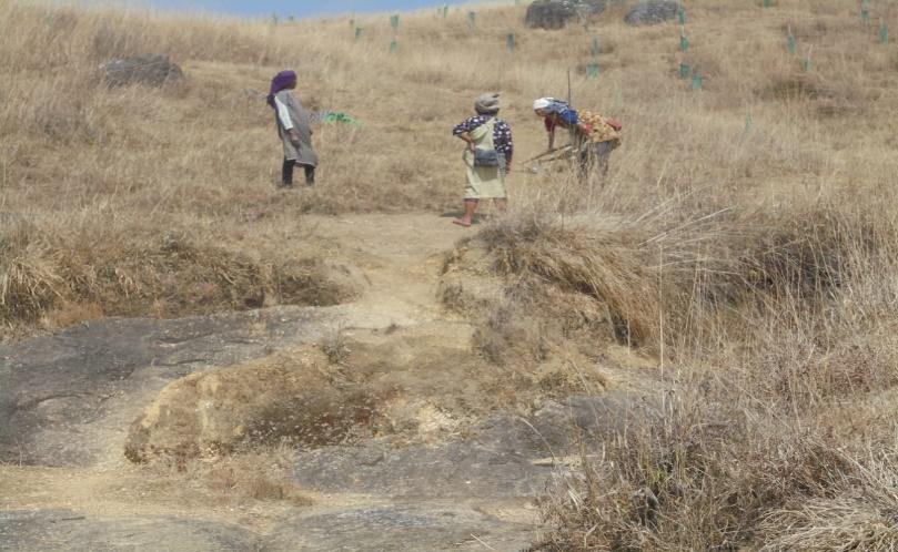
| 8 | Type Of Intervention | Site Name | GPS Co-ordinates | Amount Sanctioned | Work Status | |
|---|---|---|---|---|---|---|
| Afforestation at Khangnar | Khangnar | 25.385385 | 91.485199 | Rs. 62,440 | Completed | |
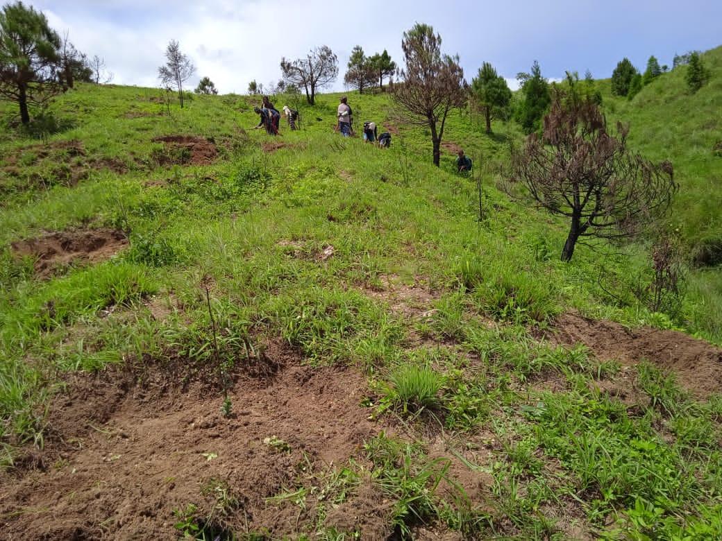
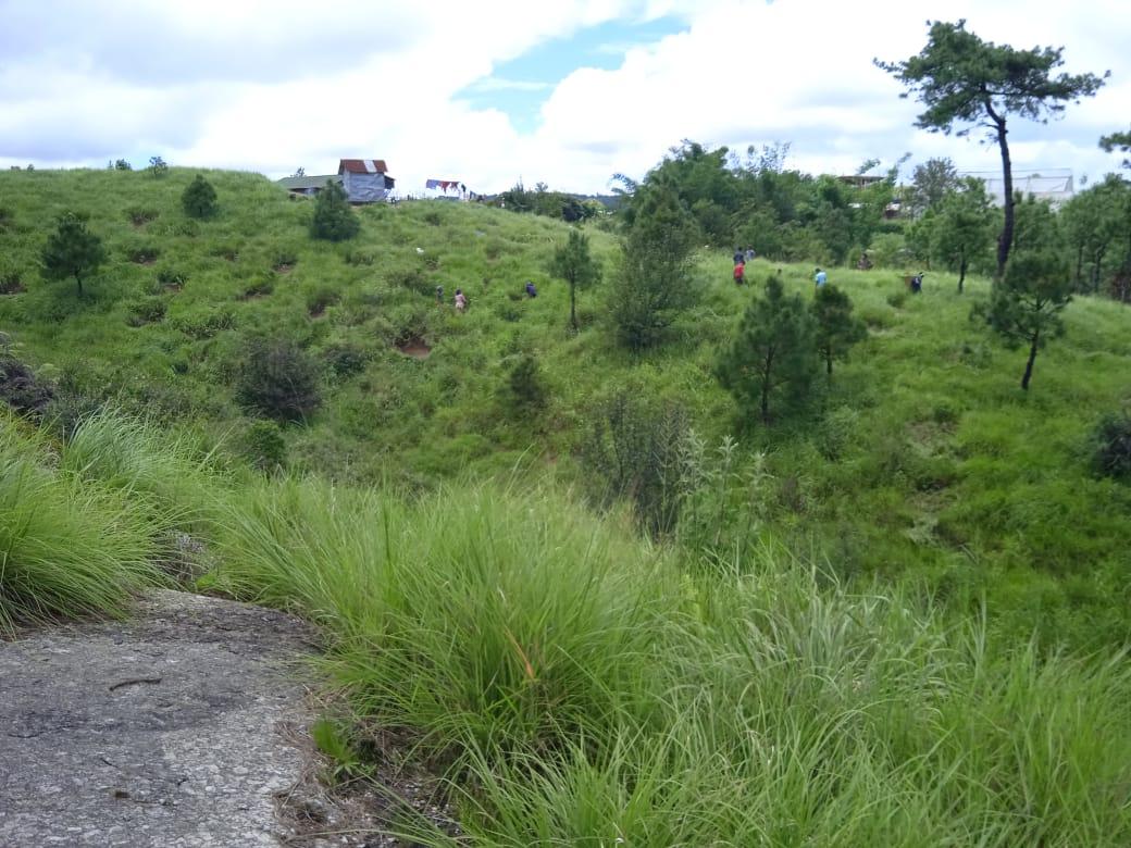
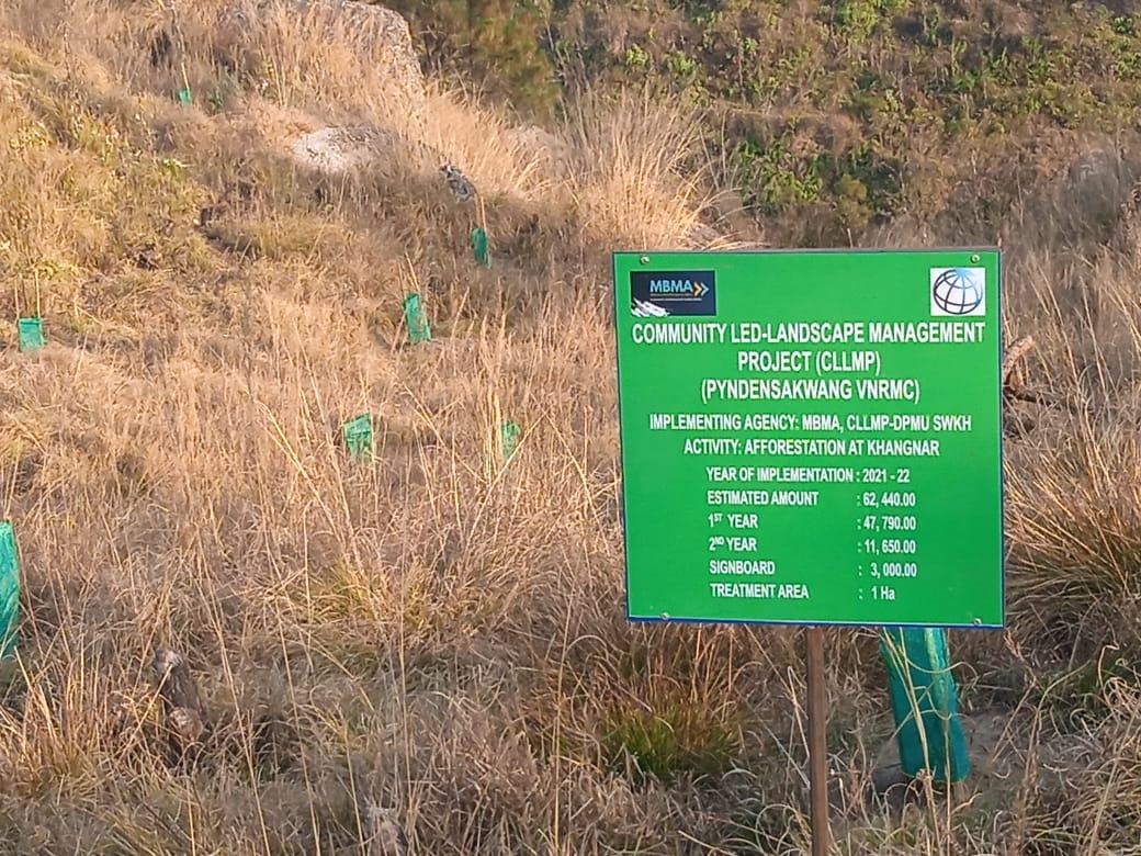
Fig: Afforestation at Khangnar.
| 9 | Type Of Intervention | Site Name | GPS Co-ordinates | Amount Sanctioned | Work Status | |
|---|---|---|---|---|---|---|
| Afforestation at Dum Myllung | Dum Myllung | 25.388245 | 91.480258 | Rs.96,910 | Completed | |
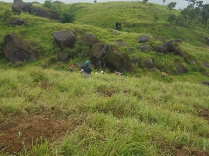
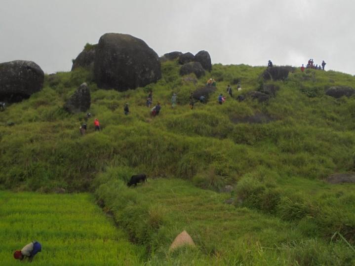
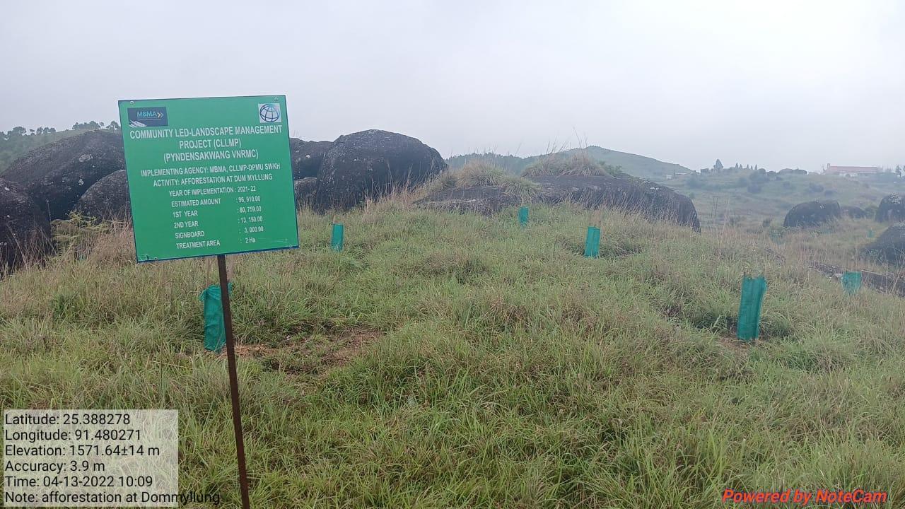
Fig: Afforestation at Dom Myllung.
| 10 | Type Of Intervention | Site Name | GPS Co-ordinates | Amount Sanctioned | Work Status | |
|---|---|---|---|---|---|---|
| Treatment of catchment area at Mawshoi | Mawshoi | 25.383523 | 91.47603 | Rs. 95,910 | Completed | |
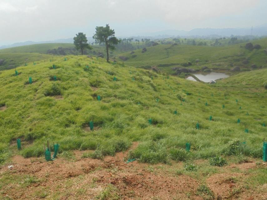
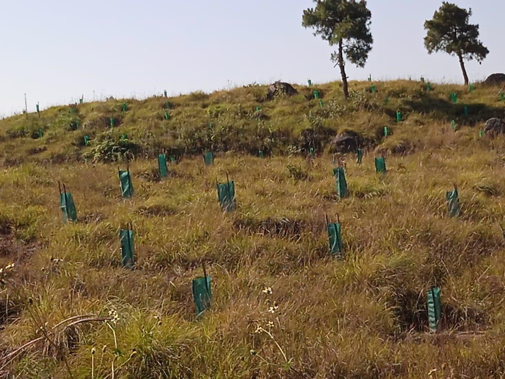
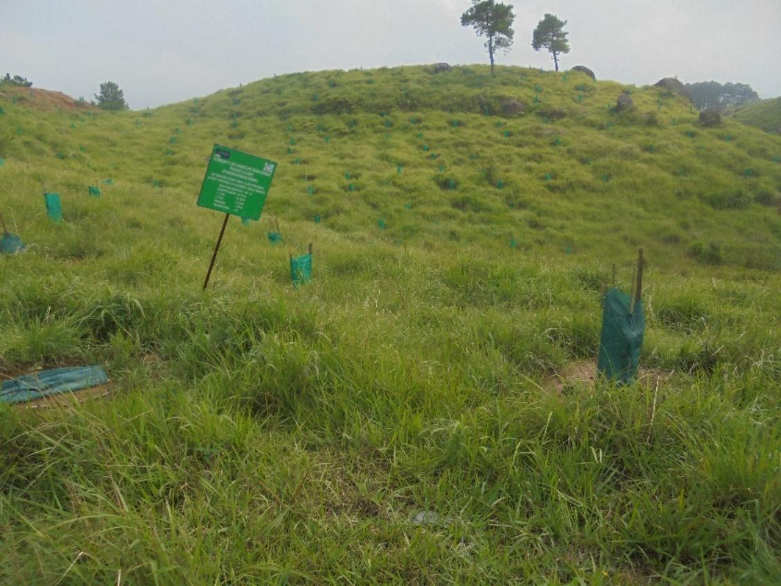
Fig: Treatment of Catchment area at Mawshoi.
| 11 | Type Of Intervention | Site Name | GPS Co-ordinates | Amount Sanctioned | Work Status | |
|---|---|---|---|---|---|---|
| Improvement of degraded forest at Dom Makhan | Dom Makhan | 25.380245 | 91.481098 | Rs.80,680 | Completed | |
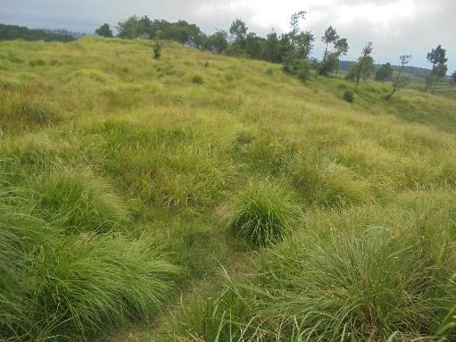
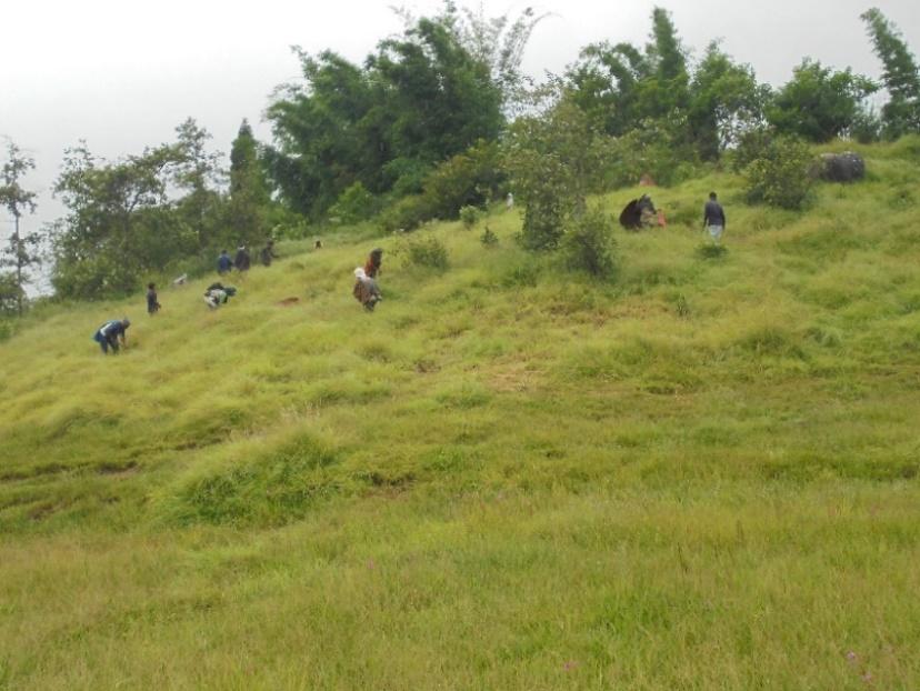
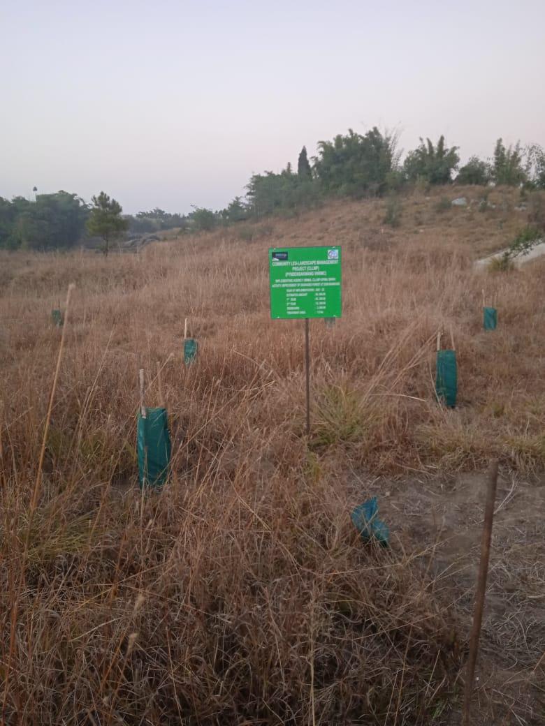
Fig: Improvement of degraded forest at Dom Makhan.
| 12 | Type Of Intervention | Site Name | GPS Co-ordinates | Amount Sanctioned | Work Status | |
|---|---|---|---|---|---|---|
| Improvement of degraded forest at Dahluwa | Dahluwa | 25.381845 | 91.483461 | Rs. 96,910 | Completed | |
.
Fig: Improvement of degraded forest at Dahluwa
| 13 | Type Of Intervention | Site Name | GPS Co-ordinates | Amount Sanctioned | Work Status | |
|---|---|---|---|---|---|---|
| Improvement of degraded forest at Shait Shait Nah | Shait Shait Nah | 25.383292 | 91.485486 | Rs.1,67,910 | Completed | |
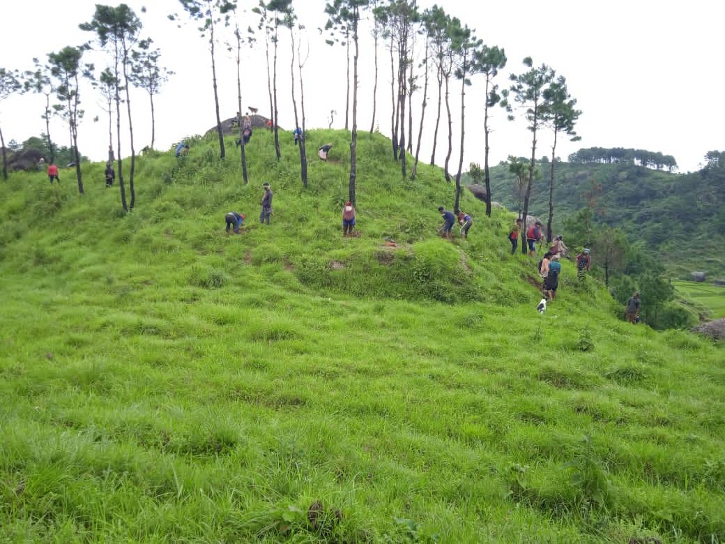
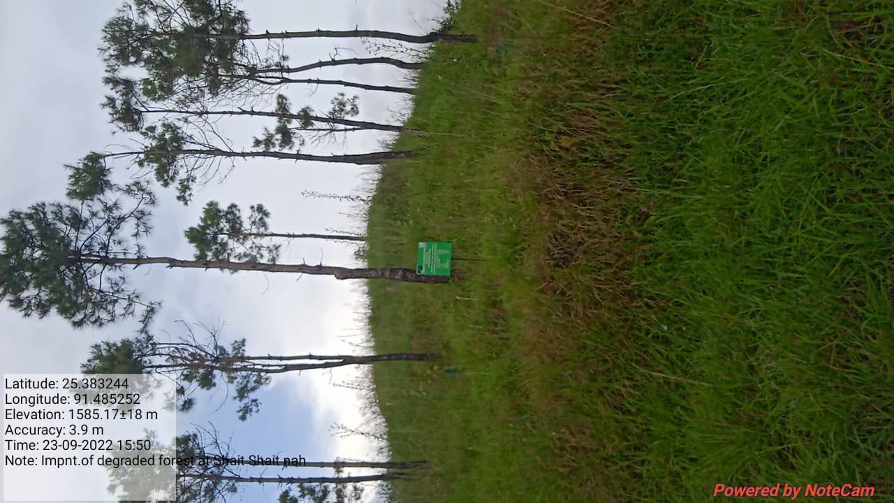
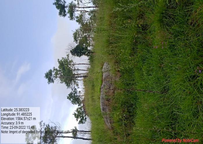
Fig: Improvement of degraded forest at Shait Shait Nah
| 14 | Type Of Intervention | Site Name | GPS Co-ordinates | Amount Sanctioned | Work Status | |
|---|---|---|---|---|---|---|
| Improvement of degraded forest at Maw Symboit | Maw Symboit | 25.387758 | 91.47809 | Rs. 39,200 | Completed | |
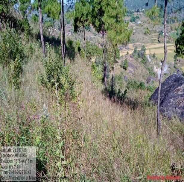
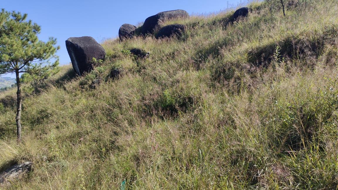
Fig: Improvement of degraded forest at Maw Symboit
| 15 | Type Of Intervention | Site Name | GPS Co-ordinates | Amount Sanctioned | Work Status | |
|---|---|---|---|---|---|---|
| Afforestation at Kper Nongsiej | Kper Nongsiej | 25.378322 | 91.477635 | Rs.1,18,180 | Completed | |
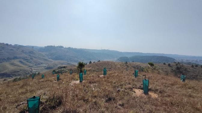
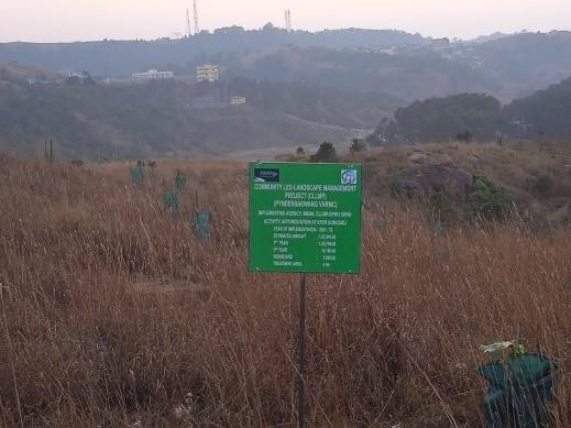
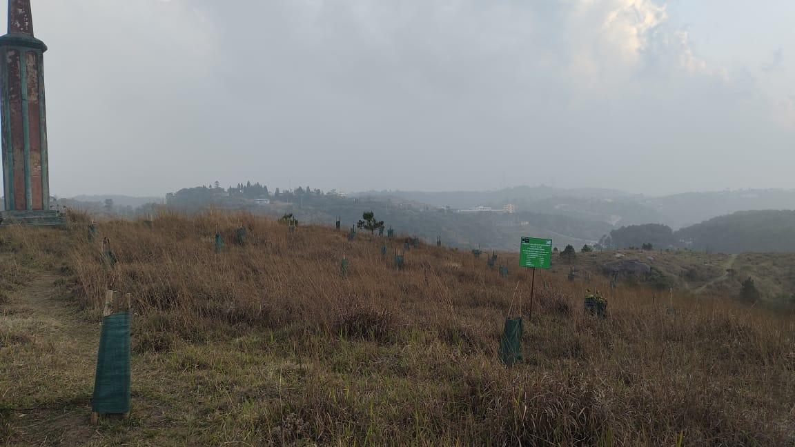
Fig: Afforestation at Kper Nongsiej
| 16 | Type Of Intervention | Site Name | GPS Co-ordinates | Amount Sanctioned | Work Status | |
|---|---|---|---|---|---|---|
| Dug Out Pond at Synrangpyndenbah | Synrangpyndenbah | 25.37985 | 91.476081 | Rs. 64,580 | Completed | |
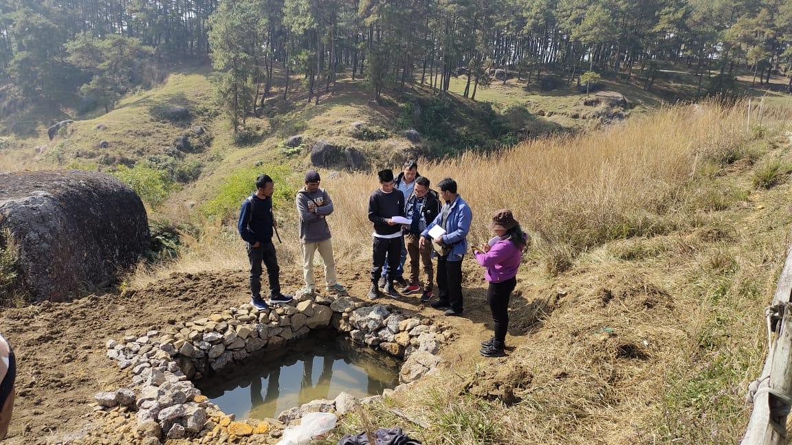
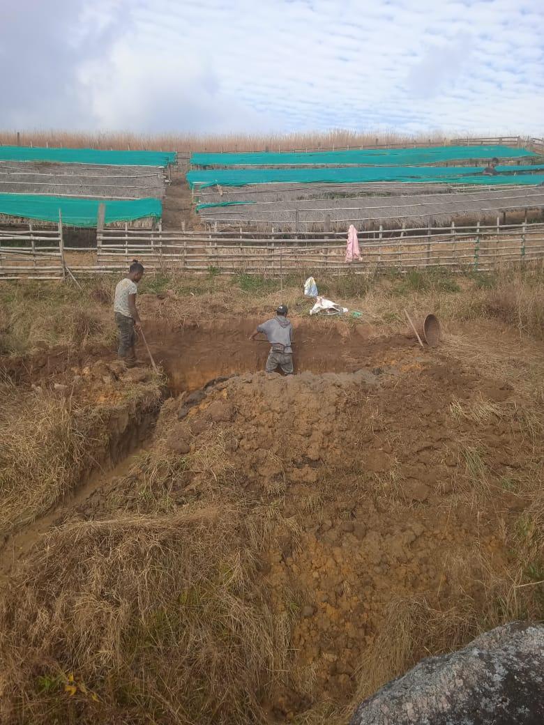
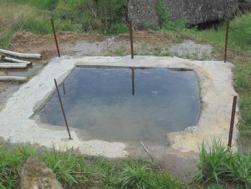
Fig: Dug out Pond at Synrangpyndenbah.
| 17 | Type Of Intervention | Site Name | GPS Co-ordinates | Amount Sanctioned | Work Status | |
|---|---|---|---|---|---|---|
| CC Checkdam, Gully Plug at Dom Mawkhan | Dom Mawkhan | 25.379756 | 91.481589 | Rs.1,18,180 | Completed | |
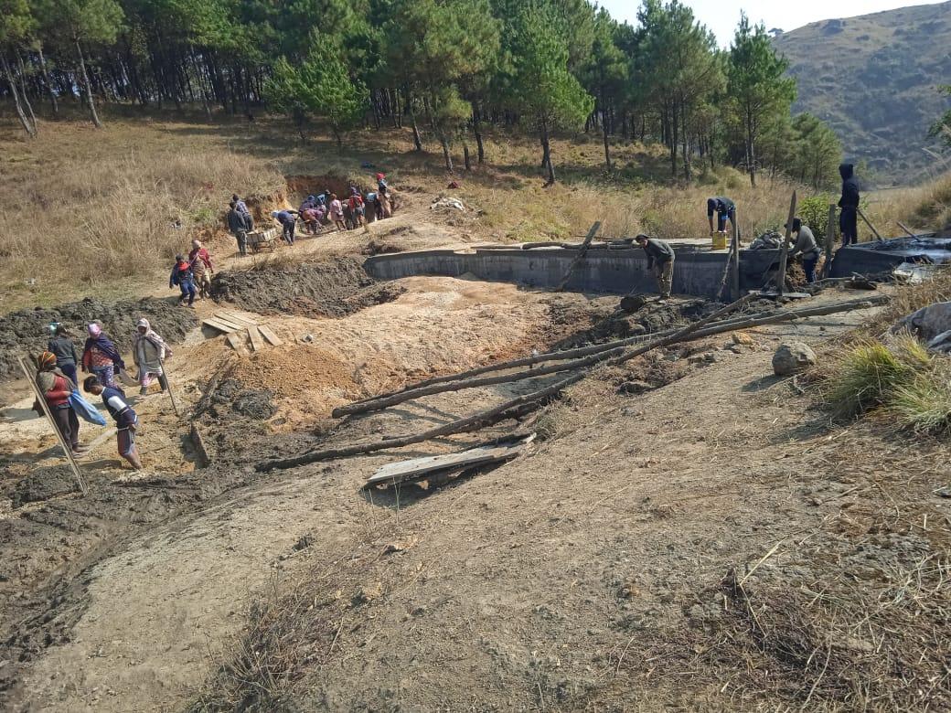
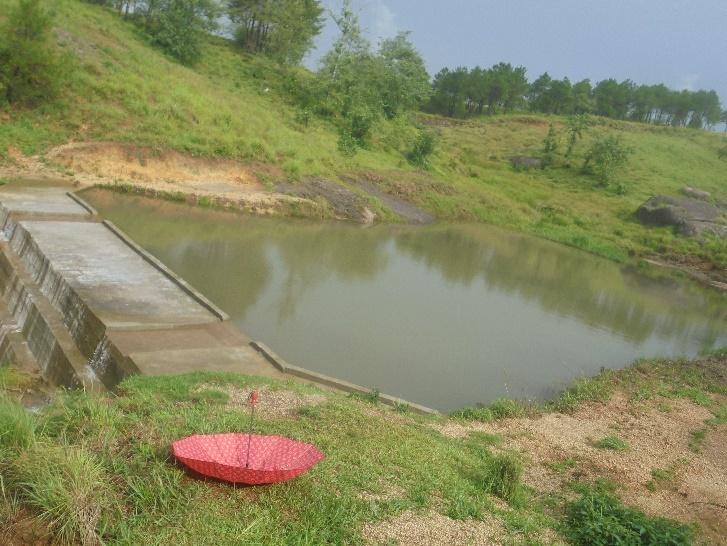
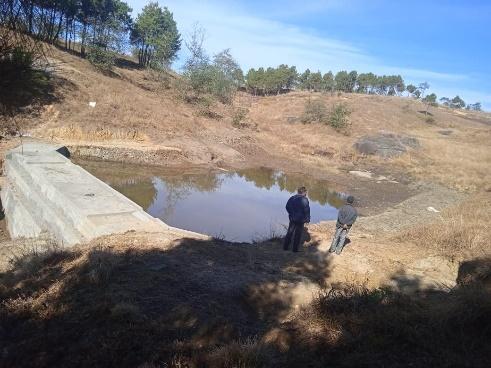
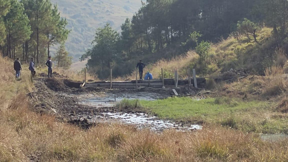
Fig: CC Checkdam, Gully Plug at Dom Mawkhan.
| 18 | Type Of Intervention | Site Name | GPS Co-ordinates | Amount Sanctioned | Work Status | |
|---|---|---|---|---|---|---|
| Spring Chamber at Compound School | Compound School | 25.386818 | 91.484067 | Rs.64,580 | Completed | |
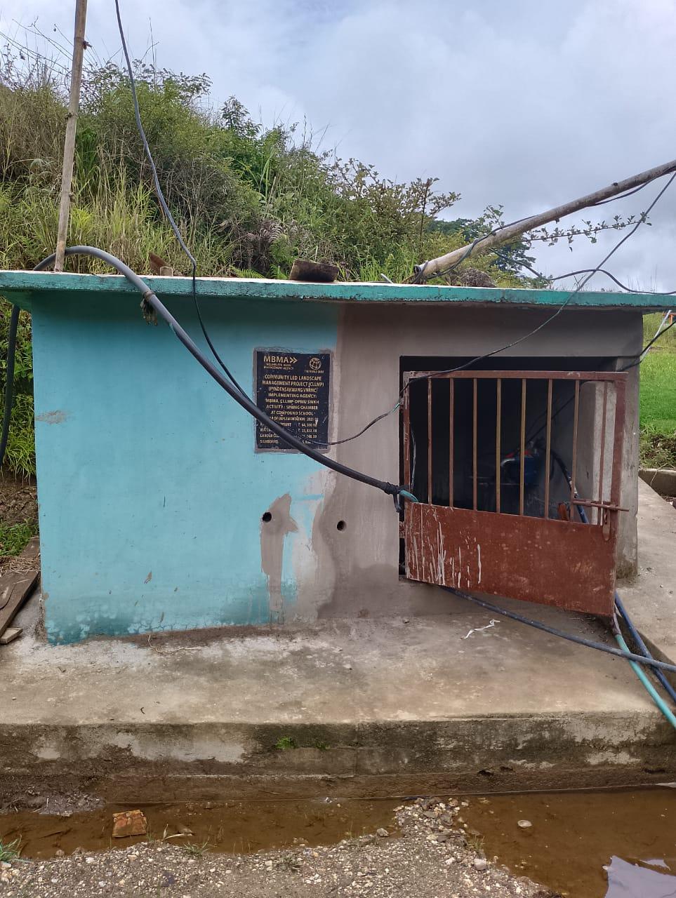
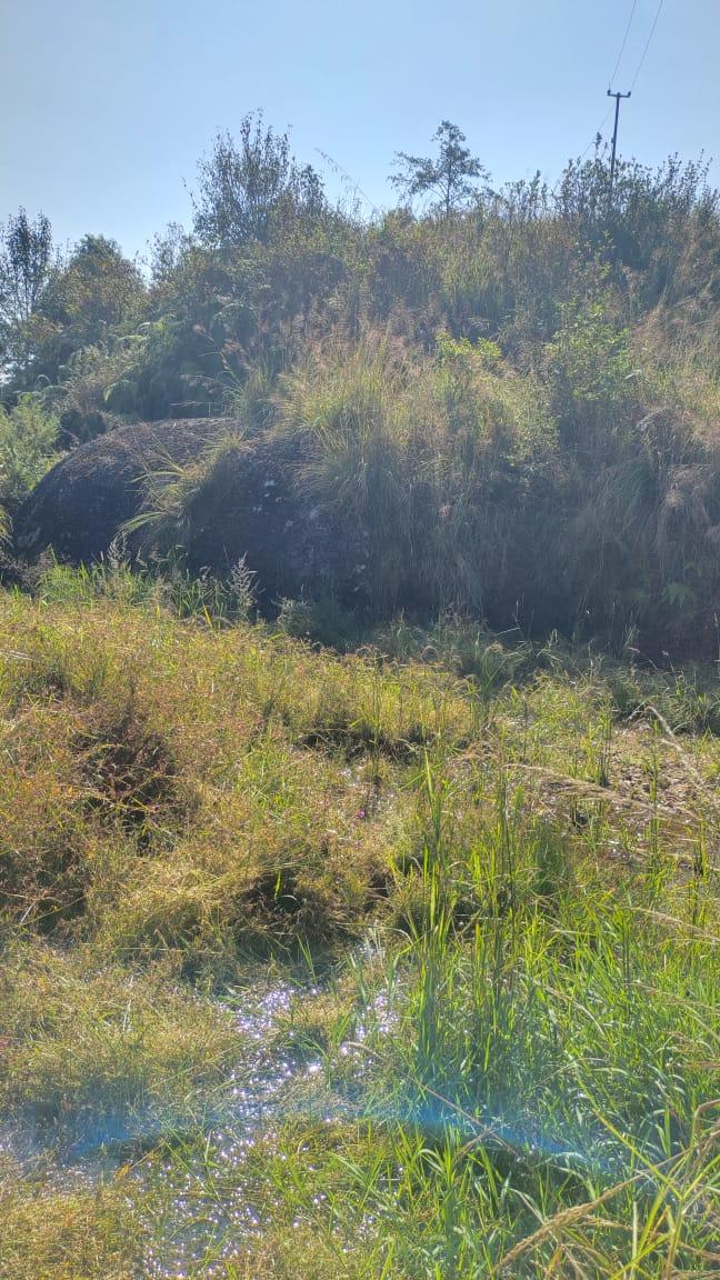
Fig: Spring Chamber at Compound School.
| 19 | Type Of Intervention | Site Name | GPS Co-ordinates | Amount Sanctioned | Work Status | |
|---|---|---|---|---|---|---|
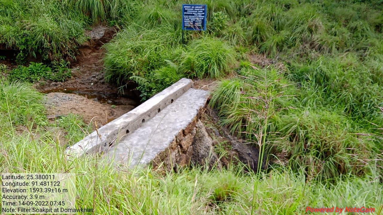
| Filter-Soaked pit at Dom Mawkhan | Dom Mawkhan | 25.380011 | 91.481122 | Rs.48,960 | Completed | |
| 20 | Type Of Intervention | Site Name | GPS Co-ordinates | Amount Sanctioned | Work Status | |
|---|---|---|---|---|---|---|
| Tretment of catchment area at Dom Mawkhan | Dom Mawkhan | 25.380292 | 91.481033 | Rs.27,700 | Completed | |
Fig: Filter-Soaked pit at Dom Mawkhan
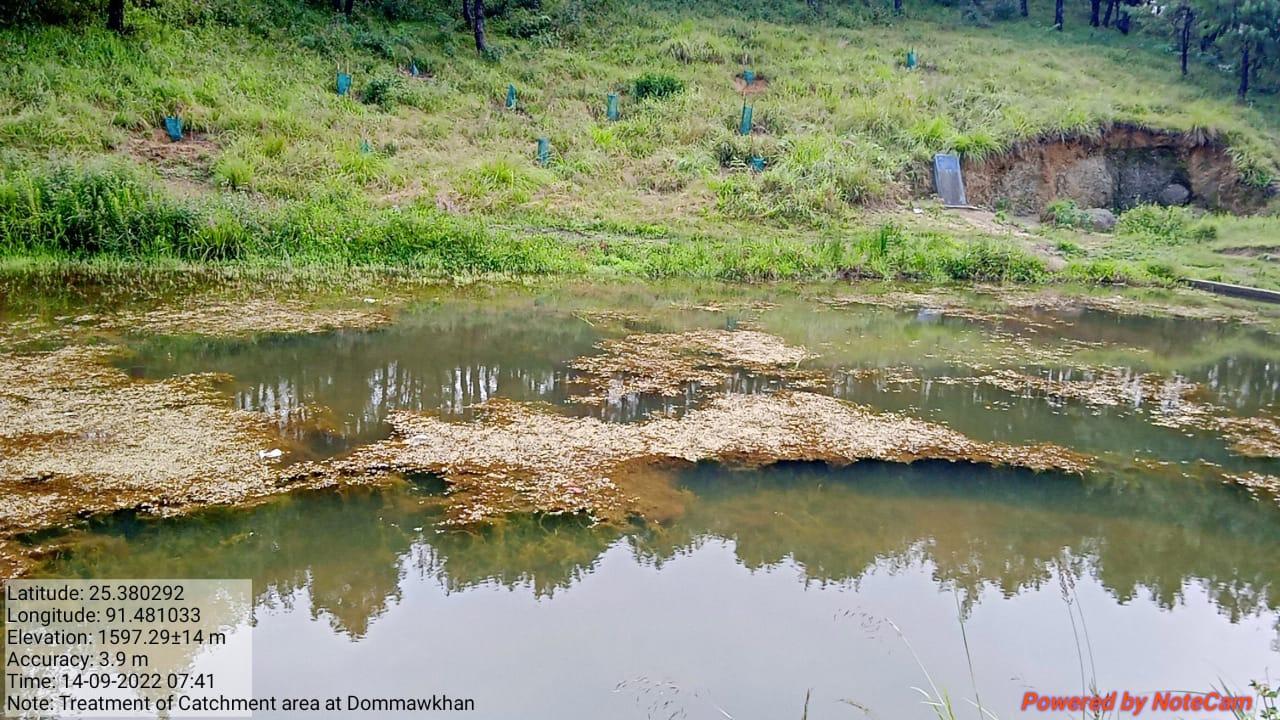
Fig: Treatment of catchment area at Dom Mawkhan
| 21 | Type Of Intervention | Site Name | GPS Co-ordinates | Amount Sanctioned | Work Status | |
|---|---|---|---|---|---|---|
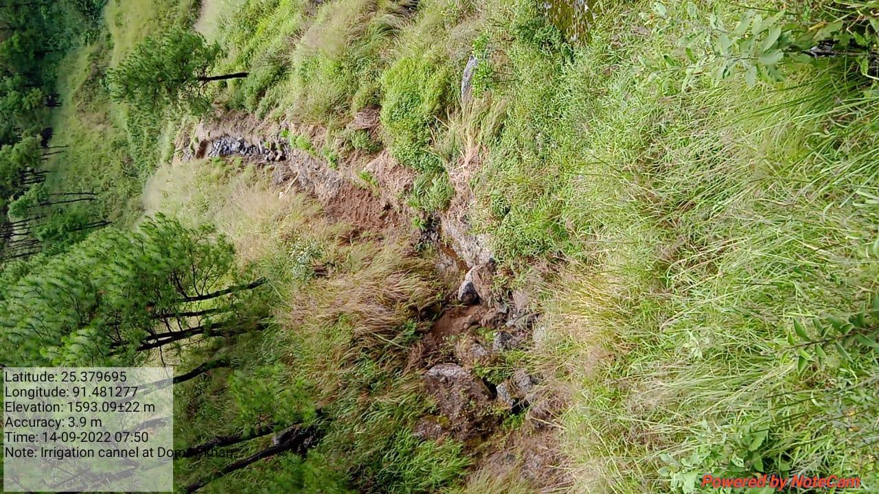
| Irrigation Canal (Water Channel) at Dom Mawkhan | Dom Mawkhan | 25.379695 | 91.481277 | Rs.2,50,260 | Completed | |
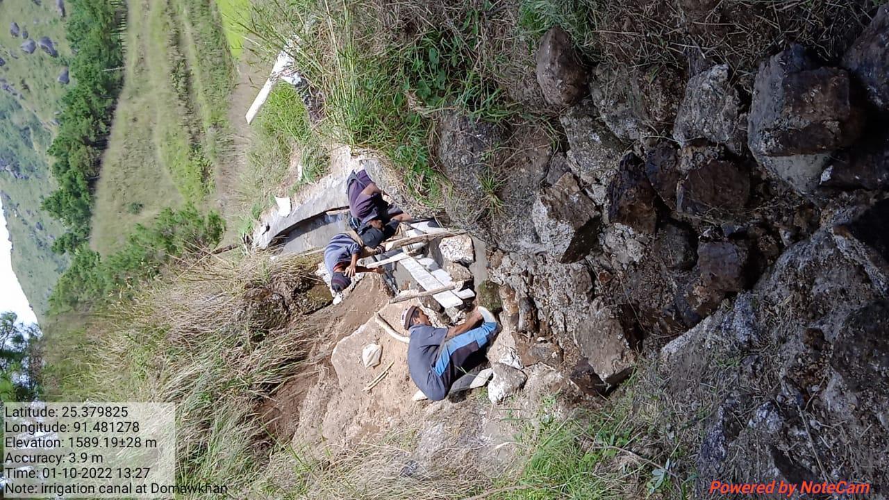
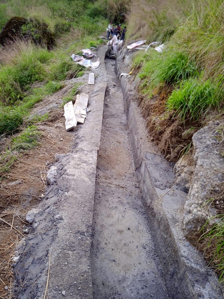
Fig: Irrigation Canal (Water Channel) at Dom Mawkhan
| 22 | Type Of Intervention | Site Name | GPS Co-ordinates | Amount Sanctioned | Work Status | |
|---|---|---|---|---|---|---|
| RCC Water Tank at Synrang Pyndenbah | Synrang Pyndenbah | 25.380365 | 91.476515 | Rs.1,19,500 | Completed | |
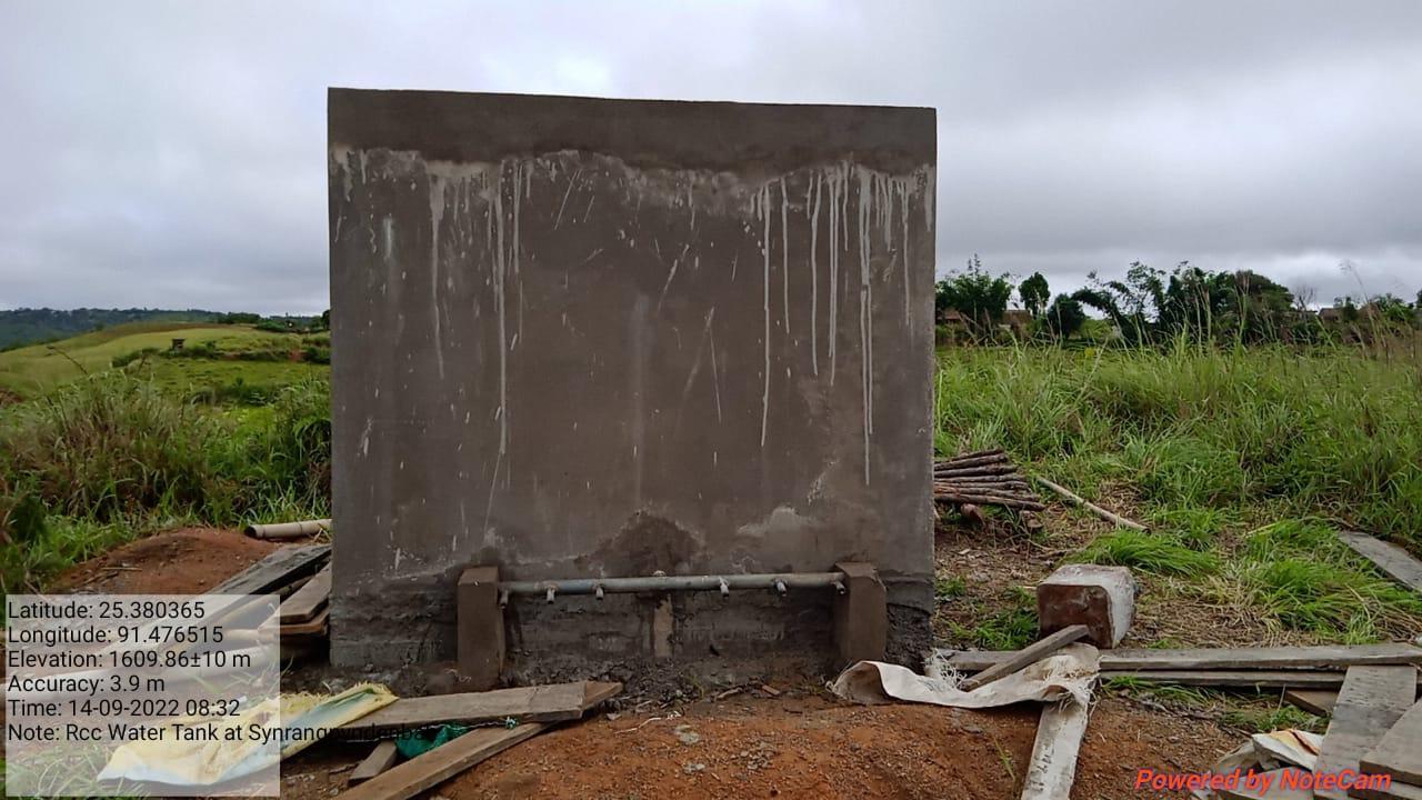
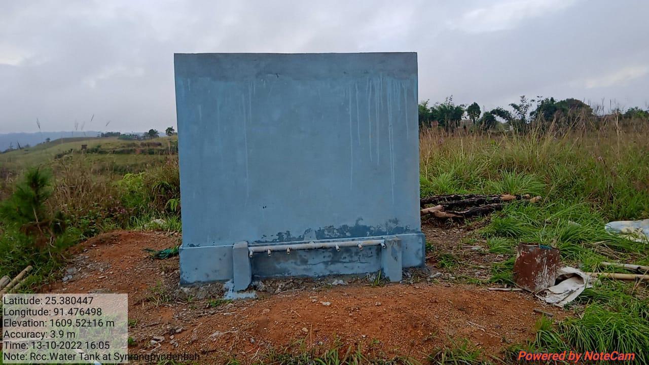
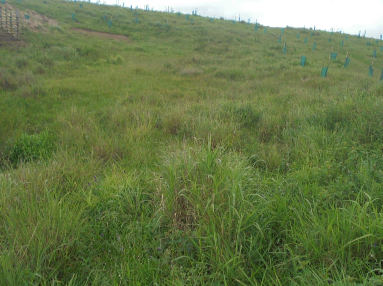
Fig: RCC Water Tank at Synrang Pyndenbah
| 23 | Type Of Intervention | Site Name | GPS Co-ordinates | Amount Sanctioned | Work Status | |
|---|---|---|---|---|---|---|
| Community Nursery (Medicinal) at Synrang Pyndenbah | Synrang Pyndenbah | 25.379952 | 91.47665 | Rs.1,30,240 | Completed | |
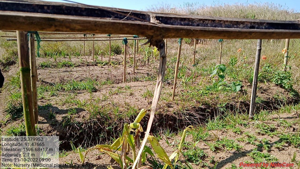
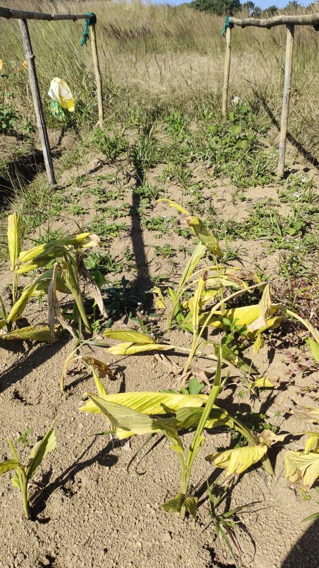
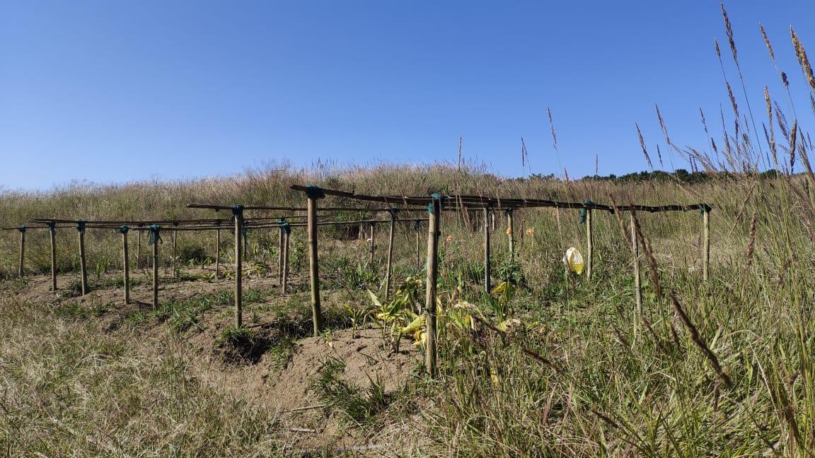
Fig: Community Nursery (Medicinal) at Synrang Pyndenbah
| 24 | Type Of Intervention | Site Name | GPS Co-ordinates | Amount Sanctioned | Work Status | |
|---|---|---|---|---|---|---|
| Permanent Nursery at Synrang Pyndenbah | Synrang Pyndenbah | 25.379699 | 91.475912 | Rs.1,99,600 | Ongoing | |
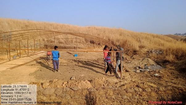
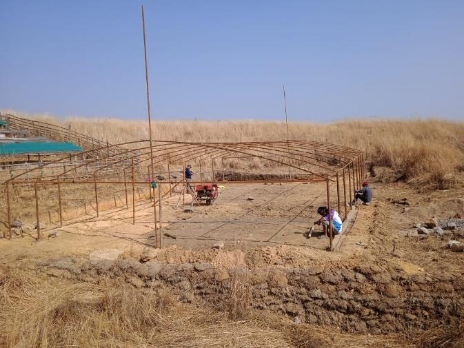
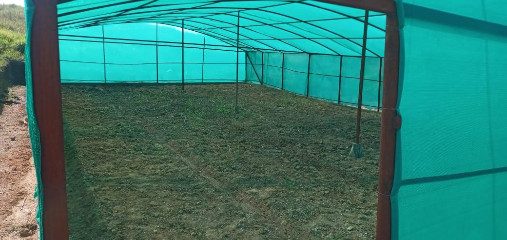
Fig: Permanent Nursery.
8.Fund Status:
The fund status of both the 21,55,000 and the additional 5,00,000 are listed in the table below:
Fund Released to VNRMC (Project Implementation)- Rs.26,55,000 Total No. of Work Order Issued- 23 |
||||
|---|---|---|---|---|
| Activity Name | Amount Sanction | Amount Spent | Start Date | End Date |
| Construction of Erosion control wall at Mawksew | Rs. 87,530 | Rs.87,530 | 6th-Feb-2020 | 5th-Mar-2020 |
| Spring Chamber and treatment of catchment area at Siej Kong Plian | Rs.91,070 | Rs.91,070 | 6th-Feb-2020 | 12th Jun-2020 |
| Afforestation at Synrangpyndenbah | Rs.1,16,500 | Rs.1,16,500 | 4th Jun 2020 | 30th Dec 2021 |
| Community Nursery at Synrangpyndennah | Rs.2,97,280 | Rs.2,97,280 | 4th Jun 2020 | 30th Nov 2021 |
| Spring Chamber & Catchment area at Mawshoi | Rs.56,850 | Rs.56,850 | 6th Jan 2021 | 29th May 2021 |
| Check Dam at Ranab Ali | Rs.4,16,900 | Rs.4,16,900 | 1st Feb 2021 | 30th Apr 2021 |
| Fireline at Kpep Nongsiej | Rs.11,900 | Rs.11,900 | 14th Jan 2021 | 30th Jan 2021 |
| Afforestation at Khangnar | Rs.62,440 | Rs.62,440 | 15th Jul 2021 | 1st Oct 2021 |
| Afforestation at Dum Myllung | Rs.96,910 | Rs.96,910 | 15th Jul 2021 | 30th Jul 2022 |
| Treatment of catchment area at Mawshoi | Rs. 95,910 | Rs.95,910 | 13th Jul 2021 | 29th Jul 2022 |
| Improvement of degraded forest at Dom Makhan | Rs. 80,680 | Rs.80,680 | 13th Jul 2021 | 31st Jul 2022 |
| Improvement of degraded forest at Dahluwa | Rs. 96,910 | Rs.96,910 | 10th Jul 2021 | 30th Jul 2022 |
| Improvement of degraded forest at Shait Shait Nah | Rs.1,67,910 | Rs.1,67,910 | 17th Jul 2021 | 30th Jul 2022 |
| Improvement of degraded forest at Maw Symboit | Rs. 39,200 | Rs.39,200 | 13th Jul 2021 | 30th Jul 2022 |
| Afforestation at Kper Nongsiej | Rs.1,18,180 | Rs.1,18,180 | 10th Jul 2021 | 30th Jul 2022 |
| Dug Out Pond at Synrangpyndenbah | Rs. 64,580 | Rs.64,580 | 3rd Nov 2021 | 30th Nov 2021 |
| CC Checkdam, Gully Plug at Dom Mawkhan | Rs.1,18,180 | Rs.1,18,180 | 4th Nov 2021 | 30th Dec 2021 |
| Spring Chamber at Compound School | Rs.64,580 | Rs.64,580 | 16th Mar 2022 | 27th Apr 2022 |
| Filter-Soaked pit at Dom Mawkhan | Rs.48,960 | Rs.48,960 | 2nd May 2022 | 23rd July 2022 |
| Tretment of catchment area at Dom Mawkhan | Rs.27,700 | Rs.27,700 | 13th June 2022 | 30th June 2022 |
| Irrigation Canal (Water Channel) at Dom Mawkhan | Rs.2,50,260 | Rs.2,50,260 | 1st Sep 2022 | 27th Oct 2022 |
| RCC Water Tank at Synrang Pyndenbah | Rs.1,19,500 | Rs.1,19,500 | 1st Jul 2022 | 27th Aug 2022 |
| Community Nursery (Medicinal) at Synrang Pyndenbah | Rs.1,30,240 | Rs.1,27,240 | 2nd Aug 2022 | 30th Sep 2022 |
9.Ground testimonials:
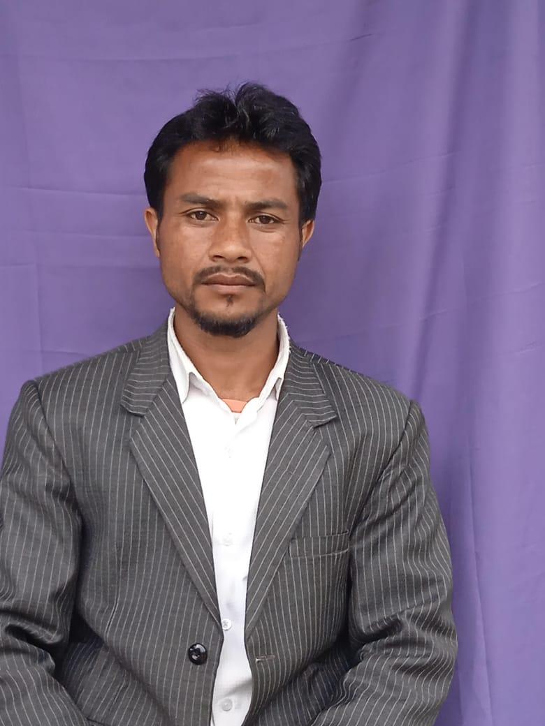
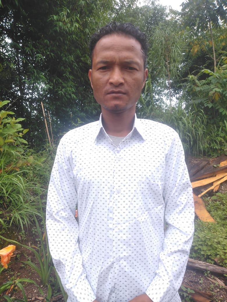
Mr. Donborlang Nongsiej
President & VCF Social Management
“I am filled with much gratitude that our village has grown in unity and has come a long way since the year 2019. When the awareness programme by the Community Led Landscape Management Project was conducted in our village, the residents of the village including men, women and the youths had expressed their interest that this Project be implemented within the village.
On 29th June 2019 the Village Durbar had formed the VNRMC to be the branch Committee. At the very beginning of the Project we faced many issues with implementing the various interventions as the people have not truly understood the ways and the importance of caring for the environment. But gradually, as the years passed, there has been a change in the mindset and attitude of the community members. This Project has been a great blessing to our people in imparting knowledge and understanding on conserving land, water and forest and has been inclusive in providing labour to many youth, womem, men and the differently abled members. Through this project, we have constructed many Spring Chambers to meet the water requirement, Checkdam to irrigate the padddy fields, Erosion Control wall, Afforestation sites, a Nursery which we are proud of, that has benefitted not only to the community members but to all the adjacent villages as well.
As a President & VCF of Social Management and on behalf of the VNRMC and the community members of Pyndensakwang , I would like to express my gratitude towards the World Bank for providing financial support and to the DPMU-CLLMP team as a whole for their extensive guidance and dedication throughout the years. Though the Project will eventually end, but the VNRMC will carry forward the knowledge that we have learned and work towards protecting and conserving our natural resources.”
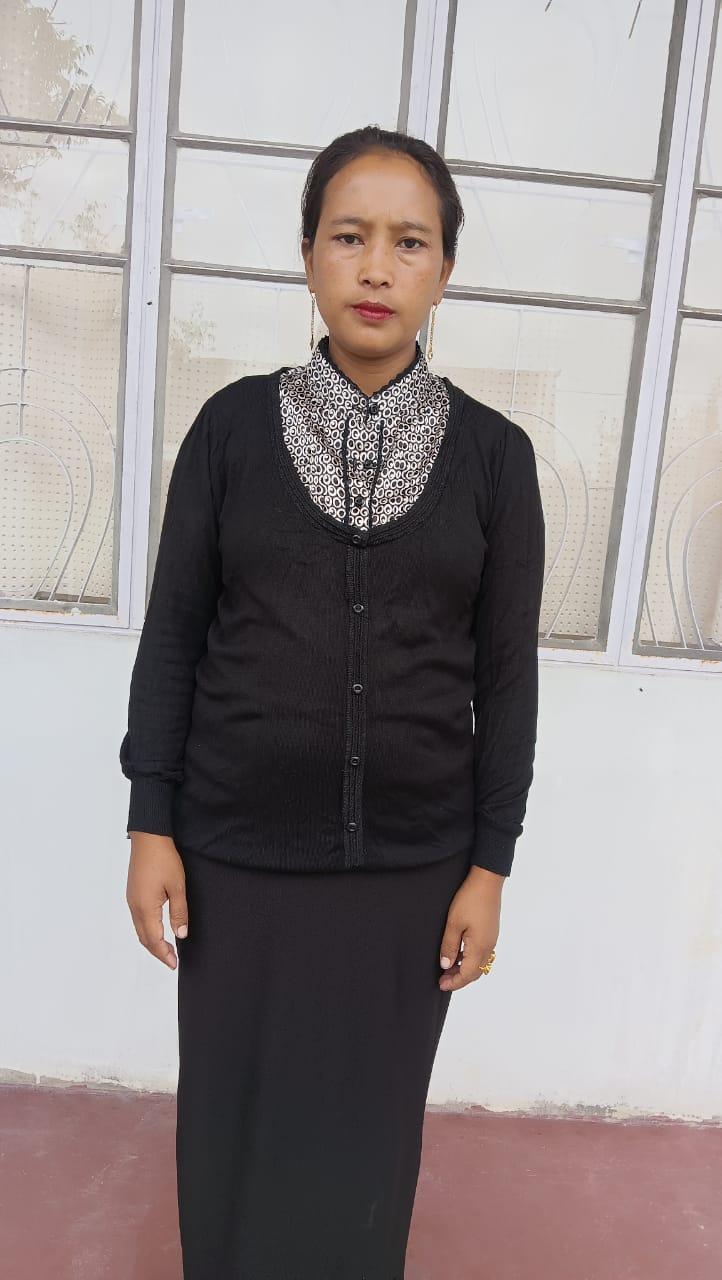
Mrs. Beautiful Ramsiej
VCF Environment & Secretary
As a Secretary of the VNRMC and also as an Environment VCF, I am privileged to have had the chance to hold such positions and this has indeed open up many doors for me to attend and learn many trainings organised by the office. Trainings such as Forest Management Plan, Environmental Safeguard, Spring Mapping, trainings on maintaining the community nursery was also taught. If everyone of us do our part and practise sustainable management of natural resources, the children of the community as a whole will reap the benefits in the future generations. All these resources are freely available to us, let us be kinder and thoughtful towards mother nature and it will in turn bless us with its produce.
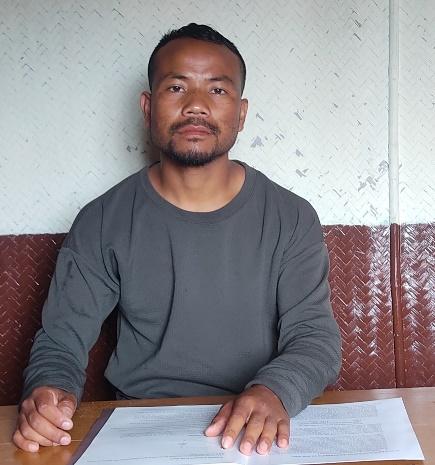
Shri.Paulingstar Ramsiej
Book Keeper & Finance Secretary
This Project have transformed our village from what it was five years ago be it the land, the water or the forest. The checkdams and irrigation canal have been a blessing to the farmers especially during the winter, the community members have access to clean drinking water and the afforestation and improvement of the degraded forest land are interventions which we are hopeful to see the changes in the coming years.This Project has brought much awareness and knowledge to our resident on the importance of conserving our environment.
As a Book Keeper of my village I have learned how to maintain and update all the books of records such as the Payment Vouncher, Minute Book, Cheque Issue Register, Cash Book and Purchase Register. I am impressed at the working of this project as with the trainings I have received, I now have the confidence to complete all the paper works required and this office had empowered me with this oppourtunity.
Mr. Plosborlin Kharjahrin
VCF M&E
I express my gratitude towards the DPMU SWKHD for considering Pyndensakwang as one of the Project villages under CLLMP. This project has brought about many advantages to the community as a whole, and has helped me to understand why it is important to change the mindset of the community regarding conservation and preservation of the environment, Procurement methods using RFQ, monitoring and follow up of intervention, books and records. I hope that through this project, we as a community will follow its footsteps for the benefit of the community and future generations.