Report on
RANGTHONG Village under MAWKYRWAT c&rdblock
District: SOUTH WEST KHASI HILLS
COMMUNITY LED LANDSCAPE MANAGEMENT PROJECT


Community Led Landscape Management Project (CLLMP)
The Government of Meghalaya with the financial help from the World Bank has been implementing the Meghalaya Community Led Landscape Management Project (MCLLMP). The project covers the entire state of Meghalaya and implementation of community led plans have been rolled out in phase manner throughout the state. The Meghalaya Basin Management Agency (MBMA) had facilitated the community-led planning by providing support, technical inputs and funding.
The project had strengthened community-led natural resources management in selected landscapes within the 11 districts of the state. This has been achieved through a variety of planning, capacity building, and on-the-ground interventions to promote the conservation, sustainable use of natural resources, social inclusion and community mobilisation; building traditional knowledge and learning, mapping of natural resources management; strengthening the community institutions and creating linkage with financial institutions and community organizations.
The project interventions include the preparation of community led natural resource management plans. The CLLMP has the following three components:
Strengthening Knowledge and Capacity of Communities for Natural Resources Management
Community-Led Landscape Planning and Implementation
Project Management and Governance
The project objective is “to manage and conserve the natural resources, especially forests, soil and water sources, in a manner that supports the financial and physical well-being of communities in the State”
SCOPE:
The CLLM-Programme focuses on increasing the capacities of communities and traditional institutions (TI) by adopting a landscape approach to manage their natural resources such as soil, springs and other water sources, forests and bio-diversity, etc.
The project has been planned and implemented in about 400 villages across the state.
CLLMP has a strong focus on institution-building at the village-level, by ensuring systematic capacity-building on technical and social skill-sets.
The project has also extended such trainings to communities beyond the targeted villages and support efforts made by them to access funding from various rural and natural resources initiatives and schemes.
The programme has also invested in improving the process and outcome delivery, by developing and adhering to effective systems and procedures, supported by the appropriate technology.
BENEFITS:
Benefits for community (Skills and Capacity relating to technical and managerial areas like NRM and Conflict resolution.
Benefits to traditional institutions (village councils, traditional leaders, community-based organizations, SHGs etc) through Knowledge sharing, promotion of innovative approach, access to technology, technical managerial and financial support.
It has been estimated that the project has impacted around 1 lakh partners (of which 50% are women) who depend on land, forest, agro forestry.
Through the project, 55000 Ha of targeted area has been ensured with availability of water, biological resources and soil productivity, which has in turn benefitted around 400 villages and the outcomes delivery can be summarized as follows.
IMPLEMENTATION AGENCY:
The Project has been executed by the MBMA in collaboration with other partners particularly, SIRD (for training and capacity building), Department of Soil and Water Conservation, Water Resource Department, Forest Department, specifically with respect to technical inputs, safeguards management and Community NRM plan preparation.
PROJECT PERIOD:
2018-2023 (5 years)
TABLE OF CONTENTS:
I.Introduction …………………………………………………………….5
II. Social Profile ………………………………………………………….6
i.VillageAccesibility……………………………………..6
ii.Literacy rate……………………………………………. 6
iii.Population……………………………………………... 6
iv.Occupation……………………………………………..7
v.Village organisation……………………………………. 7
vi. Fuel Type………………………………………………8
vii.Drinking Water………………………………………...8
viiiCultivatible Land………………………………………8
ix.Forest Cover…………………………………………….8
x.Forest Species……………………………………………8
xiWater Bodies…………………………………………….9
xii.Areas affected…………………………………………..9
III.CLLMP Activities
i.Ground-Truthing………………………………………………… 9
ii.Sensitization on CLLMP…………………………………………10
iii.Signing of EOI, VGA and Green Charter……………………….10
iv.Formation of VNRMC…………………………………………...10-11
v.Village Community Facilitators…………………………………..12
vi.Purchase Committee …………………………………………… ..13
IV. Opening of Bank Account …………………………….………………..13
V. PRA Exercise……………………………………………………………14
i.Basic Survey for CNRMP template……………………………….15
ii. Focussed Group Discussions……………………………………..15-16
iii.Village Boundary Mapping and Resource Mapping………………17
VI. GIS Activities…………………………………………………………….18-19
VII. The Proposal list of intervention…………………………………………20
VIII. Project Implementation ………………………………………… ……..21-33
IX. Fund Status ………………………………………………………………..34
INTRODUCTION
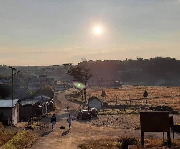
Rangthong village is located in Mawkyrwat subdivision of South West Khasi Hills district in Meghalaya, India. It is situated 15km away from sub-district headquarter Mawkyrwat (tehsildar office) . Rangthong has a total population of 1065 people, out of which male population is 540 while female population is 525.Accordint to the 2011 census Male literacy stands at 89.61% while female literacy is 90.88%.
HISTORY OF THE VILLAGE:
Rangthong village is one of the oldest village within the Hima Maharam South West Khasi Hills District. It was once the headquarter of the syiem of Hima Maharam. It was not known who were the founders of the said village however, the first settlers were from the clan Syiemlieh, Snaitang, Thongni, Wanniang, Shangdiar, Nongkrem and Khardewsaw. The literal meaning of the word Rangthong means men who won a bet. According to legends, they said that Rangthong village use to be famous because of pure physical and intellectual strength and whenever there is any sort of competition they were never defeated or outdone.
VILLAGE SOCIAL PROFILE:
Rangthong village has a total number of 186 households, having a total population of 1065 villagers. People in this village mainly depend on agriculture and its allied activities for their livelihood. There are teachers, daily labourers, government servants but the majority of the villagers depend mostly on agricultural farming.
Village Acessibility:
In order to reach Rangthong village one must travel by road with local taxis, or Maxi cabs from the Mawkyrwat-Mawlangwir road.
Literacy Rate:
As per 2011 Census, Rangthong has a lower literacy rate compared to the State average. Rangthong literacy rate was 54.13% while the State average stands at 74.4%. The female literacy rate was 44.66% and the male literacy rate was 62.61 %.In Rangthong, there is a total number of 6 schools within the village out of which 5 are Primary Schools and 1 Secondary School.
Population:
The total population of Rangthong village now stands at 1065 as of the recent survey. Out of this, 540 are male and the female count is 525.
| Age Group | Male | Female | Total |
|---|---|---|---|
| 0-4years | 89 | 66 | 155 |
| 5-14years | 117 | 97 | 214 |
| 15-30years | 128 | 145 | 273 |
| 30-60years | 161 | 168 | 329 |
| Above 60years | 45 | 49 | 94 |
| Total | 540 | 525 | 1065 |
IV. Occupations:
The people of Rangthong village rely mainly on agriculture and forest produce for their livelihood. Out of 186 households within the village, 92 household are farmers, 61 household are daily wage labourers, 18 household are teachers, while the remaining 15 household are engaged with Government Services.
V. Organisation within the Village:
There are 5 Self Help Groups (SHGs) under NRLM in Rangthong village under one Village Organisation. Presence of a 1committee relating to Water and Sanitation within the village. There are 6 village council within the village.
VI. Fuel Type:
The people of Rangthong village mainly use wood as a fuel.
| Type of Fuel | Total No of HH | Qty (Kgs/HH) | Total |
|---|---|---|---|
| Wood | 166HH | 6000kg | 99,6000kg |
| Charcoal | 0HH | 0 | 700kg |
| LPG | 20HH | 60kg | 1200kg |
VII. Drinking Water:
The people of Rangthong have access to drinking water mainly from the springs within the village. Government water supply lines are also available in this village. There are11 springs which belongs to community and Private which are perennial and the people of the village use it for drinking and 13 streams which they use for domestic purpose, drinking & irrigation.
VIII. Cultivable Land Cover:
The total agricultural area of Rangthong village is 620.88ha. The type of soil in Rangthong village is Loamy soil. The main crops that the people of Rangthong village cultivate are Potato, Paddy, Sweet potato, Squash and Seasonal Vegetables. The private area under Horticulture are Mawsiatmait and Mawphanlieh.
IX. Forest Cover:
The total forest cover under Rangthong village is 783.13ha.Most of the forest cover falls under Private Ownership. About 390.10ha of forest cover are open forest, while 393.03ha of the forest are densely covered. The name of the community forest are: Suin, Phot DommawleinMawrduk,Sohlymphur,Khlaw Kohsin,Tde Sohmen and Jyrsu. People uses the forest products mainly for fuelwood, as medicines, aromatic plants and for other purposes. There are also Private Forest and they are: Khlawbalang, Raid War,Mawsiatmait, Langsynkur, Photlatung, Mawsangah, Rangew Diphullut, Rangew Di Per, Phot Tyllang, Mawkhan, Mawiawtngaw, Mawtynrong, Riat Thru, Mawphan Syiem, Disiarpilang, Trui Pyrnon, Pep Phanrap. There are also Forest which belongs to the Clan and these are: Phottulung, Mawtynrong, Sakhiat, Pyrmasew, Tdejjawte and Sohphie Kachri.
X. Forest Species:
Some of the indigenous tree species found in this village are Dienglieng, Diengsymparat, Diengtanglung and Diengsning. There are some plant species used by the people of the community for medicinal purposes like Dienglieng, (bark, fracture, cramp), Diengsohphie(bark, cholera & dysentery). Some of the valuable grasses in the forest are Bad Pur, Tynrong Lieh, Langsohriew and Prot. The endangered species which is use for medicinal purpose is Jakharia.
XI. Water Bodies:
Total area of water bodies in Rangthong is 0.94Ha. There are 11 springs within the village which are mostly perennial which people uses mainly for drinking purpose namely Phodnah,Phodmahiem,Phodtorsympiah,Phohsohphoh,Phodisong,Phodrubiej,Phodlangbuhsiej,Phodmishon,Kperkidon,Disohthied & Umbyrthieh. The 13 streams within the village are mainly used for washing, irrigation and for fishing and these are Phoddisong,PhodsyndiarMawbahngiang,Sohrasu,Tyrsympiah,Photsaitjain,Photdisong,Photbahngai,Tdeiawtep,Photpyrmasew,Tdeisohmen,Photlyngon,Umbyrthieh.There are also three rivers that are within the geographical area of Rangthong and these are: Photdiper, Photsyna and Mawawmah. .
XII. Areas Affected:
Approximately about3.57ha of forest land have been degraded over the years due to soil erosion, 5.97ha excessive felling of trees and 4.9ha have been degraded due to forest fires which have led to the loss of productivity of the land and the loss of the saplings and other natural resources. About 1ha of cultivable land have been affected by the excessive use of fertilizers and 3.33ha of land have been degraded over the years owing to human settlement and culturable wastelands.
CLLMP ACTIVITIES:
1. Ground Truthing: The CLLMP officials met with Mr.Kitboklang Nongrem headman of Rangthong village, along with Mr.Kyntiewnam Syiemlieh the village Secretary and other village representatives for field assessment. Mr.Kitboklang, provided the CLLMP Team with important information regarding the current scenario of the landscape and the natural resource management under his headmanship.
Case Findings:
i)Most of the household falls under the BPL category.
ii)They have an actively performing VEC in the village.
iii)The land within the village falls under the Hima Maharam Syiemship.
iv)The source of water supply in the village is from two sources: private and public.
v)There are a few patches of degraded land that has been left unused.
vi)There is a loss of Natural Vegetation in the area.
vii)Abundance of small streams within the village.
2. Sensitization Programme:
The District Project Manager Mr.J.Wanniang along with the staff held a village Level Sensitization Programme on the Community Led Landscape Management Project (CLLMP) on 8th February 2019.The villagers actively participated in the program, voicing out their concerns and questions regarding the project making it a huge success.
Highlights of the meeting:
1. Awareness about the Community Led Landscape Management Project (CLLMP).
2. Laying the importance on the involvement of the community in making the CNRM plan and its success.
3. A brief awareness on cleanliness was conducted based on our finding during the ground truthing phase.
4. An interactive session was held to answer doubts of the villagers regarding the project.
3. Signing of EOI, VGA and Green Charter:
On 8thFebuary 2019,Rangthong village signed the EOI (Expression of Interest), VGA (Village Grant Agreement) and the Green Charter after there was a uniform agreement by the people of the entire Community that the Community Led Landscape Management Project (CLLMP) be implemented at Rangthong village.
4. Formation of the VNRMC:
The formation of the Village Natural Resources Management Committee was done in a public meeting on the 8th February 2019 in the presence of the entire village and the CLLMP Staff. The people of the community chose the President, The Secretary, the Purchase Committee members and the other Executive members to formed the Rangthong VNRMC. There are 9 Executive members, 3 Village community Facilitator and 3 Purchase Committee members. The VNRMC Plan was later formulated on the 24th September 2020 in the presence of the 22 members of the VNRMC
VILLAGE FUNCTIONARIES Traditional Village Institutional Functionaries (VillageDorbar/Nokma/Doloi Council) |
|||||||||||||||||
|---|---|---|---|---|---|---|---|---|---|---|---|---|---|---|---|---|---|
| Sl No | Name in Full | Gender M/F | Age (in Yrs) | Education | Designation | Occupation | Community | Contact No and email address | |||||||||
| 1 1 | Kitborlang Nongrem | Male | 44 | XII | Myntri | Business | Khasi | 9615649664 | |||||||||
| 2 2 | Kyntiewnam Syiemlieh | Male | 83 | BA | Member | Teacher | Khasi | 7005349674 | |||||||||
| 33 | Yesleander Lyngdoh | Male | 54 | BA | Member | Teacher | Khasi | 9366477903 | |||||||||
| 4 | Batskhem Syiemlieh | Male | 37 | BA | Member | Engineer | Khasi | 8837262514 | |||||||||
| 5 | Elbertson K .Dewsaw | Male | 41 | BA | Member | Teacher | Khasi | 8787843154 | |||||||||
| 6 | Tenderfully Syiemlieh | Male | 48 | XII | Member | Teacher | Khasi | 9366394717 | |||||||||
| [7 | Syrpailin Thongni | Male | 49 | X | Member | Labour | Khasi | 883720974 | |||||||||
| 88 | W.B Shandiar | Male | 50 | BA | Member | Teacher | Khasi | 9863129233 | |||||||||
| 99 | Fullmoon Girod | Male | 46 | BA | Member | Teacher | Khasi | 9366668465 | |||||||||
| 110 | Dosparly Thongni | Male | 60 | XII | Member | Soldier | Khasi | 7005126223 | |||||||||
Village Natural Resource Management Committee (9member committee constituted from
|
|||||||||||||||||
| Sl No | Name in Full | Gender M/F | Age (in Yrs) | Education | Designation | Occupation | Community | Contact No and email address | |||||||||
| 1 | Kitborlang Nongrem | Male | 41 | BA | President | Govt servant | Khasi | 7005767330 | |||||||||
| 2 | Tipbhalin Shangdiar | Female | 29 | XII | Secretary | Teacher | Khasi | 7628070087 | |||||||||
| 3 | Fillbiness Nongrem | Female | 49 | XII | Finance secretary | Teacher | Khasi | NA | |||||||||
| 4 | Wallamteibor Syiemlieh | Male | 37 | VI | Member | Labour | Khasi | 8837485997 | |||||||||
| 5 | Pynshnainlang Syiemlieh | Male | 34 | XII | Member | Labour | Khasi | 8837290609 | |||||||||
| 6 | Iohborlang Syiemlieh | Male | 38 | BA | Member | Labour | Khasi | 9366427604 | |||||||||
| 7 | Armstrong Shangdiar | Male | 38 | BA | Member | Teacher | Khasi | 7005160676 | |||||||||
| 8 | Thondar Syiemlieh | Male | 45 | VI | Member | Labour | Khasi | 9366949122 | |||||||||
| 9 | Triolin Syiemlieh | Female | 44 | XII | Member | Labour | Khasi | 6009399431 | |||||||||
| Village Community Facilitators (VCF) | ||||||
|---|---|---|---|---|---|---|
| Sl no. | Name | Age | Gender | Qualifiaction | Contact Number | Role |
| 1. | Kynmawlin Shangdiar | 25 | F | BA | 9366266308 | Envt |
| 2. | Cleverness Shangdiar | 29 | M | BA | 8787528341 | M&E |
| 3. | Lampherlang Syiemlieh | 27 | M | BA | 8014335454 | Social |
| Procurement Members | |||||
|---|---|---|---|---|---|
| Sl no. | Name | Age | Gender | Qualification | Contact Number |
| 1. | Syrpailin Thongni | 50 | Female | XI | 8837209374 |
| 2. | Darihun Snaitang | 38 | Female | MA | 8787737761 |
| 3. | Alkamery Syiemlieh | 35 | Female | BA | 8787573099 |
5.Opening of Bank Account:
The opening of the bank account was done after the signing of the EOI (Expression of Interest), the VGA (Village Grant Agreement) and the signing of the Green Charter.The Accountant of CLLMP South West Khasi Hills trained the Purchasing and Procurement Committee of Rngthong village on matters relating to Accounts and Book Keeping and on the:.
Principles of Community Procurement
Benefits of Community Procurement
Important aspects undertaken by Community Procurement.
Procurement Process/Steps
Function of Purchase Committee
Important Procurement records to be maintained
Financial limits and methods
Maintaining of Books of Accounts to the Book Keeper.
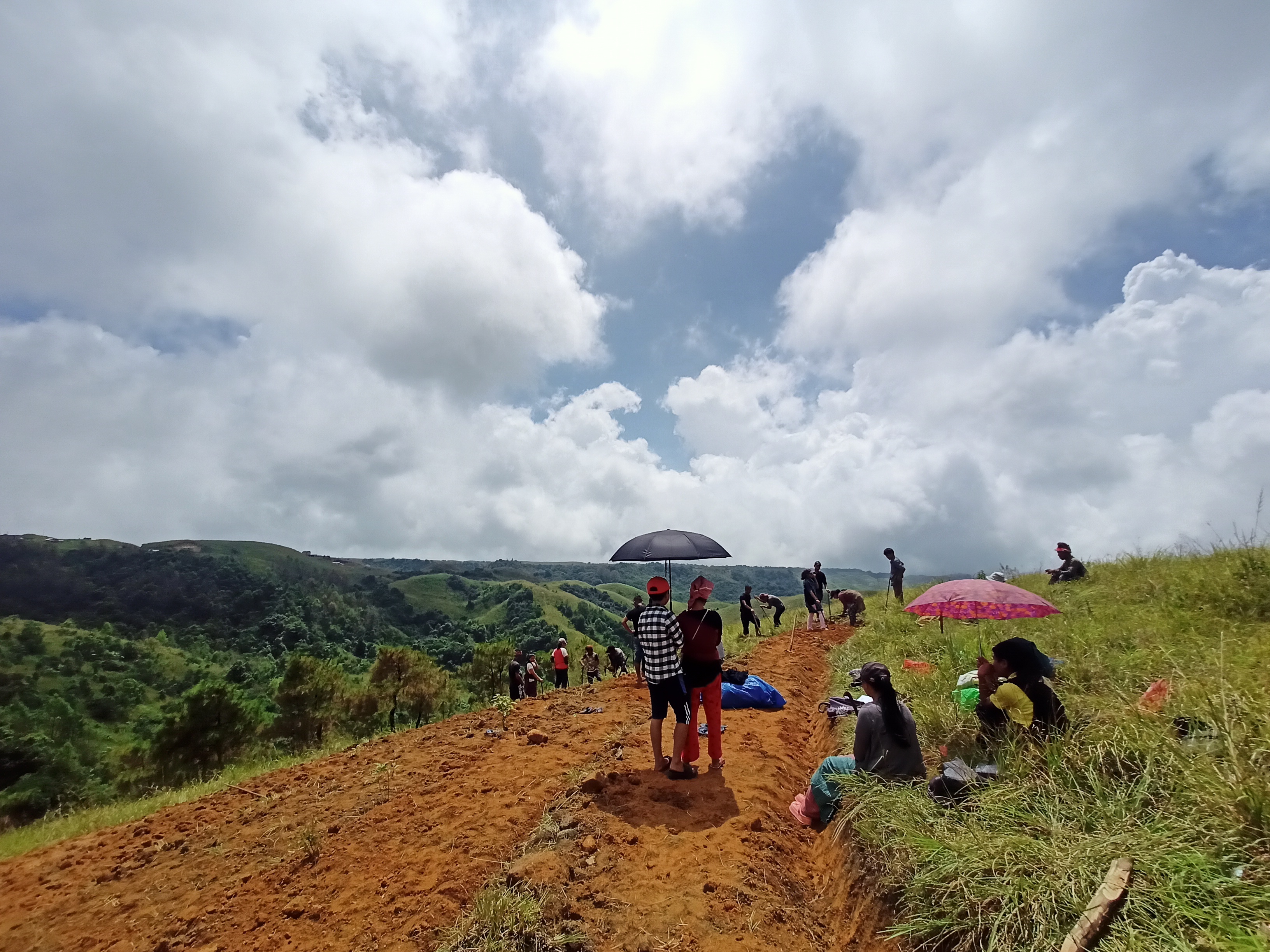
5. Participatory Rural Appraisal Exercise:
The PRA exercise aims to incorporate the knowledge and opinions of the community in the planning and management of development projects and programmes.
The PRA exercise took place on the8th January 2020 both men and women attended the program.
The District Project Manager gave the introduction and spoke about the different activities that the participants had to take part in the programme.
The Program Associate, Environment Management, spoke about the different CNRM plans and the different types of intervention. A group of participants interacted and helped in the collection of data based on the environmental template. With the help of this group, different sites of interventions were identified, analysed and evaluated in order to prioritized the areas that needed the natural resources management.
The Assistant Manager, Social Management, gathered the remaining group of participants to gather the baseline data bases on the social template.
The main objectives of PRA exercise is:
To identify the natural, human and economic resources of the village.
To identify the village problems and prioritized them with the help of the community members.
To prepare the community natural resources management plan of the village.
Findings based on the information gathered from the participants during the PRA/CNRMP exercise:
1. The main agricultural produce is Paddy, Maize and Potato.
2. Most of the household depend on firewood as a source of fuel.
3. Drinking water is limited over a period of 3-4 months during the winter season.
4. Only private ownership forest are available in this village.
5. The springs which are present in the village needs rejuvenation.
6. Training on Land productivity, spring shed management and Community nursery is necessary for the village community.
7. There are no disputes/constraints encountered within the village community or with any neighbouring villages.
Priorities Intervention required based on the PRA Exercise:
1.Rejuvination of the Springs within the community through activities such as afforestation, treatment of catchment areas and contour trenches.
2. Afforestation, Bio-fencing and fire line control in the community forest.
3.Community Nursery for endemic trees.
4.A dug out pond for collecting rain water for.
5.Check dams for erosion control.
6.Afforestation and Roadside plantation.
7.Culturable wastelands to be brought under horticulture.+
Baseline Data Survey to fill the Environment and Social Template:
During the PRA Exercise, the External Expert of Social & Environment Management held a group discussion with the different groups to gather basic village information regarding number of households, demographic information, major crops and enterprises taken in the village, trends of production and productivity of major crops in the village and demographic distribution of village population.
Information related to land use category such as forest, cultivable land, water bodies, etc and the problems and challenges related to NRM were discussed.
Focused Group Discussion on Problem Analysis:
1.Do people have sufficient access to supply of fodder, fuel wood, leaf litter?
No, people in the village do not have sufficient access to supply of fodder, fuel wood, leaf litter. They have to get it from their own private lands/forest or buy it from the nearest village.
2. Has access to timber improved or reduced over the years? How is access for household use and commercial use managed?
Access to Timber has reduced over the years. People have to purchase it from neighbouring village when needed.
3.Are the water bodies facing any threats?
Yes, the water bodies within the village are facing threats.
4. Do all people in the village have access to drinking water? What are the challenges?
No, there is not sufficient drinking water in the village except during the winter season due to less discharge of water from the spring source.
5. Are there degraded areas in the village (open/ degraded forests, mining affected, high soil erosion etc.)?
Yes, there are some minor degradation in cultivated land due to open forest fire.
6. What has caused this degradation? Are there practices causing threats to availability and access to natural resources?
Fertility of the soil has decline over the year.
Excessive felling of trees.
The practices that cause threat to the availability of these resources are:
Forest fires that take place every year
Excessive practice of Jhum Cultivation
7. What have been the changes in agricultural practices?
Previously their method of farming is Shifting Cultivation, but over the years with much awareness people have now practiced crop rotation.
8. Are there any challenges in farming?
The main challenges faced by the people of Rangthong village are that over the years they have seen a decline in the soil productivity due to soil erosion and there has been a need to use Pesticides and insecticides.
9. How would you consider the health situation in your village?
The nearest health care is in the district headquarter with a distance of 9km away and is easily accessible for the community as a whole to commute to the health centre.
10.How is the situation of cleanliness, sanitation, access to toilets and waste management?
Sufficient toilets are available in every household but most of the constructions are poor.
Presence of VWSC in the village has also improve sanitation and cleanliness. But Waste Management is poor because people are not really aware of how to properly disposed off waste.
11. Who are the most vulnerable in the village? What can be done to improve their lives?
BPL Families. Inclusion of BPL family members during project implementation
12. What are the livelihood aspirations of the youth? Are there any avenues available?
Good education as well as training .
13. Do any committees/ institutions/ rules exist to manage and monitor natural resources in the village?
The VNRMC under the CLLMP is the main committee that is now in place to manage the natural resources in the village.
14. What are some of the major issues of conflict in the village?
Nothing related to NRM.
15. Have any of the above issues been discussed in village meetings?
NA
16. How do people resolve disagreements and conflicts?
All disagreements and conflicts are addressed by the traditional institution of village called the Village Dorbar.
5. Village Boundary Mapping and Recourse Mapping:
The GIS personnel along with the Village Community Facilitators mapped the village boundary of Rohbah Village.
The village resource map is prepared by the people of the community.In this resource map, the local people prepare it by drawing it on chart paper. Recourses such as agricultural lands, wells, wastelands,cattle population,playgrounds,ICDS,churches,community halls,etc were mapped.
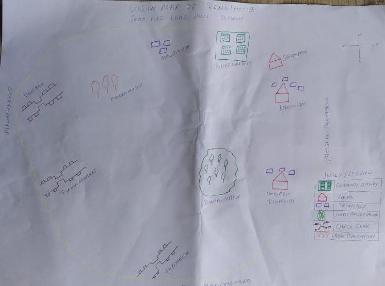
Fig: Social map drawn by the people of Rangthong.
Findings Based on the Resource Map of Rangthong Village:
1. Main agriculture produce is Maize, Potato and Paddy.
2. There is 3Type of Forest ownership: Private Owned ,Clan &Community forest.
3. There are culturable private wastelands -Phot Nongpynden, Photjaud nah, Dew byrthni, Photmawjem, Sohlawui, Eitkhlui.
4. There are 3 rivers present in the village: Phoddiper, phodsyna, Mawawmah.
5.Thereare13streamsflowingintheVillage:Phoddisong,PhodsyndiarMawbahngiang,Sohrasu,Tyrsympiah,Photsaitjain,Photdisong,Photbahngai,Tdeiawtep,Photpyrmasew,Tdeisohmen,Photlyngon,Umbyrthieh
6. There is 1 Community Hall in the village.
7. Presence of Integrated Child Development Services (ICDS) through Anganwadi Centre (AWC).
8. Shifting Cultivation for potato and paddy for a cycle period of 5years is practised.
6. GIS Activities:
| Sl. No. | Parameters | Village Information |
|---|---|---|
| 1 | GPS Coordinates: | |
| i | Latitude | 25.342297 |
| ii | Longitude | 91.384402 |
| iii | Elevation Reading (MSL) | 1542.8m |
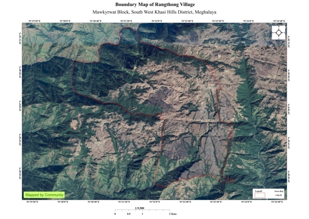
| 2 | Village Geographical Area (Ha) | 1706.55ha 17.0655 sq. km |
| i | Total Forest Area (including community, Clan, Pvt Forest) | 783.13ha |
| ii | Total Area of Water Bodies | 16.87ha |
| iii | Total Area under Agri-Horticulture | 14.57 ha |
| iv | Total Degraded land area (Ha) | 134.43 ha |
| 3 | Average Annual Rainfall | 1200-1300mm |
| 4 | Soil Type | Loamy soil |
|
Name of Proposed Interventions | Site |
|
Nos of HHs expected to Benefit | Priority (High/ Medium/ Low) | ||
|---|---|---|---|---|---|---|---|
|
|
|
|||||
| 1. | Check Dam | Photbah |
|
|
|||
| 2. | Water Conservstion | Photlongon |
|
High | |||
| 3. | Spring chamber & TCA | Umbyrthih |
|
High | |||
| 4. | Trees Plantation | Pynden-iah-siat |
|
High | |||
| 5. | Forest Preservation | Dom iawmethup |
|
High | |||
| 6. | Trenches | Twah Mawieit Kyiop |
|
High | |||
| 7. | Check Dam | Photmahjem |
|
High | |||
| 8. | Spring chamber & TCA | Kperkidon |
|
High | |||
| 9. | Spring chamber & TCA | Sohlymphur |
|
High | |||
| 10. | Check Dam | Pyrnon bahngai |
|
High | |||
| 11. | Check Dam | Photmajem Rangthong |
|
High | |||
| 12. | Check Dam | Pyrnon bahngai Rangthong |
|
High | |||
| 13. | Spring chamber & TCA | Sohynphur Rangthong |
|
High | |||
| 14. | Check Dam | Photsaitjuin Rangthong |
|
High | |||
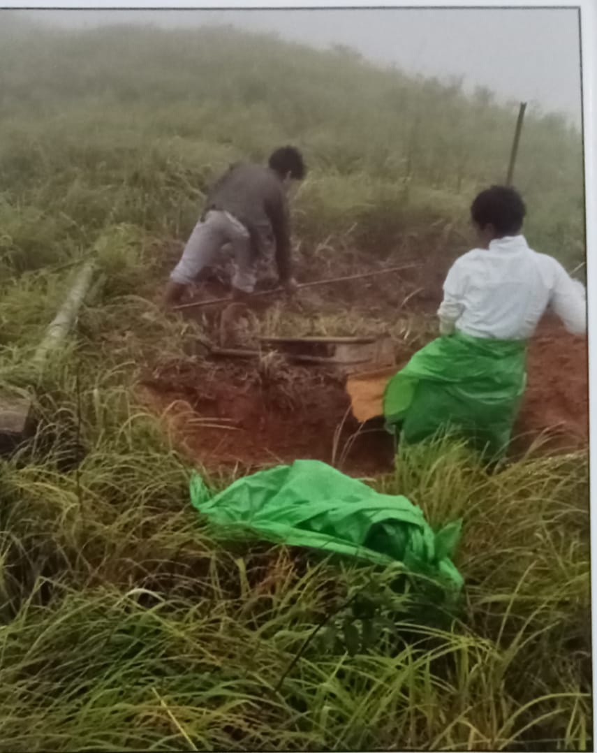
Project Implementation:
| 1. | Type Of Intervention | Site Name | GPS Co-ordinates | Amount Sanctioned | Work Status | |
|---|---|---|---|---|---|---|
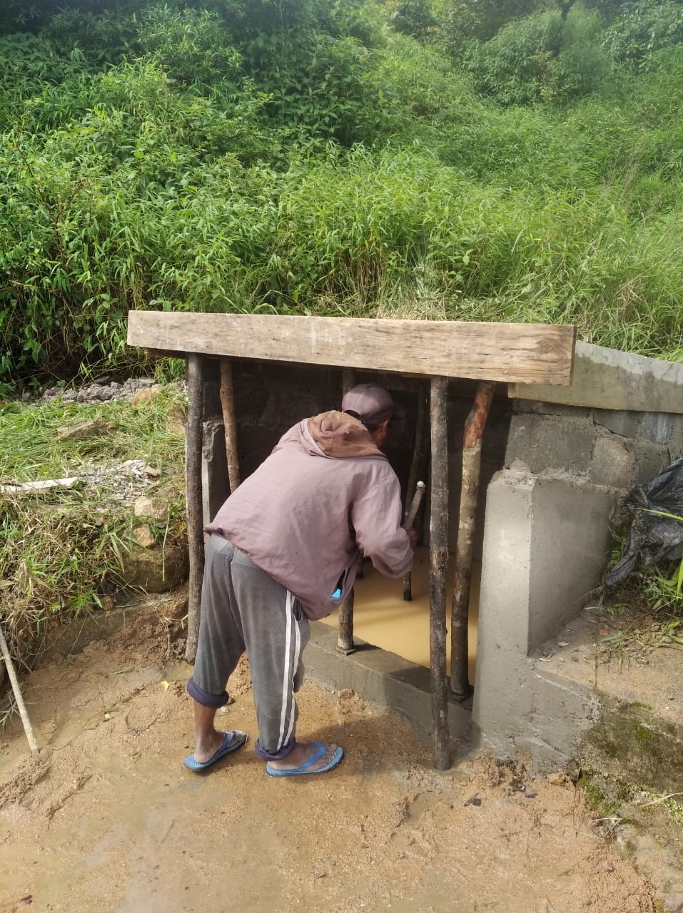
| Construction of Spring Chamber and Staggered Trenches | Umbyrthih Disohthied | 25.3242 | 91.38715 | 42,550 | Completed | |
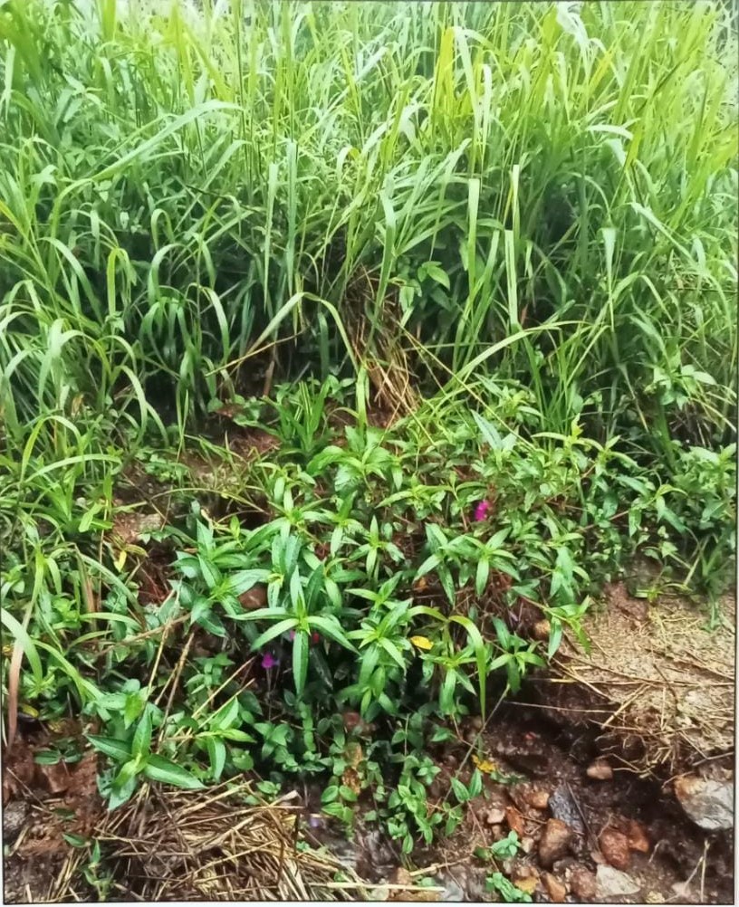
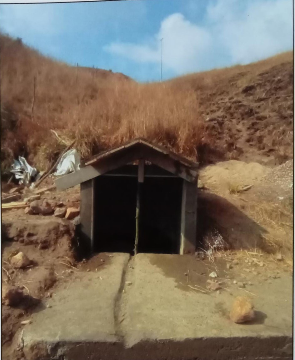
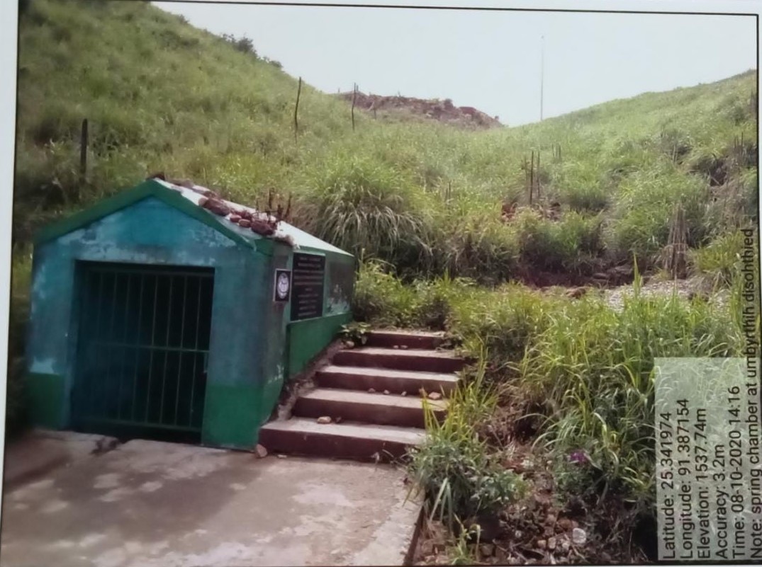
Fig: Construction of Spring Chamber and Staggered Trenches .
| 2. | Type Of Intervention | Site Name | GPS Co-ordinates | Amount Sanctioned | Work Status | |
|---|---|---|---|---|---|---|
| Construction of Spring Chamber and Staggered Trenches | Kper Kidon | 25.3423 | 91.3844 | 51,430 | Completed | |
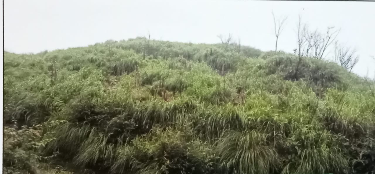
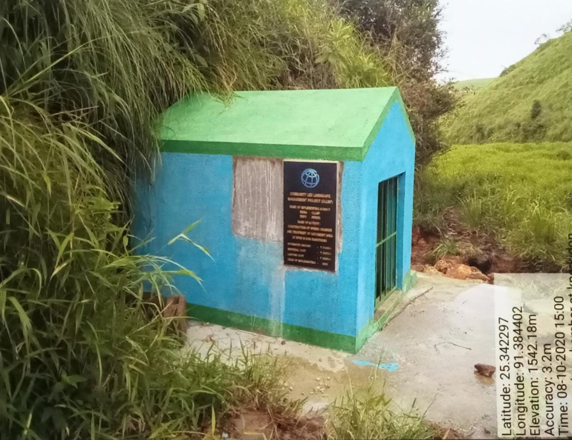
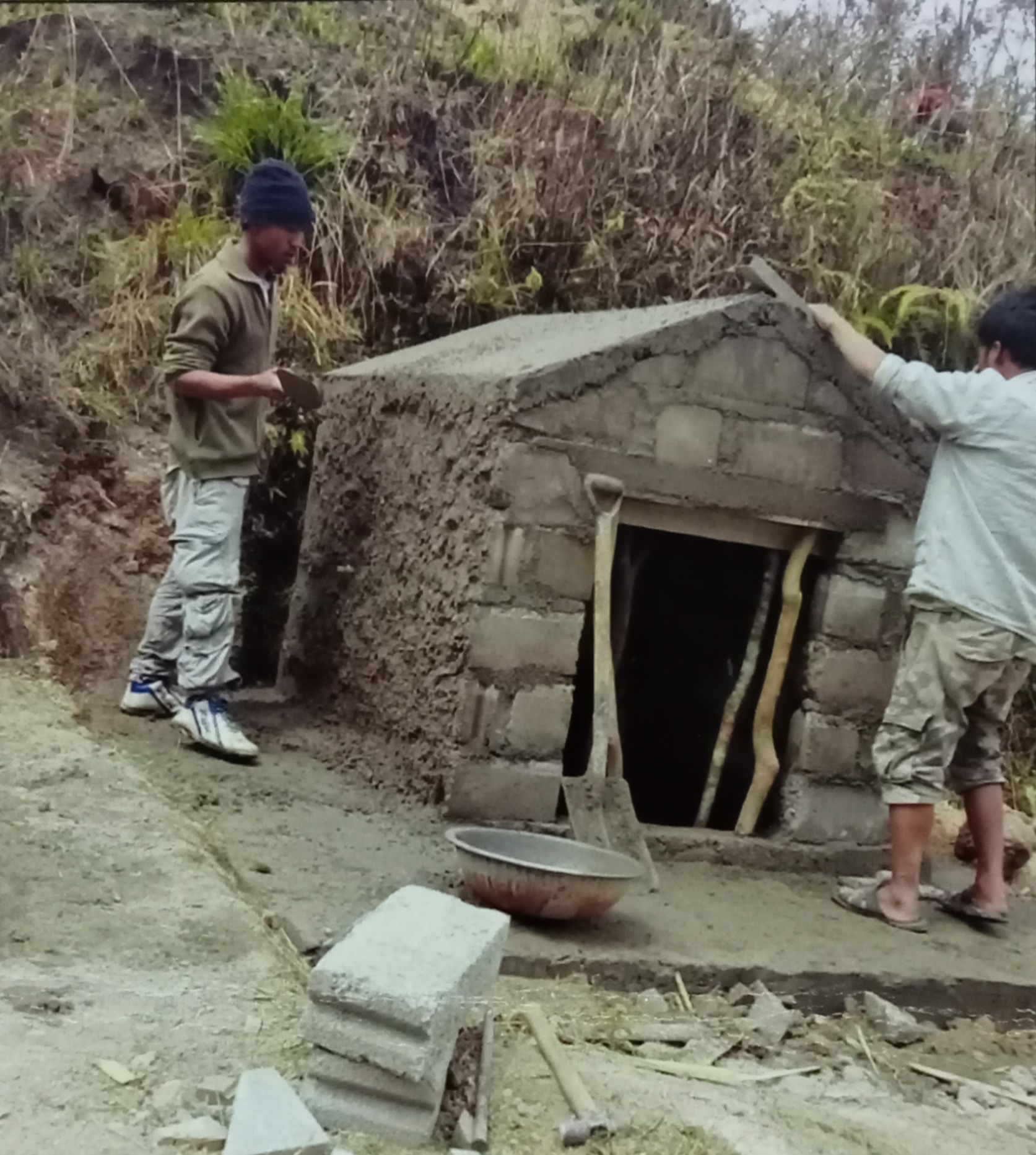
Fig: Construction of Spring Chamber and Staggered
renches.
| 3. | Type Of Intervention | Site Name | GPS Co-ordinates | Amount Sanctioned | Work Status | |
|---|---|---|---|---|---|---|
| Treatment of catchment area | Umbyrthih Disohthied | 25.3242 | 91.38715 | 3,500 | Completed | |
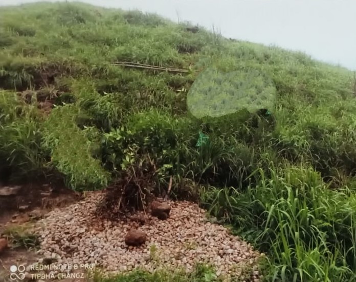
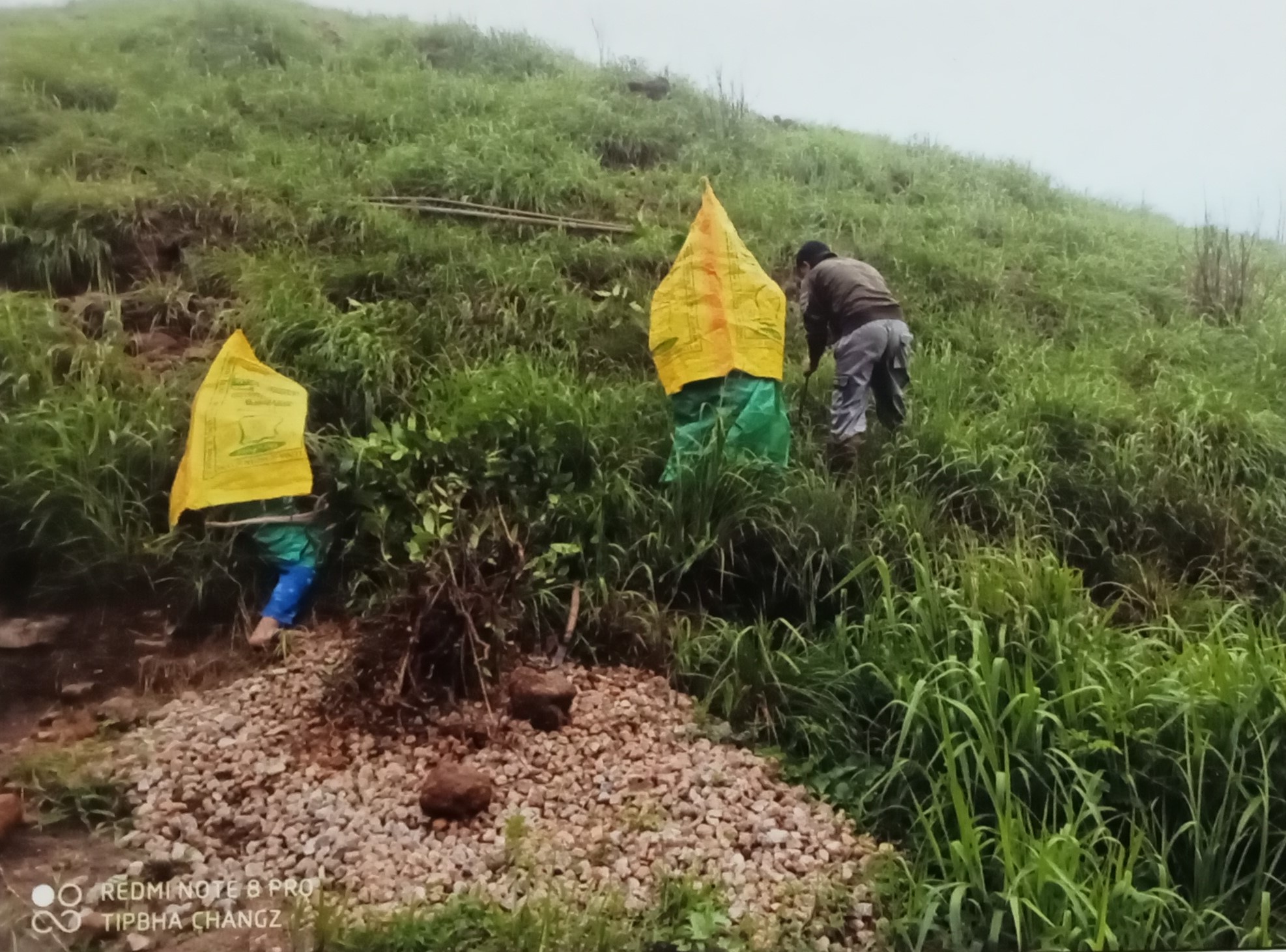

Fig:. Treatment of catchment area Umbyrthih Disohthied
| 4. | Type Of Intervention | Site Name | GPS Co-ordinates | Amount Sanctioned | Work Status | |
|---|---|---|---|---|---|---|
| Treatment of catchment area | Kperkidon | 25.3423 | 91.3844 | 3,500 | Completed | |
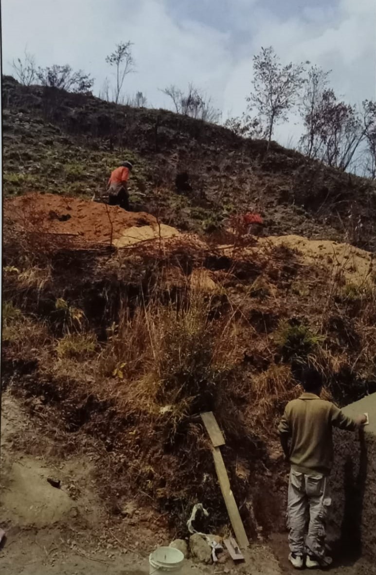
Fig:. Treatment of catchment area Kperkidon
| 5. | Type Of Intervention | Site Name | GPS Co-ordinates | Amount Sanctioned | Work Status | |
|---|---|---|---|---|---|---|
| Contour Trench | Maweitkyiop | 25.34106 | 91.38099 | Rs. 24,000 |
Completed | |
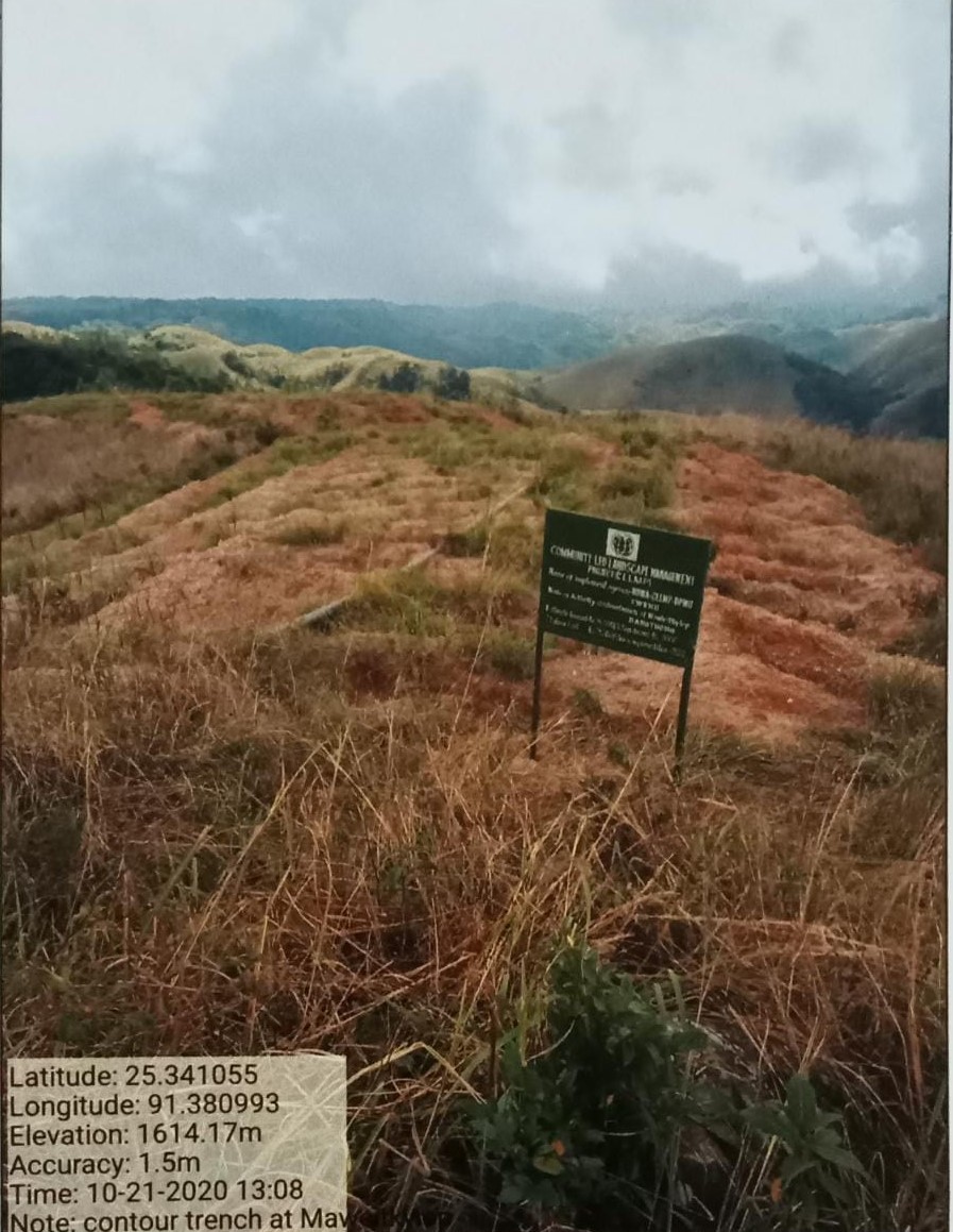
g: Contour Trench at Maweitkyiop
| 6. | Type Of Intervention | Site Name | GPS Co-ordinates | Amount Sanctioned | Work Status | |
|---|---|---|---|---|---|---|
| Community Nursery | Sohraphet | 25.34406 | 91.37265 | 1,50,530 | Completed | |
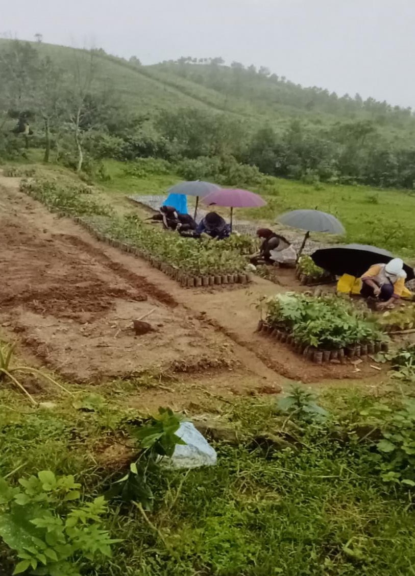
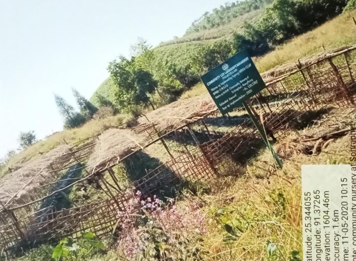
Fig: Community Nursery Sohraphet
| 7. | Type of intervention | Site name | GPS co-ordinates | Amount sanctioned | Work status | |
|---|---|---|---|---|---|---|
| Improvement of existing degraded forest | Domiawmeithup | 25.34464 | 91.36987 | 68,000 | Completed | |

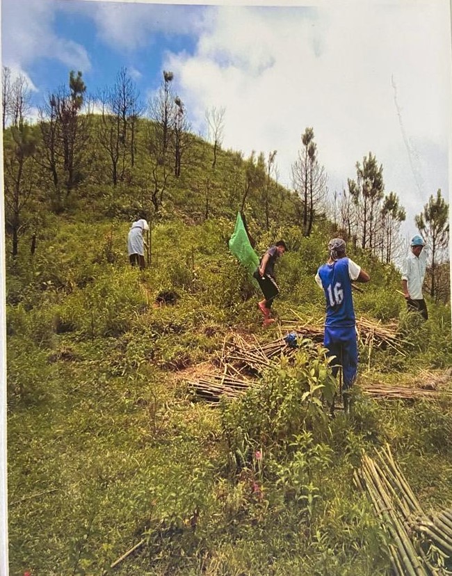
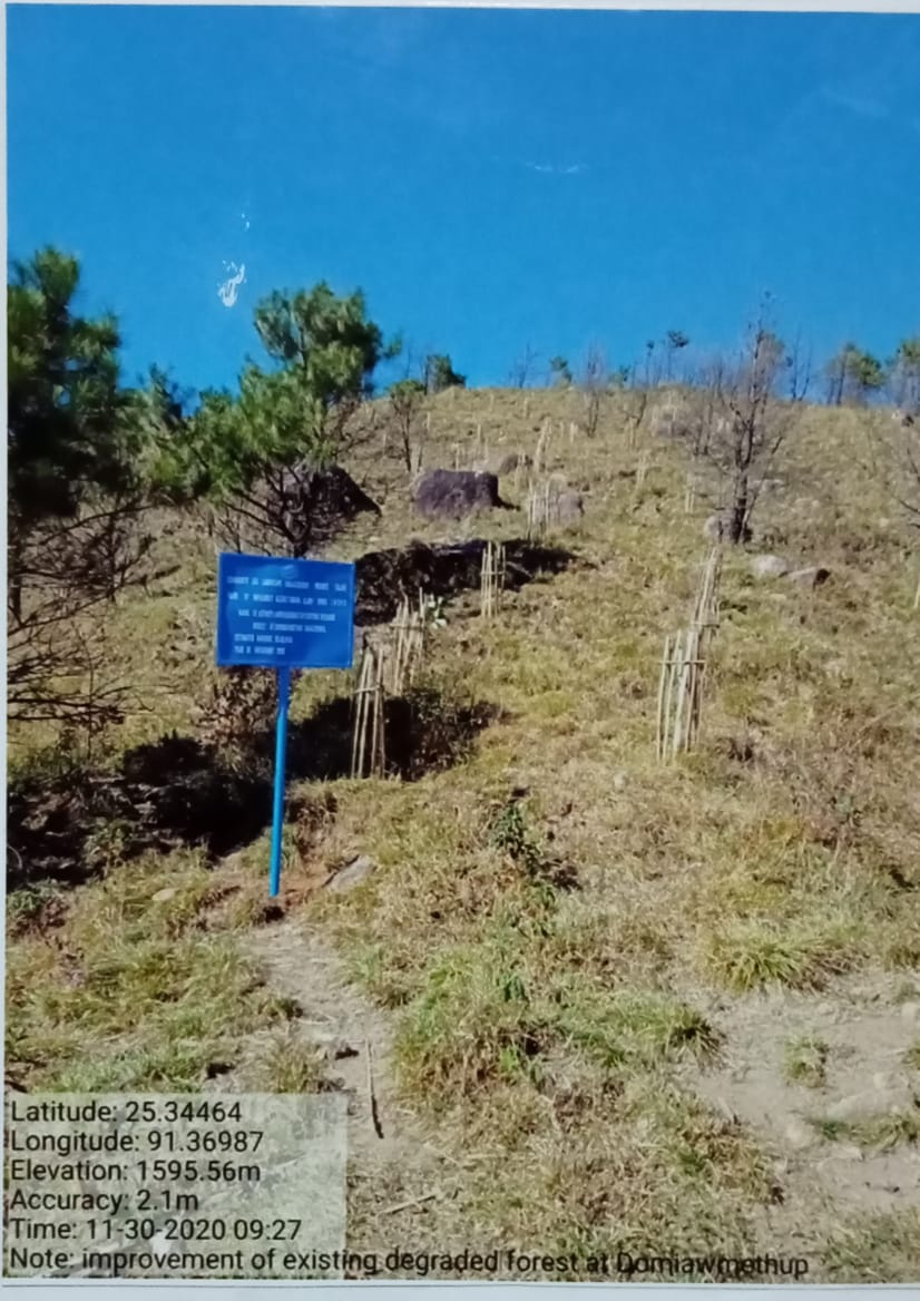
Fig:. Improvement of existing degraded forest Domiawmeithup
| 8. | Type of intervention | Site name | GPS co-ordinates | Amount sanctioned | Work status | |
|---|---|---|---|---|---|---|
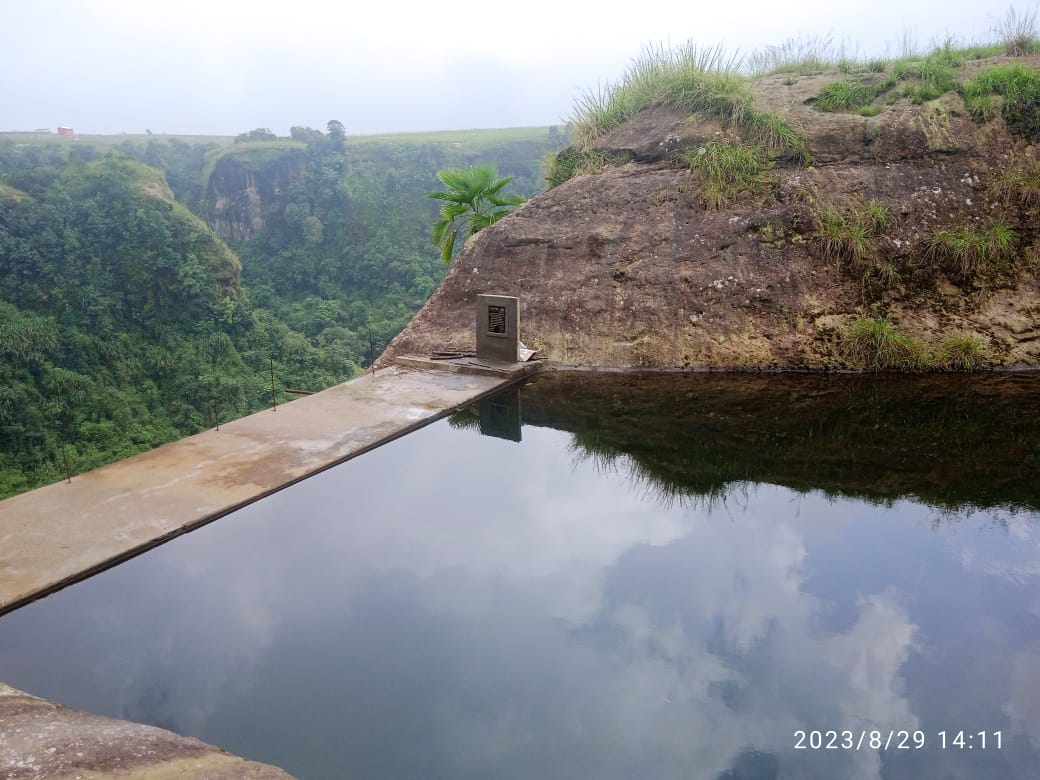
| Water Conservation Dam | Photbah | 25.33533 | 91.37491 | 5,78,000 | Completed | |
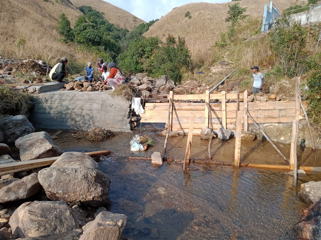
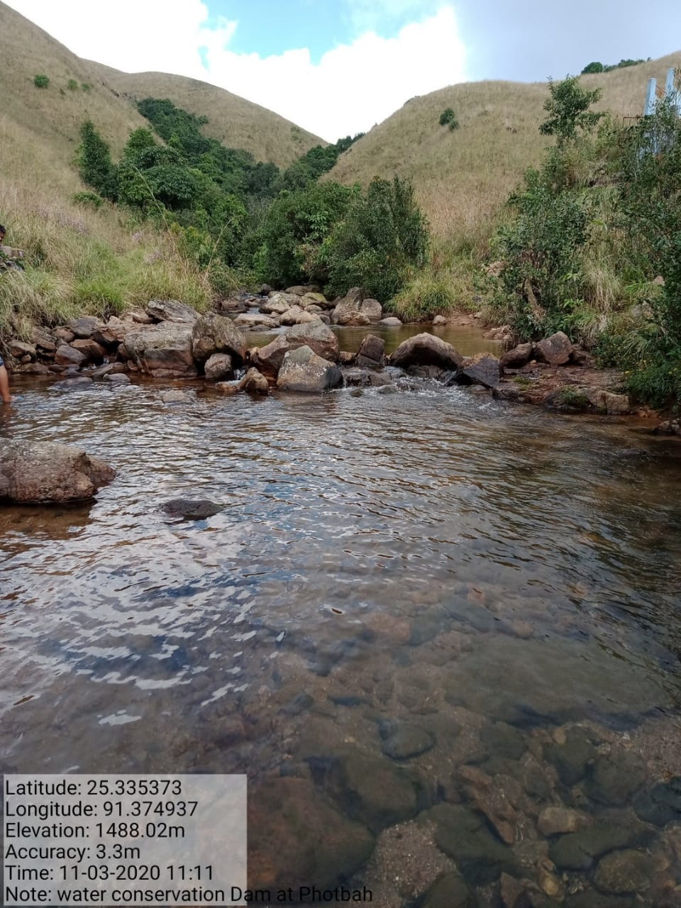
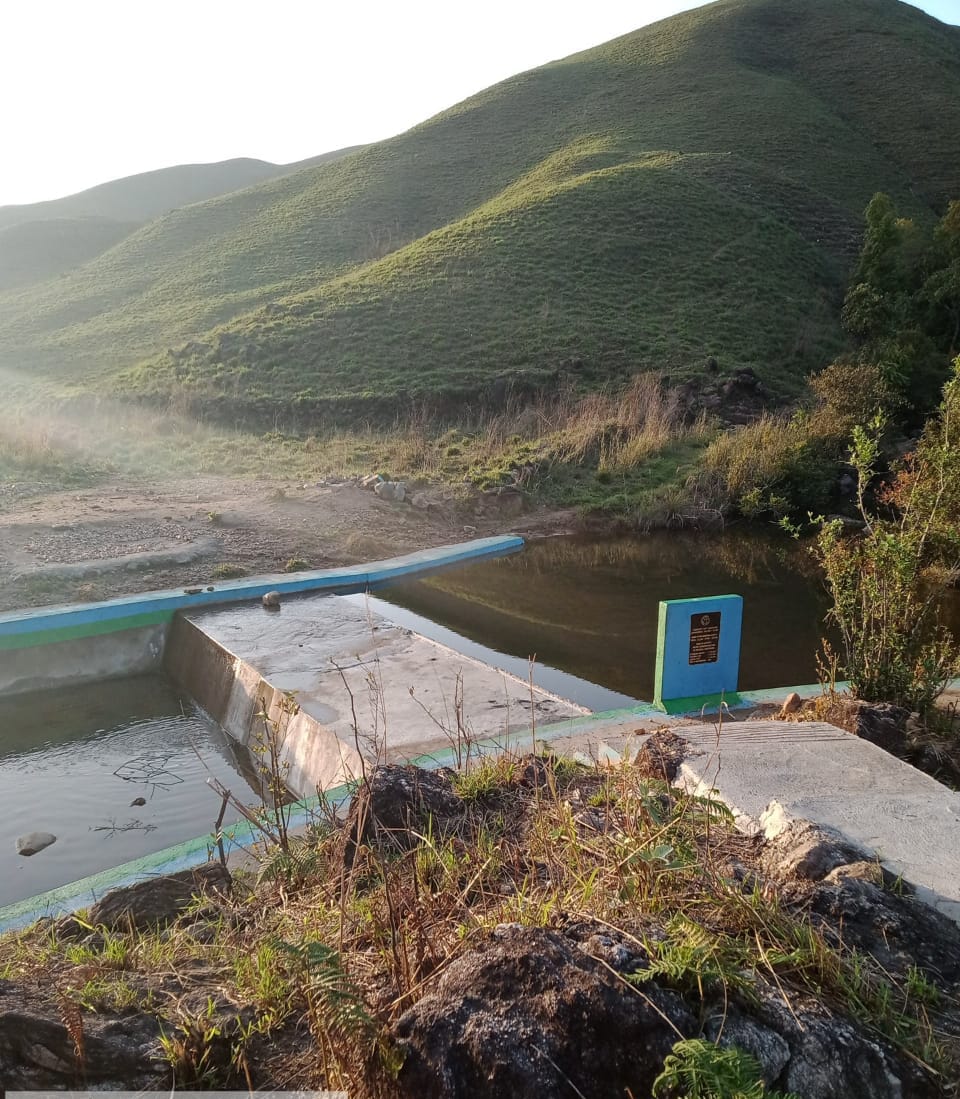
Fig: Water Conservation Dam Photbah
| 9. | Type of intervention | Site name | GPS co-ordinates | Amount sanctioned | Work status | |
|---|---|---|---|---|---|---|
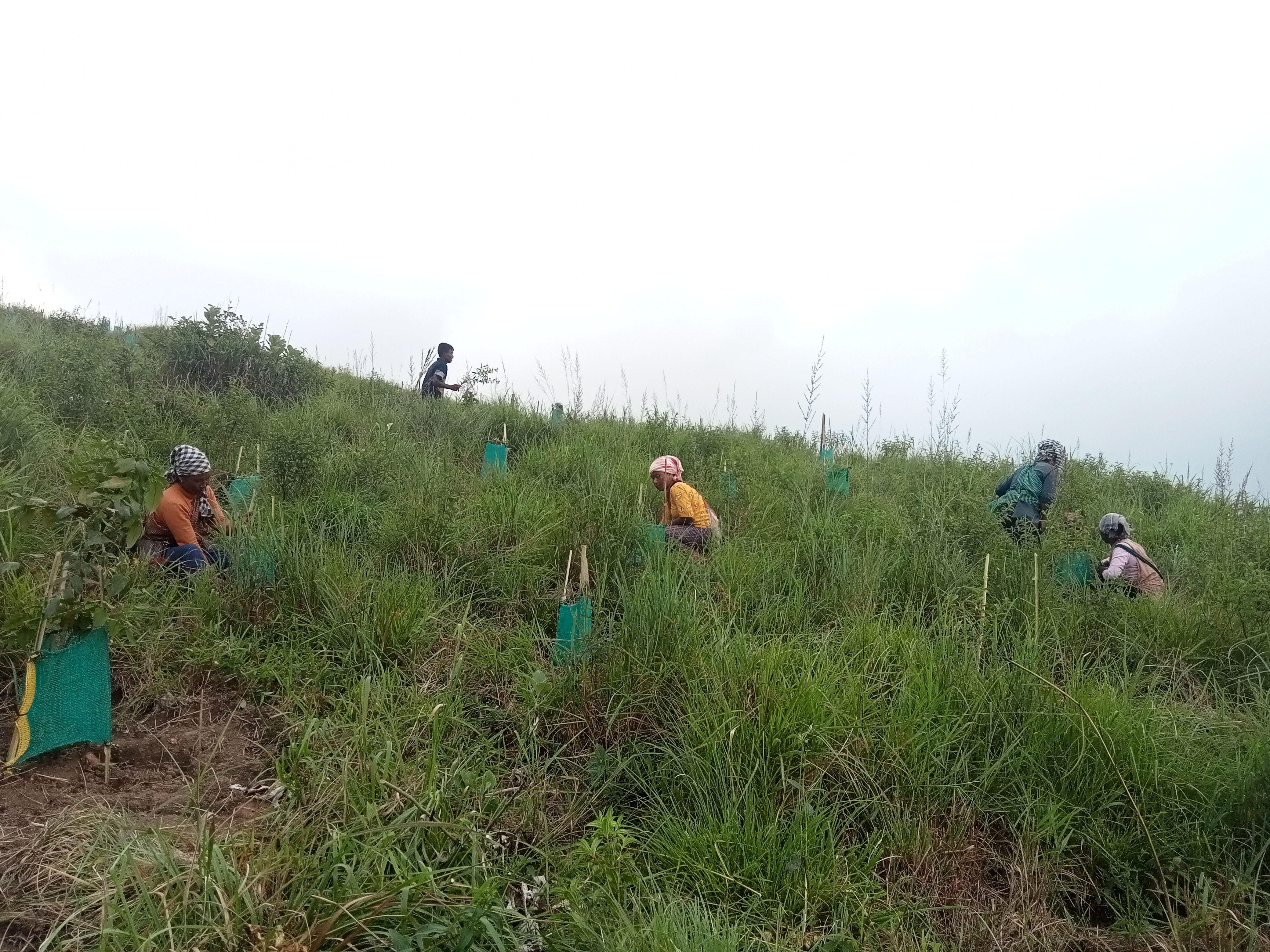
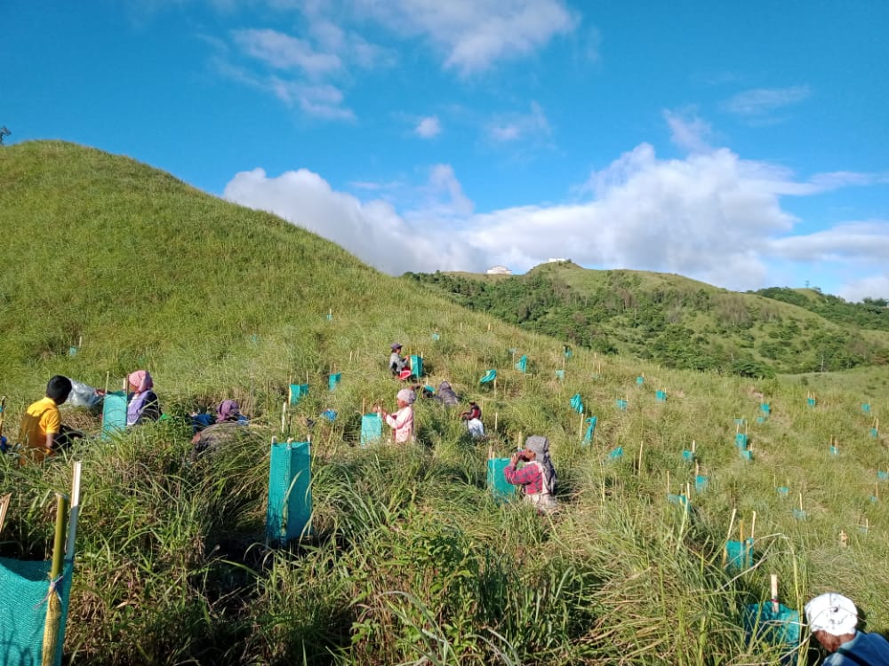
| AFFORESTATION | PHOTBAH | 25.33678 | 91.37794 | 2,43,300 | Completed | |
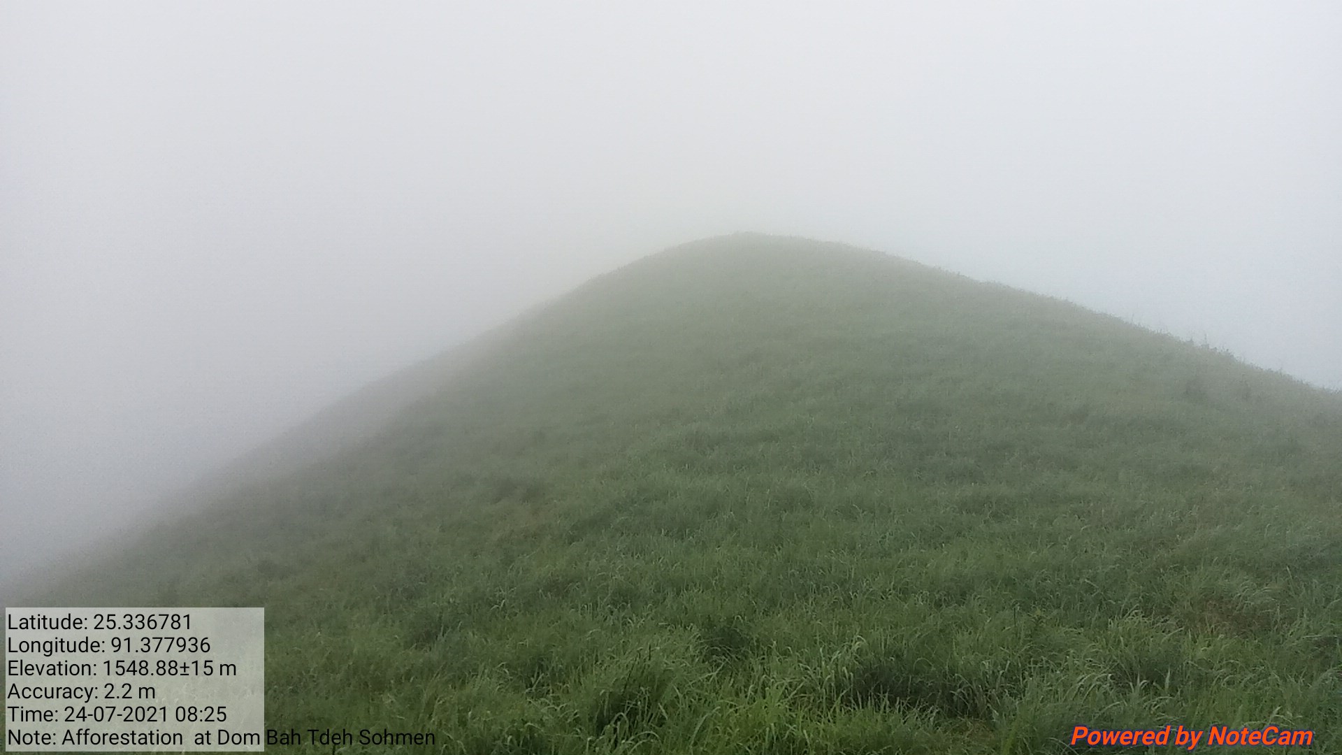
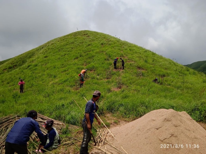
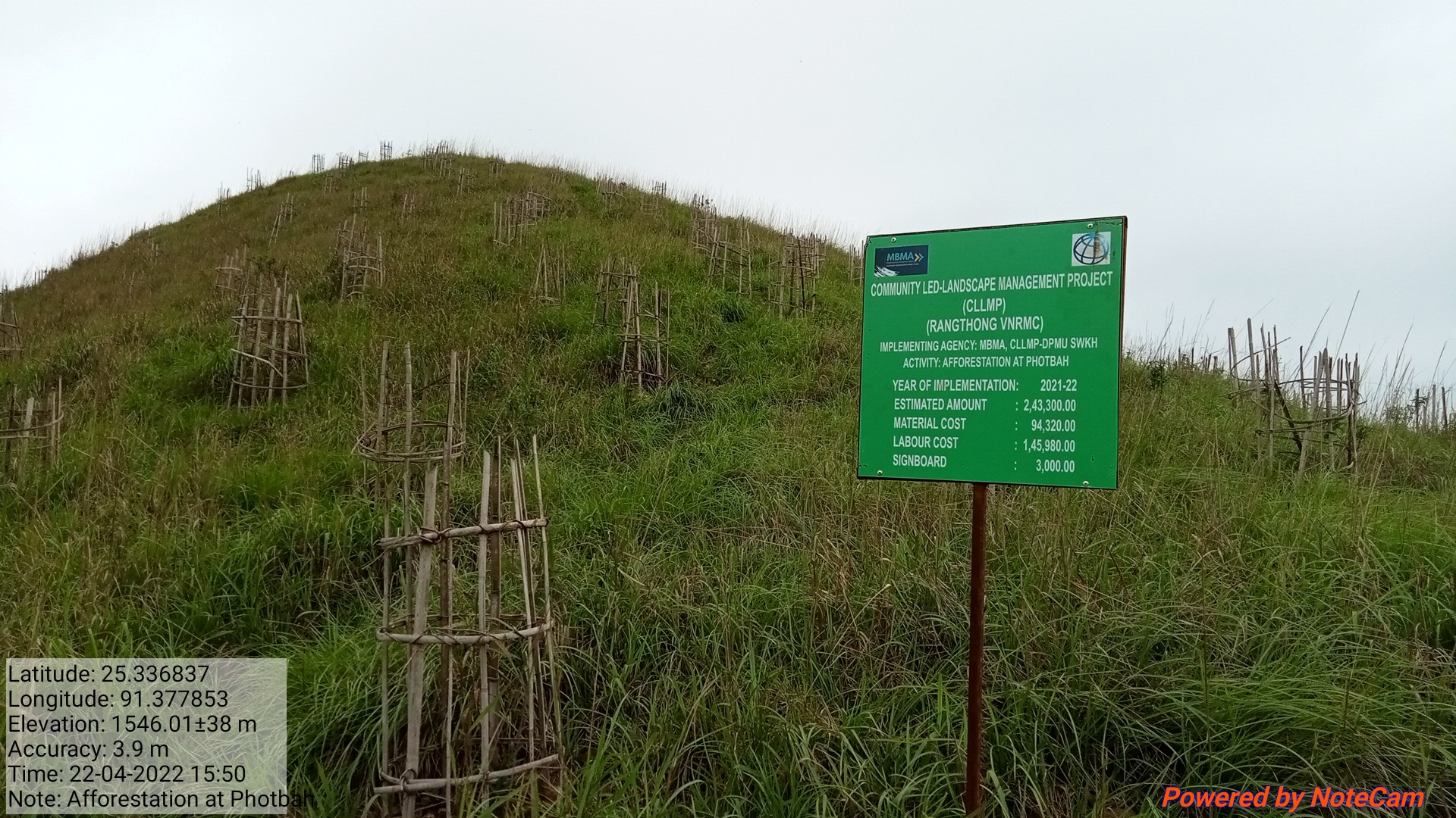
Fig: Afforestation at Tangpuhiar.
| 10. | Type of intervention | Site name | GPS co-ordinates | Amount sanctioned | Work status | |
|---|---|---|---|---|---|---|
| Afforestation | Roadside | 25.34033 | 91.3882 | 83,100 | Completed | |
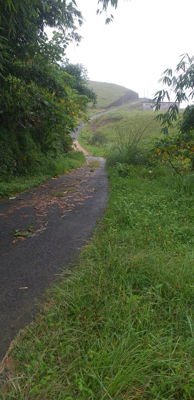
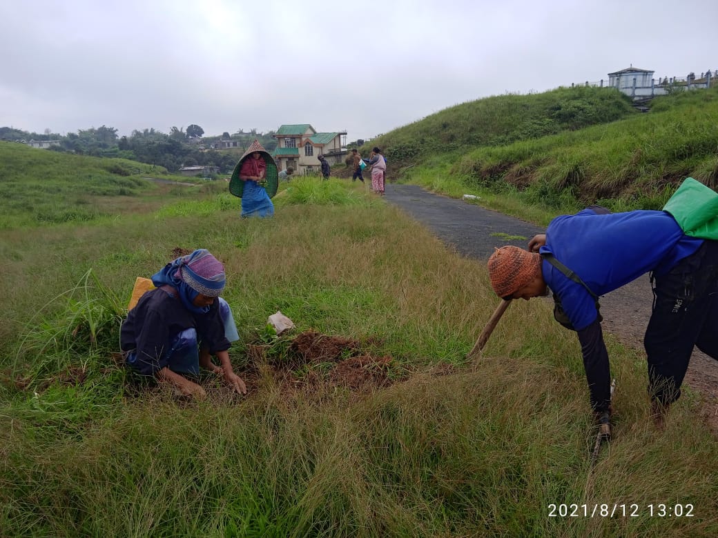
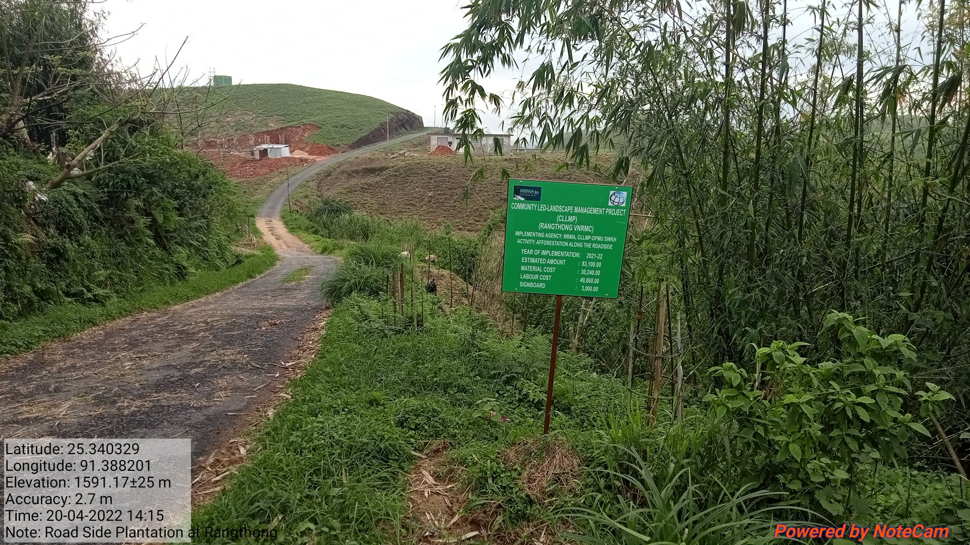
Fig: Afforestation at Saitsohphan.
| 11. | Type of intervention | Site name | GPS co-ordinates | Amount sanctioned | Work status | |
|---|---|---|---|---|---|---|
| Check Dam | Pyrnonbahngain | 25.34487 | 91.38124 | 4,16,490 | Completed | |
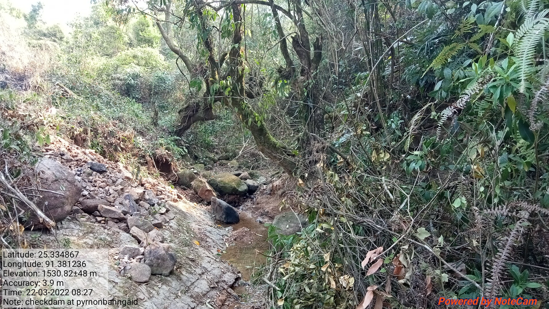
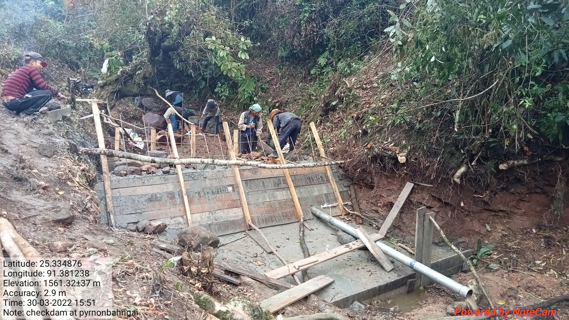
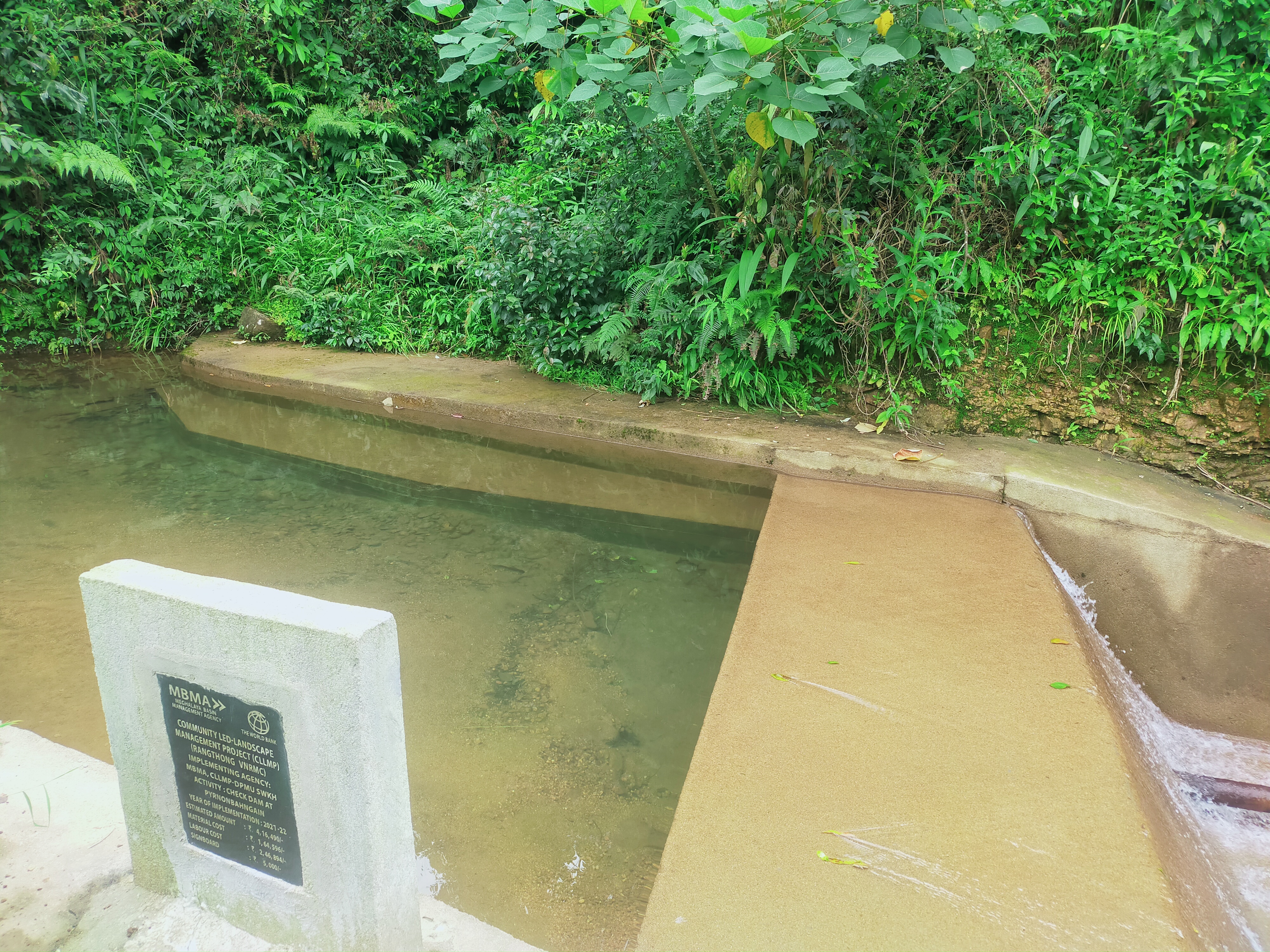
Fig: Check Dam at Pyrnonbaniang
| 12. | Type Of Intervention | Site Name | GPS Co-ordinates | Amount Sanctioned | Work Status | |
|---|---|---|---|---|---|---|
| Spring Chamber | Sohynphur | 25.343763 | 91.382531 | 70,000 | Completed | |
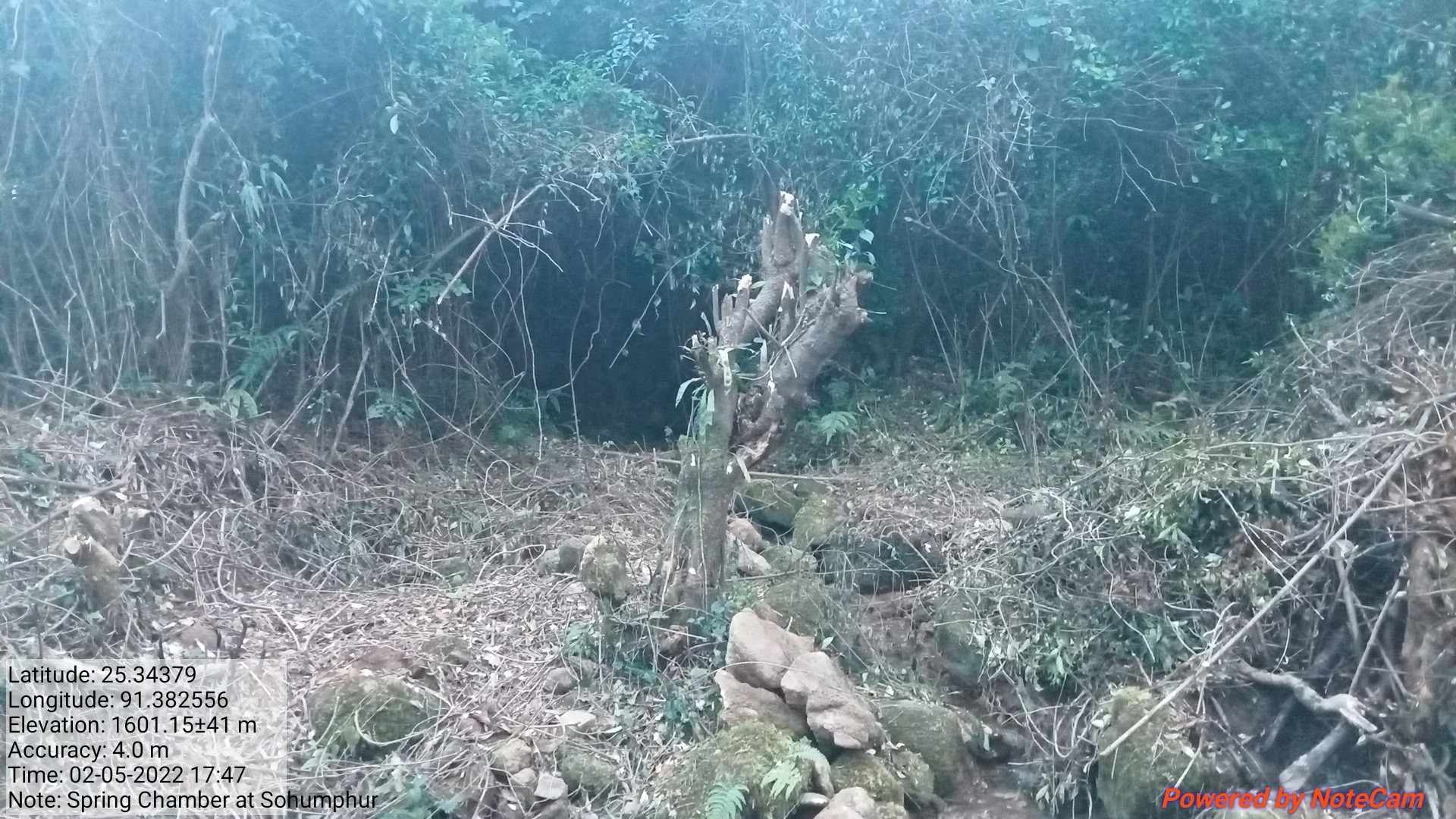
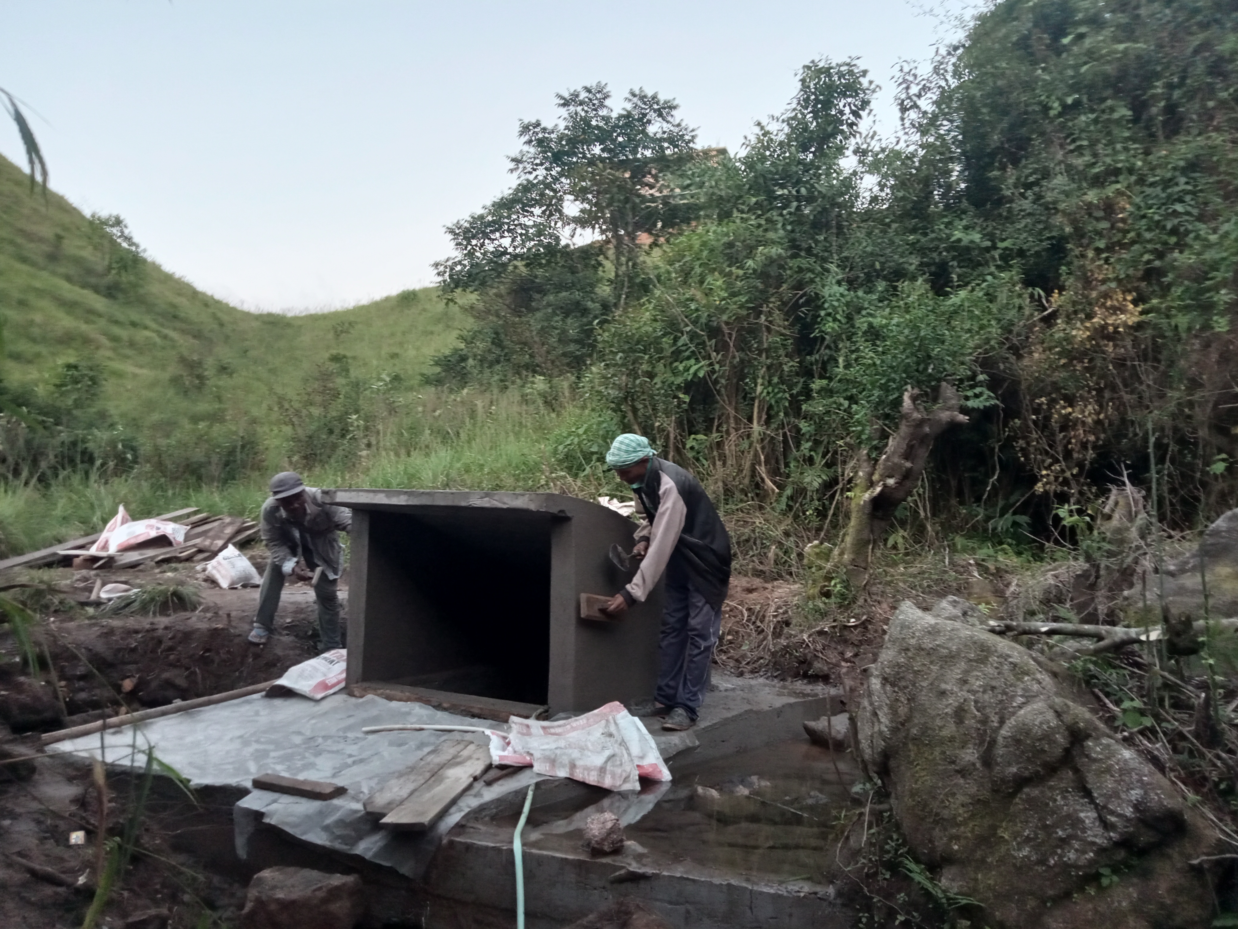
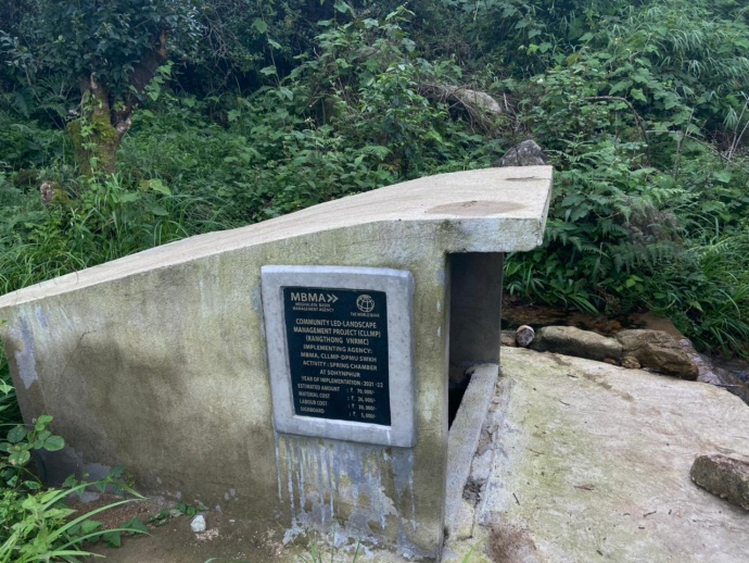
Fig: Spring Chamber at Sohkynphur
| 13. | Type Of Intervention | Site Name | GPS Co-ordinates | Amount Sanctioned | Work Status | |
|---|---|---|---|---|---|---|
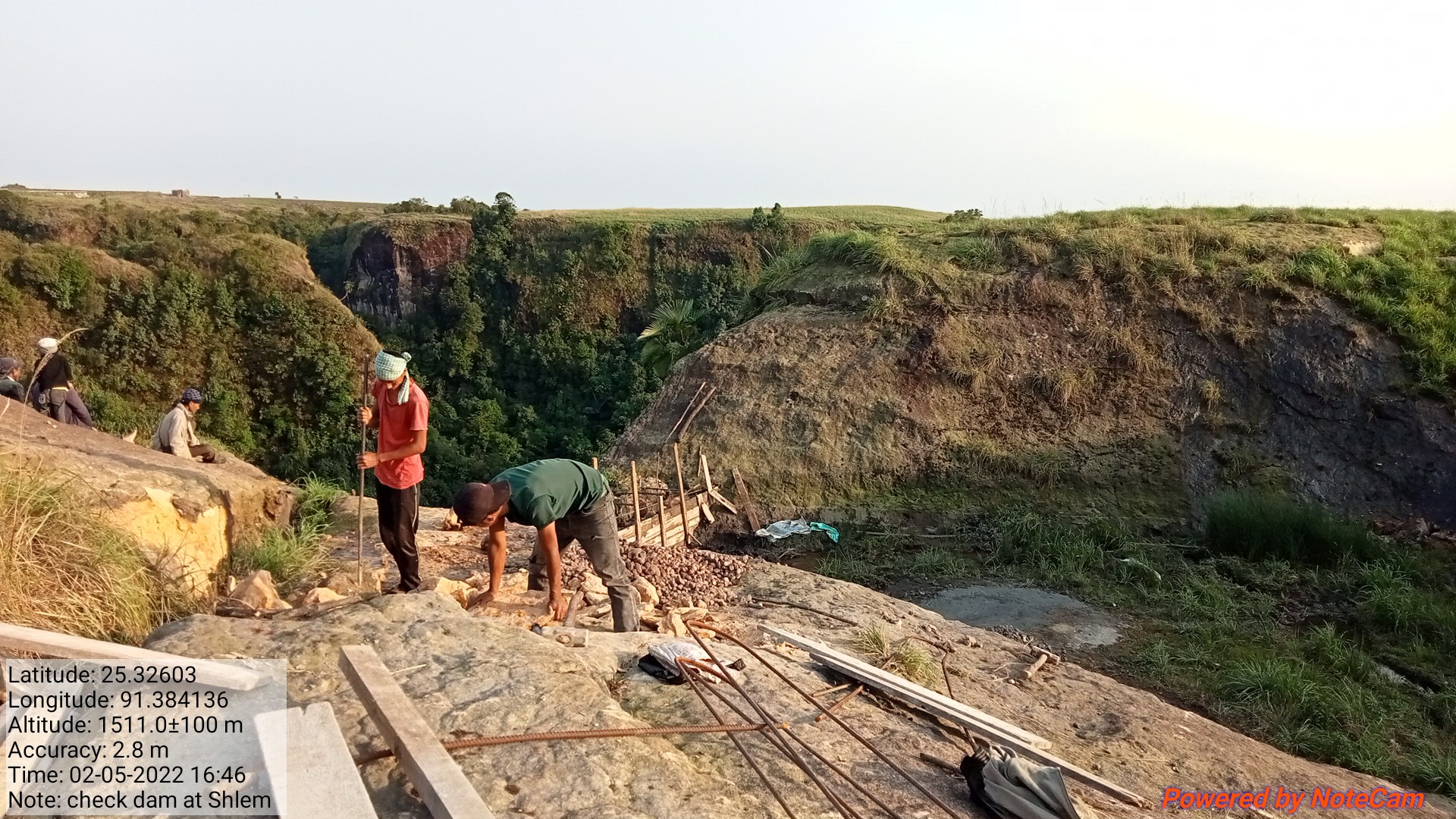
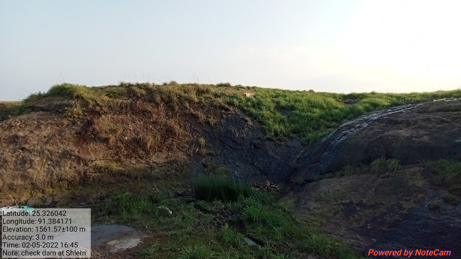
| Checkdam | Shlem | 25.32596 | 91.38422 | 28,1600 | Completed | |
| 14. | Type Of Intervention | Site Name | GPS Co-ordinates | Amount Sanctioned | Work Status | |
|---|---|---|---|---|---|---|
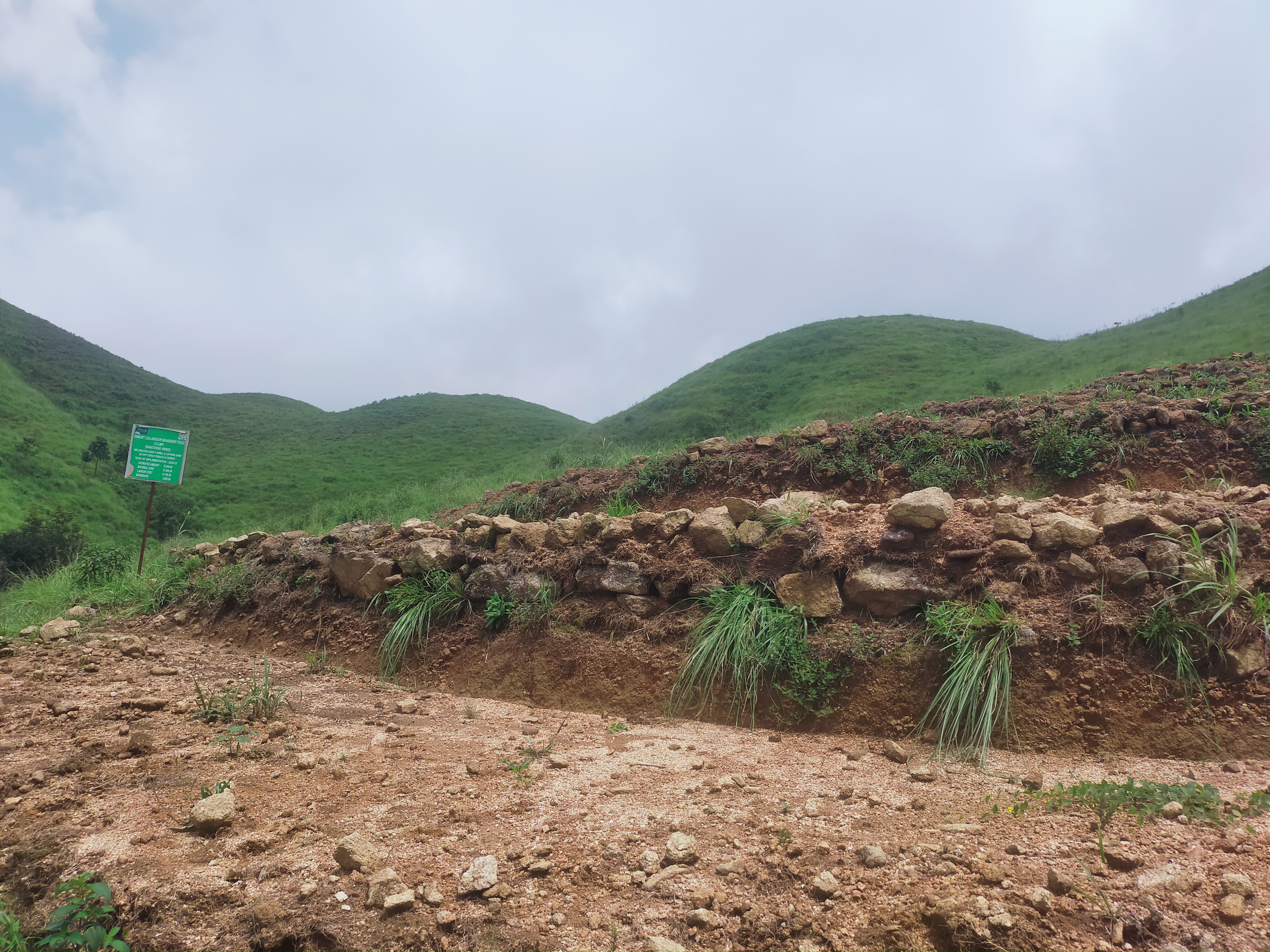
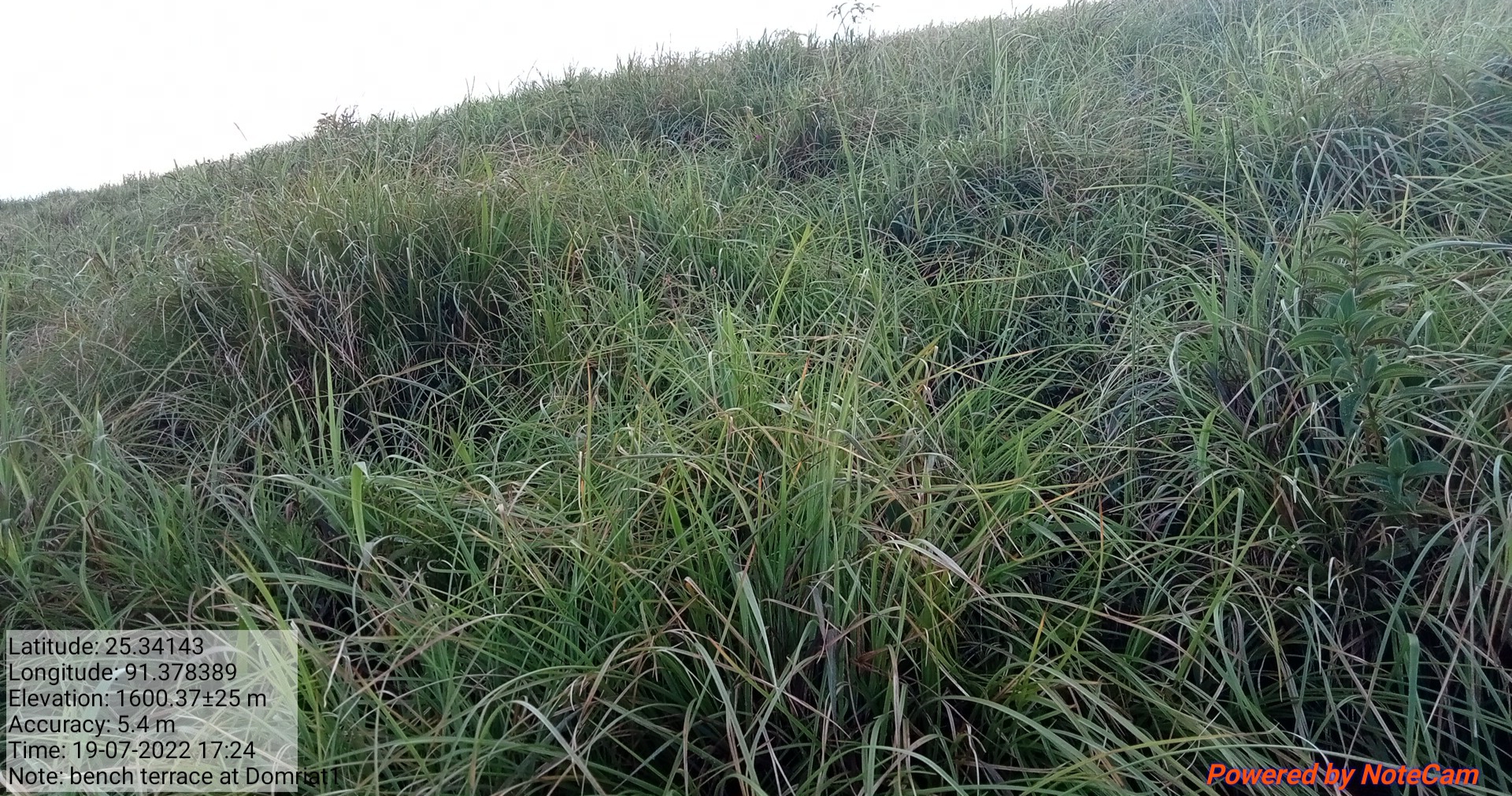
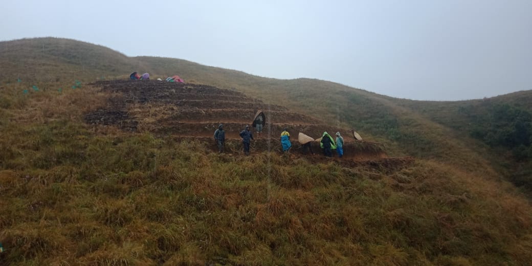
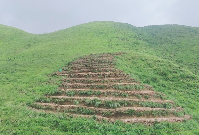
| Bench Terrace | Domriat 1 | 25.34152 | 91.3783 | 50,200 | Completed | |
| 15. | Type Of Intervention | Site Name | GPS Co-ordinates | Amount Sanctioned | Work Status | |
|---|---|---|---|---|---|---|
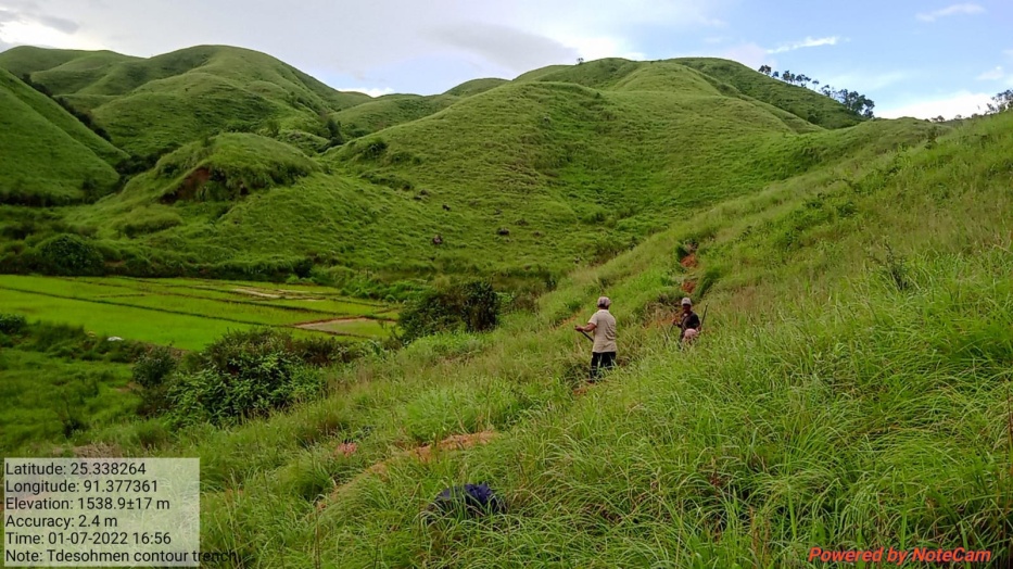
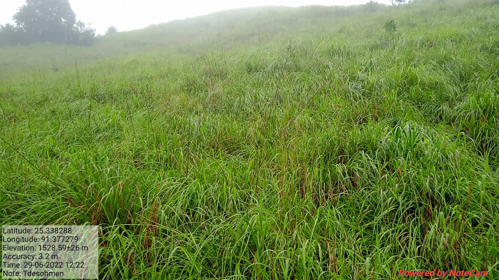
| Contour Trench | Tdesohmen | 25.33829 | 91.37728 | 21,600 | Completed | |
| 16. | Type Of Intervention | Site Name | GPS Co-ordinates | Amount Sanctioned | Work Status | |
|---|---|---|---|---|---|---|
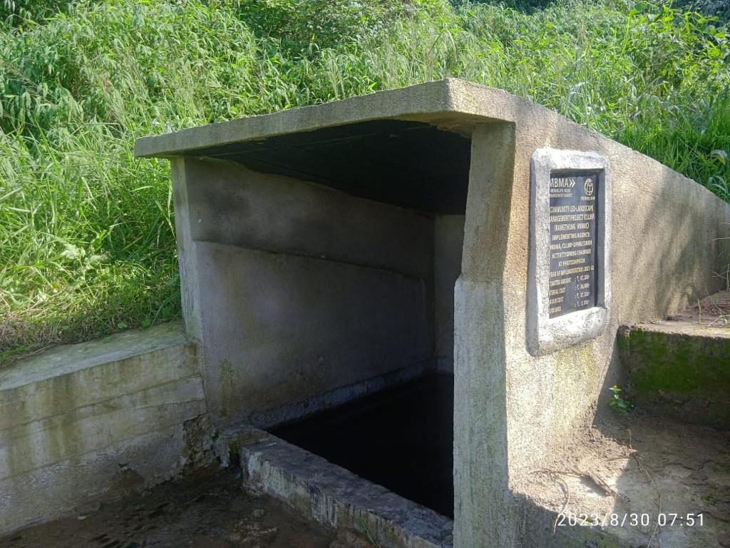
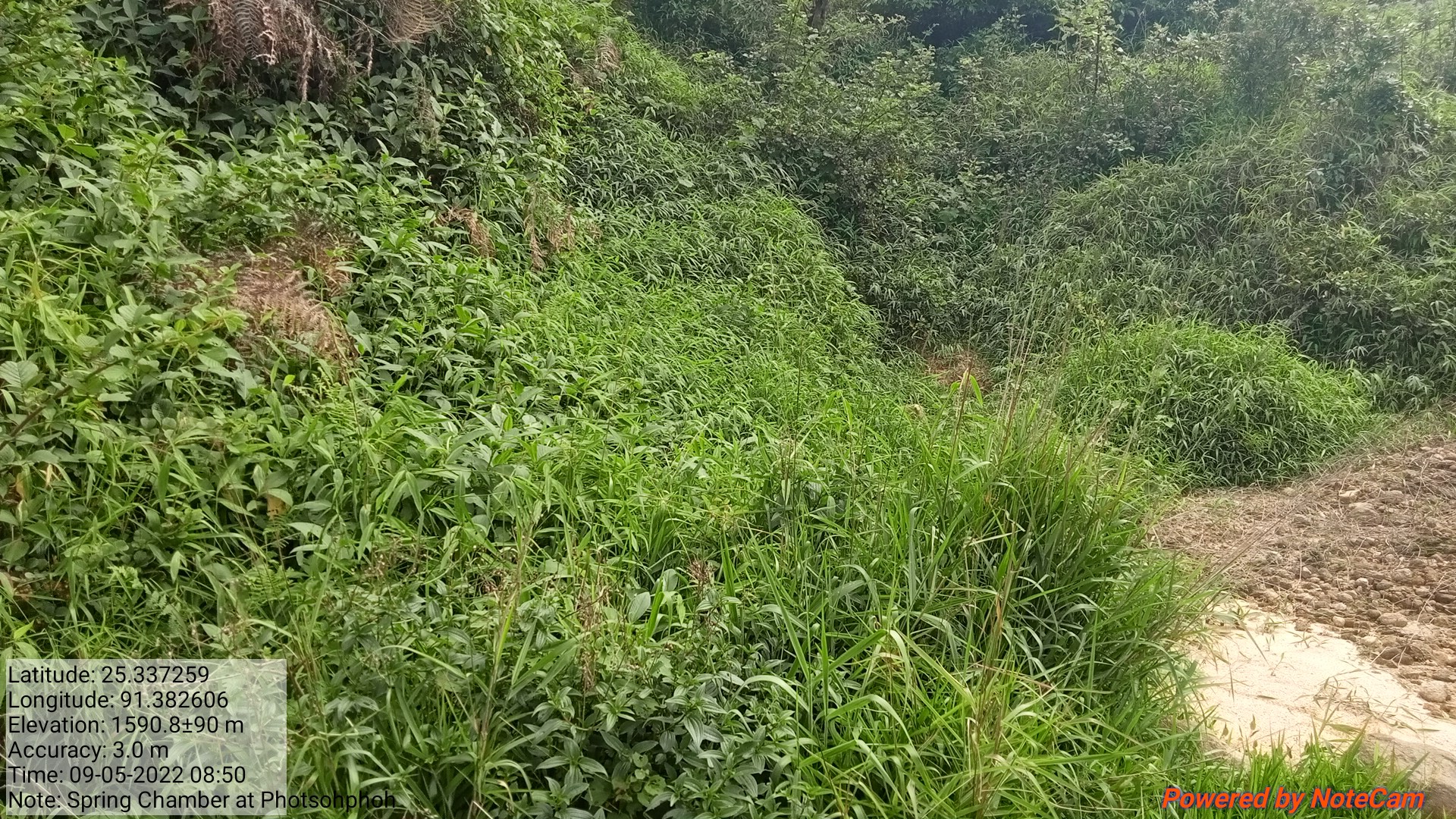
| Spring chamber | Photsohphoh | 25.33722 | 91.3825 | 67,200 | Completed | |
| 17. | Type Of Intervention | Site Name | GPS Co-ordinates | Amount Sanctioned | Work Status | |
|---|---|---|---|---|---|---|
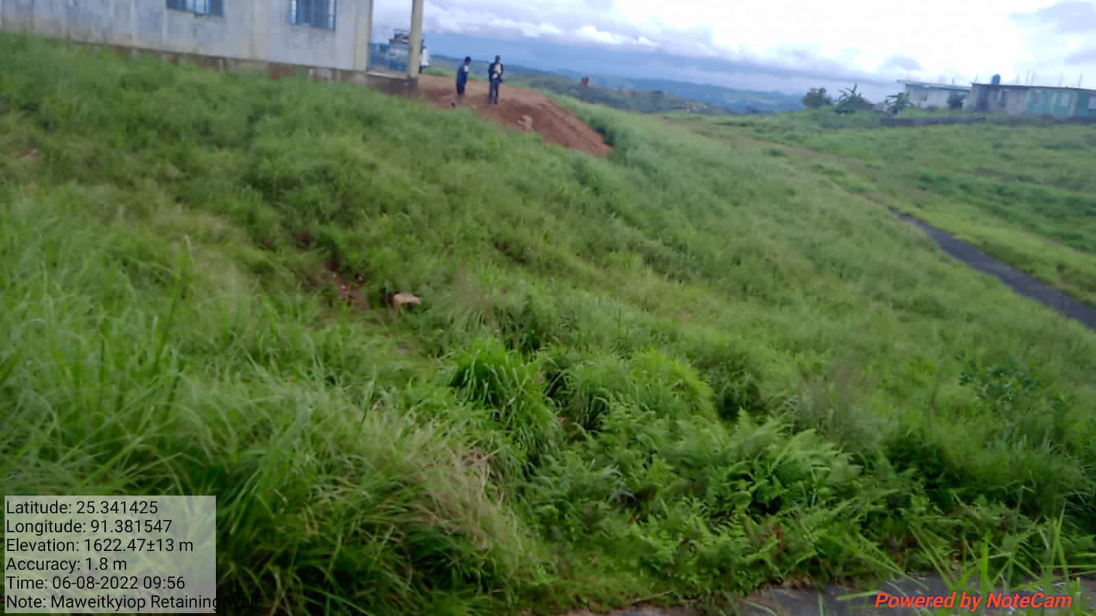
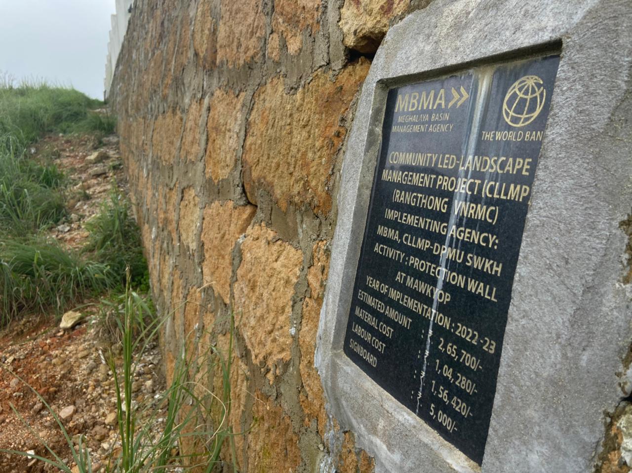
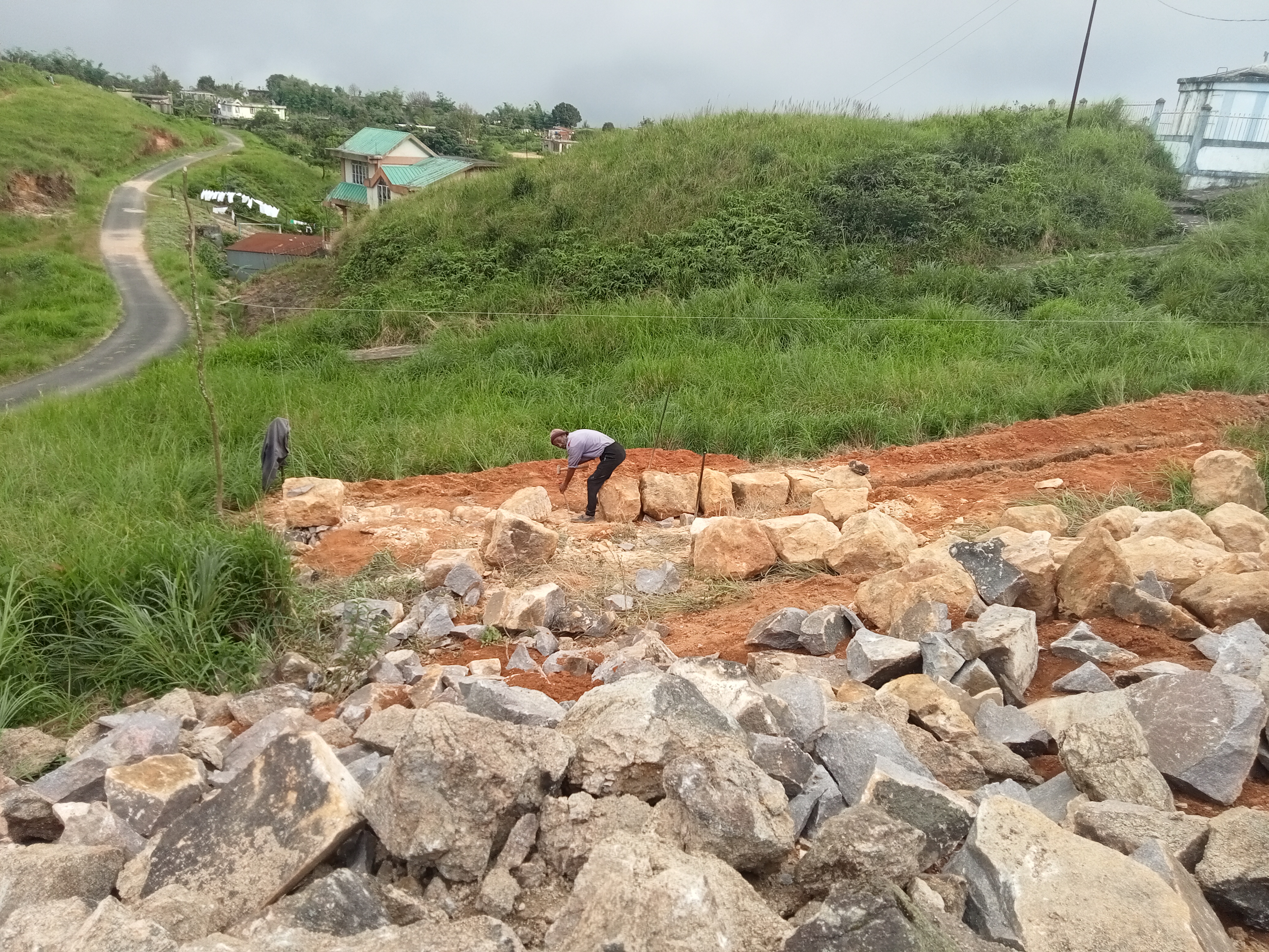
| Protection Wall | Mawkyop | 25.341425 | 91.381547 | 2,65,700 | Completed | |
| 18. | Type Of Intervention | Site Name | GPS Co-ordinates | Amount Sanctioned | Work Status | |
|---|---|---|---|---|---|---|
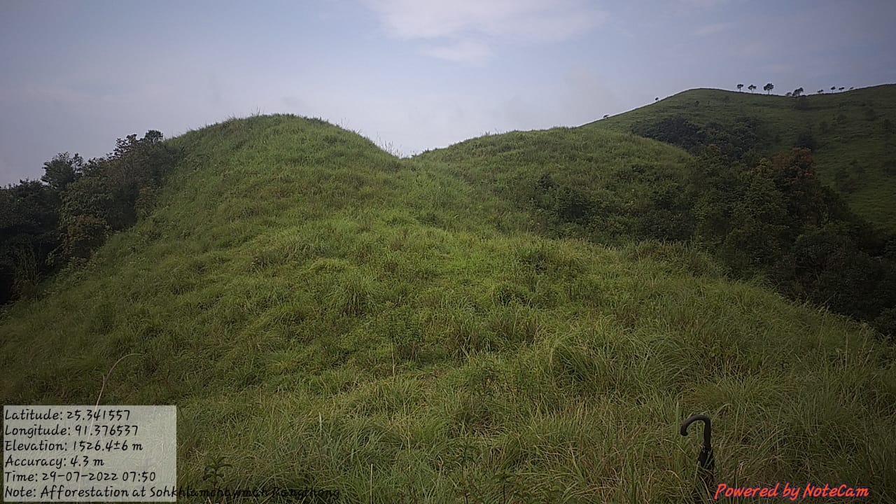
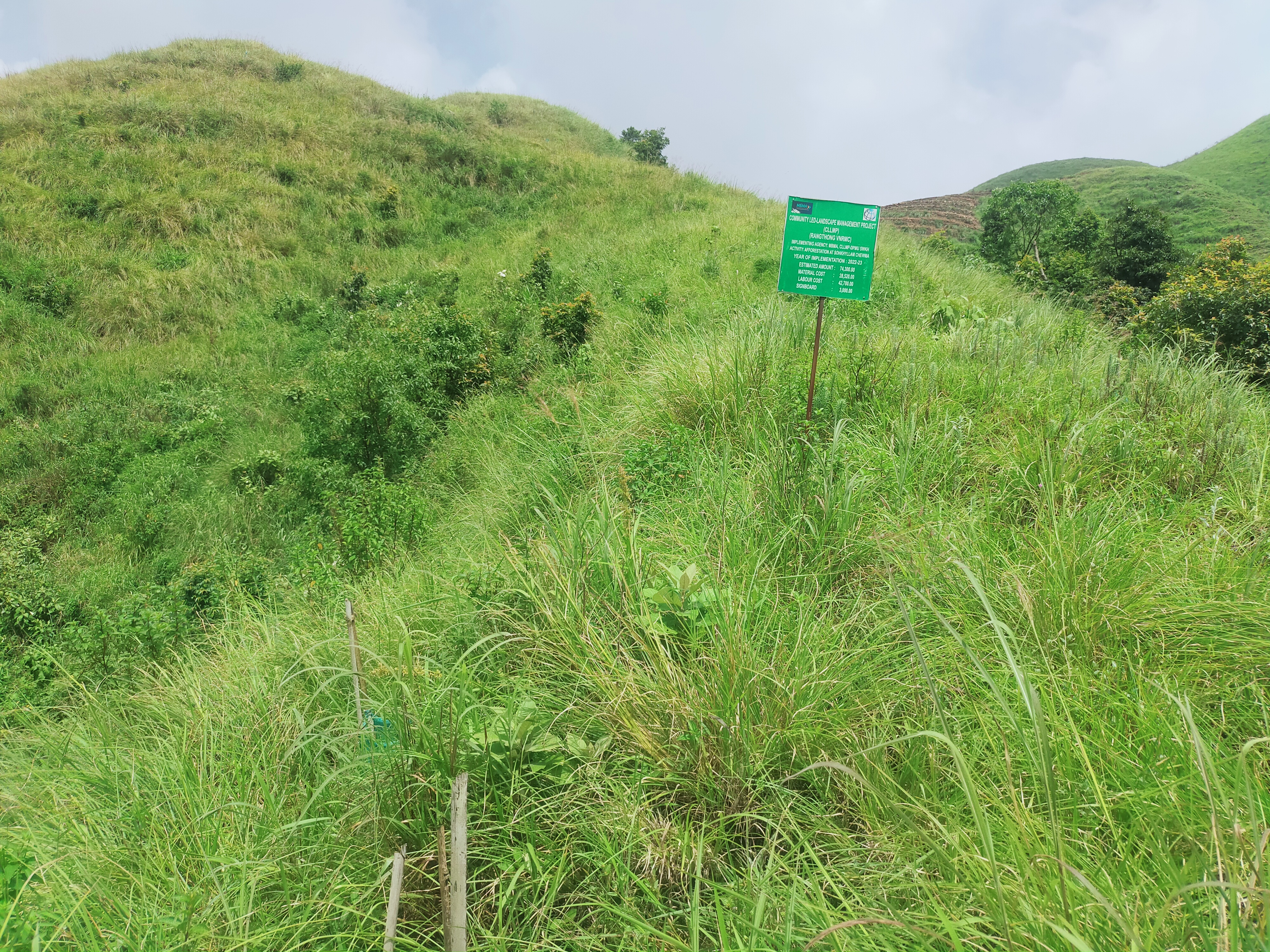
| Afforestation | Sohkhyllam Chewma | 25.341557 | 91.376537 | 74,300 | Completed | |
| 19. | Type Of Intervention | Site Name | GPS Co-ordinates | Amount Sanctioned | Work Status | |
|---|---|---|---|---|---|---|
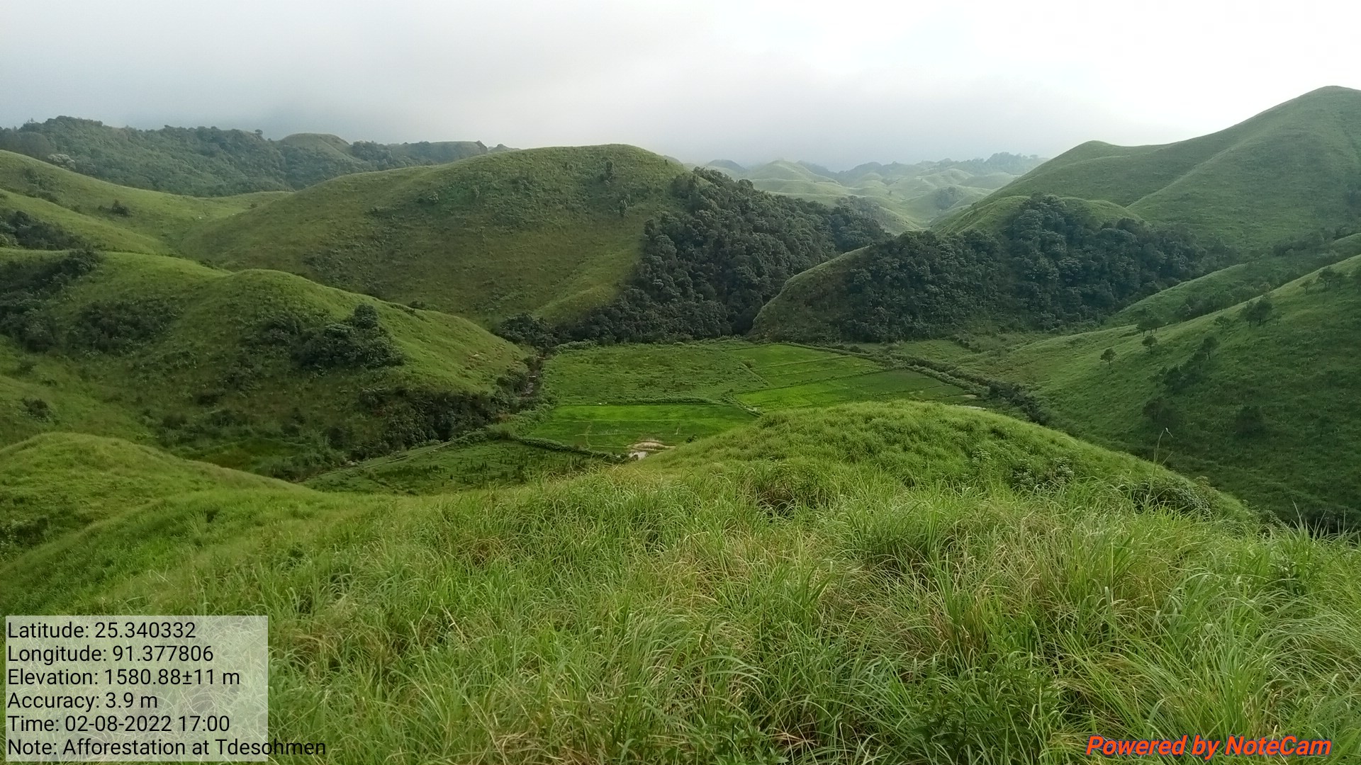
| Afforestation | Tde Sohmen | 25.340332 | 91.377806 | 87,400 | Completed | |
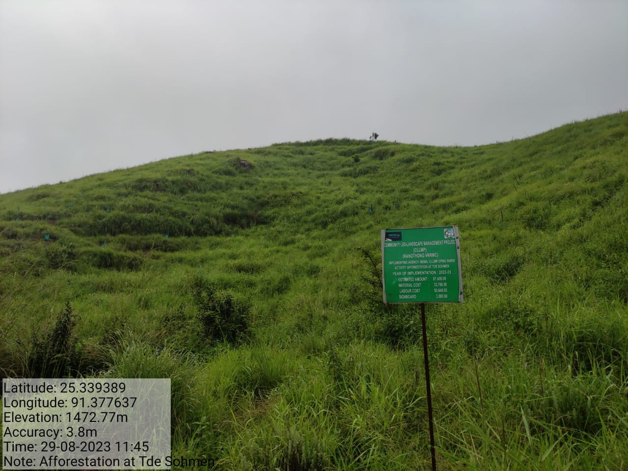
| 20. | Type Of Intervention | Site Name | GPS Co-ordinates | Amount Sanctioned | Work Status | |
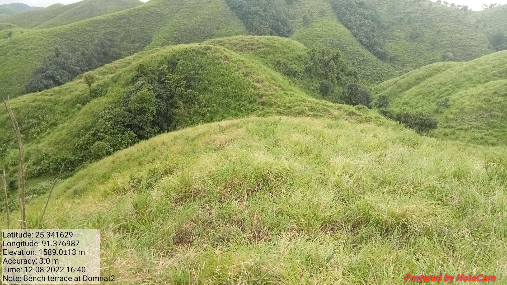
|---|---|---|---|---|---|---|
| Bench Terrace | Domriat 2 | 25.341629 | 91.376987 | 72,600 | Completed | |
11.Fund Implementation:
| Fund Released to VNRMC (Project Implementation) | Total No. of Work Order Issued | Total amount Issued under CLLMP (Per Activity) | Total Amount Spent | Work Order Issued Date | Start Date | End Date |
|---|---|---|---|---|---|---|
| 25,87,800 | 20 | Construction of Spring Chamber and Staggered Trenches at UMBYRTHIH DISOHTHIED | Rs. 42,550 |
25th Sept 2019 | 25th nov-2019 | 30th jun 2020 |
| Construction of Spring Chamber and Staggered Trenches at Kper Kidon | Rs. 51430 |
8th Jan 2020 | 06th feb 2020 | 10th Mar 2020 | ||
| Treatment of catchment area at Umbyrthih Disohthied | Rs. 3500 |
10th June 2020 | 02th jul 2019 | 06th jun2020 | ||
| Treatment of catchment area at Kperkidon | Rs. 3500 |
10th June 2020 | 16th jun 2020 | 04th Jun 2020 | ||
| Contour Trench at Maweitkyiop, Rangthong | Rs. 24000 |
10th June 2020 | 25th Jun 2020 | 17st July 2020 | ||
| Community Nursery at Sohraphet | Rs. 1,50,530 |
14th July 2020 | 20th jul 2020 | 28th feb 2022 | ||
| Improvement of existing degraded forest at Domiawmeithup | Rs. 68,000 |
14th July 2020 | 20th jul 2021 | 28th feb 2021 | ||
| WATER CONSERVATION DAM At PHOTBAH, RANGTHONG | 5,78,000 | 26th Aug 2020 | 09 nov 2020 | 27th mr2021 | ||
| AFFORESTATION AT PHOTBAH | Rs. 243300 |
16th July 2021 | 02th Aug 2021 | 22th feb 2023 | ||
| AFFORESTATION ALONG THE ROADSIDE | Rs. 83100 |
20th July 2021 | 10th Aug 2021 | 07th feb 2023 | ||
| Checkdam at Pyrnonbahngain | Rs. 416490 |
18th Jan 2022 | 25th my 2022 | 31st Aug 2022 | ||
| Spring Chamber at Sohynphur | Rs. 70000 |
10th March 2022 | 07-mr2022 | 30 pril23022 | ||
| Checkdam at Shlem | Rs. 281600 |
31st March 2022 | 02my2022 | 30jun2022 | ||
| Bench Terrace at Domriat 1 | Rs. 50200 |
31st March 2022 | 08ug2022 | 30sept2022 | ||
| Contour Trench at Tdesohmen | Rs. 21600 |
31st March 2022 | 014sept2022 | 13sept2022 | ||
| Sping chamber at Photsohphoh | Rs. 67200 |
31st March 2022 | 02my2022 | 31my2022 | ||
| Protection Wall at Mawkyop | Rs. 265700 |
31st May 2022 | 01jul2022 | 28ug2022 | ||
| Afforestation at Sohkhyllam Chewma | Rs. 74300 |
31st May 2022 | 01jun2022 | 22jun2022 | ||
| Afforestation at Tde Sohmen | Rs. 87400 |
31st May 2022 | 27jun2022 | 29jul2022 | ||
| Bench Terrace at Domriat 2 | Rs. 72,600 |
31st May 2022 | 08ug2022 | 30sept2022 | ||
| TOTAL AMOUNT SPENT | Rs.25,87,800 | |||||
 Ground
Testimonials:
Ground
Testimonials:
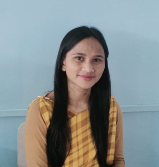
Kynmawlin Shangdiar(VCF Envt)
 Through this project CLLMP
I ,Kynmawlin Shangdiar(VCF Envt) , feels that I have benefit so much
from the Spring Chambers where we have received drinking water ,
regarding the greenery of the environment through Afforestation,
agro-horticulture, to control soil erosion through protection walls,
also to collect water through contour trench, check dams, bench
terrace and water conservation. From these activities as a VNRMC we
have learned to take responsibility to conserve our own
environment.
Through this project CLLMP
I ,Kynmawlin Shangdiar(VCF Envt) , feels that I have benefit so much
from the Spring Chambers where we have received drinking water ,
regarding the greenery of the environment through Afforestation,
agro-horticulture, to control soil erosion through protection walls,
also to collect water through contour trench, check dams, bench
terrace and water conservation. From these activities as a VNRMC we
have learned to take responsibility to conserve our own
environment.
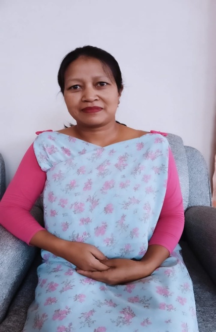
Kitborlang Nongrum(President)
I, the President and as a VNRMC, we are grateful towards the CLLMP project as we have benefit so much from the work they have provided such as the Afforestation in forest blank area, nursery, spring chambers for drinking water and for other use as well, water conservation dam for collecting water and even after this project has ended, they will be responsible in conserving the surroundings. With the coming of this project it has also bought about a short term employment for us.
Alkamerry Syiemlieh(Purchase Committee)
As a Purchase Committee, I have undergone training on Community procurement &Soft skills project and I have learned to maintain different registers, in selecting the supplier in buying the materials needed. We have also benefit when we received the spring chambers because we do not have easy access to drinking water.

Tipbhalin Shangdiar(Secretary)
I, the Secretary have worked for 3 years and I have undergone training on Community procurement, Procurement (financial) and Management & soft skills project management, I feel that this project is almost at the end so the VNRMC as a whole will have to uphold a promise to try our best to be responsible for taking care of the environment for the coming future.
----------------------------------*****************-------------------------------