Report on
Pyndenmawthawiang Village under MAWKYRWAT c&rd block
District: SOUTH WEST KHASI HILLS
COMMUNITY LED LANDSCAPE MANAGEMENT PROJECT


Community Led Landscape Management Project (CLLMP)
The Government of Meghalaya with financial help from the World Bank is implementing the Meghalaya Community Led Landscape Management Project (MCLLMP). The project will cover the entire state of Meghalaya and implementation of community led plans will be rolled out in phase manner throughout the state. The Meghalaya Basin Management Agency (MBMA) will facilitate community-led planning by providing support, technical inputs and funding.
The project is intended to strengthen community-led natural resources management in selected landscapes within the 12 districts of the state. This would be achieved through a variety of planning, capacity building, and on-the-ground interventions to promote the conservation, sustainable use of natural resources, social inclusion and community mobilisation; building traditional knowledge and learning, mapping of natural resources management; strengthening the community institutions and creating linkage with financial institutions and community organizations.
The project interventions will include preparation of community led natural resource management plans. The CLLMP has the following three components:
Strengthening Knowledge and Capacity of Communities for Natural Resources Management
Community-Led Landscape Planning and Implementation
Project Management and Governance
The project objective is “to manage and conserve the natural resources, especially forests, soil and water sources, in a manner that supports the financial and physical well-being of communities in the State”
SCOPE:
The CLLM-Programme focuses on increasing the capacities of communities and traditional institutions (TI) by adopting a landscape approach to manage their natural resources such as soil, springs and other water sources, forests and bio-diversity, etc.
The project will be planned and implemented in about 400 villages across the state.
CLLMP has a strong focus on institution-building at the village-level, by ensuring systematic capacity-building on technical and social skill-sets.
The project will also extend such training to communities beyond the targeted villages and support efforts made by them to access funding from various rural and natural resources initiatives and schemes.
The programme will also invest in improving the process and outcome delivery, by developing and adhering to effective systems and procedures, supported by the appropriate technology.
BENEFITS:
Benefits for community (Skills and Capacity relating to technical and managerial areas like NRM and Conflict resolution
Benefits to traditional institutions (village councils, traditional leaders, community-based organizations, SHGs etc) through Knowledge sharing, promotion of innovative approach, access to technology, technical managerial and financial support.
It is estimated that the project will impact around 1 lakh partners (of which 50% are women) who depend on land, forest, agro forestry.
Through the project, 55000 Ha of targeted area will be ensured with availability of water, biological resources and soil productivity, which will in turn benefit around 400 villages and the outcomes delivery can be summarized as follows.
IMPLEMENTATION AGENCY:
The Project will be executed by the MBMA in collaboration with other partners particularly, SIRD (for training and capacity building), Department of Soil and Water Conservation, Water Resource Department, Forest Department, specifically with respect to technical inputs, safeguards management and Community NRM plan preparation.
PROJECT PERIOD:
2018-2023 (5 years)
Table of contents:
Introduction and History…………………………………………………...1
Social Profile ……………………………………………………………..2
Village Accesibility……………………………………. ….2
Literacy rate…………………………………………… ….2
Population……………………………………………........2
Occupation……………………………………………. ….3
Village organisation………………………………………..4
Fuel Type……………………………………………........4
Drinking Water…………………………………………...4
Cultivatible Land……………………………………........5
Forest Cover………………………………………………5
Forest Species………………………………………….......5
Water Bodies……………………………………………….5
Areas affected…………………………………………….5
III. CLLMP Activities
Ground-Truthing……………………………………………………6
Sensitization on CLLMP…………………………………………..6
Signing of EOI, VGA and Green Charter………………………...6
Formation of VNRMC……………………………………………7
Village Community Facilitators…………………………………..7-8
Purchase Committee …………………………………………… ..8
IV. Opening of Bank Account …………………………….……………….9
V. PRA Exercise……………………………………………………………10
Basic Survey for CNRMP template………………………………11
Focussed Group Discussions……………………………………11-12
Village Boundary Mapping and Resource Mapping……………13
VI. GIS Activities…………………………………………………………...14-15
VII. The Proposal list of intervention……………………………………….16
VIII. Project Implementation ………………………………………… ……17-48
IX. Fund Status ……………………………………………………………...49-51
INTRODUCTION:
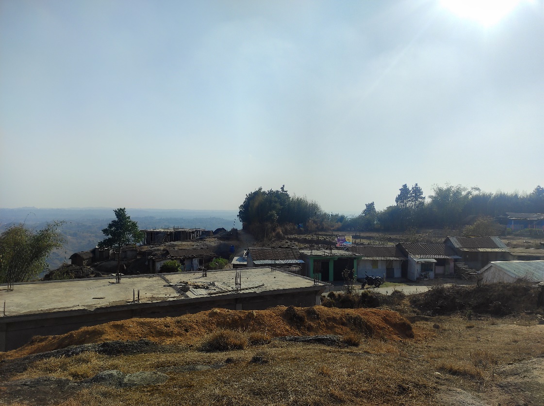
Pyndenmawthawiang village is situated in South West Khasi Hills District under the Mawkyrwat C&RD Block. The village is about 14 Km away from the District Headquarters i.e. Mawkyrwat and about 16 Km away from the Block Headquarters. It has a total geographical area of 158Ha and falls under the Hima Maharam Syiemship. The village has a total population of 590 comprising of 324 males and 266 females. All the residents of the village belonged to the Khasi Scheduled Tribe. The average rainfall is 1200mm and the type of soil is mainly loamy soil.
Brief History of the village
The birth of the village has been a series of downfall but in the present generation, there has been a vast growth and development in various sectors such as implementation of two L.P. schools and one U.P. school. Establishing a Presbyterian church, PWD roads has been one way of a development. On the other hand, Women Organisation, Youth Wings Organisation and various committee has been able to spread their wings with good deeds in the village.
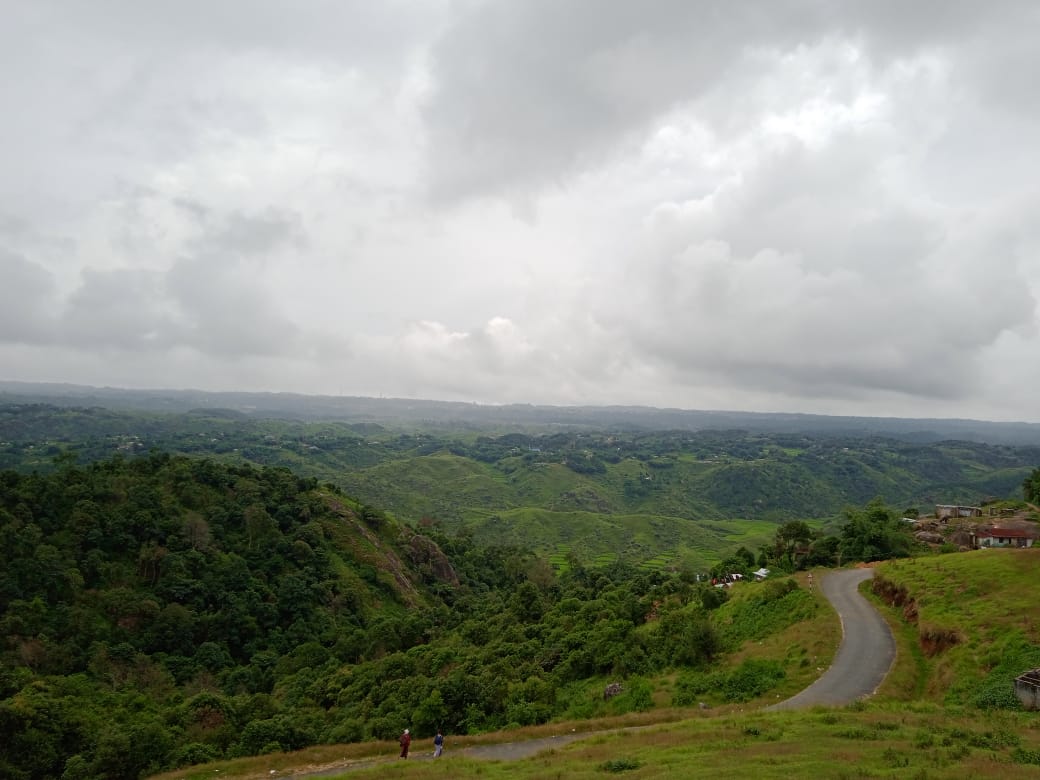
Financially development and educational quality is still a major setback, but on the contrary this beautiful village has many dense forest, football ground and various natural ponds that act as a source for drinking water and household purposes for the villagers.
Fig. Pyndenmawthawiang village.
VILLAGE SOCIAL PROFILE:
Pyndenmawthawiang village has a total number of 104 households, having a total population of 590 villagers. People in this village mainly depend on agriculture and its allied activities for their livelihood. There are few businessmen and some of them are engaged with government services.
Village Accessibility:
In order to reach Pyndenmawthawiang village one must travel through road with local taxis from the Mawkyrwat- Nongstoin road.
Literacy Rate:
In the village, there are a total number of 3 schools out of which 2 are Lower Primary Schools and 1 Upper Primary School.
Population:
As per 2011 Census, the total population of Pyndenmawthawiang village is 377 people and this has seen an increased over the years and now stands at 590 as of the recent survey. Out of this, 324 are male and the female count is 266.This village has 57 children belonging to the group 0-4 years and 13 people are above the age of 60. About 18 total number of people belong to the age group of 30-60 years and a total of 283 belong to the age group of 15-30 years, thus this indicates that the majority of the population of in the village comprise of the young and healthy people.
| Age Group | Male | Female | Total |
|---|---|---|---|
| 0-4years | 30 | 27 | 57 |
| 5-14years | 126 | 93 | 219 |
| 15-30years | 154 | 129 | 283 |
| 30-60years | 8 | 10 | 18 |
| Above 60years | 6 | 7 | 13 |
| Total | 324 | 266 | 590 |
Occupations:
The people of Pyndenmawthawiang village rely mainly on agriculture and forest produce for their livelihood. Out of 104 households within the village, 95 households are farmers, 4 household are businessmen, while 4 household are engaged in government services.
V. Organisation within the Village:
There are 5 Self Help Groups (SHGs) for livelihood activities in Pyndenmawthawiang village under one Village Organisation. There are also 6 VEC & traditional institutions within the village.
VI. Fuel Type:
The people of Pyndenmawthawiang village mainly uses wood as a fuel. About 101 households depend on wood gathered from the forest for their daily requirement.
| Type of Fuel | Total No of HH | Qty (Kgs/HH) | Total |
|---|---|---|---|
| Wood | 101 | 4200kg 3Stacks per year |
12600kg |
| LPG | 3 | 15kg 7cylinder per year |
105kg |
VII. Drinking Water:
The people of Pyndenmawthawiang have access to drinking water mainly from the springs within the village. But over the years there has been a scarcity of water supply in this village due to less water discharge from the springs source and due to the increase in human population and their daily requirements. There are 8 springs within the village which are perennial that people use for drinking viz. Tiehphanmon, Photkpertieh, Domdohlong, Tiehthiang, Mawlum Niangriang, Phot Kperkhim, Photmaw and Phot Kperpalong.
VIII. Cultivable Land Cover:
The total agricultural area of Pyndenmawthawiang village is 23ha. The type of soil in the village is Loamy soil. People practise bun cultivation and shifting cultivation in their own private lands. The main crops grown by the villagers are Paddy, Maize, Potato, Ginger, Sweet Potato, Mustard. They also plant Myricca sp fruit, crab apple, silverberry, passion fruit, black mulberry and blackberry.
IX. Forest Cover:
The total forest cover under Pyndenmawthawiang village is 158ha. Most of the forest cover are on private land and the quality of the forest is moderate. People uses the forest products mainly for fuelwood, timber as medicines, aromatic plants and for other purposes. Some of the forest that falls on the private land within the village are Wahlarew, Laitkynja, Lawriat, Sohphoh, Synrang Thapbulong.
X. Forest Species:
Some of the indigenous tree species found in this village Diengsning, Diengloin, Diengshit, Dienglingba, Diengkseh, Diengngan, Diengsong, Diengkain, Diengsohphie, Diengsoh kyrmoit, Diengsohma and Diengsohpian There are some plant species used by the people of the community for medicinal purposes like Diengsohkhyllem, Diengsohphie, Jamyrdoh, Jatira, Jalem, Jarain and Jale The forest is home to many vulnerable fauna like Fauna Tiger, Rabbit, Deer, Leopard, Kyrbei, Monkey and Flora like Diengksehble and Diengsning
XI. Water Bodies:
Total area of water bodies in Pyndenmawthawiang is 0.9ha. There are about 8 springs within the village which have been mentioned above which people use mainly for drinking purpose. Some of the streams within the village are Wahlarew, Pamtep and Kremiew which are all perennial and are mainly use for washing, irrigation and fisheries.
XII. Areas Affected:
Approximately about 19.79ha of forest land have been degraded over the years due to soil erosion, forest fires, excessive felling of trees which have led to the loss of productivity of the land and the loss of the saplings and other natural resources About 1.65ha of cultivable land have been affected by the excessive use of fertilizers, 15.31 of forest area and 2.83ha of land have been degraded over the years owing to human settlement and culturable wastelands.
CLLMP ACTIVITIES:
1. Ground Truthing: The CLLMP officials met with Mr. Humly Lyngdoh, headman of Pyndenmawthawiang village, Mr. Shringly Wanniang Ramsiej the village Secretary and other village representatives for field assessment. Mr. H. Lyngdoh, provided the CLLMP Team with important information regarding the current scenario of the landscape and the natural resource management under his headmanship.
Case Findings:
Most of the household falls under the BPL category.
They have an actively performing VEC in the village.
The land within the village falls under the Hima Maharam Syiemship.
The source of water supply in the village is from two sources: private and public.
There are a few patches of degraded land that has been left unused.
There is a loss of Natural Vegetation in the area.
Presence of three streams within the village.
Forest on hill slopes are prone to forest fires.
Some of the Paddy fields in the area are without proper irrigation.
2.Sensitization Programme:
The District Project Manager Mr. J. Wanniang along with the staff held a village Level Sensitization Programme on the Community Led Landscape Management Project (CLLMP) on the 16th November 2018.The villagers actively participated in the program, voicing out their concerns and questions regarding the project making it a huge success.
Highlights of the meeting:
Awareness about the Community Led Landscape Management Project (CLLMP).
Laying the importance on the involvement of the community in making the CNRM plan and its success.
A brief awareness on cleanliness was conducted based on our finding during the ground truthing phase.
An interactive session was held to answer doubts of the villagers regarding the project.
3.Signing of EOI, VGA and Green Charter:
On 14th December 2018, Pyndenmawthawiang village signed the EOI (Expression of Interest), VGA (Village Grant Agreement) and the Green Charter after there was a uniform agreement by the people of the entire Community that the Community Led Landscape Management Project (CLLMP) be implemented at Pyndenmawthawiang village.
4.Formation of the VNRMC:
The formation of the Village Natural Resources Management Committee was done in a public meeting on the 14th December 2018 in the presence of the entire village and the CLLMP Staff. The people of the community chose the President, The Secretary, the Purchase Committee members and the other Executive members to formed the Pyndenmawthawiang VNRMC. There are 9 Executive members, 3 Village community Facilitator and 3 Purchase Committee members.
List below are the members of the VNRMC:
| Sl No | Name in Full | Gender M/F | Age (in Yrs) | Education | Designation | Occupation | Community | Contact No and email address |
|---|---|---|---|---|---|---|---|---|
| 1 | Shringly Wanniang | Male | 58 | IX | President | Cultivator | Khasi | 9485001195 |
| 2 | Fairlili Thongni | Female | 31 | XII | Secretary | Cultivator | Khasi | NA |
| 3 | Tainlin Lyngdoh | Female | 35 | X | Finance Secretary | Cultivator | Khasi | 9402547166 |
| 4 | DabingstarLyngkhoi | Male | 40 | VI | Member | Cultivator | Khasi | 7085344536 |
| 5 | Humly Lyngdoh | Male | 68 | III | Member | Cultivator | Khasi | 9436908278 |
| 6 | Slik Wahlang | Male | 70 | V | Member | Cultivator | Khasi | NA |
| 7 | Kaida Kharshandi | Male | 26 | VII | Member | Cultivator | Khasi | 8131994038 |
| 8 | Blik Lyngdoh | Male | 55 | III | Member | Cultivator | Khasi | NA |
| 9 | Tlanding Lyngkhoi | Male | 57 | V | Member | Cultivator | Khasi | NA |
| Village Community Facilitators (VCF) | ||||||
|---|---|---|---|---|---|---|
| Sl no. | Name | Age | Gender | Qualification | Contact Number | Role |
| 1. | Fairlily Thongni | 31 | Female | BA | 7627960910 | Social & KM |
| 2. | Sandarsing Lyngdoh | 24 | Male | XII | 7005061898 | Environment & GIS |
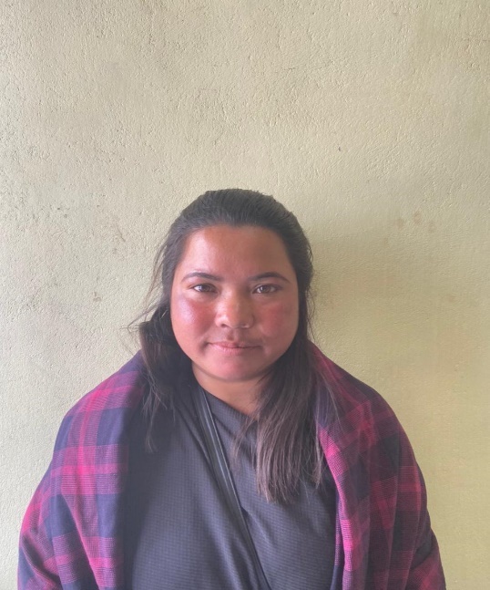
| 3. | Banjoplin Myrthong | 26 | Female | X | 8837332428 | Document and M&E |
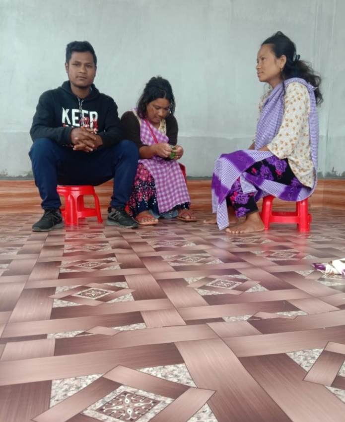
Fig. VCF of Pyndenmawthawiang VNRMC
| Procurement Members | |||||
|---|---|---|---|---|---|
| Sl no. | Name | Age | Gender | Qualification | Contact Number |
| 1. | Smingland Lyngkhoi | 35 | Male | BA | 8787612807 |
| 2. | Histar Myrthong | 40 | Female | X | 9863452805 |
| 3. | Daplin Lyngdoh | 32 | Female | X | 7005195396 |
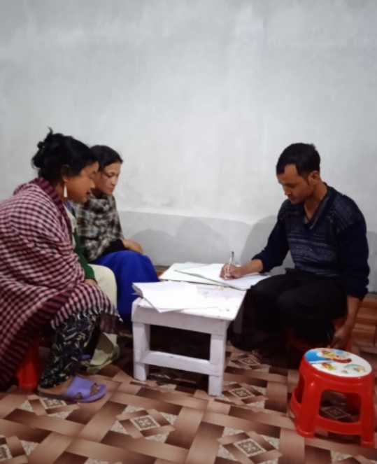
Fig: Purchase Committee of Pyndenmawthawiang VNRMC.
5. Opening of Bank Account:
The opening of the bank account was done after the signing of the EOI (Expression of Interest), the VGA (Village Grant Agreement) and the signing of the Green Charter. The Accountant of CLLMP South West Khasi Hills trained the Purchasing and Procurement Committee of Pyndenmawthawiang village on matters relating to Accounts and Book Keeping and on the:
Principles of Community Procurement
Benefits of Community Procurement
Important aspects undertaken by Community Procurement.
Procurement Process/Steps
Function of Purchase Committee
Important Procurement records to be maintained
 Financial limits and
methods
Financial limits and
methods
Maintaining of Books of Accounts to the Book Keeper.
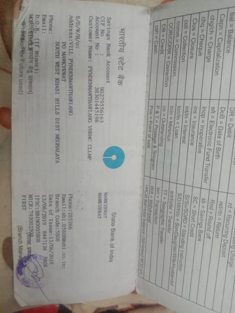
Fig: Bank details of Pyndenmawthawiang VNRMC.
6. Participatory Rural Appraisal Exercise:
The PRA exercise aims to incorporate the knowledge and opinions of the community in the planning and management of development projects and programmes.
The PRA exercise took place on the 14th December 2018 and around 17 villagers both men and women attended the program.
The District Project Manager gave the introduction and spoke about the different activities that the participants had to take part in the programme.
The Program Associate, Environment Management, spoke about the different CNRM plans and the different types of intervention. A group of participants interacted and helped in the collection of data based on the environmental template. With the help of this group, different sites of interventions had identified, analysed and evaluated in order to prioritized the areas that needed the natural resources management.
The Assistant Manager, Social Management, gathered the remaining group of participants to gather the baseline data bases on the social template.
The main objectives of PRA exercise are:
To identify the natural, human and economic resources of the village.
To identify the village problems and prioritized them with the help of the community members.
To prepare the community natural resources management plan of the village.
Findings based on the information gathered from the participants during the PRA/CNRMP exercise:
1. The main agricultural produce is Paddy, sweet potato and Potato.
2. Most of the household depend on firewood as a source of fuel.
3. Drinking water is limited over a period of 3-4 months during the winter season.
4. There are two types of forest ownership: Community and Private.
5. The springs which are present in the village needs rejuvenation.
6. Training on Land productivity, Spring shed management and Community nursery is necessary for the village community.
7. There are no disputes/constraints encountered within the village community or with any neighbouring villages.
Priorities Intervention required based on the PRA Exercise:
1. Rejuvenation of the Springs within the community through activities such as afforestation, treatment of catchment areas and contour trenches.
2. Afforestation and fire line control in the forest.
3. Community Nursery for endemic trees.
4. A dug out pond for collecting rain water for.
5. Check dams and boulder bunds for erosion control.
6. Culturable wastelands to be brought under horticulture.
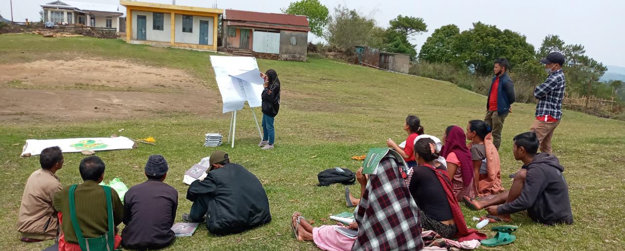
Fig: VNRMC members participating in awareness programme.
Baseline Data Survey to fill the Environment and Social Template:
During the PRA Exercise the External Expert of Social & Environment Management held a group discussion with the different groups to gather basic village information regarding number of households, demographic information, major crops and enterprises taken in the village, trends of production and productivity of major crops in the village and demographic distribution of village population.
Information related to land use category such as forest, cultivable land, water bodies, etc and the problems and challenges related to NRM were discussed.
Focussed Group Discussion on Problem Analysis:
Do people have sufficient access to supply of fodder, fuel wood, leaf litter?
No, people in the village have insufficient access to supply of fodder, fuel wood, leaf litter. They get it from their own private lands/forest and from outside the village.
Has access to timber improved or reduced over the years? How is access for household use and commercial use managed?
Access to Timber has reduced over the years. People have to purchase it from neighbouring village when needed.
Are the water bodies facing any threats?
Yes, the water bodies within the village have faced many threats.
Do all people in the village have access to drinking water? What are the challenges?
Yes, there is sufficient drinking water in the village except during the winter season due to less discharge of water from the spring source.
Are there degraded areas in the village (open/ degraded forests, mining affected, high soil erosion etc.)?
There are some minor degradations in cultivated land.
What has caused this degradation? Are there practices causing threats to availability and access to natural resources?
Fertility of the soil has decline over the year. The practices that cause threat to the availability of these resources are: Natural calamities like heavy rainfall and excessive practice of jhum cultivation.
What have been the changes in agricultural practices?
Over the past few years there is a declined in producing agricultural crops due to lack of control of pest and diseases but over the years with much awareness people have now practiced crop rotation.
Are there any challenges in farming?
The main challenges faced by the people is that over the years they have seen a decline in the soil productivity due to soil erosion and lack of control of pest and diseases.
How would you consider the health situation in your village?
The nearest health care is in the district headquarter with a distance of 14Km away and is easily accessible for the community as a whole to commute to the health centre.
How is the situation of cleanliness, sanitation, access to toilets and waste management?
Sufficient toilets are available in every household but most of the constructions are poor. Some households have access to toilets from SBM (Swash Bharat Mission) scheme. The presence of VWSC in the village has also improve sanitation and cleanliness. But Waste Management is poor because people are not really aware of how to properly disposed of waste.
Who are the most vulnerable in the village? What can be done to improve their lives?
BPL Families and orphanage. Inclusion of BPL family members and orphanage during project implementation.
What are the livelihood aspirations of the youth? Are there any avenues available?
None, except daily wages labourers.
Do any committees/ institutions/ rules exist to manage and monitor natural resources in the village?
Beside the responsible of the villagers, the VNRMC under the CLLMP is also the main committee that is now in place to manage the natural resources in the village.
What are some of the major issues of conflict in the village?
Nothing related to NRM.
Have any of the above issues been discussed in village meetings?
Yes.
How do people resolve disagreements and conflicts?
All disagreements and conflicts are addressed by the traditional institution of village called the Village Durbar.
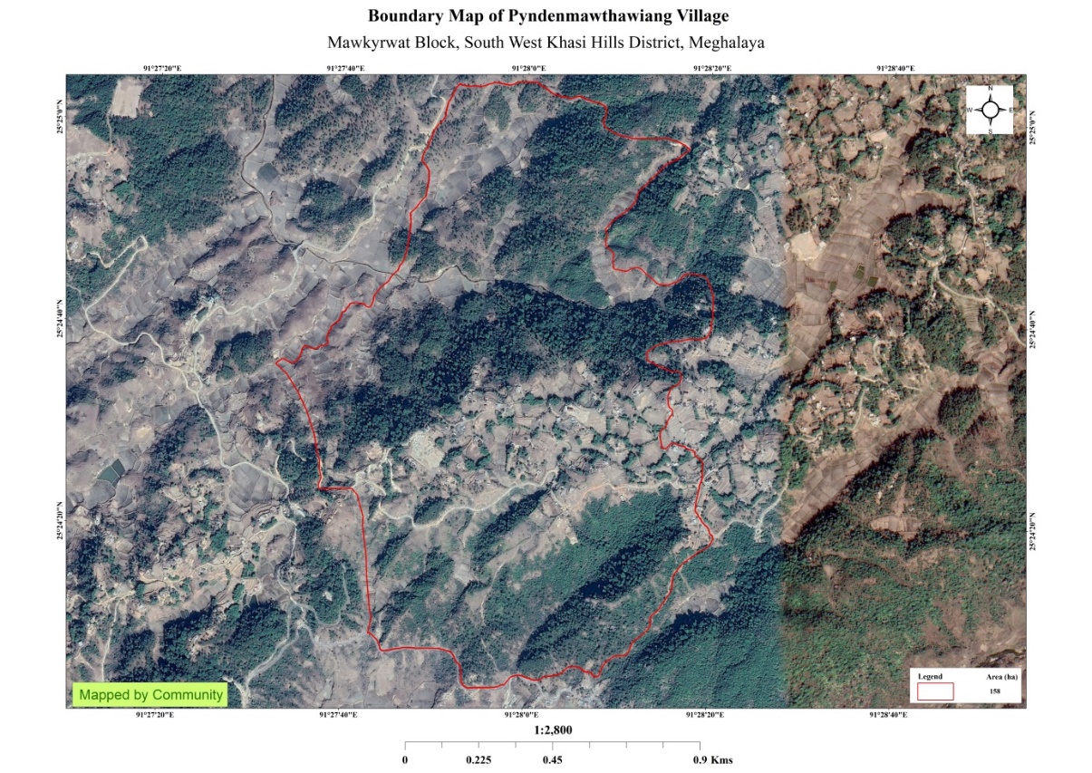
7. Village Boundary Mapping and Recourse Mapping:
The GIS personnel along with the Village Community Facilitators mapped the village boundary of Pyndenmawthawiang village. The village resource map is prepared by the people of the community. In this resource map, the local people prepare it by drawing it on chart paper. Recourses such as agricultural lands, wells, rivers, forest roads, etc were mapped.
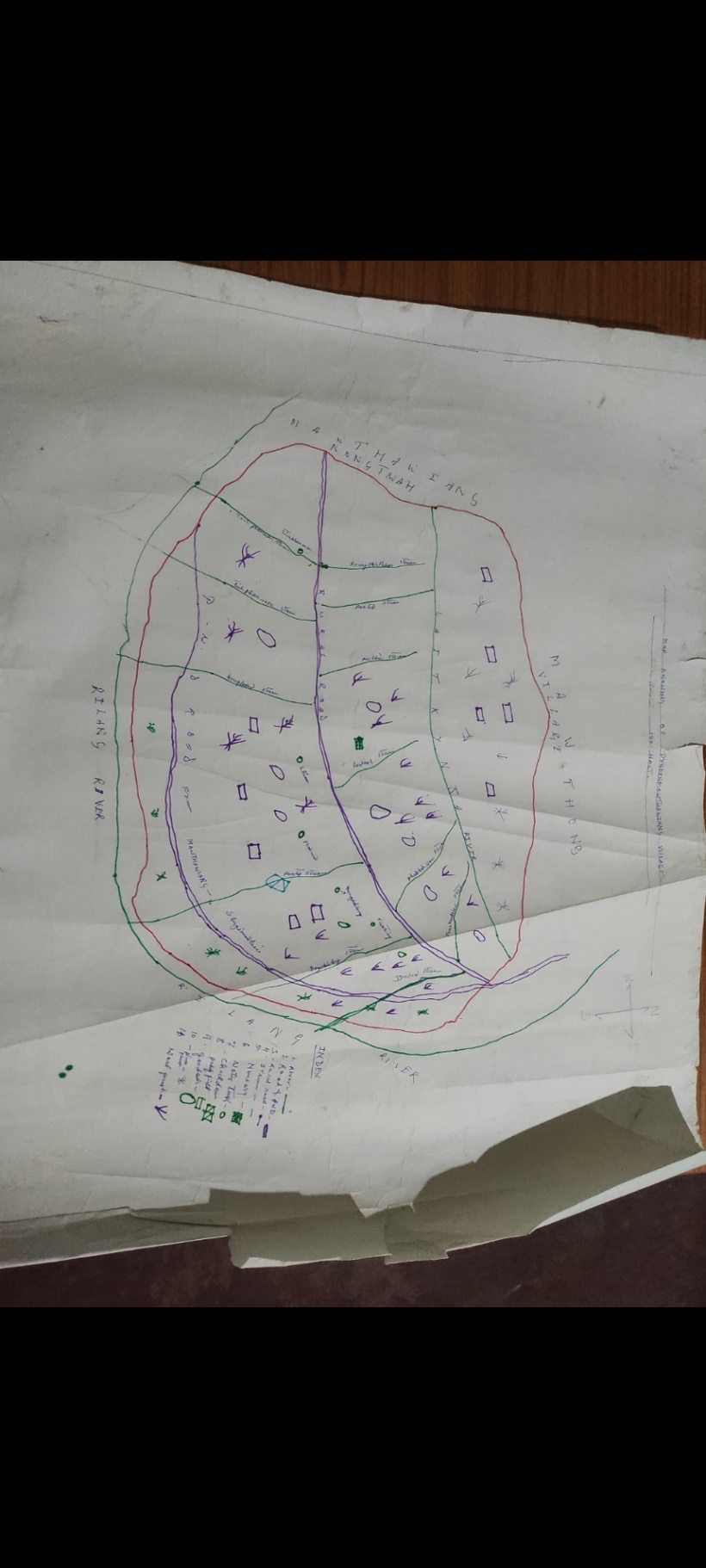
Fig:Resource map of Pyndenmawthawiang village.
Findings Based on the Resource Map of Pyndenmawthawiang Village:
1. Main agriculture produce is Potato, Sweet potato and Paddy.
2. There is only one type of Forest ownership: Private Owned.
Numerous Private Forest: Wahlarew, Laitkynja, Lawriat,Sohphoh, Synrang thapbulong
3. There are 3 streams flowing in the Village.
4. There are 2 Football playgrounds.
5. Presence of Integrated Child Development Services (ICDS) through Anganwadi Centre (AWC).
7. There are 2 L.P Schools and 1 U.P school within the village
8. GIS Activities:
| Sl. No. | Parameters | Village Information |
|---|---|---|
| 1 | GPS Coordinates: | |
| I | Latitude | 25.408693 |
| ii | Longitude | 91.448514 |
| iii | Elevation Reading (MSL) | 1657 |
| 2 | Village Geographical Area (Ha) | 158 |
| i | Total Forest Area (including community, Clan, Pvt Forest) | 84.1Ha |
| ii | Total Area of Water Bodies | 0.9Ha |
| iii | Total Area under Agri-Horticulture | 23Ha |
| iv | Total Degraded land area (Ha) | 19.79Ha |
| 3 | Average Annual Rainfall | 12000mm |
| 4 | Soil Type | Loamy soil |
Fig: Boundary Map, Slope Map and LULC Map.
The Proposed list of Interventions:
|
Name of Proposed Interventions | Site |
|
Priority (High/ Medium/ Low) | Start Date (Mm/Yy) | |
|---|---|---|---|---|---|---|
|
||||||
| 1. | SC & TCA | Laitkynja/ Photmaw |
|
|
|
|
| 2. | Community Nursery | Synrang thabulong | Private Land |
|
01-Jun-2020 | |
| 3. | Agro-Horticulture | Domdohlong | Private Land |
|
29-Jul-2021 | |
| 4. | Afforestation | Domdohlong | Private Land |
|
20-Jul-2021 | |
| 5. | Afforestation | Wahlarew | Private Land |
|
22-Jul-2021 | |
| 6. | Afforestation | Mawdungdung | Private Land |
|
08-Jul-2021 | |
| 7 | Afforestation | Synrangthabulong | Private Land |
|
26-Jul-2021 | |
| 8 | Afforestation | Lawriat | Private Land |
|
29-Jul-2021 | |
| 9 | Agro-Horticulture | Lumniangriang | Private Land |
|
05-Jan-2022 | |
| 10 | Spring Chamber | Jynrew | Private Land |
|
25-Nov-2021 | |
| 11 | Spring Chamber | Perktieh | Community Land |
|
21-Nov-2021 | |
| 12 | Boulder Bund | Tiehphanmon | Private Land |
|
31-Jan-2022 | |
| 13 | Bench Terracing | Domdohlong | Private Land |
|
03-Feb-2022 | |
| 14 | Bench Terracing | Lumniangrang | Private Land |
|
05-Feb-2022 | |
| 15 | Boulder Bund | Lumkper | Private Land |
|
14-Feb-2022 | |
| 16 | Boulder Bund | Mawsyntai | Private Land |
|
07-Feb-2022 | |
| 17 | Boulder Bund | Dom- Marwein | Private Land | 16-Feb-2022 | ||
| 18 | Boulder Bund | Dom- Thymmai | Private Land | 15-Feb-2022 | ||
| 19 | Boulder Bund | Krempamiet | Private Land | 07-Feb-2022 | ||
| 20 | Dug Out Pond | Pamtep | Private Land | 22-Mar-2022 | ||
| 21 | CC Check dam | Mawnarang | Private Land | 22-Mar-2022 | ||
| 22 | Boulder Bund | Kper Juwan | Private Land | 22-Mar-2022 | ||
| 23 | Boulder Bund | Wei-koh 1 | Private Land | 12-Apr-2022 | ||
| 24 | Boulder Bund | Wahlarew | Private Land | 12-Apr-2022 | ||
| 25 | Boulder bund | Dom marwein 2 | Private Land | 12-Apr-2022 | ||
| 26 | Boulder bund | Wei-koh 1-2 | Private Land | 12-May-2019 | ||
| 27 | Boulder bund | Tiehthiang | Private Land | 01-Jun-2020 | ||
| 28 | Retaining Wall | Domdohlong | Private Land | 19-Sep-2022 | ||
| 29 | Bench Terrace. | Lawriat | Private Land | 10-Aug-2022 | ||
| 30 | Retaining Wall | Domdohlong 2 | Private Land | 11-Jul-2022 | ||
| 31 | Protection wall. | Pynden Mawthawiang | Private Land | 07-Sept-2022 | ||
| 32 | Spring Chamber | Laitkynja | Private Land | 12-Jul-2022 | ||
Project Implementation:
| 1. | Type of Intervention | Site Name | GPS Co-ordinates | Amount Sanctioned | Work Status | |
|---|---|---|---|---|---|---|
| SC & TCA at Laitkynja /Photmaw | Laitkynja | 25.409981 | 91.469194 | Rs.42450 | Completed | |
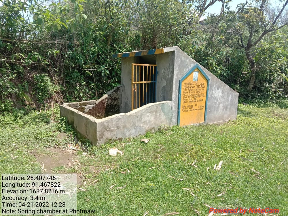
Fig.1: Before, during and after of Spring chamber at Laitkynja/Photmaw.
| 2. | Type of Intervention | Site Name | GPS Co-ordinates | Amount Sanctioned | Work Status | |
|---|---|---|---|---|---|---|
| Community Nursery at Synrangthabulong | Synrangthabulong | 25.409645 | 91.462977 | Rs.297280 | Completed | |
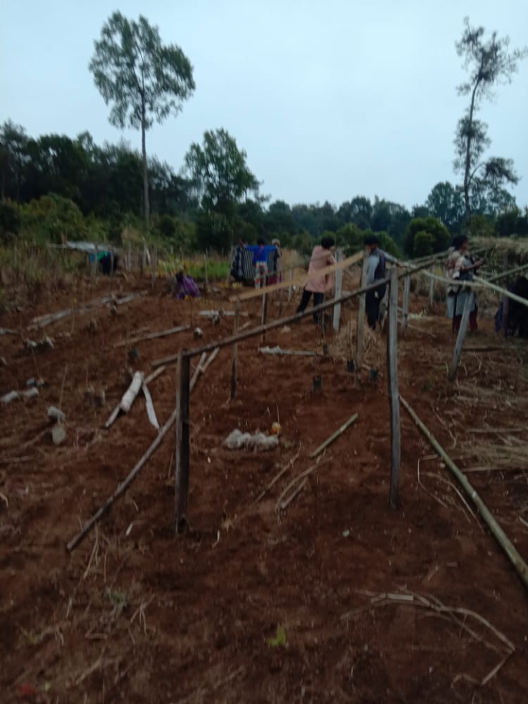
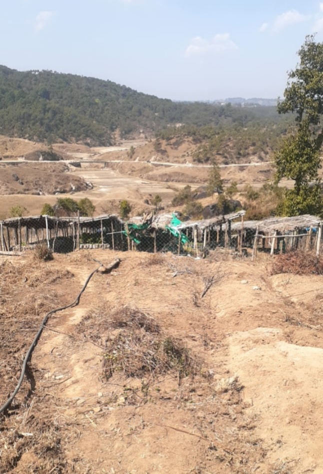
Fig.2: Before, during and after of Community Nursery at Synrangthabulong.
| 3. | Type of Intervention | Site Name | GPS Co-ordinates | Amount Sanctioned | Work Status | |
|---|---|---|---|---|---|---|
| Agro-Horticulture at Domdohlong | Domdohlong | 25.405548 | 91.4677 | Rs. 6422 | Completed | |
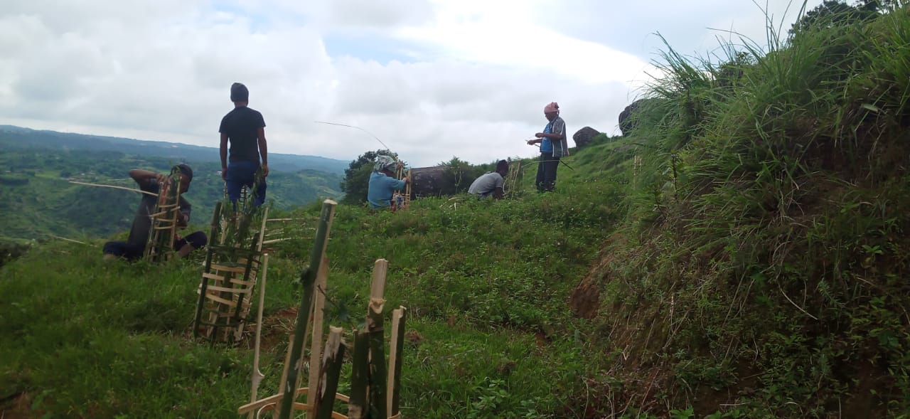
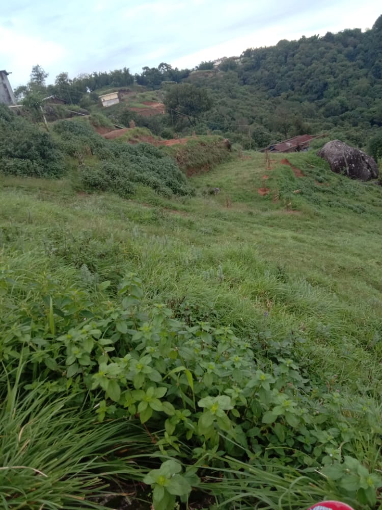
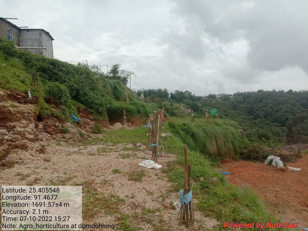
Fig.3: Before, during and after of Agro-Horticulture at Domdohlong.
| 4. | Type of Intervention | Site Name | GPS Co-ordinates | Amount Sanctioned | Work Status | |
|---|---|---|---|---|---|---|
| Afforestation at Domdohlong | Domdohlong | 25.406448 | 91.46838 | Rs.10397 | Completed | |
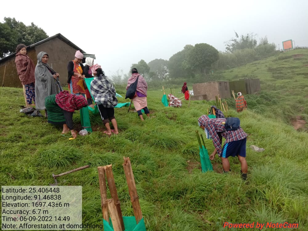
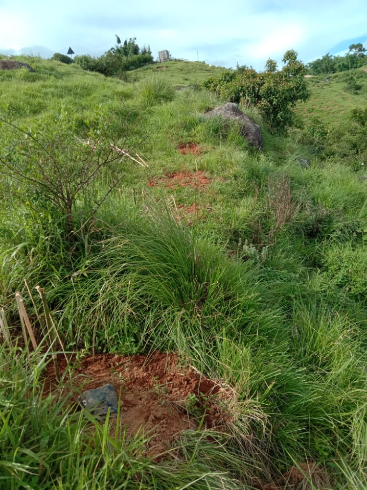
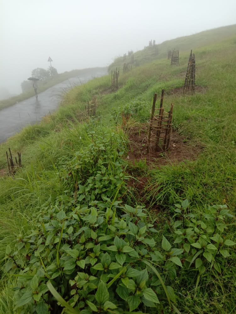
Fig.4: Before, during and after of Afforestation at Domdohlong.
| 5. | Type of Intervention | Site Name | GPS Co-ordinates | Amount Sanctioned | Work Status | |
|---|---|---|---|---|---|---|
| Afforestation at Wahlarew | Wahlarew | 25.410168 | 91.461005 | Rs.27846 | Completed | |
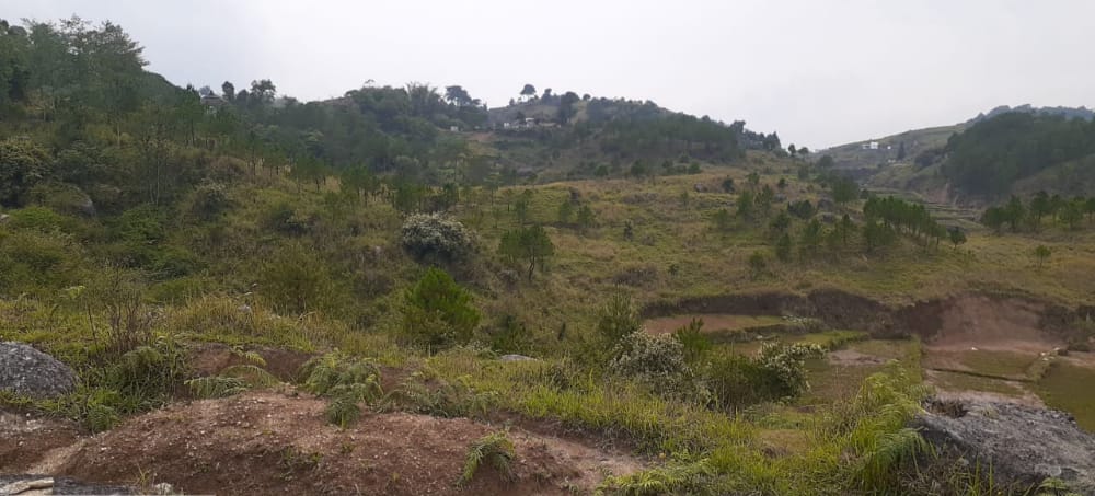
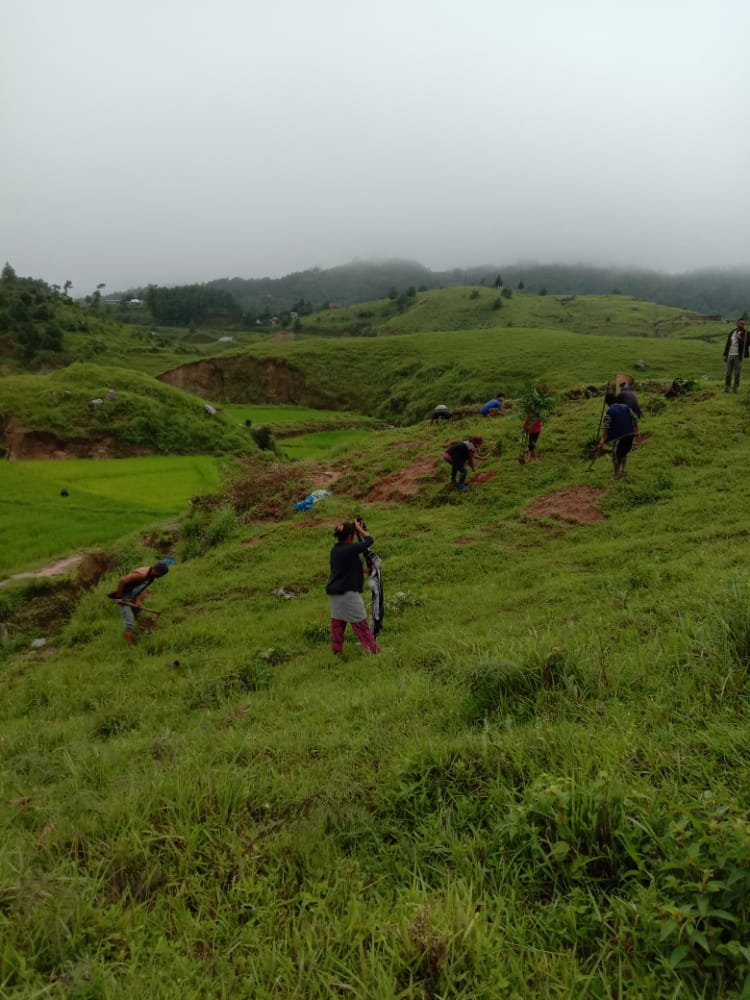
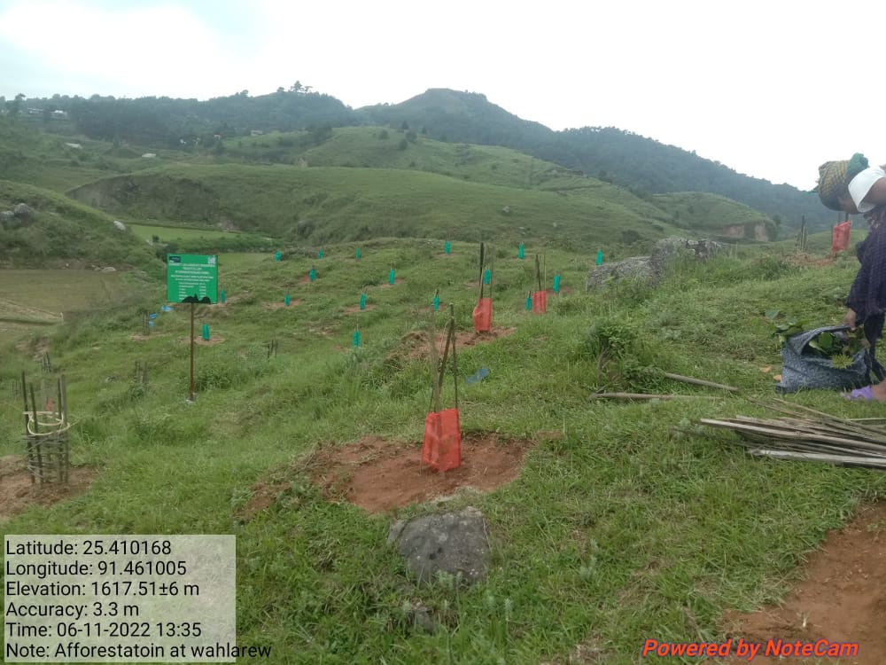
Fig.5: Before, during and after of Afforestation at Wahlarew.
| 6. | Type of Intervention | Site Name | GPS Co-ordinates | Amount Sanctioned | Work Status | |
|---|---|---|---|---|---|---|
| Afforestation at Mawdungdung | Mawdungdung | 25.405046 | 91.467141 | Rs. 47498 | Ongoing | |
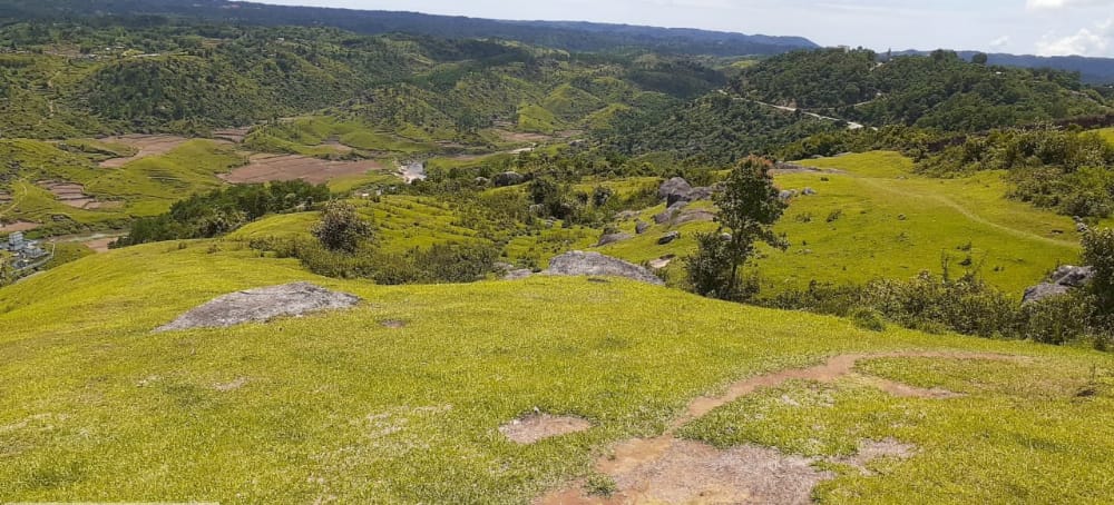
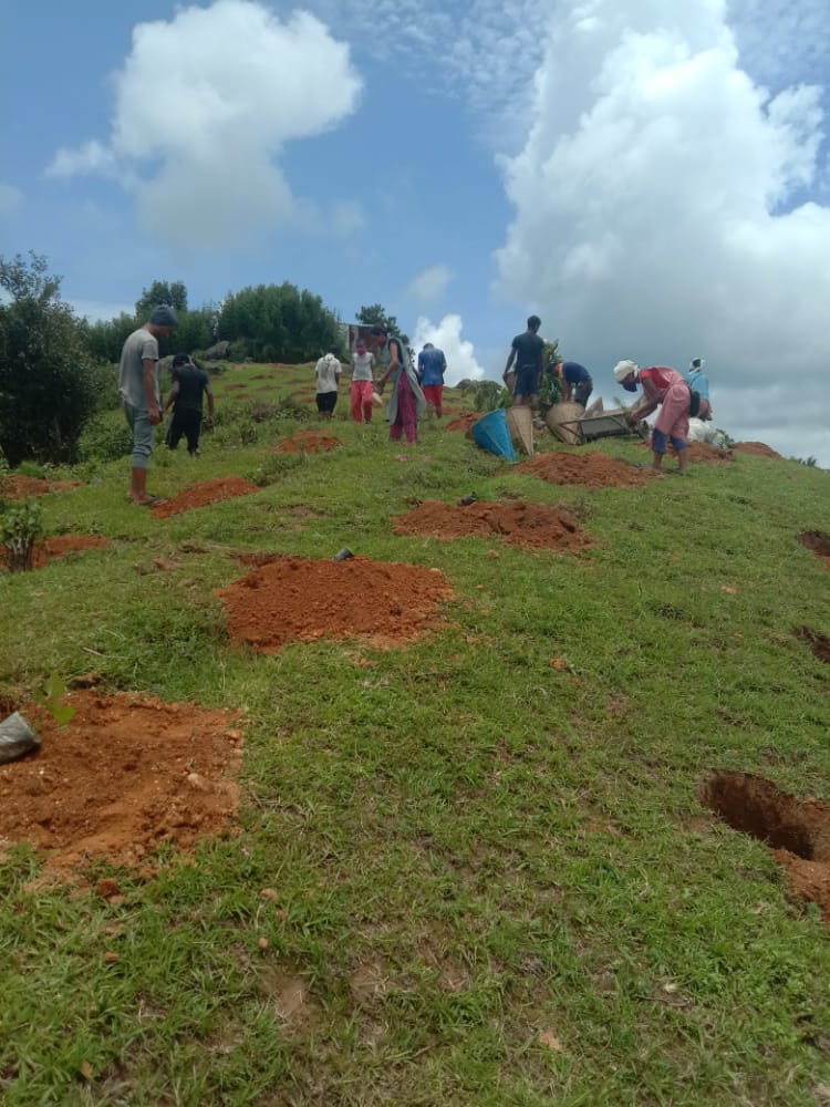
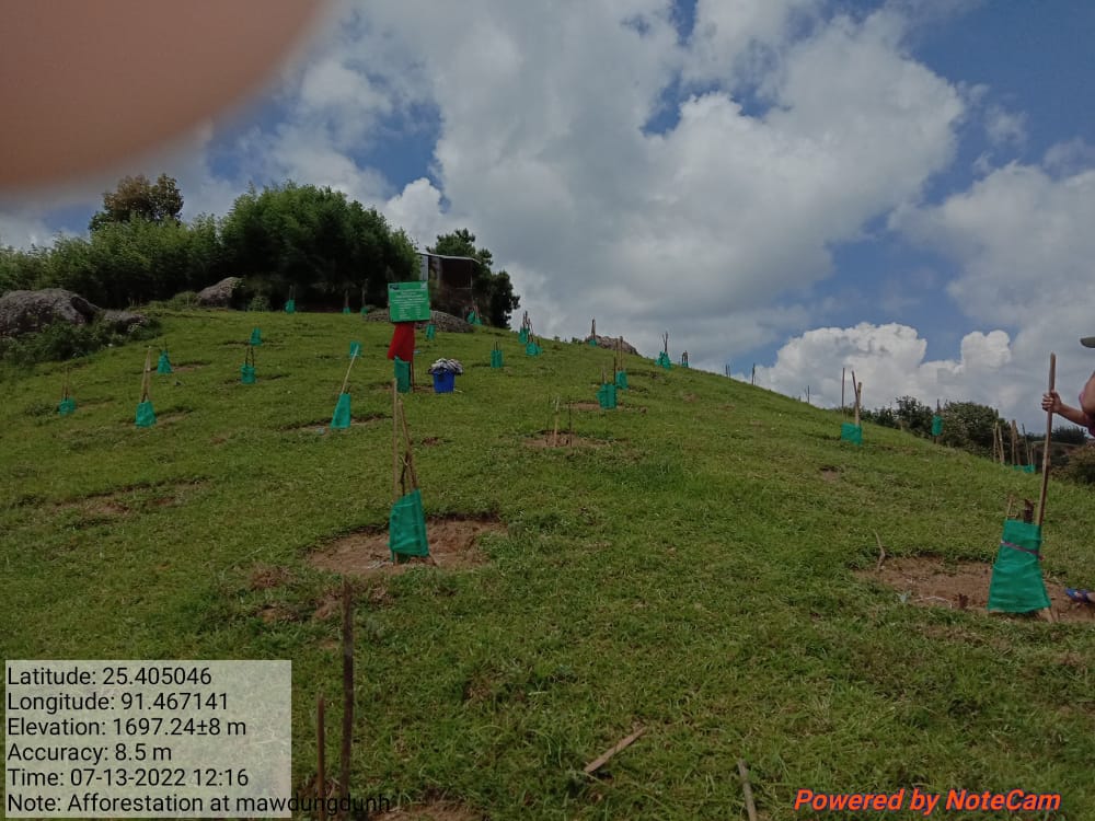
Fig.6: Before, during and after of Afforestation at Mawdungdung.
| 7. | Type of Intervention | Site Name | GPS Co-ordinates | Amount Sanctioned | Work Status | |
|---|---|---|---|---|---|---|
| Afforestation at Synrangthabulong | Synrangthabulong | 25.409593 | 91.462922 | Rs.62681 | Ongoing | |
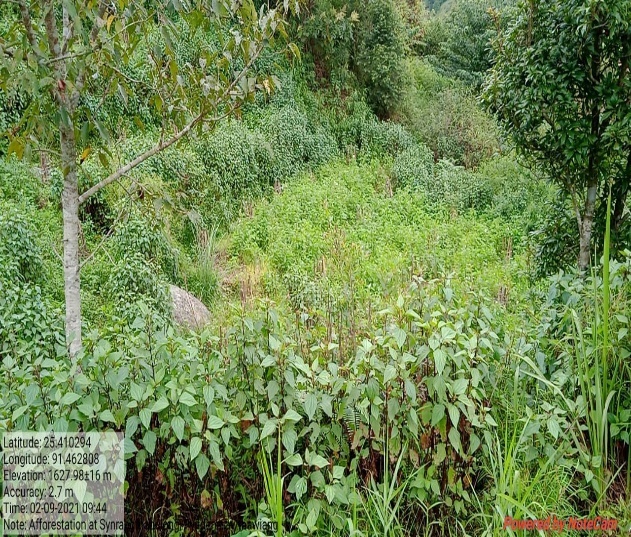
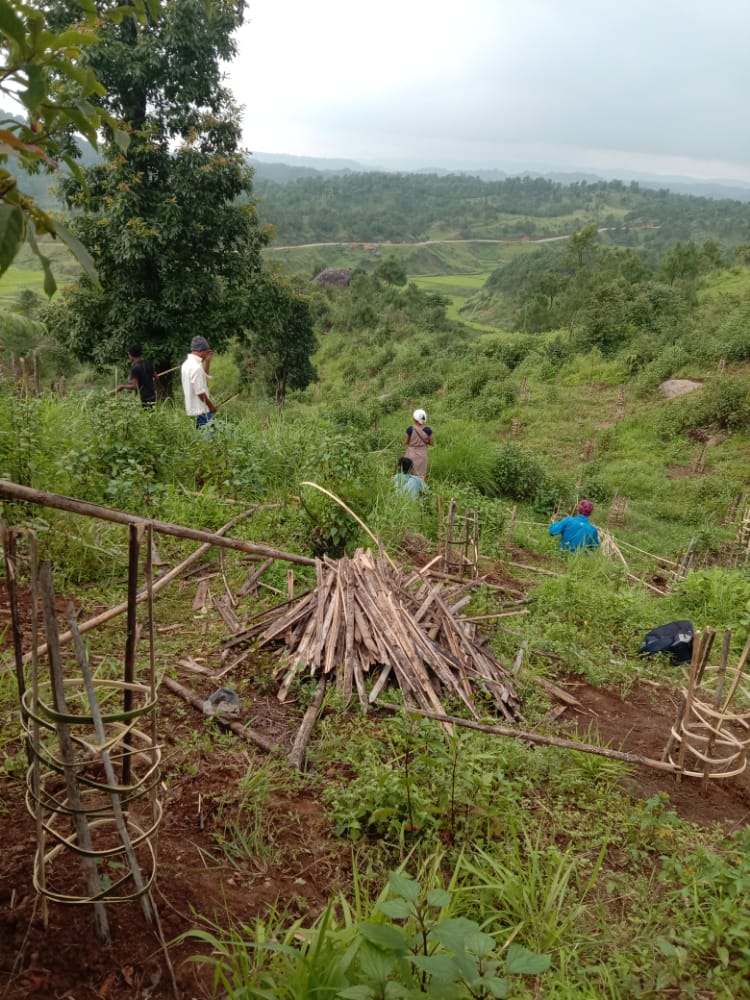
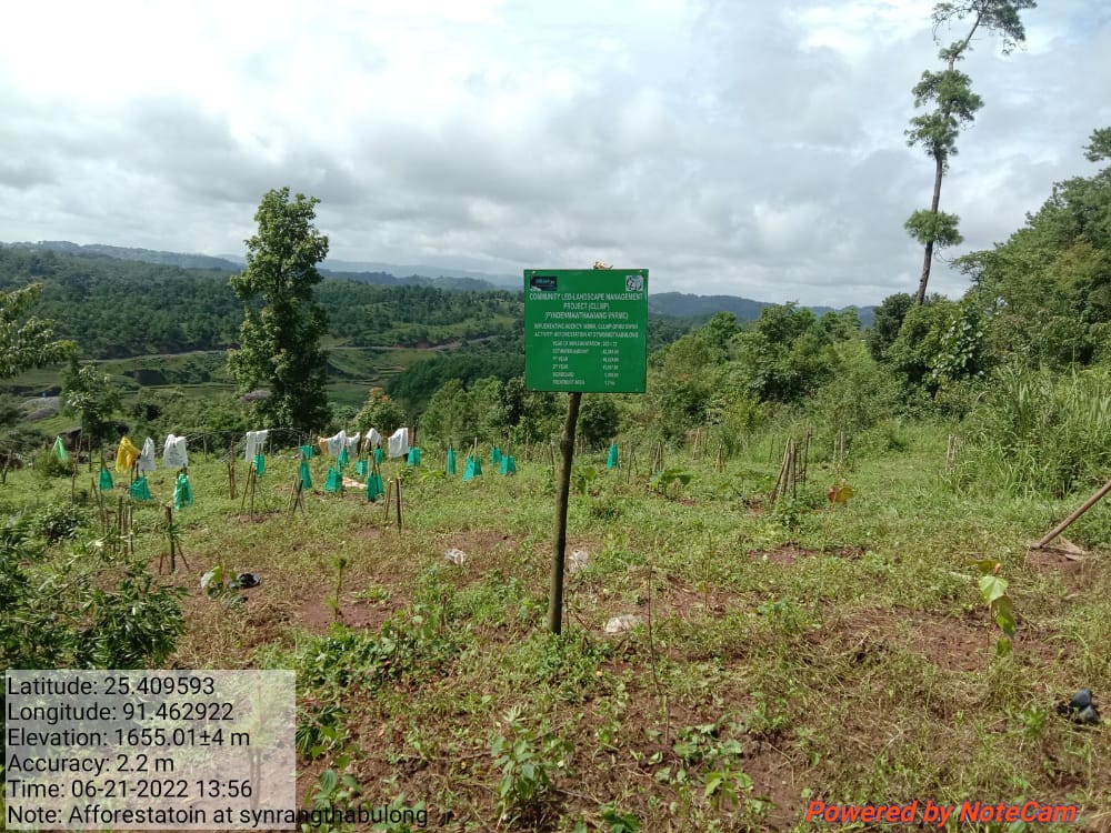
Fig.7: Before, during and after of Afforestation at Synrangthabulong.
| 8. | Type of Intervention | Site Name | GPS Co-ordinates | Amount Sanctioned | Work Status | |
|---|---|---|---|---|---|---|
| Afforestation at Lawriat | Lawriat | 25.406469 | 91.468771 | Rs.16626 | Ongoing | |
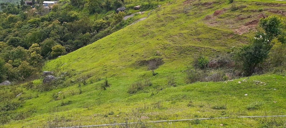
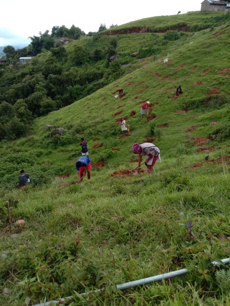
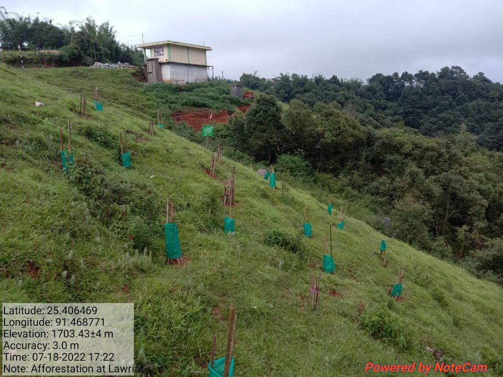
Fig.8: Before, during and after of Afforestation at Lawriat.
| 9. | Type of Intervention | Site Name | GPS Co-ordinates | Amount Sanctioned | Work Status | |
|---|---|---|---|---|---|---|
| Agro-Horticulture at Lumniangriang | Lumniangriang | 25.406525 | 91.469853 | Rs,6422 | Ongoing | |
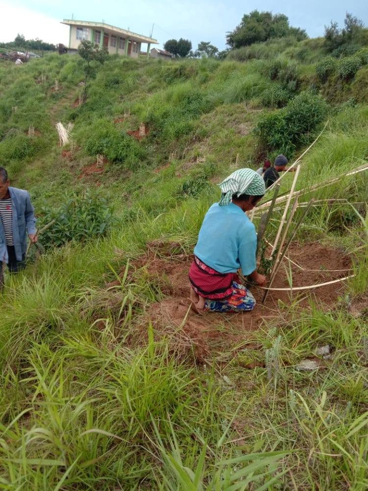

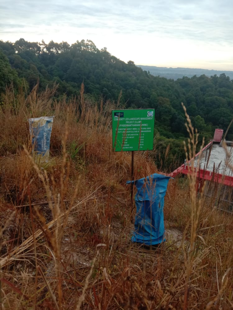
Fig.9: Before, during and after of Agro-Horticulture at Lumniangriang.
| 10. | Type of Intervention | Site Name | GPS Co-ordinates | Amount Sanctioned | Work Status | |
|---|---|---|---|---|---|---|
| Spring Chamber at Jynrew | Jynrew | 25.405726 | 91.470194 | Rs.71902 | Completed | |
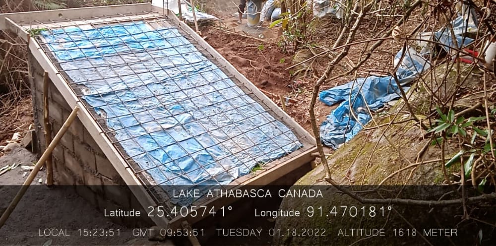
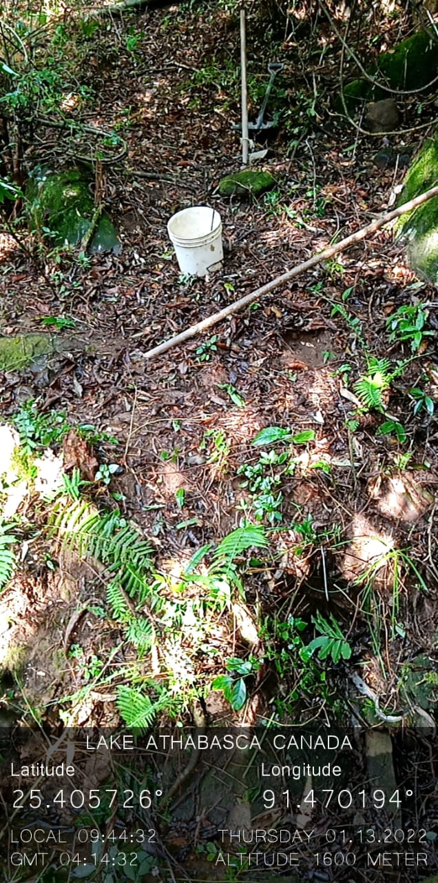
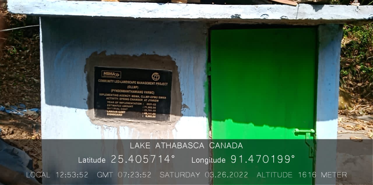
Fig.10: Before, during and after of Spring Chamber at Jynrew.
| 11. | Type of Intervention | Site Name | GPS Co-ordinates | Amount Sanctioned | Work Status | |
|---|---|---|---|---|---|---|
| Spring Chamber at Perktieh | Perktieh | 25.406450 | 91.466168 | Rs.67734 | Completed | |
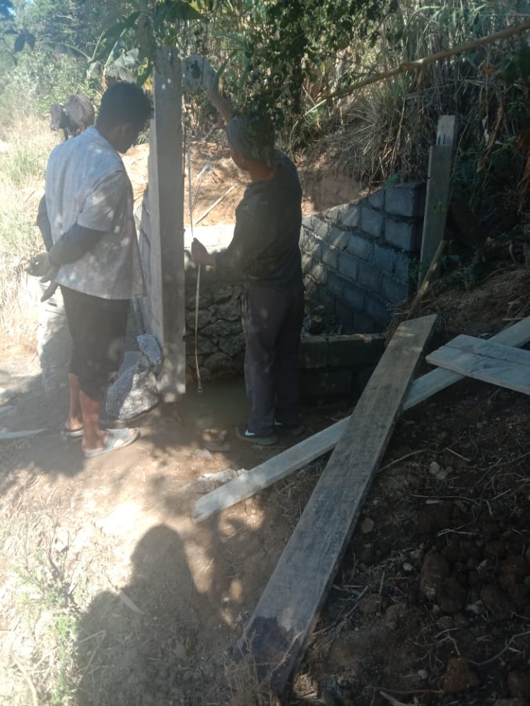
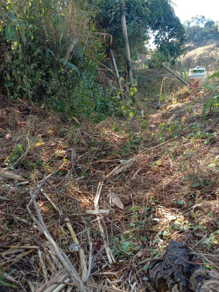
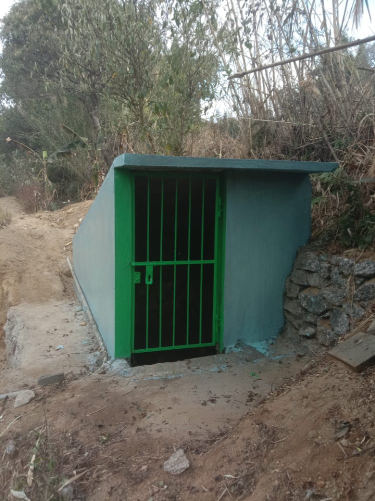
Fig.11: Before, during and after of Spring Chamber at Perktieh.
| 12. | Type of Intervention | Site Name | GPS Co-ordinates | Amount Sanctioned | Work Status | |
|---|---|---|---|---|---|---|
| Boulder Bund at Tiehphanmon | Tiehphanmon | 25.404027 | 91.461613 | Rs.62463 | Completed | |

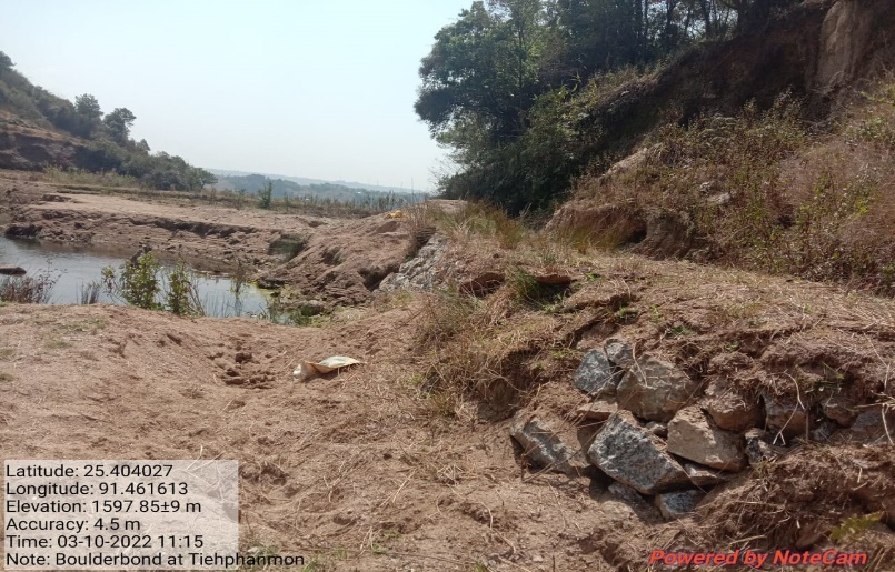
Fig.12: Before, during and after of boulder bund at Tiehphanmon.
| 13. | Type of Intervention | Site Name | GPS Co-ordinates | Amount Sanctioned | Work Status | |
|---|---|---|---|---|---|---|
| Bench Terracing at Domdohlong | Domdohlong | 25.405505 | 91.467576 | Rs.85404 | Completed | |
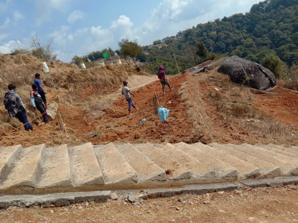
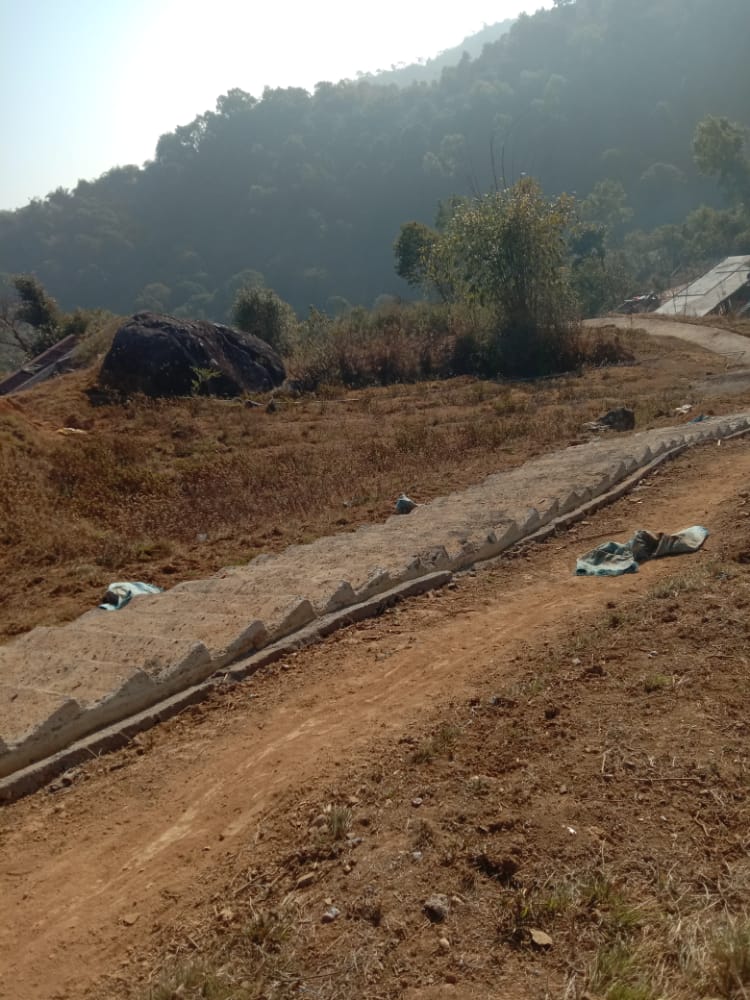

Fig.13: Before, during and after of Bench Terracing at Domdohlong.
| 14. | Type of Intervention | Site Name | GPS Co-ordinates | Amount Sanctioned | Work Status | |
|---|---|---|---|---|---|---|
| Bench Terracing at Lumniangrang | Lumniangrang | 25.40631 | 91.469998 | Rs.178096 | Completed | |
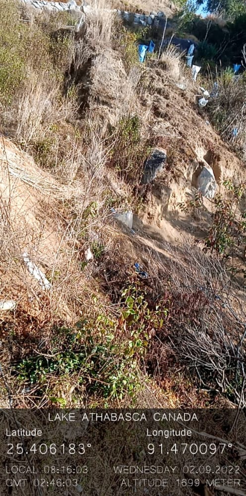
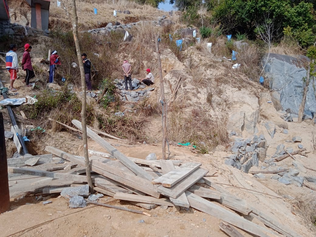
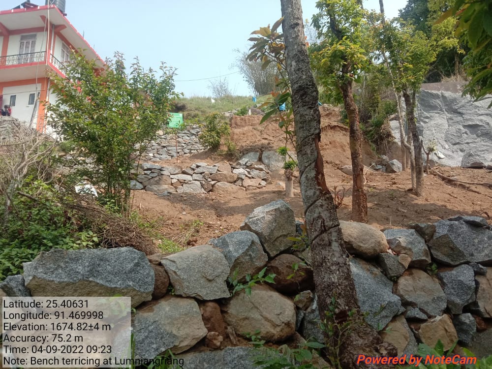
Fig.14: Before, during and after of Bench Terracing at Lumniangrang.
| 15. | Type of Intervention | Site Name | GPS Co-ordinates | Amount Sanctioned | Work Status | |
|---|---|---|---|---|---|---|
| Boulder Bund at Lumkper | Lumkper | 25.406899 | 91.470888 | Rs.18954 | Completed | |
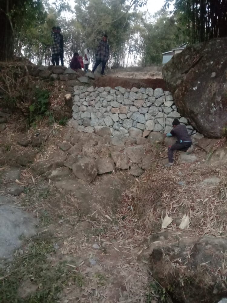
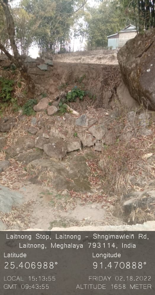
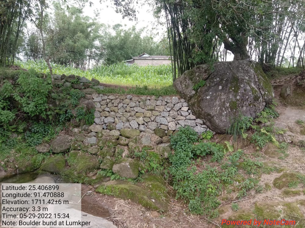
Fig.15: Before, during and after of boulder bund at Lumkper.
| 16. | Type of Intervention | Site Name | GPS Co-ordinates | Amount Sanctioned | Work Status | |
|---|---|---|---|---|---|---|
| Boulder Bund at Mawsyntai | Mawsyntai | 25.4088 | 91.45532 | Rs.93152 | Completed | |
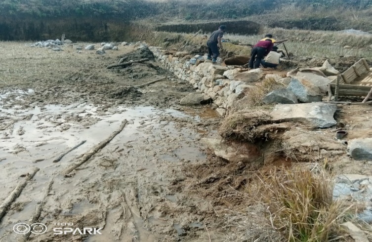
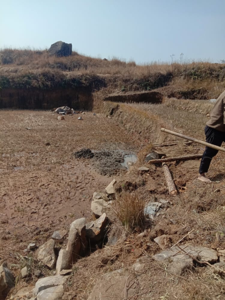
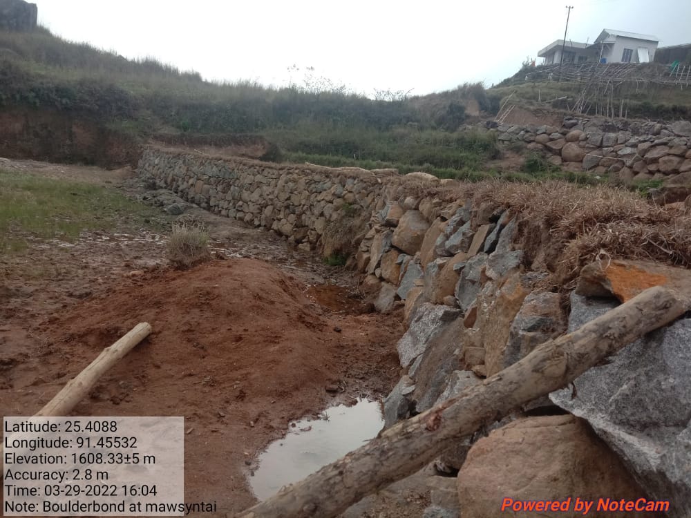
Fig.16: Before, during and after of boulder bund at Mawsyntai.
| 17. | Type of Intervention | Site Name | GPS Co-ordinates | Amount Sanctioned | Work Status | |
|---|---|---|---|---|---|---|
| Boulder Bund at Dom-Marwein | Dom-Marwein | 25.409097 | 91.466465 | Rs.51217 | Completed | |
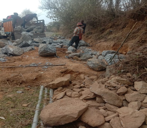
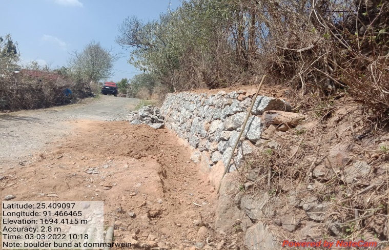
Fig.17: Before, during and after of boulder bund at Dom Marwein
| 18. | Type of Intervention | Site Name | GPS Co-ordinates | Amount Sanctioned | Work Status | |
|---|---|---|---|---|---|---|
| Boulder Bund at Dom-Thymmai | Dom-Thymmai | 25.409082 | 91.46963 | Rs.53216 | Completed | |
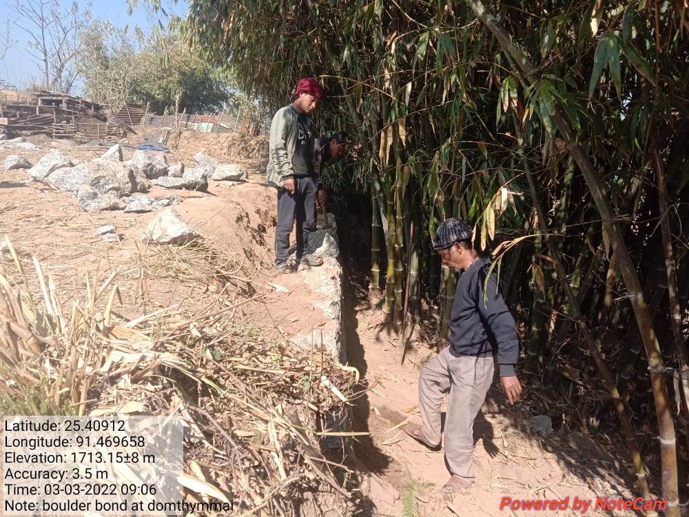

Fig.18: Before, during and after of boulder bund at Dom Thymmai.
| 19. | Type of Intervention | Site Name | GPS Co-ordinates | Amount Sanctioned | Work Status | |
|---|---|---|---|---|---|---|
| Boulder Bund at Krempamiet | Krempamiet | 25.410485 | 91.452137 | Rs.70219 | Completed | |
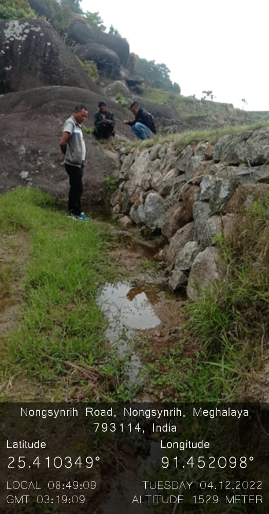
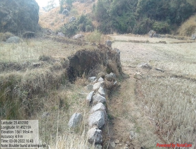
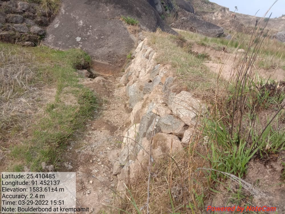
Fig.19: Before, during and after of boulder bund at Krempamiet.
| 20. | Type of Intervention | Site Name | GPS Co-ordinates | Amount Sanctioned | Work Status | |
|---|---|---|---|---|---|---|
| Dug Out Pond at Pamtep | Pamtep | 25.404706 | 91464638. | Rs.128551 | Completed | |
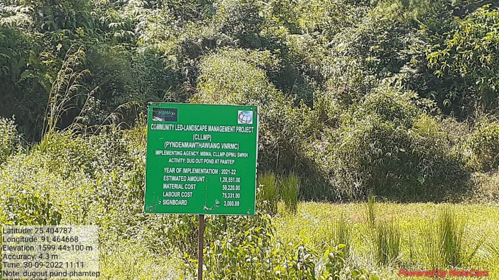
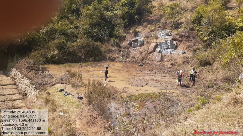
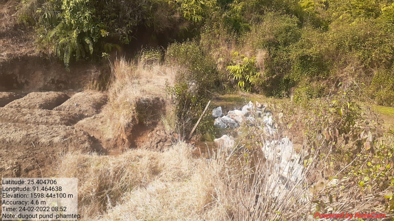
Fig.20: Before, during and after of dug out pond at Pamtep.
| 21. | Type of Intervention | Site Name | GPS Co-ordinates | Amount Sanctioned | Work Status | |
|---|---|---|---|---|---|---|
| CC Checkdam at Mawnarang | Mawnarang | 25.411856 | 91.467519 | Rs.219019 | Completed | |
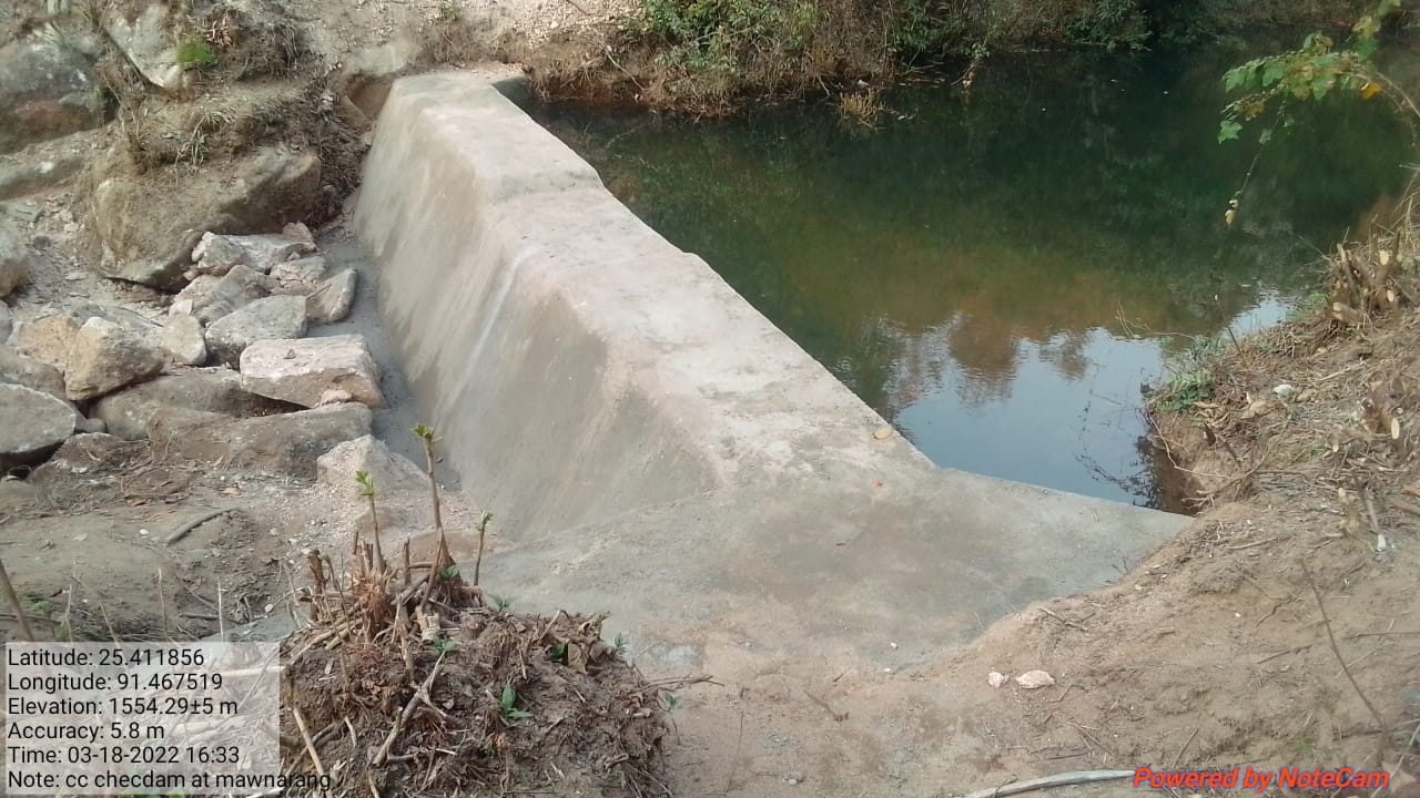
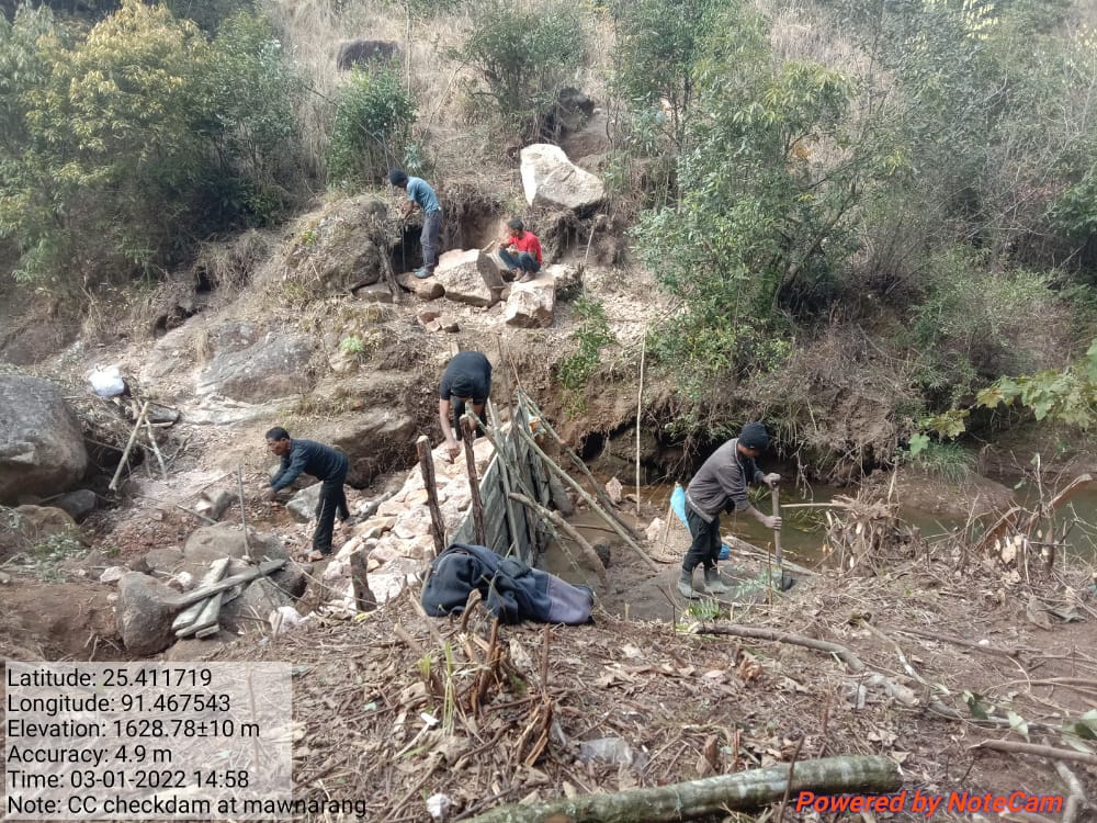
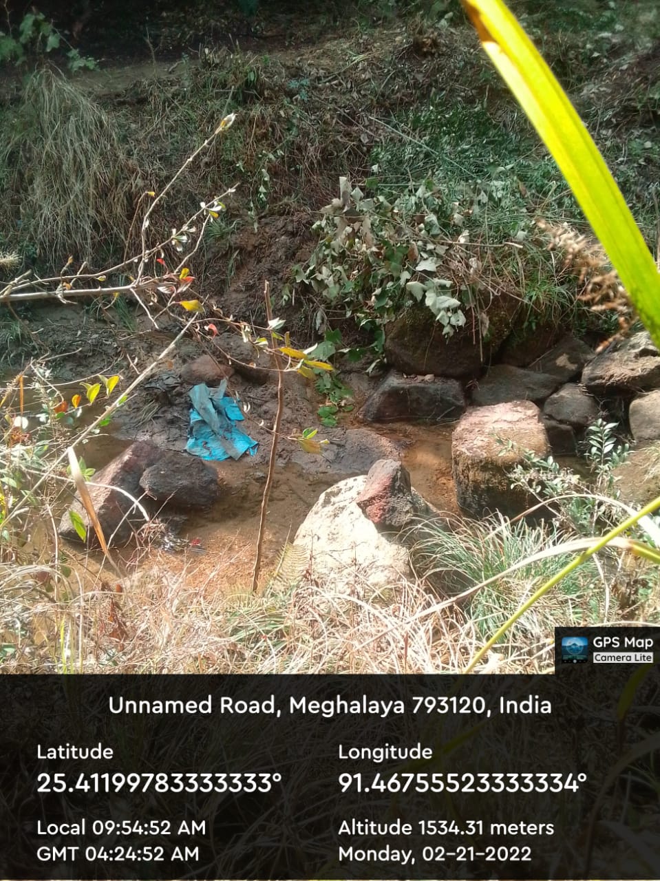
Fig.21: Before, during and after of CC checkdam at Mawnarang.
| 22. | Type of Intervention | Site Name | GPS Co-ordinates | Amount Sanctioned | Work Status | |
|---|---|---|---|---|---|---|
| Boulder Bund at Kper Juwan | Kper Juwan | 25.409548 | 91.46799 | Rs.36473 | Completed | |
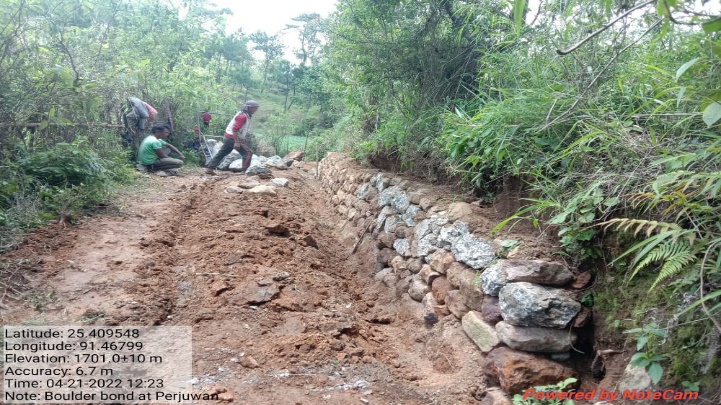
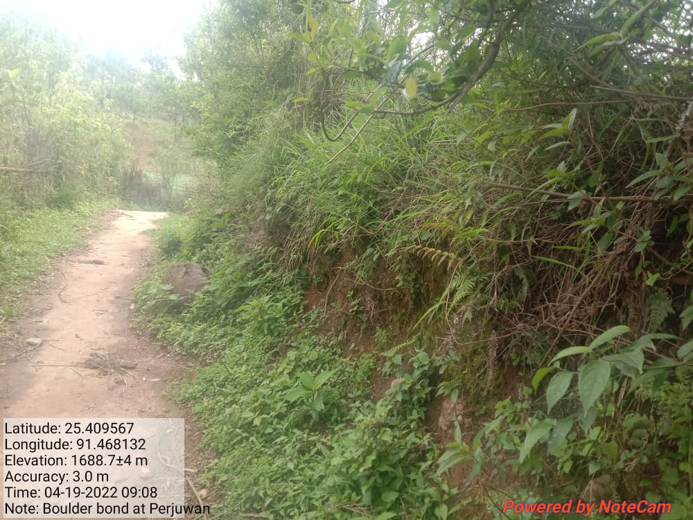
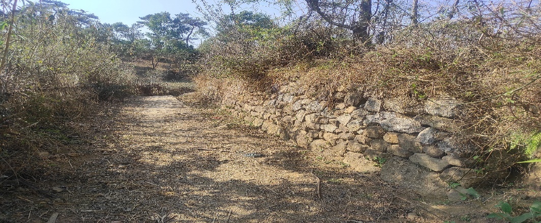
Fig.22: Before, during and after of boulder bund at Kper Juwan.
| 23. | Type of Intervention | Site Name | GPS Co-ordinates | Amount Sanctioned | Work Status | |
|---|---|---|---|---|---|---|
| Boulder Bund at Wei Koh I | Wei Koh I | 25.412262 | 91.470897 | Rs.95461 | Completed | |
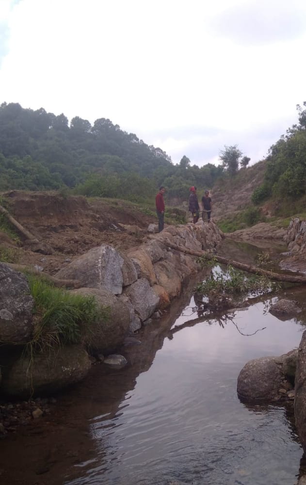
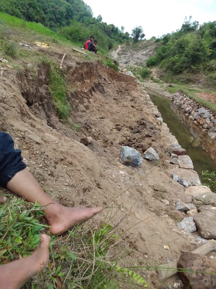
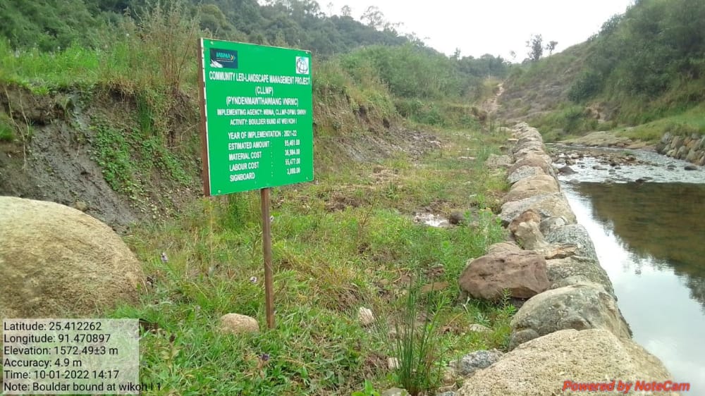
Fig.23: Before, during and after of boulder bund at Wei Koh I.
| 24. | Type of Intervention | Site Name | GPS Co-ordinates | Amount Sanctioned | Work Status | |
|---|---|---|---|---|---|---|
| Boulder Bund at Wahlarew | Wahlarew | 25.410434 | 91.460454 | Rs.186498 | Completed | |
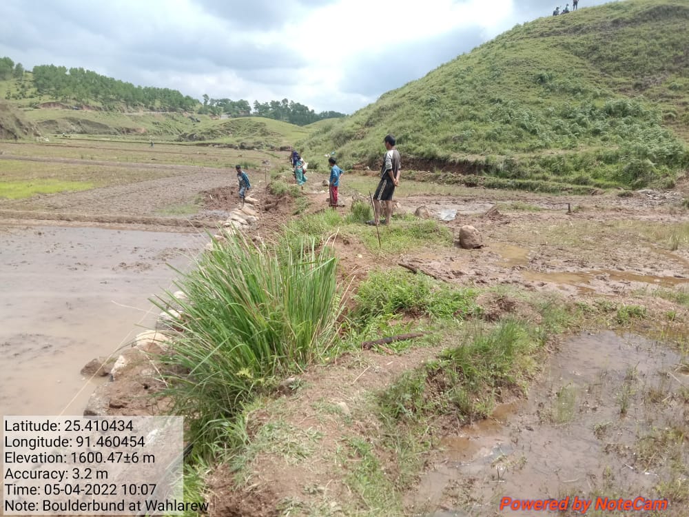
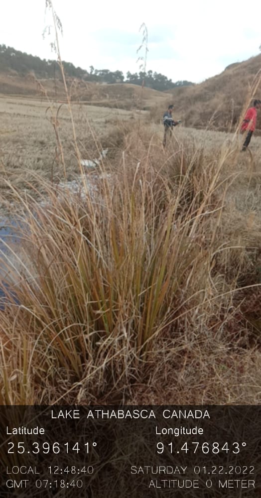
Fig.24: Before, during and after of boulder bund at Wahlarew.
| 25. | Type of Intervention | Site Name | GPS Co-ordinates | Amount Sanctioned | Work Status | |
|---|---|---|---|---|---|---|
| Boulder bund at Dom Marwein-2 | Dom Marwein-2 | 25.409082 | 91.464576 | Rs.67565 | Completed | |
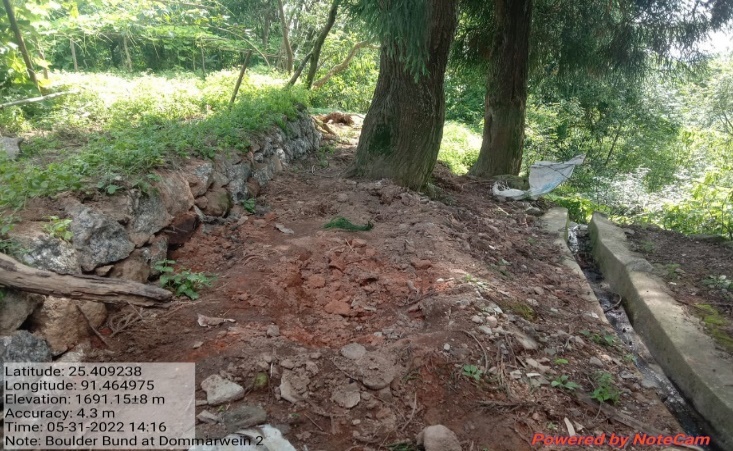
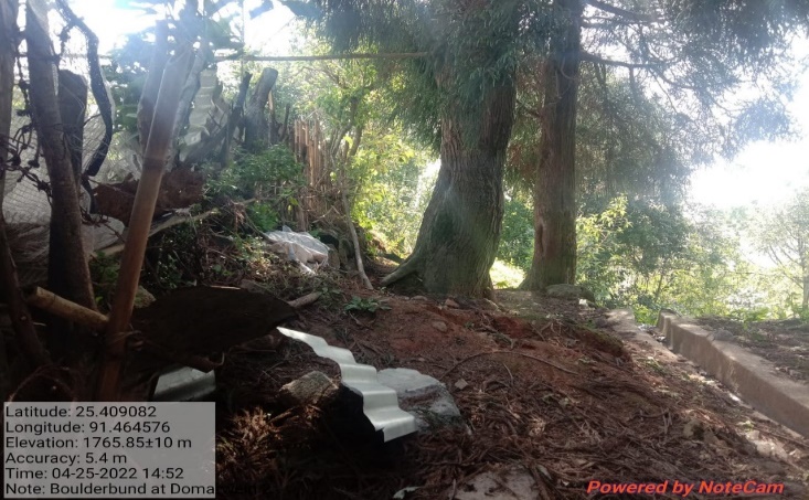
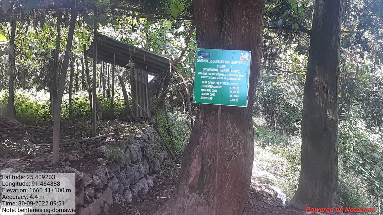
Fig.25: Before, during and after of boulder bund at Dom Marwein-2.
| 26. | Type of Intervention | Site Name | GPS Co-ordinates | Amount Sanctioned | Work Status | |
|---|---|---|---|---|---|---|
| Boulder bund at Wei-koh- I 2 | Wei-koh- I 2 | 25.412207 | 91.470856 | Rs.119823 | Completed | |
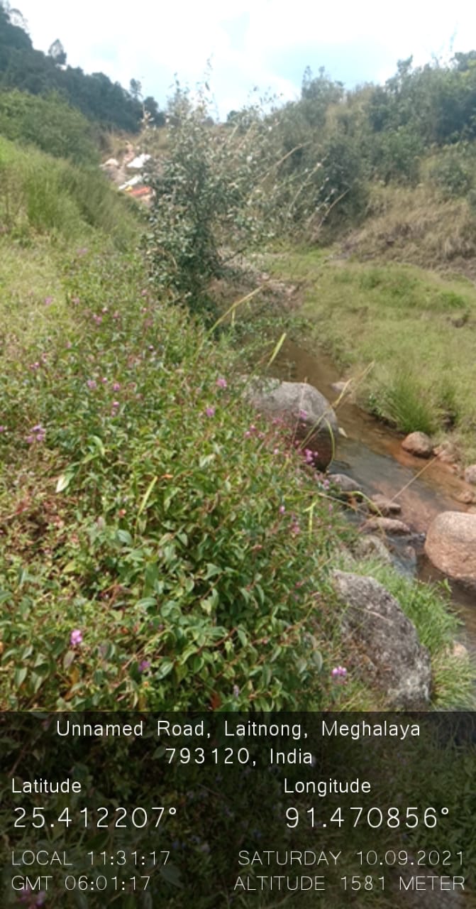
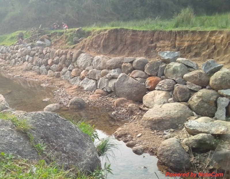
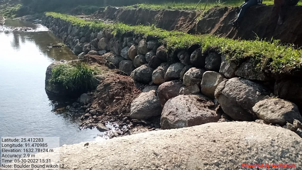
Fig.26: Before, during and after of boulder bund at Wei-koh- I 2.
\
| 27. | Type of Intervention | Site Name | GPS Co-ordinates | Amount Sanctioned | Work Status | |
|---|---|---|---|---|---|---|
| Boulder bund at Tiehthiang | Tiehthiang | 25.407132 | 91.468789 | Rs.31631 | Completed | |
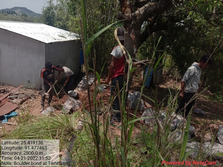
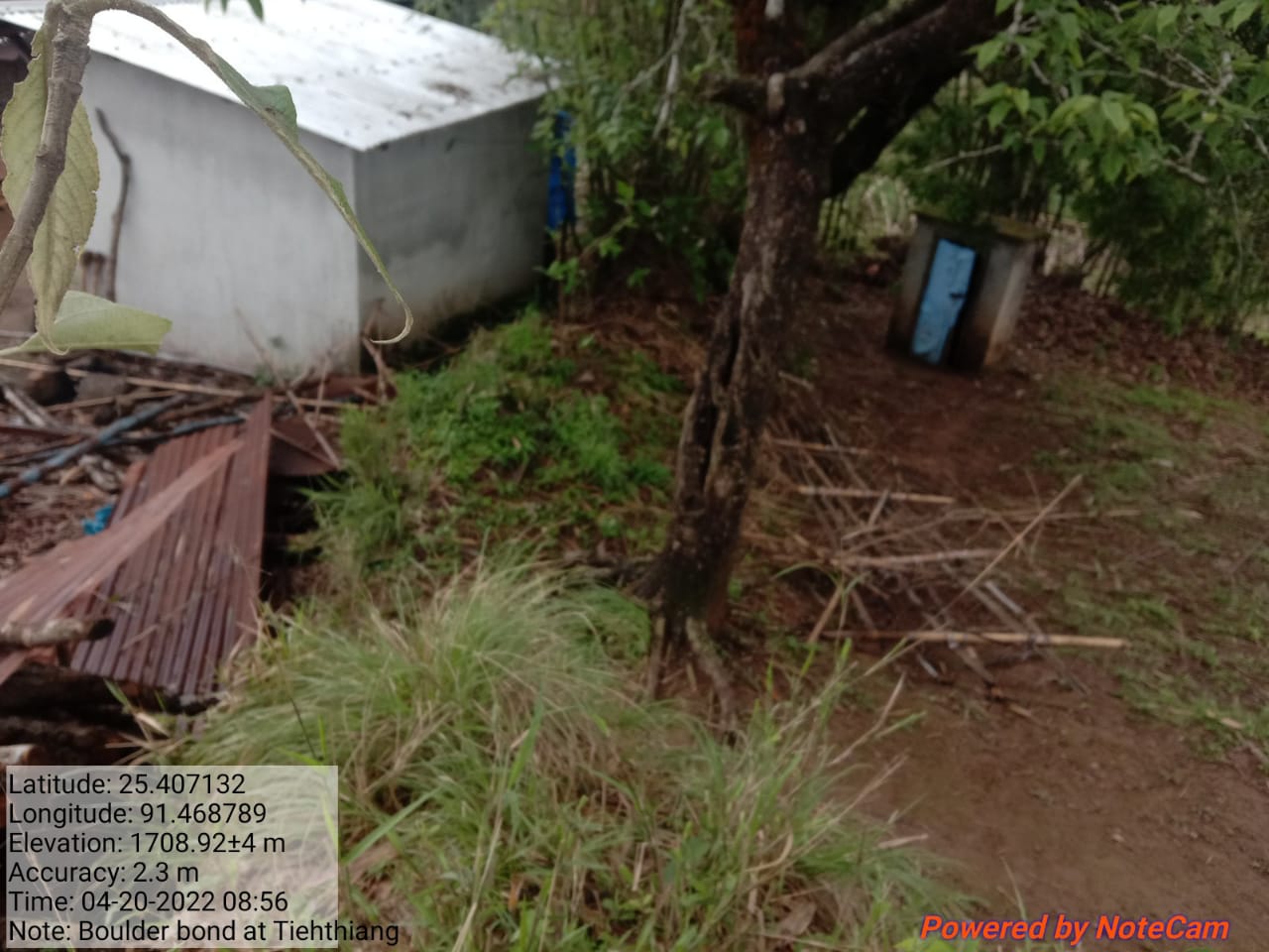
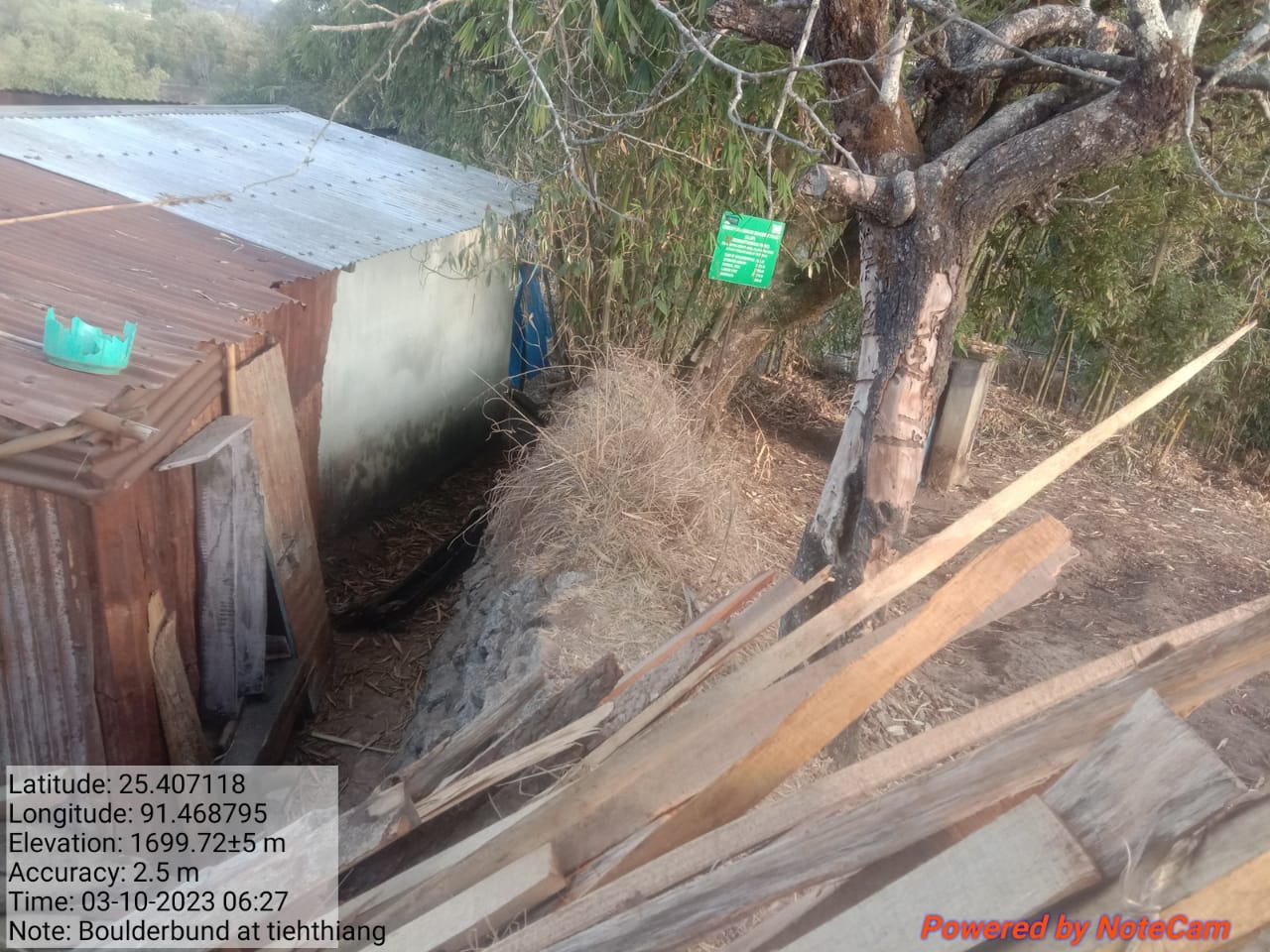
Fig.27: Before, during and after of boulder bund at Tiehthiang.
 Project
Implementation on the additional 5 lakhs:
Project
Implementation on the additional 5 lakhs:
| 28. | Type of Intervention | Site Name | GPS Co-ordinates | Amount Sanctioned | Work Status | |
|---|---|---|---|---|---|---|
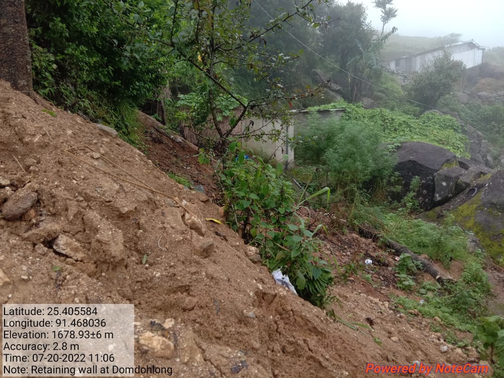
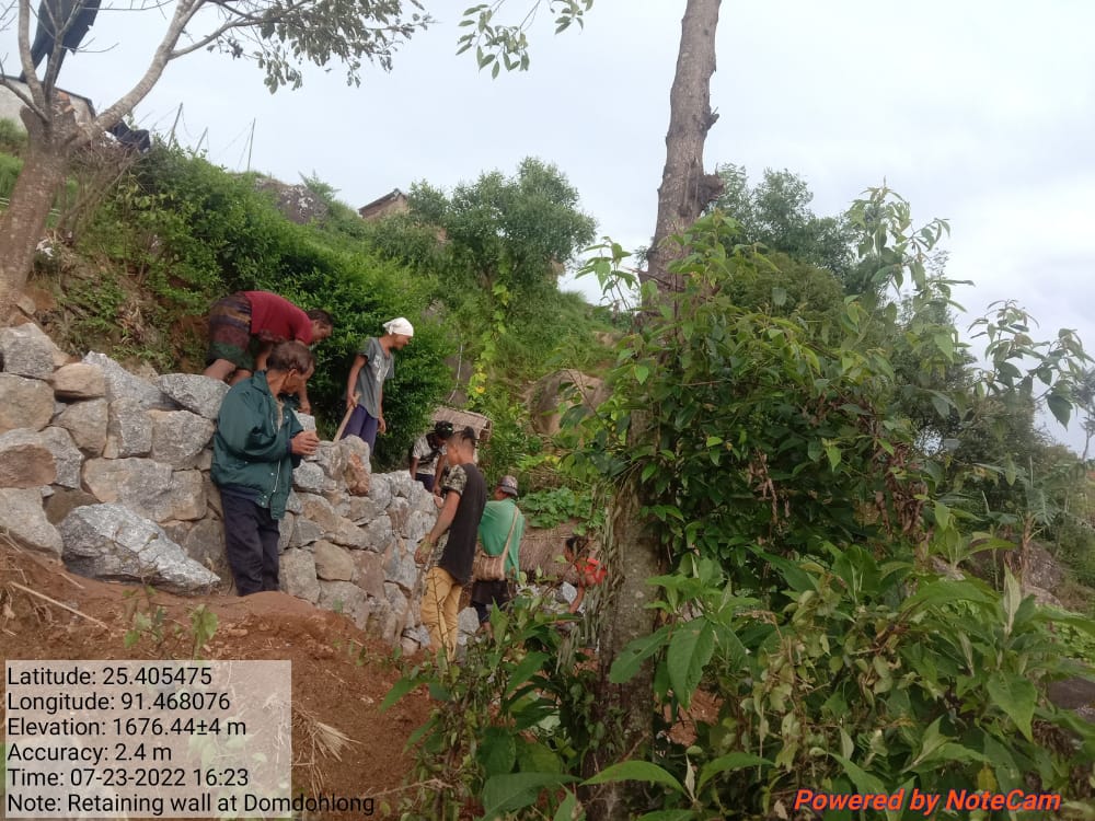
| Retaining Wall at Domdohlong. | Domdohlong. | 25.405584 | 91.468036 | Rs.119300 | Completed | |
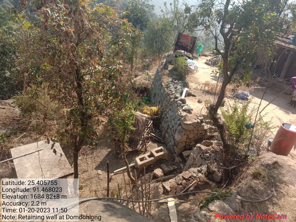
Fig 28: Before, during and after of retaining wall at Domdohlong.
| 29. | Type of Intervention | Site Name | GPS Co-ordinates | Amount Sanctioned | Work Status | |
|---|---|---|---|---|---|---|
| Bench Terrace at Lawriat. | Lawriat. | 25.405848 | 91.468267 | Rs.172300 | Completed | |
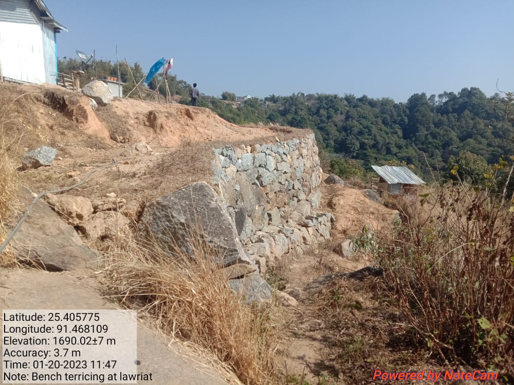
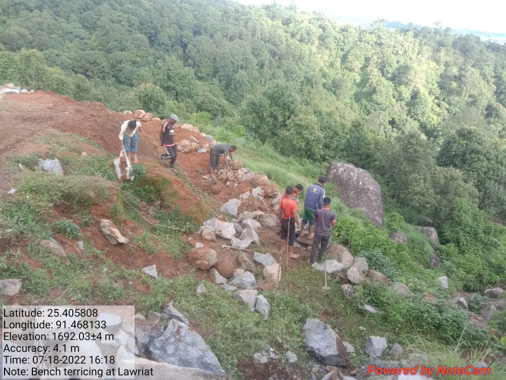
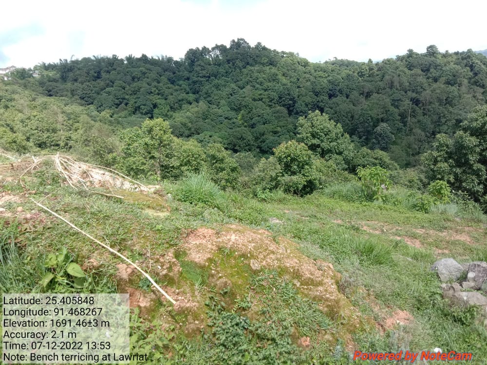
Fig 29: Before, during and after of bench terrace at Lawriat.
| 30. | Type of Intervention | Site Name | GPS Co-ordinates | Amount Sanctioned | Work Status | |
|---|---|---|---|---|---|---|
| Retaining Wall at Domdohlong 2 | Domdohlong 2 | 25.405821 | 91.46812 | Rs.46700 | Completed | |
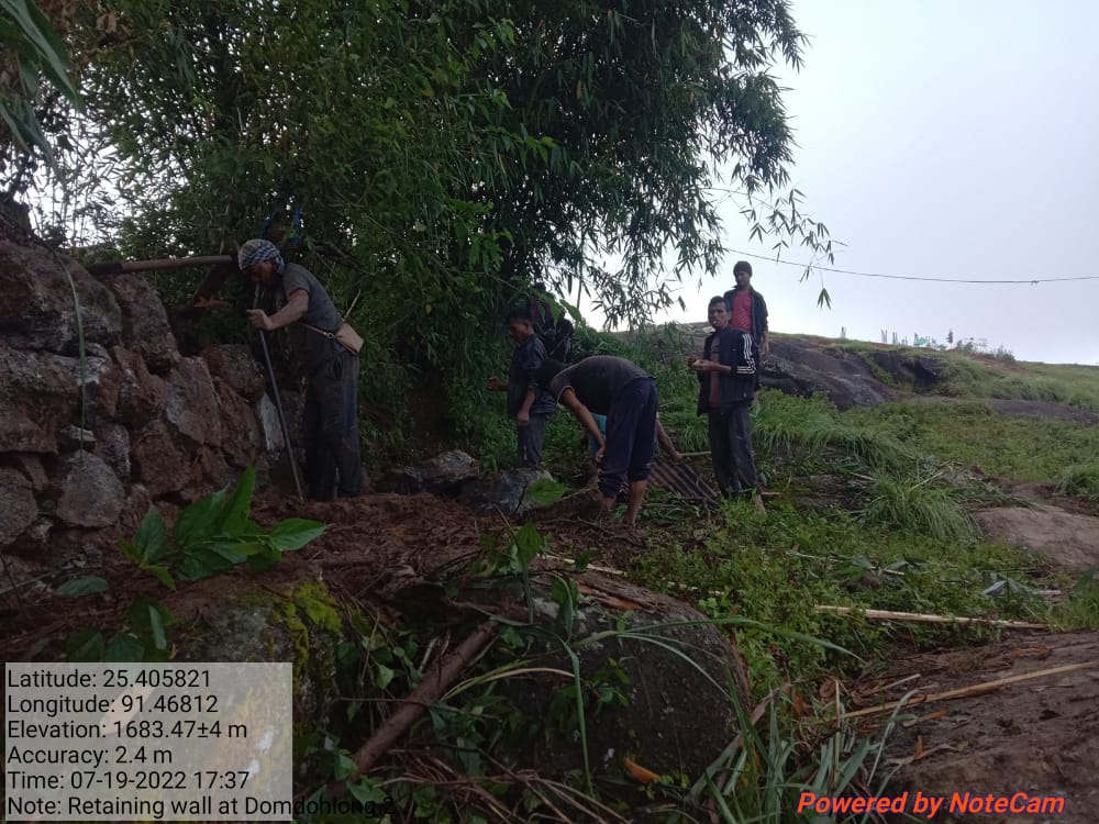
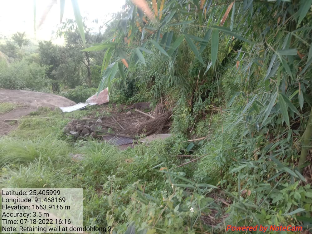
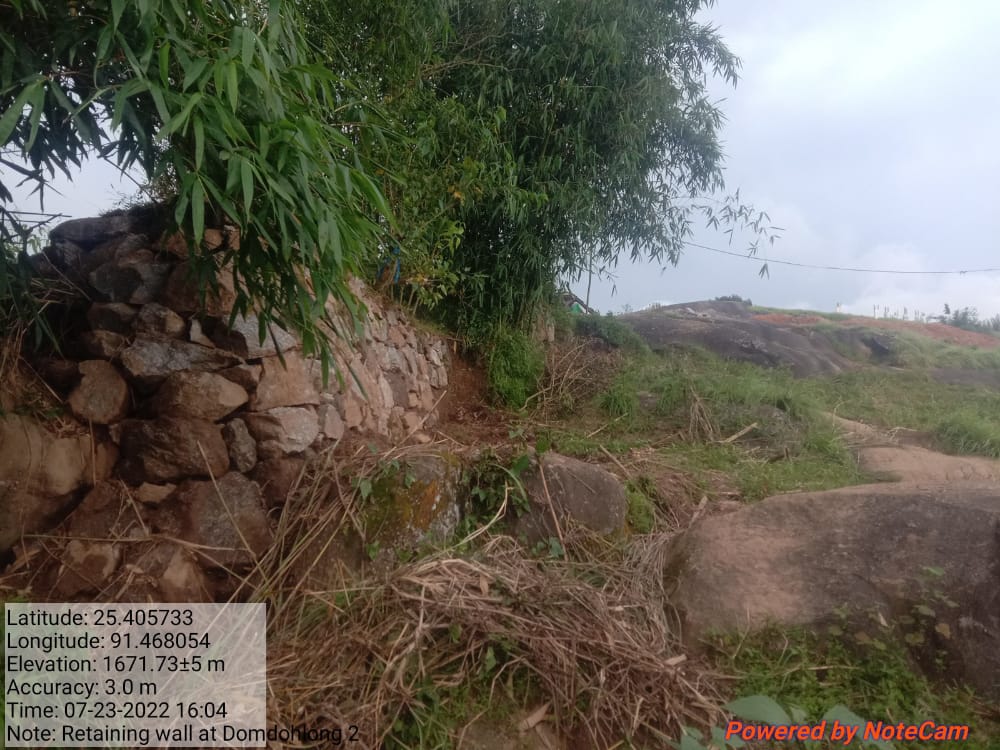
Fig.30: Before, during and after of retaining wall at Domdohlong 2.
| 31 | Type of Intervention | Site Name | GPS Co-ordinates | Amount Sanctioned | Work Status | |
|---|---|---|---|---|---|---|
| Protection wall at Pyndenmawthawiang. | Pyndenmawthawiang. | 25.406838 | 91.469286 | Rs.73200 | Completed | |
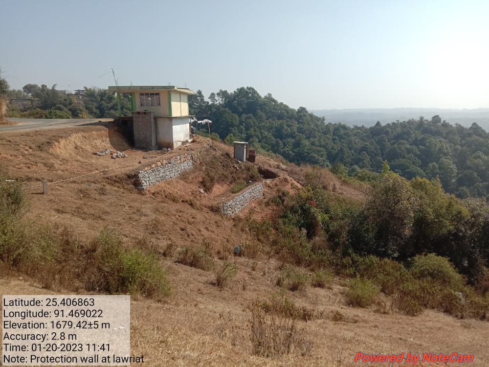

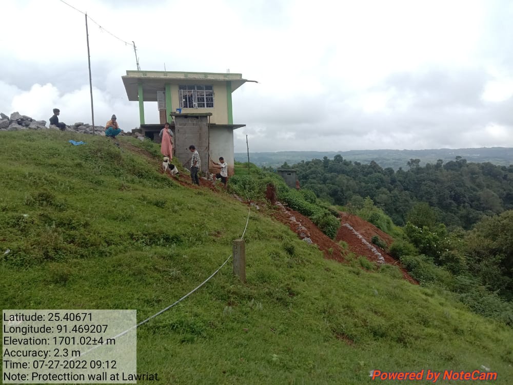
Fig.31: Before, during and after of protection wall at Pyndenmawthawiang.
| 32. | Type of Intervention | Site Name | GPS Co-ordinates | Amount Sanctioned | Work Status | |
|---|---|---|---|---|---|---|
| Spring Chamber at Laitkynja. | Laitkynja | 25.410027 | 91.46924 | Rs.88500 | Completed | |
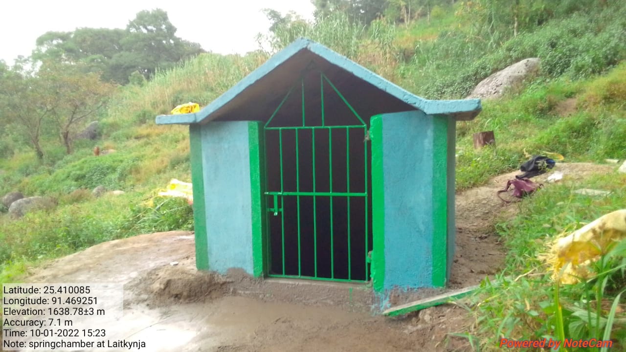
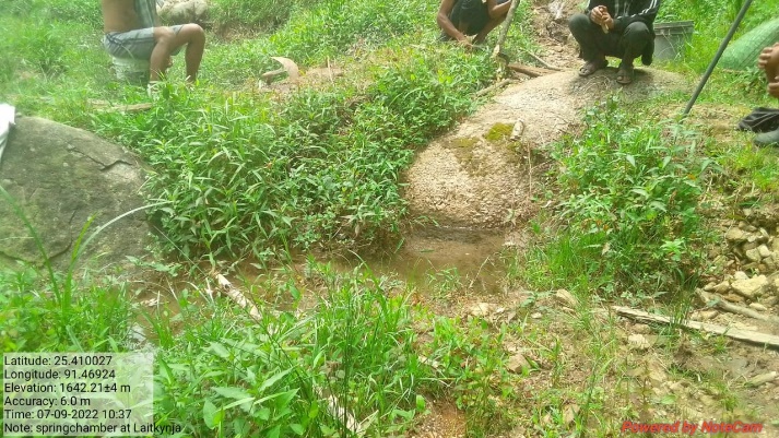

Fig.32: Before, during and after of spring chamber at Laitkynja.
11. Fund Sanctioned:
| Fund Released to VNRMC | Total No. of WO Issued | Activity Name | Amount Sanctioned | Work Order Issued Date | Start Date | End Date |
|---|---|---|---|---|---|---|
| 21,55,000 | 27 | SC & TCA at Laitkynja /Photmaw | Rs.70500 | 05-Jul-2019 | 12-May-2019 | 24-Feb-2020 |
| Community Nursery at Synrangthabulong | Rs.297,280 | 02-Mar-2020 | 01-Jun-2020 | 18-Dec-2021 | ||
Agro-Horticulture at Domdohlong 6422 |
Rs.6,422 | 30-Jun-2021 | 29-Jul-2021 | 11-Aug-2021 | ||
| Afforestation at Domdohlong | Rs.10,397 | 30-Jun-2021 | 20-Jul-2021 | 31-July2021 | ||
| Afforestation at Wahlarew | Rs.27,846 | 30-Jun-2021 | 22-Jul-2021 | 6-Aug-2021 | ||
| Afforestation at Mawdungdung | Rs.47,498 | 30-Jun-2021 | 08-Jul-2021 | 30-July-2021 | ||
| Afforestation at Synrangthabulong | Rs.62,681 | 30-Jun-2021 | 26-Jul-2021 | 28-Aug-2021 | ||
| Agro-Horticulture at Lumniangriang | Rs.6,422 | 30-Jun-2021 | 29-Jul-2021 | 11-Aug-2021 | ||
| Spring Chamber at Jynrew | Rs.71,902 | 22-Oct 2021 | 05-Jan-2022 | 12-Feb-2022 | ||
| Spring Chamber at Perktieh | Rs.67,734 | 22-Oct 2021 | 25-Nov-2021 | 23-Dec-2021 | ||
| Boulder Bund at Tiehphanmon | Rs.62,463 | 15-Nov-2021 | 21-Nov-2021 | 18-Feb-2022 | ||
| Bench Terracing at Domdohlong | Rs.85,404 | 14-Dec-2021 | 31-Jan-2022 | 03-Mar-2022 | ||
| Bench Terracing at Lumniangrang | Rs.178,096 | 14-Dec-2021 | 03-Feb-2022 | 01-Mar-2022 | ||
| Boulder Bund at Lumkper | Rs.18,954 | 02-Feb-2022 | 05-Feb-2022 | 16-Feb-2022 | ||
| Boulder Bund at Mawsyntai | Rs. 93,152 | 02-Feb 2022 | 14-Feb-2022 | 02-March-2022 | ||
| Boulder Bund at Dom-Marwein | Rs.51,217 | 02-Feb-2022 | 07-Feb-2022 | 03-March-2022 | ||
| Boulder Bund at Krempamiet | Rs.70219 | 02-Feb 2022 | 16-Feb-2022 | 08-March-2022 | ||
| Dug Out Pond at Pamtep | Rs.128,551 | 02-Feb-2022 | 15-Feb-2022 | 08-March-2022 | ||
| CC Checkdam at Mawnarang | Rs.219,019 | 02-Feb-2022 | 07-Feb-2022 | 08-March-2022 | ||
| Boulder Bund at Kper Juwan | Rs.36,473 | 10-Mar-2022 | 22-Mar-2022 | 09-Apr-2022 | ||
| Boulder Bund at Wei Koh I | Rs.95,461 | 10-Mar-2022 | 22-Mar-2022 | 29-Apr-2022 | ||
| Boulder Bund at Wahlarew | Rs.186498 | 10-Mar-2022 | 22-Mar-2022 | 26-May-2022 | ||
| Boulder bund at Dom Marwein-2 | Rs.67,565 | 31-Mar-2022 | 12-Apr-2022 | 02-May-2022 | ||
| Boulder bund at Wei-koh- I 2 | Rs.119823 | 31-Mar-2022 | 12-Apr-2022 | 30-Apr-2022 | ||
| Boulder bund at Tiehthiang | Rs.31,631 | 31-Mar-2022 | 12-Apr-2022 | 29-Apr-2022 |
Fund status on the additional 5 Lakhs:
| Fund Released to VNRMC | Total No. of WO Issued | Total amount Issued under CLLMP (Per Activity) | Total Amount Spent | Work Order Issued Date | Start Date | End Date | |
|---|---|---|---|---|---|---|---|
| 500000 | 5 | Retaining Wall at Domdohlong. | Rs.119300 | 31-Mar-2022 | 16-Jun-2022 | 19-Sep-2022 | |
| Bench Terrace at Lawriat. | Rs. 172300 | 31-Mar-2022 | 16-Jun-2022 | 10-Aug-2022 | |||
| Retaining Wall at Domdohlong 2 | Rs.46700 | 31-Mar-2022 | 16-Jun-2022 | 11-Jul-2022 | |||
| Protection wall at Pyndenmawthawiang. | Rs. 73000 | 31-Mar-2022 | 16-Jun-2022 | 07-Sept-2022 | |||
| Spring Chamber at Laitkynja | Rs. 88500 | 31-Mar-2022 | 16-Jun-2022 | 12-Jul-2022 | |||
GROUND TESTIMONIALS:
Banjoplin Marthong
VCF M&E Pyndenmawthawiang VNRMC
According to Ms. Banjoplin Marthong with the coming of CLLMP she has gathered many information and knowledge regarding the filling of the different formats and the responsibility of maintaining the books of records which she updates monthly. Recently, she has been engaged with CLLMP-MIS.