REPORT ON
NONGBREI NONGDOM VILLAGE UNDER MAWKYRWAT C&RD BLOCK
DISTRICT: SOUTH WEST KHASI HILLS
COMMUNITY LED LANDSCAPE MANAGEMENT PROJECT


The Government of Meghalaya with financial help from the World Bank is implementing the Meghalaya Community Led Landscape Management Project (MCLLMP). The project will cover the entire state of Meghalaya and implementation of community led plans will be rolled out in phase manner throughout the state. The Meghalaya Basin Management Agency (MBMA) will facilitate community-led planning by providing support, technical inputs and funding.
The project is intended to strengthen community-led natural resources management in selected landscapes within the 11 districts of the state. This would be achieved through a variety of planning, capacity building, and on-the-ground interventions to promote the conservation, sustainable use of natural resources, social inclusion and community mobilisation; building traditional knowledge and learning, mapping of natural resources management; strengthening the community institutions and creating linkage with financial institutions and community organizations.
The project interventions will include preparation of community led natural resource management plans. The CLLMP has the following three components:
Strengthening Knowledge and Capacity of Communities for Natural Resources Management
Community-Led Landscape Planning and Implementation
Project Management and Governance
The project objective is “to manage and conserve the natural resources, especially forests, soil and water sources, in a manner that supports the financial and physical well-being of communities in the State”
SCOPE:
The CLLM-Programme focuses on increasing the capacities of communities and traditional institutions (TI) by adopting a landscape approach to manage their natural resources such as soil, springs and other water sources, forests and bio-diversity, etc. The project will be planned and implemented in about 400 villages across the state. CLLMP has a strong focus on institution-building at the village-level, by ensuring systematic capacity-building on technical and social skill-sets.
The project will also extend such training to communities beyond the targeted villages and support efforts made by them to access funding from various rural and natural resources initiatives and schemes.The programme will also invest in improving the process and outcome delivery, by developing and adhering to effective systems and procedures, supported by the appropriate technology.
BENEFITS:
Benefits for community (Skills and Capacity relating to technical and managerial areas like NRM and Conflict resolution
Benefits to traditional institutions (village councils, traditional leaders, community-based organizations, SHGs etc) through Knowledge sharing, promotion of innovative approach, access to technology, technical managerial and financial support.
It is estimated that the project will impact around 1 lakh partners (of which 50% are women) who depend on land, forest, agro forestry.
Through the project, 55000 Ha of targeted area will be ensured with availability of water, biological resources and soil productivity, which will in turn benefit around 400 villages and the outcomes delivery can be summarized as follows.
IMPLEMENTATION AGENCY:
The Project will be executed by the MBMA in collaboration with other partners particularly, SIRD (for training and capacity building), Department of Soil and Water Conservation, Water Resource Department, Forest Department, specifically with respect to technical inputs, safeguards management and Community NRM plan preparation.
PROJECT PERIOD:
2018-2023 (5 years)
TABLE OF CONTENTS:
I.Introduction and History……………………………………………….. 1-2
II. Social Profile ………………………………………………………….3
i.Village Accesibility…………………………………….. 3
ii.Literacy rate……………………………………………. 3
iii.Population……………………………………………... 3
iv.Occupation…………………………………………….. 4
v.Village organisation……………………………………. 5
vi. Fuel Type………………………………………………5
vii.Drinking Water………………………………………...5
viiiCultivatible Land………………………………………5
ix.Forest Cover…………………………………………….6
x.Forest Species……………………………………………6
xiWater Bodies…………………………………………….6
xii.Areas affected…………………………………………..6
III.CLLMP Activities
i.Ground-Truthing…………………………………………………..7
ii.Sensitization on CLLMP…………………………………………7
iii.Signing of EOI, VGA and Green Charter………………………..8
iv.Formation of VNRMC…………………………………………...8
v.Village Community Facilitators…………………………………..9
vi.Purchase Committee ……………………………………………...9
IV. Opening of Bank Account …………………………….………………..9-10
V. PRA Exercise…………………………………………………………….10-11
i.Basic Survey for CNRMP template………………………………11
ii. Focussed Group Discussions……………………………………12-13
iii.Village Boundary Mapping and Resource Mapping……………13-14
VI. GIS Activities…………………………………………………………...15-16
VII. The Proposal list of intervention……………………………………….17
VIII. Project Implementation ………………………………………… ……18-33
IX. Fund Status ……………………………………………………………...34-36
X. Ground Testimonials…………………………………………………. 37
INTRODUCTION:
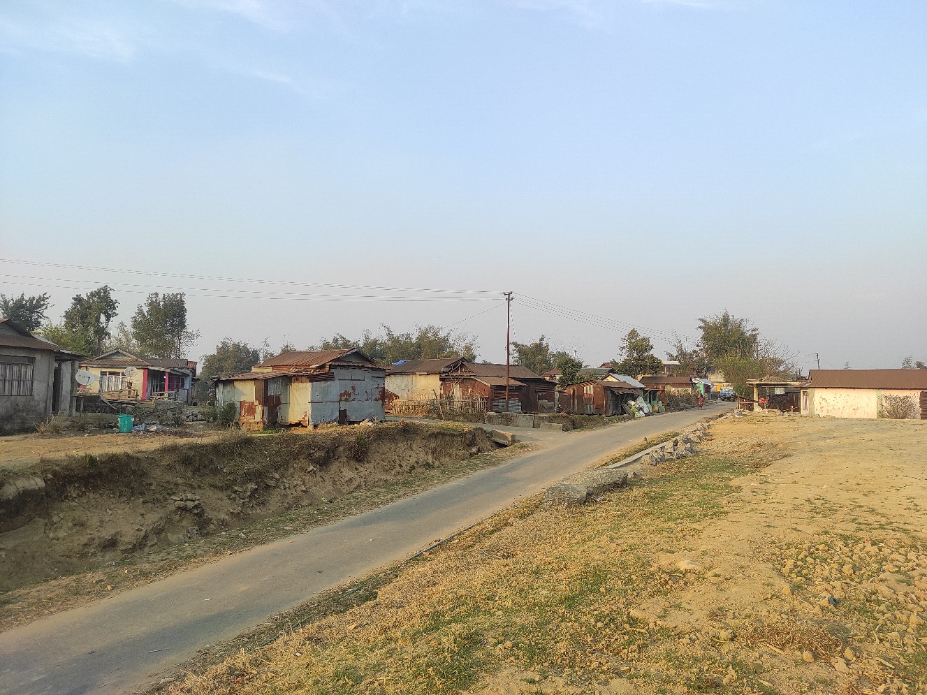
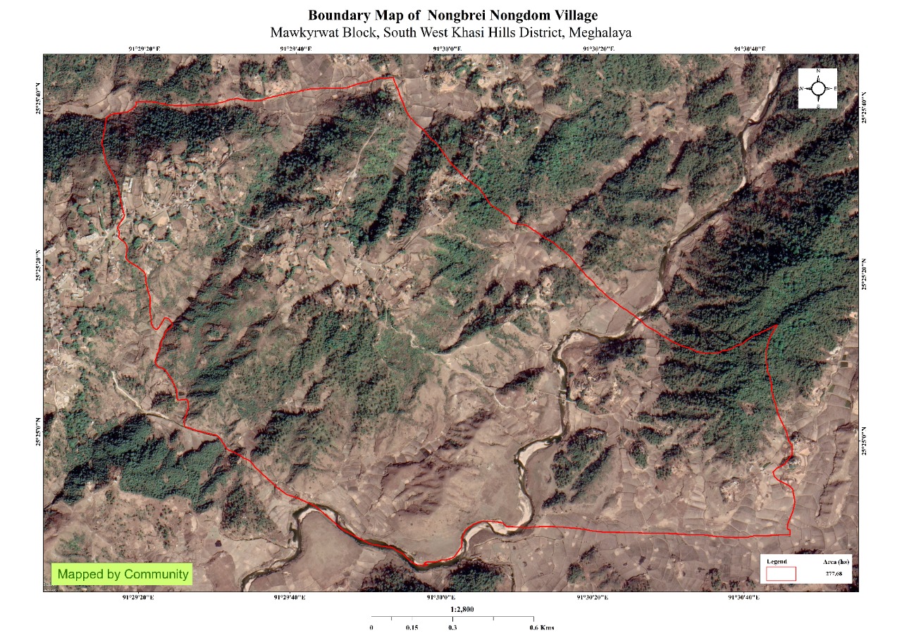
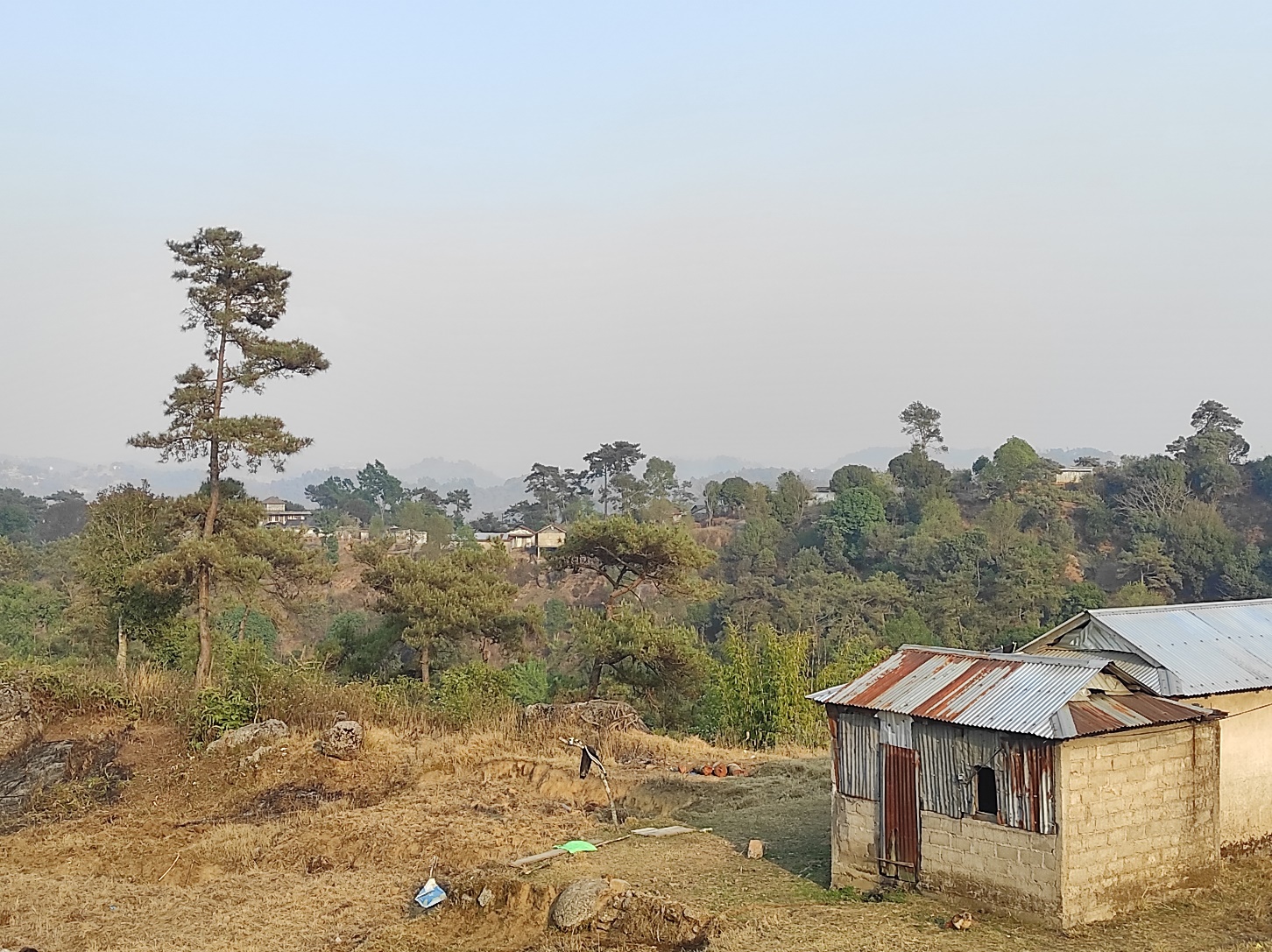
Nongbrei Nongdom village is situated in South West Khasi Hills District under the Mawkyrwat C&RD Block. The village is about 16 Km away from the District Headquarters i.e. Mawkyrwat and about 28 Km away from the Block Headquarters. It has a total geographical area of 277.68 Ha and falls under the Hima Maharam Syiemship. Nongbrei Nongdom village has a total population of 1450 comprising of 719 males and 731 females. All the residents of Nongbrei Nongdom village belonged to the Khasi Scheduled Tribe. The average rainfall of Nongbrei Nongdom village is 1200mm and the type of soil is mainly loamy soil.
BRIEF HISTORY ABOUT THE VILLAGE:
 Nongbrei Nongdom is one
of the villages that falls under the ruler of the Shngimawlein
Headman, Nojin Wanniang. As time passed, the population and
household numbers started to increased and hence it led to the
division from Shngimawlein village to the formation of Nongbrei
Ningdom village under the agreement of the Shngimalein Headman. The
village is surrounded by Jakrem from the North, Mawiang from the
South, Shngimawlei from the East and Sohma from the West. The name
“Nongbrei Nongdom” was given by the local as majority of the people
do farming in their land in which the village name has two meaning,
“brei” means agricultural land and “dom” means “hills and
valley”.
Nongbrei Nongdom is one
of the villages that falls under the ruler of the Shngimawlein
Headman, Nojin Wanniang. As time passed, the population and
household numbers started to increased and hence it led to the
division from Shngimawlein village to the formation of Nongbrei
Ningdom village under the agreement of the Shngimalein Headman. The
village is surrounded by Jakrem from the North, Mawiang from the
South, Shngimawlei from the East and Sohma from the West. The name
“Nongbrei Nongdom” was given by the local as majority of the people
do farming in their land in which the village name has two meaning,
“brei” means agricultural land and “dom” means “hills and
valley”.
Fig. Nongbrei Nongdom village.
VILLAGE SOCIAL PROFILE:
Nongbrei Nongdom village has a total number of 185 households, having a total population of 1450 villagers. People in this village mainly depend on agriculture and its allied activities for their livelihood. There are farmers, labour, teachers and some others are engaged with government services.
Village Accessibility:
In order to reach Nongbrei Nongdom village one must travel through road with local taxis from the Mawkyrwat- Shngimawlein road.
Literacy Rate:
As per 2011 Census, Nongbrei Nongdom has a lower literacy rate compared to the State’s average. The village has a literacy rate of 50.44% while the State’s average stands at 74.4%. The male literacy rate was higher at 52.97% than that of the female literacy rate at 47.73%. In Nongbrei Nongdom, there are a total number of 5 schools out of which 3 are Primary Schools and 2 Secondary Schools.
Population:
As per 2011 Census, the total population of Nongbrei Nongdom village is 620 people and this has seen an increased over the years and now stands at 1450 as of the recent survey. Out of this, 719 are male and the female count is 731.This village has 366 children belonging to the group 0-4 years and 90 people are above the age of 60. About 280 total number of people belong to the age group of 30-60 years, thus this indicates that the majority of the population of villagers comprise of the young and healthy people.
| Age Group | Male | Female | Total |
|---|---|---|---|
| 0-4years | 152 | 214 | 366` |
| 5-14years | 250 | 199 | 449 |
| 15-30years | 130 | 135 | 265 |
| 30-60years | 137 | 143 | 280 |
| Above 60years | 50 | 40 | 90 |
| Total | 719 | 731 | 1450 |
Occupations:
The people of Nongbrei Nongdom village rely mainly on agriculture and forest produce for their livelihood. Out of 185 households within the village, 100 households are farmers, 69 household are labourers, while 10 household are teachers and 6 households are in government services.
V. Organisation within the Village:
There are 4 Self Help Groups (SHGs) under NRLM in Nongbrei Nongdom village under one Village Organisation. There are also 6 VEC & traditional institution within the village.
VI. Fuel Type:
The people of Nongbrei Nongdom village mainly uses wood as a fuel. About 182 households depend on wood gathered from the forest for their daily requirement.
| Type of Fuel | Total No of HH | Qty (Kgs/HH) | Total |
|---|---|---|---|
| Wood | 182 | 12000kg 3Stacks per year |
21,84,000kg |
| Charcoal | 5 | 10000kg | 50,000kg |
| LPG | 3 | 76300kg 7cylinder per year |
18,900kg |
VII. Drinking Water:
The people of Nongbrei Nongdom have access to drinking water mainly from the springs within the village. But over the years there has been a scarcity of water supply in this village due to less water discharge from the springs source and due to the increase in human population and their daily requirements. There are 17 springs within the village which are perennial that people use for drinking viz Phot lyngkhei, Jynrew, Rembahsi, Sangtarap, Mawsain, Nongbrei, Photnah, Pyrjet, Tenkur, Mawphan, Sngeibuteng, Photpabi, Mawrembah, Twahdiliein, Pamnonglait, Phottangkulir and Photbuaid.
VIII. Cultivable Land Cover:
The total agricultural area of Nongbrei Nongdom village is 62.14ha. The type of soil is Loamy soil. People practise bun cultivation and shifting cultivation in their own private lands. The main crops of the village are Paddy, Maize, Potato, Ginger, turmeric, pumpkin, Yams, Chayote, Brinjal, Carrot, Beans, Sohngang, Coriander. They also plant Blackberry, Bayberry, Plum, Peach, Kiwi, Crab apple, Pomelo and also Broomstick as a cash crop.
IX. Forest Cover:
The total forest cover under Nongbrei Nongdom village is 47.41ha. Most of the forest cover are on private land and the quality of the forest is moderate. People uses the forest products mainly for fuelwood, timber as medicines, aromatic plants and for other purposes. There is only one clan forest belong to Kharjahrin clan at Mawjuh. Some of the forest that falls on the private land within the village are Pamnonglait, Demmyrsing, Jabar, Mawjuh, Thangpari, Tylla, and Kdait. There are some plant species used by the people of the community for medicinal purposes Like Diengsohphie, Diengsohjyrme, Diengsohryngkham, Diengsohsatsat, Sohstab, Jamyrdoh, Jatira, Jale, Jalem, Battdongsohkhai. The forest is home to many vulnerable fauna like Monkeys, Tiger, Bear, Bird, Peacock, and commercially valuable trees like Pine, Diengsning, Diengliein and Diengrai.
XI. Water Bodies:
Total area of water bodies in Nongbrei Nongdom is 4.66ha. There are about 17 springs within the village which have been mentioned above which people use mainly for drinking purpose. There are eight streams within the village are Rngibaiang, Wahjynrew, Dilingiem, Mawphan, Pamnonglait, Wahpynud, Laitsynker and Thangpari which are all perennial and are mainly use for washing, irrigation and fisheries and only two rivers within the geographical area named Wahrilang and Wahsohsyniang.
XII. Areas Affected:
Approximately about 23.13ha of forest land have been degraded over the years due to soil erosion, forest fires, excessive felling of trees which have led to the loss of productivity of the land and the loss of the saplings and other natural resources About 3.5 ha of cultivable land have been affected by the excessive use of fertilizers and 11.1 ha of land have been degraded over the years owing to human settlement and culturable wastelands.
CLLMP ACTIVITIES:
1.Ground Truthing: The CLLMP officials met with Mr. Jwir Wahlang, headman of Nongbrei Nongdom village, Mr. Sdiland Wahlang, the village Secretary and other village representatives for field assessment. Mr.J. Wahlang provided the CLLMP Team with important information regarding the current scenario of the landscape and the natural resource management under his headmanship.
Case Findings:
i)Most of the household falls under the BPL category.
ii)They have an actively performing VEC in the village.
iii)The land within the village falls under the Hima Maharam Syiemship.
iv)The source of water supply in the village is from two sources: private and public.
v)There are a few patches of degraded land that has been left unused.
vi)There is a loss of Natural Vegetation in the area.
vii)Abundance of small streams within the village.
viii)Forest on hill slopes are prone to forest fires.
ix)Some of the Paddy fields in the area are without proper irrigation.
2. Sensitization Programme:
The District Project Manager Mr.J.Wanniang along with the staff held a village Level Sensitization Programme on the Community Led Landscape Management Project (CLLMP) on the 8th November 2019.The villagers actively participated in the program, voicing out their concerns and questions regarding the project making it a huge success.
Highlights of the meeting:
Awareness about the Community Led Landscape Management Project (CLLMP).
Laying the importance on the involvement of the community in making the CNRM plan and its success.
A brief awareness on cleanliness was conducted based on our finding during the ground truthing phase.
An interactive session was held to answer doubts of the villagers regarding the project.
3. Signing of EOI, VGA and Green Charter:
On 26th March 2020, Nongbrei Nongdom village signed the EOI (Expression of Interest), VGA (Village Grant Agreement) and the Green Charter after there was a uniform agreement by the people of the entire Community that the Community Led Landscape Management Project (CLLMP) be implemented at Nongbrei Nongdom Village.
4. Formation of the VNRMC:
The formation of the Village Natural Resources Management Committee was done in a public meeting on the 8th November 2019 in the presence of the entire village and the CLLMP Staff. The people of the community chose the President, The Secretary, the Purchase Committee members and the other Executive members to formed the Nongbrei Nongdom VNRMC. There are 9 Executive members, 3 Village community Facilitator and 3 Purchase Committee members.
List below are the members of the VNRMC:
| Sl No | Name in Full | Gender M/F | Age (in Yrs) | Education | Designation | Occupation | Community | Contact No and email address |
|---|---|---|---|---|---|---|---|---|
| 1 | Ningland Mawlong | M | 37 | X | President | Farmer | Khasi | 8787809682 |
| 2 | Risha L. Nonglait | F | 25 | IX | Secretary | Farmer | Khasi | 6009290190 |
| 3 | Kning Sohphoh | M | 52 | IV | Assistant President | Farmer | Khasi | Na |
| 4 | Bina Wanniang | M | 46 | V | Member | Farmer | Khasi | Na |
| 5 | Jius Wanniang | F | 45 | XII | Finance Sec | Chowkidar | Khasi | 9615738376 |
| 6 | Drasing Wahlang | M | 33 | VI | Member | Farmer | Khasi | 6009645322 |
| 7 | Jun Wanniang | F | 30 | VII | Member | Farmer | Khasi | NA |
| 8 | Aiti L.Nonglait | F | 35 | III | Member | Farmer | Khasi | 6009645320 |
| 9 | Krobina Nongrem | F | 52 | IV | Member | Farmer | Khasi | NA |
| Village Community Facilitators (VCF) | ||||||
|---|---|---|---|---|---|---|
| Sl no. | Name | Age | Gender | Qualifiaction | Contact Number | Role |
| 1. | Jikoland Wahlang | 27 | Male | X | 7005013010 | EVT and GIS |
| 2. | Teiborlang Wahlang | 28 | Male | XII | 6009752310 | Social &KM |
| 3. | Lambokstar Wahlang | 23 | Male | X | 690119045 | M&E and project Management |
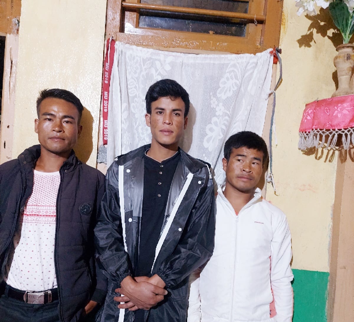
Fig: VCF of Nongbrei Nongdom VNRMC
| Procurement Members | |||||
|---|---|---|---|---|---|
| Sl no. | Name | Age | Gender | Qualification | Contact Number |
| 1. | Listamery Sohphoh | 24 | Female | XII | 7630072647 |
| 2. | Sarabiya Wahlang | 33 | Female | B.A. | NA |
| 3. | Aiborlang Sohphoh | 27 | Male | B.A. | 9101985466 |
Opening of Bank Account:
The opening of the bank account was done after the signing of the EOI (Expression of Interest), the VGA (Village Grant Agreement) and the signing of the Green Charter. The Accountant of CLLMP South West Khasi Hills trained the Purchasing and Procurement Committee of Nongbrei Nongdom village on matters relating to Accounts and Book Keeping and on the:
Principles of Community Procurement
Benefits of Community Procurement
Important aspects undertaken by Community Procurement.
Procurement Process/Steps
Function of Purchase Committee
Important Procurement records to be maintained
Financial limits and methods
Maintaining of Books of Accounts to the Book Keeper.
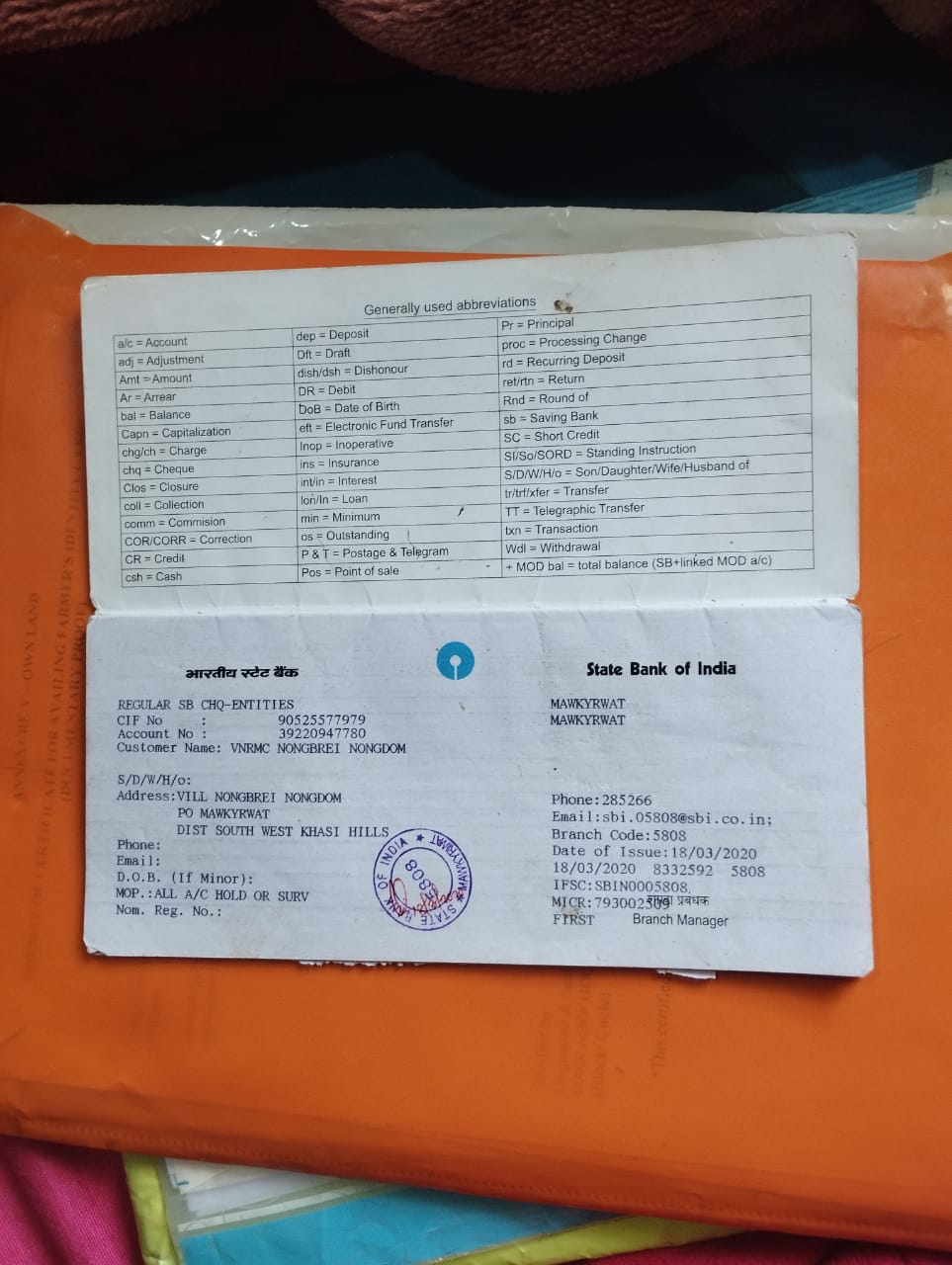
Fig:Bank details of Nongbrei Nongdom VNRMC.
6. Participatory Rural Appraisal Exercise:
The PRA exercise aims to incorporate the knowledge and opinions of the community in the planning and management of development projects and programmes.
The PRA exercise took place on the 8th November 2019 and around 18 villagers both men and women attended the program.
The District Project Manager gave the introduction and spoke about the different activities that the participants had to take part in the programme.
The Program Associate, Environment Management, spoke about the different CNRM plans and the different types of intervention. A group of participants interacted and helped in the collection of data based on the environmental template. With the help of this group, different sites of interventions had identified, analysed and evaluated in order to prioritized the areas that needed the natural resources management.
The Assistant Manager, Social Management, gathered the remaining group of participants to gather the baseline data bases on the social template.
The main objectives of PRA exercise are:
To identify the natural, human and economic resources of the village.
To identify the village problems and prioritized them with the help of the community members.
To prepare the community natural resources management plan of the village.
Findings based on the information gathered from the participants during the PRA/CNRMP exercise:
The main agricultural produce is Paddy, Maize and Potato.
Most of the household depend on firewood as a source of fuel.
Drinking water is limited over a period of 3-4 months during the winter season.
There are two types of forest ownership: Community and Private.
There are two Community Forest.
The springs which are present in the village needs rejuvenation.
Training on Land productivity, Spring shed management and Community nursery is necessary for the village community.
There are no disputes/constraints encountered within the village community or with any neighbouring villages.
Priorities Intervention required based on the PRA Exercise:
Rejuvenation of the Springs within the community through activities such as afforestation, treatment of catchment areas and contour trenches.
Afforestation, Bio-fencing and fire line control in the community forest.
Community Nursery for endemic trees.
A dugout pond for collecting rain water for.
Check dams for erosion control.
Afforestation and Roadside plantation.
Culturable wastelands to be brought under horticulture.
Baseline Data Survey to fill the Environment and Social Template:
During the PRA Exercise the External Expert of Social & Environment Management held a group discussion with the different groups to gather basic village information regarding number of households, demographic information, major crops and enterprises taken in the village, trends of production and productivity of major crops in the village and demographic distribution of village population.
Information related to land use category such as forest, cultivable land, water bodies, etc and the problems and challenges related to NRM were discussed.
Focussed Group Discussion on Problem Analysis:
Do people have sufficient access to supply of fodder, fuel wood, leaf litter?
No, people in the village have insufficient access to supply of fodder, fuel wood, leaf litter. They get it from the community forest, their own private lands/forest and from outside the village.
Has access to timber improved or reduced over the years? How is access for household use and commercial use managed?
Access to Timber has reduced over the years. People have to purchase it from neighbouring village when needed.
Are the water bodies facing any threats?
Yes, the water bodies within the village have faced many threats like deforestation, landscape changes and climatic change.
Do all people in the village have access to drinking water? What are the challenges?
Yes, there is sufficient drinking water in the village except during the winter season due to less discharge of water from the spring source.
Are there degraded areas in the village (open/ degraded forests, mining affected, high soil erosion etc.)?
There are some minor degradations in cultivated land.
What has caused this degradation? Are there practices causing threats to availability and access to natural resources?
Fertility of the soil has decline over the year.
The practices that cause threat to the availability of these resources are:
Fires that takes place every year
Excessive practice of Jhum Cultivation
What have been the changes in agricultural practices?
There has been a declined in the practice of agriculture mainly due to the lack of control of pest and diseases.
Are there any challenges in farming?
The main challenges faced by the people of Nongbrei Nongdom village is that over the years they have seen a decline in agriculture practice due to lack of control of pest and diseases, lack of treatment of seedings and scarcity of water.
How would you consider the health situation in your village?
The nearest health care is in the district headquarter with a distance of 16 Km away and is easily accessible for the community as a whole to commute to the health centre.
How is the situation of cleanliness, sanitation, access to toilets and waste management?
Sufficient toilets are available in every household but most of the constructions are poor.
Who are the most vulnerable in the village? What can be done to improve their lives?
BPL and Orphanage Families. Inclusion of the poor and needy family members during project implementation.
What are the livelihood aspirations of the youth? Are there any avenues available?
None, except daily wages labourers.
Do any committees/ institutions/ rules exist to manage and monitor natural resources in the village?
Apart from village committee and the VNRMC under the CLLMP is the main committee that is now in place to manage the natural resources in the village.
What are some of the major issues of conflict in the village?
Nothing related to NRM.
Have any of the above issues been discussed in village meetings?
NA
How do people resolve disagreements and conflicts?
All disagreements and conflicts are addressed by the traditional institution of village called the Village Durbar.
7.Village Boundary Mapping and Recourse Mapping:
The GIS personnel along with the Village Community Facilitators mapped the village boundary of Nongbrei Nongdom Village.
The village resource map is prepared by the people of the community. In this resource map, the local people prepare it by drawing it on chart paper. Recourses such as settlement areas, rivers, spring, forest, grassland, cultural wasteland, agricultural land and barren land were mapped.
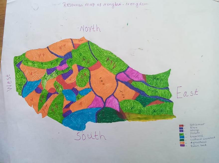
Fig:Resource map of Nongbrei Nongdom village.
Findings Based on the Resource Map of Nongbrei Nongdom Village:
Main agriculture produce is Maize, Potato, Sweet potato and Paddy.
Two types of Forest ownership: Community and Private Owned.
i). Clan forest (Kharjahrin).
ii). Numerous Private Forest.
There are culturable private wasteland - Pamnonglait, Tylla and Mawphan.
There are two rivers present: Wahrilang and Wahsohsyniang.
There are 8 streams flowing in the Village.
There is 1 Community Hall in the village.
There are 3 Football playgrounds.
Presence of 2 Integrated Child Development Services (ICDS) through Anganwadi Centre (AWC).
There are 5 Schools within Nongbrei Nongdom village.
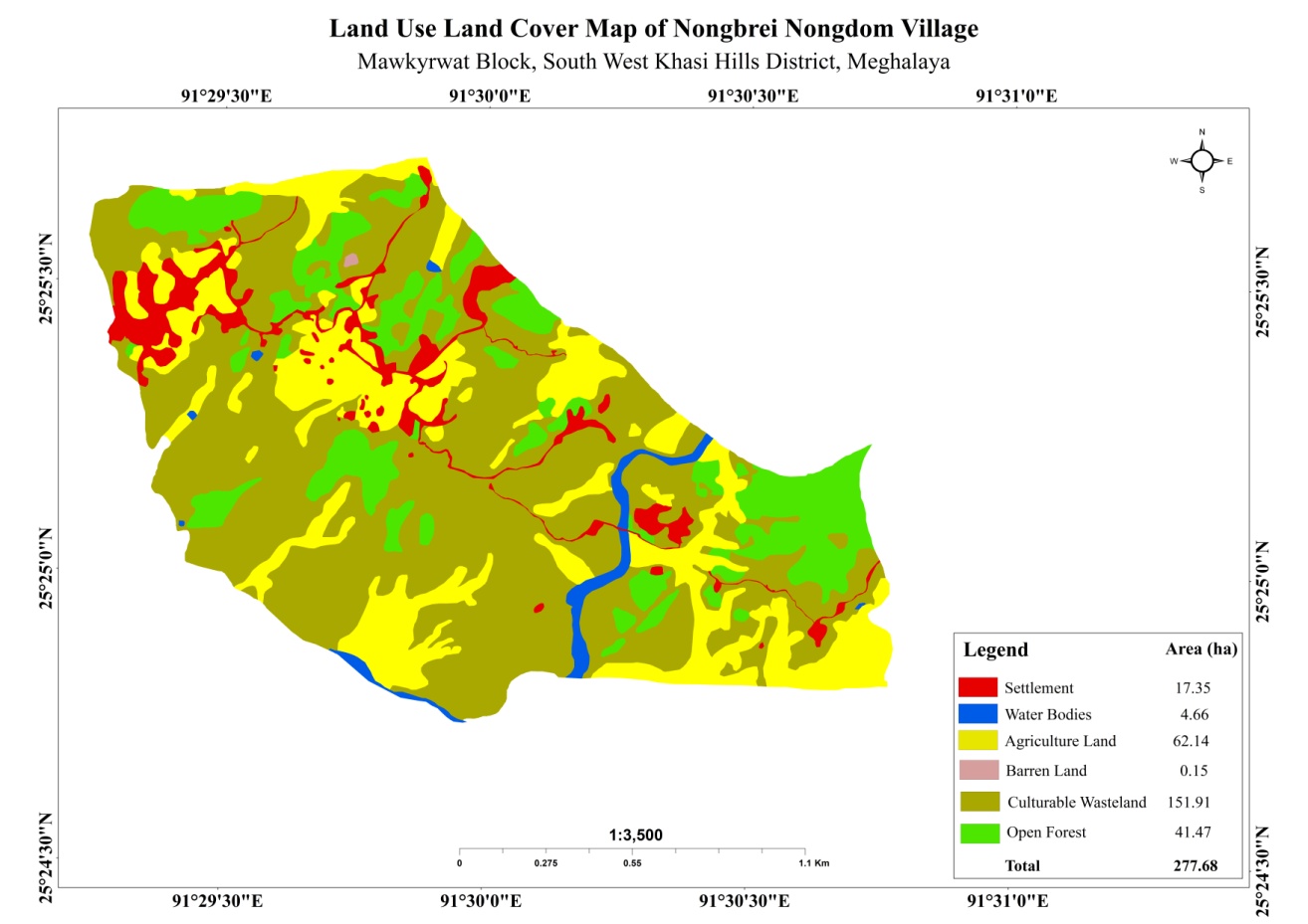
GIS Activities:
| Sl. No. | Parameters | Village Information |
|---|---|---|
| 1 | GPS Coordinates: | |
| I | Latitude | 25.423551 |
| ii | Longitude | 91.495526 |
| iii | Elevation Reading (MSL) | 1655 |
| 2 | Village Geographical Area (Ha) | 277.68 |
| i | Total Forest Area (including community, Clan, Pvt Forest) | 41.47 |
| ii | Total Area of Water Bodies | 4.66 |
| iii | Total Area under Agri-Horticulture | 62.14 (agricultural only) |
| iv | Total Degraded land area (Ha) | 37.73 Ha |
| 3 | Average Annual Rainfall | 12000mm |
| 4 | Soil Type | Loamy soil |
.
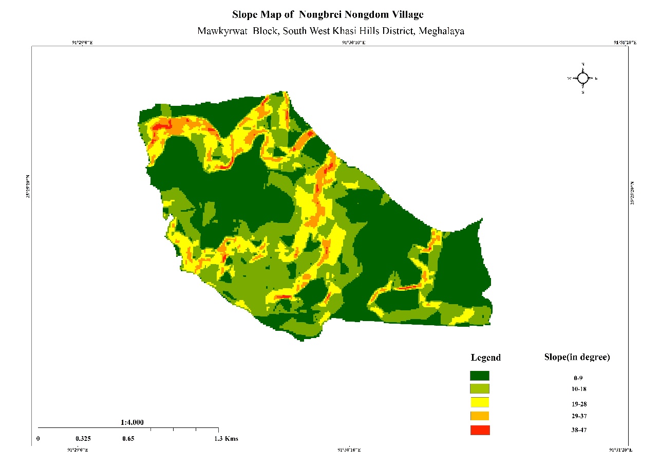
Fig. Boundary map, LULC map and Slope map of Nongbrei Nongdom.
|
Name of Proposed Interventions | Site |
|
Nos of HHs expected to Benefit | Priority (High/ Medium/ Low) |
|---|---|---|---|---|---|
|
|||||
| 1. | SC & TCA | Pamnonglait |
|
|
|
| 2. | SC & TCA | Photnah | Private |
|
High |
| 3. | Check Dam | Sohsyniang | Private |
|
High |
| 4. | Afforestation | Mawjuh | Private |
|
High |
| 5. | Community Nursery | Pamnonglait | Private |
|
High |
| 6. | Improvement of Existing Degraded Forest | Pamnonglait | Private |
|
High |
| 7. | Improvement of Existing Degraded Forest | Tylla | Private |
|
High |
| 8. | Improvement of Existing Degraded Forest | Dem Myrsiang | Private |
|
High |
| 9. | Terrace Farming | Dem-Myrsiang | Private |
|
High |
| 10. | Terrace Farming | Mawkhan | Private |
|
High |
| 11. | Cement Concrete Weir Cum Boulder Bund | Mawkhan | Private |
|
High |
| 12. | Boulder Bund | Pian | Private |
|
High |
| 13. | Boulder Bund | Sohkhynphur | Private |
|
High |
| 14. | Spring Chamber | Jynrew | Private |
|
High |
| 15. | Water Harvesting Tank | Tylla | Private |
|
|
10. Project Implementation:
| 1. | Type of Intervention | Site Name | GPS Co-ordinates | Amount Sanctioned | Work Status | |
|---|---|---|---|---|---|---|
| SC & TCA at Pamnonglait | Pamnonglait | 25. 422276 | 91.499893 | Rs.69,050 | Completed | |
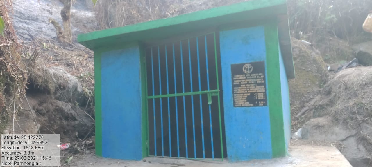
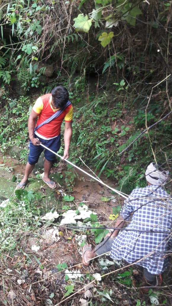
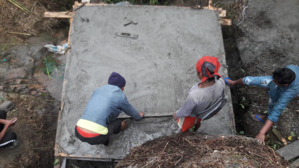
Fig.1: Before, during and after of Pamnonglait SC.
| 2. | Type of Intervention | Site Name | GPS Co-Ordinates | Amount Sanctioned | Work Status | |
|---|---|---|---|---|---|---|
| SC & TCA at Photnah | Photnah | 25.424401 | 91.492185 | Rs.90,000 | Completed | |
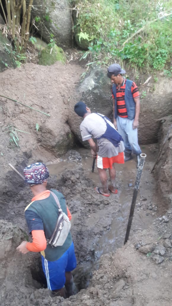
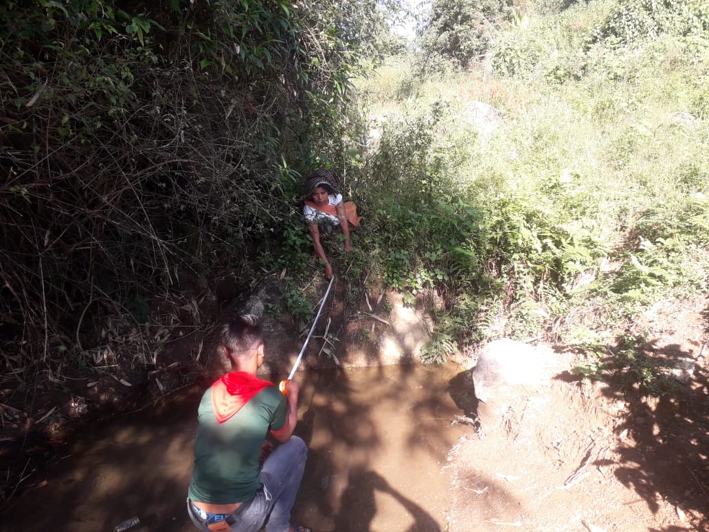
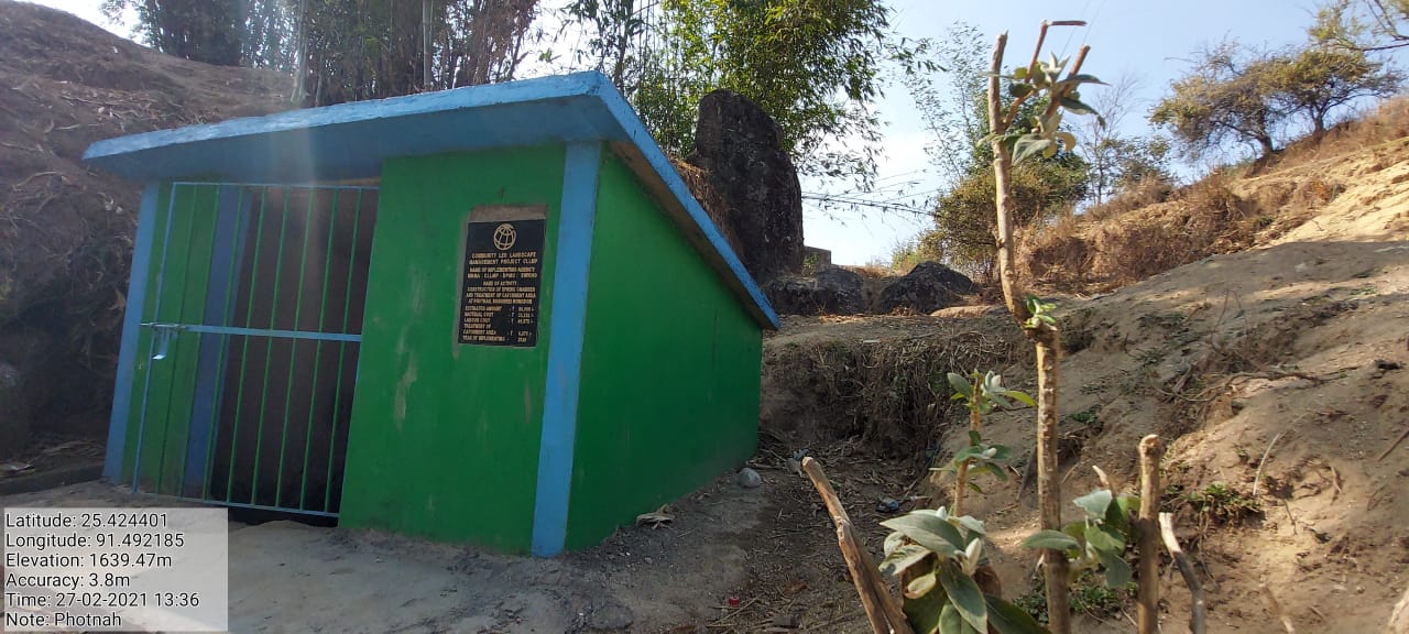
Fig.2: Before, during and after of Photnah SC.
| 3. | Type of Intervention | Site Name | GPS Co-ordinates | Amount Sanctioned | Work Status | |
|---|---|---|---|---|---|---|
| Construction of a Check Dam at Sohsyniang,Nongbrei Nongdom | Sohsyniang | 25.430828 | 91.488245 | Rs.4,99,200 | Completed | |
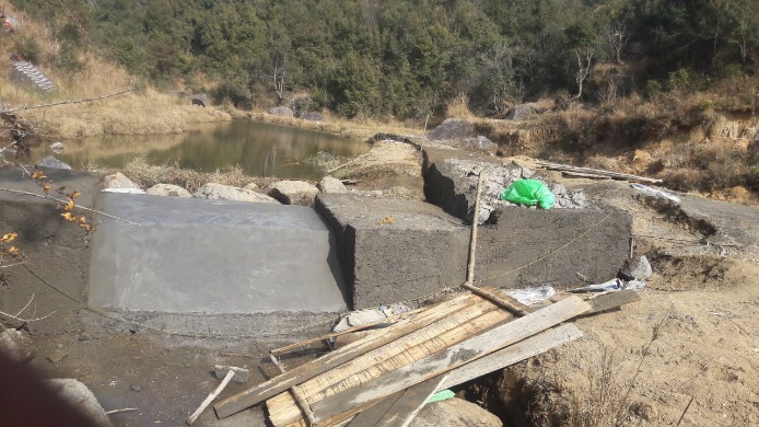
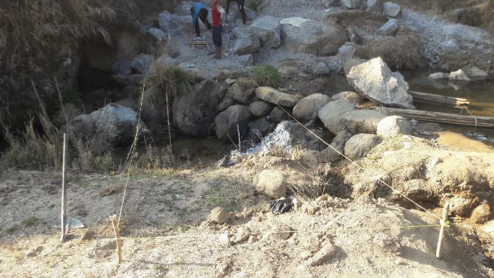
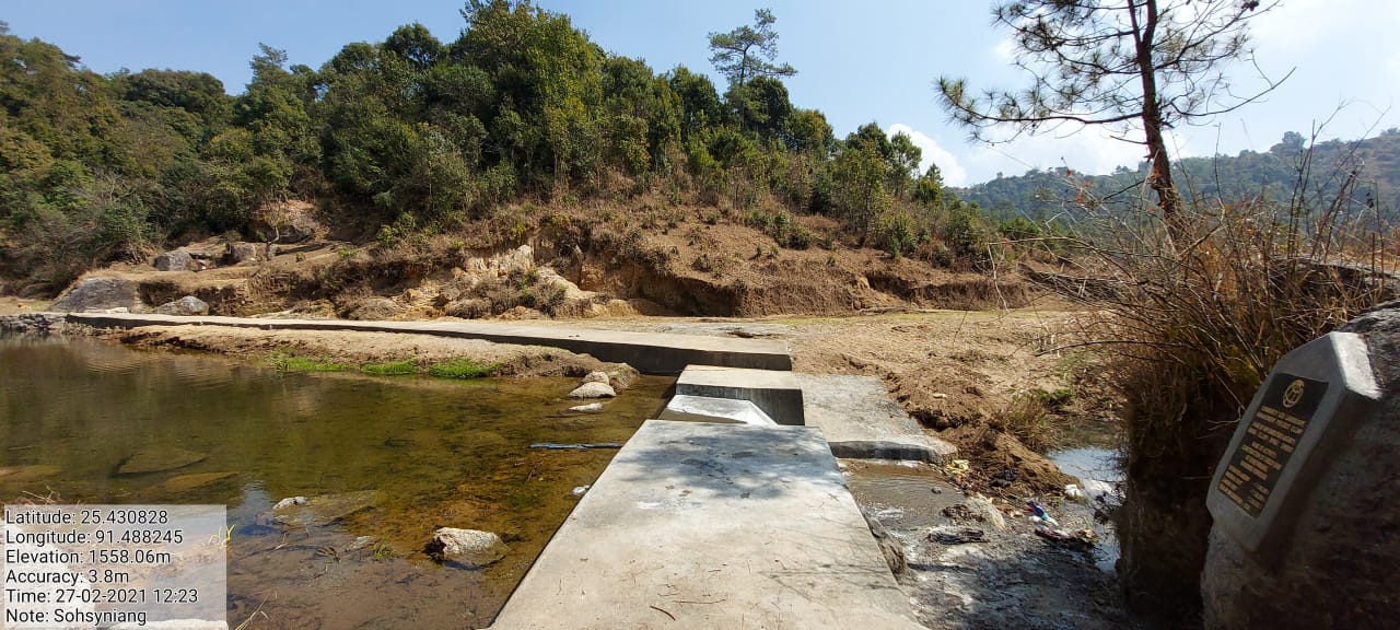
Fig.3: Before, during and after of Construction of a Check Dam at Sohsyniang.
| 4. | Type of Intervention | Site Name | GPS Co-ordinates | Amount Sanctioned | Work Status | |
|---|---|---|---|---|---|---|
| Afforestation at Mawjuh | Mawjuh | 25. 418306 | 91.49958 | Rs.91,011 | Ongoing | |
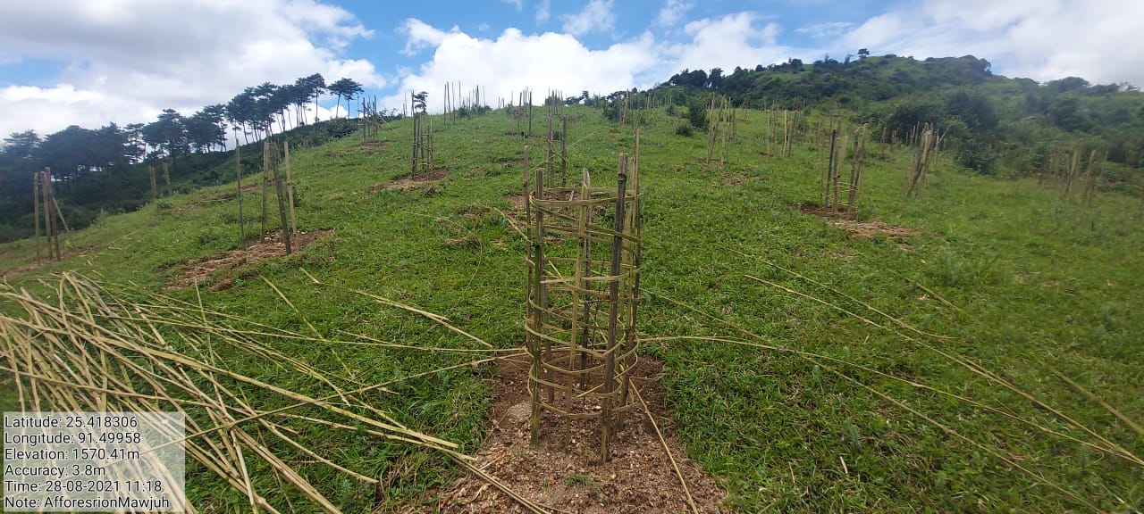
Fig.4: Before, during and after of Afforestation at Mawjuh.
| 5. | Type of Intervention | Site Name | GPS Co-ordinates | Amount Sanctioned | Work Status | |
|---|---|---|---|---|---|---|
| Community Nursery at Pamnonglait | Pamnonglait | 25. 422357 | 91.499229 | Rs.1,30,704 | Completed | |
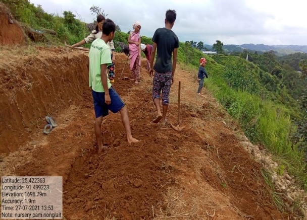
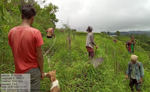
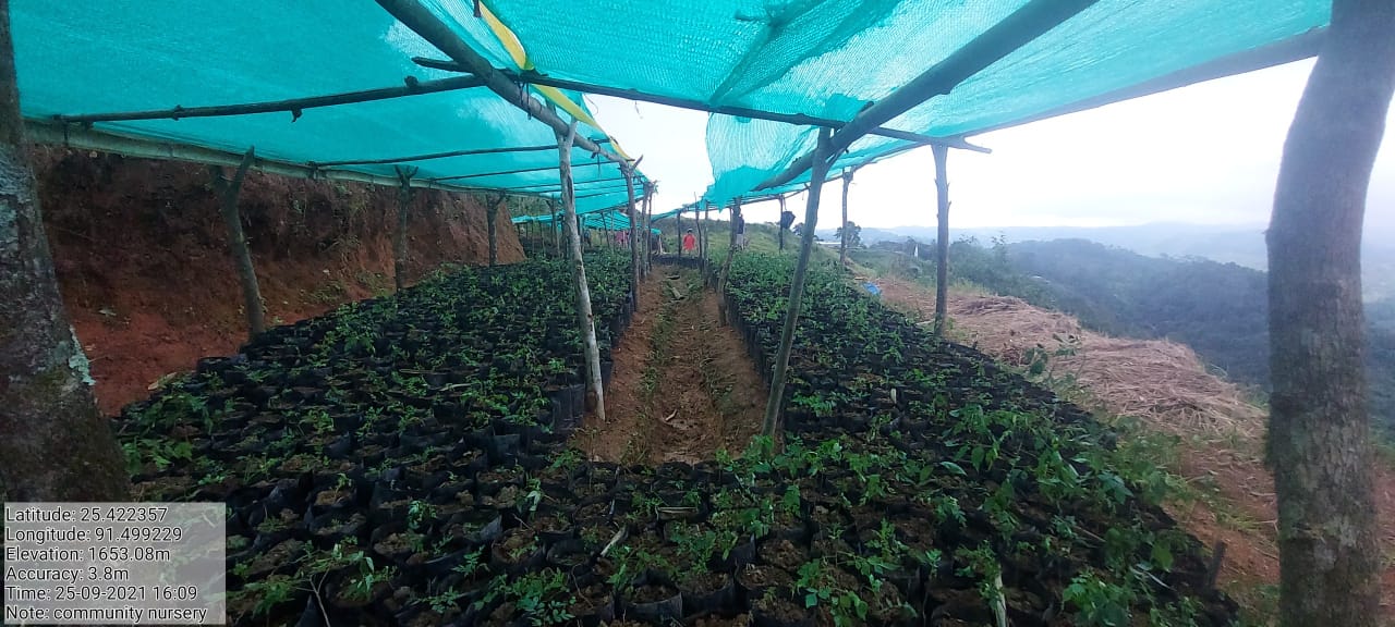
Fig.5: Before, during and present of Community Nursery at Pamnonglait.
| 6. | Type of Intervention | Site Name | GPS Co-ordinates | Amount Sanctioned | Work Status | |
|---|---|---|---|---|---|---|
| Improvement of Existing Degraded Forest at Pamnonglait | Pamnonglait | 25.421792 | 91.499598 | Rs.1,00,282 | Ongoing | |
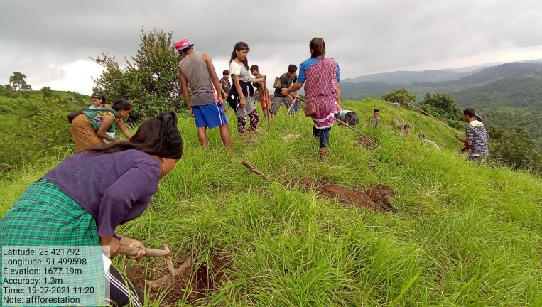
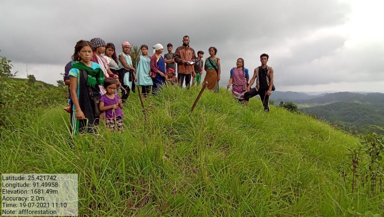
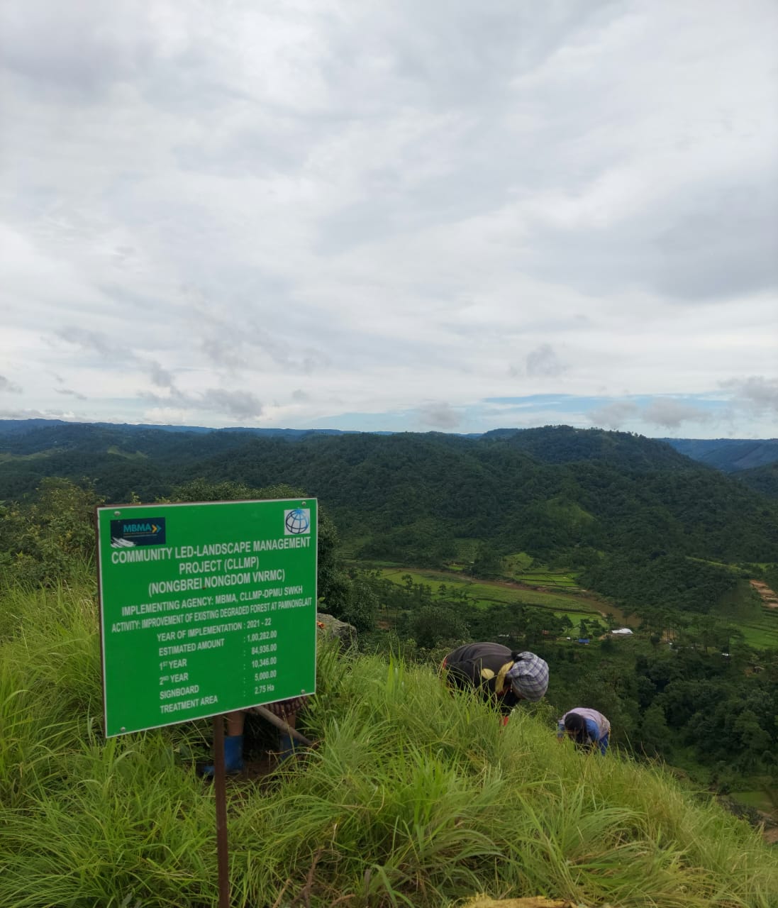
Fig.6: Before, during and after of Improvement of Existing Degraded Forest at Pamnonglait.
| 7. | Type of Intervention | Site Name | GPS Co-ordinates | Amount Sanctioned | Work Status | |
|---|---|---|---|---|---|---|
| Improvement of Existing Degraded Forest at Tylla | Tylla | 25. 419723 | 91.507942 | Rs.98,712 | Ongoing | |
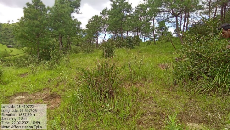
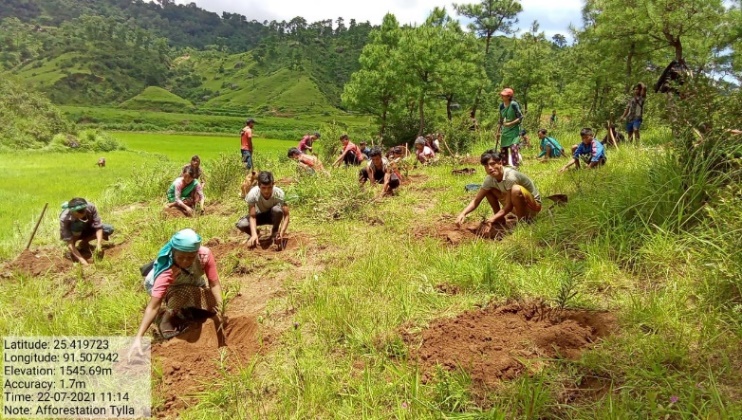
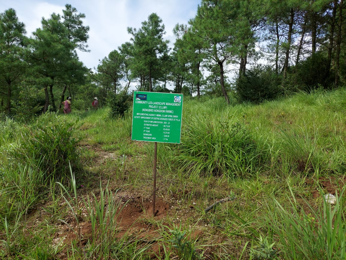
Fig.7: Before, during and after of Improvement of Existing Degraded Forest at Tylla.
| 8. | Type of Intervention | Site Name | GPS Co-ordinates | Amount Sanctioned | Work Status | |
|---|---|---|---|---|---|---|
| Improvement of Existing Degraded Forest at Demmyrsiang | Demmyrsiang | 25. 41903 | 91.506317 | Rs.1,01,852 | Ongoing | |
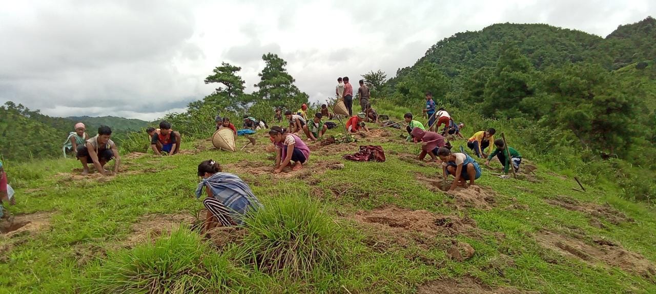
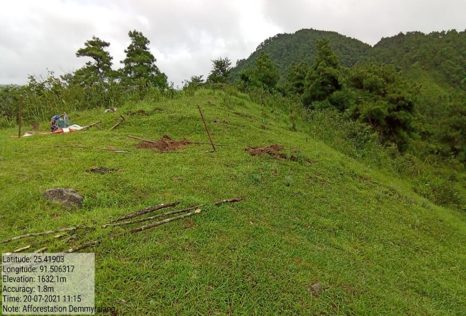
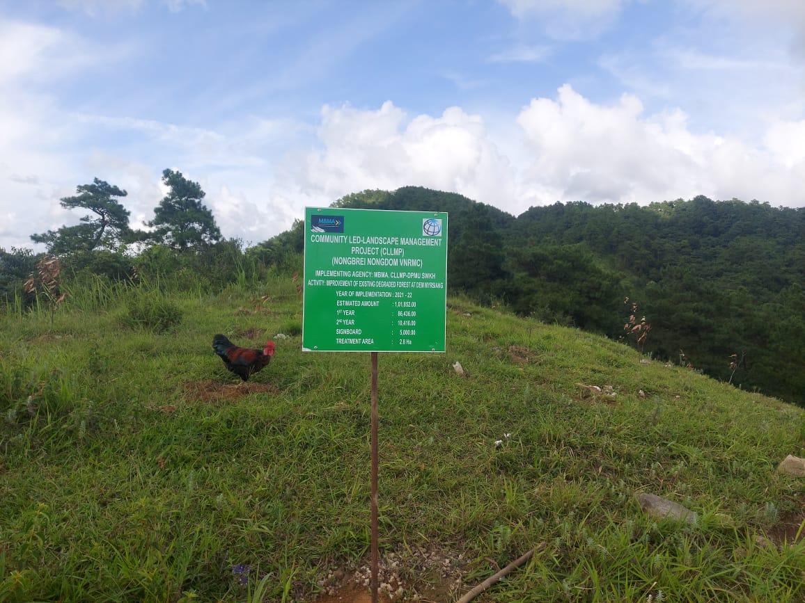
Fig.8: Before, during and after of Improvement of Existing Degraded Forest at Demmyrsiang.
| 9. | Type of Intervention | Site Name | GPS Co-ordinates | Amount Sanctioned | Work Status | |
|---|---|---|---|---|---|---|
| Bench Terrace at Mawphan | Mawphan | 25. 41851 | 91.495208 | Rs.1,42,995 | Completed | |
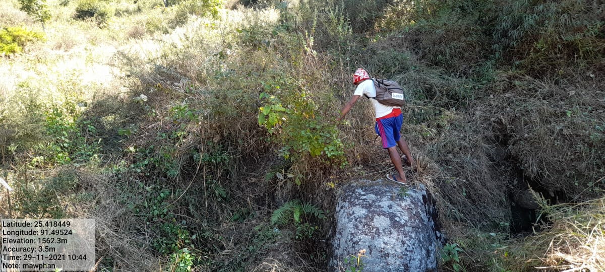
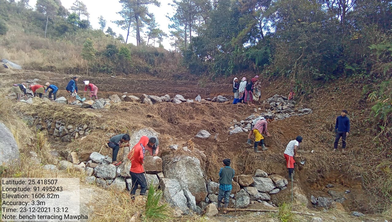
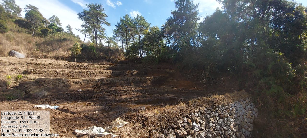
Fig.9: Before, during and after of Bench Terrace at Mawphan
| 10. | Type of Intervention | Site Name | GPS Co-ordinates | Amount Sanctioned | Work Status | |
|---|---|---|---|---|---|---|
| Bench Terrace at Dem Myrsiang | Dem Myrsiang | 25.418788 | 91.505648 | Rs.1,38,834 | Completed | |
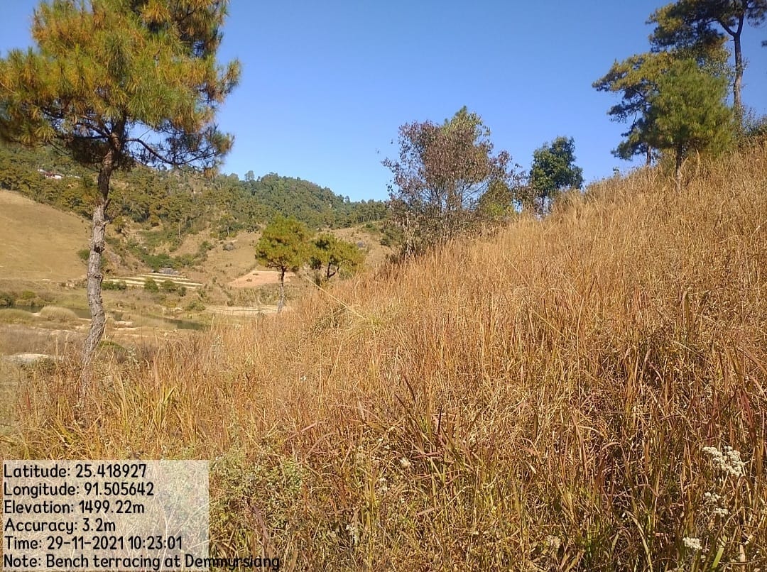
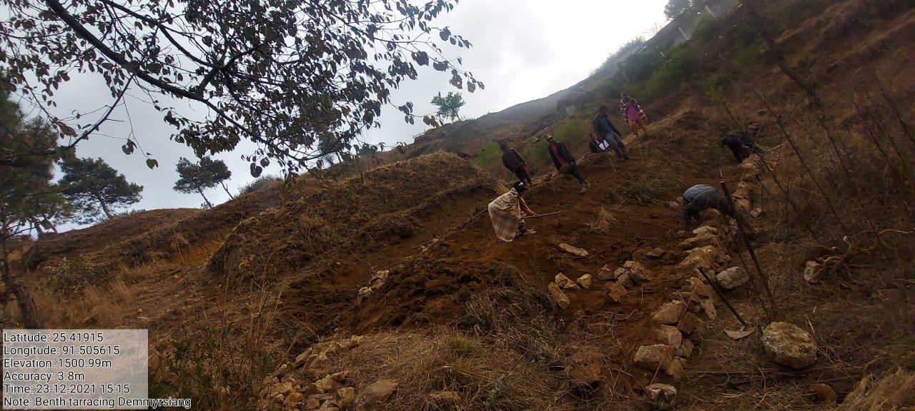
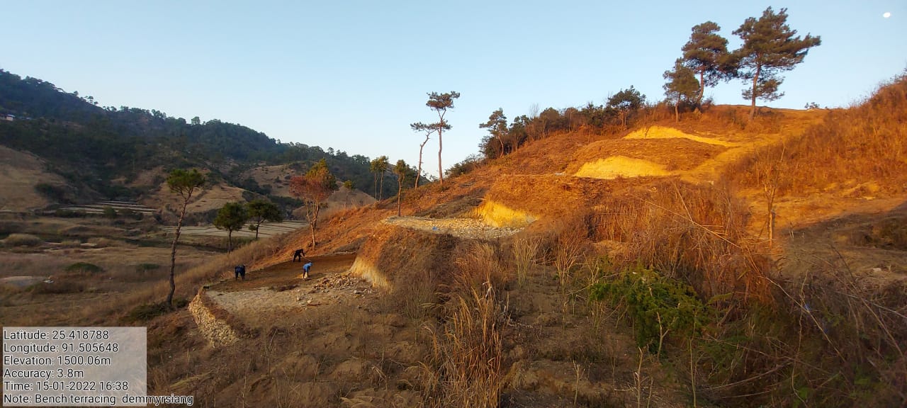
Fig.10: Before, during and after of Bench Terrace at Dem Myrsiang.
| 11. | Type of Intervention | Site Name | GPS Co-ordinates | Amount Sanctioned | Work Status | |
|---|---|---|---|---|---|---|
| Boulder Bund at Sohkynphur | Sohkynphur | 25. 427072 | 91.507627 | Rs.2,15,906 | Completed | |
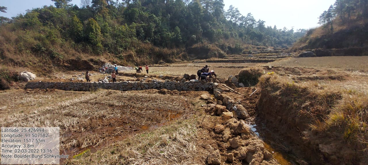
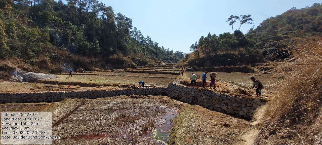
Fig.11: Before, during and after of Boulder Bund at Sohkynphur.
| 12. | Type of Intervention | Site Name | GPS Co-ordinates | Amount Sanctioned | Work Status | |
|---|---|---|---|---|---|---|
| Boulder Bund at Pamnonglait | Pamnonglait | 25. 421767 | 91.502279 | Rs.4,76,454 | Completed | |
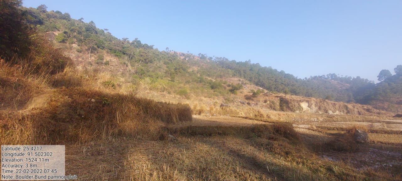
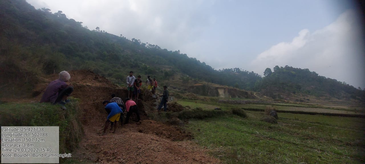
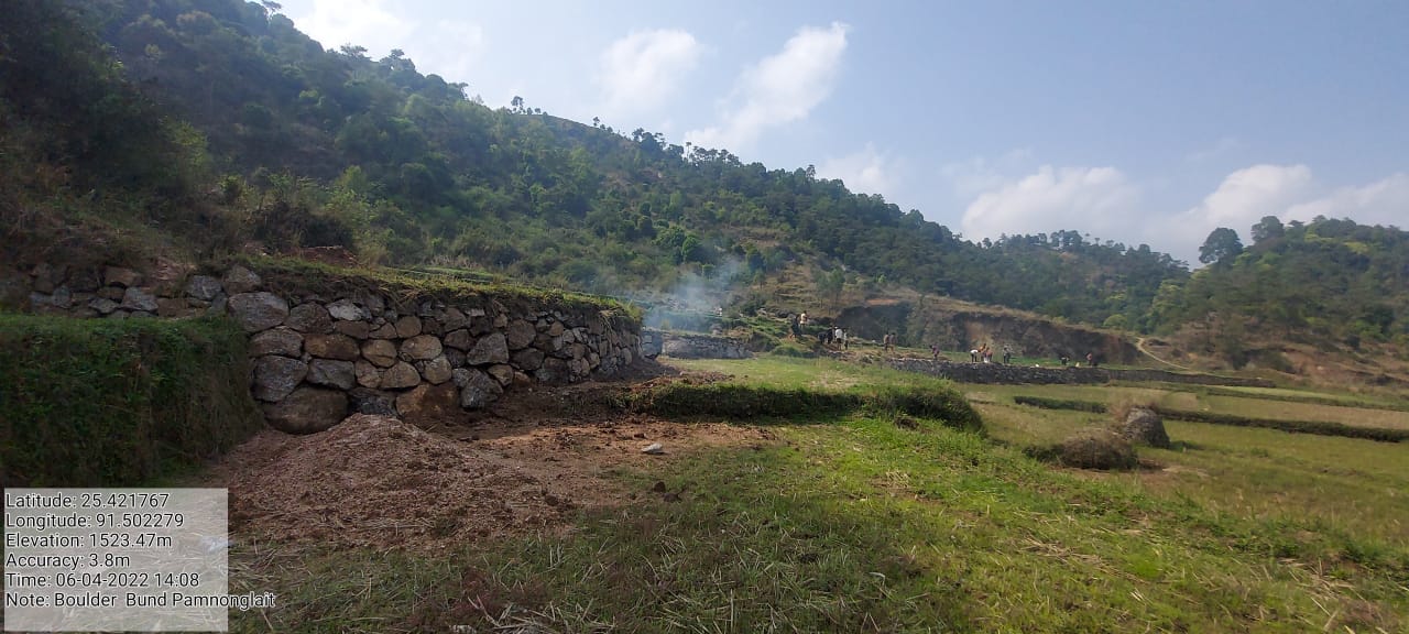
Fig.12: Before, during and after of Boulder Bund at Pamnonglait.
 Project
Implementation on the additional 5 lakhs:
Project
Implementation on the additional 5 lakhs:
| 13. | Type of Intervention | Site Name | GPS Co-ordinates | Amount Sanctioned | Work Status | |
|---|---|---|---|---|---|---|
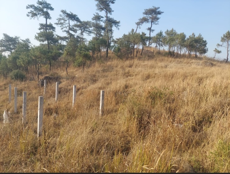
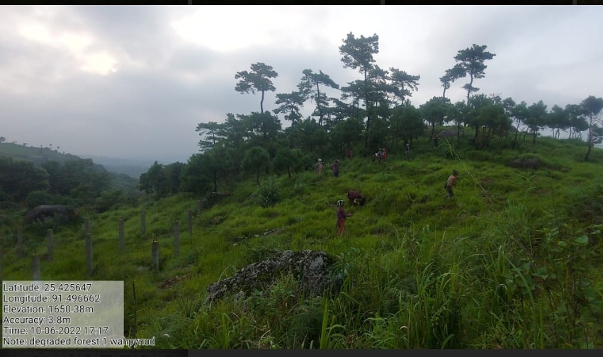
| Improvement of existing degraded forest at Wahpynud 1 | Wahpynud 1 | 25.426417 | 91.496784 | Rs.1,66,200 | Completed | |
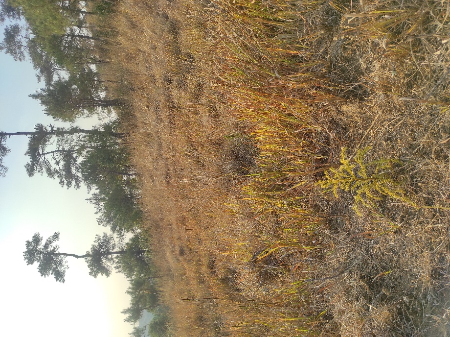
Fig.13: Before, deuring and after of degraded afforestation at Wahpynud 1.
| 14. | Type of Intervention | Site Name | GPS Co-ordinates | Amount Sanctioned | Work Status | |
|---|---|---|---|---|---|---|
| Improvement of existing degraded forest at Wahpynud 2 | Wahpynud 2 | 25.425247 | 91.496099 | Rs.1,28,300 | Completed | |
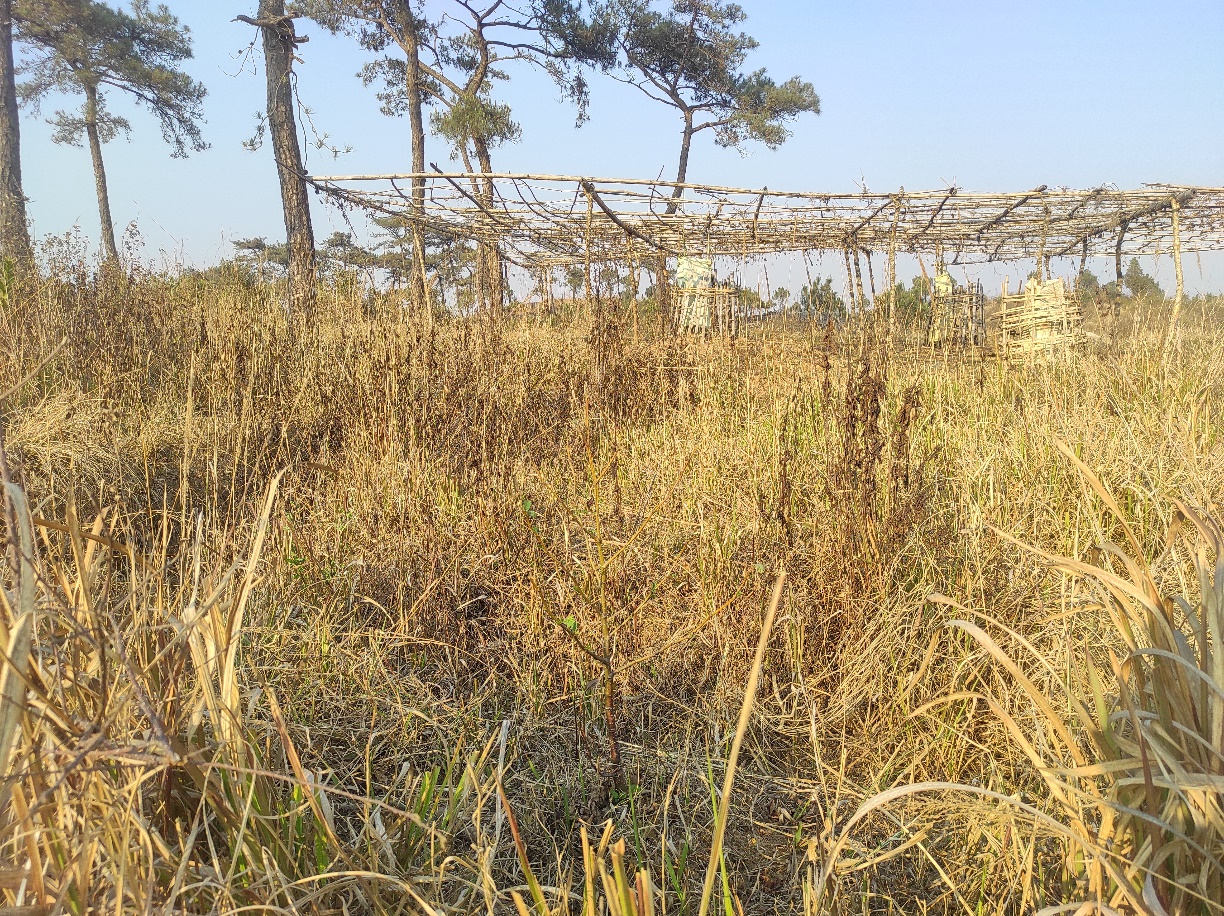
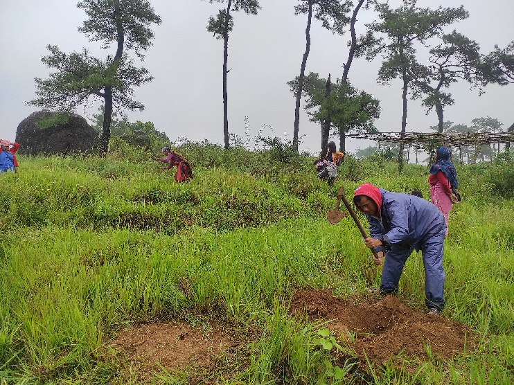
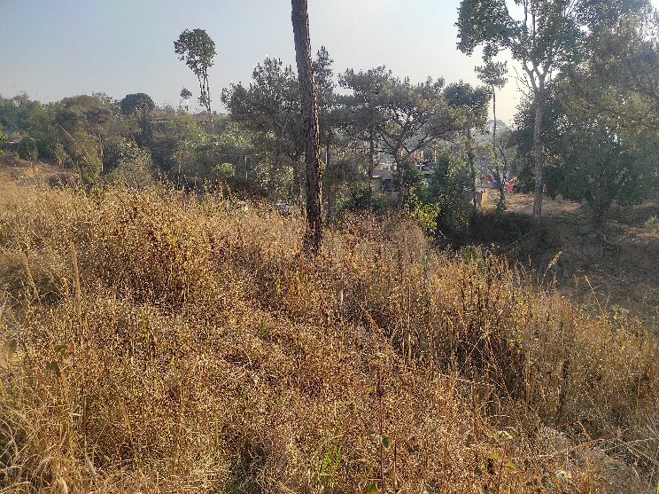
Fig.14: Before, during and after of degraded afforestation at Wahpynud 2.
| 15. | Type of Intervention | Site Name | GPS Co-ordinates | Amount Sanctioned | Work Status | |
|---|---|---|---|---|---|---|
| Improvement of existing degraded forest at Wahpynud 3 | Wahpynud 3 | 25.425293 | 91.495786 | Rs.1,30,419 | Completed | |
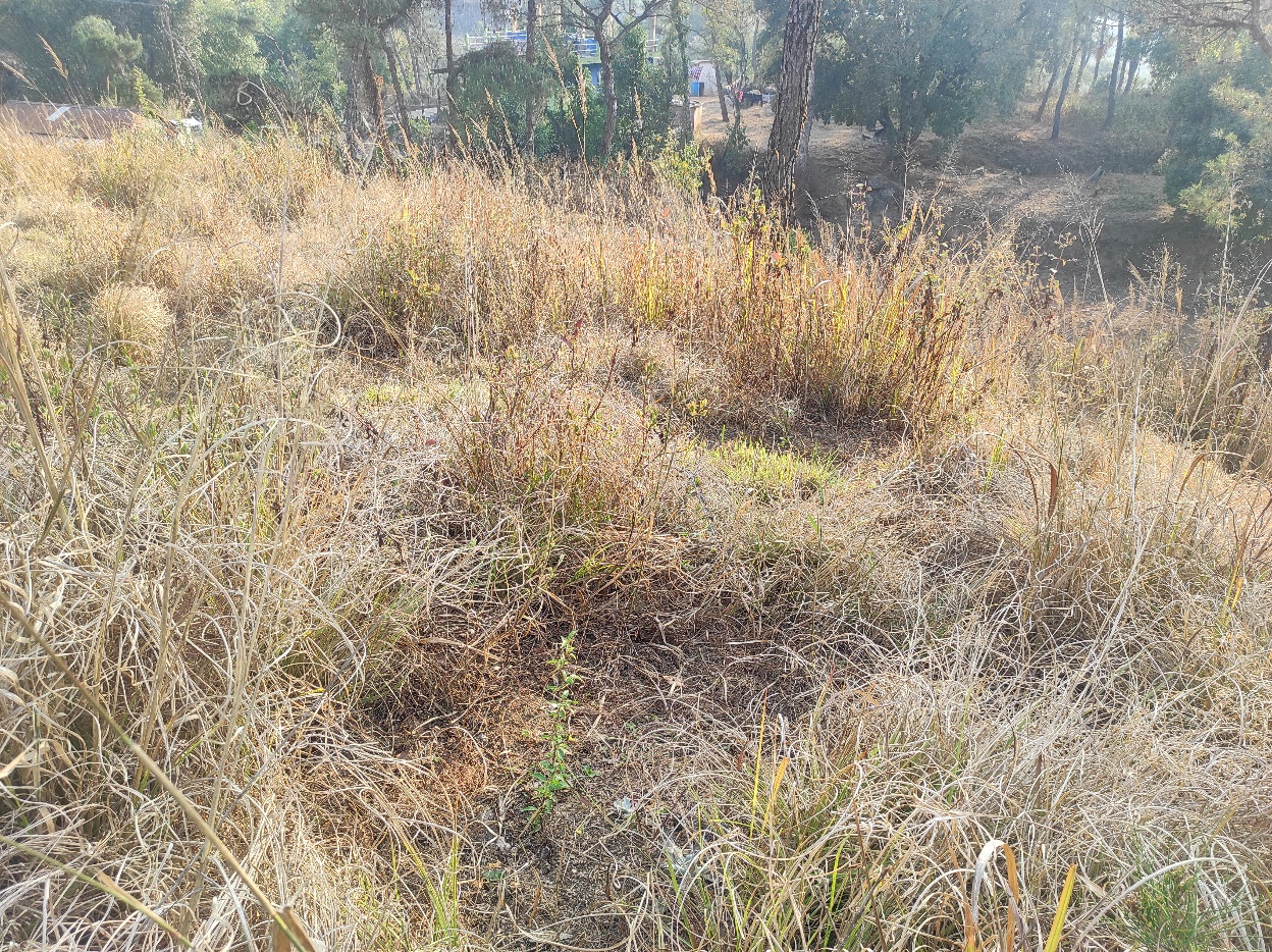
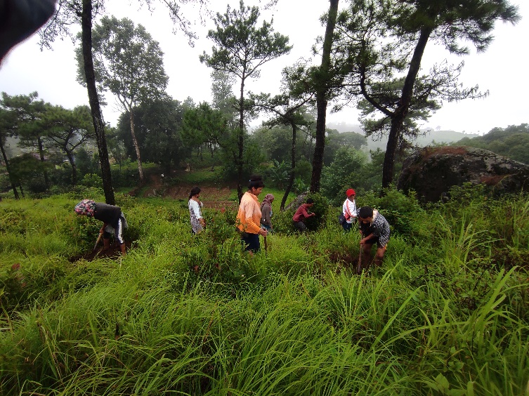
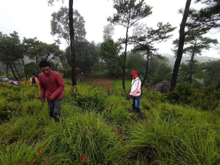
Fig.15: Before, during and after of degraded afforestation at Wahpynud 3.
| 16. | Type of Intervention | Site Name | GPS Co-ordinates | Amount Sanctioned | Work Status | |
|---|---|---|---|---|---|---|
| Spring Chamber at Jynrew | Jynrew | 25.427564 | 91.491862 | Rs.75,081 | Completed | |
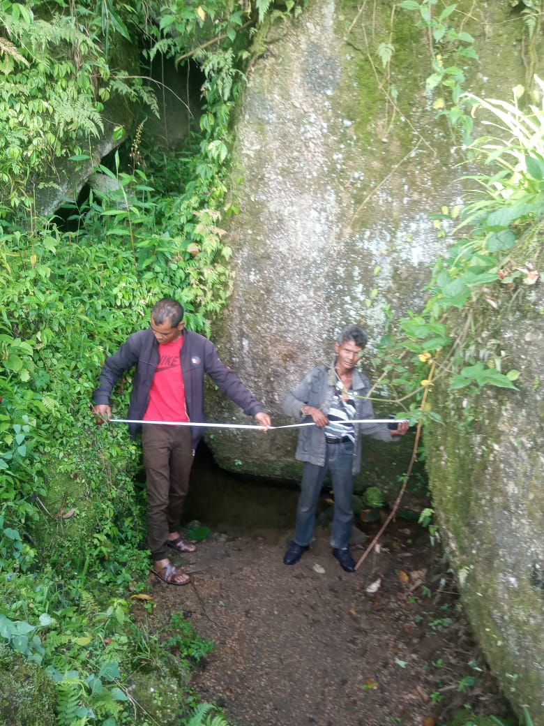
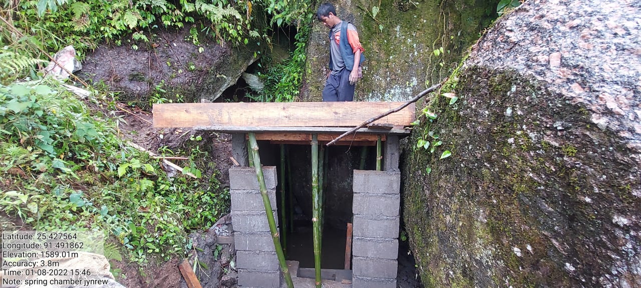
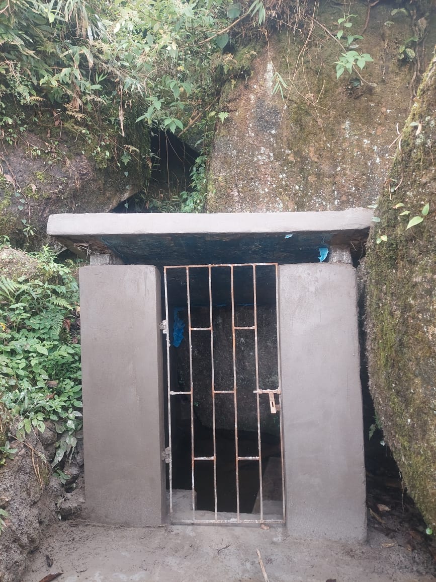
Fig.16: Before, during and after of spring chamber at Jynrew.
Fund Sanctioned:
| Fund Released to VNRMC (Project Implementation) | Total No. of Work Order Issued | Activity Name | Amount Sanctioned | Work Order Issued Date | Start Date | End Date |
|---|---|---|---|---|---|---|
| 2155000 | 12 | Afforestation at Mawjuh | 91,011 | 12-Jul-21 | 23-Jul-21 | 11-Jun-22 |
| Community Nursery At Pamnonglait | 1,30,704 | 12-Jul-21 | 20-Jul-21 | 30-Sep-21 | ||
| Check Dam at Sohsynniang, Nongbrei Nongdom | 4,99,200 | 3-Nov-20 | 24-Nov-20 | 30-Jan-21 | ||
| Spring Chamber & Treatment of Catchment area at Photnah, Nongbrei Nongdom | 90,000 | 1-Oct-20 | 14-Oct-20 | 25-Dec-20 | ||
| Spring Chamber & Treatment of Catchment area at Pamnonglait,Nongbrei nongdom | 69,050 | 1-Oct-20 | 01-Jun-20 | 11-Nov-20 | ||
| Bench Terrace at Dem myrsiang | 1,38,834 | 22-Oct-21 | 01-Nov-21 | 30-Nov-21 | ||
| Improvement of existing degraded Forest at pamnonglait | 1,00,282 | 12-Jul-21 | 19-Jul-21 | 17-Aug-21 | ||
| Improvement of existing degraded Forest at Tylla | 98,712 | 12-Jul-21 | 19-Jul-21 | 18-Aug-21 | ||
| Improvement of existing degraded Forest at Dem Myrsiang | 1,01,852 | 12-Jul-21 | 19-Jul-21 | 17-Aug-21 | ||
| Spring Chamber at Jynrew | 75,081 | 6-May-22 | 06-Jun-22 | 28-Jun-22 | ||
| Boulder Bund at Sohkynphur | 2,15,906 | 14-Dec-21 | 04-Jan-22 | 31-Jan-22 | ||
| Improvement of existing Degraded Forest at Wahpynud 1 | 1,66,200 | 6-May-22 | 02-May-22 | 30-Jun-22 |
12. Fund Sanctioned for additional 5 Lakhs:
| Fund Released to VNRMC (Project Implementation) | Total No. of Work Order Issued | Activity Name | Amount Sanctioned | Work Order Issued Date | Start Date | End Date |
|---|---|---|---|---|---|---|
| 500000 | 4 | Improvement of existing degraded forest at Wahpynud1 | Rs.1,66,200 | 6th May 2022 | 02-May-22 | 30-Jun-22 |
| Improvement of existing degraded forest at Wahpynud2 | Rs.1,28,300 | 6th May 2022 | 06-May-22 | 19-Jul-22 | ||
| Improvement of existing degraded forest at Wahpynud3 | Rs.1,30,419 | 6th May 2022 | 04-May-22 | 28-May-22 | ||
| Spring Chamber at Jynrew | Rs.75,081 | 6th May 2022 | 01-Nov-21 | 30-Nov-21 |
Ground Testimonials:
Lambokstar Wahlang
VCF M & E Nongbrei Nongdom
According to Lambokstar Wahlang, CLLMP is one of the Project that has teaches him a lot. He said that, he has gathered much information and knowledge about the environment and its surroundings over the years with the office and wishes that the project be extended so that more can be learned.
Teiborlang Wahlang
VCF SM & KM Nongbrei Nongdom
I am glad that CLLMP has been implemented in our village as this is a project that aims at conservation and sustainable use of our present natural resources for the future generations. Follow up on social safeguard, Gender equality and social inclusion are some of the objectives practiced by this project which is not usually taken into consideration by other schemes and projects.
Jikoland Wahlang
VCF Environment Nongbrei Nongdom
This Project have given me a chance to learn many new things which previously, I was unaware of. I have gathered much knowledge regarding the importance of conserving nature and its rich resources. To name a few, I would have not known how to test the quality of the water in our spring if it was not through Spring Mapping (Water discharge, Water Quality), or would I have known about the height of the tree, the Clear Bole, the size of the tree or the girth as I have learned from the Forest Management Plan training received from Kong Niwancy Bareh.