Report on
SAKWANG Village under MAWKYRWAT c & rd block
District: SOUTH WEST KHASI HILLS
COMMUNITY LED LANDSCAPE MANAGEMENT PROJECT


The Government of Meghalaya with the financial help from the World Bank has been implementing the Meghalaya Community Led Landscape Management Project (MCLLMP). The project covers the entire state of Meghalaya and implementation of community led plans have been rolled out in phase manner throughout the state. The Meghalaya Basin Management Agency (MBMA) had facilitated the community-led planning by providing support, technical inputs and funding.
The project had strengthened community-led natural resources management in selected landscapes within the 12 districts of the state. This has been achieved through a variety of planning, capacity building, and on-the-ground interventions to promote the conservation, sustainable use of natural resources, social inclusion and community mobilisation; building traditional knowledge and learning, mapping of natural resources management; strengthening the community institutions and creating linkage with financial institutions and community organizations.
The project interventions include the preparation of community led natural resource management plans. The CLLMP has the following three components:
Strengthening Knowledge and Capacity of Communities for Natural Resources Management
Community-Led Landscape Planning and Implementation
Project Management and Governance
The project objective is “to manage and conserve the natural resources, especially forests, soil and water sources, in a manner that supports the financial and physical well-being of communities in the State”
SCOPE:
The CLLM-Programme focuses on increasing the capacities of communities and traditional institutions (TI) by adopting a landscape approach to manage their natural resources such as soil, springs and other water sources, forests and bio-diversity, etc.
The project has been planned and implemented in about 400 villages across the state.
CLLMP has a strong focus on institution-building at the village-level, by ensuring systematic capacity-building on technical and social skill-sets.
The project has also extended such trainings to communities beyond the targeted villages and support efforts made by them to access funding from various rural and natural resources initiatives and schemes.
The programme has also invested in improving the process and outcome delivery, by developing and adhering to effective systems and procedures, supported by the appropriate technology.
BENEFITS:
Benefits for community (Skills and Capacity relating to technical and managerial areas like NRM and Conflict resolution
Benefits to traditional institutions (village councils, traditional leaders, community-based organizations, SHGs etc) through Knowledge sharing, promotion of innovative approach, access to technology, technical managerial and financial support.
It has been estimated that the project has impacted around 1 lakh partners (of which 50% are women) who depend on land, forest, agro forestry.
Through the project, 55000 Ha of targeted area has been ensured with availability of water, biological resources and soil productivity, which has in turn benefitted around 400 villages and the outcomes delivery can be summarized as follows.
IMPLEMENTATION AGENCY:
The Project has been executed by the MBMA in collaboration with other partners particularly, SIRD (for training and capacity building), Department of Soil and Water Conservation, Water Resource Department, Forest Department, specifically with respect to technical inputs, safeguards management and Community NRM plan preparation.
PROJECT PERIOD:
2018-2023 (5 years)
Table of contents:
Introduction and History________________________________ 4-5
Social Profile ________________________________________ 5
Village Accessibility__________________________ 5-6
Literacy rate_________________________________ 6
Population__________________________________ 6
Occupation_________________________________ 7
Village organisation__________________________ 7
Fuel Type__________________________________ 7
Drinking Water_______________________________ 7
Cultivatable Land_____________________________ 7
Forest Cover________________________________ 8
Forest Species_______________________________ 8
Water Bodies________________________________ 8
Areas affected_______________________________ 8
III. CLLMP Activities
Ground-Truthing_____________________________________ 8-9
Sensitization on CLLMP_______________________________ 9-10
Signing of EOI, VGA and Green Charter__________________ 10
Formation of VNRMC_________________________________ 10-11
Village Community Facilitators__________________________ 12
Purchase Committee___________________________________ 12
IV. Opening of Bank Account______________________________________ 13
V. PRA Exercise________________________________________________ 14-15
Basic Survey for CNRMP template_______________________ 15
Focussed Group Discussions____________________________ 15-17
Village Boundary Mapping and Resource Mapping__________ 17-18
VI. GIS Activities________________________________________________ 19-20
VII. The Proposal list of intervention_________________________________ 21
VIII. Project Implementation________________________________________ 22-37
IX. Fund Status__________________________________________________ 38
X. Ground Testimonials__________________________________________ 39-40
INTRODUCTION:
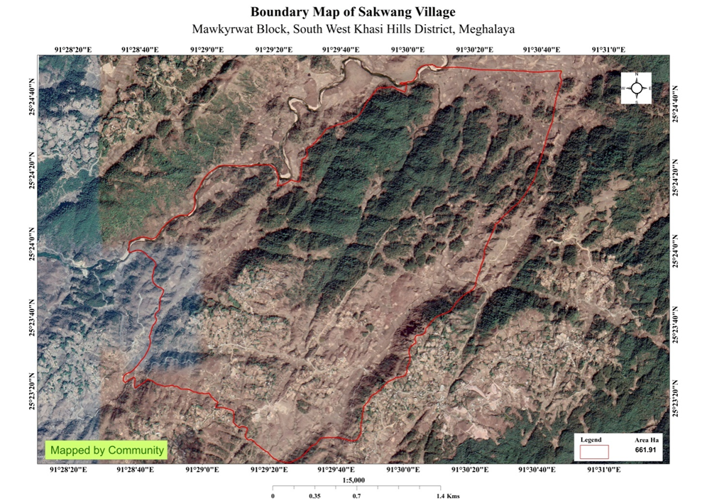
Sakwang Village is situated in South West Khasi Hills District under the Mawkyrwat C&RD Block. The village is about 19 Km away from the District Headquarters i.e., Mawkyrwat and about 22 Km away from the Block Headquarters. It has a total geographical area of 661.91Ha and falls under the Hima Maharam Syiemship. Sakwang village has a total population of 2812 comprising of 1387 males and 1425 females. All the residents of Sakwang village belonged to the Khasi Scheduled Tribe. The average rainfall of Sakwang village is 1200mm and the type of soil is mainly loamy soil.
BRIEF HISTORY ABOUT THE VILLAGE:
The name Sakwang was given to this village due to the abundance of “Wangblei” on the Eastern side of the village. This type of yam has long-wavy and huge leaves but lack of tuber. The first resident to settle in this place was about 300years ago of the clan “Mawlein” who later migrated to Nongsynrih and “Wanah” clan who shifted to a village called Rangmaw. Thus, they named the village Sakwang. The first Christians was traced back to 1898, two youth- “Ka Briah” and “ka Siar Syiemlieh” and in the year 1913 Sakwang Presbyterian Church was born.
Sakwang village falls under the Hima Maharam Syiemship. It was first ruled by two Lyngdoh – “Pdah Lyngdoh” and “Kyrwat Lyngdoh” who are known for their physical strength. There comes a time when these two Lyngdoh were divided into 6 Lyngdohs, (Lyngdoh Nonglwai and Lyngdoh Nongkhlaw) and the other five were (Lyngdoh Sakwang, Lyngdoh Nongsynrih, Lyngdoh Nonglynkien, Lyngdoh Nonglang and Lyngdoh Marshillong) and it has been said that it was the Lyndoh Sakwang who took the initiative to choose and appoint their first King. They appointed Kohringap Syiem as a king who was the first King of Hima Marharam. This King had two younger sisters, one with a fair complexion whose decendants came to be known as the clan “Syiemlieh” and the other sister with a dark complexion whose decendant came to be known as the clan “Syiemiong”. It was on these grounds that the root of the Maharam Kingdom was believed to have begun in Sakwang from the two Clan of Syiemlieh and the Syiemiongs. It is said that the Headquarter of the Hima Maharam would have been in Sakwang village had it been a market place.
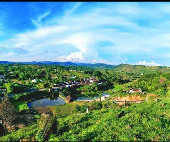
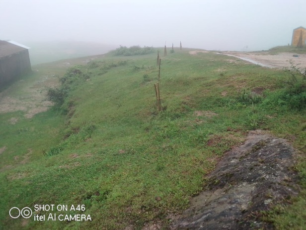
Fig: Sakwang village.
VILLAGE SOCIAL PROFILE:
Sakwang village has a total number of 312 households, having a total population of 2812 villagers. People in this village mainly depend on agriculture and its allied activities for their livelihood. There are teachers, businessmen and some others are engaged with government services.
Village Accessibility:
In order to reach Sakwang village one must travel through road with local taxis from the Mawkyrwat- Nongstoin road.
Literacy Rate:
As per 2011 Census, Sakwang has a higher literacy rate compared to the State average. Sakwang literacy rate was 78% while the State average stands at 74.4%. The female literacy rate was higher at 79.68% than that of the male literacy rate at 79.68%. In Sakwang, there are a total number of 11 schools out of which 9 are Primary Schools and 2 Secondary Schools.
Population:
As per 2011 Census, the total population of Sakwang village is 1395 people and this has seen an increased over the years and now stands at 2812 as of the recent survey. Out of this,1387 are male and the female count is 1425.This village has 576 children belonging to the group 0-4years and 341 people are above the age of 60. About 772 total number of people belong to the age group of 30-60 years, thus this indicates that the majority of the population of Sakwang village comprise of the young and healthy people.
| Age Group | Male | Female | Total |
|---|---|---|---|
| 0-4years | 282 | 294 | 576 |
| 5-14years | 261 | 270 | 531 |
| 15-30years | 294 | 298 | 592 |
| 30-60years | 381 | 391 | 772 |
| Above 60years | 169 | 172 | 341 |
| Total | 1387 | 1425 | 2812 |
Occupations:
The people of Sakwang village rely mainly on agriculture and forest produce for their livelihood. Out of 312 households within the village, 280 households are farmers, 12 household are labourers, while 10 household are teachers and 10 households are in government service.
Organisation within the Village:
There are 19 Self Help Groups (SHGs) under NRLM in Sakwang village under one Village Organisation. Presence of a committee relating to Water and Sanitation within the village. There are also 12 VEC & traditional institutions within Sakwang village.
Fuel Type:
The people of Sakwang village mainly uses wood as a fuel. About 180 households depend on wood gathered from the forest for their daily requirement.
| Type of Fuel | Total No of HH | Qty (Kgs/HH) | Total |
|---|---|---|---|
| Wood | 180 | 9000kg 3Stacks per year |
1620000kg |
| Charcoal | 102 | 420kg 12Sacks per year |
42840kg |
| LPG | 30 | 245kg 2cylinder per year |
7350kg |
Drinking Water:
The people of Sakwang have access to drinking water mainly from the springs within the village. Government water supply lines are also available in this village. But over the years there has been a scarcity of water supply in this village due to less water discharge from the springs source and due to the increase in human population and their daily requirements. There are 11 springs within the village which are perennial that people uses for drinking viz. Thad Rishan, Twah Bah, Photrai, Photiapkhla, Sohlyngum, Phottrikba, Photmawkohtep, Wahtunram, Photdommawlein, Photmawpunlhon, and Remkhla.
Cultivable Land Cover:
The total agricultural area of Sakwang village is 154.11ha. The type of soil in Sakwang village is Loamy soil. People practise bun cultivation and shifting cultivation in their own private lands. The main crops of Sakwang village are Paddy, Maize, Potato, Ginger, Sweet Potato, Mustard, Beans and Yam. They also plant Bayberry, Crab apple, Mulberry, Passion Fruit, Black berry and Peach.
Forest Cover:
The total forest cover under Sakwang village is 233.93ha. Most of the forest cover are on private land and the quality of the forest is moderate. People uses the forest products mainly for fuelwood, timber as medicines, aromatic plants and for other purposes. There is one Community Forest called Ranab Jyrwein and one protected forest namely Law Kyntang Law Lyngdoh. Some of the forest that falls on the private land within the village are WahPongksoin, Domkynjang, Mawkohet, Khlaw along, Sabbsein, Breikyrbe, Wahtymrang, Diewlieh, Lawmawboit, Mawiular, Khlaw pungbathah, and Domtyra.
Forest Species:
Some of the indigenous tree species found in this village are Diengngan, Diengkseh, Diengloin, Diengjiein, Diengsning, Diengblei, Diengsai, Diengjri, Dienglyngngim, Diengsohiongkrem and Dienglymba. There are some plant species used by the people of the community for medicinal purposes like Diengsohlang, Diengbyrkham, Jatira, Jale and Jamyrdoh. The forest is home to many vulnerable fauna-like wild birds, clouded leopard, and rabbits.
Water Bodies:
Total area of water bodies in Sakwang is 7.36ha. There are about 11 springs within the village which have been mentioned above which people use mainly for drinking purpose. Some the streams within the village are Jyrwein, Phottde, Mawkoh et, Kroh, Krohmaboit, Photumsengsakwang, Photlawsynrei, Mulein, Dohjapung which are all perennial and are mainly use for washing, irrigation and fisheries. There are two Rivers within the geographical area of Sakwang and these are Wah Rilang and Wah Kroh.
Areas Affected:
Approximately about 29.58ha of forest land have been degraded over the years due to soil erosion, forest fires, excessive felling of trees which have led to the loss of productivity of the land and the loss of the saplings and other natural resources About 8.63ha of cultivable land have been affected by the excessive use of fertilizers and 17.21ha of land have been degraded over the years owing to human settlement and culturable wastelands.
CLLMP ACTIVITIES:
Ground Truthing: The CLLMP officials met with Mr.Shaining Kharjahrin, headman of Sakwang village, Mr.Jompsingstar Ramsiej the village Secretary and other village representatives for field assessment. Mr.Kharjahrin, provided the CLLMP Team with important information regarding the current scenario of the landscape and the natural resource management under his headmanship.
Case Findings:
Most of the household falls under the BPL category.
They have an actively performing VEC in the village.
The land within the village falls under the Hima Maharam Syiemship.
The source of water supply in the village is from two sources: private and public.
There are a few patches of degraded land that has been left unused.
There is a loss of Natural Vegetation in the area.
Abundance of small streams within the village.
Forest on hill slopes is prone to forest fires.
Some of the Paddy fields in the area are without proper irrigation.
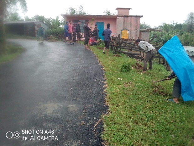
Sensitization Programme:
The District Project Manager Mr. J. Wanniang along with the staff held a village Level Sensitization Programme on the Community Led Landscape Management Project (CLLMP) on the 25th June 2019.The villagers actively participated in the program, voicing out their concerns and questions regarding the project making it a huge success.
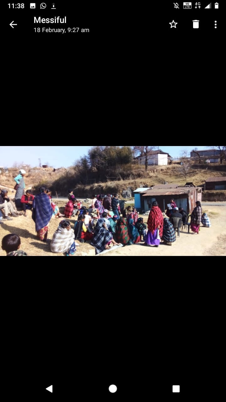
Fig: Villagers attending the Programme.
Highlights of the meeting:
1. Awareness about the Community Led Landscape Management Project (CLLMP).
2. Laying the importance on the involvement of the community in making the CNRM plan and its success.
3. A brief awareness on cleanliness was conducted based on our finding during the ground truthing phase.
4. An interactive session was held to answer doubts of the villagers regarding the project.
Signing of EOI, VGA and Green Charter:
On 25th June 2019, Sakwang village signed the EOI (Expression of Interest), VGA (Village Grant Agreement) and the Green Charter after there was a uniform agreement by the people of the entire Community that the Community Led Landscape Management Project (CLLMP) be implemented at Sakwang Village.
Formation of the VNRMC:
The formation of the Village Natural Resources Management Committee was done in a public meeting on the 25th June 2019 in the presence of the entire village and the CLLMP Staff. The people of the community chose the President, The Secretary, the Purchase Committee members and the other Executive members to formed the Sakwang VNRMC. There are 9 Executive members, 3 Village community Facilitator and 3 Purchase Committee members.
List below are the members of the VNRMC:
| Village Natural Resource Management Committee (9members committee constituted from Village Council, SHG group, Women’s group, youth, VEC) | ||||||||
|---|---|---|---|---|---|---|---|---|
| Sl No. | Name | Designation | Gender (M/F) |
Age in years | Qualification | Occupation | Community | Phone No. |
| 1. | Messiful Nongrem | Secretary | Female | 28 | X | Farmer | Khasi | 986289395 |
| 2. | Shainingstar KharJahrin | President | Male | 45 | XII | Teacher | Khasi | 6009148553 |
| 3. | Jomsingstar Ramsiej | Finance Secretary | Male | 28 | BA | Farmer | Khasi | 9366535983 |
| 4. | Laitsphor Ramsiej | Member | Male | 42 | V | Farmer | Khasi | 96091483 |
| 5. | Kworsingstar Ramsiej | Member | Male | 38 | BA | Teacher | Khasi | 8787463636 |
| 6. | Wikobat KharJahrin | Member | Male | 19 | XII | Student | Khasi | 9774031420 |
| 7. | Amsolbanwad KharJahrin | Member | Male | 45 | VIII | Farmer | Khasi | 9366873131 |
| 8. | Pynskhemborlang Shangdiar | Member | Male | 32 | X | Cultivator | Khasi | 8837447477 |
| 9. | Bansharailang Ramsiej | Member | Male | 31 | BA | Teacher | Khasi | 6009116255 |
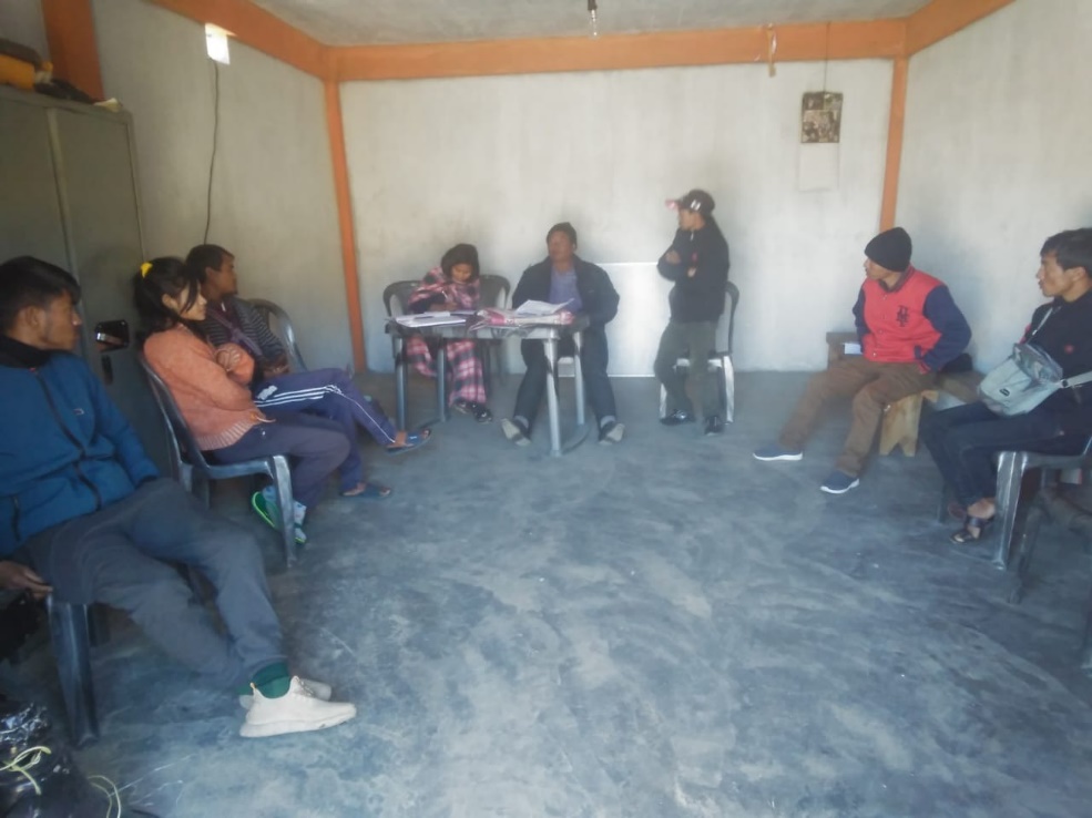
Fig: Excuetive Members of Sakwang VNRMC.
| Village Community Facilitators (VCF) | ||||||
|---|---|---|---|---|---|---|
| Sl no. | Name | Age | Gender | Qualifiaction | Contact Number | Role |
| 1. | Bansharailang Ramsiej | 28 | Female | BA | 6009116255 | Social & KM |
| 2. | Pynskhemborlang Shangdiar | 32 | Male | X | 8837447477 | Document and M&E |
| 3. | Kworsingstar Ramsiej | 42 | Male | BA | 8787463636 | Environment & GIS |
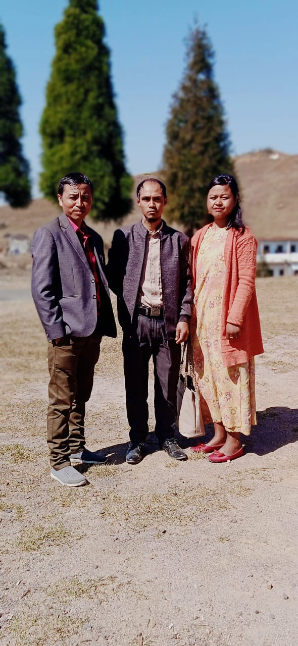
Fig: VCF of Sakwang VNRMC.
| Procurement Members | |||||
|---|---|---|---|---|---|
| Sl no. | Name | Age | Gender | Qualification | Contact Number |
| 1. | Imanbhalin Ramsiej | 26 | Female | BA | 9366625885 |
| 2. | Messiful Nongrem | X | Female | X | 9862889395 |
| 3. | Komilios Kharjahrin | 22 | Male | X | 9402155574 |
Opening of Bank Account:
The opening of the bank account was done after the signing of the EOI (Expression of Interest), the VGA (Village Grant Agreement) and the signing of the Green Charter. The Accountant of CLLMP South West Khasi Hills trained the Purchasing and Procurement Committee of Sakwang village on matters relating to Accounts and Book Keeping and on the:.
Principles of Community Procurement
Benefits of Community Procurement
Important aspects undertaken by Community Procurement.
Procurement Process/Steps
Function of Purchase Committee
Important Procurement records to be maintained
Financial limits and methods
Maintaining of Books of Accounts to the Book Keeper.
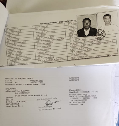
Fig:Bank details of Sakwang VNRMC.
Participatory Rural Appraisal Exercise:
The PRA exercise aims to incorporate the knowledge and opinions of the community in the planning and management of development projects and programmes.
The PRA exercise took place on the 25th June 2019 and around 50 villagers both men and women attended the program.
The District Project Manager gave the introduction and spoke about the different activities that the participants had to take part in the programme.
The Program Associate, Environment Management, spoke about the different CNRM plans and the different types of intervention. A group of participants interacted and helped in the collection of data based on the environmental template. With the help of this group, different sites of interventions were identified, analysed and evaluated in order to prioritized the areas that needed the natural resources management.
The Assistant Manager, Social Management, gathered the remaining group of participants to gather the baseline data bases on the social template.
The main objectives of PRA exercise are:
To identify the natural, human and economic resources of the village.
To identify the village problems and prioritized them with the help of the community members.
To prepare the community natural resources management plan of the village.
Findings based on the information gathered from the participants during the PRA/CNRMP exercise:
1. The main agricultural produce is Paddy, Maize and Potato.
2. Most of the household depend on firewood as a source of fuel.
3. Drinking water is limited over a period of 3-4 months during the winter season.
4. There are two types of forest ownership: Community and Private.
5. There is one Community Forest.
6. The springs which are present in the village needs rejuvenation.
7. Training on Land productivity, Spring shed management and Community nursery is necessary for the village community.
8. There are no disputes/constraints encountered within the village community or with any neighbouring villages.
Priorities Intervention required based on the PRA Exercise:
1. Rejuvenation of the Springs within the community through activities such as afforestation, treatment of catchment areas and contour trenches.
2. Afforestation, Bio-fencing and fire line control in the community forest.
3. Community Nursery for endemic trees.
4. A dug out pond for collecting rain water for.
5. Check dams for erosion control.
6. Afforestation and Roadside plantation.
7. Culturable wastelands to be brought under horticulture.
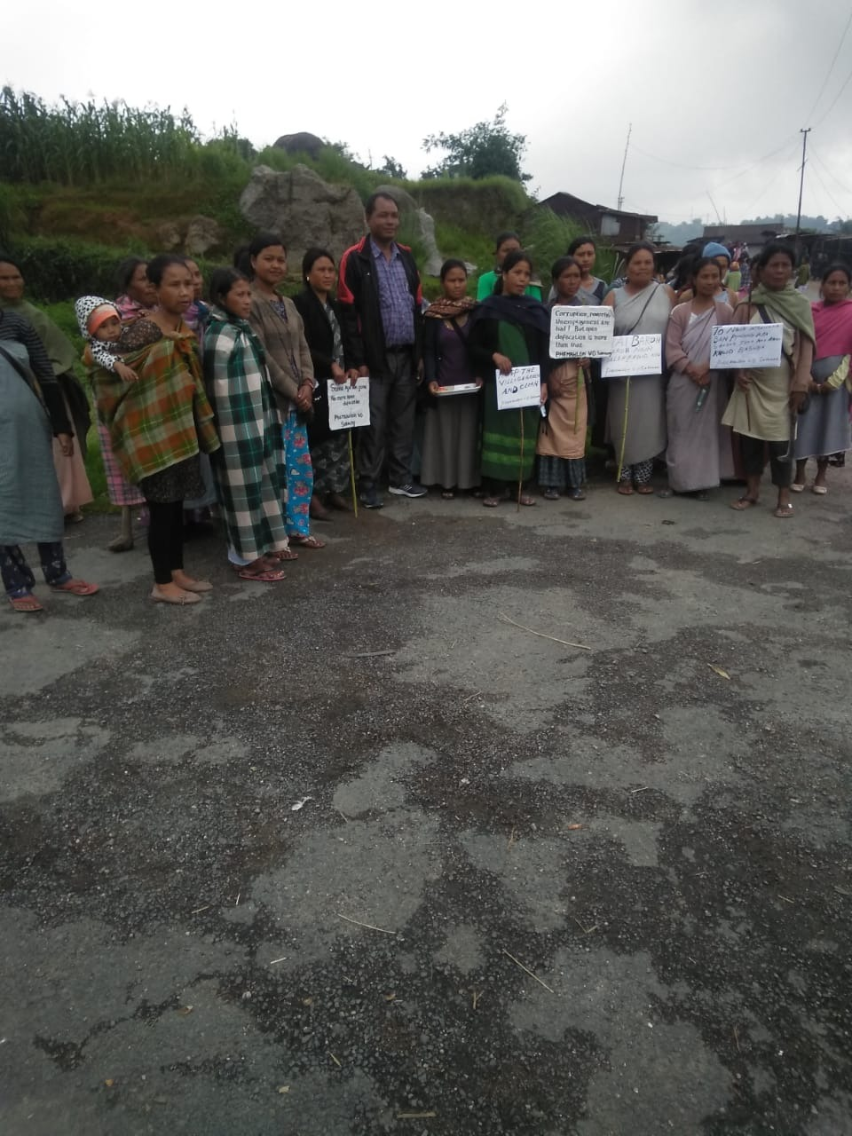
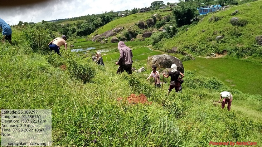
Fig: VNRMC members participating in awareness programme.
Baseline Data Survey to fill the Environment and Social Template:
During the PRA Exercise the External Expert of Social & Environment Management held a group discussion with the different groups to gather basic village information regarding number of households, demographic information, major crops and enterprises taken in the village, trends of production and productivity of major crops in the village and demographic distribution of village population.
Information related to land use category such as forest, cultivable land, water bodies, etc and the problems and challenges related to NRM were discussed.
Focussed Group Discussion on Problem Analysis:
Do people have sufficient access to supply of fodder, fuel wood, leaf litter?
Yes, people in the village have sufficient access to supply of fodder, fuel wood, leaf litter. They get it from the community forest and from their own private lands/forest.
Has access to timber improved or reduced over the years? How is access for household use and commercial use managed?
Access to Timber has reduced over the years. People have to purchase it from neighbouring village when needed.
Are the water bodies facing any threats?
So far, the water bodies within the village have not faced any threats.
Do all people in the village have access to drinking water? What are the challenges?
Yes, there is sufficient drinking water in the village except during the winter season due to less discharge of water from the spring source.
Are there degraded areas in the village (open/ degraded forests, mining affected, high soil erosion etc.)?
There are some minor degradations in cultivated land.
What has caused this degradation? Are there practices causing threats to availability and access to natural resources?
Fertility of the soil has decline over the year.
The practices that cause threat to the availability of these resources are:
Fires that take place every year
Excessive practice of Jhum Cultivation
What have been the changes in agricultural practices?
Previously their method of farming is Shifting Cultivation, but over the years with much awareness people have now practiced crop rotation.
Are there any challenges in farming?
The main challenges faced by the people of Sakwang village is that over the years they have seen a decline in the soil productivity due to soil erosion.
How would you consider the health situation in your village?
The nearest health care is in the district headquarter with a distance of 20Km away and is easily accessible for the community as a whole to commute to the health centre.
How is the situation of cleanliness, sanitation, access to toilets and waste management?
The SHG members is responsible for organizing the cleaning drive once in a month.
Sufficient toilets are available in every household but most of the constructions are poor. Some households have access to toilets from SBM (Swash Bharat Mission) scheme. The presence of VWSC in the village has also improve sanitation and cleanliness. But Waste Management is poor because people are not really aware of how to properly disposed off waste.
Who are the most vulnerable in the village? What can be done to improve their lives?
BPL Families. Inclusion of BPL family members during project implementation
What are the livelihood aspirations of the youth? Are there any avenues available?
None, except daily wages labourers.
Do any committees/ institutions/ rules exist to manage and monitor natural resources in the village?
The VNRMC under the CLLMP is the main committee that is now in place to manage the natural resources in the village.
What are some of the major issues of conflict in the village?
Nothing related to NRM.
Have any of the above issues been discussed in village meetings?
NA
How do people resolve disagreements and conflicts?
All disagreements and conflicts are addressed by the traditional institution of village called the Village Dorbar.
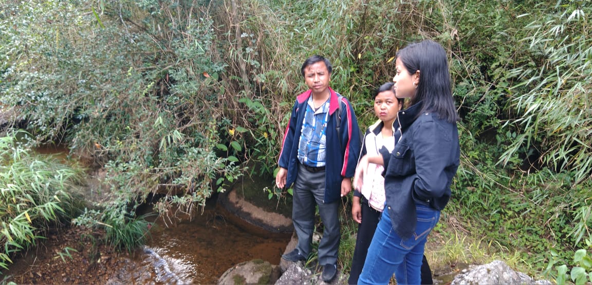
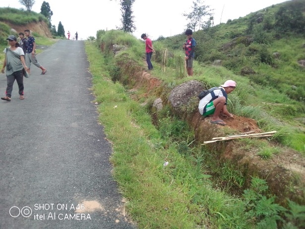
Village Boundary Mapping and Recourse Mapping:
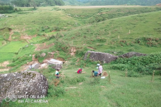
The GIS personnel along with the Village Community Facilitators mapped the village boundary of Sakwang Village.
The village resource map is prepared by the people of the community. In this resource map, the local people prepare it by drawing it on chart paper. Recourses such as agricultural lands, wells, wastelands, cattle population, playgrounds, ICDS, churches, community halls, etc were mapped.
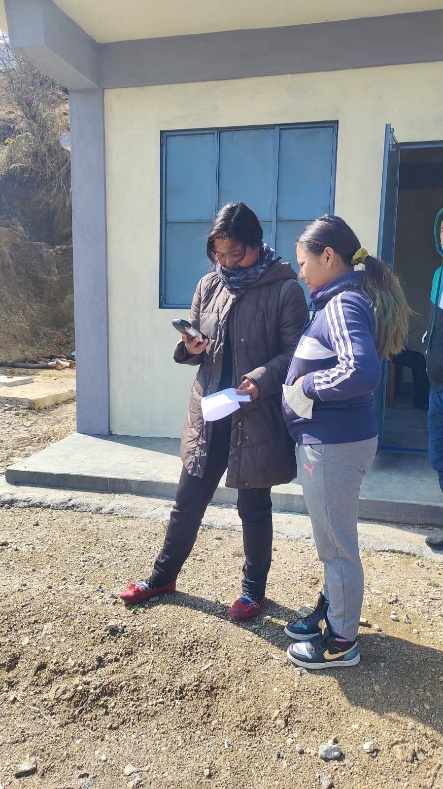
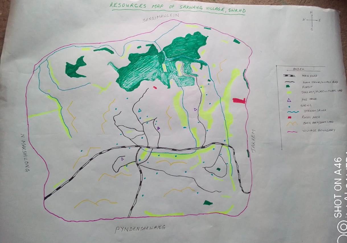
Fig:Resource map of Sakwang village Fig:Assisting in
village mapping by GIS.
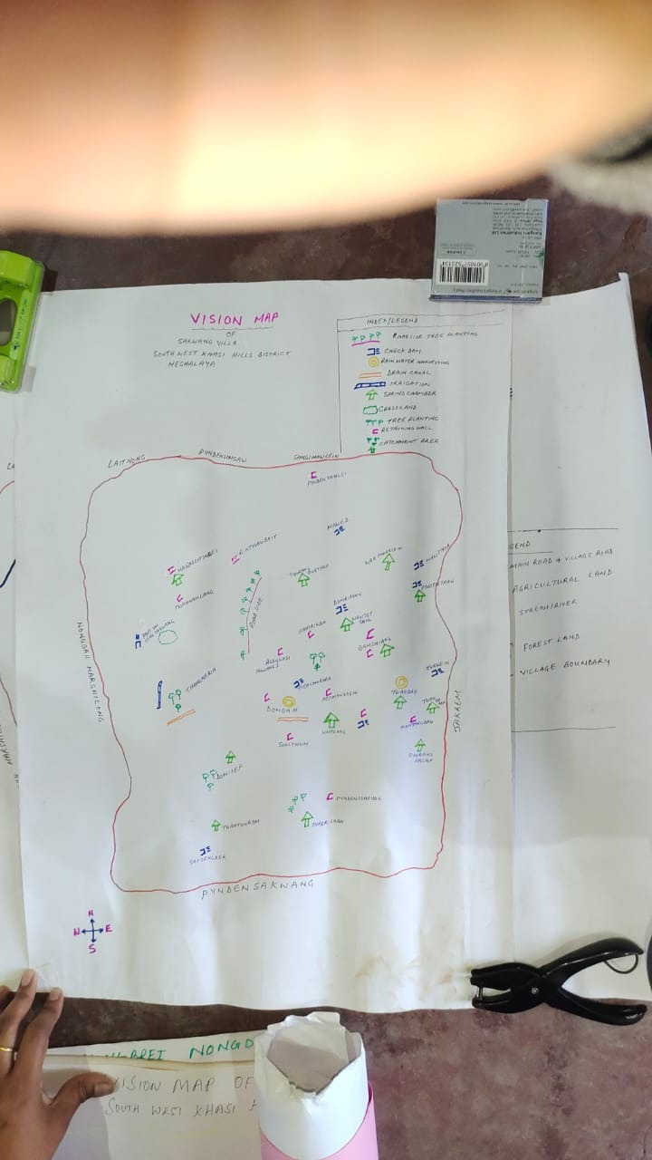
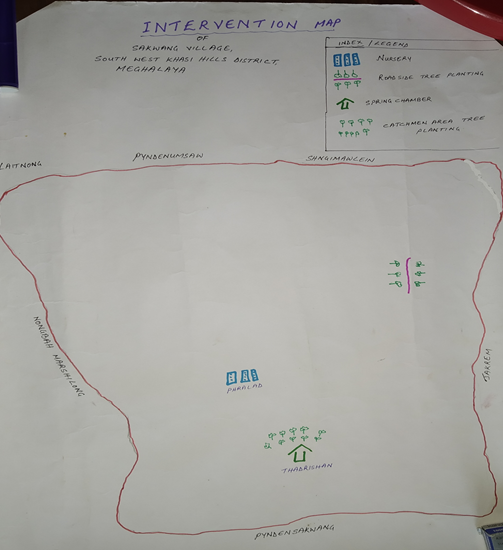
Fig: Intervention & Vision Map of Sakwang.
Findings Based on the Resource Map of Sakwang Village:
1. Main agriculture produce is Maize, Potato, Sweet potato and Paddy.
2. There are 2 Types of Forest ownership: Community and Private Owned.
i) 1 Community Forest (Ranab Jyrwein)
ii) Numerous Private Forest
3. There are culturable private wasteland - Doh japung, Twah sohiong , Phot lawsynrei.
4. There are two rivers present: Phot Rilang and Kroh.
5. There are 9 streams flowing in the Village.
6. There is 1 Community Hall in the village.
7. There are 1 Football playground.
8. Presence of Integrated Child Development Services (ICDS) through Anganwadi Centre (AWC).
9. There are 11 Schools within Sakwang village.
GIS Activities:
| Sl. No. | Parameters | Village Information |
|---|---|---|
| 1 | GPS Coordinates: | |
| I | Latitude | 25.392382 |
| Ii | Longitude | 91.483939 |
| Iii | Elevation Reading (MSL) | 1567 |
| 2 | Village Geographical Area (Ha) | 661.91 |
| i | Total Forest Area (including community, Clan, Pvt Forest) | 233.93 |
| ii | Total Area of Water Bodies | 7.36 |
| iii | Total Area under Agri-Horticulture | 154.11 (agricultural only) |
| iv | Total Degraded land area (Ha) | 55.42Ha |
| 3 | Average Annual Rainfall | 12000mm |
| 4 | Soil Type | Loamy soil |

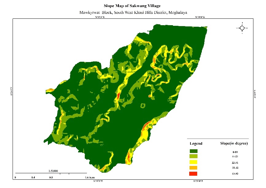
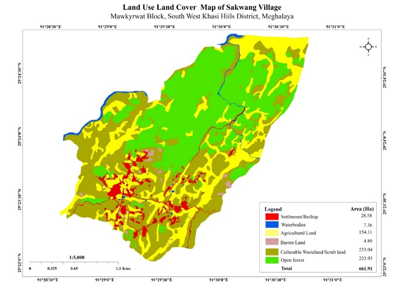
Fig: Boundary Map, Slope Map and LULC Map.
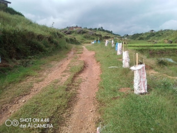
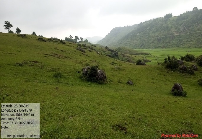
The Proposed list of Interventions:
|
Name of Proposed Interventions | Site |
|
Nos of HHs expected to Benefit | Priority (High/ Medium/ Low) |
|---|---|---|---|---|---|
|
|||||
| 1. | Check Dam | Twahlyngdoh |
|
|
|
| 2. | Spring Chamber & Treatment of catchment area | Thadrishan |
|
|
High |
| 3. | Community Nursery | Sakwang |
|
|
High |
| 4. | Afforestation (treatment of Spring at Thadrishan) | Thadrishaan |
|
|
High |
| 5. | Roadside Plantation | Sakwang |
|
|
High |
| 6. | Check Dam | Umsengsakwang |
|
|
High |
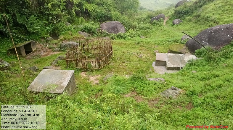
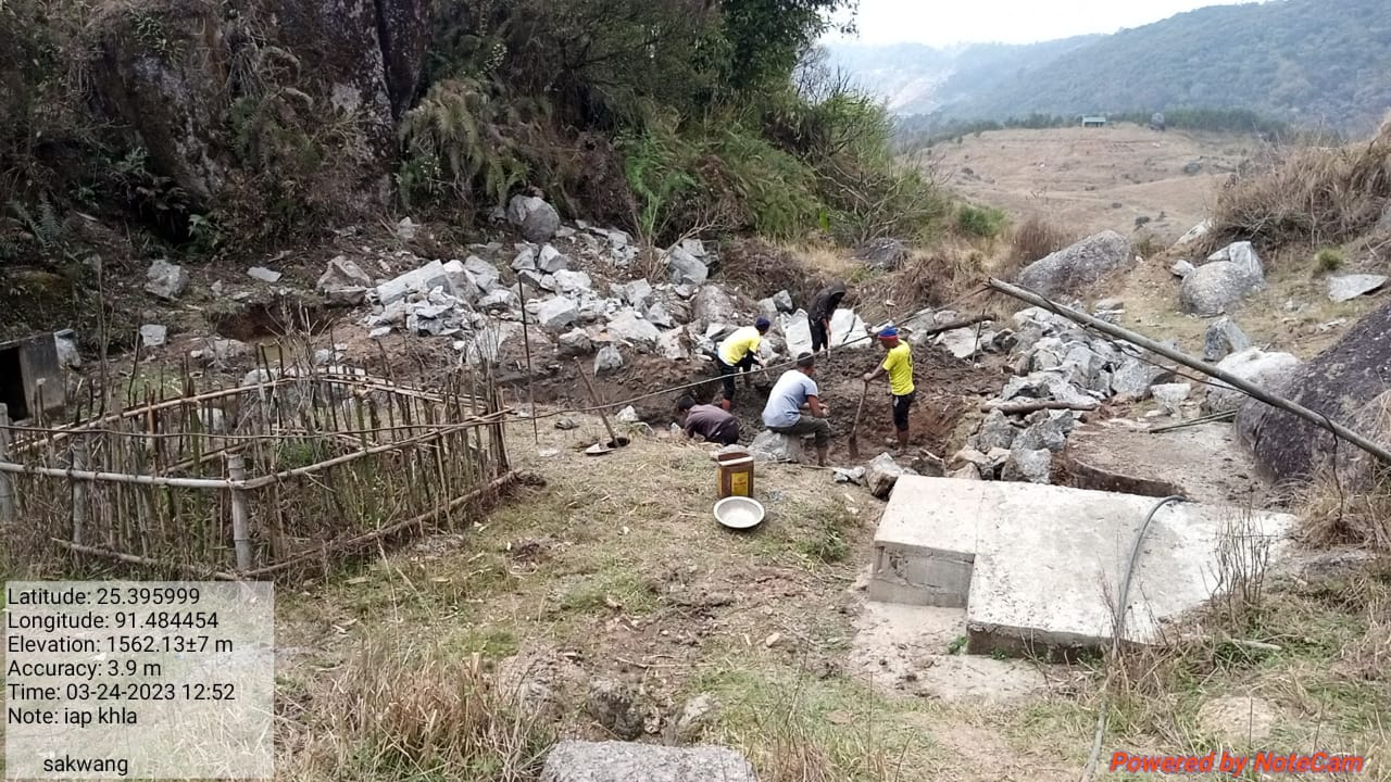
| 7. | Excavated water system | Iapkhla |
|
|
High |
| 8. | Afforestation | Riatmawboit |
|
|
High |
| 10. | Erosion control gabion check dam | Umseng Sakwang |
|
|
High |
| 11. | Boulder Gully Plug | Village land |
|
|
High |
| 12. | Afforestation | Mawmyriong Domsohphoh |
|
|
High |
| 13. | Afforestation | Mawmyriong Domsohphoh |
|
|
High |
| 14. | Afforestation | Mawsynoh |
|
|
High |
| 15. | Afforestation | Synker |
|
|
High |
| 16. | Irrigation Canal | Atep |
|
|
High |
| 17. | Horticulture | Shai Kynriang |
|
|
High |
| 18. | Dug Out Pond | Mawjetjang |
|
|
High |
| 19. | Afforestation | Kpep Menkhein |
|
|
High |
| 20. | Dug Out Pond | Jyrwiñ |
|
|
High |
| 21. | Checkdam | Thanshnong |
|
|
High |
| 22. | Afforestation | Mawthoh |
|
|
High |
| 23. | Afforestation | Kper Bahnat |
|
|
High |
Project Implementation:
| 1. | Type Of Intervention | Site Name | GPS Co-ordinates | Amount Sanctioned | Work Status | |
|---|---|---|---|---|---|---|
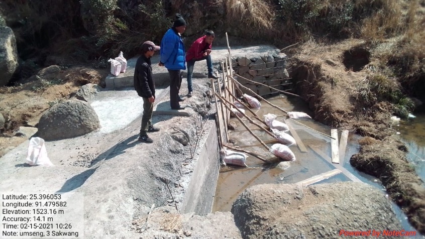
| Spring Chamber and treatment of catchment area at Thadrishan | Thadrishan | 25.388782 | 91.48913 | Rs.65,970 | Completed | |
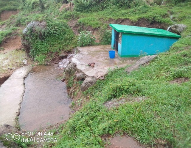
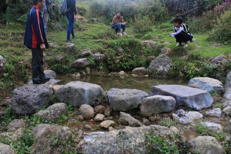
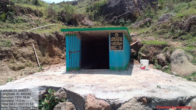
Fig: Spring Chamber and treatment of Catchment area at
Thadrishan.
| 2. | Type Of Intervention | Site Name | GPS Co-ordinates | Amount Sanctioned | Work Status | |
|---|---|---|---|---|---|---|
| Treatment of catchment area at Thadrishan | Thadrishan | 25.388782 | 91.48913 | Rs.3,500 | Completed | |
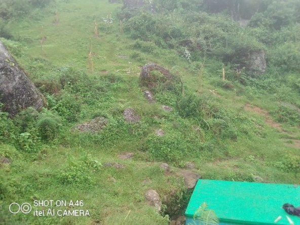
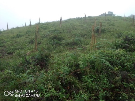
Fig: Treatment of Catchment area at Thadrishan.
| 3. | Type Of Intervention | Site Name | GPS Co-ordinates | Amount Sanctioned | Work Status | |
|---|---|---|---|---|---|---|
| Community Nursery at Phralad | Phralad | 25.391504 | 91.485708 | Rs.2,08,100 | Completed | |
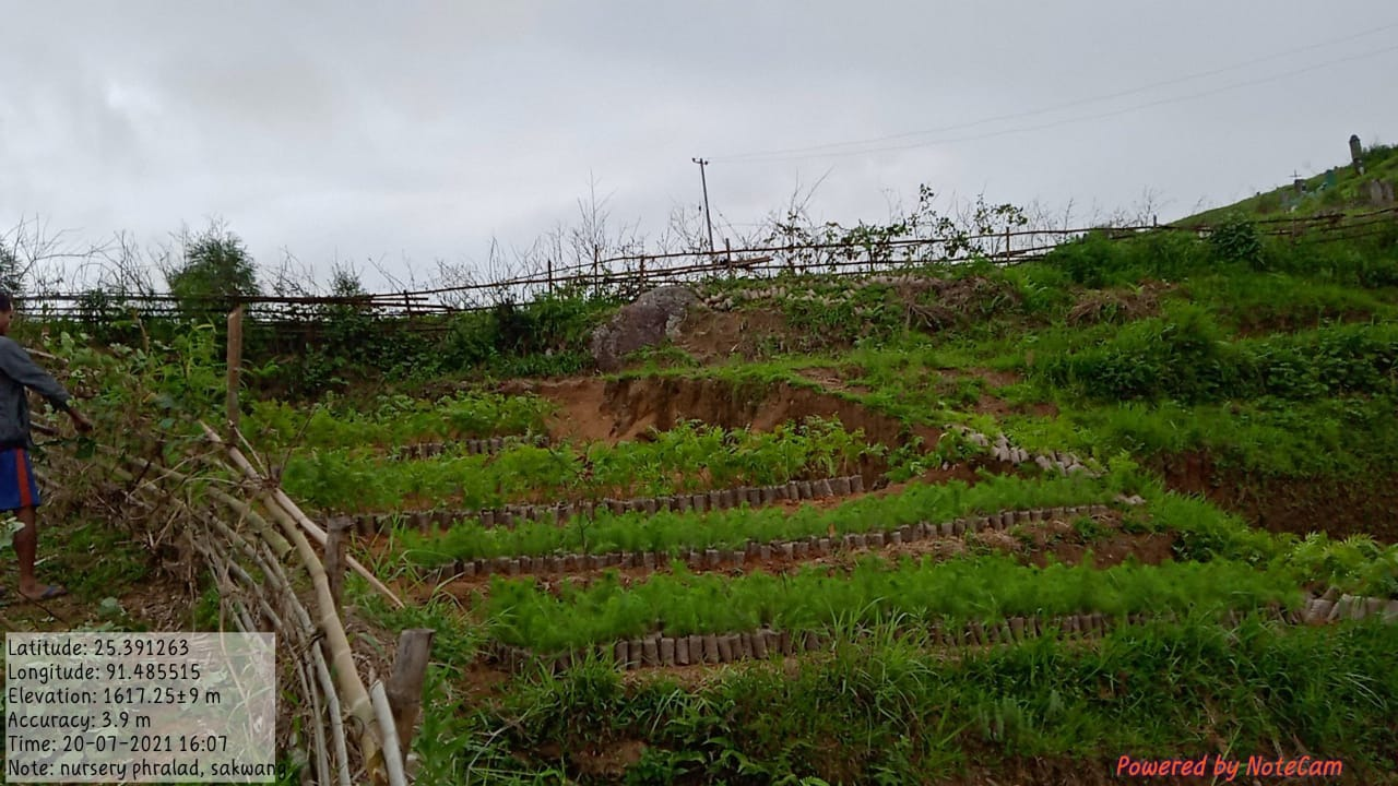
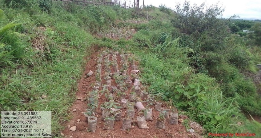
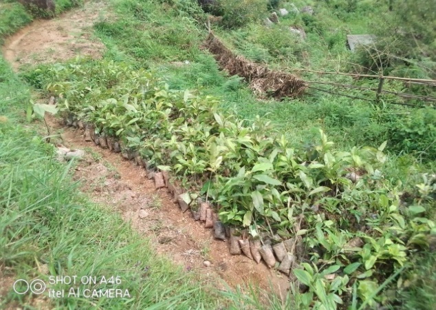
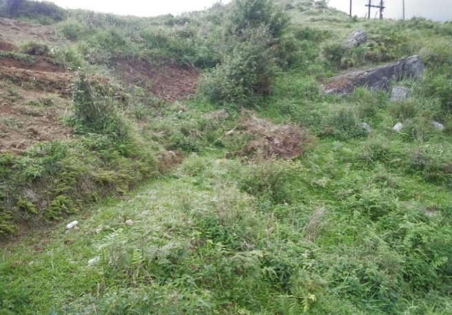
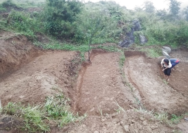
Fig: Community Nursery at Phralad Sakwang.
| 4. | Type Of Intervention | Site Name | GPS Co-ordinates | Amount Sanctioned | Work Status | |
|---|---|---|---|---|---|---|
| Roadside Plantation at Sakwang | Sakwang | 25.394501 | 91.435357 | Rs.1,64,500 | Ongoing | |
Fig: Roadside Plantation at Sakwang

| 5. | Type Of Intervention | Site Name | GPS Co-ordinates | Amount Sanctioned | Work Status | |
|---|---|---|---|---|---|---|
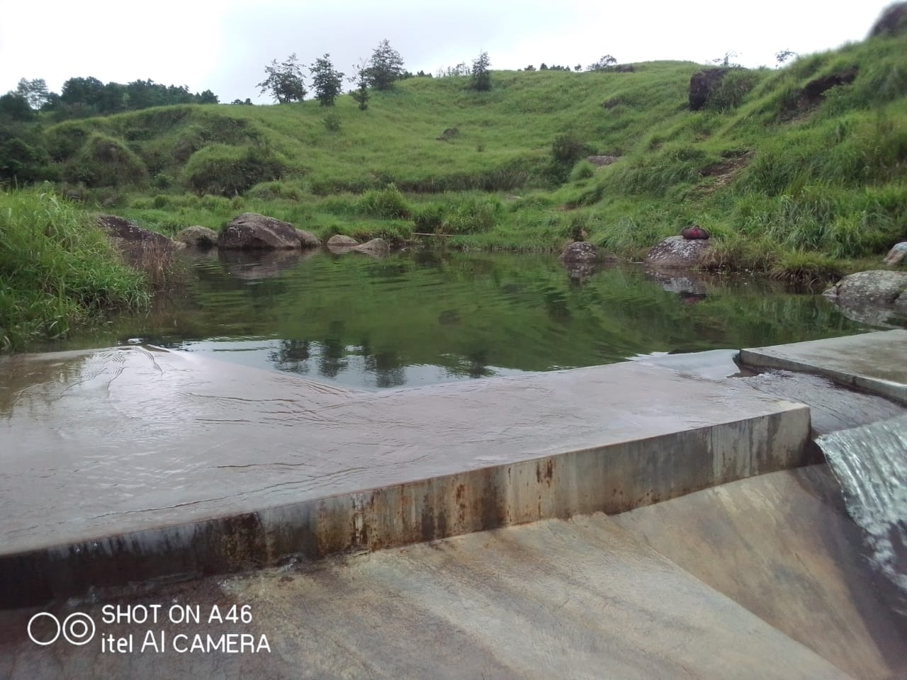
| Check dam at Phot Umseng | Sakwang | 25.39615 | 91.484338 | Rs.5,78,850 | Completed | |
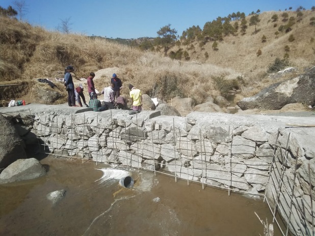
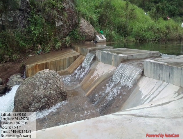
Fig: Checkdam at Phot Umseng Sakwang.
| 6. | Type Of Intervention | Site Name | GPS Co-ordinates | Amount Sanctioned | Work Status | |
|---|---|---|---|---|---|---|
| Check dam at Twahlyngdoh | Sakwang | 25.396947 | 91.493186 | Rs.5,13,200 | Completed | |
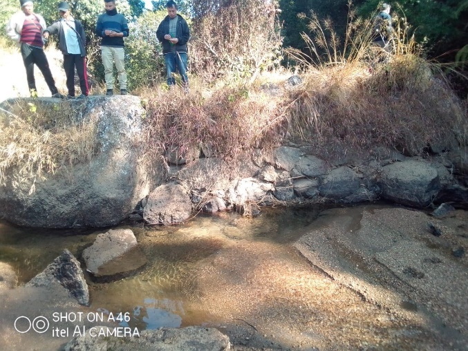
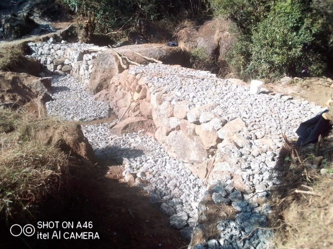
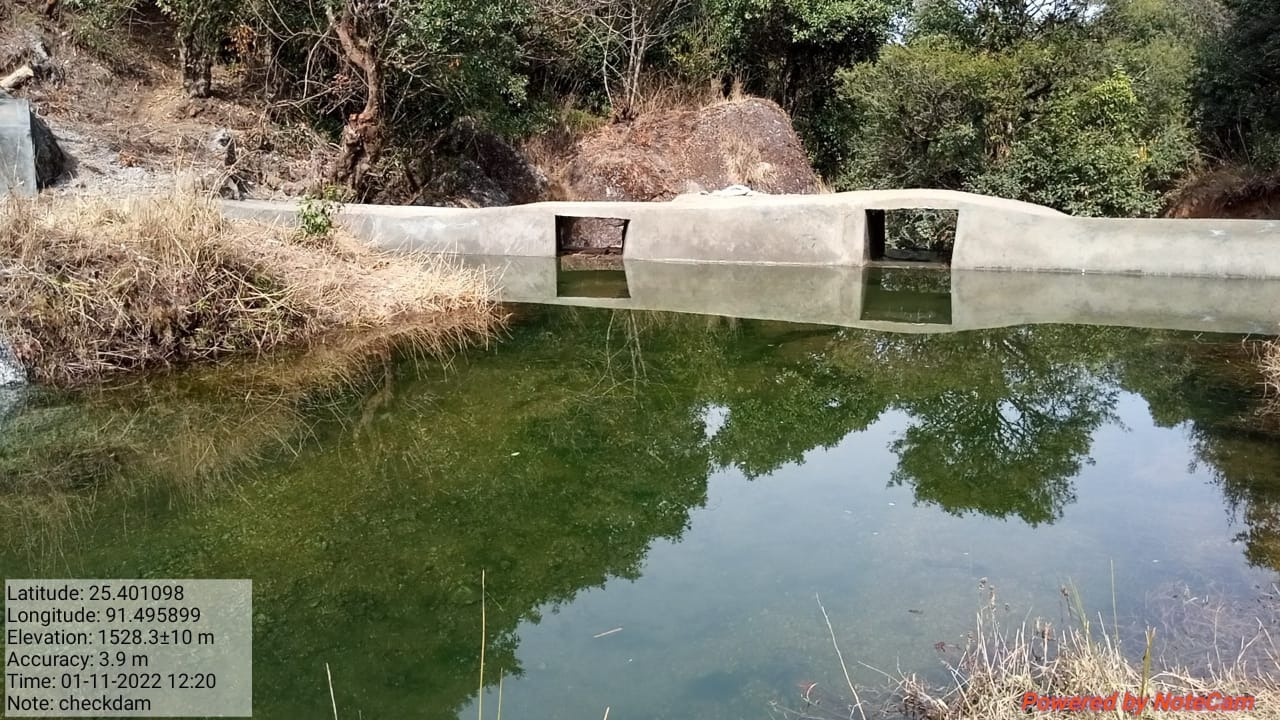
Fig: Checkdam at Twah Lyngdoh.
| 7. | Type Of Intervention | Site Name | GPS Co-ordinates | Amount Sanctioned | Work Status | |
|---|---|---|---|---|---|---|
| CC Weir at Tban Shnong | Tban Shnong | 25.392078 | 91.499025 | Rs.92,180 | Completed | |
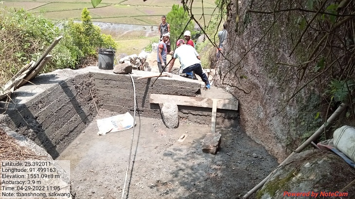
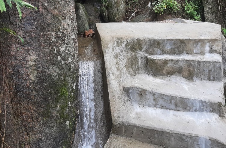
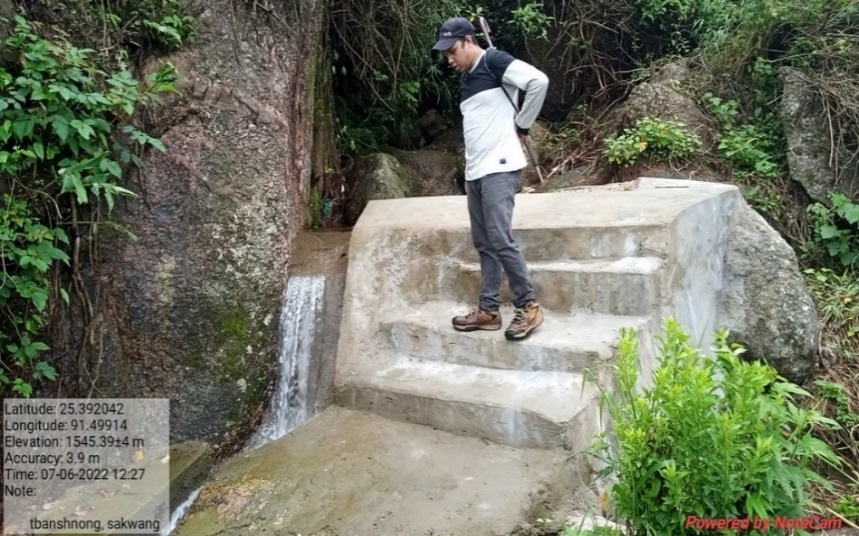
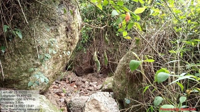
Fig: CC Weir at Tban Shnong
8. |
Type Of Intervention | Site Name | GPS Co-ordinates | Amount Sanctioned | Work Status | |
|---|---|---|---|---|---|---|
| Irrigation Canal at Atep | Atep | 25.392138 | 91.499025 | Rs.81,760 | Completed | |
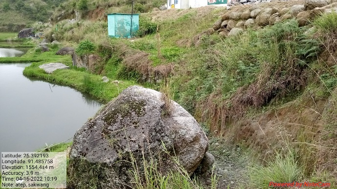
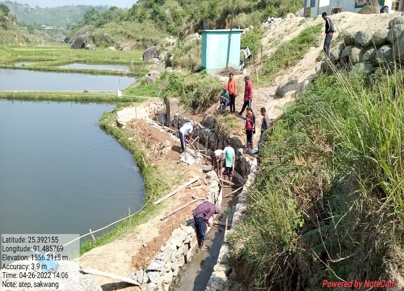
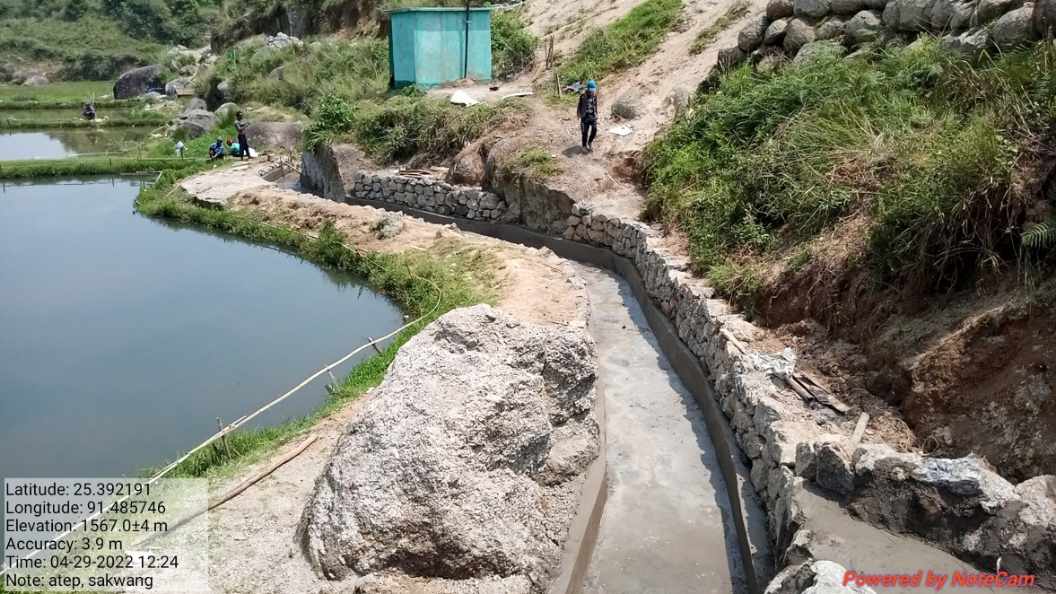
Fig: Irrigation Canal at Atep
| 9. | Type Of Intervention | Site Name | GPS Co-ordinates | Amount Sanctioned | Work Status | |
|---|---|---|---|---|---|---|
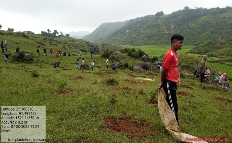
| Afforestation at Riatmawboit | Riatmawboit | 25.397924 | 91.484933 | Rs.73,150 | Completed | |
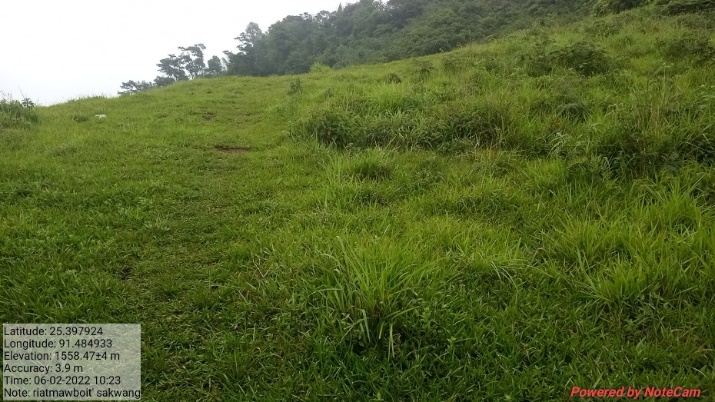
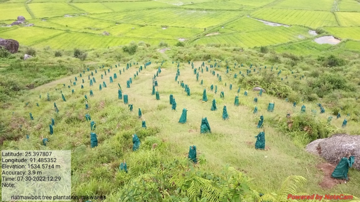
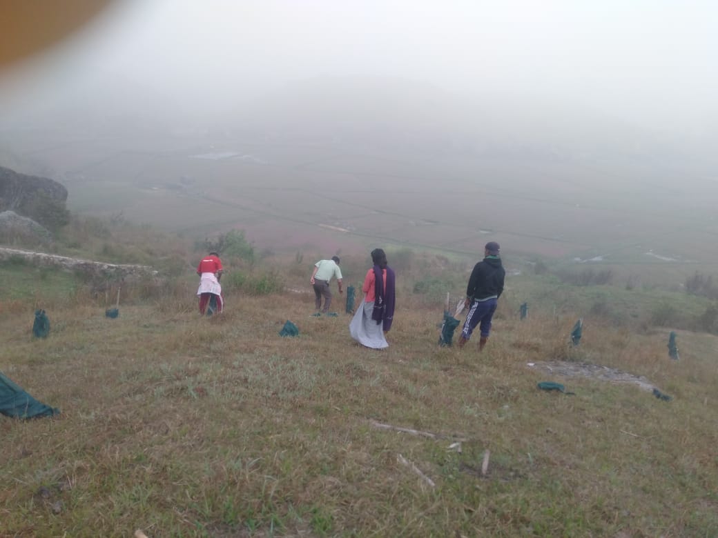
Fig: Afforestation at Riatmawboit.
| 10. | Type Of Intervention | Site Name | GPS Co-ordinates | Amount Sanctioned | Work Status | |
|---|---|---|---|---|---|---|
| Afforestation at Kper Bahnat | Kper Bahnat | 25.39245 | 91.491875 | Rs.30,150 | Completed | |
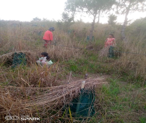
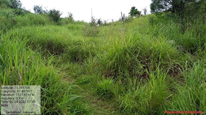
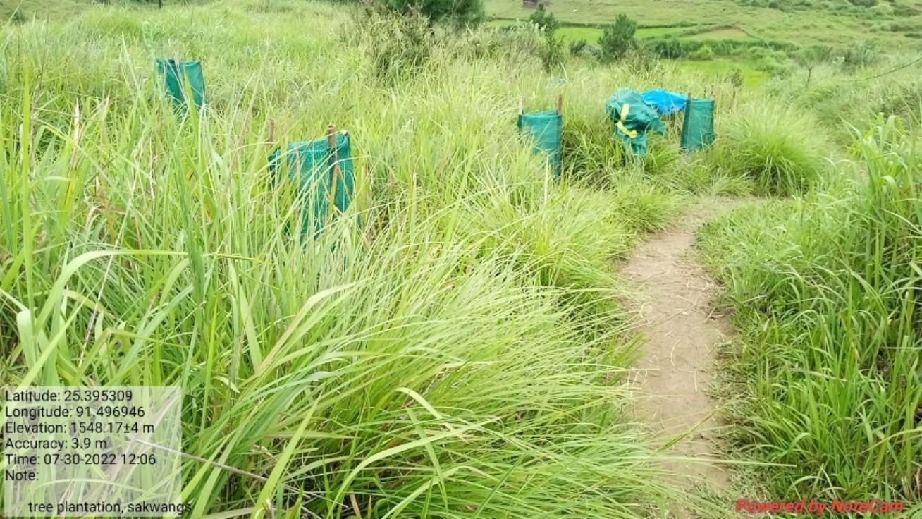
Fig: Afforestation at Kper Bahnat
| 11. | Type Of Intervention | Site Name | GPS Co-ordinates | Amount Sanctioned | Work Status | |
|---|---|---|---|---|---|---|
| Afforestation at Mawsynoh | Mawsynoh | 25.386827 | 91.491722 | Rs.87,390 | Completed | |
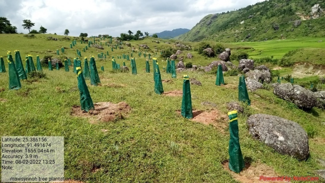
Fig: Afforestation at Mawsynoh.
| 12. | Type Of Intervention | Site Name | GPS Co-ordinates | Amount Sanctioned | Work Status | |
|---|---|---|---|---|---|---|
| Afforestation at Synker | Synker | 25.388374 | 91.4869003 | Rs.50,580 | Completed | |
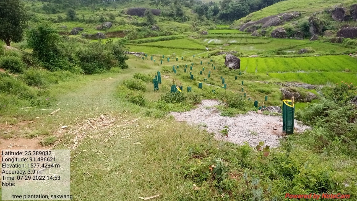
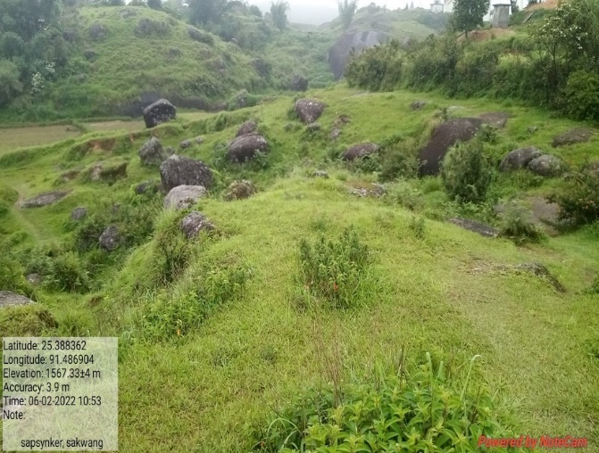
Fig: Afforestation at Synker.
| 13. | Type Of Intervention | Site Name | GPS Co-ordinates | Amount Sanctioned | Work Status | |
|---|---|---|---|---|---|---|
| Excavated Water System at Iapkhla | Iapkhla | 25.39587 | 91.484513 | Rs.2,05,670 | Completed | |
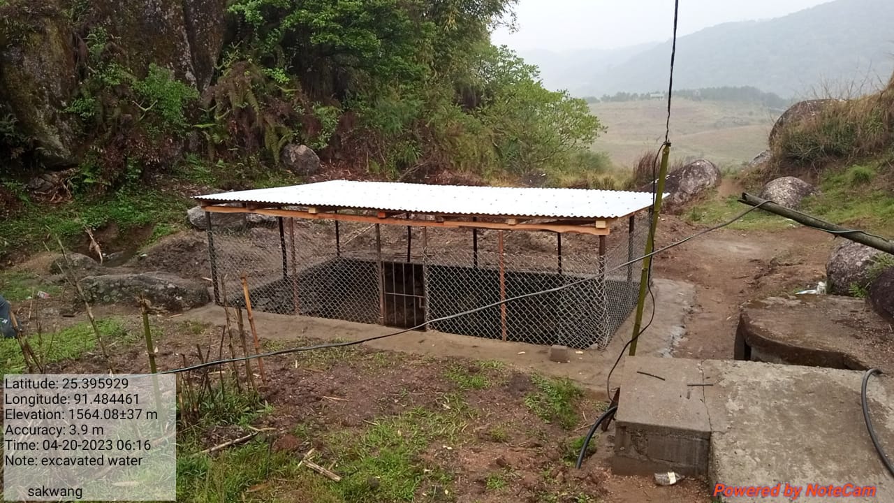
Fig: Excavated Water System at Iapkhla
| 14. | Type Of Intervention | Site Name | GPS Co-ordinates | Amount Sanctioned | Work Status | |
|---|---|---|---|---|---|---|
| Protection Wall at Shai Kynriang | Shaikynriang | 25.392065 | 91.485813 | Rs.91,700 | Completed | |
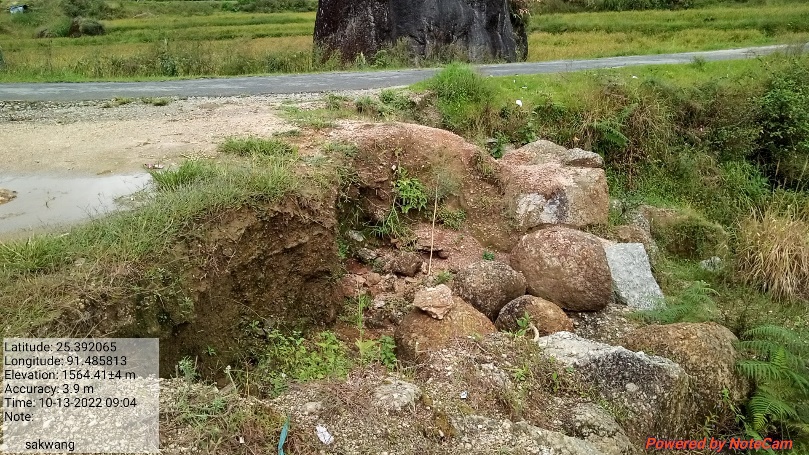
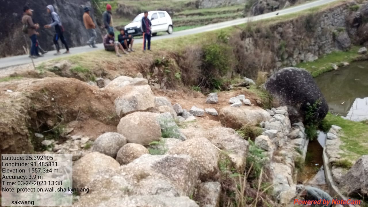
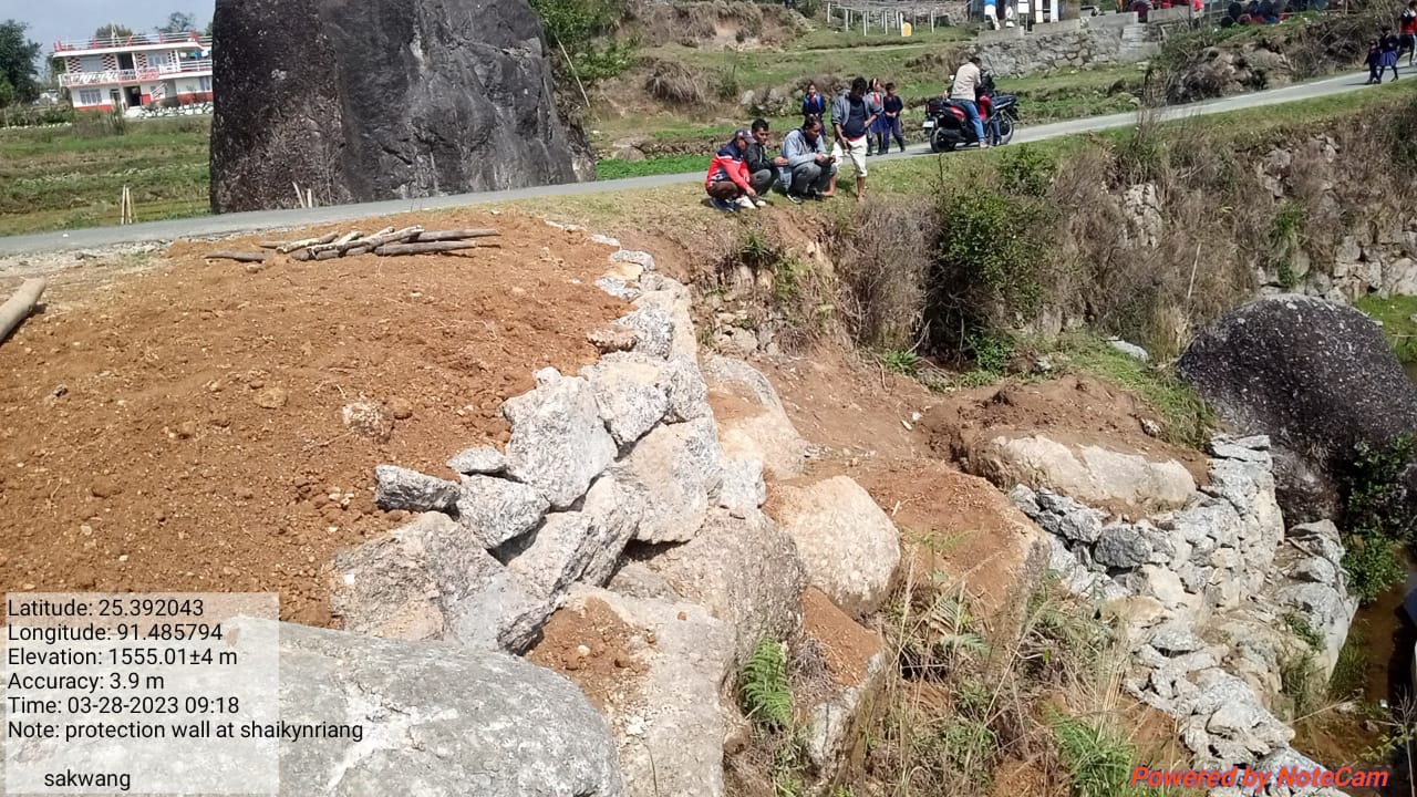
Fig: Protection Wall at Shai Kynriang.
| 15. | Type Of Intervention | Site Name | GPS Co-ordinates | Amount Sanctioned | Work Status | |
|---|---|---|---|---|---|---|
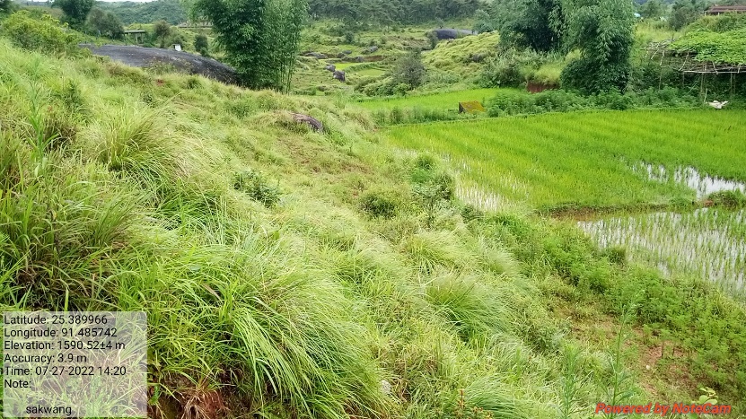
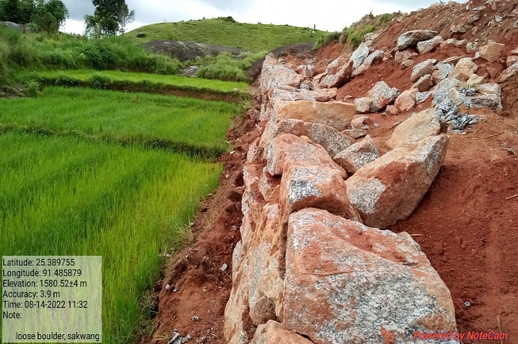
| Loose Boulder Bund at Dom Mawphor | Dom Mawphor | 25.389966 | 91.485742 | Rs.99,600 | Completed | |
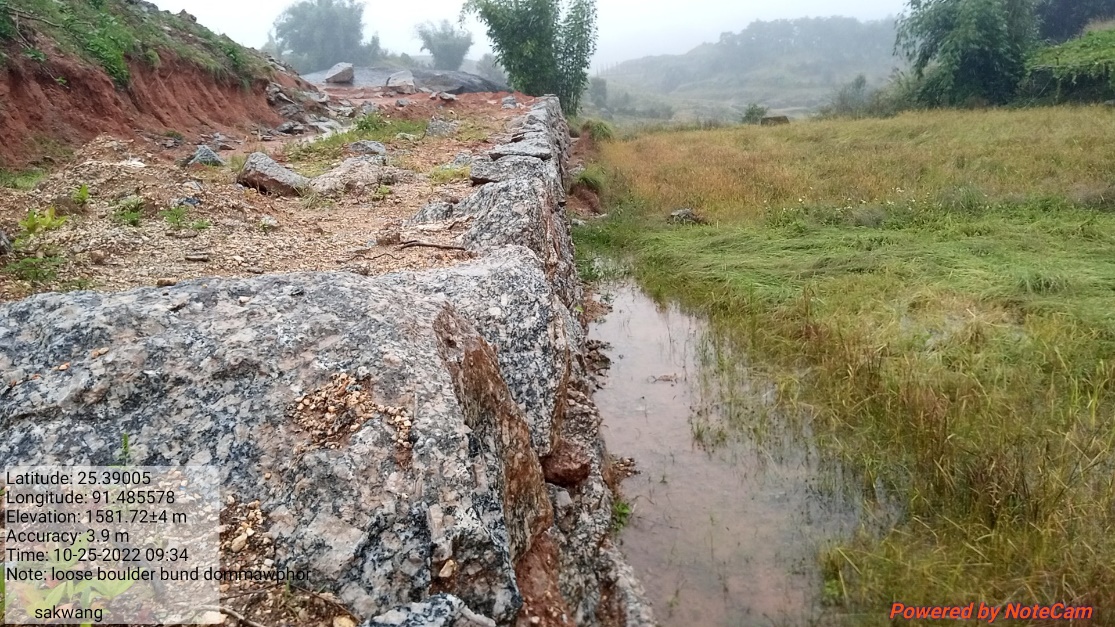
Fig: Loose Boulder Bund at Dom Mawphor

| 16. | Type Of Intervention | Site Name | GPS Co-ordinates | Amount Sanctioned | Work Status | |
|---|---|---|---|---|---|---|
| Protection Wall at Dom Mawphor | Dom Mawphor | 25.389929 | 91.486269 | Rs.3,08,700 | Completed | |
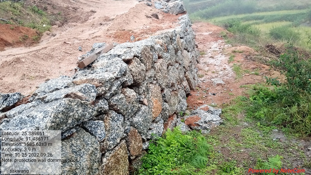

Fig: Protection Wall at Dom Mawphor
Fund Status:
Fund Released to VNRMC (Project Implementation)- Rs.26,55,000 Total No. of Work Order Issued-16 |
|||||
| Activity Name | Amount Sanction | Amount Spent | Work Order Issued Date | Start Date | End Date |
| Construction of Spring Chamber and treatment of catchment area at Thadrishan | Rs.65,970 | Rs.65,970 | 8th Jan 2020 | 27th May 2020 | 17th Jun 2020 |
| Treatment of catchment area at Thadrishan | Rs.3,500 | Rs.3,500 | 10th June 2020 | 18th Jul 2020 | 21st Jul 2020 |
| Community Nursery at Phralad | Rs.2,08,100 | Rs.91,613 | 26th June 2020 | 27th Jun 2020 | 6th July 2022 |
| Roadside Plantation at Sakwang | Rs.1,64,500 | Rs.1,91,543 | 14th July 2020 | 24th Aug 2020 | 6th July 2022 |
| Construction of a check dam at Phot Umseng | Rs.5,78,850 | Rs.5,19,129 | 23rd Oct 2020 | 22nd Dec 2020 | 26th March 2021 |
| Construction of a check dam at Twahlyngdoh | Rs.5,13,200 | Rs.5,11,133 | 23rd Oct 2020 | 15th Nov 2021 | 31st Dec 2021 |
| CC Weir at Tban Shnong | Rs.92,180 | Rs.92,180 | 10th Mar 2022 | 16th April 2022 | 30th April 2022 |
| Irrigation Canal at Atep | Rs.81,760 | Rs.81,760 | 10th Mar 2022 | 11th April 2022 | 30th April 2022 |
| Afforestation Riatmawboit | Rs.73,150 | Rs.73,150 | 31st Mar 2022 | 23th July 2022 | 29th July 2022 |
| Afforestation At Kper Bahnat | Rs.30,150 | Rs.30,150 | 31st Mar 2022 | 23th July 2022 | 29th July 2022 |
| Afforestation Mawsynoh | Rs.87,390 | Rs.87,390 | 31st Mar 2022 | 23th July 2022 | 29th July 2022 |
| Afforestation Synker | Rs.50,580 | Rs.50,580 | 31st Mar 2022 | 23th July 2022 | 29th July 2022 |
| Excavated Water System at Iapkhla | Rs.2,05,670 | Rs.2,05,670 | 31st Mar 2022 | 1st March 2023 | 31th March 2023 |
| Protection wall at Shaikynriang | Rs.91,700 | Rs.91,700 | 16th June 2022 | 8th March 2023 | 25th March 2023 |
| Loose Boulder Bund at Dom Mawphor | Rs.99,600 | Rs.99,600 | 16th June 2022 | 3th August 2022 | 17th August 2022 |
| Protection Wall at Dom Mawphor | Rs.3,08,700 | Rs.3,08,700 | 16th June 2022 | 24th August 2022 | 26th Sept 2022 |
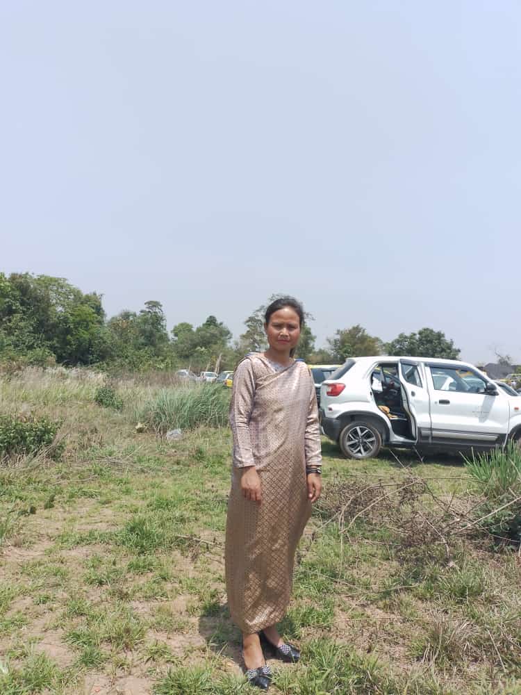
12. GROUND TESTIMONIALS:
Mr. Kworsingstar Ramsiej
VCF Environment
Sakwang VNRMC
According to Mr.Kworsingstar Ramsiej the Community Led-Landscape Management Project that had been implemented at Sakwang village had brought much benefit to the community members. Conserving and managing the Natural Resources such as forest, land and water is the main theme of the Project. Mr.Ramsiej said that if each and everyone of us do our part and practise sustainable management of natural resources, the children of the community as a whole will reap the benefits in the future generations. All these resources are freely available to us, let us be kinder and thoughtful towards mother nature and it will in turn bless us with its produce.
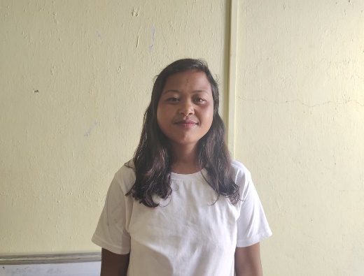
Mr.Pynskhembor Shangdiar
VCF Monitoring & Evaluation
Sakwang VNRMC
As a VCF I have always take my chance to learn new things, and being with CLLMP has taught me to write, update and maintain the book of records such as the purchase register, cheque issue register, Utilisation Certificate, Payment voucher, Cashbook, etc.
Ms.Messiful Nongrem
Secretary Sakwang VNRMC
I have received many trainings on maintaing the books of records, on Forest Management Plan and even had an oppourtunity to go for knowledge sharing exposure visits which had given me new ideas to share with the village Committee. As a secretary,I now feel confident to answer when people ask me about the objective of CLLMP be it within our village or when I was asked during the training sessions. We as a village are now more aware of the ways each member of the community can contribute to manage the resources.
Bansharailang Ramsiej
VCF Social Management
Sakwang VNRMC
First of all, CLLMP had given me the oppourtunity to go for an exposure visit and I have also received trainings on NRM, ASCI, Seedball making and on Forest Management Plan. The most recent experience I had was an oppourtunity to represent the office as a resource person on “Seedball Making” to some of the schools within the district. Miss Bansharai said that “ I have always been just a trainee, but it feels good to have had the knowledge and became a trainer myself.” She also added that being a village community Facilitator has helped her to come out of her shell and socialised with other people.
……………………………..*******************…………………………………………
5