Report of Sohmynting Village
District: West JaintiaHills
Block: Thadlaskein Block
Date: 22nd March 2023
COMMUNITY LED LANDSCAPE MANAGEMENT PROJECT


COMMUNITY LED LANDSCAPE MANAGEMENT PROJECT (CLLMP)
The Government of Meghalaya with financial help from the World Bank is implementing the Meghalaya Community Led Landscape Management Project (MCLLMP). The project covers the entire state of Meghalaya, and implementation of community-led plans are rolled out in a phased manner throughout the state. The Meghalaya Basin Management Agency (MBMA) will facilitate community-led planning by providing support, technical inputs and funding.
The project is intended to strengthen community-led natural resources management in selected landscapes within the 7 districts of the state. This would be achieved through a variety of planning, capacity building, and on-the-ground interventions to promote the conservation, sustainable use of natural resources, social inclusion and community mobilization; building traditional knowledge and learning, mapping of natural resources management; strengthening the community institutions and creating linkage with financial institutions and community organizations.
The project interventions will include preparation of community led natural resource management plans. The CLLMP has the following three components:
Strengthening Knowledge and Capacity of Communities for Natural Resources Management
Community-Led Landscape Planning and Implementation
Project Management and Governance
The project objective is “to manage and conserve the natural resources, especially forests, soil and water sources, in a manner that supports the financial and physical well-being of communities in the State”
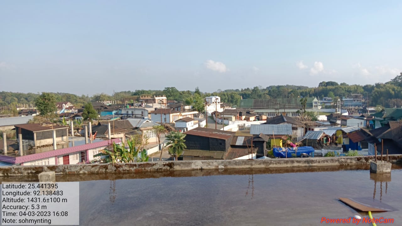
Sohmynting Village is located in Thadlaskein C. D Block, in West Jaintia Hills district in the state of Meghalaya. Agriculture is the main profession of this village and does not have any industrial development. The People of this area is very peaceful without taking much issues and problems to think about the external affairs. They are confined to what they have been doing and comfortable with their daily schedule.
According to the village history, Sohmynting has originated since the 15th Century. It is the oldest place in Jaintia Hills District. There are evidences like the sacred groves, Holy River (Wah mynsen) which endured until now. The first settler of this village was from the title family of ‘’Pyrtuh ‘’. Till today, ruling and organising are controlled by the ‘’Pyrtuh’’and the others who lived in this village also joined hands to unite with it (Pyrtuh) for betterment of the society.
The community are mainly into farming as they work on paddy cultivation, plantation of vegetables etc. And later after many years,the village was extended to the large society and people came to start their family. Education system was built and the household has been extended to 758 households with lots of population.
Sohmynting Village is located in Thadlaskein C.D Block, in West Jaintia Hills District Meghalaya, India. It is located 20km from Block Office and 10km from the district headquarter, Jowai. The traditional land tenure is Daloiship. The village is inhabited by Pnar Community with 758 households and a population of 3990. The gender ratio in the village is 1962 males and 2028 females. The major occupations of the people in the village were farmer, daily wages, Teachers, business and government services. Public transport facilities to and from village is (local taxi, tourist cab, sumo).
As per the data collected, 758 HH uses fire wood for meeting the fuel needs with an average consumption of 9000 kg per household per annum and 270 HH use LPG with an average of 3 cylinders per household per annum. The village does not have sites of tourist interest. The main institution of the village is the Village Council, School Managing Committee (SMC) and were functional, 6 Self Help Group (SHGs) are there in the village. There is no Water and Sanitation Committee. Government Water supply availability is not there in the village. There is no CHC at present. There are 13 Primary Schools in the village.

The major occupations of the people in the village are farmer, daily wages, teachers, business and government services.
LAND
Open Forest-157.15 Ha
Water Bodies- 23.11 Ha
Agri-horti-408.74 Ha
Degraded Land- 1510.82 Ha
WATER BODIES
Springs- 7
Stream-5
River- 1
Safe drinking Water
Construction canal
Irrigation System

Degraded Land
Water Shortage in Winter Session
Water bodies affected
The Village has been adopted by CLLMP on 7th December 2019. The CGC, EOI and VGA was signed on the 11th December 2019. As per the template submitted, the village meeting consists of 7 members although there were more members. The meeting consist of a village Head man, Secretary and a Treasurer. There were women representatives in the Village meeting. The community decided to have a meeting with the entire village members and discuss about the project, formation of VNRMC, EC and Village facilitators.
1. There is water shortage in winter season
2. Timber has been reduced over the years due to commercial use.
3. The community has to buy fuel wood from other villages due to insufficient of wood in their village.
4. Water bodies are facing threat due to soil waste, domestic waste water, siltation.
5. There is no proper facilities for irrigation hence the community members have to depend on rainy season.
6. There is no irrigation system in the village.
7. The cause of degradation is due to deforestation.
The list of indigenous tree species are – Dieng kseh, Myrica esculenta (sohphai), Sohiong (Prunus nepalensis), Sohlyngi, dieng chyrngan (Schuma wallichii), Sapriam (Psidium guajava), dieng sning,dienglin (Betula alnoides).
The Valuable grasses of the village are- Kdait, shken khian,symblang, tyndoo wapung, sla thylliang,yootem.
Commercially valued tree- Dieng chyrngan (schma wallichii), dieng kseh, dienglien (Betula alnoides).
Formation of VNRMC
The formation of VNRMC EC members and VCF were been done on the 7th December 2019, wherein the community decided to select the representatives from VEC, SHG and other village functionaries.
Listed below are the members of the VNRMC:
| Village Natural Resource Management Committee (VNRMC) | ||||||||
|---|---|---|---|---|---|---|---|---|
| Sl No | Name in Full | Gender M/F | Age (in Yrs) | Education | Designation | Occupation | Community | Contact No and email address |
| 1 | Teimi Rymbai | M | 30 | SSLC Passed | P.C | Labour | Pnar | 7005184849 |
| 2 | Kampher Langshiang | M | 38 | IX Passed | P.C | Labour | Pnar | 7005504227 |
| 3 | Ialamdeibha Pyrtuh | F | 44 | SSLC Passed | P.C | Labour | Pnar | 6009303342 |
Village Facilitators (VCF)
| Sl No | Name in Full | Gender M/F | Age (Yrs) |
Education | Area of specialisation/ focus (forests, water, soil, accounts, environmental and social safeguards, knowledge management, GIS) | Trained under CLLMP (Yes/ No?) if Yes, date training was received | Contact No and email address |
|---|---|---|---|---|---|---|---|
| 1 | Mrs Deisbunki Kyndait | F | 29 | XII Passed | M & E | No | 9612081848 |
| 2 | Mr Winchester Kassar | M | 24 | XII Passed | Social | No | 9366717942 |
| 3 | Mr Jerry A Suting | M | 24 | XII Passed | Environment | No | 7005670081 |
PRA exercise was conducted on the 15th November 2019 at Sohmynting Village, Thadlaskein Block, WJH.
Plan Estimate:
The plan estimate is done once field engineer along with the Environment Management pay a visit to the proposed sites for inspection. On approval, the plan estimate is being carried out further by the district field engineer.
3. PROJECT IMPLEMENTATION
| Type Of Intervention | Site Name | GPS Co-ordinates | Plan Estimate | Work Status | ||
|---|---|---|---|---|---|---|
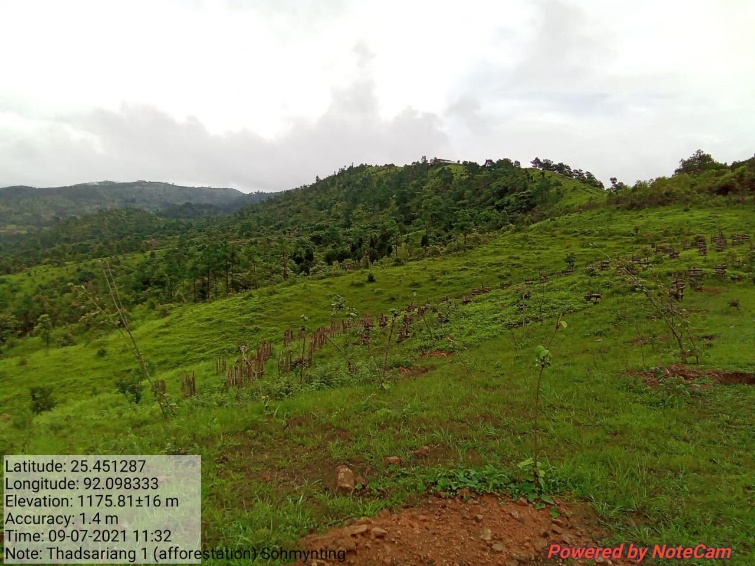
| 1 | Afforestation | Thad Sariang 1 | Lt 25. 451287 | L 92.098333 | Rs.1,66,170.00 | Implemented |
| 2 | Afforestation | Thad Sariang 2 | Lt 25.450952 | L 92.099022 | Rs.1,66,170.00 | Implemented |
| 3 | Recharge Pit | Umtlang Dongwah | Lt. 25.43548 | L 92.138843 | Rs.27,794.00 | Implemented |
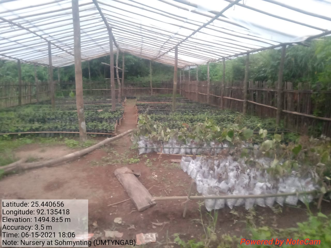
| 4 | Community Nursery | Umtyngab | Lt. 25.440656 | L 92.135418 | Rs.1,13,960.00 | Implemented |
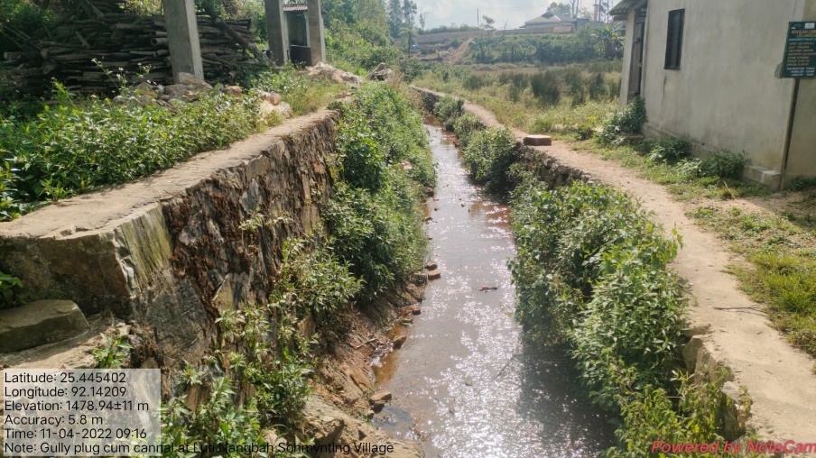
| 5 | Gully Plug cum Canal | Luti Nongbah | Lt 25.445402 | L 92.14209 | Rs.1,76,612.00 | Implemented |
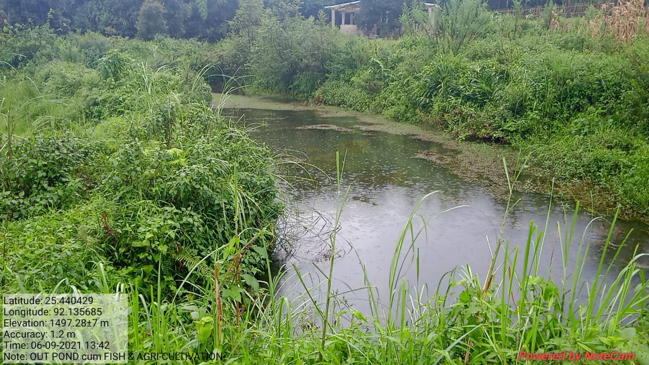
| 6 | Dug Out Pond cum fish & agri cultivation | Umtyngab | Lt 25.440429 | L 92.135685 | Rs.4,97,653.00 | Implemented |
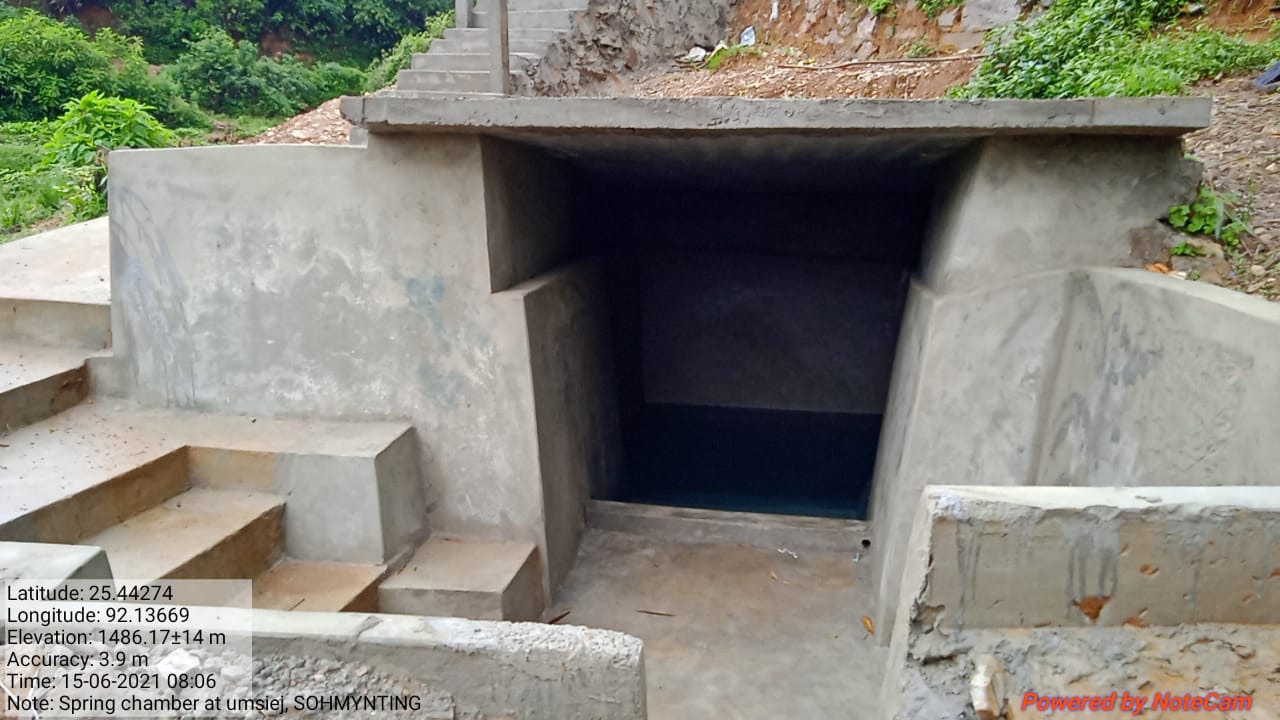
| 7 | Spring Chamber | Umsiej | Lt 25.44274 | L 92.13669 | Rs.1,43,422.00 | Implemented |
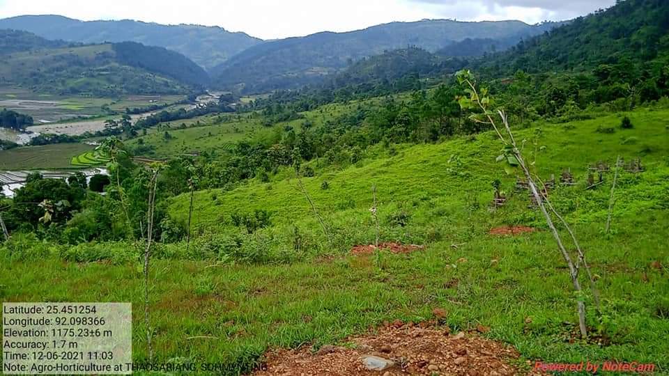
| 8 | Agro-Horticulture | Thad Sariang | Lt 25.451252 | L 92.098366 | Rs. 1,06,150.00 | Implemented |
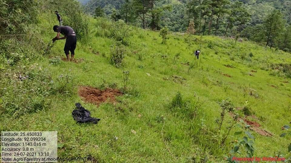
| 9 | Agro-Forestry | Mooiong | Lt 25.459833 | L 92.099204 | Rs. 1,11,250.00 | Implemented |
| 10 | Vermi Composting | Umtyngab | Lt 25.440536 | L 92.135219 | Rs. 3,01,619.00 | Implemented |
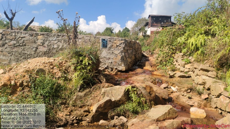
| 11 | Canal cum Retaining Wall | Luti Nongbah | Lt.25.444852 | L 92.143255 | Rs.2,50,265.00 | Implemented |
4. FUND STATUS
| SL NO | Type Of Intervention | Site Name | GPS Co-ordinates | Amount Estimate | Work Status |
|---|---|---|---|---|---|
| 1 | Community Nursery | Umtyngab | Elevation: 1494.8+5m | Rs.1,13,960.00 | Implemented |
| SL NO | Type Of Intervention | Site Name | GPS Co-ordinates | Amount Estimate | Work Status |
|---|---|---|---|---|---|
| 2 | Dug out pond cum fish & agri cultivation | Umtyngab | Elevation:1497.28+7m | Rs.4,97,653.00 | Implemented |
| SL NO | Type Of Intervention | Site Name | GPS Co-ordinates | Amount Estimate | Work Status |
|---|---|---|---|---|---|
| 3 | Spring Chamber | Umsiej | Elevation:1486. 17+14m | Rs.1,43,422.00 | Implemented |
| SL NO | Type Of Intervention | Site Name | GPS Co-ordinates | Amount Estimate | Work Status |
|---|---|---|---|---|---|
| 4 | Afforestation | Thad Sariang 1 | Elevation:1175.81+16m | Rs.1,66,170.00 | Implemented |
| SL NO | Type Of Intervention | Site Name | GPS Co-ordinates | Amount Estimate | Work Status |
|---|---|---|---|---|---|
| 5 | Agro forestry | Mooiong | Elevation:1143.0+5m | Rs.1,11,250.00 | Implemented |
| SL NO | Type Of Intervention | Site Name | GPS Co-ordinates | Amount Estimate | Work Status |
|---|---|---|---|---|---|
| 6 | Agro horticulture | Thad Sariang | Elevation:1175.23+6m | Rs.1,06,15 0.00 | Implemented |
| SL NO | Type Of Intervention | Site Name | GPS Co-ordinates | Amount Estimate | Work Status |
|---|---|---|---|---|---|
| 7 | Gully plug cum canal | Luit nongbah | Elevation:1478.94+11m | Rs.1,76,612.00 | Implemented |
| SL NO | Type Of Intervention | Site Name | GPS Co-ordinates | Amount Estimate | Work Status |
|---|---|---|---|---|---|
| 8 | Canal cum Retaining wall | Luti Nongbah | Elevation:1466.81+8m | Rs.2,50,265.00 | Implemented |
.