The Government of Meghalaya with financial help from the World Bank is implementing the Meghalaya Community Led Landscape Management Project (MCLLMP). The project will cover the entire state of Meghalaya and implementation of community led plans will be rolled out in phase manner throughout the state. The Meghalaya Basin Management Agency (MBMA) will facilitate community-led planning by providing support, technical inputs and funding.
The project is intended to strengthen community-led natural resources management in selected landscapes within the 11 districts of the state. This would be achieved through a variety of planning, capacity building, and on-the-ground interventions to promote the conservation, sustainable use of natural resources, social inclusion and community mobilisation; building traditional knowledge and learning, mapping of natural resources management; strengthening the community institutions and creating linkage with financial institutions and community organizations.
The project interventions include preparation of community led natural resource management plans. The CLLMP has the following three components:
Strengthening Knowledge and Capacity of Communities for Natural Resources Management
Community-Led Landscape Planning and Implementation
Project Management and Governance
The project objective is “to manage and conserve the natural resources, especially forests, soil and water sources, in a manner that supports the financial and physical well-being of communities in the State”
The CLLM-Programme focuses on increasing the capacities of communities and traditional institutions (TI) by adopting a landscape approach to manage their natural resources such as soil, springs and other water sources, forests and bio-diversity, etc.
The project will be planned and implemented in about 400 villages across the state.
CLLMP has a strong focus on institution-building at the village-level, by ensuring systematic capacity-building on technical and social skill-sets.
The project will also extend such training to communities beyond the targeted villages and support efforts made by them to access funding from various rural and natural resources initiatives and schemes.
The programme will also invest in improving the process and outcome delivery, by developing and adhering to effective systems and procedures, supported by the appropriate technology.
Benefits for community (Skills and Capacity relating to technical and managerial areas like NRM and Conflict resolution
Benefits to traditional institutions (village councils, traditional leaders, community-based organizations, SHGs etc) through Knowledge sharing, promotion of innovative approach, access to technology, technical managerial and financial support.
It is estimated that the project will impact around 1 lakh partners (of which 50% are women) who depend on land, forest, agroforestry.
Through the project, 55000 Ha of targeted area will be ensured with availability of water, biological resources and soil productivity, which will in turn benefit around 400 villages and the outcomes delivery can be summarized as follows.
The Project is executed by the MBMA in collaboration with other partners particularly, SIRD (for training and capacity building), Department of Soil and Water Conservation, Water Resource Department, Forest Department, specifically with respect to technical inputs, safeguards management and Community NRM plan preparation
2018-2023 (5 years)
Introduction
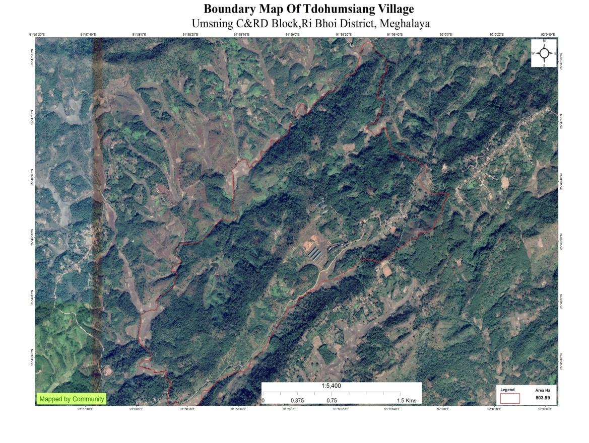
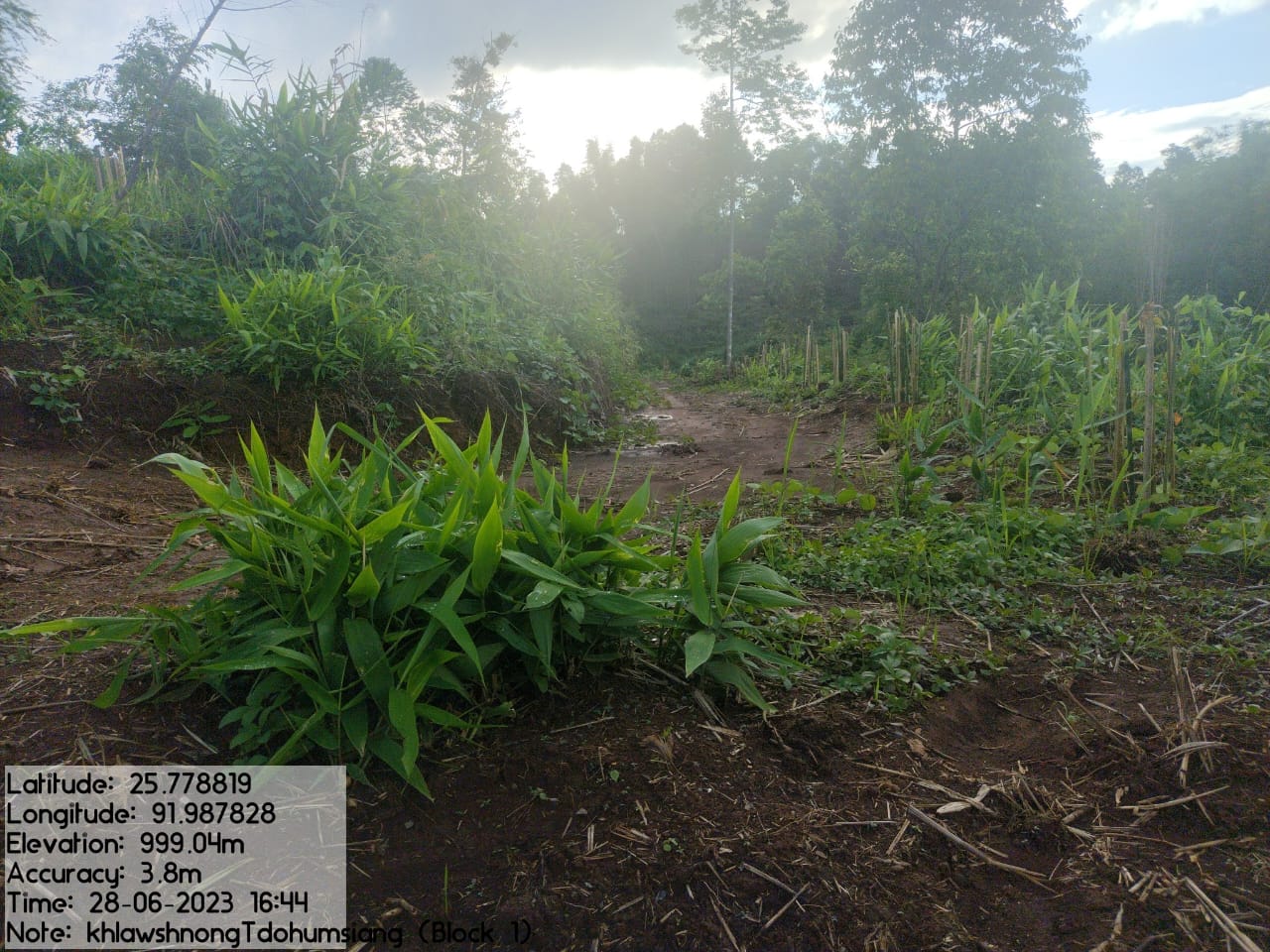
Tdoh Umsiang Village falls under Umsning C&RD block of Ri-Bhoi district in the state of Meghalaya. The village is at a distance of 43 Kms from Nongpoh, the district headquarters of Ri Bhoi District, at a distance of 16 Kms from Umsning, the block headquarter of Ri Bhoi District and is at a total distance of 40 Kms from the state capital, Shillong. It falls under Raid Kyrdem with a total geographical area of 1039.33 ha and a total population of 1650 villagers.

Brief History
Founded in 1965 Tdohumsiang village is located in the Umsning C&RD Block of Ri-Bhoi district of Meghalaya. It is under the governance of the Raid Mawbuh, Mylliem Syiemship. It lies on the foot of the northwest side of Manik Raitong hill. This village has several springs originating from it which converge to form a river known as Wah Umsiang. It is surrounded by Pait Klong village on the North, Sohpdok village on the South, Raitong village and Khlieh Umtrew village on the East and Thad village on the West.
In 1965 it was founded by four households who came from Mawkneng village in the East Khasi Hills and it was part of Raitong village. As time passed many other people from all across the Khasi hills districts came to this village to farm and reside here as villagers so Umtrew and Tdoh Umsiang grew steadily. As Raitong village falls under Raid Narlein of Hima Mylliem whereas Umtrew and Tdoh umsiang falls under Raid Mawbuh therefore the elders of Tdohumsiang and Umtrew decided to ask for these two to be recognized as an individual village and not a part of Raitong village anymore and they were granted this by the King of Hima Mylliem and a new village was formed with the name of Umtrew Tdohumsiang village. As the village continued to progress the village was divided into two localities or “dong” which was Dong Khlieh Umtrew and Dong Tdohumsiang. But with the coming of MNREGA scheme, the Election Commission decided to divide these two localities or Dongs as individual villages and there were a few difficulties along the way but through the leadership and joint consent of the elders and residents of both localities it was decided that the two localities should now be recognized as individual villages. In the year 2016 Tdohumsiang village was founded as an independent full-fledged village. Although these localities are now separate villages, they still consider each other as one under the Dorbar Pyllun as was decided before separation.
In the year 2016 there were 110 households at Tdohumsiang with a population of more than 600 people. As is the case in all villages under Meghalaya and between Khasis, Tdohumsiang is also a democracy ruled by the people. The Headman is elected by the people from among them along with the Executive Committee to aid the headman in his duties. The first EC committee of Tdohumsiang included:
Headman- Shri. Midral Warjri.
Secretary- Shri. Eveningstar Nongbet
Assistant secretary- Shri. Sharmanroi Wahlang
Treasurer- Shri. Tainingstar Shangdiar
Members- Washington Wahlang, Relingstar Nongbet, Dibanroi Mawlong, Kedo Rani, Drekstar Nongbet, Babydona Wahlang, Lamborlang Rani.
Adviser- Shri. Sormik Kharmawlong
Social Profile
Tdoh Umsiang village is located in Umsning Block of Ri-Bhoi District, in the state of Meghalaya. It came into existence in 1965. The village has 136 households and is a home to 702 people. The distance from the District Headquarter to Tdoh Umsiang is 43 kms. The village is under the supervision of the Rangbah Shnong.
The traditional form of governance prevails where the village head is the Rangbah shnong. There is a Village Employment Council (VEC) that oversees the implementation of Mahatma Gandhi National Rural Employment Guarantee Act and other developmental works. Besides women representation in the VEC, the village women are members of a women only village based organization that provides them a platform for decision making on various issues pertaining to the village.
There are a number of streams and springs in and around the village. The main source of livelihood is agriculture. The Village not only produces cash crops but also various fruits, vegetables, betel vine, tomatoes and Broom-Grass.
There is only one school inside the village, which is the Primary School, Tdoh Umsiang. The Primary Health Centre is 1 km away and the Community Health Centre is 16 km away; the nearest Bank is about 11 km away and the Post office is also 12 kms from the village.
Population 
As per Census 2011, Tdoh Umsiang population is 480 and the total population of Tdoh Umsiang in 2020 has increased to 702. Out of this, 353 are males and 349 are females. The village has 91 children in the age group of 0-4 years. Among them 45 are boys and 46 are girls.
| Age Group | Male | Female | Total |
|---|---|---|---|
| 0-4 | 45 | 46 | 91 |
| 5-14 | 93 | 90 | 183 |
| 15-30 | 115 | 123 | 238 |
| 30-60 | 80 | 74 | 154 |
| Above 60 | 20 | 16 | 36 |
Card Holding Household:
The village has a total number of 136 Health cardholders, 135 Ration cardholders. APL and BPL are no longer valid. AAY and PHH cards are being used instead. The major occupation of the people is farming while some are teachers and Govt. servants.
| Particulars | No. of HH |
|---|---|
| Total HH | 136 |
| Ration Card HH | 135 |
| AAY | 10 |
| PHH | 125 |
| Health Card HH | 135 |
Fuel Type:
| Fuel Type | Total HH |
|---|---|
| Charcoal | 0 |
| Biomass | 0 |
| Wood | 99 |
| LPG | 32 |
| Electric Heater | 05 |
| Kerosene | 0 |
OCCUPATION: The people of the village rely on
agriculture and forest products for their livelihood. The main
occupation of the villagers is farming followed by
carpenters/mason, teachers, drivers and other Govt.
Servants.
Drinking Water: There are water bodies and springs, however there is no access to water supply to the village due to lack of implementation. During the peak season, there is scarcity of water in the village and this has compelled them to walk for miles just to get water.
Jhum Cultivation : Mainly take up traditional
approaches of cultivation like the Jhum or the Shifting cultivation.
Water Bodies:3.81 ha
Springs:4
Streams:2
River: 1
CLLMP ACTIVITIES
Ground Truthing Dated: 29th of November 2018
The CLLMP team met with Mr. Medral Warjri, the Headman of Tdoh Umsiang village on the 29th of November 2018. He provided the team with important information regarding the current scenario of the landscape and the natural resource management under the current leadership.
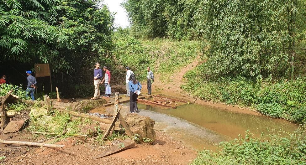
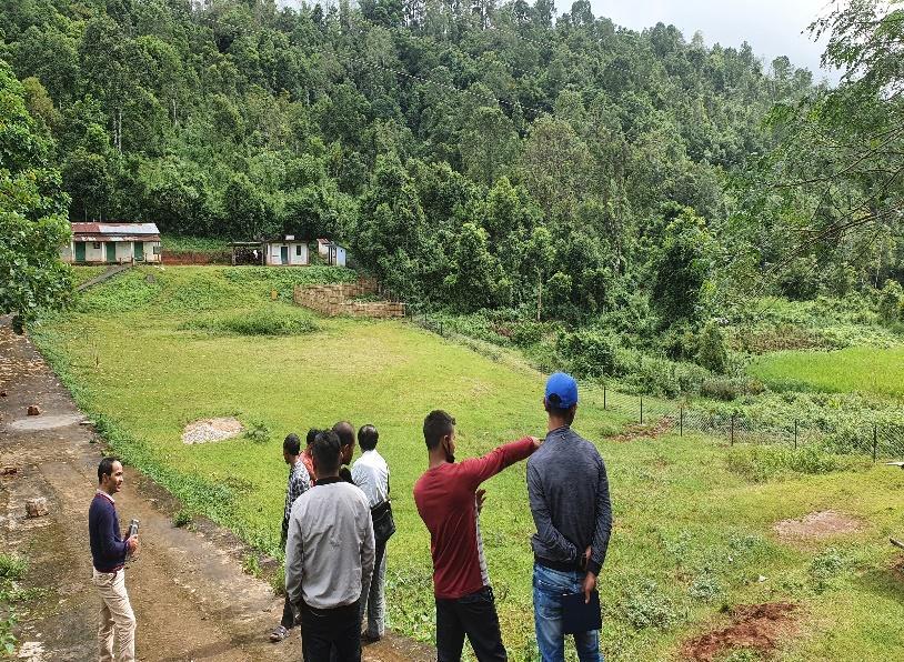
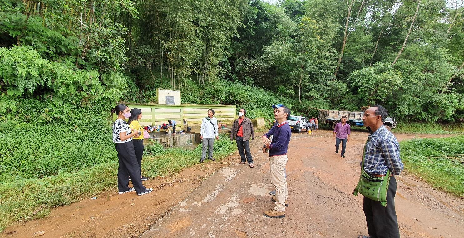
Figure 1 : Ground-truthing at Tdoh Umsiang Village.
Case Findings & Selection parameters: -
1. There are a total of 136 HH out of which 10 fall under AAY and 125 under PHH category.
2. The village is facing difficulties in terms of fetching drinking water as the water source is quite far from the village. Currently they have two river sources:
(a) Wah umsiang (b)Wah umsaw
3. Approximately 50-60 acres of land is available for community forest.
4. Stone mining is prevalent at commercial level.
The Village has been selected under the Community Led Landscape Management Project
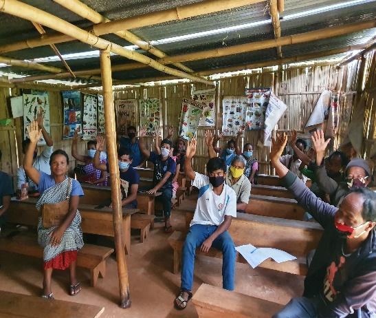
2. Sensitization Programme Dated: 09th of July 2020
The District Project Manager and the Assistant Managers held a village Level sensitization Programme on the Community Led Landscape Management project on the 20th of August 2019.The villagers actively participated in the program, voicing out their concerns and questions regarding the project making it a huge success.
The CLLMP officials gave a brief introduction on Meghalaya Basin
Management Agency (MBMA) and elucidated about the various programmes
and projects that MBMA is working on, they then gave a detailed
introduction on the Community led Landscape Management Project
(CLLMP) and the different aspects and procedures that the villagers
and the CLLMP team should carry out during the course of the project
and the importance of the involvement of the community for the
CLLM-Project to be a success. They gave due importance to the
environmental aspects of the project and enlightened them on the
various benefits that the villagers could obtain from the
project.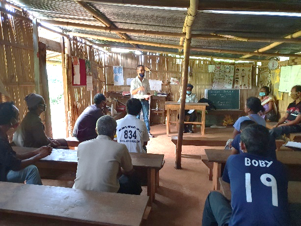
The Program was followed by an interactive session to answer the doubts and questions of the villagers some of which are mentioned below.
2.2 Signing of Documents: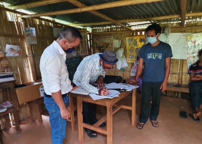
After the interactive session, the village signed the EOI, VGA and Green charter followed by the selection of candidates for the Village Natural Resource Management Committee. The Village Executive Committee (VEC) and the entire community carried out the procedure and elected the members of the VNRMC on the same day.
2.3 Formation of the VNRMC
The Formation of the Village Natural Resource Management Committee was done in a public meeting in the presence of the entire village and the CLLMP staffs. The community itself chose the President, the Secretary and the other executive members of the Committee.
Listed below are the members of the VNRMC:
|
|||||||||
|---|---|---|---|---|---|---|---|---|---|
|
Name in Full | Designation | Gender M/F | Age (Yrs) | Education | Occupation | Community | Religion and Denomination | Contact No and email address |
|
Medral Warjri | President | M | 62 | III | Self employed | Khasi | Christian | 9863076161 |
|
Ibalinda Kurbah | Secretary | F | 28 | XII | Farmer | Khasi | Christian | 9485112127 |
|
Bobydona Wahlang | Book Keeper | M | 30 | XII | Teacher | Khasi | Christian | 8837364136 |
|
Eveningstar Nongbet | Member | M | 40 | XII | Teacher | Khasi | Christian | 6009848687 |
|
Sharmanroy Wahlang | Member | M | 42 | XII | Teacher | Khasi | Christian | 8259094330 |
|
Dibanroi Mawlong | Member | M | 45 | III | Farmer | Khasi | Christian | NA |
|
Linstina Wahlang | Member | F | 37 | VIII | ASHA | Khasi | Christian | 8787301322 |
| 8 | Tila Nongbet | Member | F | 43 | III | SHG | Khasi | Christian | 8731982217 |
| 9 | Rosika Lyngkhoi | Member | F | 36 | IX | SHG | Khasi | Christian | 6009120600 |
| Village Community Facilitators | ||||||
|---|---|---|---|---|---|---|
| SI. NO | Name | Gender | Age | Education | Contact Number | Role |
| 1 | Dralinsha Wahlang | F | 32 | BA | 8787526012 | Social & Knowledge Management |
| 2 | Synsharlang Wahlang | M | 30 | XII | 9366792522 | Environment & GIS |
| 3 | Roberttrain Warjri | M | 28 | BA | 9863223481 | Project Management |
| List of Procurement Committee Members | |||||||
|---|---|---|---|---|---|---|---|
| SI. No | Name | Gender | Age | Education | Occupation | Community | Contact Number |
| 1 | Smila Warjri | F | 54 | XII | Teacher | Khasi | 6009158903 |
| 2 | Rostomson Marbaniang | M | 23 | IV | Farmer | Khasi | 9612949724 |
| 3 | Relingstar Nongbet | M | 47 | III | Farmer | Khasi | 6009332428 |
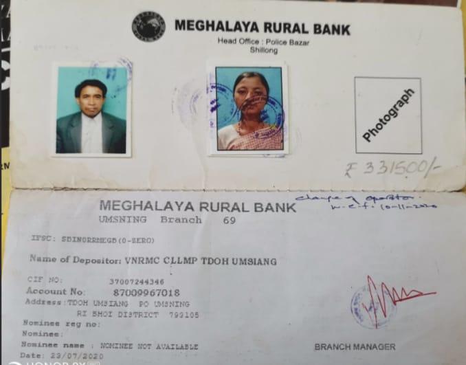
Opening of Bank Account
The opening of the bank account was initiated after the village signed the EOI (Expression of Interest), the VGA (Village Grant Agreement) and the Green Charter. The Accountant of the Ri Bhoi CLLMP team trained the Purchasing and Procurement Committee of Tdoh Umsiang Village on matters relating to Accounts and Bookkeeping on the 10th of December 2019.
4. Participatory Rural Appraisal Exercise
07th& 16th October 2020
The PRA exercise aims to incorporate the knowledge and opinions of the community in the planning and management of development projects and programmes. PRA exercise at Tdoh Umsiang Village took place on the 07th and 16th of November 2020. There were a total of 18 villagers who participated in this exercise
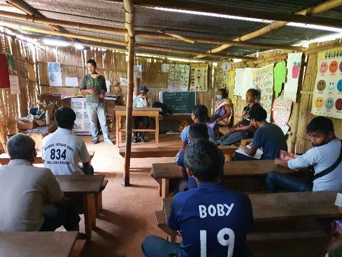
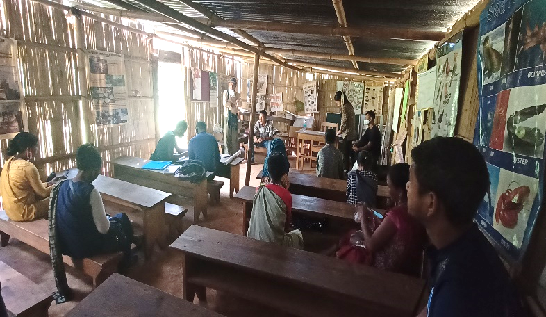
The initial stage of Participatory Rural Appraisal (PRA) exercise at Tdoh Umsiang Village, commenced with a meeting cum orientation program on CLLMP. While conducting the meeting, the community members were made aware of the various PRA exercises to be conducted for the development of the Community Natural Resource Management Plan (CNRMP) of the village, the community members’ contribution in the exercise and the objectives to be achieved. The key informants (the VNRMC and the VCFs) helped facilitate maximum participation. The dates and time for conducting the various Participatory Rural Appraisal (PRA) exercises were fixed in consultation with the community members and all were requested to participate in the exercise. The schedule and time was announced at the end of the meeting.
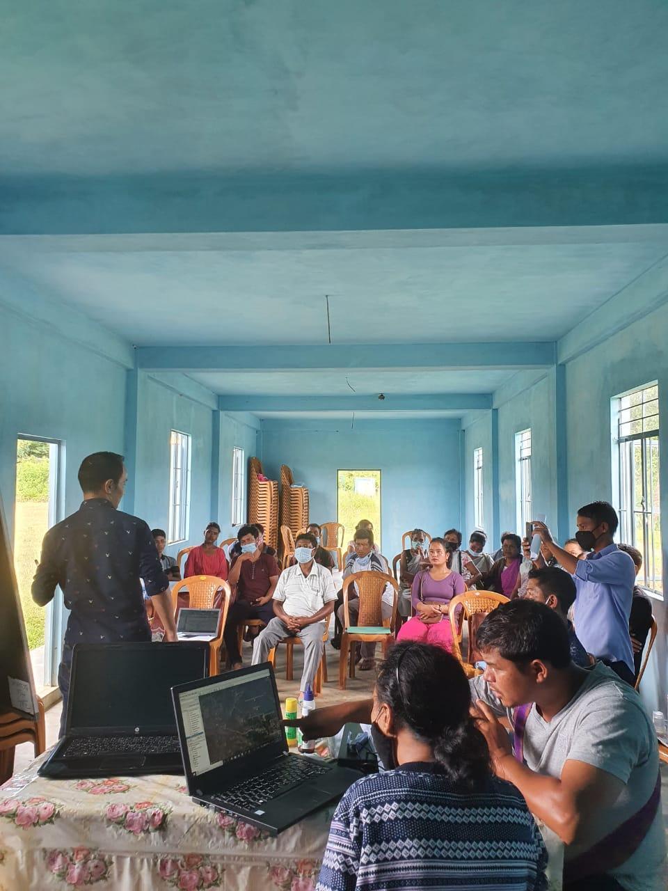
The District Project Manager of the Community Led Landscape Management Project discussed the different types of plans that can be adopted by the village and stressed on the need for more holistic and sustainable plans which will benefit the community as a whole.
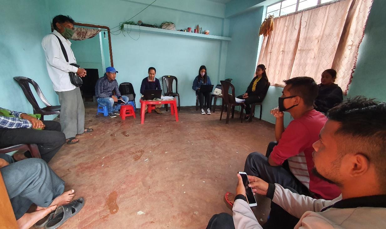
Figure : Discussion with the DPMU CLLMP Team.
Participants on the 07.10.2020:
CLLMP officials: Shri.V. Buhphang (DPM), Shri. Wilborn Kurkalang(M & E), Smt. Fondaliza Sohphoh and the DPMU CLLMP Team
Community members: Shri. Eveningstar Nongbet (Secretary), Shri. Sharmanroi Wahlang (Book-Keeper), Shri. Synsharlang Wahlang (VCF), Dralinsha Wahlang (VCF), Shri. Babydona Wahlang (VNRMC Member), Shri.Dibanroi Mawlong (VNRMC Member), Smt. Linstina Wahlang (VNRMC Member), Smt. Tila Nongbet (VNRMC Member), Smt. Rosika Lyngkhoi (VNRMC Member) and other community members
Commencement of PRA.
Introduction: Participatory Rural Appraisal (PRA) is the process of involving local people in the analysis and interpretation of their own situation of a given rural area. The local people i.e. the participants take a leadership role in collecting, analyzing, interpreting and presenting information and in this process impart knowledge and development insight to the specialists and extension agents
For management of natural resources, participatory Rural Appraisal is conducted to establish rapport with the village community as well as to identify and define problems for prioritization in the village itself. It is a way of learning from and with community members to investigate their need assessment, analyze and evaluate constraints and opportunities and find out priorities in the area of agriculture, small scale rural enterprises and any other social and economic development programs addressed to village development based on the principle of listening and learning.
Objectives of PRA exercise at Tdoh Umsiang Village:
The Participatory Rural Appraisal (PRA) exercise at Tdoh Umsiang was conducted with following objectives:
To identify the natural, human and economic resources of a village.
To identify the village problems and prioritize them with the help of the community members.
To prepare the Community natural Resource Management Plan of the village.
Activity 1: Village Boundary Mapping:
Activity 2: Drawing the Resource Map
The second step is to involve the local community in preparation of a village resource map as perceived by the community members to solicit their participation. Infrastructure, services and other village resources such as agricultural lands, wells, wastelands, cattle population etc. were mapped. Local people prepared the Resource Map by drawing it on a chart paper without much interference from outsiders.
This activity achieved the following purposes:
Rapport building and winning the confidence of the villagers.
Analysed the spatial information, particularly studied problems and opportunities of villagers.
Got an impression about the village setting, physical layout, location of various houses and institutions.
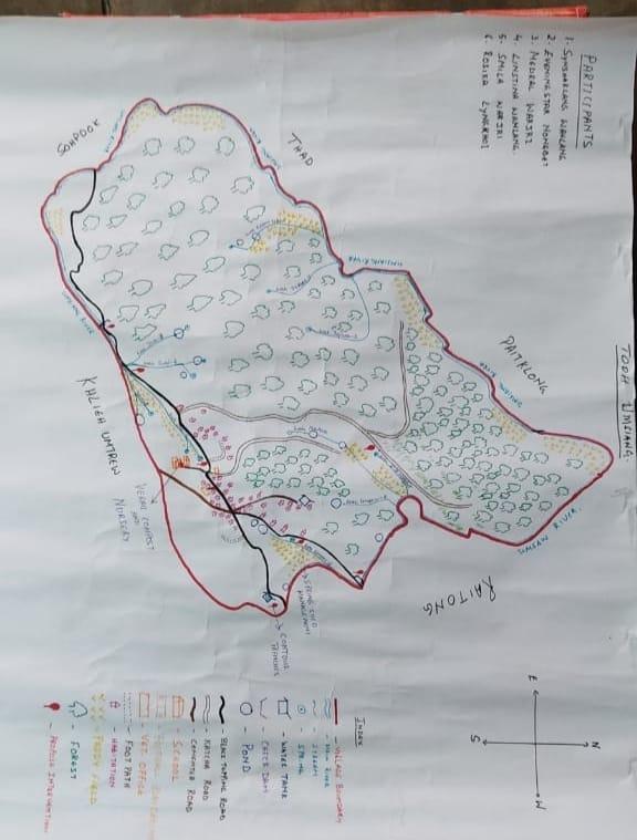
Figure : Resource Map of Tdoh Umsiang Village
Findings Based on the Resource Map of Tdoh umsiang Village:
Main agricultural produce is Paddy.
There are 3 types of Forest ownership: Community and Private.
Seven (7) springs are present in the village with three undeveloped.
Two main rivers are present and five (8) streams flow through the village paddy field.
Two water tanks are available and two check dams are available.
Four dugout ponds for fisheries and a water reservoir.
School: there are only two primary schools in the village.
Connectivity :3 roads
Habitation is not confined to one place but spread all over the village.
16.10.2020 (Day 2-Continuation of PRA)
Activity 3: Baseline Data Survey to fill the Environment and Social Template
During the PRA exercise, the CLLMP officials and the community
members were divided into groups to fill the Social and
Environmental Templates. Discussions and consultations with social
groups existing in the village was held to gather basic village
information regarding households, demographic information, major
crops and enterprises taken in the village, trends of production and
productivity of major crops in the village and demographic
distribution of village population.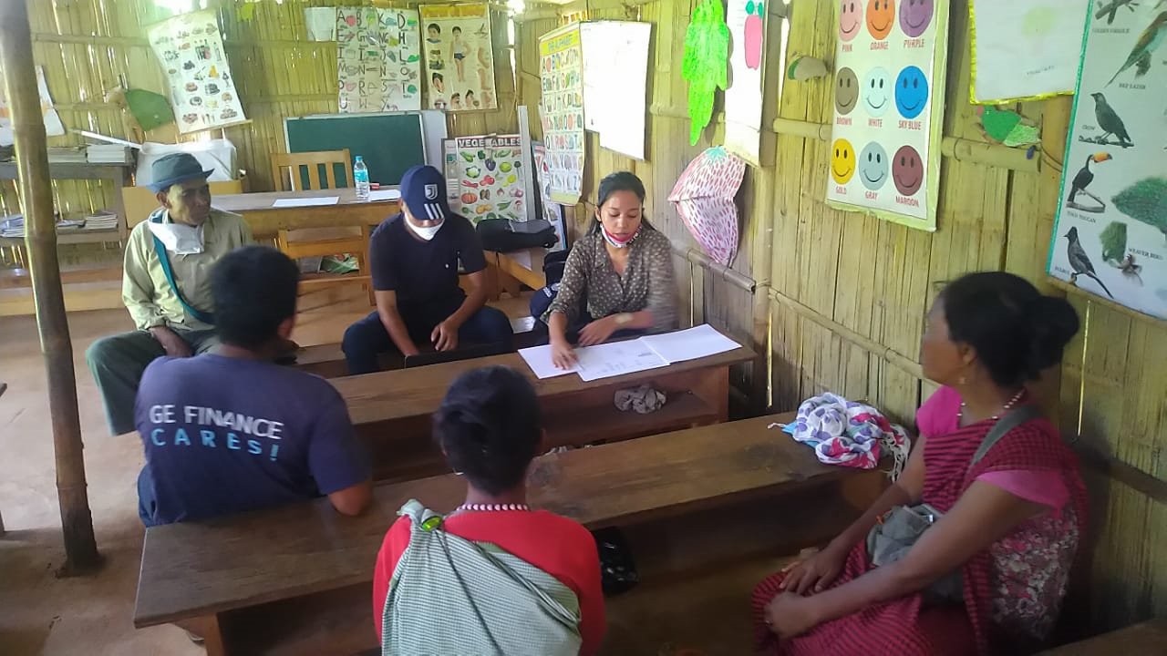
Activity 3: PROBLEM ANALYSIS
Do people have sufficient access to supply of fodder, fuel wood, leaf litter?
Since the people are depending mostly on the forest for fodder and fuel the supply of its needs is insufficient and some have to buy to fulfil their cattle.
Has access to timber improved or reduced over the years? How is access for household use and commercial use managed?
Access to Timber has reduced over the years due to the restriction over the use of the Community Forest.
Are the water bodies facing any threats?
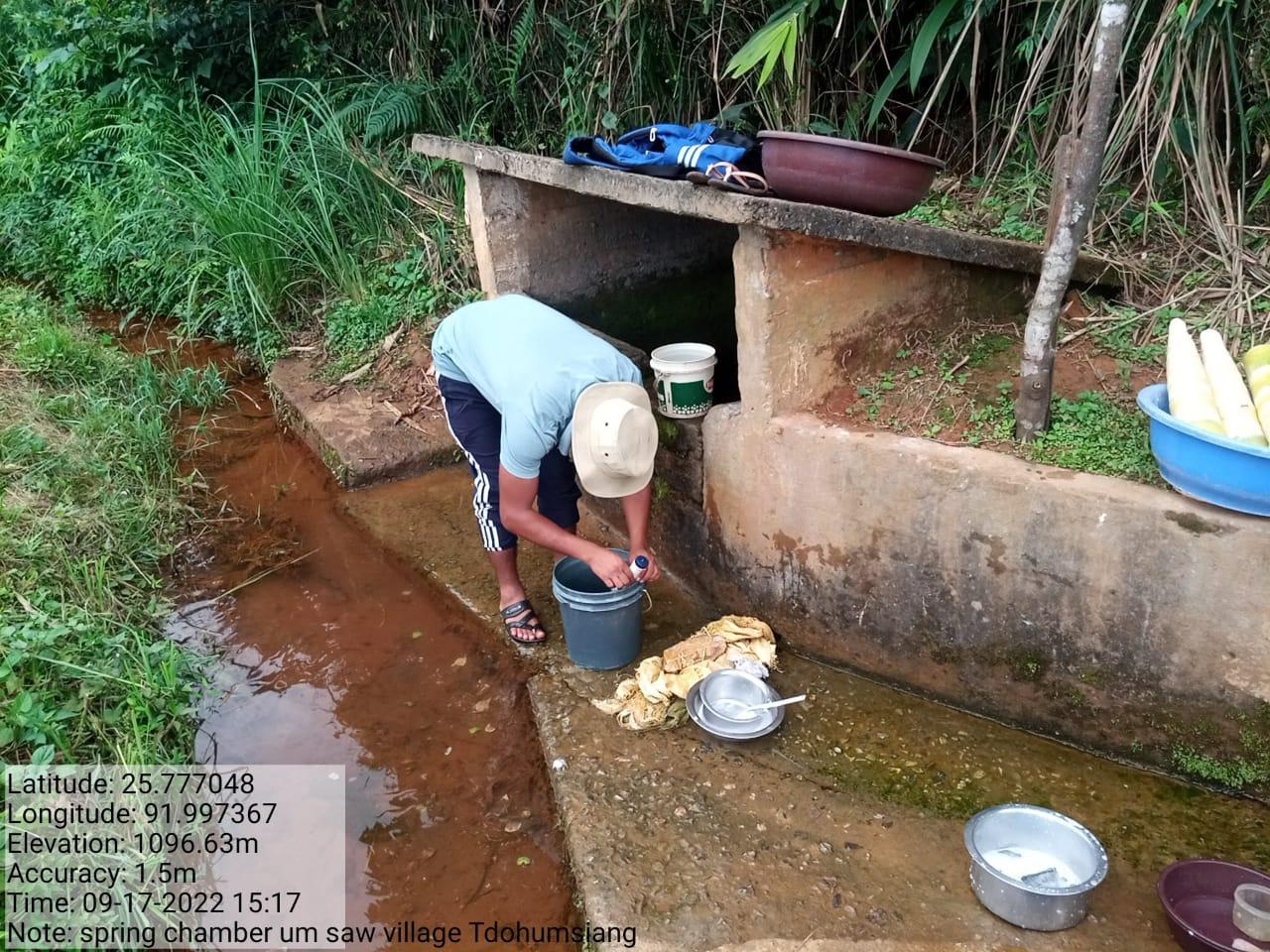
Yes, Three Springs are facing threats due to:
1.Wah Umsaw - Solid Waste
2.Umparing - Solid Waste
3.Wah Jubi - Siltation
Do all people in the village have access to drinking water? What are the challenges?
Not all people does not have access to drinking water.
Their main challenges that they are facing is the scarcity of water especially drinking water due to lack of source.
Are there degraded areas in the village (open/ degraded forests, mining affected, high soil erosion etc.)?
None
What has caused this degradation? Are there practices causing threats to availability and access to natural resources?
None
What have been the changes in agricultural practices?
Increase in agricultural produce over years which have improved the living conditions of the people in the village.
Before they cultivate only ginger, corn, sweet potato, yam and wheat. But recently they also started cultivating cabbage, carrot, fresh bean, coriander, brinjal, cauliflower, radish and potato.
Are there any challenges in farming?
There are many challenges faced by the villagers in farming some of these are:
They do not have land of their own and mostly hire the land for cultivation
High price of chemical fertilizers.
Seeds are to be brought.
How would you consider the health situation in your village?
Most prevalent sickness in the village is diarrhoea and fever. The main reason for this is drinking dirty water and changes in weather.
How is the situation of cleanliness, sanitation, access to toilets and waste management?
Cleanliness is the top most priority of the village. Twice a year there is a cleaning drive programme in the village organised by the VHSNC and everyone takes active participation in the programme.
Toilets and waste management are also available in every household in the village.
In case of serious illness the villagers have to travel a distance of 1km to PHC for treatment and 16 km to CHC for treatment.
Who are the most vulnerable in the village? What can be done to improve their lives?
Widows are being considered as the most vulnerable in the village. The village members try to enroll their names in the government scheme if available in the village.
What are the livelihood aspirations of the youth? Are there any avenues available?
The majority of the population engages in daily wage and Job-Card under MGNREGA for employment
Do any committees/ institutions/ rules exist to manage and monitor natural resources in the village?
Apart from VNRMC there is no committee that looks after the natural resources in the village.
What are some of the major issues of conflict in the village?
There are no such conflicts found in the village till date.
Have any of the above issues been discussed in village meetings?
Since no such issues arise in the village there are no meetings conducted so far.
How do people resolve disagreements and conflicts?
Any traditional conflicts in the village are addressed by the Village Dorbar.
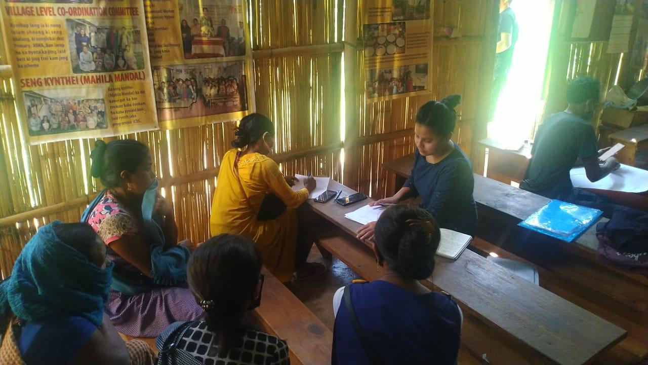
Figure 13: Group Discussions on Conflicts and Challenges
Activity 4: Seasonality Calendar
The CLLMP team also mapped the seasonal calendar of Tdoh Umsiang Village to help identify heavy workload periods, periods of relative ease, credit crunch, diseases, food security, wage availability etc. This will prove helpful in project planning and project timeline framing.
Participants: All three VCFs along with the VNRMC members
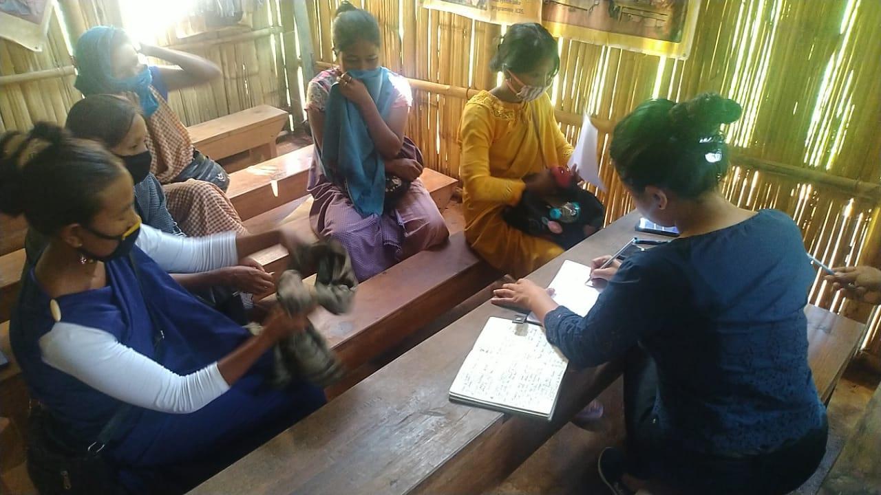
Figure 14 : Preparation of Seasonality Calendar
| SEASONAL CALENDAR | |||||||||||||
|---|---|---|---|---|---|---|---|---|---|---|---|---|---|
| Sl No. | CRITERIA | JAN | FEB | MAR | APRL | MAY | JUNE | JULY | AUG | SEP | OCT | NOV | DEC |
| 1 | Water Scarcity | 2 | 1 | 1 | 3 | 2 | |||||||
| 2 | Prone to sickness | 2 | 1 | 3 | 2 | ||||||||
| 3 | Seeking job outside | 2 | 1 | ||||||||||
| 4 | Rain Fall | 3 | 2 | 1 | 1 | 1 | 3 | ||||||
| 5 | Free – Less work | 2 | 1 | ||||||||||
| 6 | Paddy Cultivation | 2 | 1 | 3 | |||||||||
| 7 | Paddy harvesting | 1 | 2 | ||||||||||
| 8 | Ginger cultivation | 2 | 1 | 3 | |||||||||
| 9 | Ginger harvesting | 1 | 3 | 2 | |||||||||
| 10 | Tree Plantation | 1 | 2 | 3 | |||||||||
| 11 | Vegetable (crop cultivation) | 2 | 1 | 1 | 2 | 3 | |||||||
| 12 | Vegetable (crop harvesting) | 2 | 3 | 3 | 1 | 2 | |||||||
| 13 | Festive Season | 1 | 2 | 3 | 1 | ||||||||
| 14 | Forest fire | 1 | 2 | ||||||||||
| 15 | Collection of Fuel wood | 1 | 2 | 3 | 1 | ||||||||
| MAXIMUM | 1 |
|---|---|
| MODERATE | 2 |
| LESS | 3 |
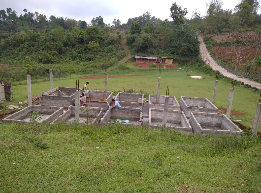
Activity 7: Submission of the List of NRM activities proposed by the VNRMC.
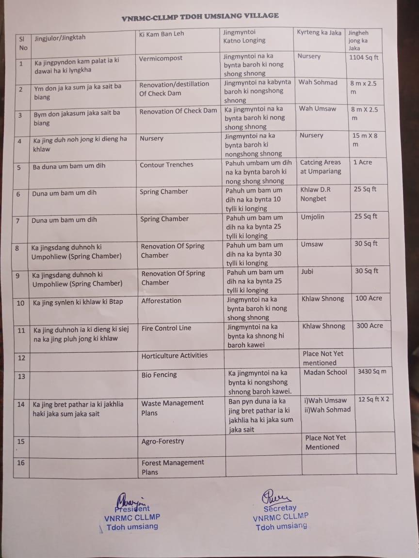
The Finalized Community Natural Resource Management Plan of Tdohumsiang Village.
| Area of Intervention | Intervention 1 | Intervention 2 | Intervention 3 | Intervention 4 | Intervention 5 |
|---|---|---|---|---|---|
| Activity/ Site | Activity/ Site | Activity/ Site | Activity/ Site | Activity/ Site | |
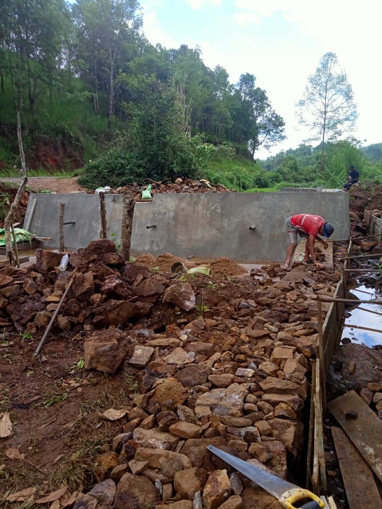
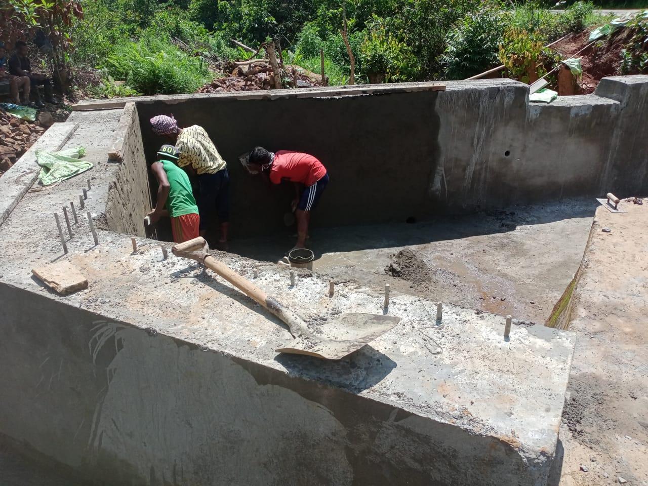
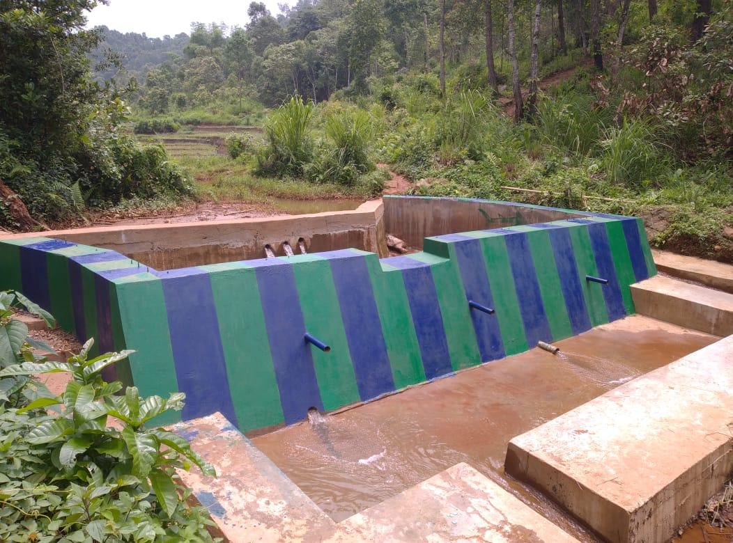
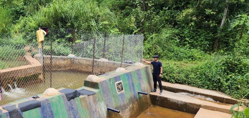
| Soil and Water Conservation | Renovation of MNGRS Check Dam (Side channel) at Wahumsaw |
Contour Trenches |
At wahsohmat |
At wahjubi |
|
| Land Productivity Enhancement | Vermi Composting At Madan skul tdohumsiang |
||||
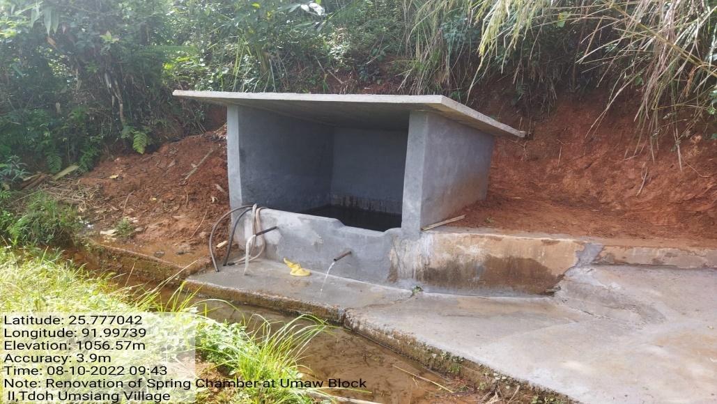
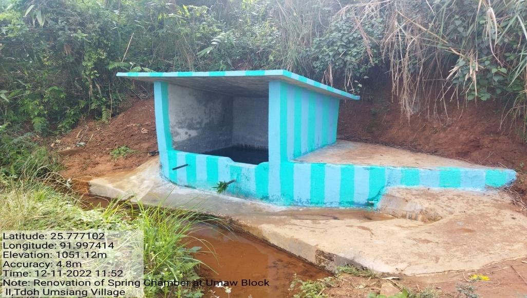
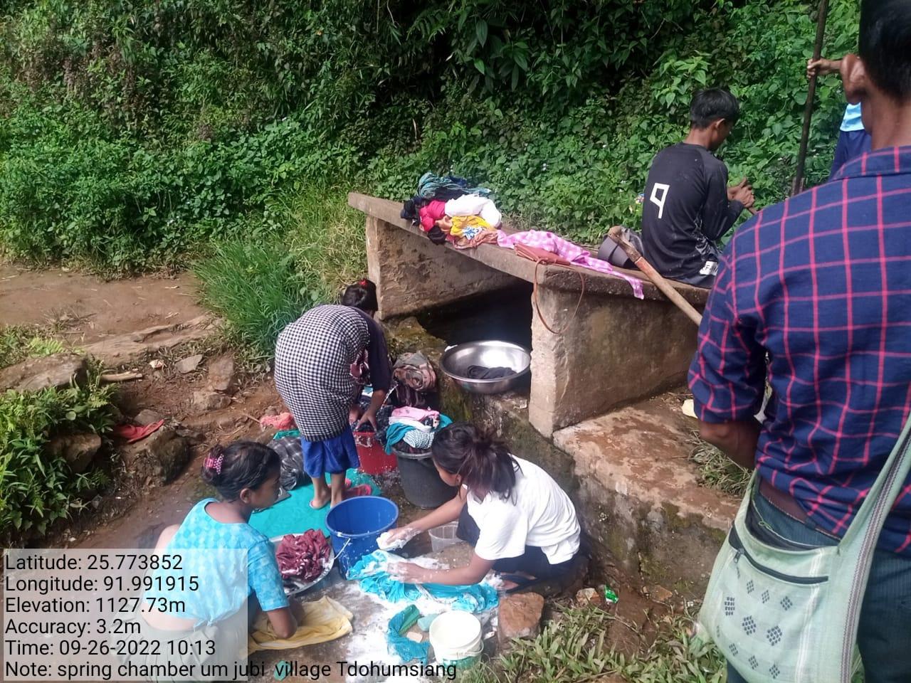
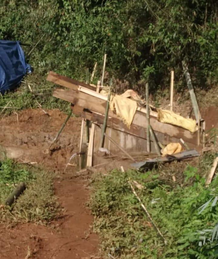
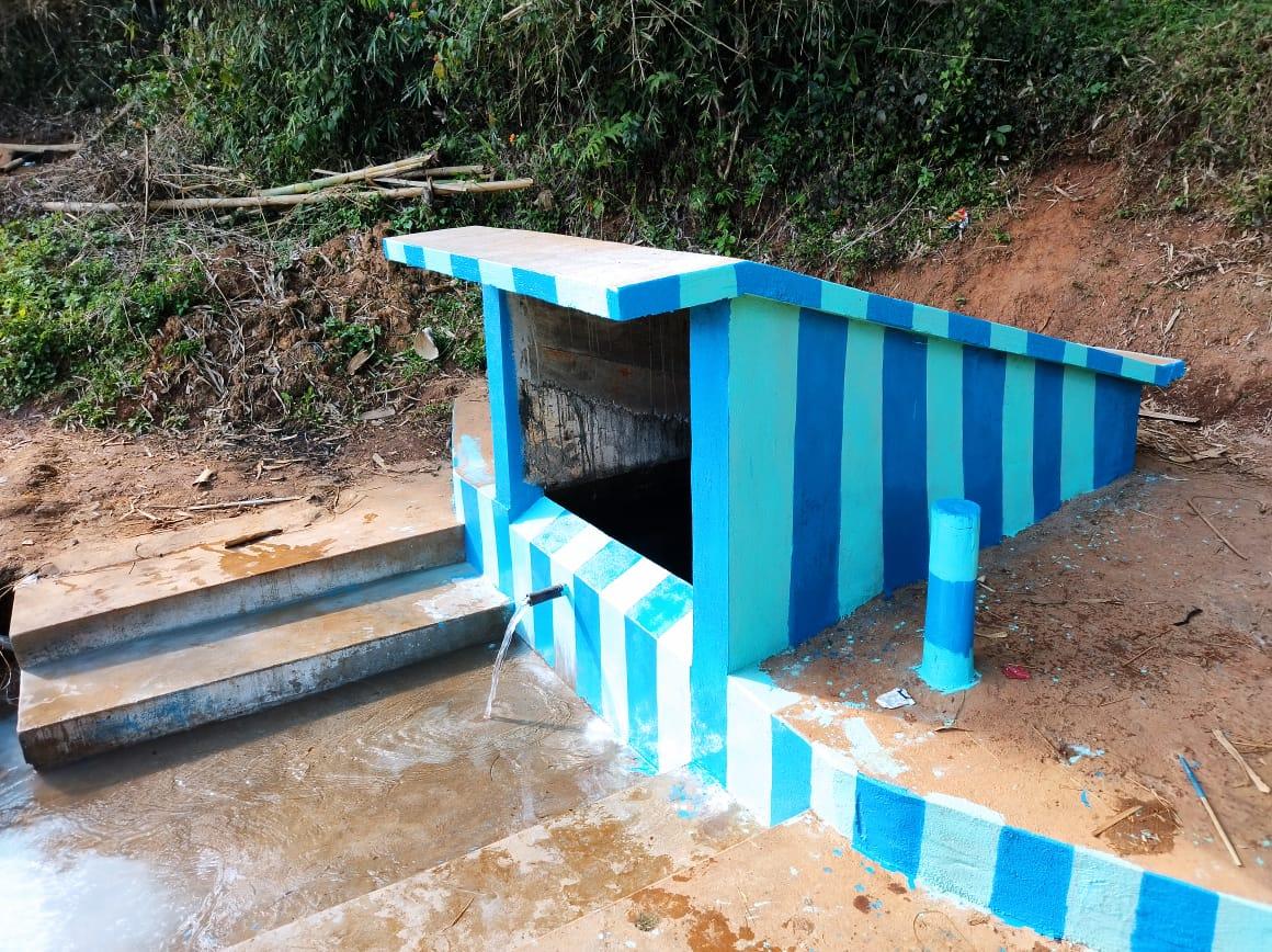
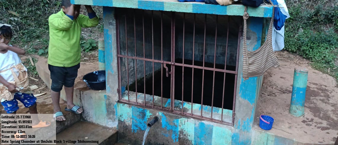
| Spring Shed Management | Renovation of Spring Chamber At umjubi |
At umdiar |
Renovation of Spring Chamber At umsat |
Development of Water source - Ramp Pump (Convergence with PHE) | |
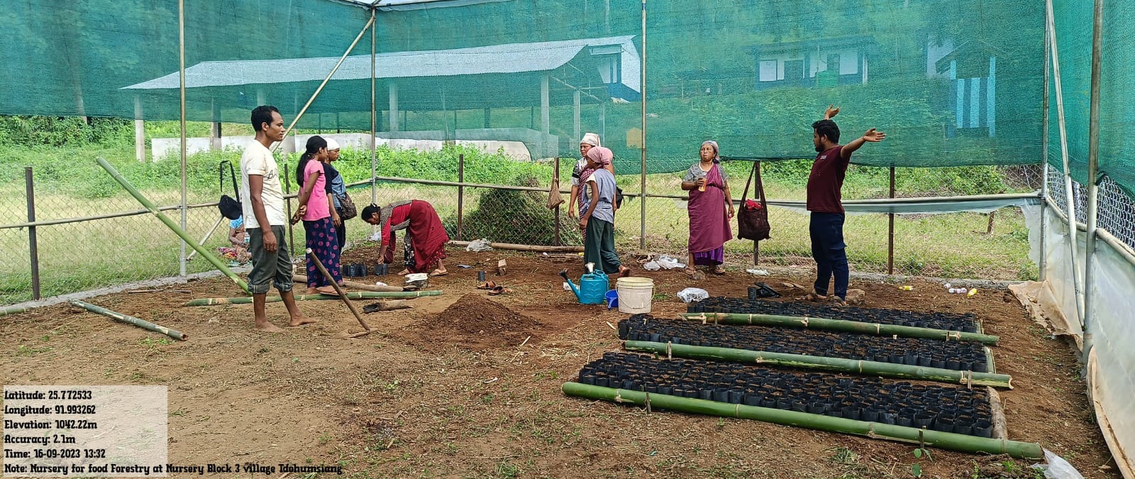
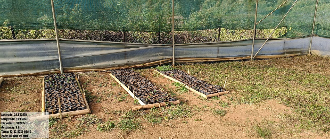
| Afforestation/ Community Forestry Activities | Afforestation | Nursery at Madanskul tdohumsiang | |||
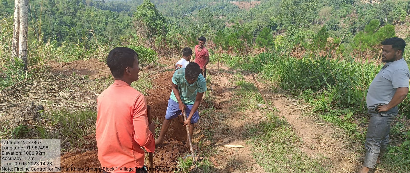
| Forest area under management plans | Forest Fire Control Line | Bio Fencing | Forest Management plans | ||
| Enhancement of Agro-forestry Activities | Agroforestry | ||||
| Culturable waste land brought under Horticulture | Horticulture | ||||
| Activities to Treat Mining Affected Area | |||||
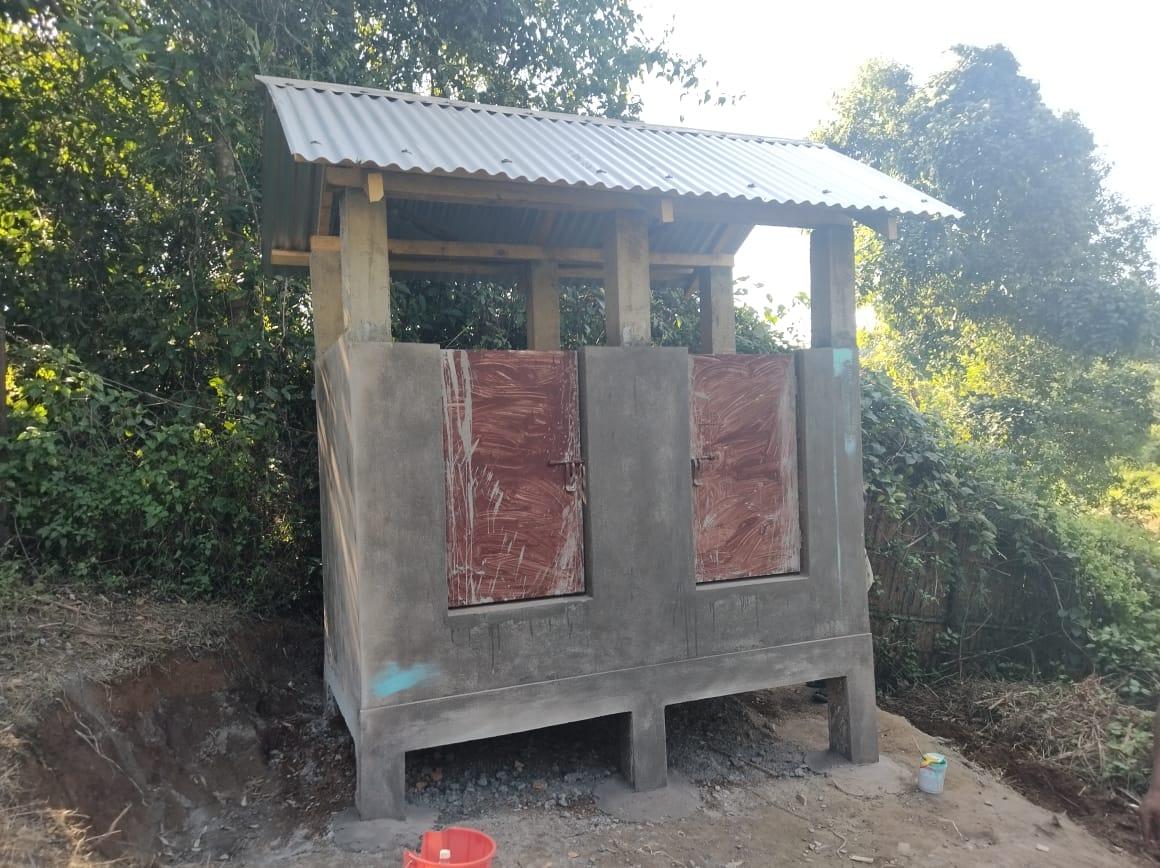
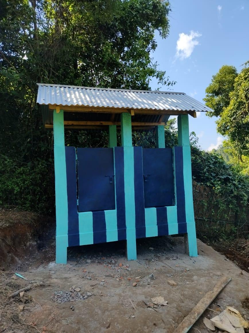
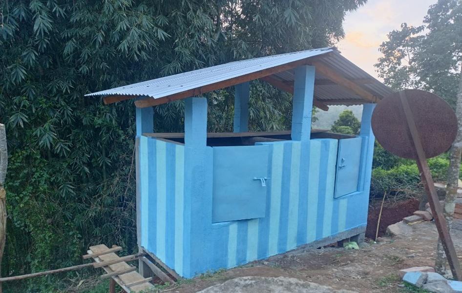
| Others | Waste Management Plans |
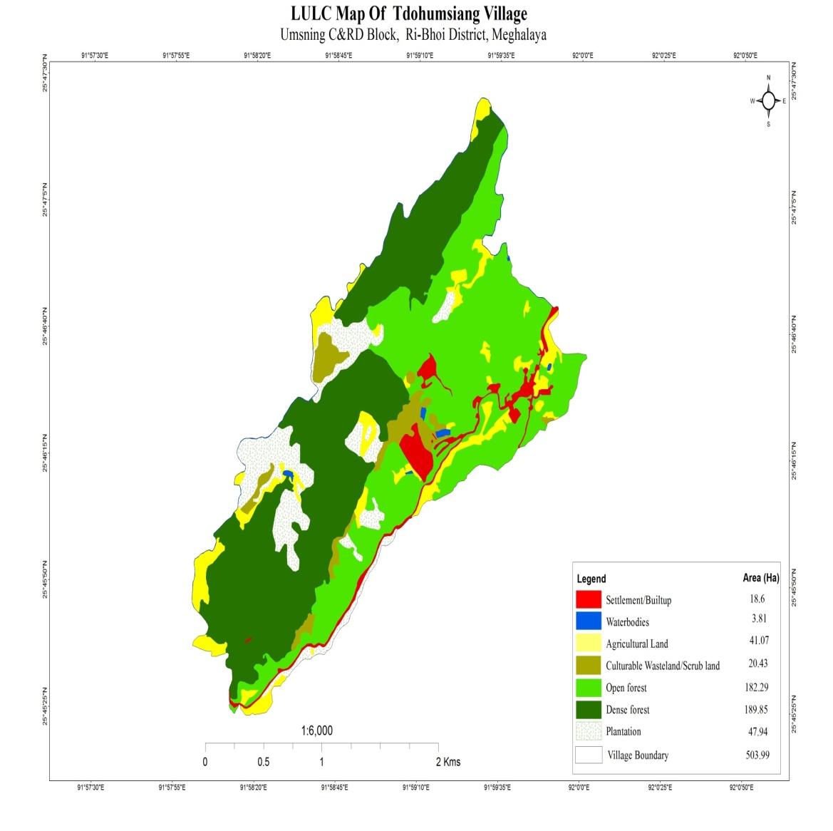
GIS Activities – Tdoh Umsiang
| Sl.No | Parameters | Village Information |
|---|---|---|
| 1. | GPS Coordinates | |
| i | Latitude | 25.773230 |
| ii | Longitude | 91.994883 |
| iii | Elevation Reading (MSL) | 1080 |
| 2. | Village Geographical Area(Ha) | 503.99 |
| i | Total Forest Area ( including community, Clan, Pvt Forest) | 372.14 |
| ii | Total Area of Water Bodies | 3.81 |
| iii | Total Area under Agri- Horticulture | 89.01 |
| iv | Total Degraded land area (Ha) | 20.43 |
| 3 | Average Annual Rainfall | 1000-1500 |
| 4 | Soil Type | Loamy soil |
PROJECT IMPLEMENTATION
| Intervention | Site Name | Amount Sanctioned | Date of Completion | Status |
|---|---|---|---|---|
| Check Dam | Wah sohmat | 4,58,600 | 01-Jul-21 | Completed |
| Intervention | Site Name | Amount Sanctioned | Date of Completion | Status |
|---|---|---|---|---|
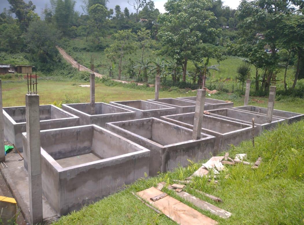
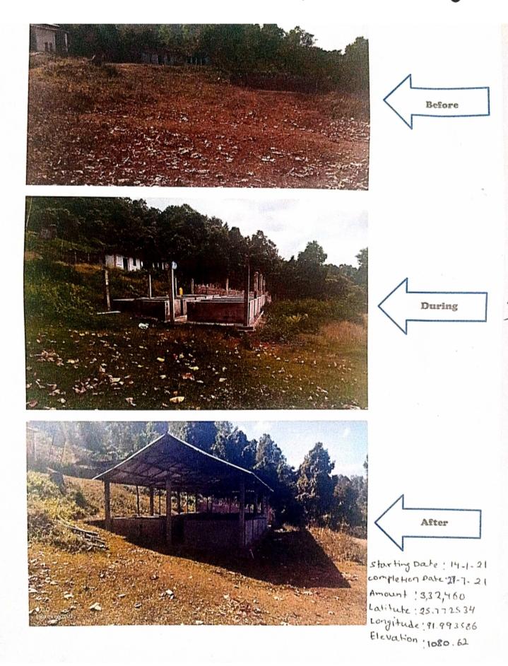
| Vermi-Composting | Madan Skul | 3,32,460.00 | 27.07.2021 | Completed |
| Intervention | Site Name | Amount Sanctioned | Date of Completion | Status |
|---|---|---|---|---|
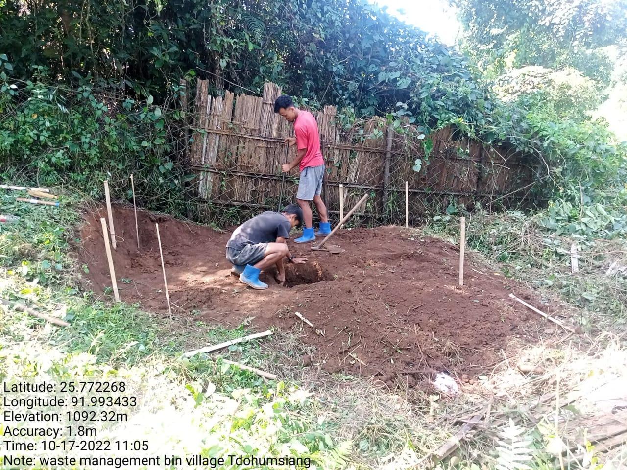
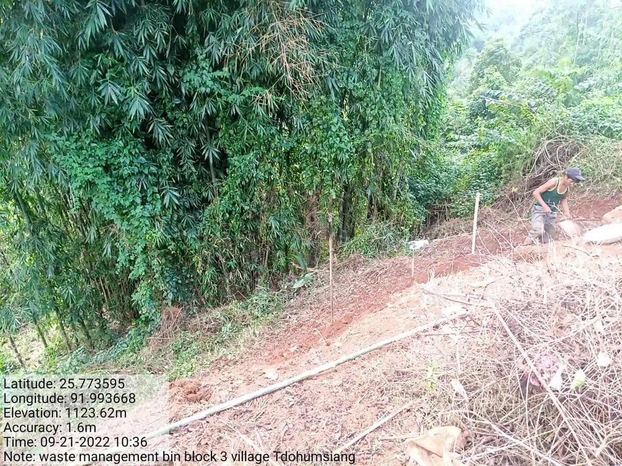
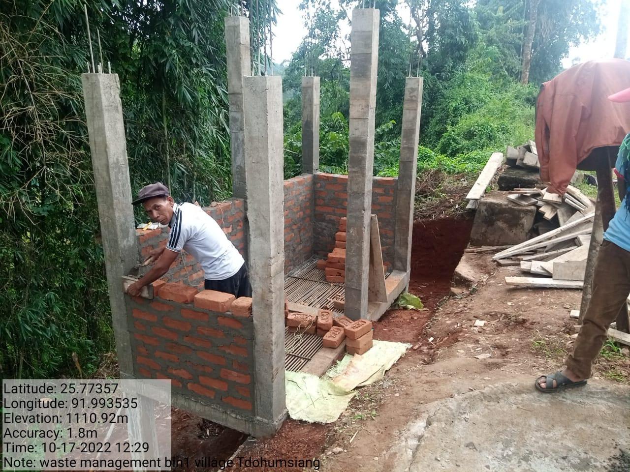
| Waste Management Bin 1 | Block 3 | 72,000.00 | 31.10.2022 | Completed |
| Intervention | Site Name | Amount Sanctioned | Date of Completion | Status |
|---|---|---|---|---|
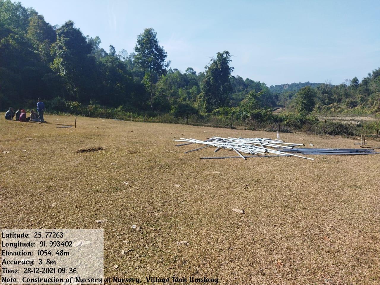
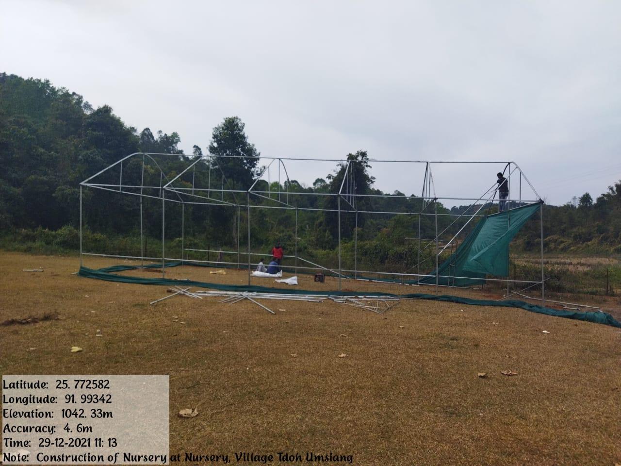
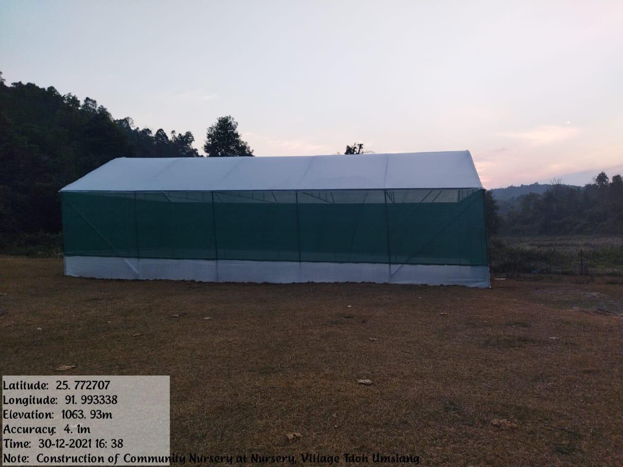
| Community Nursery | Madan Skul | 2,95,000.00 | 30.12.2021 | Completed |
| Intervention | Site Name | Amount Sanctioned | Date of Completion | Status |
|---|---|---|---|---|
| Waste Management Bin2 | Block 3 | 1,15,000.00 | 15.10.2022 | Completed |
| Intervention | Site Name | Amount Sanctioned | Date of Completion | Status |
|---|---|---|---|---|
| Renovation for Spring Chamber 1 | Umsaw | 72,000.00 | 12.10.2022 | Completed |
| Intervention | Site Name | Amount Sanctioned | Date of Completion | Status |
|---|---|---|---|---|
| Renovation for Spring Chamber 2 | Umjubi | 72,000.00 | 15.10.2022 | Completed |
| Intervention | Site Name | Amount Sanctioned | Status |
|---|---|---|---|
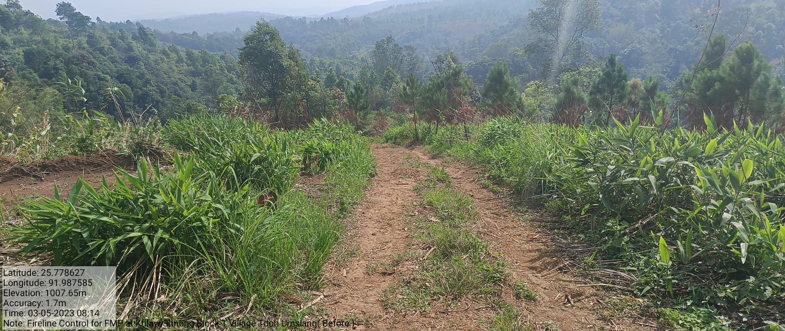
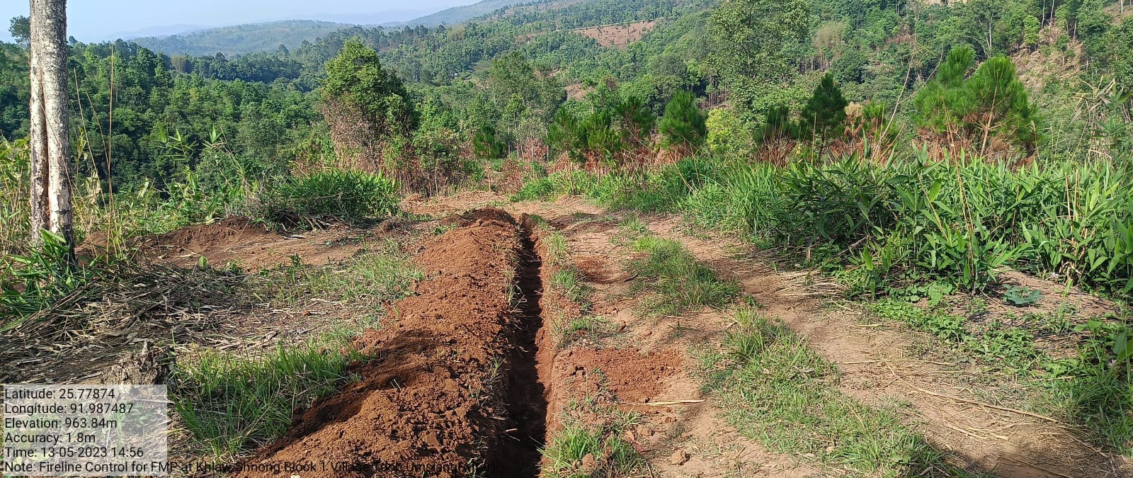
| Fire line Control | Khlaw Shnong | 59,308 | Completed |
| Intervention | Site Name | Amount Sanctioned | Status |
|---|---|---|---|
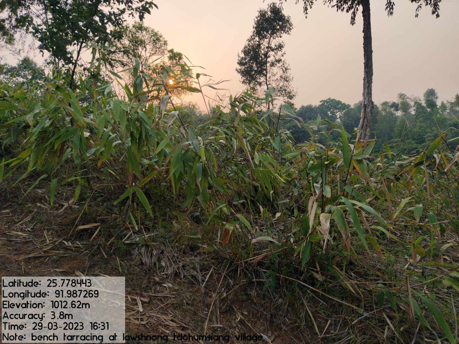
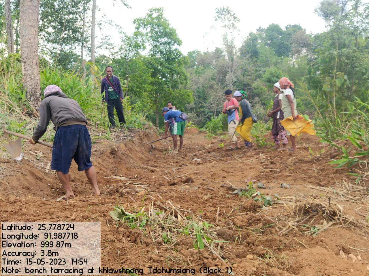
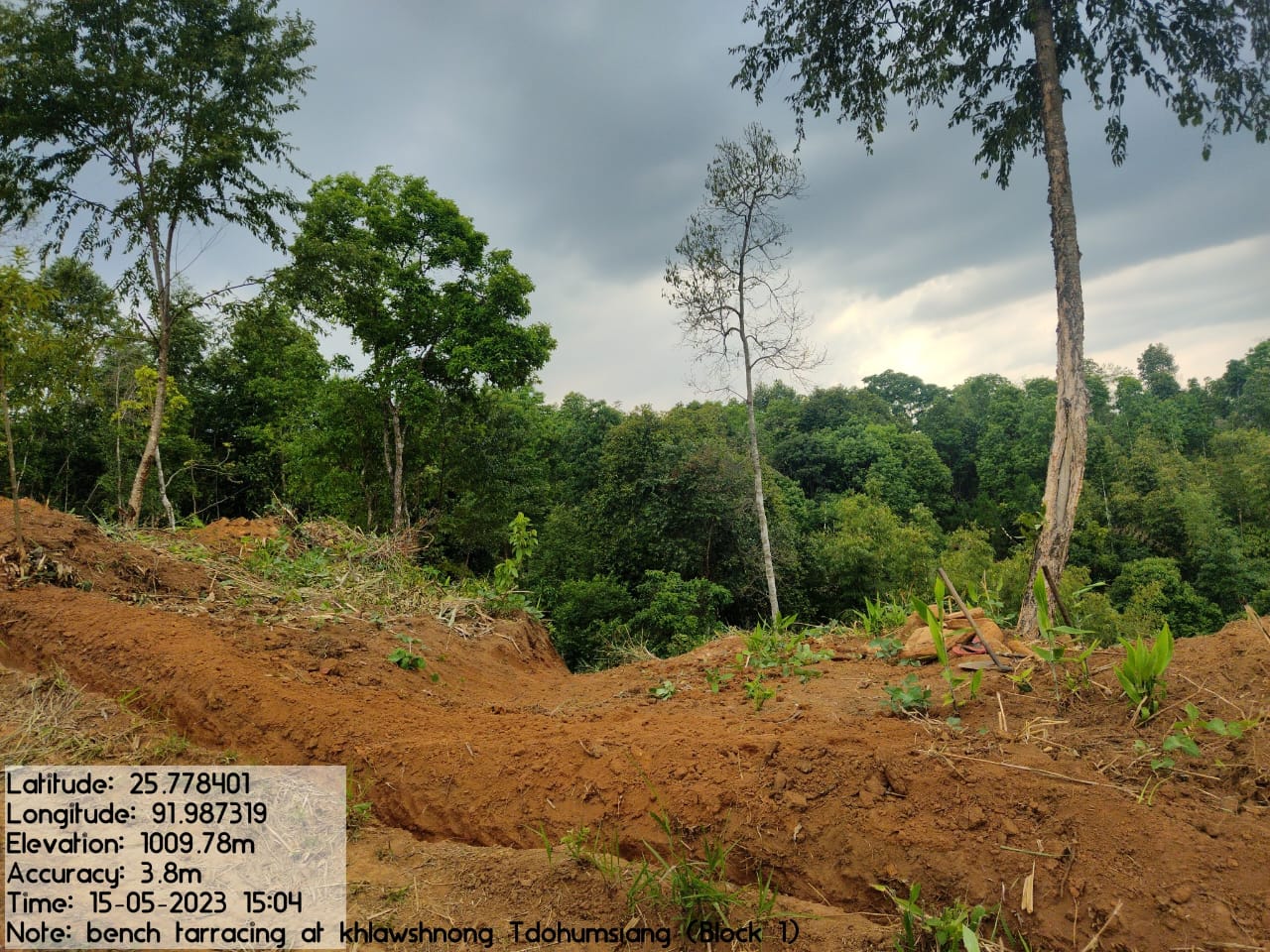
| Bench Terracing | Khlaw Shnong | 1,70,312 | Completed |
| Intervention | Site Name | Amount Sanctioned | Status |
|---|---|---|---|
| Fencing of Check dam | Wah sohmad | 14,803 | Completed |
| Intervention | Site Name | Amount Sanctioned | Status |
|---|---|---|---|
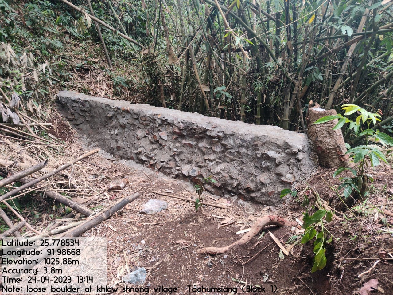
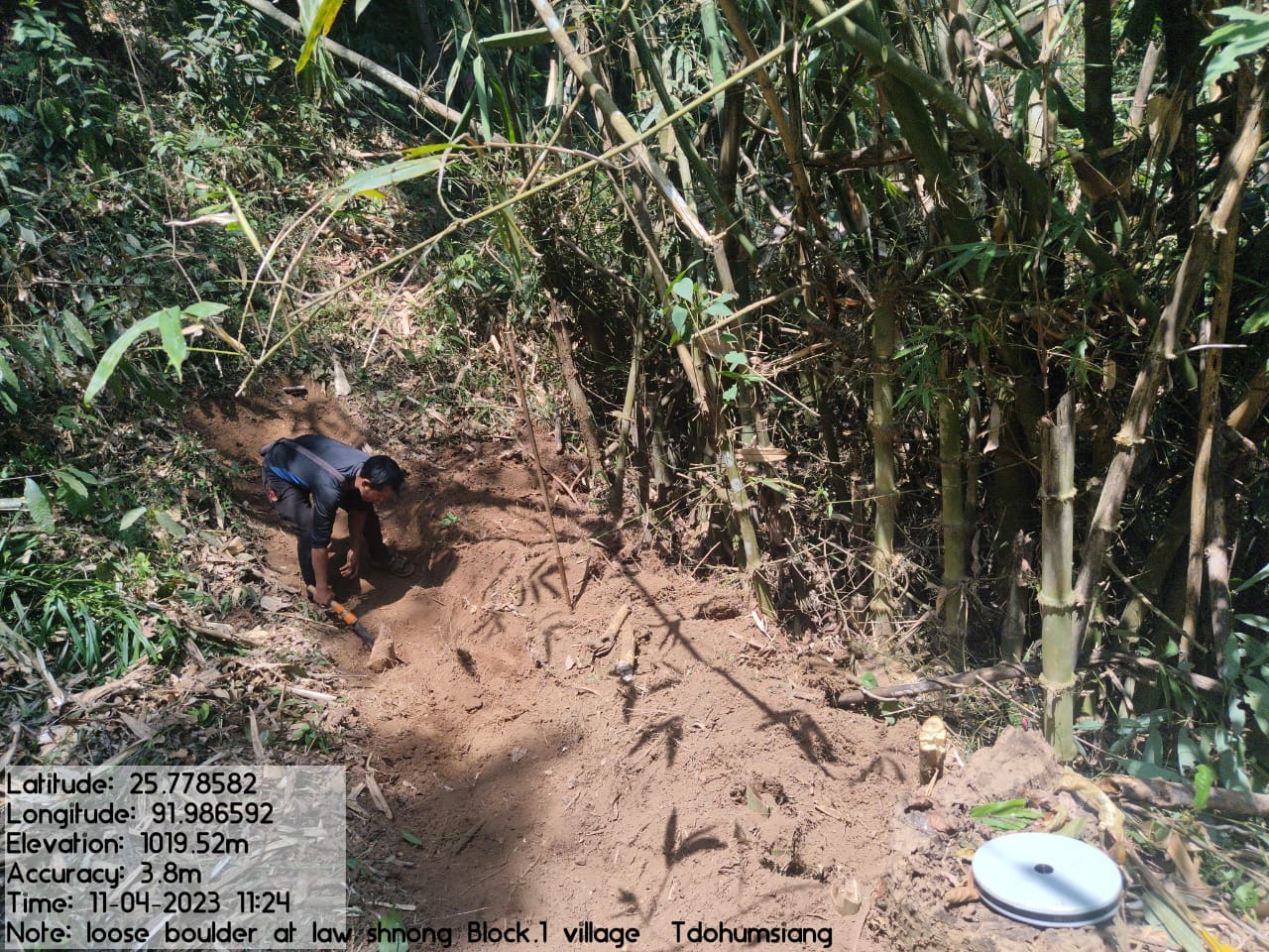
| Loose Boulder Bund | Khlaw shnong | 51,620 | Completed |
| Intervention | Site Name | Amount | Work Status |
|---|---|---|---|
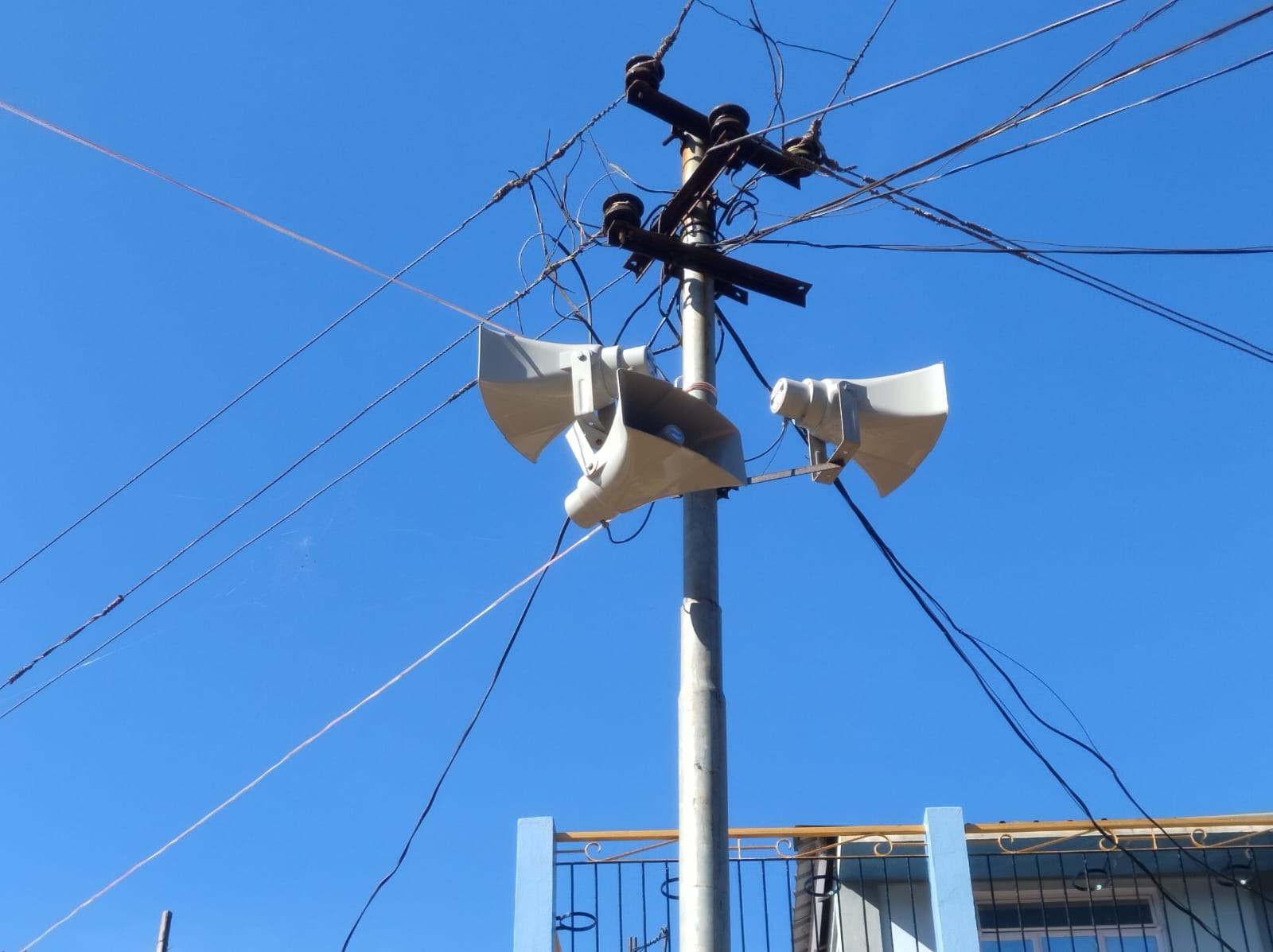
Excess fund activities Fire line control Water Tester P A System Gates for Spring Chamber |
community land | 1,81,659 | Completed |
| Intervention | Site Name | Amount | Work Status |
|---|---|---|---|
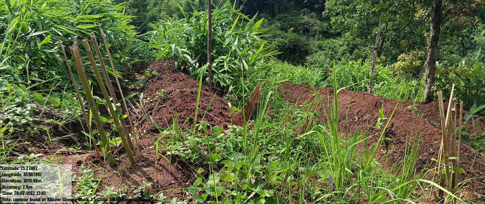
FMP Activities 1.Fire Control Line 2. .Assisted natural regeneration in open forests (Contour Bund Cum Afforestation) 3.Community Forest Boundary Survey 4.Enrichment Planting in forests blanks 5.Nursery for Food Forestry (Sapling for the Existing Nursery 6. In situ & Ex situ conservation of rare and endangered species |
Community Land | 2,04,025 | Completed |
TESTIMONIALS
VCF- Social KM-Dralisnsha Wahlang
I took this role as a volunteer where my task is to shape the
environment and also the minds of the villagers in respect to their
relation with the environment. Through the project I have learned
beyond what I did during my school days. I was taught how to collect
plastic and how to convert it into something reusable, how to do
away with chemical fertilizers in farming by using our very own
vermicompost manure and many more. All these activities are a
learning experience for me that have put a huge impact not just on
us the VCFs but also to those who are a part of it either directly
or indirectly.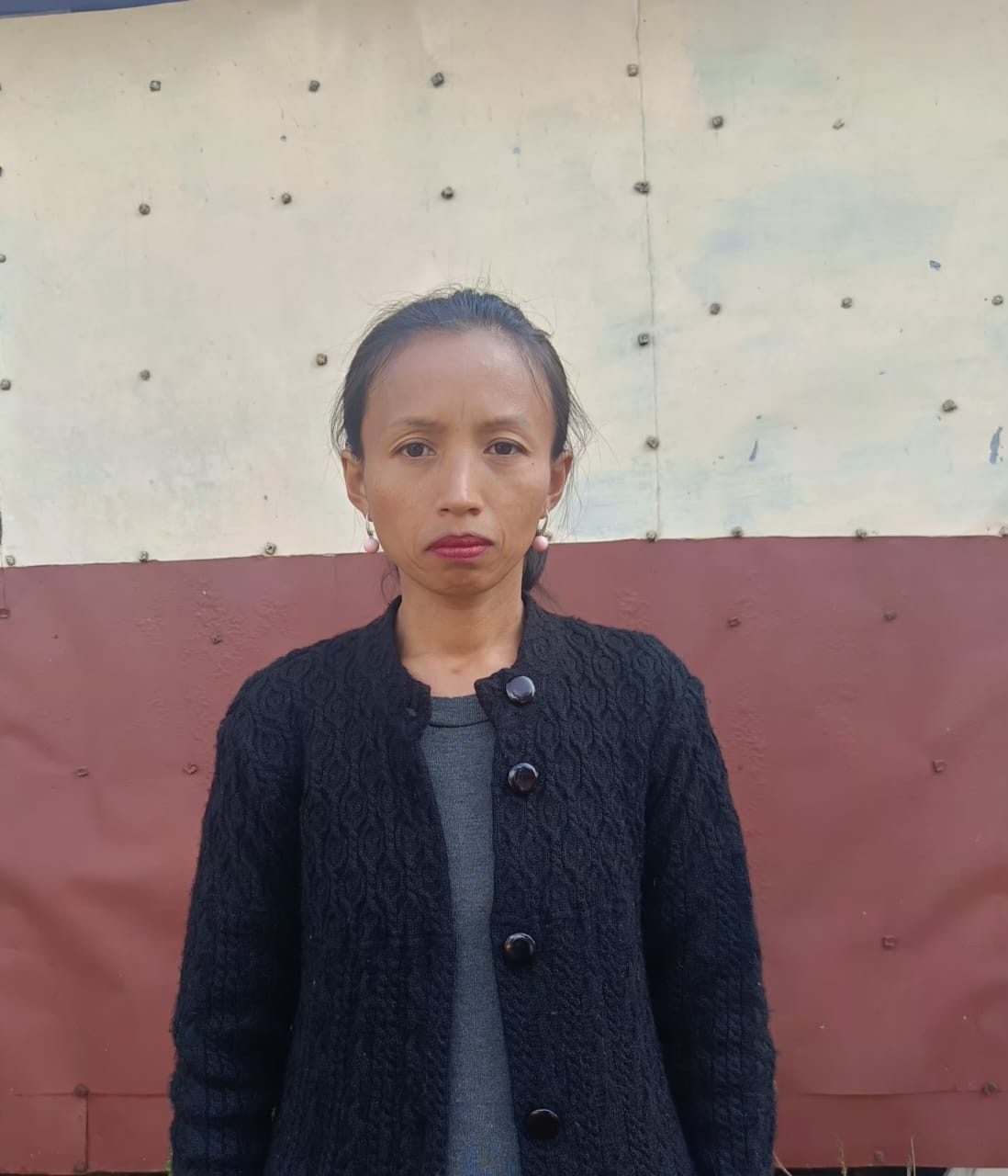
VCF- Env - Synsharlang Wahlang 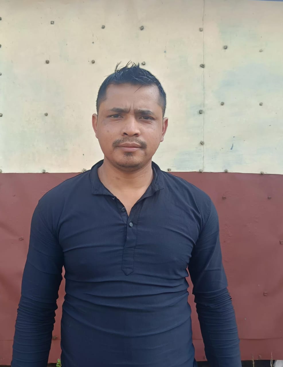
I took this role as a VCF as I wanted to contribute to the
overall well-being of the community. As we are a village where we
didn't have access to regular water supply in the past, one can
understand the difficulty that comes along with water scarcity.
However through this project we now have access to proper water
supply, our fields have easy access to water supply which makes
farming easy and successful. Our springs have been revived and well
constructed which makes our water requirements easy now. Apart from
this our green cover has also increased and seen changes with the
implementation of various activities that build up the green cover
of the village. Lastly I thank the CLLMP for being a great blessing
to us.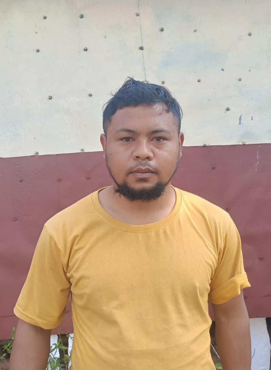
VCF- M&E- Robert Train Warjri
I took this role, so that I can work on various grounds that we as a village are lacking behind. With the coming of the project, the means of livelihood, water supply, Forest cover and many more have been increased. This makes the village prosper and stand up to the challenges of the present times
President - Medral Warjri 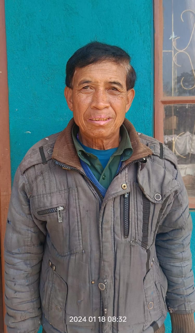
Before the coming of the project as a village we were lacking behind in various areas, especially in the developmental field. However since CLLMP came, children up to old people have started to love the environment and pay more heed to it as the project is in relation to protecting and safeguarding the environment, easy access livelihood activities and many more. I express my gratitude for the positive impact of the project in the village and acknowledge the contributions of the staff in achieving successful outcomes. As a community we believe that the project will be remembered for its positive influence on the community.
Secretary - Ibalinda Kurbah 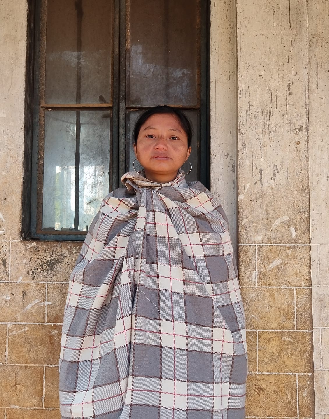
I would like to thank the CLLMP for their tremendous work in our Village. Being the secretary I have gained enormous support from the project, how to be in touch with the environment and to protect it, training on topics that I'm not aware of, teaching on how to maintain a proper record of various books and registers. I would also like to highlight the numerous benefits of the project, including environmental protection and working in harmony with nature. Also not to forget the project's support in facilitating various responsibilities and the guidance provided in various aspects of their work.