Report on:
Umlakro Village under Jirang C&RD BLock
District: Ri Bhoi
17TH JAN 2024
COMMUNITY LED LANDSCAPE MANAGEMENT PROJECT
Community Led Landscape Management Project (CLLMP)
The Government of Meghalaya with financial help from the World Bank is implementing the Meghalaya Community Led Landscape Management Project (MCLLMP). The project will cover the entire state of Meghalaya and implementation of community led plans will be rolled out in phase manner throughout the state. The Meghalaya Basin Management Agency (MBMA) will facilitate community-led planning by providing support, technical inputs and funding.
The project is intended to strengthen community-led natural resources management in selected landscapes within the 11 districts of the state. This would be achieved through a variety of planning, capacity building, and on-the-ground interventions to promote the conservation, sustainable use of natural resources, social inclusion and community mobilization; building traditional knowledge and learning, mapping of natural resources management; strengthening the community institutions and creating linkage with financial institutions and community organizations.
The project interventions include preparation of community led natural resource management plans. The CLLMP has the following three components:
Strengthening Knowledge and Capacity of Communities for Natural Resources Management
Community-Led Landscape Planning and Implementation
Project Management and Governance
The project objective is “to manage and conserve the natural resources, especially forests, soil and water sources, in a manner that supports the financial and physical well-being of communities in the State”
The CLLM-Programme focuses on increasing the capacities of communities and traditional institutions (TI) by adopting a landscape approach to manage their natural resources such as soil, springs and other water sources, forests and bio-diversity, etc.
The project will be planned and implemented in about 400 villages across the state.
CLLMP has a strong focus on institution-building at the village-level, by ensuring systematic capacity-building on technical and social skill-sets.
The project will also extend such training to communities beyond the targeted villages and support efforts made by them to access funding from various rural and natural resources initiatives and schemes.
The programme will also invest in improving the process and outcome delivery, by developing and adhering to effective systems and procedures, supported by the appropriate technology.
Benefits for community (Skills and Capacity relating to technical and managerial areas like NRM and Conflict resolution
Benefits to traditional institutions (village councils, traditional leaders, community-based organizations, SHGs etc) through Knowledge sharing, promotion of innovative approach, access to technology, technical managerial and financial support.
It is estimated that the project will impact around 1 lakh partners (of which 50% are women) who depend on land, forest, agroforestry.
Through the project, 55000 Ha of targeted area will be ensured with availability of water, biological resources and soil productivity, which will in turn benefit around 400 villages and the outcomes delivery can be summarized as follows.
The Project is executed by the MBMA in collaboration with other partners particularly, SIRD (for training and capacity building), Department of Soil and Water Conservation, Water Resource Department, Forest Department, specifically with respect to technical inputs, safeguards management and Community NRM plan preparation
2018-2023 (5 years)
Introduction
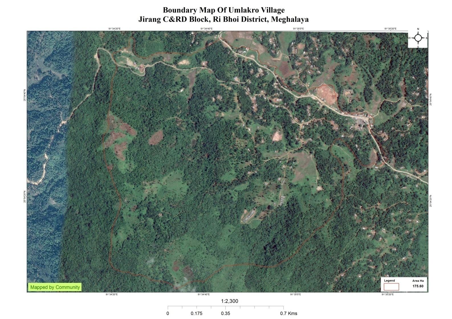
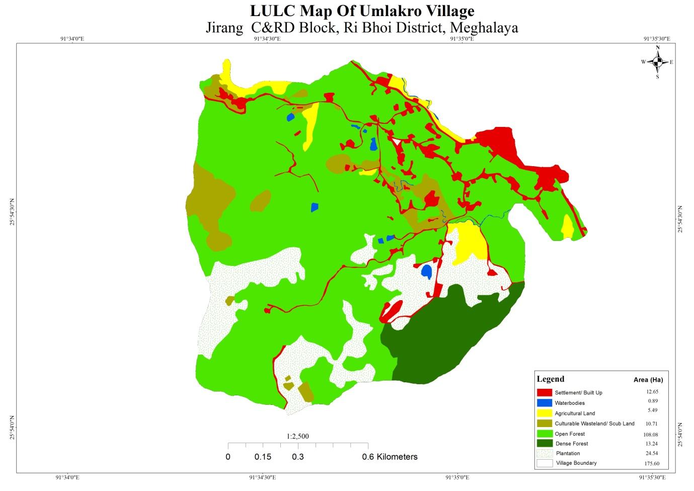
Umlakro Village falls under Jirang C&RD block of Ri-Bhoi district in the state of Meghalaya. The village is at a distance of 103 Kms from Nongpoh, the district headquarters of Ri Bhoi District and is at a total distance of 155 Kms from the state capital, Shillong. It falls under Hima Jirangwith a total geographical area of 175.60 ha and a total population of 412 villagers.
History:The formation of this village goes back to the 1960’s when forest fires spread across the whole of old Jirang. People migrated from Mynnnar Jirang to this village with also nearby localities coming together to constitute the village we now call Umlakro. There are various ways to reach the village with the majority of the people relying on public buses and private cars to reach there on a sharing basis.
Social Profile:The traditional form of governance prevails where the village head is the Rangbah shnong. There is a Village Employment Council (VEC) that oversees the implementation of Mahatma Gandhi National Rural Employment Guarantee Act and other developmental works. Besides women representation in the VEC, the village women are members of a women only village based organization that provides them a platform for decision making on various issues pertaining to the village.
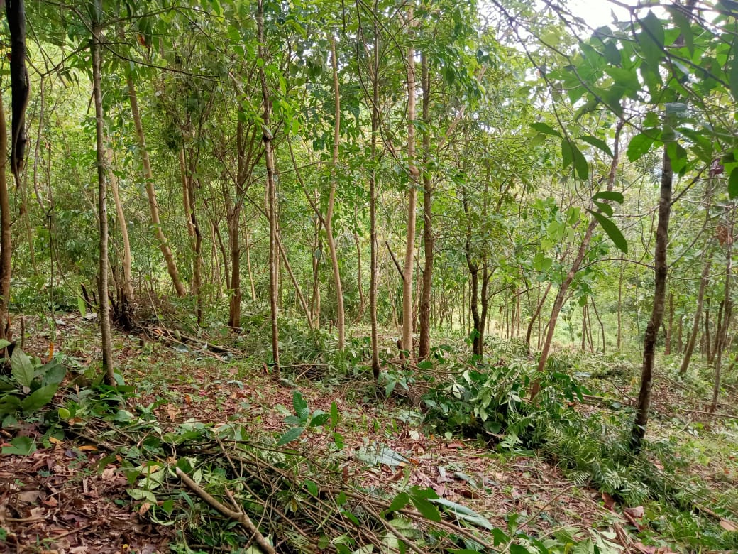
There are a number of streams and springs in and around the village. The main source of livelihood is agriculture. The Village not only produces cash crops but also various fruits, vegetables, betel nut and betel vine and Broom-Grass.
There are three schools inside the village, two of which are private institutions and one is the Govt. Upper primary School. The health dispensary is 6 km away; the nearest Bank is about 7km away and the Post office is 1 kms from the village.
Population
As per Census 2011, Umlakro population is 464. Out of this, 254 are males while the females count is210. This village has 56 children in the age group of 0-4 years. Among them 31 are boys and 25 are girls.
| Age Group | Male | Female | Total |
| 0 - 4 | 31 | 25 | 56 |
| 5-14 | 47 | 35 | 82 |
| 15 – 30 | 92 | 72 | 164 |
| 30-60 | 68 | 54 | 122 |
| Above 60 | 16 | 24 | 40 |
Card Holding Household:
The village has a total number of 94 Health cardholders, 38 Ration cardholders. The major occupation of the people is farming while some are teachers and govt. servants.
| Particulars | No. of HH/Cards |
|---|---|
| Total HH | 82 |
| Ration Card HH | 74 |
| Health Card HH | 420 |
Fuel Type:
| Fuel Type | Total HH |
|---|---|
| Charcoal | 3 |
| Biomass | 0 |
| Wood | 79 |
| LPG | 3 |
| Electric Heater | 0 |
| Kerosene | 0 |
OCCUPATION:The people of the village rely on
agriculture and forest products for their livelihood. The main
occupation of the villagers is farming followed by teaching and
government service. Every household owns areca nut and betel leaves
plantation and fishery ponds.
Drinking Water: There is a shortage of water during the dry season village. The existing springs are seasonal and their discharge is very low which leads to water scarcity in the village
Jhum cultivation: mainly take up traditional approaches of cultivation like Jhum or the shifting cultivation
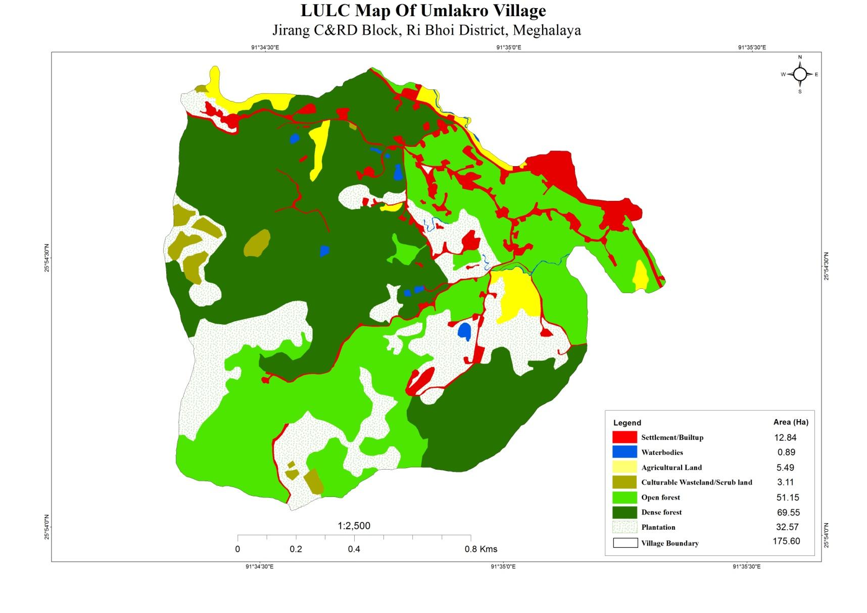
LAND
Forest- 120.70Ha
Cultivable Land- 8.6 Ha
WATER BODIES
Springs- 4
Streams- 4
River- 2
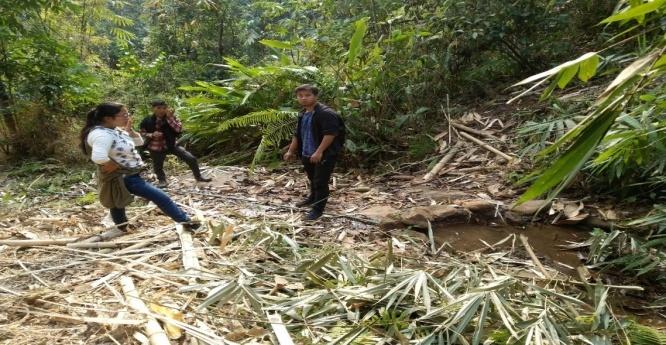
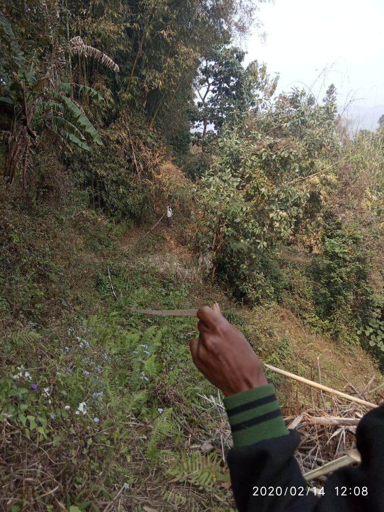
Ground Truthing
The CLLMP team met with Mr.Intusing Doloi who is the Headman of Umlakro Village on the 5th of February 2019 for Ground Truthing . He provided the Team with important information regarding the current scenario of the landscape and the natural resource management under his headman ship.
Case Findings:
More than 60 HH (81). Out of the 81 households, 58 belong to BPL category.
Actively performing VEC
Availability of Community forest (~1 hectare)
No proper access to drinking water. They have four drinking water sources but only one is in use. Their drinking water source is located outside of the village.
Water management is also a huge issue in the village and with no proper access to drinking water and a lack of catchment areas, there has been a rise in community problems.
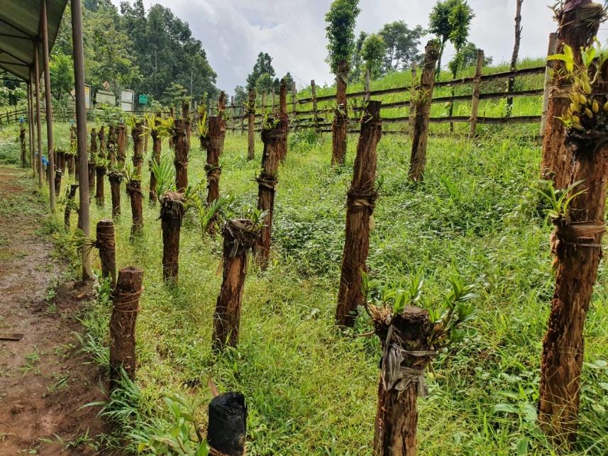
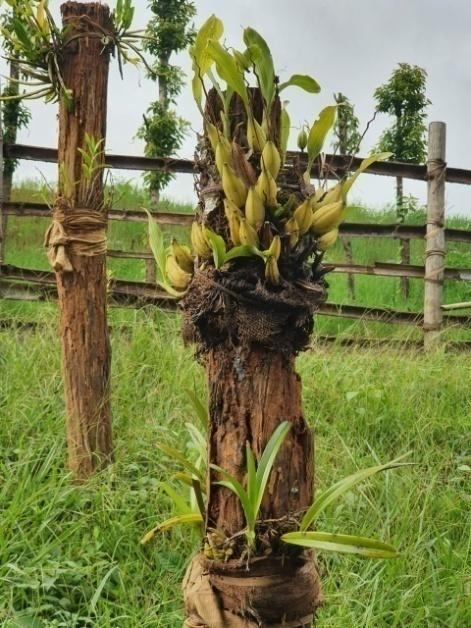
Outstanding growth of Wild Orchids in the village and a unique practice of growing them.
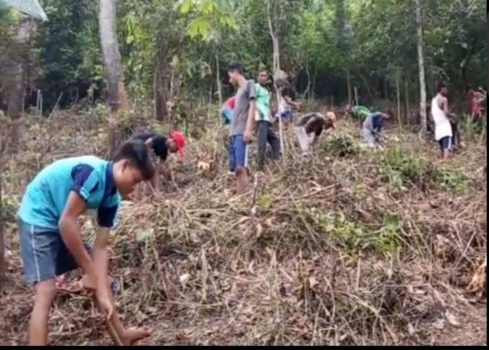
High deforestation activities (~20 Ha) .
Presence of endangered local tree species.
List of Natural Resources at Umlakro Village:
Orchid, Jackfruit, Bananas, Orange, Pomelo, Papaya, Elephant apple, Litchi, Coconut.
Bay leaves, Betel leaves,Betel nuts, Black pepper, Broom grass, Lemon grass .
Brinjal , Tapioca, Chilli , Tomatoes, Pumpkin, Neem, Green vegetables, Yam, Ginger, Turmeric, Mustard, Sesame.
Rice , Corn , Millets , Silkworm ( seasonal) .
Pond , Streams.
“Soh Khyndai Khmat”
This tree has medicinal properties and the villagers use it for treating various ailments
Sensitization Programme
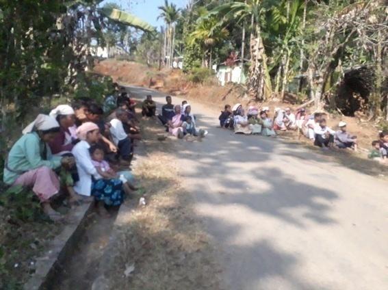
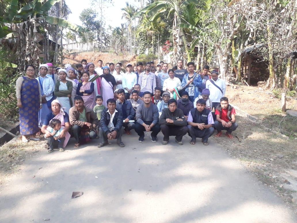
The sensitization programme took place on the 18th of January 2019 at the Community Hall of Umlakro Village. The headman of Umlakro Village, Mr. Intusingh Dolloi presided over the programme. Around fifty villagers attended the sensitization program however a significant number of the attendees were women.
The Assistant Manager (Environmental
management), Mr. Reuben Mendakor Shabong gave a brief
introduction on Meghalaya Basin Management Agency (MBMA) and
elucidated about the various programmes and projects that MBMA is
working on, but mainly focused on the Community Led Landscape
Management 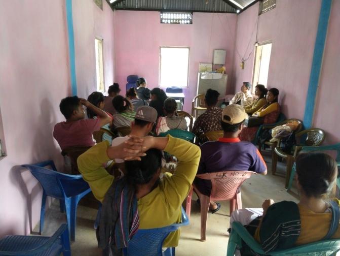
Project (CLLMP). He also spoke about the different aspects and procedures of the project and gave due importance on the environmental aspects of the project.
The Assistant Manager (Social Management), Mrs. Baiahunlang Kurbah spoke on the social aspects of the Community Led Landscape Management Project by giving numerous examples. She also enlightened the various benefits that the villagers could obtain from the project.
The Program was followed by an interactive session to answer the doubts and questions of the villagers.
The headman of Umlakro Village wanted to know if the CLLM-Project could help the community build a fence around the community forest.
The other question raised by an elderly of the village was if the CLLM-Project could aid the community with training in agriculture and husbandry.
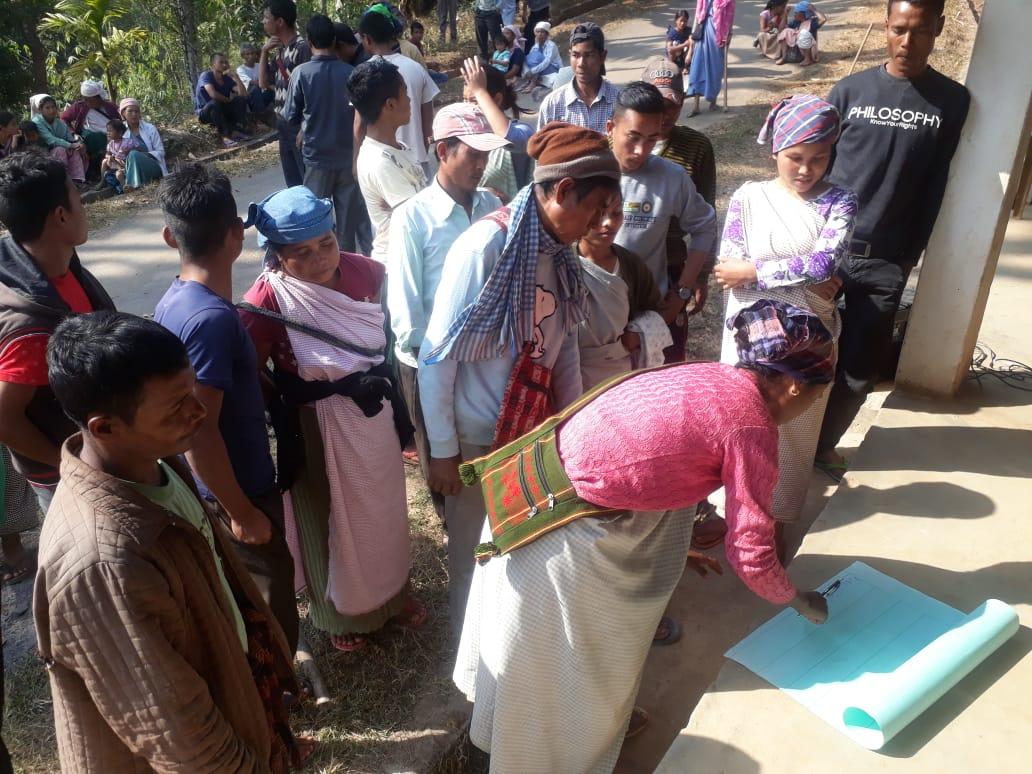
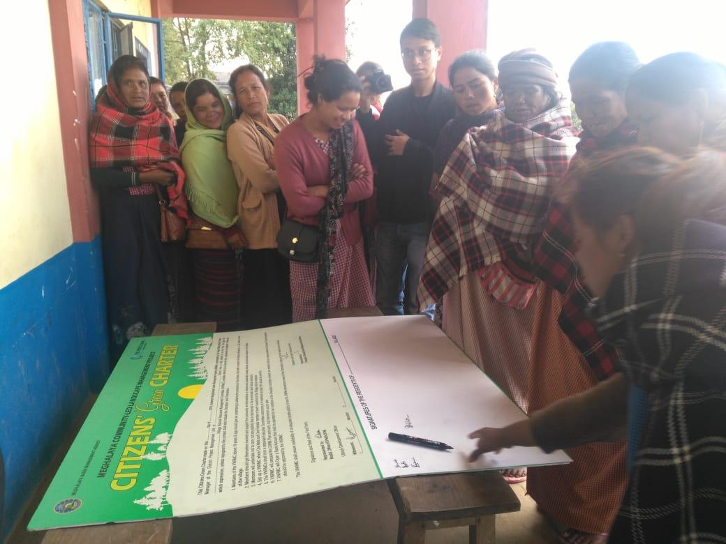
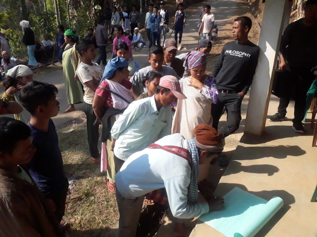
2.2 Signing of Documents: After the interactive session, the village signed the EOI, VGA and Green charter followed by the selection of candidates for the Village Natural Resource Management Committee. The Village Executive Committee (VEC) and the entire community carried out the procedure and elected the members of the VNRMC on the same day.
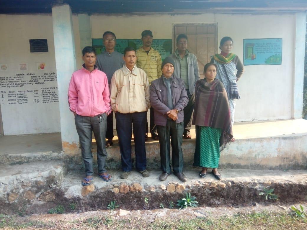
2.3 Formation of the VNRMC
The Formation of the Village Natural Resource Management Committee was done in a public meeting in the presence of the entire village and the CLLMP staffs. The community itself chose the President, the Secretary and the other executive members of the Committee.
Listed below are the members of the VNRMC:
|
|||||||||
|
Name in Full | Designation | Gender M/F | Age (Yrs) | Education | Occupation | Community | Religion and Denomination | Contact No and email address |
|
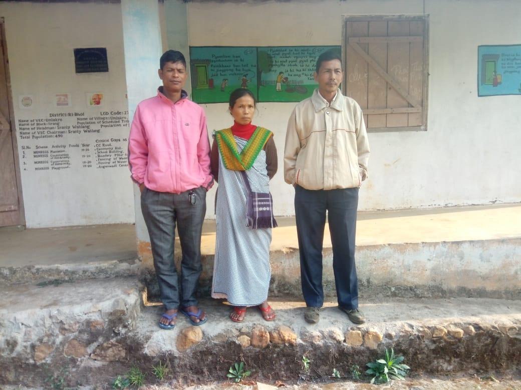
Sranly Wahlang | President | M | 45 | XII | Farmer | Khasi | Christian | 9365348574 |
|
Bashanstar Thangkhiew | Secretary | M | 33 | XII | Farmer | Khasi | Christian | 9612360096 |
|
Kynshewhun Rani | Bookkeeper | F | 28 | IX | Farmer | Khasi | Christian | 9378177195 |
|
Shormen Rani | Member | M | 55 | III | Farmer | Khasi | Christian | NA |
|
Adorstar Thangkhiew | Member | M | 33 | XII | Teacher | Khasi | Christian | 7005944051 |
|
Andira Rani | Member | M | 41 | BA | Teacher | Khasi | Christian | NA |
|
HoslinHujon | Member | F | 42 | VIII | Farmer | Khasi | Christian | NA |
|
Dorathy Rani | Member | F | 40 | IV | Farmer | Khasi | Christian | 9378176753 |
|
Sharli Wahlang | Member | F | 41 | III | Farmer | Khasi | Christian | NA |
| Village Community Facilitators | ||||||
|---|---|---|---|---|---|---|
| Sl No | Name in Full | Gender M/F | Age (Yrs) |
Education | Role | Contact No and email address |
| 1 | Charles Donal Sangma | M | 22 | 12 passed | Environment | 8730041621 |
| 2 | Sumarlin Thangkiew | F | 19 | 10 passed | Social Management | 9863223343 |
| 3 | Zegozar Sangkli | M |
|
|
Monitoring and Evaluation Management | 8787688743 |
Opening of a Bank Account.
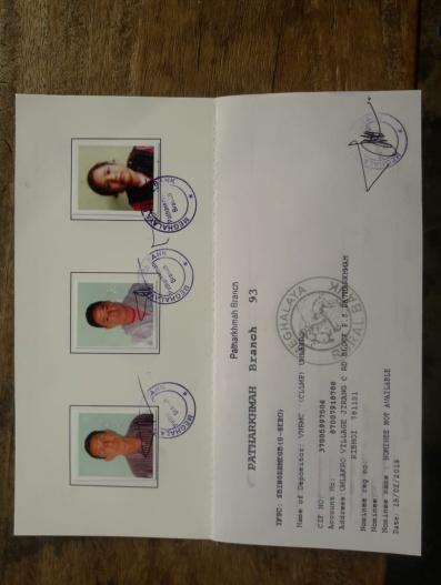
The opening of the bank account was initiated after the village signed the EOI (Expression of Interest), the VGA (Village Grant Agreement) and the Green Charter. A Meeting was also held with all members of the Village Natural Resource Management Committee (VNRMC) of Umlakro Village where the accountant of the CLLMP team had briefed them before opening the bank account.
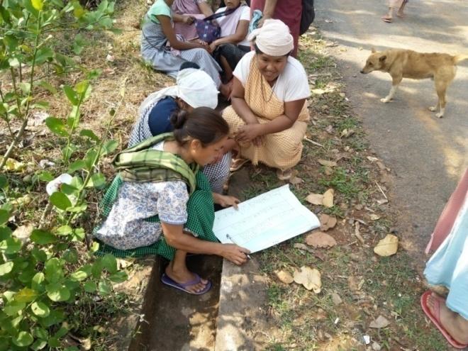
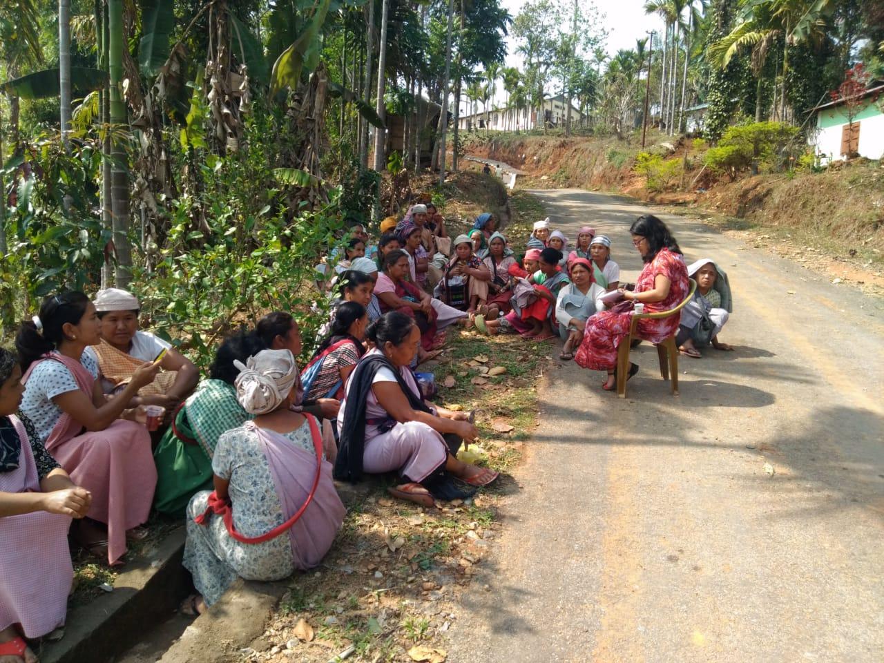
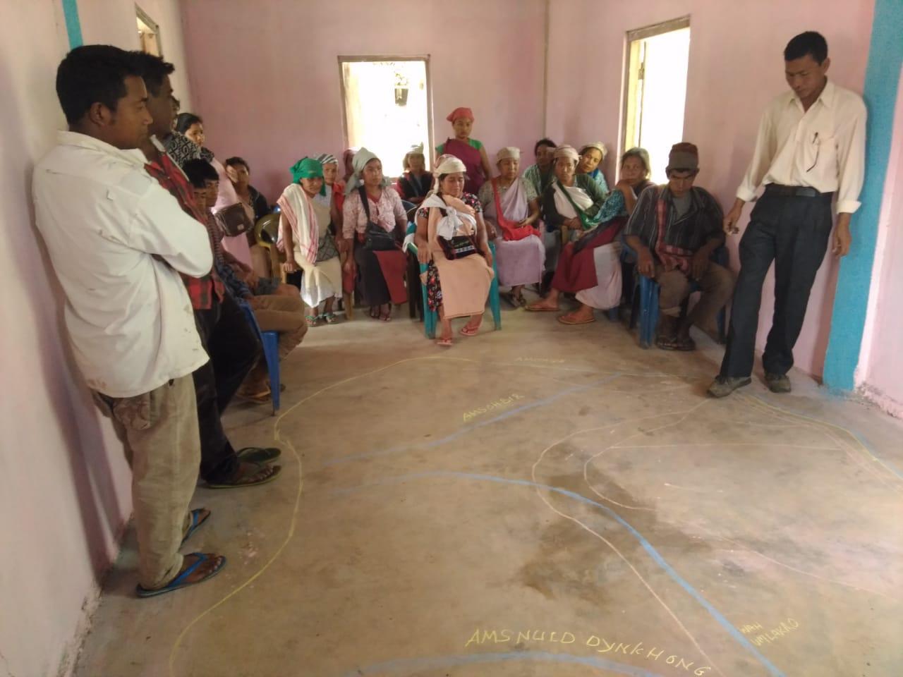
PRA Exercise
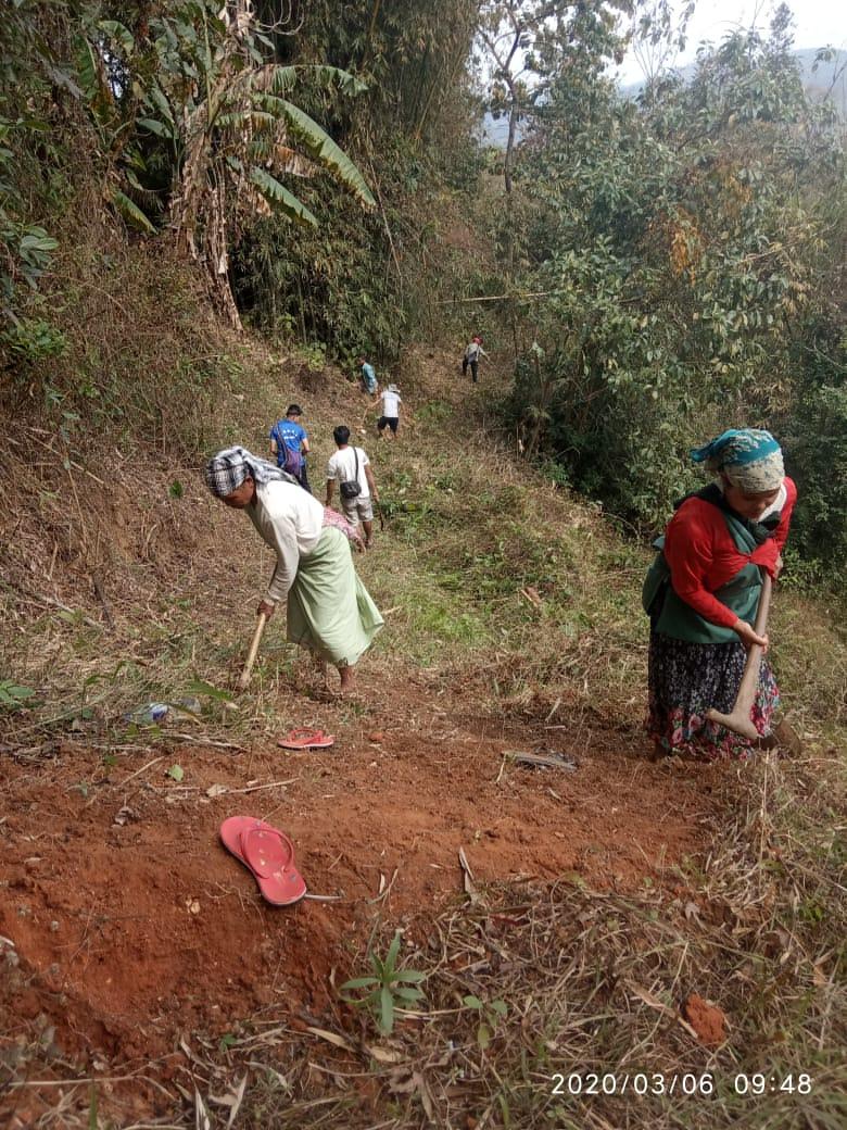
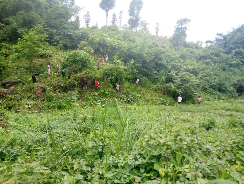
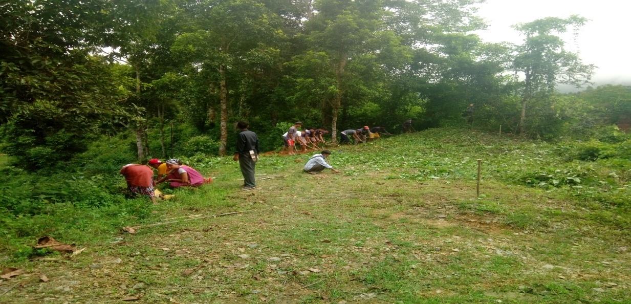
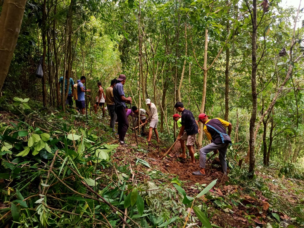
The PRA exercise aims to incorporate the knowledge and opinions of the community in the planning and management of development projects and programmes. PRA exercise at Umlakro Village took place on the 20th of March 2019. There were a total of 129 villagers taking part in this exercise who contributed their time and knowledge to this project. During the PRA exercise, the CLLMP officials and the community members were divided into groups to carry out the transect walk, fill the Social and Environmental Templates, the Seasonal Calendar, draw the Boundary map the Resource Map the activities conclude with an extensive discussion on the issues and challenges that the community faces and how they can be addressed through the CLLM-Project.
Commencement of PRA.
Introduction: Participatory Rural Appraisal (PRA) is the process of involving local people in the analysis and interpretation of their situation of a given rural area. The local people i.e. the participants take a leadership role in collecting, analyzing, interpreting and presenting information and in this process impart knowledge and development insight to the specialists and extension agents
For management of natural resources, participatory Rural Appraisal is conducted to establish rapport with the village community as well as to identify and define problems for prioritization in the village itself. It is a way of learning from and with community members to investigate their need assessment, analyze and evaluate constraints and opportunities and find out priorities in the area of agriculture, small scale rural enterprises and any other social and economic development programs addressed to village development. Based on the principle of listening and learning,
Objectives of PRA exercise at Umlakro Village:
The Participatory Rural Appraisal (PRA) exercise at Umlakro was conducted with following objectives:
To identify the natural, human and economic resources of a village.
To identify the village problems and prioritize them with the help of the community members.
To prepare the Community natural Resource Management Plan of the village.
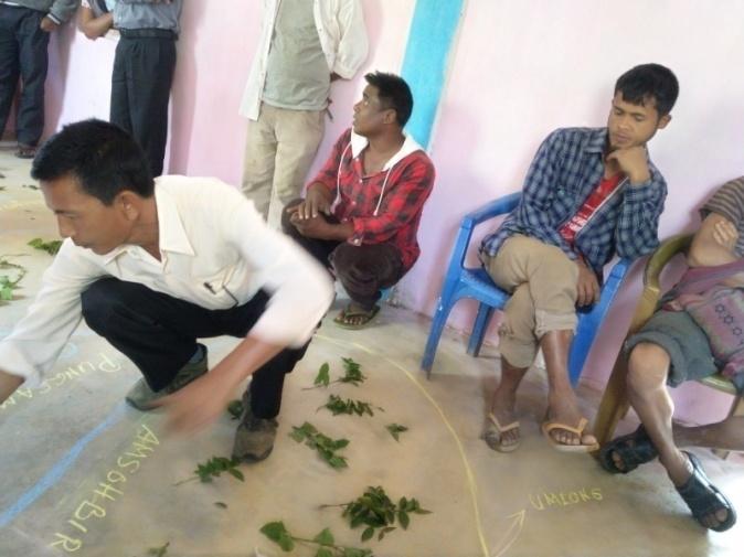
Drawing of the Resource Map
The second step is to involve the local community in preparation of a village resource map as perceived by the community members to solicit their participation. Infrastructure, services and other village resources such as agricultural lands, wells, wastelands, cattle population etc. were mapped. Local people prepared the Resource Map by drawing it on a chart paper without much interference from outsiders.
This activity achieved the following purposes:
Rapport building and winning the confidence of the villagers.
Analyzed the spatial information, particularly studied problems and opportunities of villagers.
Got an impression about the village setting, physical layout, location of various houses and institutions.
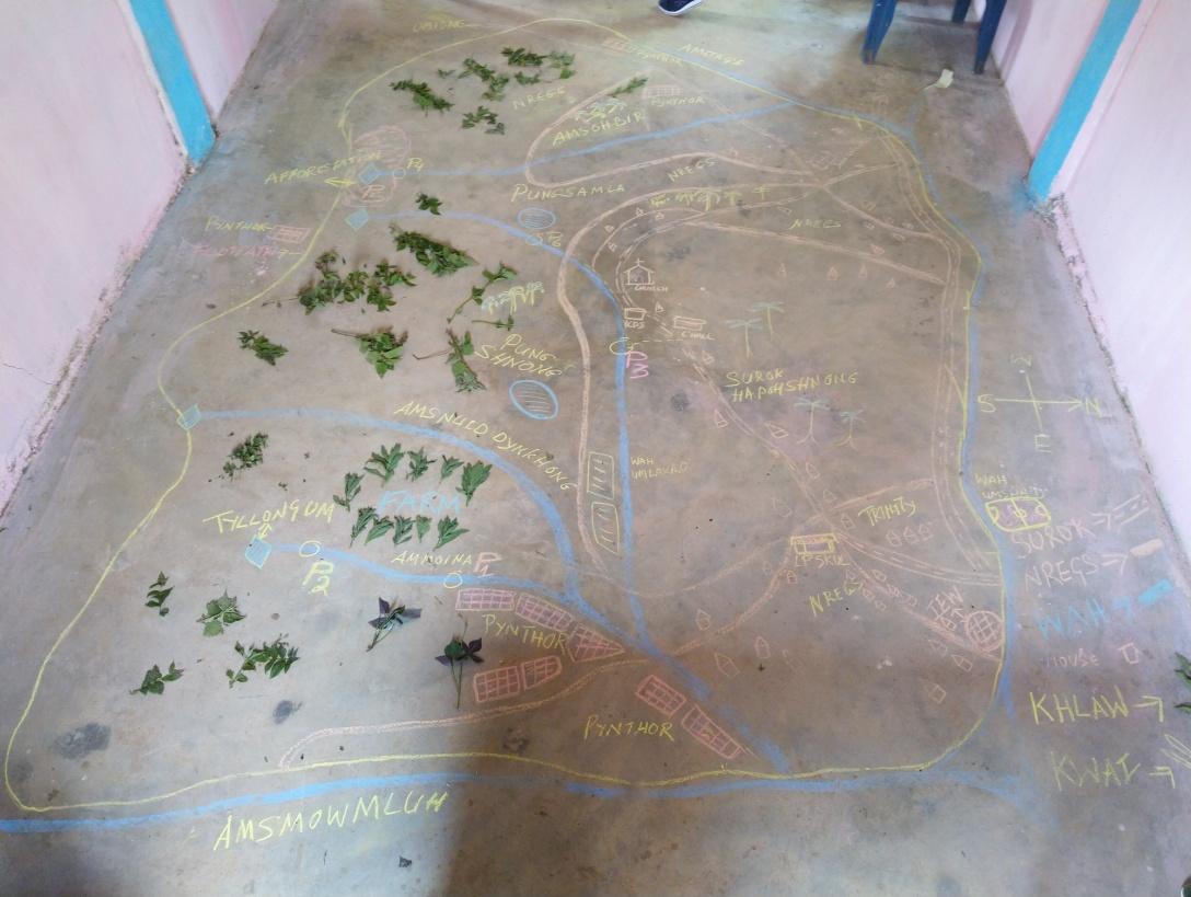
Resource Map drawn by the youths of Umlakro Village
Resource Map of Umlakro village
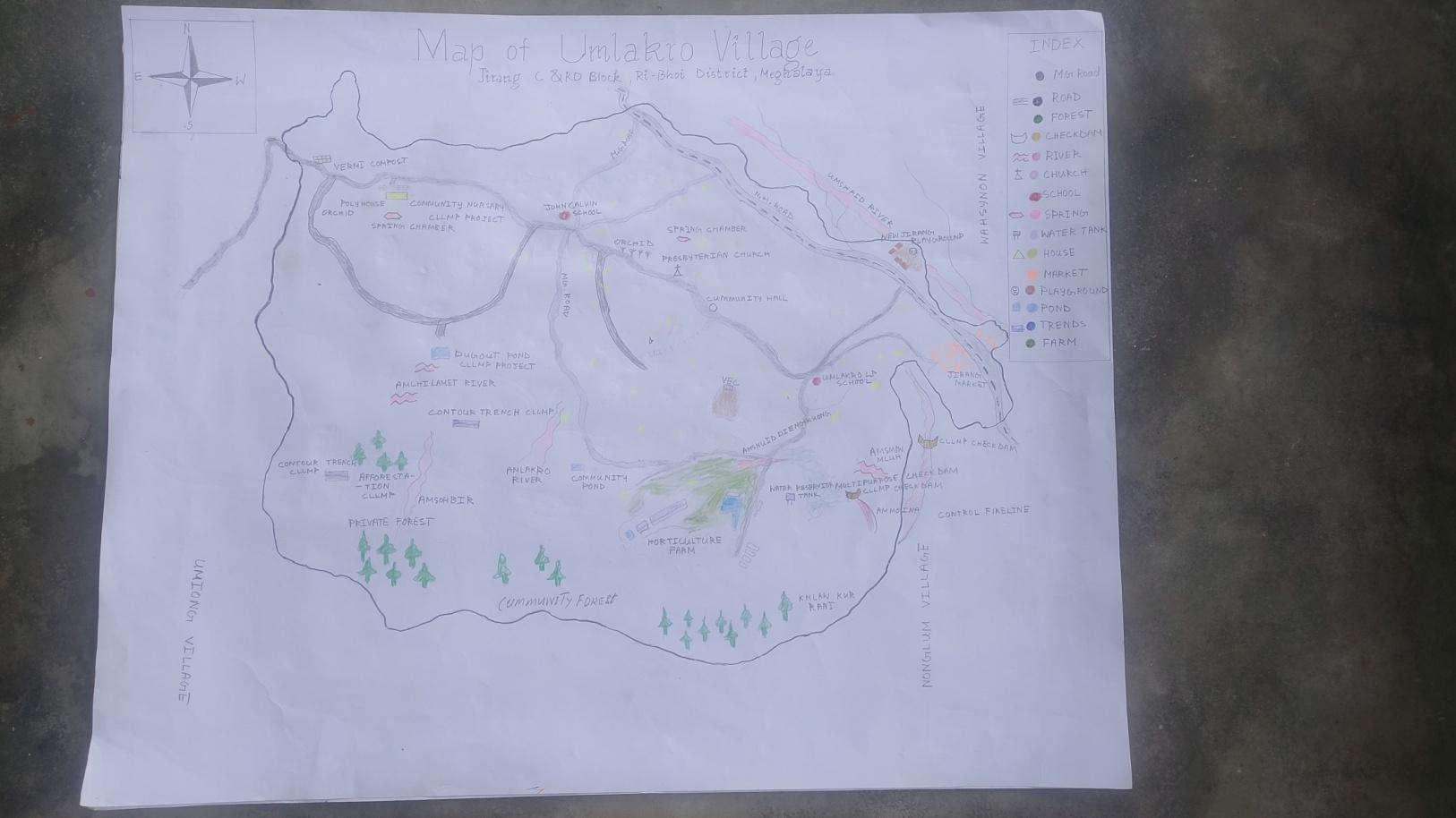
Findings based on the Resource Map of Umlakro Village
1.Main agricultural produce is Paddy and Blackpepper
2. Types of Forest Ownership : 2 types of Forest are there which consist of 2 communities and various private forests.
3. Springs in the village : There are 5 Springs within the village that flows throughout its boundary.
4. Rivers/ streams: There are 2 streams at Umlakro and these consist of Um Lakro and and Um Smowmluh which emerge from the western part of the village and go all the way to the eastern part.
5. Churches Present: there is only one Church in the village
6. School:There is one Govt.LP school and two Private Schools in the village.
7. Connectivity: The village is connected via the Mawngap- Mairang Rani NH.
8. Habitation: Confined to only one part of the village
Baseline Data Survey for Environment and Social Template
During the PRA exercise External Expert of Environment Management discussed information related to land use categories such as forest, cultivable land, water bodies ,etc. with group consisting village community members who are quite aware of the village boundary and the presence of natural resources in the village. Problems and challenges related to NRM were discussed. The problems of forest fires are discussed lengthy, community members voice out their problems and losses to forest fires in recent years. The NRM that can be done in the village are discussed.
Problem Analysis
A. Do people have sufficient access to supply of fodder ,fuel wood, leaf litter?
The villagers said that access to fodder and leaf litter is presently sufficient but fuelwood has been difficult to access since they have to go to far places and forest to fetch for fuelwood .
B. Has access to timber improved or reduced over the years? How is access for household use and commercial use managed?
Access to timber has been reduced over the years because people are cutting down trees for house construction and also commercial use to improve their livelihood status.
C. Are the Water bodies facing any threats?
No threats, but during rainy season the water becomes muddy and dirty so peoples they could not access for cleaning , washing etc
D. Do all the people in the village have access to drinking water? What are the challenges?
Yes , Umlakro village has access to drinking water through Government water supply but the challenges they face are that during the dry season all the source becomes small and dried up so they could not get enough drinking in the village.
E. Are there degraded areas in the village (open/degraded forests , mining affected ,high soil erosion etc)?
None.
F. What has caused this degradation ? Are there practices causing threats to availability and access to natural resources ?
None.
What have been the changes in agricultural practices?
They still practice Jhum cultivation and make no other changes in the farming sector.
Are there any challenges in farming?
Yes they face some challenges in farming like the wild animals attack their fields and damage all the crops and cause a great loss to the farmers.
How would you consider the health situation in your village?
During the group discussion with the women’s of Umlakro they said that during summer season mostly the children’s get sick like Diarrhoea, fever etc
Malaria since two three years back it has been reduced and no more cases found on malaria
The ASHA plays a very vital role in taking care of the pregnant women and infants of the village they examined and providing healthy supplements.
How is the situation of cleanliness , sanitation access to toilets and waste management ?
Cleanliness is the top priority of the village they said that as compare to the years before there is a lot of improvement in today present days since 2010-2012 they has access to Toilets , and since the Swachh Bharat Mission has implement in the village the cleanliness , sanitation and waste management maintenance has improved and also awareness programme the ASHA use to conduct in the village.
Who is the most vulnerable group in the village? What can be done to improve their lives?
BPL Families . Inclusion of BPL Families during project implementation.
What are the livelihood aspirations of the youth ? Are there any avenues available?
The majority of the people in the village turn to farming and get a job card under MGNREGA for employment and some engage in self-employment.
Do any committees /institutes/rules exist to manage and monitor natural resources in the village?
The VNRMC under the CLLMP will manage the Natural resources in the village . prior to the CLLMP the village received permission from the forest management committee to look after and preserve the forest.
What are some of the major issues or conflicts in the village?
The major issues and conflict in the village is for drinking water.
Have any of the above issues been discussed in village meetings?
Yes, the village executive committee has taken the initiative to look after all the arguments and problems facing the villagers .
How do people resolve disagreements and conflicts?
All disagreements and conflicts are addressed by the traditional institution of village governance called the village Dorbar.
Seasonal Calender:
| SEASONAL CALENDAR UMLAKR0 | |||||||||||||
|---|---|---|---|---|---|---|---|---|---|---|---|---|---|
| Sl No. | CRITERIA | JAN | FEB | MAR | APR | MAY | JUN | JUL | AUG | SEP | OCT | NOV | DEC |
| 1 | Water Scarcity | 2 | 1 | 1 | 2 | ||||||||
| 2 | Prone to sickness | 1 | 1 | 2 | |||||||||
| 3 | Seeking job outside | 1 | 1 | ||||||||||
| 4 | Rain Fall | 2 | 1 | 1 | 2 | ||||||||
| 5 | Free – Less work | 1 | 1 | ||||||||||
| 6 | Paddy Cultivation | 2 | 1 | 1 | |||||||||
| 7 | Paddy harvesting | 2 | 1 | 1 | |||||||||
| 8 | Ginger cultivation | 1 | 1 | 2 | |||||||||
| 9 | Ginger harvesting | 1 | 1 | ||||||||||
| 10 | Broom Cultivation | 1 | 1 | 2 | |||||||||
| 11 | Broom Harvesting | 1 | 1 | 2 | |||||||||
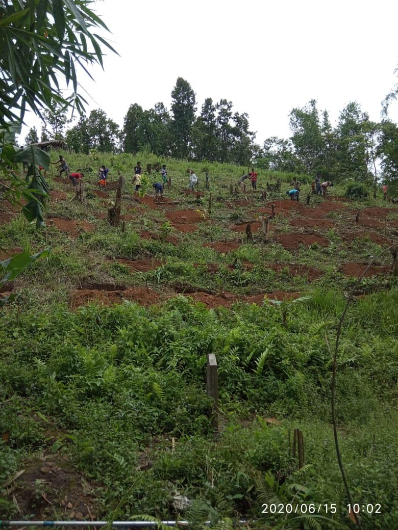
| 121 | Tree Plantation | 1 | 1 | ||||||||||
| 13 | Vegetable (crop cultivation) | 1 | 1 | 2 | |||||||||
| 14 | Vegetable (crop harvesting) | 1 | 1 | 2 | |||||||||
| 15 | Festive Season | 1 | 2 | ||||||||||
| 16 | Forest fire | 1 | 1 | 2 | |||||||||
| 17 | Collection of Fuel wood | 2 | 1 | 1 | |||||||||
5. Development of the Community Natural Resource Management Plan (CNRMP)
The Community Natural Resource Management Plan was prepared at a
village level meeting held on the 5thof February 2019. A
total of 18 men and women from the village, including members of the
Village Natural Resource Management Committee (VNRMC) were present
to voice their problems and opinions while preparing the Community
Natural Resource Management Plan.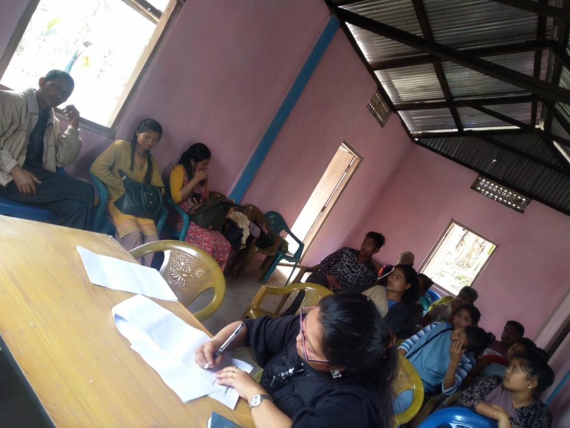
Plan Estimate:
The CLLMP Team also made an inspection to the proposed intervention sites of the CNRMP along with Ms. Badasuk kharkrang who is the Technical Assistant under Jirang Block who is responsible for providing the estimates of the plans.
Submission of CNRMP by the VNRMC
The Final Community Natural Resource Management Plan
|
Name of Proposed Interventions | Site |
|
Nos of HHs expected to Benefit | ||
|---|---|---|---|---|---|---|
|
|
|
||||
| 1 |
|
Amhlilamet |
|
|
|
|
| 2 |
|
Amsohbir |
|
|
|
|
| 3 |
|
Amhlilamet |
|
|
|
|
| 4 |
|
Umjage |
|
|
|
|
| 5 |
|
Amsmomluh |
|
|
|
|
| 6 |
|
Amlakro Amsohbir Amsmomluh |
|
|
|
|
| 7 |
|
Umjage |
|
|
|
|
| 8 |
|
KliarAmsohbir |
|
|
|
|
| 9 |
|
Amjage |
|
|
|
|
| 10 |
|
1.Pynthor Obesly (Ammoina) 2. PynthorIntosing (Umlakro) |
|
|
|
|
| 11 |
|
Catchment area of 1.Amsmomluh 2.Amlakro 3.Amsohbir |
|
|
|
|
| 12 |
|
1.Haneng Pynthorbashanstar 2.Haneng Pynthoropyrshang 3.Haneng PynthorEnodis 4.Haneng PynthorIntusing 5.Haneng pynthorEslinsis |
|
|
|
|
| 13 |
|
Umkarbai |
|
|
|
|
| 14 |
|
Amhlilamet |
|
|
|
|
| 15 |
|
1.Umjage 2. Lum Tower |
|
|
|
|
| 16 |
|
1.Barnabas area 2.Tulsi area 3.Um U Paul |
|
|
|
|
| 17 |
|
Village road side |
|
|
|
|
| 18 |
|
Catchment area at 1.Amsmomluh 2.Amlakro 3.Amsohbir |
|
|
|
40
|
| 19 |
|
Pungsamla area |
|
|
|
|
| 20 | Horticulture (Banana, pepper, Orange) | Road Side, KliarUmlakro |
|
|
|
|
| 21 | Headwork | Am-moina | ||||
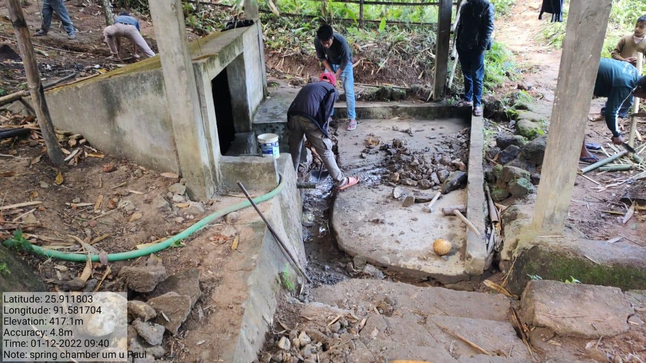
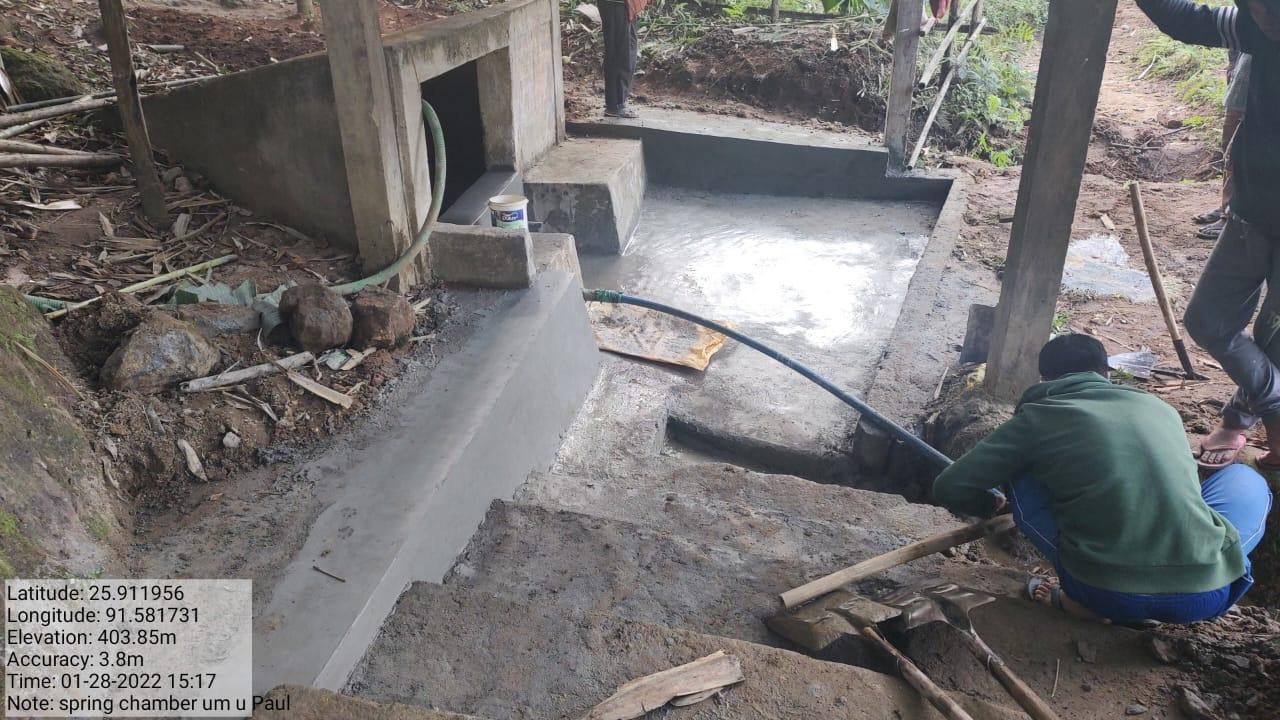
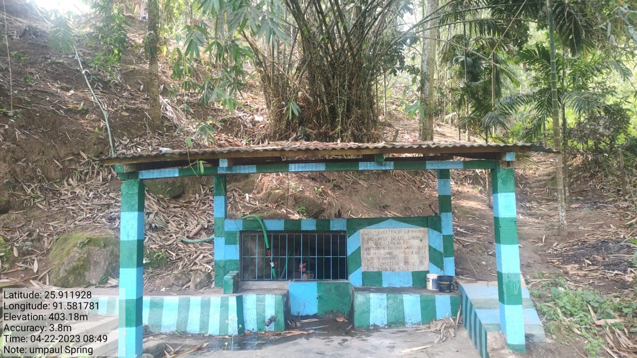
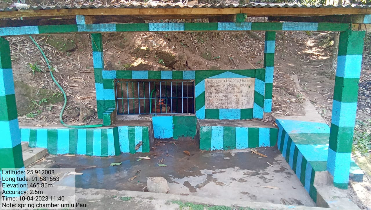
| 22 | Renovation of Spring Chamber | Um u Paul |
|
|
||
| 23 | Earthen Bun Cum Biofencing | LumUmlakro | ||||
| 24 | Pepper plantation in the catchment area | Amsmowmluh | ||||
GIS Activities:
| Sl.No | Parameters | Village Information |
| 1. | GPS Coordinates | |
| i | Latitude | 25.911004°N |
| ii | Longitude | 91.582210°E |
| iii | Elevation Reading (MSL) | 423M |
| 2. | Village Geographical Area(Ha) | 175.60 Ha |
| i | Total Forest Area ( including community, Clan, Pvt Forest) | 121.32 Ha |
| ii | Total Area of Water Bodies | 0.89 Ha |
| iii | Total Area under Agri- Horticulture | 30.03 Ha |
| iv | Total Degraded land area (Ha) | 10.71 Ha |
| 3 | Average Annual Rainfall | 1000-1200 |
| 4 | Soil Type | Loamy soil |

Project Implementation
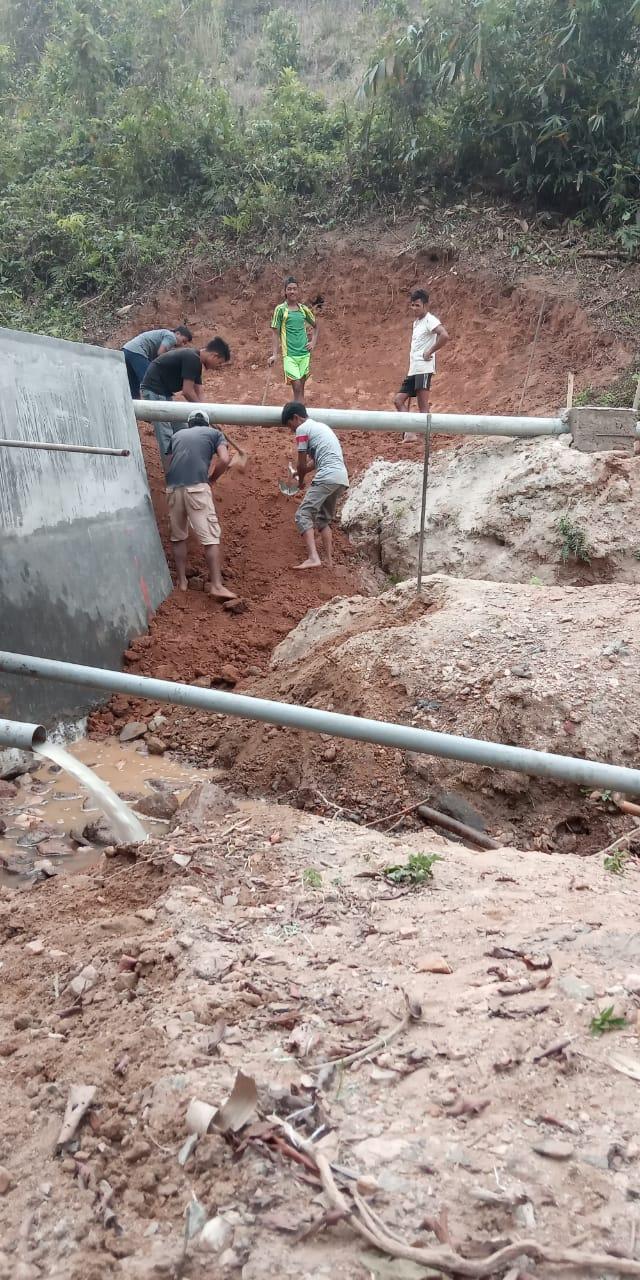
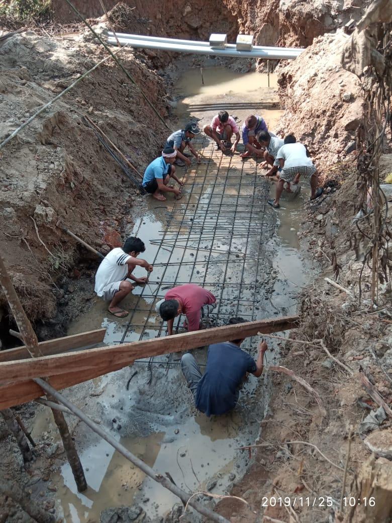
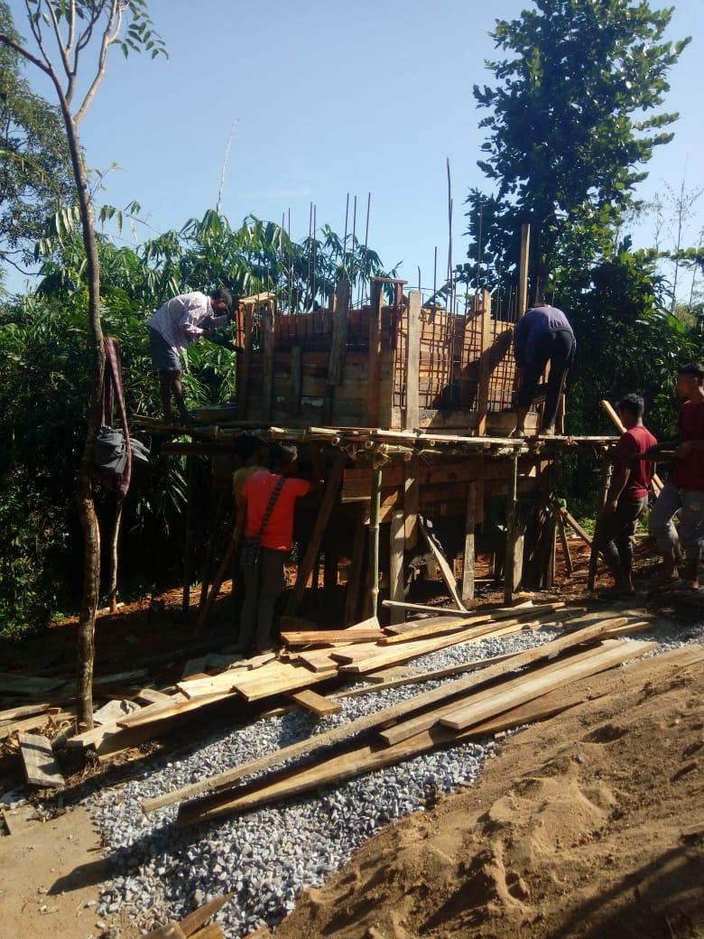
| 1. | Type Of Intervention | Site Name | GPS Co-ordinates | Amount Sanctioned | Work Status | |
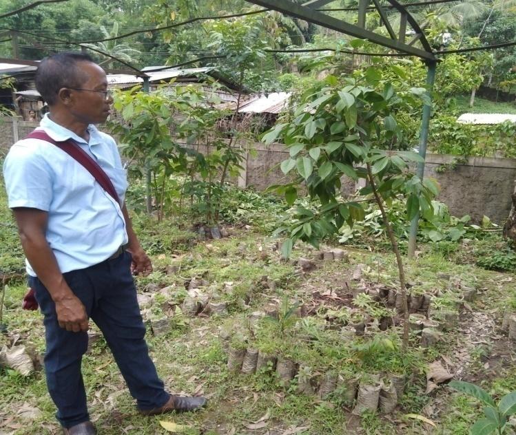
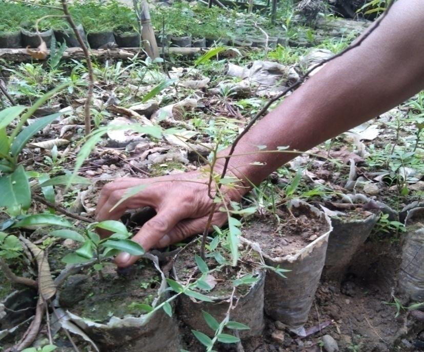
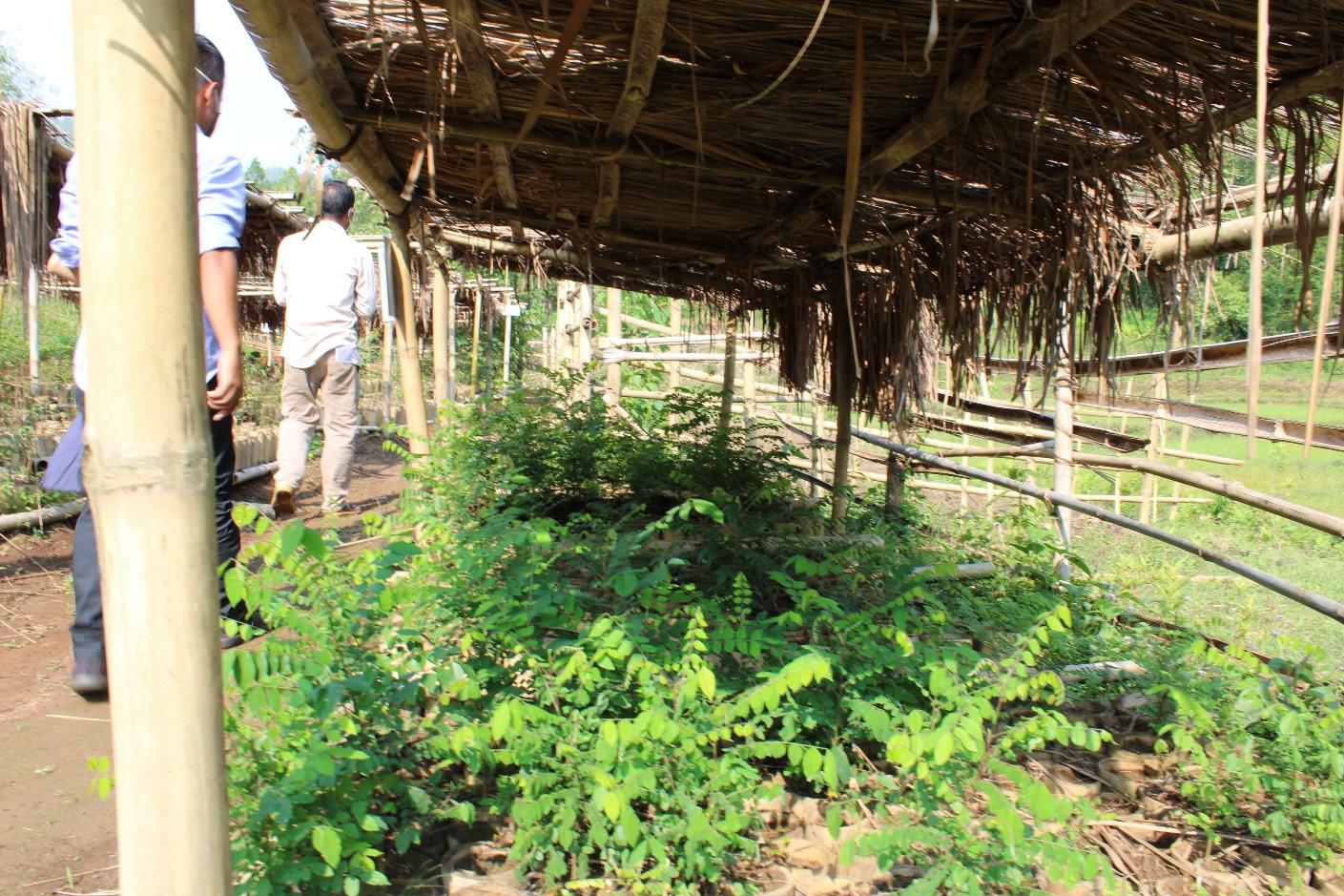
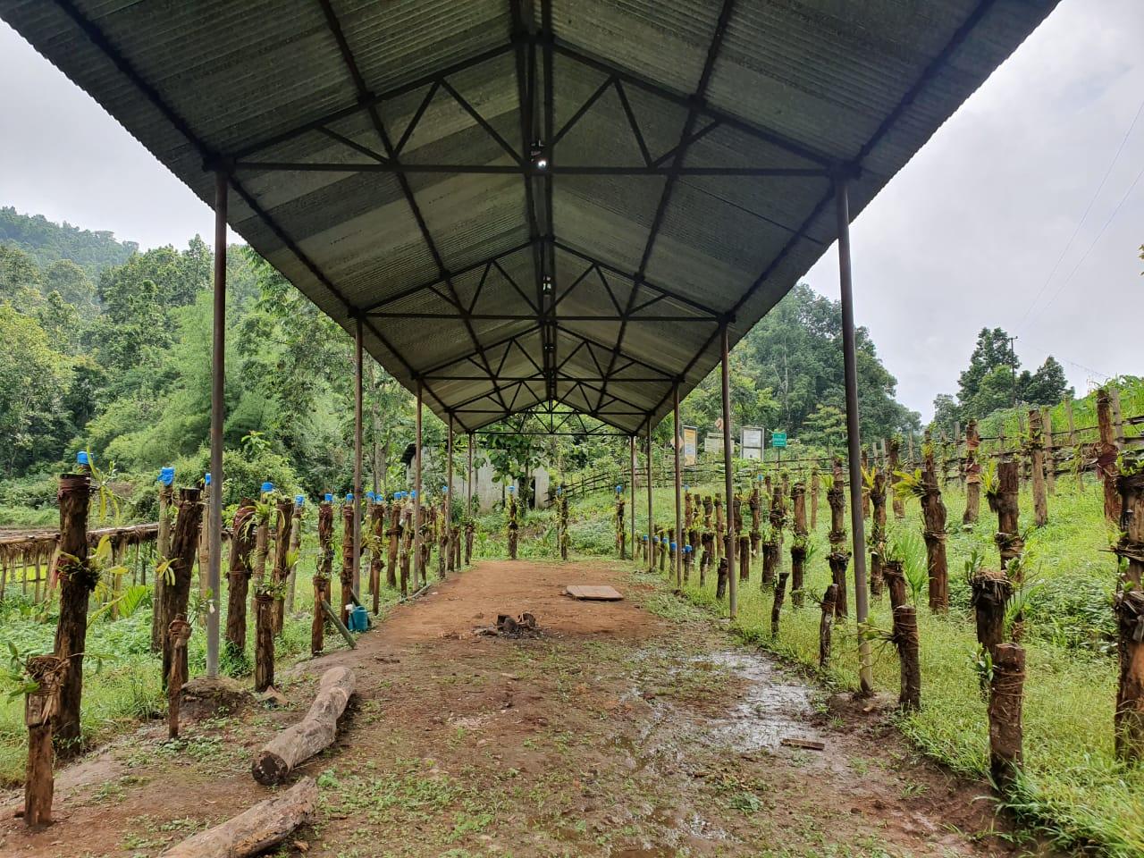
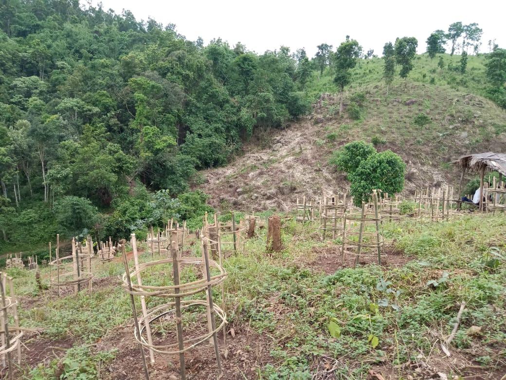
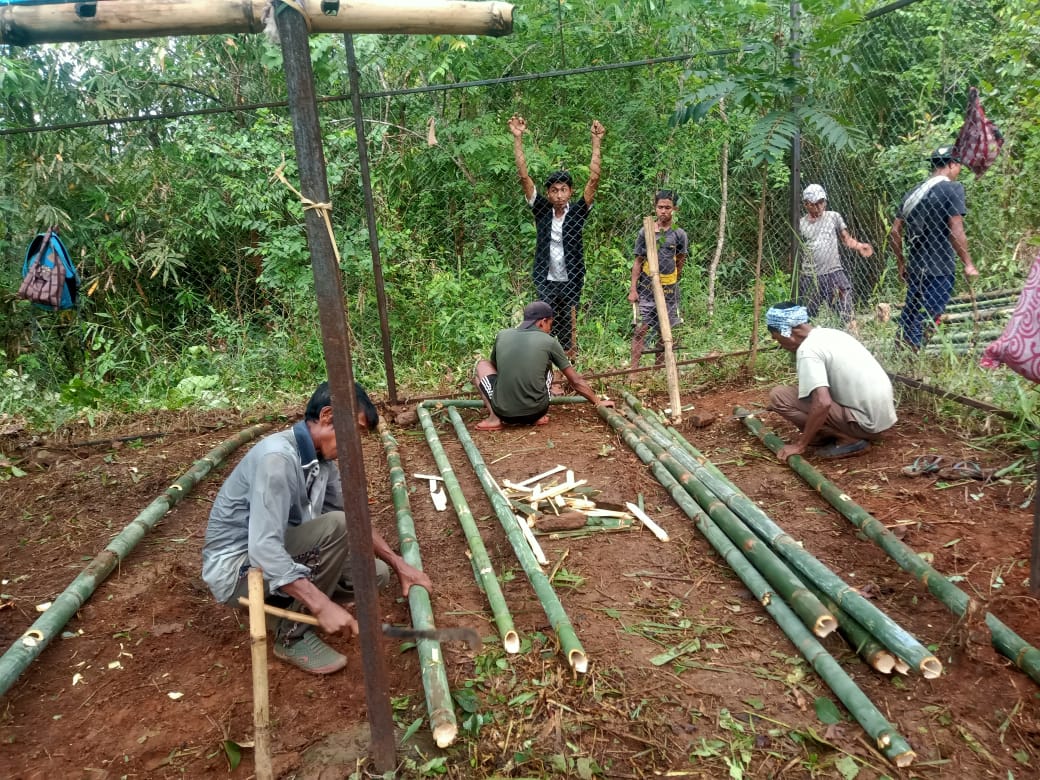
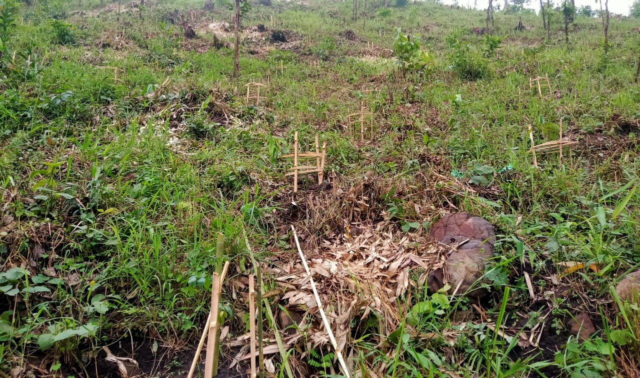
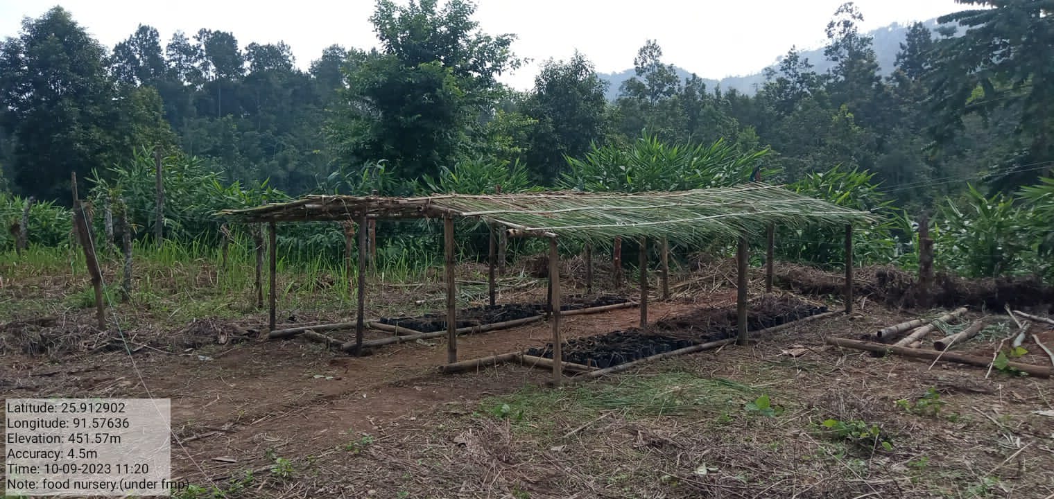
| Nursery | Umjaje | 25°54'45.06"N | 91°34'35.41"E | ₹ 1,19,300.00 | Completed | |
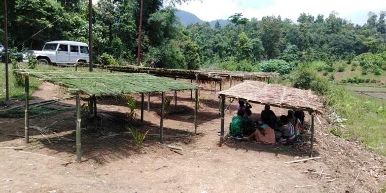
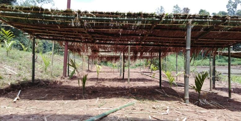
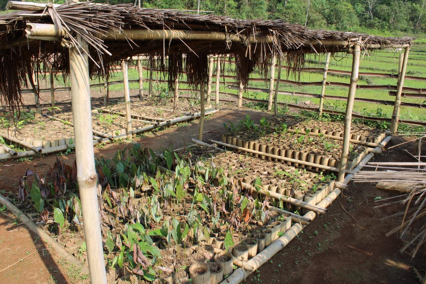
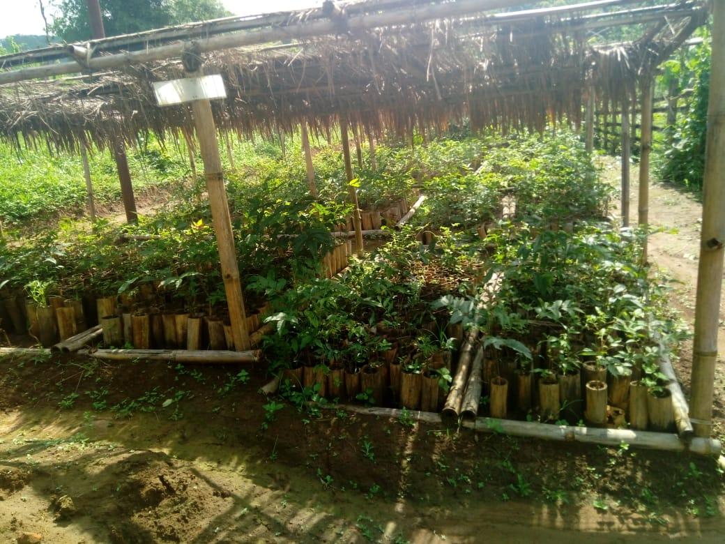
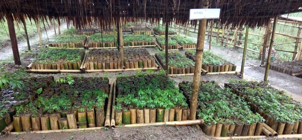
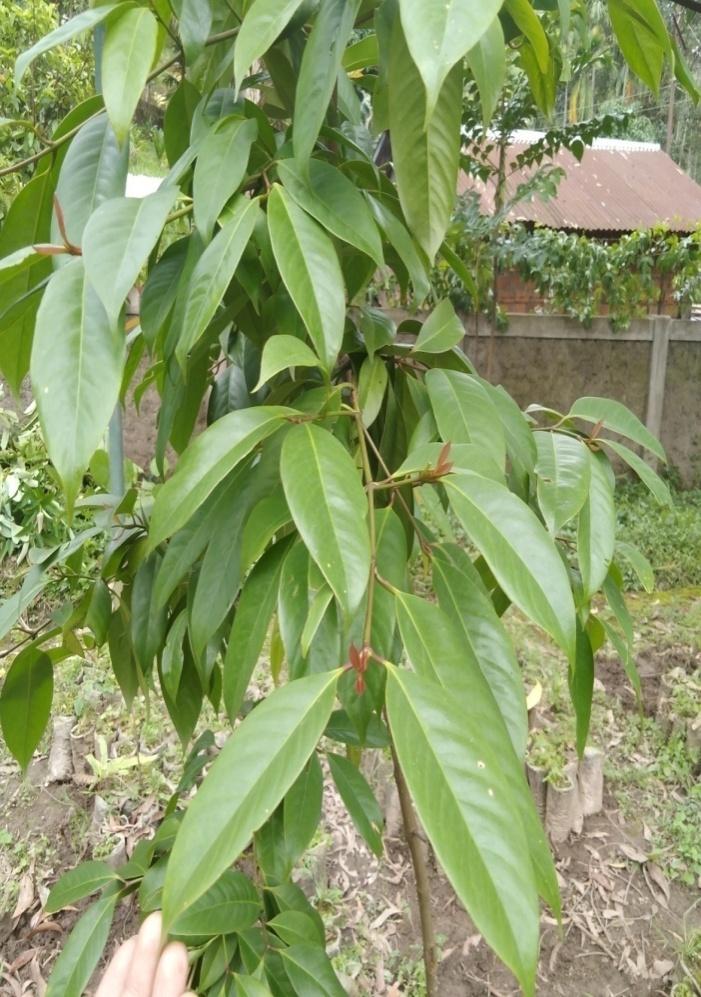
Innovative use of Bamboos at the Community nursery
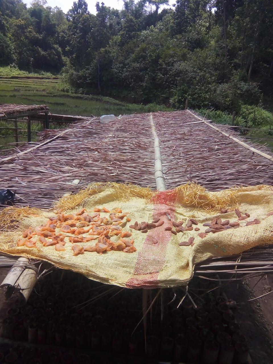
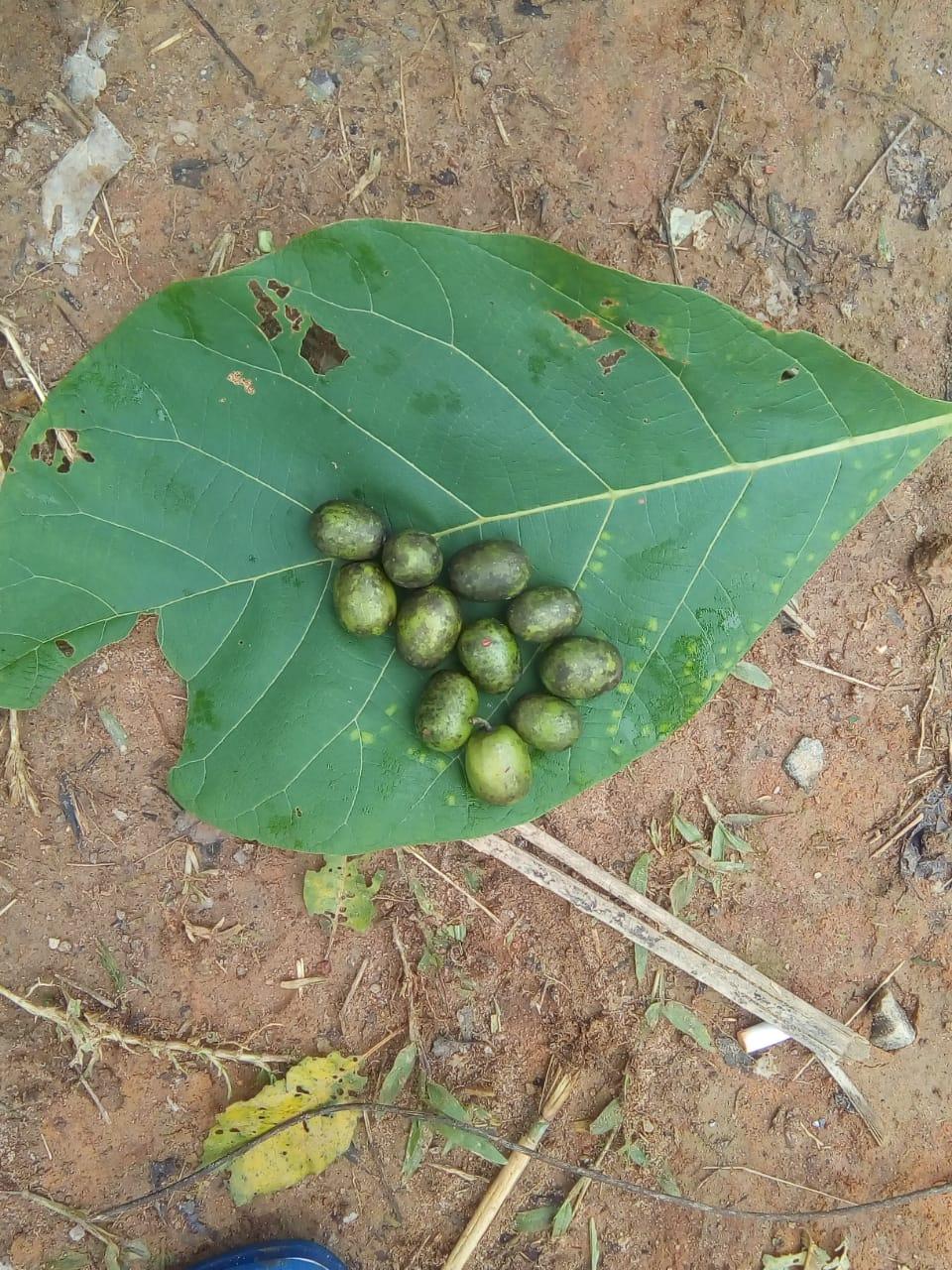
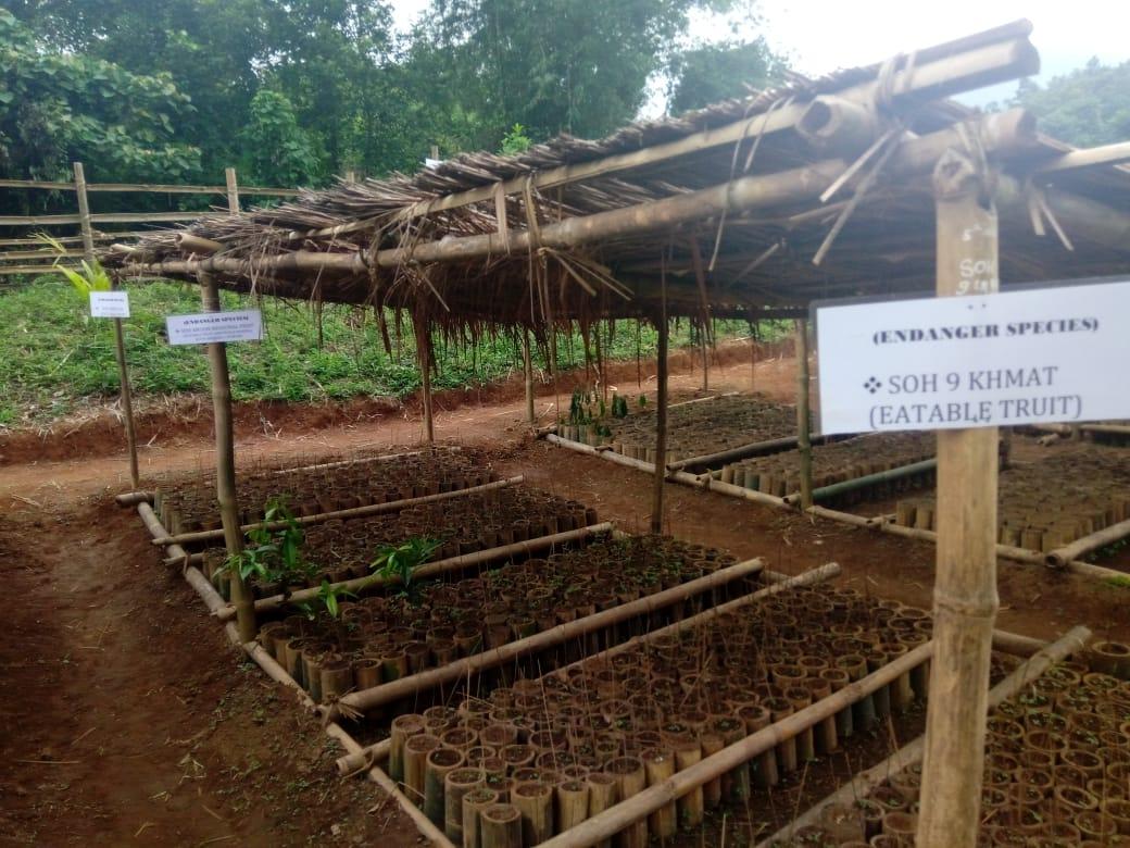
Propagation of Endangered Species
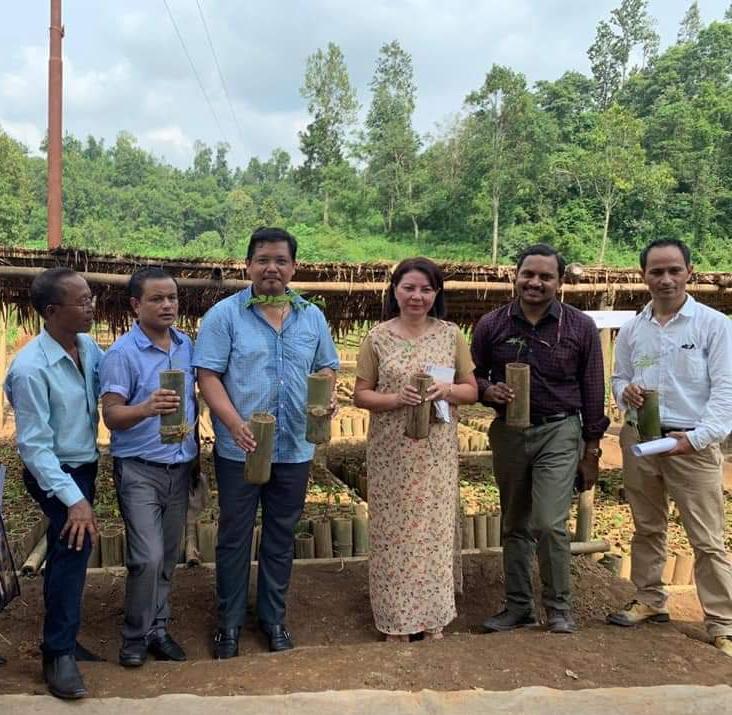
The Honourable Chief Minister of Meghalaya, Shri. Conrad K. Sangma;s visit to Umlakro Village.
The Honourable Chief Minister of Meghalaya, Shri. Conrad K. Sangma launched an initiative called 'Block to Block and villages visit'. The objective of the visit is to understand the needs of the villages and the challenges faced by them while drafting policies and implementing developmental schemes.
He started the initiative by visiting Jirang C & RD Block in Ri Bhoi District, one of the more remote blocks in the State, accompanied by Shri. Sosthenes Sohtun, MLA of Jirang Constituency, Shri. Sampath Kumar (IAS), Commissioner and Secretary, GoM, Shri. Shantanu Sharma (IAS), CEO MSRLS and APD CLLMP, Smt. Rosetta Mary Kurbah (IAS), Deputy Commissioner, Ri Bhoi District and other officials from various departments.
The CM visited the Community Nursery at Umlakro village and praised the innovative approach of using pots made of bamboo in their nurseries for the propagation of indigenous and endangered local species.
The Secretary of Umlakro village submitted a Memorandum to the Chief Minister on behalf of Umlakro Village. He thanked the Chief Minister for his visit and stated that it was a blessing for the people of Meghalaya to have an efficient Chief Minister who personally visits villages to understand the condition of the farmers and the rural people. The Chief Minister appreciated the forward thinking of the people of Umlakro village for saying ‘no to plastic’ and for starting an innovation of using pots made of bamboo instead of plastics in raising their nurseries under the Community led Landscape
Management project (CLLMP). He congratulated the officials of CLLMP for the initiative and said that the village can be a model village and an example for others
| 2. | Type Of Intervention | Site Name | GPS Co-ordinates | Amount Sanctioned | Work Status | |
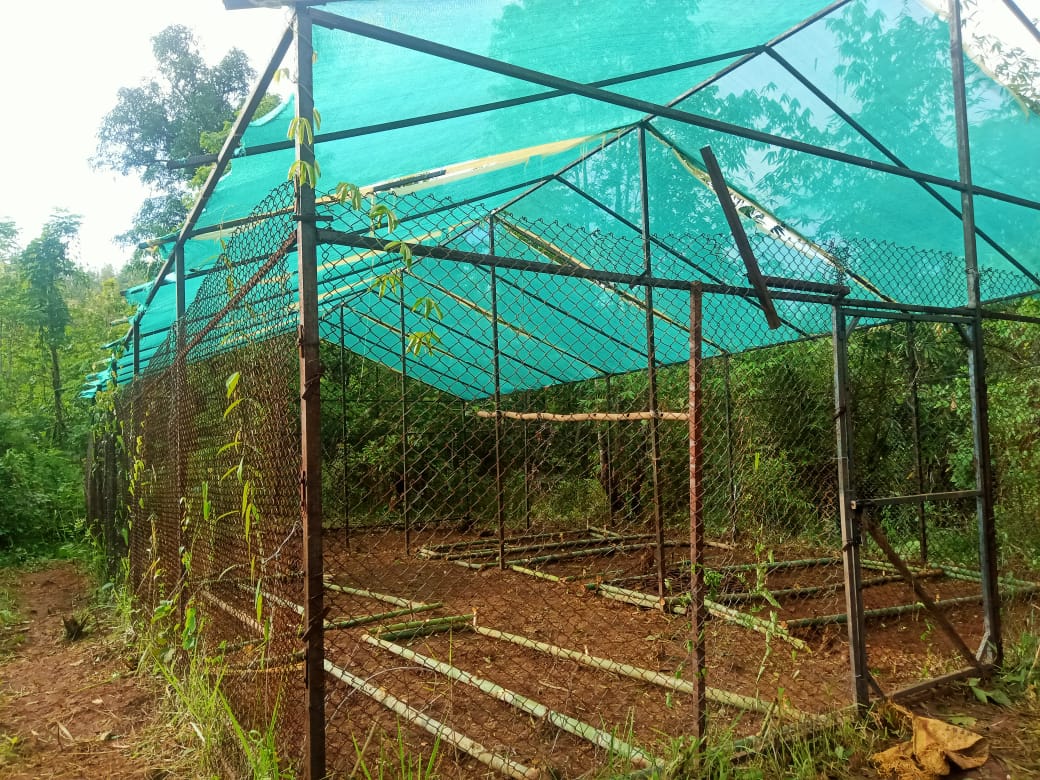
| Polyhouse for Orchids | Umjaji | 25°54'45.06"N | 91°34'35.41"E | ₹ 51,420.00 | Completed | |
| 3. | Type Of Intervention | Site Name | GPS Co-ordinates | Amount Sanctioned | Work Status | |
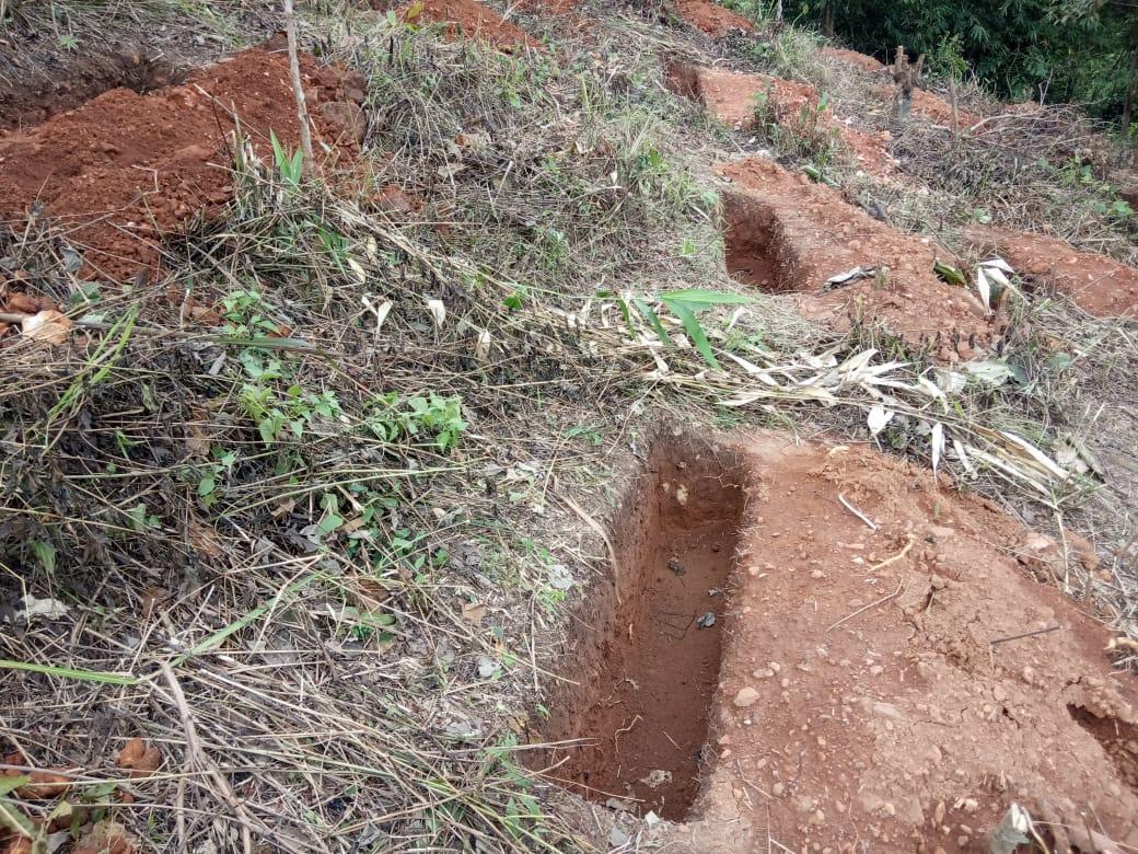
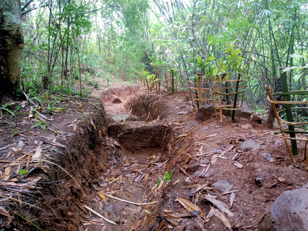
| Contour Trenches 1 | Amlhilamet | 25.9083 N | 91.5766E | ₹ 11,500.00 | Completed | |

| 4. | Type Of Intervention | Site Name | GPS Co-ordinates | Amount Sanctioned | Work Status | |
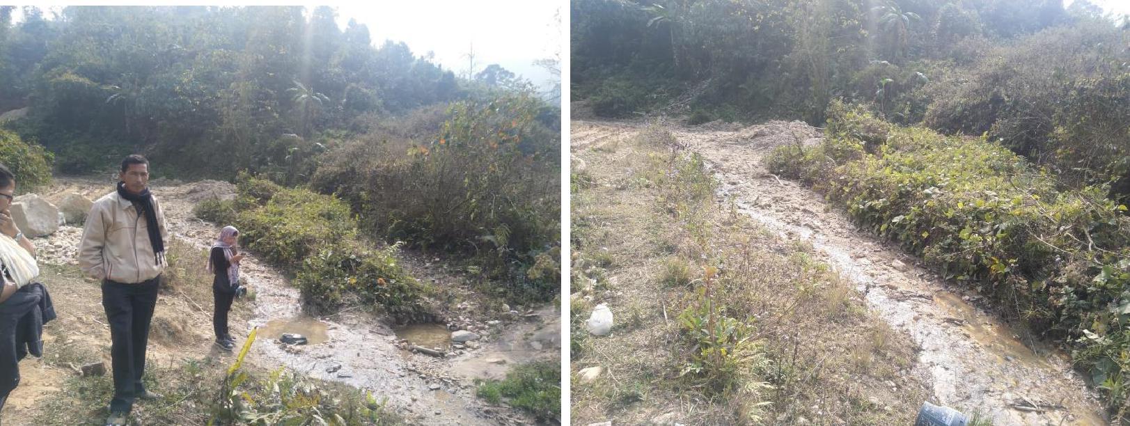
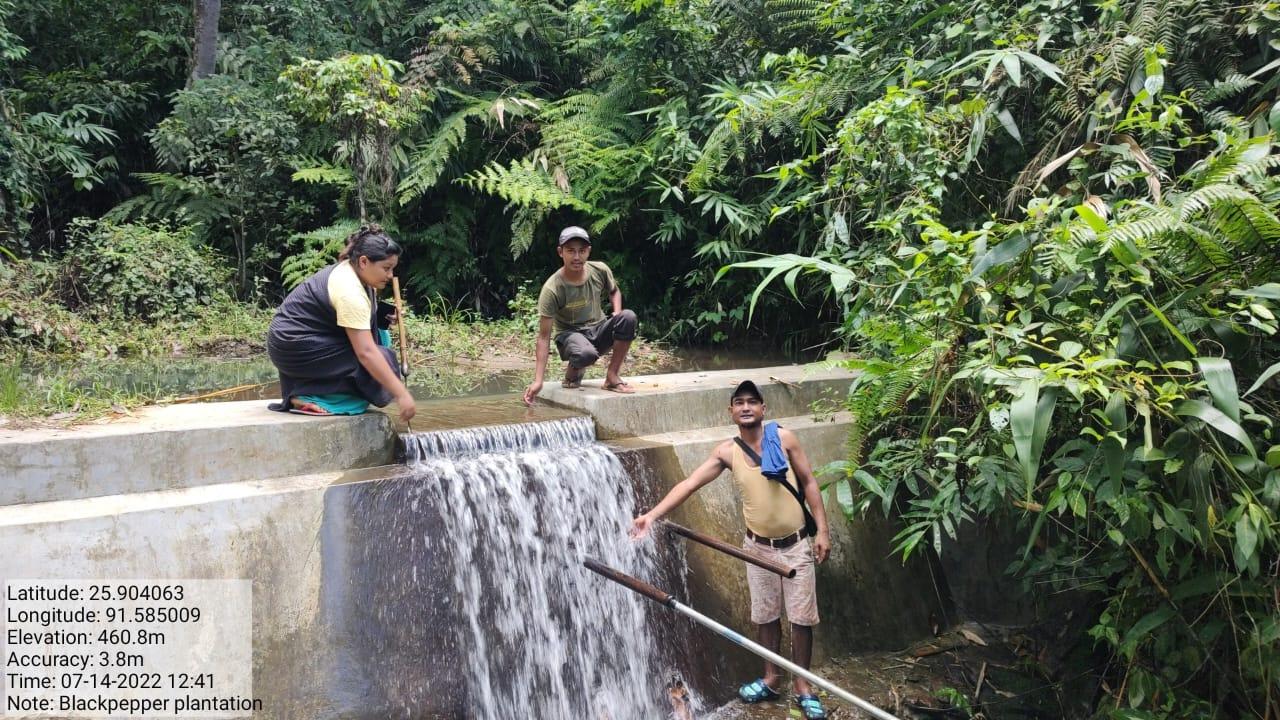
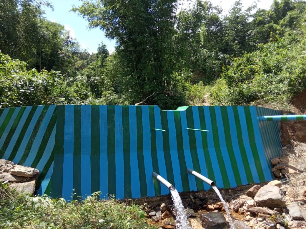
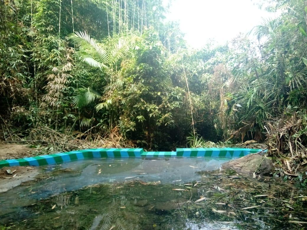
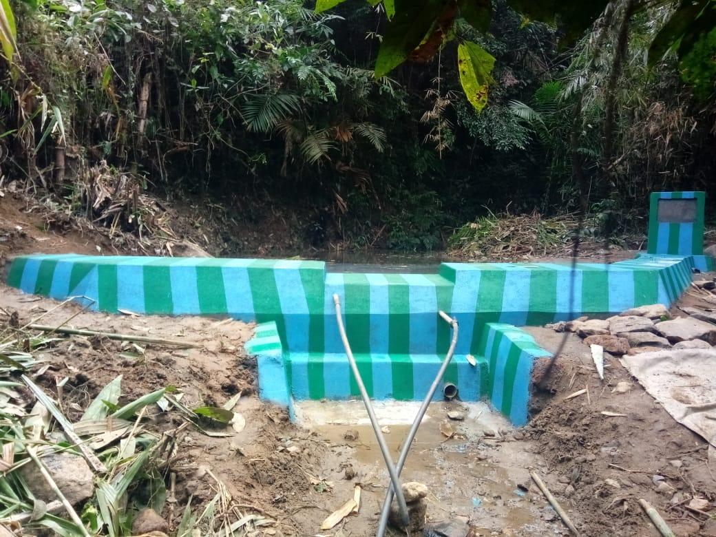
| Check Dam | Amsmawmluh | 25.906N | 91.584E | ₹ 4,46,100.00 | Completed | |
| 5. | Type Of Intervention | Site Name | GPS Co-ordinates | Amount Sanctioned | Work Status | |
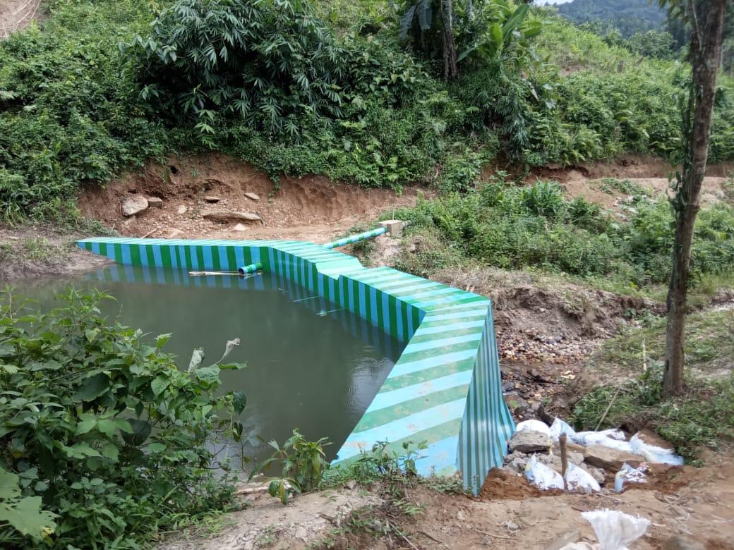
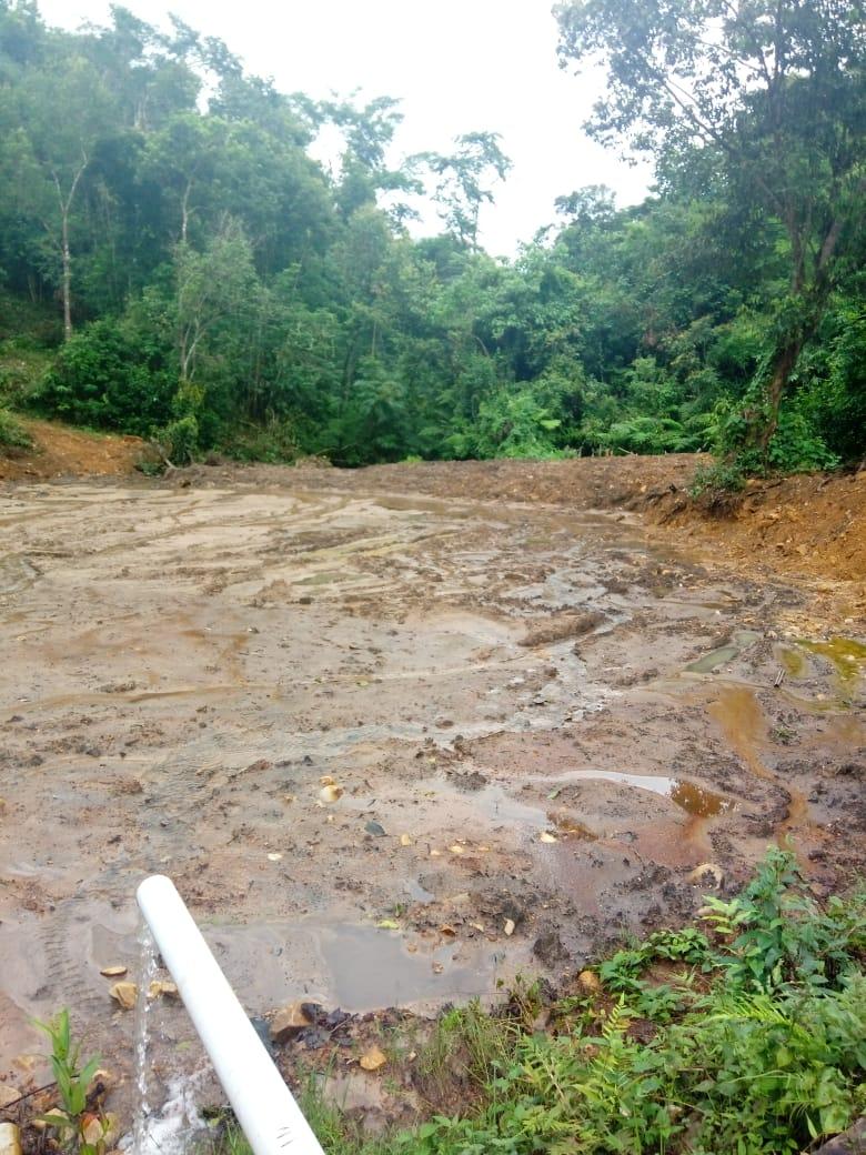
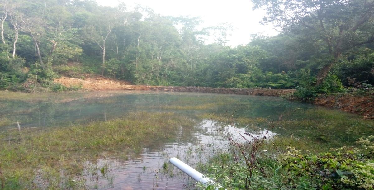
| Dug-Out Pond | Amlhilamet | 25°54'45.06"N | 91°34'35.41"E | ₹ 97,000.00 | Completed | |
| 6. | Type Of Intervention | Site Name | GPS Co-ordinates | Amount Sanctioned | Work Status | |
| Fire Line Control | Kliar umsohbir | 25°54'45.06"N | 91°34'35.41"E | ₹ 34,980.00 | Completed | |
| 7. | Type Of Intervention | Site Name | GPS Co-ordinates | Amount Sanctioned | Work Status | |
| Afforestation | Kliar umsohbir | 25°54'45.06"N | 91°34'35.41"E | ₹ 4,63,100.00 | Completed | |
| 8. | Type Of Intervention | Site Name | GPS Co-ordinates | Amount Sanctioned | Work Status | |
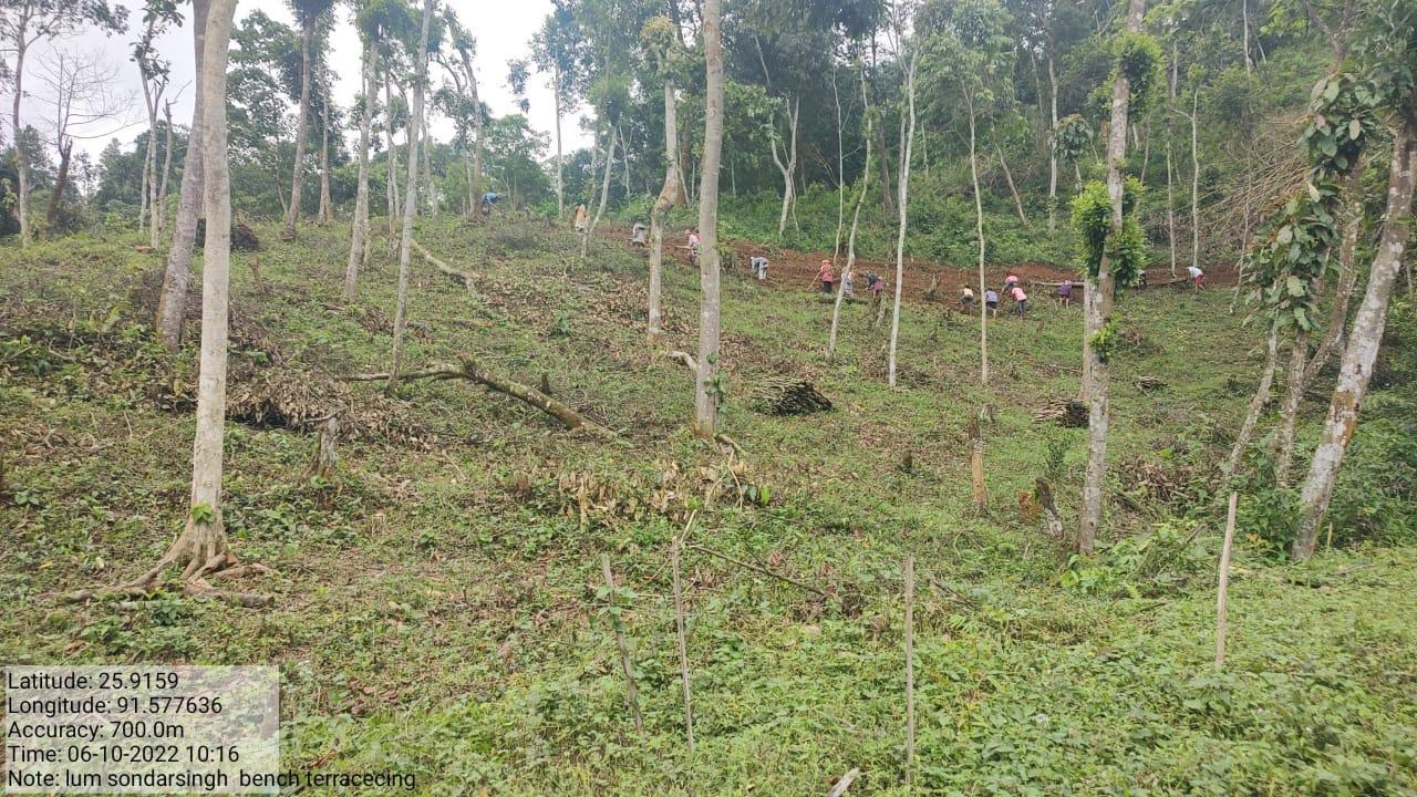
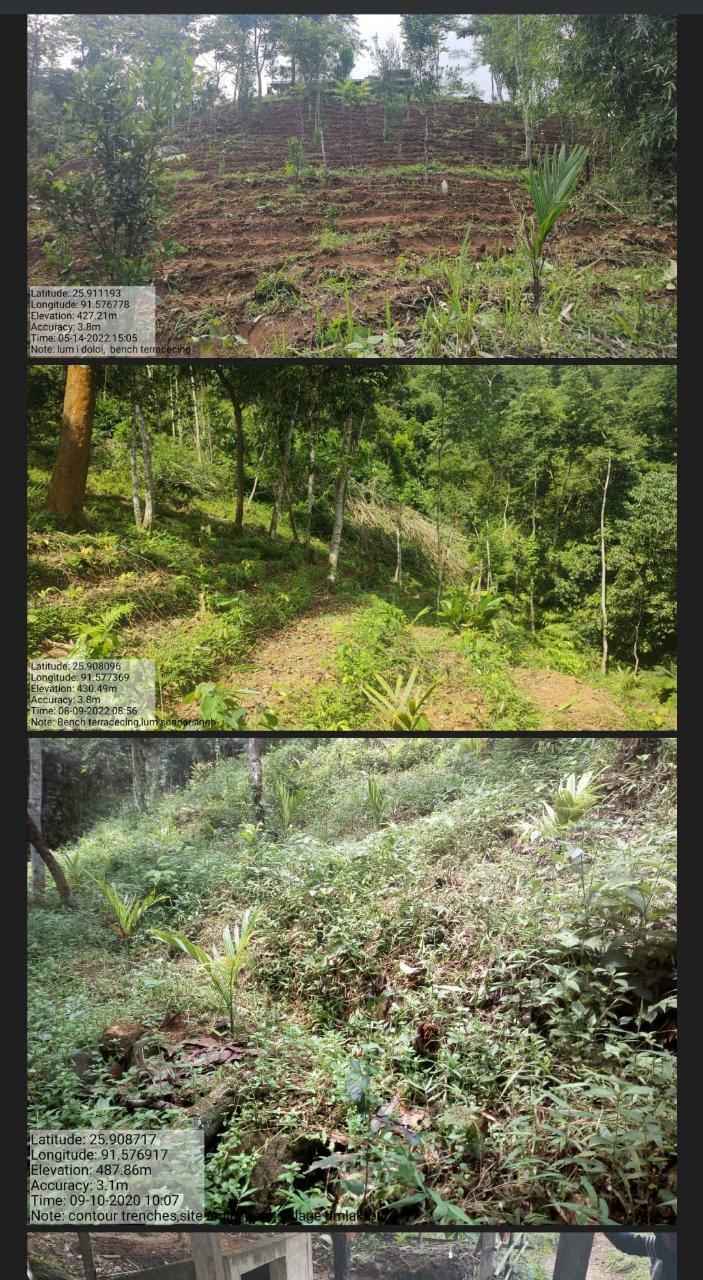
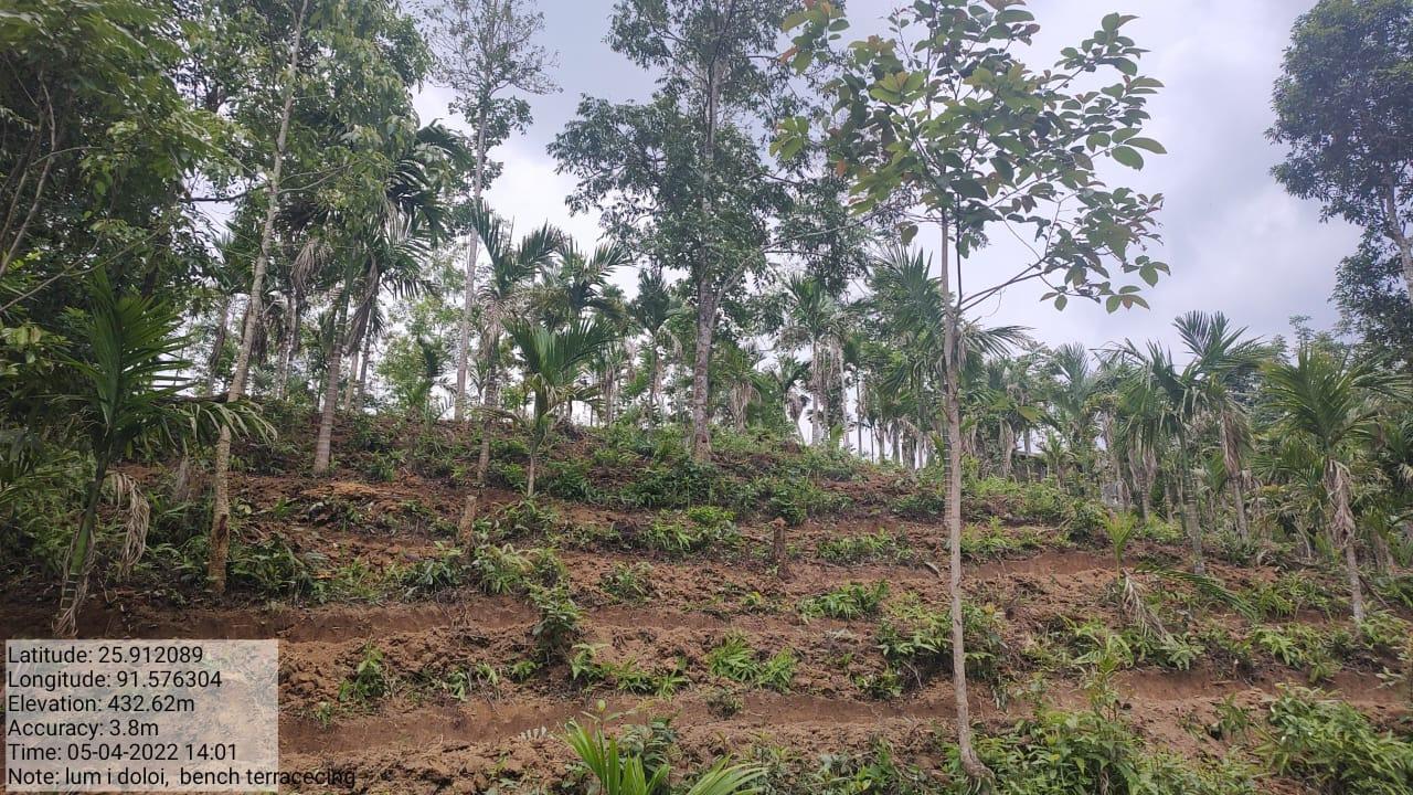
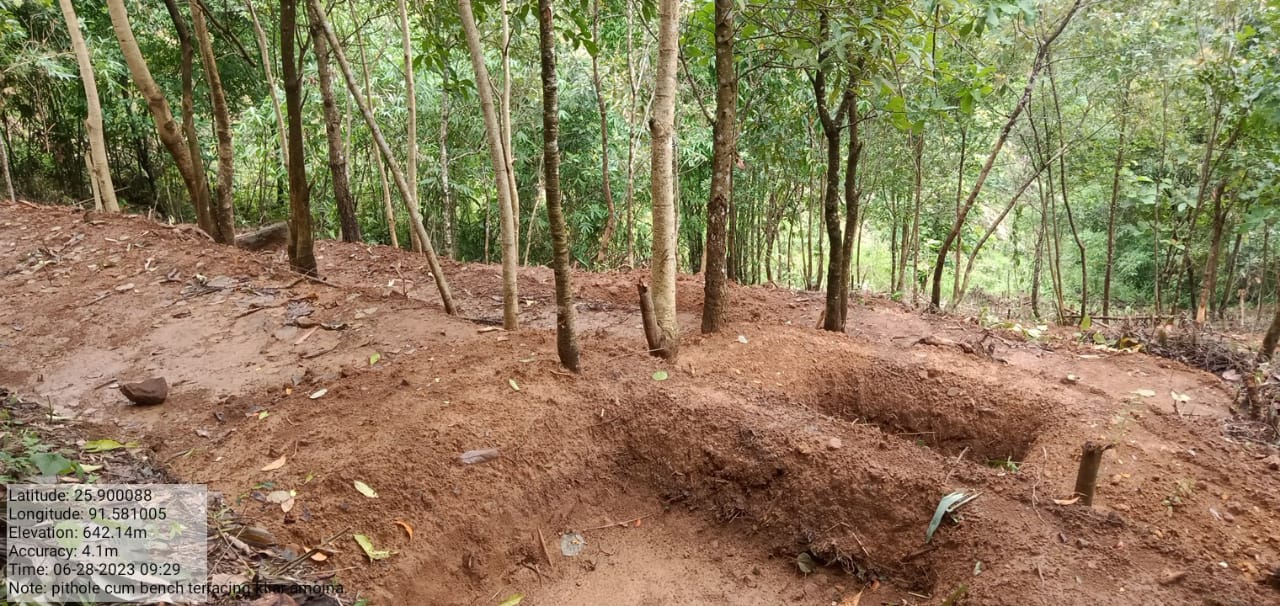
| Bench terracing | Lum I Doloi & Lum Soondar Singh | 25.911193 5.108096 |
91.56778 91.577369 |
3,40,000 | Completed | |
| 9. | Type Of Intervention | Site Name | GPS Co-ordinates | Amount Sanctioned | Work Status | |
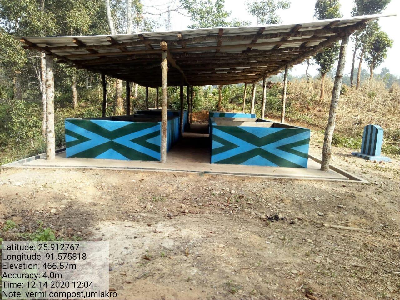
| Vermi Compost | Amjage | 25.912767 | 91.57818 | 2,64,940 | Completed | |
| 10. | Type Of Intervention | Site Name | GPS Co-ordinates | Amount Sanctioned | Work Status | |
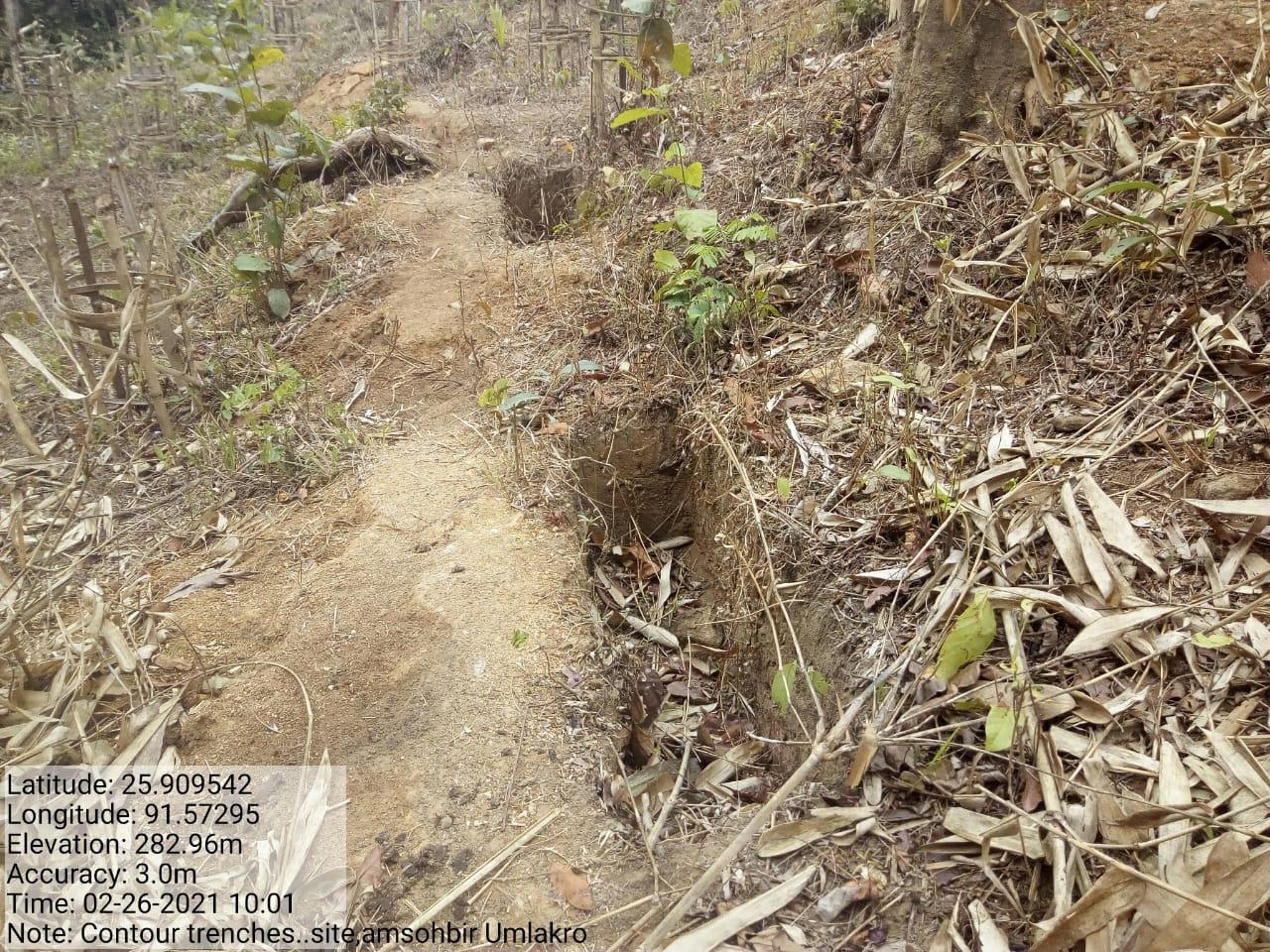
| Contour Trenches 2 | Umsohbir | 25.912408 | 91.5767 | 66,320 | Completed | |
| 11. | Type Of Intervention | Site Name | GPS Co-ordinates | Amount Sanctioned | Work Status | |
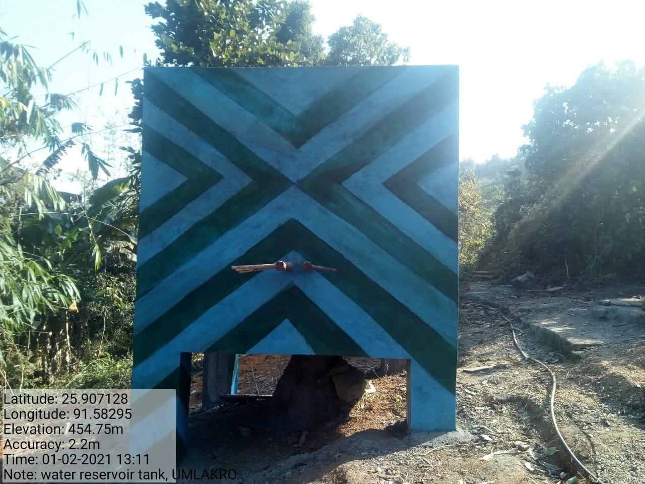
| Water Reservoir Tank | Am- moina | 25.907128 | 91.58295 | 2,31,360 | Completed | |
| 12. | Type Of Intervention | Site Name | GPS Co-ordinates | Amount Sanctioned | Work Status | |
| Renovation of Spring Chamber | Um u Paul | 25.911956 | 91.581731 | 39,974 | Completed | |
| 13. | Type Of Intervention | Site Name | GPS Co-ordinates | Amount Sanctioned | Work Status | |
| Horticulture | Roadside Kliar Umlakro |
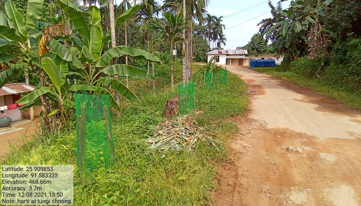
25.910615 | 91.581731 | Rs. 82, 082/- | Completed | |
| 14. | Type Of Intervention | Site Name | GPS Co-ordinates | Amount Sanctioned | Work Status | |
| Headwork | Am – Moina | 25.904848 | 91.5828237 | Rs. 2, 07, 600/- | Completed | |
| 15. | Type Of Intervention | Site Name | GPS Co-ordinates | Amount Sanctioned | Work Status | |
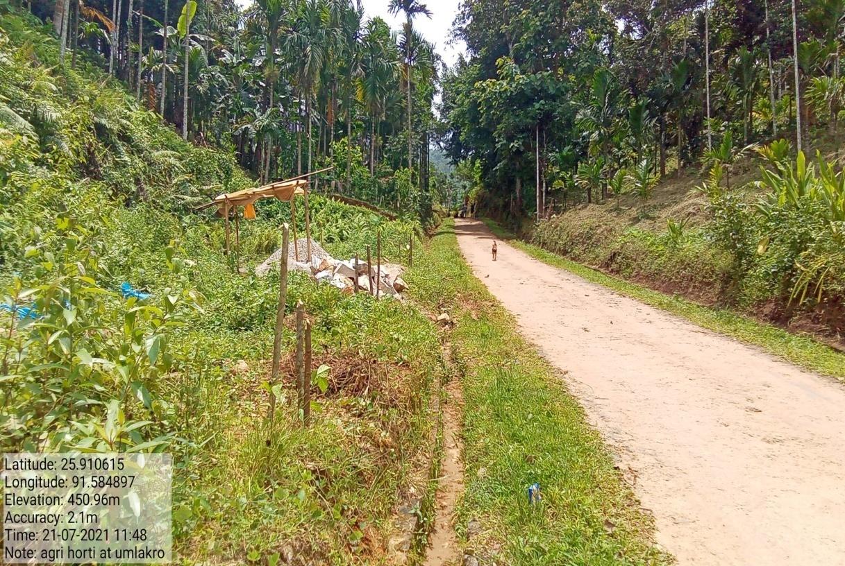
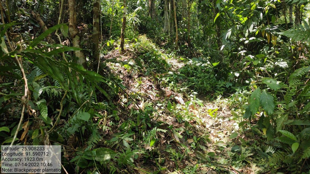
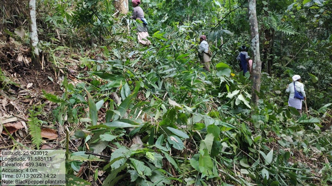
| Pepper Planatation | Amsowmluh | 25.903657 | 91.58471 | Rs. 1,00,000 | Completed | |
| Type Of Intervention | Site Name | Amount Sanctioned | Work Status |
| Earthen bund cum bio fencing | Lum umlakro | 400000 | Completed |
| Type Of Intervention | Site Name | Amount Sanctioned | Work Status |
| Community Nursery(CTF) | Amkyrbai | 300000 | Completed |
| Type Of Intervention | Site Name | Amount Sanctioned | Work Status |
| Pit hole cum Bench Terracing | Kliar Am-moina | 350000 | Completed |
| Type Of Intervention | Site Name | Amount Sanctioned | Work Status |
FMP Activities 1.Fireline control 2. .Assisted natural regeneration in open forests (Contour Bund Cum Afforestation)3.Community Forest Boundary Survey 4.Enrichment Planting in forests blanks 5.Nursery for Food Forestry (Sapling for the Existing Nursery 6. In situ & Ex situ conservation of rare and endangered species |
Community land | 1,02,480 | Completed |
| Intervention | Site Name | Amount | Work Status |
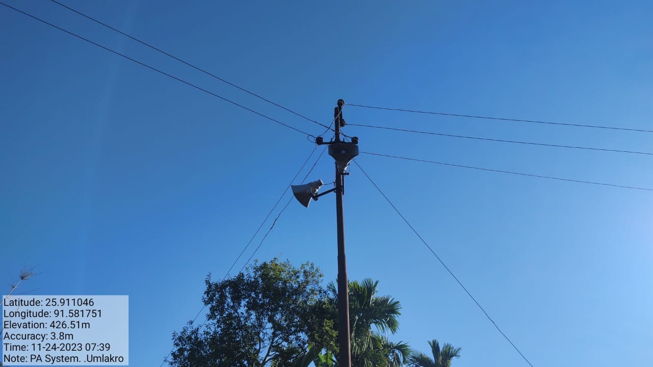
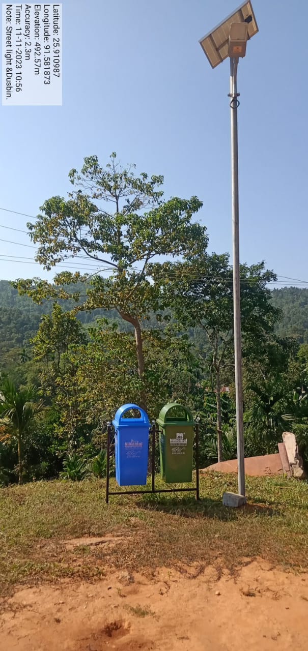
Excess fund activities PA System Water System Solar light Dustbin Gates for Spring Chamber |
community land | 30,300 | Completed |
TESTIMONIALS
President of the VNRMC- Sranly Wahlang
It's fantastic to see the positive impact that the Community Landscape Management Project (CLLMP) has had on Umtung village under my leadership as the President of the VNRMC (Village Natural Resources Management Committee). The project's focus on educating and involving the community in natural resource management has brought about significant improvements and benefits. I would like to highlight some of the key impacts of the project:
The project has succeeded in changing the mindset of many villagers, helping them understand the importance of natural resources within the environment. Through the project, residents have gained valuable knowledge about the sustainable management and preservation of natural resources.
The CLLMP has provided a platform for many villagers to actively volunteer themselves in preserving, protecting, improving, and managing natural resources in the village.This active community involvement has likely fostered a sense of ownership and responsibility for the village's environment.
The construction of various check dams and headworks for drinking water and other purposes has significantly improved access to clean drinking water in the village.
Overall, the CLLMP has significantly transformed Umtung village,
creating a more environmentally conscious and resource-efficient
community. My leadership as the President of the VNRMC has been
instrumental in driving these positive changes. The project's
success showcases the power of community-driven initiatives and the
positive impact they can have on both the environment and the
well-being of the people.
VCF Env- Charles Donal Sangma
As a Village Community Facilitator (VCF), our dedication and involvement in the Community Landscape Management Project (CLLMP) have brought numerous benefits to our village of which some of these highlight the key contributions and advantages that I have experienced as a VCF:
1. Active Involvement: The desire to help in the village's work, especially within the CLLMP, demonstrates our commitment to community development and environmental preservation.
2. Training Opportunities: As a VCF,I have had the opportunity to attend different trainings, which have likely equipped you with valuable knowledge and skills to effectively work within the project.
3. Environmental Awareness: The interest in understanding more about the environment aligns with the project's objective of promoting environmental consciousness and natural resource management.
4. Diverse Work Experience: Through my role as a VCF, I have gained experience in various aspects of Natural Resource Management (NRM), allowing me to contribute effectively to different intervention activities.
VCF M& E- Zygozer Sangkli 
It's wonderful to see how our active involvement as a Village Community Facilitator (VCF) in the Community Landscape Management Project (CLLMP) has been beneficial for the overall success. . My role as a VCF member in maintaining and evaluating the program management is crucial for its success. I would like to highlight the key benefits and opportunities I've experienced through my participation:
1. Opportunity to Work with the Project: Being chosen as a VCF member has given me the opportunity to actively work with the CLLMP, allowing me to contribute directly to its implementation and impact in our village.
2. Improved Water Supply: The project's efforts in constructing dams have led to better water supply in your village, addressing a crucial need and improving the quality of life for the residents.
3. Environmental Preservation Knowledge: Through the project, I have learned valuable lessons on how to preserve the environment, contributing to the sustainable management of natural resources in my village.
4. Training Opportunities: As a VCF member, I have had the chance to attend various training sessions, enhancing my skills and knowledge in community development and environmental conservation.
My active involvement has played a significant role in bringing about positive changes in my village. By working closely with the project and acquiring knowledge on environmental preservation, I am contributing to the overall well-being and sustainability of the community.