The Government of Meghalaya with financial help from the World Bank is implementing the Meghalaya Community Led Landscape Management Project (MCLLMP). The project will cover the entire state of Meghalaya and implementation of community led plans will be rolled out in phase manner throughout the state. The Meghalaya Basin Management Agency (MBMA) will facilitate community-led planning by providing support, technical inputs and funding.
The project is intended to strengthen community-led natural resources management in selected landscapes within the 11 districts of the state. This would be achieved through a variety of planning, capacity building, and on-the-ground interventions to promote the conservation, sustainable use of natural resources, social inclusion and community mobilisation; building traditional knowledge and learning, mapping of natural resources management; strengthening the community institutions and creating linkage with financial institutions and community organizations.
The project interventions include preparation of community led natural resource management plans. The CLLMP has the following three components:
Strengthening Knowledge and Capacity of Communities for NaturalResources Management
Community-Led Landscape Planning and Implementation
Project Management and Governance
The project objective is “to manage and conserve the natural resources, especially forests, soil and water sources, in a manner that supports the financial and physical well-being of communities in the State”
The CLLM-Programme focuses on increasing the capacities of communities and traditional institutions (TI) by adopting a landscape approach to manage their natural resources such as soil, springs and other water sources, forests and bio-diversity, etc.
The project will be planned and implemented in about 400 villages across the state.
CLLMP has a strong focus on institution-building at the village-level, by ensuring systematic capacity-building on technical and social skill-sets.
The project will also extend such training to communities beyond the targeted villages and support efforts made by them to access funding from various rural and natural resources initiatives and schemes.
The programme also invests in improving the process and outcome delivery, by developing and adhering to effective systems and procedures, supported by the appropriate technology.
Benefits for community (Skills and Capacity relating to technical and managerial areas like NRM and Conflict resolution
Benefits to traditional institutions (village councils, traditional leaders, community-based organizations, SHGs etc) through Knowledge sharing, promotion of innovative approach, access to technology, technical managerial and financial support.
It is estimated that the project will impact around 1 lakh partners (of which 50% are women) who depend on land, forest, agro forestry.
Through the project, 55000 Ha of targeted area will be ensured with availability of water, biological resources and soil productivity, which will in turn benefit around 400 villages and the outcomes delivery can be summarized as follows.
The Project is executed by the MBMA in collaboration with other partners particularly, SIRD (for training and capacity building), Department of Soil and Water Conservation, Water Resource Department, Forest Department, specifically with respect to technical inputs, safeguards management and Community NRM plan preparation
2018-2023 (5 years)
Introduction
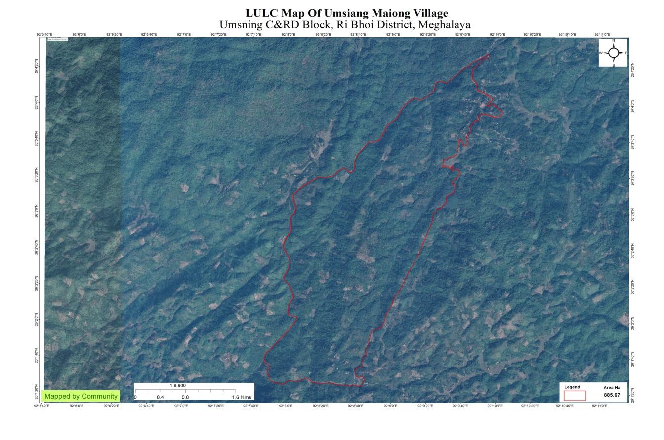
Umsiang Maiong village falls under Umsning C&RD block of Ri-Bhoi district in the state of Meghalaya. The village is at a distance of 117 Kms from Nongpoh, the district headquarters of Ri Bhoi District and is at a total distance of 118 Kms from the state capital, Shillong.
Brief History
Umsiang Maiong village is located in the Raid Maiong of Hima of Syiem Khyrim Syiemship Ri Bhoi district Meghalaya. It is located in the North Eastern part of the district and is at the border of Morigaon district of Assam. As per folklore the first inhabitants of this village were of the Mosrong Clan (title of Tiwa Lalung) who existed even before the separation of Meghalaya from Assam and that is why it is named so. Raid Maiong takes part in the yearly festivities and rituals known as Pomblang of the Khyrim Syiem which takes place at Smit. Regarding the lands and land related disputes in the village it is looked after by the Elders or Basan of the Raid. And the other works in the village are looked after by the Village Dorbar and the Headman.
In this village there are two tribes, The Tiwa Lalung and the Khasis who have their own festivities and rituals that they perform in the village. The main occupation of the village is cultivation. The village is one of two other villages which make up the Raid Maiong, and they have a yearly Raid Dorbar where these three villages come together to discuss the well-being and development of these villages and if there is anything that needs to be looked after.
Social Profile
Umsiang Maiong village is located in Umsning Block of Ri-Bhoi District, in the state of Meghalaya. It came into existence in 1947. The distance from the District Headquarter to Umsiang Maiong is 117 kms and the village is under the supervision of the Rangbah Shnong. The total number of households is 75 and has a population of 309 people. Agriculture and its allied activities are highly in vogue, where some few others are also enrolled in government and teaching jobs and some few inhabitants are engaged in local businesses.
The traditional form of governance prevails where the village head is the Rangbah shnong. There is a Village Employment Council (VEC) that oversees the implementation of Mahatma Gandhi National Rural Employment Guarantee Act and other developmental works. Besides women representation in the VEC, the village women are members of a women only village based organization that provides them a platform for decision making on various issues pertaining to the village.
There are a number of streams and springs in and around the village. The main source of livelihood is agriculture. The Village not only produces cash crops but also various fruits, vegetables, tomatoes, betel nut and betel leaf.
There are two schools inside the village, one of which is the Primary School and one is the Secondary School, Umsiang Maiong. The Primary Health Centre is 54 km away and the Community Health Centre is 117 km away; the nearest Bank is about 54 km away and the Post office is also 80 kms away from the village.
Population 
As per Census 2011, Umsiang Maiong population is 309. Out of this, 371 are males while the females count is 284. This village has 50 children in the age group of 0-4 years. Among them 29 are boys and 21 are girls.
| Age Group | Male | Female | Total |
|---|---|---|---|
| 0-4 | 09 | 08 | 17 |
| 5-14 | 23 | 15 | 38 |
| 15-30 | 55 | 58 | 111 |
| 30-60 | 58 | 60 | 118 |
| Above 60 | 10 | 15 | 25 |
BPL/APL Household:
| Particulars | No. of HH |
|---|---|
| BPL HH | 27 |
| APL HH | 48 |
Card Holding Household:
| Particulars | No. of HH |
|---|---|
| Total HH | 104 |
| Ration Card HH | 96 |
| Health Card HH | 24 |
Fuel Type:
| Fuel Type | Total HH |
|---|---|
| Charcoal | 0 |
| Biomass | 0 |
| Wood | 55 |
| LPG | 20 |
| Electric Heater | 0 |
| Kerosene | 0 |
OCCUPATION:The people of the village rely on
agriculture and forest products for their livelihood. The main
occupation of the villagers is farming followed by driver, teaching,
Self-Employed, and some other Government Servants.
CLLMP ACTIVITIES
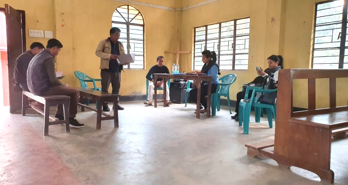
Ground Truthing Dated: 29th of November 2018
The CLLMP team met with Mr. Nimrus Khymdeit, the headman of Umsiang Village on the 29th of November 2018, who was able to provide the team with the required details for site verification.
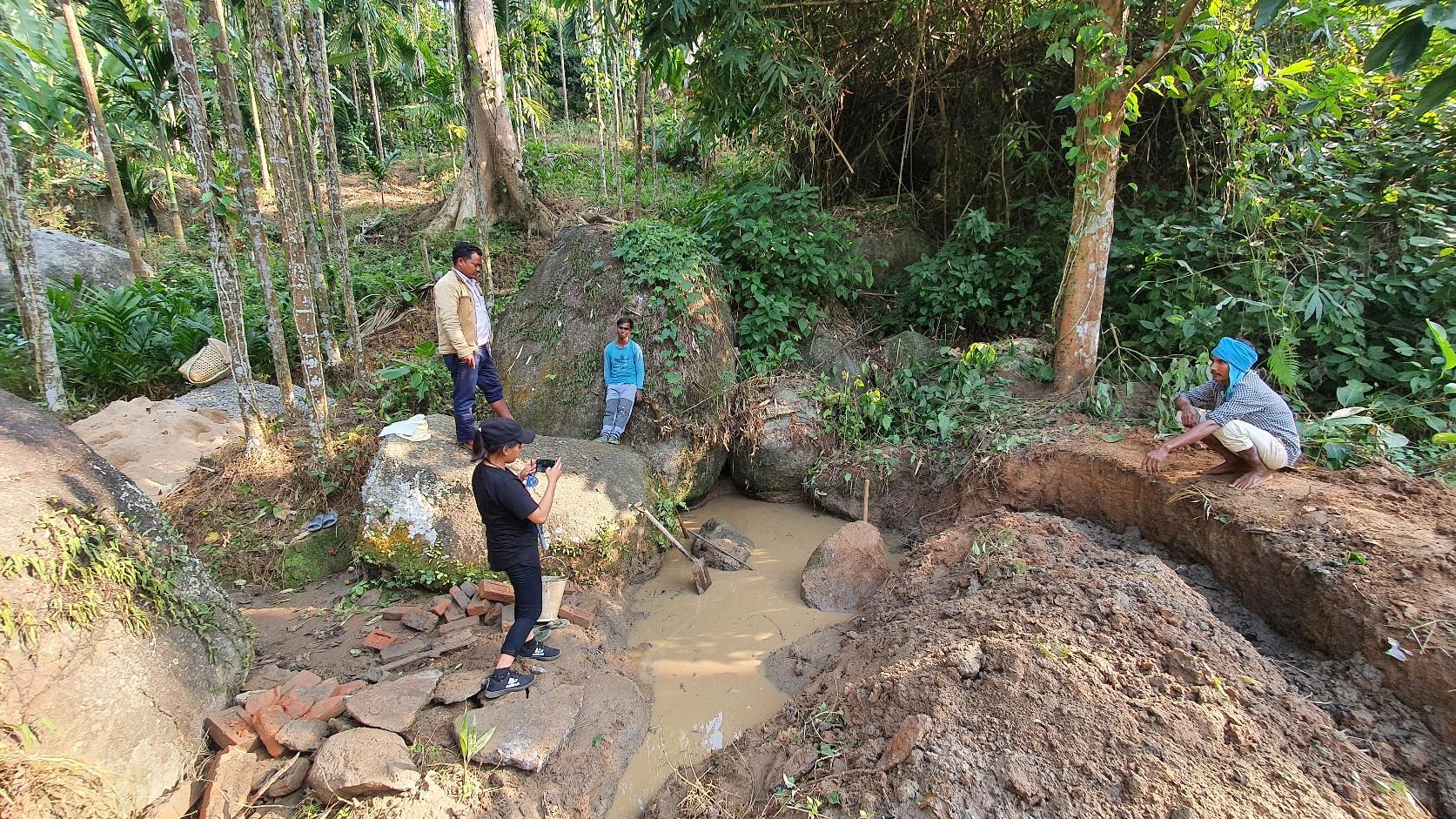
Figure 1 : Ground-truthing at Umsiang Maiong Village.
Case Findings & Selection parameters: -
1. There are 75 Households out of which 27 Households fall under the BPL category.
2. VEC actively performing.
3. Approximately 20-25 acres of community forest available.
4. Scope for Water Sources to be developed
5. Need for Community Nursery and Vermi-Compost
5. The Community members expressed their need to build a fish sanctuary.
The Village has been selected under the Community Led Landscape Management Project
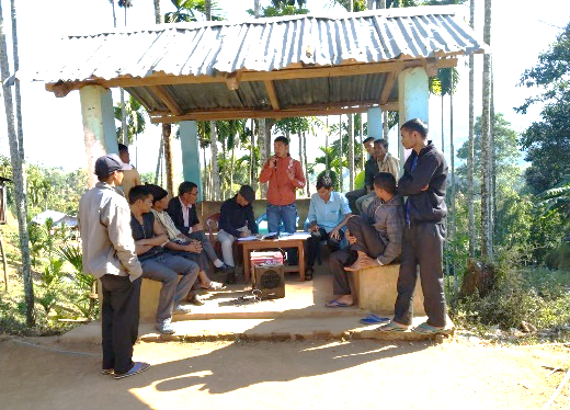
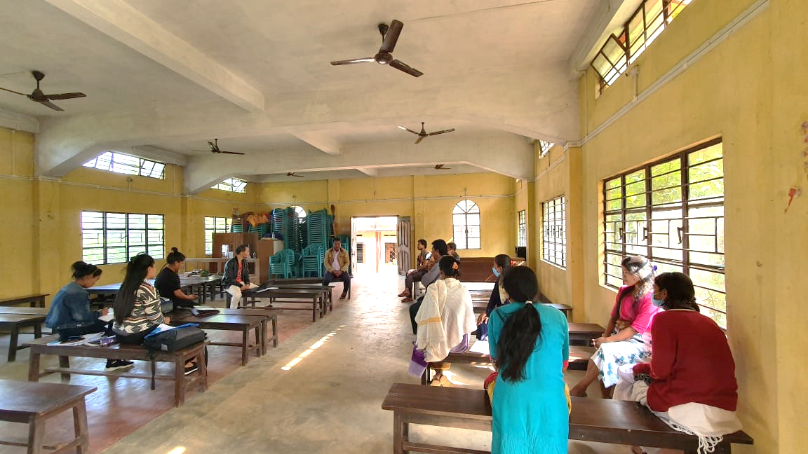
2. Sensitization Programme Dated: 07.01.2019
The District Project Manager and the Assistant Managers held a village Level sensitization Programme on the Community Led Landscape Management project on the 07th of January 2019. The villagers actively participated in the program, voicing out their concerns and questions regarding the project making it a huge success.
The CLLMP officials gave a brief introduction on Meghalaya Basin
Management Agency (MBMA) and explained about the various programmes
and projects that MBMA is working on, they then gave a detailed
introduction on the Community led Landscape Management Project
(CLLMP) and the different aspects and procedures that the villagers
and the CLLMP team should carry out during the course of the project
and the importance of the involvement of the community for the
CLLM-Project to be a success. They gave due importance to the
environmental aspects of the project and enlightened them on the
various benefits that the villagers could obtain from the
project.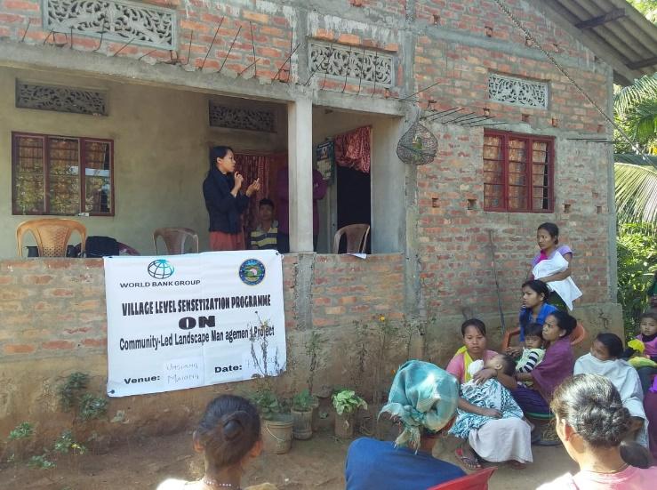
The Program was followed by an interactive session to answer the doubts and questions of the villagers some of which are mentioned below.
2.2 Signing of Documents: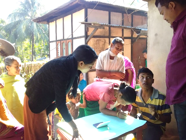
After the interactive session, the village signed the EOI, VGA and Green charter followed by the selection of candidates for the Village Natural Resource Management Committee. The Village Executive Committee (VEC) and the entire community carried out the procedure and elected the members of the VNRMC on the same day.
2.3 Formation of the VNRMC
The Formation of the Village Natural Resource Management Committee was done in a public meeting in the presence of the entire village and the CLLMP staffs. The community itself chose the President, the Secretary and the other executive members of the Committee.
Listed below are the members of the VNRMC:
|
|||||||||
|---|---|---|---|---|---|---|---|---|---|
|
Name in Full | Designation | Gender M/F | Age (Yrs) | Education | Occupation | Community | Religion and Denomination | Contact No and email address |
| 1 | Nimrus Khymdeit | President | M | 35 | XII | Farmer | Khasi | Christian | 6002627053 |
|
Albertdis Hukaid | Secretary | M | 30 | XII | Farmer | Khasi | Christian | 9435418618 |
|
Teresa Hukaid | Bookeeper | F | 25 | BA | Teacher | Khasi | Christian | 9531257049 |
|
Apris Umbah | Member | M | 48 | BA | Teacher | Khasi | Christian | NA |
|
Hebris Amsong | Member | M | 38 | VIII | Farmer | Khasi | Christian | 8811804613 |
|
Vining Amsong | Member | M | 31 | X | Farmer | Khasi | Christian | 6369193302 |
|
Sapna Pumah | Member | F | 24 | V | Farmer | Khasi | Christian | 7896735861 |
|
Bemita Pumah | Member | F | 22 | IX | Farmer | Khasi | Christian | 8876012378 |
|
Junita Lamare | Member | F | 25 | BA | Teacher | Khasi | Christian | 9101481677 |
| Village Community Facilitators | ||||||
|---|---|---|---|---|---|---|
| Sl.No. | Name | Gender | Age | Education | Contact Number | Role |
| 1 | Teresa Hukaid | F | 25 | BA | 9531257049 | Social & Knowledge Management |
| 2 | Donbok Muktieh | M | 35 | VIII | 6002543200 | Environment & GIS |
| 3 | Jenifer Khymdeit | F | 25 | XII | 8794926935 | Project Management |
| Purchase Committee | |||
|---|---|---|---|
| Sl.No. | Name | Gender | Contact Number |
| 1 | Raphael Kholar | Male | 8486991559 |
| 2 | Jenifer Khymdeit | Female | 8794926935 |
| 3 | Boni Hukaid | Male | NA |
| 4 | Rumita Lamare | Female | NA |
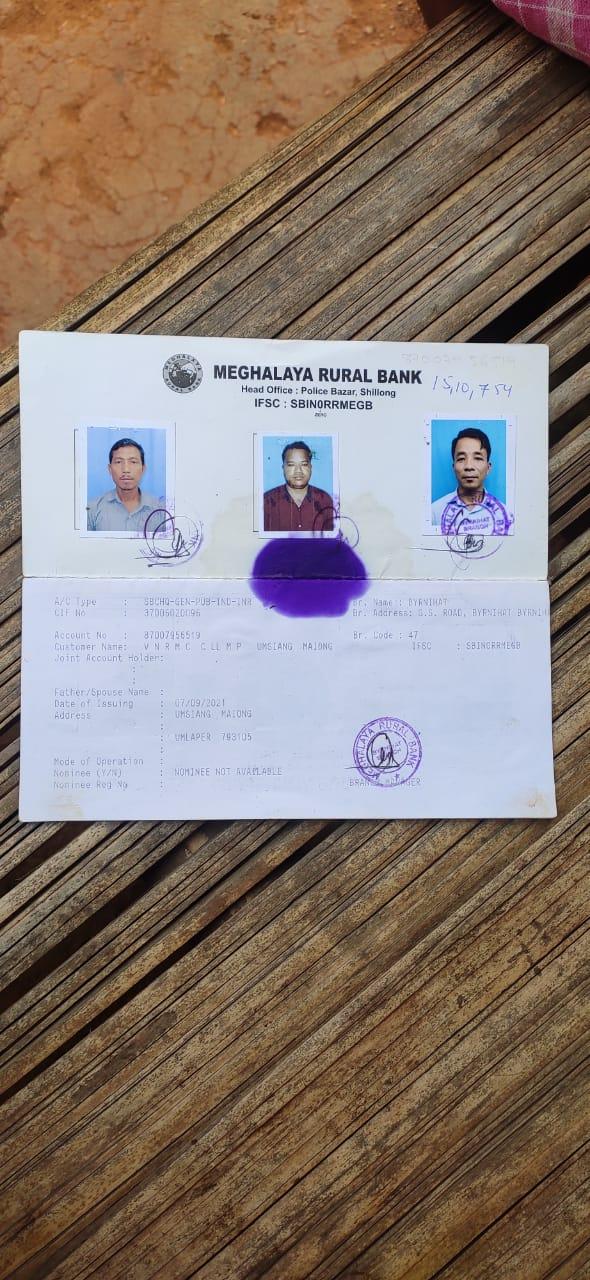
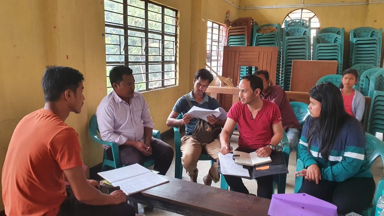
3. Opening of Bank Account
The opening of the bank account was initiated after the village signed the EOI (Expression of Interest), the VGA (Village Grant Agreement) and the Green Charter. Umsiang Maiong village opened their VNRMC account on the 30th of June2020.
The Accountant of CLLMP Team Ri Bhoi District trained the Purchasing and Procurement Committee of Umsiang Maiong Village to discuss several topics related to various works of their field.
Topics Covered:
Principles of Community Procurement
Benefits of Community Procurement
Important aspects undertaken by Community Procurement.
Procurement Process/Steps
Function of Purchase Committee
Important Procurement records to be maintained
Financial limits and methods
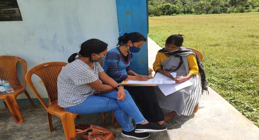
4. Participatory Rural Appraisal Exercise
15thMarch 2019
PRA exercise at Umsiang Maiong Village took place on the 15th of March 2019 & 10th December 2020. There were a total of 58 villagers taking part in this exercise who contributed their time and knowledge to this project.
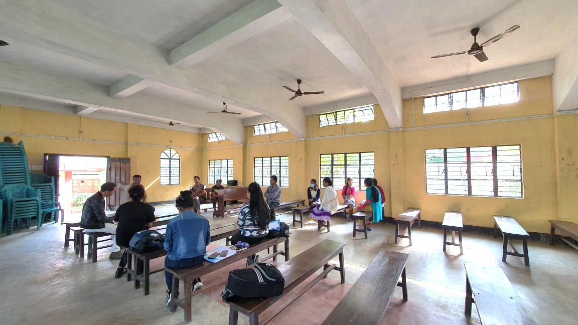
The initial stage of Participatory Rural Appraisal (PRA) exercise at Umsiang Maiong Village, commenced with a meeting cum orientation program on CLLMP. While conducting the meeting, the community members were made aware of the various PRA exercises to be conducted for the development of the Community Natural Resource Management Plan (CNRMP) of the village, the community members’ contribution in the exercise and the objectives to be achieved. The key informants (the VNRMC and the VCFs) helped facilitate maximum participation. The dates and time for conducting the various Participatory Rural Appraisal (PRA) exercises were fixed in consultation with the community members and all were requested to participate in the exercise. The schedule and time was announced at the end of the meeting.
Participants on the 15.03.2019:
CLLMP officials: Shri.V. Buhphang (DPM), Shri. Wilborn Kurkalang (M & E), Smt. Fondaliza Sohphoh (AM KM), Shri. Reuben Shabong (PA EM) and the DPMU CLLMP Team
Community members: Shri. Nimrus Khymdeit (President), Shri. Albertdis Hukaid (Secretary),Smt. Teresa Hukaid (VCF SM &KM),Shri. Vining Amsong (VNRMC Member),Smt. Junita Lamare (VNRMC Member), Shri. Benjamin Dillar, Shri. Lucas Amsong, Shri. Ripsing Lamare, Shri. Jursing Pumah, Shri. Constantine Muktieh and other community members
Commencement of PRA.
Introduction: Participatory Rural Appraisal (PRA) is the process of involving local people in the analysis and interpretation of their own situation of a given rural area. The local people i.e. the participants take a leadership role in collecting, analyzing, interpreting and presenting information and in this process impart knowledge and development insight to the specialists and extension agents
For management of natural resources, participatory Rural Appraisal is conducted to establish rapport with the village community as well as to identify and define problems for prioritization in the village itself. It is a way of learning from and with community members to investigate their need assessment, analyze and evaluate constraints and opportunities and find out priorities in the area of agriculture, small scale rural enterprises and any other social and economic development programs addressed to village development. Based on the principle of listening and learning,
Objectives of PRA exercise at Umsiang Maiong Village:
The Participatory Rural Appraisal (PRA) exercise at Umsiang Maiong was conducted with following objectives:
To identify the natural, human and economic resources of a village.
To identify the village problems and prioritize them with the help of the community members.
To prepare the Community natural Resource Management Plan of the village.
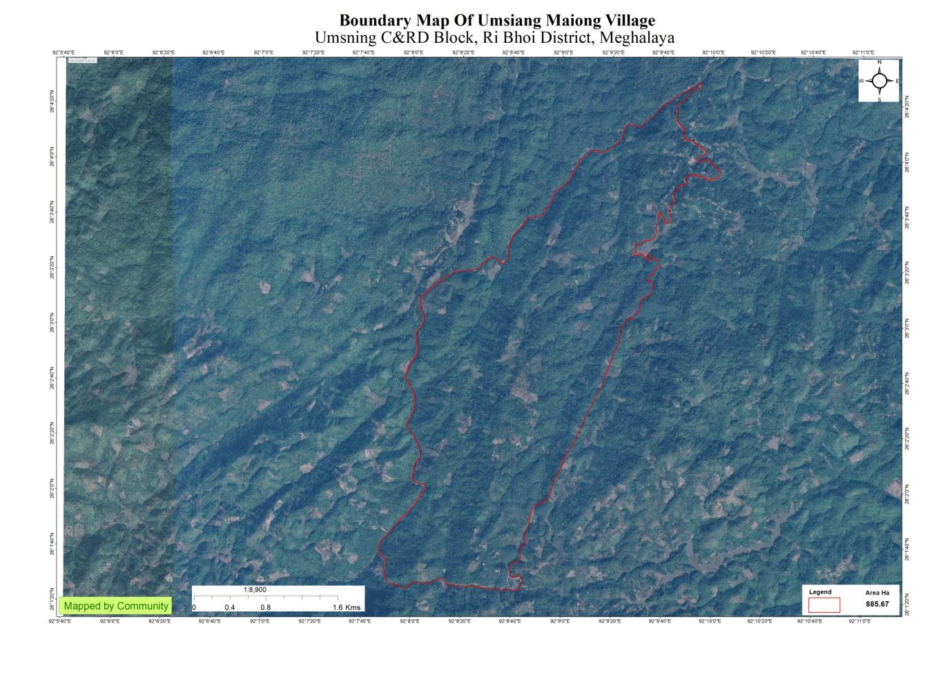
Activity 1: Village Boundary Mapping:
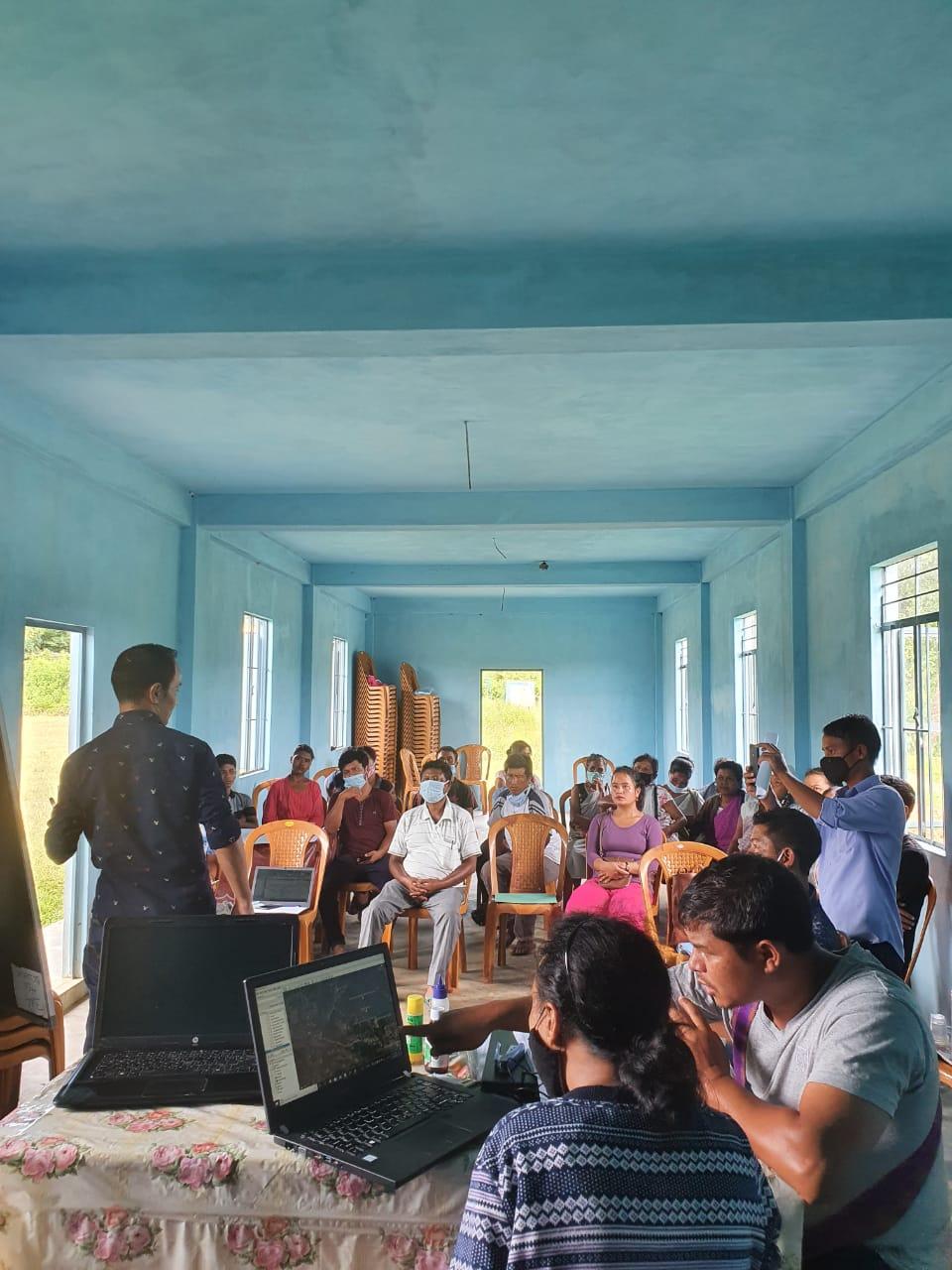
Activity 2: Drawing the Resource Map
The second step is to involve the local community in preparation of a village resource map as perceived by the community members to solicit their participation. Infrastructure, services and other village resources such as agricultural lands, wells, wastelands, cattle population etc. were mapped. Local people prepared the Resource Map by drawing it on a chart paper without much interference from outsiders.
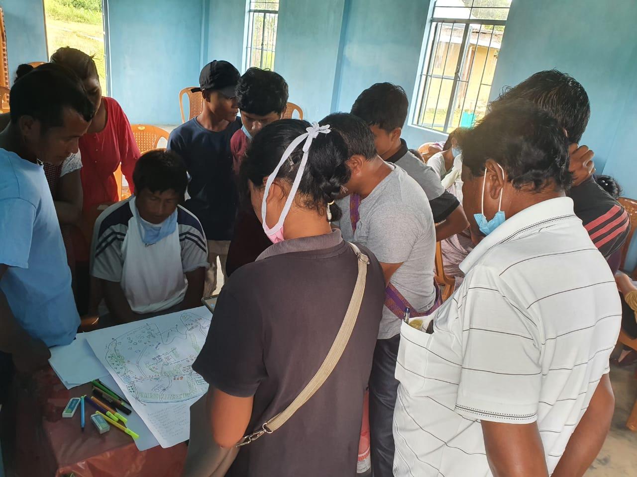
This activity achieved the following purposes:
Rapport building and won the confidence of the villagers.
Analyzed the spatial information, particularly studied problems and opportunities of villagers.
Got an impression about the village setting, physical layout, location of various houses and institutions.
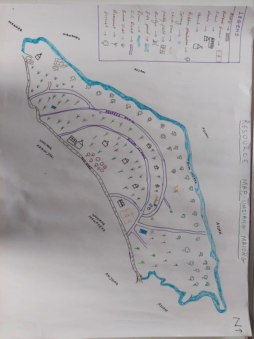
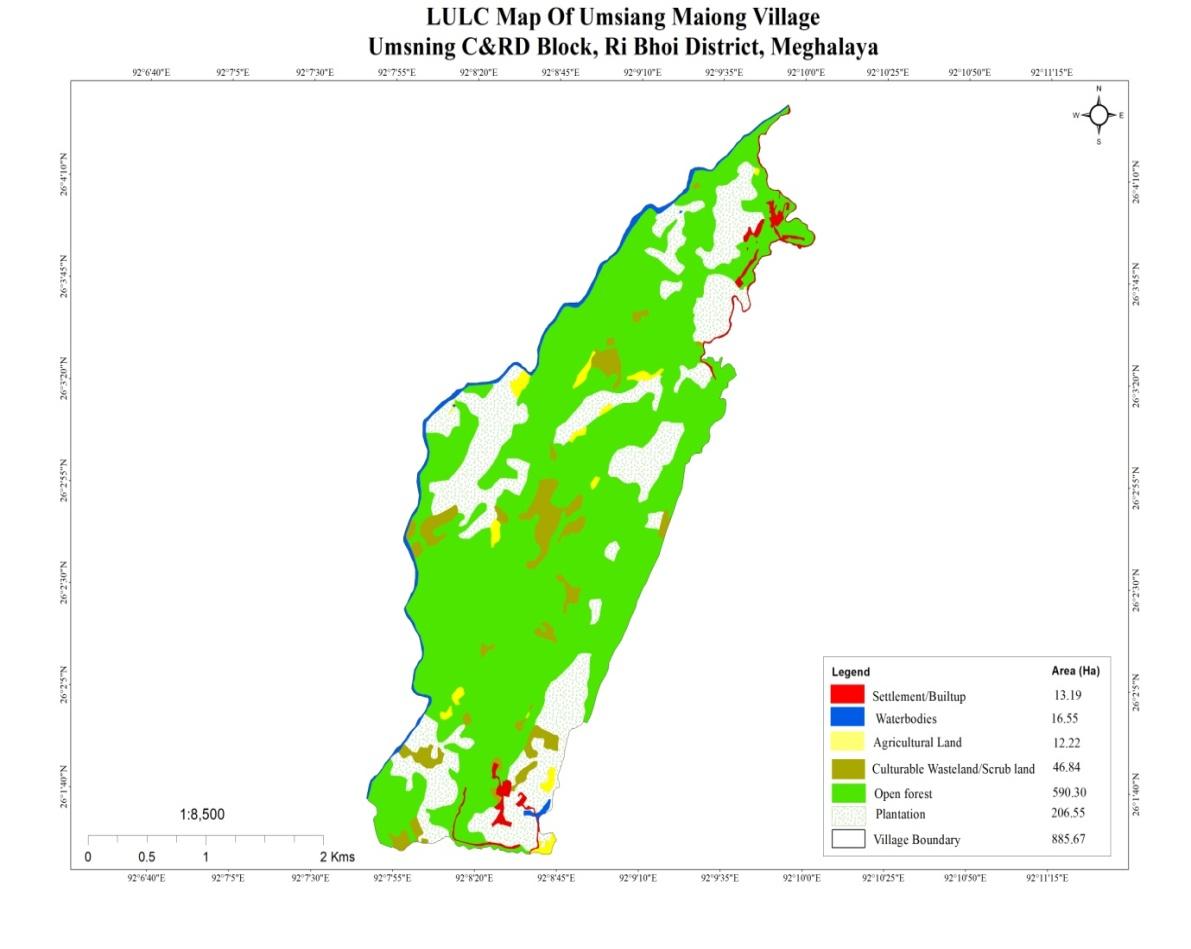
Findings Based on the Resource Map of Umsiang Maiong Village
Main agriculture produce is Paddy and Ginger
There are 3 types of Forest ownership: Community, Private and Clan Owned.
2 community forest
1 private forest
1 clan forest
Seven (7) springs are present in the village with two already developed but needs more work.
Two main rivers are present and five (5) streams flow through the village paddy field.
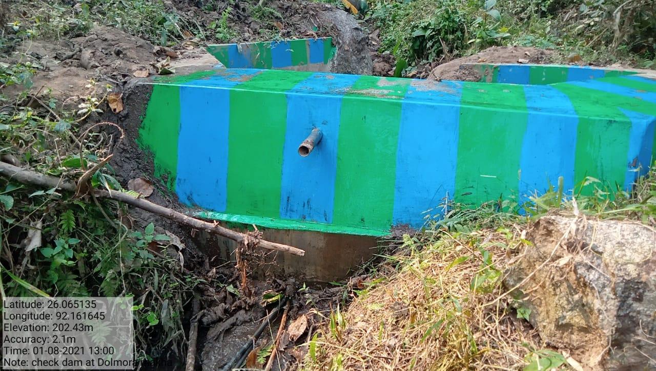
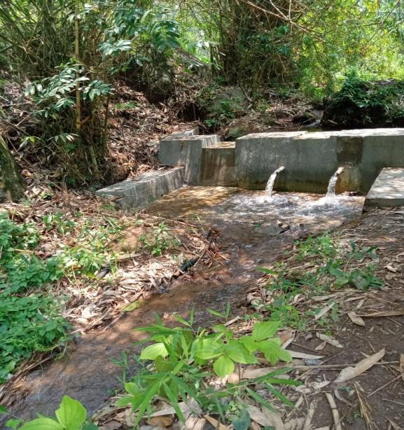
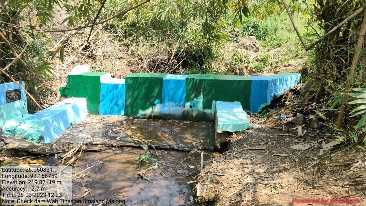
Two water tanks are available and two check dams are available.
Presence of Barren land
Seven dugout ponds for fisheries and water reservoir.
Two water pumps (tube well).
School: there are only two primary schools in the village.
Connectivity:
Habitation is not confined to one place but spread all over the village.
Activity 3: Baseline Data Survey to fill the Environment and Social Template
During the PRA exercise, the CLLMP officials and the community members were divided into groups to fill the Social and Environmental Templates. Discussions and consultations with social groups existing in the village were held to gather basic village information regarding households, demographic information, major crops and enterprises taken in the village, trends of production and productivity of major crops in the village and demographic distribution of village population.
Activity 5: PROBLEM ANALYSIS
Do people have sufficient access to supply of fodder, fuel wood, leaf litter?
Yes, for the pigs they are using the hatch of rice but for cows and goats they are being fed by the jungle food.
Has access to timber improved or reduced over the years? How is access for household use and commercial use managed?
It has improved as compared to earlier times. Firewood is the commercial use of the village.
Are the water bodies facing any threats?
Yes, two Streams (Wah Tonga Boroh and Wah Pinasion) are facing threats due to siltation.
Do all people in the village have access to drinking water? What are the challenges?
No, all people do not have access to drinking water since there is only one well available in the village for all the people to use.
Their main challenges that they are facing is the scarcity of water especially during winter because it dries up.
Are there degraded areas in the village (open/ degraded forests, mining affected, high soil erosion etc.)?
Minor degradation in cultivated land.
What has caused this degradation? Are there practices causing threats to availability and access to natural resources?
Practice of jhum cultivation.
What have been the changes in agricultural practices?
Increase in agricultural produce over years which have improved the living conditions of the people in the village.
Before they cultivate only rice, paddy, broom, betel nut and betel leaf. But recently a rubber garden was added.
Are there any challenges in farming?
The main challenge that they are facing is the infertility of soil for cultivation.
How would you consider the health situation in your village?
Most prevalent sickness in the village is back pain and chest pain, the main reason for chest pain is high consumption of tobacco.
Recently they started having gastric ulcers.
How is the situation of cleanliness, sanitation, access to toilets and waste management?
Cleanliness is the top most priority of the village. Thrice a year there is a cleaning drive programme in the village organised by the SHG and everyone takes active participation in the programme.
Toilets and waste management are also available in every household in the village.
In case of serious illness the villagers have to travel a distance of 54 km to Byrnihat PHC for treatment and 117 km to Nongpoh CHC for treatment.
Who are the most vulnerable in the village? What can be done to improve their lives?
Widowed orphans are being considered as the most vulnerable in the village. They are being provided with free housing.
What are the livelihood aspirations of the youth? Are there any avenues available?
The majority of the population engages in daily wage and Job-Card under MGNREGA for employment
Do any committees/ institutions/ rules exist to manage and monitor natural resources in the village?
Apart from VNRMC, SHG looks after the natural resources in the village.
What are some of the major issues of conflict in the village?
Drunkard creates problems in the community by destroying the village property.
Have any of the above issues been discussed in village meetings?
Since no such issues arise in the village there are no meetings conducted so far.
How do people resolve disagreements and conflicts?
Any traditional conflicts in the village are addressed by the Village Dorbar.
Activity 6: Seasonality Calendar
The CLLMP team also mapped the seasonal calendar of Umsiang Maiong Village to help identify heavy workload periods, periods of relative ease, credit crunch, diseases, food security, wage availability etc. This will prove helpful in project planning and project timeline framing.
Participants:
Shri. Raphael Kholar-Procurement Committee Member
Smt. Sapna Pumah- VNRMC Member
Smt.Junita Lamare- VNRMC Member
Smt.Bemita Pumah-VNRMC Member
Smt. Jerina G. Momin – Community Member
| SEASONAL CALENDAR | ||||||||||||||
|---|---|---|---|---|---|---|---|---|---|---|---|---|---|---|
| Sl No. | CRITERIA | JAN | FEB | MAR | APRL | MAY | JUNE | JULY | AUG | SEP | OCT | NOV | DEC | |
| 1 | Water Scarcity | 1 | 1 | 2 | 2 | 2 | 2 | 3 | 3 | |||||
| 2 | Prone to sickness | 2 | 1 | 1 | ||||||||||
| 3 | Seeking job outside | 1 | ||||||||||||
| 4 | Rain Fall | 1 | 1 | 2 | 3 | |||||||||
| 5 | Free – Less work | 2 | 1 | |||||||||||
| 6 | Paddy Cultivation | 1 | 2 | |||||||||||
| 7 | Paddy harvesting | 1 | 2 | |||||||||||
| 8 | Betel nut and betel leaf cultivation | 1 | 2 | |||||||||||
| 9 | Betel nut and betel leaf harvesting | 3 | 1 | 1 | 2 | 2 | 2 | 3 | 3 | |||||
| 10 | Tree Plantation | 3 | 1 | 2 | ||||||||||
| 11 | Vegetable (crop cultivation) | 2 | 2 | 1 | 1 | |||||||||
| 12 | Vegetable (crop harvesting) | 2 | 2 | 1 | ||||||||||
| 13 | Festive Season | 1 | 2 | 3 | ||||||||||
| 14 | Forest fire | 1 | 2 | |||||||||||
| 15 | Collection of Fuel wood | 1 | 2 | 3 | ||||||||||
| MAXIMUM | 1 |
|---|---|
| MODERATE | 2 |
| LESS | 3 |
Activity 7:Submission of the List of NRM activities proposed by the VNRMC.
The Finalized Community Natural Resource Management Plan of Umsiang Maiong Village.
|
Name of Proposed Interventions | Site |
|
Nos of HHs expected to Benefit | ||
|---|---|---|---|---|---|---|
|
|
|
||||
| 1 | Nursery | Dongabaro |
|
|
|
|
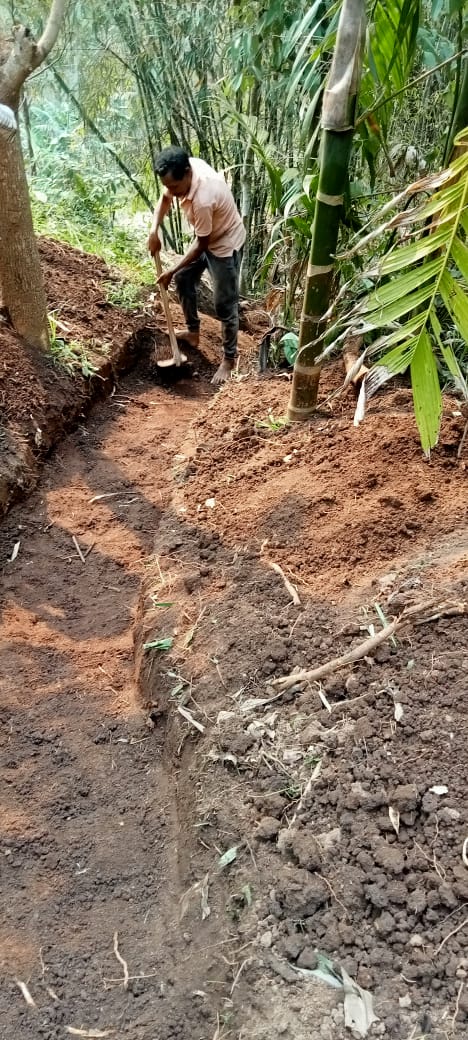
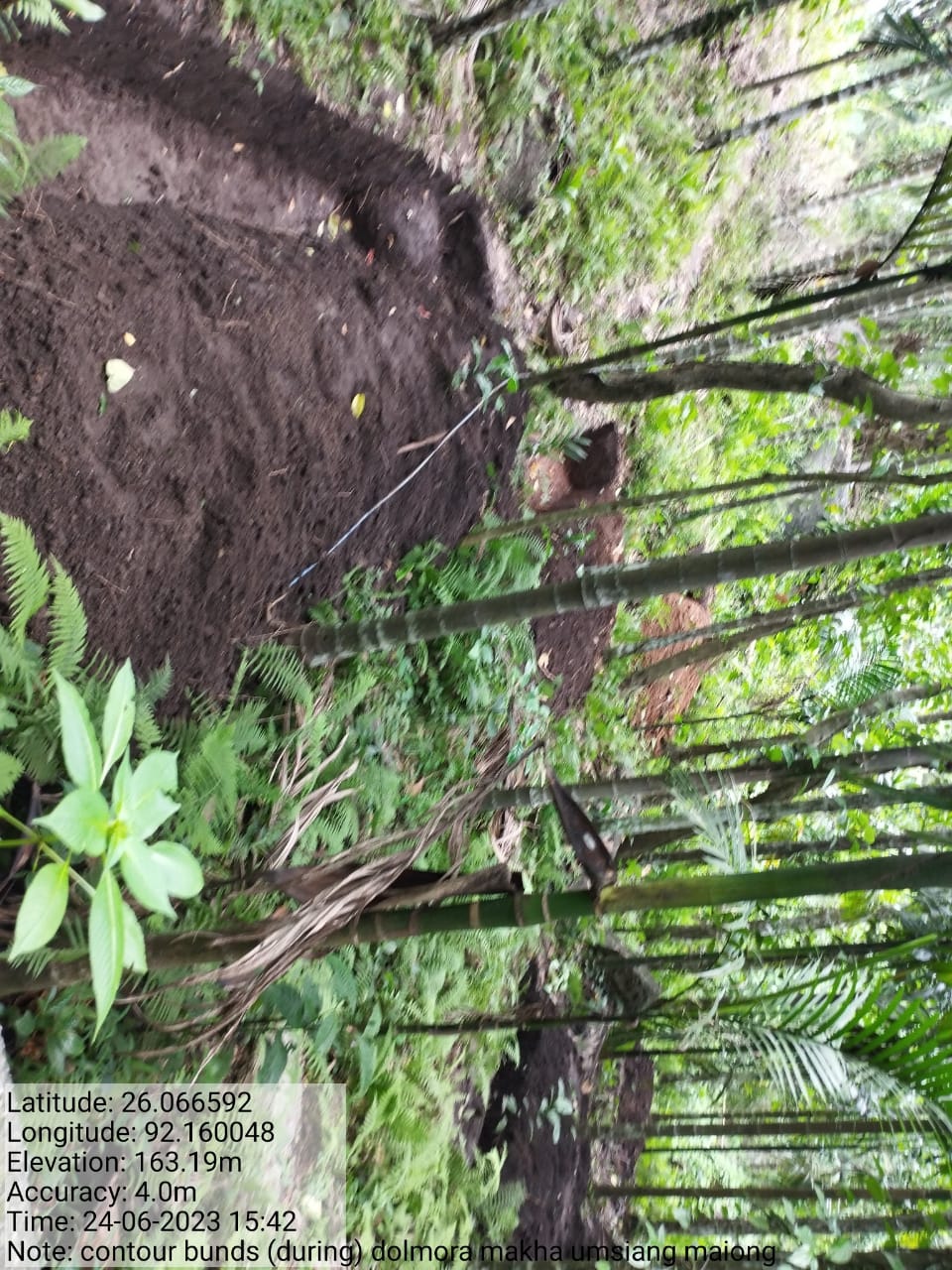
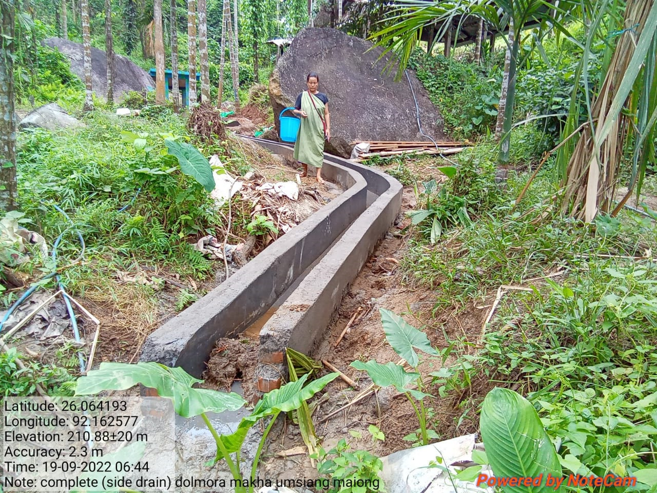
| 2 | Contour trenches | DolmoraMakha |
|
|
||
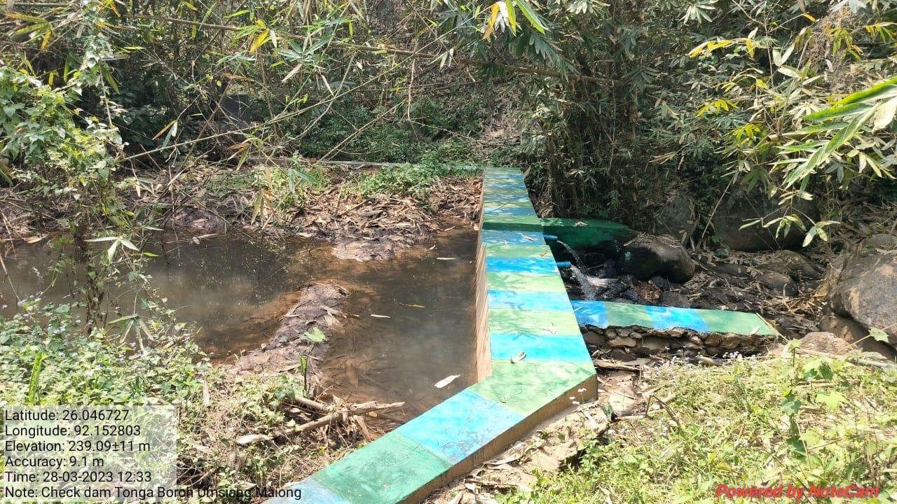
| 3 | Check Dam | WahPinasion |
|
|
||
| 4 | Check Dam | Dolmoramakha |
|
|
||
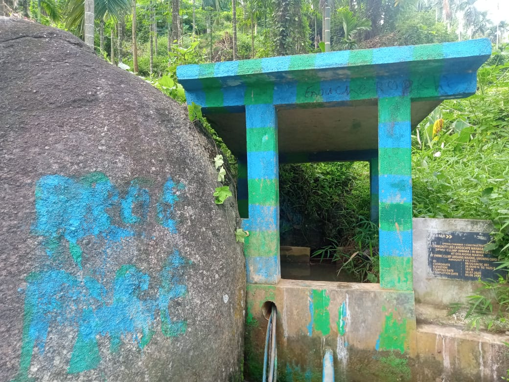
| 5 | Spring Chamber1 | Maiong |
|
|
||
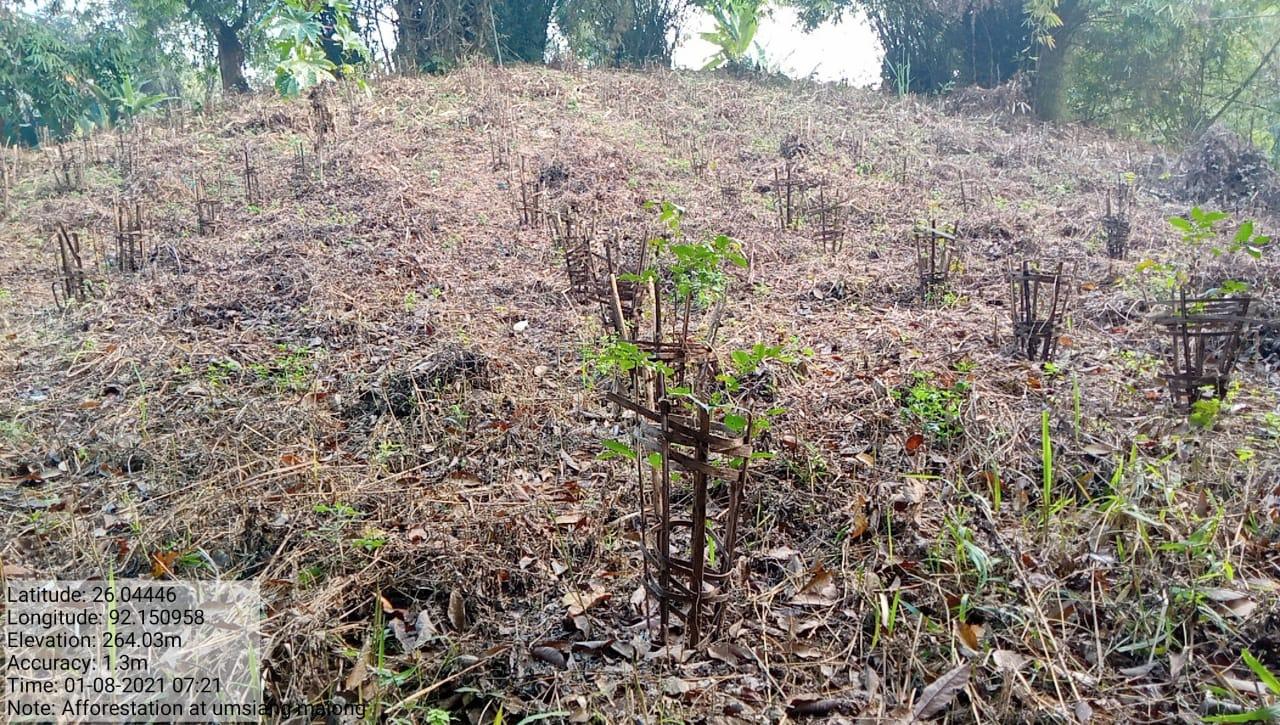
| 6 | Afforestation | TulangdepMakha TiwariMakha SalphangMakha MangkhorsalMakha |
|
|
||
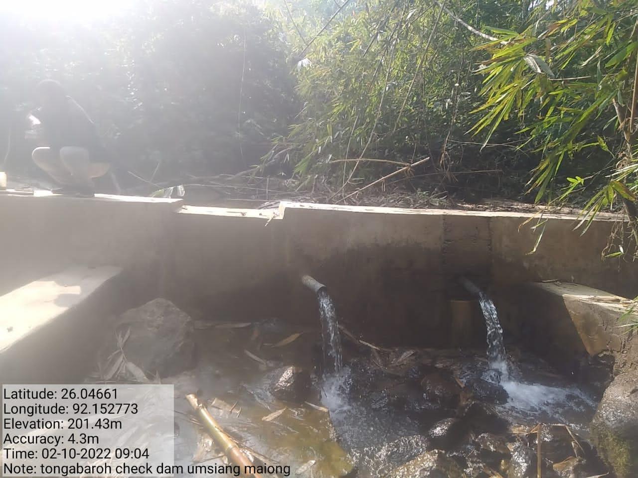
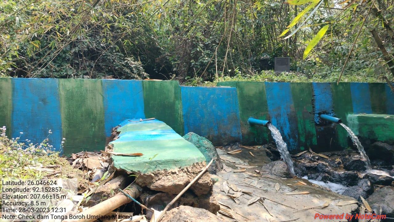
| 7 | Check Dam | Tongabaroh |
|
|
||
| 8 | Fencing | - Unknown area | ||||
| 9 | Countour Bunds and Gully Plugs | - Unknown area | ||||
| 10 | Vermi Composting | Donga BaroMakha10 Sites |
|
|
||
| 11 | Horticulture | Tonga BaroMakha |
|
|
||
| 12 | Agroforestry | |||||
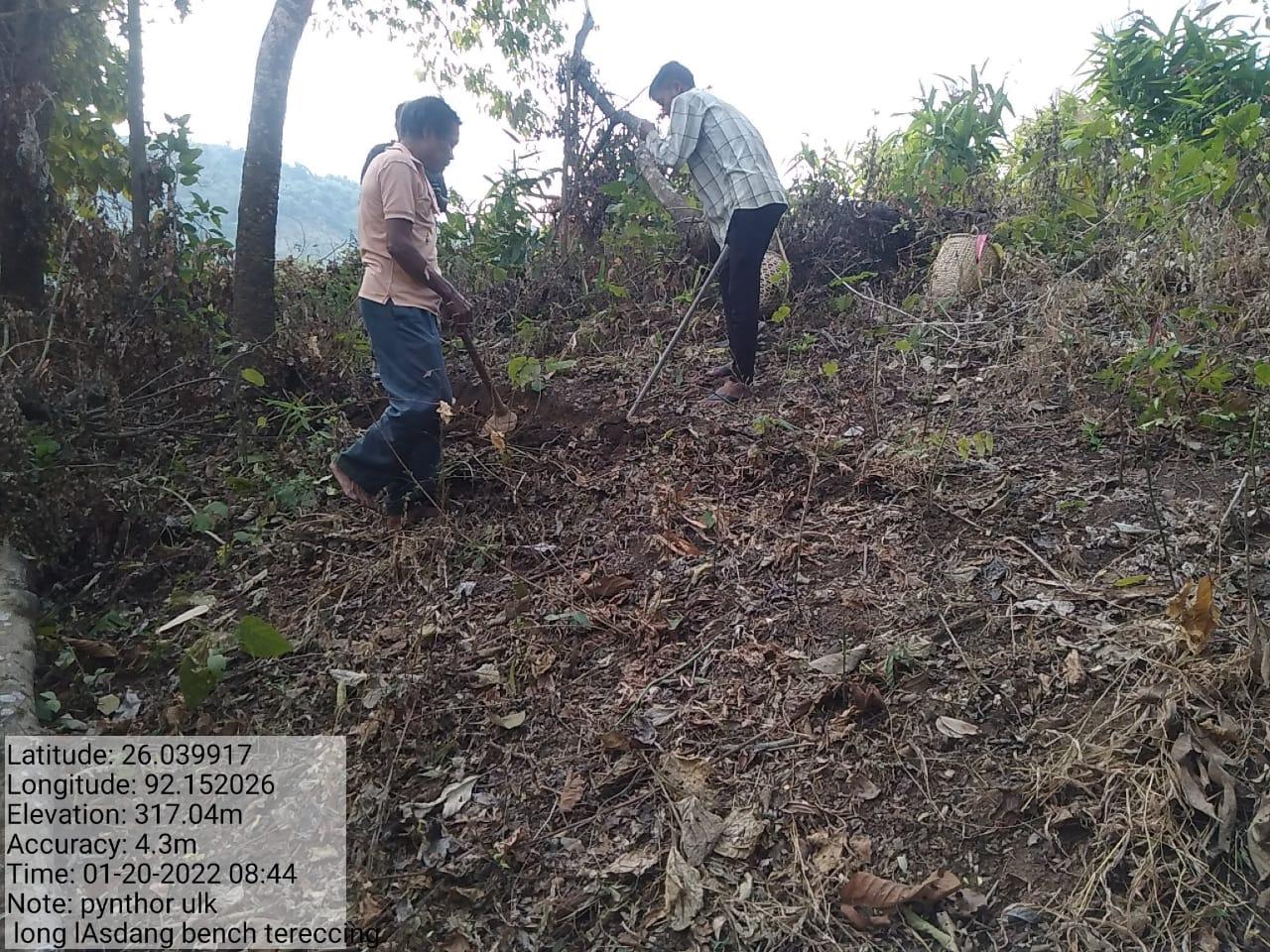
| 13 | Bench Terracing | TiwariMakha |
|
|
||
| 14 | Ringwell | Tulmuramakha |
|
|||
| 15 | Spring Chamber2 | SohkhehKhareh |
|
|
||
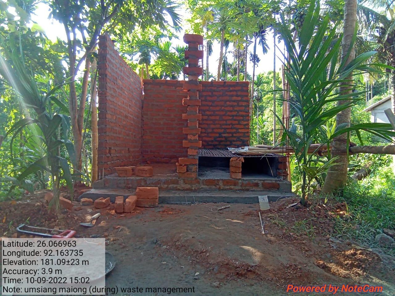
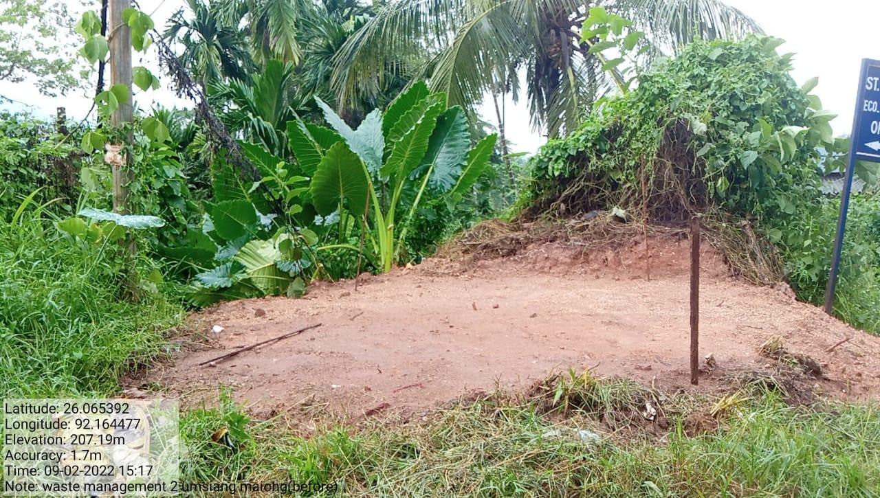
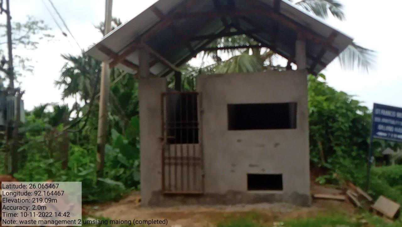
| 16 | Waste Management Plans | - Unknown area | ||||
| 17 | Forest Management plans | - Unknown area | ||||
| 18 | Preservation of Bat Cave (Tourist Spot Promotion) |
PadulikurbangMakha |
|
|||
| 19 | Preservation of Mawmihkba | MawkawahOriong |
|
|||
GIS Activities – Umsiang Maiong
| Sl.No | Parameters | Village Information |
|---|---|---|
| 1. | GPS Coordinates | |
| i | Latitude | 26.067179N |
| ii | Longitude | 92.16371E |
| iii | Elevation Reading (MSL) | 148M |
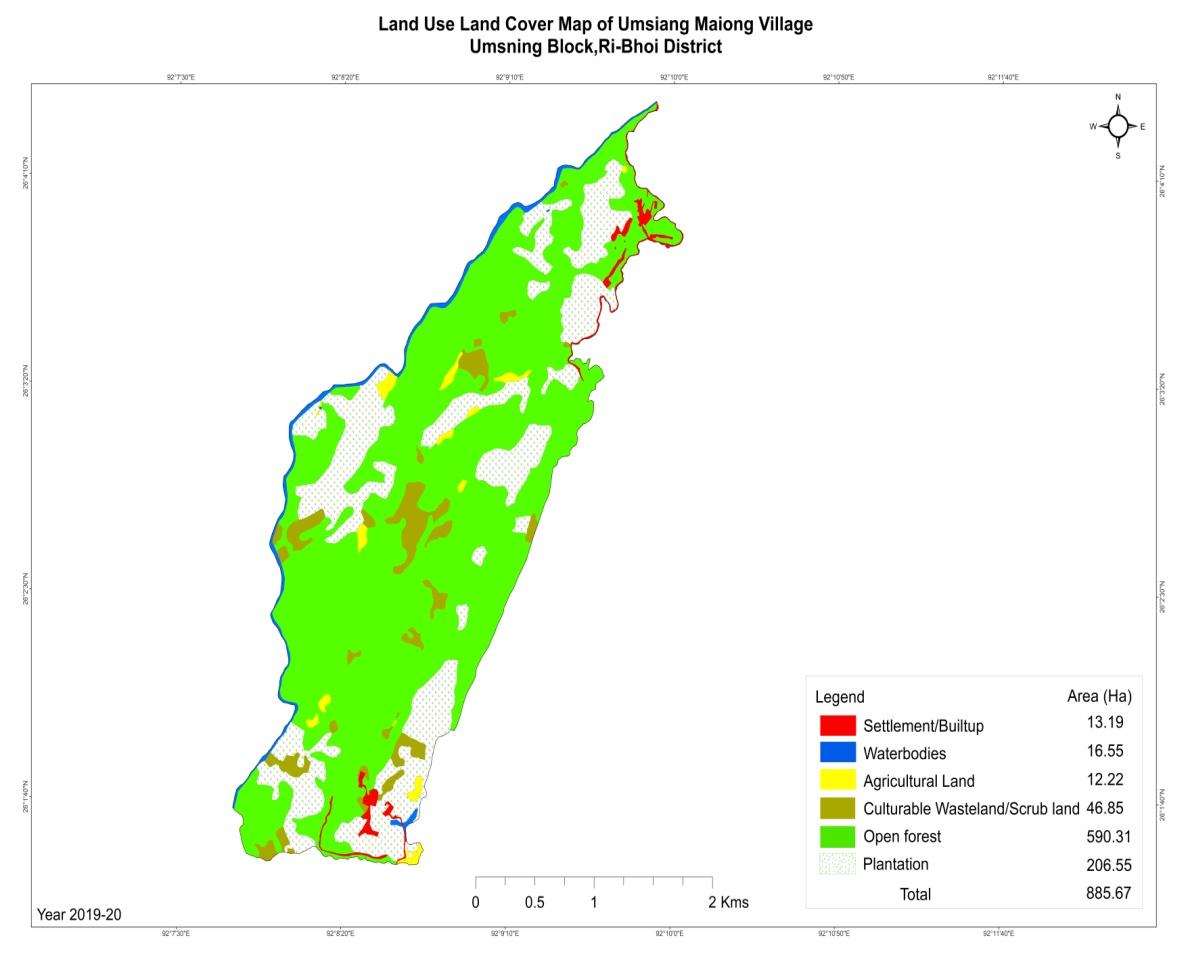
| 2. | Village Geographical Area(Ha) | 885.67 ha |
| i | Total Forest Area ( including community, Clan, Pvt Forest) | 590.30 ha |
| ii | Total Area of Water Bodies | 16.55 ha |
| iii | Total Area under Agri- Horticulture | 218.77 ha |
| iv | Total Degraded land area (Ha) | 46.84 ha |
| 3 | Average Annual Rainfall | 1000-1500 |
| 4 | Soil Type | Loamy soil |
PROJECT IMPLEMENTATION
| Intervention | Site Name | Total Amount | Work Status |
|---|---|---|---|
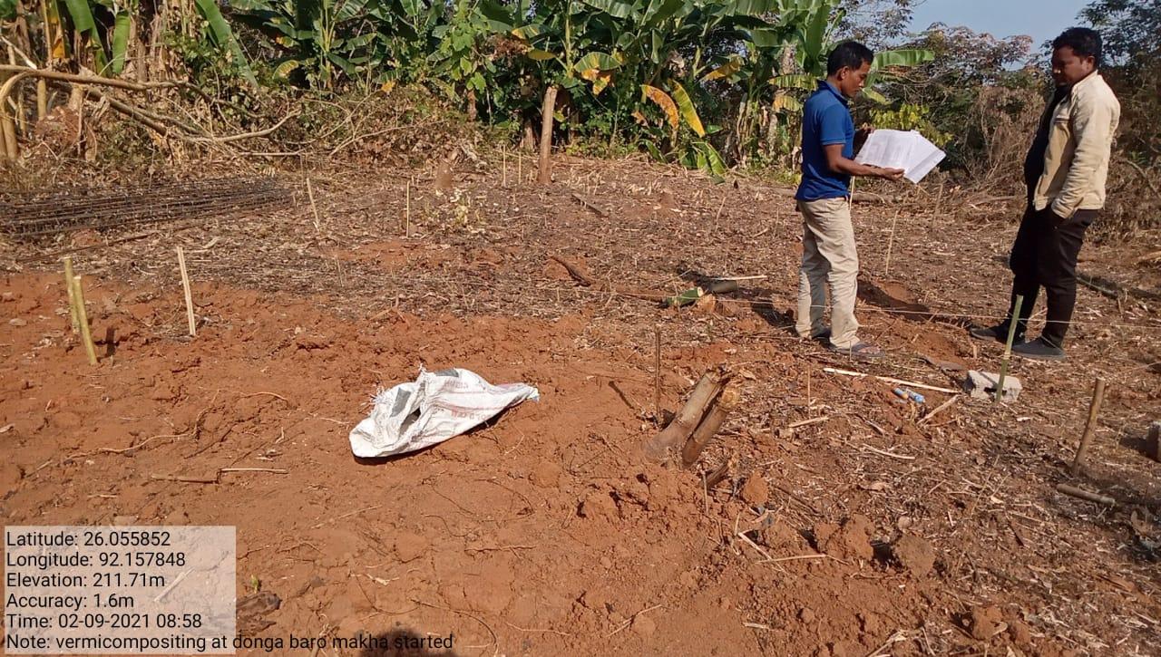
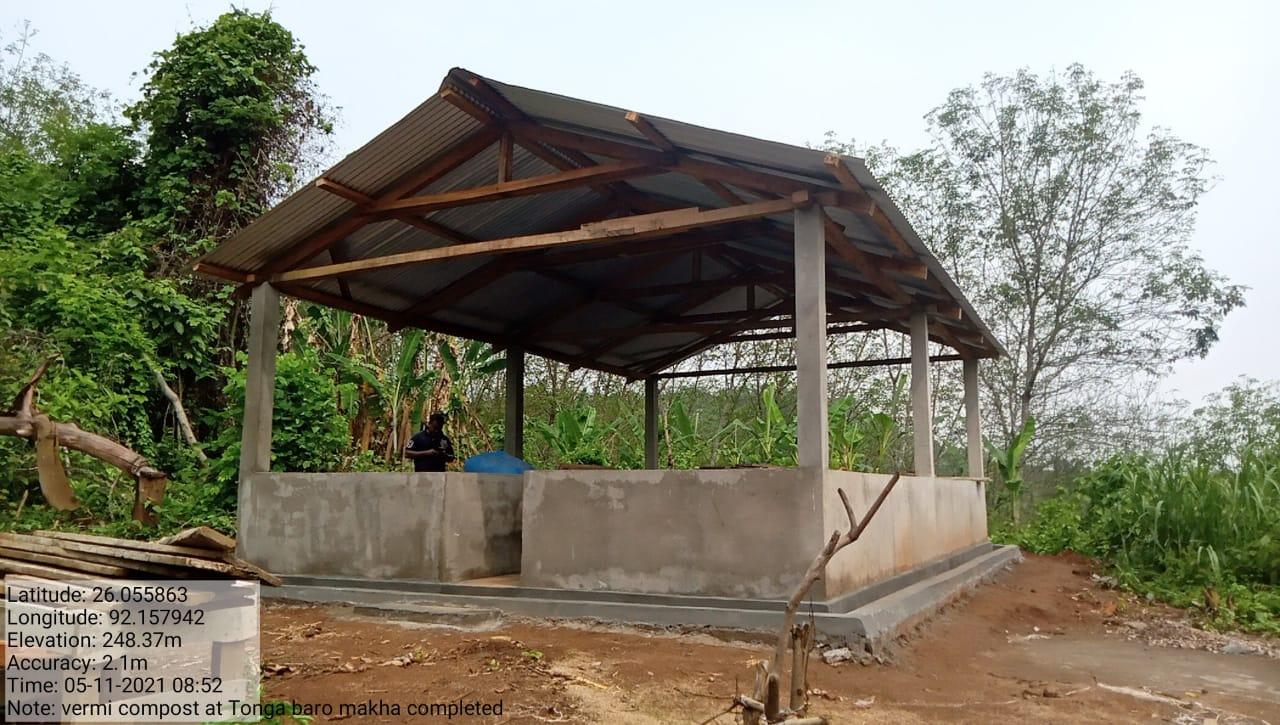
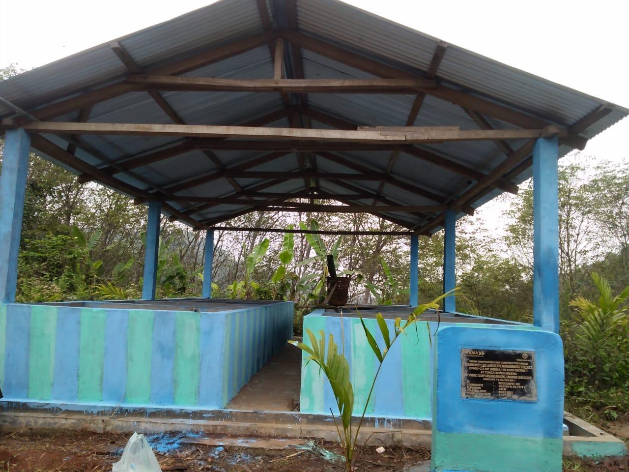
| Vermicompost | Donga Baro Makha | 3,32,460 | Completed |
| Intervention | Site Name | Total Amount | Work Status |
|---|---|---|---|
| Check Dam | Tonga Baroh | 3,92,970 | Completed |
| Intervention | Site Name | Total Amount | Work Status |
|---|---|---|---|
| Afforestation | Umsiang | 4,68,100 | Completed |
| Intervention | Site Name | Total Amount | Work Status |
|---|---|---|---|
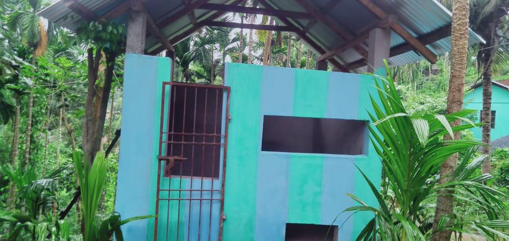
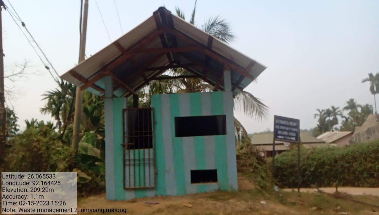
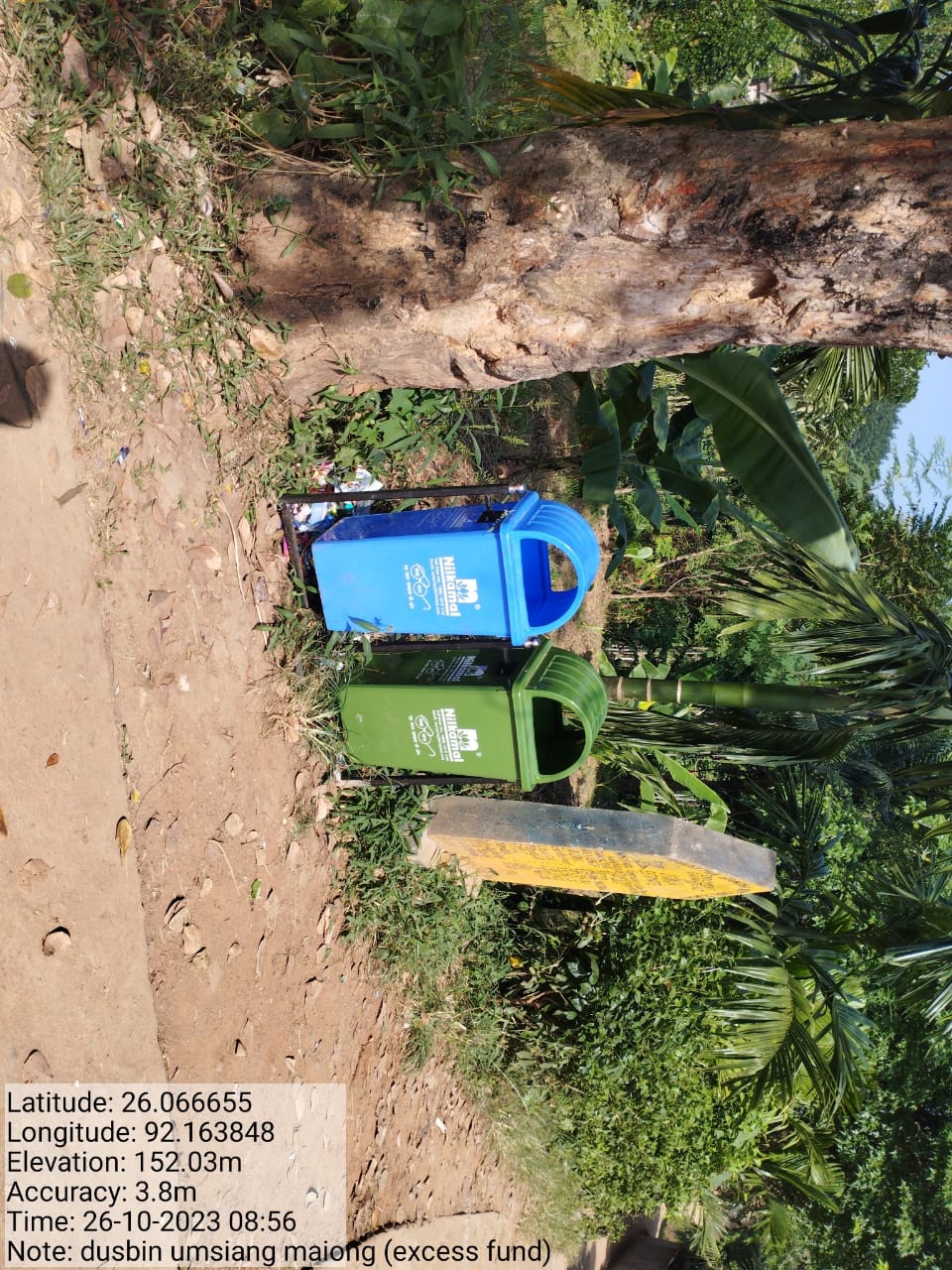
| Waste Management bin | Umsiang Maiong | 1,20,000 | Completed |
| Intervention | Site Name | Total Amount | Work Status |
|---|---|---|---|
| Check Dam | Dolmora Makha | 2,87,510 | Completed |
| Intervention | Site Name | Total Amount | Work Status |
|---|---|---|---|
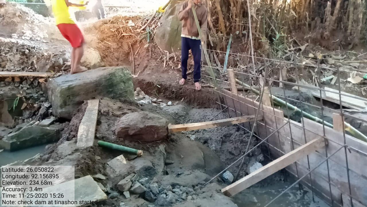
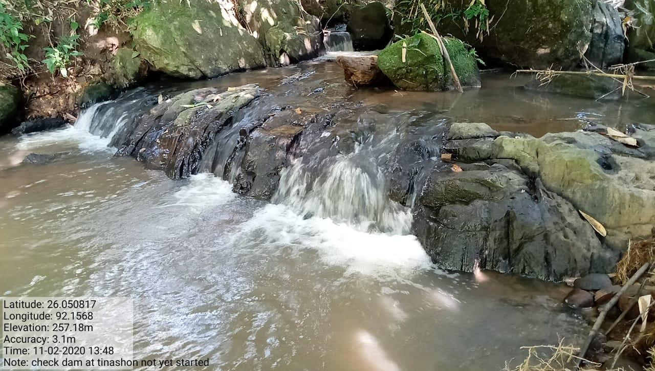
| Check Dam | Tenishon | 30,280 | Completed |
| Intervention | Site Name | Total Amount | Work Status |
|---|---|---|---|
| Waste Management Bin 2 | Umsiang Maiong | 1,20,000 | Completed |
| Intervention | Site Name | Total Amount | Work Status |
|---|---|---|---|
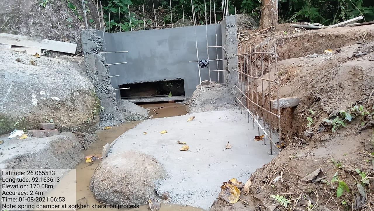
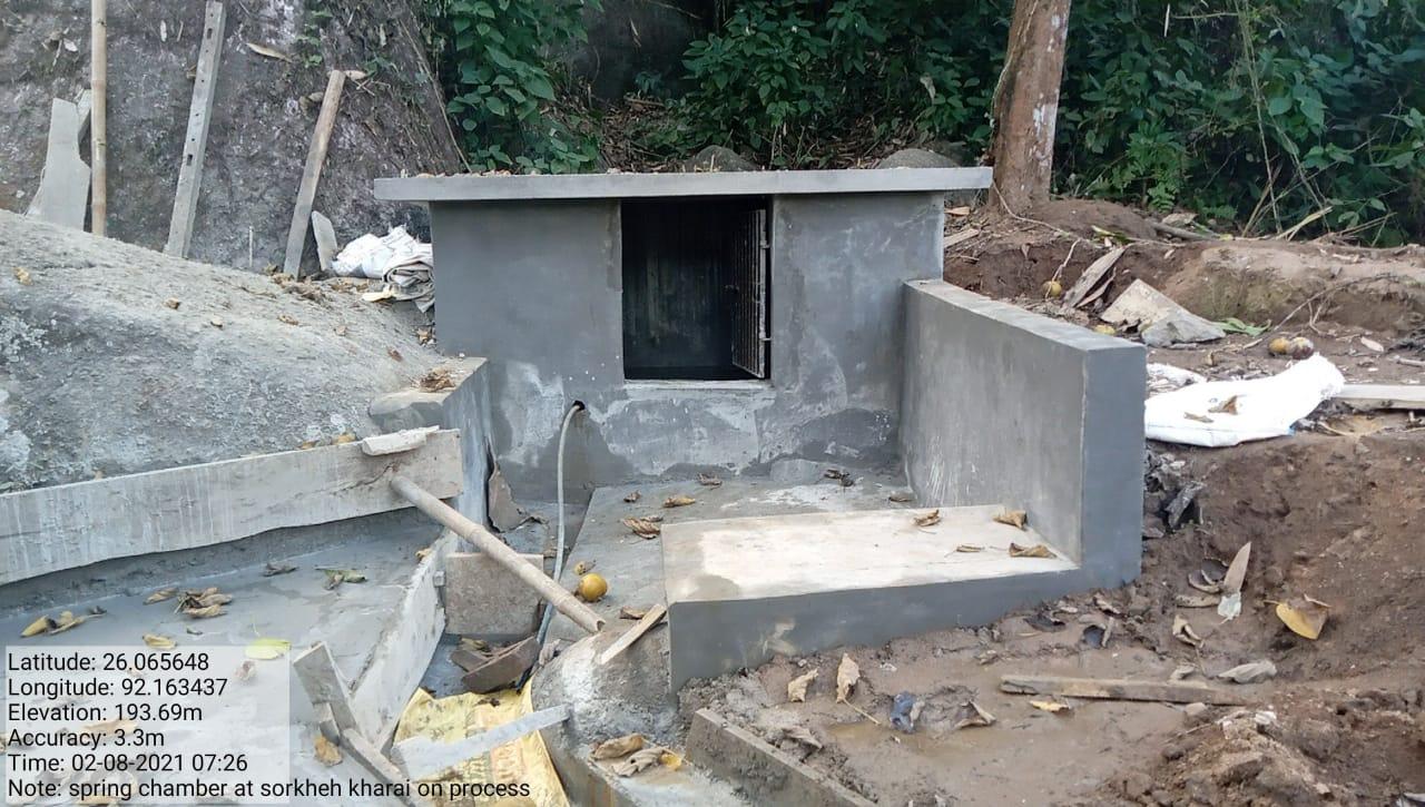
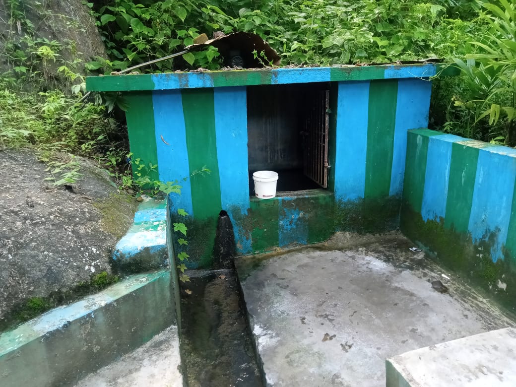
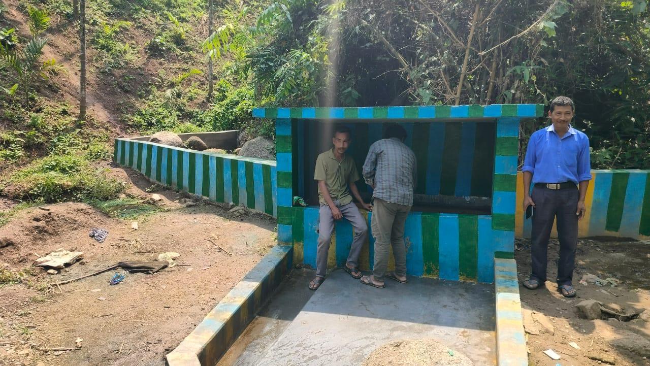
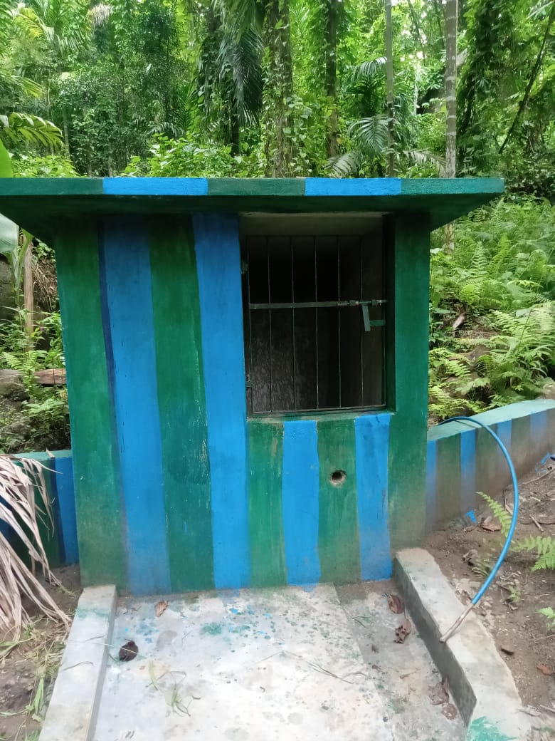
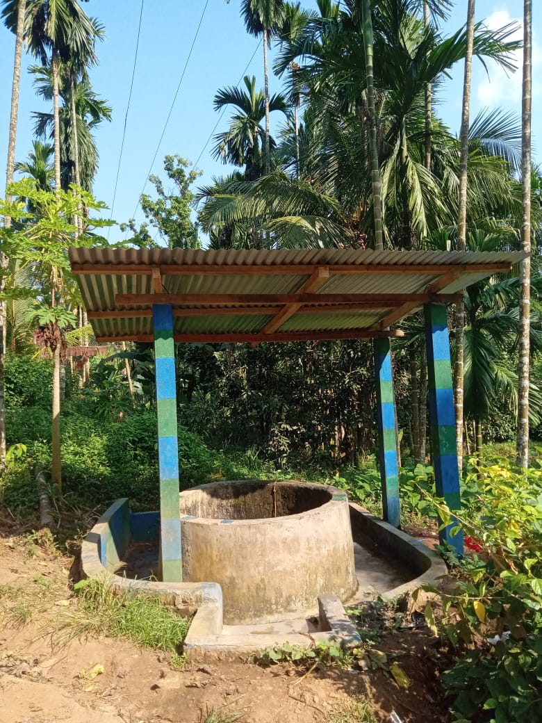
| Spring Chamber 1 | Sorkheh Kharai | 65,930 | Completed |
| Intervention | Site Name | Total Amount | Work Status |
|---|---|---|---|
| Spring chamber 2 | Sorkhehkhareh | 80,330 | Completed |
| Intervention | Site Name | Total Amount | Work Status |
|---|---|---|---|
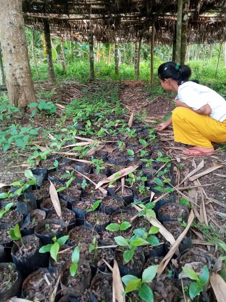
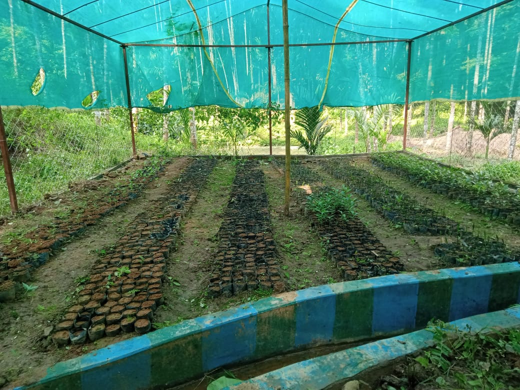
| Nursery | Donga boro | 1,19,300 | Completed |
| Intervention | Site Name | Total Amount | Work Status |
|---|---|---|---|
| Bench terracing | Tiwari Makha | 2,52,200 | Completed |
| Intervention | Site Name | Total Amount | Work Status |
|---|---|---|---|
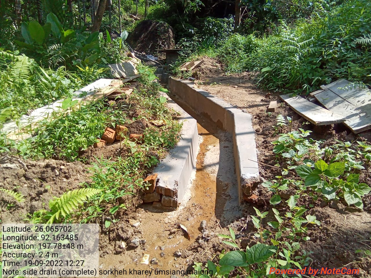
| Side drain Cum Gully plug | Sorkhehkhareh | 2,46,280 | Completed |
| Intervention | Site Name | Total Amount | Work Status |
|---|---|---|---|
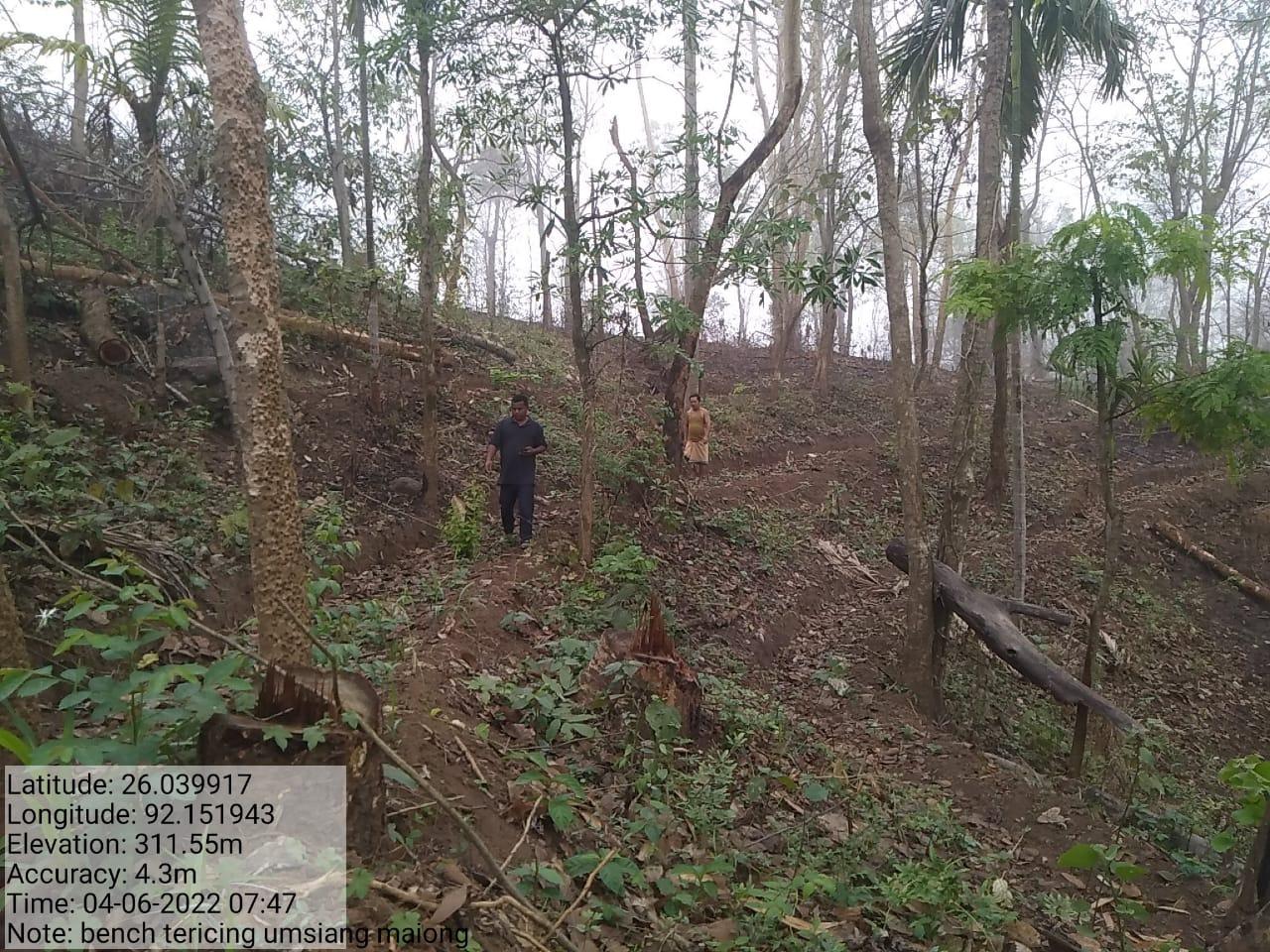
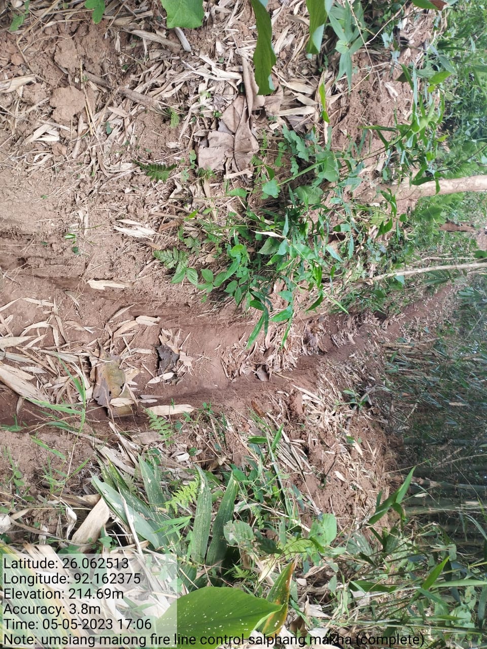
| Forest Fire line Control | Tiwari makha, Tulang lep | 53720 | Completed |
| Intervention | Site Name | Total Amount | Work Status |
|---|---|---|---|
| Spring Chamber 3 | Kakra | 160000 | Completed |
| Intervention | Site Name | Total Amount | Work Status |
|---|---|---|---|
Spring Chamber 4 ( Excess fund) |
Dolmora | 115700 | Completed |
| Intervention | Site Name | Total Amount | Work Status |
|---|---|---|---|
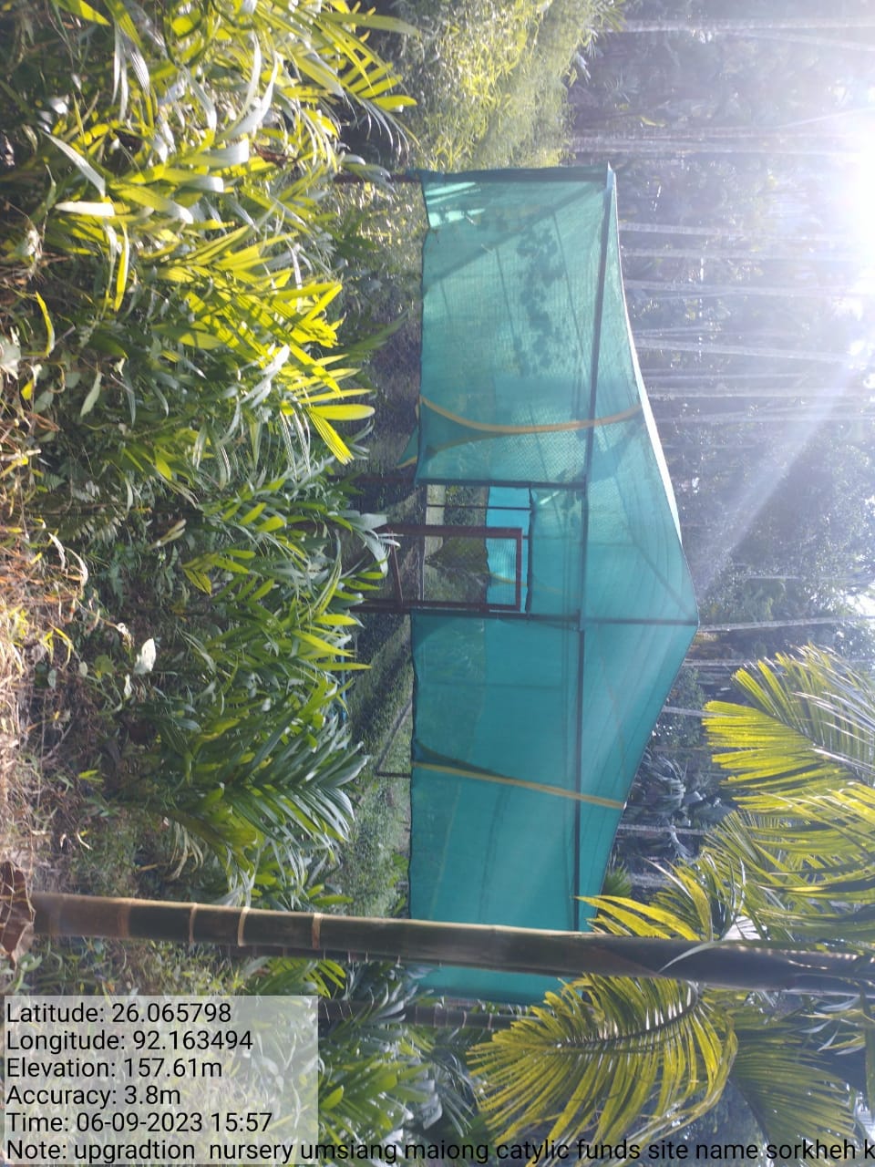
| Upgradation of Nursery | Sorkhehkhareh | 3,00,000 | Completed |
| Intervention | Site Name | Amount | Work Status |
|---|---|---|---|
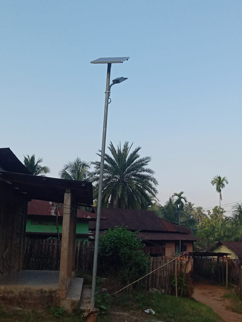
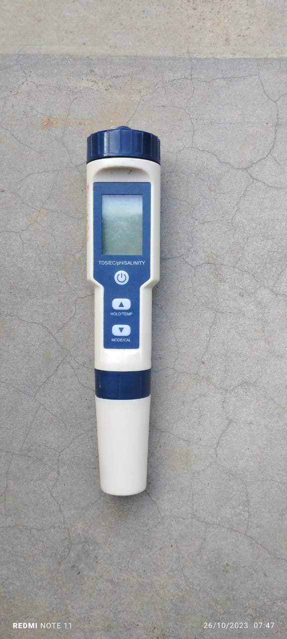
Excess fund activities Spring Guard Wall Open Well Protection Solar light Dustbin Water tester |
Dolmora Pamkduh |
12300 12000 25000 15000 10000 |
Completed |
TESTIMONIALS
President- Kisto Lamare
It is evident from the fact that our village has been hugely transformed ever since CLLMP has been introduced in our village and the positive impact it has had on our community. The project appears to focus on various aspects such as water management, horticulture, afforestation, waste management, and imparting knowledge to everyone. It's great to see that the project has brought many benefits and improvements to the village. A summary of the benefits are as follow:
Increased Water Sources: The project has helped address the scarcity of water in the village by creating additional water sources, likely through the construction of spring chambers and check dams.
Environmental Benefits: The project has focused on environmental conservation by implementing afforestation measures and taking care of trees. This has led to cleaner water sources and fresher air in the village.
Improved Health and Hygiene: The project has provided education on health and hygiene, emphasizing the importance of clean water and healthier surroundings.
Educational Opportunities: Members of the project, including the VCF (Village Community Facilitators), VNRMC members have gained knowledge and skills in various areas, such as data entry, record-keeping, and accounting among others that have improved the understanding and knowledge of the members
Soil Erosion and Drought Prevention: Measures like bench terracing and check dams have helped prevent soil erosion and mitigate the impact of droughts.
Waste Management: The project has utilized waste plastic for some purpose, likely contributing to waste management efforts in the village.
Community Involvement: The project has involved the local community, empowering VCF members to actively participate and contribute to the betterment of the village.
Safety of Surrounding Forests: Afforestation efforts have contributed to the safety and preservation of the surrounding forest areas.
Overall, this project seems to have had a positive and transformative impact on the village, addressing various environmental and socio-economic challenges. It's heartening to see how collaborative efforts can lead to meaningful improvements in local communities and as the head of the village I’m grateful for the endless support, assistance and a huge transformation that the project has brought in our village.
Secretary - Julie Muktieh 
Human's interference in the environment due to their unlimited wants has not only exploited the resources in it, but has also deprived the future generations of their own needs. But with the coming of the project in our Village they have reshaped and molded our thoughts and actions with regards to Mother Nature. Their continuous training, meetings, guidance at various intervals, have been of great help. From restoring the quality of our soil to restoring the water sources the project has done it all. I hope that the Project will continue to implement such interventions that will serve the best not just for the present generation but also to those who are yet to come which indicates a strong commitment to sustainable practices and the protection of the environment in the long term.
Overall, the project has a positive impact in the village, improving the environment, and fostering a sense of responsibility and stewardship among the community members
VCF- KM & SM- Teresa Hukait
The project has empowered the villagers to actively participate
in its implementation, providing opportunities for individuals like
me to become members of the Village Community Fund (VCF) and
contribute to the betterment of the village. The project has also
offered training and learning opportunities, enabling villagers to
enhance their skills, such as reading, writing, record-keeping, and
accounting. During my tenure as a VCF I have had the experience to
attend various trainings, to look after aspects of management of the
natural resources within the village. This role has not only
benefited me personally but also to my family as I can support and
pool financially to meet the requirements of my family.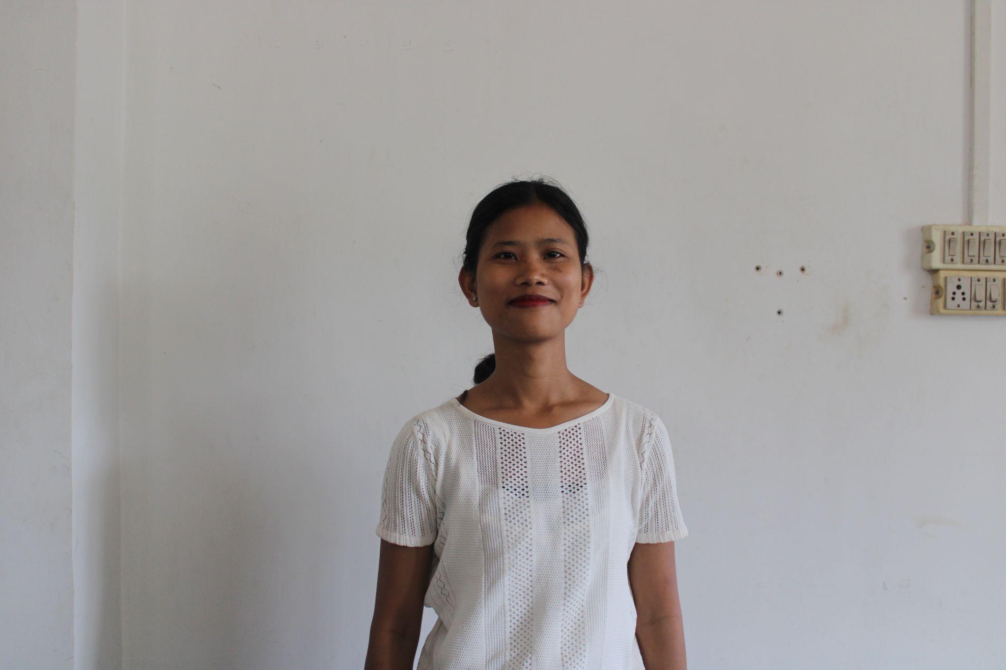
VCF- EM : Donbok Muktieh 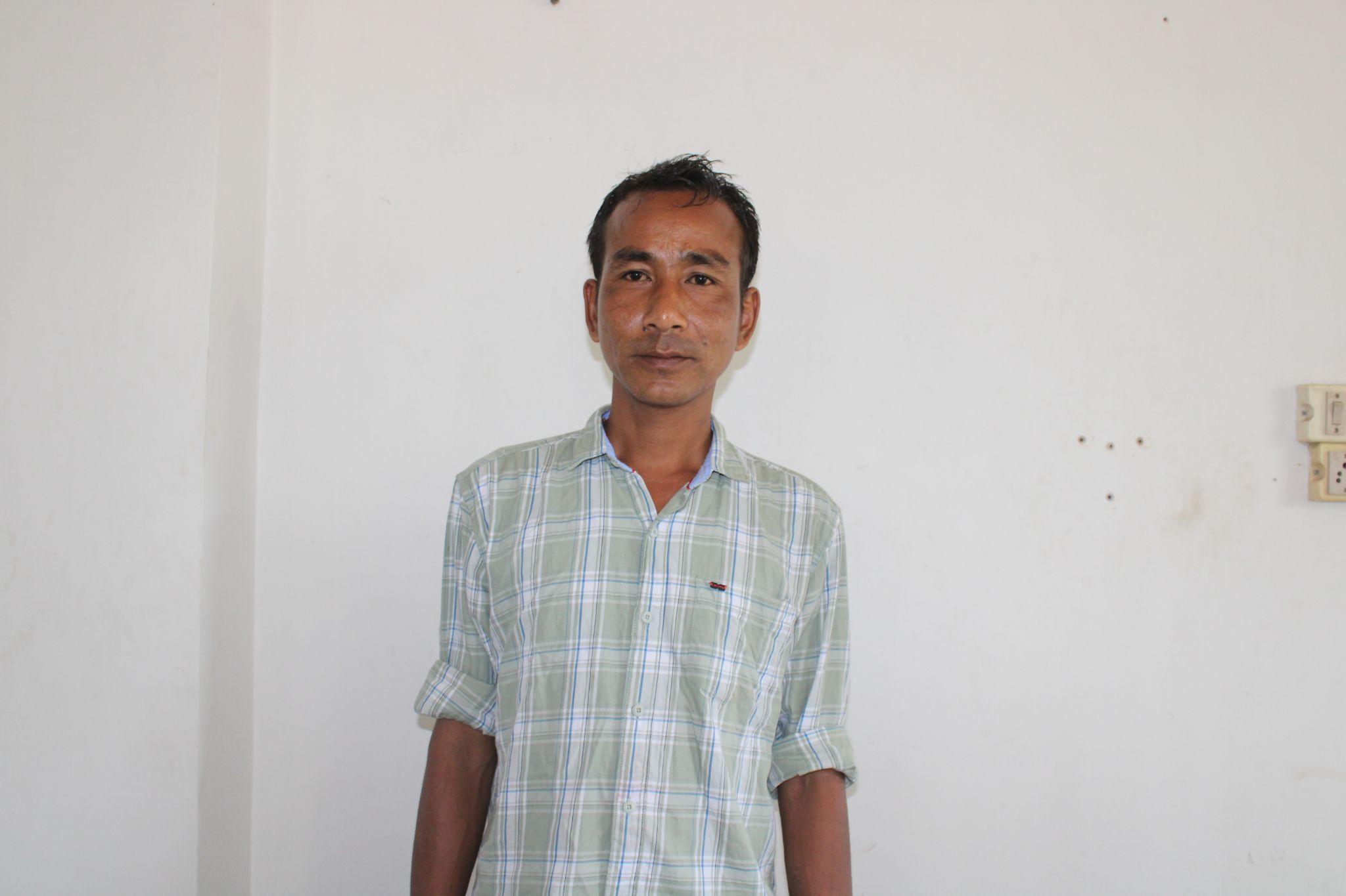
I took this role with the motive to look after the overall well being of the community, especially in maintaining the forest cover of the village and also to look after various plantation works that are under the project. The project's focus appears to be on maintaining the forest cover, implementing various plantation works, and promoting sustainable practices for natural resource management (NRM). The project has benefited the community, particularly the Village Community Facilitators (VCFs) who received training and guidance on how to restore and preserve the environment.
In the end I can say that the project has benefited a lot mainly for us who play the role of the VCFs as we are trained and guided from time to time on how to work and restore back the lost green cover of our environment.
VCF- M&E :Jessica Kropih
The project has not only benefited the village in terms of NRM activities but it has also catered to the daily livelihoods of the project which is of great importance. The overall implementation serves the best interest of the villagers and now not only they benefited from these works but also committed to work on how to restore, protect and maintain these implementations in a sustainable manner. By involving the community in restoration and protection efforts, the project has instilled a sense of commitment and responsibility towards maintaining the environment for future generations.
| Intervention | Site Name | Total Amount | Work Status |
|---|---|---|---|
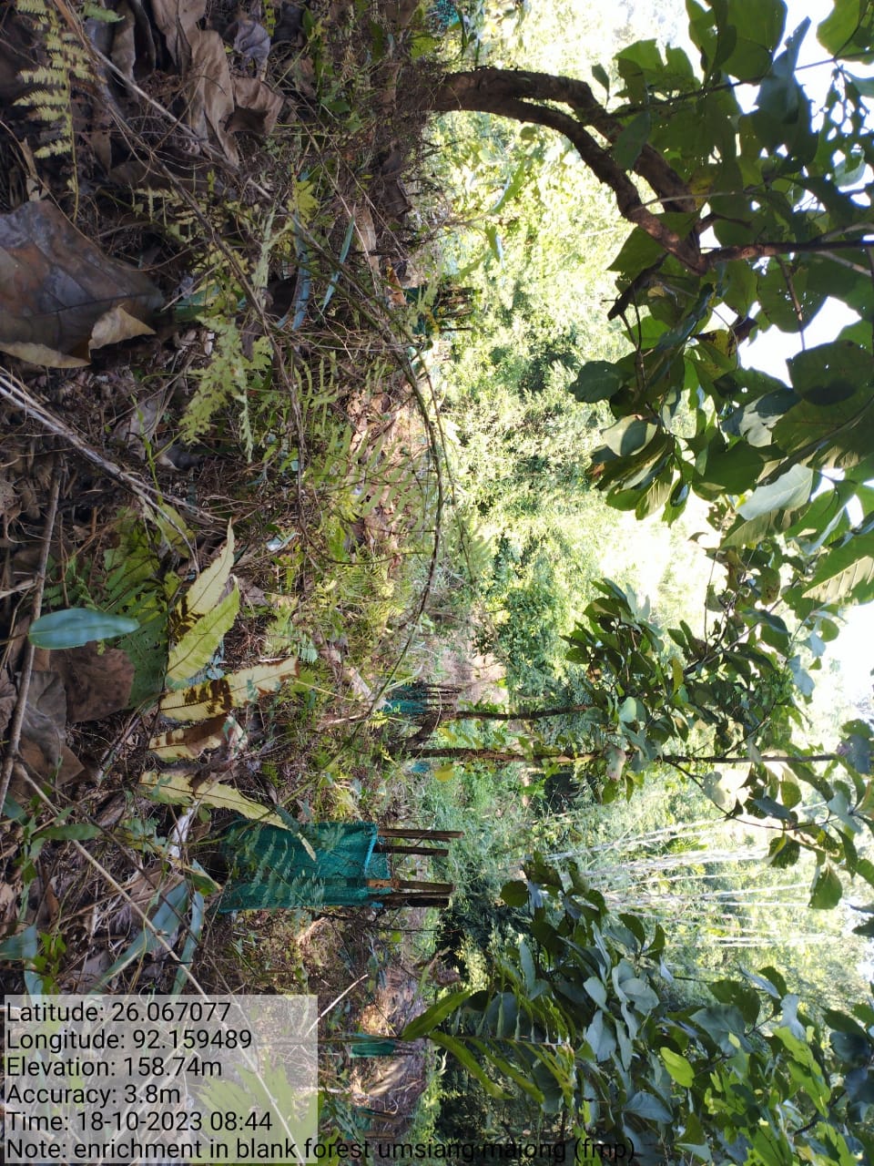
FMP Activities 1.Forest fire control measures 2.Assisted natural regeneration in open forest (Maintenance and site clearance around the existing sapling) 3.Assisted natural regeneration in open forests (Contour bunds cum afforestation) 4.Community forest boundary survey 5.Enrichment planting in forest blanks 6.In-situ & Ex-situ conservation of rare and endangered plants 7.Nursery for food forestry(providing seed sapling for existing nursery) |
Community land(All) | 139288 62060 160800 8000 30174 18000 11000 |
All Completed |