The Government of Meghalaya with financial help from the World Bank is implementing the Meghalaya Community Led Landscape Management Project (MCLLMP). The project will cover the entire state of Meghalaya and implementation of community led plans will be rolled out in phase manner throughout the state. The Meghalaya Basin Management Agency (MBMA) will facilitate community-led planning by providing support, technical inputs and funding.
The project is intended to strengthen community-led natural resources management in selected landscapes within the 11 districts of the state. This would be achieved through a variety of planning, capacity building, and on-the-ground interventions to promote the conservation, sustainable use of natural resources, social inclusion and community mobilisation; building traditional knowledge and learning, mapping of natural resources management; strengthening the community institutions and creating linkage with financial institutions and community organizations.
The project interventions include preparation of community led natural resource management plans. The CLLMP has the following three components:
Strengthening Knowledge and Capacity of Communities for Natural Resources Management
Community-Led Landscape Planning and Implementation
Project Management and Governance
The project objective is “to manage and conserve the natural resources, especially forests, soil and water sources, in a manner that supports the financial and physical well-being of communities in the State”
The CLLM-Programme focuses on increasing the capacities of communities and traditional institutions (TI) by adopting a landscape approach to manage their natural resources such as soil, springs and other water sources, forests and bio-diversity, etc.
The project will be planned and implemented in about 400 villages across the state.
CLLMP has a strong focus on institution-building at the village-level, by ensuring systematic capacity-building on technical and social skill-sets.
The project will also extend such training to communities beyond the targeted villages and support efforts made by them to access funding from various rural and natural resources initiatives and schemes.
The programme will also invest in improving the process and outcome delivery, by developing and adhering to effective systems and procedures, supported by the appropriate technology.
Benefits for community (Skills and Capacity relating to technical and managerial areas like NRM and Conflict resolution
Benefits to traditional institutions (village councils, traditional leaders, community-based organizations, SHGs etc) through Knowledge sharing, promotion of innovative approach, access to technology, technical managerial and financial support.
It is estimated that the project will impact around 1 lakh partners (of which 50% are women) who depend on land, forest, agroforestry.
Through the project, 55000 Ha of targeted area will be ensured with availability of water, biological resources and soil productivity, which will in turn benefit around 400 villages and the outcomes delivery can be summarized as follows.
The Project is executed by the MBMA in collaboration with other partners particularly, SIRD (for training and capacity building), Department of Soil and Water Conservation, Water Resource Department, Forest Department, specifically with respect to technical inputs, safeguards management and Community NRM plan preparation
2018-2023 (5 years)
Introduction
Belahari Village falls under Jirang C&RD block of Ri-Bhoi district in the state of Meghalaya. The village is at a distance of 80 Kms from Nongpoh, the district headquarters of Ri Bhoi District and is at a total distance of 132 Kms from the state capital, Shillong.

Short History of Belahari Village
Belahari village is one of the oldest villages in Ri Bhoi District. It was founded around the time of Syiem Nongbak of Hima Nongmansaw and was known as Ringaid village because a spirit known as Birmawthung used to shout “Ngaid” every time before a death or any major incident occurs in the village. Due to a power struggle between the leaders and elders of the village the village was torn apart and some villagers shifted to Mawthangrang and some to Domthawwait village.
But the ones who settled here were faced with another issue of a man eating a tiger. Folklore tells us that after the sun sets no one could leave their houses as anyone who does so gets killed and eaten by the tiger. Due to the hardships and risks faced through this the villagers shifted to a plain area which was located near Mawjri, but here they were faced with another conundrum. Newborn children were dying all the time as there was a spirit that marks some of the children on their foreheads and any child that received that mark died within a span of 3-4 weeks.
So they shifted from this place to a place beside the Rangman River (an English soldier was killed in this river by Mon Bhut, a soldier of Tirot Sing Syiem) which is one of the largest rivers in this area. Residing in this area the villagers faced a lot of problems, especially traveling due to the high water level especially during the rainy season. The villagers came together to find a solution to this problem and they decided to divert the water and they came together for a few days and dug a new canal which turned to a river known as Um Thymmei (New river). It is said that after the water was diverted and the river was drying up, different kinds of fishes started to jump out of the riverbed to the river banks and the fishes were also huge fishes weighing several kilograms each. The amount of fishes that ended up on the banks of the river was so much that the villagers were not able to collect all of them, this led to the dead fishes laying unattended on the back and this caused them to rot spreading a foul stench all over the village. In a matter of few days after this incident people started dying in huge numbers, it is said that it reached to a point where the funeral of a villager was not done yet when another villager passed away. The villagers got scared of this and named the village Nongurlong due to the disaster that befell them on this village.
Half of the remaining villagers left the village and settled down at a place known as Domsiej Lung and half settled at a place known as Warmawsaw. It was when they were residing in Domsiejlung that Christianity came to the village and during this time a Surveyor was on the way to this village but due to fatigue could not make it to the village and decided to rest on a rock on the way. His intention was to go and meet the people in the village and if he woke up late or went in the daytime he would not be able to meet the villagers so he decided to wake up early and visit the village in the morning. But due to his fatigue and since he slept very late that night he ended up waking when it was midday and the sun was at its peak and he exclaimed “Are Bela Hol'' which translates to “Ohhh it’s already midday/Ohh it's late'' and it was through this that the village got the name Belahari which means “Ohhh it’s already midday/Ohh its late”. It has been 100 years since they started to reside in this place where the village now stands.
Social Profile
The total number of households is 104 and has a population of 457 people. Agriculture and its allied activities are highly in vogue, where some few others are also enrolled in government and teaching jobs and some few inhabitants are engaged in local businesses.
Village Accessibility: In order to reach Belahari village, one must venture through the Umling-Mawdem P.W.D. road and also one can venture from Assam border road and its lying 35 Km away from Jirang block and 80 km far away from District Headquarter Nongpoh. Belahari is one of the villages that was left behind by the state Government. The people out there suffer a lot especially with road connectivity; they don’t have proper road access to Hospitals and Market.
Literacy: As per the 2011 census, the village has lower literacy rate as compared to Meghalaya literacy rate , literacy rate of Belahari village was 69.53% compared to 74.43% of Meghalaya. In Belahari Male literacy rate stands at 69.93% while female literacy rate is 69.53%.
Population 
Belahari population is 457. Out of this, 246 are males while the females count is 211. This village has 74 children in the age group of 0-4 years. Among them 40 are boys and 34 are girls.
| Age Group | Male | Female | Total |
|---|---|---|---|
| 0-4 | 40 | 34 | 74 |
| 5-14 | 60 | 51 | 111 |
| 15-30 | 78 | 62 | 140 |
| 30-60 | 57 | 53 | 110 |
| Above 60 | 11 | 11 | 2 |
BPL/APL Household:
| Particulars | No. of HH |
|---|---|
| BPL HH | 101 |
| APL HH | 03 |
Card Holding Household:
| Particulars | No. of HH |
|---|---|
| Total HH | 104 |
| Ration Card HH | 104 |
| Health Card HH | 10 |
Fuel Type:
| Fuel Type | Total HH |
|---|---|
| Charcoal | 0 |
| Biomass | 0 |
| Wood | 104 |
| LPG | 01 |
| Electric Heater | 0 |
| Kerosene | 0 |
OCCUPATION:The people of the village rely on
Agriculture , Business, Teacher’s, Govt. Servant, and Masons.
CLLMP ACTIVITIES
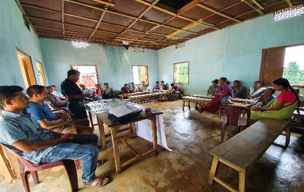
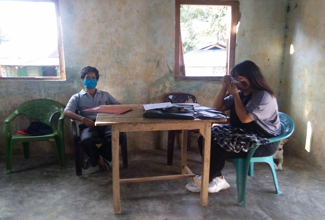
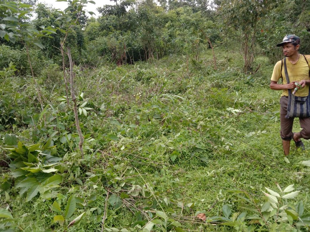
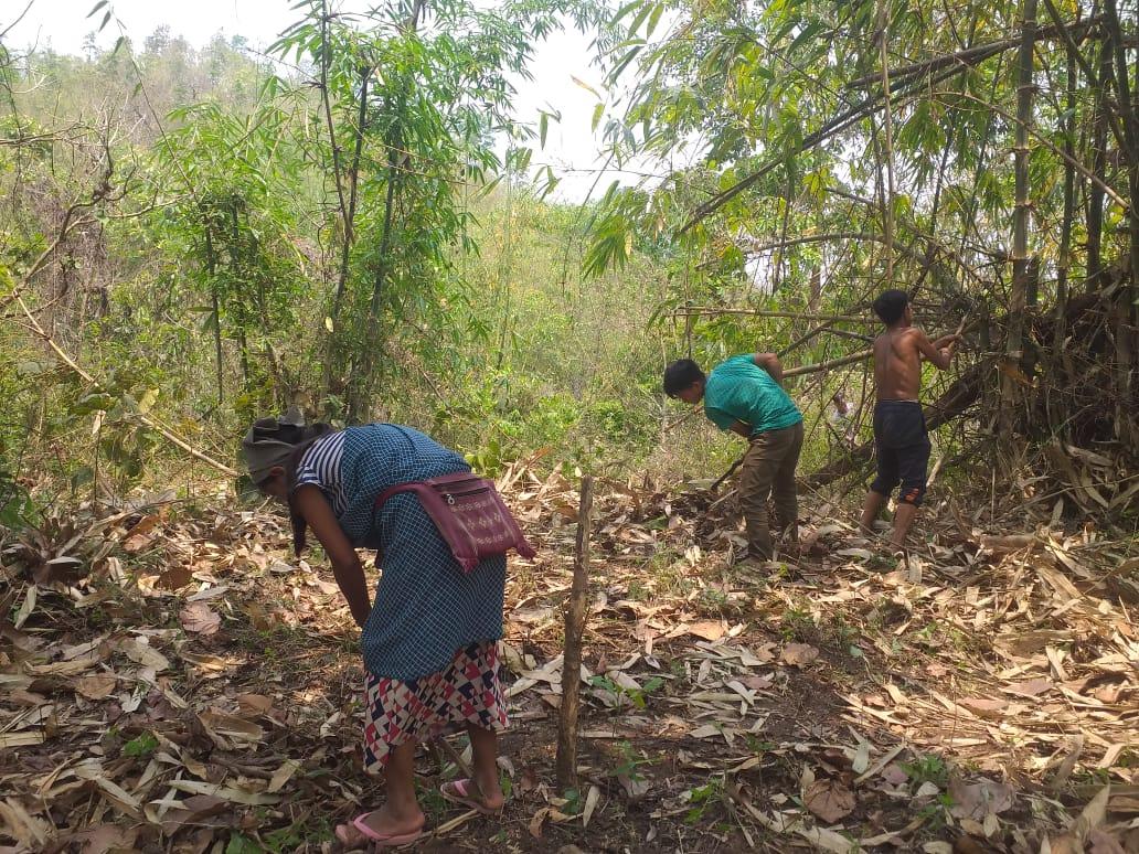
Ground Truthing Dated: 10th of July 2019
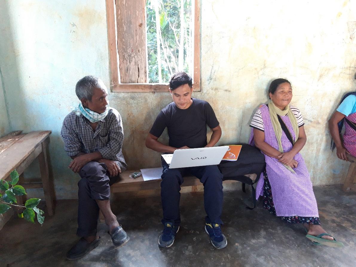
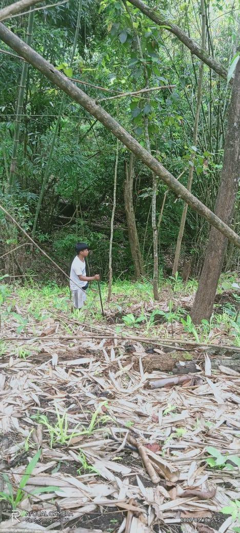
The CLLMP team met with Mr.Active Pator, the headman of Belahari Village on the10 th of July 2020, who was able to provide the team with the required details for site verification.
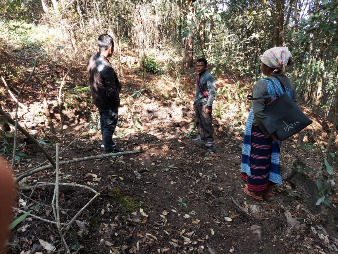
Figure 1 : Ground-truthing at Belahari Village.
Case Findings& Selection parameters: -
1. There are 104 Households out of which 101 Households fall under the BPL category.
2. VEC actively performing.
3. Approximately 20-25 acres of community forest available.
4. Scope for Water Sources to be developed
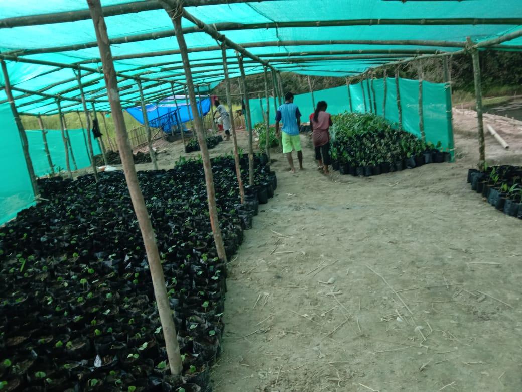
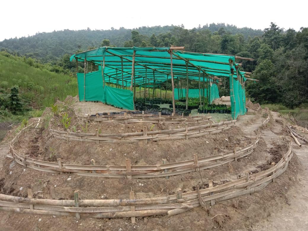
5. Need for Community Nursery and Vermi-Compost
5. The Community members expressed their need to build a fish sanctuary.
The Village has been selected under the Community Led Landscape Management Project
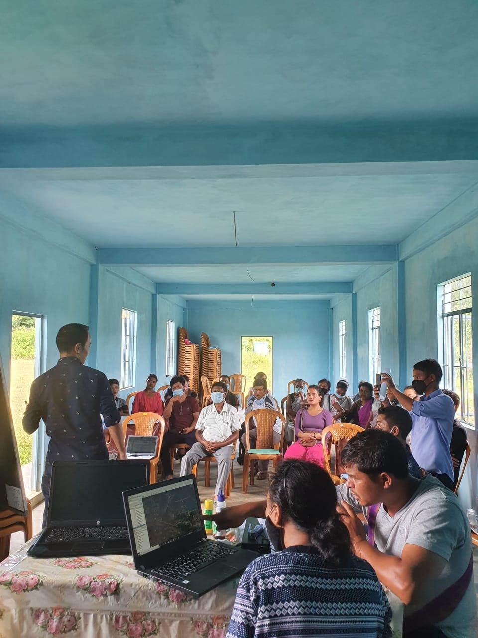
2. Sensitization Programme Dated : 11.07.2019
The District Project Manager and the Assistant Managers held a
village Level sensitization Programme on the Community Led Landscape
Management project on the 23rd, ,24th and 25th
of June 2020.The community members actively participated in the
program, voicing out their concerns and questions regarding the
project making it a huge success. A total of 54 community members
attended the program out of which 46 are female (Due to COVID
restrictions there were 18 participants in one sensitization
program, totalling to 54 participants over three days)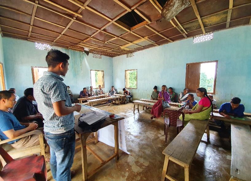
The CLLMP officials gave a brief introduction on Meghalaya Basin Management Agency (MBMA) and explained about the various programmes and projects that MBMA is working on, they then gave a detailed introduction on the Community led Landscape Management Project (CLLMP) and the different aspects and procedures that the villagers and the
CLLMP team should carry out during the course of the project and the importance of the involvement of the community for the CLLM-Project to be a success. They gave due importance on the environmental aspects of the project and enlightened them on the various benefits that the villagers could obtain from the project.
The Program was followed by an interactive session to answer the doubts and questions of the villagers some of which are mentioned below.
2.2 Signing of Documents:
After the interactive session, the village signed the EOI, VGA and Green charter followed by the selection of candidates for the Village Natural Resource Management Committee. The Village Executive Committee (VEC) and the entire community carried out the procedure and elected the members of the VNRMC on the same day.
2.3 Formation of the VNRMC
The Formation of the Village Natural Resource Management Committee was done in a public meeting in the presence of the entire village and the CLLMP staffs. The community itself chose the President, the Secretary and the other executive members of the Committee.
Listed below are the members of the VNRMC:
|
|||||||||
|---|---|---|---|---|---|---|---|---|---|
|
Name in Full | Designation | Gender M/F | Age (Yrs) | Education | Occupation | Community | Religion | Contact No |
|
Active Pator | Chairman | M | 38 | IX | Self employed | Khasi | Christian | 8837471098 |
|
Comingstar Diengdoh | Secretary | M | 44 | XII | Self employed | Khasi | Christian | 9365942442 |
|
Rosidian Kharsyntiew | Book keeper | F | 27 | X | Self employed | Khasi | Christian | 6909507192 |
|
Rangwad Lapang | Member | M | 40 | X | Self employed | Khasi | Christian | 9378176790 |
|
Backstar Diengdoh | Member | M | 42 | X | Teacher | Khasi | Christian | 8837442197 |
|
Dibas Lapang | Member | M | 57 | III | Self employed | Khasi | Christian | NA |
|
Srildamon Sangma | Member | F | 47 | IX | Self employed | Khasi | Christian | NA |
| Penilin Diengdoh | Member | F | 40 | III | Self employed | Khasi | Christian | 9383330575 | |
| Aidalin Lapang | Member | F | 42 | VIII | Asha | Khasi | Christian | NA | |
| Purchase Committee | |||
|---|---|---|---|
| Sl.No. | Name | Gender | Contact Number |
| 1 | Bishondar Syngkli | M | 6909544761 |
| 2 | Pioneerstar Kharsyntiew | M | 8974789332 |
| 3 | Adalin Syngkli | F | 9862585800 |
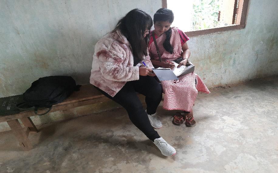
| Village Community Facilitators | |||||
|---|---|---|---|---|---|
| Name | Gender | Age | Education | Contact Number | Role |
| Shanbor Syngkli | M | 18 | lX | 7085358433 | Env |
| Balawan Sangma | M | 29 | X | 7629691379 | M&E |
| Banlumlin Syngkli | F | Xll | 8732802841 | Social Management & KM | |
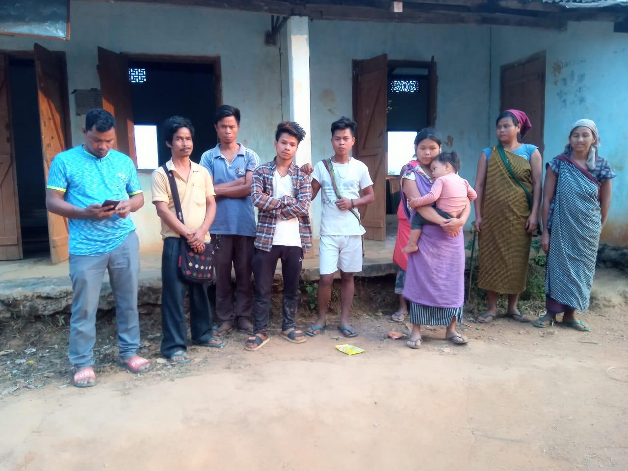
Figure – The village Natural resource Management committee
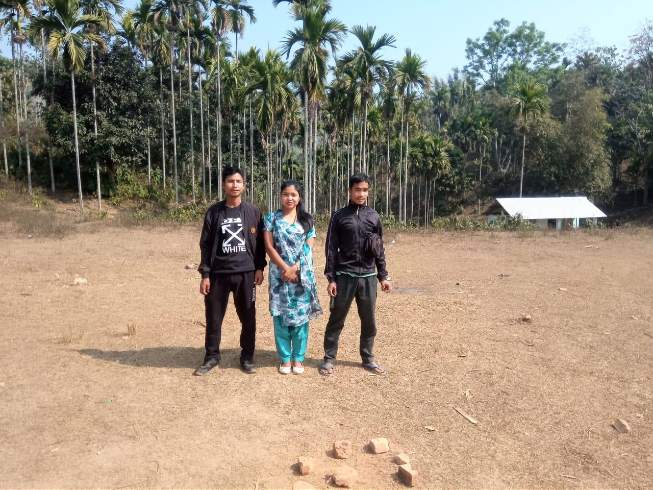
Figure- The Village Community Facilitator
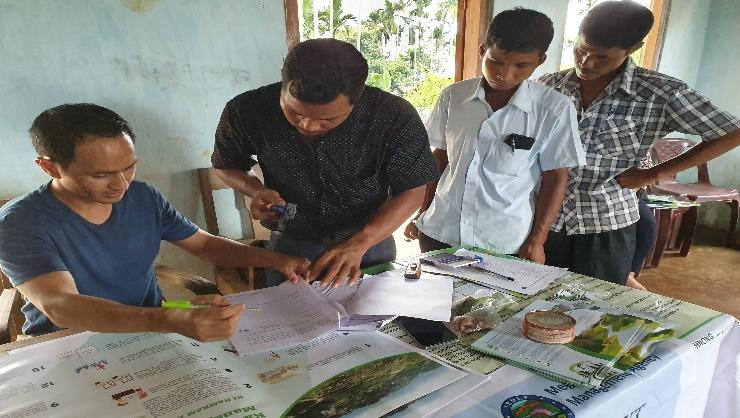
3. Opening of a Bank Account.
The opening of the bank account was initiated after the village signed the EOI (Expression of Interest), the VGA (Village Grant Agreement) and the Green Charter. Belahari village opened their VNRMC account after this.
After this the members were also trained by the Accountant on various matters relating to the financial aspects of the VNRMC.
Topics Covered:
Principles of Community Procurement
Benefits of Community Procurement
Important aspects undertaken by Community Procurement.
Procurement Process/Steps
Function of Purchase Committee
Important Procurement records to be maintained
Financial limits and methods
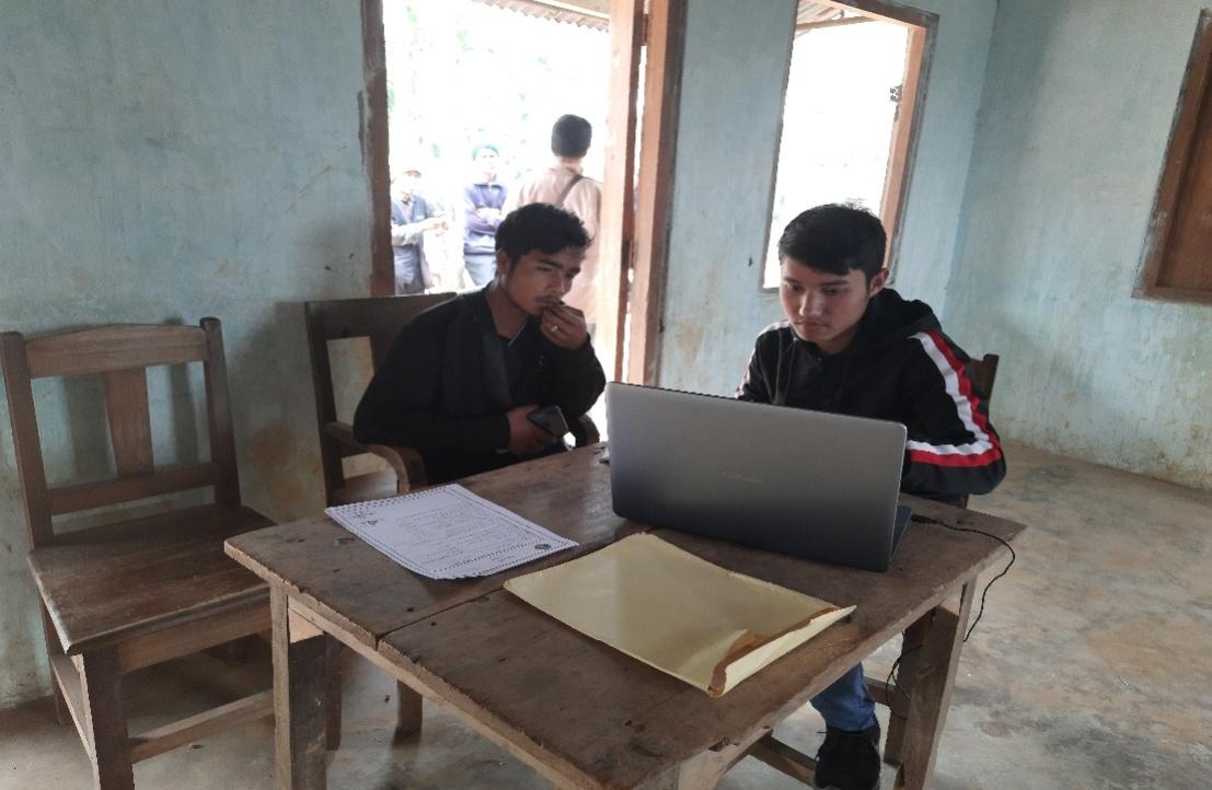
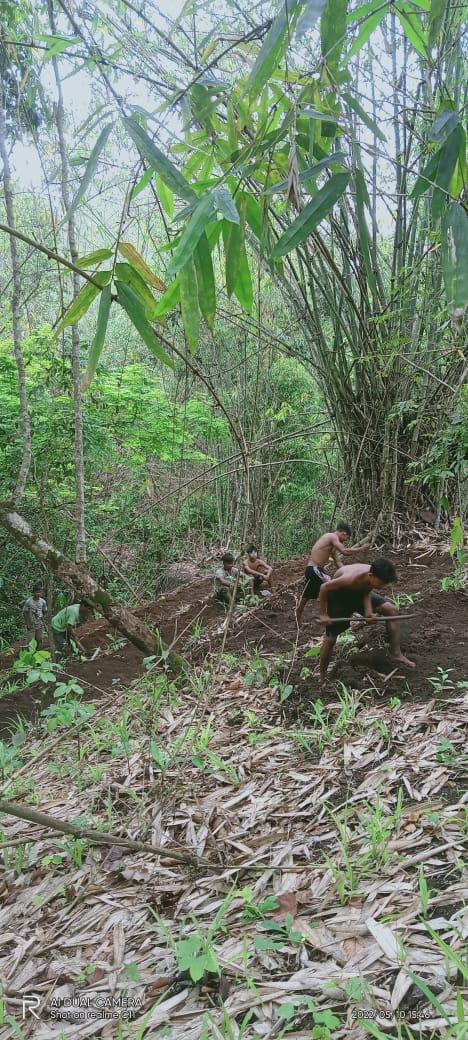
4. Participatory Rural Appraisal Exercise
26th – 27stJuly 2019
PRA exercise at Belahari Village took place from the 26th to the 27th of July 2019. There were a total of 75 villagers taking part in this exercise who contributed their time and knowledge to this project.
27.07.2019. (Day 2: Re-Orientation on CLLMP and Discussion on CNRMP)
On the 27th of July 2020, the District project Manager , Assistance Knowledge Manager,Assistance Monitoring and Evaluation , and all team Members of CLLMP Ri Bhoi District, Meghalaya.
The initial stage of Participatory Rural Appraisal (PRA) exercise at Belahari Village, commenced with a meeting cum orientation program on CLLMP. While conducting the meeting, the community members weremade aware of the various PRA exercises to be conducted for the development of the Community Natural Resource Management Plan (CNRMP) of the village, the community members’ contribution in the exercise and the objectives to be achieved. The key informants (the VNRMC and the VCFs) helped facilitate maximum participation. The dates and time for conducting the various Participatory Rural Appraisal (PRA) exercise were
fixed in consultation with the community members and all were
requested to participate in the exercise. The schedule and time was
announced at the end of the meeting.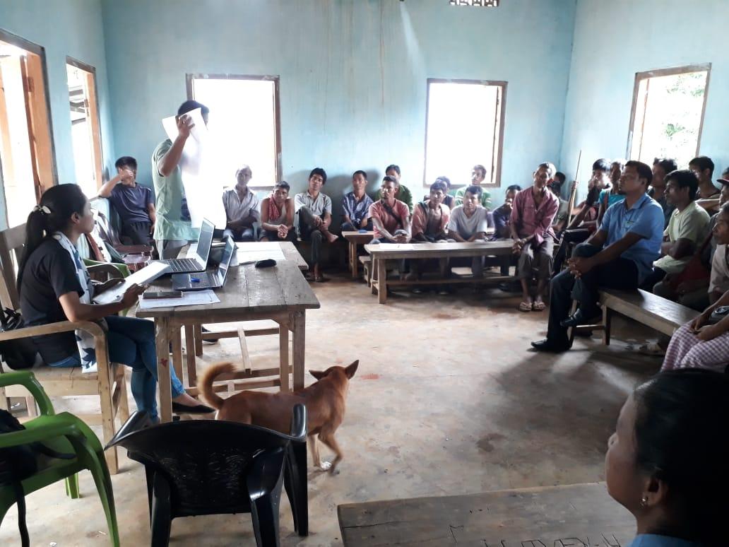
Commencement of PRA.
Introduction: Participatory Rural Appraisal (PRA) is the process of involving local people in the analysis and interpretation of their own situation of a given rural area. The local people i.e. the participants take a leadership role in collecting, analyzing, interpreting and presenting information and in this process impart knowledge and development insight to the specialists and extension agents
For management of natural resources, participatory Rural Appraisal is conducted to establish rapport with the village community as well as to identify and define problems for prioritization in the village itself. It is a way of learning from and with community members to investigate their need assessment, analyze and evaluate constraints and opportunities and find out priorities in the area of agriculture, small scale rural enterprises and any other social and economic development programs addressed to village development. Based on the principle of listening and learning,
Objectives of PRA exercise at Belahari village:
The Participatory Rural Appraisal (PRA) exercise at Belahari was conducted with following objectives:
To identify the natural, human and economic resources of a village.
To identify the village problems and prioritize them with the help of the community members.
To prepare the Community natural Resource Management Plan of the village.
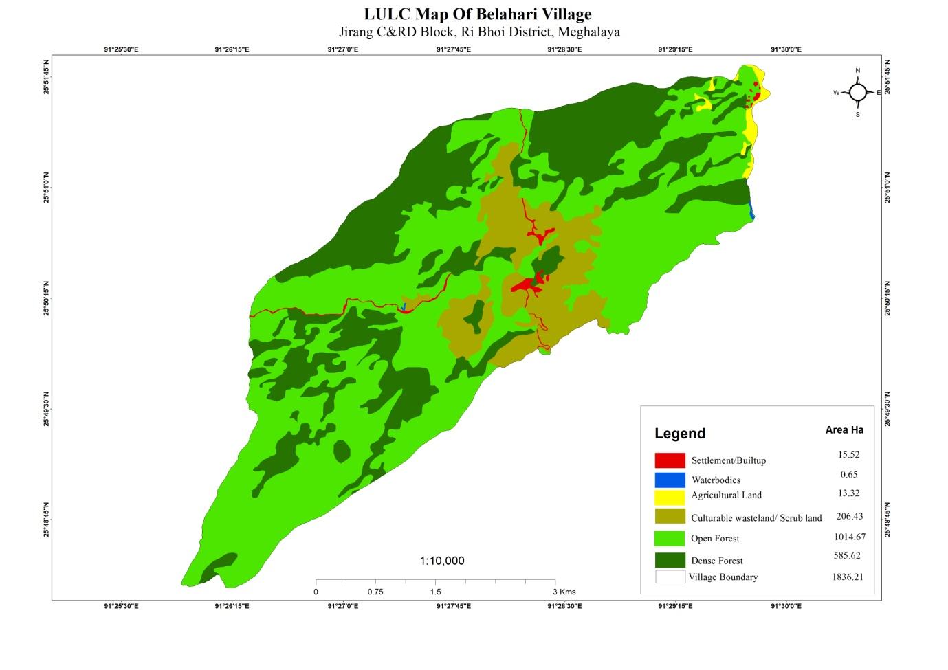
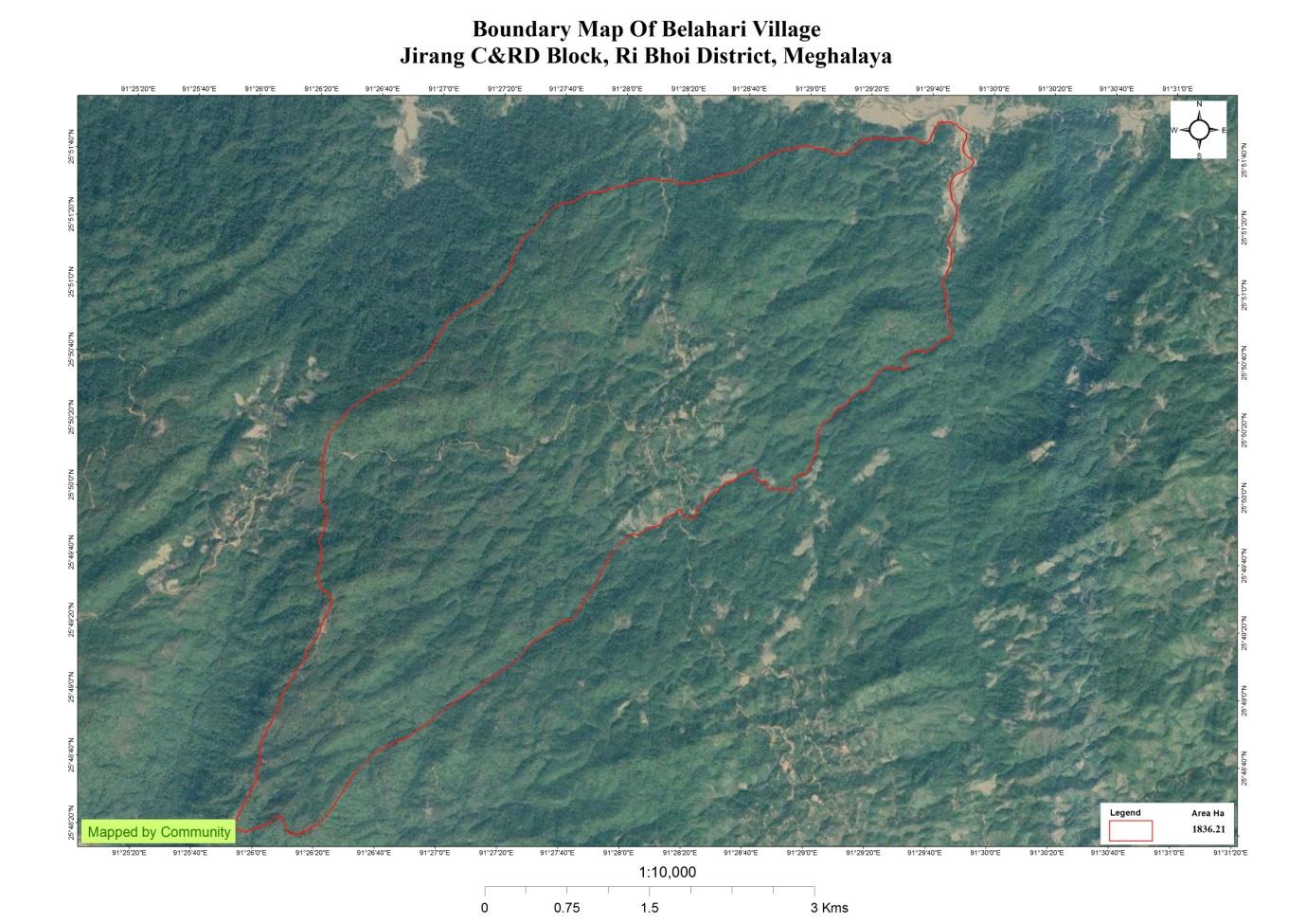
Activity 1: Village Boundary Mapping:
The GIS personnel along with the headman of Belahari Village outlined the boundary of the Village on the 17th of August 2020.
Activity 2: Drawing the Resource Map
The second step is to involve the local community in preparation of a village resource map as perceived by the community members to solicit their participation. Infrastructure, services and other village resources such as agricultural lands, wells, wastelands, cattle population etc. were mapped. Local people prepared the Resource Map by drawing it on a chart paper without much interference from outsiders.
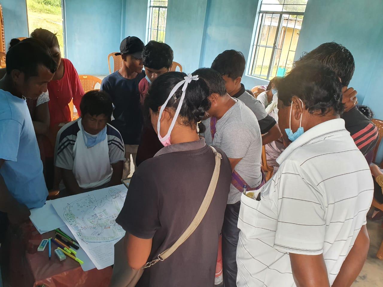
This activity achieved the following purposes:
Rapport building and winning the confidence of the villagers.
Analyzed the spatial information, particularly studied problems and opportunities of villagers.
Got an impression about the village setting, physical layout, location of various houses and institutions.
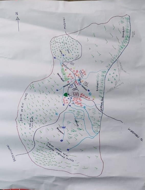
Findings Based on the Resource Map of Belahari Village:
Main agriculture produce is Paddy and Ginger
There are 3 types of Forest ownership: Community and protected forest
1 community forest
1 Protected forest
Seven (12) springs are present in the village with two already developed but needs more work.
Two main rivers are present
Presence of Barren land
Thirty (30) dugout ponds for fisheries and water reservoirs.
School: there are three primary schools in the village.
Road connectivity is very poor. All roads in the village are muddy.
Habitation is not confined to one place but spread all over the village.
Activity 3: Baseline Data Survey to fill the Environment and Social Template
During the PRA exercise, the CLLMP officials and the community members were divided into groups to fill the Social and Environmental Templates.Discussions and consultations with social groups existing in the village was held to gather basic village information regarding no. of households, demographic information, major crops and enterprises taken in the village, trends of production and productivity of major crops in the village and demographic distribution of village population.
Information related to land use categories such as forest, cultivable land, water bodies, etc; were discussed with a group consisting of External experts of environment management and the village community, who are quite aware of the village boundary and the presence of natural resources in the village. Problems related to NRM were discussed. Scarcity of water and forest fire is one of the main issues being discussed. Loss of biodiversity due to deforestation and destruction of crops by wild animals is common in the agricultural fields. Discussion and consultations by the EE on formations of plans were also done.
Activity 4: PROBLEM ANALYSIS
A. Do people have sufficient access to supply of fodder ,fuel wood, leaf litter?
It has been reduced access to fuel wood they have to go to far places in search of wood , but access to fodder and leaf litter are still sufficient
B. Has access to timber improved or reduced over the years? How is access for household use and commercial use managed?
Timber production has been reduced over the years they have to buy everything whenever they need Timber for Household Construction or furniture .
C. Are the Water bodies facing any threats?
Yes there are some water bodies in the village that cause skin diseases.
D. Do all the people in the village have access to drinking water? What are the challenges?
Yes they have access to drinking water all the 3 Hamlets i.e. Dombah, Shilliang um, and Wahsohkyrkhah ,there is govt supply in the village but is not regular and less water sources causing difficulties to the villagers especially in the dry season. From all the three Hamlets Dombah is facing more challenges when accessing drinking water .
E. Are there degraded areas in the village (open/degraded forests , mining affected ,high soil erosion etc)?
None.
F. What has caused this degradation ? Are there practices causing threats to availability and access to natural resources ?
None.
What have been the changes in agricultural practices?
There are no changes in agricultural practices; they are still engaged in Jhum cultivation and also they started to cultivate cash crops .
Are there any challenges in farming?
Yes they face a lot of challenges especially water for irrigation, no proper water canal and also wild animals destroy their crops.
How would you consider the health situation in your village?
The health situation at Belahari is much more better than the other years but people out there face a lot of challenges because they are far from Dispensary or any Hospital , so those who are ill are died on the way due to the lack of connectivity and the road condition is very worse , the Asha and Anganwadi plays a very crucial role she have to take care of the pregnant women and also provides supplements to infants.
The last case of Malaria in Belahari was in the year 2016-17 but the previous year 2010-11 total 6 deaths who suffered from Malaria because they did not get proper medication due to lack of connectivity.
How is the situation of cleanliness , sanitation access to toilets and waste management ?
Cleanliness is the priority of the village . Belahari is one of the village who does not access 100% to toilets , there are only 40% of the household that have been access to toilets .There is also no proper management of sanitation and waste management in the village but they said as compared to the years before they have improve a little bit in cleanliness.
Who are the most vulnerable group in the village? What can be done to improve their lives?
BPL Families . Inclusion of BPL Families during project implementation.
What are the livelihood aspirations of the youth ? Are there any avenues available?
The majority of the people in the village turn to farming and job cards under MGNREGA for employment and also they engage in some business and self-employment to earn and to improve their livelihood and mostly the youths work under daily wages.
Do any committees /institutes/rules exist to manage and monitor natural resources in the village?
The village Executive committee, the VEC and the VNRMC under the CLLMP manage the Natural resources in the village . prior to the CLLMP the village from the forest management committee to look after and preserve the forest.
What are some of the major issues or conflicts in the village?
Yes, mostly the major conflicts in the village are because of the dunkers .
Have any of the above issues been discussed in village meetings?
Yes, all the conflicts and issues are discussed and solved in the village meetings .
How do people resolve disagreements and conflicts?
All disagreements and conflicts are addressed by the traditional institution of village governance called the village Durbar.
Activity 5: Seasonality Calendar
The CLLMP team also mapped the seasonal calendar of Belahari Village to help identify heavy workload periods, periods of relative ease, credit crunch, diseases, food security, wage availability etc. This will prove helpful in project planning and project timeline framing.
Participants:
Shri . Active Pator - VNRMC Member
Shri. Coming Diengdoh- VNRMC Member
Smt. Banlumlin Syngkli - Village Community Facilitator
Shri. Millionstar Ryntathiang – Village Community Facilitator
| SEASONAL CALENDAR | |||||||||||||
|---|---|---|---|---|---|---|---|---|---|---|---|---|---|
| S.l No. | CRITERIA | JAN | FEB | MAR | APRL | MAY | JUNE | JULY | AUG | SEP | OCT | NOV | DEC |
| 1 | Water Scarcity | 2 | 1 | 1 | 1 | 2 | |||||||
| 2 | Prone to sickness | 1 | 1 | 1 | 2 | 2 | |||||||
| 3 | Seeking job outside | 1 | 1 | ||||||||||
| 4 | Rain Fall | 2 | 1 | 1 | 1 | ||||||||
| 5 | Free – Less work | 1 | 1 | ||||||||||
| 6 | Paddy Cultivation | 1 | 1 | ||||||||||
| 7 | Paddy harvesting | 2 | 1 | 1 | |||||||||
| 8 | Ginger cultivation | 1 | 1 | ||||||||||
| 9 | Ginger harvesting | 1 | 1 | ||||||||||
| 10 | Broom Cultivation | 1 | 1 | 2 | |||||||||
| 11 | Broom Harvesting | 1 | 1 | 2 | |||||||||
| 12 | Tree Plantation | 1 | 1 | ||||||||||
| 13 | Vegetable (crop cultivation) | 1 | 1 | 2 | |||||||||
| 14 | Vegetable (crop harvesting) | 1 | 1 | 2 | |||||||||
| 15 | Festive Season | 1 | |||||||||||
| 16 | Forest fire | 1 | 1 | ||||||||||
| 17 | Collection of Fuel wood | 3 | 1 | 1 | |||||||||
| MAXIMUM | 1 |
|---|---|
| MODERATE | 2 |
| LESS | 3 |
The Finalized Community Natural Resource Management Plan of Belahari Village.
|
Name of Proposed Interventions | Site |
|
Nos of HHs expected to Benefit |
|---|---|---|---|---|
|
||||
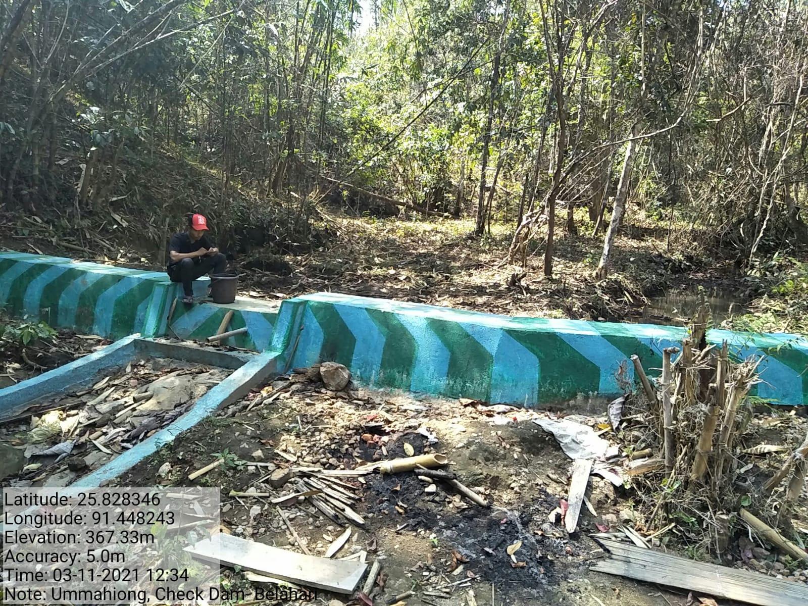
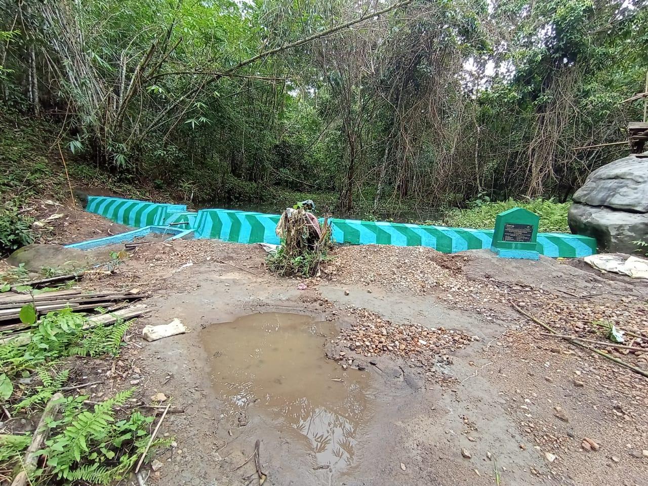
| 1 | Checkdam | Ummahiong |
|
|
| 2 | Fire Line Control | KhlawShnong |
|
|
| 3 |
|
NongthymmaiUmmahiong |
|
|
| 4 |
|
Mawthung |
|
|
| 5 |
|
Umlan |
|
|
| 6 |
|
|
|
|
| 7 |
|
NongthymmaiUmmahiong |
|
|
| 8 |
|
Umland |
|
|
| 9 |
|
1.Umpyrden 2.Umtong Donbor |
|
|
| 10 |
|
1.Ummaiong 2.Umtong Donbor 3.Umtyngrai 4.Umdumu 5.Umktieh Kesor 6.Umthlu |
|
|
| 11 |
|
Belahari Govt. L.P School Belahari RCLP School |
|
|
| 12 |
|
NongthymmaiUmmahiong |
|
|
| 13 |
|
KhlawShnong |
|
|
| 14 |
|
Umland |
|
|
| 15 |
|
Nongthymmai Um Mahiong |
|
|
| 16 |
|
Umsaitsning |
|
|
| 17 |
|
Hall Dorbar |
|
|
| 18 |
|
KhlawShnong Dom Mahiong |
|
|
| 19 |
|
Nongthymmai |
|
|
| 20 |
|
Dorbar hall |
|
GIS Activities – BELAHARI
| Sl.No | Parameters | Village Information |
|---|---|---|
| 1. | GPS Coordinates | |
| i | Latitude | 25.839976N |
| ii | Longitude | 91.471988E |
| iii | Elevation Reading (MSL) | 345M |
| 2. | Village Geographical Area(Ha) | 1836.21Ha Ha |
| i | Total Forest Area ( including community, Clan, Pvt Forest) | 1600.29 Ha |
| ii | Total Area of Water Bodies | 0.65 Ha |
| iii | Total Area under Agri- Horticulture | 13.32 Ha |
| iv | Total Degraded land area (Ha) | 206.43 Ha |
| 3 | Average Annual Rainfall | 1000-1200 |
| 4 | Soil Type | Loamy soil |
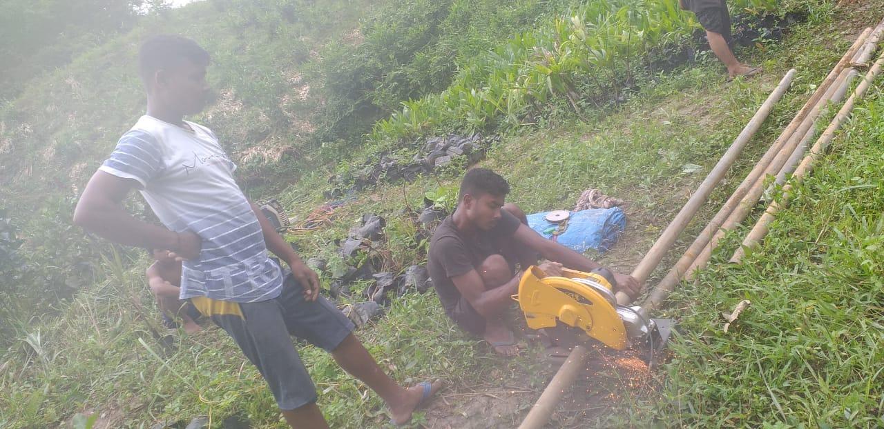
PROJECT IMPLEMENTATION
| NAME OF THE INTERVENTION | SITE NAME | TOTAL AMOUNT | DATE OF COMPLETION | WORK STATUS |
|---|---|---|---|---|
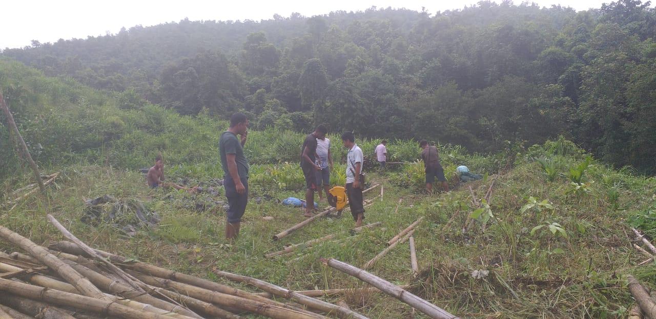
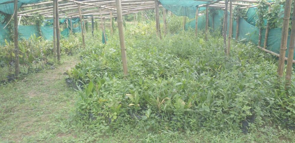
| NURSERY | NONGTHYMMAI UMMAIONG | 1,19,300 | 20.05.2022 | COMPLETED |
| NAME OF THE INTERVENTION | SITE NAME | AMOUNT | DATE OF COMPLETION | WORK STATUS |
|---|---|---|---|---|
| AFFORESTATION | DOM MAWTHUNG KHLAW SHNONG | 4,68,100 | 3.08.2020 | COMPLETED |
| NAME OF THE INTERVENTION | SITE NAME | AMOUNT | DATE OF COMPLETION | WORK STATUS |
|---|---|---|---|---|
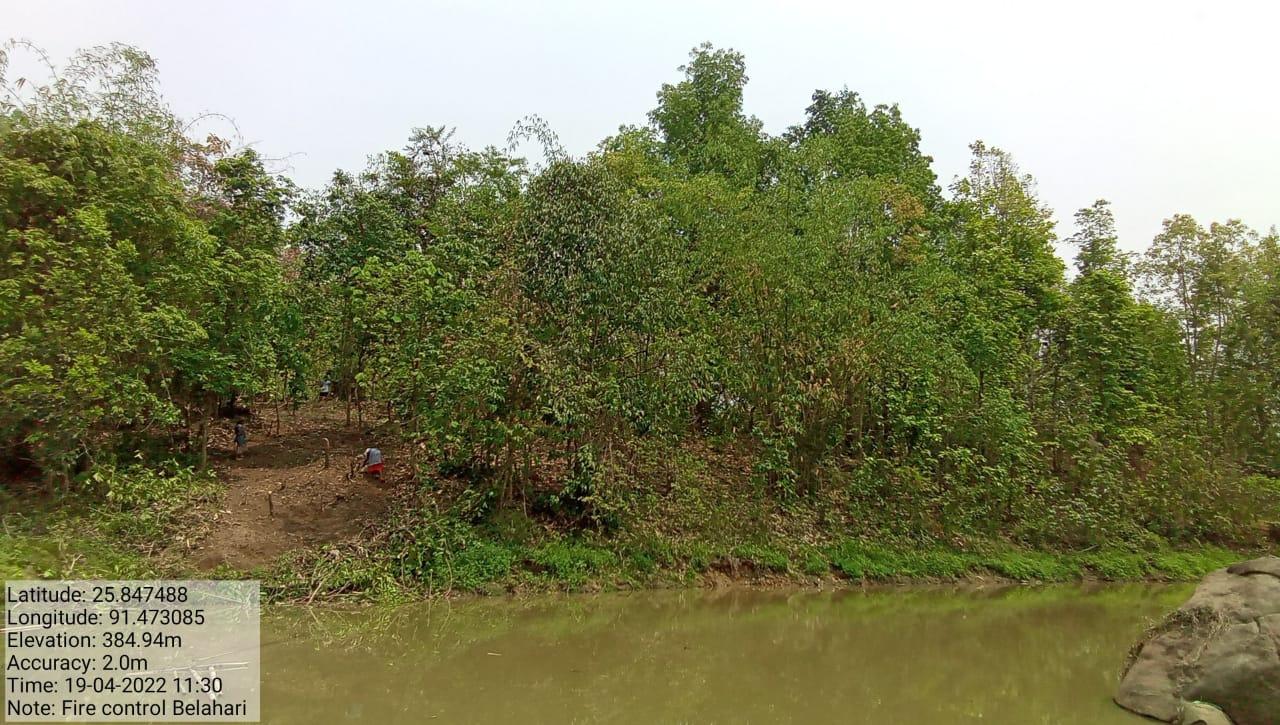
| FOREST FIRE LINE | LUMJINGTEP BELAHARITHEM | 44,100 | 14.05.2022 | COMPLETED |
| NAME OF THE INTERVENTION | SITE NAME | AMOUNT | DATE OF COMPLETION | WORK STATUS |
|---|---|---|---|---|
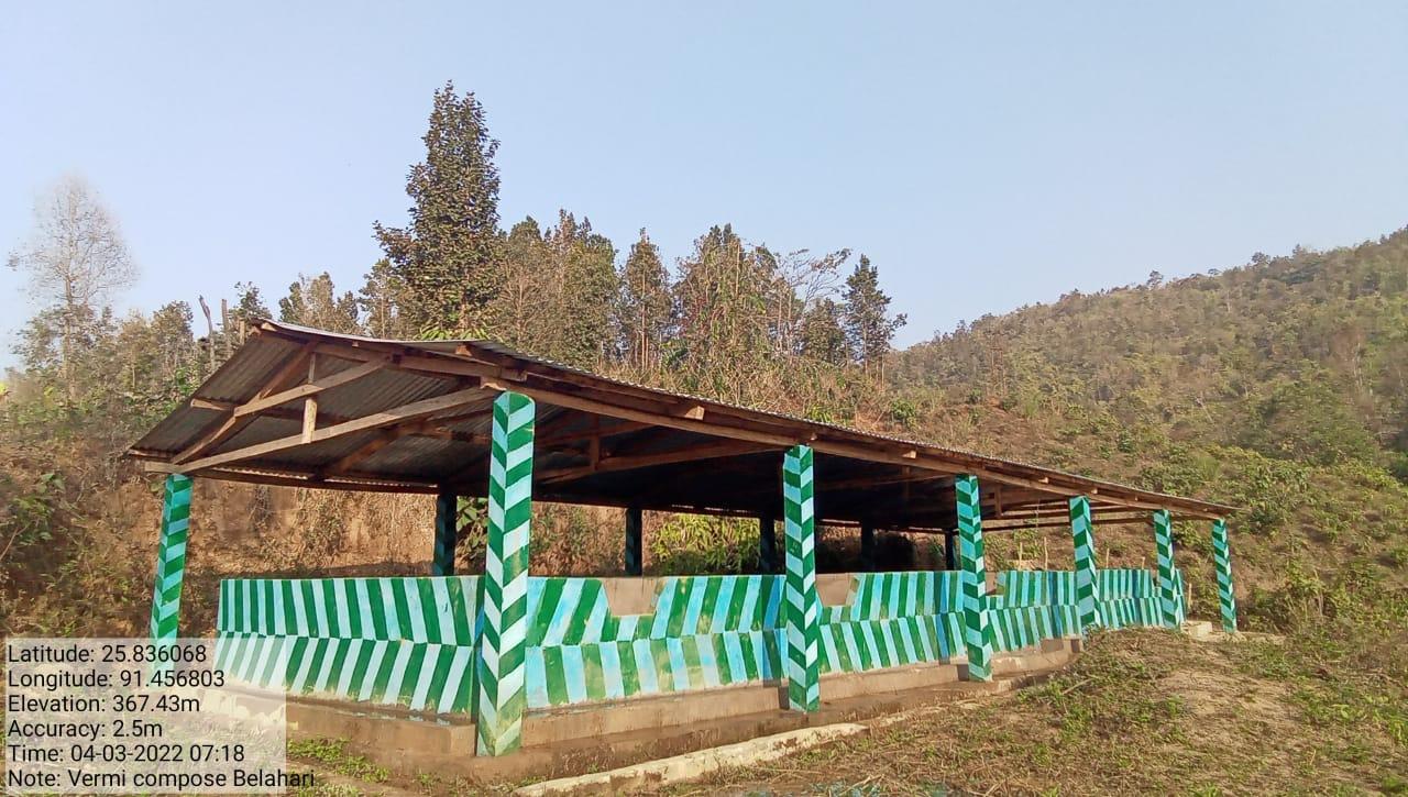
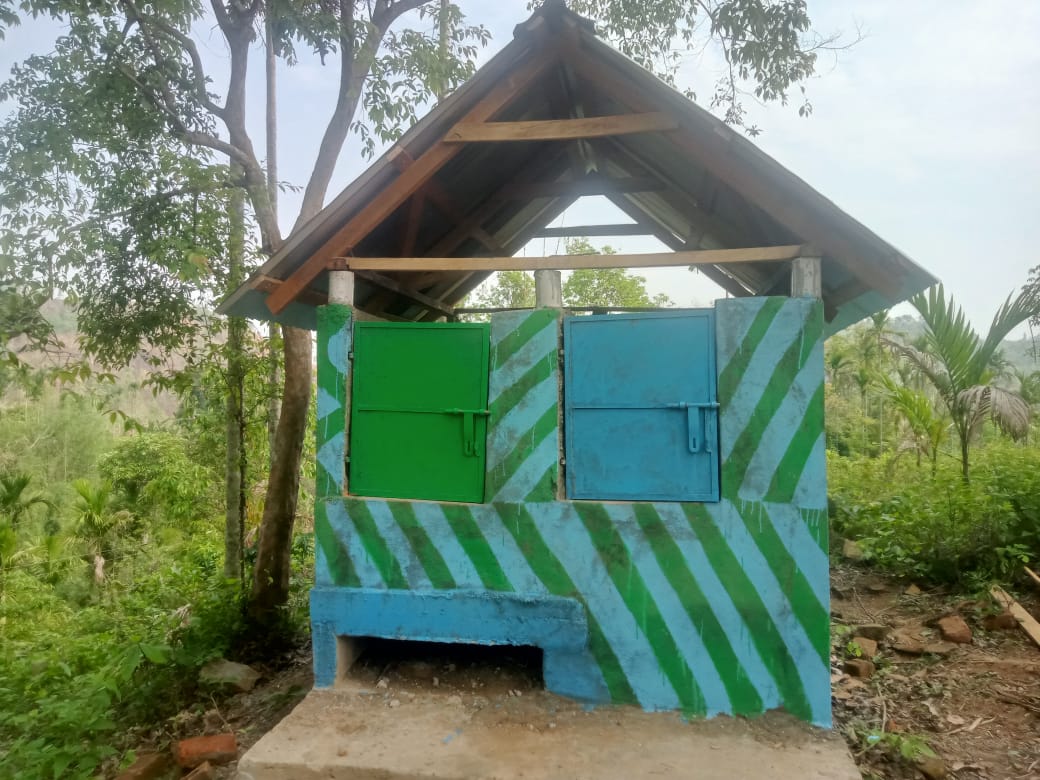
| VERMICOMPOSTING (10 UNITS) | NONGTHYMMAI | 3,32,460 | 21.12.2020 | COMPLETED |
| NAME OF THE INTERVENTION | SITE NAME | AMOUNT | DATE OF COMPLETION | WORK STATUS |
|---|---|---|---|---|
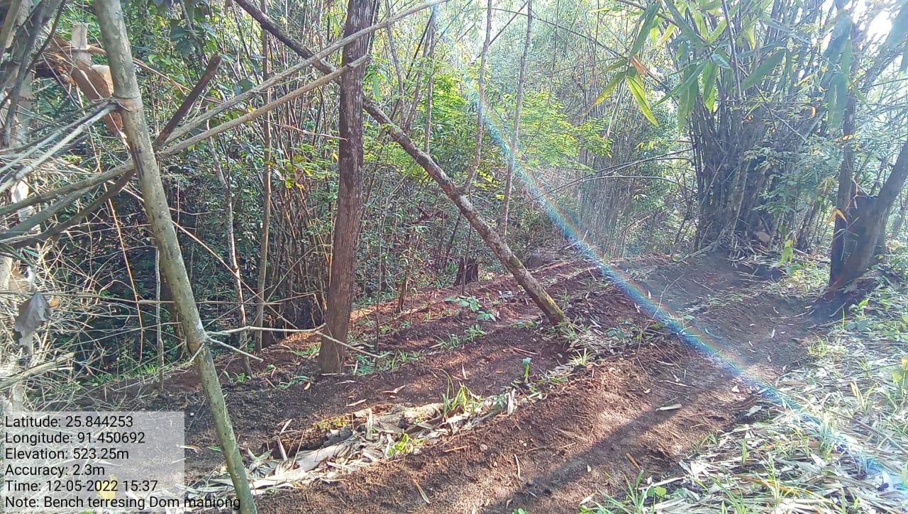
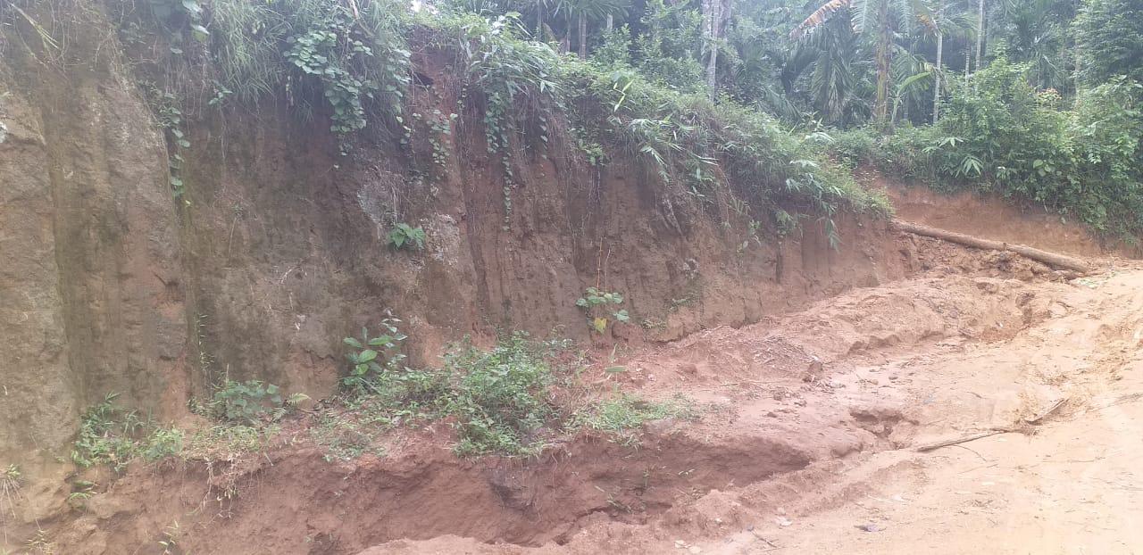
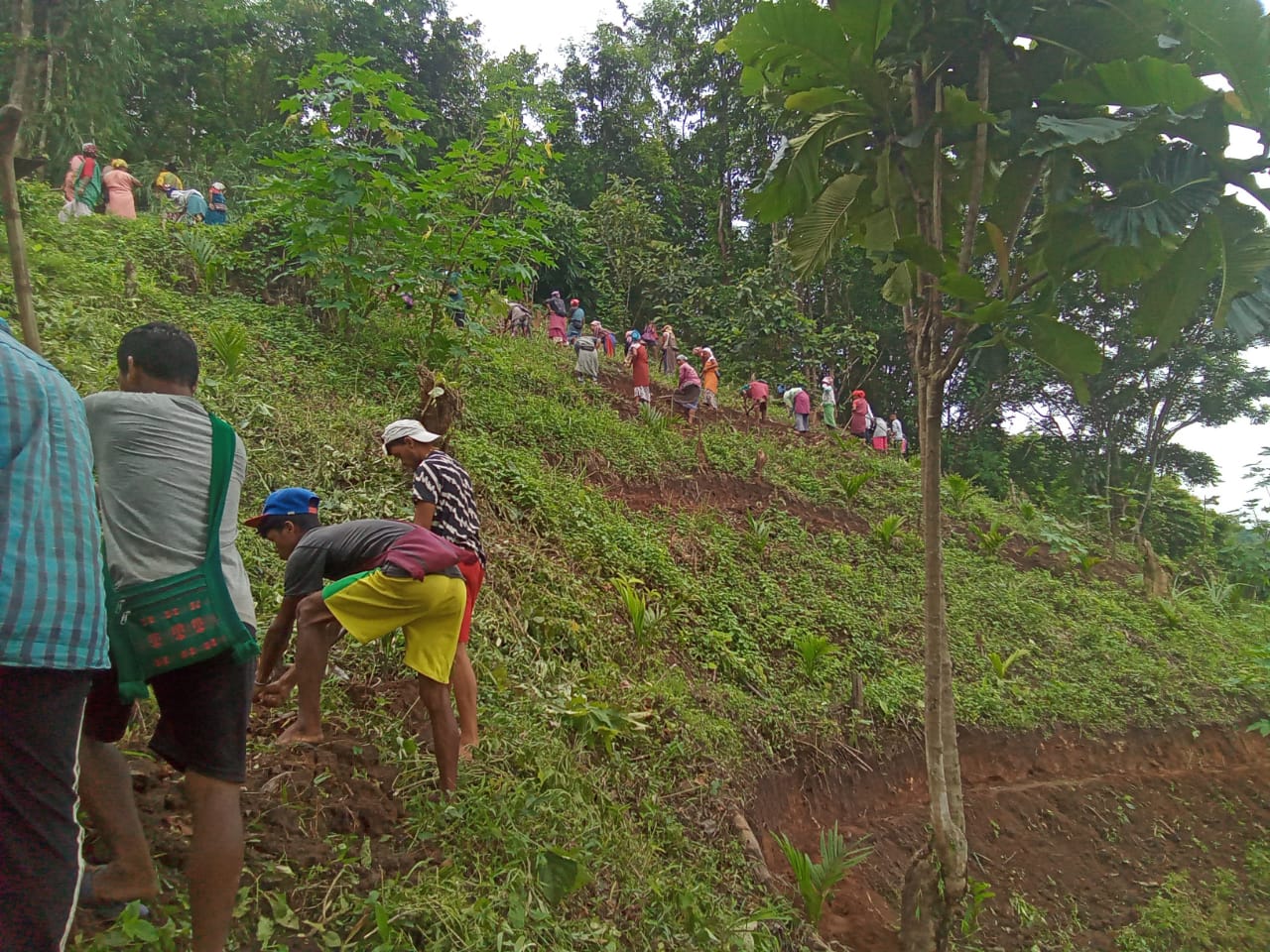
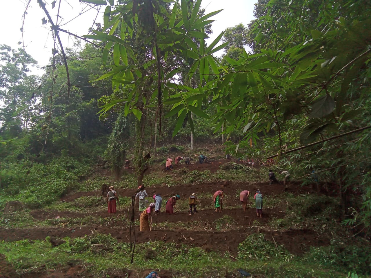
| BENCH TERRACING | DOM MAHIONG KHLAW SHNONG | 3,25,000 | 15.09.20 | Completed |
| NAME OF THE INTERVENTION | SITE NAME | AMOUNT | DATE OF COMPLETION | WORK STATUS |
|---|---|---|---|---|
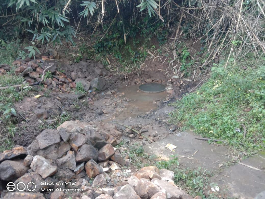
| SPRING CHAMBER | NONGTHYMMAI UMMAHIONG | 67,080 | 18.12.20 | COMPLETED |
| NAME OF THE INTERVENTION | SITE NAME | AMOUNT | DATE OF COMPLETION | WORK STATUS |
|---|---|---|---|---|
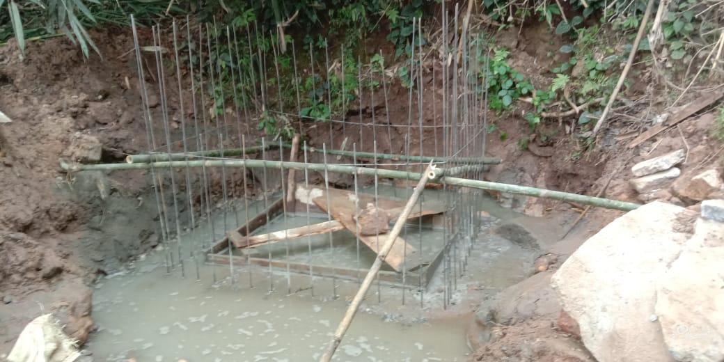
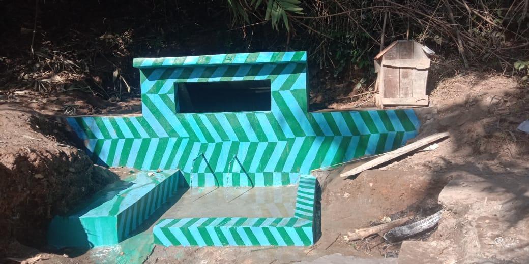
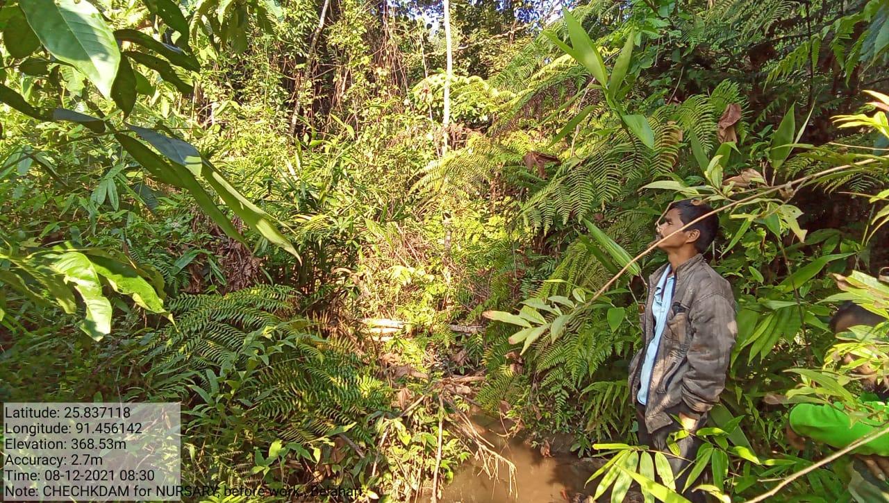
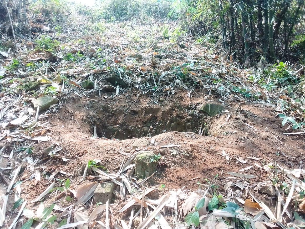
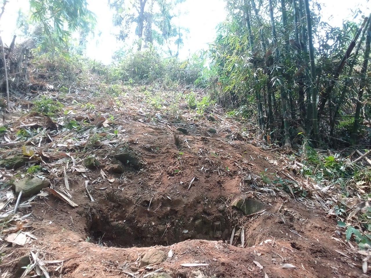
| CHECK DAM | Um Mahiong | 1,50,240 | 30.12.19 | COMPLETED |
| NAME OF THE INTERVENTION | SITE NAME | AMOUNT | DATE OF COMPLETION | WORK STATUS |
|---|---|---|---|---|
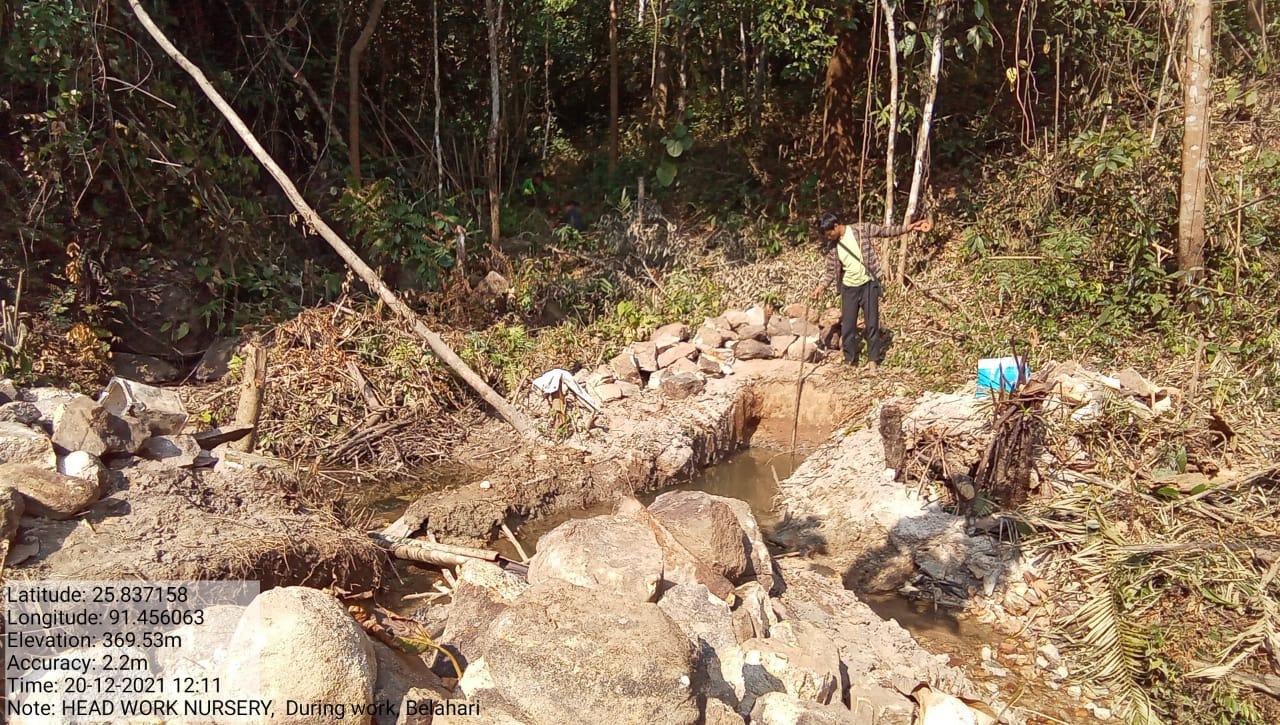
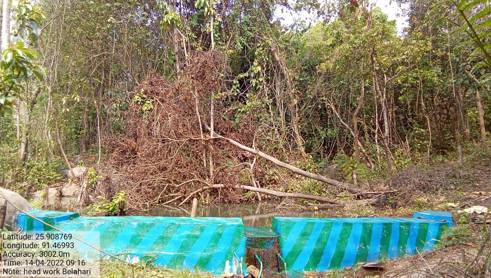
| HEADWORK | Nongthymmai Um Mahiong | 2,00,000 | 13.12.21 | COMPLETED |
| NAME OF THE INTERVENTION | SITE NAME | AMOUNT | WORK STATUS |
|---|---|---|---|
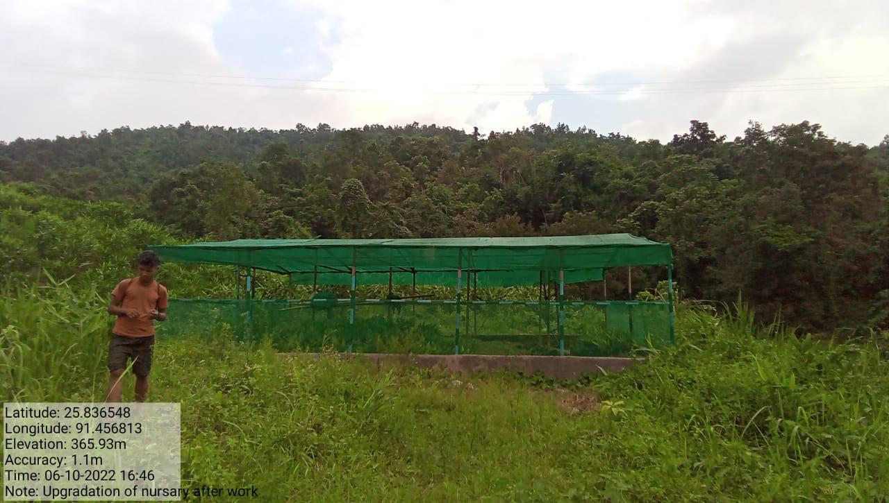
| Upgradation of Nursery | Nongthymmai | 3,00,000 | COMPLETED |
| NAME OF THE INTERVENTION | SITE NAME | AMOUNT | DATE OF COMPLETION | WORK STATUS |
|---|---|---|---|---|
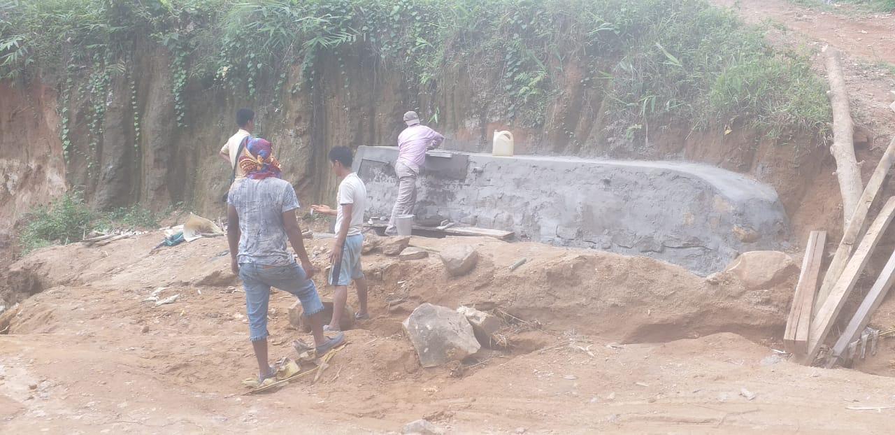
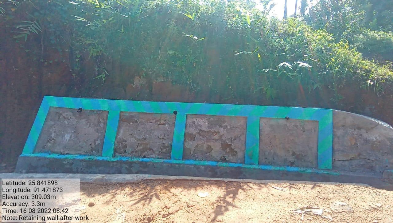
| Retaining Wall | Dorbar Hall | 2,00,000 | 16 Aug, 2022 | COMPLETED |
| NAME OF THE INTERVENTION | SITE NAME | AMOUNT | DATE OF COMPLETION | WORK STATUS |
|---|---|---|---|---|
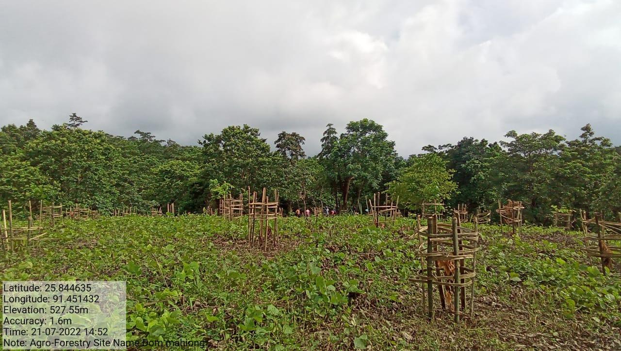
| Agro-Forestry | Khlaw Shnong Dom Mahiong | 2,19,788 | 25, Aug, 2022 | COMPLETED |

| NAME OF THE INTERVENTION | SITE NAME | AMOUNT | DATE OF COMPLETION | WORK STATUS |
|---|---|---|---|---|
| Fire line control 2 | Kper soh vnrmc | 84,982 | 28.04.22 | Completed |
| NAME OF THE INTERVENTION | SITE NAME | AMOUNT | WORK STATUS |
|---|---|---|---|
| Waste Plastic bin | Hall dorbar | 1,10,000 | Completed |
| Intervention | Site name | Amount | Status |
|---|---|---|---|
| Contour trenches | Umland | 33,950 | Completed |

| Intervention | Site name | Amount | Status |
|---|---|---|---|
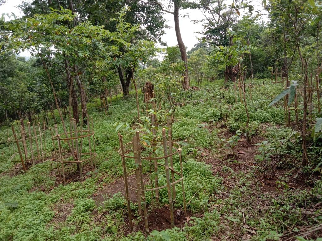
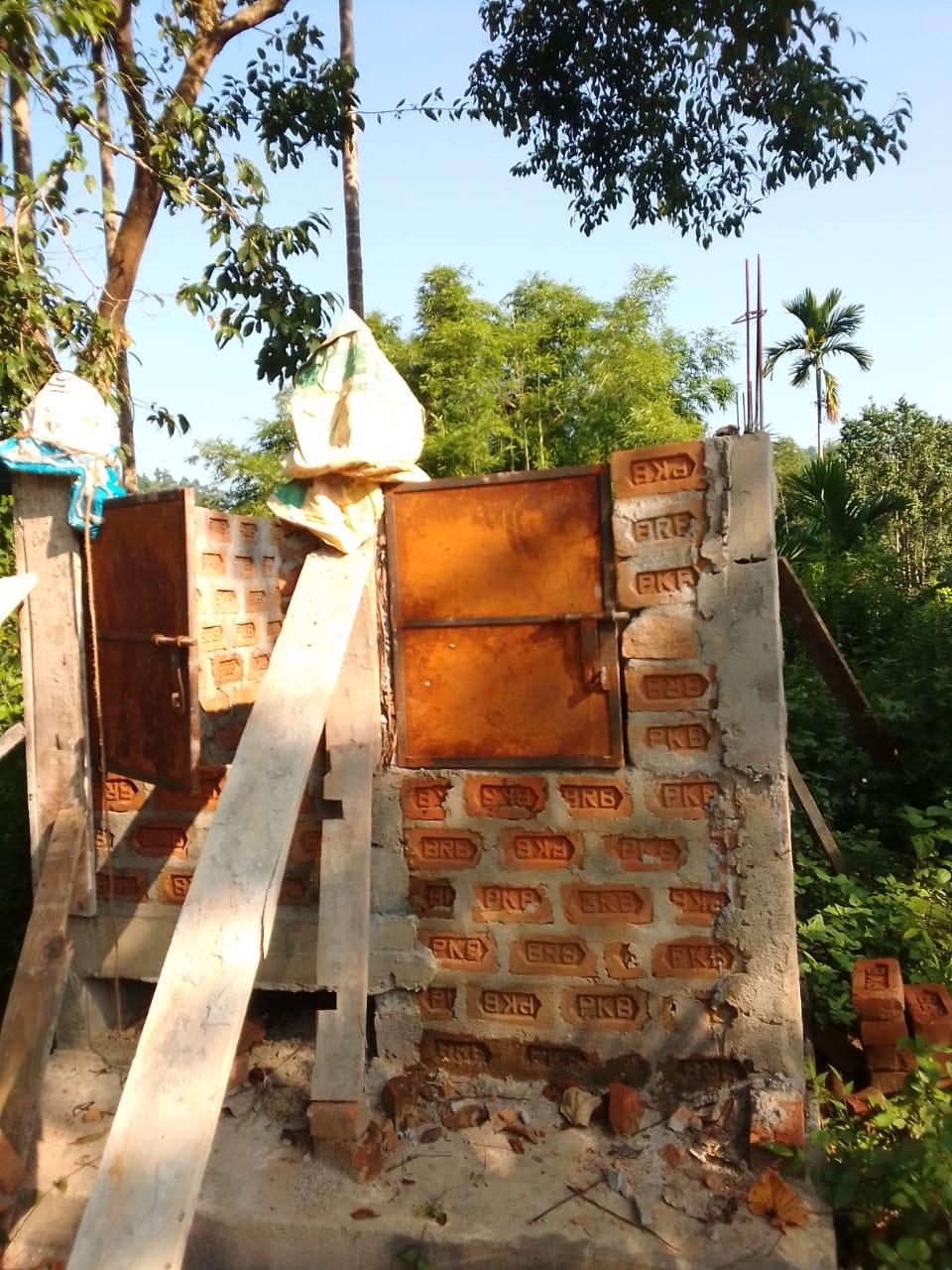
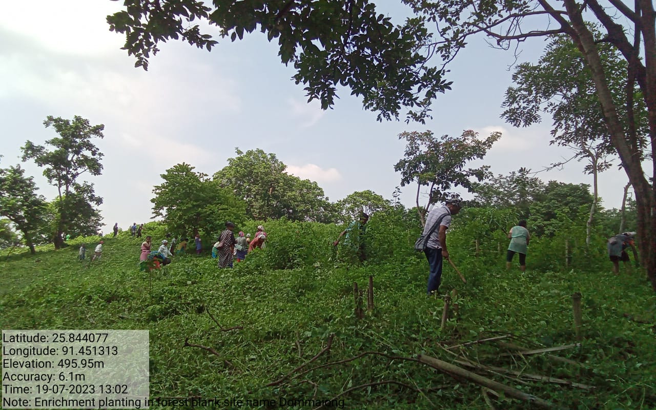
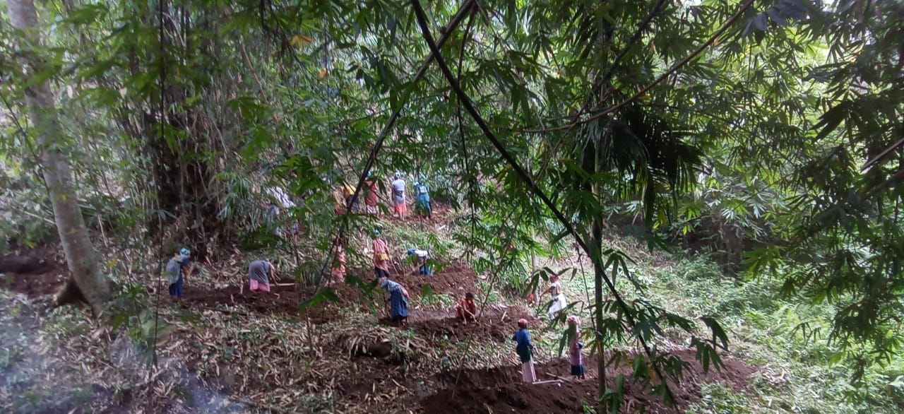
FMP Activities 1.Fire Control Line Cum Bio Fencing 2. Assisted Natural Regeneration in Open Forests (Bench Terrace and Afforestation) 3.Assisted Natural Regeneration in Open Forests (Contour Bund) 4.Nursery for Food Forestry (Sapling for the Existing Nursery) 5.Community Forest Boundary Survey 6.Enrichment planting in forest blanks 7.In-situ & Ex-situ conservation of rare and endangered plants |
Under Community Land (All) | 400073 250000 155868 11000 8000 158049 18000 |
Completed (ALL) |
| Intervention | Site name | Amount | Status |
|---|---|---|---|
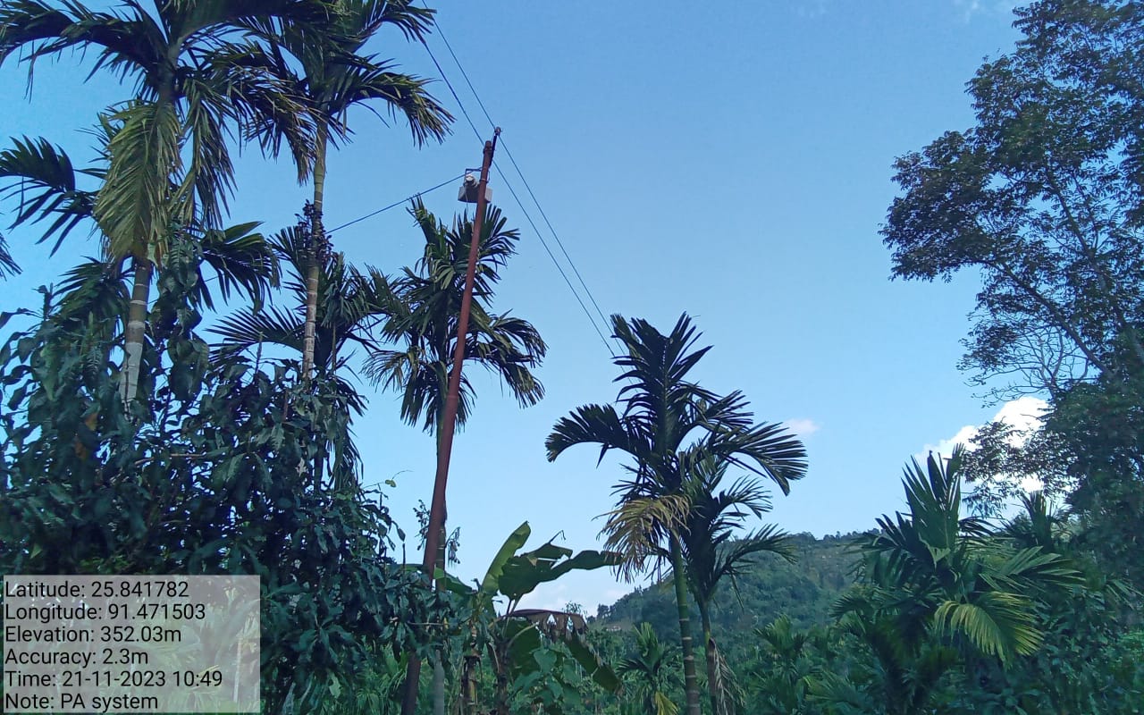
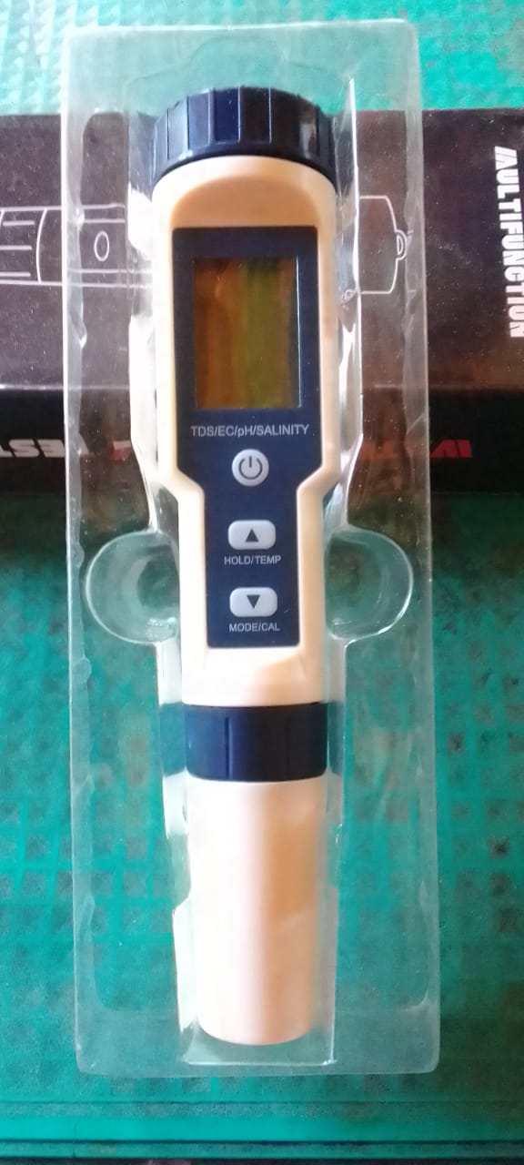
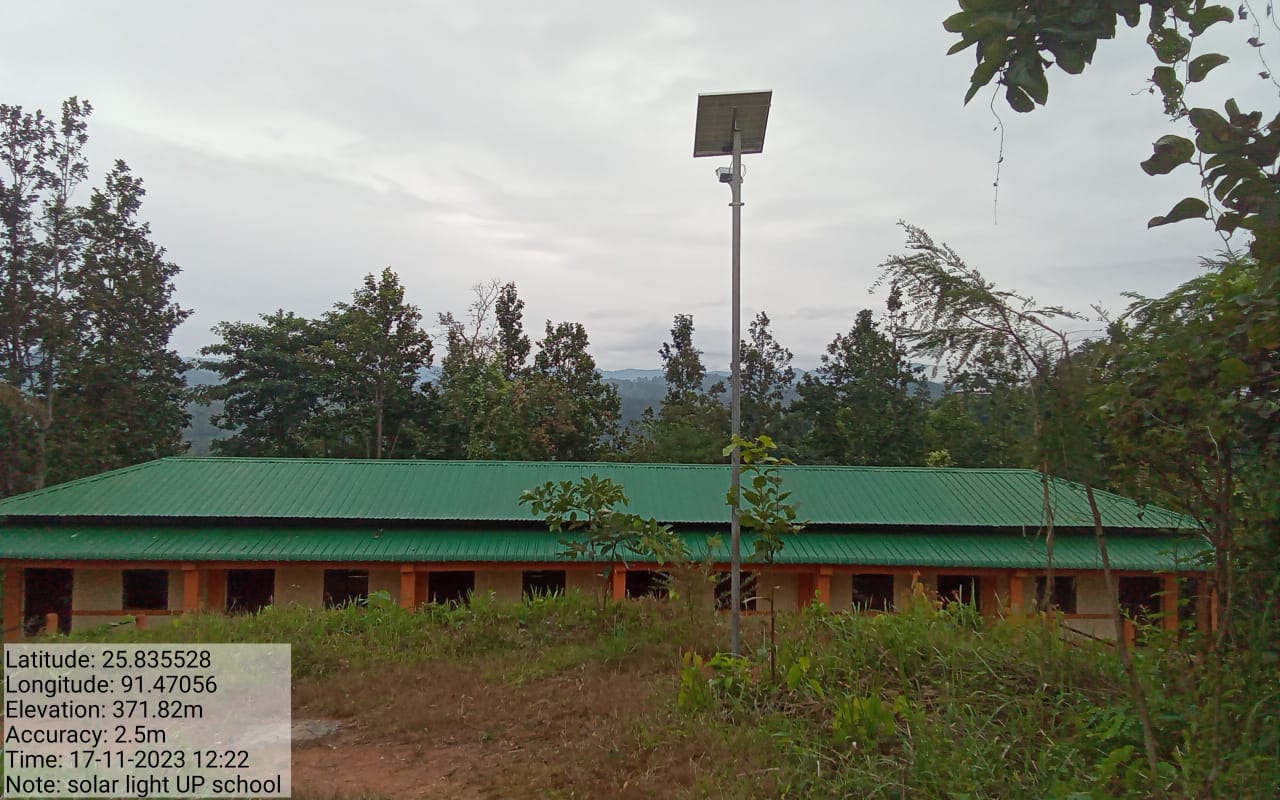
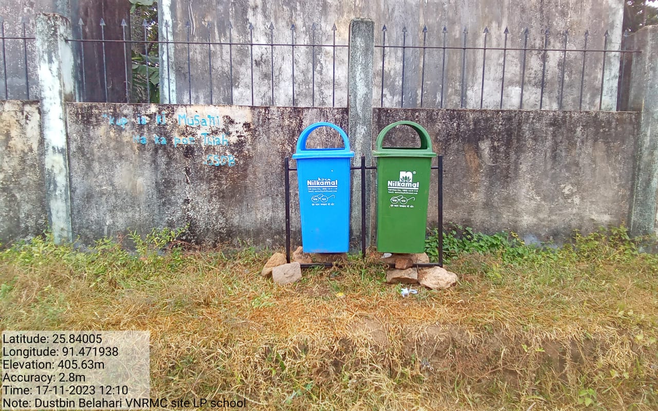
Excess fund Ativities PA system Water tester Solar lights Dustbins |
Alll under community land | 1,45,000 | Completed |
TESTIMONIALS
PRESIDENT- Active Pator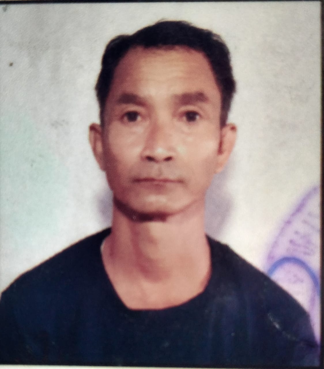
It's wonderful to see how the project has brought numerous benefits to our village, focusing on environmental preservation and sustainability. The list highlights key positive outcomes that demonstrate a commitment to both the local ecosystem and the well-being of the community that was carried under the Project:
Environmental Preservation: The project's emphasis on preserving the environment reflects a collective effort to protect the natural beauty and resources of your village. This has long-lasting benefits for both the present and future generations.
Water Source Preservation: Protecting water sources is essential for ensuring a consistent and clean water supply for the community's needs. Preserving these sources helps maintain the overall health of the ecosystem.
Tree Preservation: The focus on preserving different types of trees acknowledges the importance of biodiversity. Trees play a crucial role in supporting wildlife habitats, improving air quality, and preventing soil erosion.
Tree Planting: The initiative to plant more trees contributes to afforestation and reforestation efforts. This not only enhances the beauty of the surroundings but also supports ecosystem balance and provides valuable resources.
Contour Trenches: Implementing contour trenches is a sustainable practice that helps manage water runoff, prevent soil erosion, and promote efficient water usage in agriculture.
The project's contributions go beyond the immediate benefits by fostering a deeper understanding of environmental stewardship and encouraging sustainable practices. These positive changes serve as a testament to the efforts of the community and the impact of the project. It's heartening to witness how these initiatives are making our village more resilient and environmentally conscious
SECRETARY- Kristina Lapang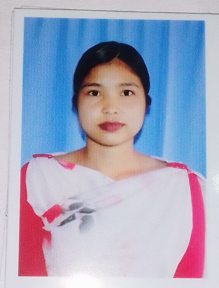
It's clear that the project has brought valuable education, empowerment, and positive change to our village. The benefits of the same can be highlighted below and it encompasses various aspects of environmental preservation and community development:
Education and Empowerment as Secretary: My role as a secretary has provided me with practical skills such as reading, writing, and understanding rules. These skills can have a lasting impact on my personal growth and ability to contribute to your community.
Environmental Preservation and Crop Protection: The project's teachings have focused on both preserving the environment and protecting crops. This holistic approach likely includes sustainable farming practices that maintain ecosystem health while ensuring agricultural productivity.
Preservation of Forest and Water Sources: The project's emphasis on preserving the forest and water sources is crucial for maintaining the balance of the ecosystem. This effort helps ensure the availability of natural resources for current and future generations.
Diverse Benefits: The project's multifaceted approach has provided our village with a variety of tasks and activities that contribute to environmental betterment. This diversity of work creates a comprehensive impact on the surroundings.
The combination of education, empowerment, and practical actions is a powerful way to drive positive change in a community. The role as a secretary has allowed me to bridge the gap between the project's goals and the community's understanding. It's evident that the project is not only contributing to environmental preservation but also fostering personal growth, community engagement, and a stronger sense of stewardship for the environment.
VCF-SOCIAL- Banlumlin Syngkli
My commitment and dedication as a Village Community Facilitator (VCF) is to promote social management, knowledge management, and environmental protection in the village. All efforts, along with the project's initiatives, have brought several significant benefits to your community, of which some of those are:
Youth Employment: The project's creation of jobs for the youth is crucial for local economic development. Providing employment opportunities can lead to improved livelihoods and engagement among young members of the community.
Forest Preservation: The project's focus on preserving the
existing forest and planting new trees is vital for maintaining
biodiversity, mitigating climate change, and ensuring the health of
local ecosystems.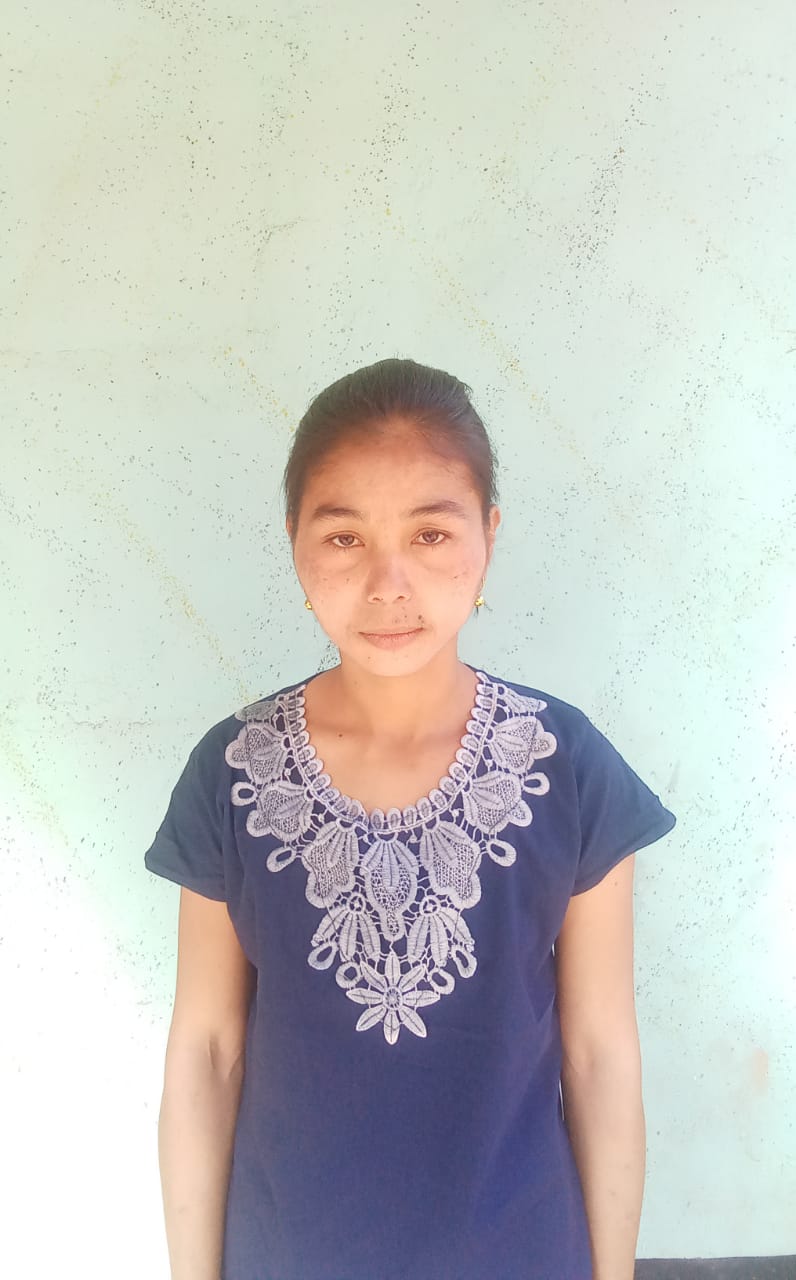
Water Source Preservation: The emphasis on preserving water sources, especially drinking water, is essential for community health and well-being. Protecting these sources helps ensure a reliable and clean water supply.
Income Generation: The project's introduction of vermicompost and nursery practices offers opportunities for community members to generate income. This economic aspect contributes to the overall sustainability of the project and the community.
Personal Development as VCF: The involvement as a VCF has provided me with invaluable experiences and knowledge. Attending different training sessions and caring for the environment not only benefits me but also equips me to guide and inspire others.
Gratitude and Impact: My gratitude for the project's presence in our village reflects the meaningful impact it has had on both me and the community as a whole. The Village Facilitators efforts are contributing to a more sustainable and prosperous future.
At the end, the overall work of the project showcases a holistic approach to community development that integrates environmental stewardship, economic growth, and personal empowerment. And the role as a VCF reflects the importance of individuals taking initiative to drive positive change. The dedication not only benefits the immediate community but also sets an example for others who may be inspired to engage in similar initiatives.