The Government of Meghalaya with financial help from the World Bank is implementing the Meghalaya Community Led Landscape Management Project (MCLLMP). The project will cover the entire state of Meghalaya and implementation of community led plans will be rolled out in phase manner throughout the state. The Meghalaya Basin Management Agency (MBMA) will facilitate community-led planning by providing support, technical inputs and funding.
The project is intended to strengthen community-led natural resources management in selected landscapes within the 11 districts of the state. This would be achieved through a variety of planning, capacity building, and on-the-ground interventions to promote the conservation, sustainable use of natural resources, social inclusion and community mobilisation; building traditional knowledge and learning, mapping of natural resources management; strengthening the community institutions and creating linkage with financial institutions and community organizations.
The project interventions include preparation of community led natural resource management plans. The CLLMP has the following three components:
Strengthening Knowledge and Capacity of Communities for Natural Resources Management
Community-Led Landscape Planning and Implementation
Project Management and Governance
The project objective is “to manage and conserve the natural resources, especially forests, soil and water sources, in a manner that supports the financial and physical well-being of communities in the State”
The CLLM-Programme focuses on increasing the capacities of communities and traditional institutions (TI) by adopting a landscape approach to manage their natural resources such as soil, springs and other water sources, forests and bio-diversity, etc.
The project will be planned and implemented in about 400 villages across the state.
CLLMP has a strong focus on institution-building at the village-level, by ensuring systematic capacity-building on technical and social skill-sets.
The project will also extend such training to communities beyond the targeted villages and support efforts made by them to access funding from various rural and natural resources initiatives and schemes.
The programme will also invest in improving the process and outcome delivery, by developing and adhering to effective systems and procedures, supported by the appropriate technology.
Benefits for community (Skills and Capacity relating to technical and managerial areas like NRM and Conflict resolution
Benefits to traditional institutions (village councils, traditional leaders, community-based organizations, SHGs etc) through Knowledge sharing, promotion of innovative approach, access to technology, technical managerial and financial support.
It is estimated that the project will impact around 1 lakh partners (of which 50% are women) who depend on land, forest, agro forestry.
Through the project, 55000 Ha of targeted area will be ensured with availability of water, biological resources and soil productivity, which will in turn benefit around 400 villages and the outcomes delivery can be summarized as follows.
The Project is executed by the MBMA in collaboration with other partners particularly, SIRD (for training and capacity building), Department of Soil and Water Conservation, Water Resource Department, Forest Department, specifically with respect to technical inputs, safeguards management and Community NRM plan preparation
2018-2023 (5 years)
Introduction
Mawbsein Village falls under Bhoi Rymbong C&RD block of Ri-Bhoi district in the state of Meghalaya. The Village is at a distance of 65 Kms from Nongpoh, the district headquarter of Ri Bhoi District and is at a total distance of 35 Kms from the state capital, Shillong.

Brief History
Mawbsein village is located at the edge of Ri-bhoi to the Eastern part of the district under the Raid Madan Kyrdem, Hima Khyrim. About 3 ⁄ 4 of this village is surrounded by the Umtung River and Umklew River. The foundation of this village was laid in 1947 by a man named Semicolon Pale along with a lady by the name of Rida Kharsati when this area was just a part of Raid Madan village. After a few years a few more households belonging to the Lamin, Lyngdoh Kyndar, and the Sten tribe came to settle down in this area. This area was known as the Mawbsein (snake rock) colony since the past as there is a rock in the village that looks like a snake lying on its belly. As time passed more people came to settle down in this area and in the year 1957 it received recognition as a full-fledged village under Raid Madan and it was decided to name the village as Mawbsein with Francis Masharing as the Headman.
The area of the village is around 8 Km/sq. and around 500 acres of the village land is preserved as village forest for the village use, to keep the environment clean and to conserve the indigenous flora and fauna. It is prohibited to cut trees indiscriminately in this forest or to do any kind of cultivation in the forest. In the village there are a few areas which can be transformed into tourist hotspots like Mawbsein Rock, Sadhu cave, Mawtari and Mawkner but the village has not been able to do anything till date towards this end.
Around 90% of the villagers are farmers and the rest 10 % are either traders and merchants or Government employees. The soil in the village is quite fertile and is used to cultivate ginger, rice, corn, tomatoes, potato, chilies, legumes etc. In the year 1957 missionaries of Christianity came to the village and churches were set up in the village, centers for learning were also set up. Now there are 7 schools including 3 Higher Secondary Schools in the village, 3 I.C.D.S centers, Asha center, and Primary Health sub-center. With the existence of these various departments’ centers in the village it is quite beneficial to the village.
After 58 years passed since the foundation of the village, the village has grown significantly in terms of households and population and hence it was unanimously decided to divide the village into 4 new villages in the year 2014 as the leaders of the village were finding it difficult to look after a large village with so many people, these 4 new villages were Mawbsein Lum Mission, Mawbsein Lumsohlang, Mawbsein Mawlong and Mawbsein Dieng sohmaud. After the division the leaders still looked after these villages to ensure that they were self-sufficient and well to do. These 4 villages received proper recognition from the Raid, Hima and various offices like C&RD Block, D.C Office, they also received NOCs from the District Council. All the 4 villages have received their individual Village L.G.D Code and all that’s left now is to receive the Census Village Code. As of now there are 507 households in Mawbsein and the population exceeds 3000 people.
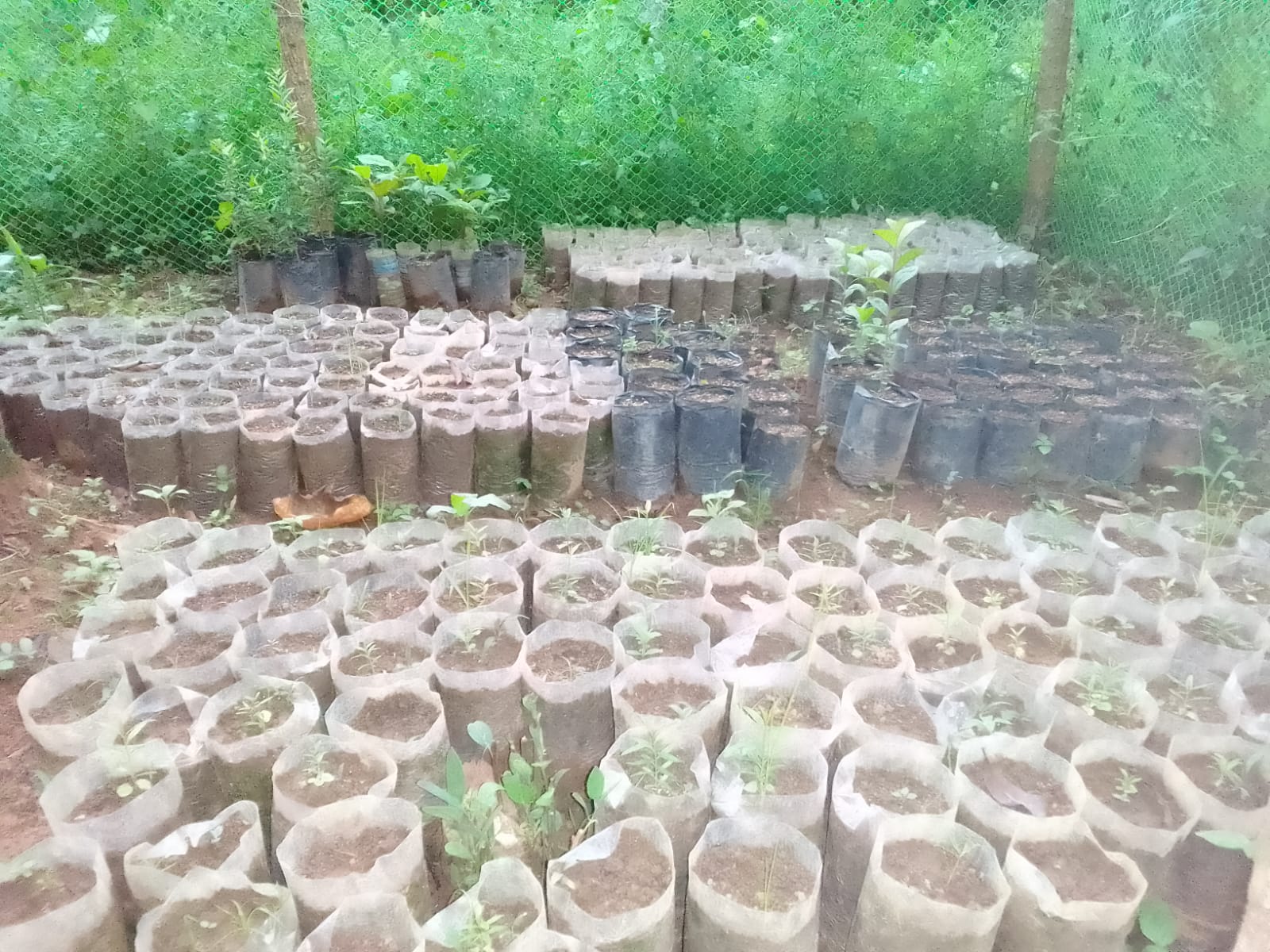
Until the year 2010 Mawbsein village was lacking in various areas of development as a village. With the coming of MGNREGA project in 2010 many visible changes of development could be seen throughout the village and it helped increase the average village income by almost 30%. And in the month of October of the year 2019 the village was fortunate enough to be able to receive the CLLMP Project from the Basin Development when this project was first started in the Ri-Bhoi District. With the coming of the CLLMP Project in the village many significant changes could be seen in the village especially regarding the preservation of the environment, cleanliness and with these also came good health. Until date there have been 7 areas of implementation of projects done through CLLMP in this village and the villagers have benefited a lot from these projects and the village hopes that this will continue in the future so that the village will be able to develop further and stand on the same stage as other more developed villages.
Social Profile
Mawbsein village is located in Bhoirymbong Block of Ri-Bhoi District, in the state of Meghalaya. It came into existence in the year 1957. The distance from the District Headquarter to Mawbsein is 65 kms and the village is under the supervision of the Rangbah Shnong. The total number of households is 457 and having a population of 2723 people. Agriculture and its allied activities are highly in vogue, where some few others are also enrolled in government and teaching jobs.
There are a number of streams and springs in and around the village. The main source of livelihood is agriculture. The Village not only produces cash crops but also various fruits, vegetables, tomatoes and Broom-Grass.
There are five schools inside the village, three of which are Primary Schools and two are the Secondary School, Mawbsein. The Primary Health Centre is 5 km away and the Community Health Centre is 14 km away; the nearest Bank is about 14 km away and the Post office is also 4 kms from the village.
Population 
As per Census 2011, Mawbsein population is 2042 and in 2020 the total population of Mawbsein has increased to 2723. Out of this, 1415 are males and 1308 are females. The village has 462 children in the age group of 0-4 years. Among them 232 are boys and 230 are girls.
| Age Group | Male | Female | Total |
|---|---|---|---|
| 0-4 | 232 | 230 | 462 |
| 5-14 | 425 | 350 | 775 |
| 15-30 | 495 | 479 | 974 |
| 30-60 | 210 | 189 | 399 |
| Above 60 | 53 | 60 | 113 |
BPL/APL Household:
| Particulars | No. of HH |
|---|---|
| BPL HH | 331 |
| APL HH | 22 |
Card Holding Household:
The village has a total number of 296 Health cardholders, 343 Ration cardholders out of which 331 households belong to BPL and 22 belong to APL. The major occupation of the people is farming while some are teachers, drivers, carpenters/mason, engineers and Business.
| Particulars | No. of HH |
|---|---|
| Total HH | 457 |
| Ration Card HH | 343 |
| Health Card HH | 296 |
Fuel Type:
| Fuel Type | Total HH |
|---|---|
| Charcoal | 0 |
| Biomass | 0 |
| Wood | 400 |
| LPG | 0 |
| Electric Heater | 57 |
| Kerosene | 0 |
OCCUPATION:The people of the village rely on
agriculture and forest products for their livelihood. The main
occupation of the villagers is farming followed by driver,
carpenter/mason, teacher, Govt. Servant and some other business.
Education: They have only two (Primary school) and three (Secondary school) in the village.
CLLMP ACTIVITIES
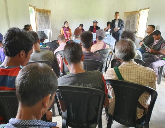
Ground Truthing Dated: 29th of May 2019
The CLLMP team met withMr Francis Masharing, the headman of Mawbsein Village on the 29th of May 2019, who was able to provide the team with the required details for site verification.
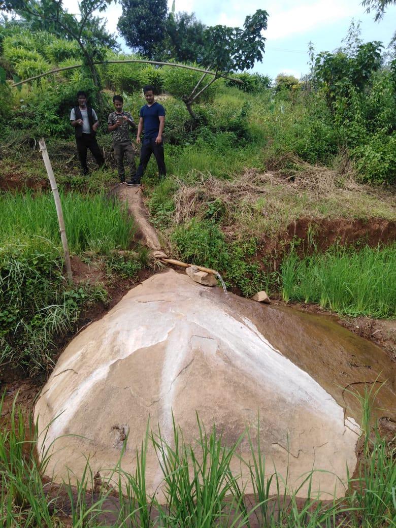
Figure 1 : Ground-truthing at Mawbsein Village.
Case Findings & Selection parameters: -
1. There are 457 Households out of which 331 Households fall under the BPL category.
2. One main water source outside the village under a combined scheme from PHE Dept. Of four villages (Mawnohsynrun, Mawblang, Nongpyrdot and Mawbsein).
3. Actively performing VEC.
4. Approximately 30 acres of community forest which they want to preserve.
5. About 15 springs which they want to develop.
6. 90% of the HH cultivated tomatoes and required intervention in organic farming.
7. The village has four hamlets each with their hamlet head’s.
The Village has been selected under the Community Led Landscape Management Project
2. Sensitization Programme Dated: 16.07.2019
The District Project Manager and the Assistant Managers held a village Level sensitization Programme on the Community Led Landscape Management project on the16th of July 2019.The community members actively participated in the program, voicing out their concerns and questions regarding the project making it a huge success. A total of 26 community members attended the program out of which 3 are female and 23 are male.
The CLLMP officials gave a brief introduction on Meghalaya Basin
Management Agency (MBMA) and explained about the various programmes
and projects that MBMA is working on, they then gave a detailed
introduction on the Community led Landscape Management Project
(CLLMP) and the different aspects and procedures that the villagers
and the CLLMP team should carry out during the course of the project
and the importance of the involvement of the community for the
CLLM-Project to be a success. They gave due importance to the
environmental aspects of the project and enlightened them on the
various benefits that the villagers could obtain from the
project.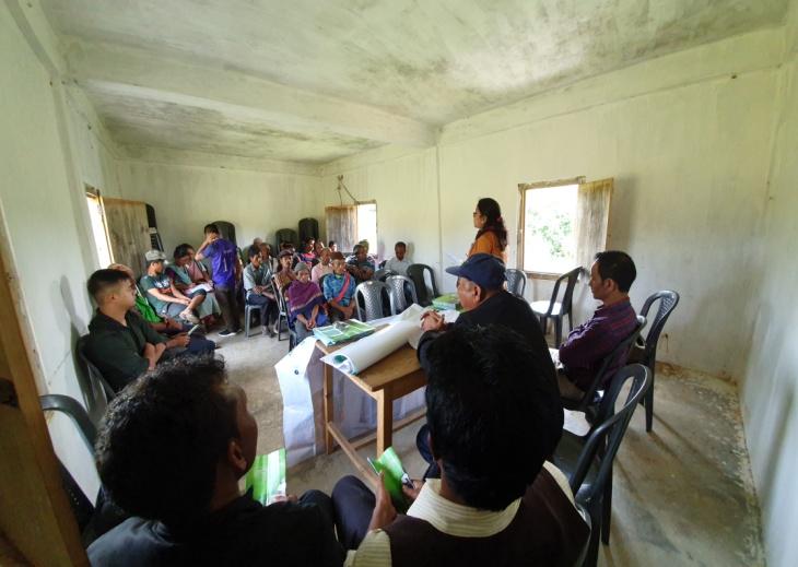
The Program was followed by an interactive session to answer the doubts and questions of the villagers some of which are mentioned below.
2.2 Signing of Documents: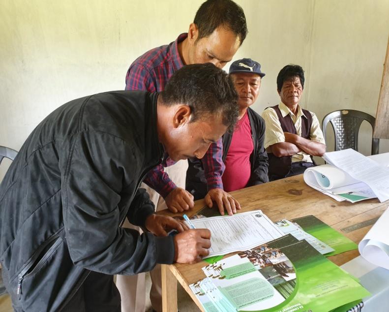
After the interactive session, the village signed the EOI, VGA and Green charter followed by the selection of candidates for the Village Natural Resource Management Committee. The Village Executive Committee (VEC) and the entire community carried out the procedure and elected the members of the VNRMC on the same day.
2.3 Formation of the VNRMC
The Formation of the Village Natural Resource Management Committee was done in a public meeting in the presence of the entire village and the CLLMP staffs. The community itself chose the President, the Secretary and the other executive members of the Committee.
Listed below are the members of VNRMC:
|
|||||||||
|---|---|---|---|---|---|---|---|---|---|
|
Name in Full | Designation | Gender M/F | Age (Yrs) | Education | Occupation | Community | Religion | Contact No |
|
Francis Masharing | President | M | 48 | III | Farmer | Khasi | Christian | 9378180557 |
|
Kristina Synnah | Secretary | F | 51 | X | Farmer | Khasi | Christian | 9383297519 |
|
Lamkupar Nongrum | Book Keeper | M | 29 | BA Passed | Self employed | Khasi | Christian | 8787723612 |
|
Drun Nongrum | Member | M | 50 | II | Farmer | Khasi | Christian | 9366981049 |
|
Obernes Synnah | Member | M | 35 | VI | Farmer | Khasi | Christian | 7005380681 |
|
Albinus Nongrum | Member | M | 52 | III | Driver | Khasi | Christian | 6009250698 |
|
Aimeris Nongrum | Member | F | 37 | IX | Aganwadi | Khasi | Christian | 9383295835 |
| 8 | Kwinsila Nongrum | Member | F | 49 | VIII | Asha | Khasi | Christian | 6009183819 |
| 9 | Pdianghok Nongrum | Member | F | 30 | IX | Farmer | Khasi | Christian | 6009281101 |
| Village Community Facilitators | |||||
|---|---|---|---|---|---|
| Name | Gender | Age | Education | Contact Number | Role |
| Donbok Nongkhlaw | M | 31 | X | 9366995704 | Project Management (M & E) |
| Trisila Nongrum | F | 28 | XII | 9366549394 | Social & Knowledge Management |
| Ephrenstar Lyngdoh | M | 29 | IX | 8837249704 | Environment & GIS |
| List of Procurement Committee Members | ||||||
|---|---|---|---|---|---|---|
| Name | Gender | Age | Education | Occupation | Community | Contact Number |
| Self employed | ||||||
| Veronica Lyngdoh | F | 28 | XII | Khasi | 6009185623 | |
| Rosical Synnah | F | 44 | VIII | Farmer | Khasi | 6009411971 |
| Robin Mukhim | M | 48 | III | Farmer | Khasi | 7005902998 |
3. Opening of a Bank Account.
The opening of the bank account was initiated after the village signed the EOI (Expression of Interest), the VGA (Village Grant Agreement) and the Green Charter. Mawbsien village opened their VNRMC account after this.
The Accountant of CLLMP Team Ri Bhoi District trained the Purchasing and Procurement Committee of Mawbsien village and discussed various topics regarding the accounts related matters.
Topics Covered:
Principles of Community Procurement
Benefits of Community Procurement
Important aspects undertaken by Community Procurement.
Procurement Process/Steps
Function of Purchase Committee
Important Procurement records to be maintained
Financial limits and methods
4. Participatory Rural Appraisal Exercise
The PRA exercise aims to incorporate the knowledge and opinions
of the community in the planning and management of development
projects and programmes. PRA exercise at Mawbsein Village took place
on the 21st of September 2019. There were a total of 270 villagers
who participated in this exercise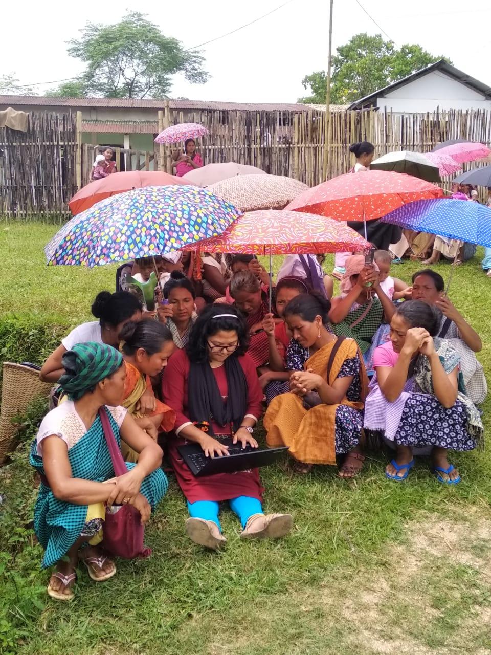
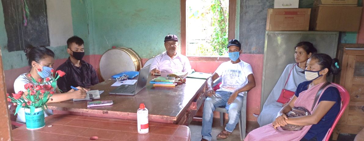
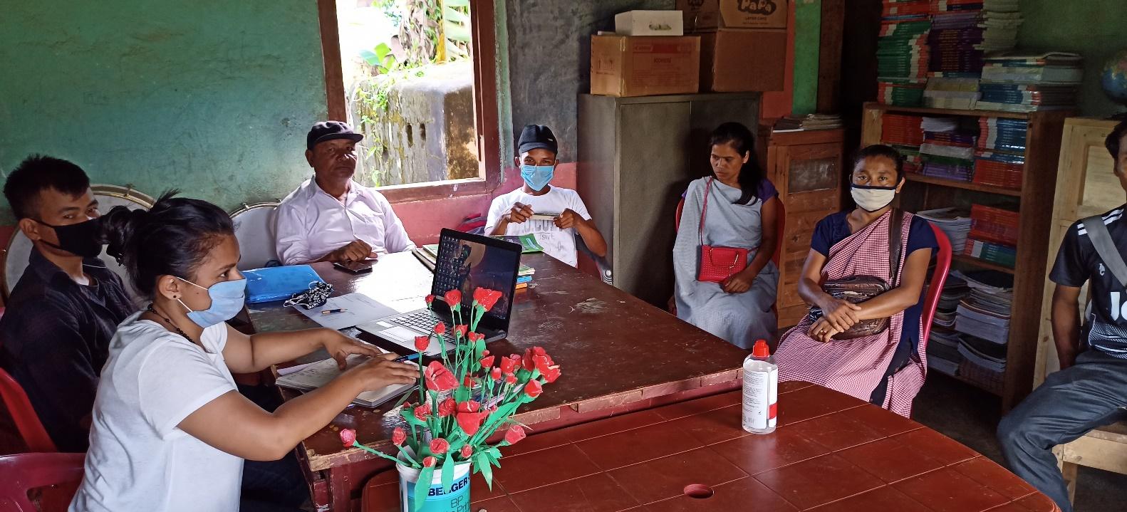
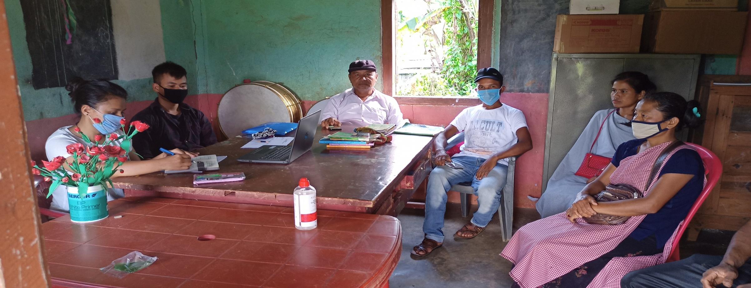
On the 21th of September 2019, The Assistant Manager (Social Management), Mrs. Baiahunlang Kurbah spoke on the social aspects of the Community Led Landscape Management Project by giving numerous examples. She also enlightened the various benefits that the villagers could obtain from the project.
The initial stage of Participatory Rural Appraisal (PRA) exercise at Mawbsein Village, commenced with a meeting cum orientation program on CLLMP. While conducting the meeting, the community members were made aware of the various PRA exercises to be conducted for the development of the Community Natural Resource Management Plan (CNRMP) of the village, the community members’ contribution in the exercise and the objectives to be achieved. The key informants (the VNRMC and the VCFs) helped facilitate maximum participation. The dates and time for conducting the various Participatory Rural Appraisal (PRA) exercises were fixed in consultation with the community members and all were requested to participate in the exercise. The schedule and time was announced at the end of the meeting.
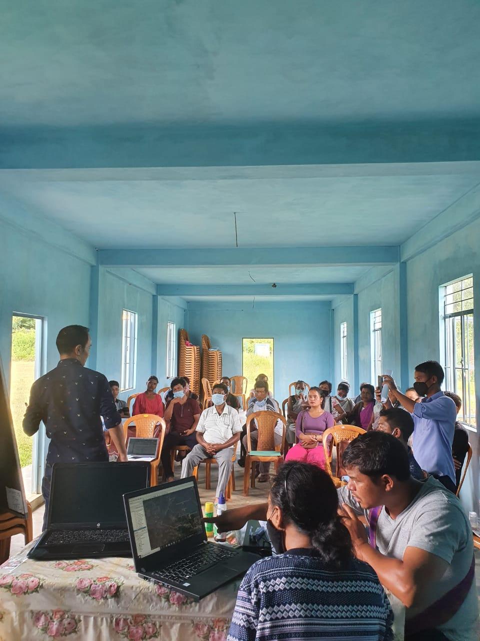
The Deputy Project Director (NRM) of the Community Led Landscape Management Project discussed the different types of plans that can be adopted by the village and stressed on the need for more holistic and sustainable plans which will benefit the community as a whole.
The SPMU Team also held a separate discussion with the DPMU CLLMP Team to discuss the Community Natural Resource Management Template and the various activities that will be undertaken during the PRA week.
.
Participants on the 21.09.2019:
CLLMP officials:Shri VS. Buhphang (DPM), Smt. Baiahunlang Kurbah (AM, Social Management), Shri. Reuben Shabong (PA EM), Shri. Ebrin Synnah ( Field Engineer) and DPMU CLLMP team.
Community members:Shri. Francis Masharing (President), Kristina Synnah (Secretary), Lamkupar Nongrum (Book-Keeper) Smt. Kwinsila Nongrum, Smt. Aimeris Nongrum, Shri. Albinus Nongrum, Shri. Obernes Synnah, Shri. Drun Nongrum, Smt. Pdianghok Nongrum (VNRMC Members), Shri. Donbok Nongkhlaw, Smt. Trisila Nongrum, Shri. Ephrenstar Lyngdoh(VCF) and other community members.
Commencement of PRA.
Introduction: Participatory Rural Appraisal (PRA) is the process of involving local people in the analysis and interpretation of their own situation of a given rural area. The local people i.e. the participants take a leadership role in collecting, analyzing, interpreting and presenting information and in this process impart knowledge and development insight to the specialists and extension agents
For management of natural resources, participatory Rural Appraisal is conducted to establish rapport with the village community as well as to identify and define problems for prioritization in the village itself. It is a way of learning from and with community members to investigate their need assessment, analyze and evaluate constraints and opportunities and find out priorities in the area of agriculture, small scale rural enterprises and any other social and economic development programs addressed to village development. Based on the principle of listening and learning,
Objectives of PRA exercise at Mawbsein Village:
The Participatory Rural Appraisal (PRA) exercise at Mawbsein was conducted with following objectives:
To identify the natural, human and economic resources of a village.
To identify the village problems and prioritize them with the help of the community members.
To prepare the Community Natural Resource Management Plan of the village.
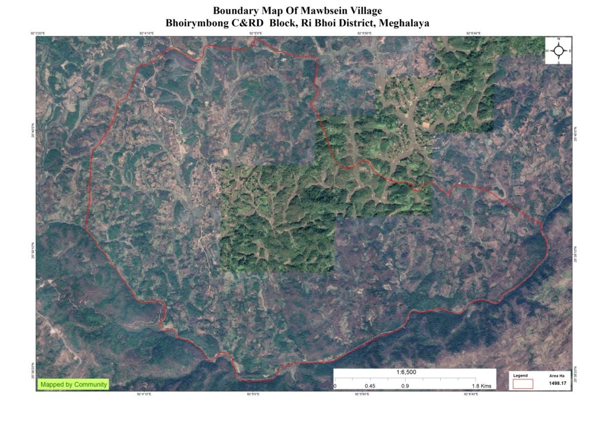
Activity 1: Village Boundary Mapping:
Activity 2: Drawing the Resource Map
The second step is to involve the local community in preparation of a village resource map as perceived by the community members to solicit their participation. Infrastructure, services and other village resources such as agricultural lands, wells, wastelands, cattle population etc. were mapped. Local people prepared the Resource Map by drawing it on a chart paper without much interference from outsiders.
This activity achieved the following purposes:
Rapport building and winning the confidence of the villagers.
Analyzed the spatial information, particularly studied problems and opportunities of villagers.
Got an impression about the village setting, physical layout, location of various houses and institutions.
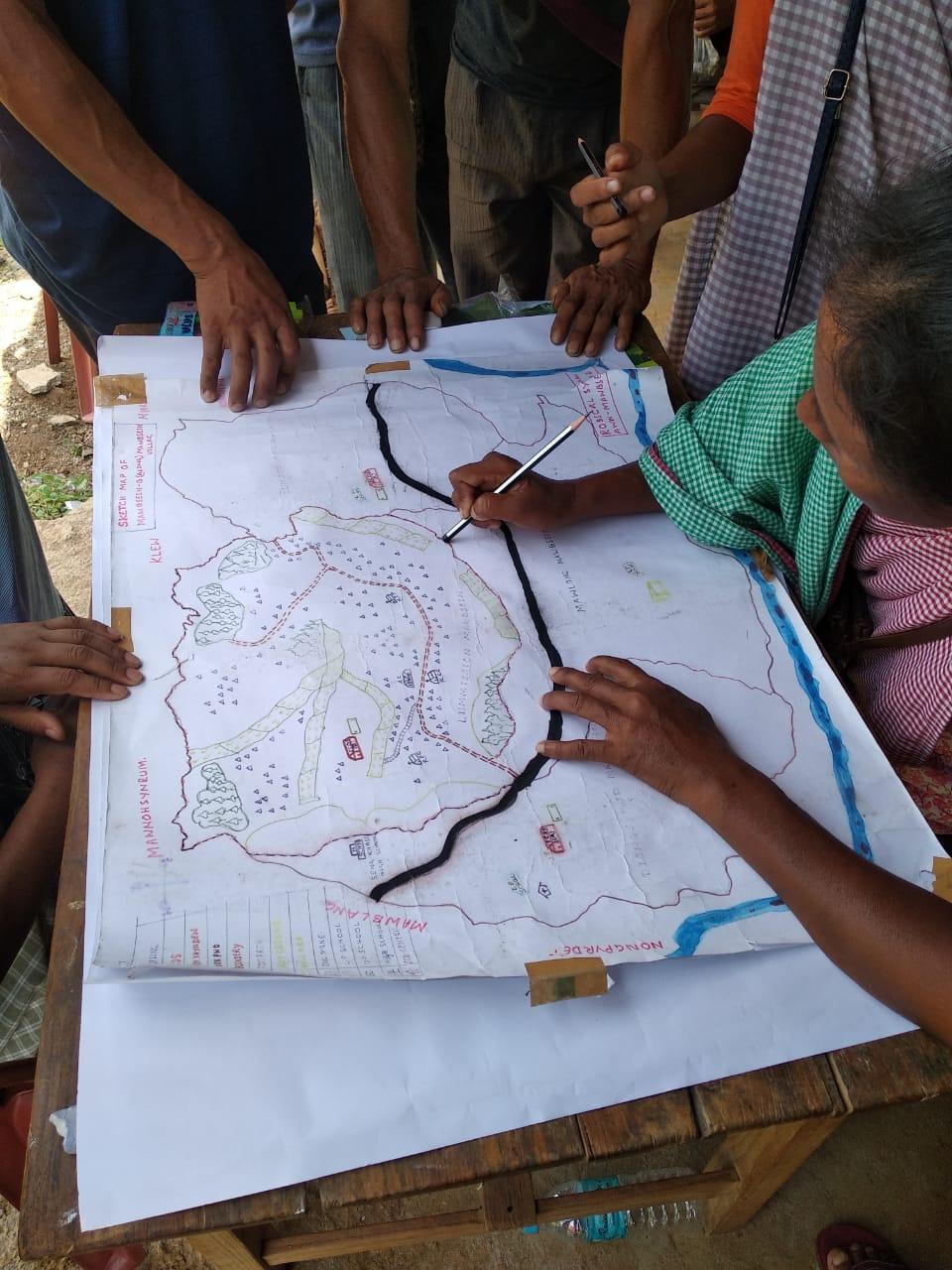
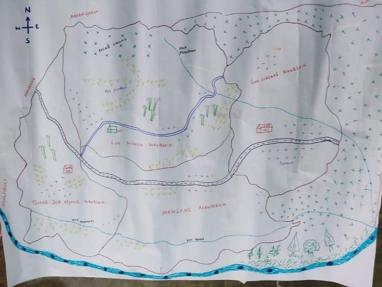
Findings Based on the Resource Map of Mawbsein Village:
Main agriculture produce is Paddy and Ginger
There are 3 types of Forest ownership: Community, Private and Clan Owned.
2 community forest
1 private forest
1 clan forest
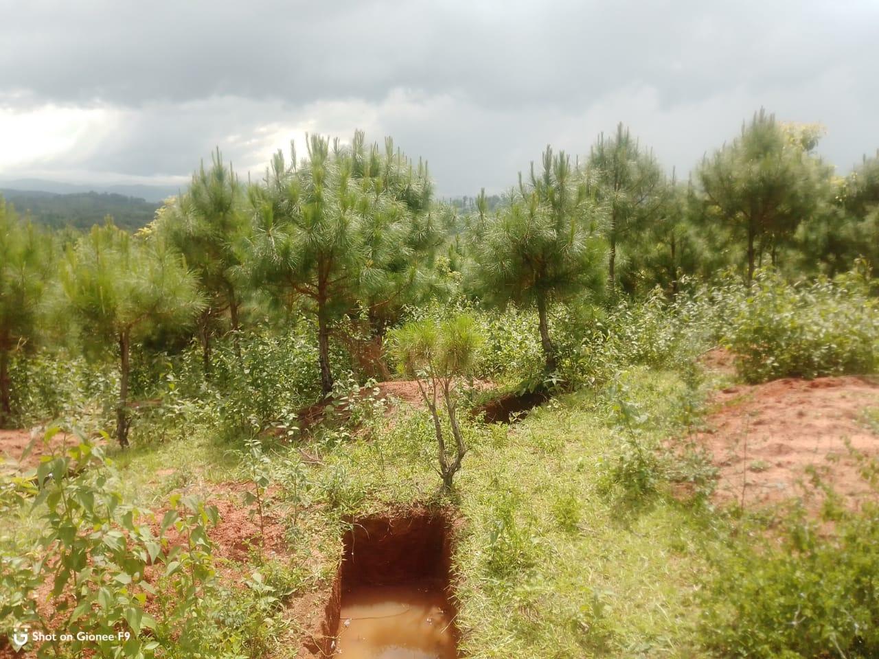
Seven (7) springs are present in the village with two already developed but needs more work.
Two main rivers are present and five (5) streams flow through the village paddy field.
Two water tanks are available and two check dams are available.
Presence of Barren land
Seven dugout ponds for fisheries and water reservoir.
Two water pumps (tube well).
School: there are only two primary schools in the village.
Connectivity:
Habitation is not confined to one place but spread all over the village.
Activity 3: Baseline Data Survey to fill the Environment and Social Template
During the PRA exercise, the CLLMP officials and the community members were divided into groups to fill the Social and Environmental Templates. Discussions and consultations with social groups existing in the village was held to gather basic village information regarding households, demographic information, major crops and enterprises taken in the village, trends of production and productivity of major crops in the village and demographic distribution of village population.
14.10.2020(Day 2-Continuation of PRA)
Activity 5: PROBLEM ANALYSIS
Do people have sufficient access to supply of fodder, fuel wood, leaf litter?
Since the people are depending mostly on the forest for fodder and fuel the supply of its needs is insufficient and some have to buy to fulfil their cattle.
Has access to timber improved or reduced over the years? How is access for household use and commercial use managed?
Access to Timber has reduced over the years due to the restriction over the use of the Community Forest.
Are the water bodies facing any threats?
Yes, four Springs (Umnan, Wah Dkhar, Mawthohrew and Mawsieh) are facing threats due to Siltation and Deforestation
Yes, three Rivers (Wah Umtung, Mawbsein and Wah Shnong) are facing threats due to deforestation
Do all people in the village have access to drinking water? What are the challenges?
No, they do not have access to drinking water.
Their main challenge is that they have to travel a distance to fetch water for daily use.
Are there degraded areas in the village (open/ degraded forests, mining affected, high soil erosion etc.)?
None
What has caused this degradation? Are there practices causing threats to availability and access to natural resources?
None
What have been the changes in agricultural practices?
Some of the changes occur in agricultural practices are:
Are there any challenges in farming?
Due to decline in soil fertility over the years.
Overuse of chemical fertilizers has also damaged the soil.
Cultivating broom grass has also made the soil dry and loss its fertility.
How would you consider the health situation in your village?
It is found out that the main illness in the village is diarrhoea and puke. The main reason for this is because of the dirty drinking water which has made the people fall sick.
Fever is also considered as the most prevalent disease in the village.
How is the situation of cleanliness, sanitation, access to toilets and waste management?
Cleanliness is considered to be the top most priority of the village. Cleaning drive is always being organized in the village by the Headman of the village at least once a month. Here every member of the community takes part in the programme.
Who are the most vulnerable in the village? What can be done to improve their lives?
Widows are considered to be the most vulnerable in the village.
In order to improve their lives their names are being included in the BPL list and are being provided with Govt schemes if available.
What are the livelihood aspirations of the youth? Are there any avenues available?
The youth employments are daily wages and the majority of the youth turn to farming and Job-Card under MGNREGA for employment.
Do any committees/ institutions/ rules exist to manage and monitor natural resources in the village?
Apart from VNRMC the VEC looks after the Natural Resources in the village.
What are some of the major issues of conflict in the village?
Till the present day the people of the village have no conflict or issues within or outside the village they live in a peaceful environment.
Have any of the above issues been discussed in village meetings?
If there is any issue in the village then it will be discussed in the dorbar hall.
How do people resolve disagreements and conflicts?
All disagreements and conflicts are addressed by the traditional institution of village governance called the Village Dorbar.
Activity 6: Seasonal Calendar
The CLLMP team also mapped the seasonal calendar of Mawbsein Village to help identify heavy workload periods, periods of relative ease, credit crunch, diseases, food security, wage availability etc. This will prove helpful in project planning and project timeline framing.
Participants:
Shri. Donboklang Nongkhlaw- Community Member
Shri. Subash Shamphang- Community Member
Shri. Ribolding Rynjah- Community Member
Shri. Trisila Nongrum- Village Community Facilitator
Smt. Balari Warlarpih- Community Member
Smt. Ephrenstar Lyngdoh - Village Community Facilitator
| Sl No. | CRITERIA | JAN | FEB | MAR | APRL | MAY | JUNE | JULY | AUG | SEP | OCT | NOV | DEC |
|---|---|---|---|---|---|---|---|---|---|---|---|---|---|
| 1 | Water Scarcity | 3 | 2 | 1 | |||||||||
| 2 | Prone to sickness | 1 | 2 | 2 | 3 | 3 | |||||||
| 3 | Seeking job outside | 2 | 1 | 1 | |||||||||
| 4 | Rain Fall | 3 | 1 | 1 | 1 | 2 | 2 | 3 | |||||
| 5 | Free – Less work | 1 | 2 | ||||||||||
| 6 | Paddy Cultivation | 1 | 2 | ||||||||||
| 7 | Paddy harvesting | 1 | 2 | ||||||||||
| 8 | Broom cultivation | 1 | 2 | ||||||||||
| 9 | Broom harvesting | ||||||||||||
| 10 | Tree Plantation | 1 | 2 | 3 | |||||||||
| 11 | Vegetable (crop cultivation) | 1 | 1 | 2 | 2 | 2 | 2 | 3 | |||||
| 12 | Vegetable (crop harvesting) | 1 | 1 | 3 | 2 | 2 | |||||||
| 13 | Festive Season | 1 | 3 | 1 | |||||||||
| 14 | Forest fire | 2 | 1 | ||||||||||
| 15 | Collection of Fuel wood | 1 | 1 | 2 | 3 |
| MAXIMUM | 1 |
|---|---|
| MODERATE | 2 |
| LESS | 3 |
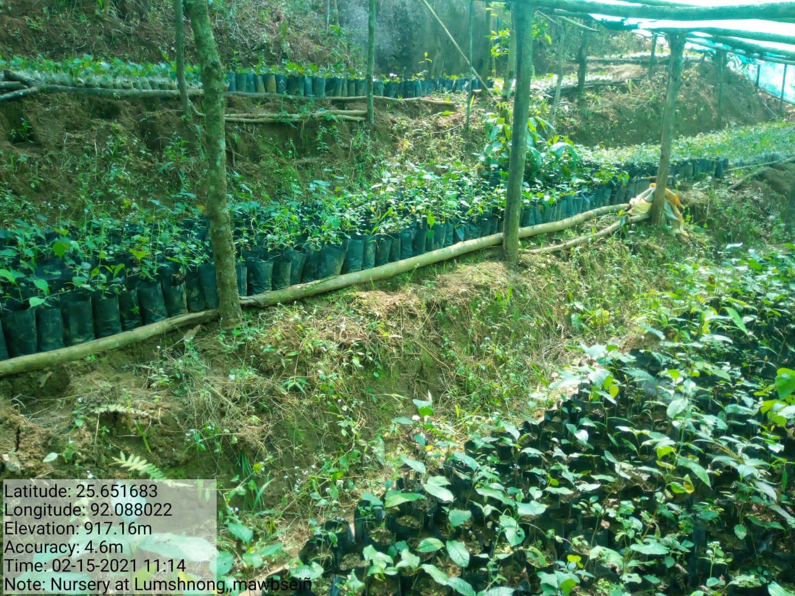
Activity 7:Submission of the List of NRM activities proposed by the VNRMC.
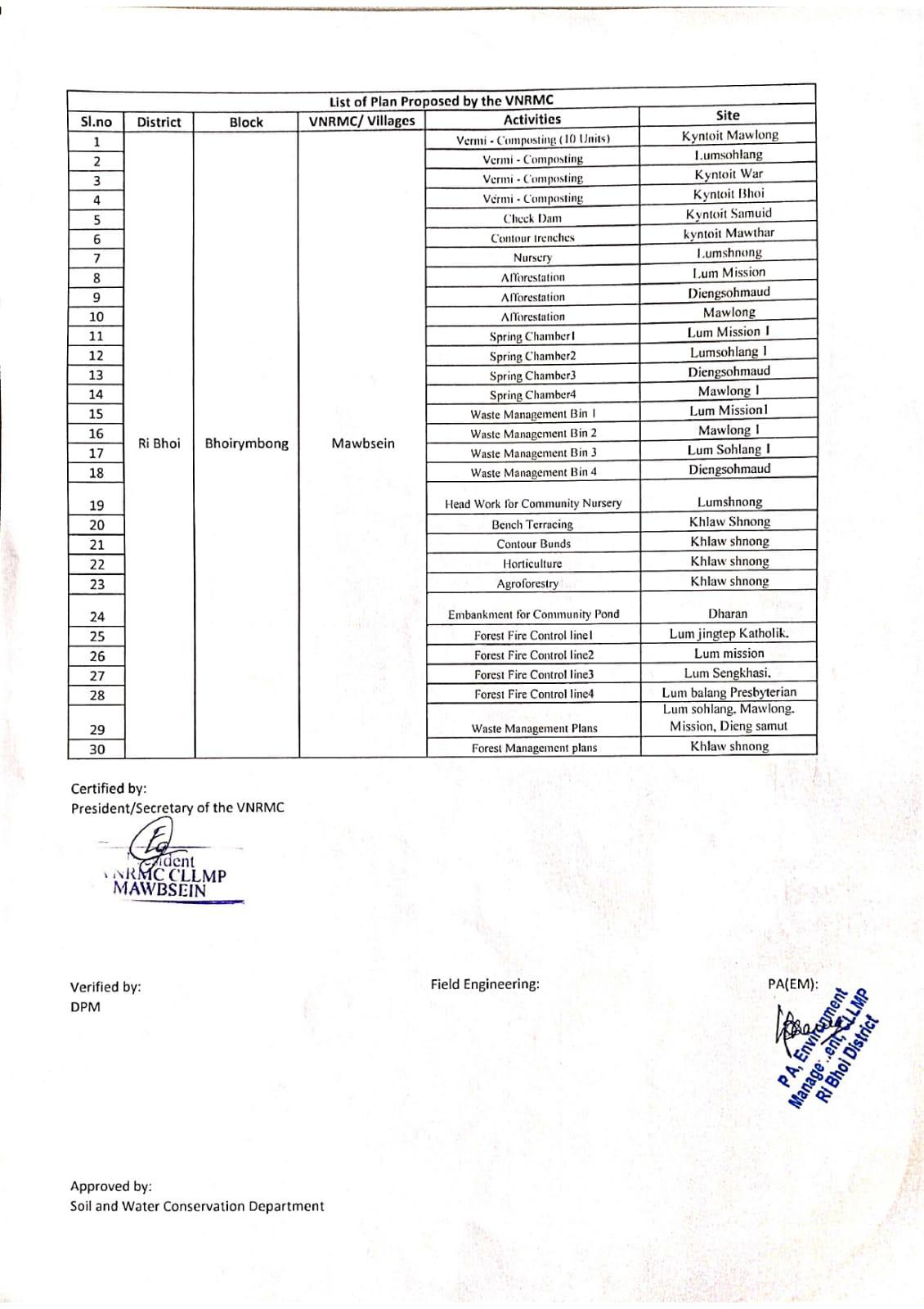
The Finalized Community Natural Resource Management Plan of Mawbsien Village.
|
Name of Proposed Interventions | Site |
|
Nos of HHs expected to Benefit | ||
|---|---|---|---|---|---|---|
|
|
|
||||
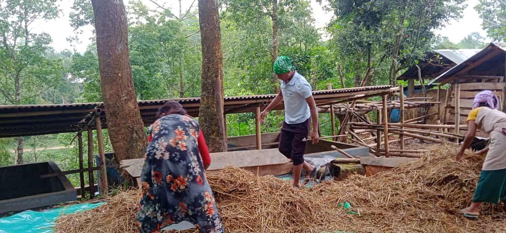
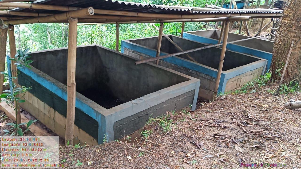
| 1 | Vermicomposting(10 Unit) | Mawlong |
|
|
||
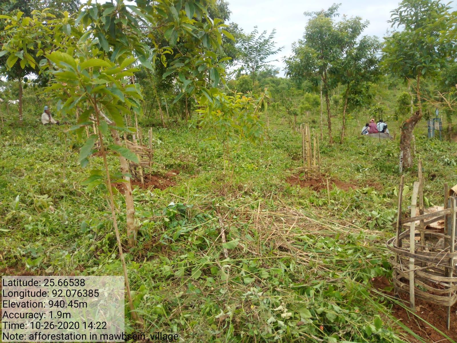
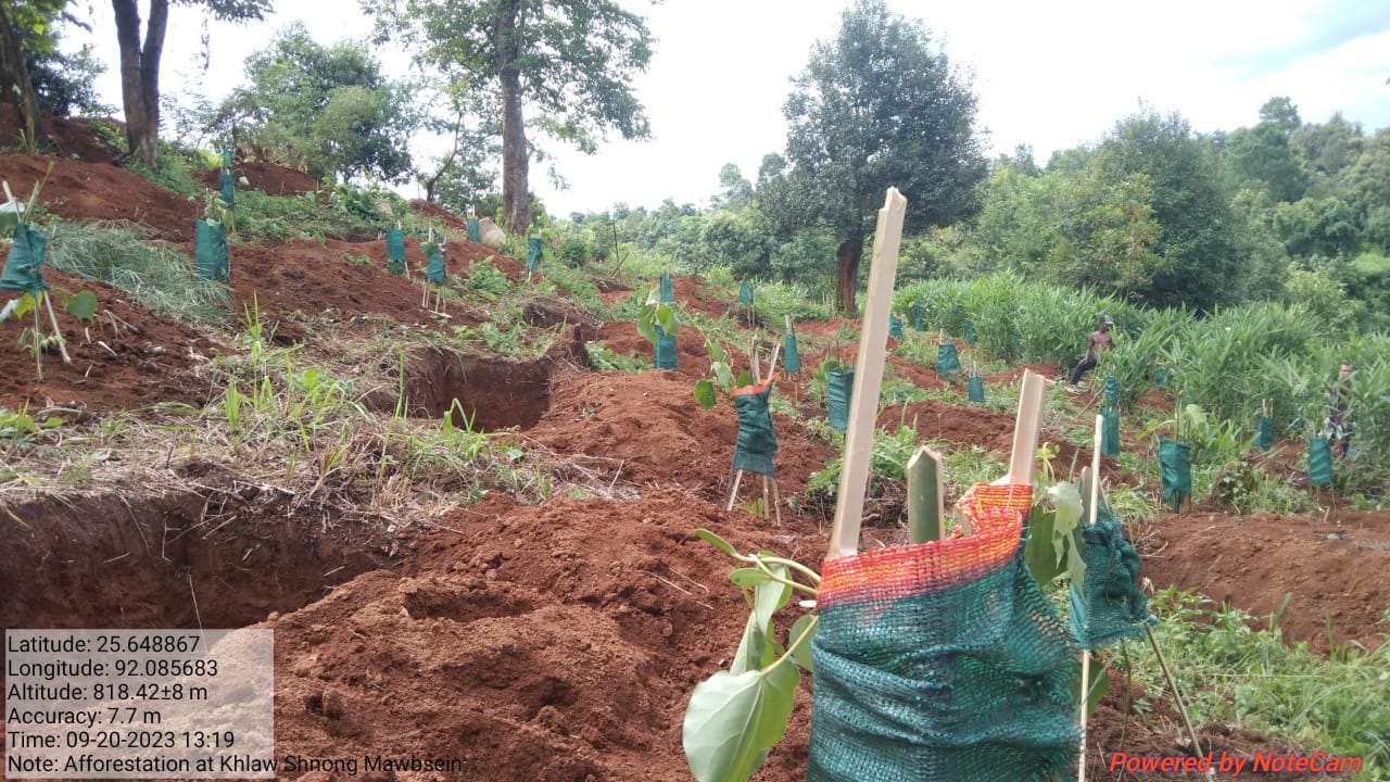
| 2 | Afforestation | In Dingsohma-ud |
|
|
||
| 3 | Check dam | Dingsoh ma ut |
|
|
|
|
| 4 |
|
Maw ang Lumshnong |
|
|
|
|
| 5 |
|
Lumshnong |
|
|
||
| 6 |
|
Khlawshnong |
|
|
||
| 7 |
|
1.Lum Mission (1) | Private |
|
|
|
| 8 |
|
Lumshnong |
|
|
||
| 9 |
|
Khlawshnong |
|
|||
| 10 |
|
Khlawshnong |
|
|
||
| 11 |
|
Khlawshnong |
|
|
||
| 12 |
|
Khlawshnong |
|
|
||
| 13 |
|
|||||
| 14 |
|
1.Lum Jingtep Catholic 2.Lum Mission 3.Lum Sengkhasi 4.Lum Baling Presbyterian |
|
|
||
| 15 |
|
1.Lum Sohlang 2.Mawlong 3.Mission 4.Dieng Samut |
1.Community 2.Community 3.Community 4.Community |
|
||
| 16 |
|
Khlawshnong |
|
|
||
| 17 |
|
Lumsohlang 1 |
|
|
||
| 18 |
|
Diengsohmaud |
|
|
||
| 19 |
|
Mawlong 1 |
|
|
||
| 20 |
|
Lumshnong |
|
|
||
| 21 |
|
Lum Mission |
|
|
||
| 22 |
|
Mawlong 1 |
|
|
||
| 23 |
|
Lumsohlang 1 |
|
|
||
| 24 |
|
Diengsohmaud |
|
|
||
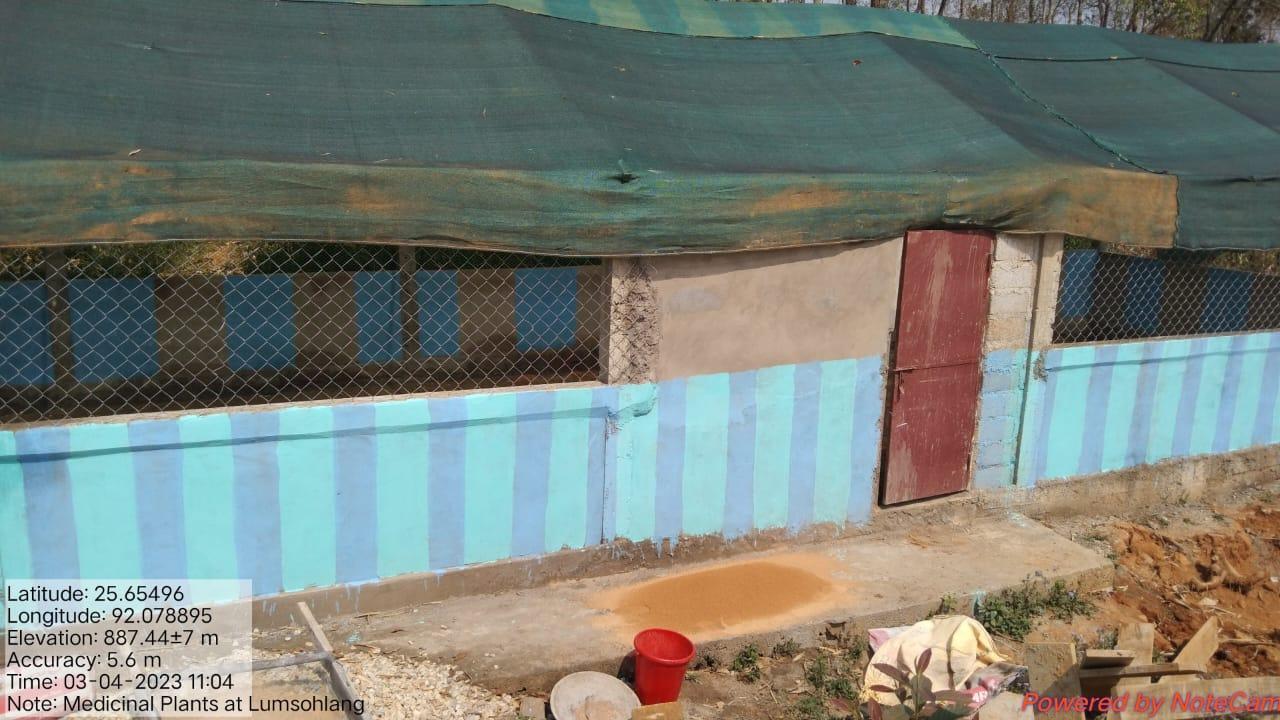
| 25 | Polyhouse for Medicinal Plants | Lumsohlang Playground | Community | 527 | ||
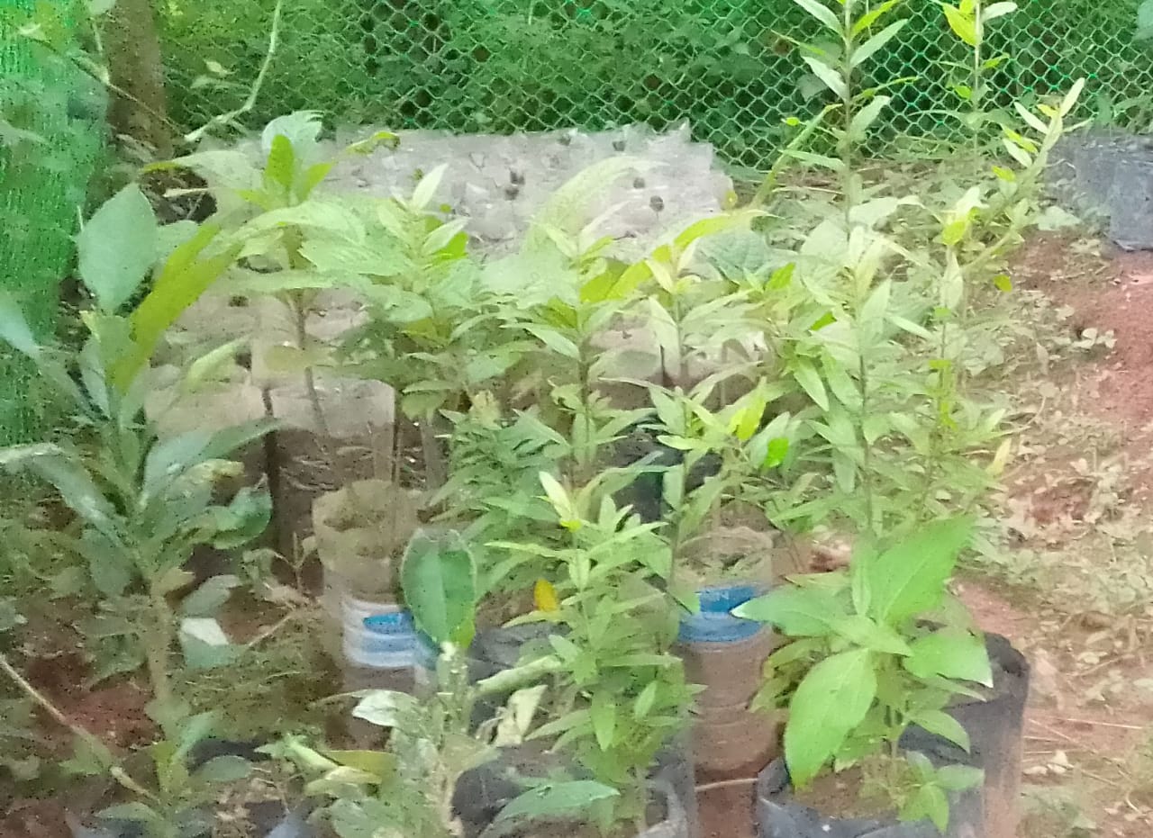
| 26 | Nursery | Shyipsngoid | Private | 457 | ||
GIS Activities – MAWBSEIN
| Sl.No | Parameters | Village Information |
|---|---|---|
| 1. | GPS Coordinates | |
| i | Latitude | 25.661300°N |
| ii | Longitude | 92.078100°E |
| iii | Elevation Reading (MSL) | 913 m |
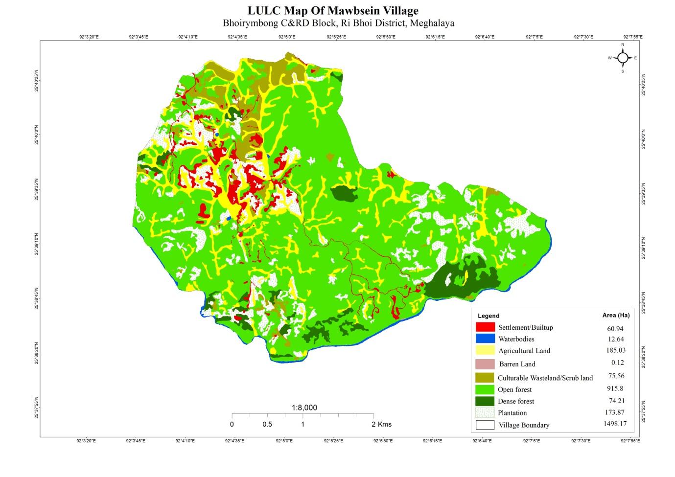
| 2. | Village Geographical Area(Ha) | 1498.17 Ha |
| i | Total Forest Area ( including community, Clan, Pvt Forest) | 990.1 Ha |
| ii | Total Area of Water Bodies | 12.64 Ha |
| iii | Total Area under Agri- Horticulture | 185.03 Ha |
| iv | Total Degraded land area (Ha) | 75.56 Ha |
| 3 | Average Annual Rainfall | 1000-1200 |
| 4 | Soil Type | Loamy soil |
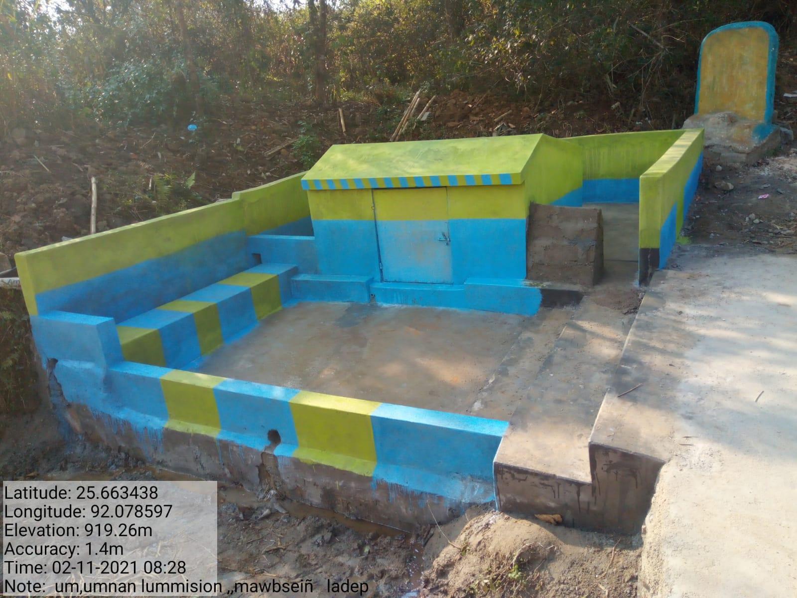
| INTERVENTION | SITE NAME | AMOUNT SANCTIONED | TREATED AREA | BENEFITTED AREA | STATUS |
|---|---|---|---|---|---|
| NURSERY | LUMSHNONG | 1,19,300 | 0.0135(Ha) | 4.361177116(Ha) | COMPLETED |
| INTERVENTION | SITE NAME | AMOUNT SANCTIONED | TREATED AREA | BENEFITTED AREA | STATUS |
|---|---|---|---|---|---|
| AFFORESTATION | KHLAW SHNONG | 5,54,720 | 12(Ha) | 15(Ha) | COMPLETED |
| INTERVENTION | SITE NAME | AMOUNT SANCTIONED | TREATED AREA | BENEFITTED AREA | STATUS |
|---|---|---|---|---|---|
| VERMICOMPOSTING | Lum Soh Lang | 3,36,500 | 0.0759(Ha) | 12.30122464(Ha) | COMPLETED |
| INTERVENTION | SITE NAME | AMOUNT SANCTIONED | TREATED AREA | BENEFITTED AREA | STATUS |
|---|---|---|---|---|---|
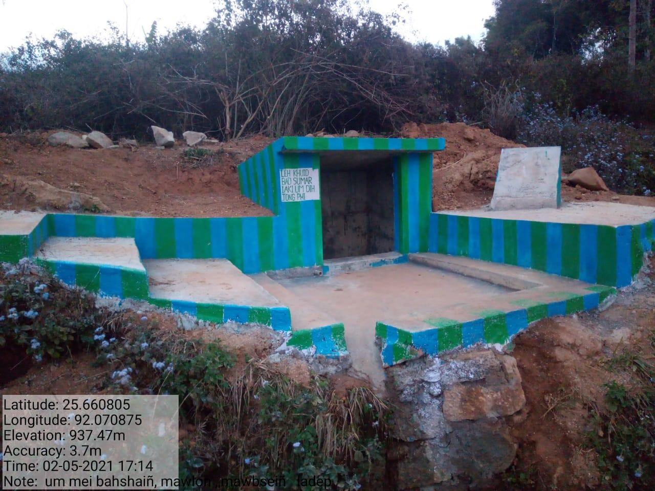
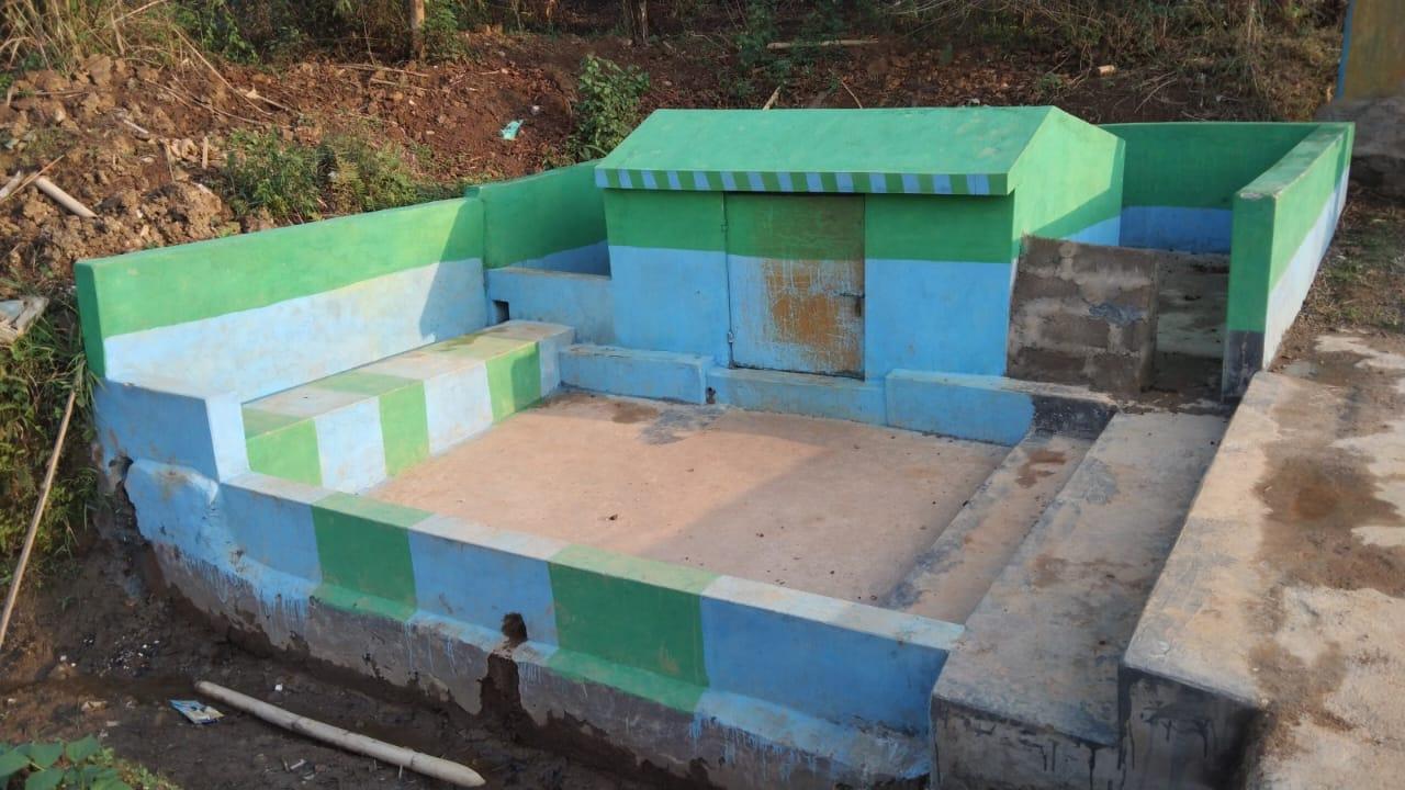
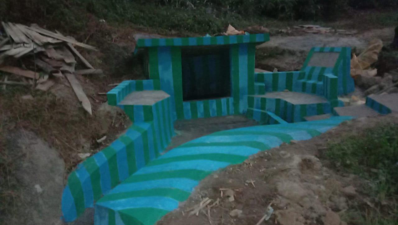
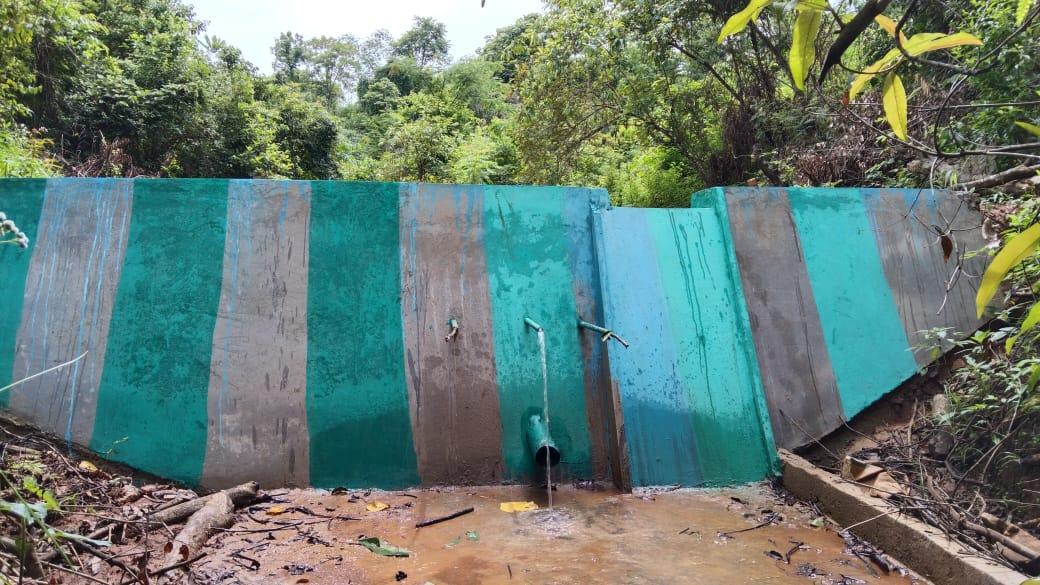
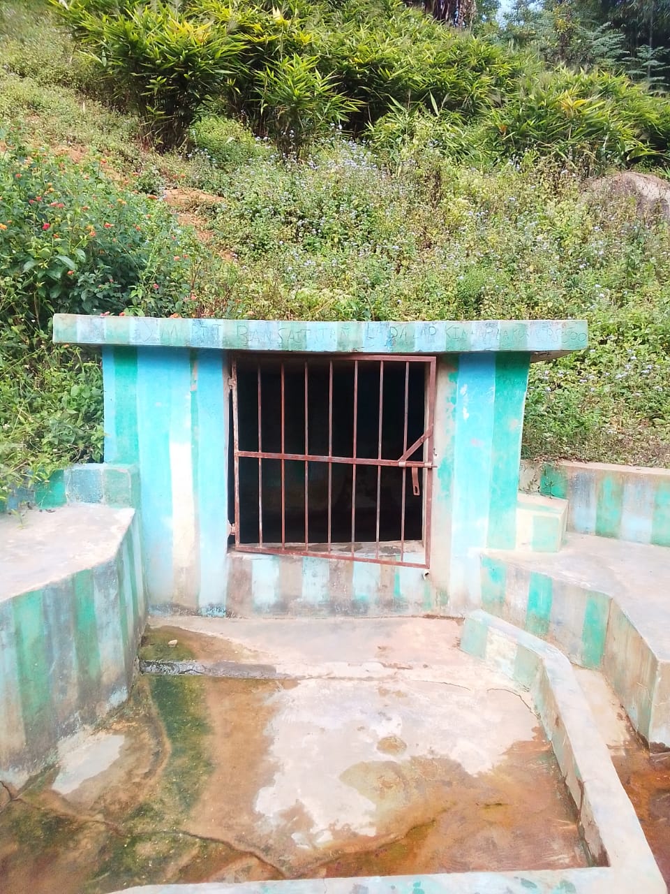
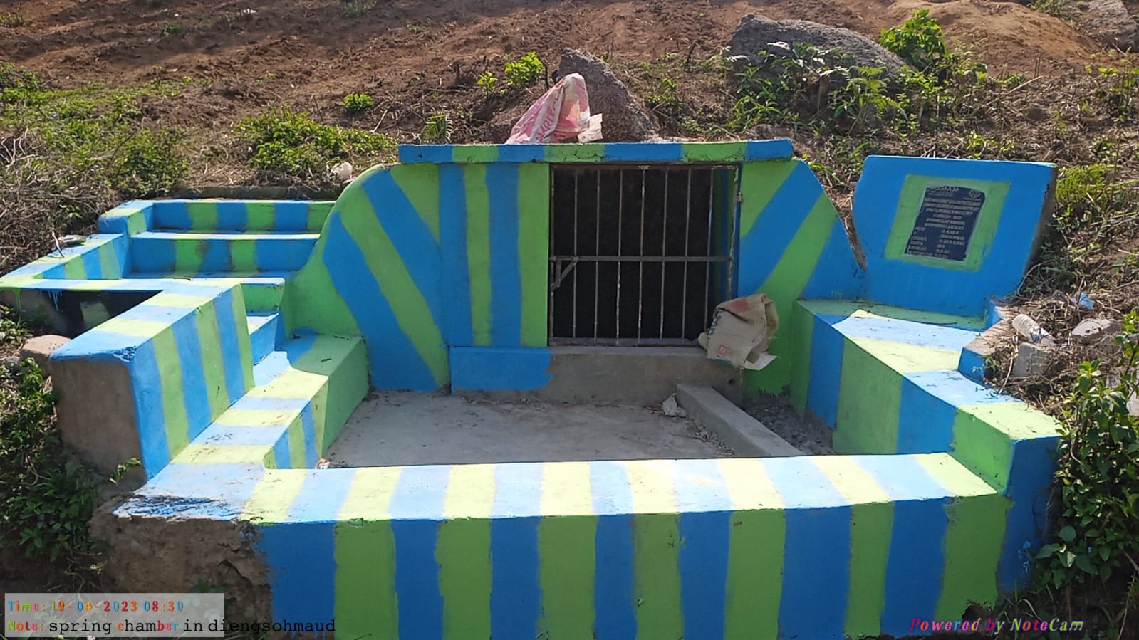
| SPRING CHAMBER | LUM SOHLANG LUM MISSION MAWLONG KYNTOIT SAMUID |
76,300 76,300 67,080 67,080 |
0.00032(Ha) 0.00032(Ha) 0.00032(Ha) 0.00032(Ha) |
1(Ha) 1(Ha) 1(Ha) 1(Ha) |
COMPLETED |
| INTERVENTION | SITE NAME | AMOUNT SANCTIONED | TREATED AREA | BENEFITTED AREA | STATUS |
|---|---|---|---|---|---|
| Headwork | Lumshnong | 2,85,970 | 2(Ha) | 12.47978357(Ha) | COMPLETED |

| INTERVENTION | SITE NAME | AMOUNT SANCTIONED | TREATED AREA | BENEFITTED AREA | STATUS |
|---|---|---|---|---|---|
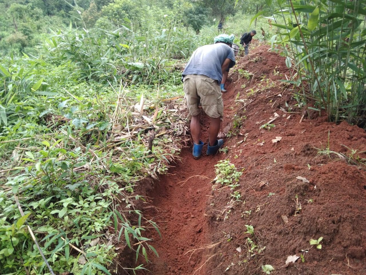
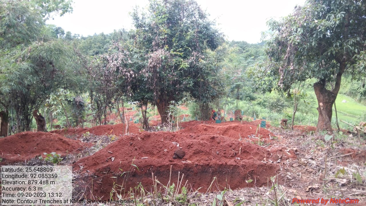
| CONTOUR TRENCHES | KYNTOIT MAWTHOR | 82,900 | 5(Ha) | 7.025753224(Ha) | COMPLETED |
| INTERVENTION | SITE NAME | AMOUNT SANCTIONED | TREATED AREA | BENEFITTED AREA | STATUS |
|---|---|---|---|---|---|
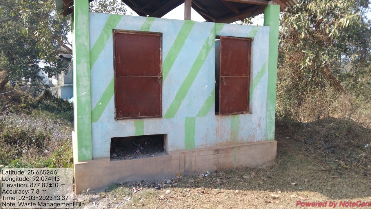
| WASTE MANAGEMENT BIN1,2,3&4 | LUMMISSION-1 MAWLONG 1 LUMSOHLANG-1 DIENGSOHMAUD |
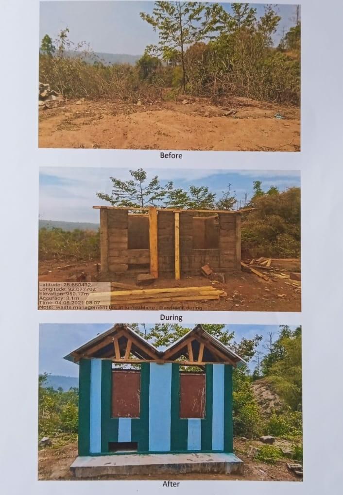
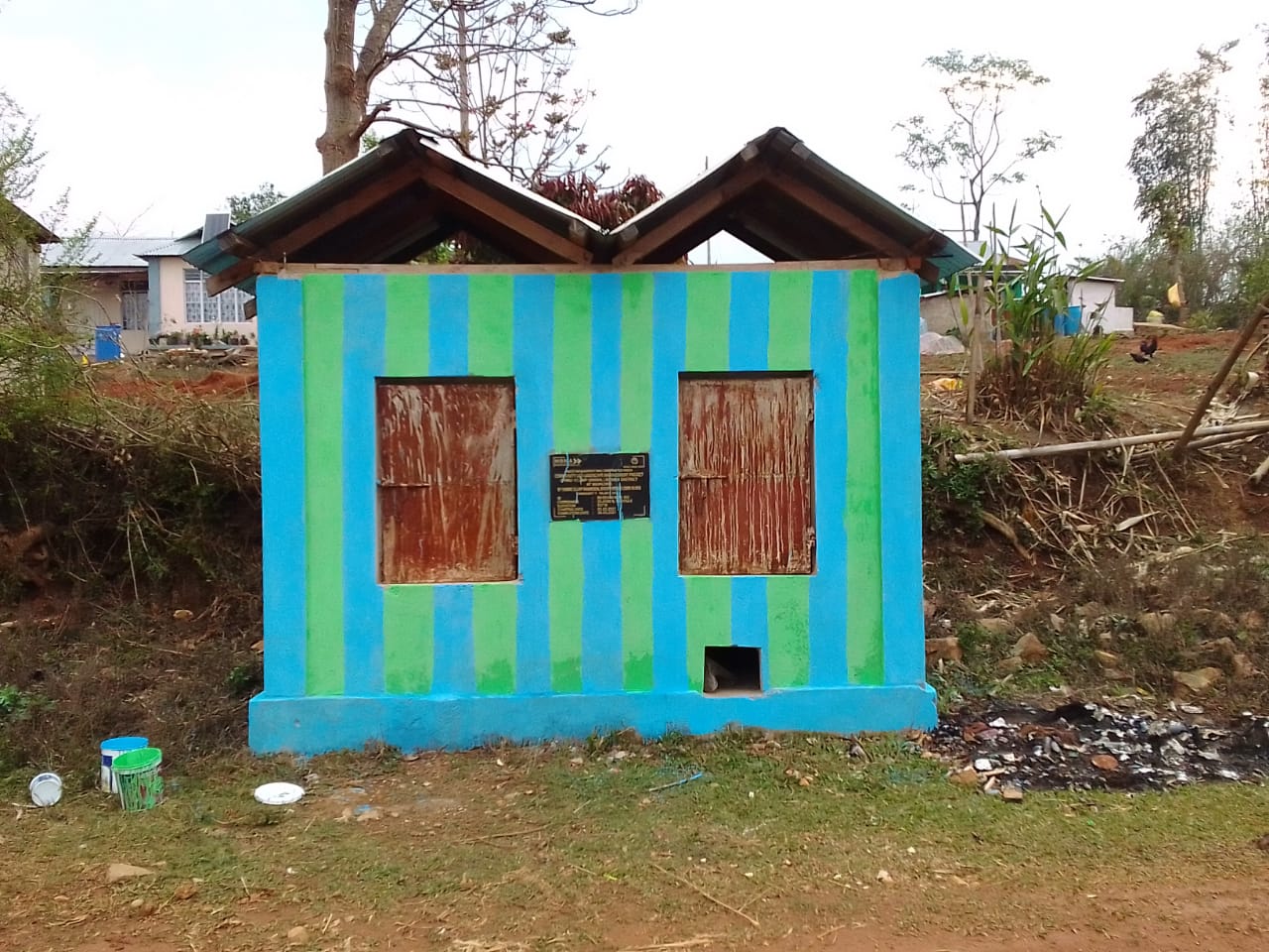
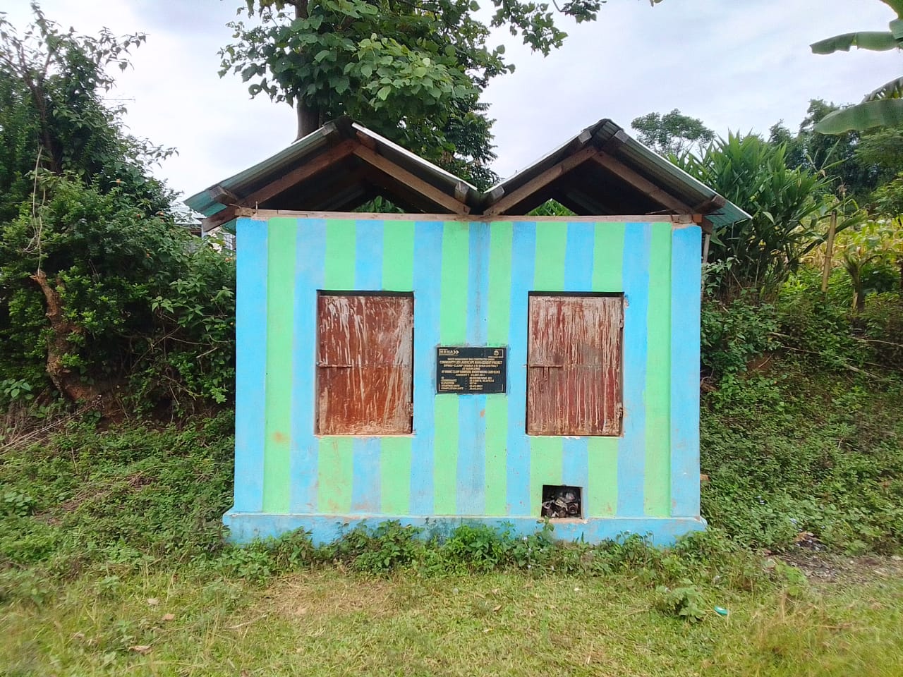
46,887 46,887 46,888 46,888 |
0.009(Ha) | 1(Ha) | COMPLETED |
INTERVENTION |
SITE NAME |
Total Amount |
STATUS |
|---|---|---|---|
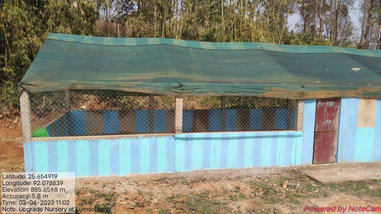
Polyhouse for orchids & Upgradation of Nursery |
Lumsohlang Playground |
1,40,0001,60,000 |
Completed |
INTERVENTION |
SITE NAME |
Total Amount |
STATUS |
|---|---|---|---|
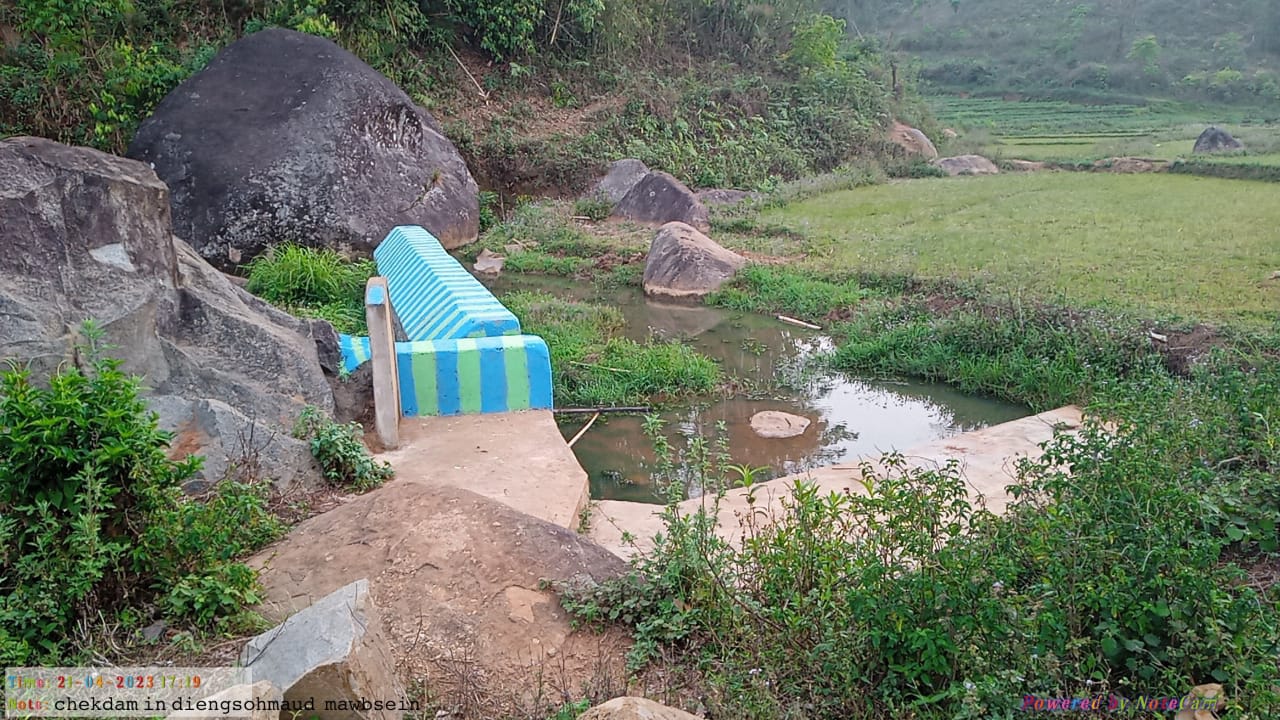
Check Dam |
Dieng soh maud |
2,85,970, | Completed |
INTERVENTION |
Total Amount |
Site Name |
STATUS |
|---|---|---|---|
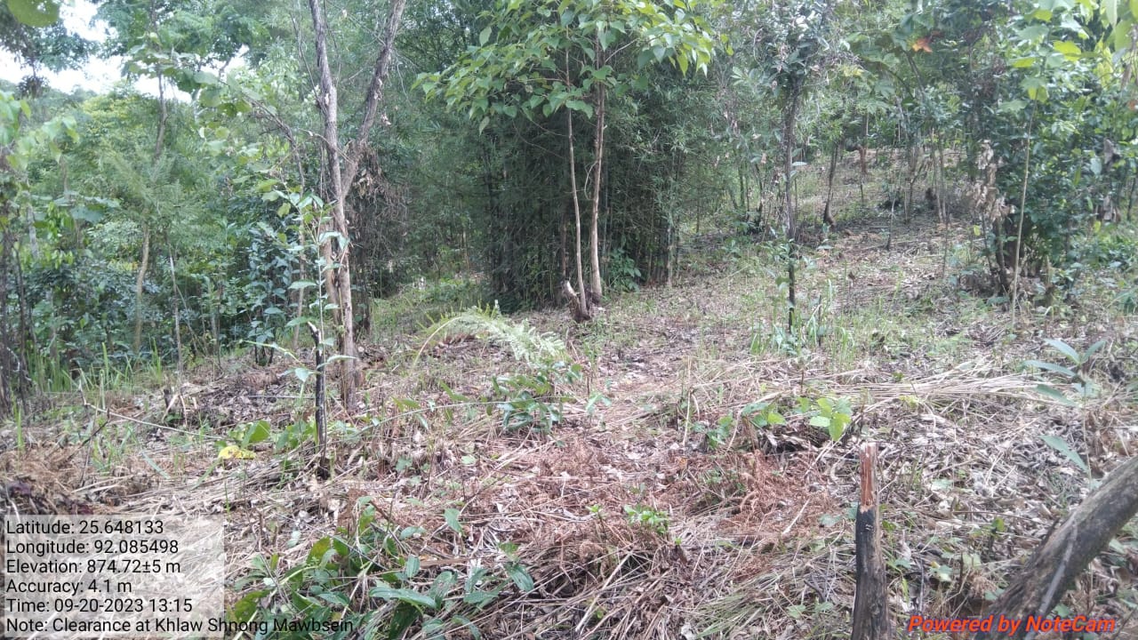
FMP Activities:Fire Control Line Assisted Natural Regeneration in Open Forests(contour bund) Community Forest Boundary Survey Enrichment planting in forest blanks In-situ & Ex-situ conservation of rare and endangered plants Nursery for Food Forestry (Sapling for the Existing Nursery) |
48848 22536 5000 12859 5000 11000 |
Under Community land |
All Completed |
| Intervention | Site Name | Amount | Work Status |
|---|---|---|---|
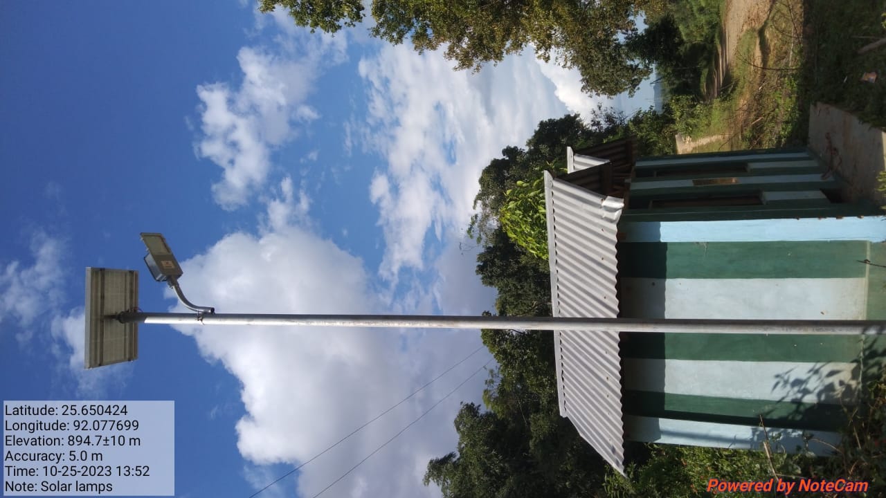
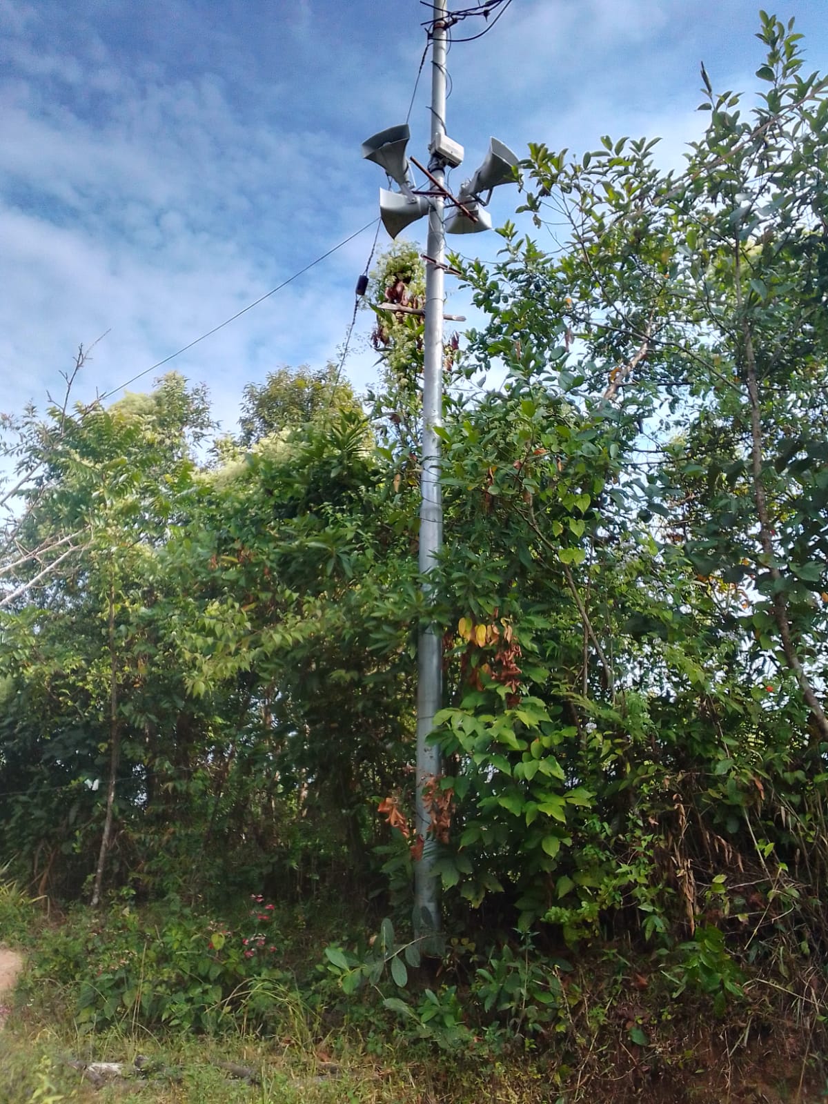
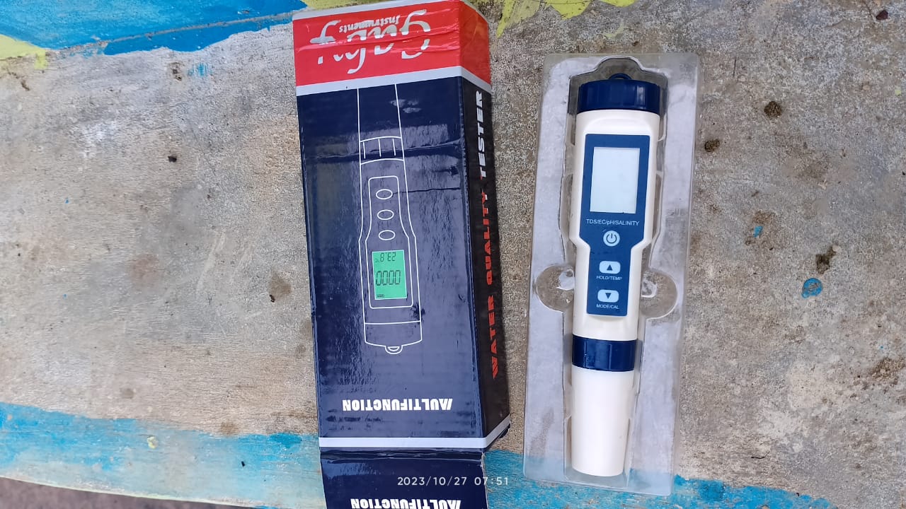
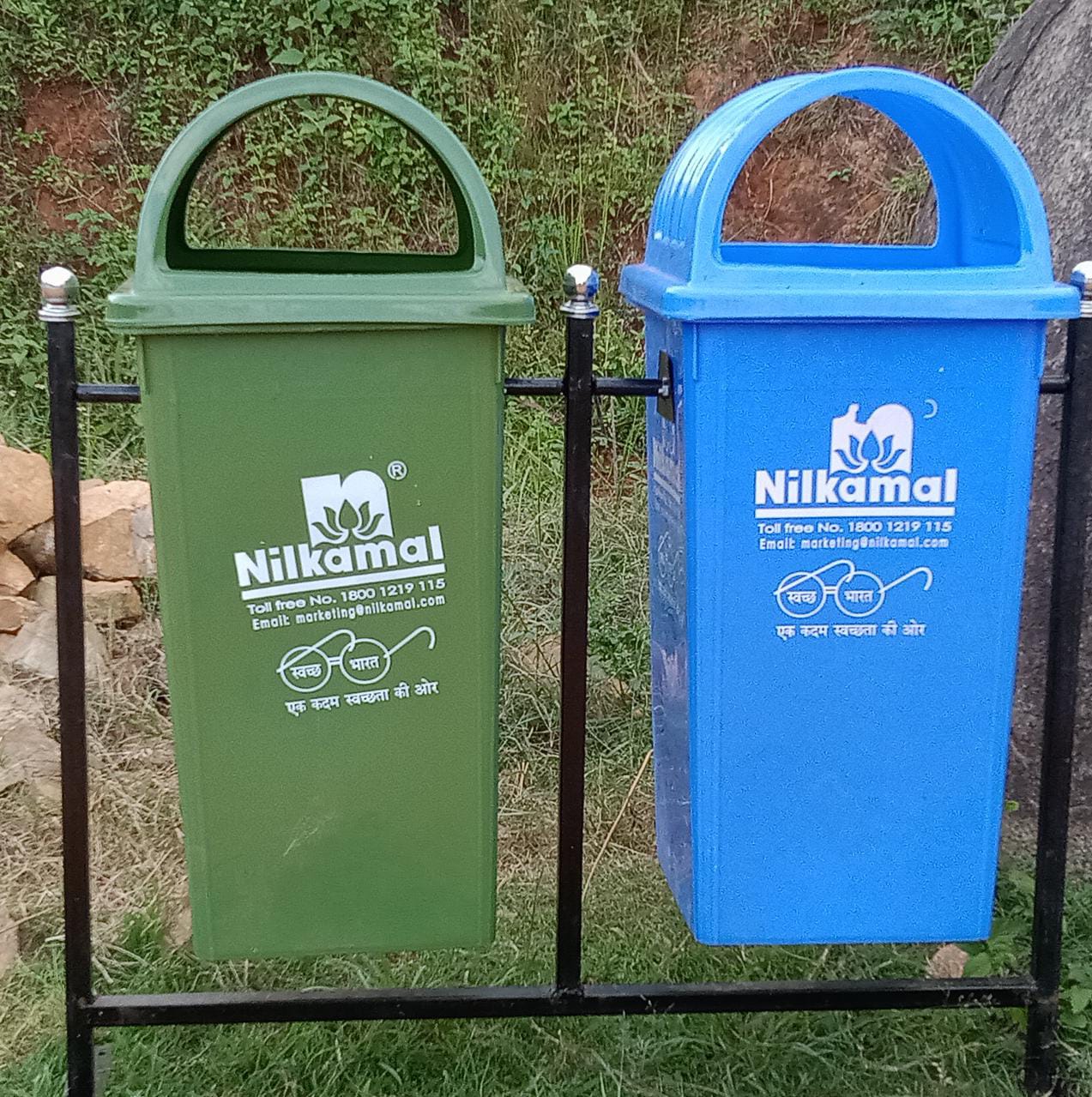
Excess fund activities PA System Water Tester Solar light Dustbin Gates for Spring Chamber |
community land | 1,86,000 | Completed |
TESTIMONIALS 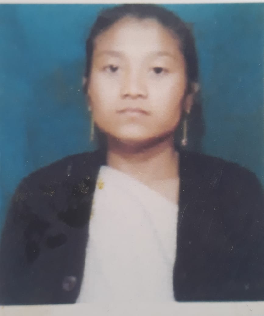
Balarisha Warlarpih- Secretary
As a secretary I have seen that the Village has benefited a lot from the project. Various interventions like Afforestation, Spring Chamber, Community Nursery, Vermicompost and others I can see that it not only shown drastic results through its various outcomes but it also helps us to gain more knowledge on how to work towards building a sustainable environment through our daily actions
Francis Masharing - President 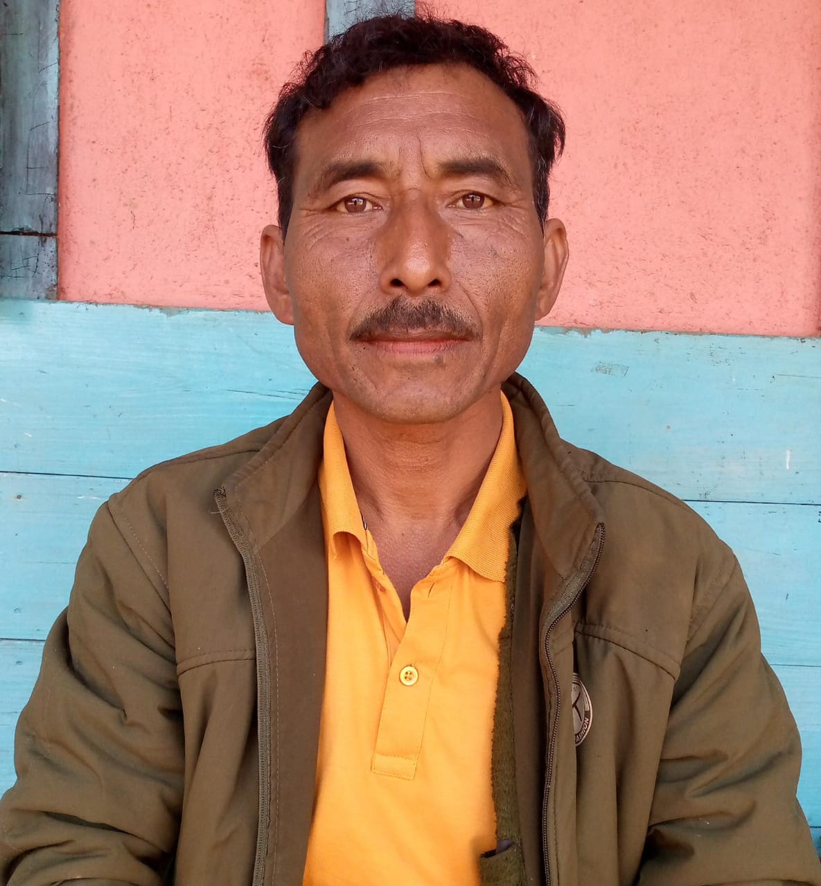
As a President of the VNRMC I have seen significant changes in the surrounding of the village ranging from our forest cover, mass initiative to work towards strengthening the ecosystem, overall cleanliness of the village, and also to re-use waste and to turn them to usable products. The main achievement that we can see in the village is their understanding and commitment to respect and preserve Nature's rich resources.
As per my findings, the CLLM project has brought in significant changes that makes NRM work in the village a fruitful one. The role that the VCFs have in the village has made work much easier as there's manpower in the village making this work more successful. The overall benefit can be seen in terms of the green cover, soil fertility and many more not leaving aside the means of employment that it provides to everyone in the village.
Donbok Nongkhlaw-VCF M&E 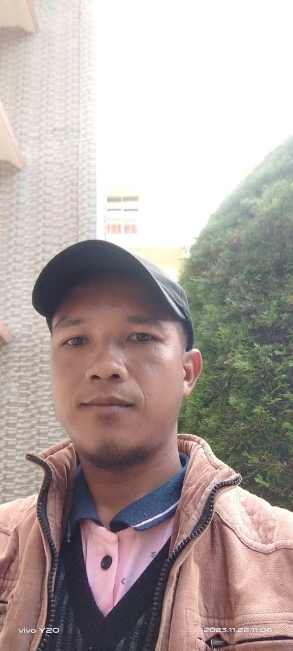
I had no knowledge of the project then, but now I can say that I know a lot about it and most importantly about the various NRM works that it has given to us. Activities on how to use GPS, various applications to use in the implementation of the project, Data entry, trainings and several more, all these has helped me a lot and I hope that this knowledge that I have gained will help me in the years to come professionally.