UNDER JIRANG C&RD BLOCK
RI BHOI DISTRICT

The Government of Meghalaya with financial help from the World Bank is implementing the Meghalaya Community Led Landscape Management Project (MCLLMP). The project will cover the entire state of Meghalaya and implementation of community led plans will be rolled out in phase manner throughout the state. The Meghalaya Basin Management Agency (MBMA) will facilitate community-led planning by providing support, technical inputs and funding.
The project is intended to strengthen community-led natural resources management in selected landscapes within the 11 districts of the state. This would be achieved through a variety of planning, capacity building, and on-the-ground interventions to promote the conservation, sustainable use of natural resources, social inclusion and community mobilization; building traditional knowledge and learning, mapping of natural resources management; strengthening the community institutions and creating linkage with financial institutions and community organizations.
The project interventions include preparation of community led natural resource management plans. The CLLMP has the following three components:
Strengthening Knowledge and Capacity of Communities for Natural Resources Management
Community-Led Landscape Planning and Implementation
Project Management and Governance
The project objective is “to manage and conserve the natural resources, especially forests, soil and water sources, in a manner that supports the financial and physical well-being of communities in the State”
The CLLM-Programme focuses on increasing the capacities of communities and traditional institutions (TI) by adopting a landscape approach to manage their natural resources such as soil, springs and other water sources, forests and bio-diversity, etc.
The project will be planned and implemented in about 400 villages across the state.
CLLMP has a strong focus on institution-building at the village-level, by ensuring systematic capacity-building on technical and social skill-sets.
The project will also extend such training to communities beyond the targeted villages and support efforts made by them to access funding from various rural and natural resources initiatives and schemes.
The programme will also invest in improving the process and outcome delivery, by developing and adhering to effective systems and procedures, supported by the appropriate technology.
Benefits for community (Skills and Capacity relating to technical and managerial areas like NRM and Conflict resolution
Benefits to traditional institutions (village councils, traditional leaders, community-based organizations, SHGs etc) through Knowledge sharing, promotion of innovative approach, access to technology, technical managerial and financial support.
It is estimated that the project will impact around 1 lakh partners (of which 50% are women) who depend on land, forest, agroforestry.
Through the project, 55000 Ha of targeted area will be ensured with availability of water, biological resources and soil productivity, which will in turn benefit around 400 villages and the outcomes delivery can be summarized as follows.
The Project is executed by the MBMA in collaboration with other partners particularly, SIRD (for training and capacity building), Department of Soil and Water Conservation, Water Resource Department, Forest Department, specifically with respect to technical inputs, safeguards management and Community NRM plan preparation
2018-2023 (5 years)
Introduction
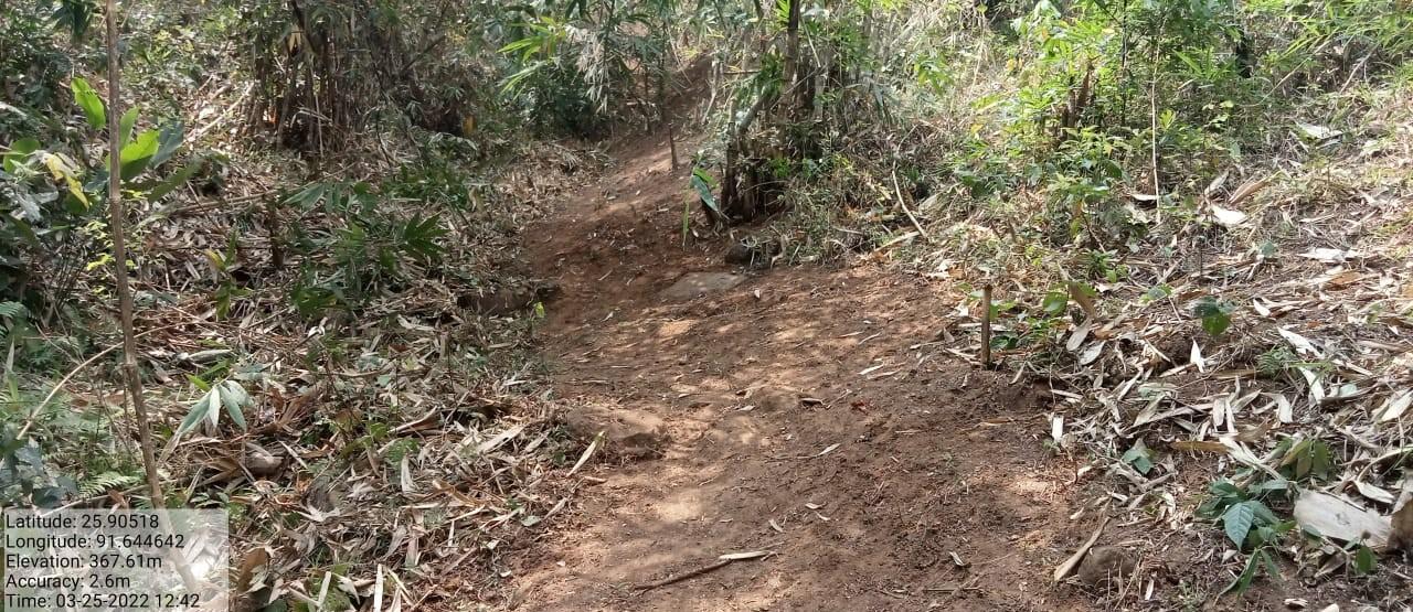
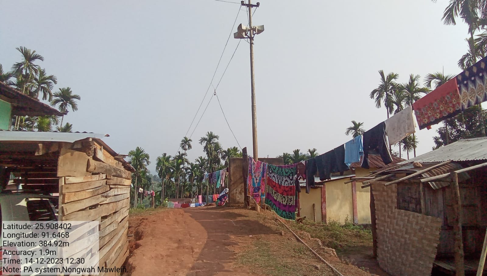
Nongwah Mawlein Village falls under Jirang C&RD block of Ri-Bhoi district in the state of Meghalaya. The village is at a distance of 55 Kms from Nongpoh, the district headquarters of Ri Bhoi District and is at a total distance of 105 Kms from the state capital, Shillong.
Short History of Nongwah Mawlein
As per the folklore of our ancestors people started to settle down at Nongwah Mawlein in the year 1820. This village is known as Nongwah Mawlein because there is a river (wah) which contains a particular rock(quartz) which is known as “Mawlein'' in it. The ancestors of this village were mostly farmers and labourers and they were illiterate, they did not even know how to write their own names. They lived by farming and also gathering plants from the forest to eat.
In the year 1960 a school was founded in this village and this school exists till date. In the year 1997 a Lower primary school was founded in the village and it was not until 2004 that the village got an Upper Primary School. In the year 2008 the village got its own Anganwadi Centre and in the year 2012 it got another Anganwadi Centre B.
Looking at the state of the villagers they are still lacking in every department from the other villages and much less developed. Even till date the village has not taken a leap towards a brighter future.
Social Profile
The total number of households is 153 and has a population of 832 people. Agriculture and its allied activities are highly in vogue, where some few others are also enrolled in government and teaching jobs and some few inhabitants are engaged in Agriculture allied and local businesses.
Village Accessibility: In order to reach Nongwah Mawlein village , one must venture through the Umling P.W.D. road lying just 10Km away from Jirang Block. One can reach Nongwah Mawlein vide through P.W.D. road. As regards Weikulai’s accessibility one must walk by the village footpath and crossing the river Umtung before reaching the sub-locality.
Literacy: As per the 2011 census, the village literacy rate has touched to the tune of 76%. Credit primarily goes to one primary school of the village founded in 1971 The school is now known as the Holy Innocents School Umtung and its class–level presently stands up to VIII(eight) grade.
Population 
Nongwah Mawlein population is 832. Out of this, 395 are males while the female count is 437 . This village has 131 children in the age group of 0-4 years. Among them 62 are boys and 69 are girls.
| Age Group | Male | Female | Total |
|---|---|---|---|
| 0-4 | 62 | 69 | 131 |
| 5-14 | 85 | 95 | 180 |
| 15-30 | 81 | 88 | 169 |
| 30-60 | 84 | 99 | 183 |
| Above 60 | 83 | 86 | 169 |
BPL/APL Household:
| Particulars | No. of HH |
|---|---|
| BPL HH | 152 |
| APL HH | 01 |
Card Holding Household:
| Particulars | No. of HH |
|---|---|
| Total HH | 153 |
| Ration Card HH | 153 |
| Health Card HH | NIL |
Fuel Type:
| Fuel Type | Total HH |
|---|---|
| Charcoal | 0 |
| Biomass | 0 |
| Wood | 153 |
| LPG | 0 |
| Electric Heater | 0 |
| Kerosene | 0 |
OCCUPATION: The people of the village rely on
Agriculture, Business, Teacher, Govt. Servant, and Masons.
There is a shortage of water during the dry season and there is
less source of water in the village. The existing springs are
seasonal and their discharge is very low which leads to water
scarcity in the village
Jhum cultivation: mainly take up traditional approaches of
cultivation like Jhum or the shifting cultivation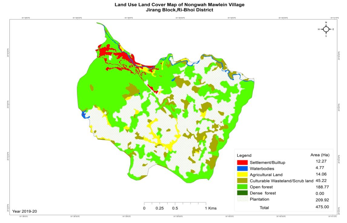
WATER BODIES:
Springs: 8
Streams: 6
Rivers:1
LAND: 475.00 Ha
Forest: 188.76 Ha
Culturable land: 14.06 Ha
CLLMP ACTIVITIES
Ground Truthing Dated: 10th of December,2020
The CLLMP team met with Mr. Oskar Lyngdoh, the President of Nongwah Mawlein Village on the 10th of December 2020, who was able to provide the team with the required details for site verification.
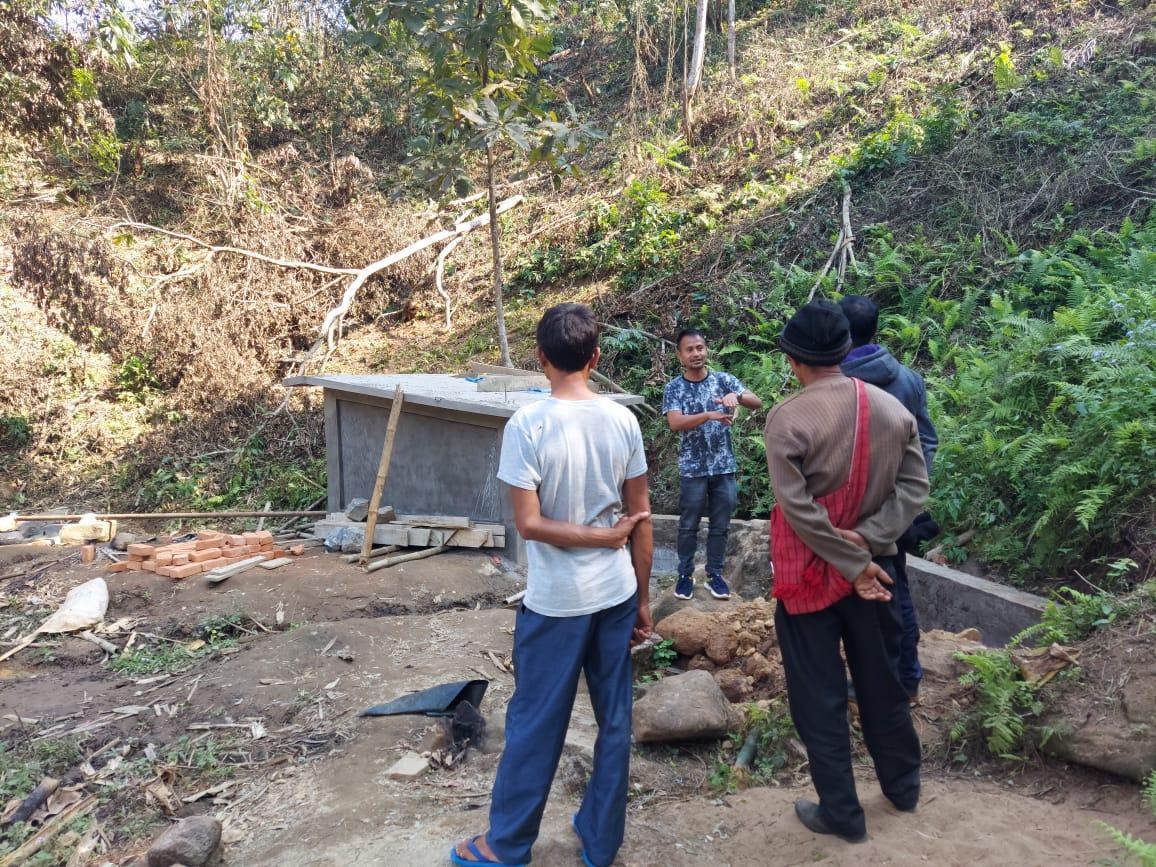
Figure 1 : Ground-truthing at Nongwah Mawlein Village.
Case Findings & Selection parameters: -
1. There are 154 Households out of which 153 Households fall under the BPL category.
2. VEC actively performing.
3. Approximately 20-25 acres of community forest available.
4. Scope for Water Sources to be developed
5. Need for Community Nursery and Vermi-Compost
5. The Community members expressed their need to build a fish sanctuary.
The Village has been selected under the Community Led Landscape Management Project
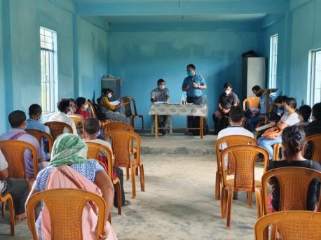
2. Sensitization Programme Dated : 11.01.2019
The District Project Manager and the Assistant Managers held a village Level sensitization Programme on the Community Led Landscape Management project on the 11th of January 2019.The community members actively participated in the program, voicing out their concerns and questions regarding the project making it a huge success. A total of 40 community members attended the program.
The CLLMP officials gave a brief introduction on Meghalaya Basin
Management Agency (MBMA) and explained about the various programmes
and projects that MBMA is working on, they then gave a detailed
introduction on the Community led Landscape Management Project
(CLLMP) and the different aspects and procedures that the villagers
and the CLLMP team should carry out during the course of the project
and the importance of the involvement of the community for the
CLLM-Project to be a success. They gave due importance to the
environmental aspects of the project and enlightened them on the
various benefits that the villagers could obtain from the
project.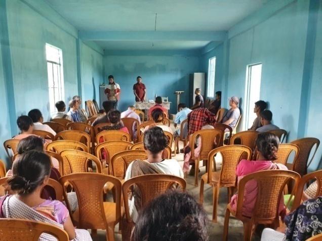
The Program was followed by an interactive session to answer the doubts and questions of the villagers some of which are mentioned below.
Since the project is funded by the World Bank, will the village be asked to repay the fund to the World Bank?
The CLLMP officials clarified that no amount will be charged from the community during or after the project implementation. The village can make community contributions towards the implantation of the project if they desire to.
If activities can be carried out in private land.
Community land is best preferred however in cases where interventions are necessary to be carried out in private land, a n MOU and a NOC needs to be produced by the VNRMC and the Private land owner to ensure that the project benefits the entire community.
2.2 Signing of Documents:
After the interactive session, the village signed the EOI, VGA
and Green charter followed by the selection of candidates for the
Village Natural Resource Management Committee. The Village Executive
Committee (VEC) and the entire community carried out the procedure
and elected the members of the VNRMC on the same day.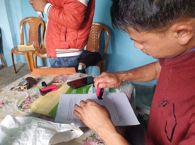
2.3 Formation of the VNRMC
The Formation of the Village Natural Resource Management Committee was done in a public meeting in the presence of the entire village and the CLLMP staffs. The community itself chose the President, the Secretary and the other executive members of the Committee.
Listed below are the members of the VNRMC:
|
|||||||||
|---|---|---|---|---|---|---|---|---|---|
|
Name in Full | Designation | Gender M/F | Age (Yrs) | Education | Occupation | Community | Religion and Denomination | Contact No and email address |
|
Oskar Lyngdoh | President | M | 52 | IX | Farmer | Khasi | Christian | 9378177009 |
|
Installment Wahlang | Secretary | F | 30 | IX | Farmer | Khasi | Christian | 7005971266 |
|
Story Rani | Book keeper | F | 35 | IV | Asha | Khasi | Christian | 6009684605 |
|
Mikhal Syiem | Member | M | 42 | III | Farmers | Khasi | Christian | NA |
|
Actor Lyngdoh | Member | M | 45 | III | Farmers | Khasi | Christian | NA |
|
Sorendro Lyngdoh | Member | M | 75 | IV | Farmers | Khasi | Christian | NA |
|
Charly Wahlang | Member | F | 33 | VIII | Farmers | Khasi | Christian | 6009904293 |
| Sertis Syiem | Member | F | 65 | IV | Anganwadi | Khasi | Christian | NA | |
| Thain Rani | Member | F | 66 | II | Anganwadi | Khasi | Christian | NA | |
| Village Community Facilitators | |||||
|---|---|---|---|---|---|
| Name | Gender | Age | Education | Contact Number | Role |
| Permanent Rani | F | 20 | Xll | NA | EM |
| Kyrmen Wahlang | M | 27 | X | 6009128010 | M&E |
| Lanosha Lyngdoh | F | 24 | X | 7005208198 | Social Management & KM |
| Purchase Committee | |||
|---|---|---|---|
| Sl.No. | Name | Gender | Contact Number |
| 1 | Bestarshon Sohkhwai | M | 7627953633 |
| 2 | Delington Rani | M | 7085359162 |
| 3 | Ailinda Lyngdoh | F | 6009904304 |
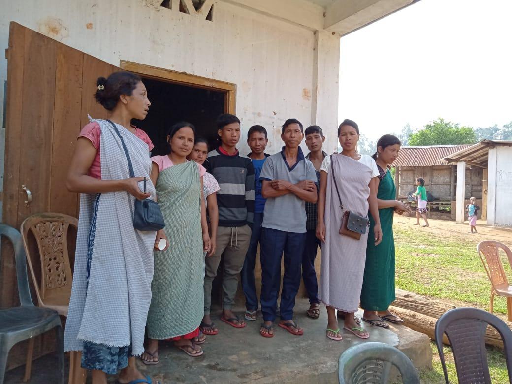
Figure – The village Natural Resources Management Committee
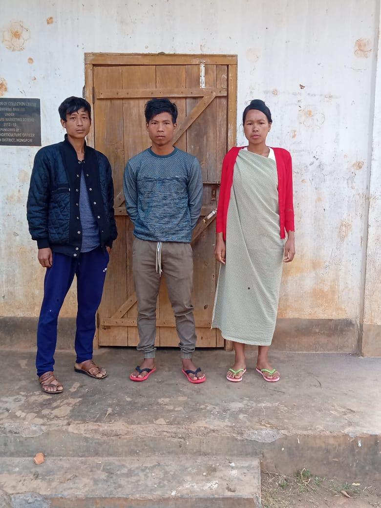
Figure – The Village Community Facilitators
3. Opening of Bank Account.
The opening of the bank account was initiated after the village signed the EOI (Expression of Interest), the VGA (Village Grant Agreement) and the Green Charter. Nongwah Mawlien village opened their VNRMC account after this.
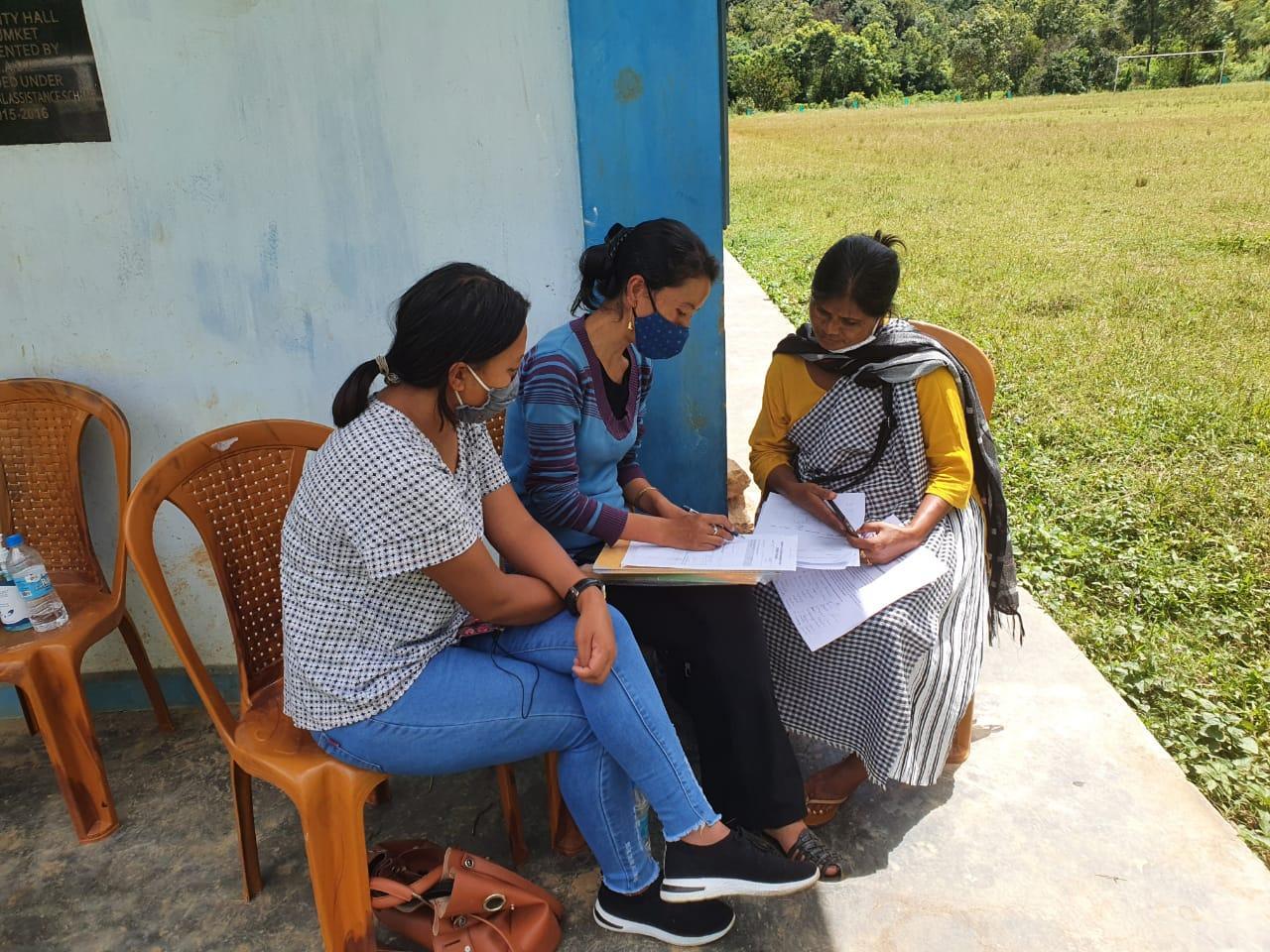
The Accountant of CLLMP Team Ri Bhoi District trained the Purchasing and Procurement Committee of Nongwah Mawlien Village to discuss various topics on accounts related matters.
Topics Covered:
Principles of Community Procurement
Benefits of Community Procurement
Important aspects undertaken by Community Procurement.
Procurement Process/Steps
Function of Purchase Committee
Important Procurement records to be maintained
Financial limits and methods
4. Participatory Rural Appraisal Exercise
18th ,March ,2019
PRA exercise at Nongwah Village took place from the 18th of March 2019. There were a total of 33 villagers taking part in this exercise who contributed their time and knowledge to this project.
18.03.2019 (Day 1: Re-Orientation on CLLMP and Discussion on CNRMP)
On the 18th of March 2019, the Assistance Knowledge
Management, Assistance Social Management and Assistance Manager of
Environment along with the DPMU team organized a re-orientation
program on CLLMP. 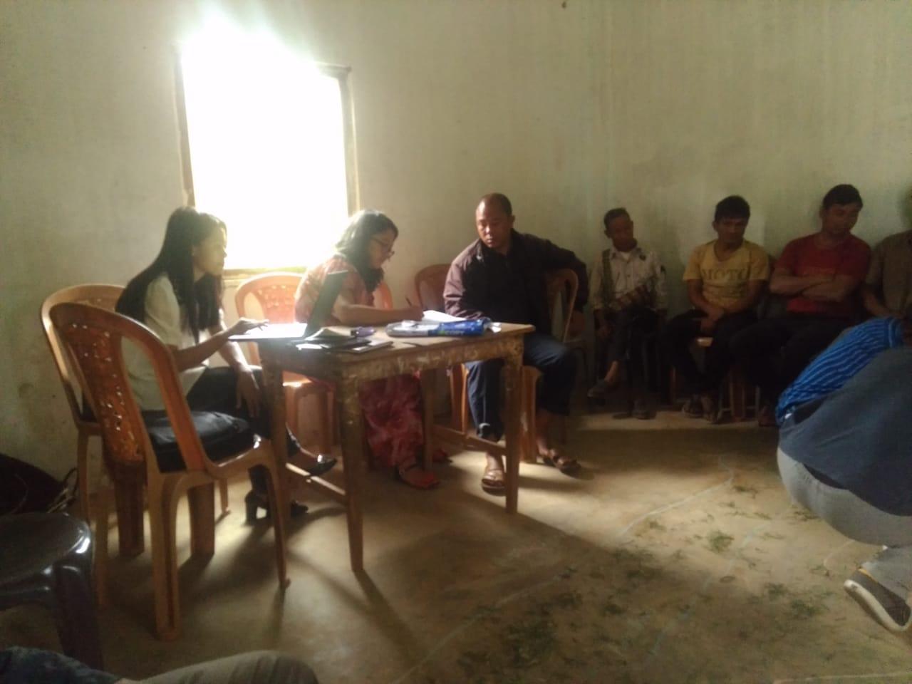
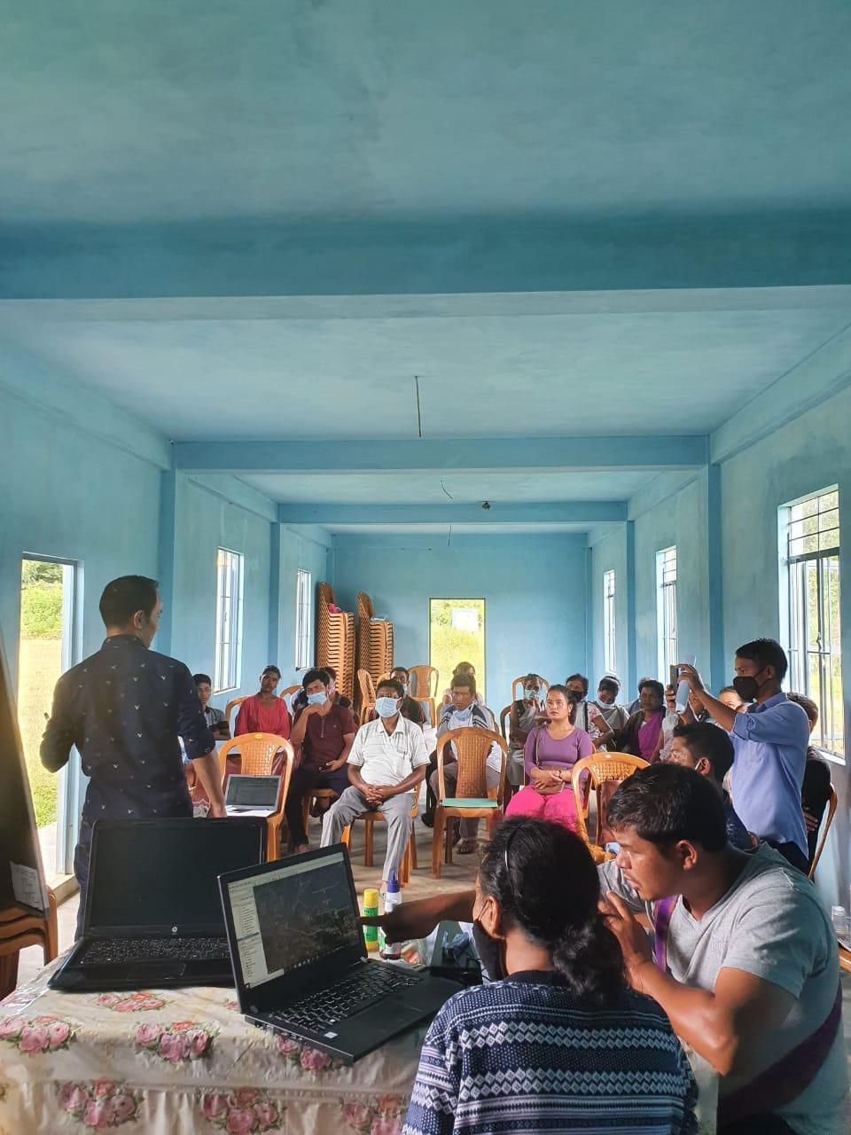
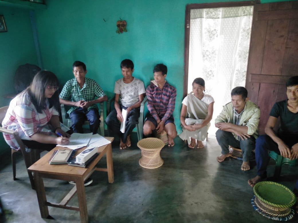
The initial stage of Participatory Rural Appraisal (PRA) exercise at Nongwah Village, commenced with a meeting cum orientation program on CLLMP. While conducting the meeting, the community members were made aware of the various PRA exercises to be conducted for the development of the Community Natural Resource Management Plan (CNRMP) of the village, the community members’ contribution in the exercise and the objectives to be achieved. The key informants (the VNRMC and the VCFs) helped facilitate maximum participation. The dates and time for conducting the various Participatory Rural Appraisal (PRA) exercises were fixed in consultation with the community members and all were requested to participate in the exercise. The schedule and time was announced at the end of the meeting.
DPMU CLLMP Team to discuss the Community Natural Resource Management Template and the various activities that will be undertaken during the PRA.
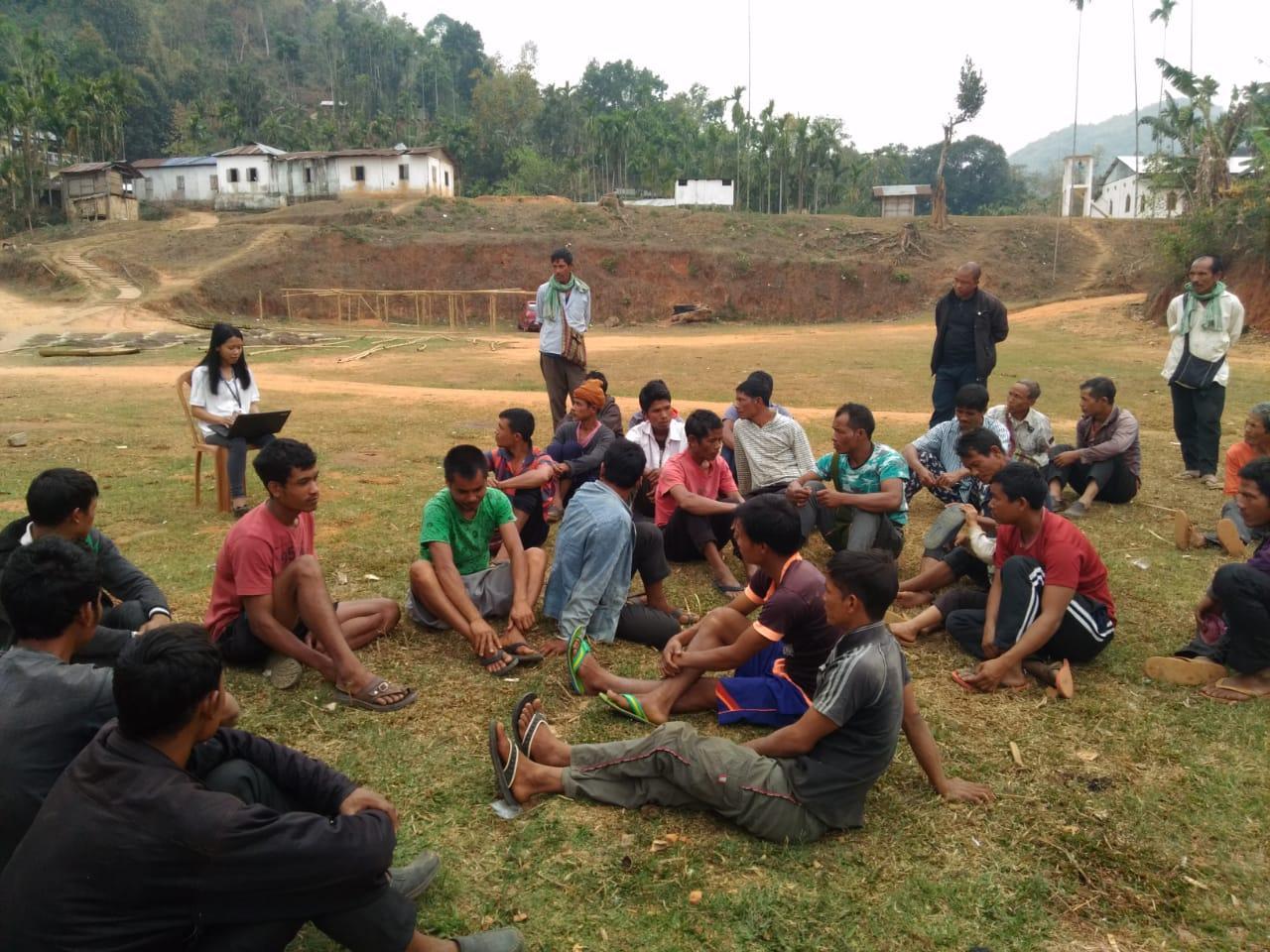
Figure 8 : Discussion with the DPMU CLLMP Team.
Participants on the 18th .03.2019
CLLMP officials: Shri Reuben Shabong(Assistant Manager Environment), Smt Fonda Sohphoh (Assistance Knowledge Management), Smt Baia Kurbah(Assistance Social Management).
Community members: Shri. Oskar Lyngdoh(Chairman), Francis Lapang (Secreatry) , Story Rani(Book-Keeper) and all community Members.
Commencement of PRA.
Introduction: Participatory Rural Appraisal (PRA) is the process of involving local people in the analysis and interpretation of their own situation of a given rural area. The local people i.e. the participants take a leadership role in collecting, analyzing, interpreting and presenting information and in this process impart knowledge and development insight to the specialists and extension agents.
For management of natural resources, participatory Rural Appraisal is conducted to establish rapport with the village community as well as to identify and define problems for prioritization in the village itself. It is a way of learning from and with community members to investigate their need assessment, analyze and evaluate constraints and opportunities and find out priorities in the area of agriculture, small scale rural enterprises and any other social and economic development programs addressed to village development. Based on the principle of listening and learning,
Objectives of PRA exercise at Umtung Village:
The Participatory Rural Appraisal (PRA) exercise at Umtung was conducted with following objectives:
To identify the natural, human and economic resources of a village.
To identify the village problems and prioritize them with the help of the community members.
To prepare the Community natural Resource Management Plan of the village.
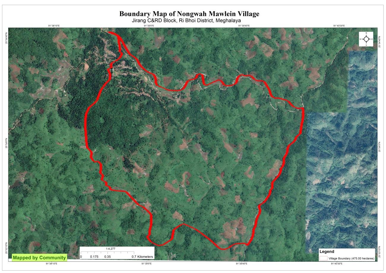
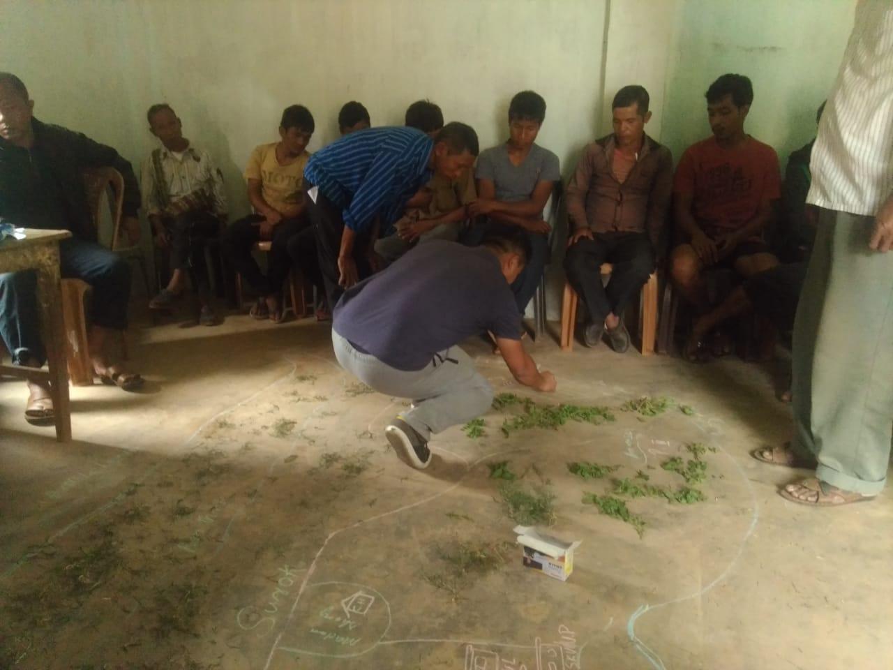
Activity 1: Village Boundary Mapping:
The GIS personnel along with the headman of Nongwah Mawlein Village outlined the boundary of this Village.
Activity 2: Drawing the Resource Map
The second step is to involve the local community in preparation of a village resource map as perceived by the community members to solicit their participation. Infrastructure, services and other village resources such as agricultural lands, wells, wastelands, cattle population etc. were mapped. Local people prepared the Resource Map by drawing it on a chart paper without much interference from outsiders.
This activity achieved the following purposes:
Rapport building and winning the confidence of the villagers.
Analyzed the spatial information, particularly studied problems and opportunities of villagers.
Got an impression about the village setting, physical layout,
location of various houses and institutions.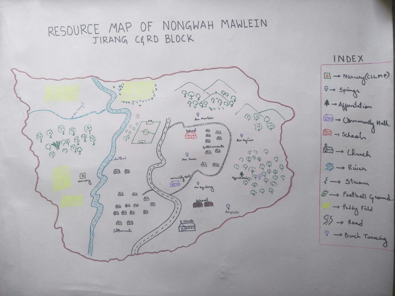
Fig: resource Map of Nongwah Mawlein
Findings Based on the Resource Map of Nongwah Mawlein Village:
Main agriculture produce is Paddy and
There are 2 types of Forest ownership: Community and Government Owned.
2 community forest: Jashir and Nongbhow
1 Government Forest: Wah Mawrong
Eight (8) springs are present in the village.
One (1) main river (Amthni) is present through the village.
Six (6) Stream join to Amthni rivers
Three water tanks are available and One check dams are available.
Presence of Barren land
Seven dugout ponds for fisheries and water reservoir.
School: there are two primary schools in the village.
Presence of Anganwadi Centre.
Connectivity : Roads and footpaths within the village are muddy in the rainy season and dusty in dry season.
Habitation is not confined to one place but spread all over the village.
Activity 3: Baseline Data Survey to fill the Environment and Social Template
During the PRA exercise, the EE (External Experts) of Social Management and the community members were divided into groups to fill the Social and Environmental Templates. Discussions and consultations with social groups existing in the village were held to gather basic village information regarding households, demographic information, major crops and enterprises taken in the village, trends of production and productivity of major crops in the village and demographic distribution of village population.
The External Expert Environment Manager along with the community
members discussed and collected information related to land use
category, forest types, water bodies, plants species and animals
species present in the village area. Various problems faced by the
community members are discussed, especially those related to NRM.
Scarcity of water and Forest fire are issues faced by the villagers
during the dry season. The list of local species of trees present in
the village and their availability are discussed. Plans proposed by
the VNRMC are discussed and different interventions that can be
added by the VNRMC are discussed.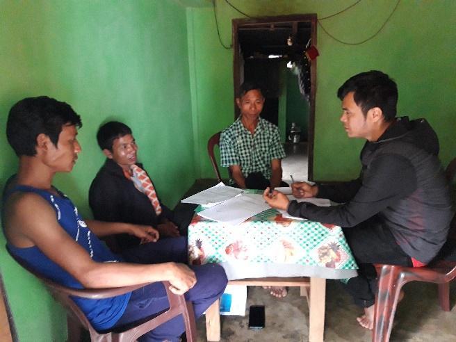
Participants:
Oskar Lyngdoh – President, Francis Lapang – Secretary, Story Rani – Booker, Phrangsngi Rani – VCF, Kyrmen Wahlang – VCF, Lanosha Lyngdoh – VCF, Bestarshon Sohkhwai – Purchase Committee, Delington Rani – Purchase Committee, Sertis Syiem – Community Member, Thain Rani - Community Member.
Activity 5: PROBLEM ANALYSIS
Do people have sufficient access to supply of fodder ,fuel wood, leaf litter?
YES, they access sufficiently to all the three fodder, fuel wood and leaf litter.
B. Has access to timber improved or reduced over the years? How is access for household use and commercial use managed?
Timber production has been reduced over the years they have to but they are still sufficient for houses construction and also for household use and also Timber they are use for commercial
C. Are the Water bodies facing any threats?
None
D. Do all the people in the village have access to drinking water? What are the challenges?
Yes , they have access to drinking water but there are less water sources and less water tank in the village so it does not provide enough water to the villagers they face challenges especially in the dried season , there is PHE water Govt supply but it is not regular so peoples faces a lots of difficulty like they have to go to far places to collect drinking water
E. Are there degraded areas in the village (open/degraded forests , mining affected ,high soil erosion etc)?
None.
F. What has caused this degradation ? Are there practices causing threats to availability and access to natural resources ?
None.
What have been the changes in agricultural practices?
There are no such changes in the agricultural practices. They are still engaged in jhum cultivation, paddy fields but somehow in recent years people started cultivating cash crops in which it is a very start that they can improve their livelihood and economic status.
Are there any challenges in farming?
Yes they face a lot of challenges especially water for irrigation no proper water canal and also wild animals destroys their crops ,environment challenges etc
How would you consider the health situation in your village?
The health situation at Nongwah Mawlein village it has improved as compare to others years the ASHA plays a very vital role in keeping the health of the peoples in a good state they conduct awareness programme from time to time they also go for home visit to give polio and also the villagers are aware of their health and surrounding they also learns how to keep themselves good and healthy , the Asha and the anganwadi plays a vital role in the village they helps providing supplements and nutrients to the pregnant women and to the infants.
How is the situation of cleanliness , sanitation access to toilets and waste management ?
Cleanliness is the priority of the village but without the cooperation of the community they cannot keep their surroundings and environment clean. Half of the households in the village have no access to toilets .Cleanliness and sanitation are still lacking in the village.
Who is the most vulnerable group in the village? What can be done to improve their lives?
BPL Families . Inclusion of BPL Families during project implementation.
What are the livelihood aspirations of the youth ? Are there any avenues available?
The majority of the people in the village turn to farming and job cards under MGNREGA for employment and also they engage in some self-employment to earn to improve their livelihood and mostly the youths work under daily wages.
Do any committees /institutes/rules exist to manage and monitor natural resources in the village?
The village executive committee and the VNRMC under the CLLMP manage the Natural resources in the village . prior to the CLLMP the village received permission from the forest management committee to look after and preserve the forest.
What are some of the major issues or conflicts in the village?
The village does not have any major issues or conflicts till dates.
Have any of the above issues been discussed in village meetings?
Yes, all the conflicts and issues are discussed and solved in the village meetings .
How do people resolve disagreements and conflicts?
All disagreements and conflicts are addressed by the traditional institution of village governance called the village Durbar.
Activity 6: Seasonality Calendar
The EE (External Expert) also mapped the seasonal calendar of Nongwah Village to help identify heavy workload periods, periods of relative ease, credit crunch, diseases, food security, wage availability etc. This will prove helpful in project planning and project timeline framing.
Participants:
Shri. Oskar Lyngdoh- VNRMC Member
Smt. Lanosha Lyngdoh - Village Community Facilitator
Shri. Phrangsngi Rani – Village Community Facilitator
Smt. Iohbatkynti Kharmudai- Community Member
Smt. Jonika Mawrie - Community Member
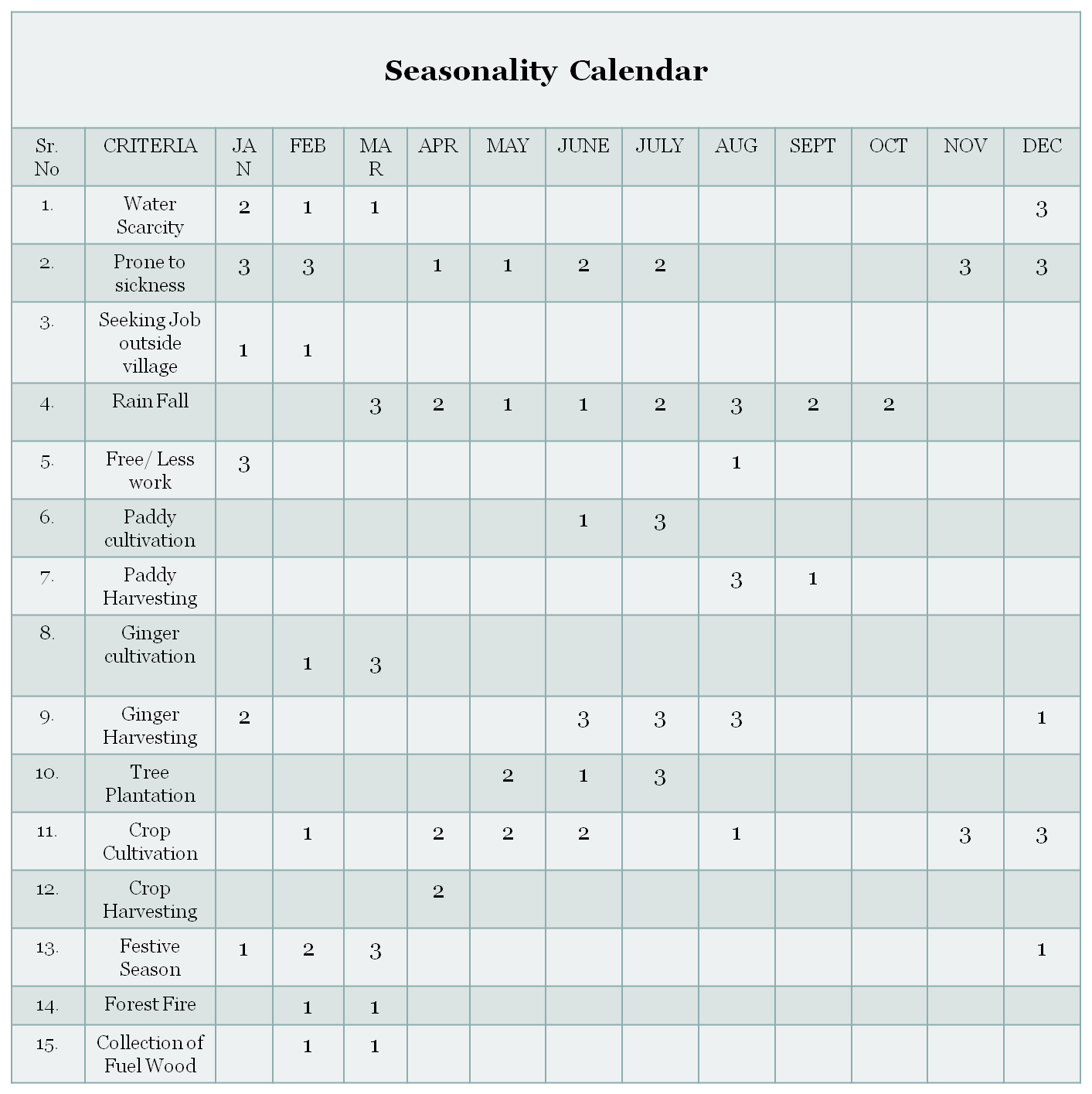
| MAXIMUM | 1 |
|---|---|
| MODERATE | 2 |
| LESS | 3 |
Activity 7: Submission of the List of NRM activities proposed by the VNRMC.
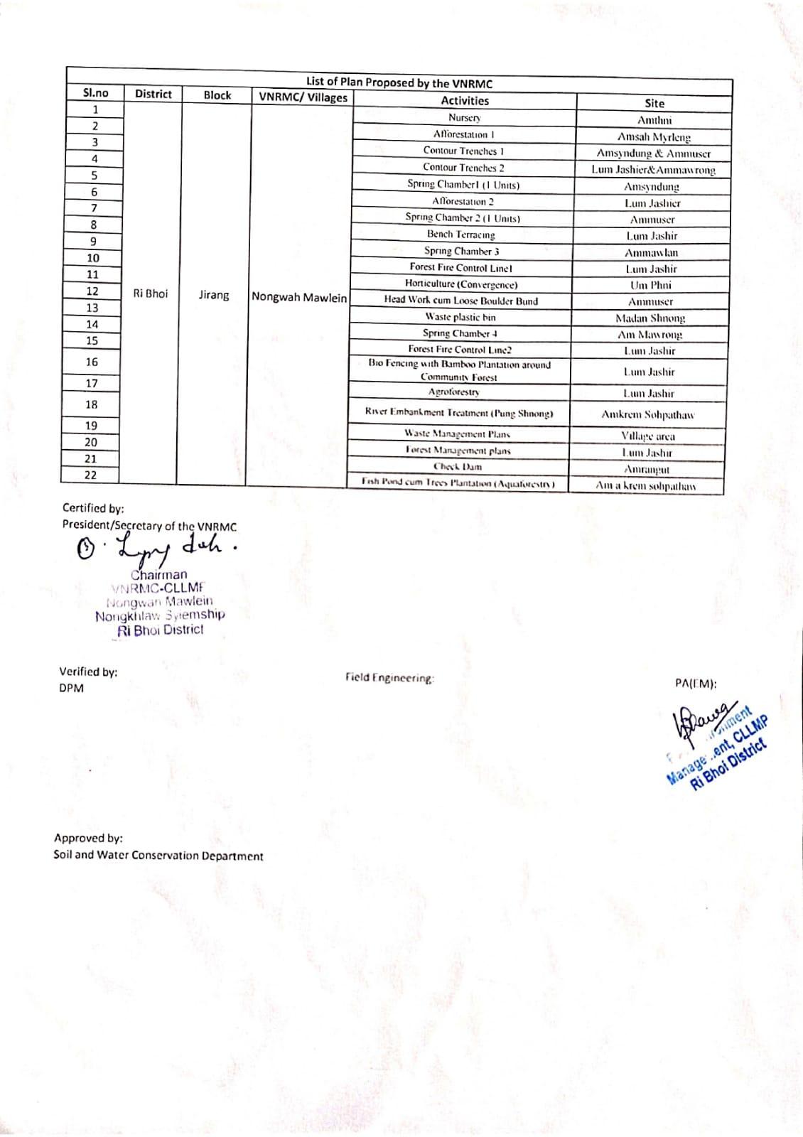
The Finalized Community Natural Resource Management Plan of Nongwah MawleinVillage.
|
|
|
|
|
||
|---|---|---|---|---|---|---|
|
|
|
||||
|
|
|
|
|
|
|
|
|
|
|
|
|
|
|
|
|
|
|
|
|
|
|
|
|
|
|
|
|
|
|
|
|
|
|
|
|
|
|
|
|
|
|
|
|
|
|
|
|
|
|
|
|
|
|
|
|
|
|
|
|
|
|
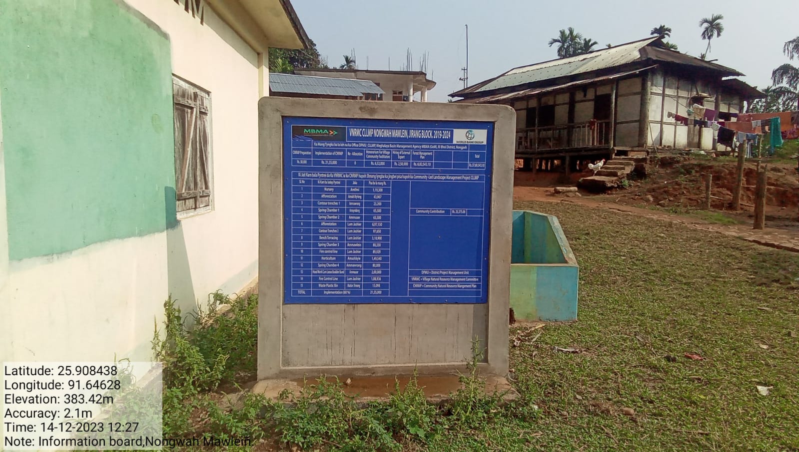
PROJECT IMPLEMENTATION
| INTERVENTION | SITE NAME | AMOUNT SANCTIONED | TREATED AREA | BENEFITTED AREA | STATUS |
|---|---|---|---|---|---|
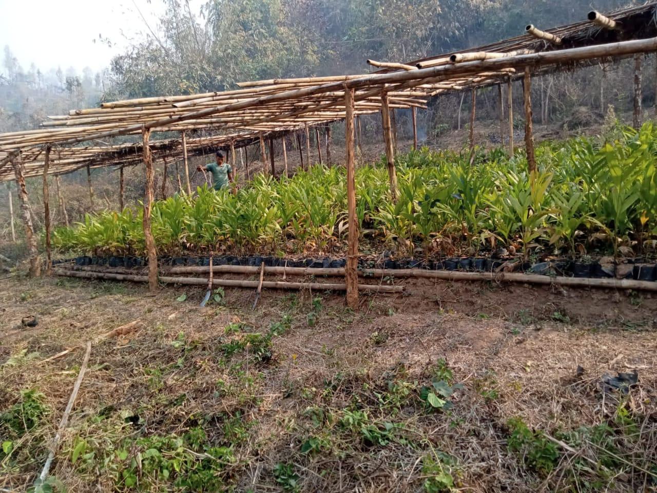
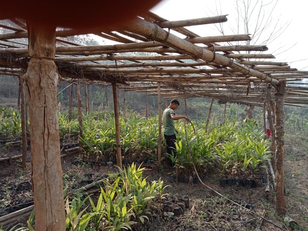
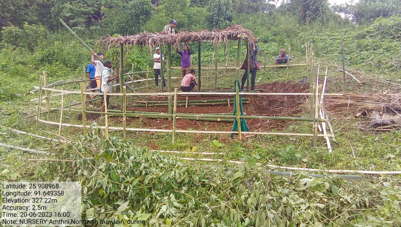
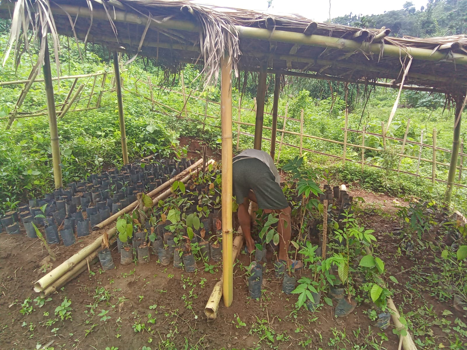
| NURSERY | UMTHNI | 1,19,300 | 0.0135(Ha) | 4.361177116(Ha) | Completed |
| INTERVENTION | SITE NAME | AMOUNT SANCTIONED | TREATED AREA | BENEFITTED AREA | STATUS |
|---|---|---|---|---|---|
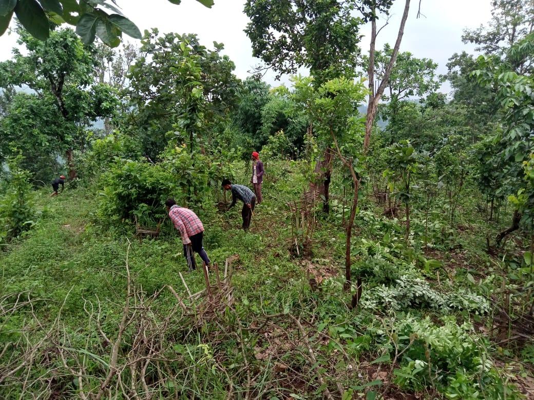
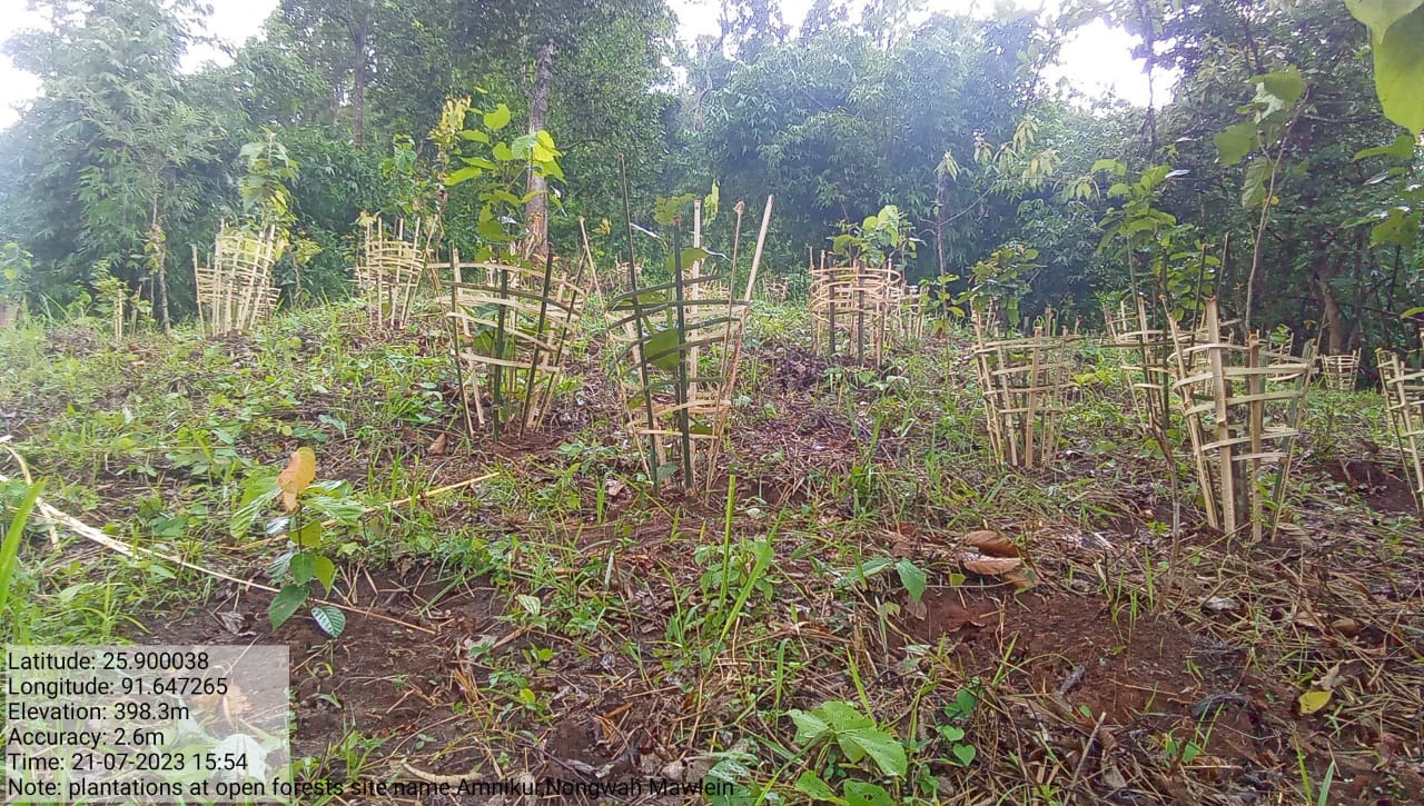
| AFFORESTATION | Amsah Myrleng & Lum Jashier | 43,967 6,97,150 |
4(Ha) | 9.60(Ha) | COMPLETED |
| INTERVENTION | SITE NAME | AMOUNT SANCTIONED | TREATED AREA | BENEFITTED AREA | STATUS |
|---|---|---|---|---|---|
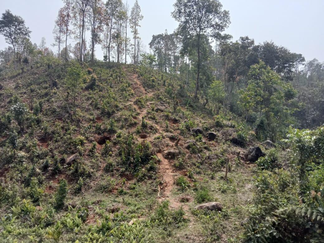
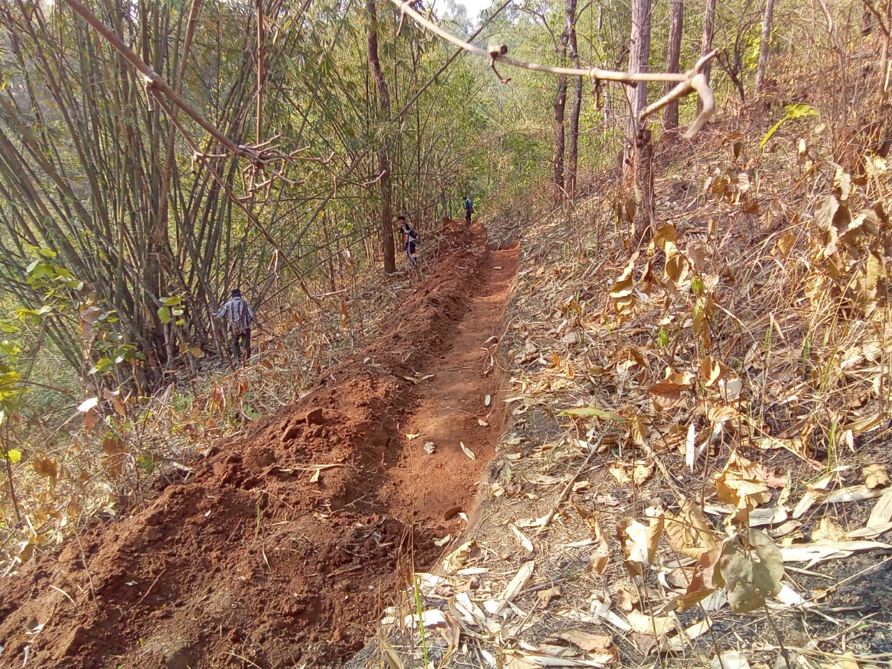
| FIRE CONTROL LINE | LUMJASHIER | 89,929 | 4119M | 15(Ha) | COMPLETED |
| INTERVENTION | SITE NAME | AMOUNT SANCTIONED | TREATED AREA | BENEFITTED AREA | STATUS |
|---|---|---|---|---|---|
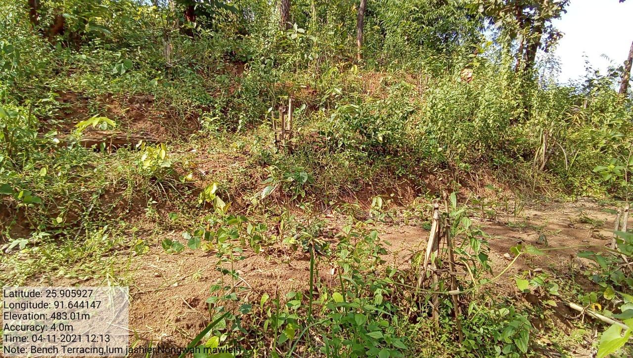
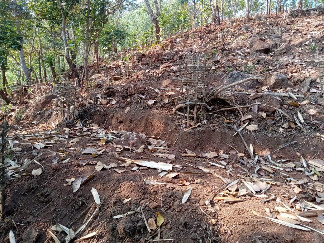
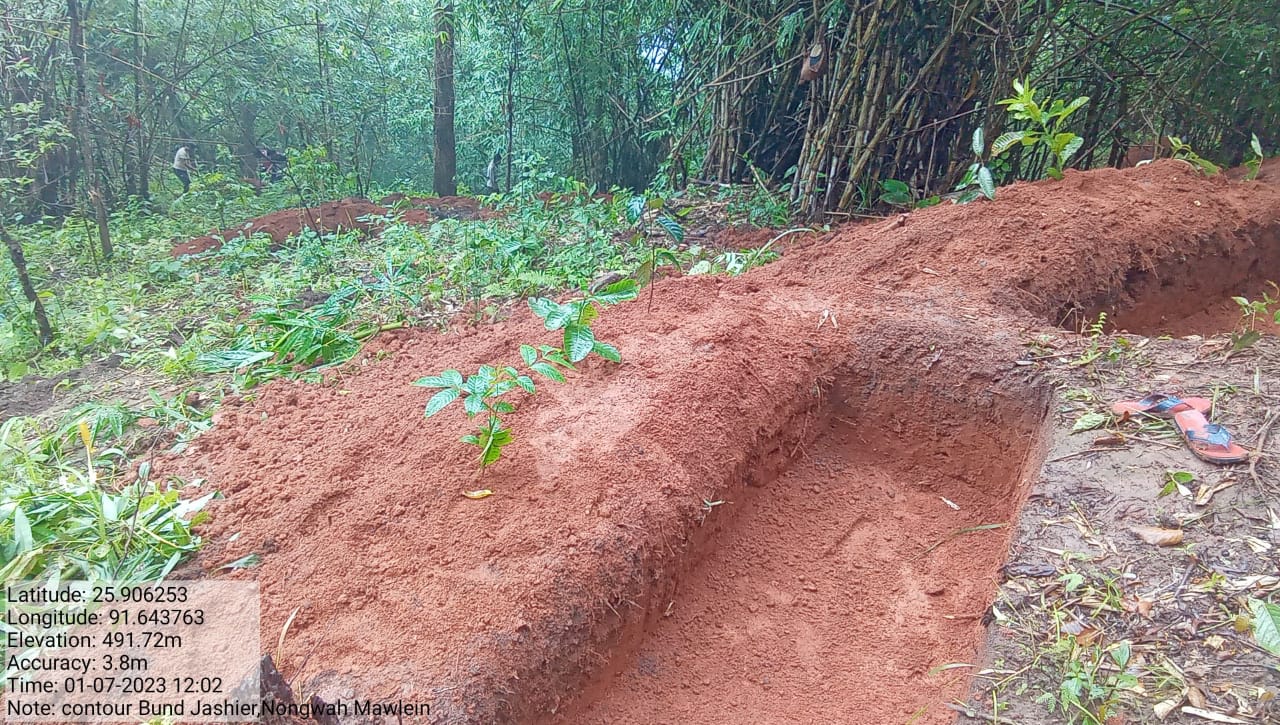
| BENCH TERRACING | LUMJASHIER | 3,18,900 | 0.208(Ha) | 27.02575322(Ha) | COMPLETED |
| INTERVENTION | SITE NAME | AMOUNT SANCTIONED | TREATED AREA | BENEFITTED AREA | STATUS |
|---|---|---|---|---|---|
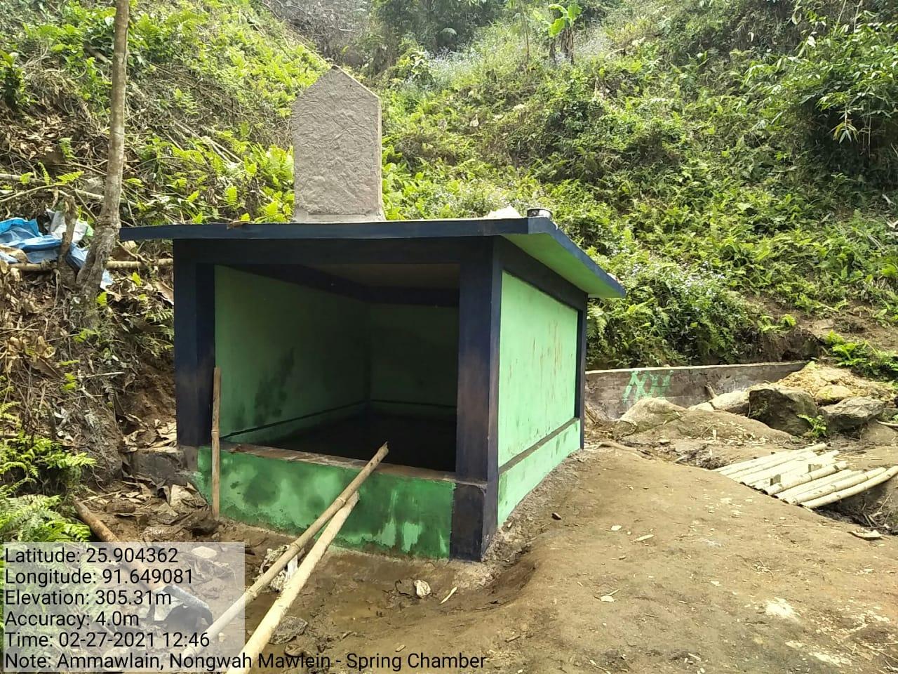
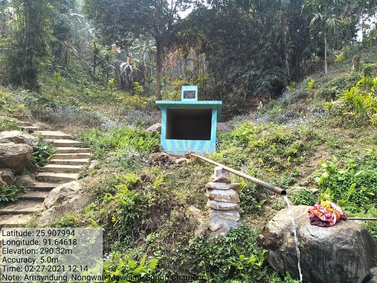
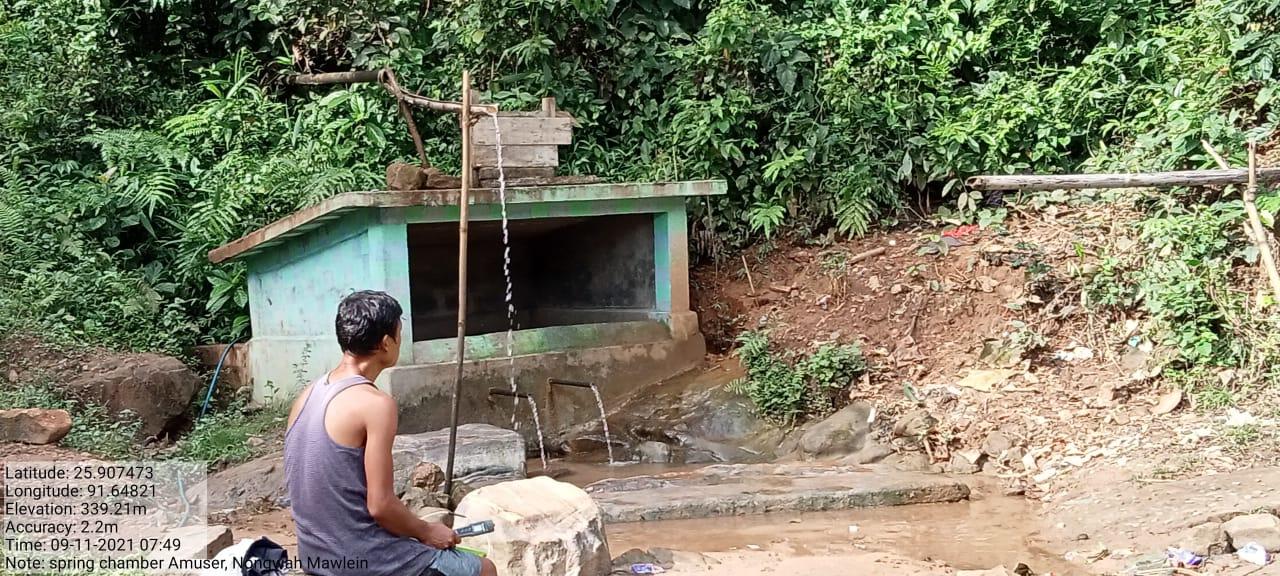
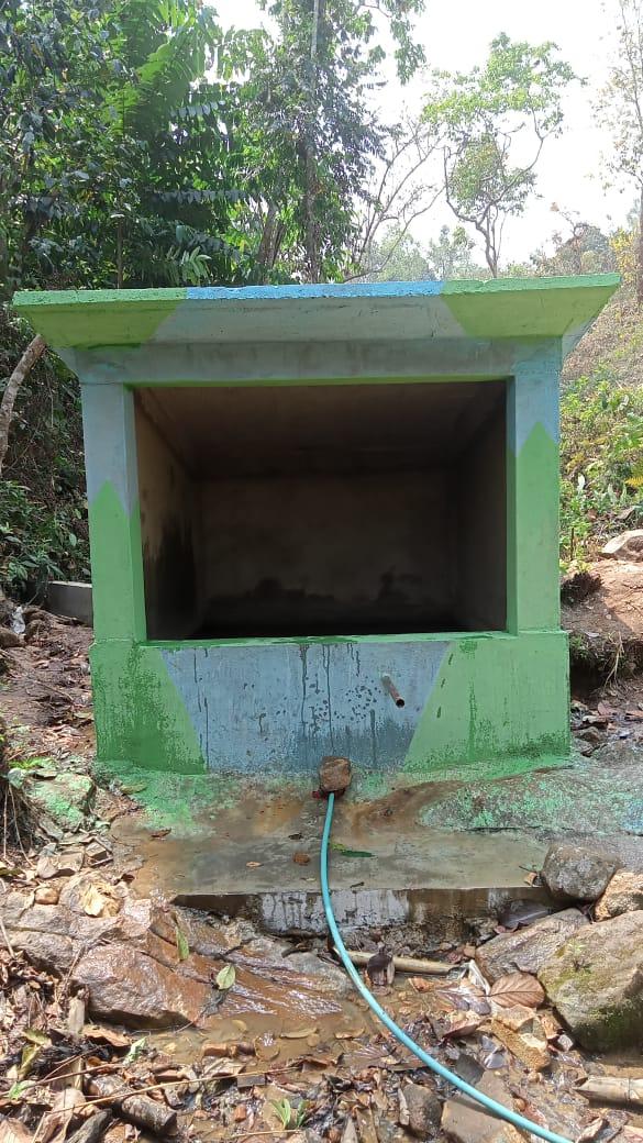
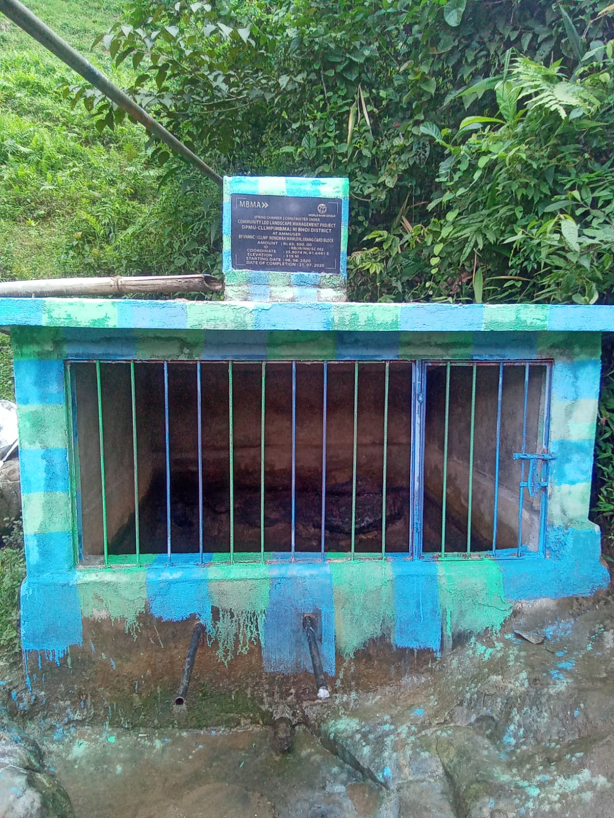
| SPRING CHAMBER | AMMAWLAIN AMSYNDONG AMMUSER |
80,330 65,500 65,500 |
0.0004(Ha) 0.006(Ha) 0.006(Ha) |
1(Ha) 2.394443429 |
COMPLETED |
| INTERVENTION | SITE NAME | AMOUNT SANCTIONED | TREATED AREA | BENEFITTED AREA | STATUS |
|---|---|---|---|---|---|
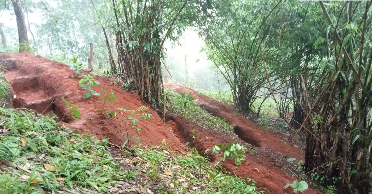
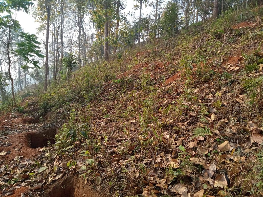
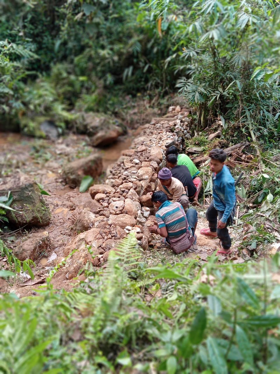
| CONTOUR TRENCHES | AMSYNDONG UMMUSER |
23,200 97,650 |
2(Ha) 8(Ha) |
4.025752224(Ha) 5.595(Ha) |
COMPLETED |
| INTERVENTION | SITE NAME | AMOUNT SANCTIONED | TREATED AREA | BENEFITTED AREA | STATUS |
|---|---|---|---|---|---|
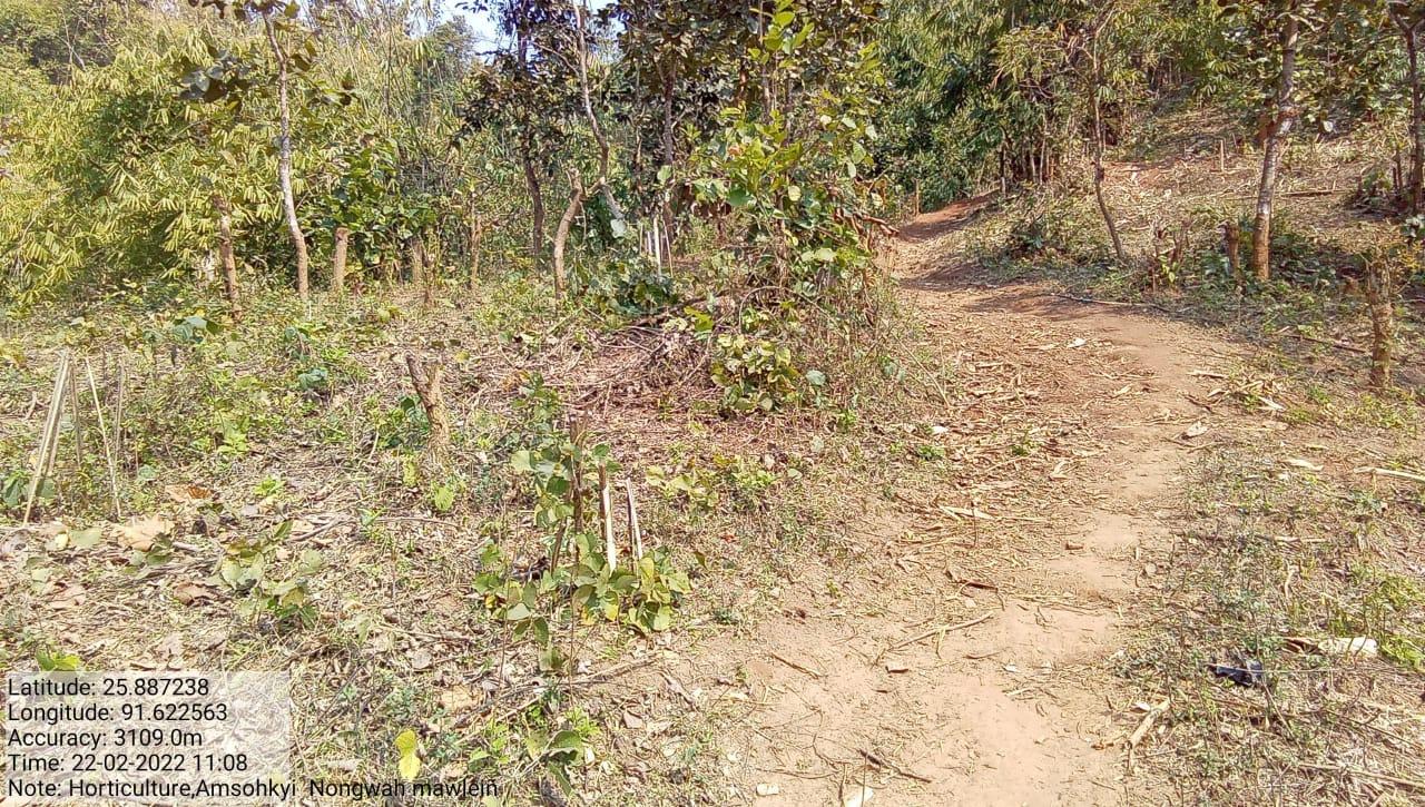
| HORTICULTURE | AMSOHKYI | 1,49,540 | 3.6(Ha) | 15(Ha) | COMPLETED |
| INTERVENTION | SITE NAME | AMOUNT SANCTIONED | STATUS |
|---|---|---|---|
| Spring Chamber 4 | Ammawrong | 80,000 | Completed |
| INTERVENTION | SITE NAME | AMOUNT SANCTIONED | STATUS |
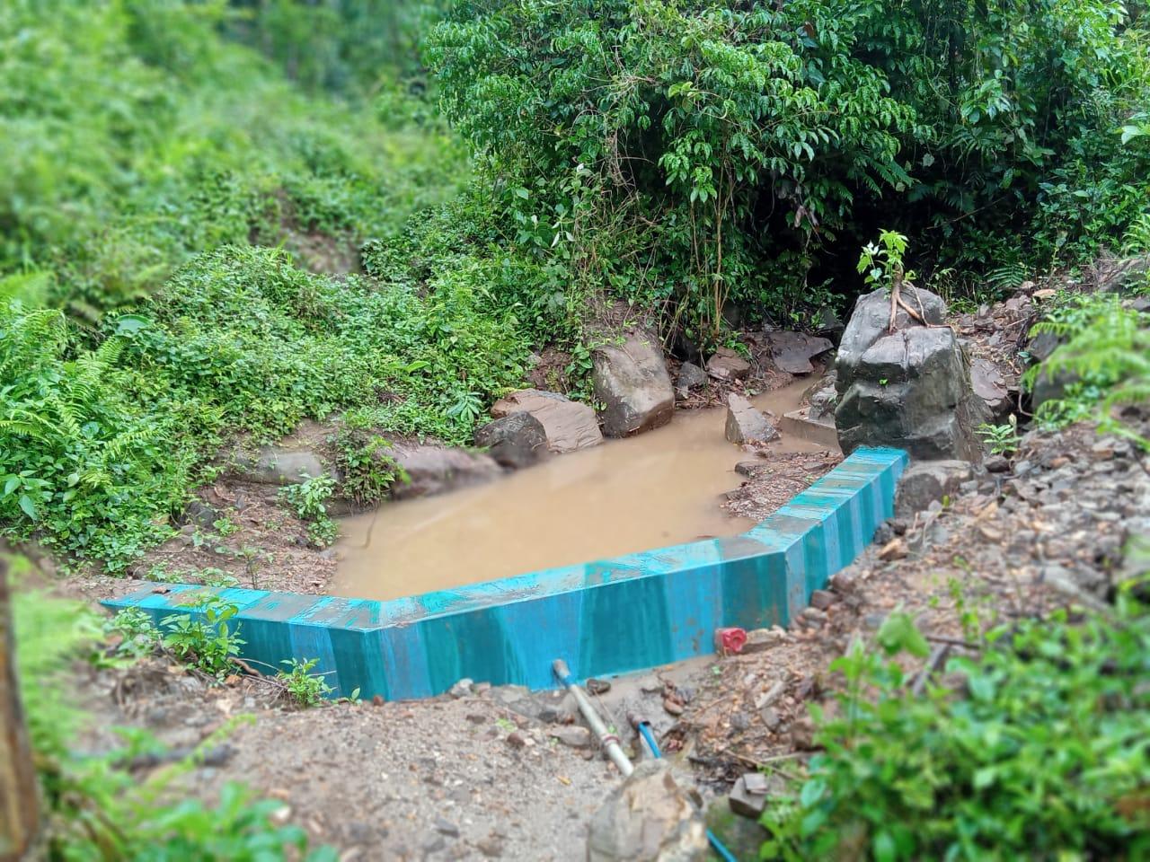
|---|---|---|---|
| Headwork cum loose boulder bund | Ammuser | 2,00,000 | Completed |
| INTERVENTION | SITE NAME | AMOUNT SANCTIONED | STATUS |
|---|---|---|---|
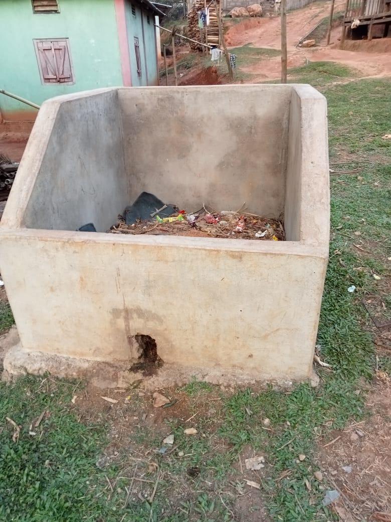
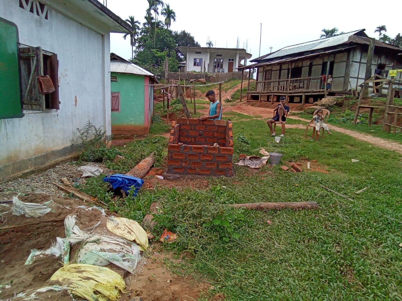
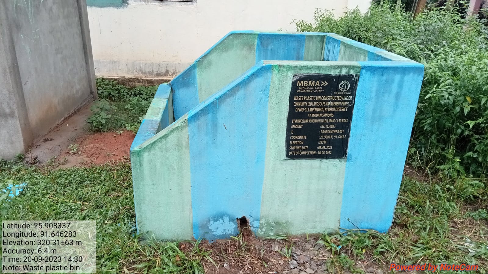
| Waste plastic bin | Madan Shnong | 15,098 | Completed |
| INTERVENTION | SITE NAME | AMOUNT SANCTIONED | STATUS |
|---|---|---|---|
FMP activities : Fire Line Control Contour Bund ENRICHMENT PLANTING IN FOREST BLANKS Insitu & Ex-situ SAMPLING FOR THE AVAILABLE NURSERY |
Community area | 6,82,544 (All FMP Activities) | Completed |
| INTERVENTION | SITE NAME | AMOUNT SANCTIONED | STATUS |
|---|---|---|---|
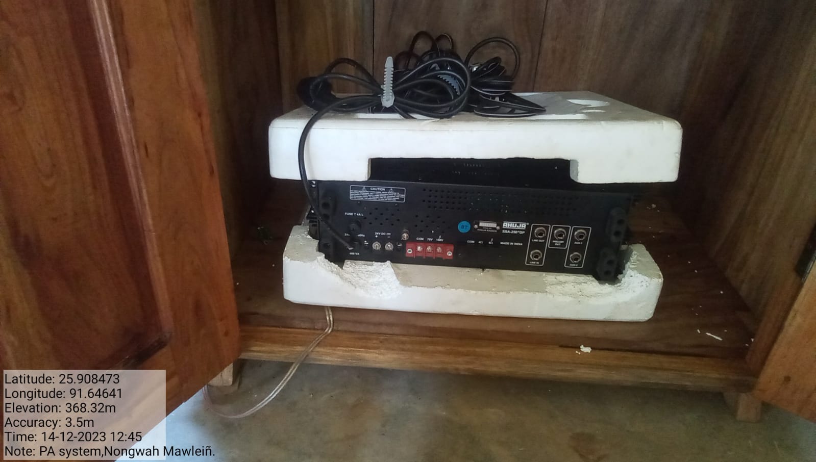
Excess fund Activities Upgradation of Community Nursery Gates for Spring Chambers PA System Signboard 2nd Installment |
under Community land | 1,52,345 | Completed |
TESTIMONIALS
President-Oskar Lyngdoh 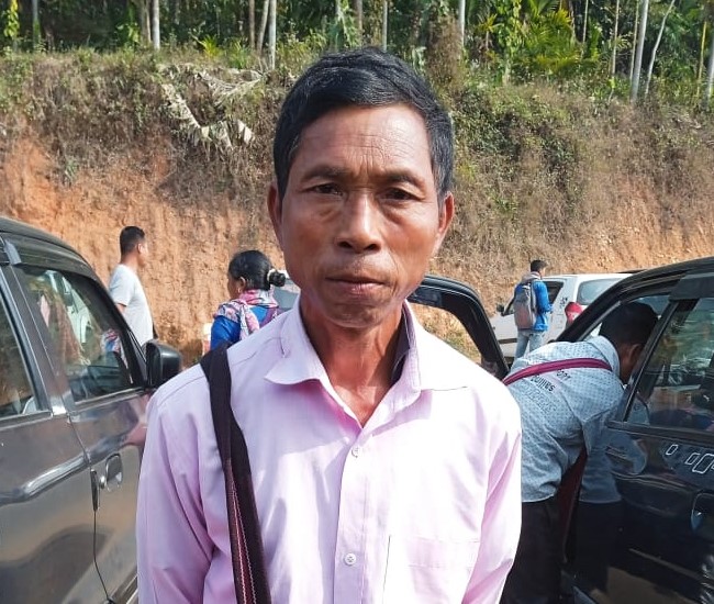
It is evident from the fact that our village has been hugely transformed ever since CLLMP has been introduced in our village and the positive impact it has had on our community. The project appears to focus on various aspects such as water management, horticulture, afforestation, waste management, and imparting knowledge to everyone. It's great to see that the project has brought many benefits and improvements to the village. A summary of the benefits are as follow:
Increased Water Sources: The project has helped address the scarcity of water in the village by creating additional water sources, likely through the construction of spring chambers and check dams.
Environmental Benefits: The project has focused on environmental conservation by implementing afforestation measures and taking care of trees. This has led to cleaner water sources and fresher air in the village.
Improved Health and Hygiene: The project has provided education on health and hygiene, emphasizing the importance of clean water and healthier surroundings.
Educational Opportunities: Members of the project, including the VCF (Village Community Facilitators), VNRMC members have gained knowledge and skills in various areas, such as data entry, record-keeping, and accounting among others that have improved the understanding and knowledge of the members
Soil Erosion and Drought Prevention: Measures like bench terracing and check dams have helped prevent soil erosion and mitigate the impact of droughts.
Waste Management: The project has utilized waste plastic for some purpose, likely contributing to waste management efforts in the village.
Community Involvement: The project has involved the local community, empowering VCF members to actively participate and contribute to the betterment of the village.
Safety of Surrounding Forests: Afforestation efforts have contributed to the safety and preservation of the surrounding forest areas.
Overall, this project seems to have had a positive and transformative impact on the village, addressing various environmental and socio-economic challenges. It's heartening to see how collaborative efforts can lead to meaningful improvements in local communities and as the head of the village I’m grateful for the endless support, assistance and a huge transformation that the project has brought in our village.
Secretary-Installment Wahlang 
I’m grateful to the project as it has given me this role in which I get to take part in various meetings and decision making matters. The interventions have made our life easier and improved our daily lives in various ways and means. From not knowing much about NRM activities to now working for the restoration and promotion of NRM activities, the project has made it all possible. The project reminded us of our duties towards Nature and that we are just caretakers and custodians of it, not owners of the free gifts that nature has given us.
VCF Social-Lanosha Lyngdoh 
As a Social Facilitator's my role mainly emphasises on social responsibilities and promoting healthy practices within the community which underscores the holistic approach of the CLLMP project. The project not only focuses on environmental aspects but also considers social well-being and community engagement throughout its duration.
VCF Environment-Permanent Rani
As an Environmental Facilitator I give my sincere acknowledgement to the management unit's for their hard work and support and its success lies in the importance of teamwork and collaboration in achieving success in natural resource management. By learning and putting environmental knowledge into practice will undoubtedly have a positive impact on the village's sustainability and I hope that all of the teachings I’ve gathered from the project can be utilised in the best possible manner at all times.
VCF Monitor –Kyrmen Wahlang
It’s evident that the CLLM project has been instrumental in improving the living conditions and environment in the village. The efforts of the VCF members and the support received from the project have played a significant role in bringing about these positive changes The success also lies on the commitment that we as VCFs has put in, to promote a harmonious ecosystem and working on the restoration of water sources and greenery which shows our deep concern for nature and the environment.