REPORT ON
NONGKTIEH VILLAGE UNDER RANIKOR C&RD BLOCK
DISTRICT: SOUTH WEST KHASI HILLS
COMMUNITY LED LANDSCAPE MANAGEMENT PROJECT


COMMUNITY LED LANDSCAPE MANAGEMENT PROJECT (CLLMP)
The Government of Meghalaya with the financial help from the World Bank has been implementing the Meghalaya Community Led Landscape Management Project (MCLLMP). The project covers the entire state of Meghalaya and implementation of community led plans have been rolled out in phase manner throughout the state. The Meghalaya Basin Management Agency (MBMA) had facilitated the community-led planning by providing support, technical inputs and funding.
The project had strengthened community-led natural resources management in selected landscapes within the 12 districts of the state. This has been achieved through a variety of planning, capacity building, and on-the-ground interventions to promote the conservation, sustainable use of natural resources, social inclusion and community mobilisation; building traditional knowledge and learning, mapping of natural resources management; strengthening the community institutions and creating linkage with financial institutions and community organizations.
The project interventions include the preparation of community led natural resource management plans. The CLLMP has the following three components:
Strengthening Knowledge and Capacity of Communities for Natural Resources Management
Community-Led Landscape Planning and Implementation
Project Management and Governance
The project objective is “to manage and conserve the natural resources, especially forests, soil and water sources, in a manner that supports the financial and physical well-being of communities in the State”
SCOPE:
The CLLM-Programme focuses on increasing the capacities of communities and traditional institutions (TI) by adopting a landscape approach to manage their natural resources such as soil, springs and other water sources, forests and bio-diversity, etc.
The project has been planned and implemented in about 400 villages across the state.
CLLMP has a strong focus on institution-building at the village-level, by ensuring systematic capacity-building on technical and social skill-sets.
The project has also extended such trainings to communities beyond the targeted villages and support efforts made by them to access funding from various rural and natural resources initiatives and schemes.
The programme has also invested in improving the process and outcome delivery, by developing and adhering to effective systems and procedures, supported by the appropriate technology.
BENEFITS:
Benefits for community (Skills and Capacity relating to technical and managerial areas like NRM and Conflict resolution.
Benefits to traditional institutions (village councils, traditional leaders, community-based organizations, SHGs etc) through Knowledge sharing, promotion of innovative approach, access to technology, technical managerial and financial support.
It has been estimated that the project has impacted around 1 lakh partners (of which 50% are women) who depend on land, forest, agro forestry.
Through the project, 55000 Ha of targeted area has been ensured with availability of water, biological resources and soil productivity, which has in turn benefitted around 400 villages and the outcomes delivery can be summarized as follows.
IMPLEMENTATION AGENCY:
The Project has been executed by the MBMA in collaboration with other partners particularly, SIRD (for training and capacity building), Department of Soil and Water Conservation, Water Resource Department, Forest Department, specifically with respect to technical inputs, safeguards management and Community NRM plan preparation.
PROJECT PERIOD:
2018-2023 (5 years)
TABLES OF CONTENTS PAGE NO.
INTRODUCTION. 5
Brief History About the Village 5-6
Social Profile of The Village 6-9
Village Accessibility 6
Literacy Rate 6
Population 7
Occupation 7
Fuel Type 8
Card Holding Household 8
Drinking Water 8
Cultivable Land Area 8
Forest Cover 8
Forest Species 9
Water Bodies 9
Area Affected 9
CLLMP ACTIVITIES.
GROUND TRUTHING 9
Sensitization Program 10
Signing of EOI, VGA and Green Charter 11
Formation Of the VNRCM 11-14
Village functionaries 12
Village Community Facilitator 13
Procurement Member 13
Opening Of Bank Account 13-14
Participatory Rural Appraisal Exercise 15-18
Gis Activities 19-20
The Proposed List of Intervention 20-21
Project Implementation 21-31
Fund Status 32-33
Ground Testimonials_________________________
INTRODUCTION:
Nongktieh village falls under Ranikor C&RD Block of South West Khasi Hills District in the state of Meghalaya. The village has a distance of 18 kms from Block Headquarter and 28 kms from Mawkyrwat, the District Headquarter. It falls under Hima Maharam Syiemship with a total geographical area of 1229.6 ha and a total population of 1082 villagers. All the resident of Nongktieh village belonged to the Khasi Scheduled Tribe. The average rainfall of this village is 1200- 3000 mm and the type of soil is fine loamy and coarse loamy.
BRIEF HISTORY OF NONGKTIEH VILLAGE:
Nongktieh village is under Hima Maharam, South West Khasi Hills District. It exists in the North Eastern side from the hills Iawpaw. This village is like a ground field resembling a table where there are many cliffs that are beautiful to look at.
The village is adjacent to two rugged soils which are of the two clan that is of the clan Lyngkhoi Nongnah and the clan Paliar. The village is called Nongktieh because the whole length of the village is full with mud especially in the rainy season. The first people who came and settle in this village was Larwan Thongni from Rangjadong village who married Step Lyngkhoi from Ngunraw village. The couple did not settle in Rangjadong village instead they came and settle in the mountain Mawtariem and since then they name that place as ‘Step Larwan’. But because they did not find an alter to sacrifice their Gods, they decided to came and settle at Nongktieh which is near to the altar to sacrifice. As the time goes by, to make the village more sufficient, Larwan Thongni went to pick up the clan ‘Kurkania and Nonglong from ‘Dommaning’ to settle together with them. Till now, these clans still settled there.
SOCIAL PROFILE OF THE VILLAGE:
The Dorbar serves as the traditional form of local governance in the village and looks after the administration, safety of villagers as well as overall governance. Apart from the village Dorbar, there is also the Nongktieh VEC and the recently formed VNRMC which looks after the implementation of CLLMP activities aided by the World Bank.
Nongktieh village has a total number of 158 households and having the population of 982 villagers. Agriculture and its allied activities are highly vogue in this village, where some few others are being engaged in labourers, government services, and in business.
Village Accessibility: In order to reach to Nongktieh village one must take a road toward Rangthong village then to Keniong, Mawtaiem and turn in the left side of the road there is Nongktieh village.
Literacy Rate: As per census 2011, literacy rate of Nongktieh village was 67.38% out of which 65.92 males and 68.69%females are literate.
Population: As per census 2011, this village has a total population of 564 peoples, out of which male population is 267 while female population is 297 which has increase to 982 as per 2019 survey. Out of this 485 are male and 497 are female. This village has 106 populations of children between the age of 0-4 where 57 boys and 49 are girls.
| Age groups | Male | Female | Total |
|---|---|---|---|
| 0-4 | 57 | 49 | 106 |
| 5-14 | 122 | 148 | 270 |
| 15-30 | 255 | 230 | 485 |
| 30-60 | 30 | 40 | 70 |
| Above 60 | 21 | 30 | 51 |
Occupation:
The people of the village rely on agriculture and forest products for their livelihood. The main occupation of the villagers is farming followed by labourers, Government service and business.
Cards Holding Household:
| Name of Cards | No of Households |
|---|---|
| AAY | 16 |
| PHH | 108 |
| Health cards | 84 |
Fuel Types:
Most of the Household in Nongktieh village mainly use wood as fuel some are use LPG and electricity.
| Type of Fuel | Total No of HH | Qty (Kgs/HH) | Total |
|---|---|---|---|
| Wood | 130 | 6000kg (1 year) | 78,0000kg |
| LPG | 25 | 60kg (1 year) | 1500kg |
| Electricity | 3 | 1000 bill 1 month |
Drinking water:
The people of Nongktieh village have access to drinking water mainly from 3 springs that are within the village. Government water supply lines are also available in this village. But there has been a scarcity of water supply. As the source of water is downhill and settlement is uphill.
Cultivable Area:
The type of soil in Nongktieh village is fine loamy and course loamy soil. People practise shifting cultivation in private and clan lands. The main cash crops of Nongktieh village are, Arecanut, Betel vine, Wild Pepper, Bay leaf, and Broomstick. They also cultivate Orange, Lemon, Jackfruit and Litchi.
Forest Cover:
The total forest cover under Nongktieh village is 950.47 Ha. There are two protected forests one which is of the community and the other of the clan Lyngkhoi. There are also 4 numbers of clan forests namely, khlaw Lyngkhoi, Khlaw Paliar, Khlaw Khurnia, Khalw Syiemlieh. The quality of these forest ranges from open to dense. People use the forest products mainly for fuelwood.
Forest Species:
Some of the indigenous tree species and commercial valuable trees found in this village are Diengngan, Diengsohmon, Diengkhiat, Diengsnammaw, Diengsohlajat, Diengwaitlamkhar, Diengsohkhajur, there are some other valuable medicinal trees like Diengjaler (Bark- fracture), Diengbliat (roots- applied to wounds), Pitcher plant (fluid- healing to ears), (Roots- Khait - skin diseases) which are useful for the community. Some endangered species of flora and fauna found in Nongktieh village are: Diengsohpdung, Dieng bat mekhra, diengsohniamtra, Sla sohtngaw, phan saw niehtang, wild animals (Tngaw, khlathapsim, kyrbei (iguana), dngiem, Niangkhlaw (wild boar).
Water Bodies:
Total area of water bodies in Nongktieh village is 17.99 Ha. There are three springs within the village which people use mainly for drinking purpose. There are some streams which people use for domestic and drinking and three rivers which flow within the village geographical area which are used for conservation purpose.
Area Affected:
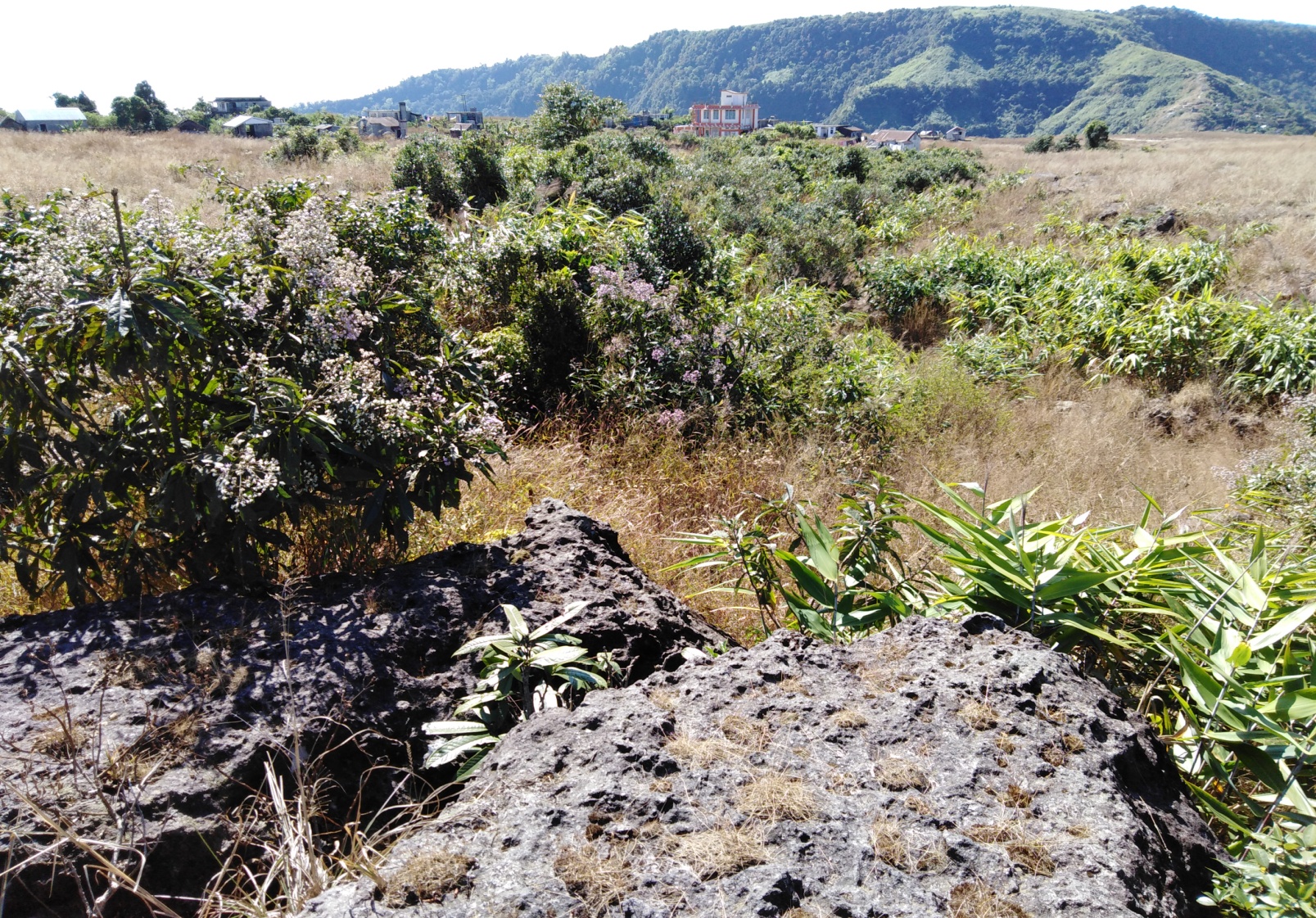
In Nongktieh village about 28.39 ha of land have been degraded over the years. Approximately 9.65 ha are due to soil erosion and excessive felling of trees. About 28.39 ha of land have been degraded over the years owing to human settlement, water bodies, grassland and culturable wastelands.
CLLMP ACTIVITIES:
GROUND TRUTHING:
The CLLMP officials met with Mr.Stearnoi Langte headman of Nongktieh village, Kupborlin Lyngkhoi the village Secretary and other village representatives for field assessment. Mr.Langte provided the CLLMP Team with important information regarding the current scenario of the landscape and the natural resource management under his headman ship.
Case Findings:
Most of the household falls under the BPL category.
They have an actively performing VEC in the village.
The land within the village falls under the Hima Maharam Syiemship.
The source of water supply in the village is from two sources: private and public.
There are a few patches of degraded land that has been left unused.
There is a loss of Natural Vegetation in the area.
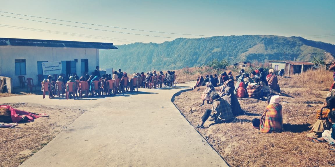
SENSITIZATION PROGRAMME:
The District Project Manager Mr.J.Wanniang along with the staff held a village Level Sensitization Programme on the Community Led Landscape Management Project (CLLMP) on the 17th January, 2019.The villagers actively participated in the program, voicing out their concerns and questions regarding the project making it a huge success.
Highlights of the meeting:
Awareness about the Community Led Landscape Management Project (CLLMP).
Laying the importance on the involvement of the community in making the CNRM plan and its success.
A brief awareness on cleanliness was conducted based on our finding during the ground truthing phase.
An interactive session was held to answer doubts of the villagers regarding the project.
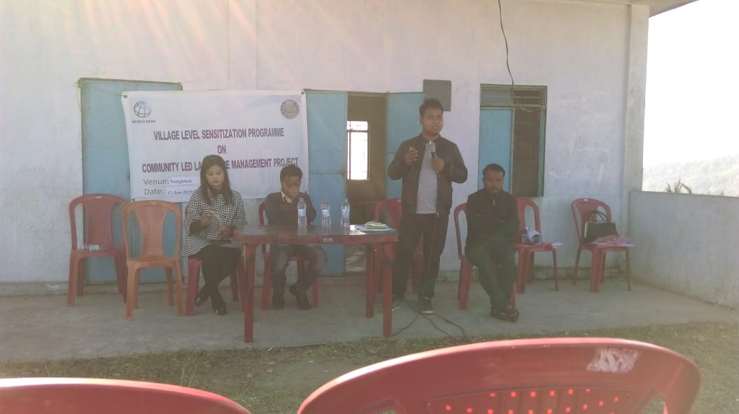
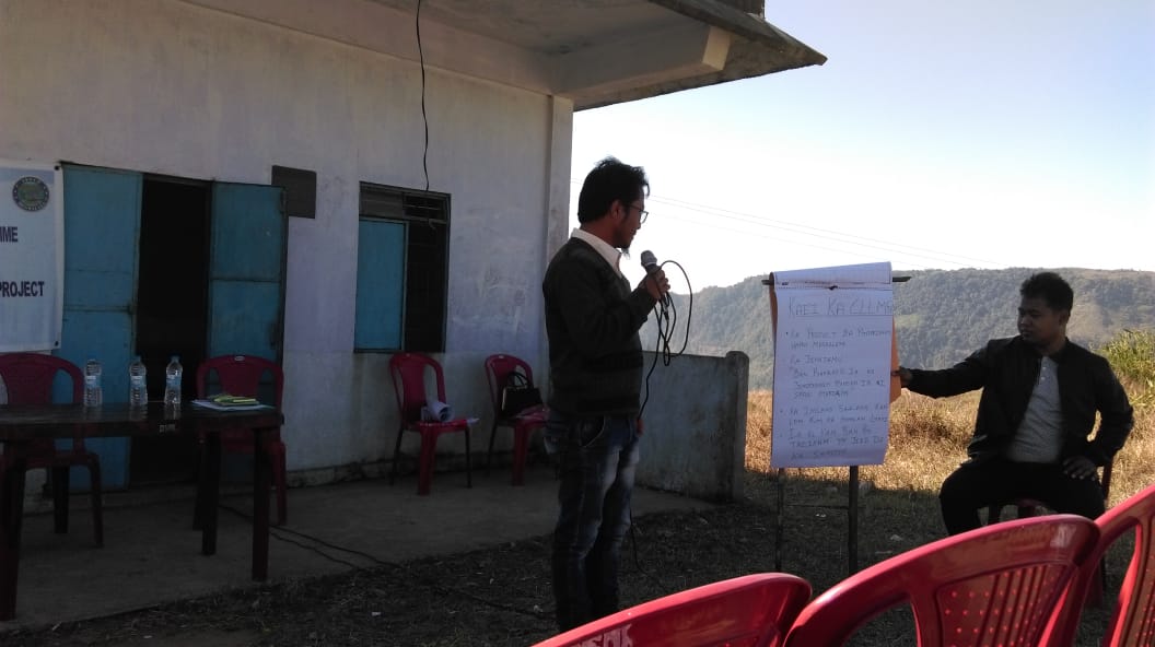
Fig: Sensitization Program at Nongktieh.
SIGNING OF EOI, VGA AND GREEN CHARTER:
On 17th January, 2019 Nongktieh village signed the EOI (Expression of Interest), VGA (Village Grant Agreement) and the Green Charter after there was a uniform agreement by the people of the entire Community that the Community Led Landscape Management Project (CLLMP) be implemented at Nongktieh village.
FORMATION OF THE VNRMC:
The formation of the Village Natural Resources Management Committee was done in a public meeting on the 17th January,2019 in the presence of the entire village and the CLLMP Staff. The people of the community chose the President, The Secretary, the Purchase Committee members and the other Executive members to formed the Nongktieh VNRMC. There are 9 Executive members, 3 Village community Facilitator and 3 Purchase Committee members.
List below are the members of the VNRMC:
| Village Natural Resource Management Committee (9members committee constituted from Village Council, SHG group, Women’s group, youth, VEC) | ||||||||
|---|---|---|---|---|---|---|---|---|
| Sl No | Name | Designation | Gender (M/F) |
Age in years | Qualification | Occupation | Community | Phone No. |
| 1. | Shembirlang Rngaid | President | Male | NA | NA | Teacher | Khasi | 8837010618 |
| 2. | Totally Langte | Secretary | Male | 42 | XII | Cultivator | Khasi | 8787442519 |
| 3. | Balasumarlin K Turnia | F. Secretary | Male | NA | NA | NA | Khasi | NA |
| 4. | Bundor Ramsiej | Member | Male | 45 | IX | Farmer | Khasi | 7005646177 |
| 5. | Rakesh K. Turnia | Member | Male | 38 | VIII | Farmer | Khasi | 9366355820 |
| 6. | Minorris Ramsiej | Member | Female | 35 | XII | Farmer | Khasi | 6009724258 |
| 7. | Banisha K Bani | Member | Female | 30 | VIII | Farmer | Khasi | 8787359718 |
| 8. | Iohty Ramsiej | Member | Female | 47 | VI | Farmer | Khasi | 9856370118 |
| 9. | Piodalin Lyngkhoi | Member | Female | NA | III | Farmer | Khasi | NA |
VILLAGE FUNCTIONARIES Traditional Village Institutional Functionaries (Village Dorbar) |
|||||||
|---|---|---|---|---|---|---|---|
| Sl No | Name in Full | Gender M/F | Age | Education | Designation | Occupation | Contact No. |
| 1. | Stearnol Langte | M | 40 | BA | Myntri | Teacher | 8837059235 |
| 2. | Kupborlin Lyngkhoi | M | 42 | XII | Secretary | Cultivator | 8787352950 |
| 3. | Smanding Turnia | M | 56 | VIII | Member | Teacher | 8787653014 |
| 4. | Bundor Ramsiej | M | 45 | IX | Member | Farmer | 7005646177 |
| 5. | Tanbor K Turnia | M | 41 | BA | Member | Farmer | 9366234624 |
| 6. | Throning Nonglong | M | 59 | VII | Member | Teacher | 9856370118 |
| Village Community Facilitators (VCF) | ||||||
|---|---|---|---|---|---|---|
| Sl no. | Name | Age | Gender | Qualification | Contact Number | Role |
| 1 | Joyfully Syiemlieh | 27 | Female | BA | 9774782287 | Social and KM |
| 2 | Bikromshan Lyngkhoi | 34 | Male | XII | 7005154064 | Evst and GIS |
| 3 | Nimrose Ramsiej | 28 | Male | BSC | 8731851109 | Document ME |
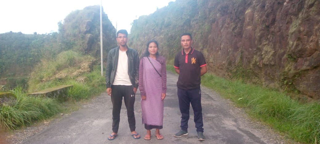
+
Fig: Village Community Facilitators.
| Procurement Members | |||||
|---|---|---|---|---|---|
| Sl no. | Name | Age | Gender | Qualification | Contact Number |
| 1. | Nipallan Lyngkhoi | 28 | Male | BA | NA |
| 2. | Tressmerry Riamsiej | 24 | Female | XII | NA |
| 3. | Banshanti Syienlieh | 28 | Male | XII | NA |
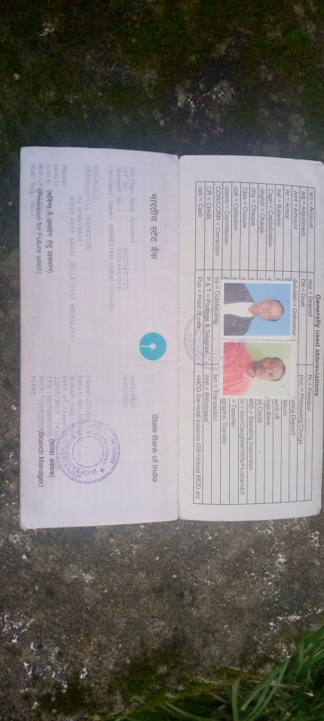
OPENING OF BANK ACCOUNT:
The opening of the bank account was done after the signing of the EOI (Expression of Interest), the VGA (Village Grant Agreement) and the signing of the Green Charter. The Accountant of CLLMP South West Khasi Hills trained the Purchasing and Procurement Committee of Nongktieh village on matters relating to Accounts and Book Keeping and on the:
Principles of Community Procurement
Benefits of Community Procurement
Important aspects undertaken by Community Procurement.
Procurement Process/Steps
Function of Purchase Committee
Important Procurement records to be maintained
Financial limits and methods
Maintaining of Books of Accounts to the Book Keeper.
Fig: Bank Account Details.
PARTICIPATORY RURAL APPRAISAL EXERCISE:
The PRA exercise aims to incorporate the knowledge and opinions of the community in the planning and management of development projects and programmes.
The PRA exercise took place on the 18th March, 2019 and the villagers took part in this exercise and also contributed their time and knowledge to this project.
The District Project Manager gave the introduction and spoke about the different activities that the participants had to take part in the programme.
The Program Associate, Environment Management, spoke about the different CNRM plans and the different types of intervention. A group of participants interacted and helped in the collection of data based on the environmental template. With the help of this group, different sites of interventions were identified, analyzed and evaluated in order to prioritized the areas that needed the natural resources management.
The Assistant Manager, Social Management, gathered the remaining group of participants to gather the baseline data bases on the social template.
The main objectives of PRA exercise are:
To identify the natural, human and economic resources of the village.
To identify the village problems and prioritized them with the help of the community members.
To prepare the community natural resources management plan of the village.
Findings based on the information gathered from the participants during the PRA/CNRMP exercise:
The main agro-horticultural produce is Broomstick, Orange, Bay leaf, Jackfruit, Litchi, Areca nut, Betel vine, Wild Pepper, and Bay Leaf.
Most of the household depend on firewood as a source of fuel.
Drinking water is limited over a period of 3-4 months during the winter season.
There are two types of forest ownership: Clan and Protected Forest.
The springs which are present in the village needs rejuvenation.
Training on Land productivity, Spring shed management and Community nursery is necessary for the village community.
There are no disputes/constraints encountered within the village community or with any neighbouring villages.
Priorities Intervention required based on the PRA Exercise:
Rejuvenation of the Springs within the community through activities such as afforestation, treatment of catchment areas and contour trenches.
Afforestation, Bio-fencing and fire line control in the community forest.
Community Nursery for endemic trees.
Water storage tanks for collecting rain water.
Check dams for erosion control.
Afforestation and Roadside plantation.
Culturable wastelands to be brought under horticulture.
Baseline Data Survey to fill the Environment and Social Template:
During the PRA Exercise the External Expert of Social & Environment Management held a group discussion with the different groups to gather basic village information regarding number of households, demographic information, major crops and enterprises taken in the village, trends of production and productivity of major crops in the village and demographic distribution of village population.
Information related to land use category such as forest, cultivable land, water bodies, etc and the problems and challenges related to NRM were discussed.
Focused Group Discussion on Problem Analysis:
Do people have sufficient access to supply of fodder, fuel wood, leaf litter?
Yes, people in the village have sufficient access to supply of fodder, fuel wood, leaf litter. They get it from the community forest and from their own private lands/forest.
Has access to timber improved or reduced over the years? How is access for household use and commercial use managed?
Access to timber has reduced over the years. People have to purchase it from neighbouring village when needed.
Are the water bodies facing any threats?
Yes, some of the water bodies within the village have faced minor threats.
Do all people in the village have access to drinking water? What are the challenges?
Yes, there is sufficient drinking water in the village except during the winter season due to less discharge of water from the spring source and because the source of water is downhill while settlement is uphill.
Are there degraded areas in the village (open/ degraded forests, mining affected, high soil erosion etc.)?
There are some minor degradations in cultivated land.
What has caused this degradation? Are there practices causing threats to availability and access to natural resources?
Fertility of the soil has decline over the year.
The practices that cause threat to the availability of these resources are:
Fires that take place every year
Excessive practice of Jhum Cultivation
What have been the changes in agricultural practices?
Previously their method of farming is Shifting Cultivation, but over the years with much awareness people have now direct to more conservation practises in order to recover the forest.
Are there any challenges in farming?
The main challenges faced by the people is that over the years they have seen a decline in the soil productivity due to soil erosion.
How would you consider the health situation in your village?
Good.
How is the situation of cleanliness, sanitation, access to toilets and waste management?
Sufficient toilets are available in every household but most of the constructions are poor. The presence of VWSC in the village has also improve sanitation and cleanliness. But Waste Management is poor because people are not really aware of how to properly disposed off waste.
Who are the most vulnerable in the village? What can be done to improve their lives?
BPL Families. Inclusion of BPL family members during project implementation
What are the livelihood aspirations of the youth? Are there any avenues available?
None, except daily wages labourers.
Do any committees/ institutions/ rules exist to manage and monitor natural resources in the village?
The VNRMC under the CLLMP is the main committee that is now in place to manage the natural resources in the village.
What are some of the major issues of conflict in the village?
Nothing related to NRM.
Have any of the above issues been discussed in village meetings?
NA
P. How do people resolve disagreements and conflicts?
All disagreements and conflicts are addressed by the traditional institution of village called the Village Dorbar.
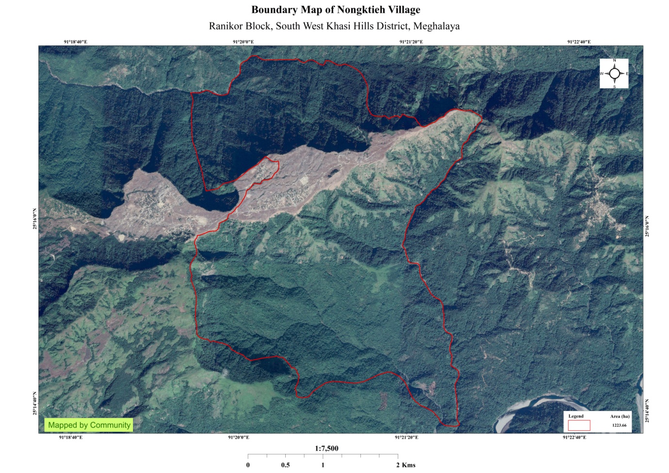
Village Boundary Mapping and Recourse Mapping:
The GIS personnel along with the Village Community Facilitators mapped the village boundary of Nongktieh village.
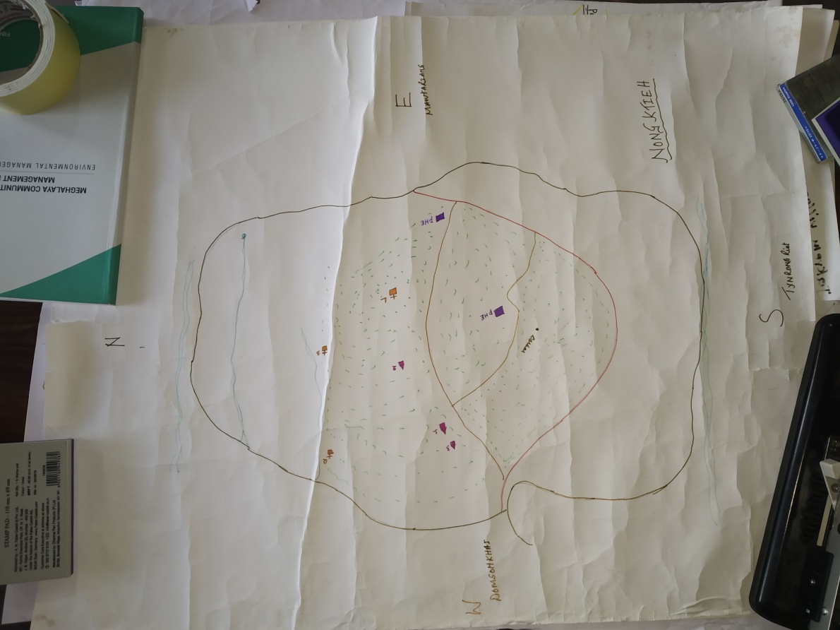 The
village resource map is prepared by the people of the community. In
this resource map, the local people prepare it by drawing it on
chart paper. Recourses such as agricultural lands, wells,
wastelands, cattle population, playgrounds, ICDS, churches,
community halls, etc were mapped.
The
village resource map is prepared by the people of the community. In
this resource map, the local people prepare it by drawing it on
chart paper. Recourses such as agricultural lands, wells,
wastelands, cattle population, playgrounds, ICDS, churches,
community halls, etc were mapped.
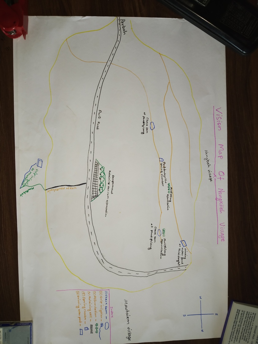
Fig: Village boundary Map.
7.GIS ACTIVITIES:
| Sl. No. | Parameters | Village Information |
|---|---|---|
| 1. | GPS Coordinates: | |
| i | Latitude | 25.2657 |
| ii | Longitude | 91.33923 |
| iii | Elevation Reading (MSL) | 3520m |
| 2. | Village Geographical Area (Ha) | 1229.6 Ha |
| i | Total Forest Area (including community, Clan, Pvt Forest) | 950.47 Ha |
| ii | Total Area of Water Bodies | 17.94 Ha |
| iii | Total Area under Agri-Horticulture | 18.79 Ha |
| iv | Total Degraded land area (Ha) | 7.24 Ha |
| 3. | Average Annual Rainfall | 1200-3000mm |
| 4. | Soil Type | Fine loamy and course loamy soil. |
Figure: Boundary Map of Nongktieh village.
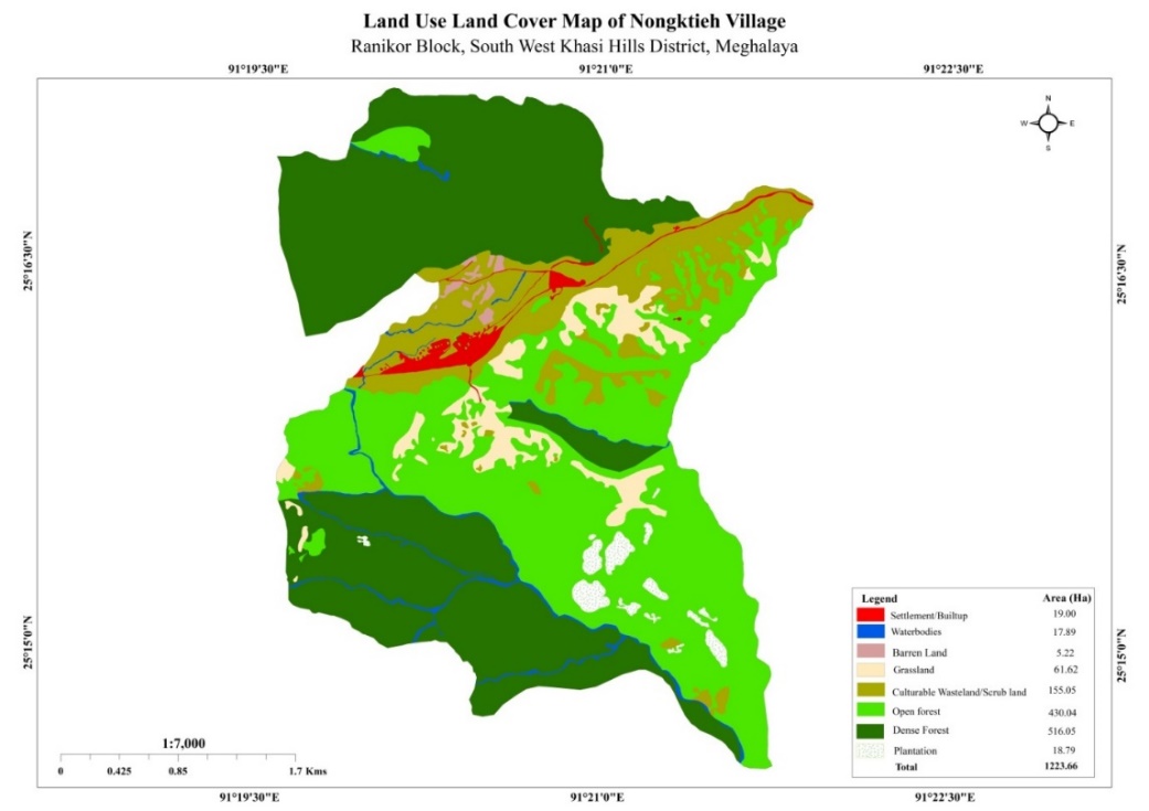
Fig: LULC Map of Nongktieh.
8.THE PROPOSED LIST OF INTERVENTIONS:
|
Name Of Proposed Interventions | Site |
|
Nos Of HH’s Expected to Benefit | Priority (High/ Medium/ Low) |
|---|---|---|---|---|---|
|
|||||
| 1. | Drip Irrigation Work: CC Dam | Nongktieh | Private |
|
High |
| 2. | Conservation Pond | Photdew Byrtha | Community |
|
High |
| 3. | Afforestation | Photphlang, Photdewbyrtha and Photipliang |
|
|
High |
| 4. | Protection Wall | Nongktieh | Community |
|
High |
| 5. | RCC Lid of a Conservation Pond | Photdewbyrtha |
|
|
High |
| 6. | Water Harvesting Structure | Nongktieh |
|
|
High |
| 7. | Soak pit drain and platform | Phot Dewbyrtha |
|
|
High |
| 8 | Drip Irrigation Work: Ground Water Tank | Nongktieh |
|
|
High |
| 9 | Drip Irrigation Work: Distribution Tank | Nongktieh |
|
|
High |
| 10 | Afforestation Development Work | Nongktieh |
|
|
High |
| 11 | Plantation Work | Nongktieh |
|
|
High |
| 12 | Protection Wall | Nongktieh |
|
|
High |
| 13 | Roadside Tree Plantation | Nongktieh |
|
|
High |
| 14 | Natural Footpath | Nongktieh |
|
|
High |
9.PROJECT IMPLEMENTATION:
| 1. | Type Of Intervention | Site Name | GPS Co-ordinates | Amount Sanctioned | Work Status | |
|---|---|---|---|---|---|---|
| RCC lid of a conservation pond & Soak pit, drain and platform | Photdewbyrtha | 25.270455 | 91.33833 | Rs. 29,160 +37,270 | Completed | |
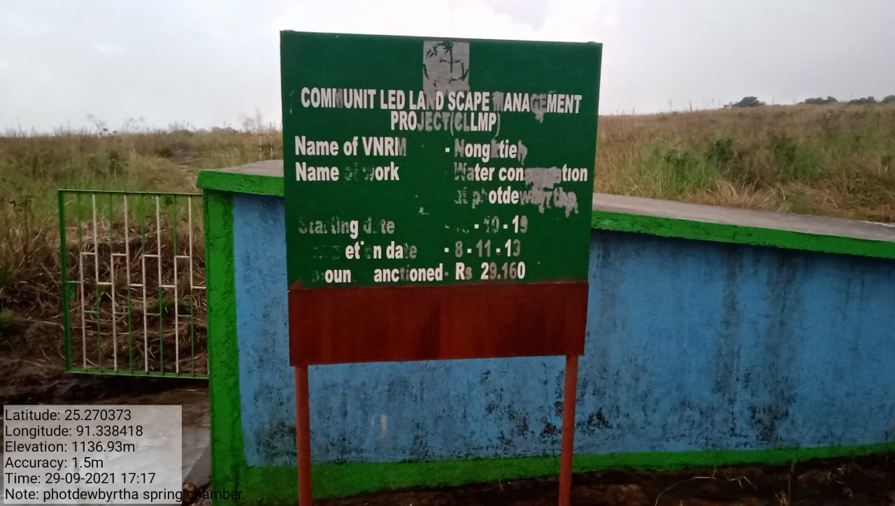
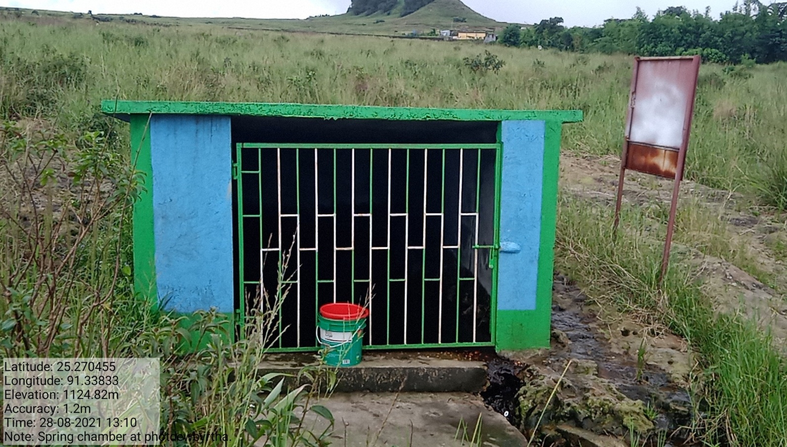
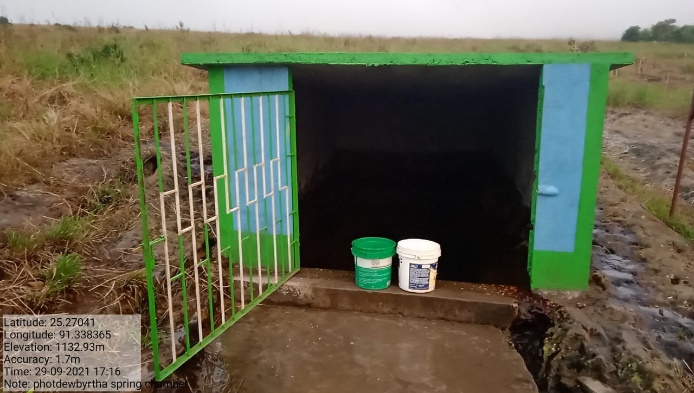
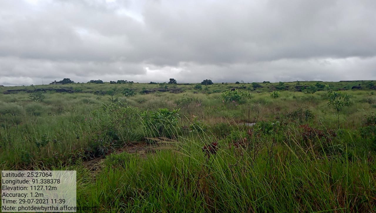
Fig: RCC lid of conservation pond, soak pit drain & platform.
| 2. | Type Of Intervention | Site Name | GPS Co-ordinates | Amount Sanctioned | Work Status | |
|---|---|---|---|---|---|---|
| Drip Irrigation works: CC Dam | Umsaw | 25.26696 | 91.339593 | Rs. 3,00,000 | Completed | |
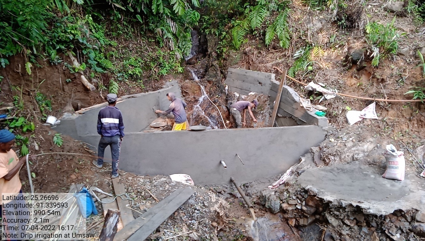
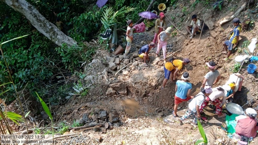
Fig: Drip Irrigation Work: CC Dam.
| 3. | Type Of Intervention | Site Name | GPS Co-ordinates | Amount Sanctioned | Work Status | |
|---|---|---|---|---|---|---|
| Drip Irrigation works: Ground water tank | Ladjasang | 25.264522 | 91.342938 | Rs. 3,00,000 | Completed | |
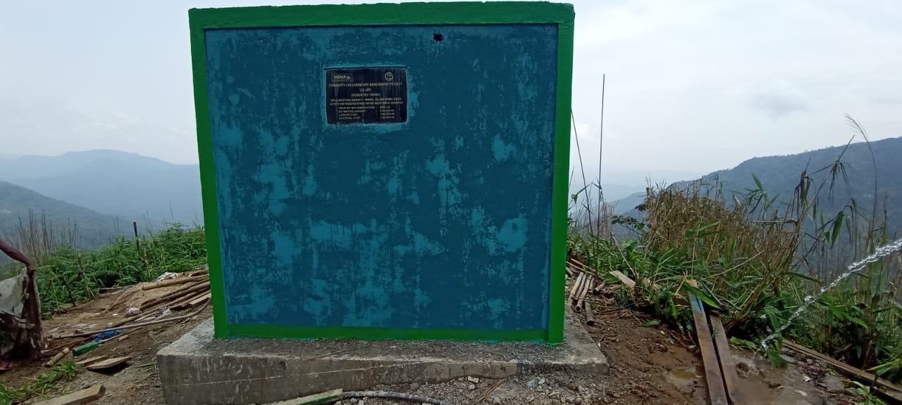
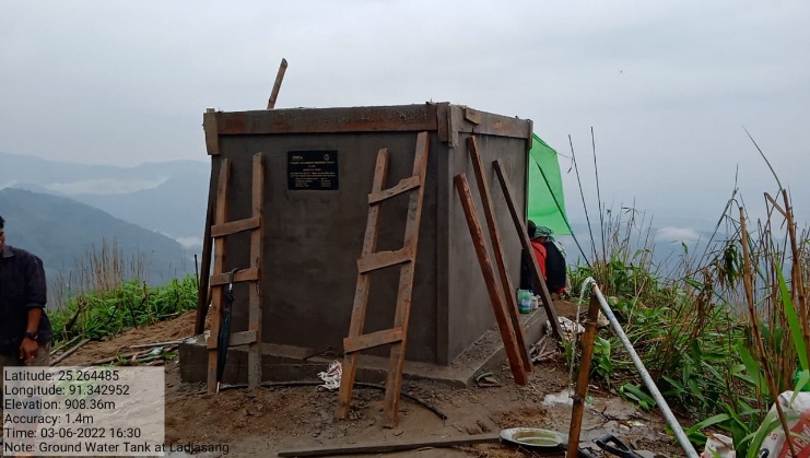
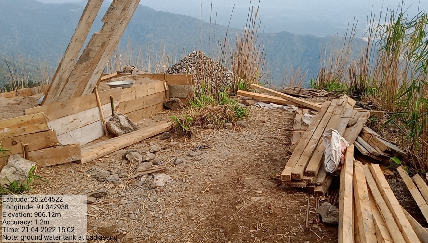
Fig: Drip Irrigation Works: Ground Water Tank.
| 4. | Type Of Intervention | Site Name | GPS Co-ordinates | Amount Sanctioned | Work Status | |
|---|---|---|---|---|---|---|
| Drip Irrigation works: Distribution Tank | Nongktieh | 25.26115 | 91.350968 | Rs. 4,80,000 | Completed | |
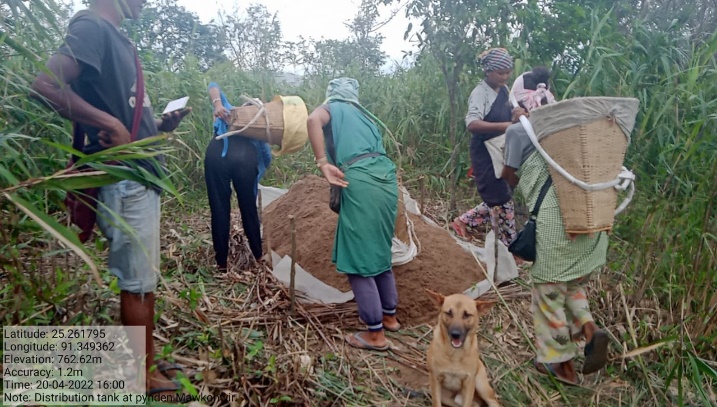
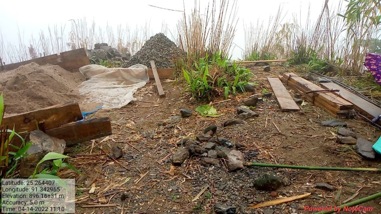
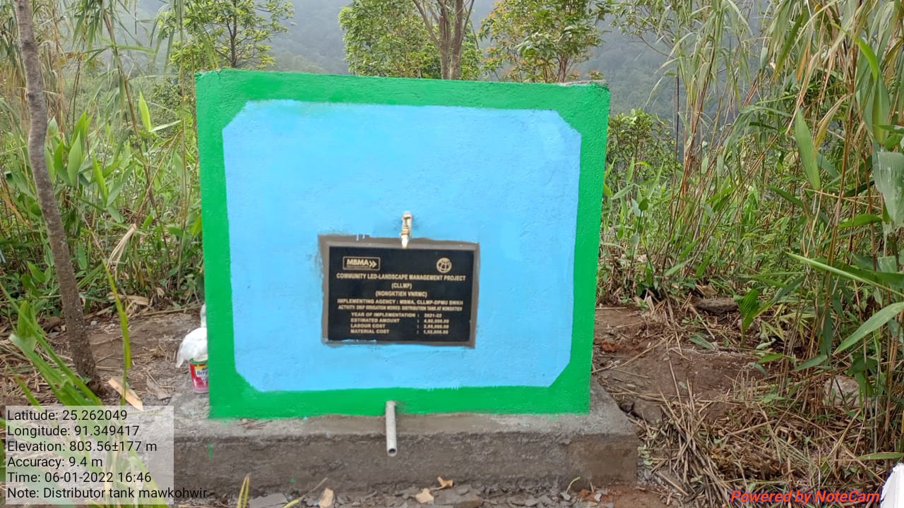
Fig: Drip Irrigation works: Distribution Tank.
| 5. | Type Of Intervention | Site Name | GPS Co-ordinates | Amount Sanctioned | Work Status | |
|---|---|---|---|---|---|---|
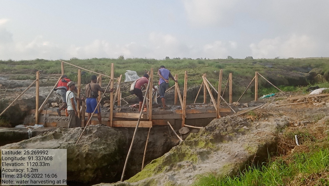
| Water Harvesting Structure | Phottyllang | 25.29947 | 91.337628 | Rs. 2,50,000 | Completed | |
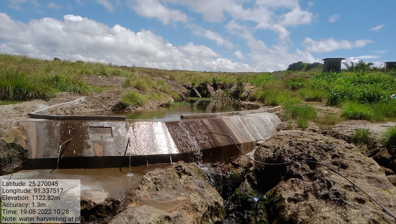
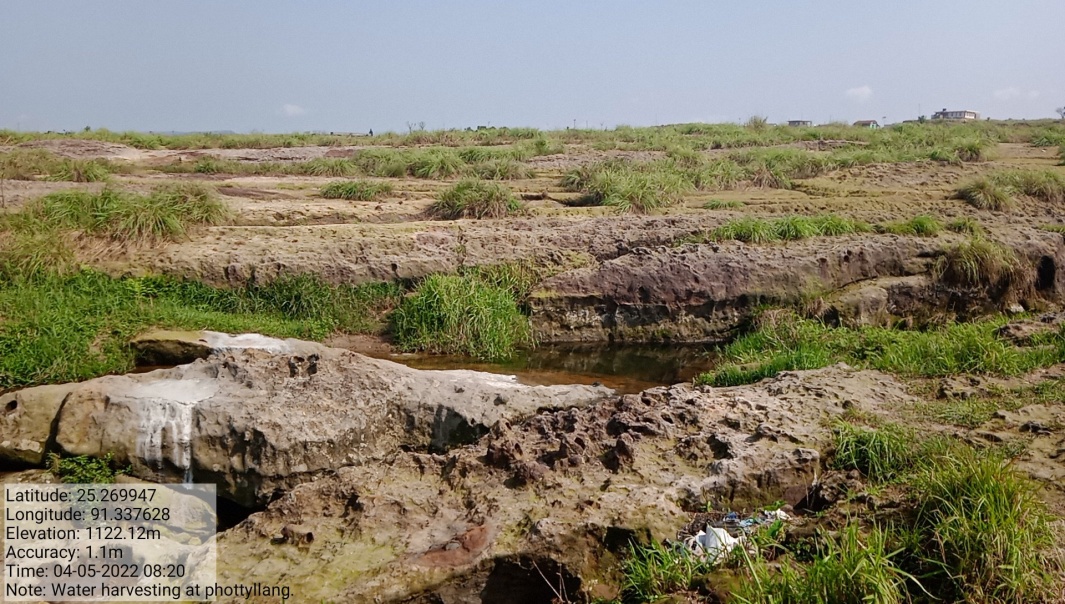
Fig: Water Harvesting structure at Phottyllang.
| 6. | Type Of Intervention | Site Name | GPS Co-ordinates | Amount Sanctioned | Work Status | |
|---|---|---|---|---|---|---|
Road side Tree Plantation |
Nongktieh | 25.269402 | 91.338723 | Rs. 49,900 | Completed | |
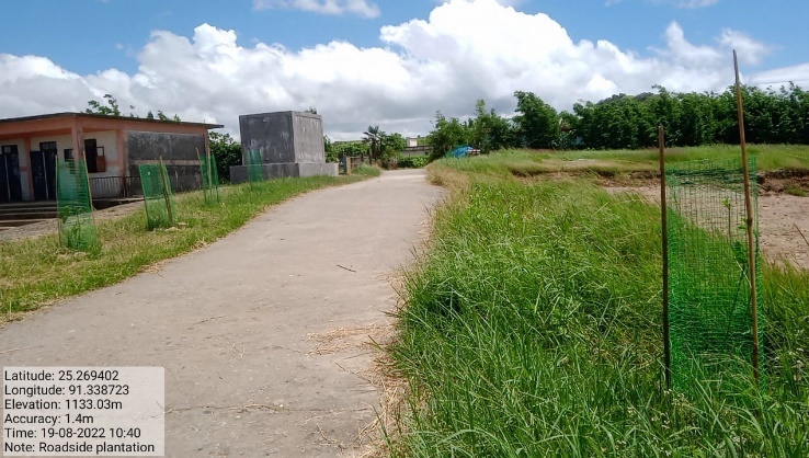
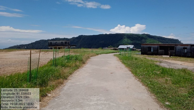
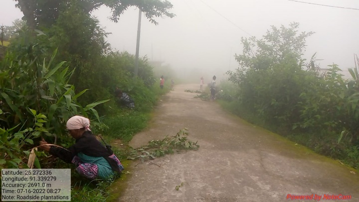
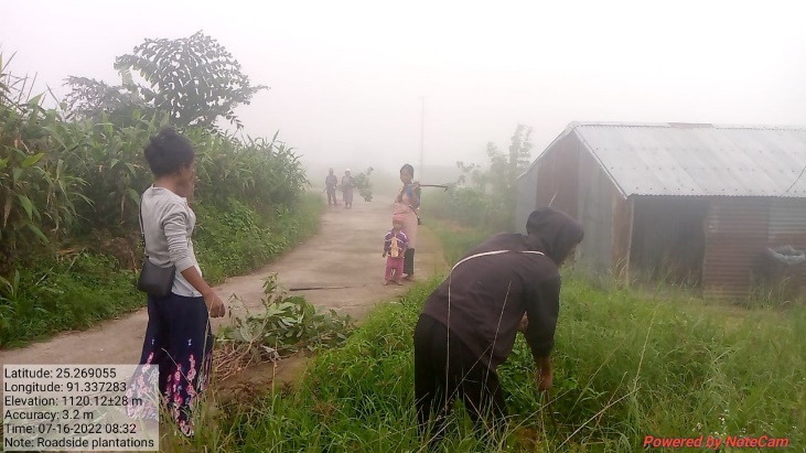
Fig: Roadside Plantation.
| 7. | Type Of Intervention | Site Name | GPS Co-ordinates | Amount Sanctioned | Work Status | |
|---|---|---|---|---|---|---|
| Protection wall | Dompamthat | 25.268645 | 91.340535 | Rs. 4,00,000 | Completed | |
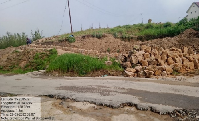
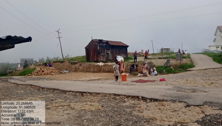
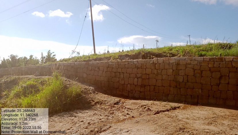
Fig: Protection wall at Dompamthat.
| 8. | Type Of Intervention | Site Name | GPS Co-ordinates | Amount Sanctioned | Work Status | |
|---|---|---|---|---|---|---|
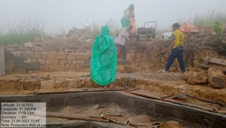
| Protection Wall | Nongktieh | 25.267758 | 91.340375 | Rs. 3,71,600 | Completed | |
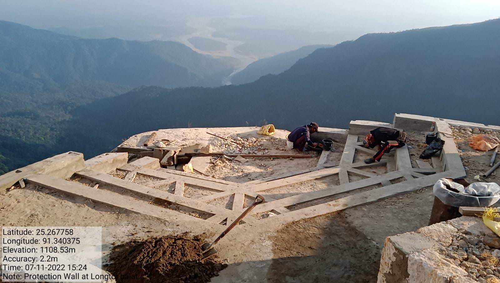
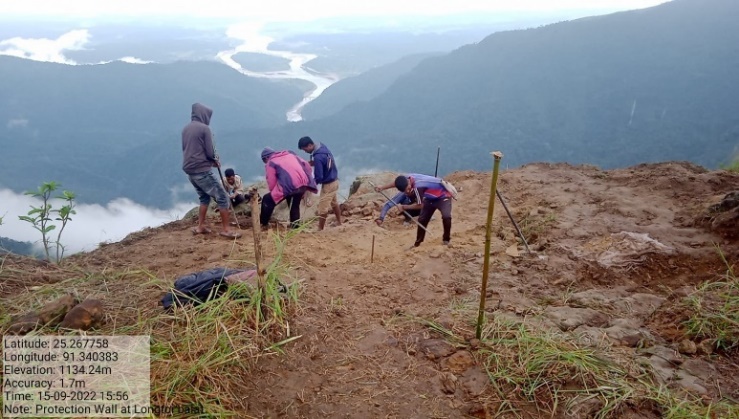
Fig: Protection wall at Nongktieh.
| 9. | Type Of Intervention | Site Name | GPS Co-ordinates | Amount Sanctioned | Work Status | |
|---|---|---|---|---|---|---|
| Natural footpath | Nongktieh | 25.268282 | 91.340345 | Rs. 78,500 | Completed | |
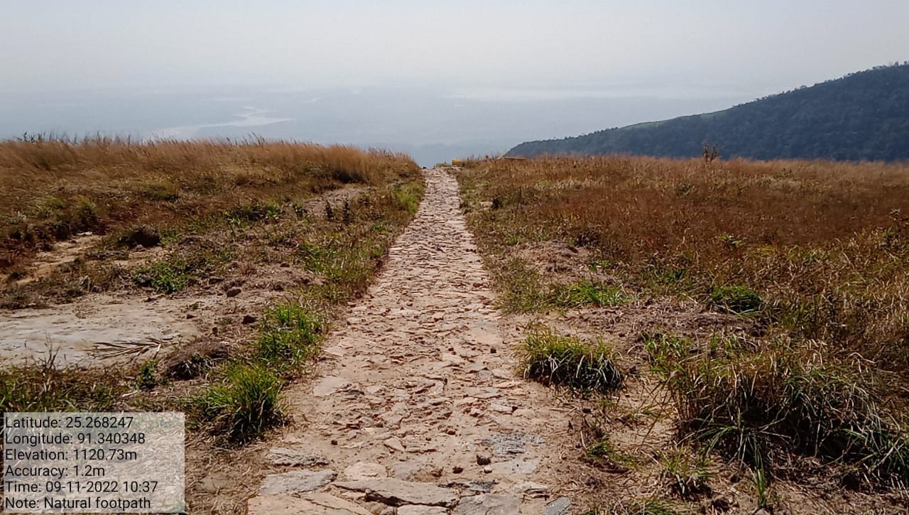
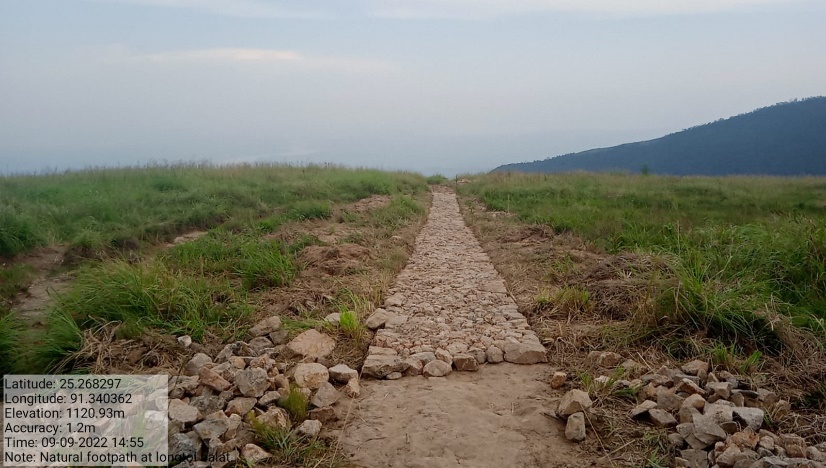
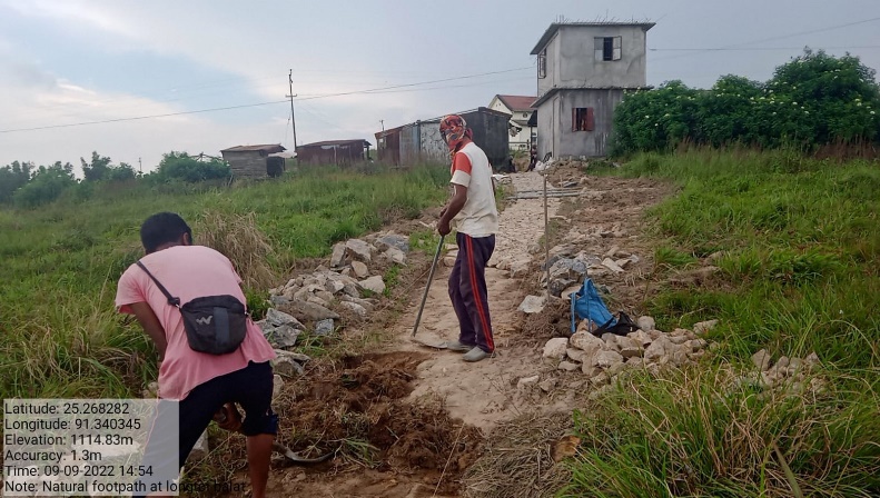
Fig: Natural Footpath at Nongktieh.
| 10. | Type Of Intervention | Site Name | GPS Co-ordinates | Amount Sanctioned | Work Status | |
|---|---|---|---|---|---|---|
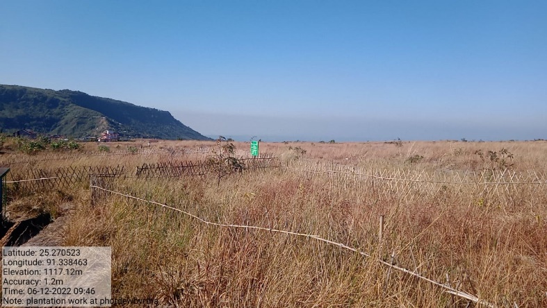
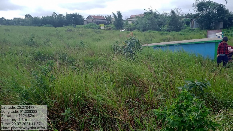
| Plantation Work | Dewbyrtha | 25.270523 | 91.338463 | Rs. 95,070 | Completed | |
Fig: Plantation works at Photdewbyrtha.
| 11. | Type Of Intervention | Site Name | GPS Co-ordinates | Amount Sanctioned | Work Status | |
|---|---|---|---|---|---|---|
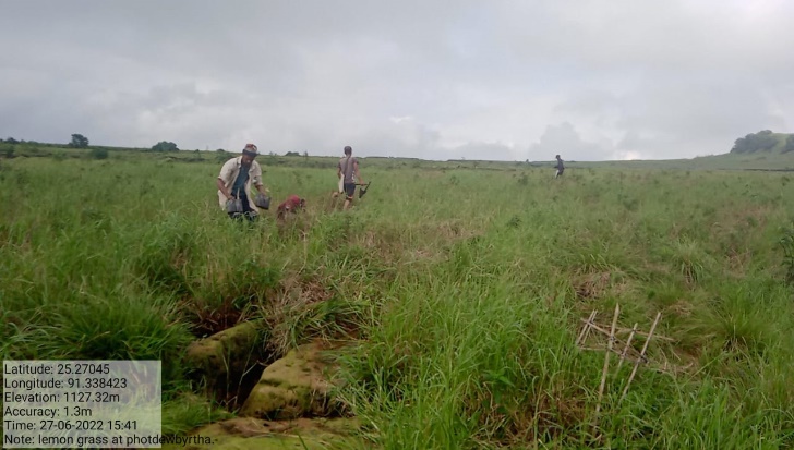
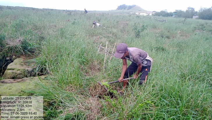
| Afforestation Development work | Photdewbyrtha, Ipliang, Phlang | 25.268718 | 91.338382 | Rs.1,50,000 | Completed | |
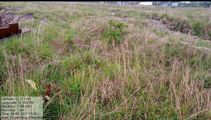
Fig: Afforestation Development work at Photdewbyrtha, Ipliang, Phlang.
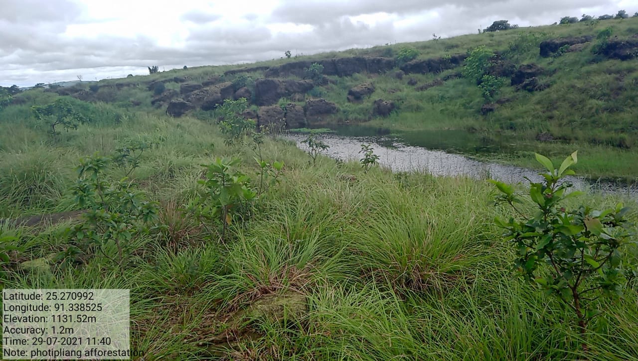
Figure: Afforestation at Photdewbyrtha.
Figure: Afforestation
at
Photphlang.
10. FUND STATUS:
| Fund Released to VNRMC (Project Implementation) | Total No. of Work Order Issued | Total amount Issued under CLLMP (Per Activity) | Amount Spent | Work Order Issued Date |
Start Date | End Date |
|---|---|---|---|---|---|---|
Rs. 21,55,000 Rs. 5,00,000 |
11 | Soak Pit, drain and platform at Photdewbyrtha Rs.29,160 |
Rs.29,160 | 25th Jul 2019 | 1st Oct 2019 | 18th Oct 2019 |
Drip Irrigation Works: CC Dam at Nongktieh Umsaw Rs.3,00,000 |
Rs. 3,00,000 | 14th Dec 2021 | 1st Jan 2022 | 22nd Feb 2022 | ||
| Drip Irrigation Works: Ground Water Tank at Nongktieh Rs.3,00,000 | Rs. 3,00,000 | 14th Dec 2021 | 1st Mar 2022 | 21st Apr 2022 | ||
| Drip Irrigation Works: Distribution Tank at Nongktieh Rs.4,80,000 | Rs. 4,80,000 | 14th Dec 2021 | 2nd Feb 2022 | 25th Apr 2022 | ||
Water Harvesting Structure at Nongktieh Rs.2,50,000 |
Rs. 2,50,000 |
31st Mar 2022 | 4th Apr 2022 | 9th May 2022 | ||
| Afforestation work Development Rs.1,50,000 | Rs. 1,50,000 | 31st Mar 2022 | 1st Jun 2022 | 29th Jun 2022 | ||
Plantation Work Rs.95,070 |
Rs.95,070 | 31st Mar 2022 | 2nd May 2022 | 20th May 2022 | ||
Protection Wall at Dombyrthad Rs.4,00,000 |
Rs. 4,00,000 | 31st Mar 2022 | 4th Apr 2022 | 13th May 2022 | ||
Roadside Tree Plantation at Nongktieh Rs.49,900 |
Rs.49,900 | 6th May 2022 | 6th Jun 2022 | 14th Jun 2022 | ||
Protection Wall at Nongktieh Rs.3,71,600 |
Rs. 3,71,600 |
31st Mar 2022 | 1st Aug 2022 | 1st Sep 2022 | ||
Natural Foot Path at Nongktieh Rs.78,500 |
Rs.78,500 | 31st May 2022 | 1st Jul 2022 | 13th Jul 2022 | ||
| Total | Rs. | |||||
11. GROUND TESTIMONIALS:
Shemborlang Rngaid
President Nongktieh VNRMC
I have been a President of Nongktieh VNRMC for the
past 3 years and I am grateful since the coming of the project
within our village as with it comes much development that aims at
conservation of our surroundings. According to me the Drip
irrigation works is one of the best interventions that had been
implemented by the Project in our village as it has provided water
supply to our fields especially during the lean season. We as a
community we will strive our best to protect and conserve our land,
water and forest for years to come as we have been taught.
Mr.Nimrose Riamsiej
VCF M&E
I was appointed as a VCF of M&E Nongktieh VNRMC
since the onset of Project in our village on the 2019 during a
village durbar meeting. Through the CLLMP, I had undergone different
trainings which have benefitted me in improving maintaining the
different registers and also, I have been trained on filling of the
MIS (Management Information System) online. This Project have also
given me an opportunity to improve and conduct public village
meetings. I would also like to express my gratitude towards the
Project as it had brought with it an overall development in our
community.
Mrs. Totally Langte
Secretary Nongktieh VNRMC
Being the Secretary of the VNRMC, I have indeed been in the front and centre in the implementation of the Project in our village. I have had much experience in maintaining the books of records such as the minute books and the many different registers that needs to be updated monthly and I have been benefitted by it all because CLLMP had given me this opportunity. I am responsible in bringing to the table the agendas needed for discussion and this have given me the courage to speak in a public platform.

Miss. Joyfully Syiemlieh
VCF Social
With the coming of the CLLMP in our village, it has extended the help in conservation of our natural resources and much has been done with the different interventions that this office has carried out with the understanding with the VNRMC members. As a Social VCF I have had many opportunities to attend many trainings that have been conducted by this office which have improved my confidence in conducting myself in a public meeting. This is one of the projects that provides employment and wages equally to men and women, and also the knowledge I have gathered over the years will help me to take up responsibility in conserving the environment.
_____________________******************______________________