REPORT ON: LARKET VILLAGE
DISTICT: EAST JAINTIA HILLS
20th MARCH 2023
COMMUNITY LED LANDSCAPE MANAGEMENT PROJECT


MEGHALAYA BASIN MANAGEMENT AGENCY
COMMUNITY LED LANDSCAPE MANAGEMENT PROJECT (CLLMP)
The Government of Meghalaya with financial help from the World Bank is implementing the Meghalaya Community Led Landscape Management Project (MCLLMP). The project will cover the manner throughout the state. The Meghalaya Basin Management Agency (MBMA) will facilitate community-led planning by providing support, technical inputs and funding.
Theprojectisintendedtostrengthen Community Led Natural Resources Managementinselected landscapes within the 7 districts of the state. This would be achieved through a variety of planning, capacity building, and on-the-ground interventions to promote the conservation, sustainable use of natural resources, social inclusion and community mobilization; building traditional knowledge and learning, mapping of natural resources management; strengthening the community institutions and creating linkage with financial institutions and community organisations.
The project interventions will include preparation of community led natural resource management plans. The CLLMP has the following three components:
1. Strengthening Knowledge and Capacity of Communities for Natural Resources Management
2. Community-Led Landscape Planning and Implementation
3. Project Management and Governance
The project objective is “to manage and conserve the natural resources especially forests, soil and water sources, in a manner that supports the financial and physical well-being of communities in the State”
The CLLM-Programme focuses on increasing the capacities of communities and traditional institutions (TI) by adopting a landscape approach to manage their natural resources such as soil, springs and other water sources, forests and bio-diversity, etc.
The project will be planned and implemented in about 400 villages across the state.
CLLMP has a strong focus on institution-building at the village-level, by ensuring systematic capacity-building on technical and social skill-sets.
The project will also extend such training to communities beyond the targeted villages and support efforts made by them to access funding from various rural and natural resources initiatives and schemes.
The programme will also invest in improving the process and outcome delivery, by developing and adhering to effective systems and procedures, supported by the appropriate technology.
Benefits for community (Skills and Capacity relating to technical and managerial areas like NRM and Conflict resolution
Benefits to traditional institutions (village councils, traditional leaders, community-based organizations, SHGs etc) through Knowledge sharing, promotion of innovative approach, access to technology, technical managerial and financial support.
It is estimated that the project will impact around 1 lakh partners (of which 50% are women) who depend on land, forest, agro forestry.
Through the project, 55000 Ha of targeted area will be ensured with availability of water, biological resources and soil productivity, which will in turn benefit around 400 villages and the outcomes delivery can be summarized as follows.
The Project will be executed by the MBMA in collaboration with other partners particularly, SIRD (for training and capacity building), Department of Soil and Water Conservation, Water Resource Department, Forest Department, specifically with respect to technical inputs, safeguards management and Community NRM plan preparation
2018-2023 (5 years)
Introduction and History……………………………………………………….05
Physical & Social profile…………………………………………………………06
Population……………………………………………………………… …………….07
Card Holding household………………………………………………………..07
Fuel Type………………………………………………………………………………08
Occupation……………………………………………………………………………08
Key Constraints…………………………………………………………………….08
Environment Challenge…………………………………………………………08
Land Use Land Cover Pattern………………………………………………..09 – 12
The different maps of the village…………………………………………..10-12
CLLMP Activities
1. Ground Truthing……………………………………………………………………10
2. Sensitization on CLLMP………………………………………………………….11
2.1 Signing of EOI, VGA and Green Charter………………………………..12
2.2 Formation of VNRMC…………………………………………………………..12
2.3 Bookkeeper………………………………………………………….................12
2.3 Village Community Facilitators…………………………………………….12
2.4 Purchase Committee……………………………………………………………12
3. Opening of Bank Account and training on accounting……………………….13
4. PRA Exercise and Preparation of CNRMP………………………………14
4.1 Drawing of Resource and Social Map…………………………………….14-15
4.2 Re-orientation session on preparation of CNRM plan……………16-17
4.3 Preparation CNRMP………………………………………………………………18-24
4.4 Site inspection of Proposed Intervention Sites………………………25-40
4.5 Review of the progress & in-situ course
in the Preparation of CNRMP………………………………………………..41-44
4.6 Presentation of CNRMP to the VNRMC………………………………….45
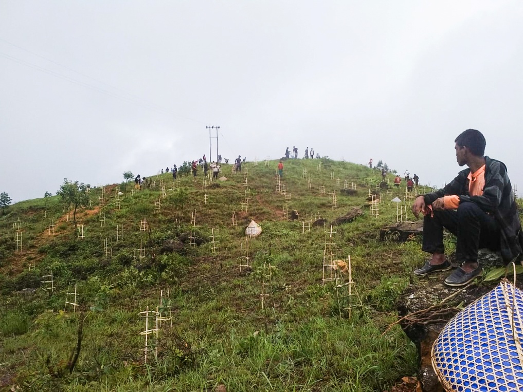
5. Implementation of Activities …………………………………….…………….46-48
6. Fund Status……………………………………………………………………………..49
7. Annexure………………………………………………………………...................50-104
INTRODUCTION
Larket Village falls under Khliehriat C&RD block of East Jaintia Hills district in the state of Meghalaya. The village is at a distance of 37 km from Khliehriat, the district headquarters of East Jaintia Hills District and is at a total distance of 122 Km from the state capital, Shillong. It falls under the “Elaka sutnga” with a total geographical area of532.44 Ha 5.32 sqkm ha and a total population of 480 villagers.
GPS coordinates: Latitude: 25.397026
Longitude: 92.570833 °E
Elevation Reading (MSL): 1005m
History of larket Village:
According to Shri. Dren Pdang, a senior citizen, Pynurkba village was formed by (late) Shri. Wariah Bareh and (late) Smt. Tein Dkharand later inhabited by the Kur Pdang and Kur Rymbai. The Kur Dkhar clan mostly cultivated on plain land while the Kur Pdang and Kur Rymbai clans cultivated on slopes. They would cultivate vegetables such as Cucumber, Bitter Gourd, Bitter Tomato, Bringal, Mustard Greens, Cassava, Pumpkins, Corn, Sweet Potato, Yam, Salah Ngan, Salah Rasu, Salah Thang, Salah Lieh (which are different types of potatoes), and planted fruit trees such as Orange, Grape fruit, Banana, Passion fruit, Soh Kymphria ( similar to Lime), Guava, Soh Syrman (similar to Lemon), Silver Berry, Bay Berry. They would then sell these including RedRice and some locally made handicrafts in the border markets and in return they will buy salt, sugar, fish and Roof tins. Bamboo drip irrigation was also practiced back then.
Village Profile:
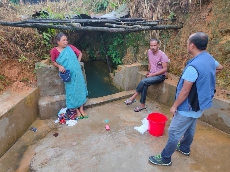
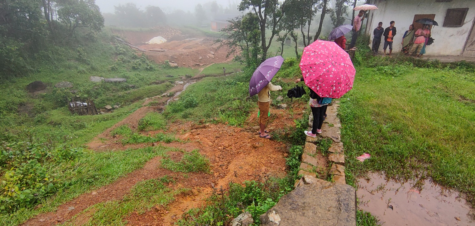
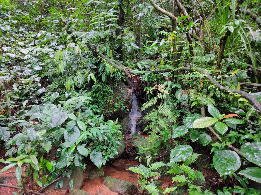
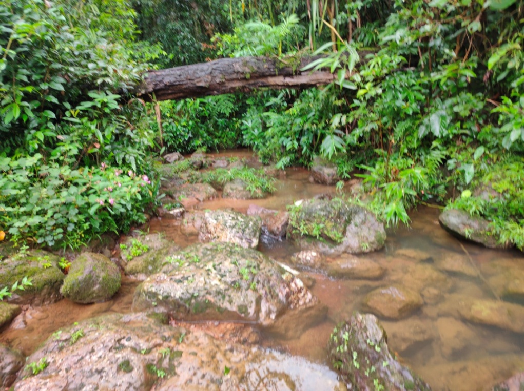
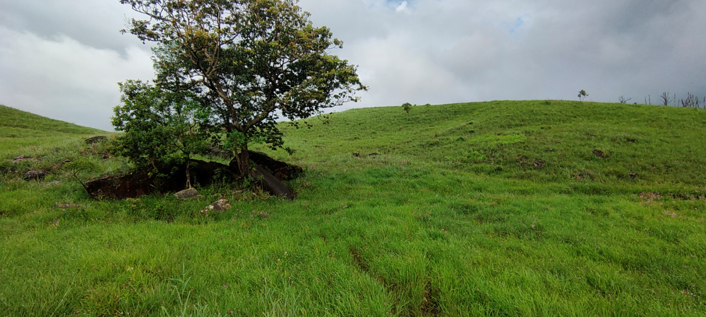
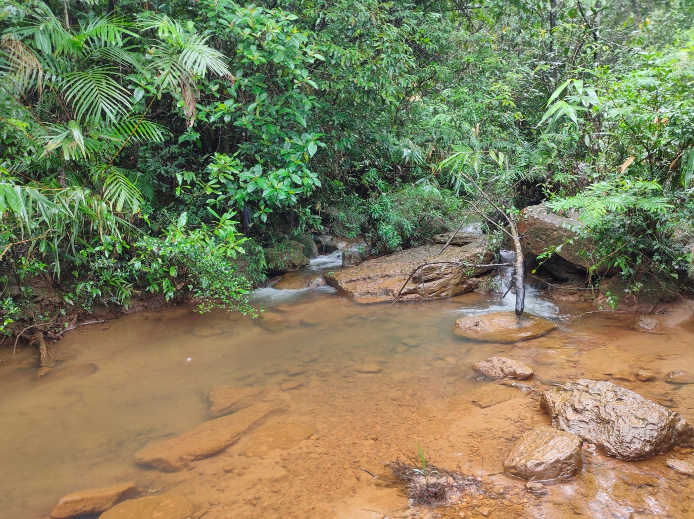
The village has a total area of 17.97 sq. km as per the village boundary given by the community. The area mostly falls under forest cover which are mostly dense & open and these belong to the community & individuals. The main source of drinking water is from PHE tap water and numerous springs such as Um Khloo, Um Pajat etc. There are also numerous fishery ponds which belong to individual owners. There are community culturable wasteland such as Pdak Pdak, Puriang, Shnongrim, Lum Iap Syiar and Lum Roman which can be used for many interventions. Agriculture is the main occupation of Pynurkba village where they mainly take up traditional approaches of cultivation like jhum or shifting cultivation. The farmersmostly cultivate paddy and vegetables. There are two schools inside the village, out of which one is a Lower Primary School and the other is a Primary School. The health dispensary and Bank is 17 km away and the Post office is 23 km away from the village.
 Population
As per data collected during the PRA exercise, Larket total population is 480 Out of this 229, are males while the females count is 251.
| Age Group | Male | Female | Total |
|---|---|---|---|
| 0-4 | 25 | 27 | 52 |
| 5-14 | 62 | 74 | 136 |
| 15-30 | 52 | 63 | 115 |
| 30-60 | 63 | 55 | 118 |
| Above 60 | 27 | 32 | 59 |
Occupation:
The large portion of the population is mostly farmers and daily wage earners.
Irrigation water:
B. Water: all have access to drinking water but not sufficient, especially during winter season from late November till March and during this period they mostly purchase (3000L/Week)
Access to LPG: The people need to travel to khliehriat village (which is ms away) just to get a refilled cylinder.
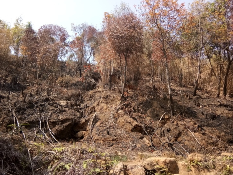
A. Soil erosion is very common as most of the landscapes are highly degraded Mostly due to anthropogenic activities(mining ), deforestation( now they start to re-afforesation .
B. soil degradation are Over exploitation, however in this village deforestation are the main threat, forest fire and soil erosion due to heavy rainfall.
Due to soil.
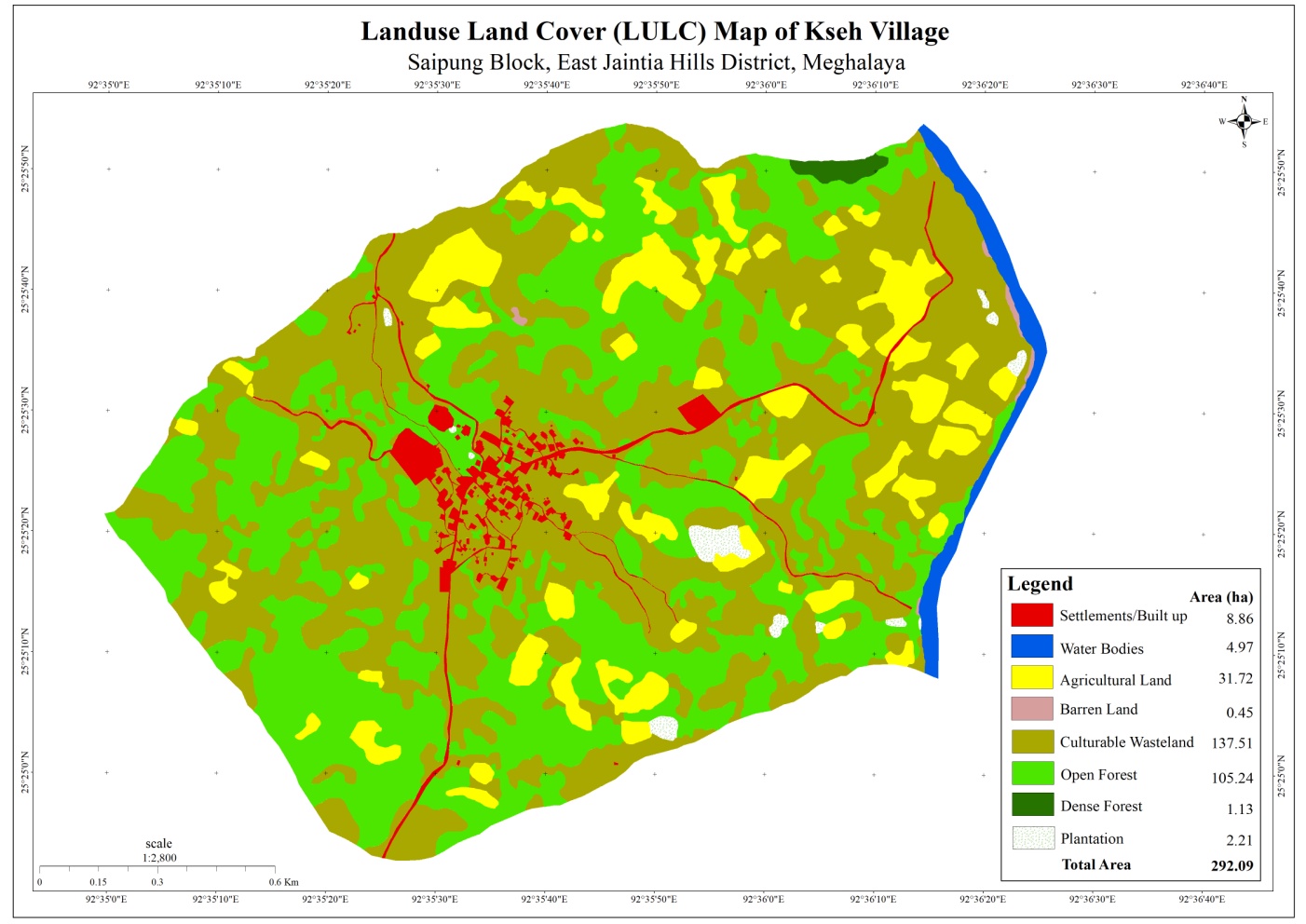
 The LULC map
has been categories into 8 categories which are under the
following
The LULC map
has been categories into 8 categories which are under the
following
| Landuse/ Landcover | Area in Hectare |
|---|---|
| Settlements/ Built Ups | 8.86 |
| Water Bodies | 4.97 |
| Agricultural Land | 31.72 |
| Barren Land | 0.45 |
| Culturable wasteland | 137.24 |
| Open forest | 105.24 |
| Dense forest | 1.13 |
| plantation | 2.21 |
| total | 292.09 |
GROUND TRUTHING
Dated: 19th November2018
Larket village falls under the NESAC list, the DPMU team met with the local headman to gather information about the village and conducted site verification. This village was also suggested by the Deputy Commissioner of East Jaintia Hills District and BDO of Khliehriat Block
Case Findings: -
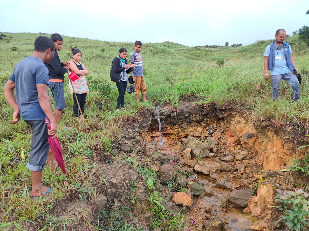
1. There are1springs which the whole community highly depend on and these springs tend to dry up during the winter season. So during this dry period, the people depend on other privately owned springs for drinking water and streams which are located far away from the village for washing clothes.
2. Shifting cultivation is the main agricultural practice and this has resulted to soil becoming highly infertile and loose.
3. The productivity of the land is decreasing with each passing year.
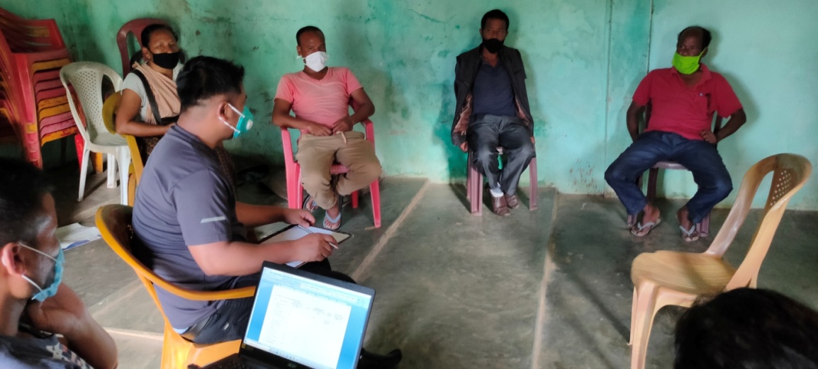
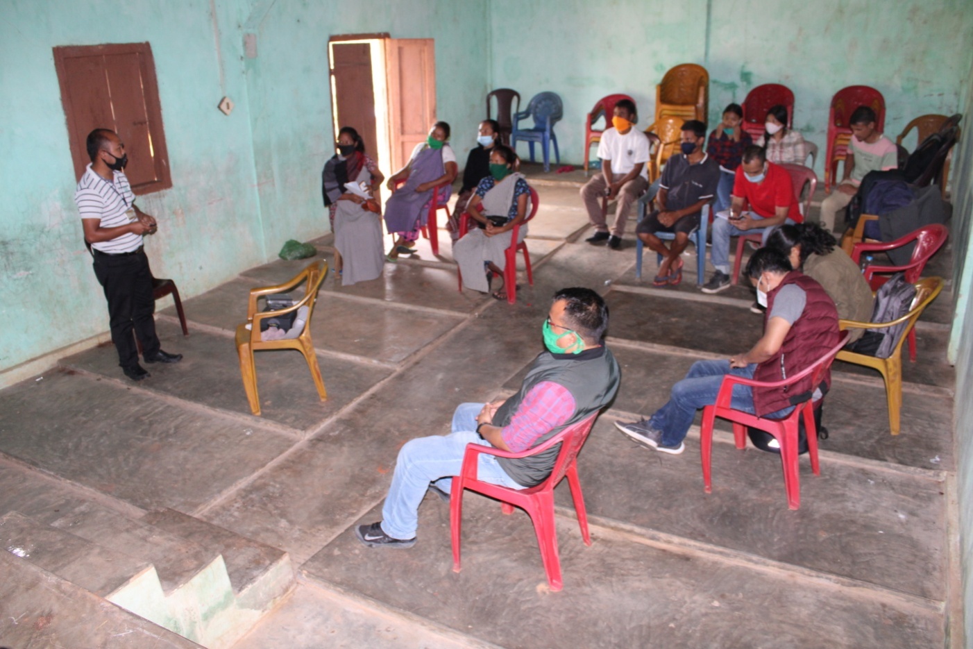
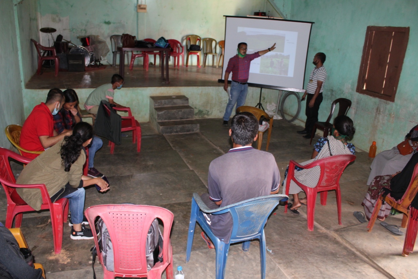
SENSITIZATION PROGRAMME
Dated: 19th November 2018
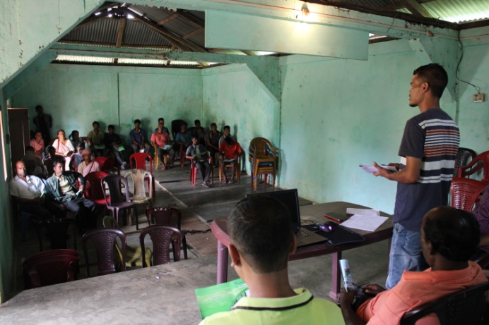
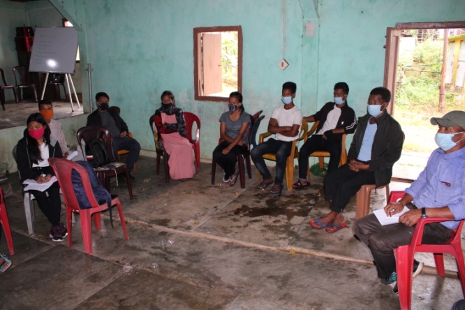
The sensitization programme at larket Village took place on the 24th August 2019 at the Community Hall of larket Village.
 The
Assistant Manager (Social Management) gave a detailed introduction
to the Community led Landscape Management Project(CLLMP) and the
different procedures that the villagers and the CLLMP team should
carry out during the course of the project and the importance of the
involvement of the community for the CLLM-Project to be a
success.
The
Assistant Manager (Social Management) gave a detailed introduction
to the Community led Landscape Management Project(CLLMP) and the
different procedures that the villagers and the CLLMP team should
carry out during the course of the project and the importance of the
involvement of the community for the CLLM-Project to be a
success.
The Assistant Manager (Monitoring & Evaluation) gave a brief introduction on Meghalaya Basin Management Agency (MBMA) and elucidated about the various programmes and projects that MBMA is working on, but mainly focused on the Community Led Landscape Management Project (CLLMP). He also spoke about the different aspects and procedures of the project and gave due importance on the environmental aspects of the project.
The Assistant Manager (Social Management) spoke on the social aspects of the Community Led Landscape Management Project by giving numerous examples. He also enlightened the various benefits that the villagers could obtain from the project.
The Program was followed by an interactive session to answer the doubts and questions of the villagers.
Can this project be implemented on individual land?
Ans: Yes, but there should be an agreement signed between the land owner and the VNRMC before
implementing any NRM related activity.
Does this project only concentrate on conservation?
Ans: No, there are different NRM activities which can be implemented but this project mainly focuses
on capacity building and training the community people
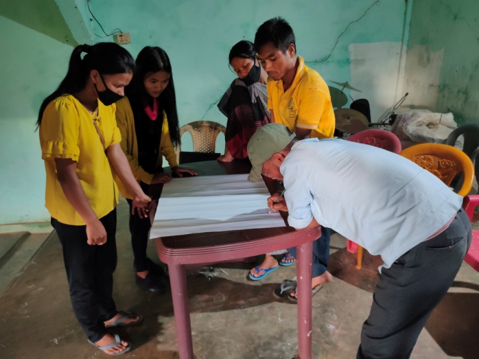
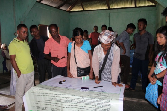 Signing
of Documents:After the sensitization programme, all the
participants signed the Citizens Green charterbanner. The EOI, VGA
and Citizens Green Charter documents were signed on 3rd
August 2019 during a public meeting (Dorbar shnong) in the presence
of the entire village
Signing
of Documents:After the sensitization programme, all the
participants signed the Citizens Green charterbanner. The EOI, VGA
and Citizens Green Charter documents were signed on 3rd
August 2019 during a public meeting (Dorbar shnong) in the presence
of the entire village
Formation of the VNRMC
The Formation of the Village Natural Resource Management Committee was done in a public meeting (Dorbar Shnong) in the presence of the entire village on 3rd August 2019. The community itself chose the Chairman, the Secretary and the other executive members of the Committee.
|
||||||||
|---|---|---|---|---|---|---|---|---|
| Sl No | Name in Full | Gender M/F | Age (in Yrs) | Education | Designation | Occupation | Community | Contact No and email address |
| 1 | Precious Pakem | M | 25 | XII | Chairman | Farmer | Pnar | 7005186823 |
| 2 | Mandakani Pakem | F | 22 | X | Secretary | Farmer | Pnar | 8732059567 |
| 3 | Yespel Pakem | M | 35 | II | Member | Farmer | Pnar | 9774836841 |
| 4 | Isaia Salahe | M | 40 | I | Member | Farmer | Pnar | 9774415911 |
| 5 | Niwan Pakem | M | 22 | III | Member | Farmer | Pnar | 6009042379 |
| 6 | Treda Manar | F | 49 | X | Member | Farmer | Pnar | 9366850852 |
| 7 | Chessibon Sumer | F | 50 | X | Member | Farmer | Pnar | 9612354920 |
| 8 | Aitilut Sumer | F | 24 | I | Member | Farmer | Pnar | 9366484154 |
| 9 | Herolis Pakem | F | 31 | III | Member | Farmer | Pnar | 9774417655 |
Listed below are members of the Executive Committee of the VNRMC:
| Bookkeeper | |||||||||||
|---|---|---|---|---|---|---|---|---|---|---|---|
| Sl.No. | Name | Gender | Contact Number | ||||||||
| 1 | |||||||||||
| Village Community Facilitators | |||||||||||
| Sl.No. | Name | Gender | Age | Education | Contact Number | Role | |||||
| 1 | |||||||||||
| 2 | |||||||||||
| 3 | |||||||||||
| Purchase Committee | |||
|---|---|---|---|
| Sl.No. | Name | Gender | Contact Number |
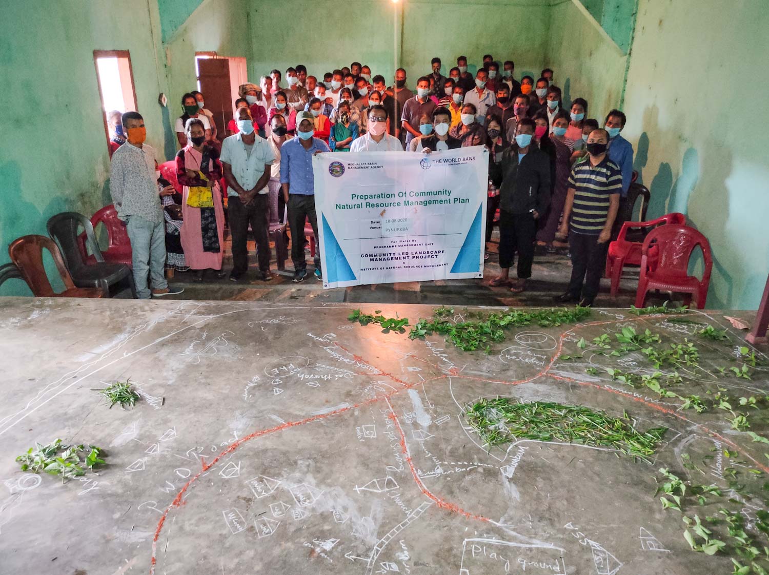
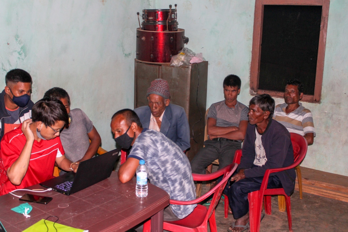
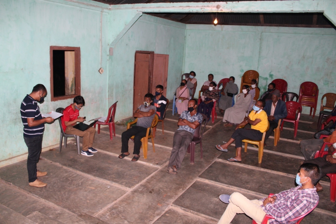
4. PRA EXERCISE & PREPARATION OF CNRMP
18th – 25th AUGUST 2020
Dated – 18thAugust 2020
Venue: Larket village Community Hall
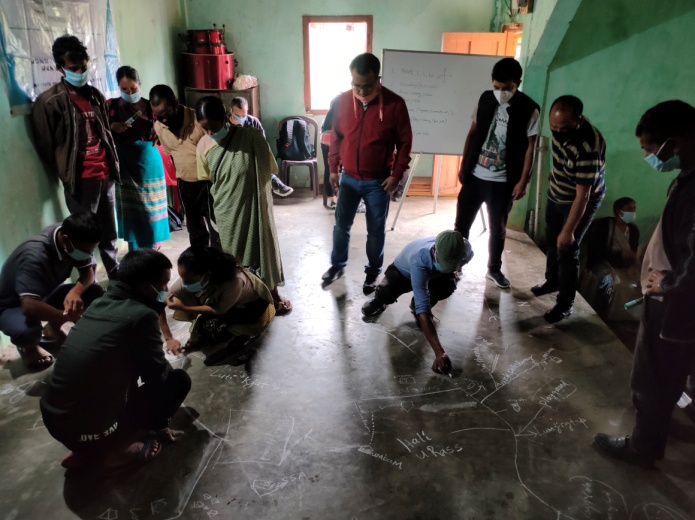
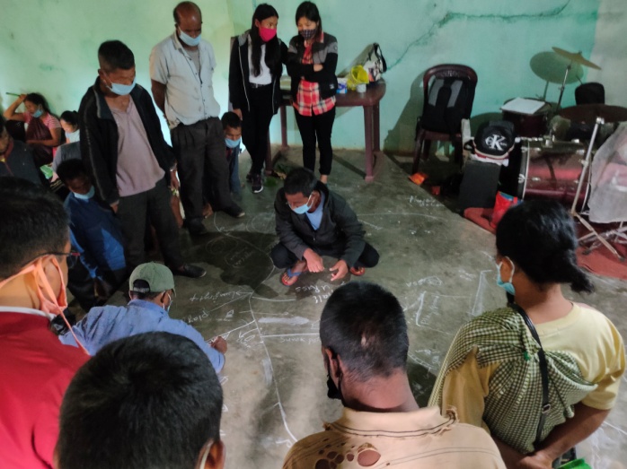
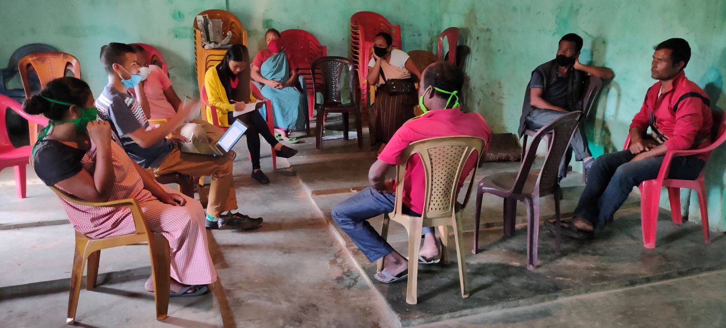
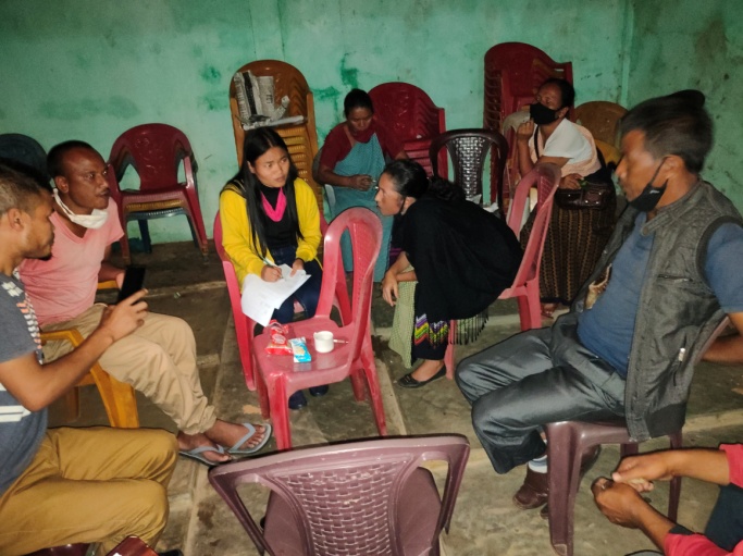
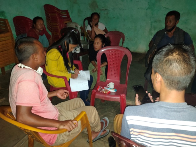
The PRA exercise aims to incorporate the knowledge and opinions of the community in the planning and management of development projects and programmes. There were a total of 65 participants taking part in this exercise who contributed their time and knowledge to this project.
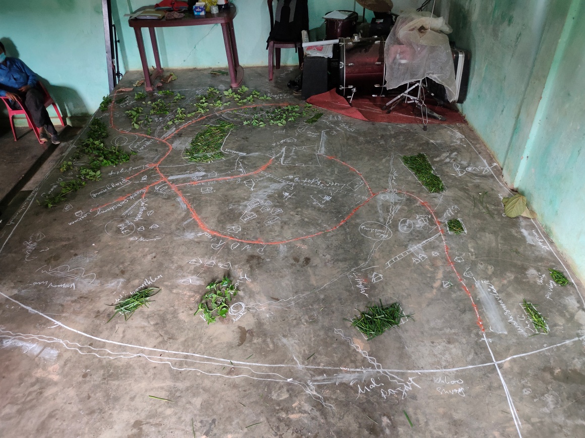
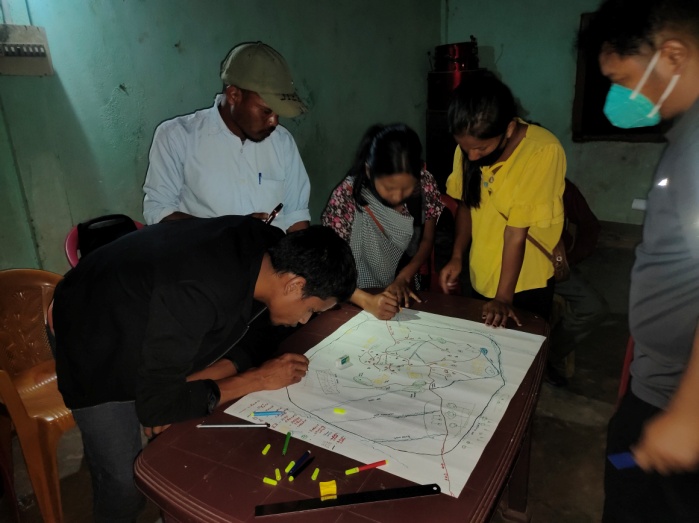
i) Drawing of the Resource and Social Map
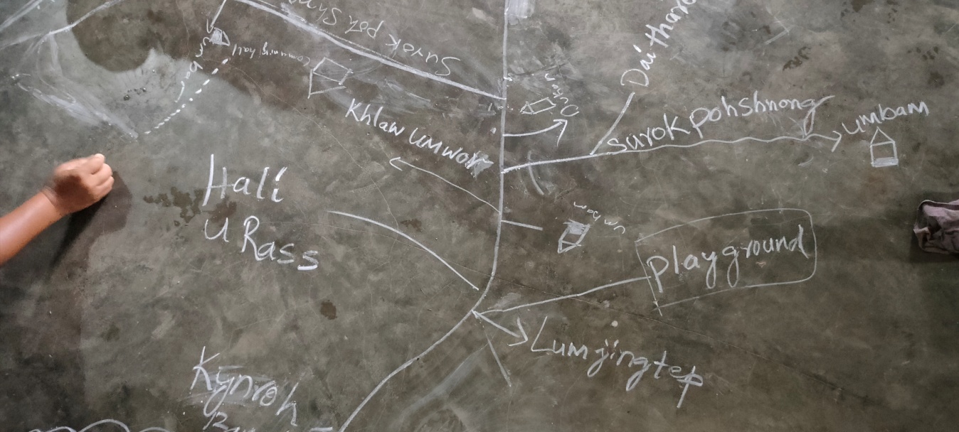
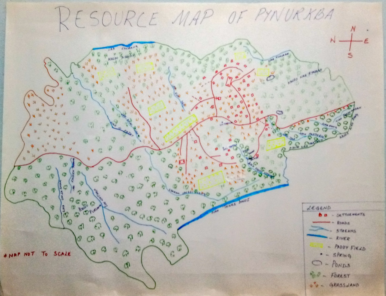
The participated in drawing the resource and social map of larket village. They started by drawing the roads, the village boundary, then the landmarks, the community forest, the rivers/streams and lastly the springs. With time, the map design got better and better as more participants got involved and shared their inputs. The DPMU and SPMU team made the participants understand that by drawing the resource map, they would have greater knowledge on the location and distribution of their available resources.
ii. Re-orientation session on preparation of CNRM plan
The purpose of this session is to revisit the CNRM plan and to identify all the key areas in the plan that needs improvement and reworked. The topics of discussions are as follows:
The major issue with old plan was that it was very limited and the DPD advised the VNRMC members to work with DPMU team in order to prepare a new plan that exceeds more than 10 years.
The plan should not be focussed only on water conservation but also on other interventions such as Land productivity enhancement, Agro-forestry activities, Community nurseries and Capacity building.
All the plans should relate with one another.
There is a huge area of cultivable wasteland (587.26 ha) that can be reclaimed and by practicing Agro-forestry can benefit and improve the livelihoods of the farmers.
It is important to know the area of the intervention site before implementing any activity.
Before any afforestation activity, it it important to first identify the nature of the soil in order for the VNRMC to have a better idea on the types of tree species which can survive in their village. If the proposed afforestation site is far away from the village, the DPD suggested in identifying tree species which cattle and goats don’t like to feed on.
Proper management of the available forest is needed to avoid any over exploitation such as unnecessary felling of trees for firewood.
Preparation of CNRMP in Larket Village
Dated – 21th August 2020
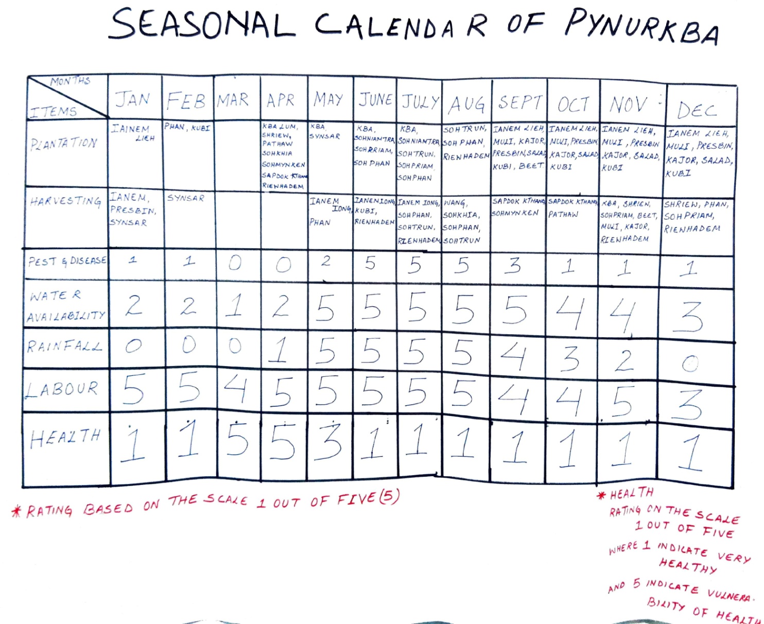
Group 1 – Preparation of Seasonal Calendar
Findings as per the Seasonal Calendar:
| January – June | July - December | |
|---|---|---|
| Plantation | Mustard greens, Potato, Cabbage, Paddy, Cassava, Cucumber,Chilli, Bitter tomato, Yam, Corn, Broom,Orange, Jackfruit, Passion fruit | Paddy, Orange, Passion fruit, Jackfruit, Corn, Mustard greens, Radish, Carrot, French bean, Salad, Cabbage, Beetroot, |
| Harvesting | Mustard greens, French bean, Broom, Potato, Cabbage, Corn | Mustard green, Jackfruit, Pineapple, Colocasia, Orange Corn, Cucumber, Bitter tomato, Chilli, Pumpkin, Cassava, Passion fruit, Beetroot, Radish, Yam, Carrot, Potato |
Pest infestation is at large during the month of June – August.
Water availability improves after the month of May and starts decreasing after November.
There is adequate amount of rainfall during the monsoon but little to no rainfall from November till April.
People tend to fall sick during the month of March – May.
Group 2 – Drawing of the resource & social map on chart paper
Group 3 –Problem Analysis
Findings:
At present, there are no constraints to access of fodder, fuel wood and fodder but the participants’ belief that with time and with increase in population they will eventually start decreasing.
Some of the water bodies are polluted due to domestic waste, siltation and also turn up dry during the winter season.
There is always a shortage of drinking water starting from the month of November till April and then the community has to depend on water bodies which are 2 to 3 km away from the village.
As seen on the map below, a large portion of the land is highly degraded and therefore soil erosion and open/degraded forest is common. Shifting cultivation, growth in population, open grazing etc. are some of the causes to this degradation.
To cope with the increase in population, the people had to adapt from the traditional agricultural practices to a modern approach by using machines, fertilizers, pesticides etc.
Due to water scarcity, most of the land is left uncultivated and then they are prone to soil erosion. Climate change has deeply affected farmers as most of their crops would get damaged by heavy rainfall and pest proliferation.
There are no proper drains for domestic effluents and the runoff ends up polluting some water bodies.
Most of the conflicts and disagreements are resolved during the village Dorbar
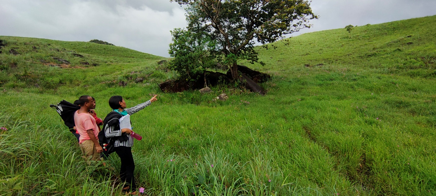
Group 4 – Identification of Intervention Sites
Findings based on the discussion
According to the VNRMC their first prioritise is constructing a retaining wall to prevent soil erosion in SSA Lower primary school.
The participants all agreed on the construction of a spring chamber in Khlieh Umwar which is a community spring.
Shri. Hamlet Pdang suggested on construction of a spring chamber in Daitharoh and also a loose boulder around the spring to prevent any soil erosion.
Shri Rass Rymbai and Shri. Philip Pdang suggested on building a check dam in Khlieh Umwar which is one of the streams the local community highly depend on.
The participants suggested Mooprah as the best site for Agro-forestry, Loose boulder check dam and Jalkund for rain water harvesting
As there is a community forest and agricultural land in Puriang (a site), Smt. Taimon Pdang and Shri. Philip Rymbai suggested a need of a dug out pond, a community nursery and a composting area.
Larshah site was also suggested for horticulture practice.
Group 5 – Vision Map
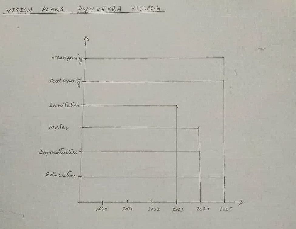
Vision Plan of larket village
Green/Organic farming: The people of larket village who are mostly farmer’s wants to practiced organic farming by the year 2025 since they could see the affected to soil infertility and agricultural products produce low quality as before if they use the fertilizers.
Food Security: They want to access to a sufficient quantity and good quality of affordable & nutritious food by the year 2025 which includes the people from BPL category.
Sanitation: They want to gain access to clean water household wise, proper waste management and transform the village as one of the cleanest in Meghalaya by the year 2023.
Water: To have adequate amount water in the village all throughout the year by 2024.
Infrastructure: To have a basic infrastructure and facilities available by 2024 for the community like Higher Secondary School building, PHC, CHC, Community Service centre, good metalled roads, etc.
Education: They want that all the people in the village should be able to read and write and the children and youth in the village should have an advanced education by the year 2024.
Group 5 – Vision Map
| Sl. no. | Desire/Needs | How to avail | Responsible in assisting | Target/Goals |
|---|---|---|---|---|
| Organic farming |
|
|
5 years | |
| Food security |
|
|
5 years | |
Sanitation
|
|
|
3 years | |
| Availability of irrigation and drinking water all throughout the year |
|
|
4 years | |
Infrastructure
|
|
|
4 years | |
Education
|
|
|
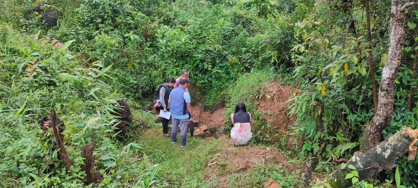
Site inspection of Proposed Intervention sites
Dated: 22nd August 2020
1.
| Name of Site | GPS Coordinates | Reason for selection | Proposed Intervention |
|---|---|---|---|
| SSA Lower Primary School | 25.25031°N 92.28918°E |
Due to heavy rainfall the school ground wall has been affected by soil erosion. Loose boulder wall will prevent landslide occurrence. | Loose Boulder wall |
| Name of Site | GPS Coordinates | Reason for selection | Proposed Intervention |
|---|---|---|---|
| Khloo Um War (Spring) | 25.25227°N 92.29230°E |
A communal spring which is perennial and give adequate amount of drinking water to people during dry season |
Spring Chamber |
| Khloo Um War(Stream) | 25.24998°N 92.29195°E |
One of the streams which the people highly depend on during the winter season | Check dam |
3.
| Name of Site | GPS Coordinates | Reason for selection | Proposed Intervention |
|---|---|---|---|
| Wah Hali | 25.25178°N 92.29134°E |
A stream which the people depend for irrigating their fields | Gabion Wall |
4.
| Name of Site | GPS Coordinates | Reason for selection | Proposed Intervention |
|---|---|---|---|
| Wah Tar | 25.25220°N 92.29457°E |
One of the streams which the people highly depend on during the winter season | Check dam |
5.
| Name of Site | GPS Coordinates | Reason for selection | Proposed Intervention |
|---|---|---|---|
| Puriang | 25.23963°N 92.27866°E |
One of the agricultural sites. Dug out pond will provide water and with the use of bamboo drip irrigation it can irrigate the agricultural fields | Jalkund and Dug out pond |
6.
| Name of Site | GPS Coordinates | Reason for selection | Proposed Intervention |
|---|---|---|---|
| Pdak Pdak | 25.23359°N 92.28592°E |
A catchment areaand also a culturable wasteland which people want to cultivate these lands | Water reservoir |
7.
| Name of Site | GPS Coordinates | Reason for selection | Proposed Intervention |
|---|---|---|---|
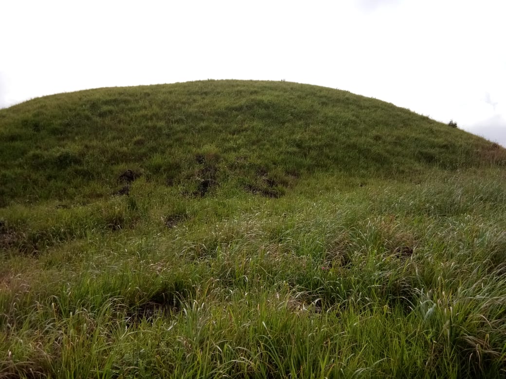
| Shnongrim | 25.23343°N 92.28667°E |
Cultivable wasteland | Afforestation |
8.
| Name of Site | GPS Coordinates | Reason for selection | Proposed Intervention |
|---|---|---|---|
| Um Latyap | 25.233173°N 92.287506°N |
A catchment area near an agricultural land | Dugout pond and recharge pits |
9.
| Name of Site | GPS Coordinates | Reason for selection | Proposed Intervention |
|---|---|---|---|
| Li Pajat | 25.25155°N 92.28039°N |
A stream which the local community depend on for irrigation |
Check dam |
10.
| Name of Site | GPS Coordinates | Reason for selection | Proposed Intervention |
|---|---|---|---|
| Hali Pom Thlun | 25.25422°N 92.28581°N |
Agricultural land affected by gully erosion |
Gully plugs |
11.
| Name of Site | GPS Coordinates | Reason for selection | Proposed Intervention |
|---|---|---|---|
| Khlieh Um Thalong | 25.25415°N 92.28605°N |
A communal spring | Contour Trenches and Afforestation to improve discharge |
12.
| Name of Site | GPS Coordinates | Reason for selection | Proposed Intervention |
|---|---|---|---|
| Daitharoh | 25.25343°N 92.28715°N |
A communal spring | Spring Chamber |
13.
| Name of Site | GPS Coordinates | Reason for selection | Proposed Intervention |
|---|---|---|---|
| Mooprah | 25.25917°N 92.29910°N |
A cultivable wasteland | Agroforestry |
NRM breakdown of the proposed activities
| SL.NO | Problems they are facing | NAME OF PROPOSED INTERVENTION | NAME OF THE SITE | IMPACT | BENEFITED HH |
|---|---|---|---|---|---|
| 1 | Soil Erosion near paddy field | Gullys plug Side channel Loose boulder |
Pamthlun Umlasnam Hali pajat |
|
84 |
| 2 | Culturable wasteland | Afforestation Contour trenches |
Shnongrim Lumkumser |
|
84 |
| 3 | Not enough water for domestic and irrigation purposes | Check dam | Khliehumwar Wahlipajat Madan larshah |
|
84 |
| 4 | Not enough water for irrigation purposes | Water reservoir(earthern dam) | Pdak pdak |
|
84 |
| 5 | Spring chmaber | Daitharoh Umthalong khlooumwar |
|
50 | |
| 6 | Jalkund Dugout pond |
Puriang Umlatyab umwahlieh |
|
84 | |
| 7 | Poor nutrient of the soil | Composting/ vermicomposting | Madanlaeshah |
|
84 |
| 8 | Community nursery | Madan larshah |
|
84 | |
| 9 | Agroforestry | Mooprah |
|
84 | |
| 10 | Contour trenches | umthalong |
|
45 |
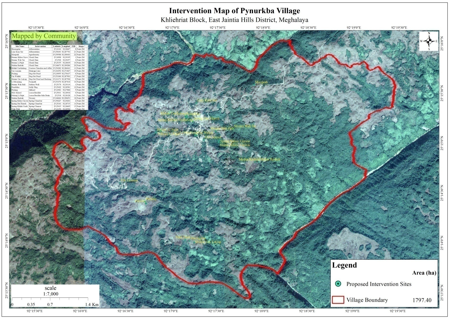
This map shows all the location of the proposed Intervention in Pynurkba Village
Review of the progress and in-situ course in the Preparation of CNRMP
Dated: 24th August 2020
The Asst. Manager Knowledge Management prepared a presentation based on the activities completed and this was presented by the ADPM. The DPD and GM gave their inputs and remarks which are as follows:
According to the GM Knowledge Management there is a lack of information under Problem Analysis with women/vulnerable groups.
The DPD NRM suggested the VNRMC and DPMU team to identify sites where earthen dams can be built as the materials required are available in the village and also the design is relatively simple.
He also advised the VNRMC to work with the DPMU team to identity the local tree species and their usage.
In Puriang,a proposed intervention site, the DPD advised to treat the landscape following the ridge to valley approach.
For any afforestation site which is located far away from the village, he suggested of planting only those tree species which cattle and goats do not like to feed upon.
Presentation of CNRMP to the VNRMC
Dated: 25th August 2020
i. Documenting the History of larket village
With the help of Shri. Dren Pdang, a senior resident of the village, the Asst. Manager Knowledge Management was able to document the timeline of the village on the social and development aspects.
ii. Problem Analysis with the Women/Vulnerable Group
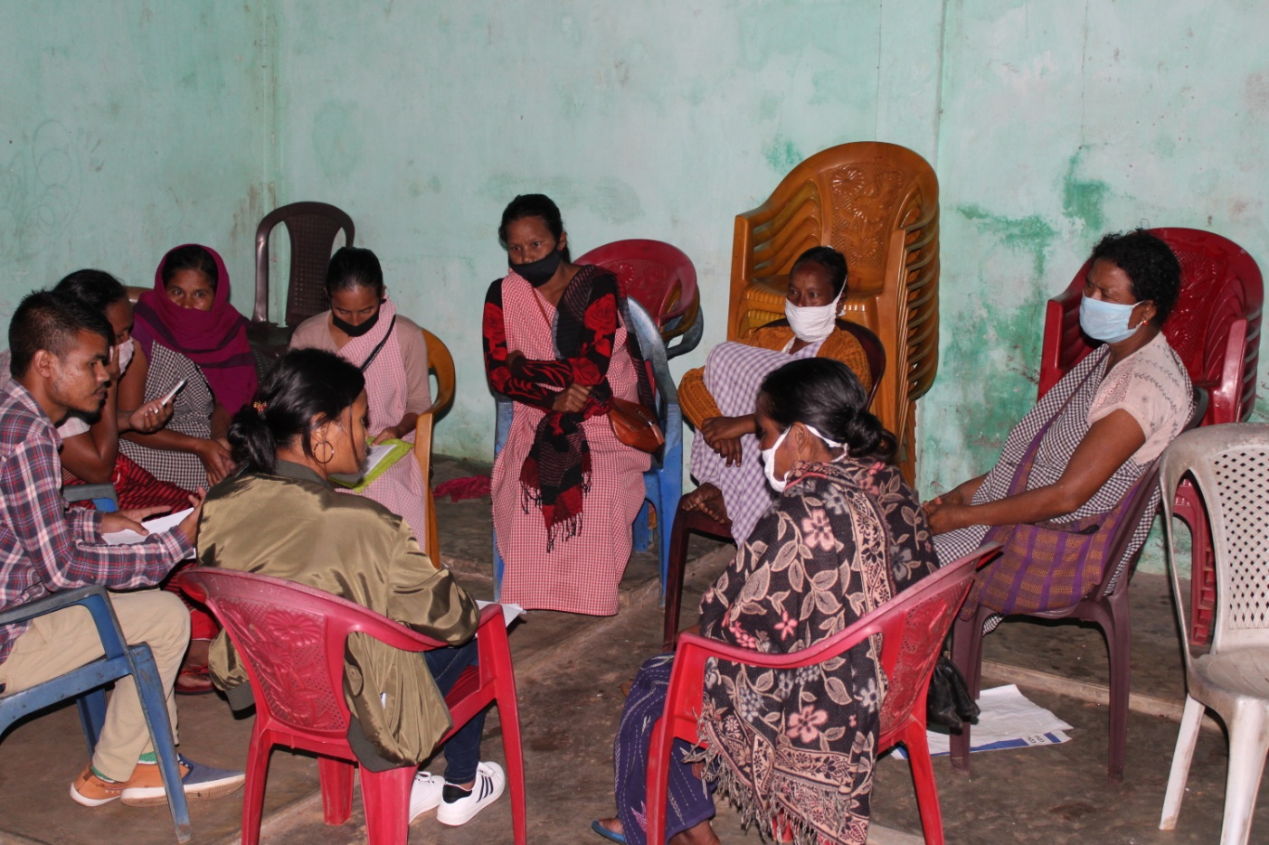
Findings:
The community women are involved in decision making but there also some instances where only men are involved.
Part of the Dorbar: The participant agreed that at present the village women have come forward to take part in meetings and also be members of the local governing body (dorbar shnong committee).
Water problems: the problems related to water have always been highlighted but the women feel that they are the ones who are most vulnerable especially during the winter season as they have to walk a long distance just to fetch water which is stressful and time consuming.
Sanitation: The participants feel that the village needs to do more to improve as there is no proper drainage system for domestic effluents. These effluents end up contaminating water bodies such as springs and streams which can cause severe health problems.
When asked about the different interventions proposed they all agreed that solving the water crisis of the village should be the number one priority and doing that will help improve all livelihood activities.
Presentation of CNRMP to the VNRMC
On 25th August 2020, the ADPM and the entire DPMU team thanked all the members of the VNRMC and VCF’s who had work with the team from the first day in order to help bring changes to help the entire community. The ADPM presented the CNRM plan to the VNRMC members and VCF’s as to conclude the entire week’s program. They were briefed once again on all the activities that were completed, the different types of interventions which were proposed along with their benefits and the roles and responsibilities of each VCF.
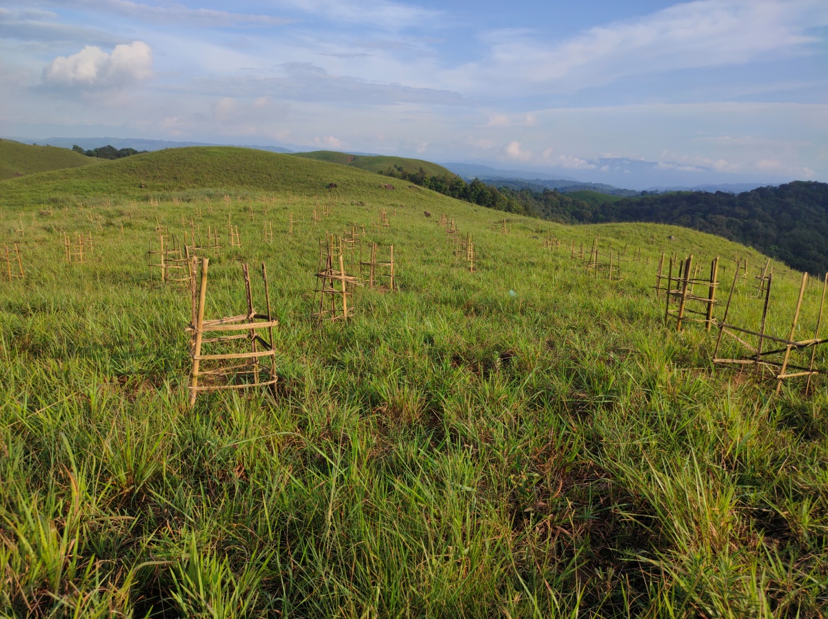
IMPLEMENTATION OF ACTIVITES
| 1. | Type Of Intervention | Site Name | GPS Co-ordinates | Amount Sanctioned | Work Status | Benefitted area | |
|---|---|---|---|---|---|---|---|
| Afforestation | Umlasma | 25.25742°N | 92.29373°E | ₹ 1,66,170.00 | Completed | 27.2 ha | |
| 2. | Type Of Intervention | Site Name | GPS Co-ordinates | Amount Sanctioned | Work Status | Benefitted area | |
|---|---|---|---|---|---|---|---|
| Afforestation | Lum Iap Syiar | 25.26279°N | 92.30309°E | ₹ 1,66,170.00 | Completed | 19.5 ha | |
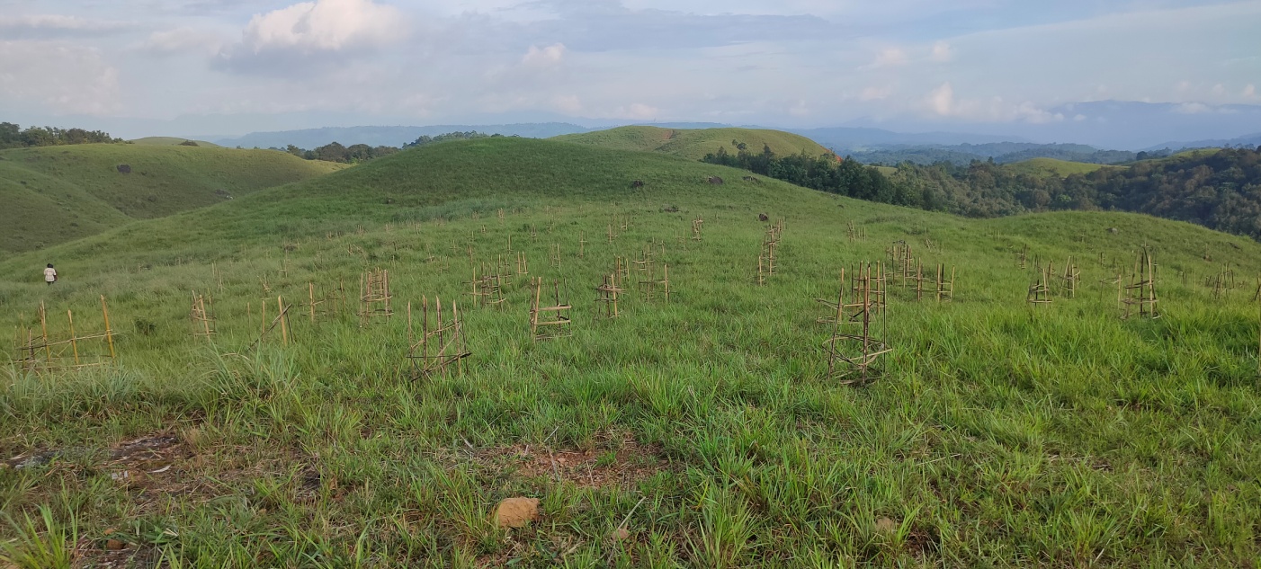
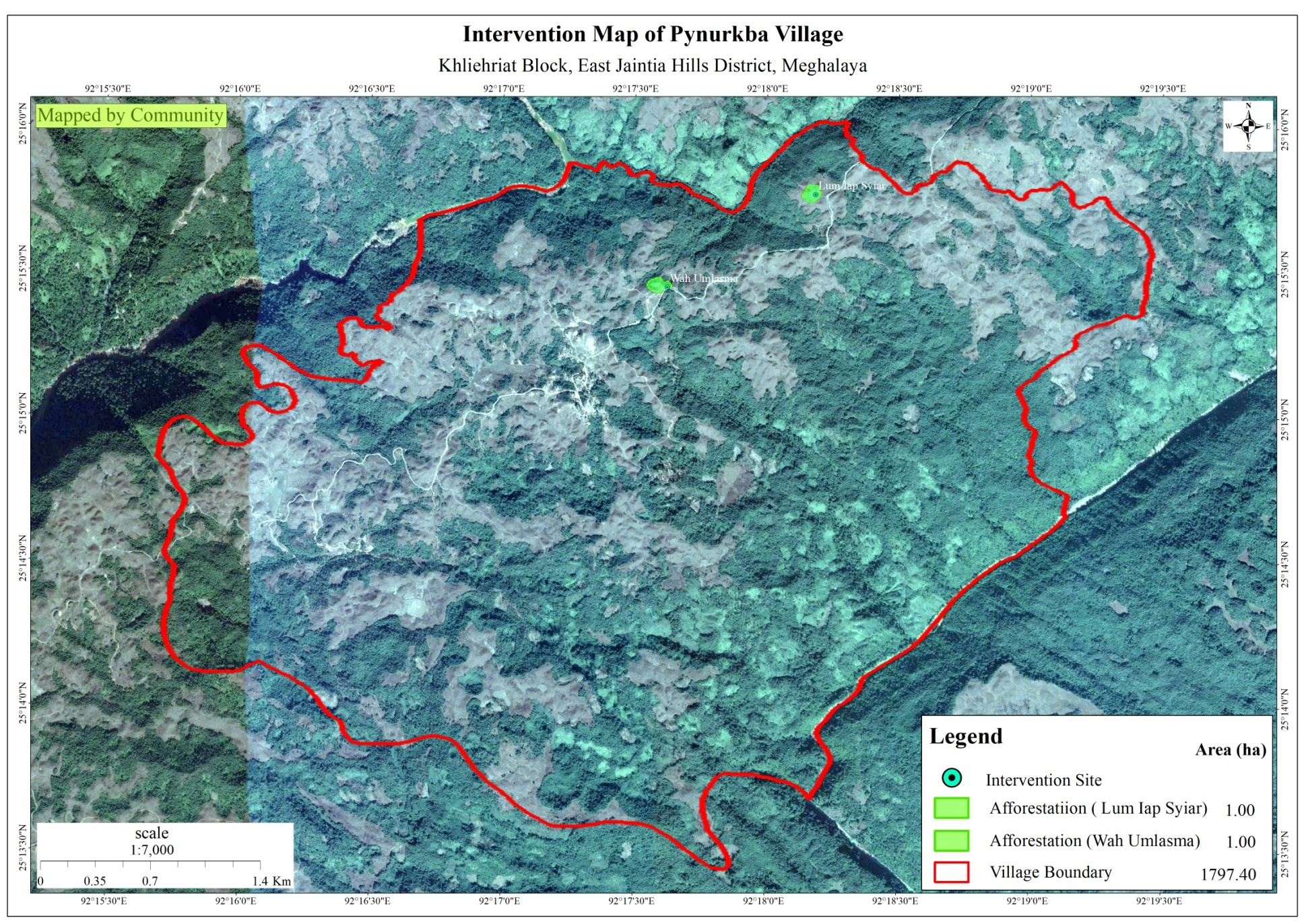
This map shows the location and area of the both the afforestaion sites which have been implemented in Pynurkba village.
FUND STATUS
| Name of Village | Fund available at the VNRMC | Total No. of Work Order Issued | Total amount Issued under CLLMP (Per Activity) | Total Amount Spent | Unspent Funds |
|---|---|---|---|---|---|
| Pynurkba Village | Rs. 8,30,000/- | 2 | Afforestation ₹ 1,66,170.00 |
₹ 3,32,340.00 | ₹ 4,97,660.00 |
Afforestation ₹ 1,66,170.00 |
ANNEXURE
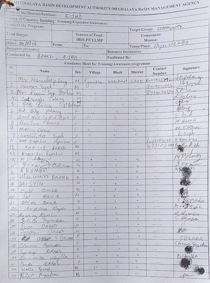
Attendance Sheet for Sensitization Programme conducted in Pynurkba community hall on 24th August 2019
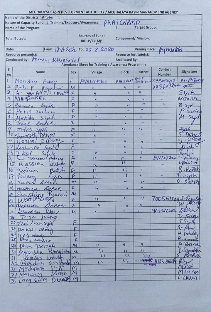
Attendance Sheet for PRA & Preparation of CNRMP conducted in Pynurkba Community hall 18– 25 August 2019
Community Natural Resource Management Plan Template
VILLAGE SUMMARY
| District : East Jaintia Hills Block:Khliehriat Village:Pynurkba | |
|---|---|
| Postal Address:LadrymbaiPIN: 793160 | |
VILLAGE GIS MAP(Baseline Land use land cover map of village to be prepared using information from GIS Atlas and Google Earth as a first step before community mobilisation in the village)
| Sl. No. | Parameters (sl.no.1&2 to be filled by GIS Expert) | Village Information | ||||||
|---|---|---|---|---|---|---|---|---|
| 1 | GPS Coordinates: | |||||||
| i | Latitude | 25.250116°N | ||||||
| ii | Longitude | 92.289244°E | ||||||
| iii | Elevation Reading (MSL) | 874 m | ||||||
| 2 | Village Geographical Area (Ha) | 1797.40 | ||||||
| i | Total Forest Area (including community, Clan, Pvt Forest) | |||||||
| ii | Total Area of Water Bodies | |||||||
| iii | Total Area under Agri-Horticulture | |||||||
| iv | Total Degraded land area (Ha) | |||||||
| 3 | Average Annual Rainfall (data to be collected from secondary data by DPMU at district/block level and need not be village level) | |||||||
| 4 | Soil Type(data to be collected from secondary data by DPMU) | |||||||
|
||||||||||||||
|---|---|---|---|---|---|---|---|---|---|---|---|---|---|---|
| Sl. No. | Parameters | Village Information | ||||||||||||
| 1 | Traditional Land tenure system (Hima /Raid/ /Doloiship/sirdarship/Nokmaakingetc) | Doloiship | ||||||||||||
| 2 | Distance from Block HQ (Km) | 24Km | ||||||||||||
| 3 | Distance from District HQ(Km) | 24Km | ||||||||||||
| 4 | Community inhabiting the village (Khasi, jaintia, Garo & Others) | Total – 86 HHs | ||||||||||||
| 5 | No of HHs in the village | 86 HHs | ||||||||||||
| 6 | Total population | Total – 597, M – 308, F -289 | ||||||||||||
| 7 | Demographic | M | F | Total | ||||||||||
| i | 0-4 | 46 | 50 | 96 | ||||||||||
| ii | 5-14 | 83 | 90 | 173 | ||||||||||
| iii | 15-30 | 84 | 82 | 166 | ||||||||||
| iv | 30-60 | 74 | 48 | 122 | ||||||||||
| v | Above 60 | 21 | 19 | 40 | ||||||||||
| 8 | Major occupations of people in the village (in order of importance). (Collect only one major occupation per HH. The Number of all occupation should be equal to total no.of HH in the village.) | |||||||||||||
| Occupations | ||||||||||||||
| i | Farmer | 41 | ||||||||||||
| ii | Daily Wages | 42 | ||||||||||||
| iii | Teacher | 2 | ||||||||||||
| iv | Business | 1 | ||||||||||||
| v | Govt. Service | |||||||||||||
| vi | ||||||||||||||
| 9 | Public Transport Facilities to & from village Yes/No:…if yes (specify) | i)Yes, Local Taxi (M – 800, Ato -800) | ||||||||||||
| ii)Pick up | ||||||||||||||
| iii)Private vehicles | ||||||||||||||
| 10 | Energy fuel use by HHs | No of HH | Qty (Kg/HH) | Total | ||||||||||
| i | Charcoal | 0 | ||||||||||||
| ii | Wood | 86 | ||||||||||||
| iii | LPG | 25 | ||||||||||||
| iv | Kerosene | 0 | ||||||||||||
| v | Electricity | 80 | ||||||||||||
| 11 | Does the village have sites of Tourist interest | |||||||||||||
| If Yes mention the site & No of Tourist | No of Tourist per Year | |||||||||||||
| i | ||||||||||||||
| ii | ||||||||||||||
| iii | ||||||||||||||
| 12 | Number of Village Institution with their status | |||||||||||||
| Village Council/ VEC/Traditional Institutions | Yes | |||||||||||||
| Water and Sanitation Committee | Yes | |||||||||||||
| Self Help Group for Livelihood Activities | Yes | |||||||||||||
| Other if any | ||||||||||||||
| 13 | Availability of Govt. Water Supply (Y/N) | Yes | ||||||||||||
2.1 Traditional Village Institutional Functionaries (Village Dorbar/Nokma/Doloi Council) |
||||||||||||||||
|---|---|---|---|---|---|---|---|---|---|---|---|---|---|---|---|---|
| Sl No | Name in Full | Gender M/F | Age (in Yrs) | Education | Designation | Occupation | Community | Contact No and email address | ||||||||
| 1 | RassRymbai | M | 44 | III | Headman | Business | Pnar | 9366505268 | ||||||||
| 2 | Hamlet Pdang | M | 51 | VII | Secretary | Farmer | Pnar | 6001423796 | ||||||||
| 3 | Hermon Syad | M | 52 | IV | Treasurer | Farmer | Pnar | 8119011993 | ||||||||
| 4 | Friday Pdang | M | 45 | IV | Member | Carpenter | Pnar | |||||||||
| 5 | Pass Dkhar | M | 54 | - | Member | Farmer | Pnar | 8973486040 | ||||||||
| 6 | Philip Rymbai | M | 42 | SSLC | Member | Farmer | Pnar | 8837098502 | ||||||||
| 7 | MeleyDkhar | M | 45 | - | Member | Farmer | Pnar | |||||||||
| 8 | ShakespearSyad | M | 56 | SSLC | Member | Farmer | Pnar | |||||||||
| 9 | Sunshine Rymbai | M | 35 | VIII | Member | Farmer | Pnar | |||||||||
| 10 | ||||||||||||||||
|
||||||||||||||||
| Sl No | Name in Full | Gender M/F | Age (in Yrs) | Education | Designation | Occupation | Community | Contact No and email address | ||||||||
| 1 | Philip Rymbai | M | 42 | SSLC | Chairman | Business | Pnar | 8837098502 | ||||||||
| 2 | Monday Pdang | F | 36 | Graduate | Secretary | Teacher | Pnar | 87311051417 | ||||||||
| 3 | Pass Dkhar | M | 54 | - | Member | Farmer | Pnar | 8973486040 | ||||||||
| 4 | Hamlet Pdang | M | 51 | VII | Member | Farmer | Pnar | 6001423796 | ||||||||
| 5 | Hermon Syad | M | 52 | IV | Member | Farmer | Pnar | 8119011993 | ||||||||
| 6 | NidawanDkhar | F | 36 | - | Member | Farmer | Pnar | - | ||||||||
| 7 | TailetPdang | F | 40 | HSSLC | Member | Teacher | Pnar | 9366962141 | ||||||||
| 8 | GracyfullSyih | F | 22 | X | Member | Farmer | Pnar | - | ||||||||
| 9 | MedasShylla | F | 45 | III | Member | Farmer | Pnar | - | ||||||||
2.3 Green Facilitators
| Sl No | Name in Full | Gender M/F | Age (Yrs) |
Education | Area of specialisation/ focus (forests, water, soil, accounts, environmental and social safeguards, knowledge management, GIS) | Trained under CLLMP (Yes/ No?) if Yes, date training was received | Contact No and email address |
|---|---|---|---|---|---|---|---|
| 1 | Peterson Dkhar | M | 24 | HSSLC | No | No | 9612060113 |
| 2 | KrisnuLyngwar | M | 40 | III | No | No | 6003783023 |
| 3 | TailetPdang | F | 40 | HSSLC | No | No | 9366962141 |
| 4 | MelcyDkhar | F | 45 | VII | No | No | 6009425295 |
| 1 | The exercise should be done in a public place, that all members of the community, can access and participate in; |
|---|---|
| 2 | Facilitators should carry GIS map of village/ Google Earth Map |
| 3 | Introduction on Resource Map to the community; entire community to be present |
| 4 | Facilitate the community to draw the Village Resource Map of the village on the floor/open ground/Chart Paper using participatory tools and locally available materials |
| 5 | Facilitate community to draw village Boundary-basic landmarks such as roads streams, rivers, forests, agricultural land etc |
| 6 | Map out details of land use such as Community forest, clan forest, Pvt individual forest, Jhum area, important cash crop areas, Agriculture areas, Agro forestry, degraded land area, sand/stone quarries, coal mining areas, steep slope areas, low land areas, wasteland & Plant species in each forest type etc. |
| 7 | Map out details of water bodies such as springs &springshed, water catchment areas, ponds, lakes, water reservoirs, sites for fishing etc & Temporary features (Seasonal ponds/Lakes) etc |
| 8 | Briefing and validation of the Resource Map with the community. Copy the Resource Map on the paper for official record. Use Standard legends for uniformity and convenience. |
| 9 | Ensure that participants engaged in drawing Resource maps including VNRM committee sign and date at the back of the Resource Map and it is endorsed by the head of the village council |
| 10 | It is recommended that the group prepare two copies of Resource Maps, so that one copy may be given to the community for their future reference. Take a photo |
RESOURCE MAPPING
(This is the tool to begin interaction with the people in the village. This exercise will provide an opportunity to bring people together to understand the natural resources of the village towards plan preparation. The facilitators must have the secondary information in advance to be able to facilitate effectively; The information collected through this process should be filled into the template provided for Land Use Pattern.)
LAND USE PATTERN
| Sl No | Land use Category | Land Ownership (Community/Clan /Pvt individual etc) |
Name of the Site |
Quality of forest(Dense, Moderate, open) refer to GIS Map | Land Area /stretch as in the vilage (Ha/Km) |
Present Uses/Benefits HHs=1; Timber =2; NTFP =3; Fuelwood = 4; Medicine & Aromatic plants=5, Others=6 |
Land Area available for intervention (Ha) | Grazing (Y/N) |
Remarks |
|---|---|---|---|---|---|---|---|---|---|
| 4.1 | Forest (Specify type)(total area of all forest should match with forest area of the village measured under GIS) | ||||||||
| Community Forest (Lawshnong/SongniBirungbolgrik) | -Community | 1.khloo Wanku 2.khloo Wahrang 3.khloo Pakthem 4.Pohsiej 5. Wah tar 6.Khloo Puriang |
Dense & Open Dense & Open Dense & open Open Dense & open Dense & open |
29.6 ha 30.9 ha 305 ha 0.24 ha 36.9 ha 150.20 |
1,2,4 | 1.3.19 ha 2.4.6 ha 3.10.8 ha 4. No 5.52 ha 10 ha |
Yes Yes Yes Yes Yes |
4)It resides in the settlement area | |
| Private (Rikynti/) | Private | Individual Owner | Dense & Open | 381.45 ha | 1,2,3,4 | No | Yes | It is a private property | |
| Clan Forest (Lawkur/Maharini/ Raid | Nil | ||||||||
| Protected Forests/ Green Blocks (including Law Adong and Law shnong, forests protected for aesthetic reasons) | -Community | Khlawwahrembah | Dense & Open | 94 ha | No | No | No | It is a protected area | |
| Catchment Areas (water supply) (Area to be filled by GIS) | Community | Khlooumwar Lum roman Lumkumser Khloowah tar Lumwahrymbah Dong wahchnong Khloowahpakthem Khloowah rang Lumlyngkeintariang Lum li pajat Lum um Latyap |
9.91 ha 9.54 ha 8.21 ha 32.6 ha 51.9 ha 3.49 ha 28.3 ha 34.6 ha 50.2 ha 11.7 ha 23.8 ha |
These catchments areas are for springs and streams |
| SL. No. | Land use Category | Land Ownership (Community/Pvt individual etc) |
Name of the Site |
Land Area available for intervention (Ha) | Source of Seeds Community Nursery=1 Purchase=2 Others=3 |
Use of Organic Fertiliser/Bio-Pesticide/Bio-Insecticides etc. (Y/N) |
Remarks | |||||||||||||||||||
|---|---|---|---|---|---|---|---|---|---|---|---|---|---|---|---|---|---|---|---|---|---|---|---|---|---|---|
| 4.2 | Cultivable Land (Area in ha to be filled by GIS) | (To be filled by DPMU team) | (To be filled by DPMU team) | |||||||||||||||||||||||
| 1 | Area under Agriculture (Mention Ha under each crop – Paddy, Maize others) wet land (Paddy Field) | Private | Individual owner | 2,3 | Yes | |||||||||||||||||||||
| 2 | Area under Horticulture (Mention Ha under each type) |
-No | ||||||||||||||||||||||||
| 3 | Area under Cash Crops 1 (Specify) | -No | ||||||||||||||||||||||||
| 4 | Area under Cash Crops 2 (Specify)…… ) | -No | ||||||||||||||||||||||||
| 5 | Area under Shifting Cultivation Average cycle (yrs)………………… | -NA | ||||||||||||||||||||||||
| 6 | Culturable Wasteland(to be filled by GIS ) | Private community |
Individual site Pdakpdak Puriang Shnongrim Lumiapsyiar Lum Roman Lumkumser Khliehumlasma |
503.32ha 4.42 ha 26.6 ha 5.76 ha 6.31 ha 3.75 ha 19.1 ha 18 ha |
2,3 | Afforestion can be done in these areas | ||||||||||||||||||||
| SL. No. | Land use Category | Ownership/Community/Private | Name of the water body/spring |
GPS coordinates (to be filled by technical team) | No of Dependent HH (to be filled by social survey team) | Nature of water body (Perennial/Seasonal) (to be filled by technical team) | Existing Soil & Water Conservation structures (to be filled by technical team) |
Water quality tested (Y/N) (to be filled by technical team) |
Size/length of River /stream (Ha/Km) (length of river, stream, to be provided by GIS) |
Present use/Benefit (fisheries/irrigation/drinking water) (to be filled by social survey team) |
Number/Area available for intervention (to be filled by technical team) |
Remarks (to be filled by DPMU) | ||||||||||||||
| 4.3 | Water Bodies (specify) | |||||||||||||||||||||||||
| 1 | Springs/Water Source | Community | 1.Umthalong 2.Khloo Umwar 3.Dai tharoh 4.khlieh umthalong |
1) 25.252809°N 92.288137°E 2) 25.250227°N 92.292030°E 3) 25.25343°N 92.28715°E 4)25.25415°N 92.286043°E |
40 40 10 - |
Perennial Perennial Perennial Perennial |
No No No No |
No Yes Yes Yes |
Drinking water Drinking water Drinking water |
1.Umthalong 2.Dai tharoh 3.Umthalong |
||||||||||||||||
| 2 | Natural ponds | Private | Individual site Individual site Individual site Individual site Individual site |
Perennial Perennial Perennial Perennial perennial |
No No No No No |
No No No No No |
0.03 0.01 0.01 0.01 |
Fisheries | ||||||||||||||||||
| 3 | Lakes | |||||||||||||||||||||||||
| 4 | Streams within village area | Community | 1.Wahrang 2. WahthlooMadan 3.Wah tar 4.Wah pakthem 5.Wah Rembah 6.Wah umlasnam 7.Wah lynkeintariang 8.Wah li pajat 9.Wah kliehumwar 10.umsoithlang 11.Wah hali 12.Wah pahat 13.Wah kumser 14.Umlatyap 15. WahPhlang |
30 40 30 30 15 20 20 15 |
Perennial Perennial Perennial Perennial Perennial Perennial Perennial Seasonal perennial perennial perennial Perennial perennial perennial perennial |
No No No No No No No No No No No No No No No |
No No Yes Yes No No No Yes Yes Yes Yes No No No No |
1) 0.99 km 2)0.43 km 3)1.35 km 4)1.89 km 5)2.3 km 6)0.55 km 7)0.74 km 8)0.21 km 0.51 km 0.48 km 0.42 km 1.15 km 0.22 km 1.32 km 1.27 km |
No No Domestics uses No No No No Domestics uses & agriculture Domestics uses & agriculture Drinking water &domesticsuses Agriculture Agriculture Agriculture No |
1. Wahtar 2.Wah pajat 3.Wah khliehumwar 4.umsoithlang |
Other are far from the settlements areas Wahrembah is the source for PHE water in the village |
|||||||||||||||
| 5 | Rivers within Village Geographical area | Community | 1)ThweiDoloi 2)WahLynriang |
- - |
Perennial perennial |
No No |
No No |
1)0.89 km 2)1.17 km |
No No |
no | ||||||||||||||||
| 6 | Others (Specify) | Community | Tap water 1 Tap water 2 Tap water 3 |
25.252365 N 92.288771 E 25.251022 N 92.288232 E 25.252308 N 92.289377 E |
Perennial Perennial Perennial |
No No No |
Drinking water & domestics Drinking water & domestics Drinking water & Domestics |
PHE Tap water | ||||||||||||||||||
| 4.4 | Indigenous/ Cultivated Trees and NTFPs in Forests | List of Species | Main use (Household/ Commercial) |
|---|---|---|---|
| 1 | Indigenous Tree species in Forest | Pinuskesiya Schimawallichii Lakhar Cinnamoniumtamala PhyllanthusemblicaDiengsnieng/ Castanopsisindicasusuit, Slongsain,Sohjler Wahsniang,skap, sajing, SohsaliyaTlongjong, Pyrne, Pyrchin, Ternge Fruits tree-Autocarpusheterophyllus, Myricaesculenta, Mangiferaindica, Citrus reticulata, Citrus aurantium, Psidiumguajava, Morusrubra, Ananascomosus,Sohsalyngi |
Firewood ,construction Firewood, Leaves-packing Leaf- spices Fruit-edible Firewood , Fruit-edible Firewood, construction, Fencing Handicraft Fruits- edible |
| 2 | NTFPs in Forest including medicinal shrubs/trees etc | Saccharumofficinarum, Cytisusscoparius, bamboo, Fargesia, Phyllostachysnigra, Mushroom-tittung, pyrsit, rngaw, Zingiberofficinale, Piper betle, , Centellaasiatica, ,Eupatorium, squash, phiengdieng, syntiewkhnai ,sohslongwiat, Iopomoeabatatas,Bidenspilosa Medicinal plants Plantigo major Chyrmitkyndeh Phiah thong Lantana camara, Dioscoreaalata,houttuyniacordata, Nepenthes khasiana |
Stem- edible Cleaning Fencing, Edible Spices Fodder |
| 3 | Commercially valued Trees/ Shrubs/Plants in forests/ | ||
| 4 | Fodder Species/ Valuable grasses in forests | Dioscoreaalata,Iopomoeabatatas leaf, Banana trunk, kynbathati squash | |
| 5 | Any vulnerable/ endangered species in Forest (fauna & flora) ) | Deer | |
| 6 | Invasive plant Species (if any) |
5. PROBLEM ANALYSIS
(These are some questions to facilitate FGDs to get an understanding on the challenges and concerns in the village. Some of the issues could be Soil degradation/erosion; Forest Fires; Unscientific Mining; Deforestation; Degraded Jhum Lands; Waste/Pollution; Mining runoff; Siltation; Over- extraction. This information will help fill the form 5.1, 5.2, 5.3 and 5.4. The information can be collected in advance or substantiated later with the help of secondary sources. The interaction should take place as a discussion and the forms should be filled after the discussion and not during it)
Do people have sufficient access to supply of fodder, fuel wood, leaf litter? –Yes at present, but decreases with each passing year
Has access to timber improved or reduced over the years? How is access for household use and commercial use managed?-No, it is the same(Managed by dorbarshnong)
Are the water bodies facing any threats?-yes,pollution, siltation and Scarcity during winter seasons
Do all people in the village have access to drinking water? What are the challenges?-Yes-during dry season have to walk distance to fetch water
Are there degraded areas in the village (open/ degraded forests, mining affected, high soil erosion etc.)? Yes, soil erosion, open/degraded forest.
What has caused this degradation? Are there practices causing threats to availability and access to natural resources?-population growth, land brought under cultivation, Shifting cultivation, grazing of live stocks etc.
What have been the changes in agricultural practices?-Different techniques were adopt by the people with time, ploughing ,use of fertilizer and manure to increase production,
Are there any challenges in farming?-Yes, 1. There are many areas but due to water scarcity becomesculturable waste 2. The area is prone to soil erosion during summer season led to destruction of crops, pests is another problem.
How would you consider the health situation in your village?-Good
How is the situation of cleanliness, sanitation, access to toilets and waste management?Average(no proper drain for domestics effluents)
Who are the most vulnerable in the village? What can be done to improve their lives?Yes (women),
What are the livelihood aspirations of the youth? Are there any avenues available?
Do any committees/ institutions/ rules exist to manage and monitor natural resources in the village?Yes
What are some of the major issues of conflict in the village?No major conflicts only minor conflicts
Have any of the above issues been discussed in village meetings?yes
How do people resolve disagreements and conflicts?Solved within the village dorbar
| 5.1 | Land | ||||||||
|---|---|---|---|---|---|---|---|---|---|
| Sl No | Category of Land/Water Body |
Soil degradation/erosion (in Ha) (DPMU to collect from secondary data) |
Forest Fires (in Ha) | Un scientific Mining (in Ha) |
Deforestation (in Ha) (To be filled by GIS) |
Degraded Jhum Lands (in Ha) | Others (in Ha) | Total Area Affected (approx. in Ha) |
Remarks |
| 1 | Land | 727.45 ha | 0.00 | 0.00 | 4.95 | 35.18 | No | 767.58 ha | Not much deforestation but the canopy of forest is declining and mostly culturable waste land area/grassland, due to shifting cultivation and timber |
| A | Forest | No | No | No | No | No | No | ||
| B | Cultivable land | No | No | No | No | No | No | ||
| C | Others (Specify) | ||||||||
| 5.2 | Water Bodies Affected | |||||||||
|---|---|---|---|---|---|---|---|---|---|---|
| Sl No | Category of Land/Water Body | Number affected & Name of sites | Waste/ Pollution | Mining runoff | Siltation of water bodies | Over- extraction | Deforestation in Catchment | Test Result? (attach) | Others (Specify)
|
|
| Solid Waste | Domestic waste water | |||||||||
| 2 | Water Bodies | |||||||||
| A | Springs (name of springs) | Umthalong | yes | yes | - | yes | - | - | ||
| Dai tharoh | - | - | - | yes | - | - | ||||
| Khlooumwar | - | - | - | yes | - | - | ||||
| B | Stream (number) | Wah tar umsoithlang |
Yes - |
Yes - |
- - |
- Yes |
- - |
- - |
||
| C | River/ pond/ lake | |||||||||
| 5.3 | Disputes / Constraints encountered by Community | |||||
|---|---|---|---|---|---|---|
| Sl No | Type of Resource | Dispute (mention if within village=1 or with other village/s =2) | Constraint | Rating/Frequency/ Number of Months in the year | Proposed resolution | Priority (can be addressed through CNRM plan) |
| 1 | Village Geographical Boundary | No | NA | NA | NA | NA |
| 2 | Drinking Water | No | Yes | Dec-April | Afforestation, recharge pit | Yes |
| 3 | Water for irrigation | No | Yes | March-Midmay | Bamboo drip irrigation was practiced but discontinued due to lack of source of water | Yes |
| 4 | Access to land for construction of House | No | Yes | NA | NA | NA |
| 5 | Access of land for cultivation | No | Yes | Dec-mar | Dug out pond, jhalcoon | Yes |
| 6 | Access to timber for construction etc | No | NA | NA | NA | NA |
| 7 | Access to NTFP (Wild vegetables, canes and bamboo, lac, Herbal medicines etc) | No | NA | NA | NA | NA |
| 8 | Access to Fodder | No | NA | NA | NA | NA |
| 9 | Access to Fuel wood | No | NA | NA | NA | NA |
| 10 | Access to LPG | No | Yes | Whole Year | LPG centre located far from the village | NA |
| 11 | Access to solar cookers/ heaters | No | NA | NA | NA | NA |
| 12 | Access to Food/PDS | No | Yes | NA | NA | NA |
| 13 | Others (Erosion in School Premises) | No | Yes | No proper drainage and wall in the SSA school | NA | NA |
| 5.4 | ||||||
|---|---|---|---|---|---|---|
| Sl No | Environment Parameters | Rules & Management System In Place in Village Yes =1; No = 2; Not Applicable (NA)=3 |
Management Committee/Volunteers in place (Y/N and Composition) |
Contact Person and contact Details | ||
| Y/N | No of M | No of F | ||||
| 1 | Access for timber/NTFPs etc from community forest | 1 | Y | Rassrymbai | ||
| 2 | Access for cultivable land for villagers from community land | 1 | Y | RassRymbai | ||
| 3 | Protection of spring sheds, water sources | 1 | Y | Rassrymbai | ||
| 4 | Protection of catchment areas | |||||
| 5 | Prevention of forest fires | 1 | Y | Rassrymbai | ||
| 6 | Conservation of aquatic life in rivers, streams etc | 1 | Y | RassRymbai | ||
| 7 | System for Disposal of solid waste | 1 | Y | |||
| 8 | System for treatment of Household affluent | 1 | Y | |||
| 9 | Cleanliness of village - roads, footpaths | 1 | Y | |||
| 10 | Social fencing for Protection of stray cattle/other domestic animals | 1 | Y | RassRymbai | ||
| 11 | Participation of women in decision making at various platforms | 1 | Y | |||
| 12 | Rate of wages for both men and women for different types of labour | 1 | Y | m-400 f-250 |
||
| 13 | Ensuring survival of young plantations (upto 5 years) | 1 | Y | Rassrymbai | ||
| 14 | Management of afforested plots | 1 | Y | Rassrymbai | ||
| 15 | Eco-Tourism | |||||
| 16 | Others (Specify) | |||||
6. CNRM PLAN PREPARATION
The idea is to create a positive environment where the people discuss problems but with a target of solving them, moving to a higher goal, identifying that goal and a collective vision.
There are many ways of facilitating a visioning exercise. If the group is very large then they can be broken into smaller groups, if the group is small, then questions can be posed for each individual. Based on small group discussions or individual map a depiction of what the village would be ten years from now can be prepared. Facilitators should aim to break the ice and help the group think about their vision. Make the exercise fun by asking “if you had a magic wand what would you change” or “if you had one wish what you would do for your village”. There is no harm in starting from personal aspiration- ask parents what they want for their children or ask youth what their aspirations are.
Each small group or individual can be given a topic/area: forests, agriculture, water, school, health, transport, livelihood, tourism and so on. They can be asked to discuss the problem today that needs to be solved and what they see in this area ten years from now. Based on the discussion or reflection, a combined chart can be prepared the issues can be written and another chart where the vision/desire/wish/goal can be written for each area. This process helps people to think holistically and not see the project as a source of a few activities.
This vision chart can be a basis to start the next set of discussion, on prioritization of interventions and be a reference document to help plan under the project.
6.2 Prioritization Exercise
The exercise should build on the resource map and baseline information collected to arrive at potential interventions and initiatives the community would like to plan to achieve their vision for improvements in the state of natural resources of their village.
Group Discussion - Groups of different age groups such as youth men, youth women, men above 30, women above 30 years old.
Facilitate each group to discuss the pressures and challenges related to natural resources in the village, existing best practices and knowledge within the village and then envision improvements that could enhance the state of natural resources and contribute to an improved resource base.
Facilitate them to prioritize new interventions and initiatives to achieve these improvements. Map out the proposed interventions and initiatives using the resource map and write up the interventions in a tabular format
Copy the Vision map on paper for purpose of record and attach the group discussion points of different groups. The list of participants of each group may be attached for future reference.
Geo-tag intervention sites, take photos of sites during the planning stage to compare through the cycle of intervention.
6.3 Intervention identification
| Area of Intervention | Intervention 1 | Intervention 2 |
|
Intervention 4 | Intervention 5 | Remark on any traditional knowledge/ best practice within the village |
|---|---|---|---|---|---|---|
|
|
|
|
|
||
| Soil and Water Conservation | Gully plugs/ Pamthlun Drainage/ umlasnam |
|
|
Jalkund/Puriang Dug out pond/ puriang(2) Umlatyap(1) Um wahlieh(1) |
|
|
| Land Productivity Enhancement | Contour bunding/ Mooprah | Composting/site to be decide |
|
|
|
|
| Spring Shed Management | Spring Chamber/ DaiTharohUmthalong Khliehumwar |
|
Contour trenches/ umthalongPuriang |
|
|
|
| Afforestation/ Community Forestry Activities | Afforestation near monoliath / Mo-raja |
|
|
|||
| Forest area under management plans |
|
|
||||
| Enhancement of Agro-forestry Activities |
|
|||||
| Culturable waste land brought under Horticulture |
|
|
|
Afforestation/Lumkumser | ||
| Activities to Treat Mining Affected Area | ||||||
| Others |
|
|
|
|
*Note: Consider following criteria for prioritizing the water sources for intervention:
a) Number of dependent households b) Discharge level c) Demand vs. Supply Gap d) Drastic change in discharge e) Availability of Land for intervention f) Willingness of communities/individuals
For prioritized springs, fill and attach Annexure-B (Spring Information Form)
|
Name of Proposed Interventions | Site |
|
Nos of HHs expected to Benefit | Priority (High/ Medium/ Low) | Start date (MM/YY) | Completion date (MM/YY) | ||
|---|---|---|---|---|---|---|---|---|---|
|
|
|
|||||||
| 1 | Soil and water conservation |
WahLipajatpomthlum Pohsiej Umlatyap Puriang pdak |
|
|
|
|
|||
| 2 | Land Productivity Enhanccement | Mooprah |
|
|
|
|
|||
| 3 |
|
Khliehumthalong Daitharoh Khlooumwar |
|
|
|
|
|||
| 4 |
|
Lumiapsyiar khliehumwasma |
|
|
|
|
|||
| 5 |
|
Shnongrim Larshah |
|
|
|
|
|||
| 6 | Forest area under management plans | Wah tar | Community |
|
|
|
|||
| 7 | Enhancement of Agro-forestry Activities | Mooprah | Community |
|
|
|
|||
6.5Training and Capacity Building for implementing CNRM Plan
Sl
|
Type of Training/ Cap Building Activity | No of People | Target audience (VCF/VNRMC) | Proposed frequency | Remarks | ||
|---|---|---|---|---|---|---|---|
| 1 | Training on Solid Waste Management | To be Conducted | |||||
| 2 | Training on Gender inclusion | 5 | VCF/VNRMC | Completed | |||
| 3 | Training on Landscape Management | To be conducted | |||||
| 4 | Social Management and Community Mobilization | 5 | VCF/VNRMC | Completed | |||
| 5 | Soil and Water Conservation | To be conducted | |||||
| 6 | Land Productivity Enhancement | 5 | VCF/VNRMC | Completed | |||
| 7 | Forestry and Agroforestry | To be Conducted | |||||
| 8 | Community Nursery and Nursery Management | To be Conducted | |||||
| 9 | Spring Shed Management and Development | 5 | VCF/VNRMC | Completed | |||
| 10 | Other training required (please specify) | ||||||
6.6ENVIRONMENT ELIGIBILITY SCREENING
| Sl. No | Activities/Subprojects with any of the attributes listed below will be ineligible for support under the proposed project due to environmental implications. | Yes/No |
| 1 | Any subproject/activities that is not consistent with Acts of GoI and GoM | No |
| 2 | Subproject/activities that could intervene or damage/fragment and/or adversely affect/ impact natural habitats/ protected areas, reserve forests, including but not limited to, the following sites:
|
No |
| 3 | Subproject/activities that support forest harvesting on a large/industrial scale | No |
| 4 | Activity that involves construction of check dam >3m height | No |
| 5 | Subprojects/activities that promote or require pesticides that falls in WHO classes IA, IB, or II and/or procurement of large amount of pesticides or toxic agro-chemicals. | No |
| 6 | Subprojects/activities will not support large- scale clearing of land, dredging of water bodies, undercutting of slopes, replacement of natural vegetation that may cause permanent, irreversible impacts. | No |
| 7 | Any activity that has a significant potential of causing forest fires | No |
| 8 | Any project activity that leads to large-scale soil erosion and siltation of water bodies | No |
| 9 | Any activity that promotes or involves incidence of child labour. | No |
| 10 | Sub project/Activities that would adversely affect cultural sites, places of significance importance and protected historical assets (both living and built) | No |
| 11 | Sub project/Activities that involves the felling of the ‘prohibited trees’ without a permit | No |
| 12 | Sub project/Activities that seeks to impose restrictions or loss of access to using natural resources, including medicinal plants or those of economic value for livelihoods. | No |
| 13 | Any activities involving use of Asbestos Containing Materials (e.g. Pipes for community irrigation schemes). | No |
If Yes- reject /modify activities in the plan to meet the criteria.
6.7 ENVIRONMENTAL REGULATORY COMPLIANCE SCREENING
If the answer to the questions posed in the screening process below is ‘Yes’, mitigation measures would be required to be put in place.
| S. No. | Regulatory requirements | Implications for project | |
|---|---|---|---|
| I | Are any of the activities located within a notified Eco Sensitive Zone (ESZ)?
If yes, Are any of the activities on the list of activities regulated in ESZ? If yes, Has the required permission been taken? |
No |
|
II III |
Are any of the activities involving construction located between 100-300 meters from an archaeological site/monument. If yes, has permission been taken from the Archaeological Survey of India? |
No No |
Follow EGs on Chance find procedures |
IV V |
Do any of the activities require license under the Fertilizer Order 1985 (selling, stocking, exhibiting for sale or distribution of bio-fertilizers and organic fertilizers)? If yes, has the license been taken? |
No No |
Follow General Rules under Fertilizer Order 19851 |
6.8 Social Screening Checklist
LAND MANAGEMENT2
| Screening Questions | Yes | No | Details/Remarks | |
|---|---|---|---|---|
| 1. | Is there land requirement under each proposed intervention? | Yes | What is the size of land required per intervention? Who owns the land (Community, Clan or Private) |
|
| 2. | Does the land selected ensure minimum adverse impact? | Yes | ||
| 3. | Is there any impact on: | Provide number of affected persons per intervention | ||
| Agricultural land | No | |||
| Forest land | No | |||
| Access to common resource (mention type of resource) | No | |||
| 4. | Are the estimated affected persons from the vulnerable category? | No | Provide number of affected persons per intervention | |
| Women headed HH | No | |||
| BPL HH | No | |||
| 5. | Will land be taken on voluntary land donation? | Yes | ||
| 6. | Have the principles and procedures3 for voluntary land donation been duly followed? | Yes | ||
| 7. | Have due precautions been taken to minimize disturbance to sensitive locations or locations having cultural significance? | Yes |
SOCIAL INCLUSION4
| Screening Questions | Yes | No | Details/Remarks | |
|---|---|---|---|---|
| 1. | Was separate consultation held with different groups? | Yes | Mention type of interaction and location | |
| Women | Yes | |||
| Youth | Yes | |||
| Low income families | Yes | |||
| Minority groups | Yes | |||
| Any other | ||||
| 2. | Are the concerns and priorities of different groups reflected in the interventions proposed? | Yes | List the specific concern | |
| Women | Yes | |||
| Youth | Yes | |||
| Low income families | Yes | |||
| Minority group | Yes | |||
| Any other | ||||
| 3. | Were separate meetings with women organised to prioritise their needs? | Yes | ||
| 4. | What percentage of women are members of local committees formed under the project? | Yes | Specify for each committee 50% | |
| 5. | Number of women are employed under the project? (provide total number at each level and the total staff to calculate the percentage of women) |
Staff, consultants, field workers | ||
| State | ||||
| District | ||||
| Block | ||||
| Village |
LABOUR MANAGEMENT
| Screening Questions | Yes | No | Details/Remarks | |
|---|---|---|---|---|
| 1. | What are the number of labour required under the interventions proposed? | Yes | Number of labour/number of days | |
| 2. | Is labour influx5 expected? | Yes | ||
| 3. | Is an assessment on impacts due to labour influx required? | Yes | Specify the reason for Yes or No | |
| 4. | Does the project ensure that no activity will involve child labor? | Yes | ||
| 5. | Does the project ensure equal opportunities and wage to female workers as per applicable acts? | Yes | ||
| 6. | Are there any contractors to be engaged? | Yes | ||
| 7. | Do contractor agreements contain clauses for labour protection and insurance6? | Yes | ||
| 8. | Is there any GRM for labour related issues? | Yes |
CITIZEN ENGAGEMENT
| Screening | Yes | No | Details | |
|---|---|---|---|---|
| 1 | Is there communication material available? | Yes | ||
| 2 | Is the communication material available in local language? | Yes | ||
| 3 | Are multiple mediums used to share information at the village level? | Yes | ||
| 4 | Are meetings organised at village level? | Yes | ||
| 5 | Are people informed in advance of the meetings? | Yes | ||
| 6 | Are citizen’s needs documented? | Yes | ||
| 7 | Are CNRMPs consolidation of people’s needs? | Yes | ||
| 8 | Is information on CNRMP displayed in the village? | Yes | (please provide a list of what and where) | |
| 9 | Is there a GRM system? | Yes | If yes, give details? | |
| 10 | Is the GRM system advertised? | Yes | ||
| 11 | Are people aware of it? | Yes |
BENEFIT SHARING
(to be filled for each intervention):
| 1 | Name of the Intervention | Afforestation |
|---|---|---|
| 2 | Number of Direct Beneficiaries | 50 |
| 3 | Overall Quantum of Benefit | 36 |
| 4 | Distribution of benefit per HH | |
| 5 | Contribution (What is each HH contributing) |
|
| 6 | Number of Indirect Beneficiaries | 36 |
6.9 Preparation of Estimate and Budget by Technical Assistants/ Engineers
(Based on the technical feasibility, scope and scale of interventions identified a budget and estimate needs to be prepared for the plan that receives technical sanction by technical experts/ block level engineers)
| S No | Intervention (Area and no. of units) | Estimated Total Cost (INR) | Yearly Budget | Source of Funding | Remarks | ||||
|---|---|---|---|---|---|---|---|---|---|
| Y1 ____ | Y2____ | Y3____ |
|
Govt Scheme | Others | ||||
| 1. | Afforestation (1) Afforestation (1) |
166170 166170 |
107500 107500 |
|
|
166170
|
|||
7. Community Natural Resource Management Plan Checklists (to be submitted)
List of participants (ensure participation of women and vulnerable groups)
Completed CNRM booklet
Resource Map
GPS Coordinates and maps of village area, different forest cover, springsheds, water bodies, catchment areas etc for generating Satellite images of different GIS layers of villages as required)
Summary of Village CNRM Plan with community estimate/ Budget
Checklists: Eligibility Screening Checklist, Regulatory Compliance Screening form, Social Screening Checklist
Photos of Resource mapping exercise, group discussions, proposed intervention areas
General Observation/Remarks of the Facilitators on the Village:
(Comment on number and composition of participants/ Any challenges/ feedback etc)
………………………………………………………………………………………………………………………………………………………………………………………………………………………………
……………………………………………………………………………………………………………………………………………………………………………………………………………………………………………………………………………………………………………………………………………………………………………………………………………………………………………………………………………..
Name of Facilitator:………………………….…………………………………… Designation:……………………………………………… Signature and Date:………………………………..
Name of VNRMC Chairperson/Secretary..................................Designation:……………………………………………… Signature and Date:………………………………..
Name of Technical Assistant……………………………………………………Designation:………………………………………………Signature and Date:………………………………..
Annexure – A
Water Budgeting
| S No | Parameter | Response | |||||||||||||||||||||||||||
|---|---|---|---|---|---|---|---|---|---|---|---|---|---|---|---|---|---|---|---|---|---|---|---|---|---|---|---|---|---|
| 1 | Total Number of Households | 84 | |||||||||||||||||||||||||||
| 2 | Total Population | 569 | |||||||||||||||||||||||||||
| 3 | Average Population per Household | 6 | |||||||||||||||||||||||||||
| 4 | Total Livestock | 620 | |||||||||||||||||||||||||||
| DEMAND | Spring (Mar-Apr) | Monsoon (May-Sept) | Autumn (Oct-Nov) | Winter (Dec-Feb) | |||||||||||||||||||||||||
| Water Demand per capita per day (Human use) | 55 | ||||||||||||||||||||||||||||
| Water Demand per capita per day (Livestock) | 54 | ||||||||||||||||||||||||||||
| Total Demand per day (litres)-Human | 31295 | ||||||||||||||||||||||||||||
| Total Demand per day (litres)-Livestock | 33480 | ||||||||||||||||||||||||||||
| Total Demand per day (liters) (Human+Livestock) | 64775 | ||||||||||||||||||||||||||||
| Time Spent for fetching water per Household per day (in minutes) | 100 | ||||||||||||||||||||||||||||
| Total Supply per day (litres) | 15696 | ||||||||||||||||||||||||||||
| Difference | -49079 | ||||||||||||||||||||||||||||
| Difference Per Capita Per day | -51.43 |
|---|
| SUPPLY | Spring (Mar-Apr) | Monsoon (May-Sept) | Autumn (Oct-Nov) | Winter (Dec-Feb) | |||||||||||||||||||||||||
| 1 | Water sources | Available in numbers | Distance from village Community hall (average) | Purpose Used for: Drinking-1 Domestic-2 Animals-3 |
Sum of average discharge of all utilised springs (lpm) or Water Levels in m bgl (meters below ground level) | Total water supply (liters) per day | Sum of average discharge of all utilised springs (lpm) or Water Levels in m bgl (meters below ground level) | Total water supply (liters) per day | Sum of average discharge of all utilised springs (lpm) or Water Levels in m bgl (meters below ground level) | Total water supply (liters) per day | Sum of average discharge of all utilised springs (lpm) or Water Levels in m bgl (meters below ground level) | Total water supply (liters) per day | |||||||||||||||||
| 1 | 2 | 3 | 4 | 5 | 6 | 7 | 8 | 9 | 10 | 11 | 12 | ||||||||||||||||||
| 1.1 | No of Springs | 3 | 200 | 1 | 2.97 | 12844.8 | |||||||||||||||||||||||
| 1.2 | No of Ponds | 0 | 0 | 0 | |||||||||||||||||||||||||
| 1.3 | No of Lakes | 0 | 0 | 0 | |||||||||||||||||||||||||
| 1.4 | No of Wells | 0 | 0 | 0 | |||||||||||||||||||||||||
| 1.5 | No of Hand pumps | 0 | 0 | 0 | |||||||||||||||||||||||||
| 1.6 | Other water supply (PHED, etc) | 3 | 160 | 2 | 3.63 | 15696 | |||||||||||||||||||||||
| Total | Total | Total | Total | ||||||||||||||||||||||||||
Annexure-B
SPRING INFORMATION FORM
|
|||
|---|---|---|---|
| Date & Time | : 22/08/2020 & 5:30 PM | ||
| Name of surveyor | :DPMU_EJHD | ||
| State | :Meghalaya | ||
| District | : East Jaintia Hills | ||
| Block name | : Khliehriat | ||
| Village name | :Pynurkba | Panchayat: _____________ | Hamlet: _______________ |
| Local Spring Name | : Daitharoh | ||
| Spring ID | : MGEJKHPYS01 (2-aplphabet initials of State/District/block/village/spring number) |
||
|
|||||
|---|---|---|---|---|---|
| Latitude: _25.25343°N_ | Longitude: ___92.28715°E__ | Elevation (m): 874 m | |||
| GPS Accuracy (m): __3_____ | No. of Dependent Households-10 HHs | ||||
|
|||||
| Community 🗹 | Private | Forest | Others | ||
|
|||||
| Contact spring | Karst spring | ||||
| Fault spring | Depression spring | 🗹 | |||
| Fracture spring | |||||
| Combination (Please specify) | ______________________________ | ||||
|
|||||
| Seasonal | Perennial 🗹 | ||||
| If seasonal, period of flow (in months) | _______________ | ||||
| Peak discharge period: ______________ | |||||
|
||||||
|---|---|---|---|---|---|---|
| Spring box/tank/chamber | 🗹 | |||||
| Using pipe/Bamboo outlet | ||||||
| From a flowing stream | ||||||
| Pipeline system | ||||||
| Flowing from a wetland/water logged area | ||||||
|
||||||
| Dimensions of the box | ||||||
| Length (m): _____1m_________ | Breadth (m): ___1m__________ | Height (m): ____________ | ||||
| Diameter (m): ____________ | Height (m): ____________ (in case of cylindrical tank) | |||||
Other: ________
|
||||||
| Drinking & Cooking | 🗹 | Agriculture | ||||
| Domestic (Washing clothes/utensils, Bathing etc.) | Livestock | |||||
| Community Water Supply | Not Used | |||||
| Other | None | |||||
|
|---|
|
|||
|---|---|---|---|
| pH : 6.67 | TDS (ppm) __25_____ | Salinity (ppm) _______12_________ | |
| Temperature (0C) __24.4__ | Electrical Conductivity (µS/cm) ___________ | ||
| Bacterial Contamination | Yes No 🗹 | ||
| Water sample collected | Yes No 🗹 | If Yes, Sample ID: ____________ | |
|
|||
| Jhoom Cultivation | |||
| Terrace Agriculture | |||
| Forest | |||
| Reserved Forest | |||
| Community Forest | |||
| Settlements | 🗹 | ||
| Others if any. Please Mention | |||
|
|||
| Private | 🗹 | ||
| Community | 🗹 | ||
| Government | |||
| Mixed | |||
| Others, if any, Please Mention | |||
|
|||
| Latrines | 🗹( Latrines have concretised septic tanks) | ||
| Waste dump | 🗹 | ||
| Gutters | |||
| Open defecation | |||
|
|||
| Loose unconsolidated | 🗹 | ||
| Weathered rock | 🗹 | ||
| Fractured-vertical | |||
| Fractured-horizontal | |||
| Hard and compact | |||
| Other Characteristics (mention if any) | _____________________________________________ | ||
|
|
|---|---|
| Dip slope | 🗹 |
| Escarpment slope | |
| Vertical slope | |
|
|---|
Field sketch of the Spring emergence site
Geological section or 3-D conceptual diagram of the Springshed
Google Earth image of the delineated potential recharge area/zone of the Spring (with specific interventions marked)
Details of the Spring recharge interventions
| Recharge intervention type | Dimensions | Number of plantations/structures |
|---|---|---|
| Social | ||
| Engineering | ||
| Biological |
Annexure-B
SPRING INFORMATION FORM
|
|||
|---|---|---|---|
| Date & Time | : 22/08/2020 11:38 AM | ||
| Name of surveyor | : DPMU_EJHD | ||
| State | : Meghalaya | ||
| District | : East Jaintia Hills | ||
| Block name | : Khliehriat | ||
| Village name | : Pynurkba | Panchayat: _____________ | Hamlet: _______________ |
| Local Spring Name | : Khlooumwar | ||
| Spring ID | : MGEJKHPYS02 (2-aplphabet initials of State/District/block/village/spring number) |
||
|
|||||
|---|---|---|---|---|---|
| Latitude: 25.25415 °N_ | Longitude: 92.286043 °E__ | Elevation (m): 826 m | |||
| GPS Accuracy (m): __3_____ | No. of Dependent Households-40 HHs | ||||
|
|||||
| Community 🗹 | Private | Forest | Others ________________ | ||
|
|||||
| Contact spring | Karst spring | ||||
| Fault spring | Depression spring | 🗹 | |||
| Fracture spring | |||||
| Combination (Please specify) | ______________________________ | ||||
|
|||||
| Seasonal | Perennial 🗹 | ||||
| If seasonal, period of flow (in months) | _______________ | ||||
| Peak discharge period: ______________ | |||||
|
||||||
|---|---|---|---|---|---|---|
| Spring box/tank/chamber | ||||||
| Using pipe/Bamboo outlet | ||||||
| From a flowing stream | 🗹 | |||||
| Pipeline system | ||||||
| Flowing from a wetland/water logged area | ||||||
|
||||||
| Dimensions of the box | ||||||
| Length (m): ______________ | Breadth (m): _____________ | Height (m): ____________ | ||||
| Diameter (m): ____________ | Height (m): ____________ (in case of cylindrical tank) | |||||
Other: ________
|
||||||
| Drinking & Cooking | 🗹 | Agriculture | ||||
| Domestic (Washing clothes/utensils, Bathing etc.) | Livestock | |||||
| Community Water Supply | Not Used | |||||
| Other | None | |||||
|
|---|
|
|||
|---|---|---|---|
| pH : 6.48 | TDS (ppm) __20_____ | Salinity (ppm) ______10__________ | |
| Temperature (0C) __23.4__ | Electrical Conductivity (µS/cm) ___________ | ||
| Bacterial Contamination | Yes No 🗹 | ||
| Water sample collected | Yes No 🗹 | If Yes, Sample ID: ____________ | |
|
|||
| Jhoom Cultivation | |||
| Terrace Agriculture | |||
| Forest | |||
| Reserved Forest | |||
| Community Forest | 🗹 | ||
| Settlements | |||
| Others if any. Please Mention | |||
|
|||
| Private | |||
| Community | 🗹 | ||
| Government | |||
| Mixed | |||
| Others, if any, Please Mention | |||
|
|||
| Latrines | |||
| Waste dump | |||
| Gutters | |||
| Open defecation | |||
|
|||
| Loose unconsolidated | 🗹 | ||
| Weathered rock | 🗹 | ||
| Fractured-vertical | |||
| Fractured-horizontal | |||
| Hard and compact | |||
| Other Characteristics (mention if any) | _____________________________________________ | ||
|
|
|---|---|
| Dip slope | |
| Escarpment slope | |
| Vertical slope | |
|
|---|
Field sketch of the Spring emergence site
Geological section or 3-D conceptual diagram of the Springshed
Google Earth image of the delineated potential recharge area/zone of the Spring (with specific interventions marked)
Details of the Spring recharge interventions
| Recharge intervention type | Dimensions | Number of plantations/structures |
|---|---|---|
| Social | ||
| Engineering | ||
| Biological |
Annexure-B
SPRING INFORMATION FORM
|
|||
|---|---|---|---|
| Date & Time | : 22/08/2020 &04:40 PM | ||
| Name of surveyor | : DPMU_EJHD | ||
| State | : Meghalaya | ||
| District | : East Jaintia Hills | ||
| Block name | : Khliehriat | ||
| Village name | : Pynurkba | Panchayat: _____________ | Hamlet: _______________ |
| Local Spring Name | : Umthalong | ||
| Spring ID | : MGEJKHPYS03 (2-aplphabet initials of State/District/block/village/spring number) |
||
|
|||||
|---|---|---|---|---|---|
| Latitude: _25.252809°N_ | Longitude: __92.288137°E__ | Elevation (m): 866 m | |||
| GPS Accuracy (m): __3_____ | No. of Dependent Households-40 HHs | ||||
|
|||||
| Community 🗹 | Private | Forest | Others ________________ | ||
|
|||||
| Contact spring | Karst spring | ||||
| Fault spring | Depression spring | 🗹 | |||
| Fracture spring | |||||
| Combination (Please specify) | ______________________________ | ||||
|
|||||
| Seasonal | Perennial 🗹 | ||||
| If seasonal, period of flow (in months) | _______________ | ||||
| Peak discharge period: ______________ | |||||
|
||||||
|---|---|---|---|---|---|---|
| Spring box/tank/chamber | 🗹 | |||||
| Using pipe/Bamboo outlet | ||||||
| From a flowing stream | ||||||
| Pipeline system | ||||||
| Flowing from a wetland/water logged area | ||||||
|
||||||
| Dimensions of the box | ||||||
| Length (m): ______________ | Breadth (m): _____________ | Height (m): ____________ | ||||
| Diameter (m): ____________ | Height (m): ____________ (in case of cylindrical tank) | |||||
Other: ________
|
||||||
| Drinking & Cooking | 🗹 | Agriculture | ||||
| Domestic (Washing clothes/utensils, Bathing etc.) | Livestock | |||||
| Community Water Supply | Not Used | |||||
| Other | None | |||||
|
|---|
|
|||
|---|---|---|---|
| pH : 6.29 | TDS (ppm) __20_____ | Salinity (ppm) _______10_________ | |
| Temperature (0C) __23.88__ | Electrical Conductivity (µS/cm) ___________ | ||
| Bacterial Contamination | Yes No 🗹 | ||
| Water sample collected | Yes No 🗹 | If Yes, Sample ID: ____________ | |
|
|||
| Jhoom Cultivation | |||
| Terrace Agriculture | |||
| Forest | |||
| Reserved Forest | |||
| Community Forest | |||
| Settlements | |||
Others if any. Please Mention Culturable waste land |
🗹 | ||
|
|||
| Private | 🗹 | ||
| Community | |||
| Government | |||
| Mixed | |||
| Others, if any, Please Mention | |||
|
|||
| Latrines | |||
| Waste dump | |||
| Gutters | |||
| Open defecation | |||
|
|||
| Loose unconsolidated | 🗹 | ||
| Weathered rock | 🗹 | ||
| Fractured-vertical | |||
| Fractured-horizontal | |||
| Hard and compact | |||
| Other Characteristics (mention if any) | _____________________________________________ | ||
|
|
|---|---|
| Dip slope | |
| Escarpment slope | |
| Vertical slope | |
|
|---|
Field sketch of the Spring emergence site
Geological section or 3-D conceptual diagram of the Springshed
Google Earth image of the delineated potential recharge area/zone of the Spring (with specific interventions marked)
Details of the Spring recharge interventions
| Recharge intervention type | Dimensions | Number of plantations/structures |
|---|---|---|
| Social | ||
| Engineering | ||
| Biological |
Natural resource (particularly land) ownership and management in Meghalaya is complex – in the presence of customary norms and formal laws. The project intervention will be particularly mindful of such land ownership issues, particularly the nuances of community and private ownership issues. Screening of land sites identified for project interventions: All land for planned interventions would be undertaken on: Existing land available with the implementing agency; Government land accessed through department transfer; Land taken on lease under relevant legal provisions or through voluntary land donation by beneficiaries or taken through lease deed, private market; Purchase agreement or MOU with relevant institutions (like ADCs, Syiems/Nokmas) for community demand driven interventions. No private land acquisition will be undertaken under any project component.↩︎
Voluntary donation of land would be undertaken as per the following principles: That all donors would compulsorily become beneficiaries i.e. no individual or individuals would end up landless and therefore unable to benefit from the demand driven scheme. Such donors are adequately compensated for land given either in cash (at market rates) by purchasing body or given alternate land by contribution from other members. The process of taking such land would involve: Identification of demand from the community followed by assessment of suitability of land as per design; Drawing up of a MOU or agreement with the concerned parties; Such land taken on voluntary donation basis would be duly registered to avoid future complications↩︎
It is to be noted that poverty is not the only indicator that excludes or deprives a person or group from equal access to resources, services and information. Various other indicators such as ethnicity, clan, gender, religion, place of residence, age and others play a very important role in disabling or excluding people from a range of processes and opportunities. CLLMP aims to strengthen the capacities and knowledge of men, women and youths residing in rural Meghalaya. It also aims to ensure that all groups of people in the community are actively involved in the planning, management and monitoring of various initiatives↩︎
The team needs to be cognisant of the possibilities that influx of workers could lead to adverse social and environmental impacts on local communities, especially if the communities are rural, remote or small. Such adverse impacts may include increased demand for goods and services that can lead to price hikes and crowding out of local consumers, increased volume of traffic and higher risk of accidents, increased demands on the ecosystem and natural resources, social conflicts within and between communities, increased risk of spread of communicable diseases, and increased rates of illicit behaviour and crime↩︎
Wherever labour camps will be set up, it will be ensured that the contract labourers are properlydocumented for, the camps have suitable living conditions with safe drinking water, sanitary toilet facilities (earmarked separately for men and women)etc. Contractors’ agreements will have specific clause to ensure child labour and forced labour and banned at project sites, wages are provided as per legal guidelines, labour camp conditions meet adequate quality norms and every contractual employee have proper work-related documentation. The contract should also include clauses regarding reduction of waste general and safe disposal of waste at camp sites; ensure that workers’ camps and associated facilities are connected to septic tank or other wastewater systems which are appropriate and of sufficient capacity for the number of workers and local conditions; avoid contamination of freshwater resources; place workers’ camps away from environmentally sensitive areas to avoid impacts on the local wildlife; route new access routes for workers’ camps to avoid/minimize environmentally sensitive areas; avoid deforestation around camps; provide adequate training to workers on health and safety standards and ensure that children and minors are not employed directly or indirectly on the project↩︎