ym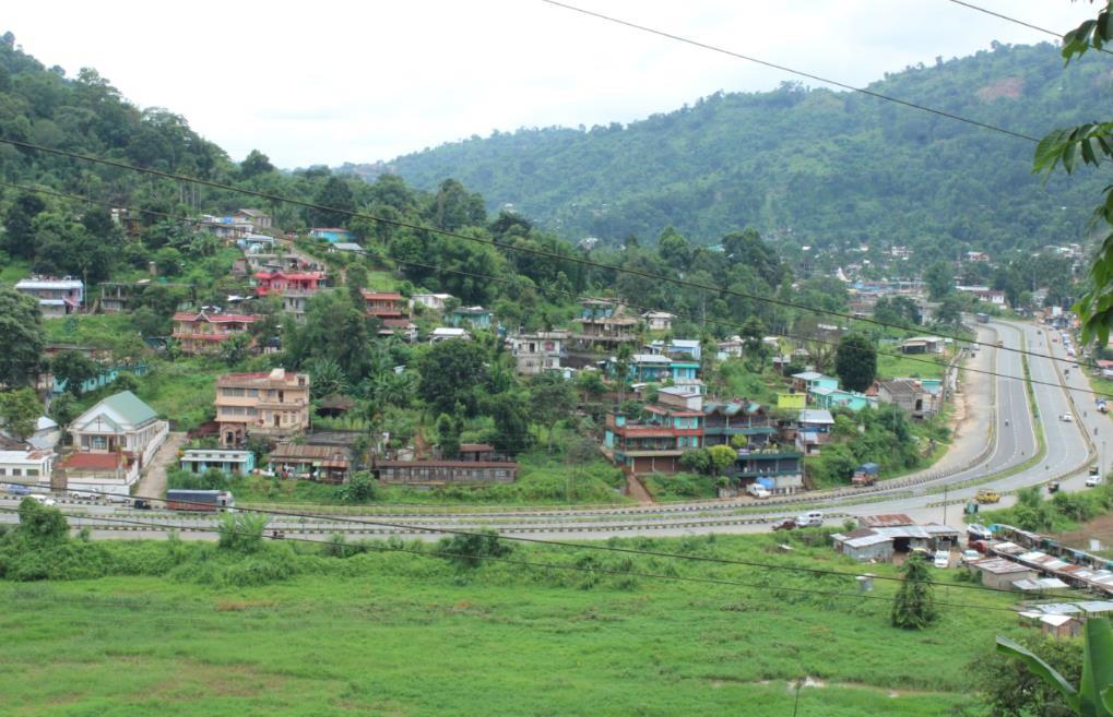
REPORT ON:
MAWDIANGUM VILLAGE UNDER UMLING C&RD BLOCK DISTRICT:RI-BHOI
18th JAN, 2024
COMMUNITY LED LANDSCAPE MANAGEMENT PROJECT
The Government of Meghalaya with financial help from the World Bank is implementing the Meghalaya Community Led Landscape Management Project (MCLLMP). The project will cover the entire state of Meghalaya and implementation of community led plans will be rolled out in phase manner throughout the state. The Meghalaya Basin Management Agency (MBMA) will facilitate community-led planning by providing support, technical inputs and funding.
The project is intended to strengthen community-led natural resources management in selected landscapes within the 11 districts of the state. This would be achieved through a variety of planning, capacity building, and on- the-ground interventions to promote the conservation, sustainable use of natural resources, social inclusion and community mobilization; building traditional knowledge and learning, mapping of natural resources management; strengthening the community institutions and creating linkage with financial institutions and community organizations.
The project interventions include preparation of community led natural resource management plans. The CLLMP has the following three components:
Strengthening Knowledge and Capacity of Communities for
Natural Resources Management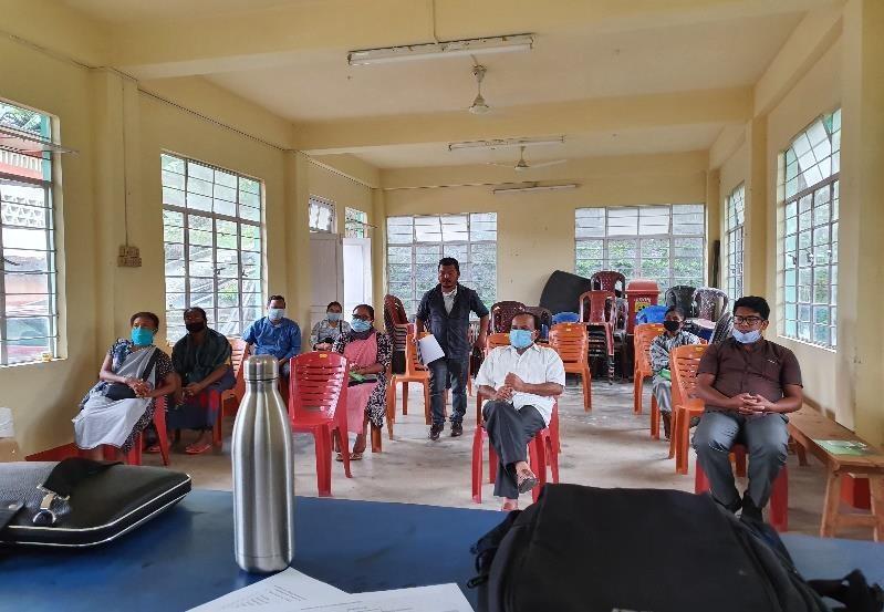
Community-Led Landscape Planning and Implementation
Project Management and Governance
The project objective is “to manage and conserve the natural resources, especially forests, soil and water sources, in a manner that supports the financial and physical well-being of communities in the State”
The CLLM-Programme focuses on increasing the capacities of communities and traditional institutions(TI) by adopting a landscape approach to manage their natural resources such as soil, springs and other water sources, forests and bio-diversity,etc.
The project will be planned and implemented in about 400 villages across the state.
CLLMP has a strong focus on institution-building at the village-level, by ensuring systematic capacity-building on technical and social skill-sets.
The project will also extend such training to communities beyond the targeted villages and support efforts made by them to access funding from various rural and natural resources initiatives and schemes.
The programme will also invest in improving the process and outcome delivery, by developing and adhering to effective systems and procedures, supported by the appropriate technology.
Benefits for community (Skills and Capacity relating to technical and managerial areas like NRM and Conflict resolution
Benefits to traditional institutions (village councils, traditional leaders, community-based organizations, SHGs etc) through Knowledge sharing, promotion of innovative approach, access to technology, technical managerial and financial support.
It is estimated that the project will impact around 1 lakh partners (of which 50% are women) who depend on land,forest, agro forestry.
Through the project, 55000 Ha of targeted area will be ensured with availability of water, biological resources and soil productivity, which will in turn benefit around 400 villages and the outcomes delivery can be summarized as follows.
The Project is executed by the MBMA in collaboration with other partners particularly, SIRD (for training and capacity building), Department of Soil and Water Conservation, Water Resource Department, Forest Department, specifically with respect to technical inputs, safeguards management and Community NRM plan preparation
2018-2023(5years)
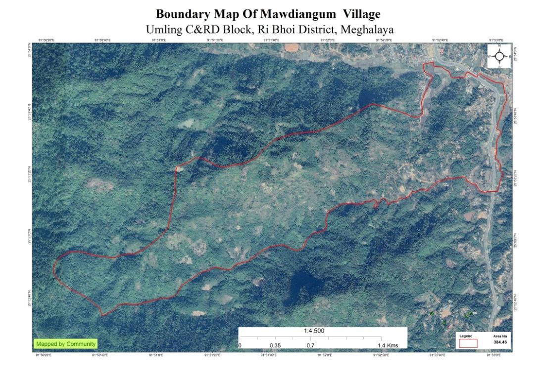
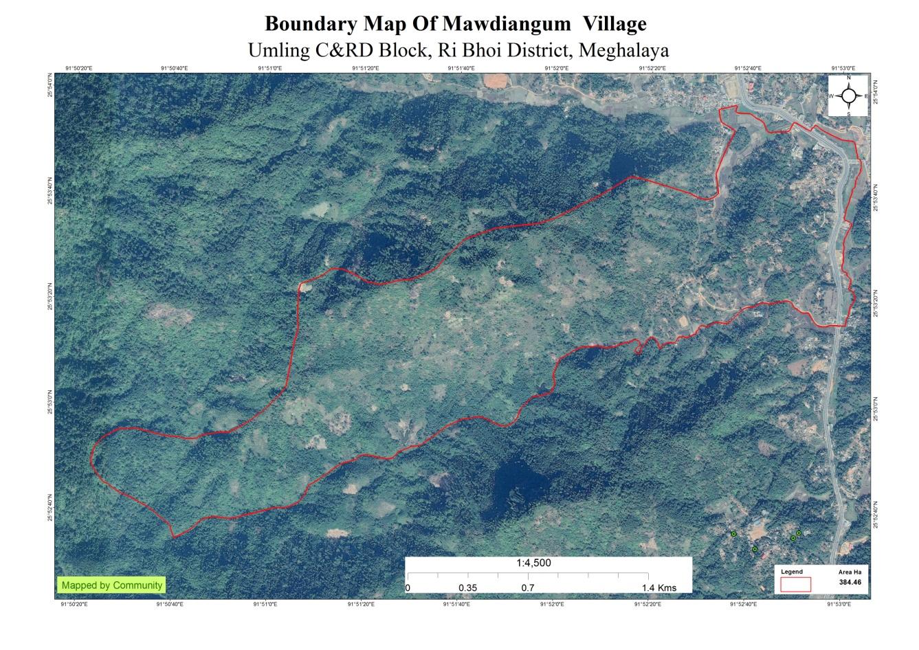
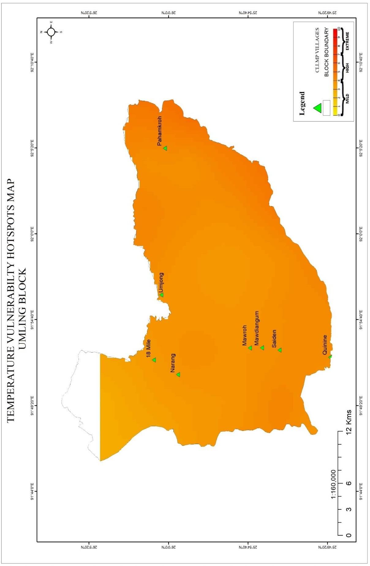
Mawdiangum Village falls under Umling C&RD block of Ri-Bhoi district in the state of Meghalaya. The village is at a distance of 3 Kms from Nongpoh, the district headquarters of Ri Bhoi District and is at a total distance of 56 Kms from the state capital, Shillong.
Brief History: Mawdiangum Village which is formerly known as Garikhana (originated from the Hindi language) is surrounded by the Umpyrli river from the East, Shami Hill from the West, Pahamsyiem and Pahamsohthri village from the North and Saiden village from the South. As per folktales told by the elders this village existed since the days of the British rule and the roads were still unpaved roads where only horses or cattle carriages could travel. This place was where the travelers, merchants used to rest and feed their cattle or horses which pulled the carriages and that’s how the village got its original name “Garikhana.”. The first inhabitants of this village were the Bhoi Khad –ar lyngdoh who moved away from Raid Nongkhyllem due to a plague that happened hundreds of years ago.
Since the name of the village was from a different language and not easily understood by the local residents, the Village Durbar on the 30th of October 1999 changed the name of the village from “Garikhana” to “Mawdiangum.” This new name means “a stone used to collect water” and it was derived from a stone which looked like a basin that’s collecting water from a spring.
The total number of households is 242 and has a population of 1018 people. Agriculture and its allied activities are highly in vogue, where some few others are also enrolling government and teaching jobs and some few inhabitants are engaged in local businesses.
Village Accessibility: In order to reach Mawdiangum village, one must venture through the National Highway.The village lies just 5Km away from District Headquarters. One can reach Mawdiangum by entering the pwd road to the right and footpath to reach the sub locality of Mawdiangum.
Literacy:As per the 2011 census, the village literacy rate has touched to the tune of 82.56%.Credit primarily goes to the primary school and Ri Bhoi college.

As per 2011 census, Mawdiangum population is 1018. Out of this, 498 are males while the females count is 520. This village has 104 children in the age group of 0-4 years. Among them50 are boys and 54 are girls.
|
|
|
|
|---|---|---|---|
|
|
|
|
|
|
|
|
|
|
|
|
|
|
|
|
|
|
|
|
The village has a total number of Health cardholders 231, 242 Ration cardholders in which 152 belong to BPL and90 belong to APL. The major occupation of the people is farming while some are Teachers, Mason and Govt. servants.
|
|
|---|---|
| BPL |
|
| APL |
|
|
|
|---|---|
|
|
|
|
|
|
Fuel Type:
|
|
|---|---|
|
|
|
|
|
|
|
|
|
|
|
|
The people of the village mostly rely on Agricultural activities with some of the population taking up other professions such as Business, Teaching, Masonry and Government jobs
Drinking Water: There is not enough drinking water supply. Mawdiangum Bhamlet in particular faces a serious problem as it is located far away from the major source of water supply in the village.
Although there is government water supply as well, the increasing population has a serious problem, for the demands of all the households in the village.
Jhum cultivation: Mainly take up traditional approaches of cultivation like Jhum or the shifting cultivation
STREAMS:2
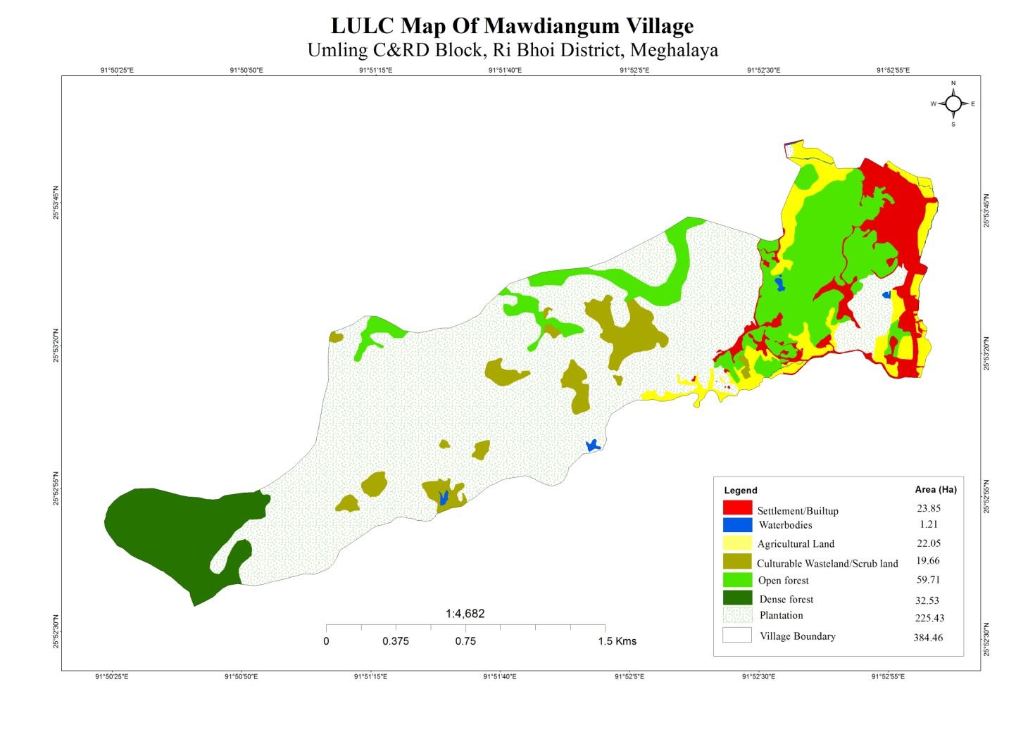
LAND:336.46ha
FOREST: 92.24 ha
CULTURABLE LAND: 22.05ha
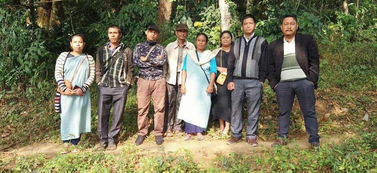
The CLLMP team met with Mr. Linus Lyngdoh, the secretary of Mawdiangum Village on the 1stof June 2020. He provided the team with important information regarding the current scenario of the landscape and the natural resource management under his chairmanship.
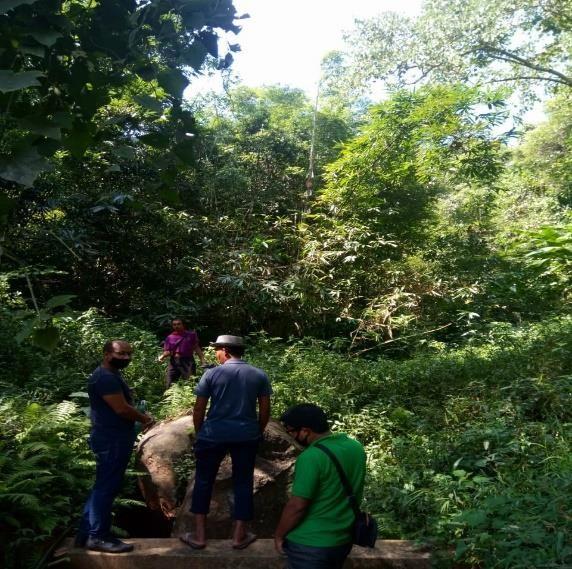
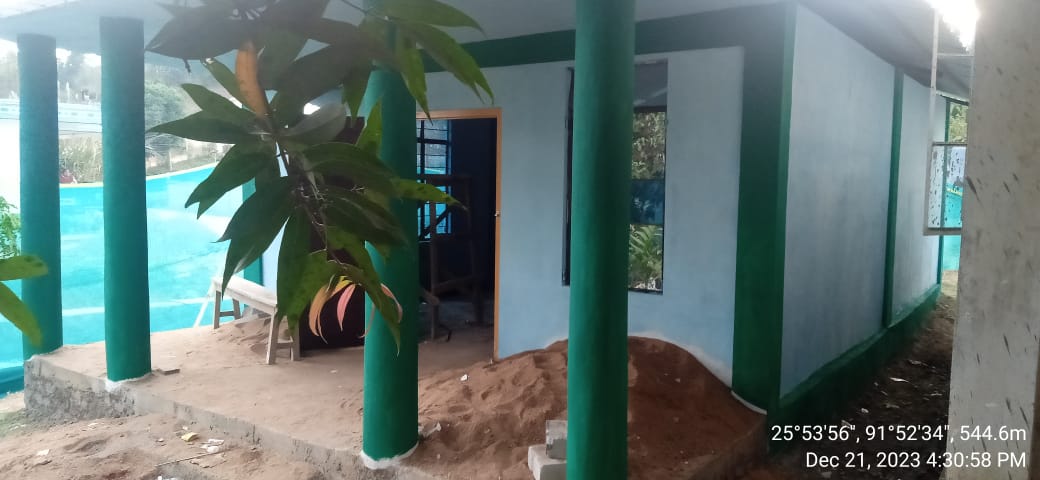
Figure1:Ground-truthing at Mawdiangum Village.
There are 242 Households out of which 152Households fall under the BPL category.
VEC actively performing.
Approximately 20-25 acres of community forest available.
Scope for Water Sources to be developed
Need for Community Nursery and Vermi-Compost
The Community members expressed their need to build a fish sanctuary.
The Village has been selected under the Community Led Landscape Management Project
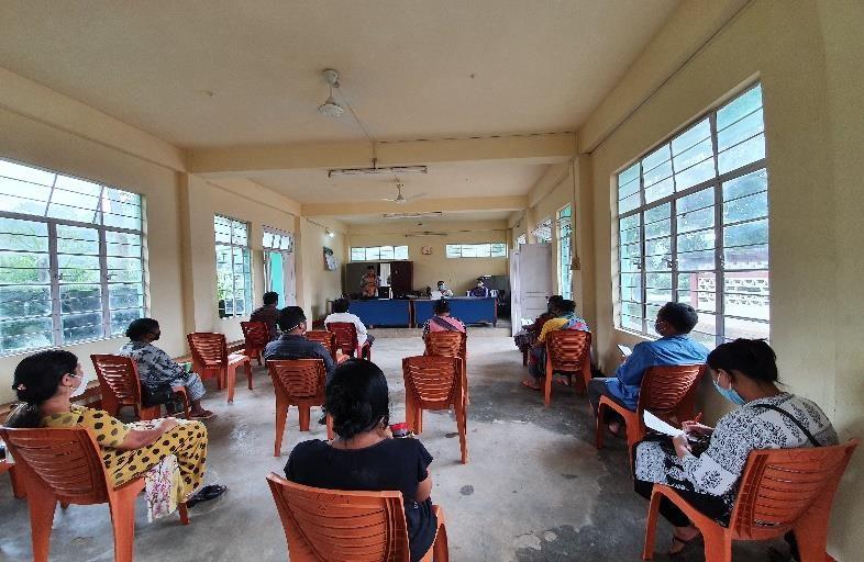
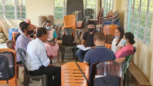
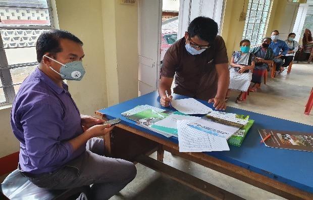
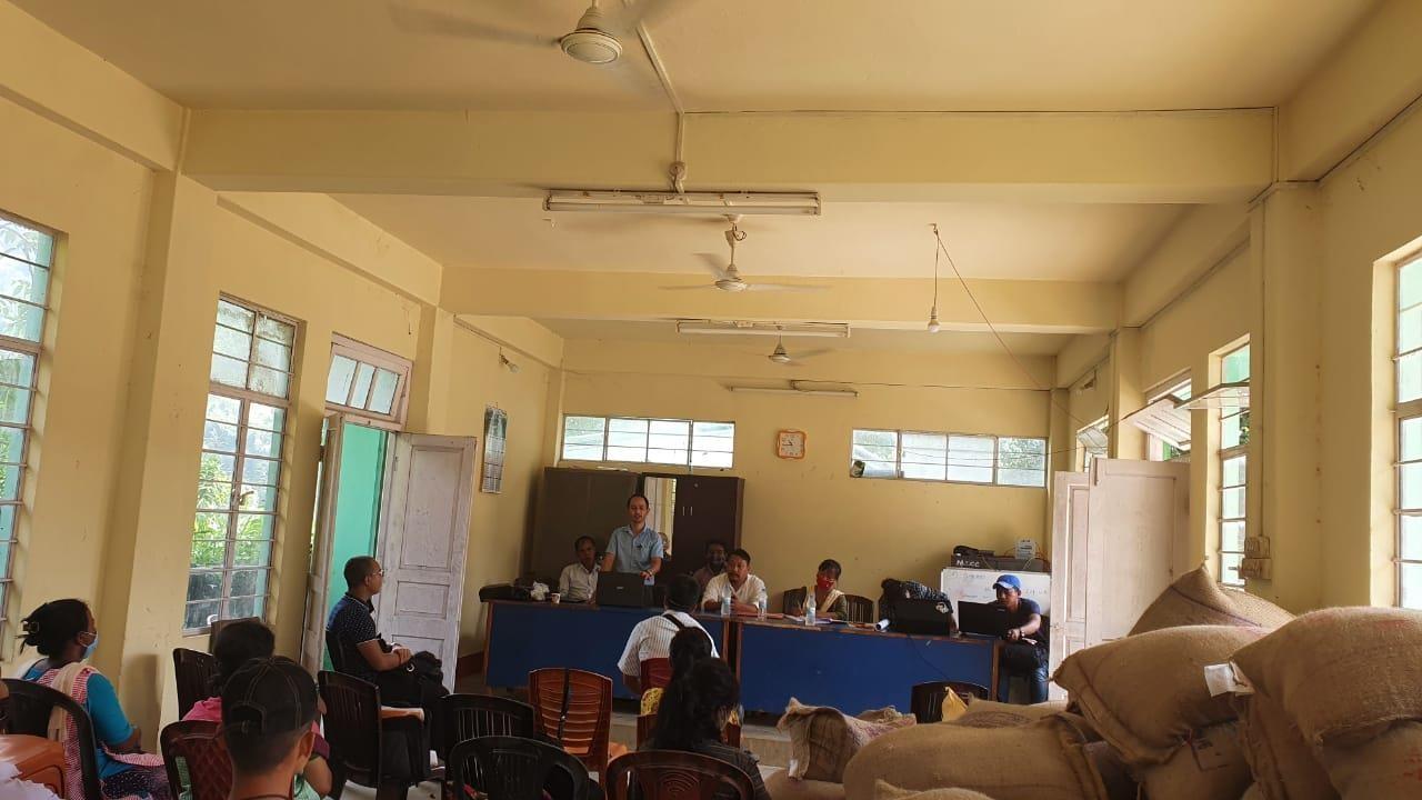
The District Project Manager and the Assistant Managers held a village Level sensitization Programme on the Community Led Landscape Management project on the 2nd of July, 2020.The community members actively participated in the program, voicing out their concerns and questions regarding the project making it a huge success. A total of 16 community members attended the program out of which 08 are female and 08 are Males (Due to COVID restrictions there were only16 participants in the sensitization program.
The CLLMP officials gave a brief introduction on Meghalaya Basin Management Agency (MBMA) and explained about the various programmes and projects that MBMA is working on, they then gave a detailed introduction on the Community led Landscape
Management Project (CLLMP) and the different aspects and procedures that the villagers and the CLLMP team should carry out during the course of the project and the importance of the involvement of the community for the CLLM-Project to be a success. They gave due importance to the environmental aspects of the project and enlightened them on the various benefits that the villagers could obtain from the project.
Figure2:SensitizationProgram
The Program was followed by an interactive session to answer the doubts and questions of the Community members some of which are mentioned below.
Signing of Documents:
After the interactive session, the village signed the EOI, VGA and Green charter followed by the selection of candidates for the Village Natural Resource Management Committee. The Village Executive Committee(VEC) and the entire community carried out the procedure and elected the members of the VNRMC on the same day.
Formation of the VNRMC
The Formation of the Village Natural Resource Management Committee was done in a public meeting in the presence of the entire village and the CLLMP staffs. The community itself chooses the President, the Secretary and the other executive members of the Committee.
Listed below are the members of the VNRMC:
|
||||||||
|---|---|---|---|---|---|---|---|---|
| Name in Full | Designation | GenderM/F | Age(Yrs) | Education | Occupation | Community | Religion and Denomination | Contact No and email address |
|
|
M |
|
B.A |
|
|
|
|
|
|
F |
|
XII |
|
|
|
|
|
|
F |
|
B.Sc |
|
|
|
|
|
|
M |
|
VIII |
|
|
|
|
|
|
M |
|
|
|
|
|
|
Rexon Warjri |
|
M |
|
B.A |
|
|
|
|
|
|
M |
|
B.A |
|
|
|
|
|
|
F |
|
|
|
|
|
|
|
|
F |
|
|
|
|
|
|
|
|||||
|---|---|---|---|---|---|
|
|
Age |
|
|
|
|
|
35 |
|
|
|
|
|
23 |
|
9383051234 |
|
|
|
40 |
|
9366513872 |
|
|
|||
|---|---|---|---|
|
|
|
|
|
|
|
8730846945 |
|
|
|
7005806962 |
|
|
|
6009967036 |
Fig:The Village Natural Resource Committee (VNRMC) of Mawdiangum
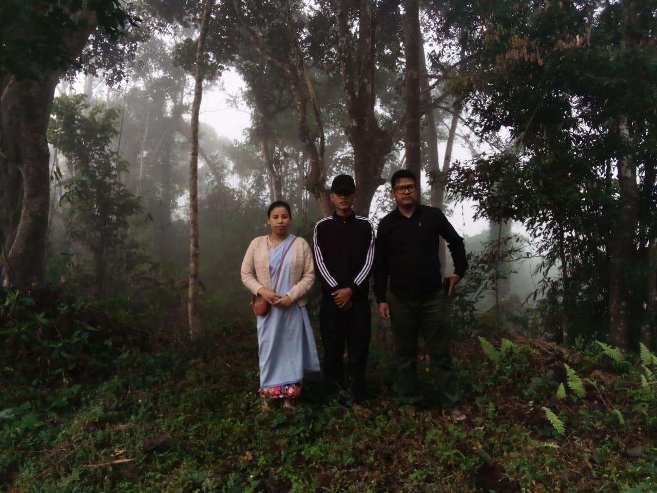
Fig:The Village Facilitators Committee (VCF)of Mawdiangum
The opening of the bank account was initiated after the village signed the EOI (Expression of Interest),the VGA (Village Grant Agreement) and the Green Charter. The Accountant of the Ri Bhoi CLLMP team trained the Purchasing and Procurement Committee of Mawdiangum Village on matters relating to Accounts and Bookkeeping on the 31st of August, 2020.
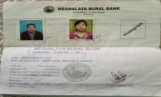
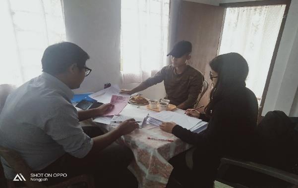
Figure6: Training provided to members of the purchasing committee
The Accounts Team of CLLM Project Ri Bhoi District trained the Book-keeper, the Purchasing and Procurement Committee of Mawdiangum Village,on the 10thNovember,2020.
Principles of Community Procurement
Benefits of Community Procurement
Important aspects undertaken by Community Procurement.
Procurement Process / Steps
Function of Purchase Committee
Important Procurement records to be maintained
Financial limits and methods
Maintaining Books of Accounts to the Book Keeper.
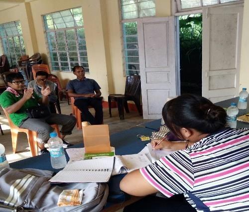
PRA exercise at Mawdiangum Village took place from the 17th to the 20th of August 2020. There were a total of 89 villagers taking part in this exercise who contributed their time and knowledge to this project.
Introduction: Participatory Rural Appraisal (PRA) is the process of involving local people in the analysis and interpretation of their own situation of a given rural area. The local people i.e. the participants take a leadership role in collecting, analyzing, interpreting and presenting information and in this process impart knowledge and development insight to the specialists and extension agents
For management of natural resources, participatory Rural Appraisal is conducted to establish rapport with the village community as well as to identify and define problems for prioritization in the village itself. It is a way of learning from and with community members to investigate their need assessment, analyze and evaluate constraints and opportunities and find out priorities in the area of agriculture, small scale rural enterprises and any other social and economic development programs addressed to village development, based on the principle of listening and learning.
The Participatory Rural Appraisal (PRA) exercise at Mawdiangum was conducted with following objectives:
To identify the natural, human and economic resources of a village.
To identify the village problems and prioritize them with the help of the community members.
To prepare the Community Natural Resource Management Plan of the village.
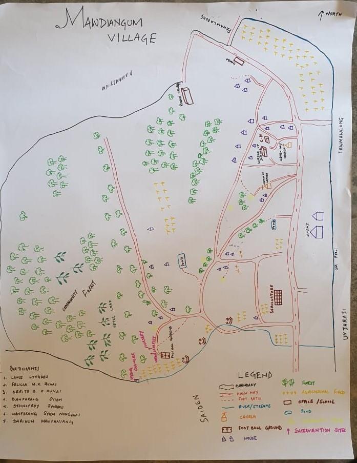
The first Step is to map the Village boundary of the Village. The second step is to involve the local community in preparation of villager source maps as perceived by the community members to solicit their participation. Infrastructure, services and other village resources such as agricultural lands, wells, wastelands, cattle population etc. were mapped. Local people prepared the Resource Map by drawing it on a chart paper without much interference from outsiders.
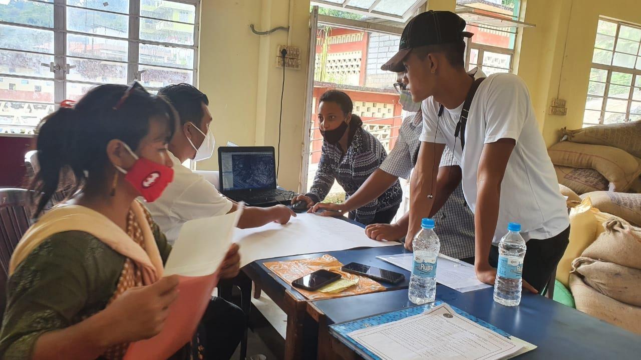
The second step is to involve the local community in preparation of a village resource map as perceived by the community members to solicit their participation. Infrastructure, services and other village resources such as agricultural lands, wells, wastelands, cattle population etc. were mapped. Local people prepared the Resource Map by drawing it on a chart paper without much interference from outsiders.
Figure11:Resource Map of Mawdiangum Village
This activity achieved the following purposes:
Rapport building and winning the confidence of the villagers.
Analyzed the spatial information, particularly studied problems and opportunities of villagers.
Got an impression about the village setting, physical layout, location of various houses and institutions.
Main agricultural produce is:
Paddy
Betel leaves and Betel Nuts
Ginger,Turmeric,Chilies.
Tomato,Beans,Yam.Pumpkin,Guard.
Pine apple
Broom,etc.
There are 2 types of Forest ownership: Community and Private Owned.
3 community forest
5 private forest
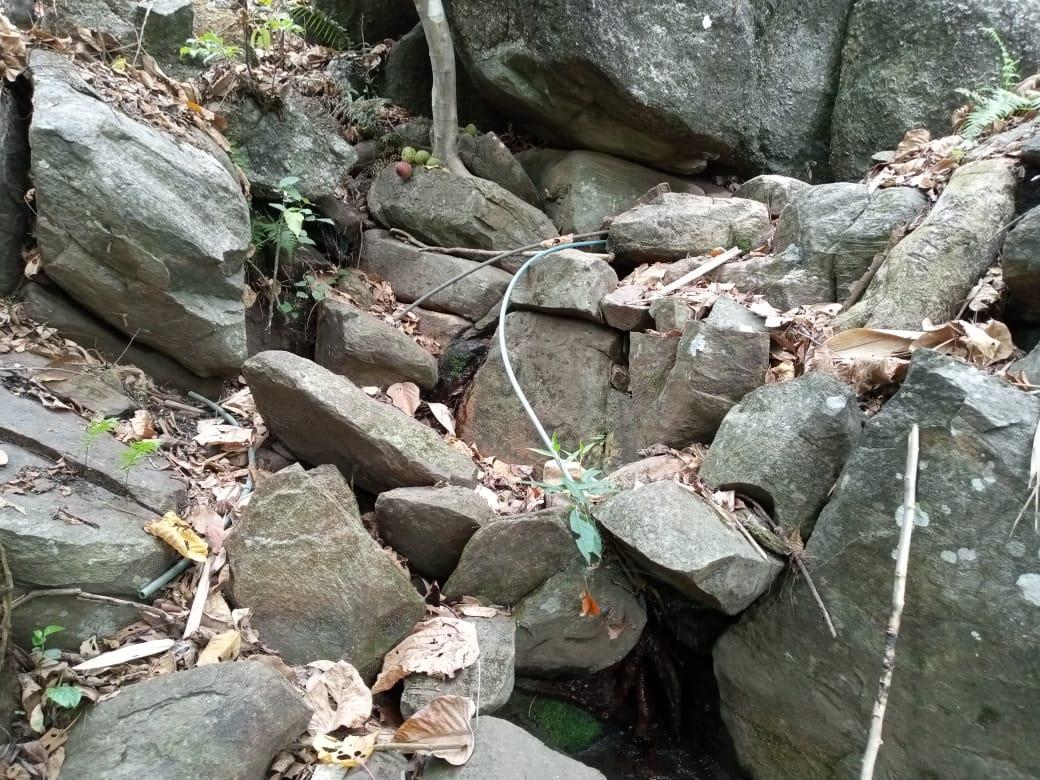
Twelve(12) springs are present in the village with 7 already developed springs.
One main rivers flows along the north-eastern boundary and two (2) stream flow along the south-eastern boundary of the village
4 private fish ponds present.
There are two churches.
School: there is one Upper primary school and one Lower primary School in the village.
Connectivity: Shillong to Guwahati national highway passing through the village,
Habitation is confined to the north-eastern and to the south-eastern part of the village.
During the PRA Exercise, the CLLMP officials had a discussion with the community members to gather basic village information regarding the number of households, demographic information, major crops and enterprises taken in the village, trends of production and productivity of major crops in the village and demographic distribution of village population.
Information related to land use categories such as forest, cultivable land, water bodies, etc and problems and challenges related to NRM were discussed.
A. Do people have sufficient access to supply of fodder, fuel wood, leaf litter?
The villagers expressed that they have sufficient access when it comes to supply of
fodder and leaf litter and they have not faced any issues till now, but they do not
have sufficient access to supply of fuel wood as they have to either purchase fuel
wood or get it from far off forests.
B. Has access to timber improved or reduced over the years? How is access for household use
and commercial use managed?
Timber production has been reduced over the years. They have to buy everything
whenever it is needed for Household Construction or furniture however they have
started using bamboo more frequently for commercial purposes.
C. Are the Water bodies facing any threats?
The water procured from “Umran River” causes skin problems and is only suitable
for cleaning and washing.
D. Do all the people in the village have access to drinking water? What are the challenges?
Yes they have access to drinking water all the 3Hamlets i.e. Mawdiangum A,
Mawdiangum B, and Kjatlumshami. However, among these three hamlets
Kjatlumshami and Mawdiangum B faces huge problems with regard to drinking
water due to poor management of the water resources. There is no proper water
tank and the supply is not enough to feed the entire village population. Moreover
the supply of PHE water is not regular and they have to wait for hours just to get
one bucket of water.
E. Are there degraded areas in the village (open/degraded forests, mining affected, high soil
erosion etc…)?
Yes
F. What has caused this degradation? Are there practices causing threats to availability and
access to natural resources?
The majority of the villagers are still practicing Jhum Cultivation and this leads to
the degradation of the land and also destruction of the forests which in turn have
lead to soil erosion
G. What have been the changes in agricultural practices?
The villagers have started using advanced Agriculture Tools in place of traditional
tools used in the ancient techniques of farming.
The land for agriculture has drastically reduced over the years and the farmers they
do not have enough land for farming.
H. How would you consider the health situation in your village?
The health situation at Mawdiangum village has improved as compared to other
years since the Health Department has played an active role in monitoring the
conditions of all villages in the state. The ASHA of Mawdiangum village also
conducts awareness programme from time to time, goes for home visits and the
community members are aware of their health and surroundings and they have
learnt how to keep themselves fit and healthy.
I. How is the situation of cleanliness, sanitation, access to toilets and waste management?
Cleanliness, sanitation and waste management is well maintained by the village
members, women’s group and youth group in the village. Since the Swachh Bharat
Mission has come into force the village council has taken the initiative to improve
the cleanliness in the village and all the villagers now have access to toilets.
J. Who are the most vulnerable group in the village? What can be done to improve their lives?
BPL families and single parent families are the most vulnerable groups in the
village. Inclusion of such families during implementation of the project would help
improve their lives.
K. What are the livelihood aspirations of the youth? Are there any avenues available?
The majority of the people in the village turns into farming and job card under
MGNREGA for employment and they also engage in some business and self employment to earn
and to improve their livelihood.
L. Do any committees /institutes/rules exist to manage and monitor natural resources in the
village?
The VNRMC under the CLLMP manage the Natural resources in the village. prior
to the CLLMP the village from the forest management committee to look after and
preservation of the forest
M. What are some of the major issues or conflicts in the village?
None
N. Have any of the above issues been discussed in village meetings?
If there is any issues or conflict within the village the Durbar village executive
The committee will solve the issues and address the Problems.
O. How do people resolve disagreements and conflicts?
All disagreements and conflicts are addressed by the traditional institution of
villages’ governance called the village Durbar.
The team also mapped the seasonal calendar of Mawdiangum Village to help identify heavy work load periods, periods of relative ease, credit crunch, diseases, food security, wage availability, festive season etc. This will prove helpful in project planning and project timeline framing
|
|||||||||||||
|---|---|---|---|---|---|---|---|---|---|---|---|---|---|
|
|
|
|
|
|
|
|
|
|
|
|
|
|
|
|
|
|
|
|
2 | 3 | 2 | 2 | ||||
|
|
|
|
|
2 | 2 | 3 | ||||||
|
|
|
1 | ||||||||||
|
|
|
|
1 | 1 | 2 | |||||||
|
|
|
1 | ||||||||||
|
|
1 | 1 | ||||||||||
|
|
|
1 | 1 | |||||||||
|
|
|
|
||||||||||
|
|
1 | 1 | ||||||||||
|
|
|
|
|
|||||||||
|
|
|
|
|
|||||||||
|
|
1 | 1 | ||||||||||
|
|
|
|
2 | |||||||||
|
|
|
|
|
|||||||||
|
|
|
|||||||||||
|
|
|
|
||||||||||
|
|
|
1 | 1 | |||||||||
| MAXIMUM | 1 |
|---|---|
| MODERATE | 2 |
| LESS | 3 |
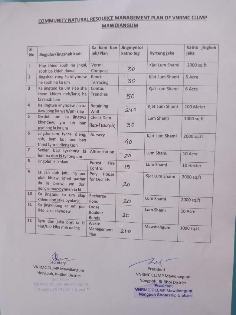
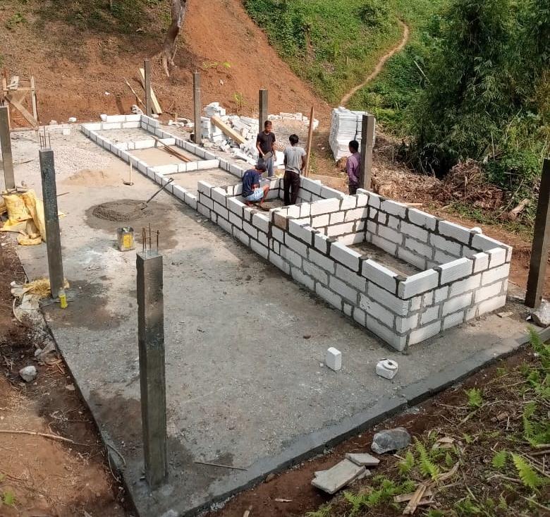
The Final Community Natural Resource Management Plan
|
|
|
|
|
||
|---|---|---|---|---|---|---|
|
|
|
||||
|
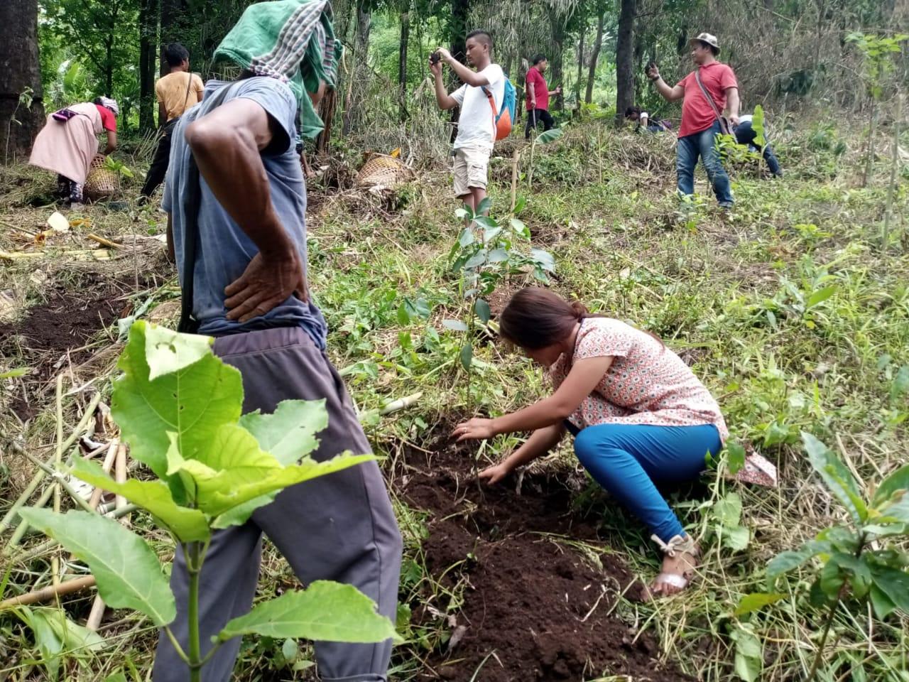
AFFORESTATION |
|
|
|
|
|
|
VERMICOMPOSTING |
|
|
|
|
|
|
HORTICULTURE |
|
|
|
|
|
|
AGROFORESTRY |
|
|
|
|
|
|
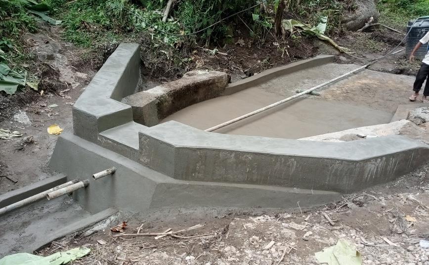
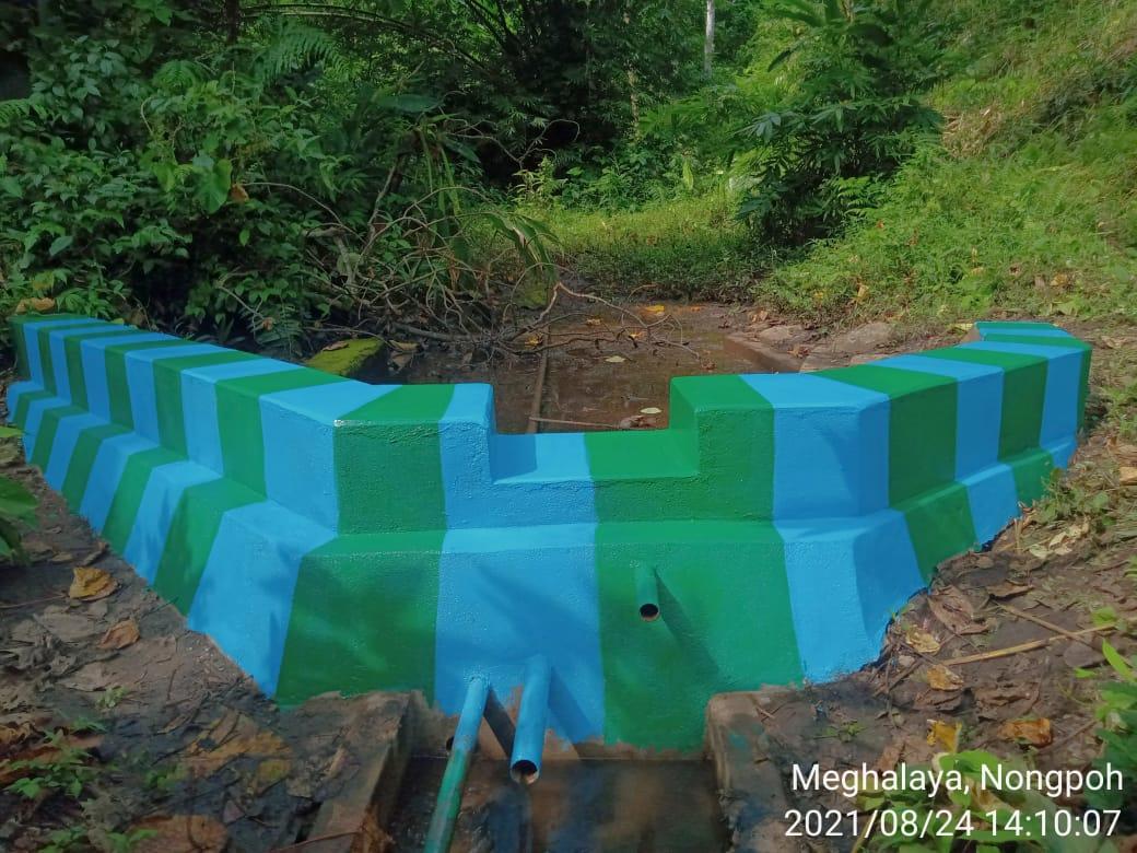
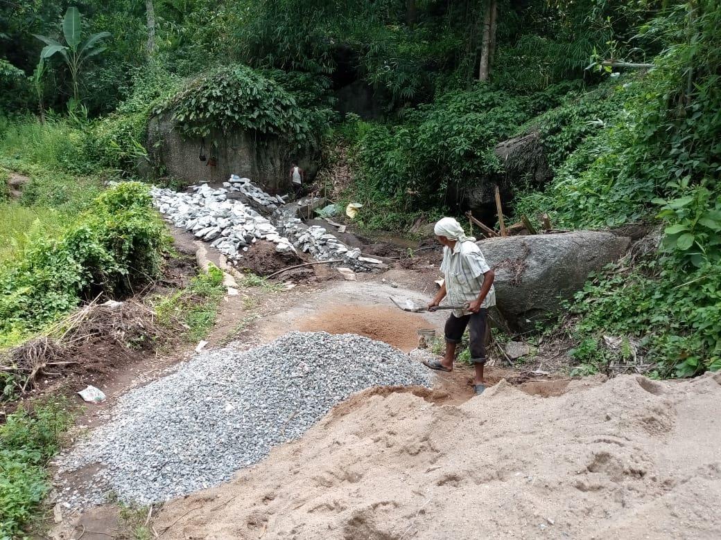
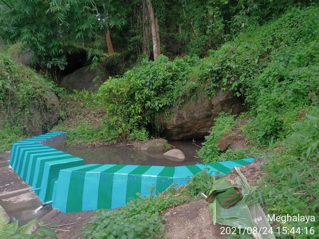
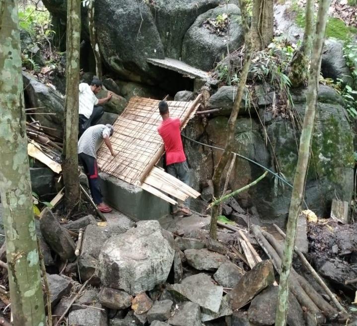
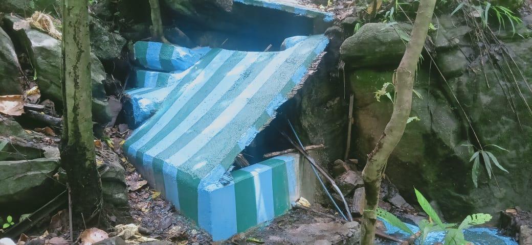
SPRING CHAMBER,4NOS |
|
|
|
|
|
|
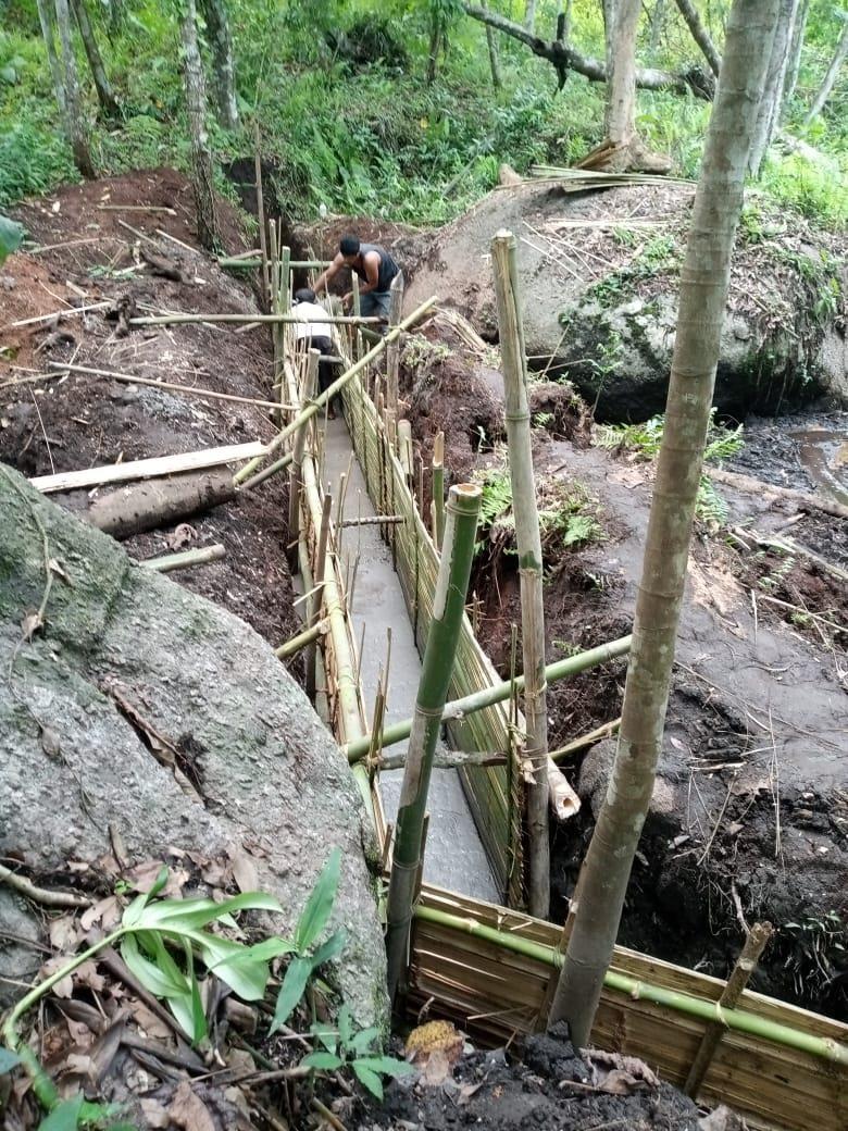
CHECKDAM 4NOS |
|
|
|
|
|
|
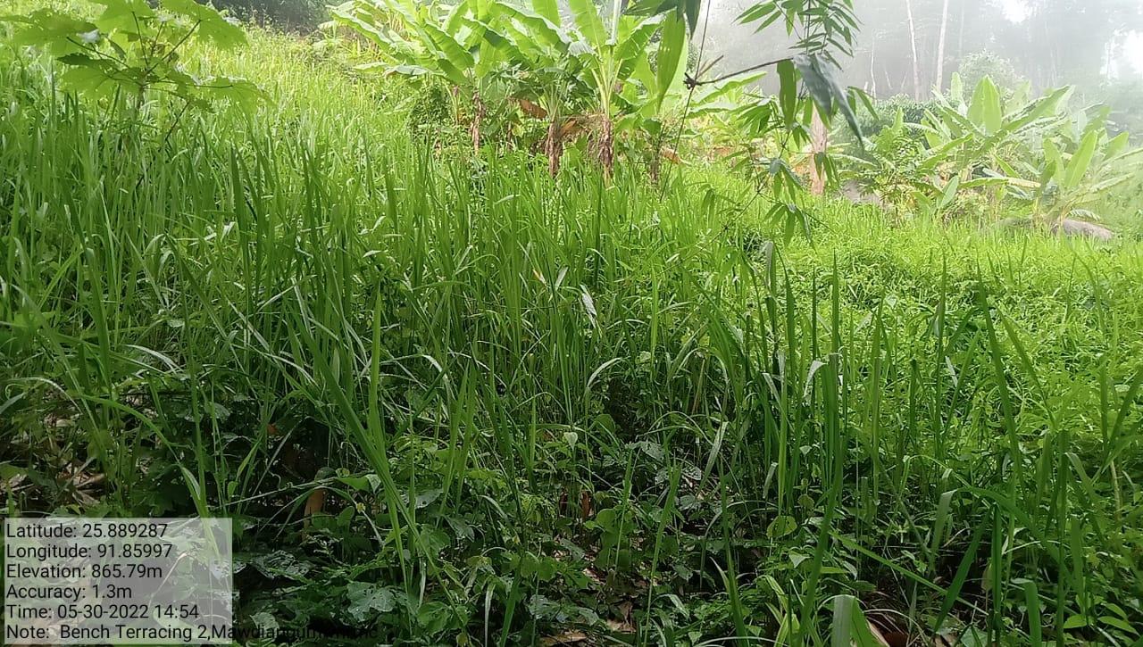
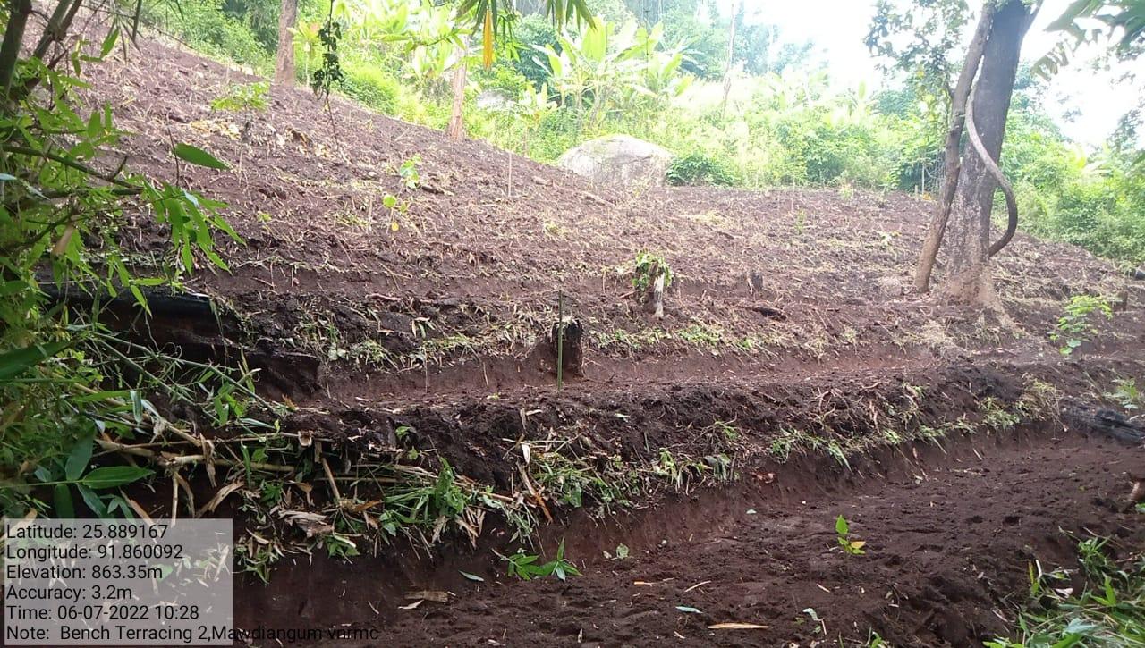
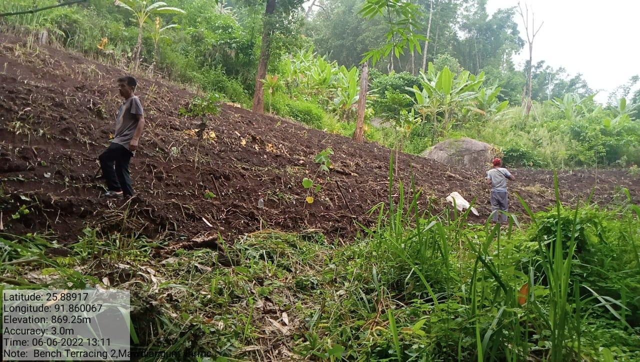
BENCH TERRACING |
|
|
|
|
|
|
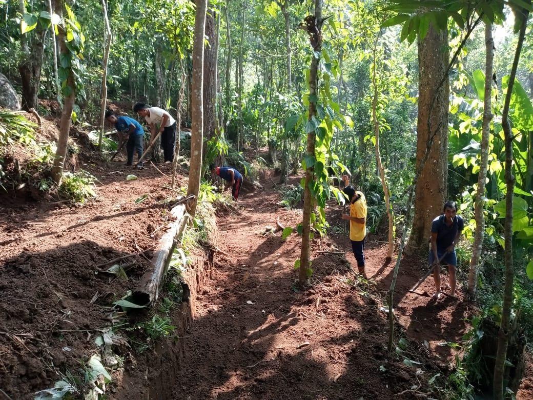
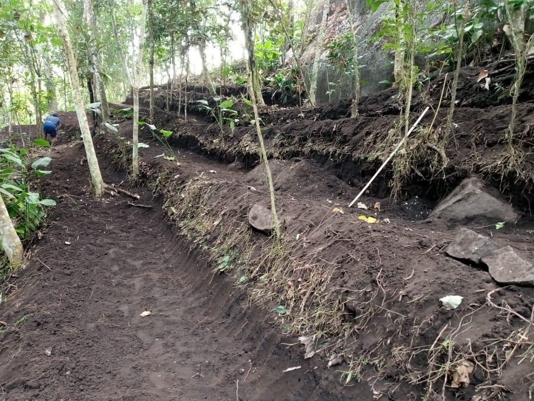
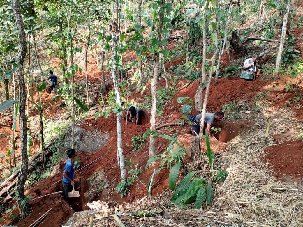
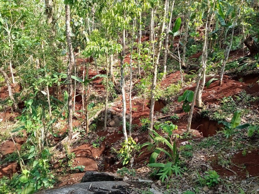
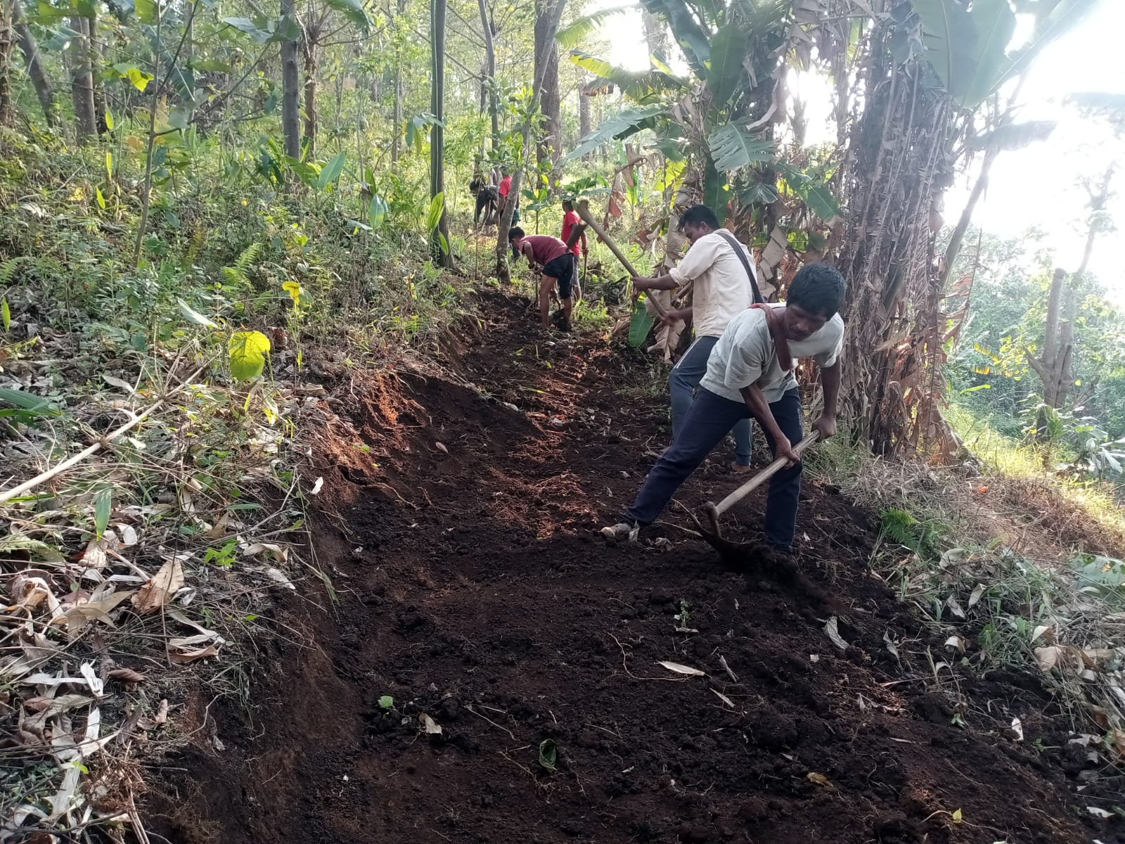
CONTOUR TRENCHES |
|
|
|
|
|
|
COMMUNITY NURSERY |
|
|
|
|
|
|
PADDY CUM FISH CULTIVATION |
|
|
|
|
|
|
BIOFENCING |
|
|
|
|
|
|
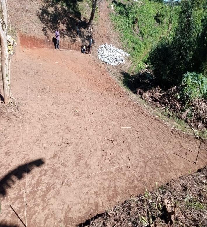
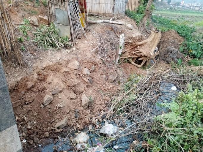
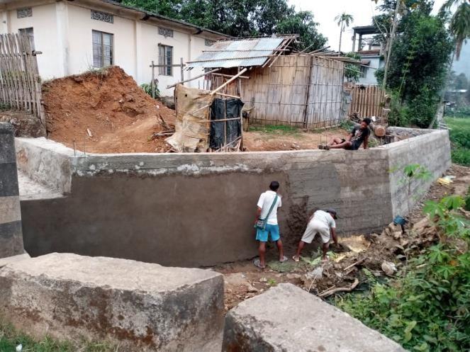
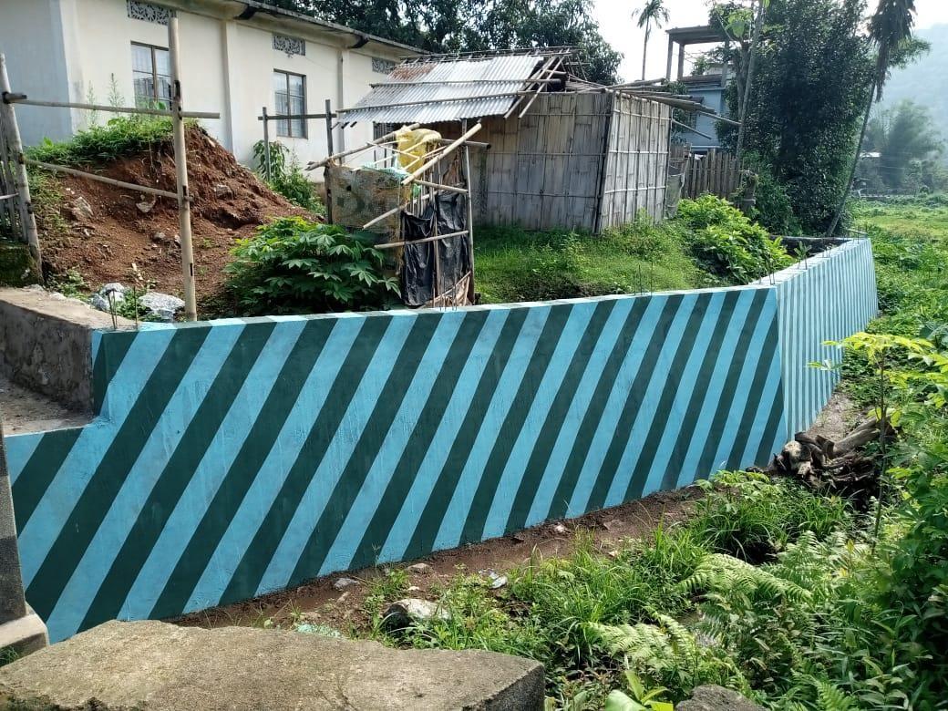
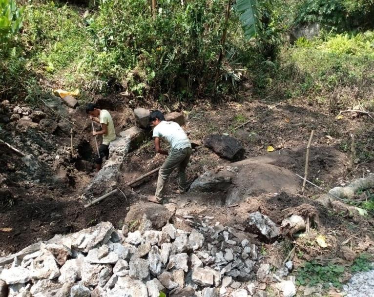
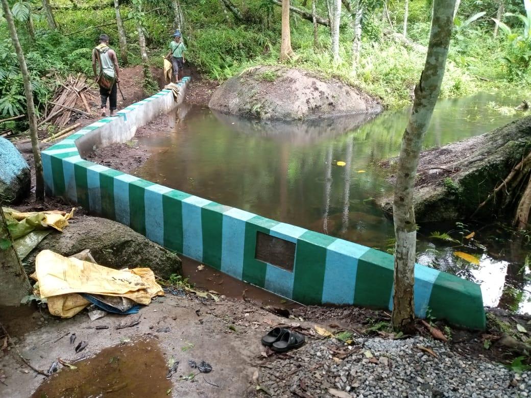
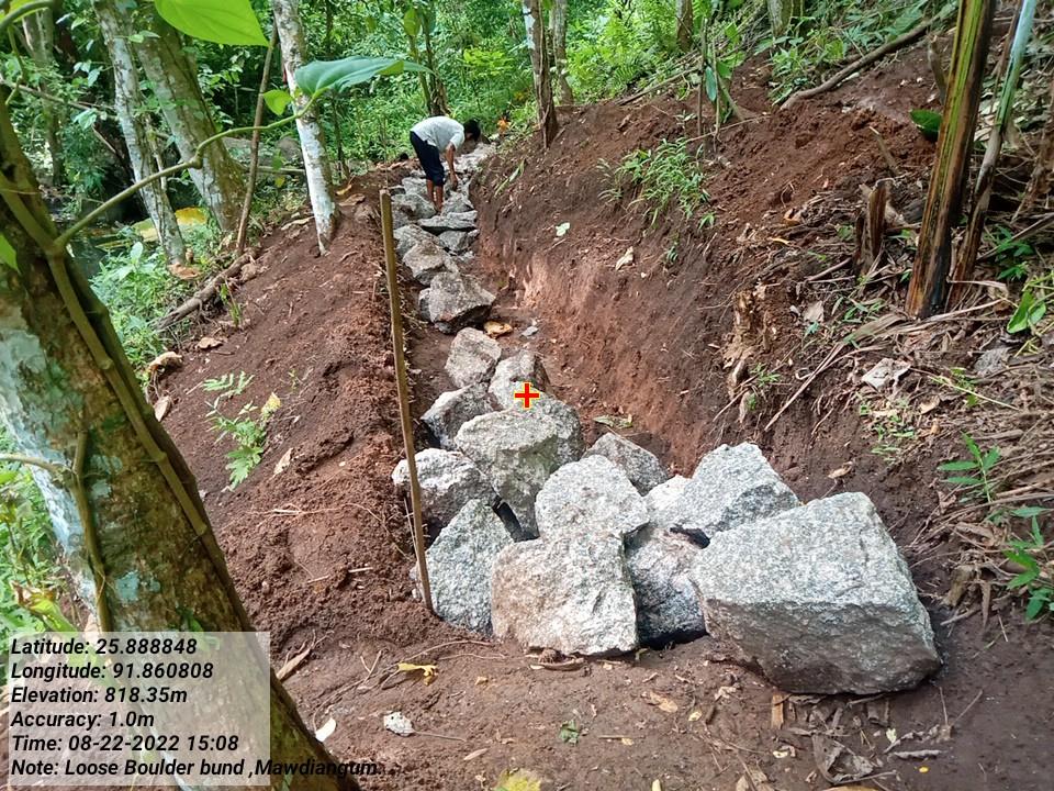
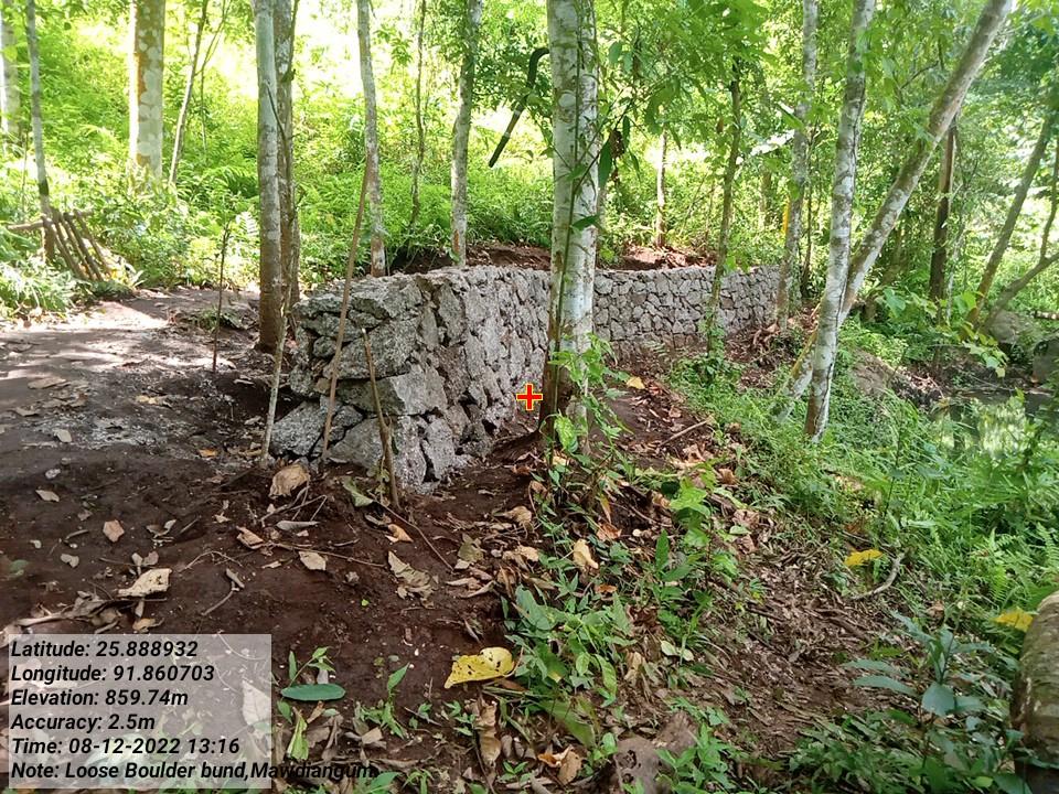
RETAINING WALL FOR CONTROLLING EROSION BY RIVER |
|
|
|
|
|
|
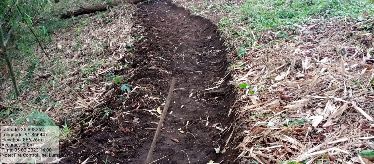
FOREST FIRE CONTROL LINE |
|
|
|
|
|
|
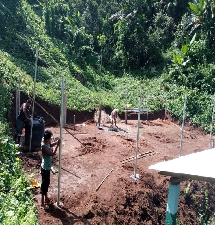
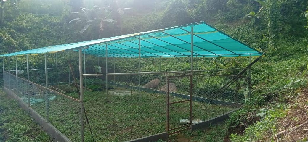
POLYHOUSE FOR ORCHIDS |
|
|
|
|
|
|
PRESERVATION OF COMMUNITY FOREST |
|
|
|
|
|
|
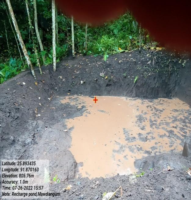
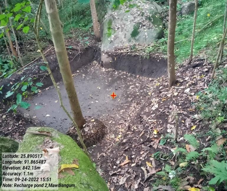
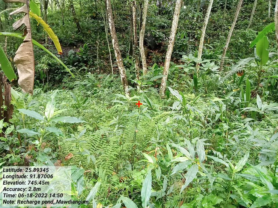
RECHARGE POND |
|
|
|
|
|
GIS Activities
|
|
|
|---|---|---|
|
|
|
|
|
|
|
|
|
|
|
|
|
|
|
|
|
|
|
|
|
|
|
|
|
|
|
|
|
|
|
|
|
|
|
|
|
|
|
|
|---|---|---|---|---|---|---|
|
|
|
|
|
|
|
|
|
|
|
|
|
|
|---|---|---|---|---|---|---|
| Retaining Wall |
|
|
|
|
|
|
|
|
|
|
|
|
|
|---|---|---|---|---|---|---|
|
|
|
|
|
|
|
|
|
|
|
|
|
|
|---|---|---|---|---|---|---|
|
|
|
|
|
|
|
|
|
|
|
Amount Sanctioned |
|
|
|---|---|---|---|---|---|---|
|
|
|
|
|
|
|
|
|
|
|
|
|
|
|---|---|---|---|---|---|---|
|
|
|
|
|
|
|
|
|
|
|
Amount Sanctioned | Work Status | |
|---|---|---|---|---|---|---|
|
|
|
|
|
|
|
|
Intervention |
|
|
Amount Sanctioned |
|
|
|---|---|---|---|---|---|---|
|
|
|
|
|
|
|
|
|
|
|
Amount Sanctioned |
|
|
|---|---|---|---|---|---|---|
|
LumShami Mawkba |
|
|
|
|
|
|
|
|
|
Amount Sanctioned |
|
|
|---|---|---|---|---|---|---|
|
|
|
|
|
|
|
|
|
|
|
Amount Sanctioned |
|
|
|---|---|---|---|---|---|---|
|
LumShami Mawkba |
|
|
|
|
|
|
Intervention |
|
|
|
|
|
|---|---|---|---|---|---|---|
|
LumShami Mawkba |
|
|
|
|
|
|
Type of Intervention |
|
|
|
|
|
|---|---|---|---|---|---|---|
|
|
|
|
|
|
|
|
|
|
|
|
|
|
|---|---|---|---|---|---|---|
|
|
|
|
|
|
|
|
|
|
|
|---|---|---|---|
|
|
|
|
| Intervention | Site Name | Amount | Work Status |
|---|---|---|---|
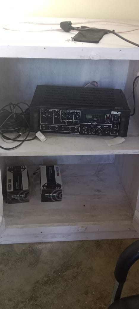
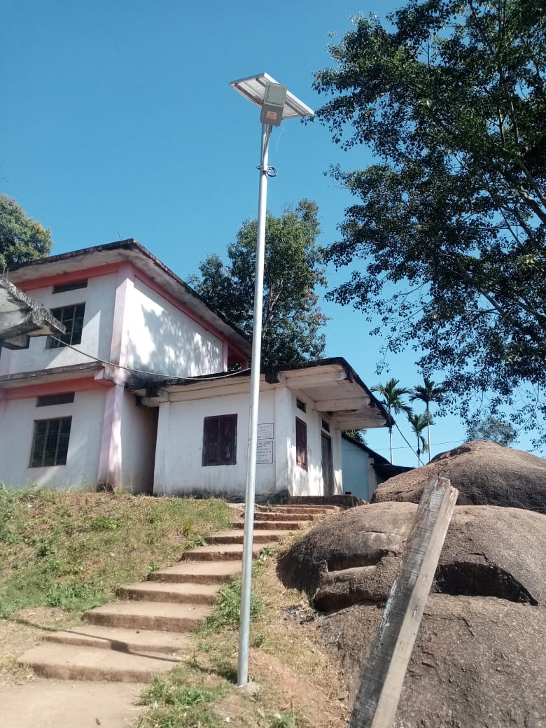
Excess fund activities PA System Water Tester Solar light |
community land | 1,05,000 | Completed |

| Intervention | Site Name | Amount | Work Status |
|---|---|---|---|
NRM Library under Innovation |
Kjat Lumshami | 10,00,000 | Completed |
TESTIMONIALS
President- Wanphrang Syiem 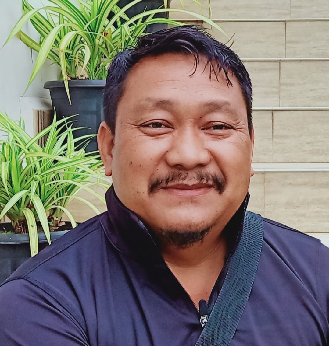
It's truly heartening to see about the significant positive changes and benefits that the project has brought to our village. The transformation showcases a comprehensive approach to environmental conservation, sustainability, and community development. Some of the key points under it are as follow:
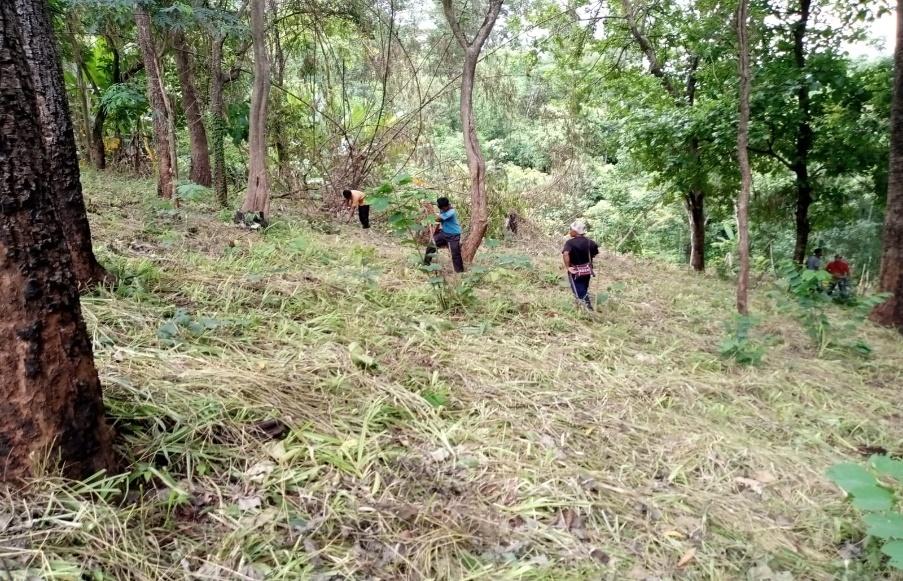
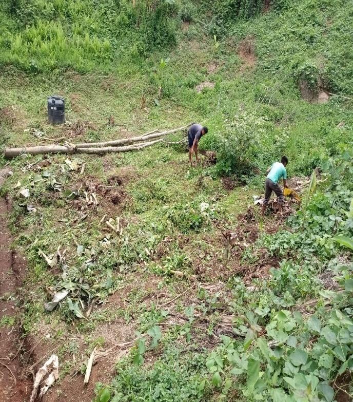
Terracing: The implementation of terraces helps retain fertilizers and rainwater, contributing to soil fertility and water conservation. This sustainable practice supports agriculture and prevents soil erosion.
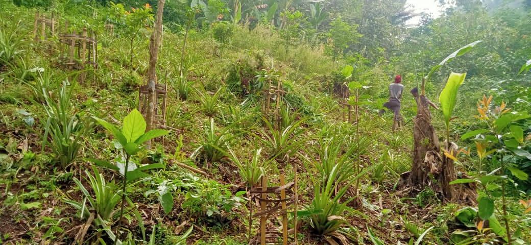
Tree Planting: The project's focus on afforestation contributes to a greener environment. Planting trees not only enhances the aesthetics but also provides ecological benefits such as improved air quality, habitat creation, and soil stabilization.
Nursery and Seed Planting: Establishing a nursery and planting tree seeds on lands lacking vegetation is crucial for ecosystem restoration. It helps reclaim barren areas and contributes to biodiversity.
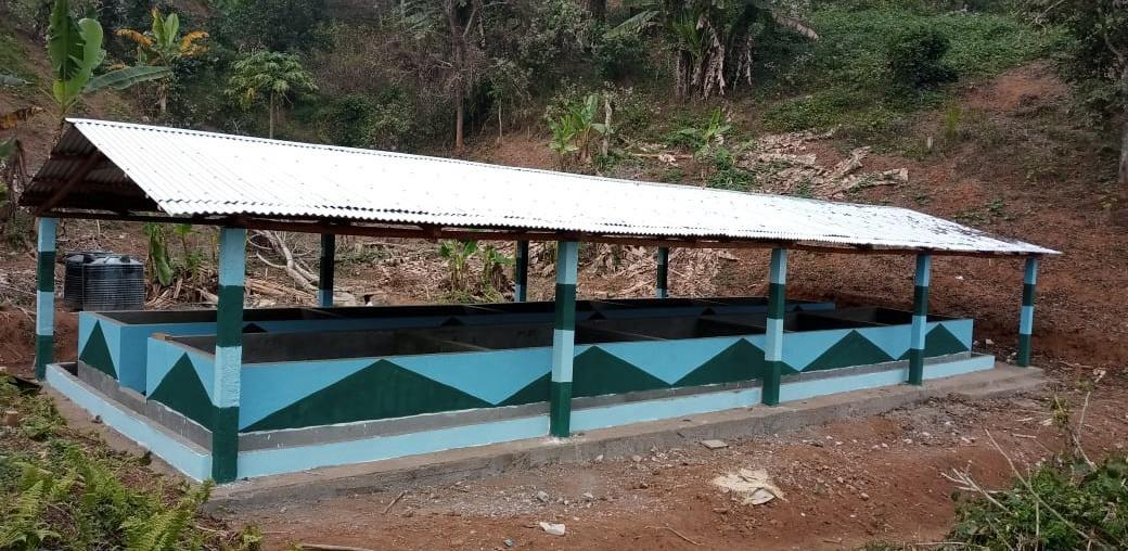
Vermicompost: The creation of vermicompost rooms underscores the importance of organic waste recycling. Earthworm fertilizers enrich the soil with nutrients and support sustainable farming.
The entire description portrays a comprehensive effort that touches on various aspects of environmental sustainability and community empowerment. The project's benefits extend beyond immediate improvements, as it contributes to the long-term health and resilience of the village's ecosystem. Our gratitude and acknowledgment demonstrate the profound impact that community-driven initiatives can have on creating a brighter, more sustainable future for everyone.
VCF M&E:Manlang Mawphniang 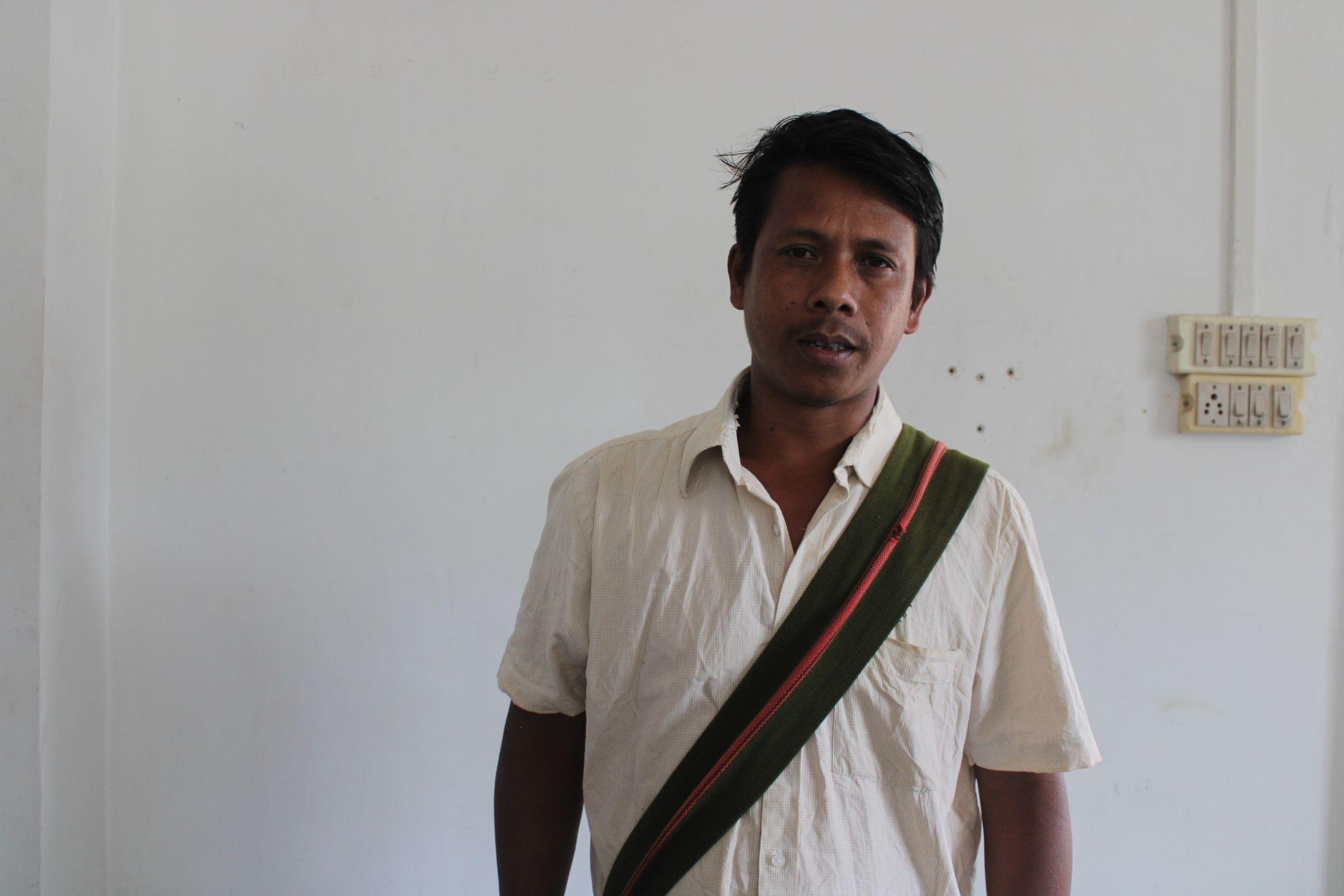
As a VCF, I have taken responsibility for preserving the environment, aiming to make the village greener and ensuring access to fresh air and clean water. The project has introduced effective measures such as contour trenches and rain water pons, which have resulted in a positive impact on water sources, increasing water availability. Vermicompost production has also been initiated, providing organic fertilizers to the community for plantations and promoting sustainable agricultural practices.
VCF Environment:Linus Lyngdoh 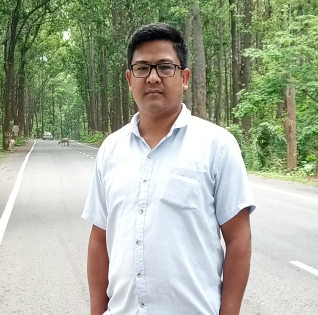
The spirit for managing and preserving the forest and environment is evident in our role as a VCF and also in our actions to strive towards building a better and healthier environment for everyone. The project has been perceived as a blessing to the village, and as a VCF I aspire for its continuation to ensure ongoing environmental preservation.I believe that this project is unique and essential in taking good care of the environment.
My dedication as a VCF and passion for environmental conservation have made a significant impact on the well-being of my village through the daily engagement and activities that were implemented in our community. Through our efforts in spreading awareness and implementing sustainable practices, we are contributing to the long-term health and prosperity of the community and the environment. Continued collaboration and dedication will further strengthen the positive impact of the project in our village
My role as a VCF has also enabled me to manage and advocate for the preservation of the forest and water sources in our village.