The Government of Meghalaya with financial help from the World Bank is implementing the Meghalaya Community Led Landscape Management Project (MCLLMP). The project will cover the entire state of Meghalaya and implementation of community led plans will be rolled out in phase manner throughout the state. The Meghalaya Basin Management Agency (MBMA) will facilitate community-led planning by providing support, technical inputs and funding.
The project is intended to strengthen community-led natural resources management in selected landscapes within the 11 districts of the state. This would be achieved through a variety of planning, capacity building, and on-the-ground interventions to promote the conservation, sustainable use of natural resources, social inclusion and community mobilisation; building traditional knowledge and learning, mapping of natural resources management; strengthening the community institutions and creating linkage with financial institutions and community organizations.
The project interventions include preparation of community led natural resource management plans. The CLLMP has the following three components:
Strengthening Knowledge and Capacity of Communities for NaturalResources Management
Community-Led Landscape Planning and Implementation
Project Management and Governance
The project objective is “to manage and conserve the natural resources, especially forests, soil and water sources, in a manner that supports the financial and physical well-being of communities in the State”
The CLLM-Programme focuses on increasing the capacities of communities and traditional institutions (TI) by adopting a landscape approach to manage their natural resources such as soil, springs and other water sources, forests and bio-diversity, etc.
The project will be planned and implemented in about 400 villages across the state.
CLLMP has a strong focus on institution-building at the village-level, by ensuring systematic capacity-building on technical and social skill-sets.
The project will also extend such training to communities beyond the targeted villages and support efforts made by them to access funding from various rural and natural resources initiatives and schemes.
The programme will also invest in improving the process and outcome delivery, by developing and adhering to effective systems and procedures, supported by the appropriate technology.
Benefits for community (Skills and Capacity relating to technical and managerial areas like NRM and Conflict resolution
Benefits to traditional institutions (village councils, traditional leaders, community-based organizations, SHGs etc) through Knowledge sharing, promotion of innovative approach, access to technology, technical managerial and financial support.
It is estimated that the project will impact around 1 lakh partners (of which 50% are women) who depend on land, forest, agro forestry.
Through the project, 55000 Ha of targeted area will be ensured with availability of water, biological resources and soil productivity, which will in turn benefit around 400 villages and the outcomes delivery can be summarized as follows.
The Project is executed by the MBMA in collaboration with other partners particularly, SIRD (for training and capacity building), Department of Soil and Water Conservation, Water Resource Department, Forest Department, specifically with respect to technical inputs, safeguards management and Community NRM plan preparation
2018-2023 (5 years)
Introduction
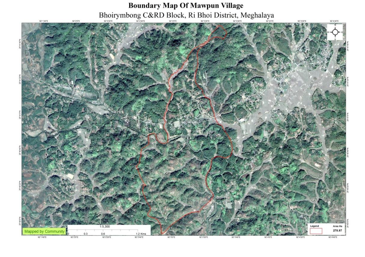
Mawpun Village falls under Bhoi Rymbong C&RD block of Ri-Bhoi district in the state of Meghalaya. The village is at a distance of 56 Kms from Nongpoh, the district headquarters of Ri Bhoi District and is at a total distance of 58 Kms from the state capital, Shillong.
Brief History
Founded in 1960 Mawpun village was under the Umsning C&RD Block of Ri-Bhoi district Meghalaya but is now under the Bhoirymbong C&RD Block. In the past there used to be rocks which pile up as steps on one another and that is how the name Mawpun originated. When it was founded it only had 5 households which gradually continued to grow and now there are 222 households with a population of 1257 consisting of 634 males and 623 females. The population distribution according to age is:
0-4 years – 183
5-14 years – 356
15-30 years – 385
31-60 years – 291
Above 60 years – 42
Most of the villagers at Mawpun are farmers, some are teachers and some rear animals like chicken, pigs, cattle, goats and buffaloes. There are 165 households under MHS, 181 households under APL and 41 households under BPL. In the village there are 3 churches, 3 SSA schools, 2 Private schools, 2 ICDS centres, a Durbar hall, and 2 football grounds.
The village has received several benefits from Job Card, these include:
1. Village footpaths.
2. One spring to supply water to the village.
3. Three ponds to supply water to the entire village.
Through CLLMP the benefits that the village received are:
1. Afforestation.
2. Vermicomposting.
The administration of the village is looked after by the Headman and the Secretary along with the executive members of the VEC. The village also has a Women’s Group, a Village Organization (V.O) and 10 Self Help Groups (looked after by the V.O).
Social Profile
Mawpun village is located in Bhoirymbong Block of Ri-Bhoi District, in the state of Meghalaya. It came into existence in 1960. The distance from the District Headquarter to Mawpun is 56 kms and the village is under the supervision of the Rangbah Shnong. The total number of households is 222 and has a population of 1257 people. Agriculture and its allied activities are highly in vogue, where some few others are also enrolled in government and teaching jobs.
The traditional form of governance prevails where the village head is the Rangbah shnong. There is a Village Employment Council (VEC) that oversees the implementation of Mahatma Gandhi National Rural Employment Guarantee Act and other developmental works. Besides women representation in the VEC, the village women are members of a women only village based organization that provides them a platform for decision making on various issues pertaining to the village.
There are a number of streams and springs in and around the village. The main source of livelihood is agriculture. The Village not only produces cash crops but also various fruits, vegetables, tomatoes and Broom-Grass.
There are five schools inside the village, five of which are Primary Schools and one is the Secondary School, Mawpun. The Primary Health Centre is 3 km away and the Community Health Centre is 5 km away; the nearest Bank is about 5 km away and the Post office is also 3 kms from the village.
Population 
As per Census 2011, Mawpun population is 909 and the total population of Mawpun has increased to 1257. Out of this, 634 are males and 603 are females. The village has 183 children in the age group of 0-4 years. Among them 96 are boys and 87 are girls.
| Age Group | Male | Female | Total |
|---|---|---|---|
| 0-4 | 96 | 87 | 183 |
| 5-14 | 192 | 164 | 356 |
| 15-30 | 191 | 194 | 385 |
| 30-60 | 133 | 158 | 291 |
| Above 60 | 22 | 20 | 42 |
BPL/APL Household:
| Particulars | No. of HH |
|---|---|
| BPL HH | 41 |
| APL HH | 181 |
Card Holding Household:
The village has a total number of 165 Health cardholders, 222 Ration cardholders. Out of which 181 are APL and 41 are BPL card holders. The major occupation of the people is farming while some are teachers and Govt. servants.
| Particulars | No. of HH |
|---|---|
| Total HH | 222 |
| Ration Card HH | 222 |
| Health Card HH | 165 |
Fuel Type:
| Fuel Type | Total HH |
|---|---|
| Charcoal | 0 |
| Biomass | 0 |
| Wood | 202 |
| LPG | 0 |
| Electric Heater | 20 |
| Kerosene | 0 |
OCCUPATION: The people of the village rely on
agriculture and forest products for their livelihood. The main
occupation of the villagers is farming followed by
carpenters/mason, drivers and teaching.
CLLMP ACTIVITIES
Ground Truthing Dated: 20th of June 2020
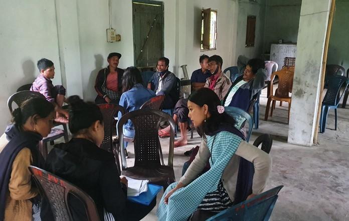
The CLLMP team met with Mr. Diphrin Nongrum, the headman of Mawpun Village on the 20th of June 2020, who was able to provide the team with the required details for site verification.
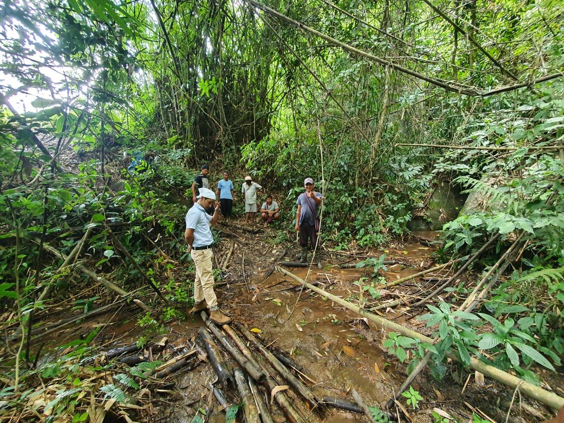
Figure 1 : Ground-truthing at Mawpun Village.
Case Findings & Selection parameters: -
1. There are 222 Households out of which 41 Households fall under the BPL category.
2. VEC actively performing.
3. Approximately 60-65 Ha of community forest available.
4. Scope for Water Sources to be developed
5. Need for Community Nursery and Vermi-Compost
The Village has been selected under the Community Led Landscape Management Project
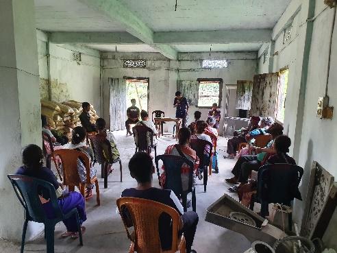
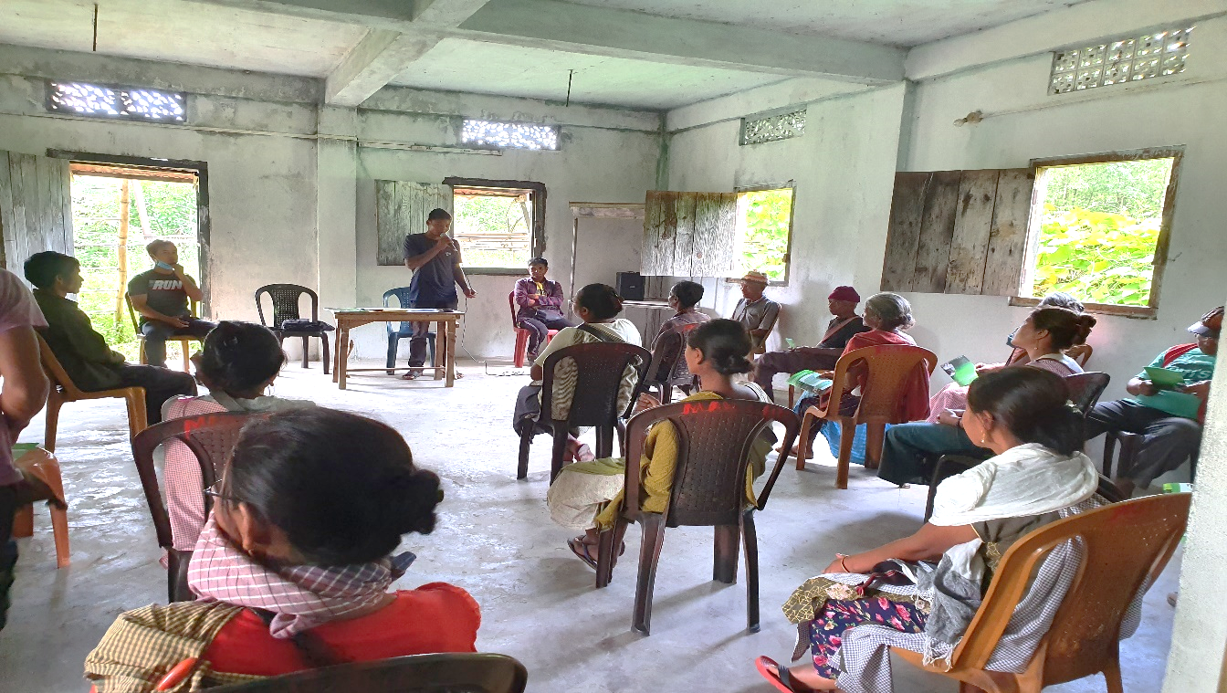
2. Sensitization Programme Dated : 09.07.2020
The District Project Manager and the Assistant Managers held a village Level sensitization Programme on the Community Led Landscape Management project on the 09th of July 2020.The community members actively participated in the program, voicing out their concerns and questions regarding the project making it a huge success. A total of 54 community members attended the program out of which 46 are female (Due to COVID restrictions there were 18 participants in one sensitization program, totalling to 54 participants over three days)
The CLLMP officials gave a brief introduction on Meghalaya Basin
Management Agency (MBMA) and explained about the various programmes
and projects that MBMA is working on, they then gave a detailed
introduction on the Community led Landscape Management Project
(CLLMP) and the different aspects and procedures that the villagers
and the CLLMP team should carry out during the course of the project
and the importance of the involvement of the community for the
CLLM-Project to be a success. They gave due importance to the
environmental aspects of the project and enlightened them on the
various benefits that the villagers could obtain from the
project.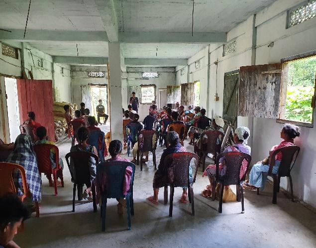
The Program was followed by an interactive session to answer the doubts and questions of the villagers some of which are mentioned below.
2.2 Signing of Documents: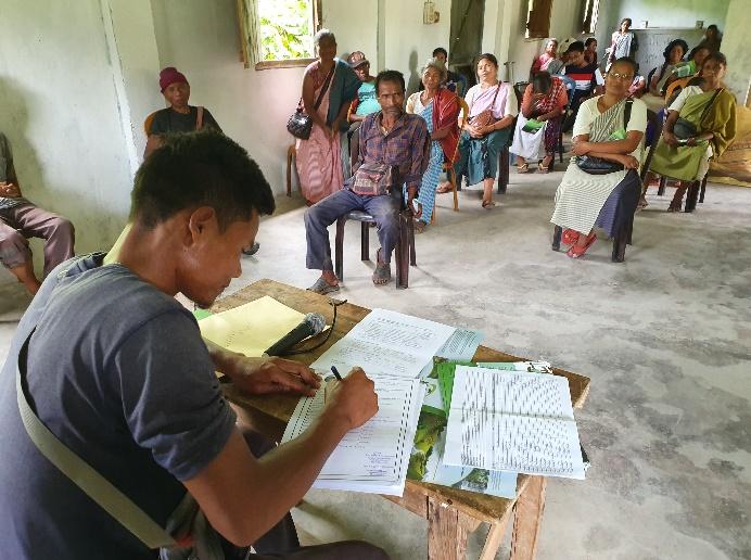
After the interactive session, the village signed the EOI, VGA and Green charter followed by the selection of candidates for the Village Natural Resource Management Committee. The Village Executive Committee (VEC) and the entire community carried out the procedure and elected the members of the VNRMC on the same day.
2.3 Formation of the VNRMC
The Formation of the Village Natural Resource Management Committee was done in a public meeting in the presence of the entire village and the CLLMP staffs. The community itself chose the President, the Secretary and the other executive members of the Committee.
Listed below are the members of the VNRMC:
|
|||||||||
|---|---|---|---|---|---|---|---|---|---|
|
Name in Full | Designation | Gender M/F | Age (Yrs) | Education | Occupation | Community | Religion and Denomination | Contact No and email address |
|
Diphrin Nongrum | President | M | 32 | BA | Govt. Service | Khasi | Christian | 8787545505 |
|
Hiardamon Kshiar | Secretary | F | 27 | MA | Teacher | Khasi | Christian | 8787819376 |
|
Iohborlang Mukhim | Book keeper | M | 29 | BA | Teacher | Khasi | Christian | 8837316393 |
|
Lamphrang Markhap | Member | M | 61 | VIII | Farmer | Khasi | Christian | 7005490206 |
|
Mathias Lyngdoh | Member | M | 46 | III | Farmer | Khasi | Christian | 9402179647 |
|
Sibar Kharbihkhiew | Member | M | 56 | II | Farmer | Khasi | Christian | 6009591059 |
|
Baida Nongrum | Member | F | 46 | IX | ASHA | Khasi | Christian | 8731050084 |
| 8 | Monica Mukhim | Member | F | 36 | XI | Aganwadi | Khasi | Christian | 6009903955 |
| 9 | Prissila Rynjah | Member | F | 23 | BA | Teacher | Khasi | Christian | 9366834014 |
| Village Community Facilitators | ||||||
|---|---|---|---|---|---|---|
| SI. NO | Name | Gender | Age | Education | Contact Number | Role |
| 1 | Rosalyn L. Nongbri | F | 37 | XII | 7640894849 | Social & Knowledge Management |
| 2 | Gilbert Mukhim | M | 27 | BA | 7005305951 | Environment & GIS |
| 3 | Becareful Kahit | M | 26 | BA | 8014429325 | Project Management (M & E) |
| List of Procurement Committee Members | ||||||
|---|---|---|---|---|---|---|
| Name | Gender | Age | Education | Occupation | Community | Contact Number |
| Jailin Mukhim | F | 31 | XII | Aganwadi | Khasi | 9366565288 |
| Nisharlang Mukhim | M | 37 | VIII | Farmer | Khasi | 8787682758 |
| Prostone Kharumnuid | m | 38 | IV | Farmer | Khasi | 6009258440 |
3. Opening of a Bank Account.
The opening of the bank account was initiated after the village signed the EOI (Expression of Interest), the VGA (Village Grant Agreement) and the Green Charter.
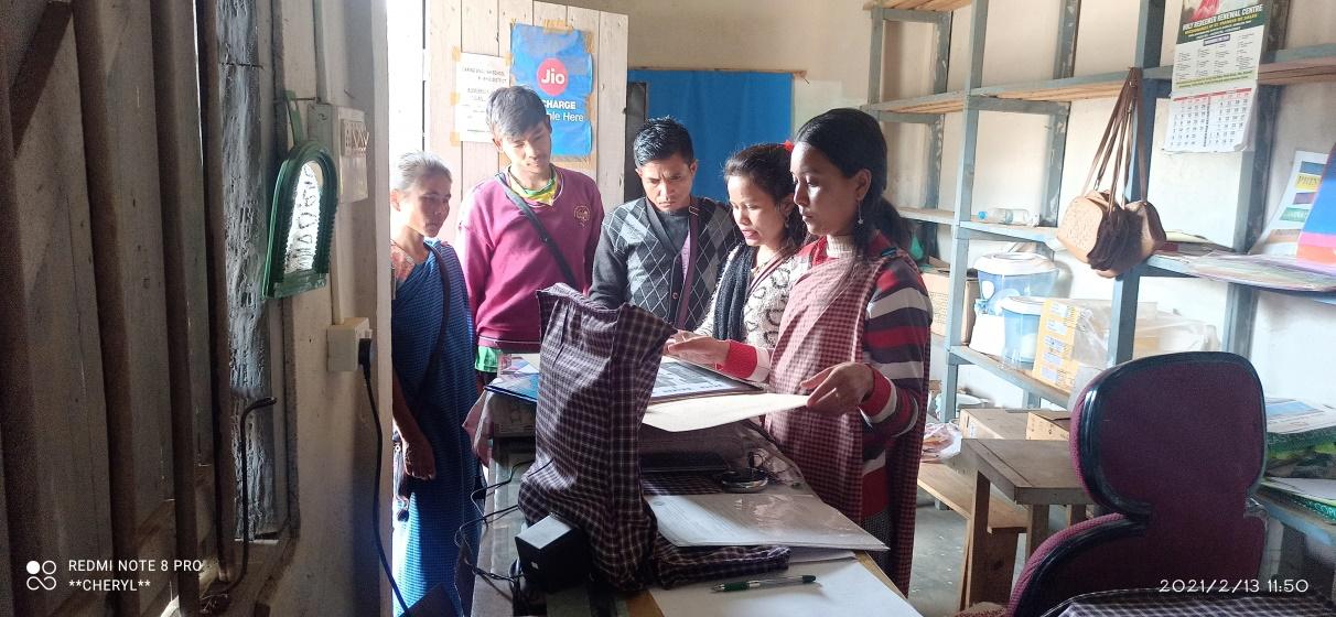
The Accountant of CLLMP Team Ri Bhoi District trained the Purchasing and Procurement Committee of Mawpun Village on 30th October 2020.
Topics Covered:
Principles of Community Procurement
Benefits of Community Procurement
Important aspects undertaken by Community Procurement.
Procurement Process/Steps
Function of Purchase Committee
Important Procurement records to be maintained
Financial limits and methods
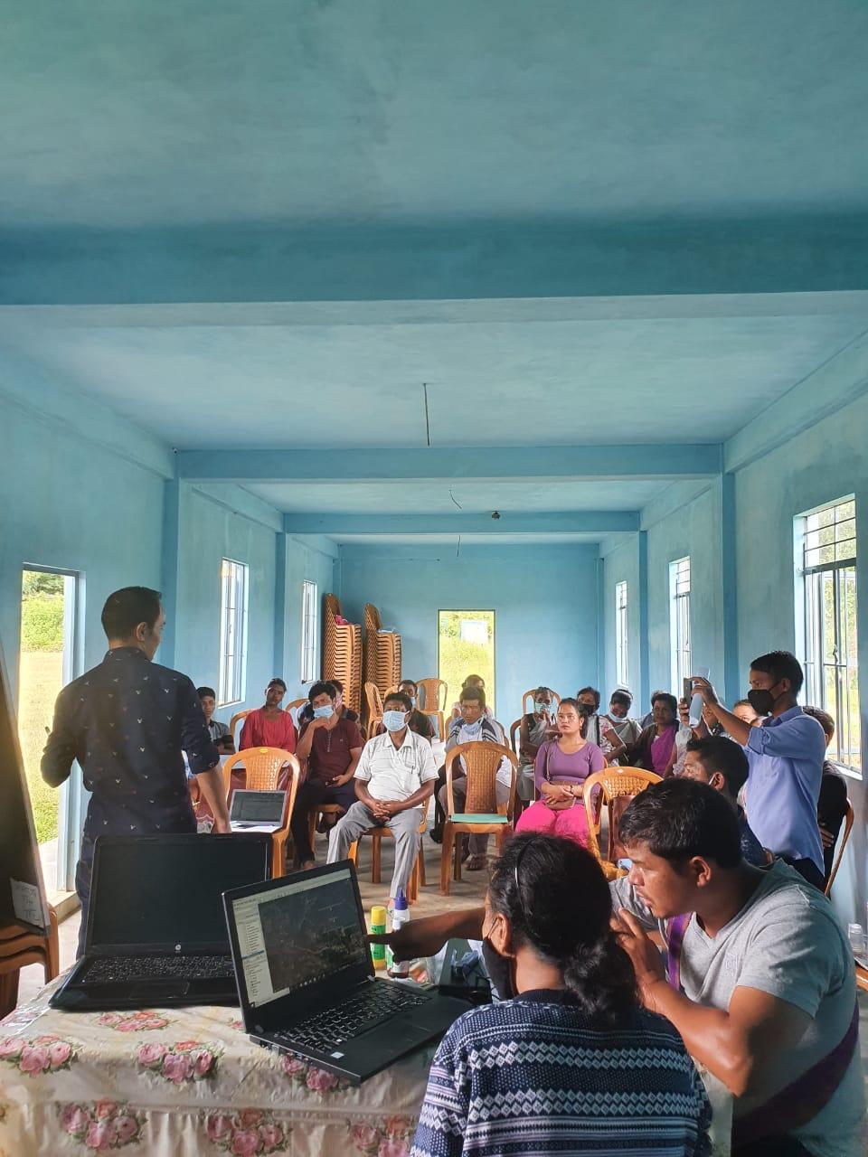
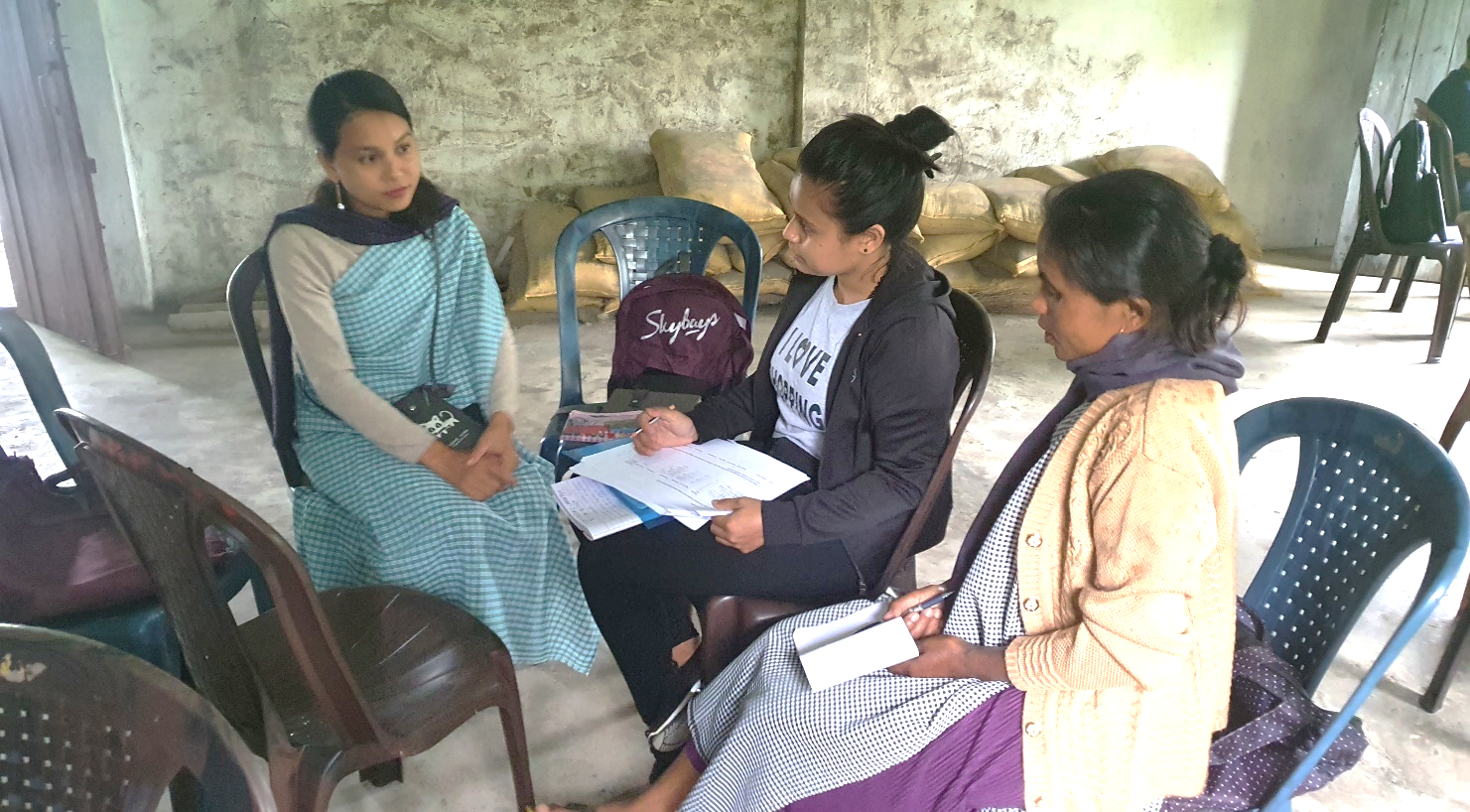
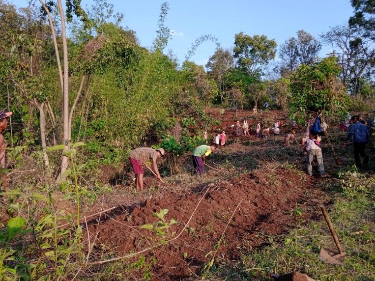
4. Participatory Rural Appraisal Exercise
09th September 2020
The PRA exercise aims to incorporate the knowledge and opinions of the community in the planning and management of development projects and programmes. PRA exercise at Mawpun Village took place on the 09th of September 2020. There were a total of 27 villagers who participated in this exercise
The initial stage of Participatory Rural Appraisal (PRA) exercise at Mawpun Village, commenced with a meeting cum orientation program on CLLMP. While conducting the meeting, the community members were made aware of the various PRA exercises to be conducted for the development of the Community Natural Resource Management Plan (CNRMP) of the village, the community members’ contribution in the exercise and the objectives to be achieved. The key informants (the VNRMC and the VCFs) helped facilitate maximum participation. The dates and time for conducting the various Participatory Rural Appraisal (PRA) exercises were fixed in consultation with the community members and all were requested to participate in the exercise. The schedule and time was announced at the end of the meeting.
The District Project Manager of the Community Led Landscape Management Project discussed the different types of plans that can be adopted by the village and stressed on the need for more holistic and sustainable plans which will benefit the community as a whole.
The SPMU Team also held a separate discussion with the DPMU CLLMP Team to discuss the Community Natural Resource Management Template and the various activities that will be undertaken during the PRA.
Participants on the 09.09.2020:
CLLMP officials: Shri.V. Buhphang (DPM), Shri. Wilborn Kurkalang (M & E), Smt. Jane Mary Kharkamni, Shri. Reuben Shabong (PA EM) and the DPMU CLLMP Team
Community members: Shri. Diphrin Nongrum (President), Smt. Hiardamon Kshiar (Secretary) Shri. Iohborlang Mukhim (Book-Keeper) Smt. Rosalyne L. Nongbri (VCF SM), Shri. Gilbert Mukhim (VCF EM), (VNRMC Members), Shri Sibar Kharbihkhiew (VNRMC Member), Shri. Gilbert Mukhim, Shri. Snorsing Mukhim, Shri. Phorbatson, Shri. Stanroi Nongbri and other community members
Commencement of PRA.
Introduction: Participatory Rural Appraisal (PRA) is the process of involving local people in the analysis and interpretation of their own situation of a given rural area. The local people i.e. the participants take a leadership role in collecting, analyzing, interpreting and presenting information and in this process impart knowledge and development insight to the specialists and extension agents
For management of natural resources, participatory Rural Appraisal is conducted to establish rapport with the village community as well as to identify and define problems for prioritization in the village itself. It is a way of learning from and with community members to investigate their need assessment, analyze and evaluate constraints and opportunities and find out priorities in the area of agriculture, small scale rural enterprises and any other social and economic development programs addressed to village development. Based on the principle of listening and learning,
Objectives of PRA exercise at Mawpun Village:
The Participatory Rural Appraisal (PRA) exercise at Mawpun was conducted with following objectives:
To identify the natural, human and economic resources of village.
To identify the village problems and prioritize them with the help of the community members.
To prepare the Community natural Resource Management Plan of the village.
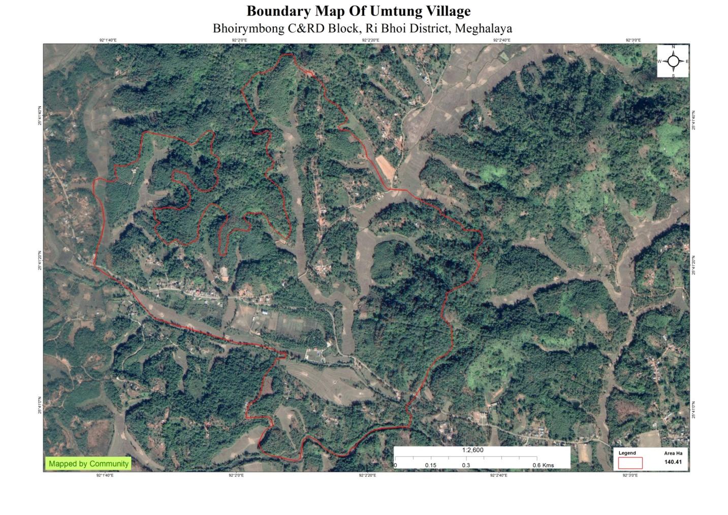
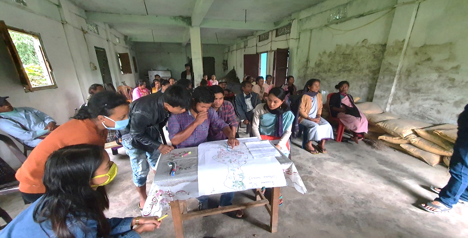
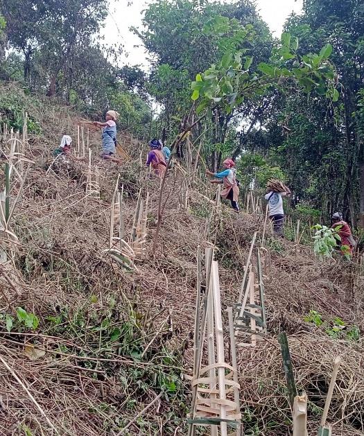
Activity 1: Village Boundary Mapping:
The GIS personnel along with the members of Mawpun Village and outlined the boundary of the village
Activity 2: Drawing the Resource Map
The second step is to involve the local community in preparation
of a village resource map as perceived by the community members to
solicit their participation. Infrastructure, services and other
village resources such as agricultural lands, wells, wastelands,
cattle population etc. were mapped. Local people prepared the
Resource Map by drawing it on a chart paper without much
interference from outsiders.
This activity achieved the following purposes:
Rapport building and winning the confidence of the villagers.
Analyzed the spatial information, particularly studied problems and opportunities of villagers.
Got an impression about the village setting, physical layout, location of various houses and institutions.
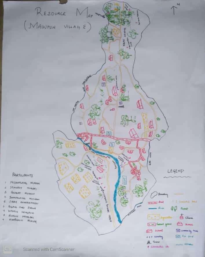
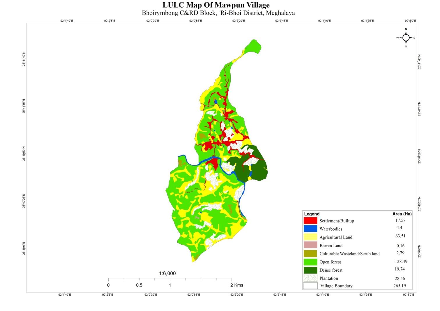
Finding based on Resource Map of Mawpun Village:
Main agriculture produce is Paddy and Ginger
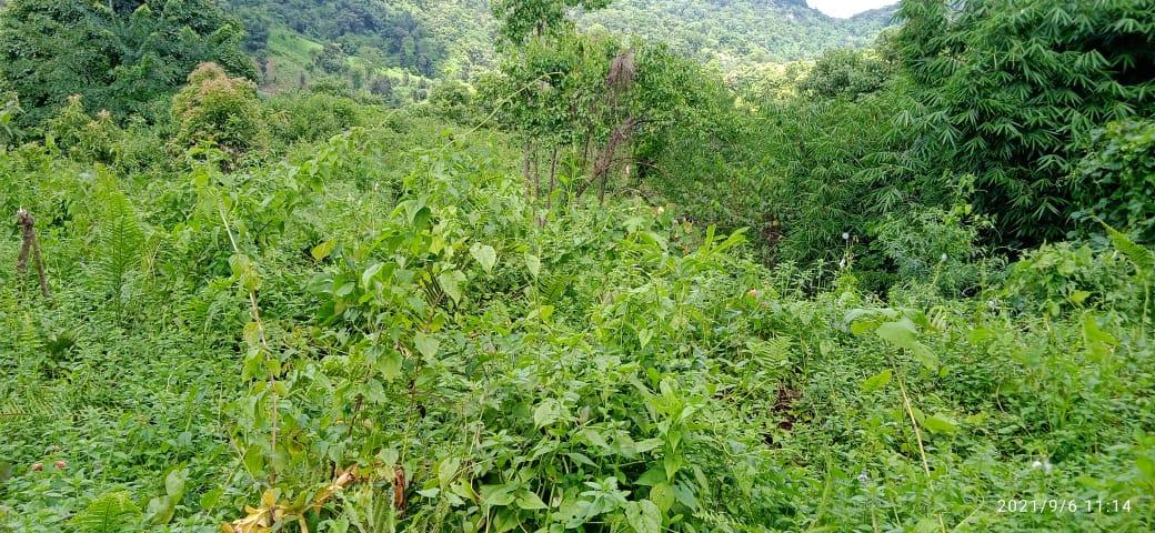
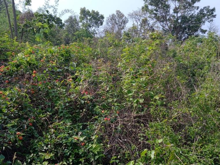
There are 2 types of Forest ownership: Community, Private and Clan Owned.
1 community forest
1 private forest
One football ground is present
Three(3) water tanks are present.
Three(3) dugout pond for fisheries
One river and three stream which supply water for irrigation to the paddy fields
Four primary school and three church is present
Habitation is not confined to one place but spread all over the village.
Activity 3: Baseline Data Survey to fill the Environment and Social Template
During the PRA exercise, the CLLMP officials and the community
members were divided into groups to fill the Social and
Environmental Templates. Discussions and consultations with social
groups existing in the village was held to gather basic village
information regarding households, demographic information, major
crops and enterprises taken in the village, trends of production and
productivity of major crops in the village and demographic
distribution of village population.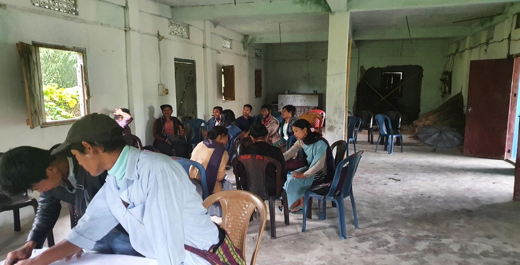
Information related to land use categories such as forest, cultivable land, water bodies, etc were discussed with another group consisting of External experts of environment management and the village community (who are quite aware of the village boundary and the presence of natural resources in the village) Problems related to NRM were discussed. Soil fertility deteriorating due to shifting cultivation was one of the issues being discussed. Discussion and consultations by the EE on formations of plans were also done.
Activity 5: PROBLEM ANALYSIS
Do people have sufficient access to supply of fodder, fuel wood, leaf litter?
No, people are facing insufficient access regarding supply of fodder, fuel wood and litter for there are less trees as compared to olden days.
Access to fodder is provided to them from their own forest but it is not sufficient and they also have to buy to fulfil their cattle.
Has access to timber improved or reduced over the years? How is access for household use and commercial use managed?
Access to Timber has reduced over the years due to the restriction over the use of the Community Forest.
Are the water bodies facing any threats?
Yes, Two Streams(Wah Mawsakdep and Wah Khah) are facing threats due to Siltation
Do all people in the village have access to drinking water? What are the challenges?
No, all people in the village do not have access to drinking water.
The main challenges they are facing is the distance for fetching water and there is scarcity of water during winter season.
Are there degraded areas in the village (open/ degraded forests, mining affected, high soil erosion etc.)?
Yes,
What has caused this degradation? Are there practices causing threats to availability and access to natural resources?
Shifting cultivation, yes they causing threat because the soil fertility is reducing and colourable land is reducing and more convertion of forest to agriculture land
What have been the changes in agricultural practices?
Some of the agricultural changes in the agricultural practices are their cultivating habits. Before they cultivated only potatoes but now they have also cultivated fresh bean, pea, cucumber, cabbage, cauliflower, tomato etc.
Are there any challenges in farming?
The main challenges in farming has been the use of chemical fertilizers which has further damaged the soil and lost its fertility.
How would you consider the health situation in your village?
Major illnesses found in the village are fever and malaria. Digestion disorder is also prevalent and it is mainly because of the water.
In case of serious illness the villagers have to travel a distance of 5km to CHC Bhoirymbong for treatment and PHC kyrdem of 3km distance.
ASHA and Angandwadi play a vital role in the village.
How is the situation of cleanliness, sanitation, access to toilets and waste management?
Cleanliness is the top most priority of the village and it is the duty of the villagers to maintain the cleanliness and health hygiene. Once a week the women's committee organised a cleaning drive programme in the locality and every member of the village takes active participation.
Toilets and waste management is available in every household.
Who are the most vulnerable in the village? What can be done to improve their lives?
BPL Families. Inclusion of BPL family members during project implementation
What are the livelihood aspirations of the youth? Are there any avenues available?
The majority of the population turn to farming, daily wages and Job-Cards under MGNREGA for employment.
Do any committees/ institutions/ rules exist to manage and monitor natural resources in the village?
Apart from VNRMC there is no committee that looks after the natural resources.
What are some of the major issues of conflict in the village?
The major issue of conflict in the village is alcohol abuse.
Have any of the above issues been discussed in village meetings?
Yes the village of Dorbar have discussed the issues and addressed these problems with better solutions.
How do people resolve disagreements and conflicts?
All disagreements and conflicts are addressed by the traditional institution of village governance called the Village Dorbar.
Activity 6: Seasonality Calendar
The CLLMP team also mapped the seasonal calendar of Mawpun Village to help identify heavy workload periods, periods of relative ease, credit crunch, diseases, food security, wage availability etc. This will prove helpful in project planning and project timeline framing.
Participants:
Shri. Gilbert Mukhim - Village Community Facilitator
Smt. Rosalyne L Nongbri- Village Community Facilitator
Smt. Hiardamon Kshiar- VNRMC Member
Smt. Isida Suting- Community Member
Smt. Sardina Suting- Community Member
Smt. Thrilin Nongrum- Community Member
Smt. Thiosia Sohtun - Community Member
Smt. Aimira Mukhim – Community Member
| SEASONAL CALENDAR | |||||||||||||
|---|---|---|---|---|---|---|---|---|---|---|---|---|---|
| Sl No. | CRITERIA | JAN | FEB | MAR | APRL | MAY | JUNE | JULY | AUG | SEP | OCT | NOV | DEC |
| 1 | Water Scarcity | 2 | 2 | 1 | 1 | 2 | |||||||
| 2 | Prone to sickness | 3 | 3 | 1 | 1 | 2 | 2 | ||||||
| 3 | Seeking job outside | 2 | 3 | 1 | 1 | 2 | |||||||
| 4 | Rain Fall | 1 | 1 | 2 | 2 | 3 | 3 | ||||||
| 5 | Free – Less work | 2 | 3 | ||||||||||
| 6 | Paddy Cultivation | 1 | 2 | ||||||||||
| 7 | Paddy harvesting | 1 | 2 | ||||||||||
| 8 | Turmeric cultivation | 1 | 1 | 2 | 3 | ||||||||
| 9 | Turmeric harvesting | 2 | 3 | 1 | |||||||||
| 10 | Tree Plantation | 1 | 2 | ||||||||||
| 11 | Vegetable (crop cultivation) | 1 | 2 | 3 | 3 | 1 | |||||||
| 12 | Vegetable (crop harvesting) | 1 | 1 | 3 | 2 | 2 | |||||||
| 13 | Festive Season | 1 | 2 | 3 | 1 | ||||||||
| 14 | Forest fire | 1 | 2 | ||||||||||
| 15 | Collection of Fuel wood | 1 | 2 | 3 | 1 | ||||||||
| MAXIMUM | 1 |
|---|---|
| MODERATE | 2 |
| LESS | 3 |
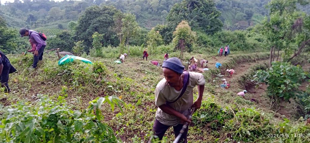
Activity 7: Submission of the List of NRM activities proposed by the VNRMC.
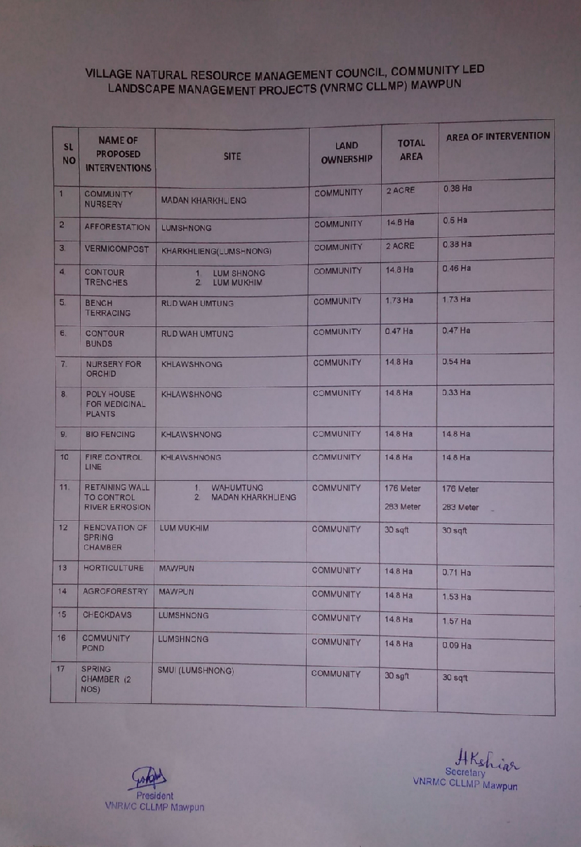
The Finalized Community Natural Resource Management Plan of Mawpun Village.
| Area of Intervention | Intervention 1 | Intervention 2 | Intervention 3 | Intervention 4 | Intervention 5 |
|---|---|---|---|---|---|
| Activity/ Site | Activity/ Site | Activity/ Site | Activity/ Site | Activity/ Site | |
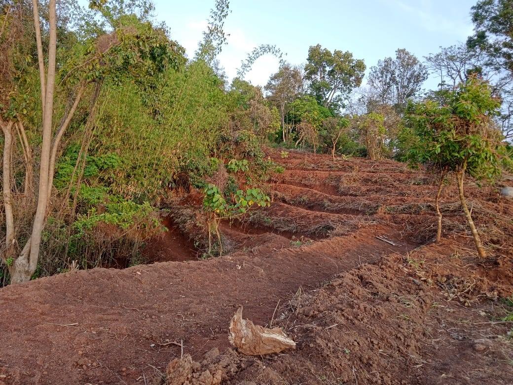
| Soil and Water Conservation | CONTOUR BUNDS AT RUD WAH UMTUNG |
|
1.WAHUMTUNG 2.MADAN KHARKHLIENG |
|
|
| Land Productivity Enhancement |
|
||||
| Spring Shed Management | CONTOUR TRENCHES 1.LUM SHNONG 2.LUM MUKHIM |
|
|
||
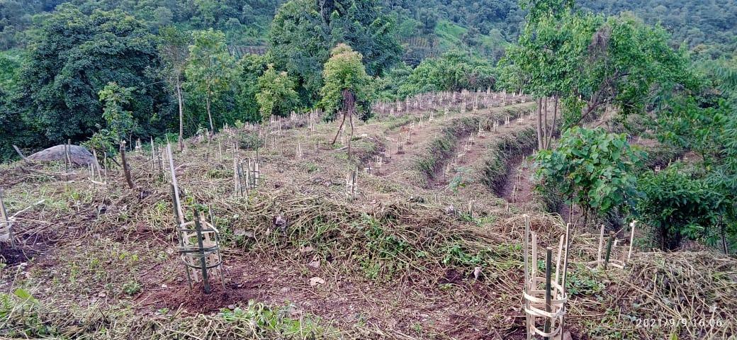
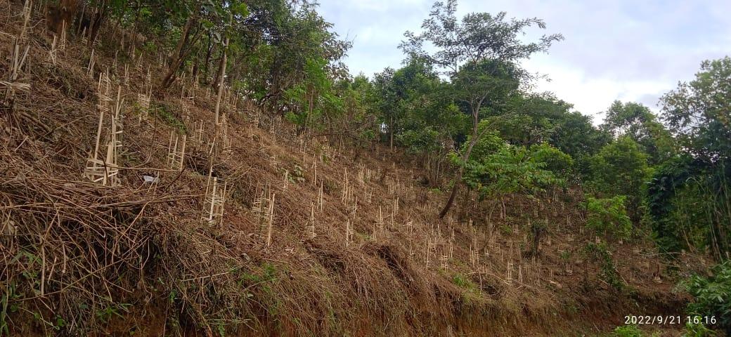
| Afforestation/ Community Forestry Activities |
|
|
|||
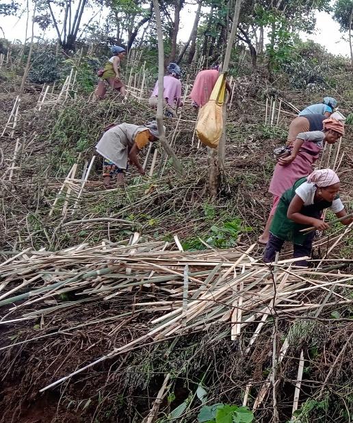
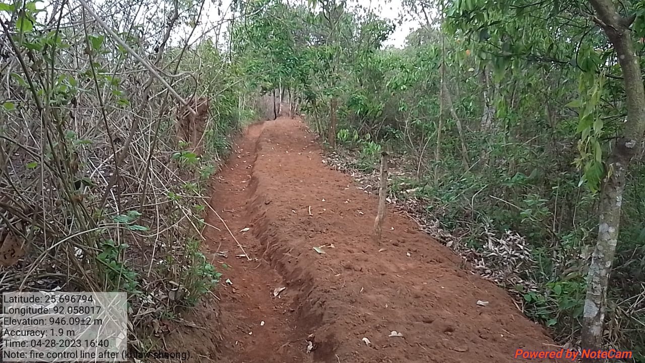
| Forest area under management plans | BIO FENCING AT KHLAWSHNONG | FIRE CONTROL LINE AT KHLAWSHNONG | |||
| Enhancement of Agro-forestry Activities | AGROFORESTRY( TREE PLANTATION IN AND ARROUND AGRICULTURE FIELD) AT MAWPUN | TREE PLANTATION +COMMUNITY POND( AQUAFORESTRY) AT LUMSHNONG | |||
| Culturable waste land brought under Horticulture |
|
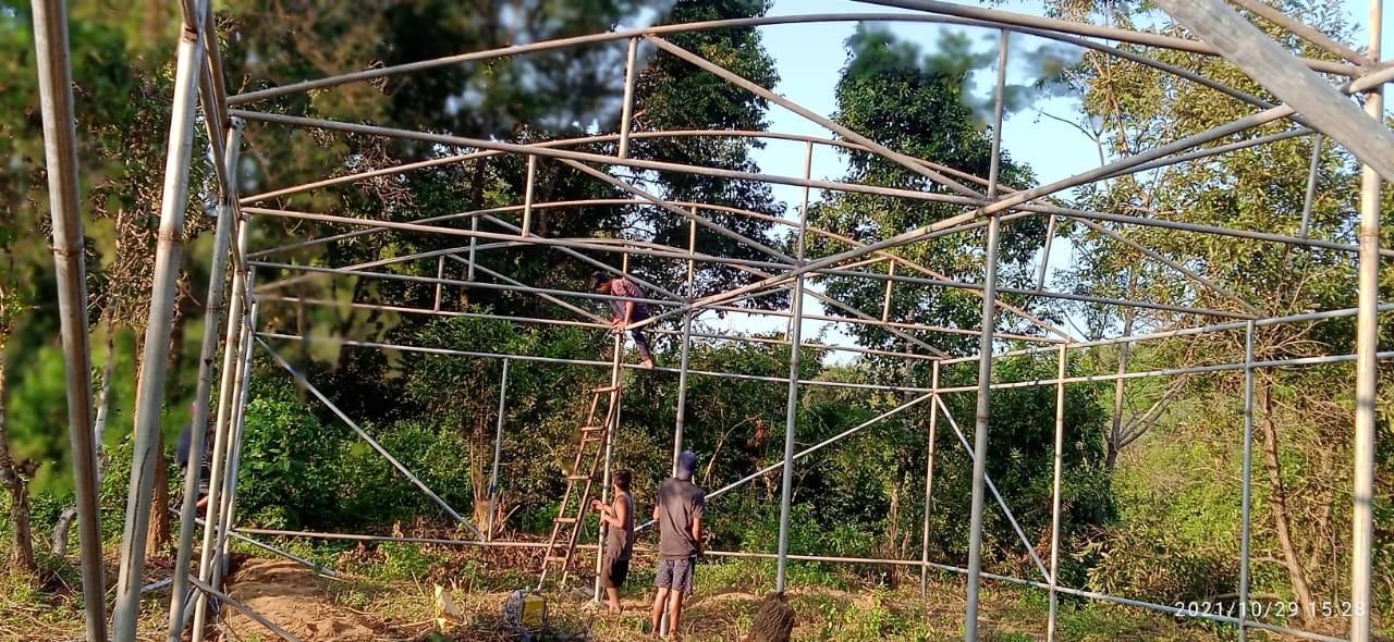
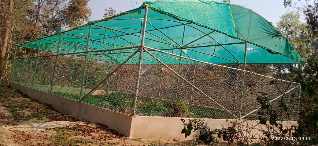
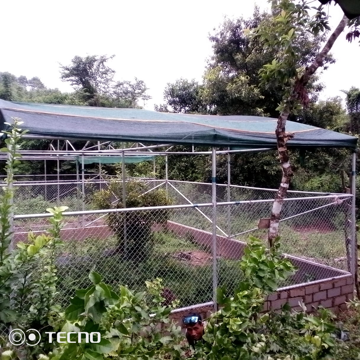
POLY HOUSE FOR MEDICINAL PLANTS AT KHLAWSHNONG |
|
||
| Activities to Treat Mining Affected Area | |||||
| Others |
GIS Activities – MAWPUN
| Sl.No | Parameters | Village Information |
|---|---|---|
| 1. | GPS Coordinates | |
| i | Latitude | 25.682255°N |
| ii | Longitude | 92.050868°E |
| iii | Elevation Reading (MSL) | 899M |
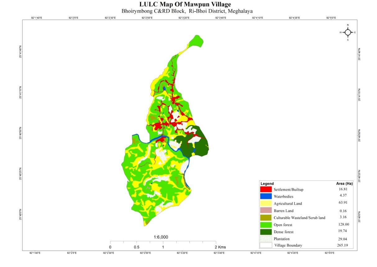
| 2. | Village Geographical Area(Ha) | 265.19Ha |
| i | Total Forest Area ( including community, Clan, Pvt Forest) | 147.74 Ha |
| ii | Total Area of Water Bodies | 4.37Ha |
| iii | Total Area under Agri- Horticulture | 92.25 Ha |
| iv | Total Degraded land area (Ha) | 3.16 Ha |
| 3 | Average Annual Rainfall | 1000-1200 |
| 4 | Soil Type | Loamy soil |
PROJECT IMPLEMENTATION
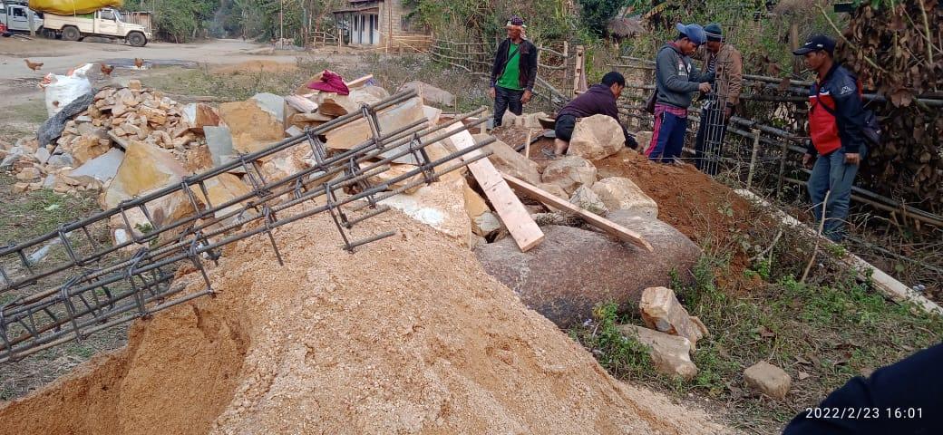
| 1. | Type Of Intervention | Site Name | GPS Co-ordinates | Amount Sanctioned | Work Status | |
|---|---|---|---|---|---|---|
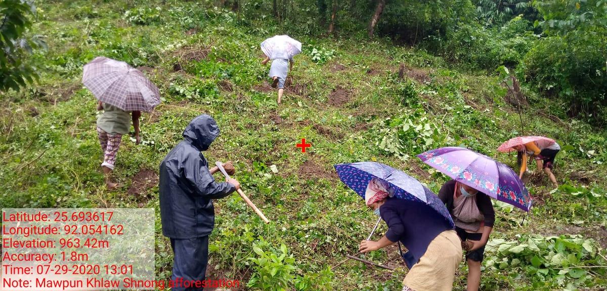
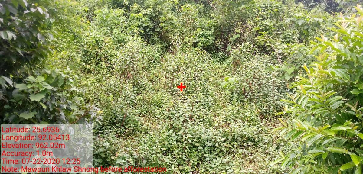
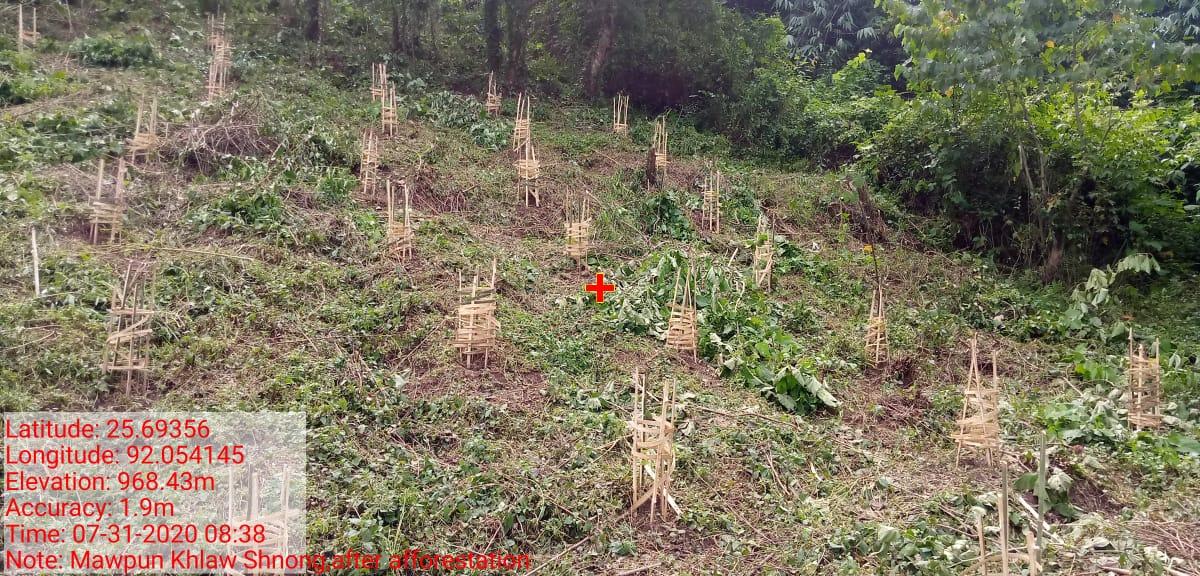
| Afforestation | Khlaw Shnong | 25.6936 N | 92.05413 E | ₹50,810 | Completed | |
| 2 | Type Of Intervention | Site Name | GPS Co-ordinates | Amount Sanctioned | Work Status | |
|---|---|---|---|---|---|---|
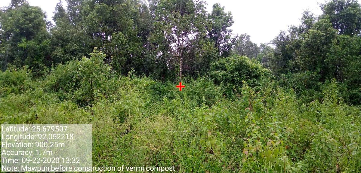
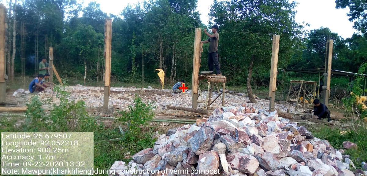
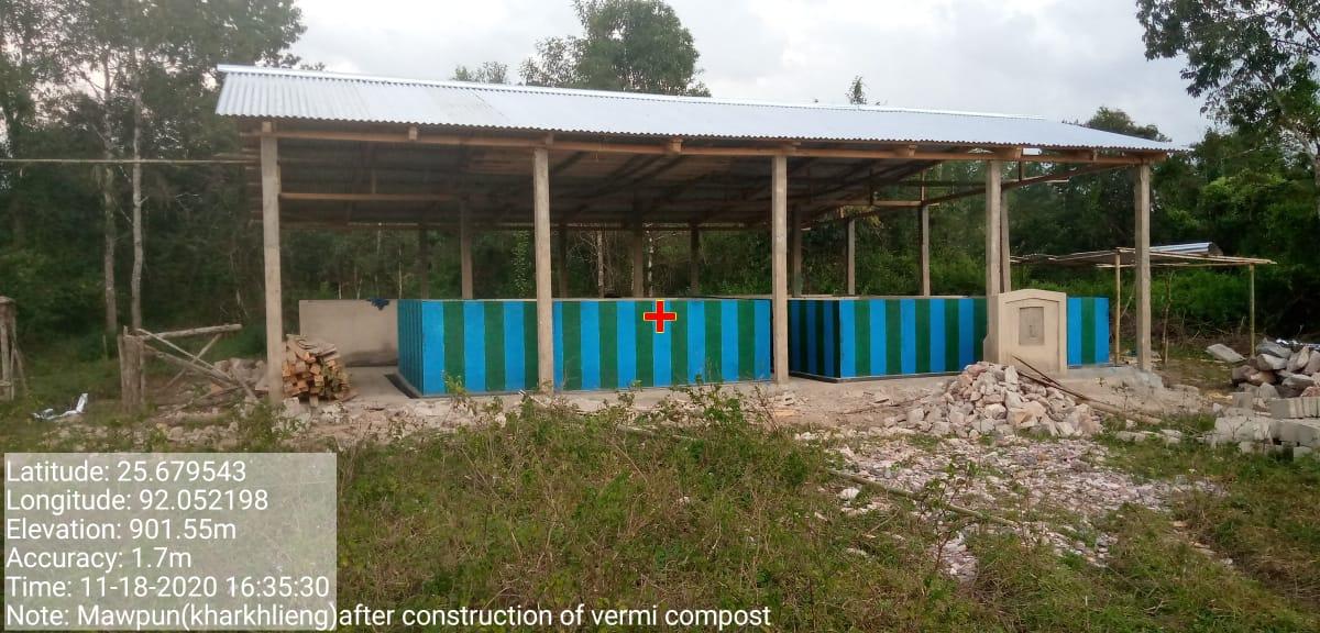
| Vermicompost | Mawpun(Kharkhlieng) | 25.679507 | 92.052218 | ₹3,32,460 | Completed | |
| 3 | Type Of Intervention | Site Name | GPS Co-ordinates | Amount Sanctioned | Work Status | |
|---|---|---|---|---|---|---|
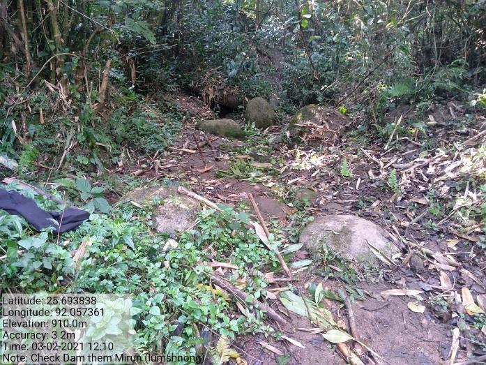
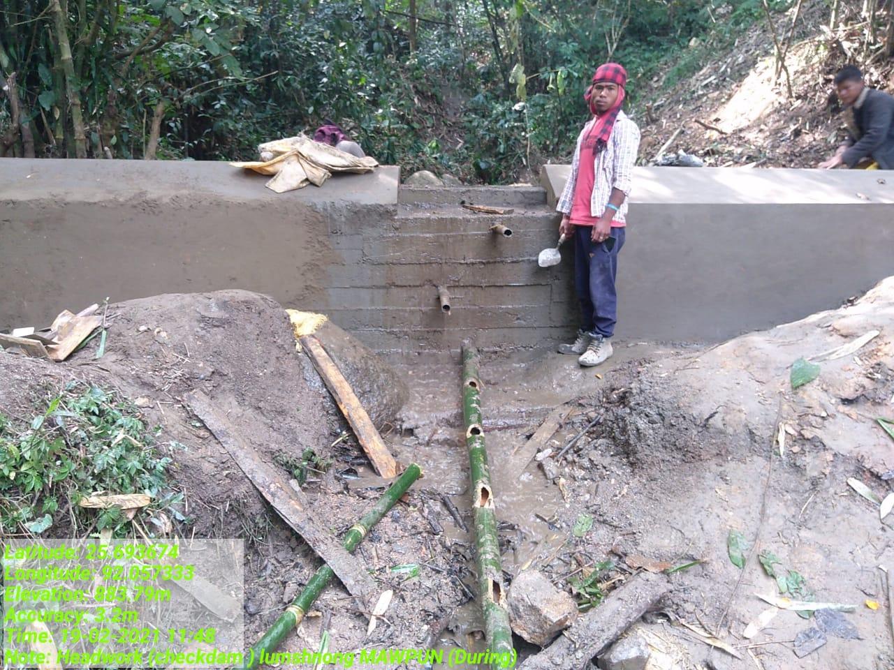
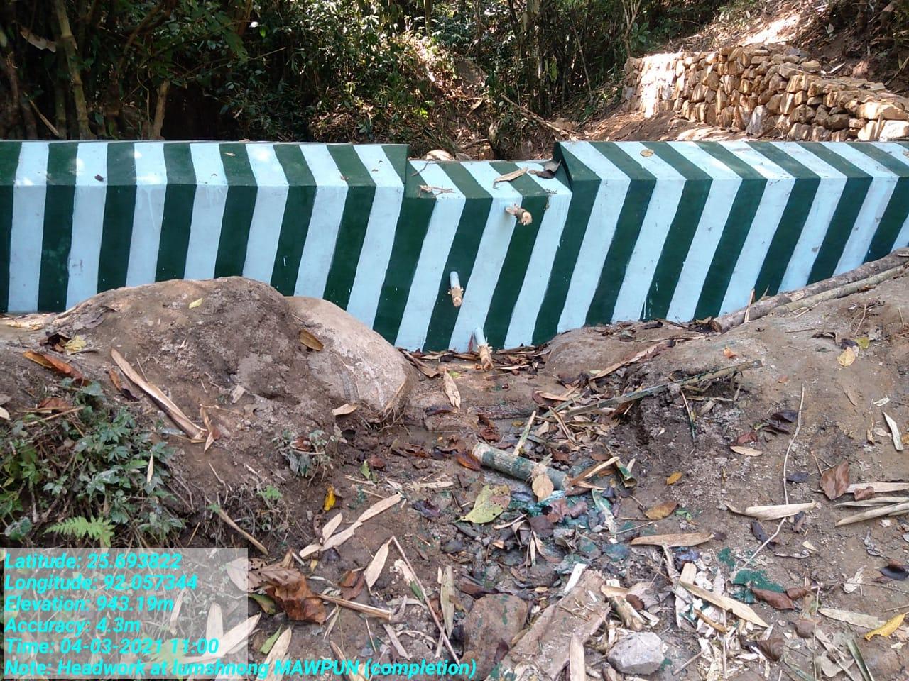
| Head work | Khlieh Shnong | 25.693822 | 92.057344 | ₹ 1,82,000 | Completed | |
| 4 | Type Of Intervention | Site Name | GPS Co-ordinates | Amount Sanctioned | Work Status | |
|---|---|---|---|---|---|---|
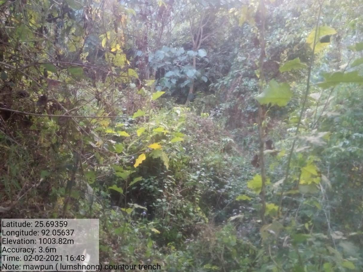
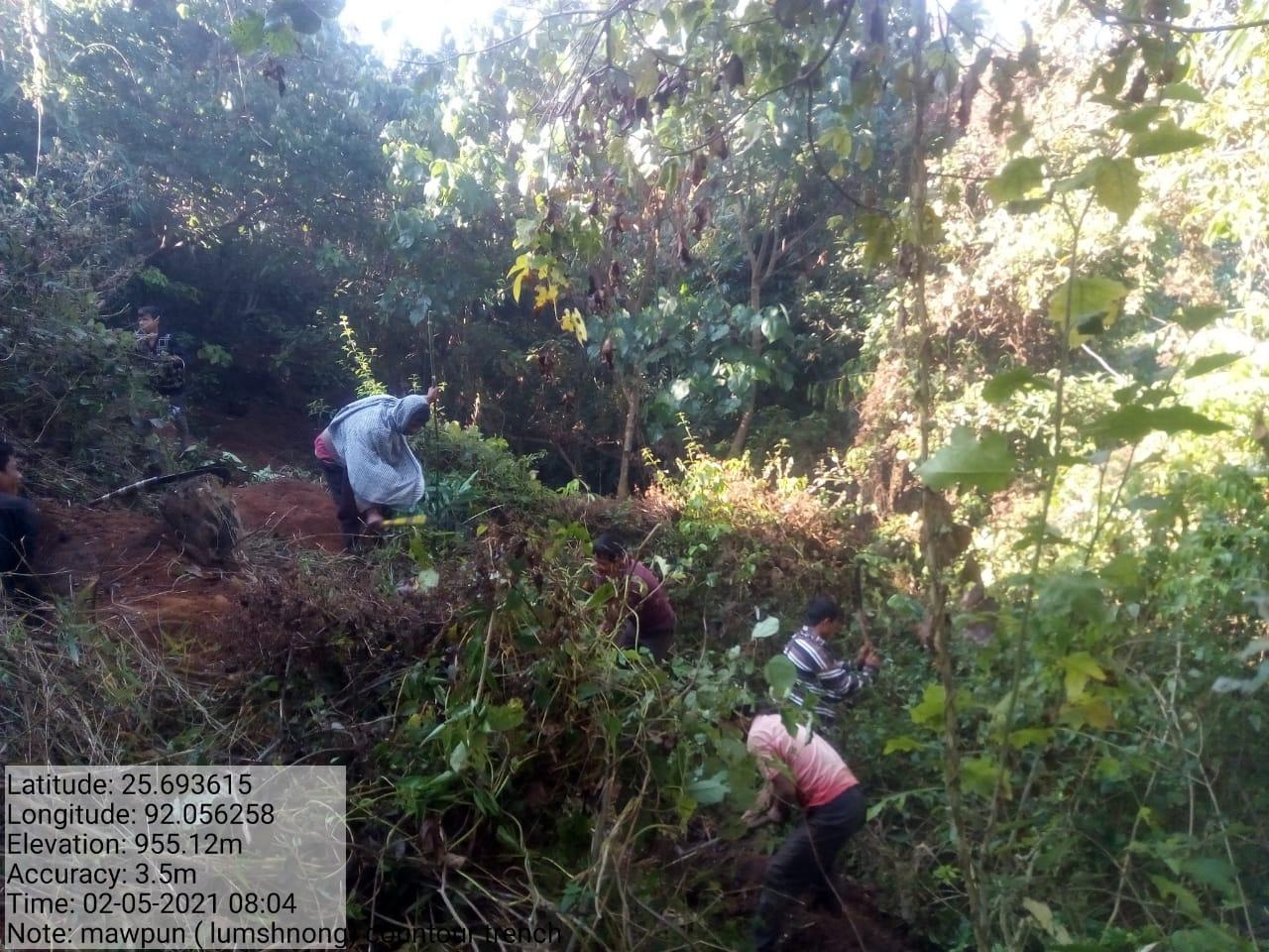
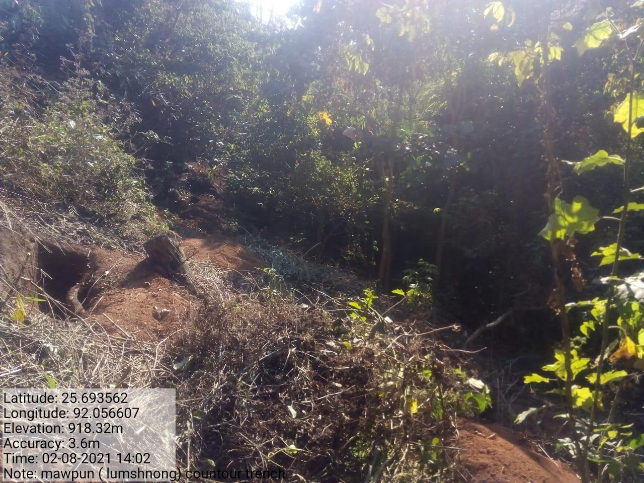
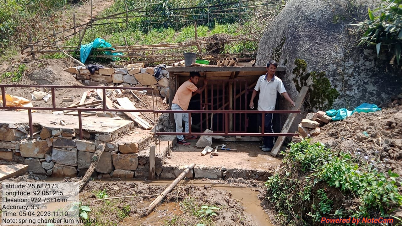
| Contour trenches | Lum shnong | 25.693562 | 92.056607 | ₹79,140 | Completed | |
| 5 | Type Of Intervention | Site Name | GPS Co-ordinates | Amount Sanctioned | Work Status | |
|---|---|---|---|---|---|---|
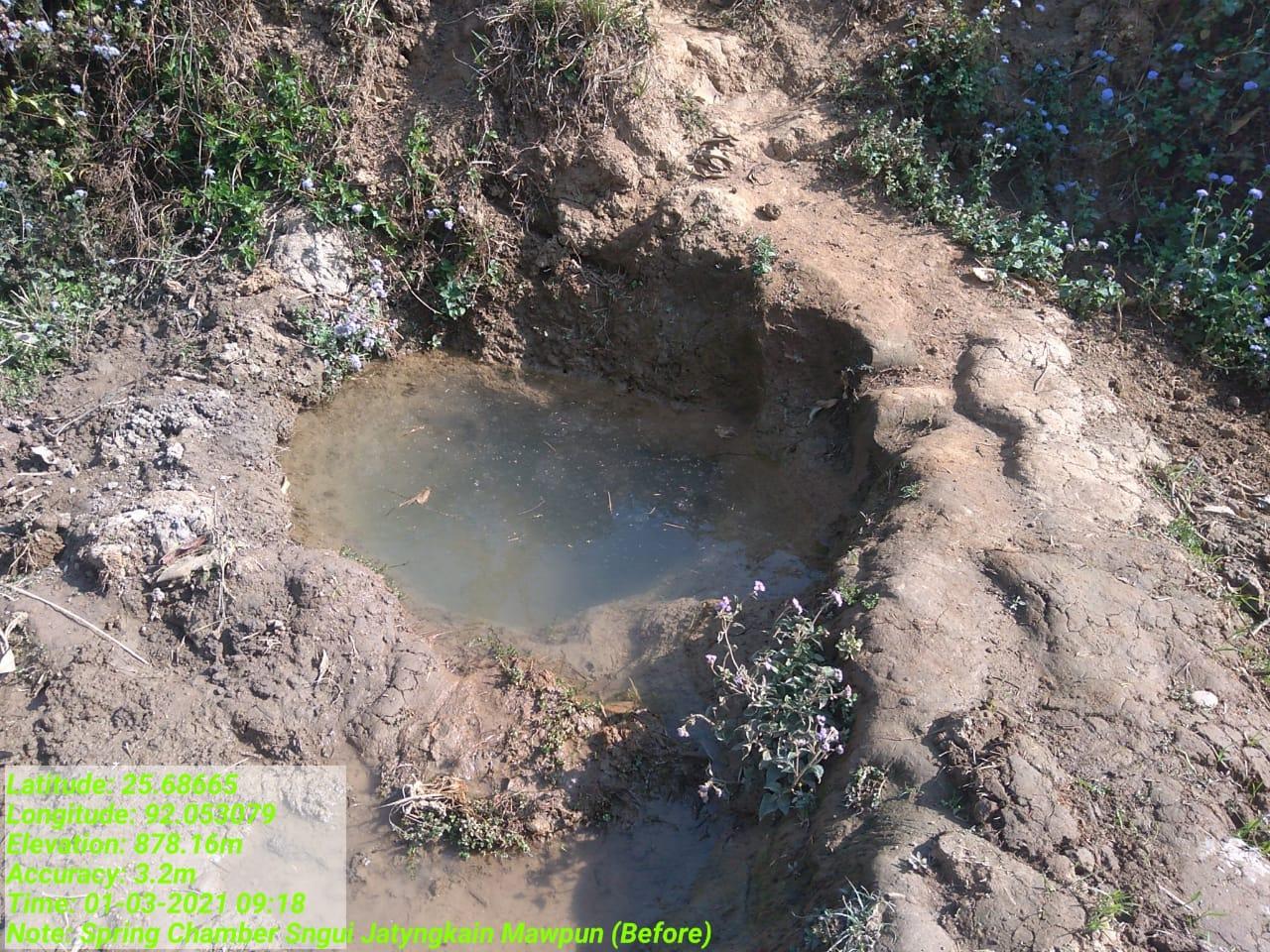
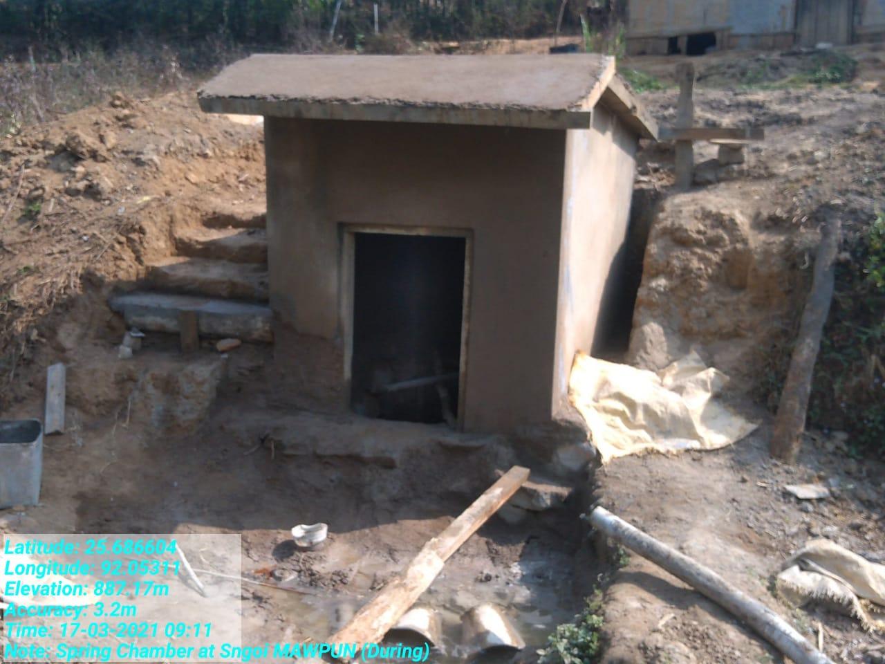
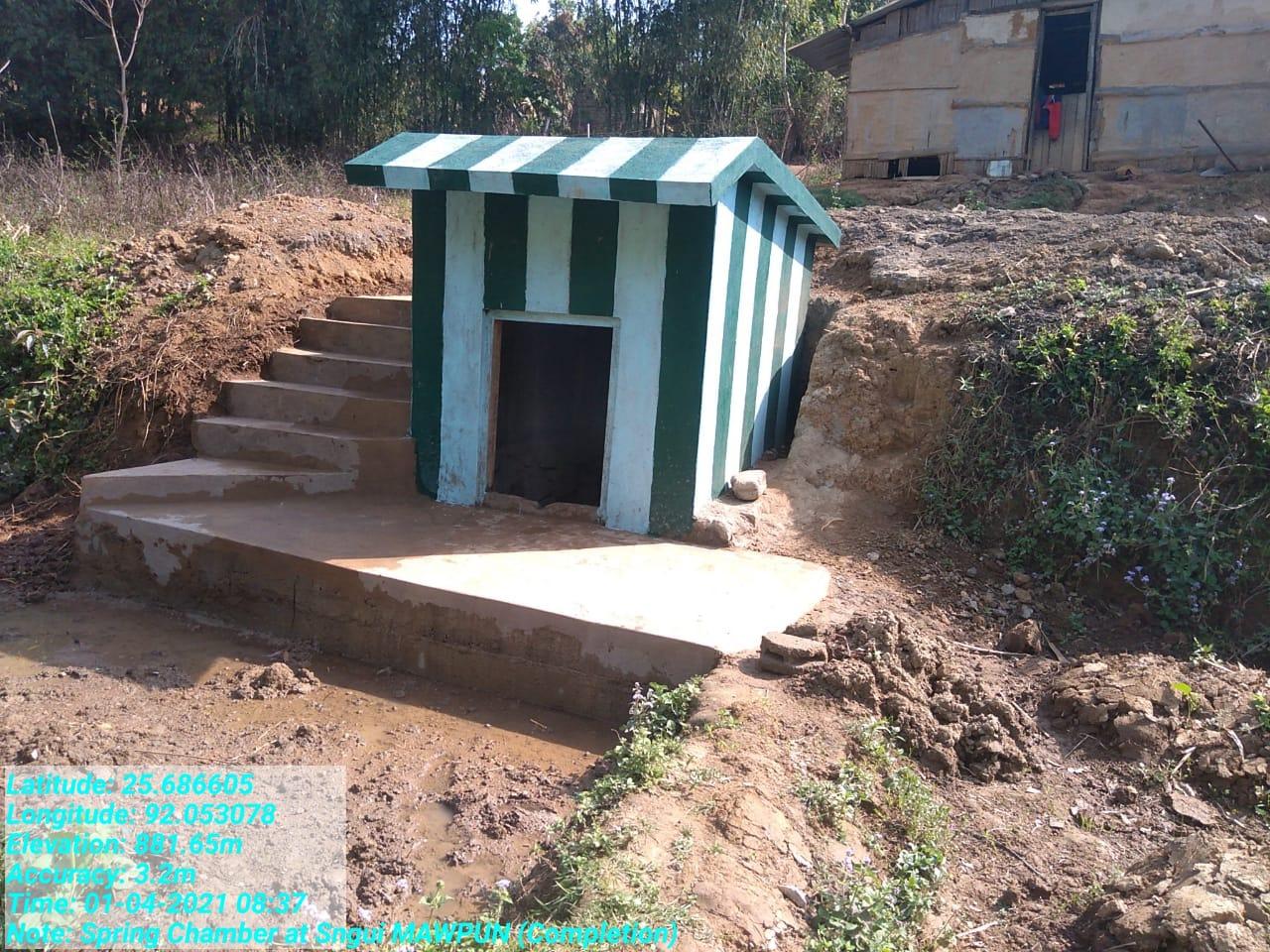
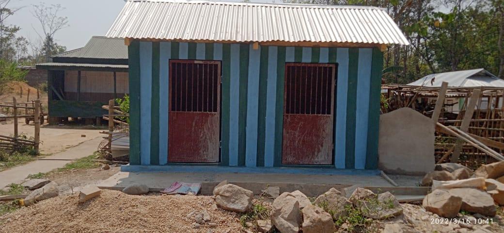
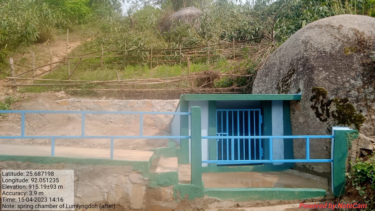
| Spring Chamber | Jatyngkain | 25.686605 | 92.053078 | ₹ 69,000 | Completed | |
| 6 | Type Of Intervention | Site Name | GPS Co-ordinates | Amount Sanctioned | Work Status | |
|---|---|---|---|---|---|---|
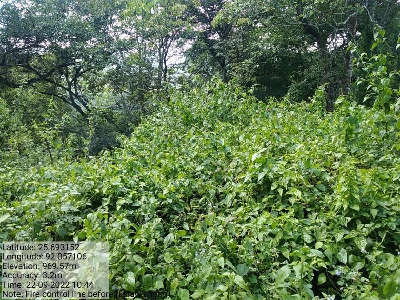
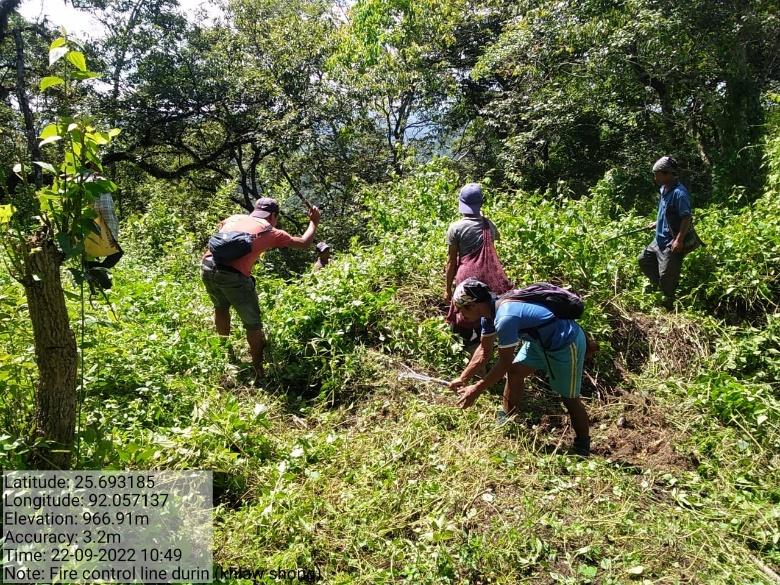
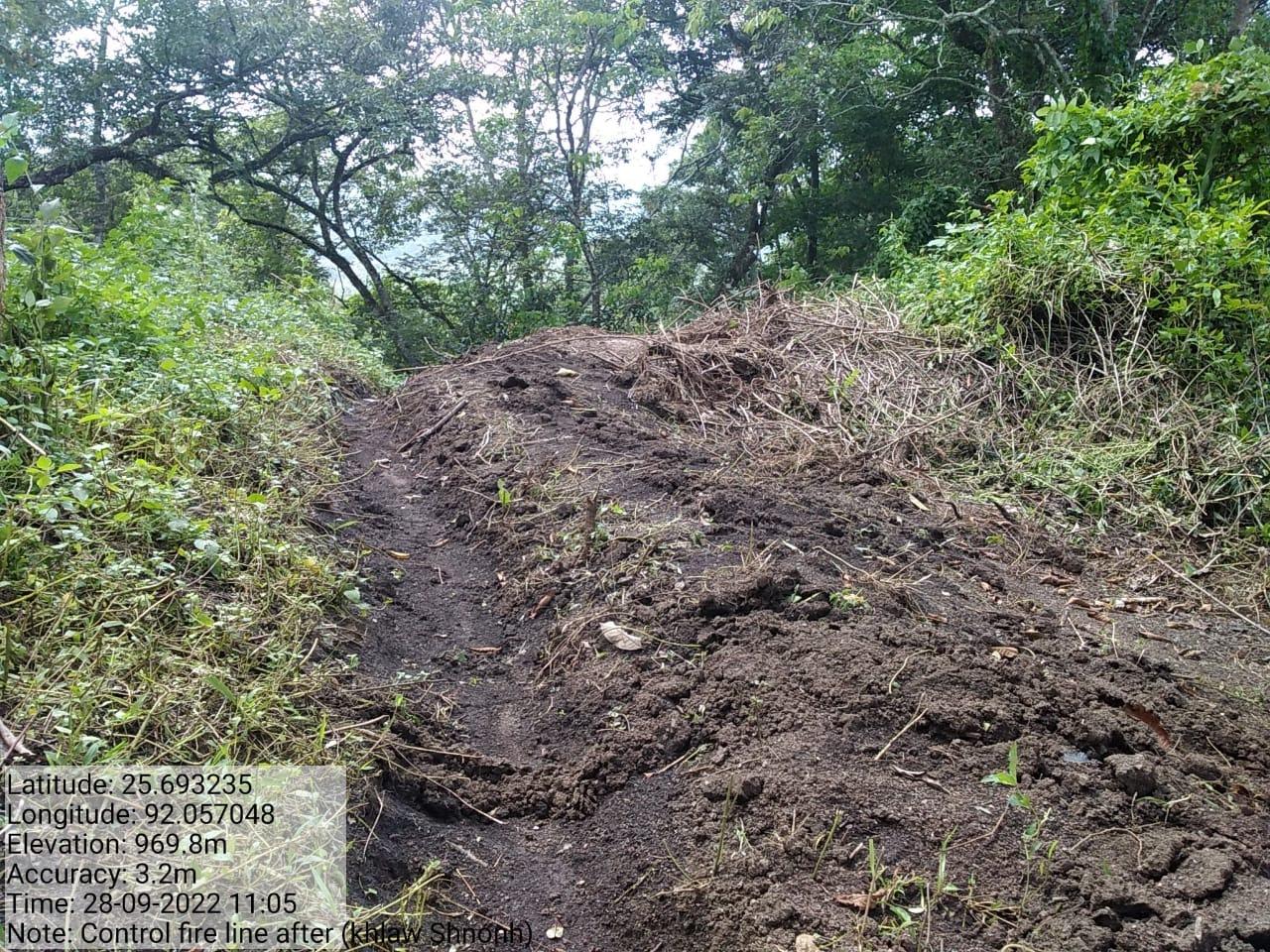
| Fire line Control | Khlaw Shnong | 25.693253 N | 92.057048 E | ₹ 71,990 | Completed | |
| 7 | Type Of Intervention | Site Name | GPS Co-ordinates | Amount Sanctioned | Work Status | |
|---|---|---|---|---|---|---|
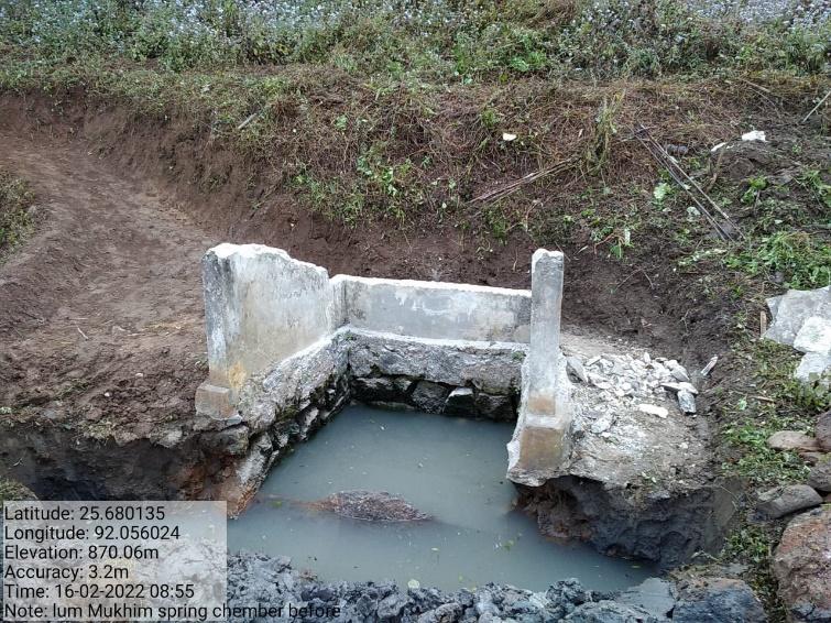
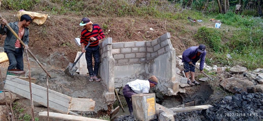
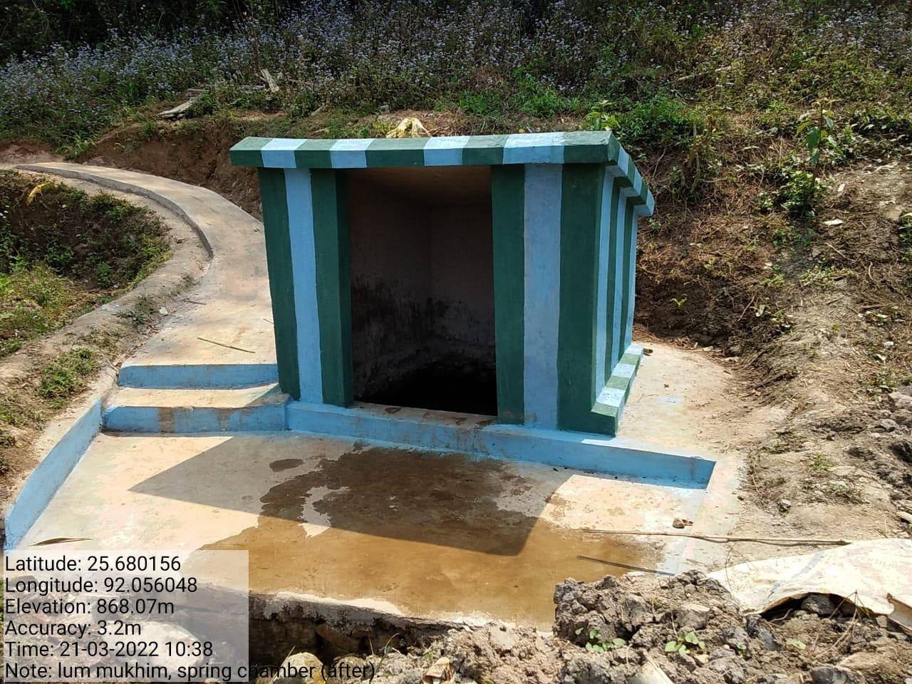
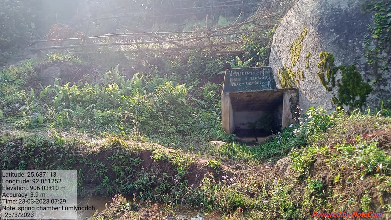
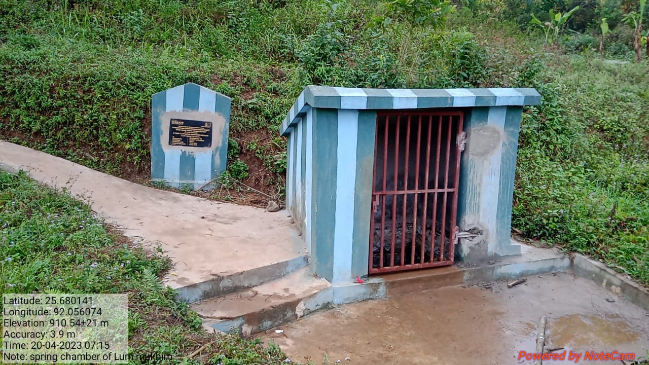
| Renovation of Spring Chamber | Lum Mukhim | 26.680135 N | 92.0056024 E | ₹ 68,000 | Completed | |
| 8 | Type Of Intervention | Site Name | GPS Co-ordinates | Amount Sanctioned | Work Status | |
|---|---|---|---|---|---|---|
| Waste Management Bin | Dong Madan | 26.6823 N | 92.0536 E | ₹ 72,000 | Completed | |
| 9 | Type Of Intervention | Site Name | GPS Co-ordinates | Amount Sanctioned | Work Status | |
|---|---|---|---|---|---|---|
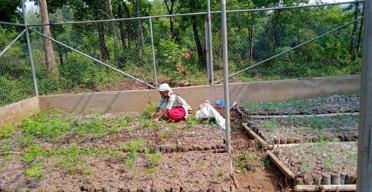
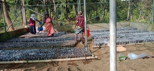
| Nursery | Kharkhlieng | 26.679402 N | 92.052442 E | ₹ 2,95,000 | Completed | |
| 10 | Type Of Intervention | Site Name | GPS Co-ordinates | Amount Sanctioned | Work Status | |
|---|---|---|---|---|---|---|
| Agroforestry | Khlaw Shnong | 26.69356 N | 92.056478 E | ₹ 2,14,280 | Completed | |
| 11 | Type Of Intervention | Site Name | GPS Co-ordinates | Amount Sanctioned | Work Status | |
|---|---|---|---|---|---|---|
| Bench Terracing | Khlaw Shnong | 26.693596 N | 92.0565608 E | ₹ 2,02,000 | Completed | |
| 12 | Type Of Intervention | Site Name | GPS Co-ordinates | Amount Sanctioned | Work Status | |
|---|---|---|---|---|---|---|
| Horticulture | Khlaw Shnong | 26.692832 N | 92.053477 E | ₹ 3,50,000 | Completed | |
| 13 | Type Of Intervention | Site Name | Amount Sanctioned | Work Status |
|---|---|---|---|---|
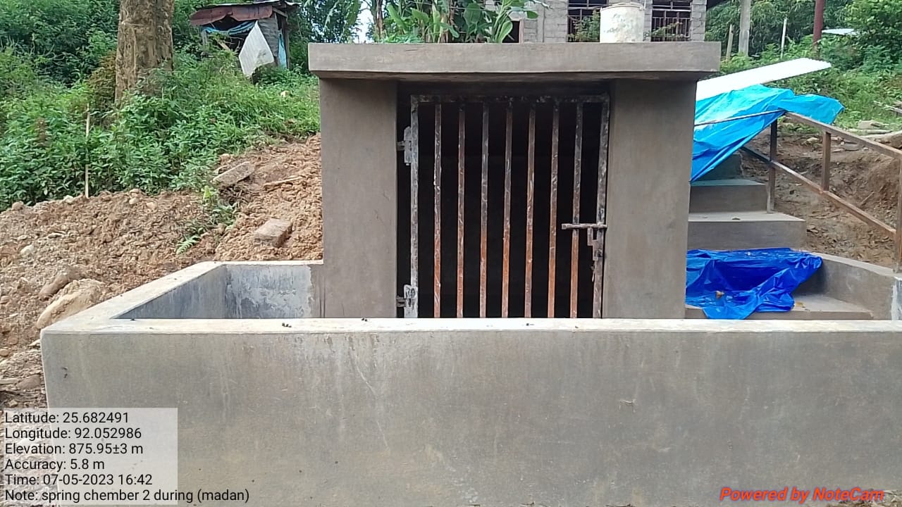
| Spring Chamber 2 | Dong Madan | ₹ 1,35, 900 | Completed |
| 14 | Type Of Intervention | Site Name | Amount Sanctioned | Work Status |
|---|---|---|---|---|
| Spring Chamber cum Protection wall | Lum Lyndong | ₹ 1,88, 100 | Completed |
| 15 | Type Of Intervention | Site Name | Amount Sanctioned | Work Status |
|---|---|---|---|---|
| Polyhouse for Meicinal Plants | Kharkhlieng | ₹ 1,76, 000 | Completed |
| 16 | Type Of Intervention | Site Name | Amount Sanctioned | Work Status |
|---|---|---|---|---|
Excess fund Spring chamber’s gate Water tester |
Kharkhlieng | ₹ 10,000 | Completed |
| 17 | Type Of Intervention | Site Name | Amount Sanctioned | Work Status |
|---|---|---|---|---|
| FMP Activities | Mawpun village | ₹ 116,302 | Completed |
| 18 | Type Of Intervention | Site Name | Amount Sanctioned | Work Status |
|---|---|---|---|---|
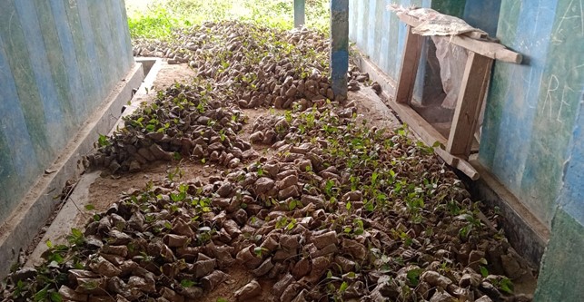
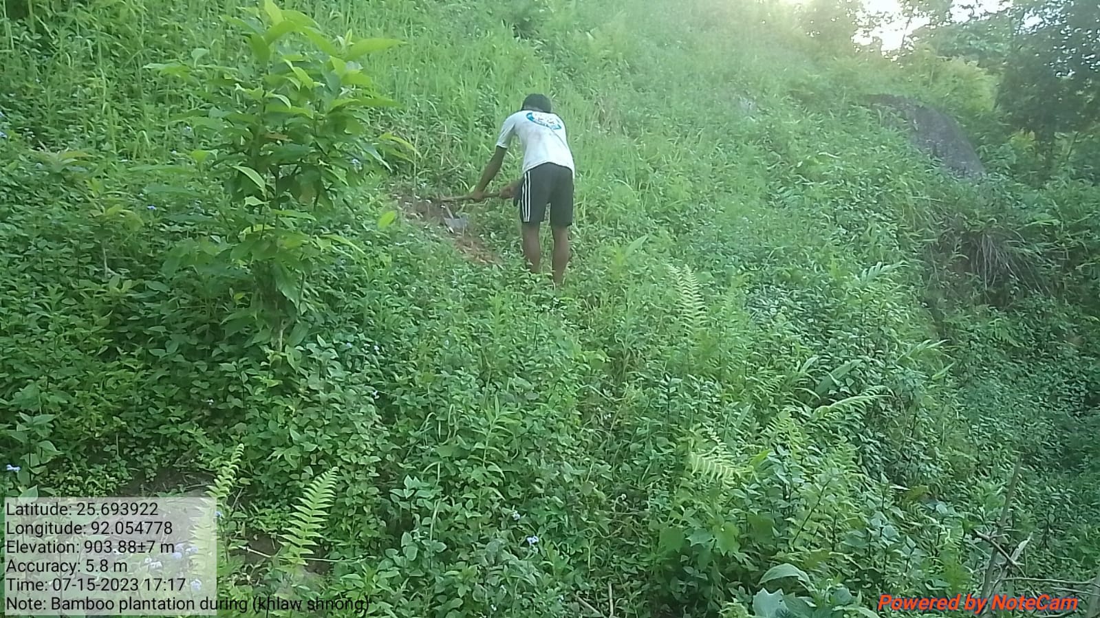
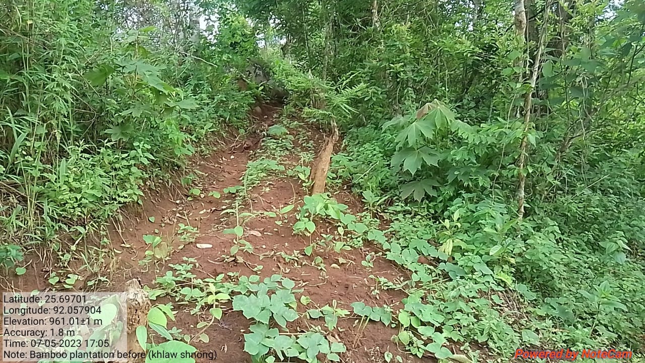
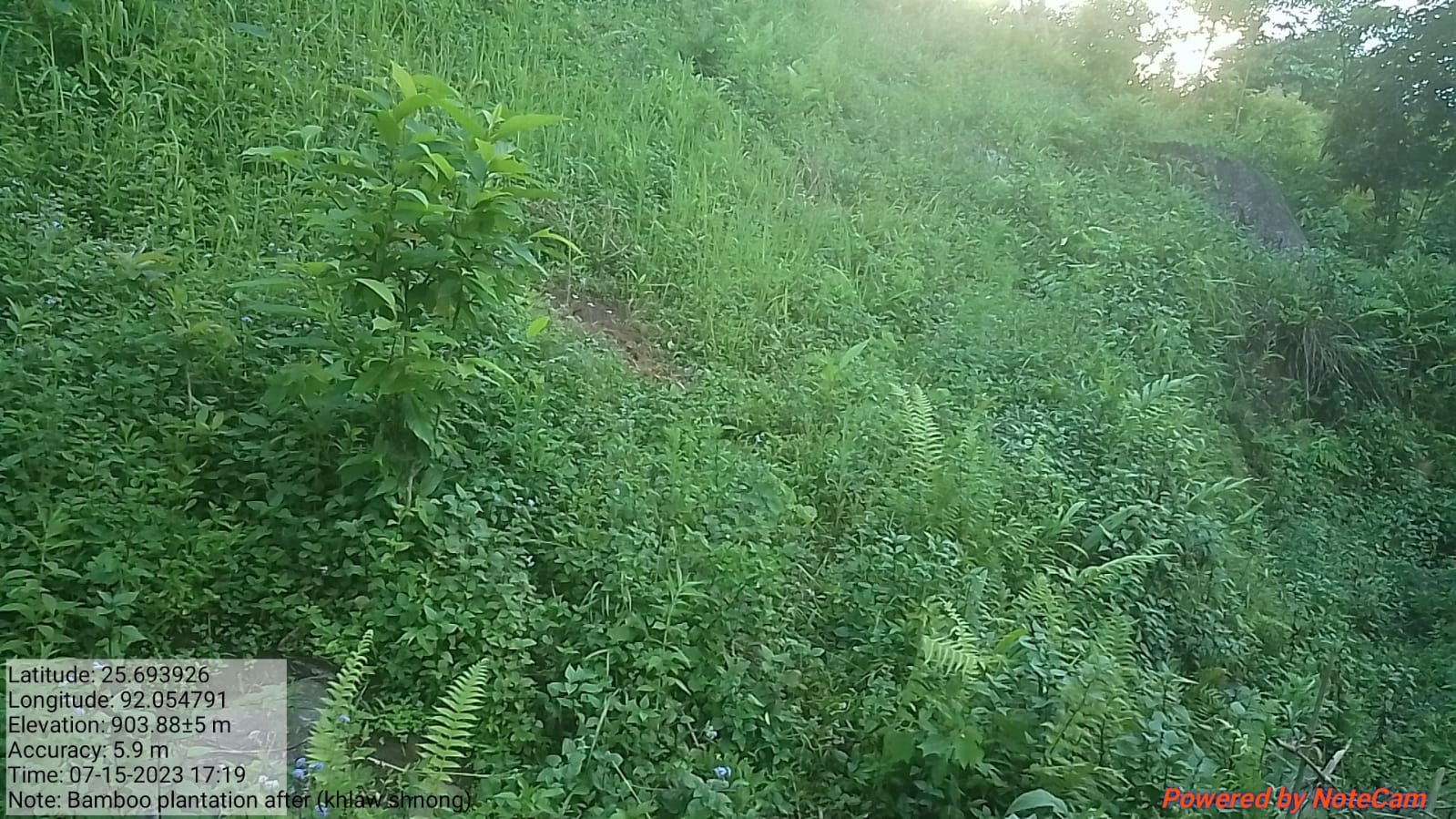
| Bamboo Planatation | khlaw shnong | ₹ 168,320 | Completed |

TESTIMONIALS
Secretary - Heardamon Kshiar
As a secretary I have seen that the Village has been benefitted a lot from the project. I can see that various interventions like Afforestation, Spring Chamber, Community Nursery, Vermicompost and others not only show drastic results through its various outcomes but it also helps us to gain more knowledge on how to work towards building a sustainable environment through our daily actions.
President - Dephrin Nongbri
As a President of the VNRMC I have seen significant changes in the surrounding of the village ranging from our forest cover, mass initiative to work towards strengthening the ecosystem, overall cleanliness of the village, and also to reuse waste and to turn them to usable products. The main achievement that we have witnessed in the village is their understanding and commitment to respect and preserve Nature's rich resources.
VCF - M&E Stanroy Nongbri
The reason as to why I chose to be a VCF is to help the VNRMC in various works of the project. And through this I have gained various benefits and knowledge in relation to my roles as proper training was provided on a frequent basis, To make Vermicompost thereby replacing the chemical pesticides in farming, how to take care of the environment for a better tomorrow.
VCF Social - Rosalyne Nongbri 
As a VCF I get various opportunities through the project. From attending training to attending the EC meeting where I can share my knowledge and concerns at the meeting. The project has also enabled me to use PDA, online meeting platforms, to take pictures using the geotag apps. I've also had the experience of learning on field through the Exposure Visit to Dehradun that the office has arranged. I now know very well how to make entries on registers for the works and progress related to the project.
VCF - Environment
Shanbok Nongrum
I did not know about the project then, but now I can say that I know a lot about it and most importantly about the various NRM works that it has given to us. Activities on how to use GPS, various applications to use in the implementation of the project, Data entry, training and several more, all these has helped me a lot and I hope that the knowledge that I have gained will help me in the years to come professionally.